

Start: Kiowa, KS
Lunch: Plum Thickett Inn in Kiowa
End: Woodward, OK (306 miles)
Van roof cam/timelapse by Tempest guide Chris Gullikson
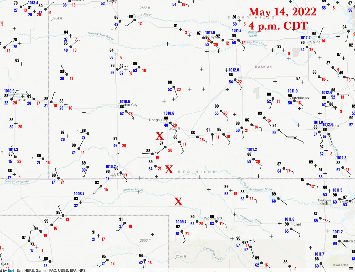
SPC upgraded part of western KS to a slight risk midday. Mid-level flow was barely adequate for severe, from the W to WNW at about 30 knots at 500. Low level moisture from the SE was not as good as the day prior, with dews in the 50s for the most part in the slight risk swath along 283 in western KS. SPC discussions into the mid-afternoon were fairly low-key regarding severe weather prospects, noting a little better moisture pooling perhaps up north along a boundary close to Nebraska. Moisture was mixing out some in the afternoon sunshine, though, and by 4 p.m. dew points were only 48F at Dodge City and 52F at Hays. Any storms would be high-based and outflow-ish and junky, right?! Marginally severe hail and gusty outflow winds were expected with the Kansas storms.
Our group had a leisurely lunch in Kiowa, and we then drifted north and west a little with some stops near Lake City and Sun City in Barber County, KS.

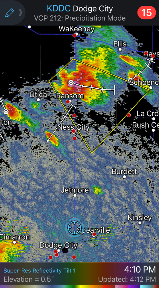
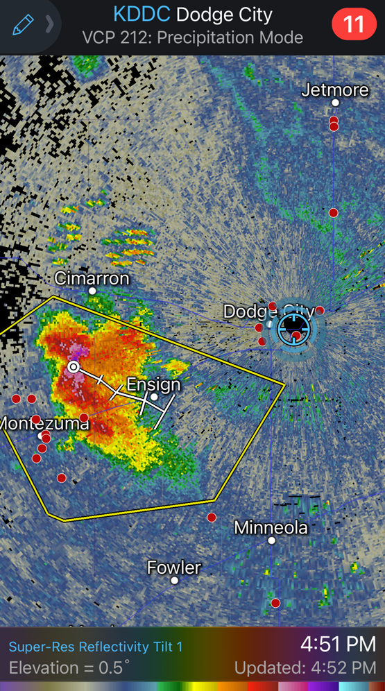
It wasn’t entirely clear as to the best area to play north-south along the “slight risk” axis (generally along 283). I kind of took a wait-and-see approach. I did not see much benefit to racing up north closer to Nebraska. It seemed that conditions close to Dodge City were just as favorable for severe.
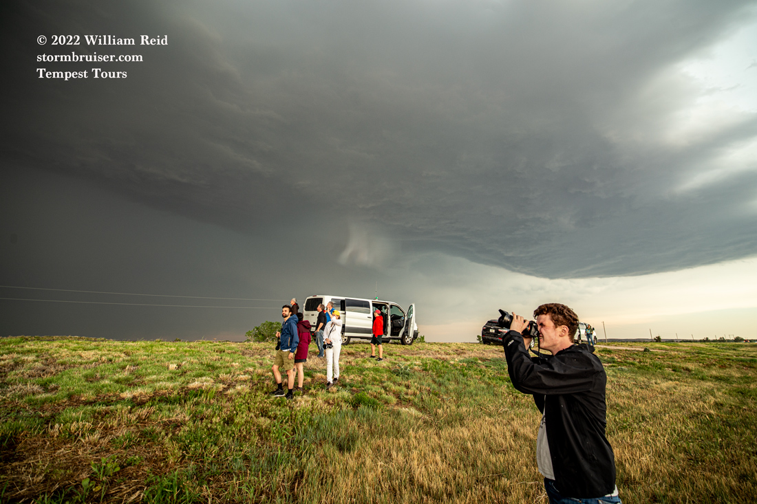
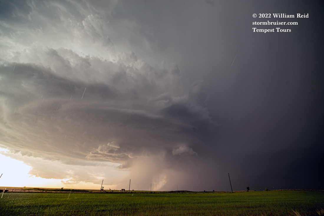
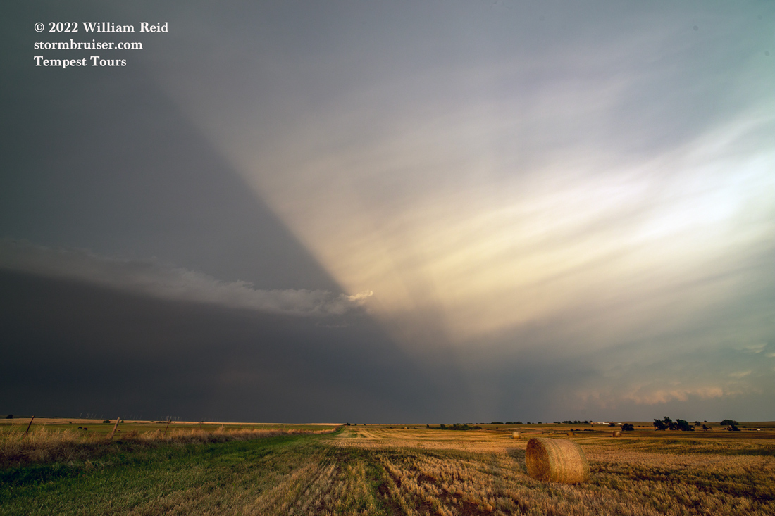
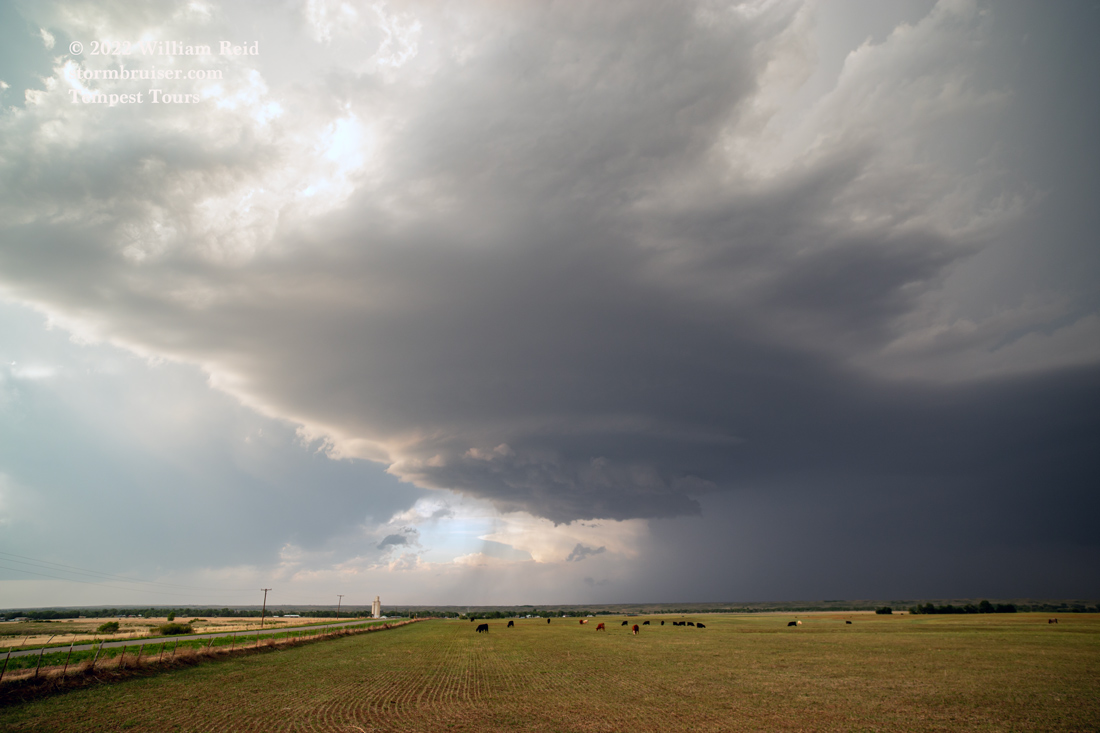
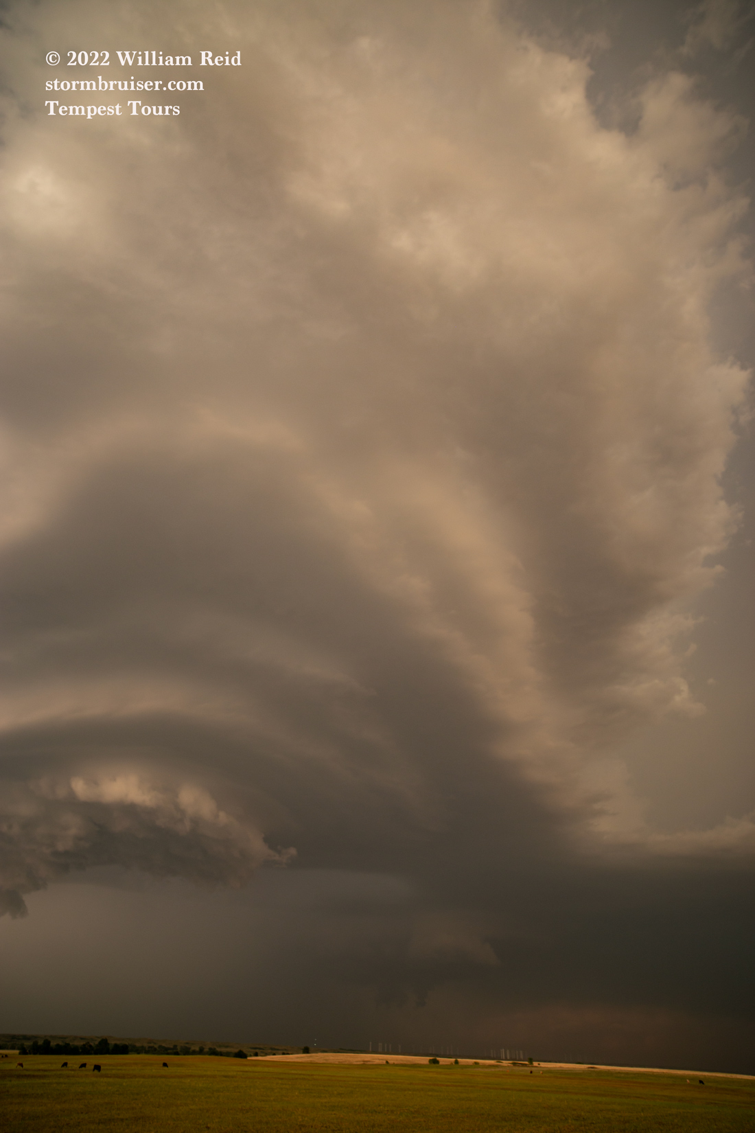
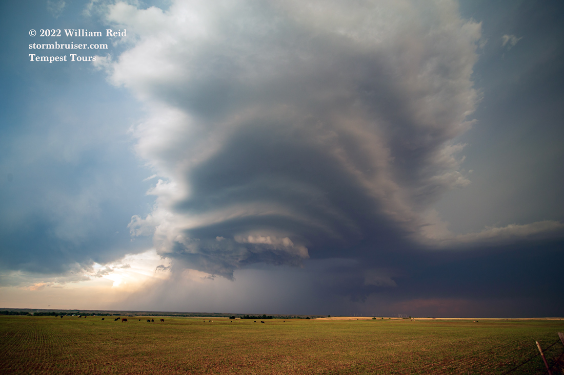
Storms eventually developed at about the same time in two areas: WSW of Dodge City and up in the Oakley/Wakeeney area. We were in decent position to play either area, but I had to choose one or the other! I had Matt and Chris take us north of Dodge City by perhaps 10 miles. (See radar image below) I waffled some, of course, and finally decided to go for the southern play. We had a good view of that cell southwest of Dodge and were able to maneuver to its southeast side, near Minneola. It was high-based and ho-hum for a bit, but then it seemed to get into better low-level moisture (low 60 dews were lurking just to the southeast in OK), strong rotation commenced, and the storm started diving to the SSE!
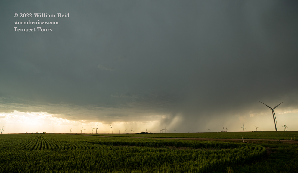

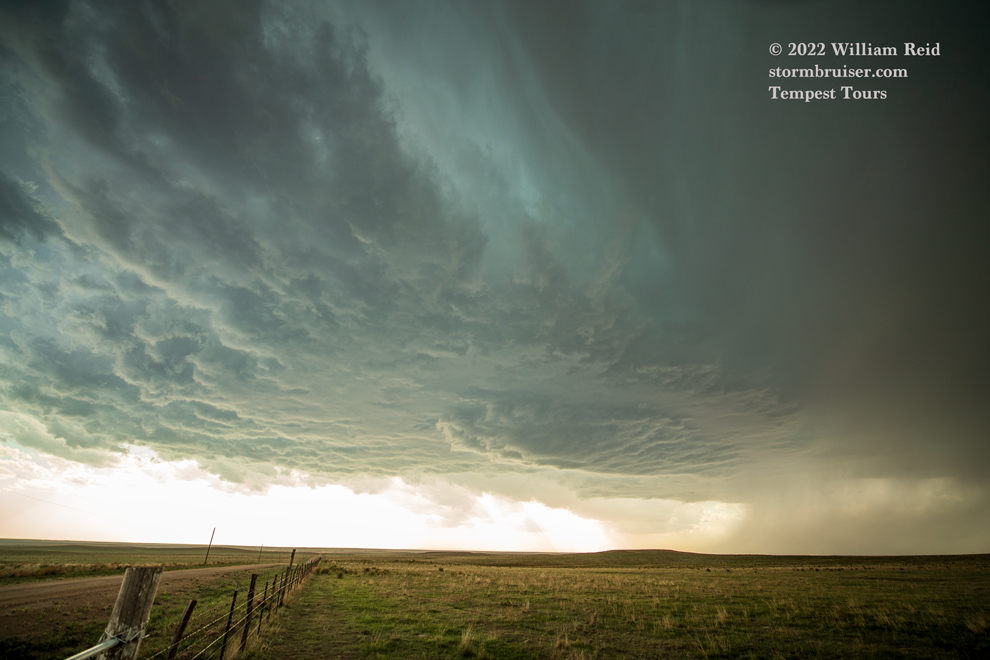


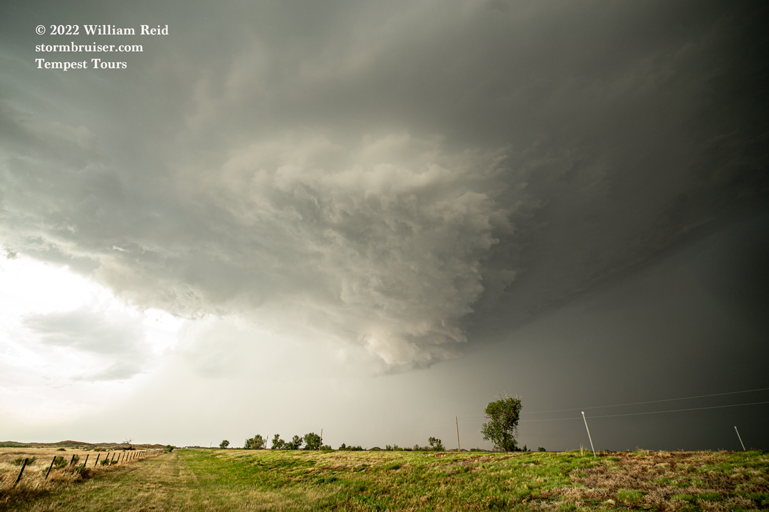
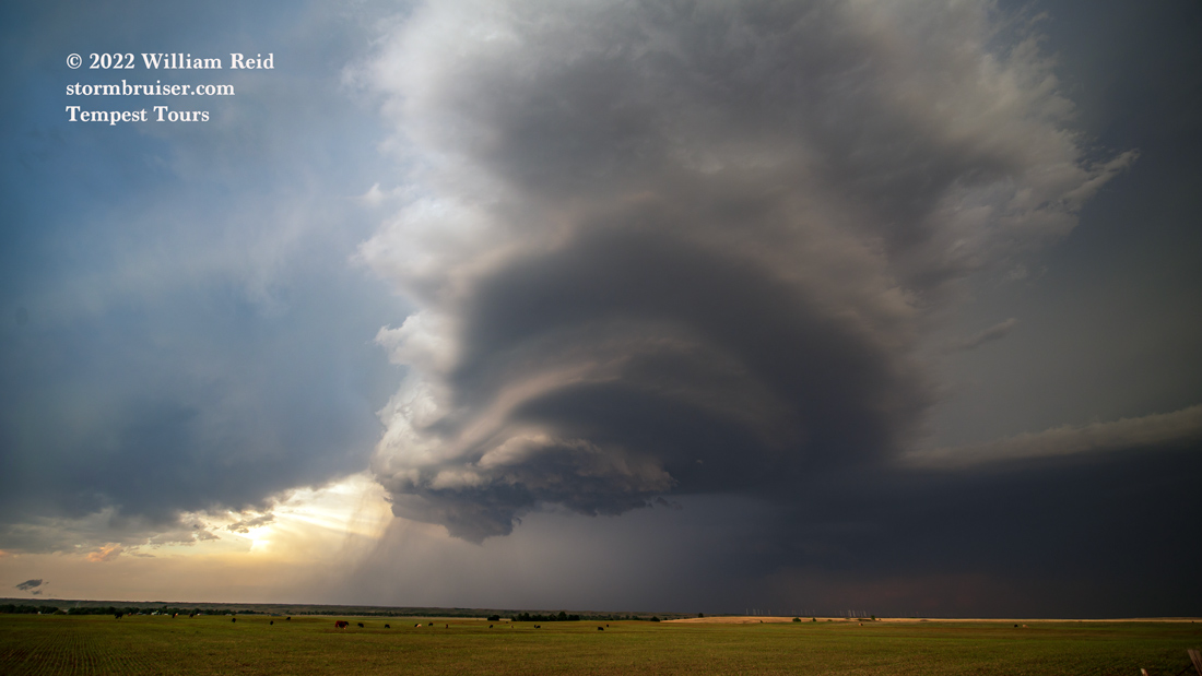
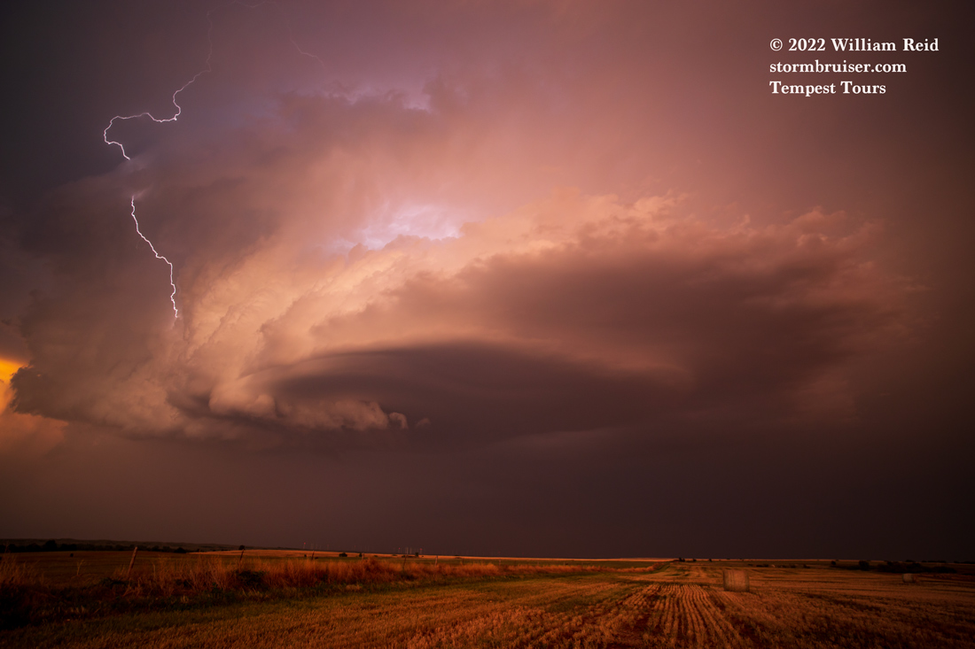
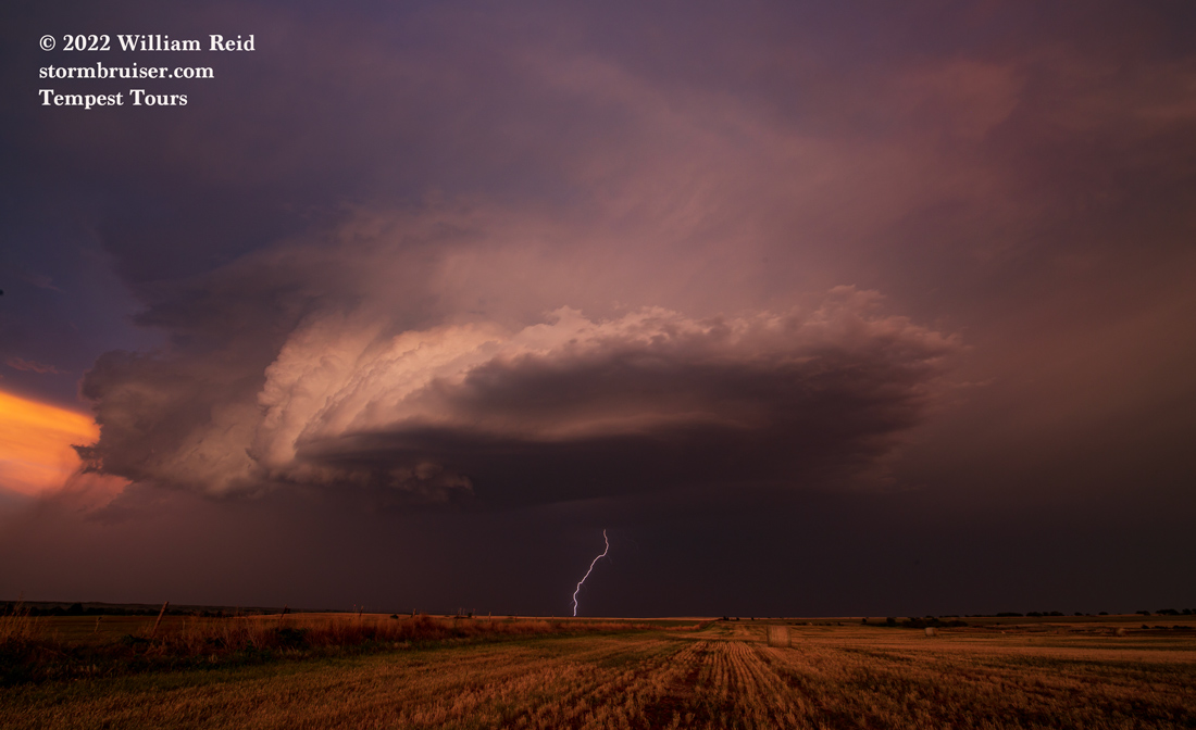
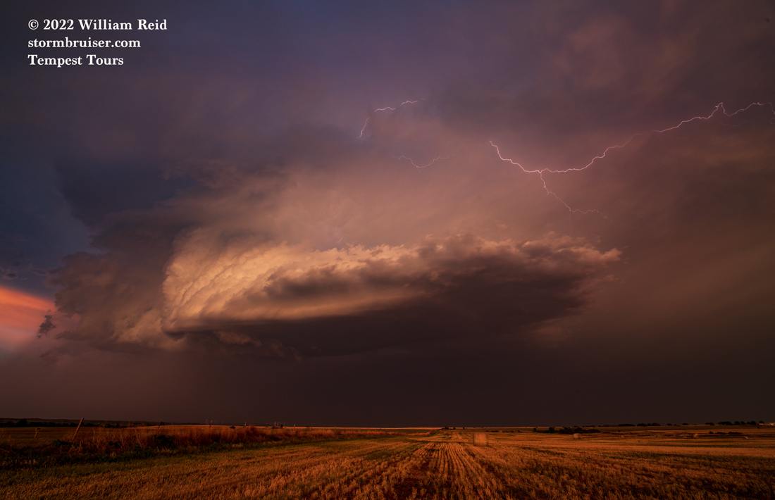
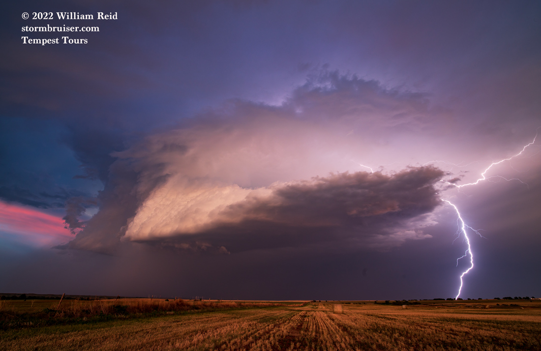
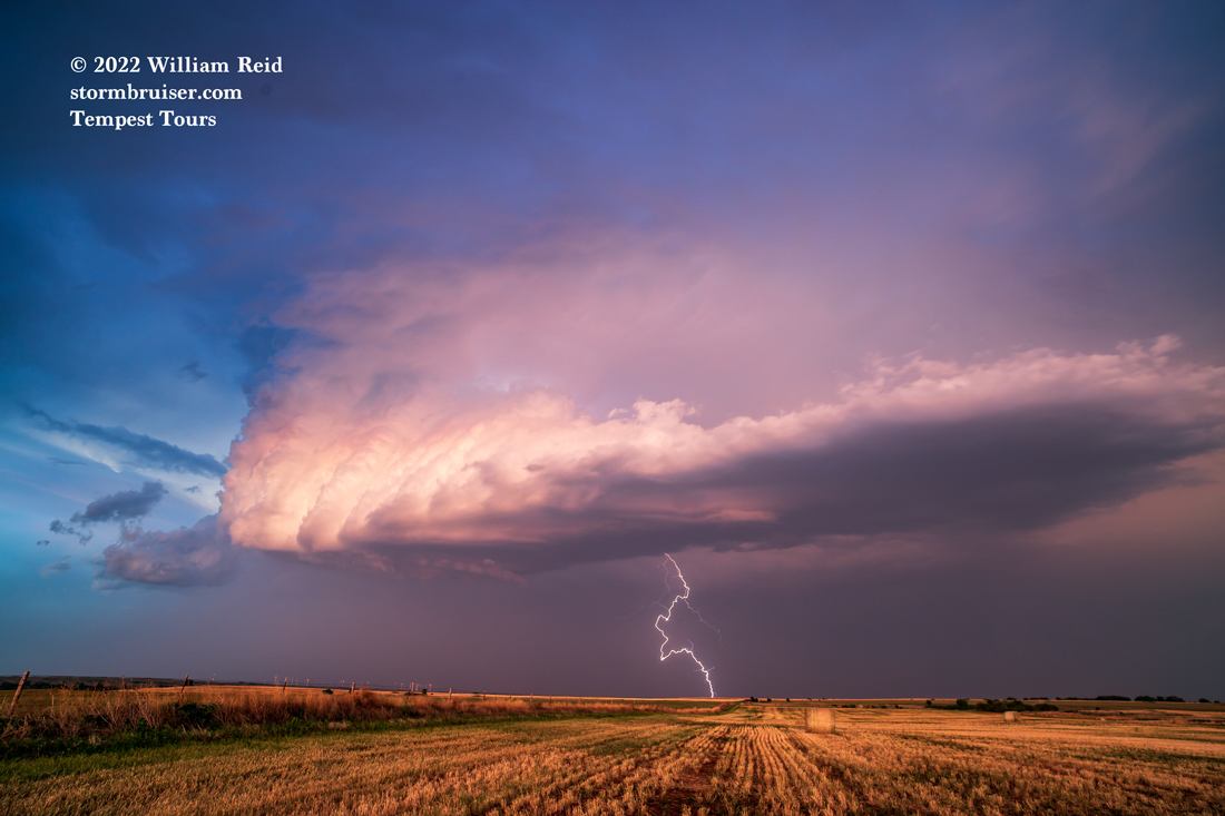
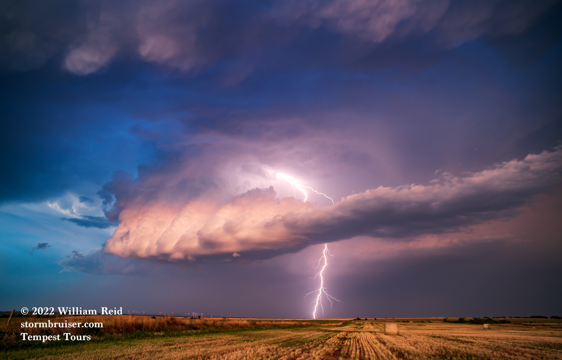
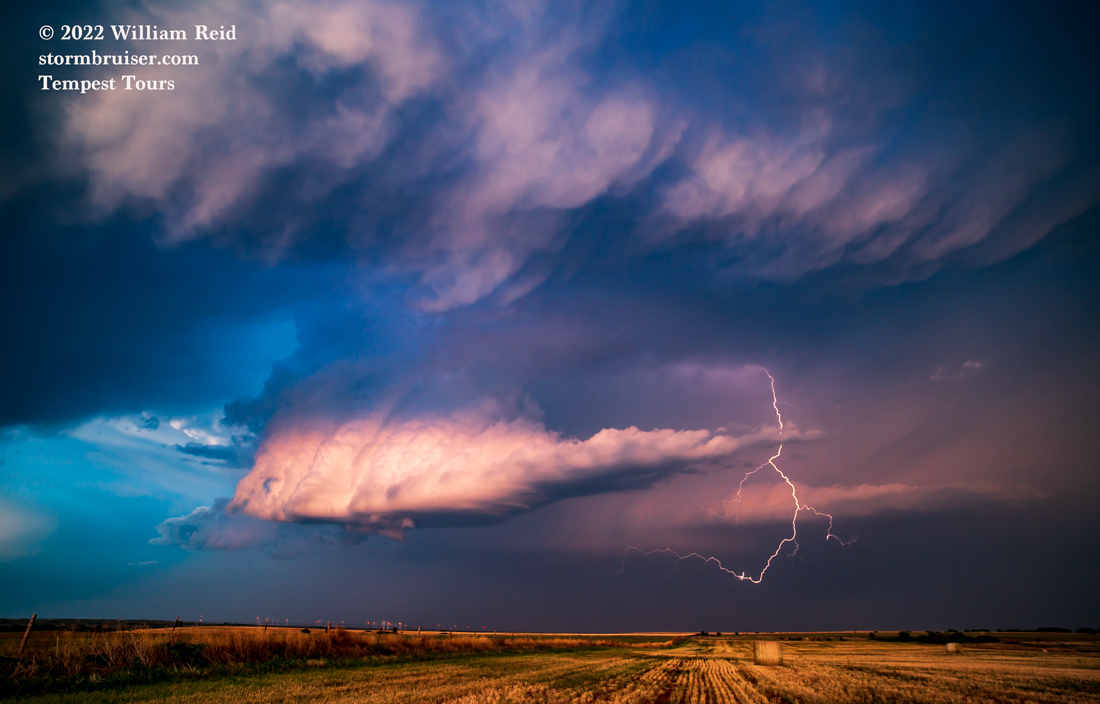
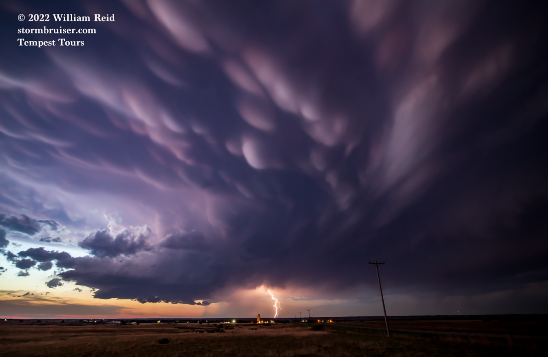
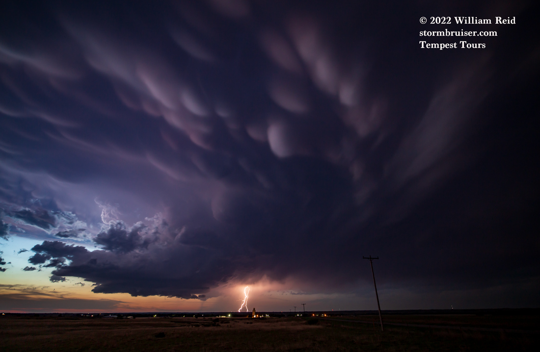
This storm had developed into quite the supercell, with a mostly rain-free base and some intriguing lowerings. SPC was now singing a different tune, as baseball-size hail reports started coming in! The images below were primarily between Minneola and Englewood.
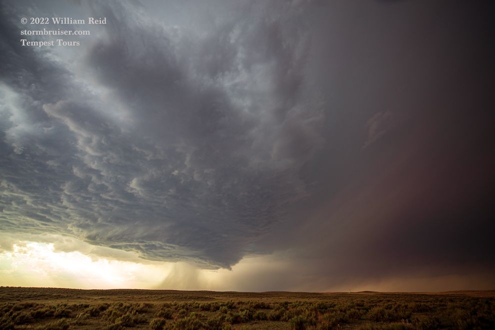
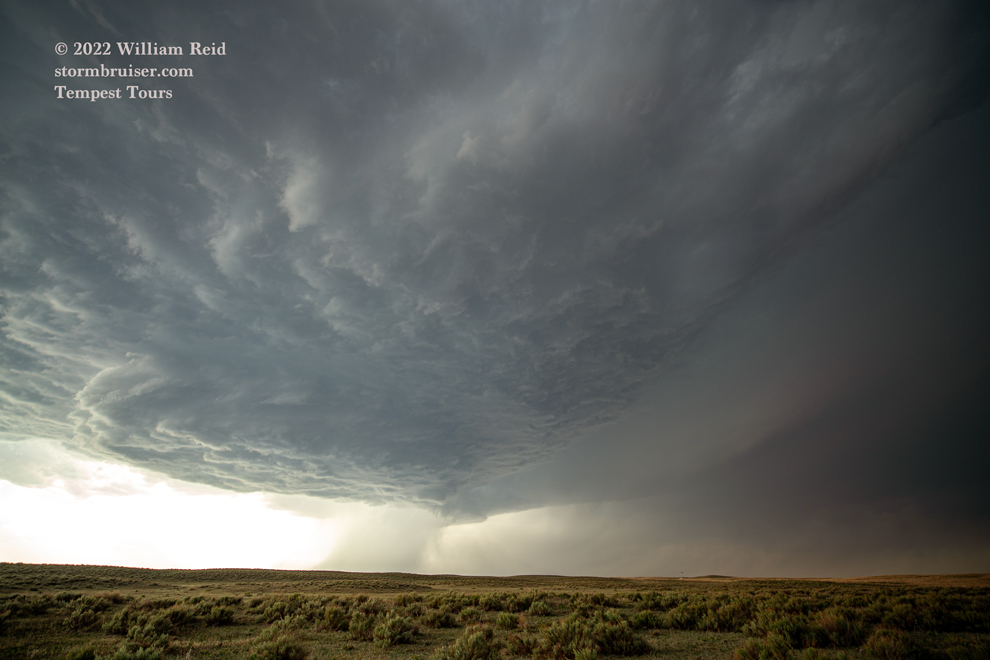

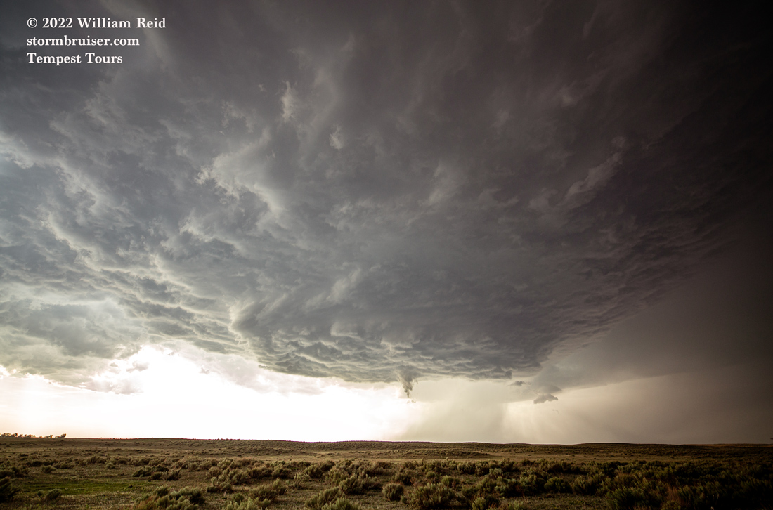

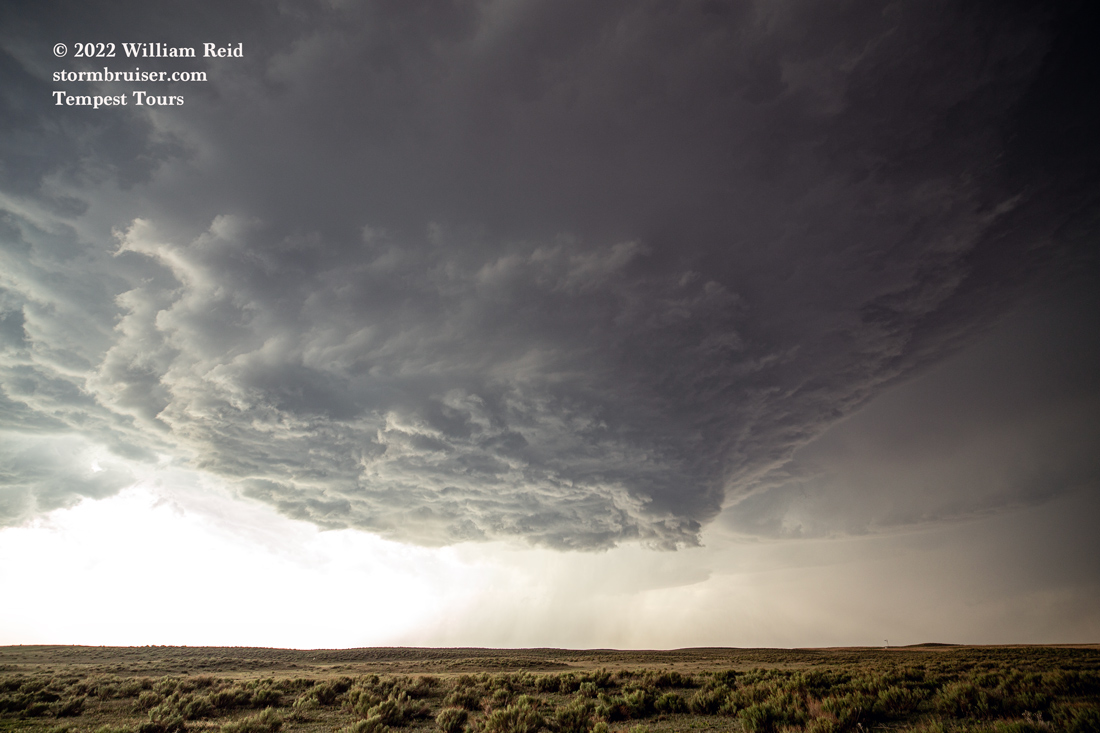
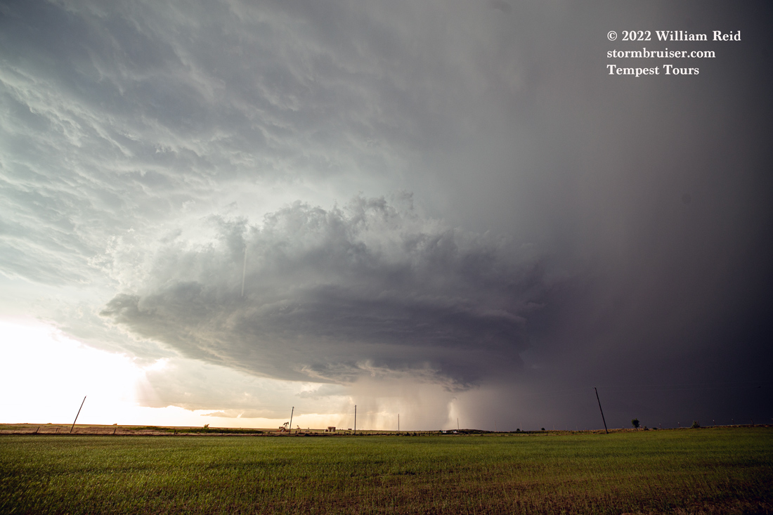
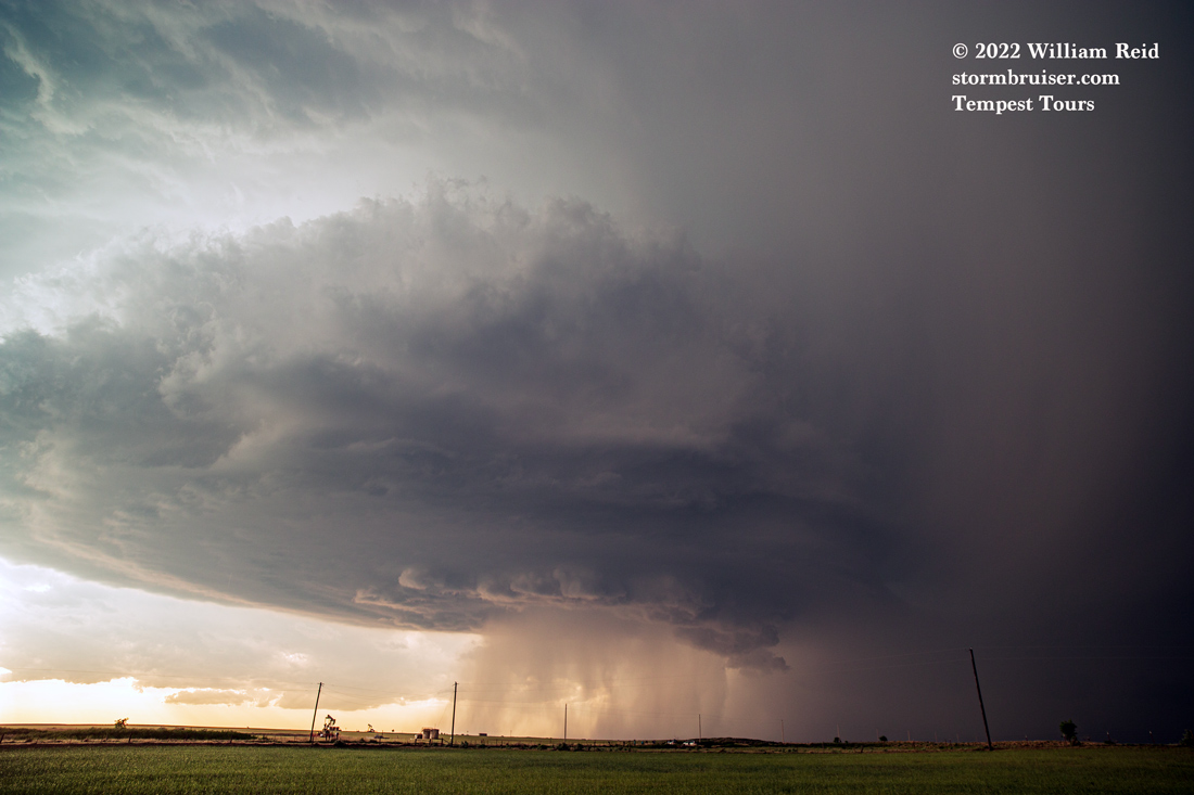


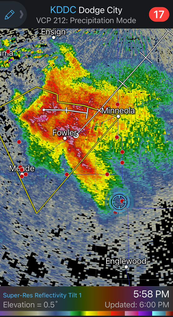
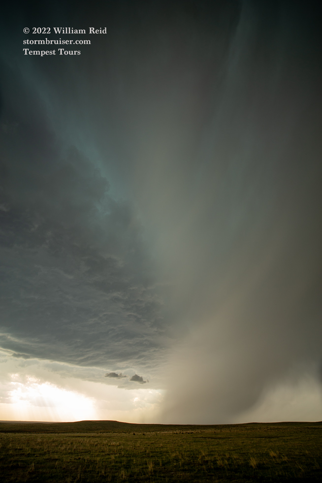
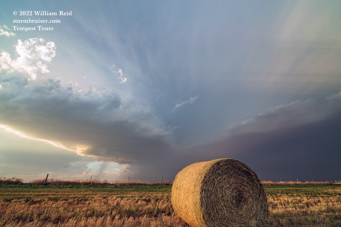
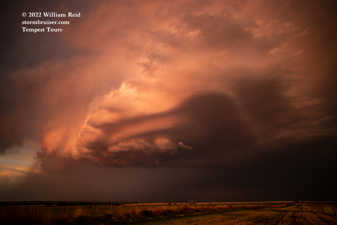
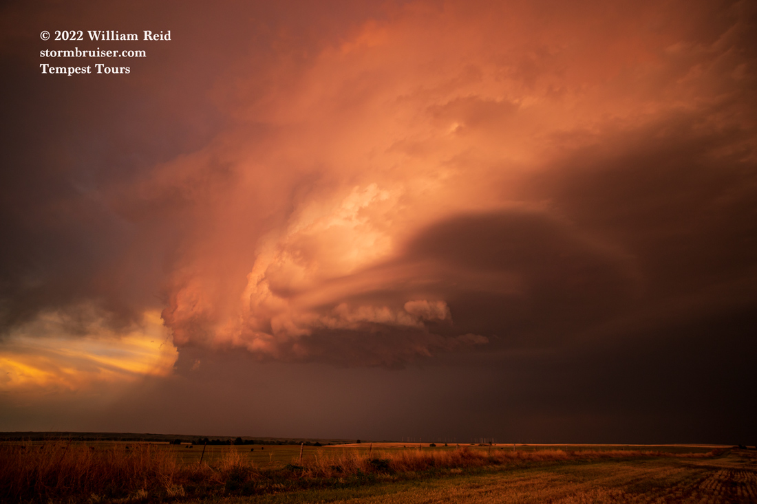
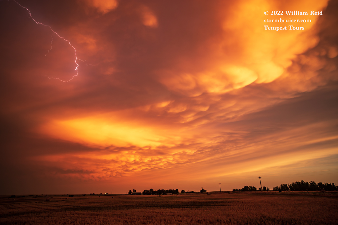
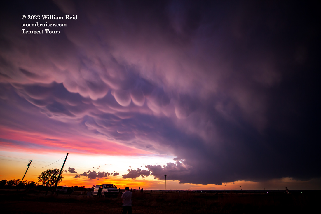
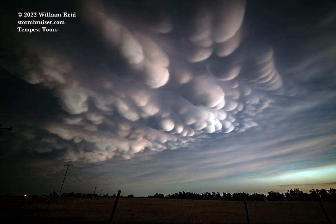
The storm was moving right along at maybe 25 mph to the SSE, and we stayed with it into the eastern Oklahoma Panhandle, all of the way down to the town of May. We stopped just south of May and had a fabulous look at the back end of the supercell at sunset. A second supercell made an appearance to the north after sunset, and the mammatus was super, too! I think that the southern play wound up the way to go, as much better moisture was available compared to the storms that moved into central Kansas.


Leave a Reply
You must be logged in to post a comment.