Start: Liberal, KS
Lunch: Colby fast food
End: Goodland, KS (412 miles)
Chase account by Tempest guest Lesleyanne
This was the final chase day for Tour 5 out of Denver. Unlike Day One of Tour 5, when we had to drive 8000 miles on the first day to see a severe storm, Mother Nature was kind to our group this time around. We began in Liberal, with a target around NW Kansas in mind. Mid-level flow was WNW to NW at about 40 knots. A front was draped along I-80 in Nebraska, and it took me a while to figure out that that would be where convergence was sufficient to get a storm to go up. Dews weren’t especially good south of the front, but winds were backed a little. A pocket of dews well into the 60s lurked around north-central Kansas. If a storm could access this moisture, then we would be in Fat City.
I had the group at a nice shady park in Colby for part of the mid-afternoon. Eventually it became obvious that development would be on that front up north in Nebraska. We scooted east to Oberlin and north to McCook via 83.
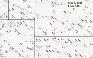
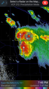
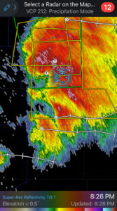
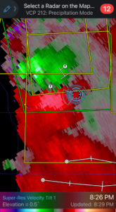
A healthy and somewhat organized storm was southeast of North Platte. We stopped to its south, between Curtis and Moorefield. It exhibited a decent sculpted storm base. A couple additional towers went up nearby, so we soon were amidst a handful of strong-to-severe storms. Note on those early radar shots that the storms are moving rather slowly to the ESE!

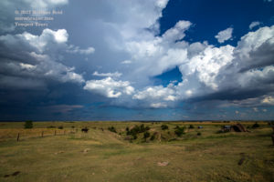
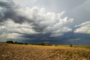
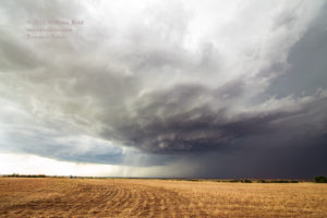
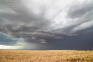
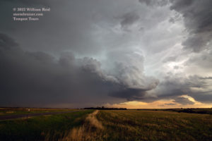

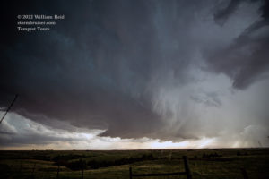

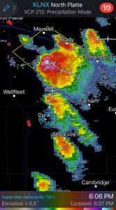
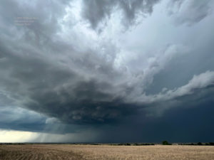
This was the critical moment of the chase. Should we stick fairly close to the biggest and oldest cell, now not too far to our north? Or should we leave options open and get south, since surface winds were out of the southeast and the cells on the north side might soon be deprived of uncontaminated air? The answer to this was pretty easy — we need to get south and keep options open, and see if the “leading” cells on the south end might eventually tap that more-juicy air in north-central Kansas.
Our group was on Hwy 18 between Curtis and Stockville. Let’s get south. But how? I had two options. The most obvious one was to head SE to Stockville on 18, and then another nine miles or so east to 73A and south to Cambridge. A look at the storms, and the radar, and the road map…I REALLY needed to be going due south and not east 10 miles and then south, but the immediate south options were only dirt roads, in the rain. A storm just to our west and another one to the southwest were getting strong and moving more to the SSE or even S now. I needed to be a little west or southwest or south of the updraft bases of these. Doing this east-and-south jaunt via Cambridge puts us on the wrong side and will take a bunch of time to get back into position. The other option would be to head back to Curtis (about 7 miles to the NW), and then west 8 miles to U.S. 83, where we had a straight shot south to get back into position. I KNEW that the Curtis/U.S. 83 option was favored logistically. But a large hail core from the old north cell was now descending upon Curtis. UGH.
Yes, I could have tried to manage the hail core. Would it be damaging hail? Would it cause a horrible delay as we waited underneath an awning for the hail to move on? I elected to play it safe and to head to Stockville for the E and S option. Curtis wound up on the receiving end of 2.5-inch hailstones.
The next hour or so was agony. You NEVER want to be in major repositioning mode during the hour or two prior to sunset. These two really nice supercells to our W and SW were dropping due south, and we were in rain, rain, rain and more rain while on a po-dunk (but paved) road. We could kind of see a nice storm base at times to the west, but it was more than 12 miles away and we were in its forward-flank anvil rain. Heck. Along our way south, the southernmost storm strengthened and the trailing (north) cell sputtered. More playing catch-up for us!
We arrived at U.S. 34 west of Cambridge, and had to backtrack east three miles more in order to reach the next south option, Route 47. Every minute counted, and we were not even getting closer to the storm. It was awful. I think that the cell was dropping south at about 30 mph, and it looked like we might be able to barely squeeze in front of the supercell along 89, near Lebanon and Danbury. So, another 15 miles south on 47, and finally we were heading SW and W on 89 and we would be close!
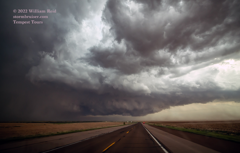
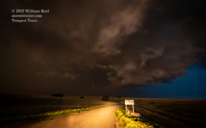
And close we got. The leading edge of a VERY low and ominous storm base was descending upon the area between Lebanon and Danbury (images 2 to 9 below).

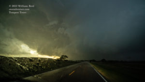
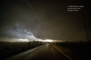

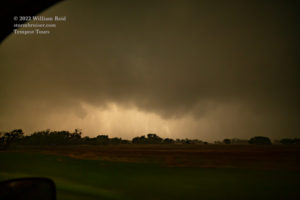
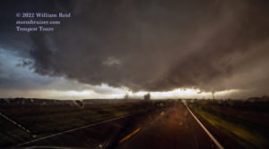
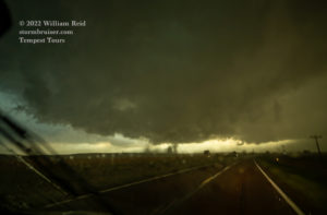
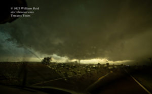
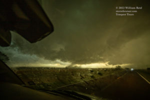

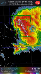
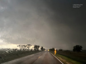

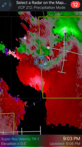
From the radar shot above at 9:06 p.m. CDT, you can see that we were right in the notch area of a supercell, which is typically not a great place to be. We are looking west for the most part in images 2 through 9 above, battling moderate-to-heavy rain, a little hail, and some gusty winds. We were able to maintain enough visibility to make sure that we were not going to drive into a tornado. A burst of dust and dirt rose skyward not too far to our WSW, but any rotation with this was weak.
The 5-10 minutes along this stretch to Danbury were rather white-knuckle! We emerged unscathed at 83 and continued to the south. The idea now was to try to get in front for some storm structure, but we were just a little too far north and the storm was heading south towards Oberlin at just too fast a clip. To add a little salt to our wounds, a little tornado was reported just south of Oberlin while we were stopped in town for a quick potty break! The 3rd through 7th images below, looking south along 83, show the back-end of the supercell’s updraft base and the action area, where the tornado occurred minutes later, presumably.
I think the second image below is out of order, as that was taken just southeast of Curtis.
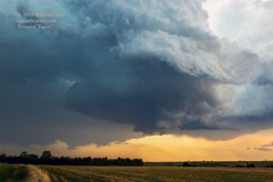

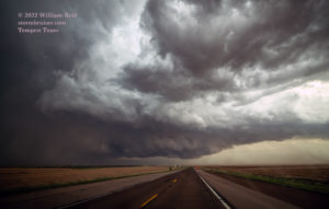
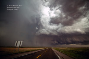


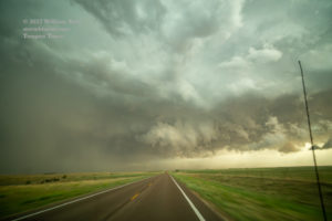


This was one of the more beautiful and photogenic supercells of the year, based on the photos by other chasers who were in position (i.e., south of the storm along 83 at sunset). It was a tough day logistically, and I wasn’t really anticipating a fast southward motion to this activity. I suppose the moral to this story is to make sure you don’t get too far behind the “lead” cells if you are working with a shoddy road network.
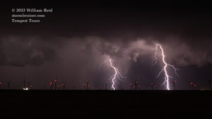
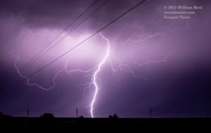
We played with some additional storms at dusk around Norton and Atwood, and the lightning show was pretty good to our east.



Leave a Reply
You must be logged in to post a comment.