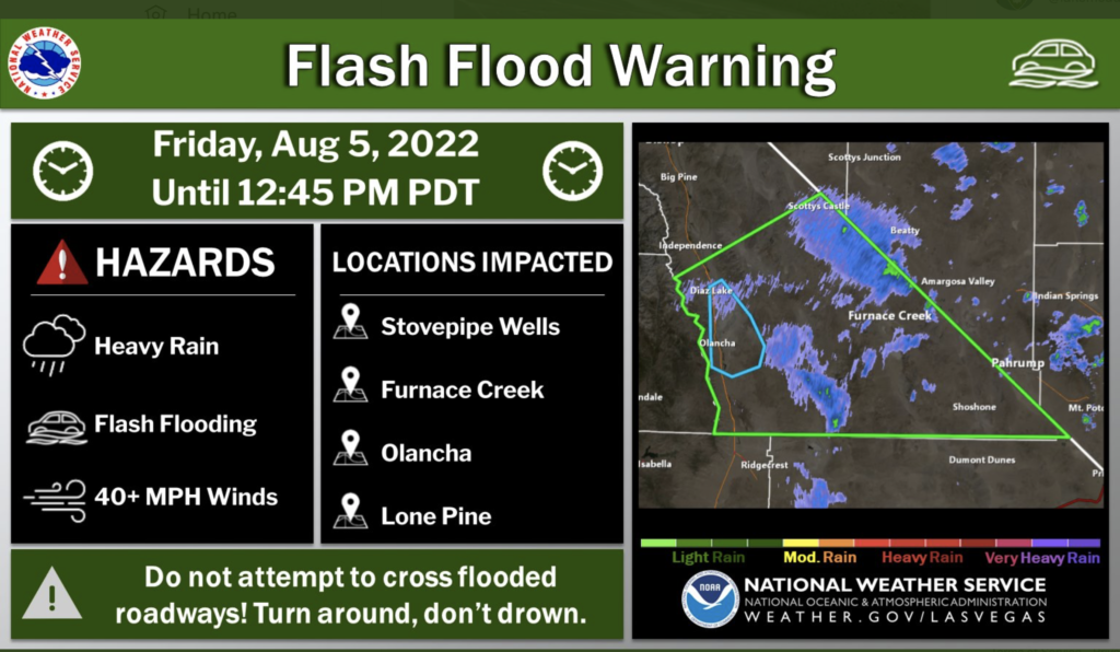
(Youtube video with some video and pics of rain and flooding in DV on Aug 5)
The 2022 summer monsoon season has been quite active for much of the Eastern Mojave Desert, and on the morning of August 5th an “easterly wave” provided a large-scale rainstorm to Death Valley and vicinity. Rain amounts of more than an inch in two hours (1.02″ from 6 to 8 a.m. at Furnace Creek) caused plenty of washes to run. Debris covered roadways and partially buried some vehicles. I was not in Death Valley for the event (unfortunately?), so I don’t have any pretty flood photos to share. But, I can share some numbers to show how unusual the rain event was.
At the Death Valley weather station in Furnace Creek, a daily amount of 1.46″ was recorded on August 5th. This table shows the hourly amounts at Furnace Creek, with all of the rain falling here from 2 a.m. to 9 a.m. PDT.
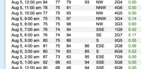
The wettest hour was 7 to 8 a.m. with 0.60.”
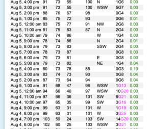
At the Badwater station, 0.31″ fell from 1 a.m. to 5 a.m. It is interesting that Badwater had no rain from 6 a.m. to 8 a.m., when FC picked up an inch. The westerly breeze at Badwater went calm when the rain began between 1 and 2 a.m. Here is the table for Badwater on the morning of the 5th.
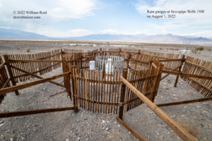
The Stovepipe Wells rain gage caught 0.80″ from 3 a.m. to 11 a.m. PDT, with the greatest in one hour 0.31″ from 7 to 8 a.m. The wind was light for the event, with wind gusts of less than 12 mph for the most part at all three stations. For your viewing pleasure, below is a picture of the rain gauge(s) at Stovepipe Wells 1SW that I took on August 1, just four days prior to this rain event. It looks like they are serious about slowing the wind down here. The view is towards the northeast, and Stovepipe Wells village is visible.
Here is an image of the Furnace Creek station and its automatic rain gage (upper left), almost at anemometer level. This was from July 10, 2021. This view is towards the east.

It appears that the daily amount of 1.46″ at Furnace Creek is the second highest daily amount in the station’s history, including Greenland Ranch, from 1911 to the present. Highest (barely) is 1.47″ at Death Valley/FC on April 15, 1988. August 5, 2022, is now second with 1.46″, and third is November 9, 1923, with 1.40″ (at Greenland Ranch). Long-term average annual rainfall is about 2.00 inches if you go all the way back to 1911. The greatest daily amount at Cow Creek (3 miles north of Furnace Creek, 1934 to 1961) was 1.09″ on September 25, 1939.
Below are two maps showing the rain amounts in the region for this event (72-hour amounts ending at 6 p.m. on August 6th).

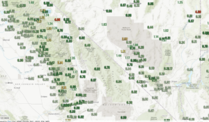
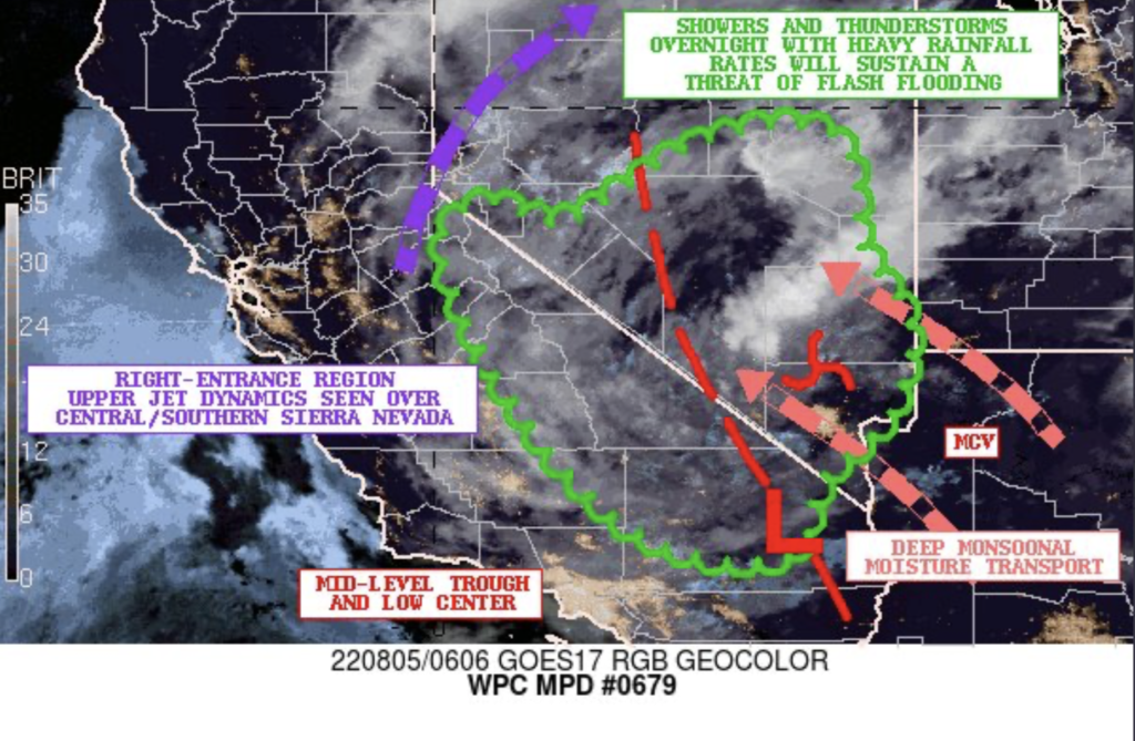
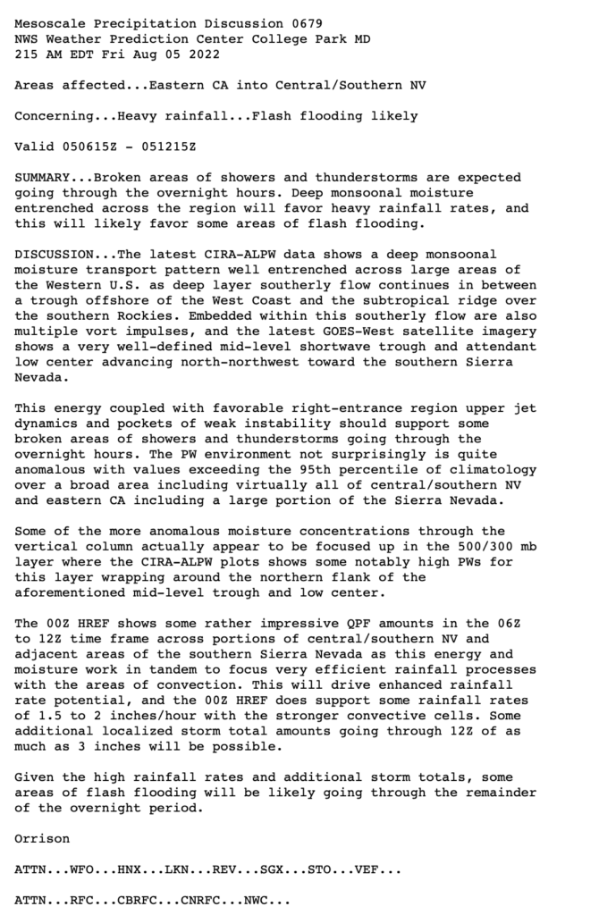
It appears that this was a fairly widespread/regional rain event, with some embedded heavy rainstorms. Precipitable water amounts were very high, and dew points were well into the 60s at both Furnace Creek and Badwater prior to rainfall early on the 5th. The discussion below was issued by the Weather Prediction Center around 11 p.m. PDT on the 4th.

Leave a Reply
You must be logged in to post a comment.