
May 9) Start: Kiowa, KS/lunch: Yur Place in Hardtner/End: Burlington, CO/370 miles
May 10) Start: Burlington/lunch: fast food in Limon/end: Wakeeney, KS/541 miles
First, a brief look at the dud chase day of May 9th:
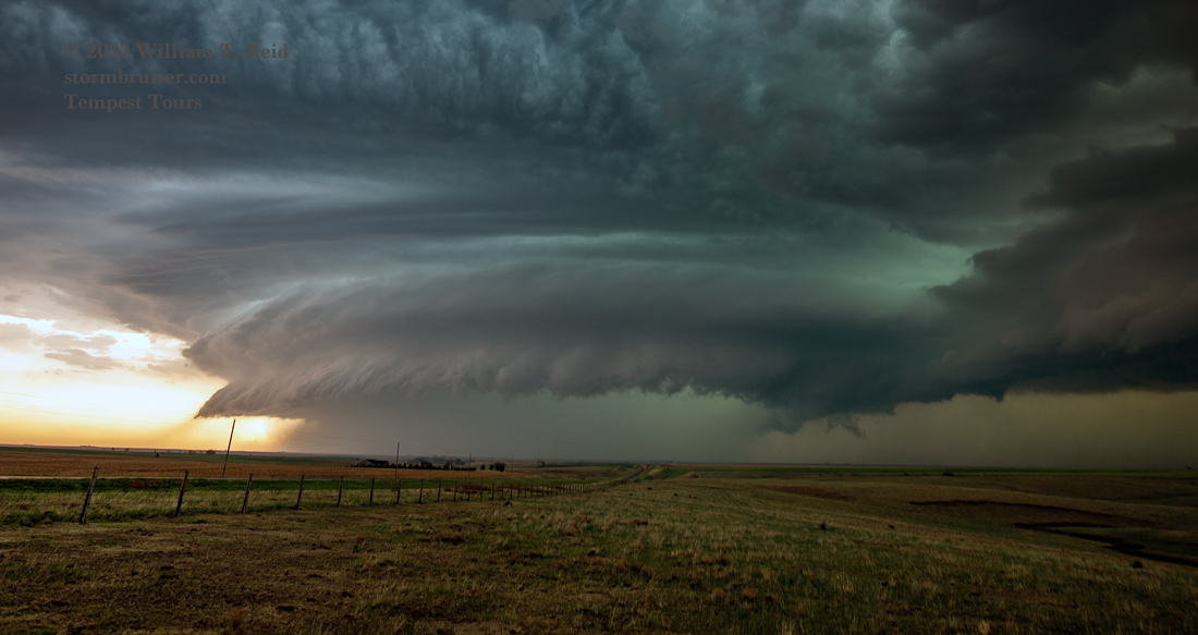
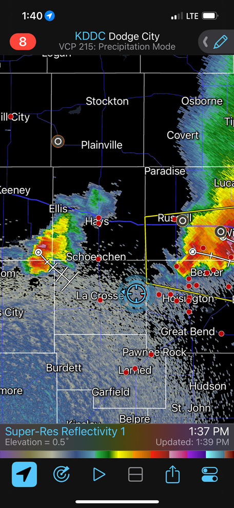
May 9 was looking like a decent chase day, as SPC showed an enhanced slight risk and a 5 percent tornado risk for central Kansas. We scampered north from Kiowa to the Hoisington area and found a somewhat discrete storm forming on a pronounced outflow boundary. The boundary was coming off of a bowing line of continuing morning elevated storms in NW and NC Kansas. See this MCD:
And if you haven’t figured it out yet…since this entry is for May 10 and not May 9, the 9th must have been a big DUD. And it was. May 9 does not deserve its own entry on Stormbruiser.
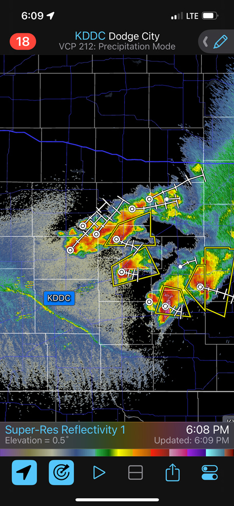
Our storm near Hoisington and then our storm WNW of LaCrosse were quickly undercut, and the tornado threat was zero. There was a little semi-impressive low-level structure. The dumb morning activity had done its damage, and this undercut junk was not for me. We went west and NW into western KS, hoping for a miracle in the sunshine. There was a weak attempt at something near Scott City but it fizzled. I took a screenshot of the radar east of Dodge City at 6:09 p.m. CDT. Note that the boundary is well south of the severe storms. It might have been worthwhile to see how those storms evolved.
So let’s get to the better chase day, May 10.
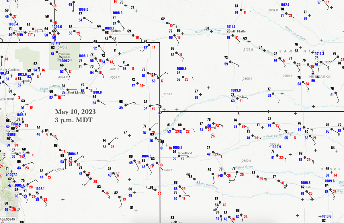
Surface Map for 3 p.m. MDT on May 10 above.
Video of the Oberlin supercell during the “tornado warning” phase by TT guide Chris Gullikson
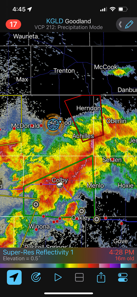
The corridor to consider today extended from about Denver to Fort Morgan to McCook and Norton. SPC had it cranked up to a 10 percent tornado risk, with an enhanced risk of severe. Really nice easterly upslope flow was in extreme NW KS, with a surface low and convergence along I-70 from about Limon to Flagler. Intital storms would be out west, near Denver and Las Chance. We headed that way for lunch, but then I came to my senses and went back into NW KS, where instability and tornado prospects looked quite a bit better.
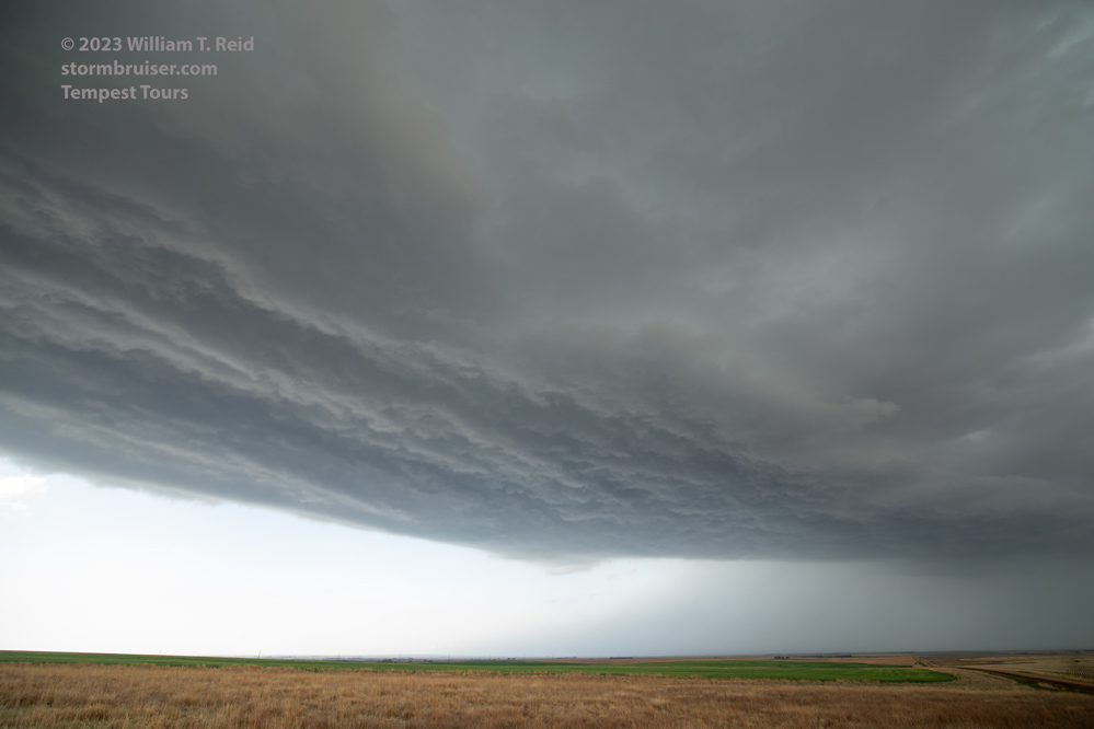
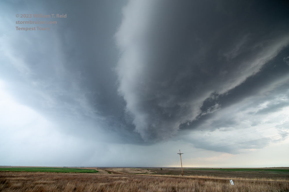
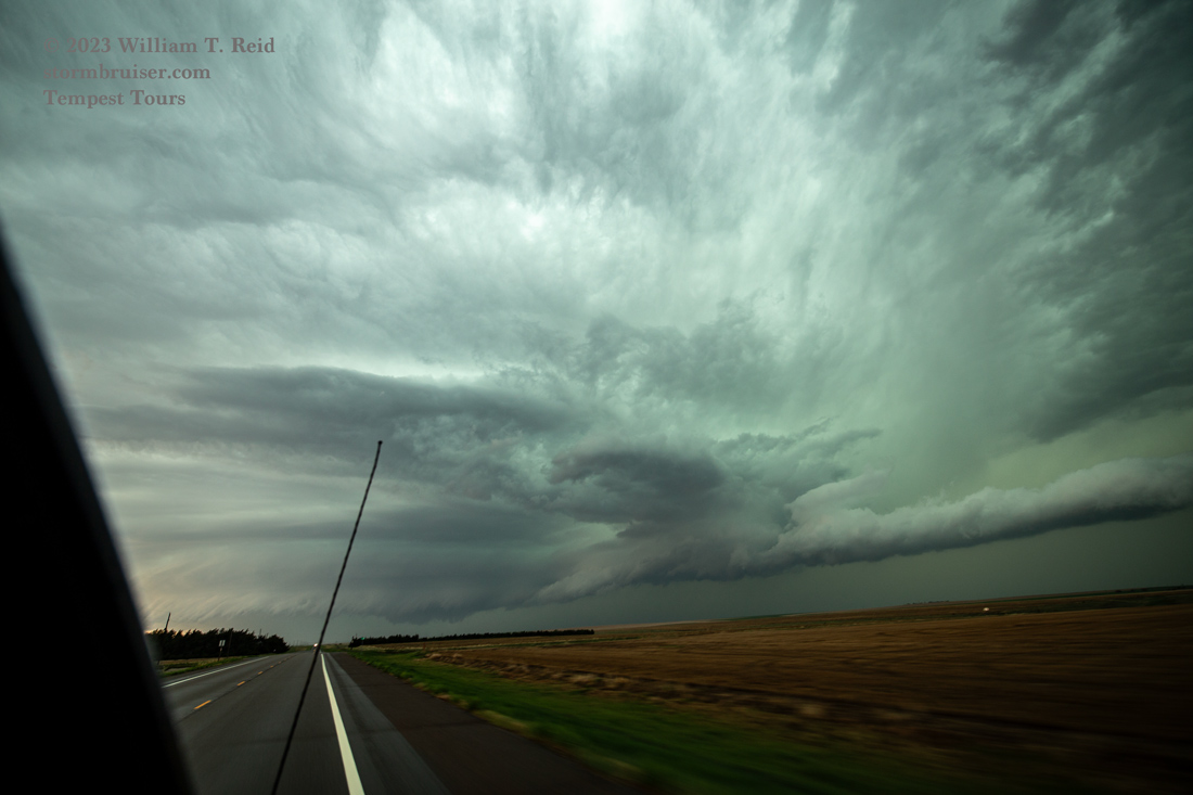
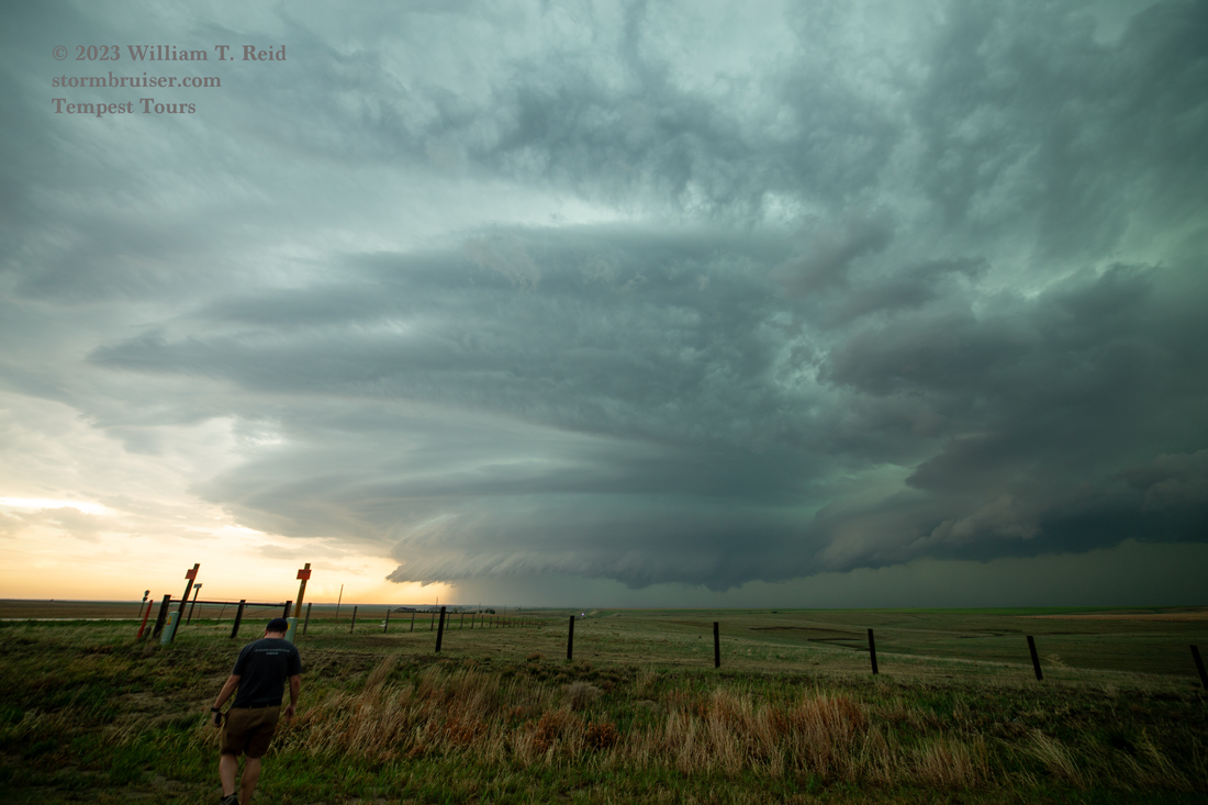
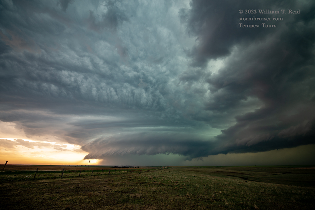
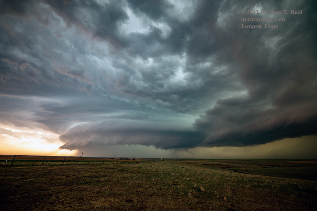
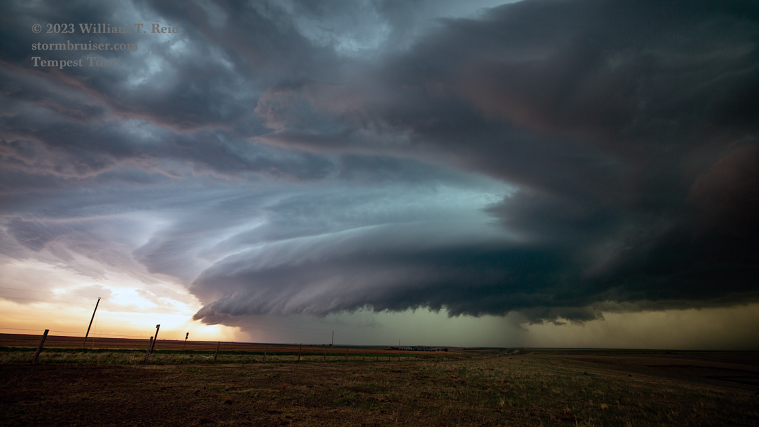
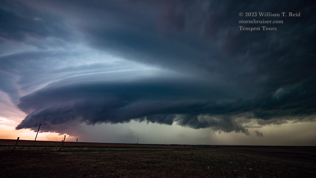
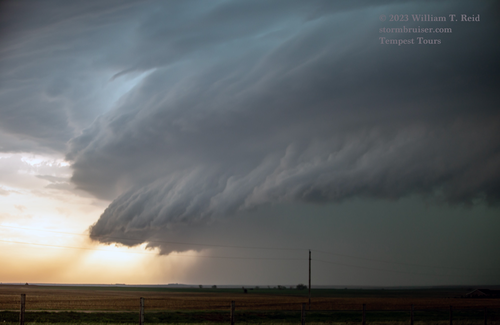
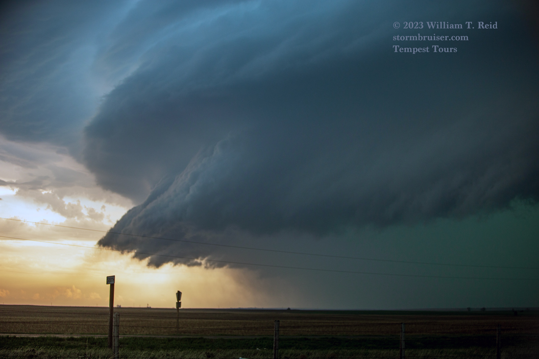
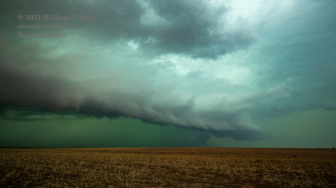
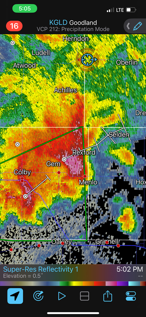
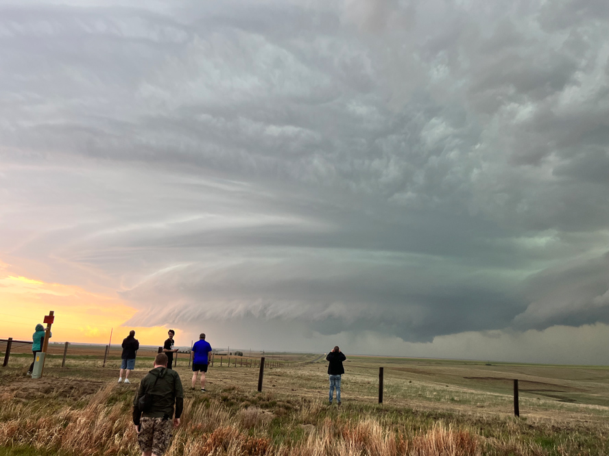
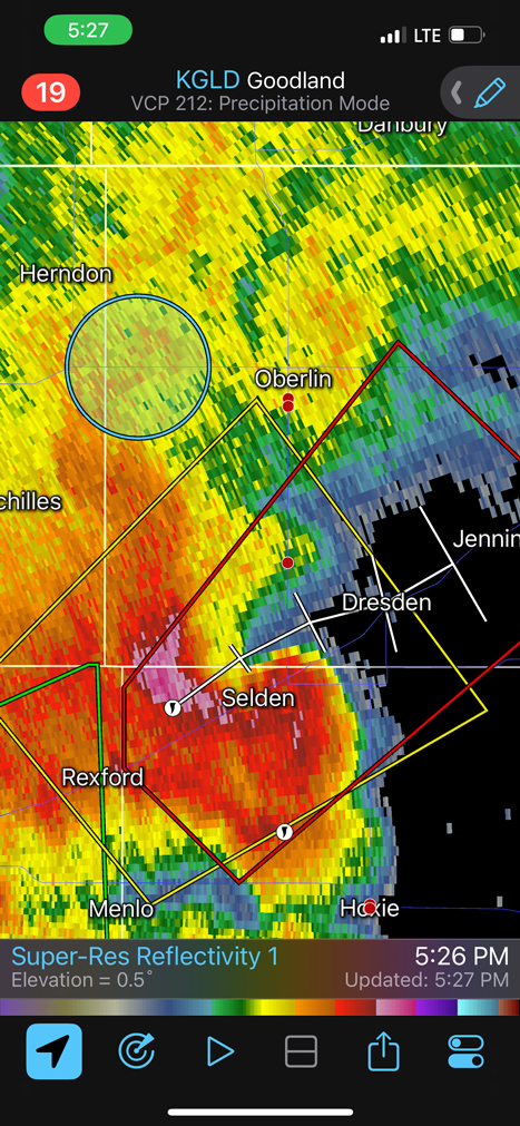
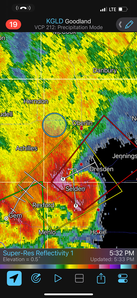
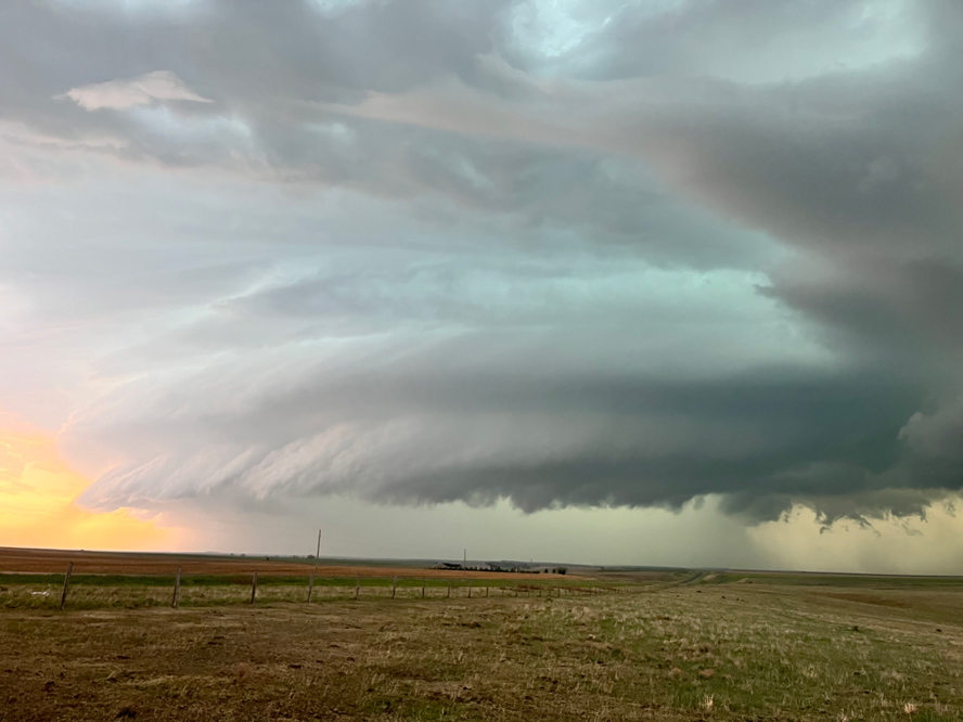
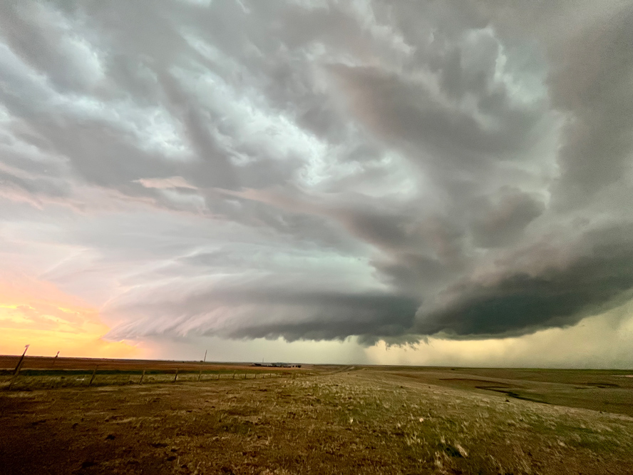
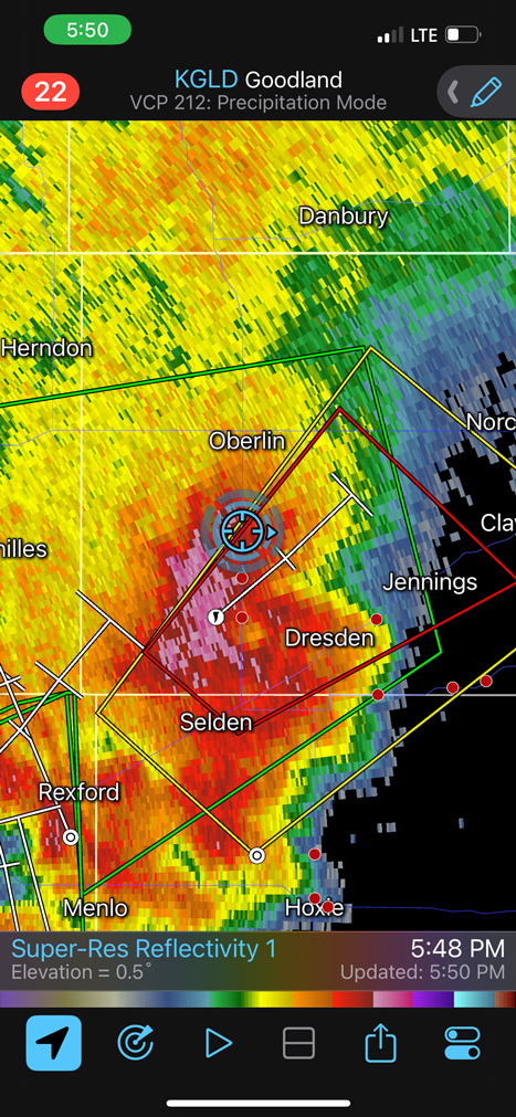
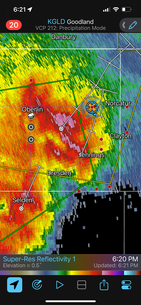
A strong storm or two developed to our southeast as we headed east on U.S. 36 in the vicinity of Atwood. A tornado warning was issued along our way between Atwood and Oberlin, but that seemed to be a nothing burger. We continued east to Oberlin and dropped south, stopping about halfway to Selden. A beautifully sculpted supercell was due south!
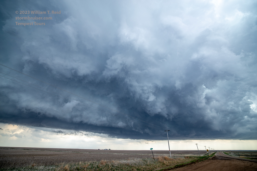
The first six images below are looking south. A tornado occurred with the cell, near the western fringe of the core. We saw some suspicious activity but were not certain whether we saw the tornado or not. I zoomed in for some front-end structure shots to our southeast, and then we were forced back north to 36 and east to Norcatur and Norton.
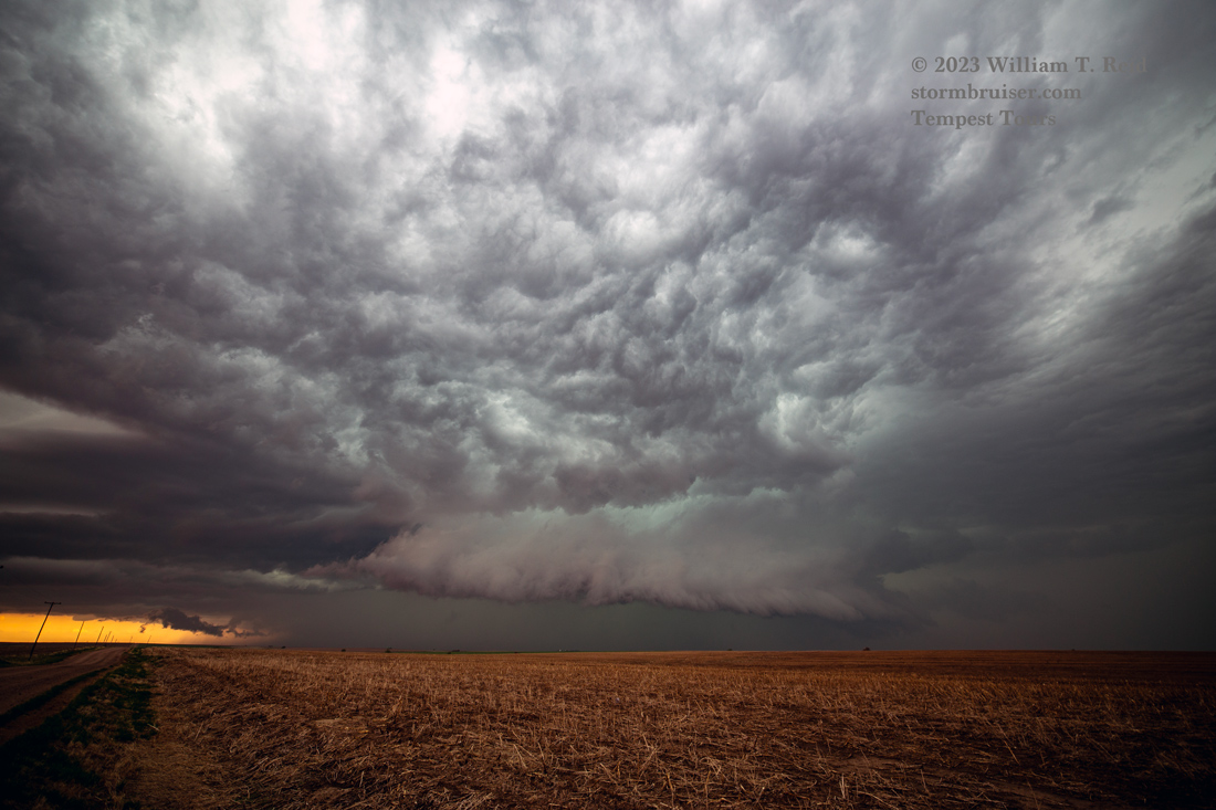
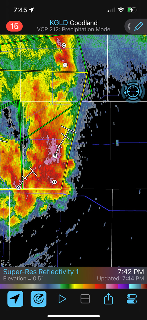
The severe storm morphed into a big, wet and nasty HP. We stayed with the same stuff south and southwest of Norton for a while, but it was more of a messy outflowfest towards sunset.
Leave a Reply
You must be logged in to post a comment.