
Start: Wakeeney, KS
Lunch: Woodward/Chases BBQ
End: El Reno, OK/594 miles
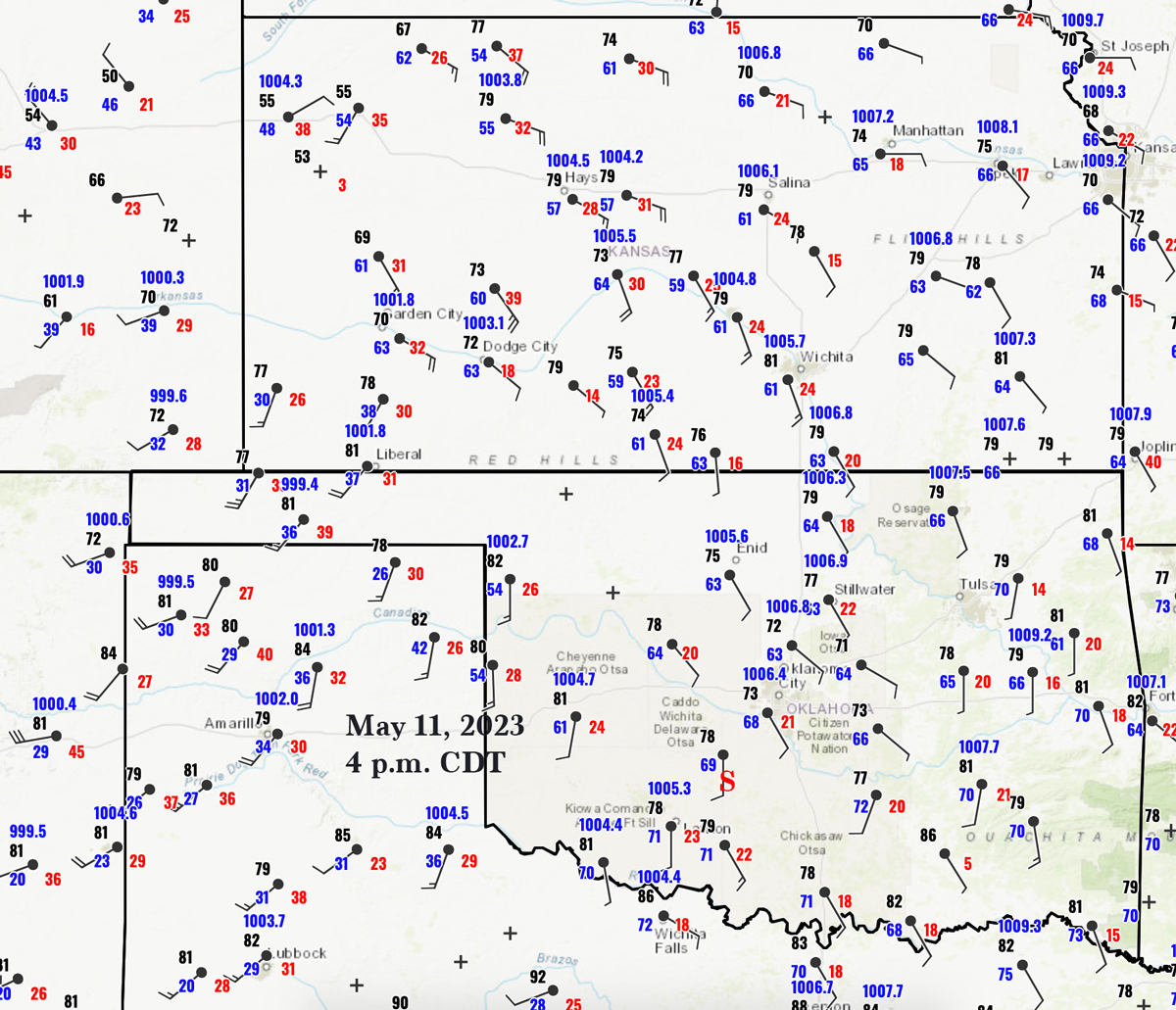
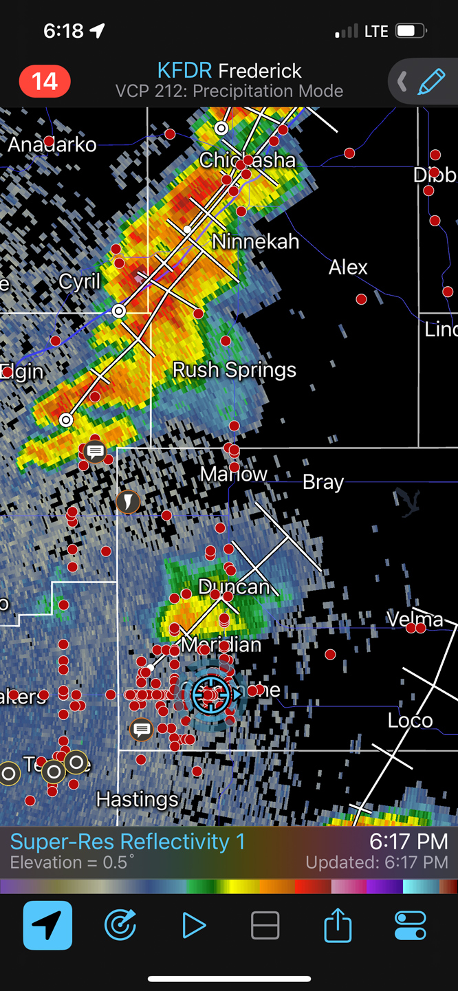
Surface obs at 4 p.m. CDT above. “S” marks the general location of the supercell chased near sunset, near Alex, OK.
Time lapse video of the chase day by TT guide Chris Gullikson
Despite a 10 percent tornado risk over parts of western KS, and a start to the day in nearby Wakeeney, I was lured down to south-central Oklahoma. Here, along an outflow boundary, instability was a lot better as were the chances for a high-end tornado (with dew points near 70F.) SPC showed a hatched 10% tornado risk area from about Duncan to Shawnee. We needed to get ourselves way down near the Red River.
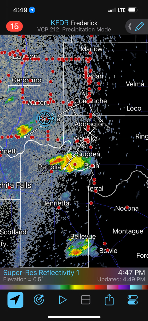
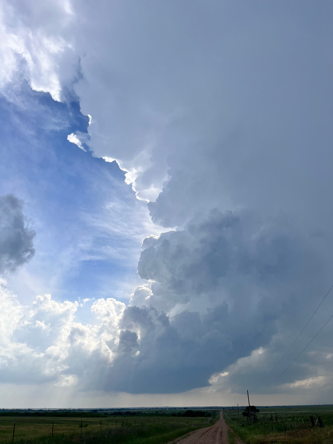
A robust updraft took shape as we neared Randlett, just east of I-44 and just north of the Red River. The low levels of this smallish supercell showed really nice rotation. It strengthened some and dragged us to Temple and Comanche, but then it fizzled.
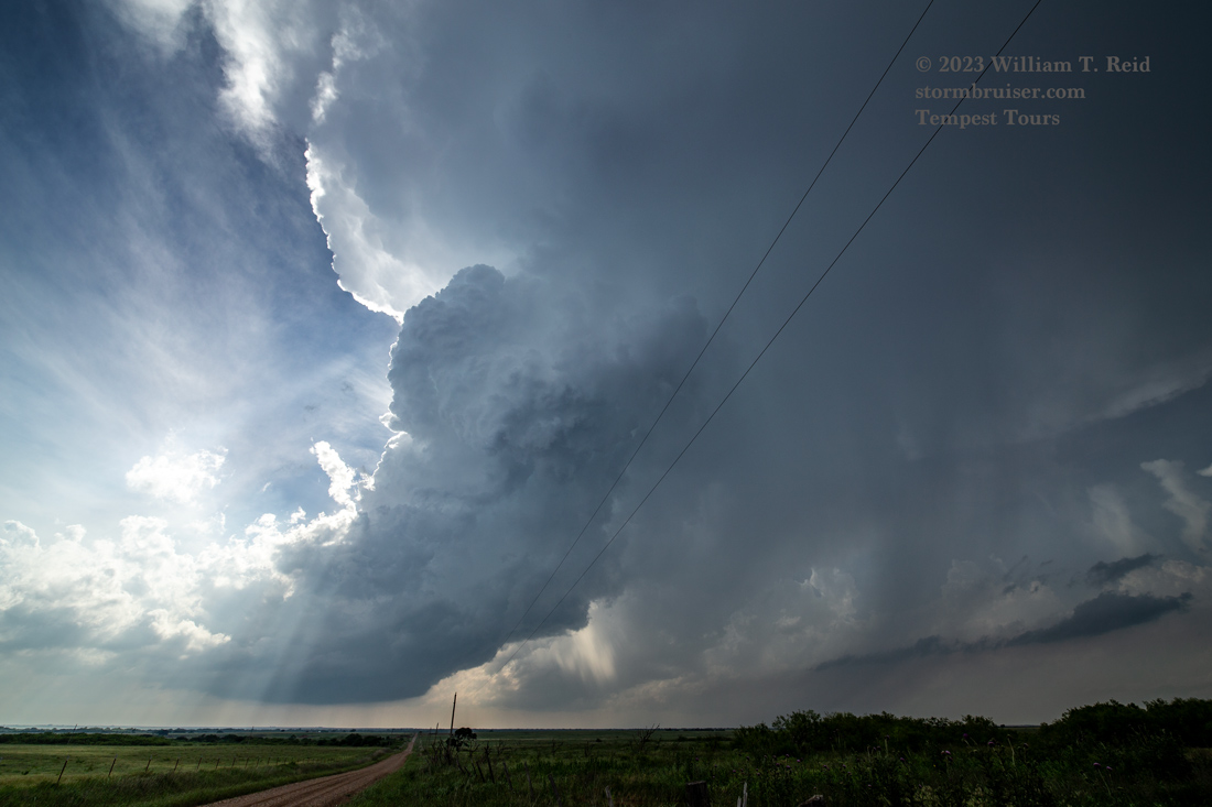
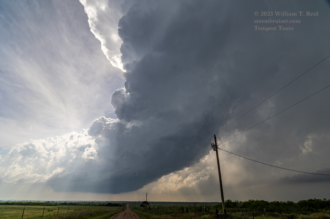
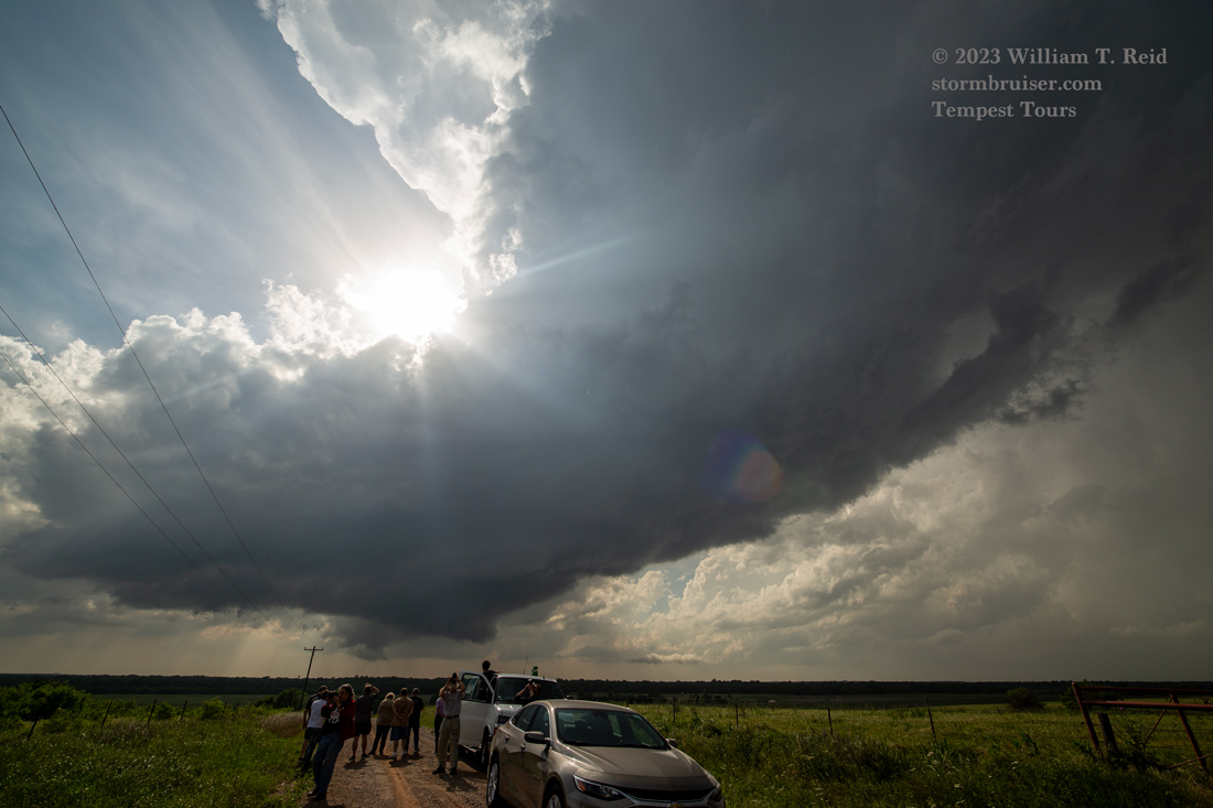
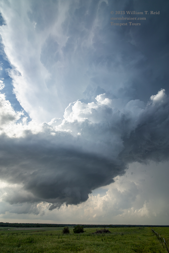
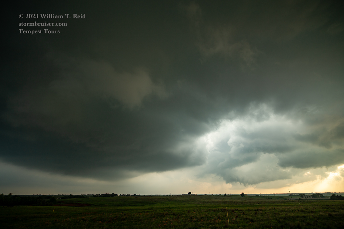
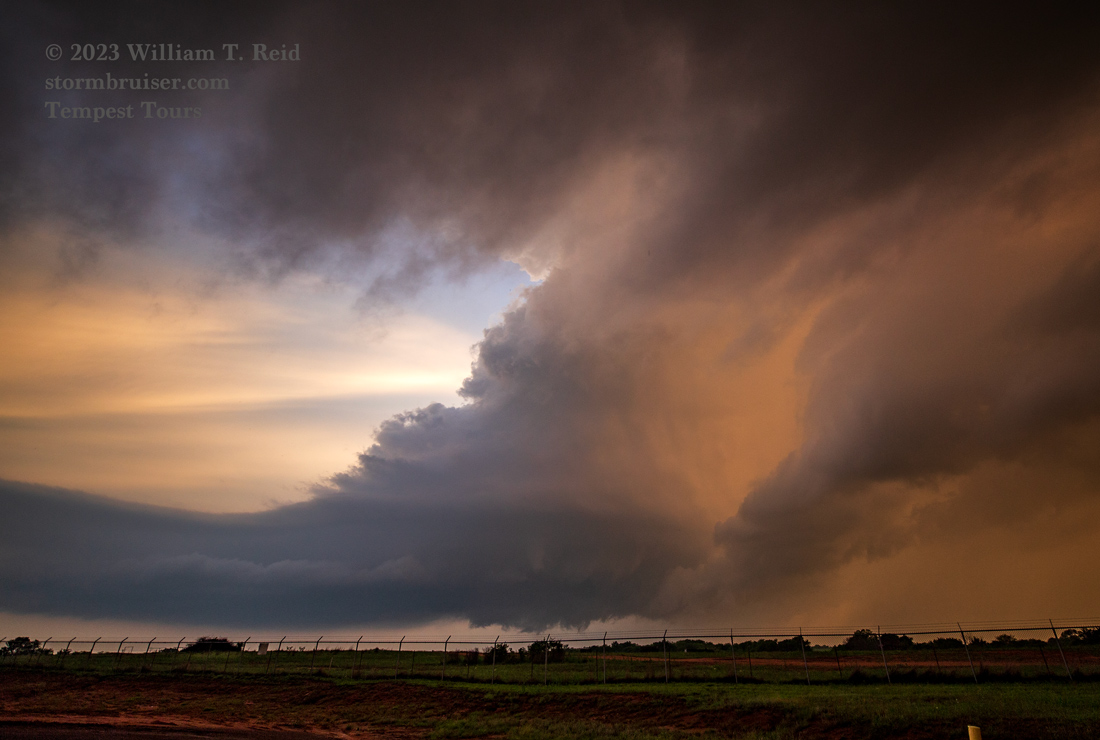
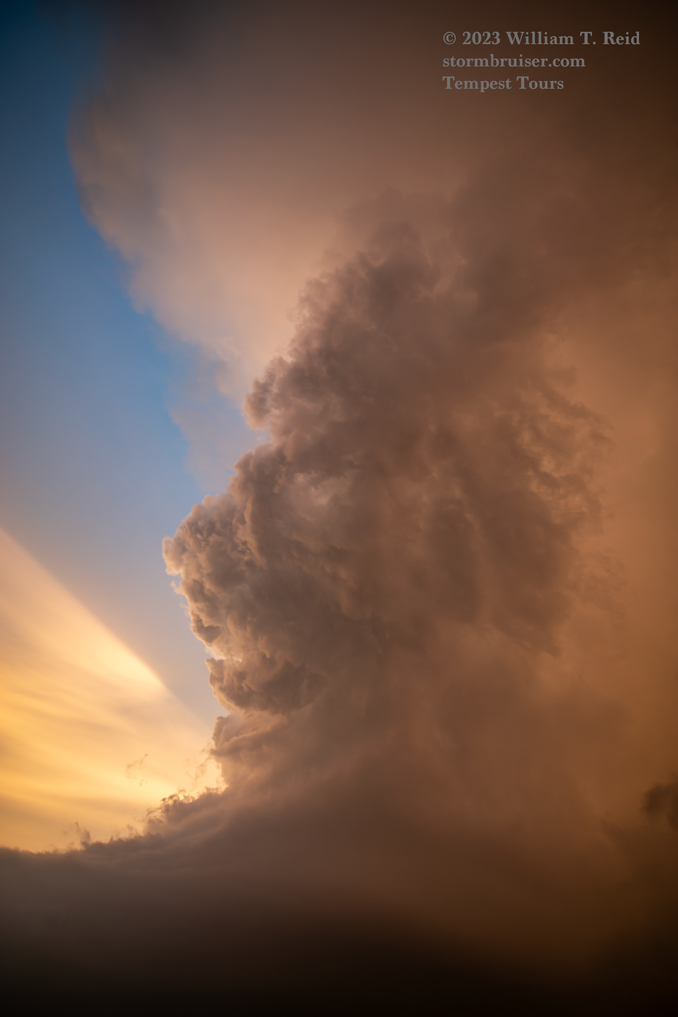
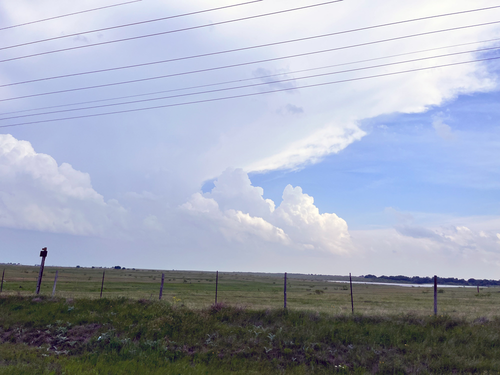
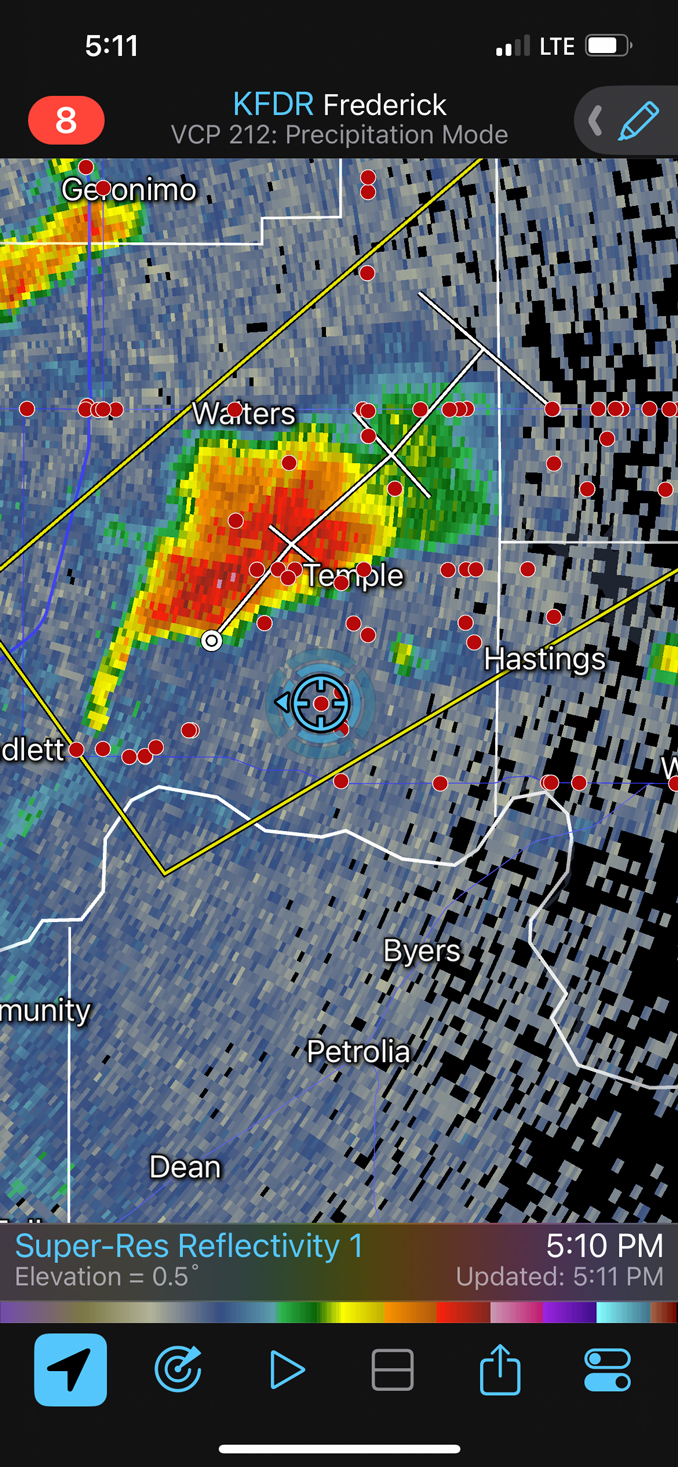
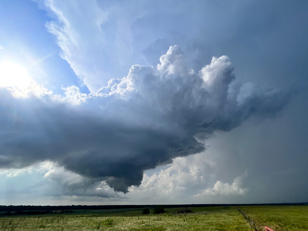
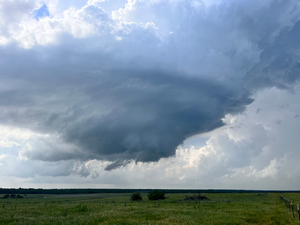
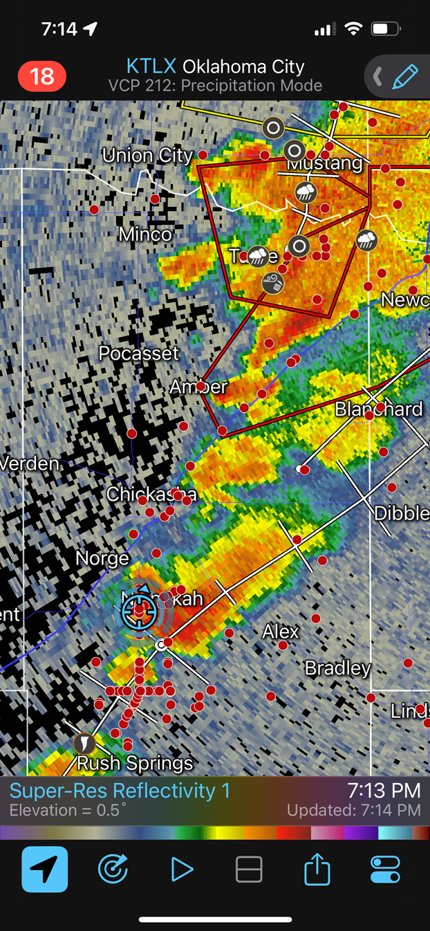
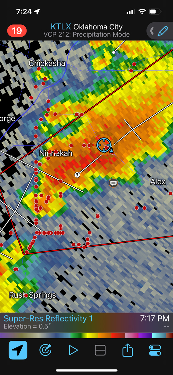
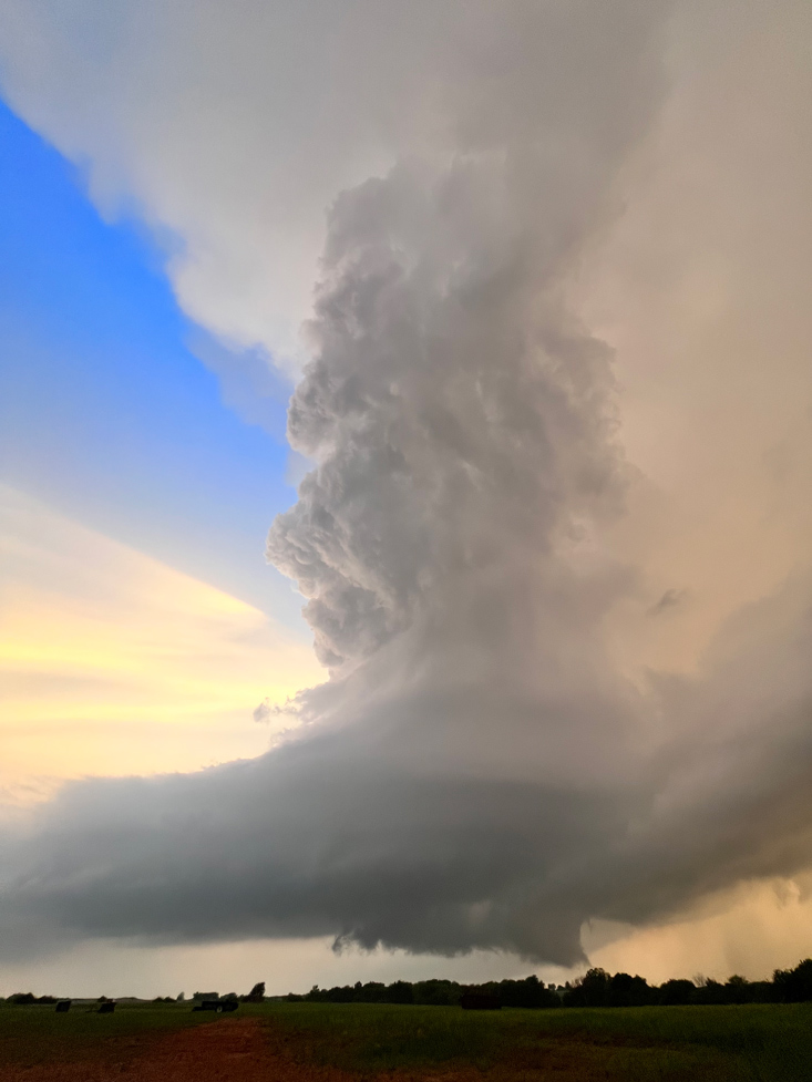
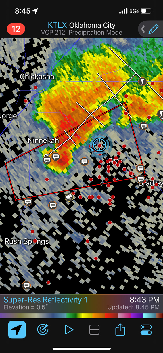
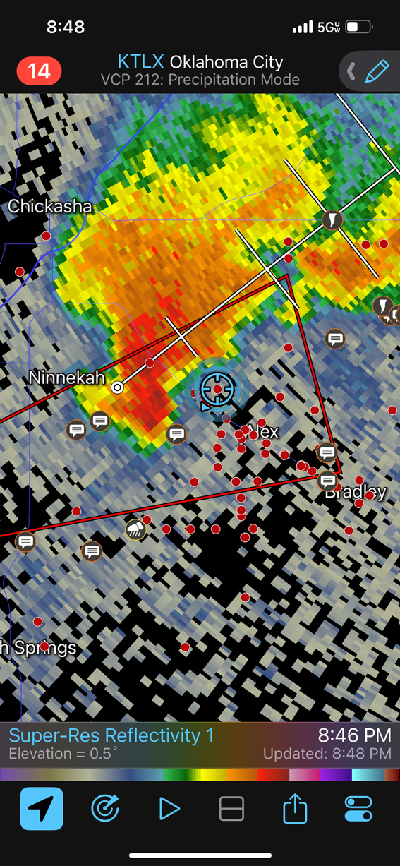
The area to “key-in” on shifted a little to the north, and we went up U.S. 81 to Rush Springs and another robust supercell. I think this one had a tornado warning with it, but we saw none as we maneuvered to its northeast side via Ninnekah (first two pics below).
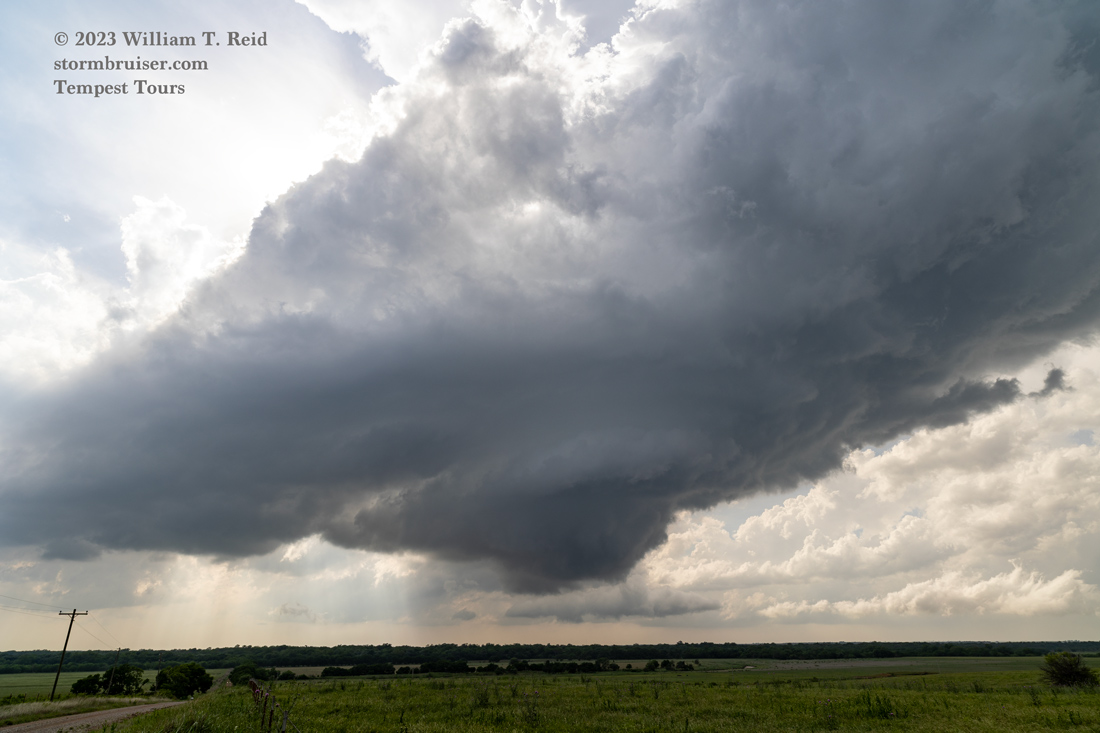
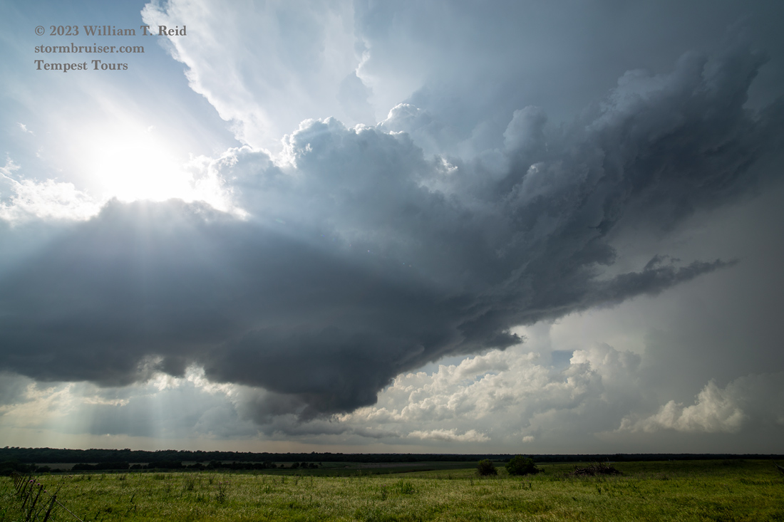
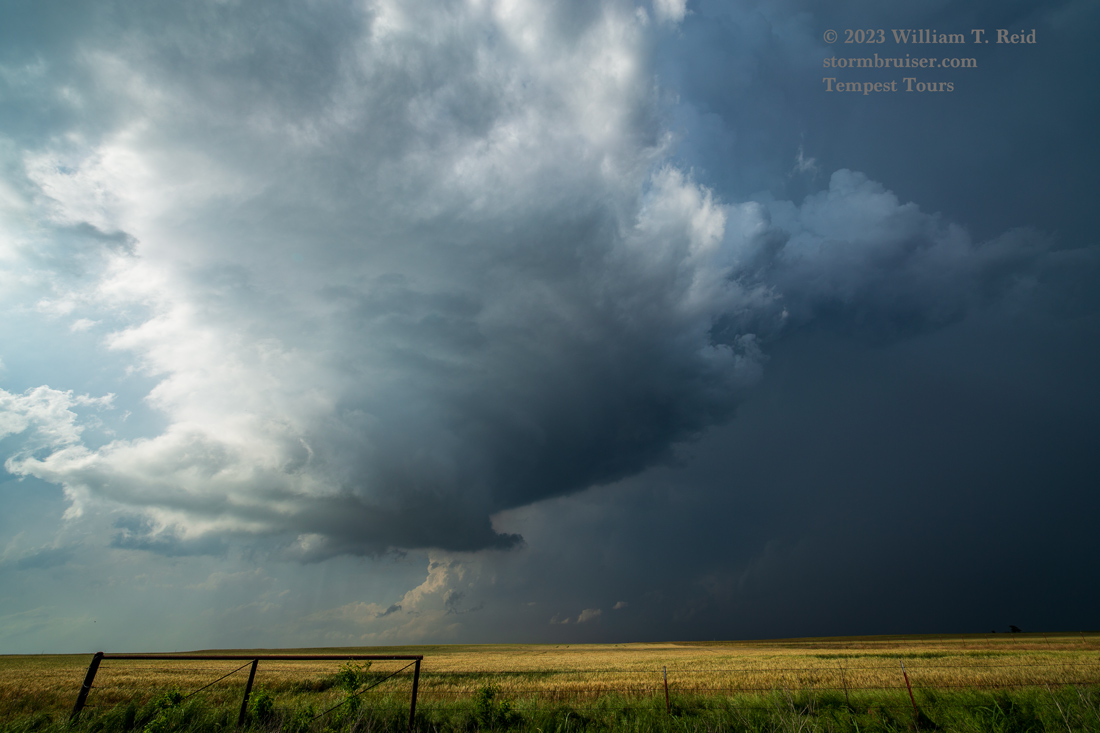
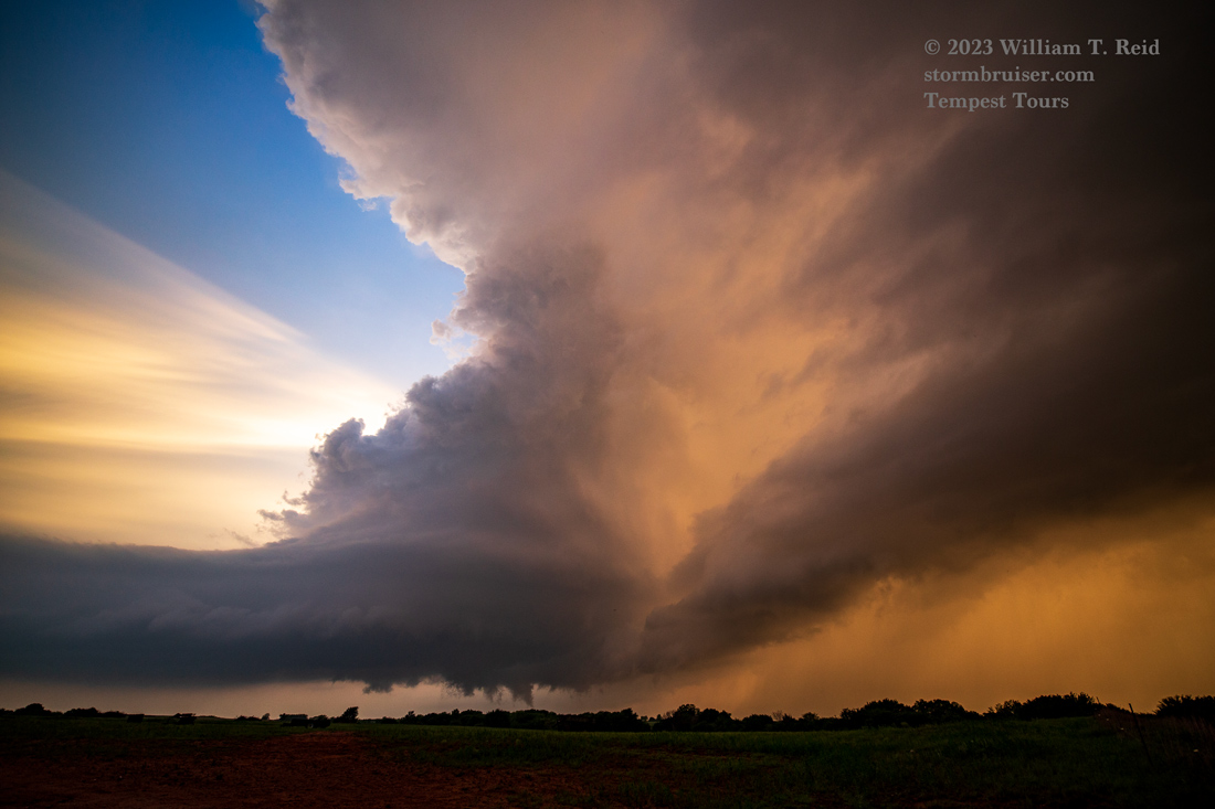
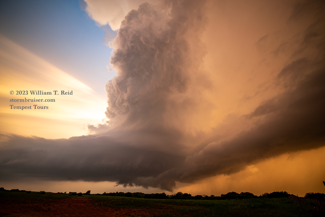
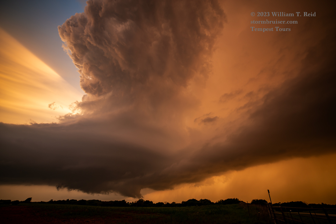
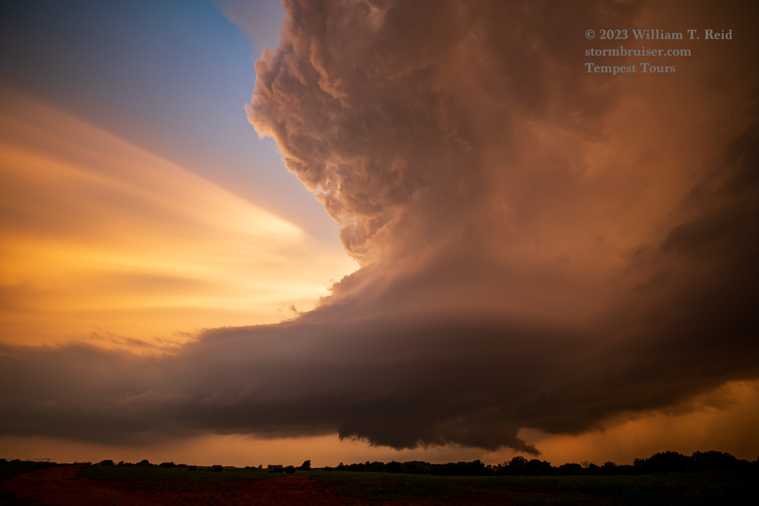
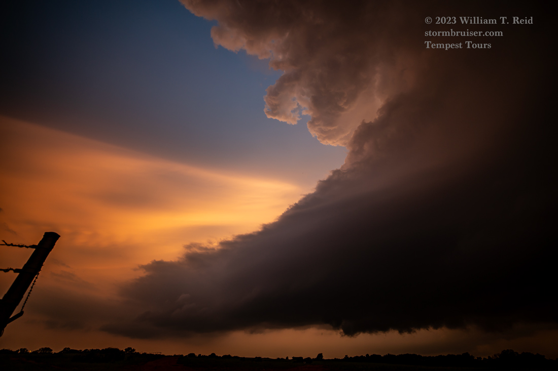
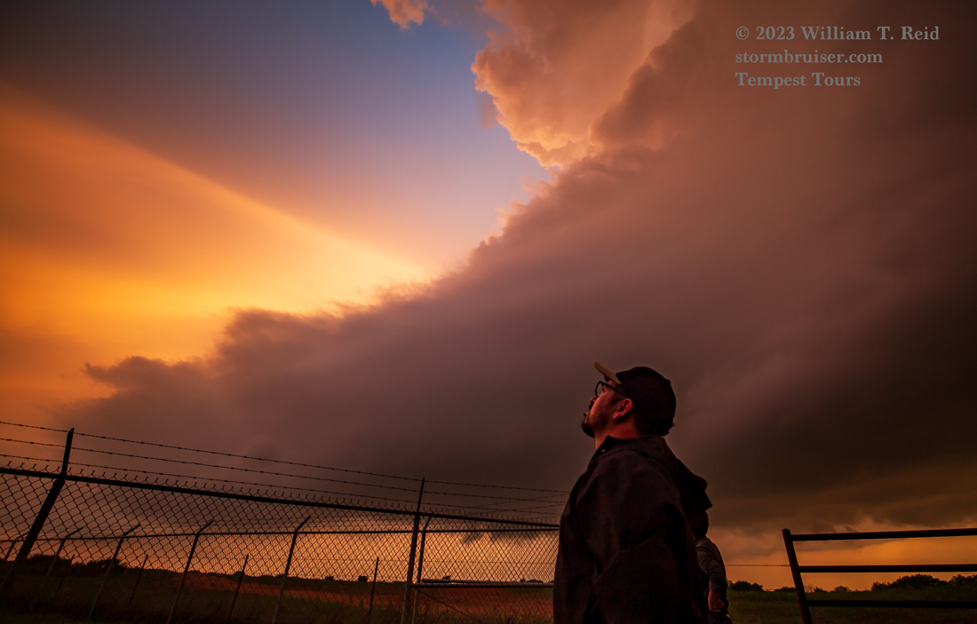
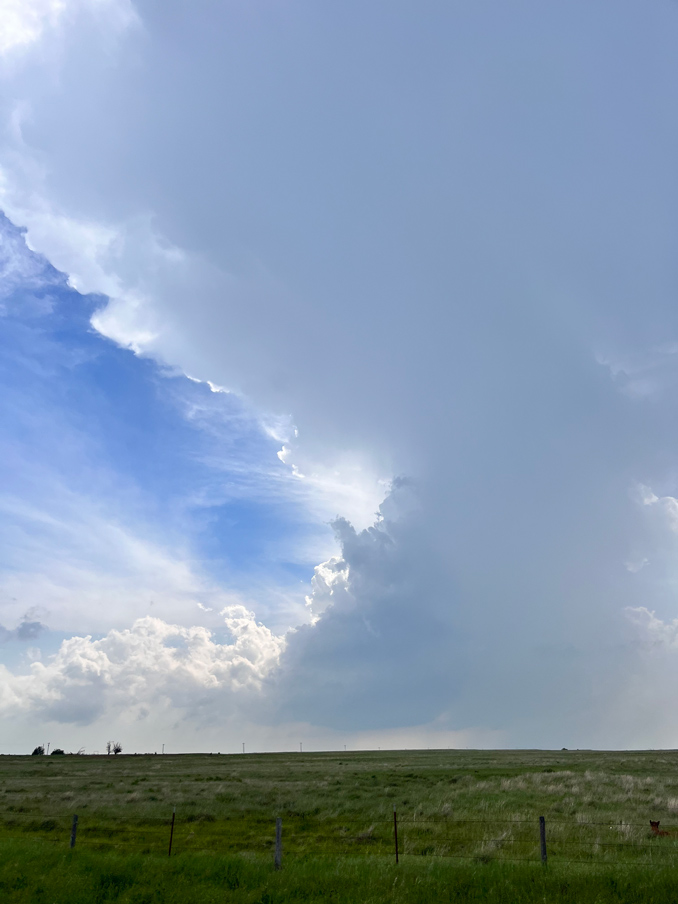
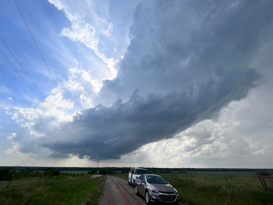
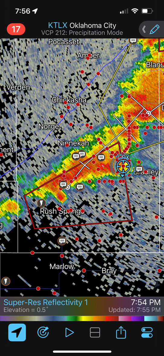
A trio of supercells developed around the same spot, west of Rush Springs, and moved to the ENE towards Alex, OK. The second of the series looked great as we viewed from its south side (along 1450 west of Alex, I think). A decent funnel cloud formed to our east, but it did not appear to touch down despite persisting for a few minutes.
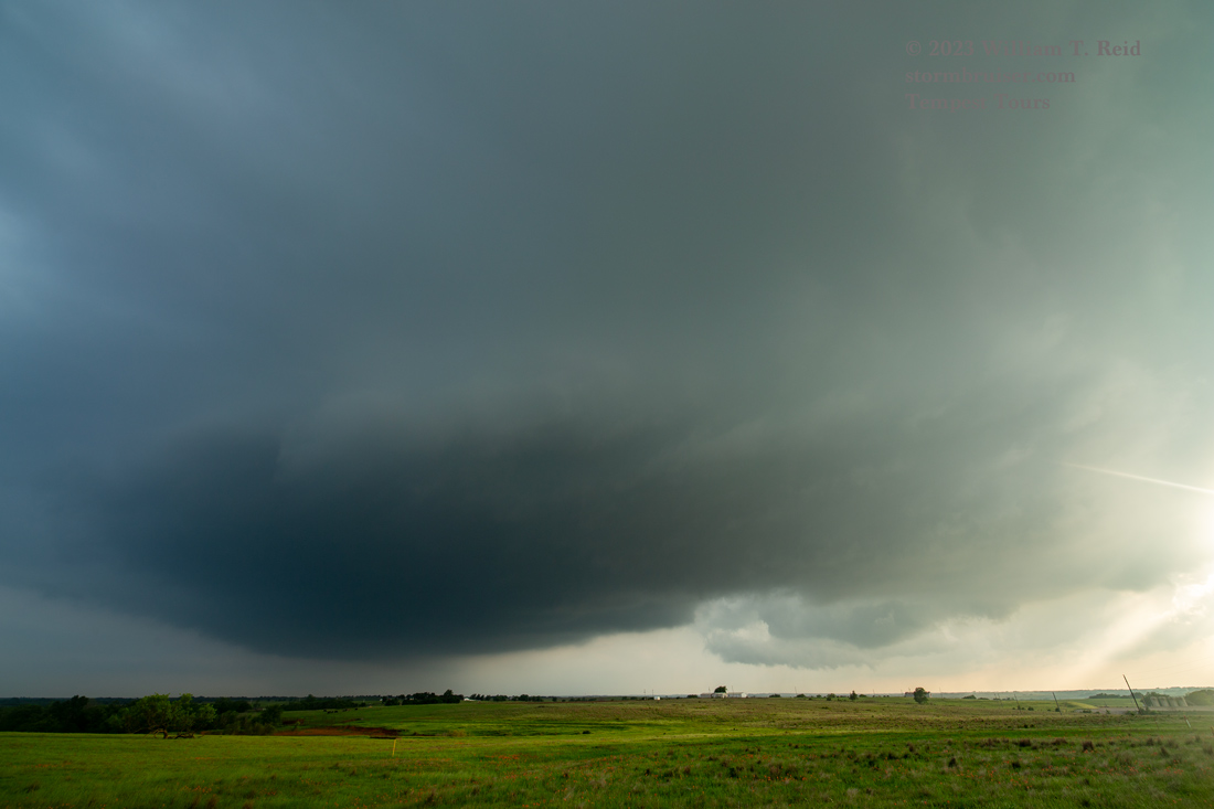
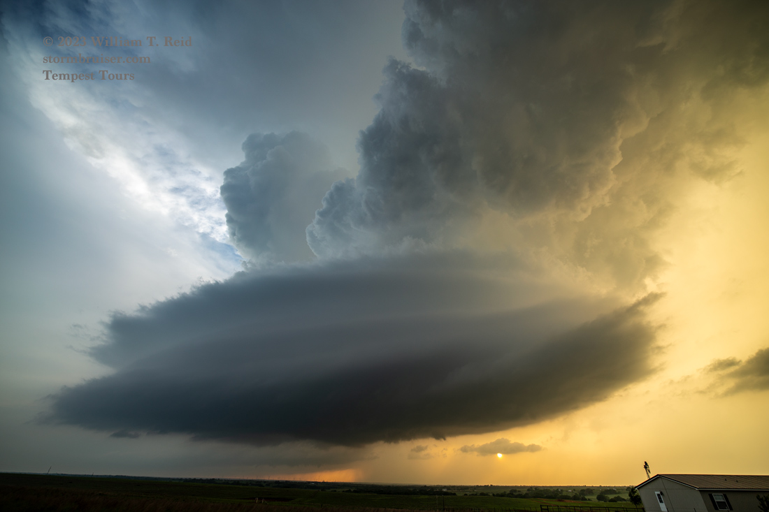
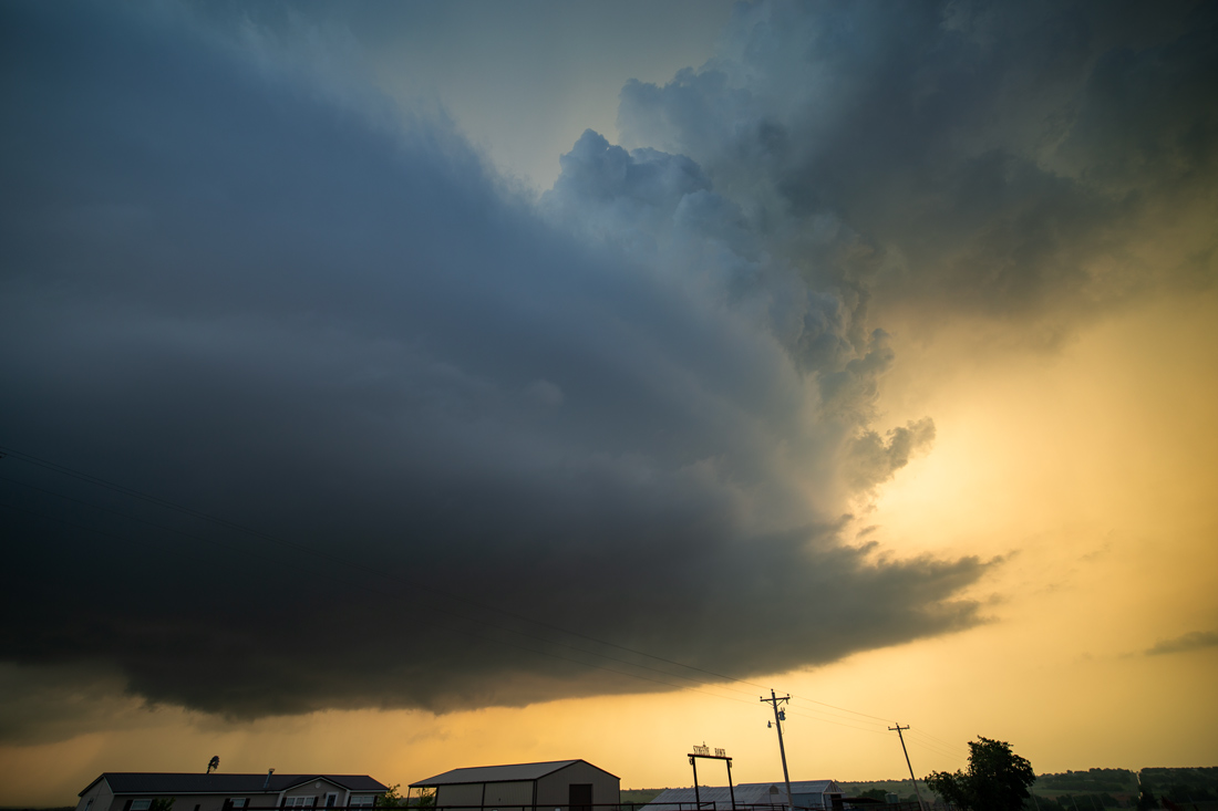
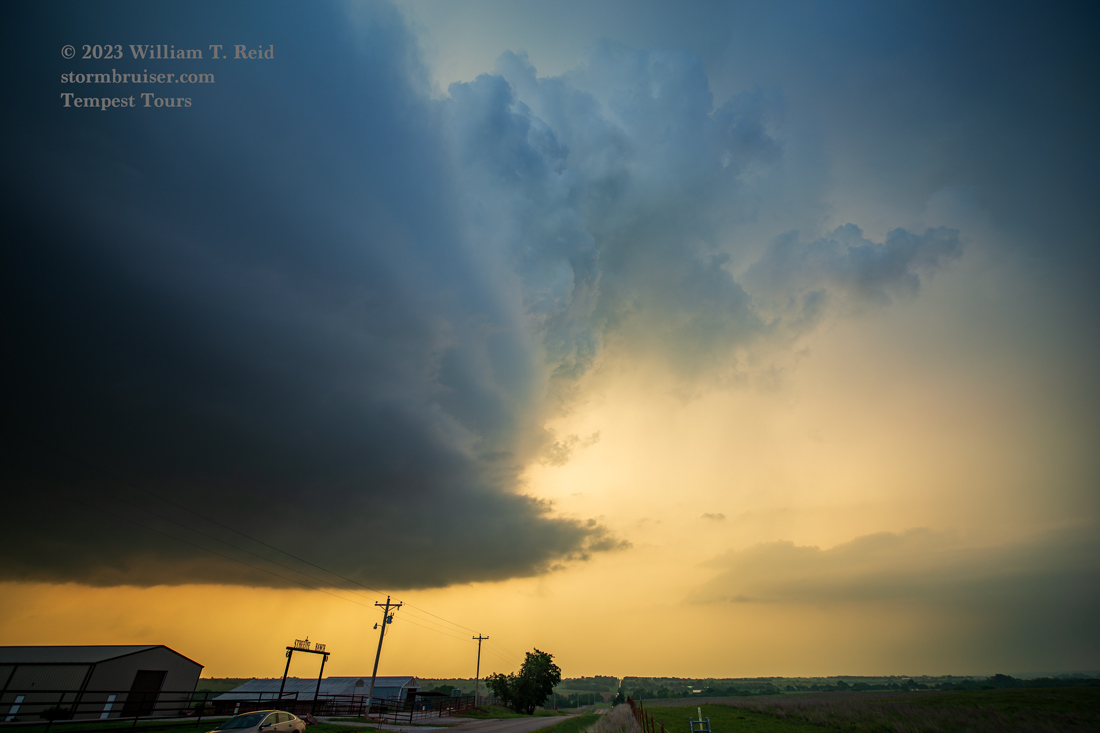
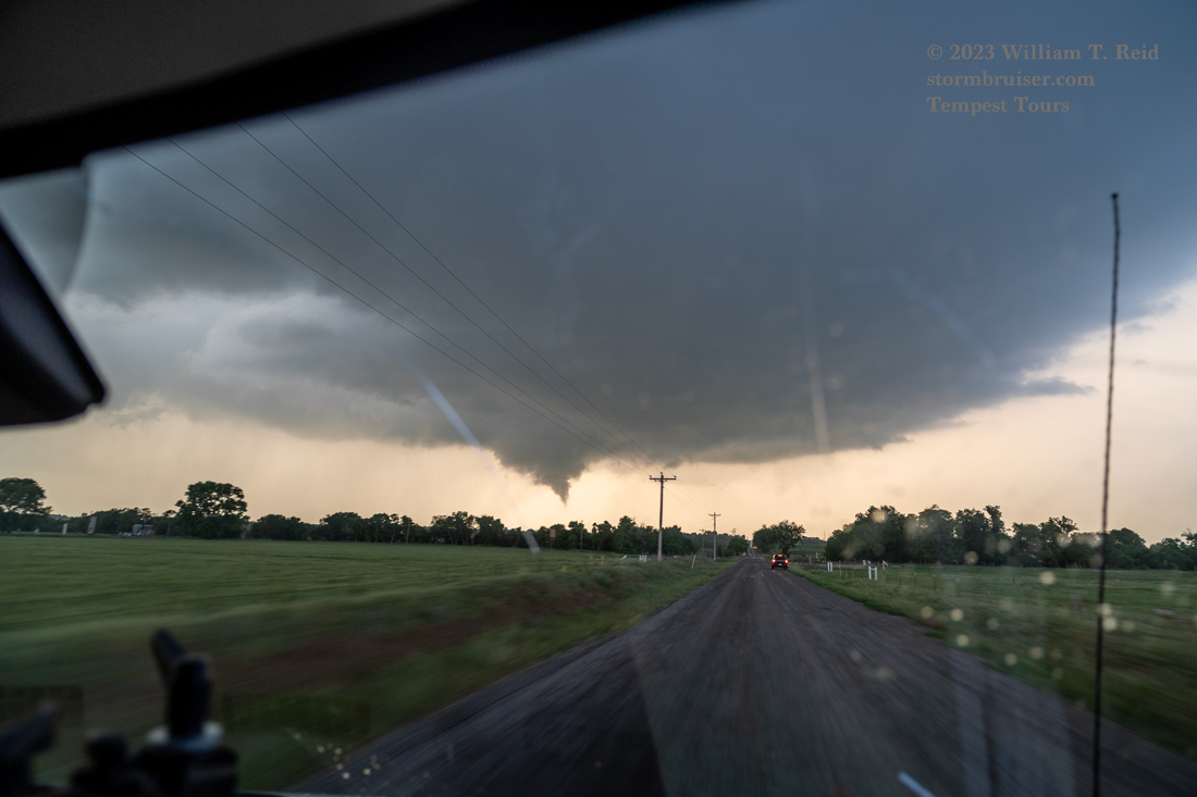
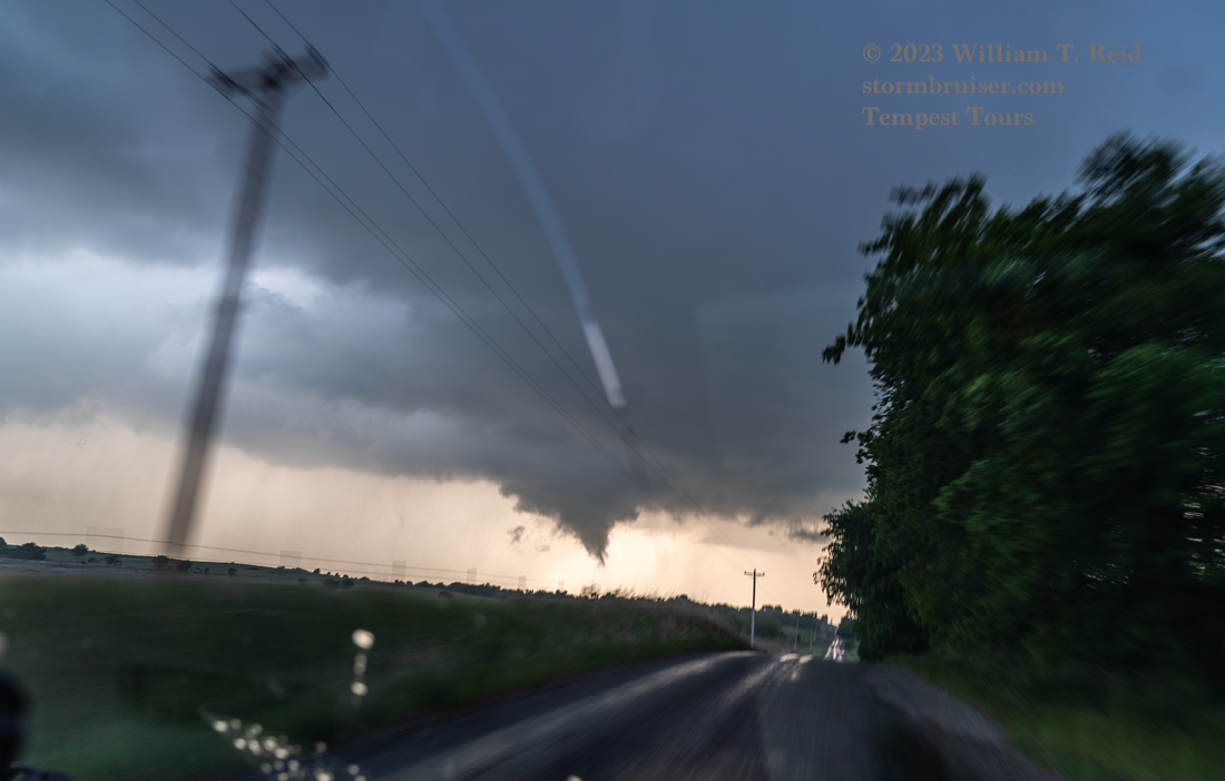
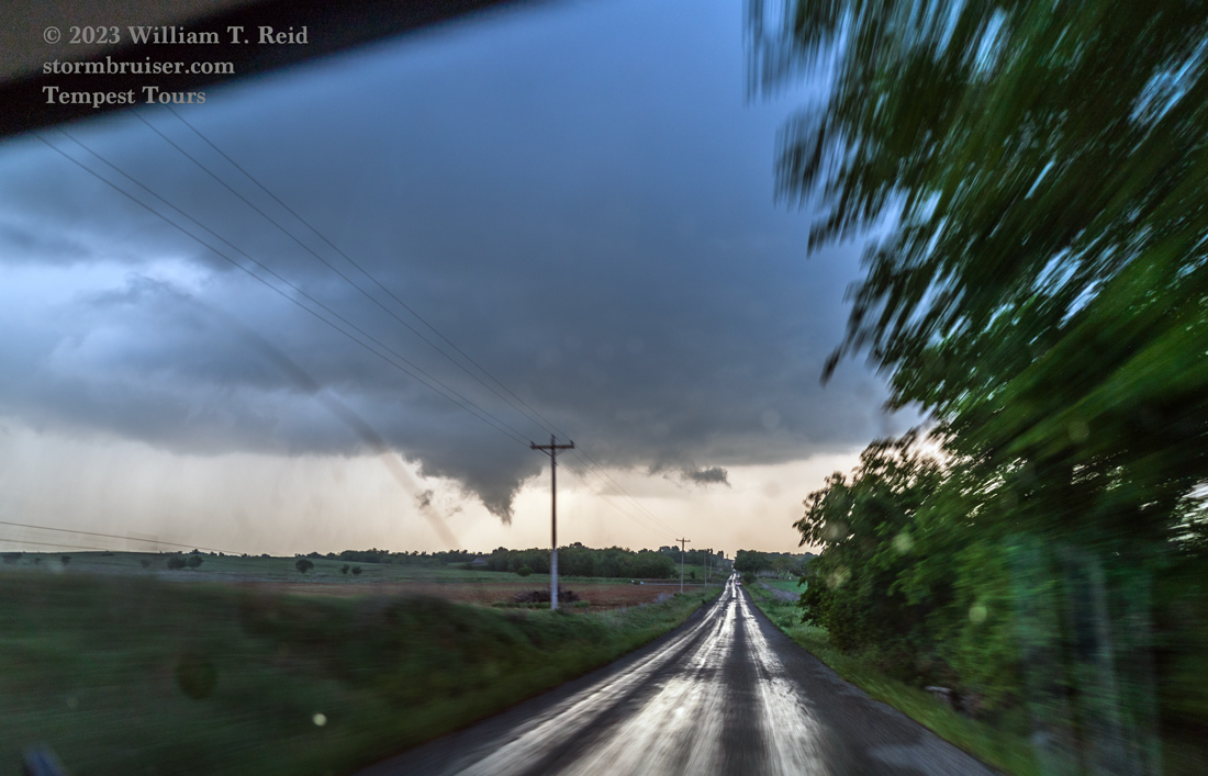
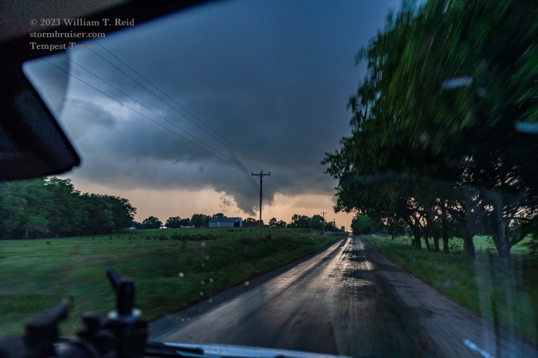
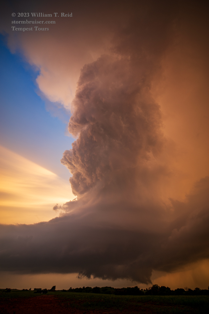
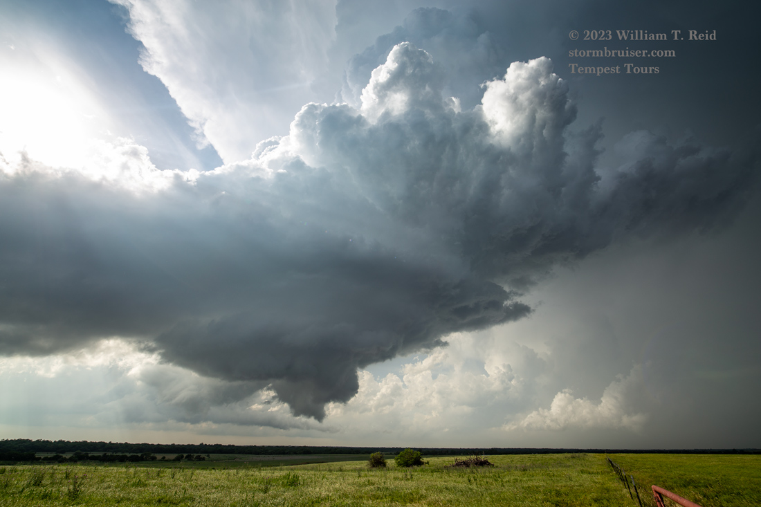
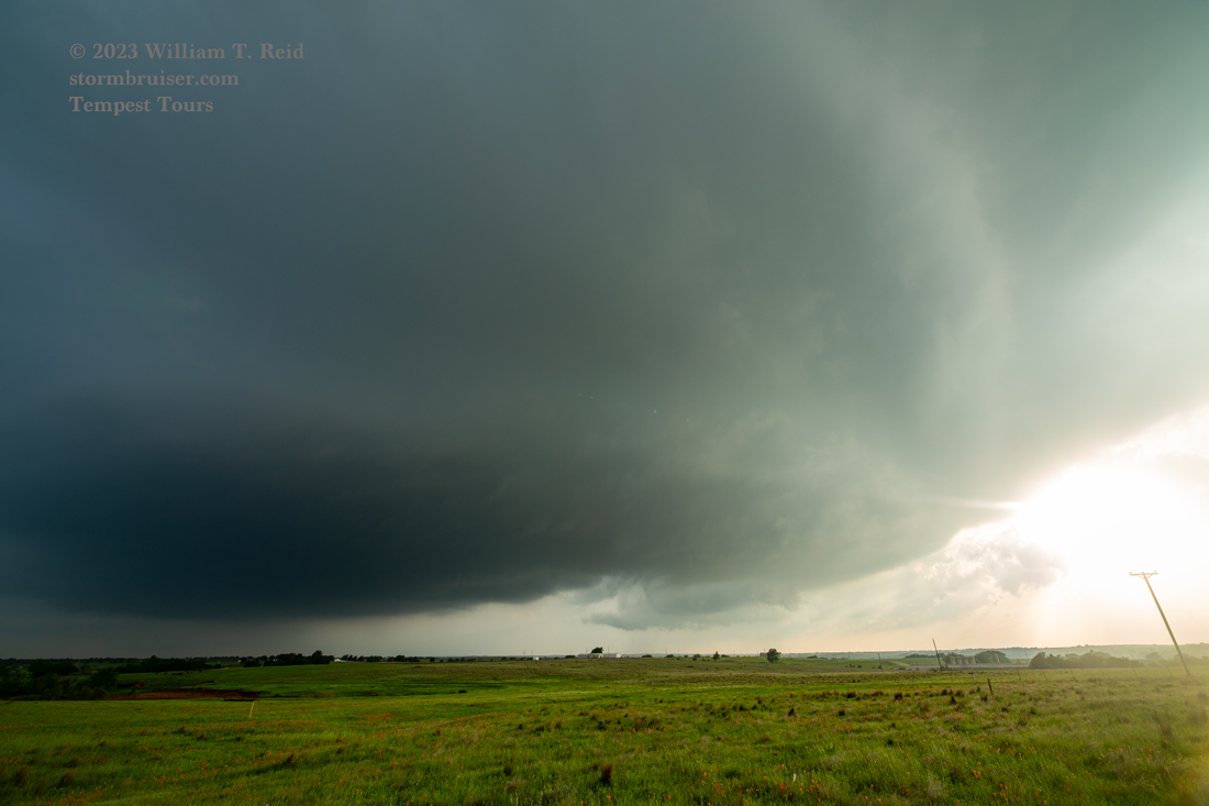
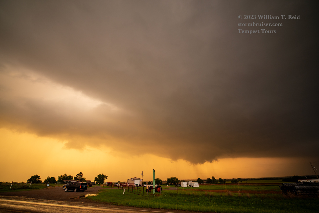
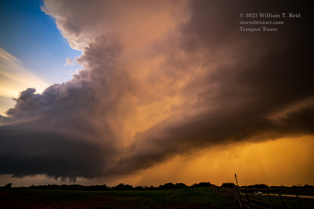
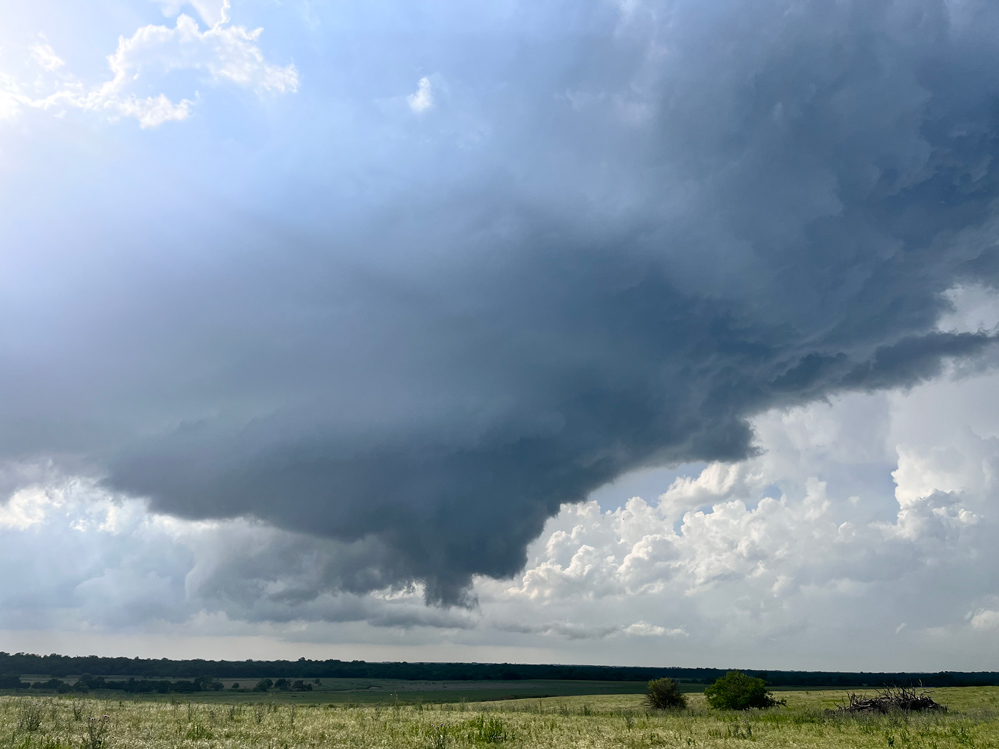
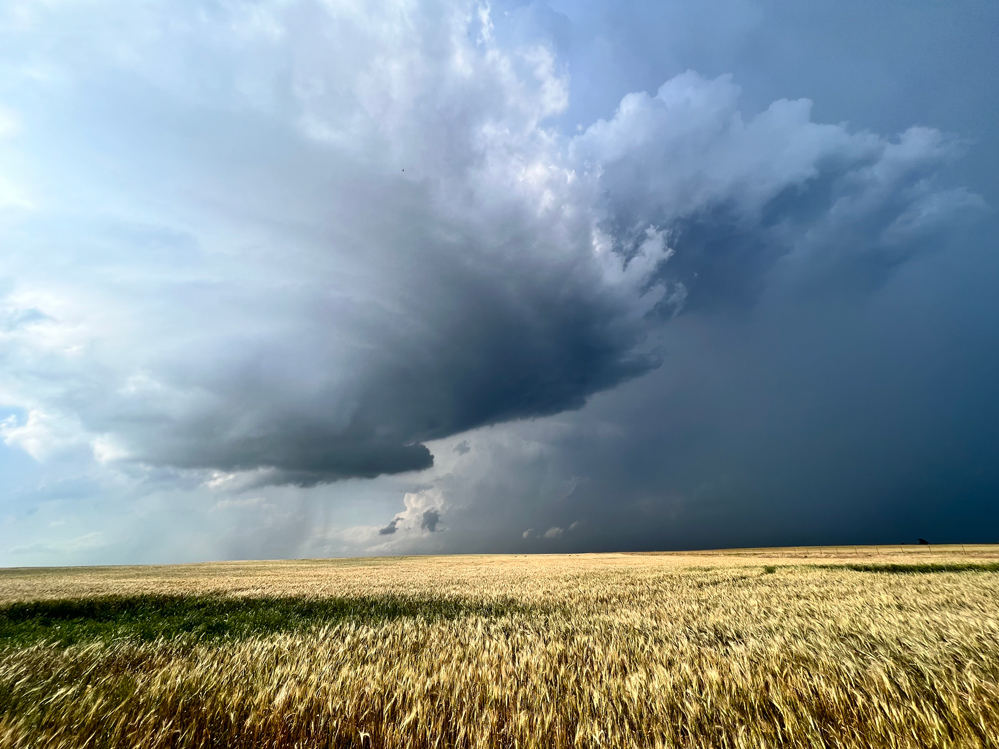
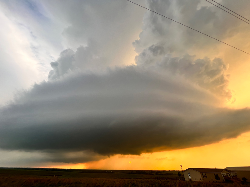
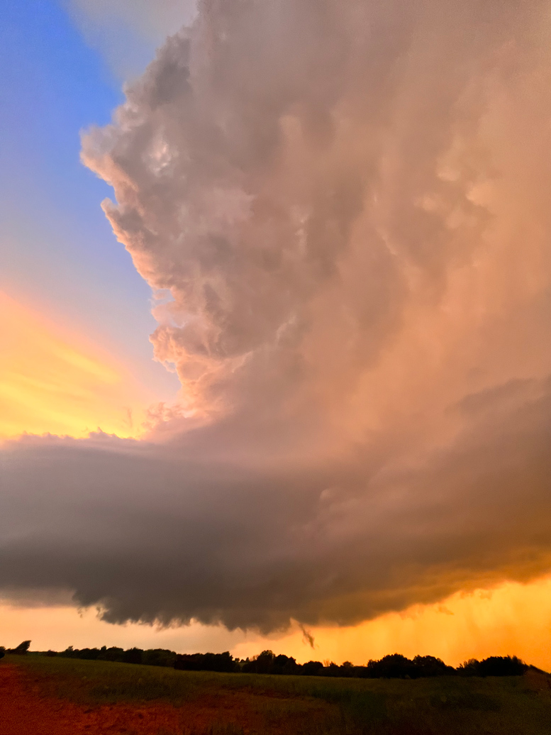
We stopped again near Alex at sunset, with a view of the base of the second supercell just to our northeast and the third nice supercell approaching from the west. This third one was also quite strong and with good rotation, but it did not produce a tornado. I wonder why!
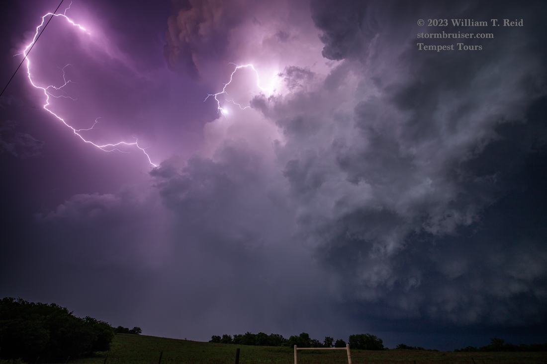
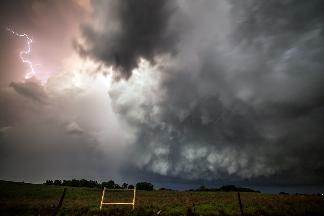
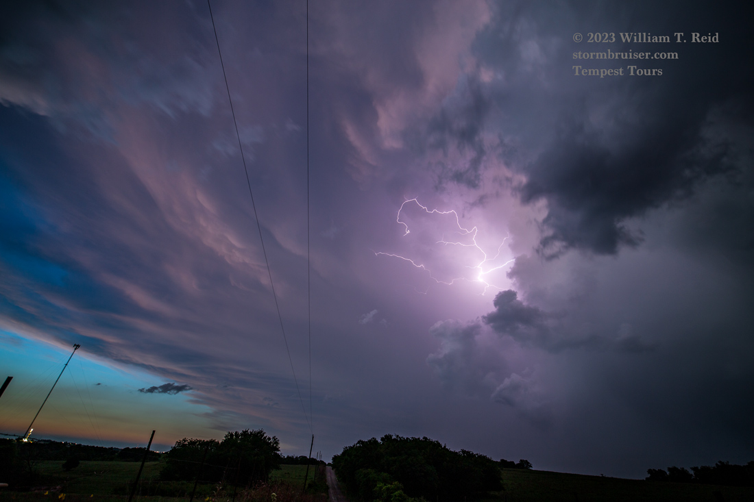
After sunset we scooted north a little bit to watch the lightning on the wicked-looking backside of the third supercell.

Below are iPhone pics and radar screenshots from the chase, in chronological order.
Leave a Reply
You must be logged in to post a comment.