
(May 31, Ogallala to northeast NM and Hereford, TX area: junky. 579 miles)
(June 1, Amarillo to Lubbock and west to Lovington, NM area: bustola. 388 miles)
June 2/Start: Seminole, TX
Lunch: Did we have lunch?
End: Andrews, TX/264 miles
The pattern was rather active and energetic as May turned to June on the High Plains. Mid-level winds were more than strong enough from the west and WSW to provide adequate shear. There was ample moisture available south of outflow boundaries, primarily in western TX and eastern NM. We had somewhat high hopes on both the 31st and 1st as SPC showed a 5% tornado risk both days. We made. very long drive south on May 31 to get ourselves into northeastern NM, but morning convection trashed the low levels. We couldn’t get to semi-decent storms southwest of Clovis in time and wound up on junk near Hereford. On June 1 we were drawn south from Amarillo to an outflow boundary from about Andrews to Lovington. It never fired, probably because of poor timing with upper-level support.
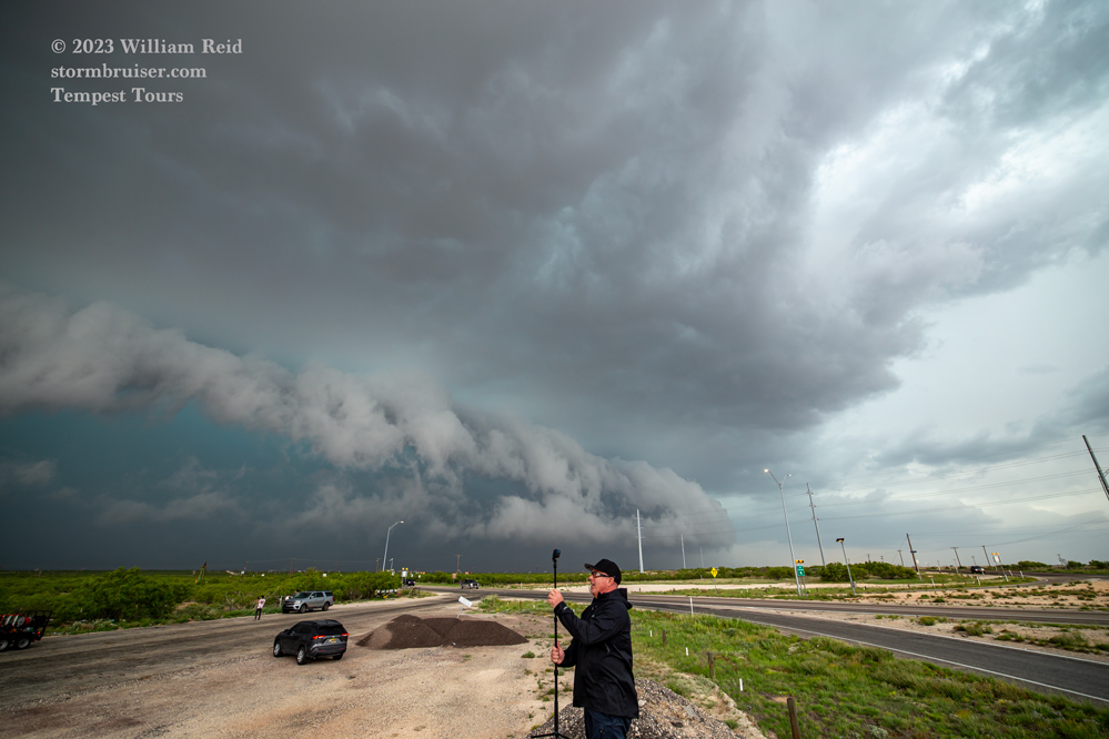
So, moving on to June 2, we started out in fine shape near the target area around Hobbs. A severe storm initiated somewhat early on, just after lunch time, near Nadine (south of Hobbs, in NM). We were in front of the HP supercell while it was tornado-warned, but the action area was filled in with precipitation.
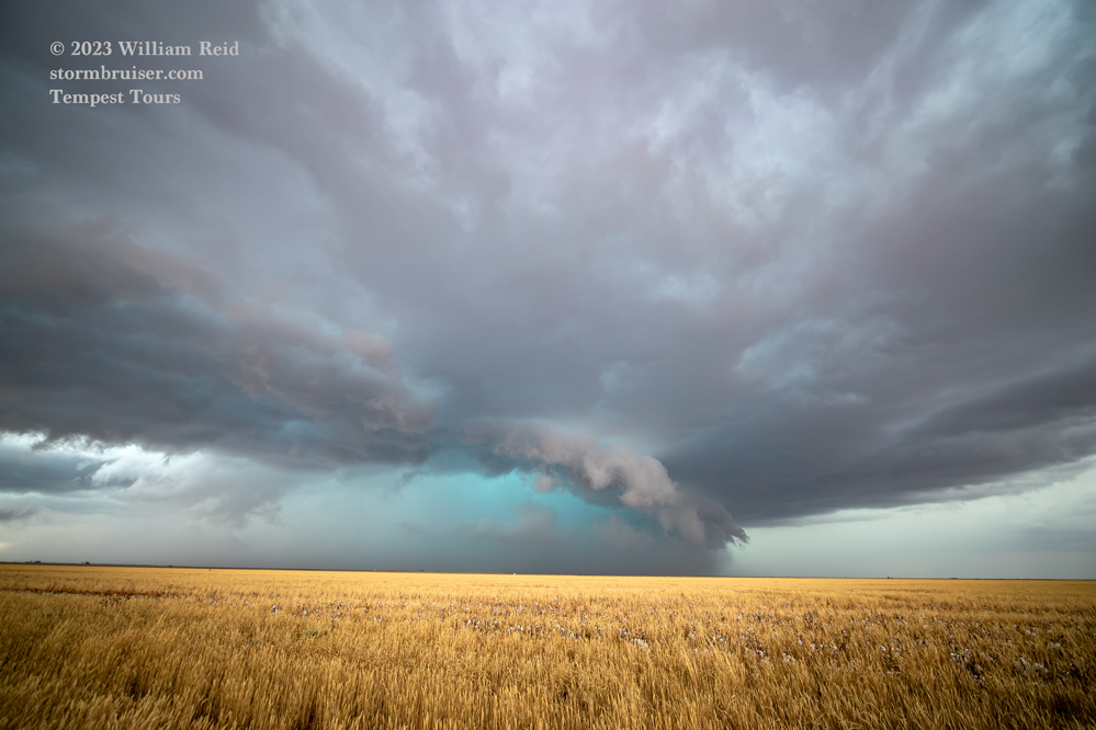
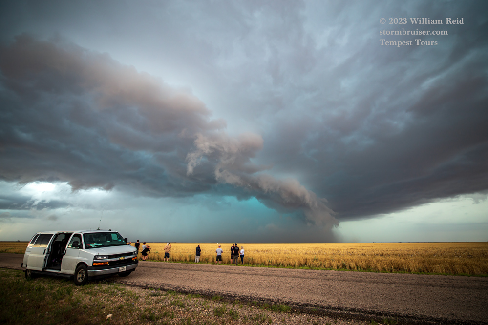
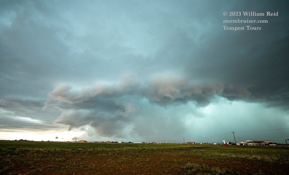
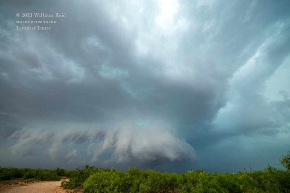
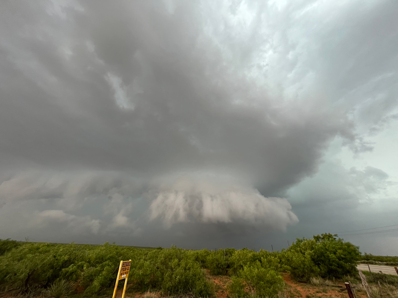
This cell pushed us towards Seminole, and remained HP and increasingly cold and outflowish. A new supercell developed to our SW, and we dropped south and SSW to west of Andrews, near Frankel City.
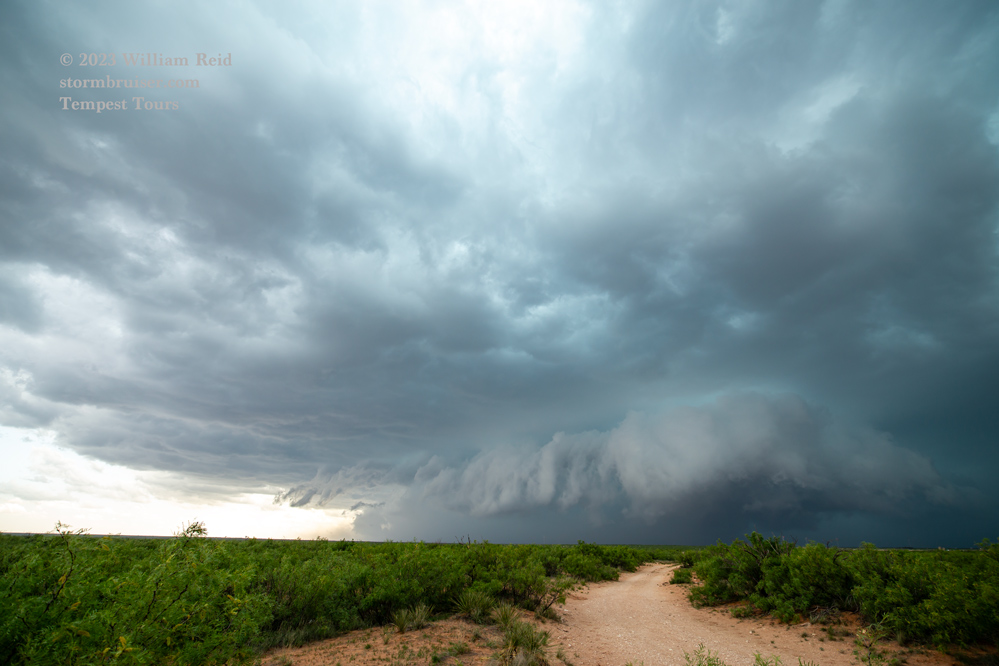
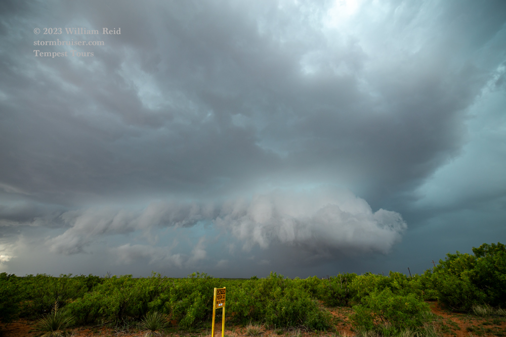
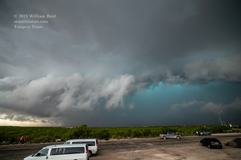
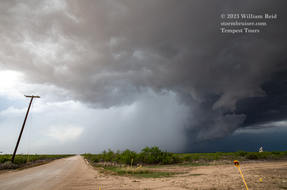
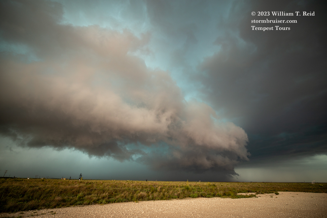
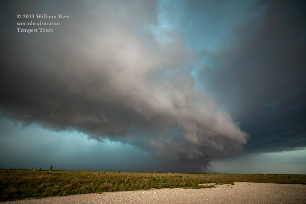
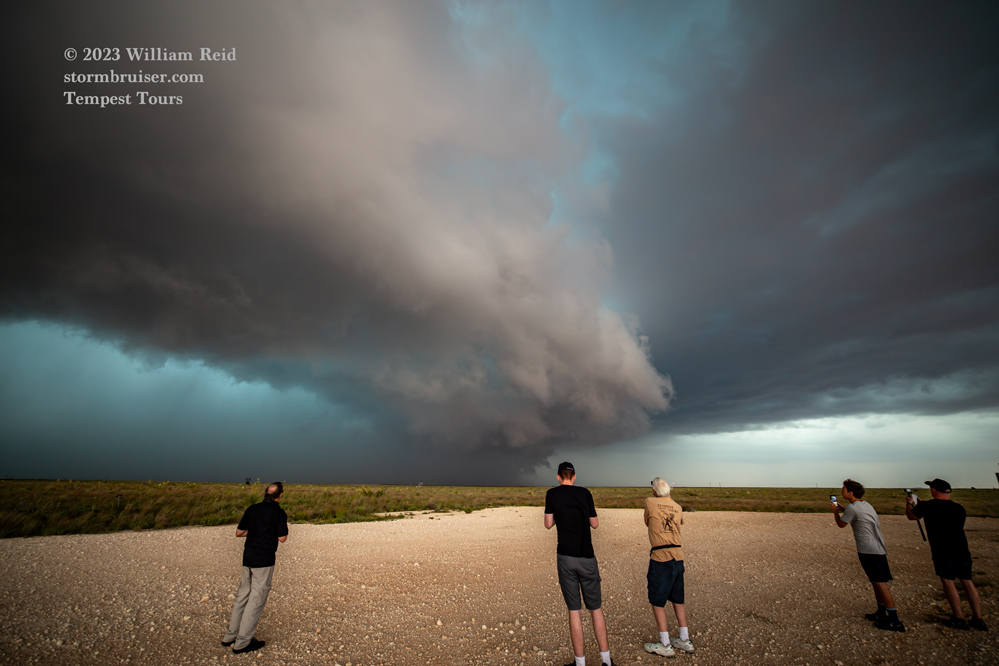
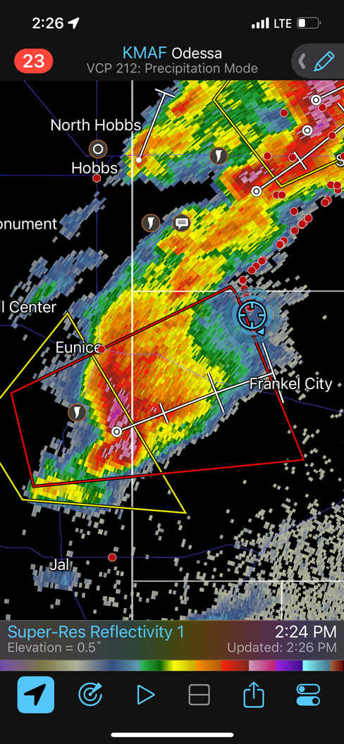
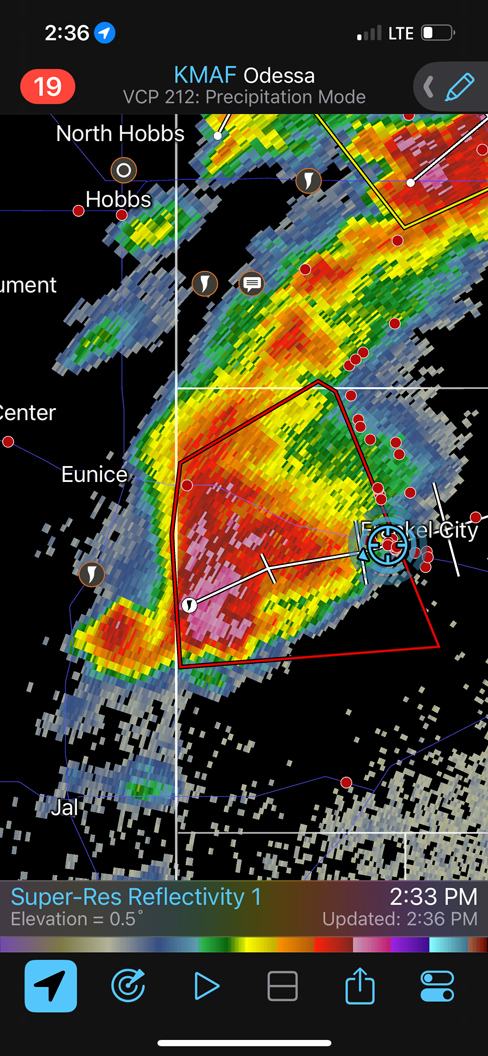
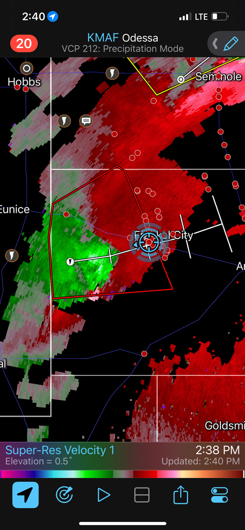
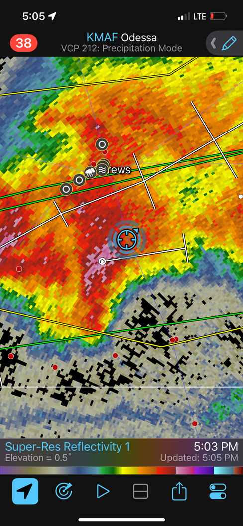
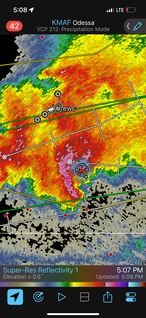
This newer supercell showed great promise, with a sculpted front end for a bit. But it soon became a rain-filled blob. Thereafter we had to be content playing with hail cores. The first three radar screen grabs below show the second supercell south of Eunice. Note the boundary at the bottom of the last two radar images around 5 p.m. The severe storm here was undercut by rain-cooled air, so any tornado fun had about a zero percent chance of happening. That is what usually transpires when storms fire so early in the afternoon.
An impressive tornado was photographed today by chasers who ventured to the Sanderson and Dryden area, near the Rio Grande.
Leave a Reply
You must be logged in to post a comment.