
Start: Clayton, NM
Brunch: 87 Restaurant/Clayton
End: Clayton/about 230 miles
Chase account by TT guest Lesleyanne
We were in good shape today to chase the “hatched” hail risk area outlined by SPC in their Day One forecast. This was along the Raton Mesa and eastward into the OK Panhandle. Tornado prospects were not too good, though dews were into the low 50s from Springfield to Trinidad. That isn’t bad at all for the elevations (above 4500 feet) on the north side of the Raton Mesa. A “backdoor” cold front was promoting upslope flow here (good), but surface wind direction was mostly from the ENE (not good). Mid-level winds from the WSW would carry storms to the east, and surface inflow would be involved with the forward-flank precipitation before reaching the updraft base of any supercell. This cools and stabilizes the surface inflow at least a little, and is generally detrimental for promoting tornado-making. You want nice, pristine, uncontaminated warm and moist inflow (usually from the SSE to ESE that is not getting rained on) towards the storm base for much better tornado odds. Okay, enough with the severe-weather lesson.
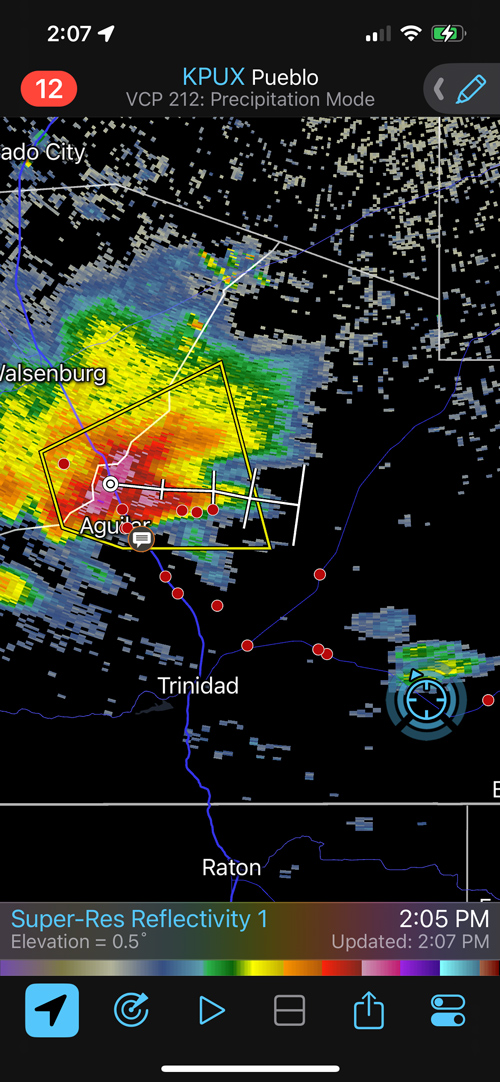
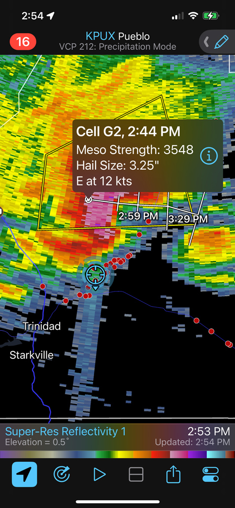
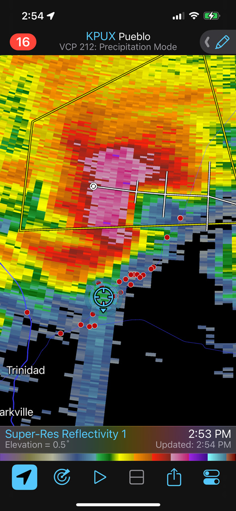
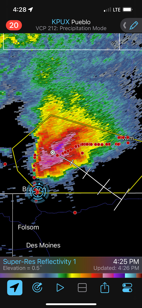
We headed to Folsom and Branson following our healthy brunch in Clayton. It soon became apparent that we needed to be closer to I-25 to check out somewhat early convection between Trinidad and Walsenburg. The iPhone screen grabs towards the bottom here can help you follow our position with respect to the supercell observed.
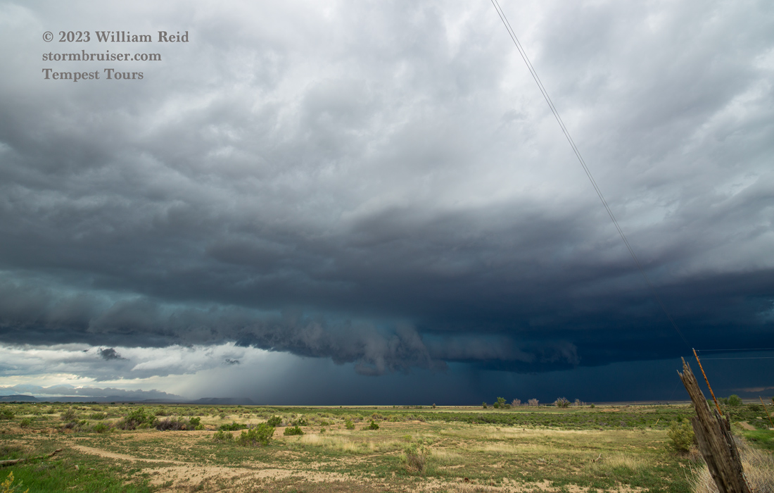
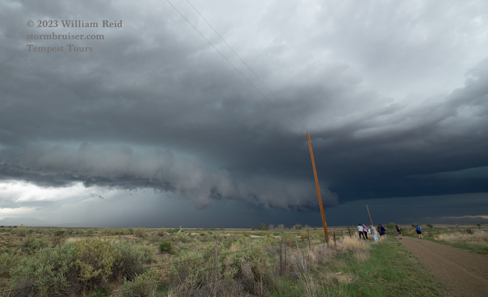
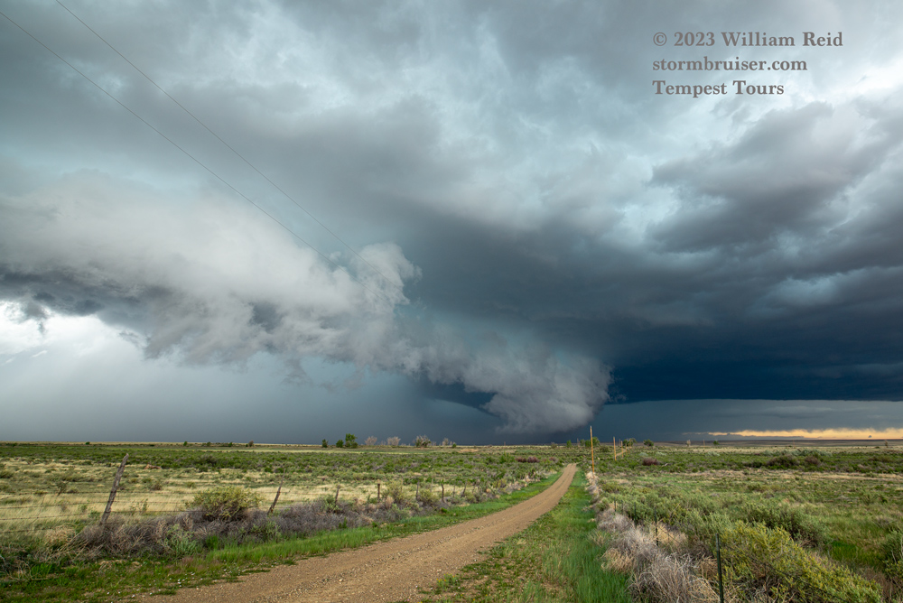
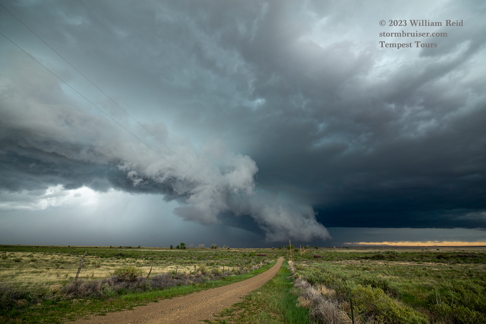
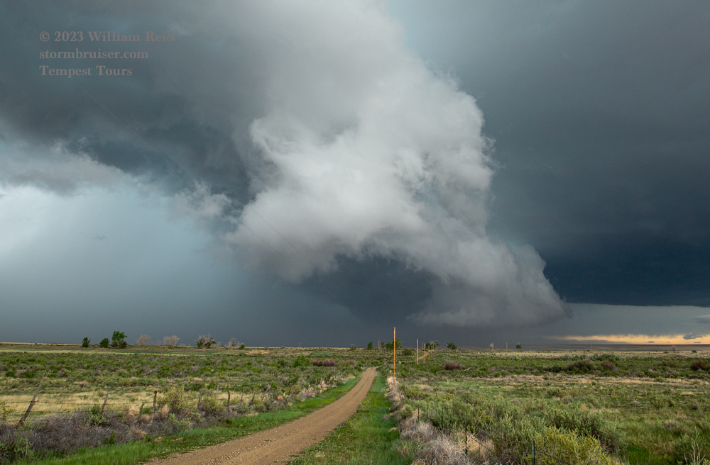
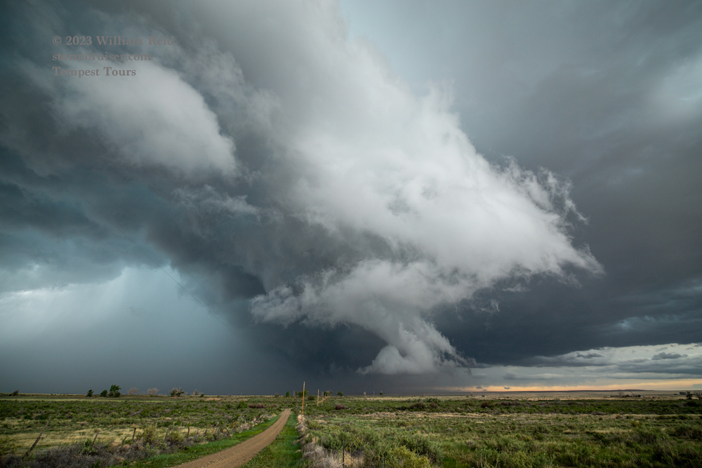
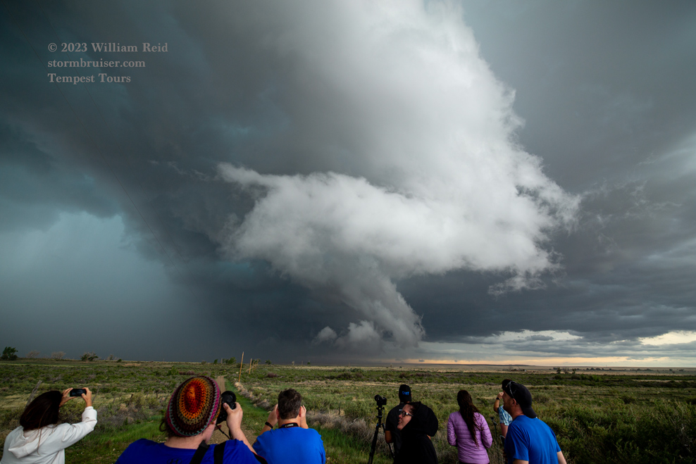
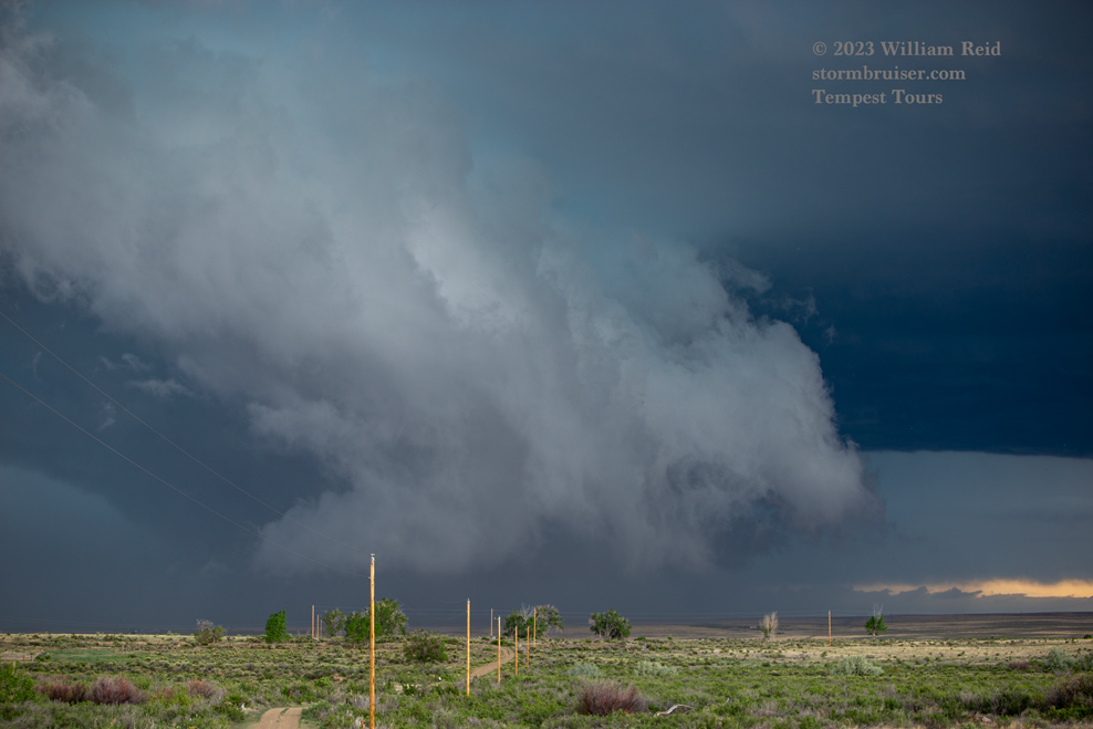
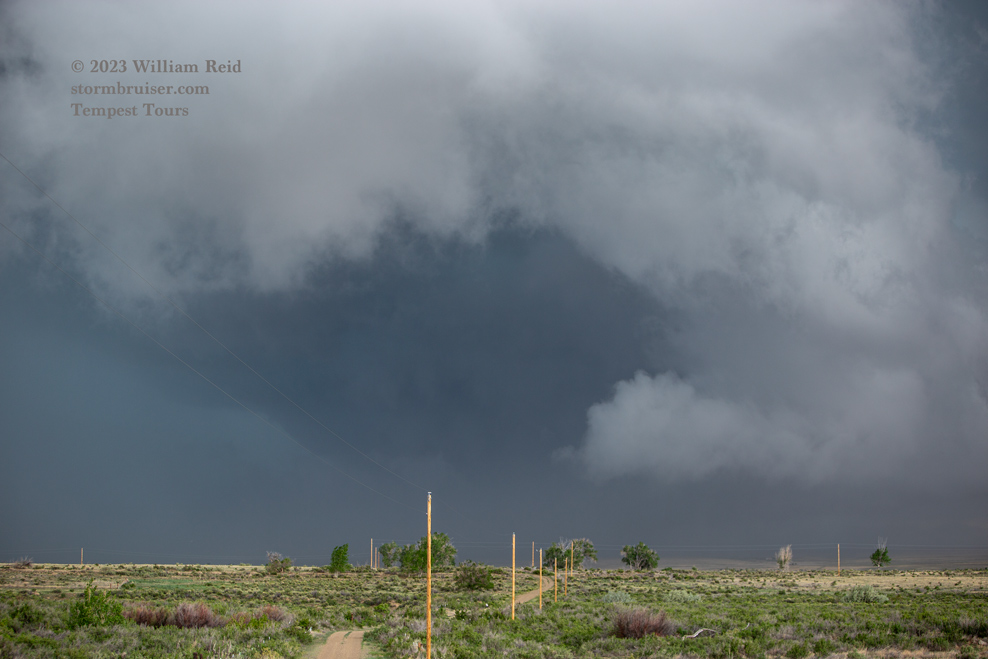
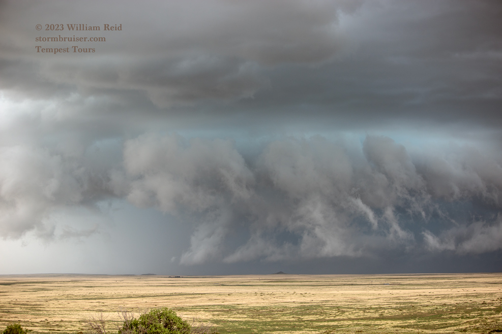
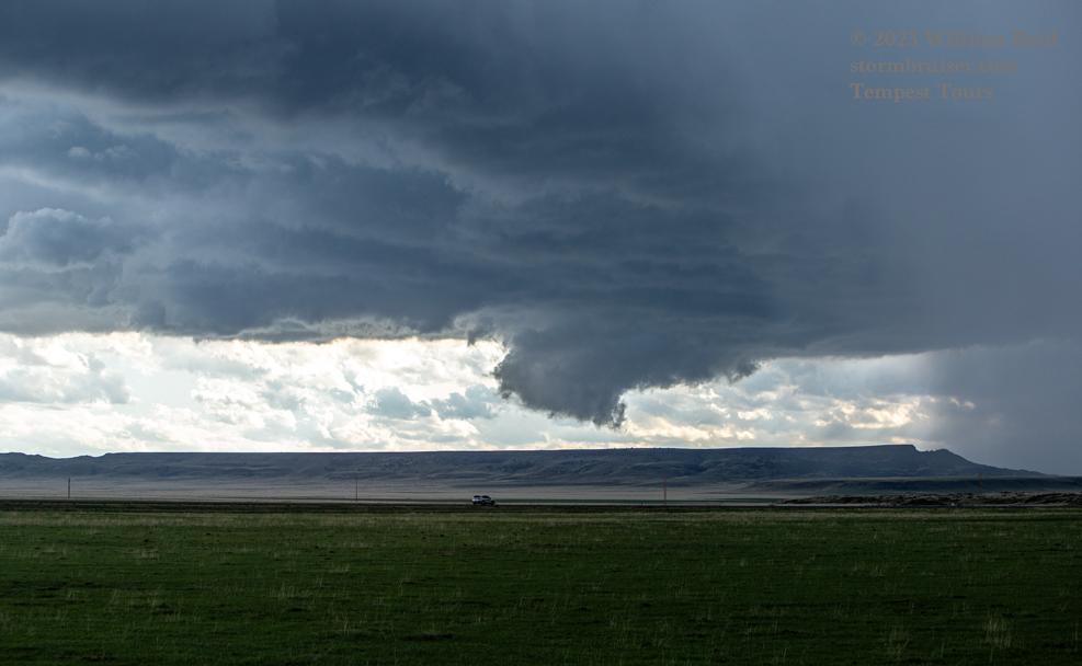
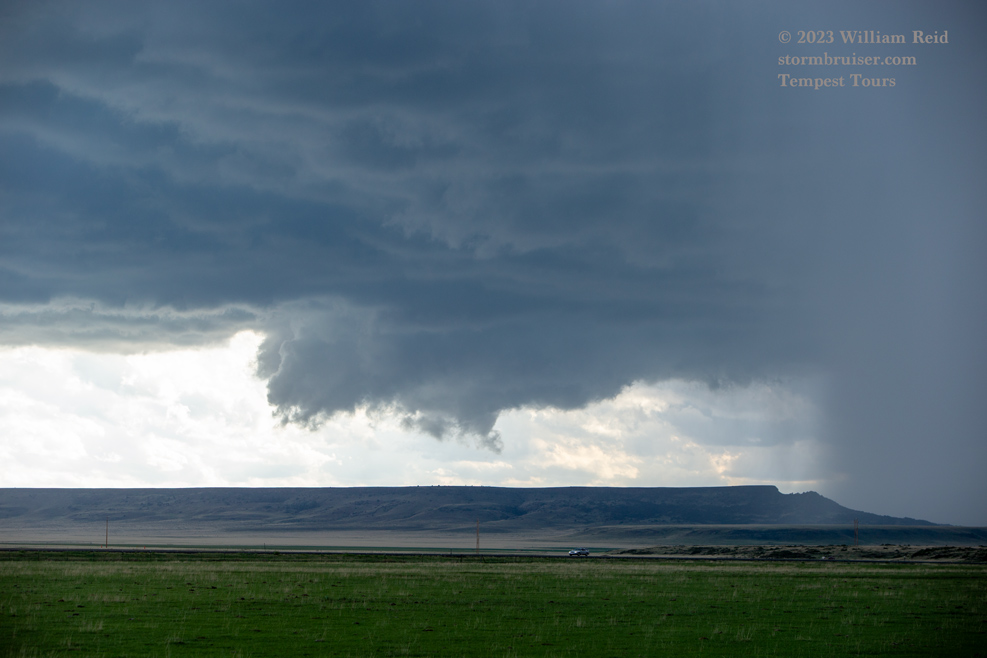
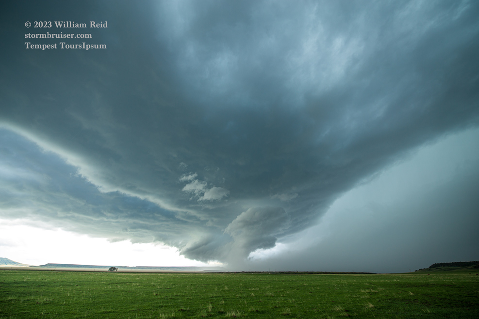
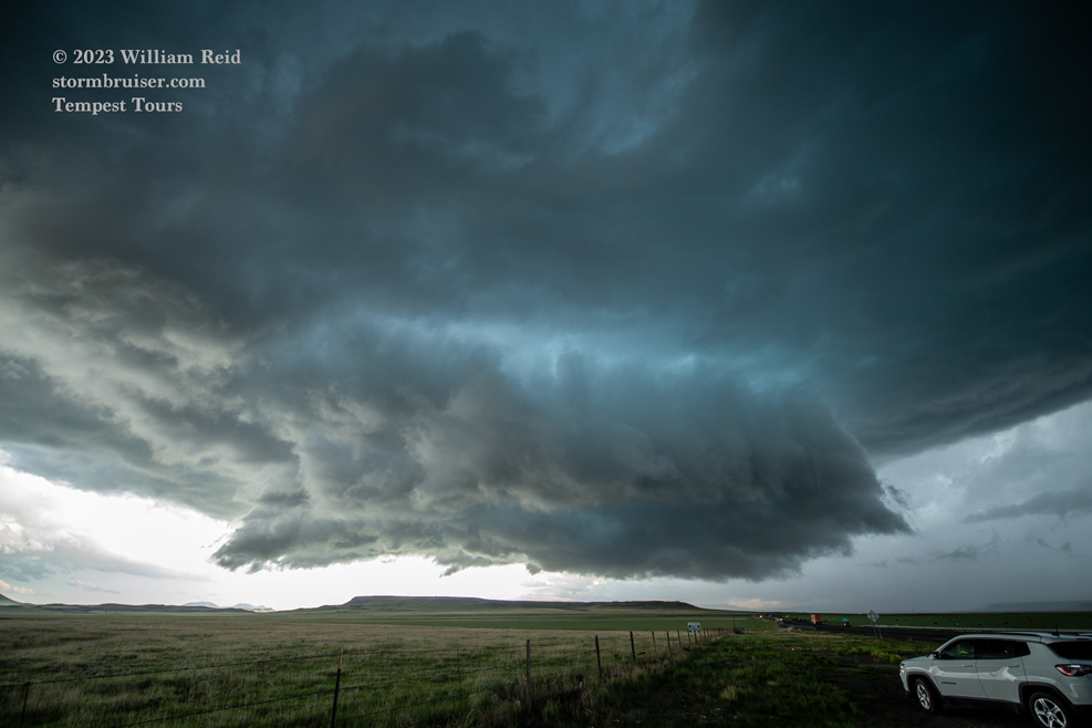
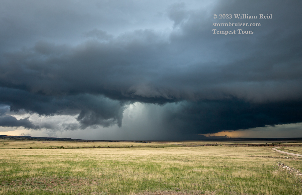
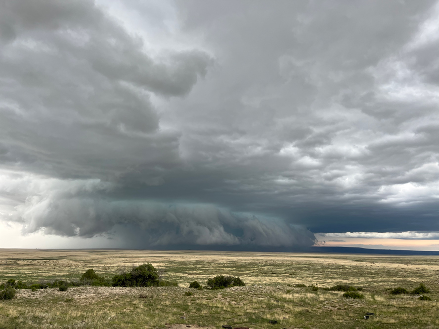
The views below were from the Hoehne area, northwest of Trinidad AP. The dirt road in the pics heads due north. The storm showed a slightly cold and outflow-ish look upon our arrival here, but as it moved to our north a robust RFD developed and a pronounced front-end lowering teased the ground. There was decent rotation with this, and something black and sinister was lurking next to a precipitation core. But, we did not observe a tornado.
This supercell was moving to the east. There was the option of getting in front of it along 350, but by doing that we would have either been
a) thrashed by the hail core
and/or
b) quickly forced to head WELL to the northeast and out of position on 350
and/or
c) forced to backtrack to the southwest to near the airport in order to jump onto 160 east to catch back up
This area of the High Plains is road-poor.
I elected to keep my longer-range options open and my vehicle glass intact by heading south from Hoehne to 160 eastbound. This decision was made easier when the RFD gust front hit us. It was on the cool side for sure, so that was working against tornado development with the supercell. The radar presentation looked quite good, with a hook and decent velocity couplet…but getting up into the notch with a few other chasers along 350 to see if a tornado might form was probably going to be too nasty, with nowhere to hide!
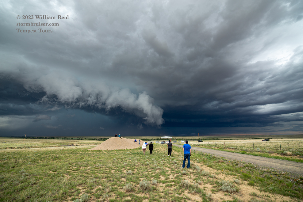
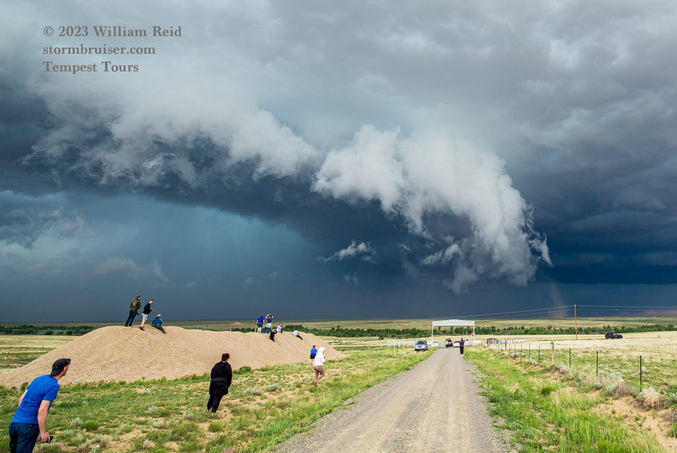
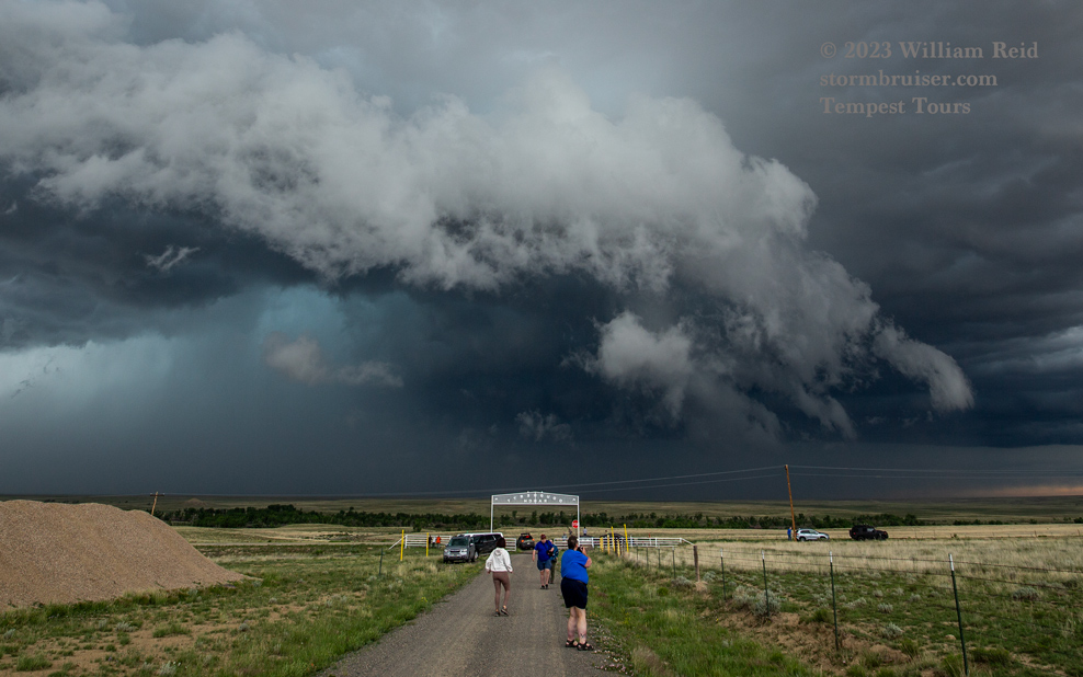
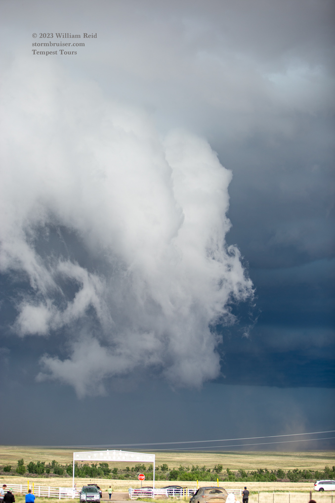
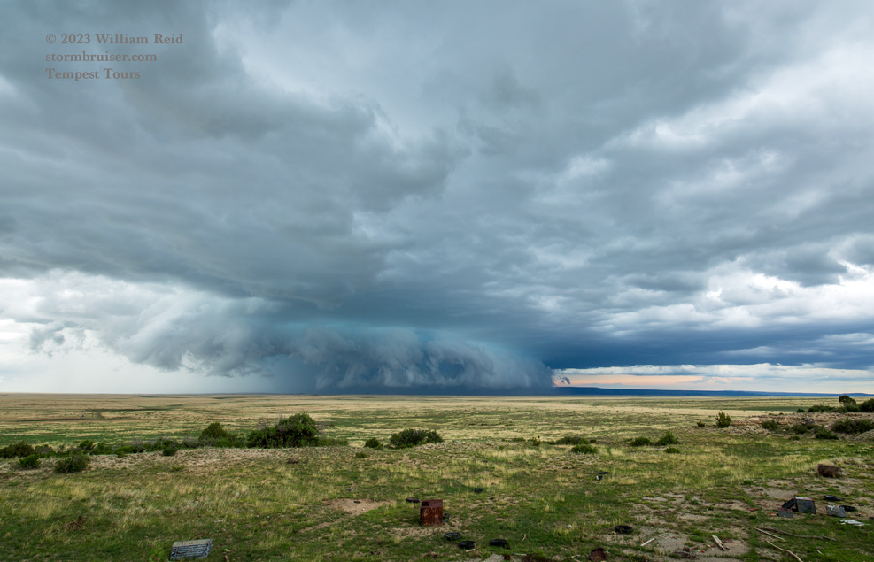
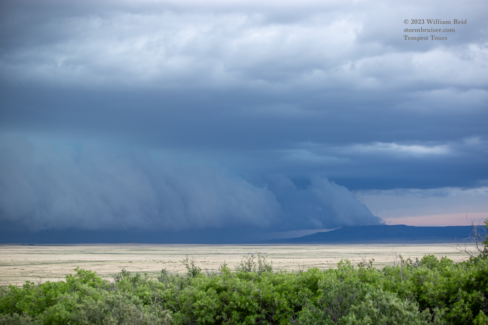
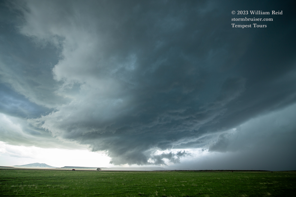
We were able to stop a time or two to view the supercell and its new-and-improved ground-scraping front end from near Walt’s Corner on 160 and south to Branson (above). At one point a dusty vortex was near the wall cloud, to our north.
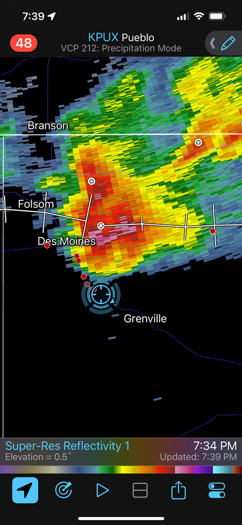
Again, a decision had to be made: should I stay with this thing along 160, or drop south to the Capulin area for something newer? Our “Hoehne” supercell was getting colder and more HP-ish looking, so I felt good about abandoning this and heading south.
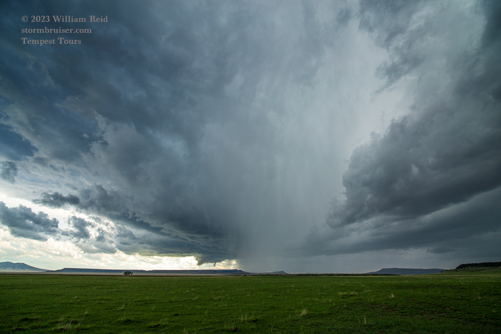
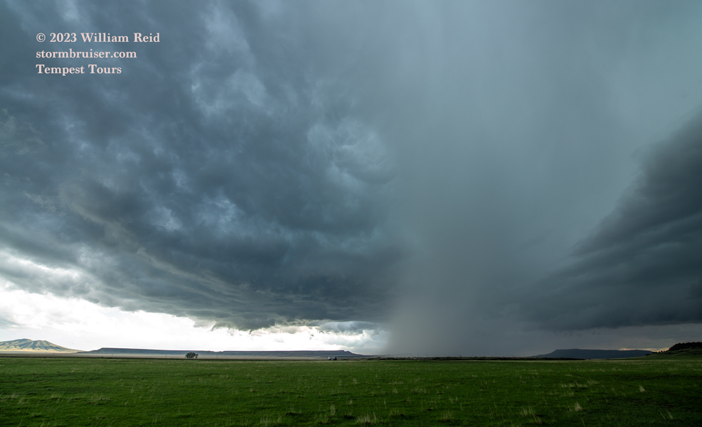
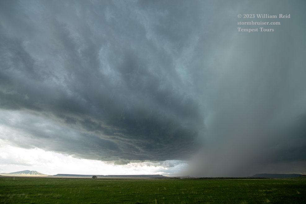
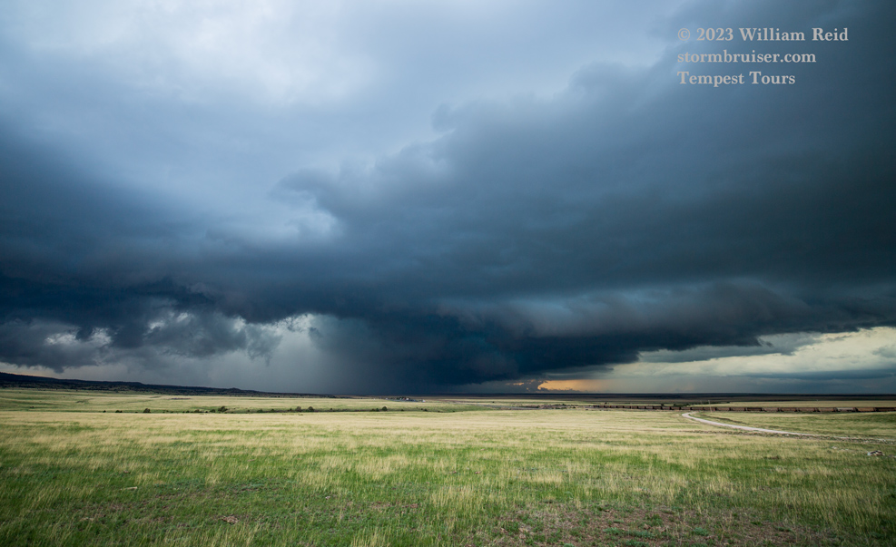
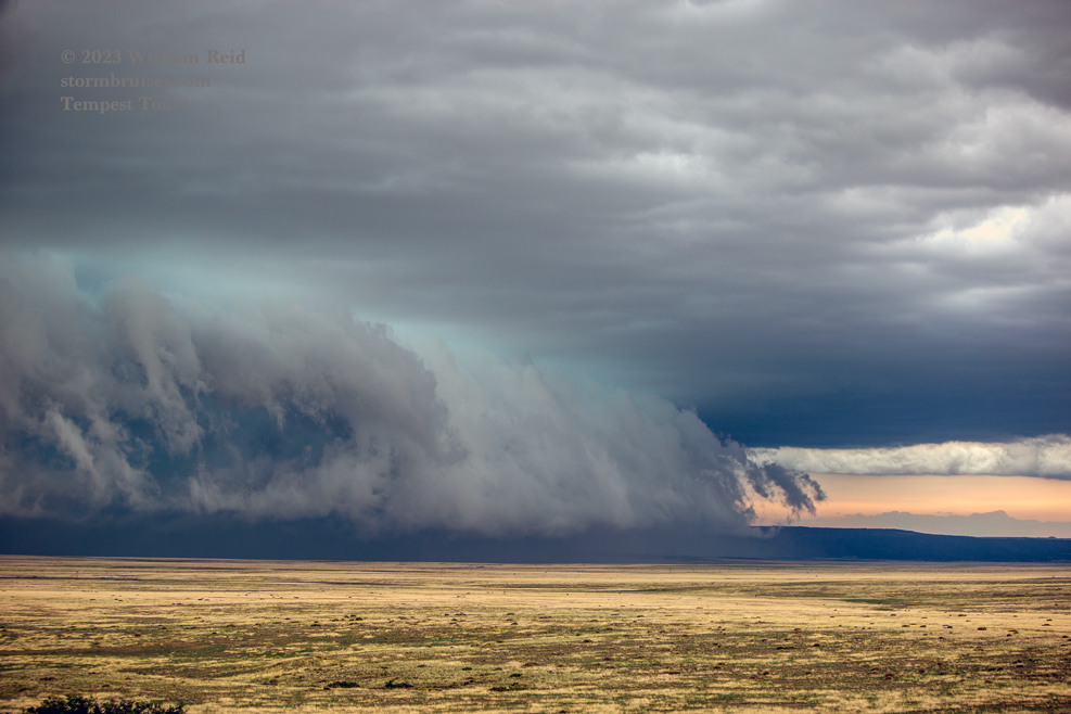
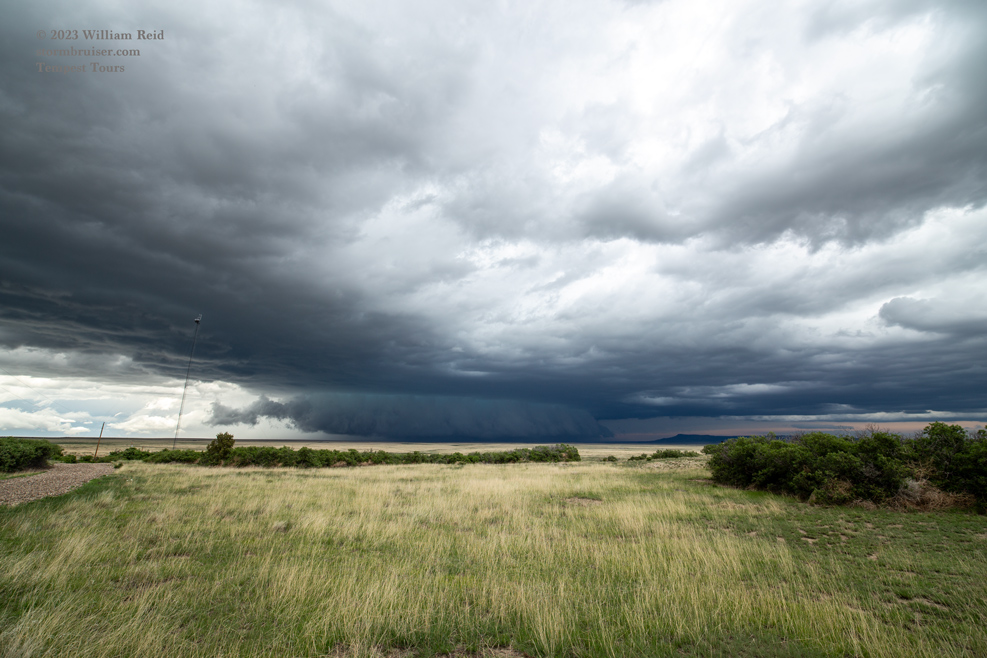
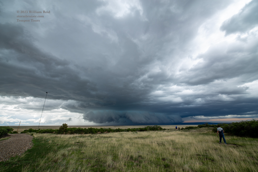
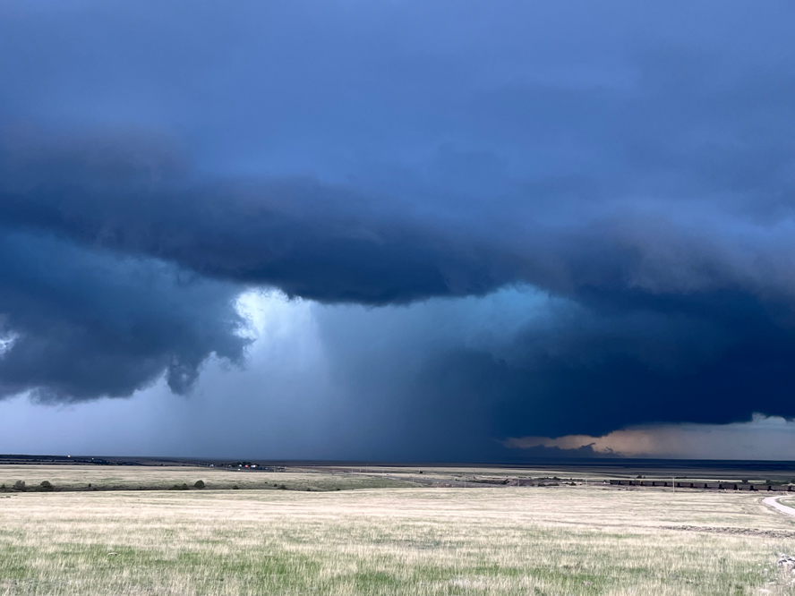
We wound up observing another rather wet supercell, near Capulin and Des Moines in New Mexico. This one showed a pretty good wall cloud for a while, but rotation with the lowering was negligible (pics above).
Leave a Reply
You must be logged in to post a comment.