
Start: Denver, CO
Lunch: missing
End: Woodward, OK/500 miles
Chase account by TT guest Lesleyanne
There was little consternation as to where to target today. We wanted to be around the middle of the Oklahoma Panhandle, northeast of a triple-point low, as some good upper-level energy emerged from the Central Rockies. SPC figured that a big line of storms would come out of the Raton Mesa and southeastern Colorado area eventually, but we were hoping for discrete supercells east of there first. SPC was kind enough to bless us with an enhanced slight, a hatched hail corridor, and 5% tornado risk. Low-level moisture was good but not great, with dew points in the low-mid 60s in Texas and Beaver counties in the E OK PH. The first order of business was to get out of Denver and southeast towards Lamar and then Guymon. This was the first day of Tour 7.
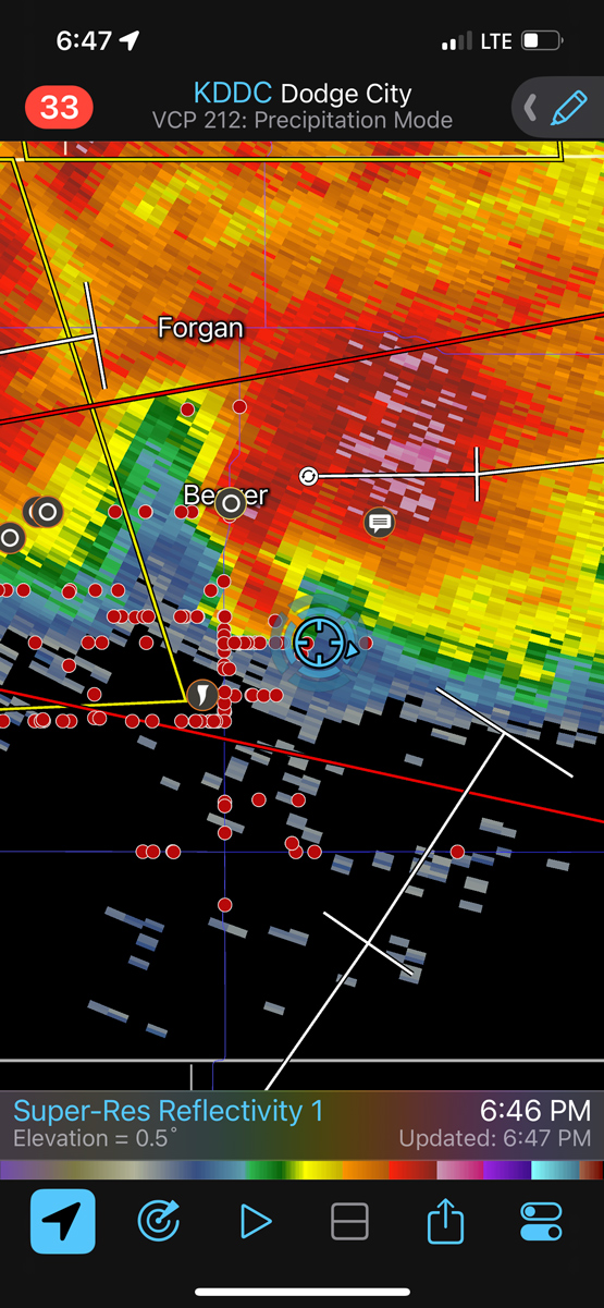
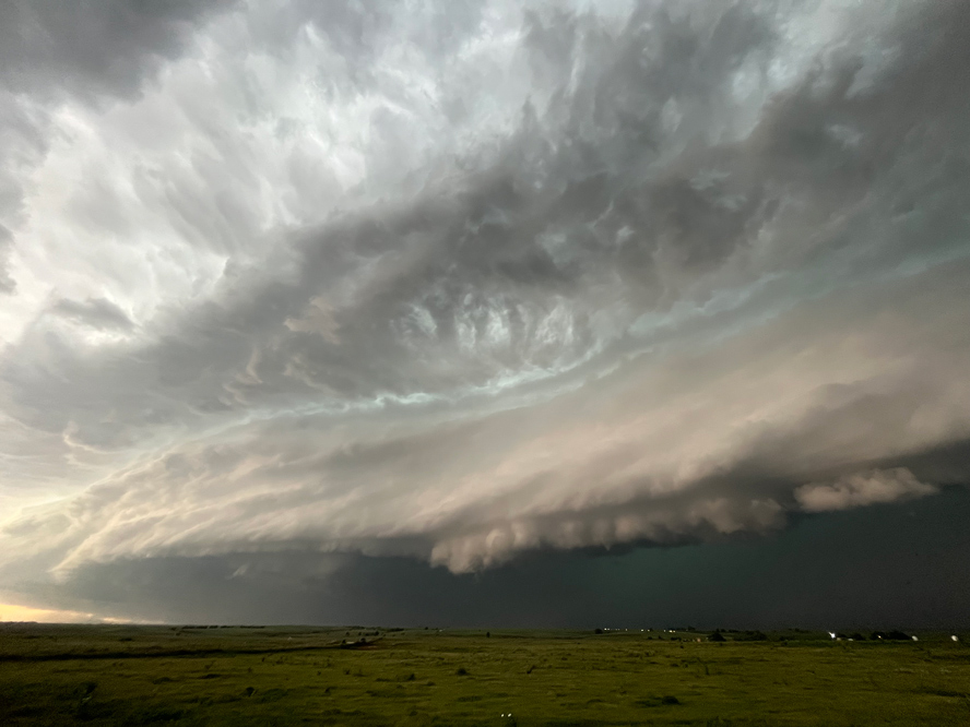
At Hardesty, OK, we had a decent supercell developing just to our north. iPhone images below show our position and the storm base and updraft.

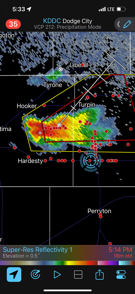
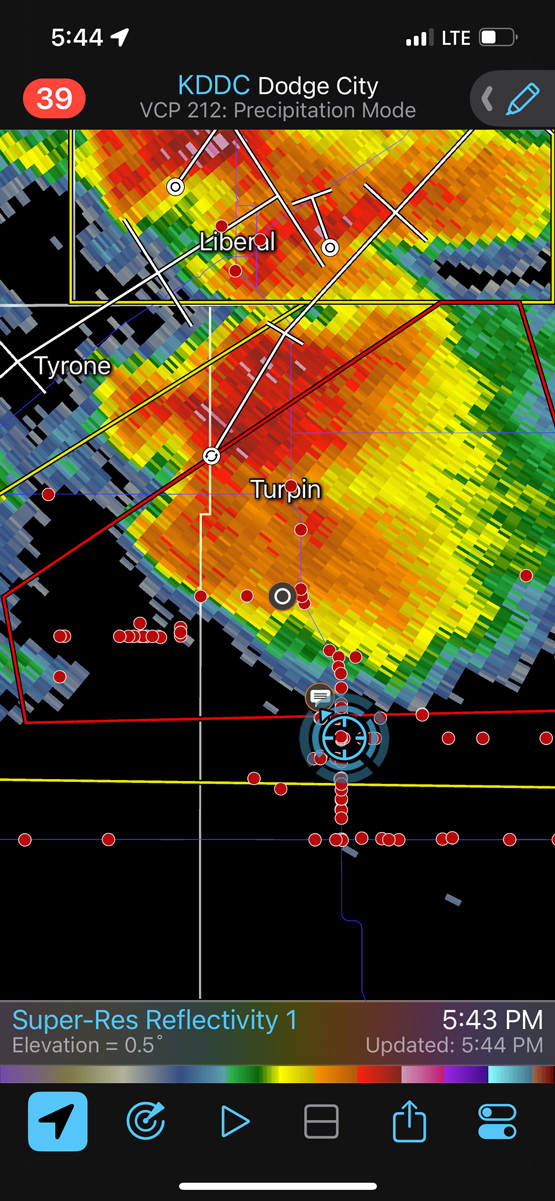


A little ways east down 412 and the cell was tornado-warned. A wisp of dust was kicked up near a wall cloud, and that might have been strong enough to be called a tornado. Or maybe not. At one point, a few miles north of 412, a big and strongly rotating wall cloud was nearly overhead. Somehow, someway, no tornado developed on that chance. Shots from the Canon camera are below.
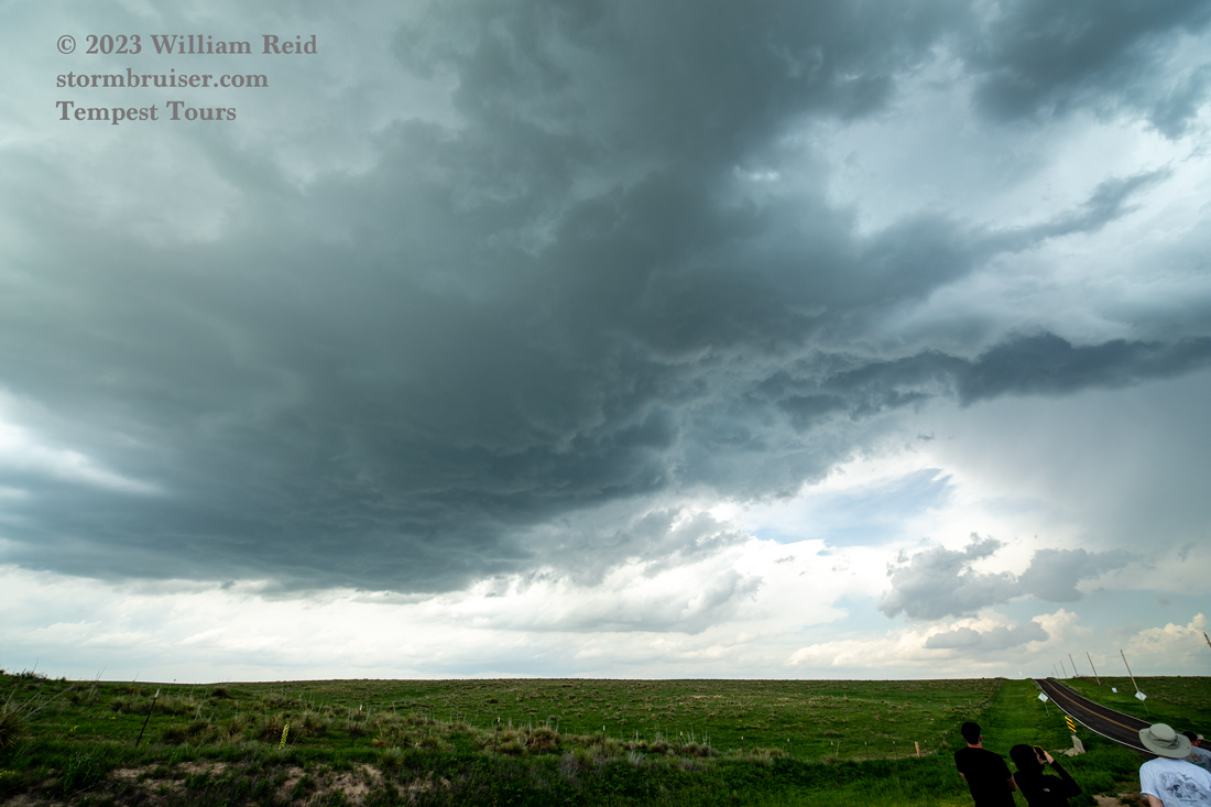
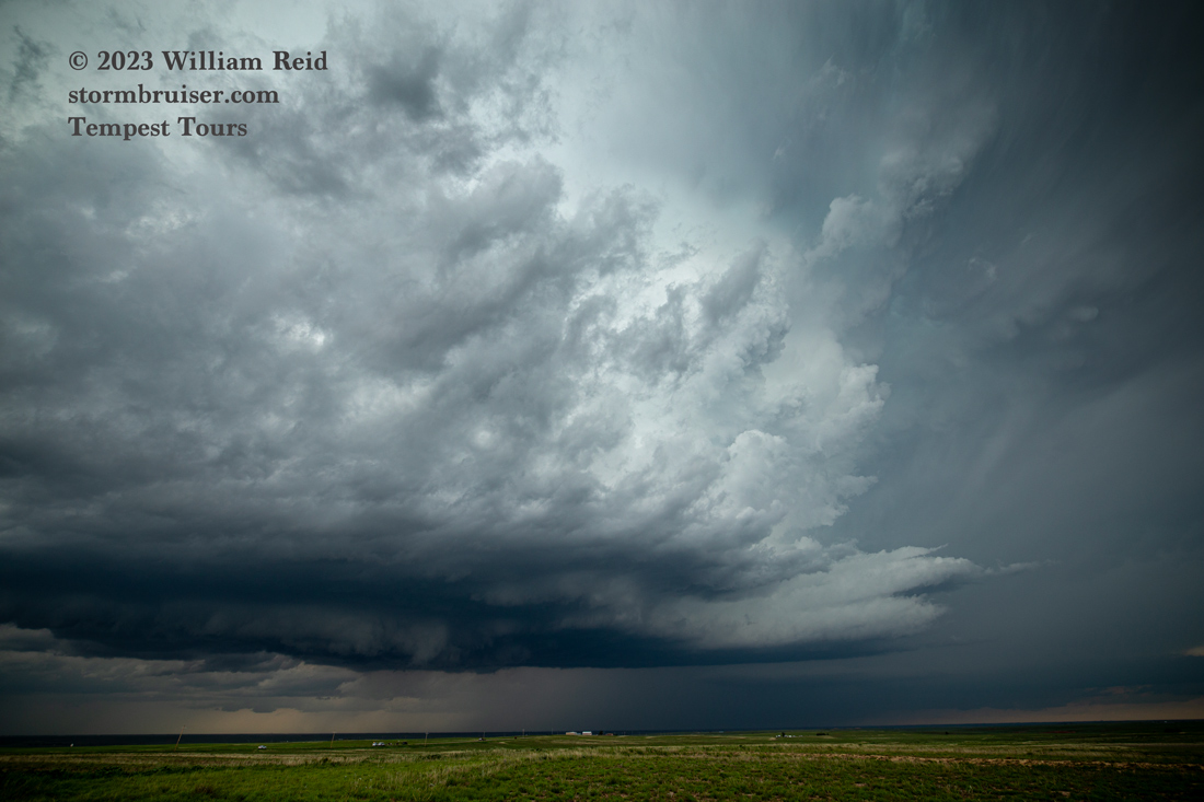


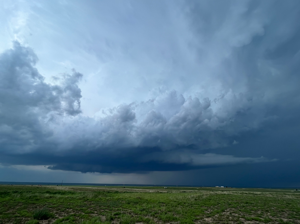
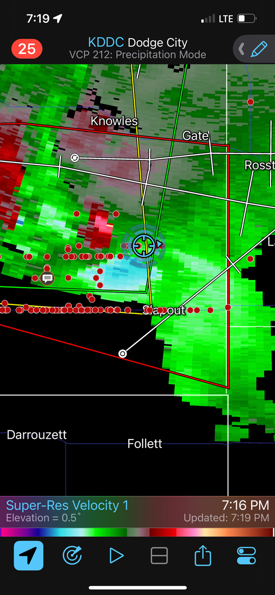
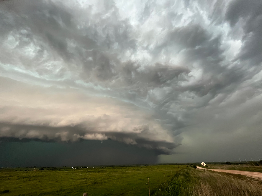
A nasty-looking lowering developed towards Slapout and Laverne. Was there a tornado in there to our north? Maybe. More iPhone shots and radar looks below.
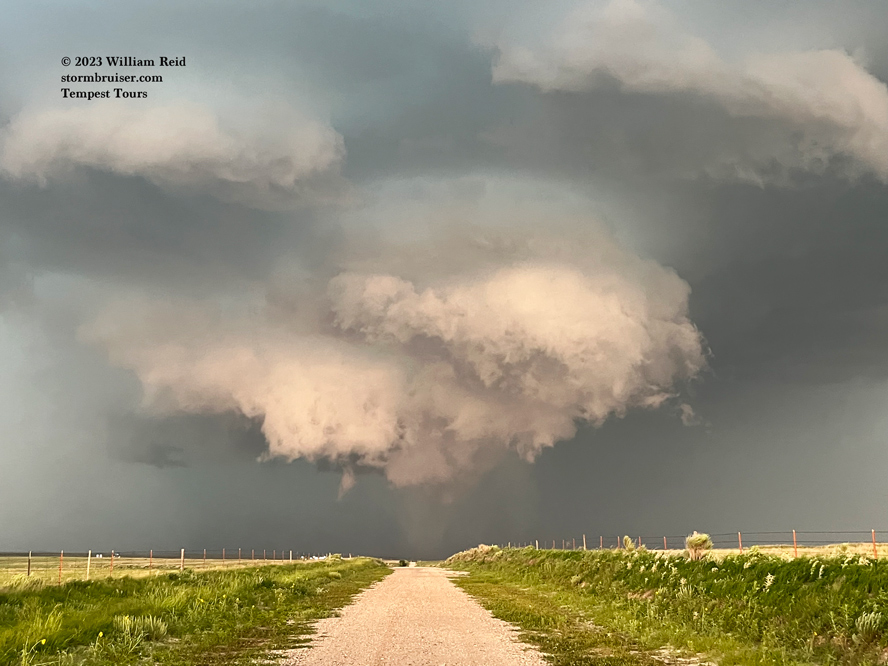
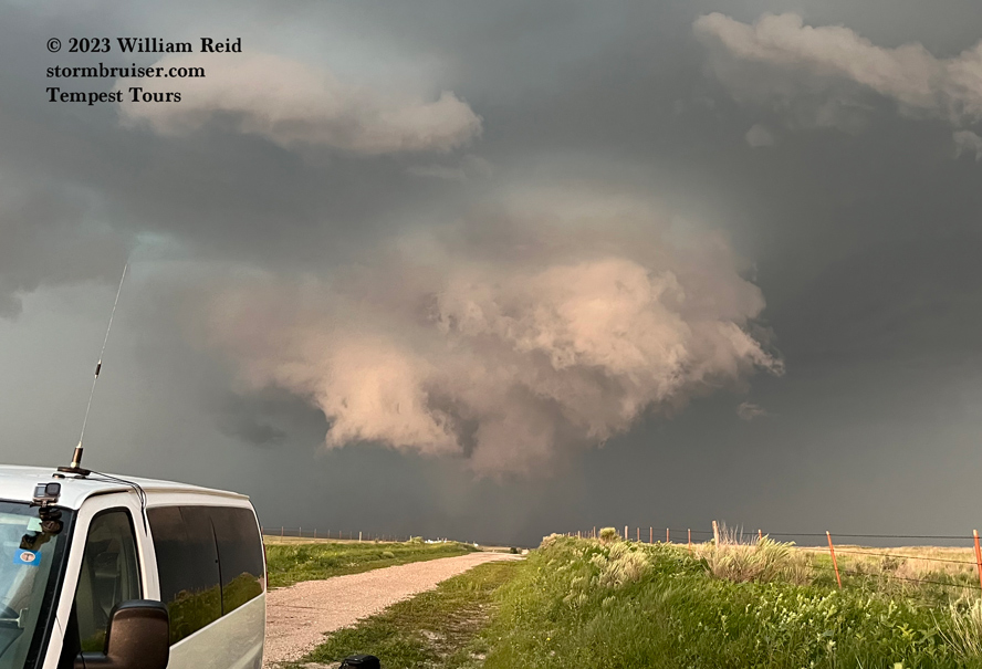
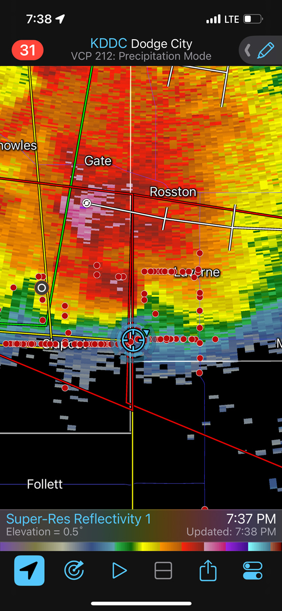
The storm was a bit HP, so it was not easy to see what was happening in the action area now. It spun up a tornado which hit part of Laverne, OK, and caused some moderate damage.
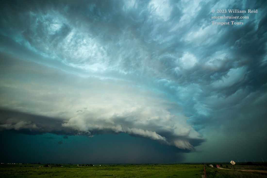
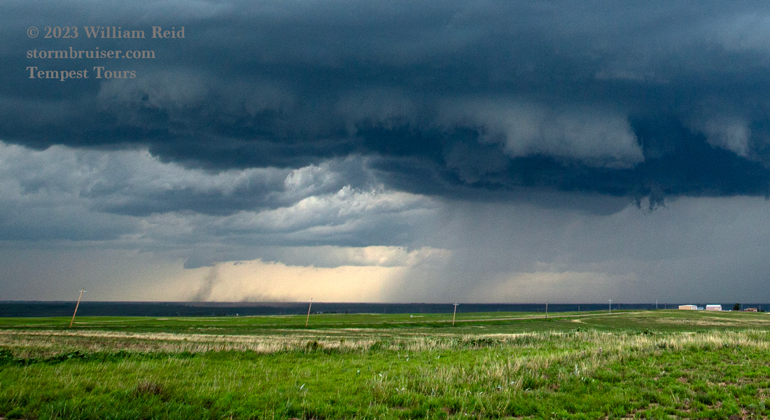
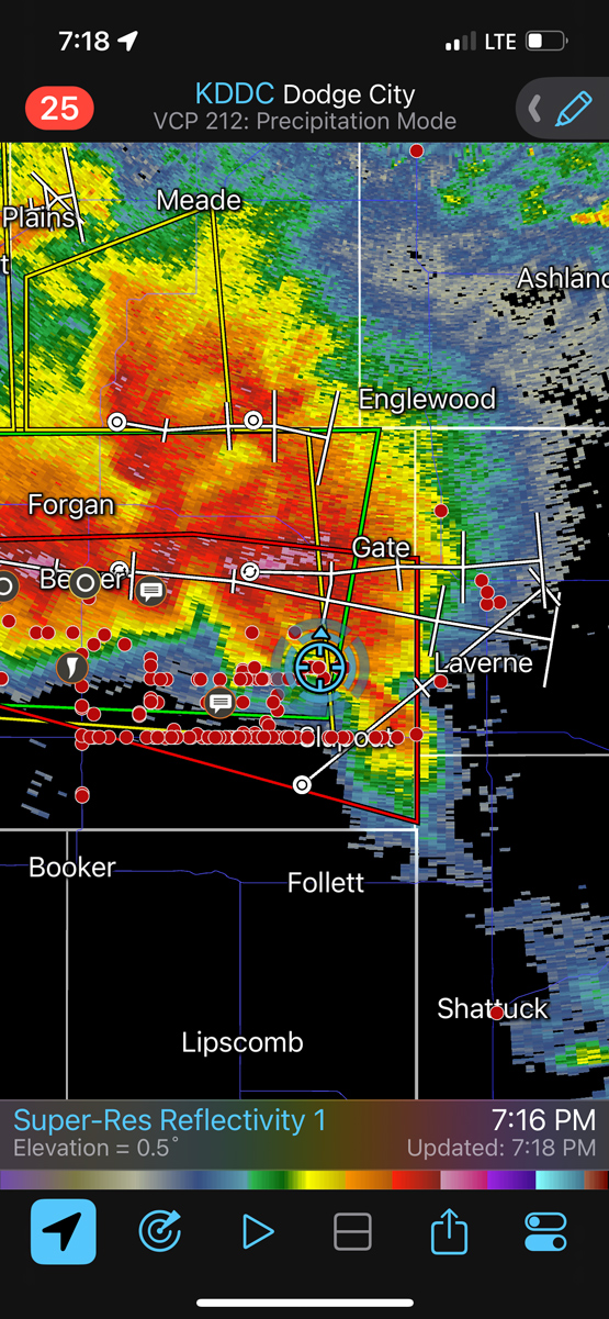
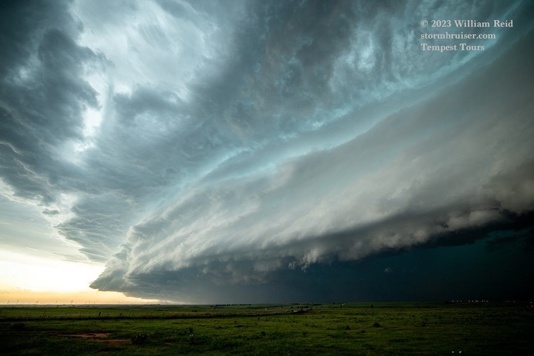
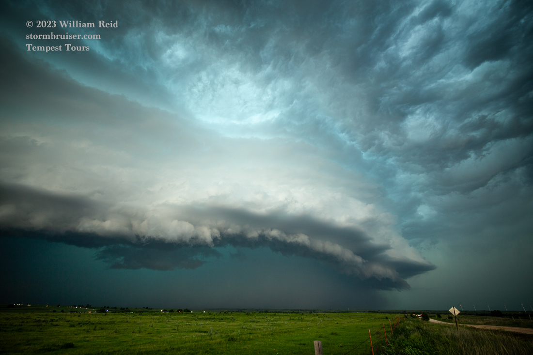
Around this time the storm was expanding and surging to the south, and suddenly we had a race E and ESE on 412 to stay out of harm’s way. We had enough space near Fort Supply to stop and shoot these wide-angle shots.


And these were with the iPhone (below). I thought that Woodward would get a good pummeling, but the storm seemed to weaken a little as we watched from a protected spot. By now it was getting dark and it was time for Braums!

Leave a Reply
You must be logged in to post a comment.