
Start: Sidney, NE
Lunch: Eads, CO/Subway
End: Hugoton, KS
520 miles
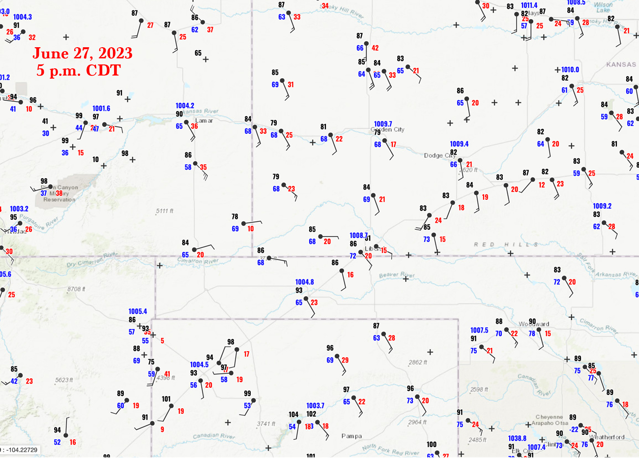
Surface map for 5 p.m. CDT above. Note the nice dew points from Liberal to Canadian!
This day began in the southern Nebraska Panhandle at Sidney. SPC outlined two areas: a little to our east in Nebraska, and way down south around the Oklahoma Panhandle. The southern play looked a little better to me as near-70F dews were lurking around the E OK PH. But, tornado prospects were ho-hum for both plays (just 2%). We blasted south through eastern Colorado, and SPC upgraded our southern target to moderate risk by midday. “Intense supercells” were expected initially around the western half of the OK PH, then evolving into a high-end severe wind event along the KS/OK border east of Liberal.
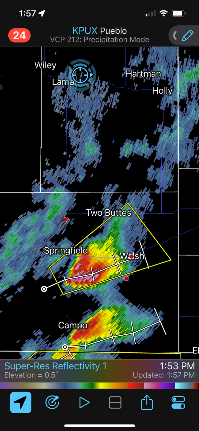
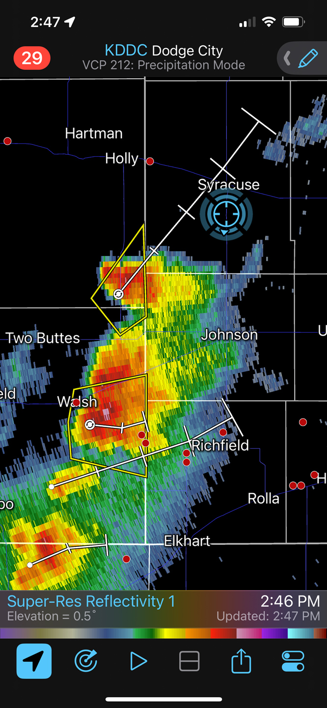
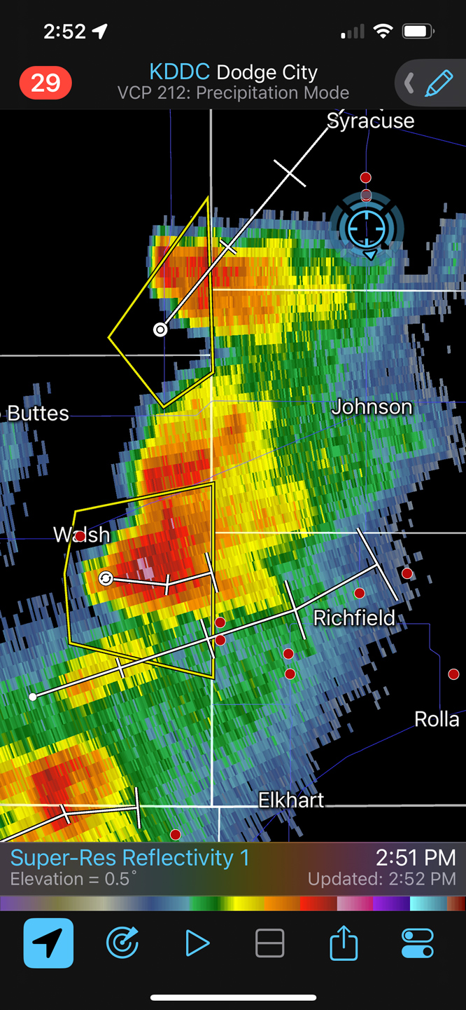
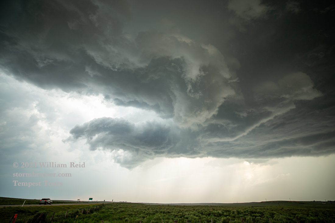
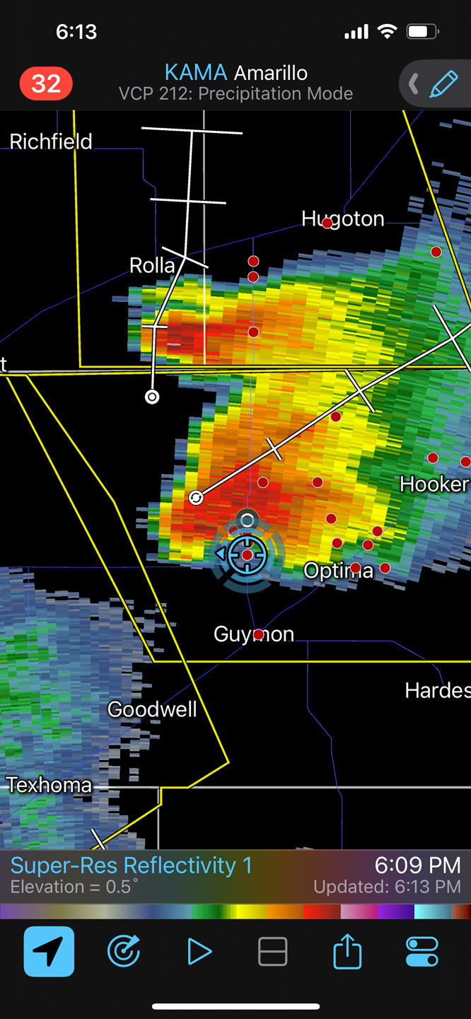
Initiation was rather early, near the eastern end of the Raton Mesa, southwest of Springfield. I was not really pleased with the early start, as we were still well north of Lamar. The radar grabs below show our progress southward as these severe cells moved ENE. We snuck into Kansas and dropped south out of Johnson City to get in front, and that is when the storms decided to take an afternoon siesta. The third image below is of the “left split” updraft that was moving NE towards Syracuse.
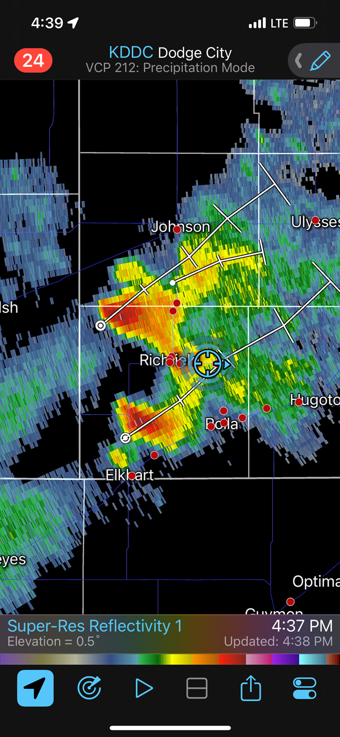
The weakening trend was rather disconcerting, but it gave us a chance to make a relaxed pit stop at Rolla. I think. Other weak stuff was moving into Texas County, near Guymon, so we continued to the south a bit. We soon found ourselves right next to a big developing storm base. The show was on!
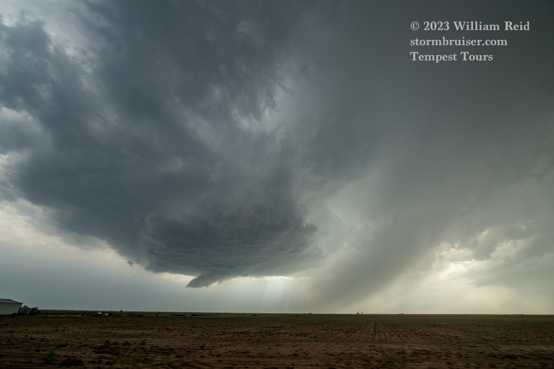
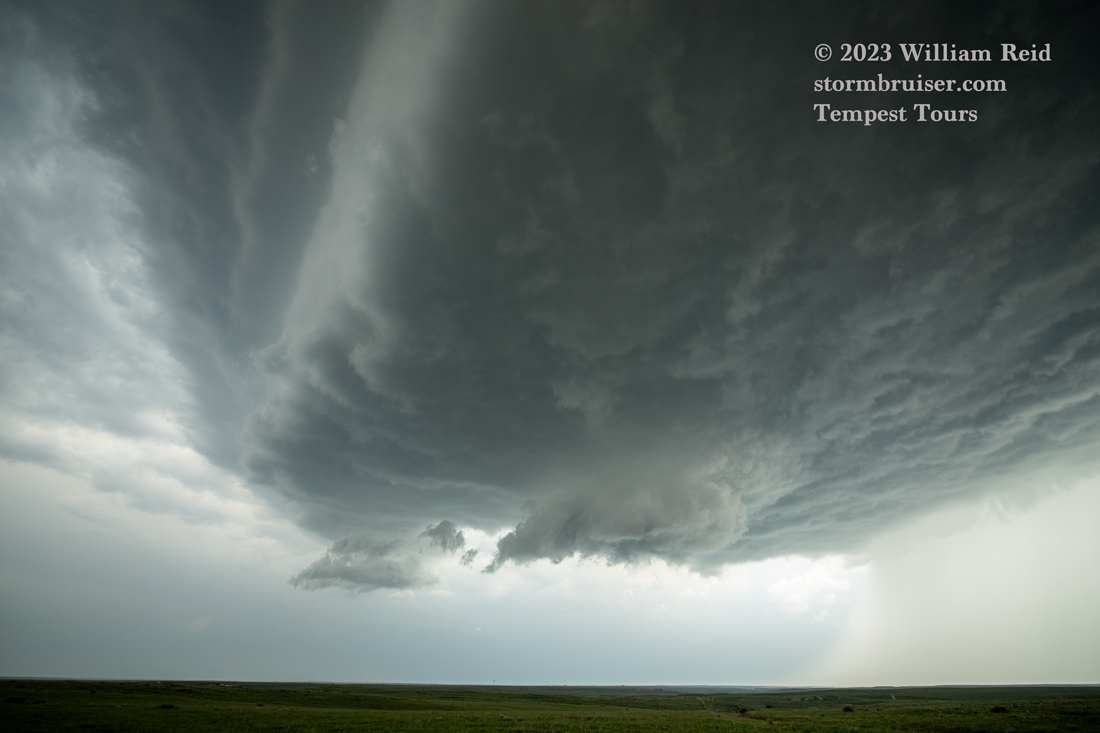
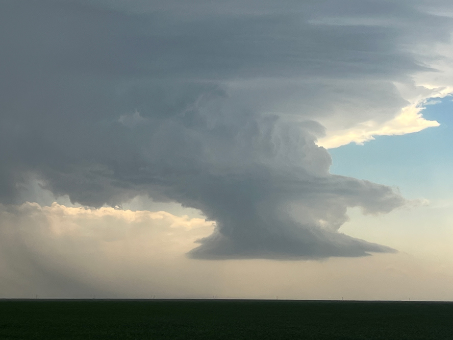
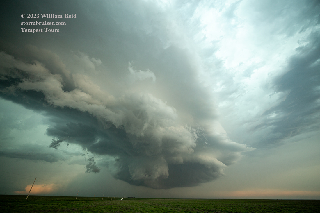
The pics above show the storm base, just to our NW and N, north of Guymon a bit.
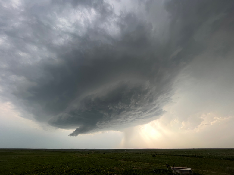
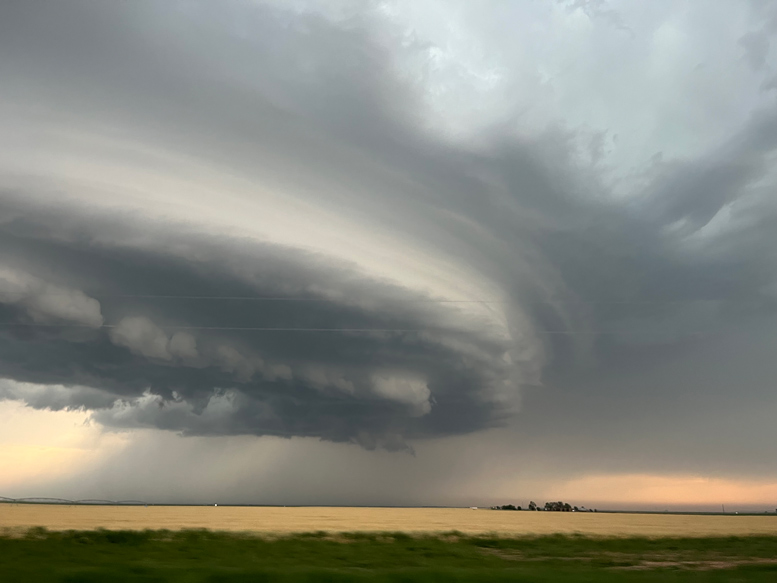
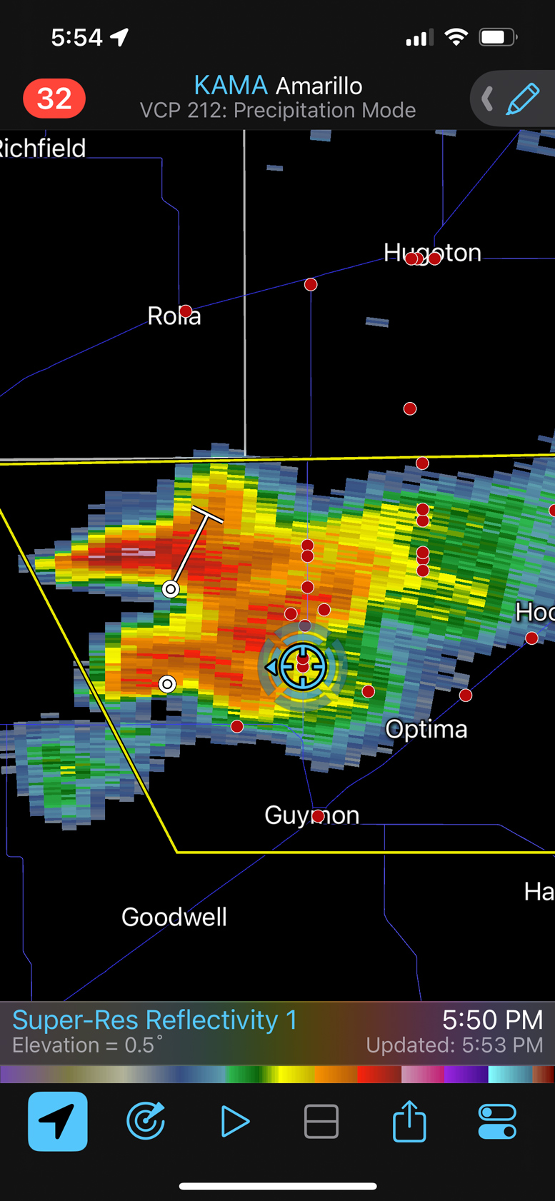
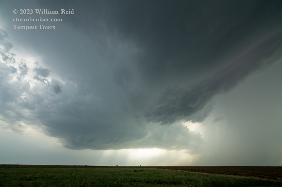
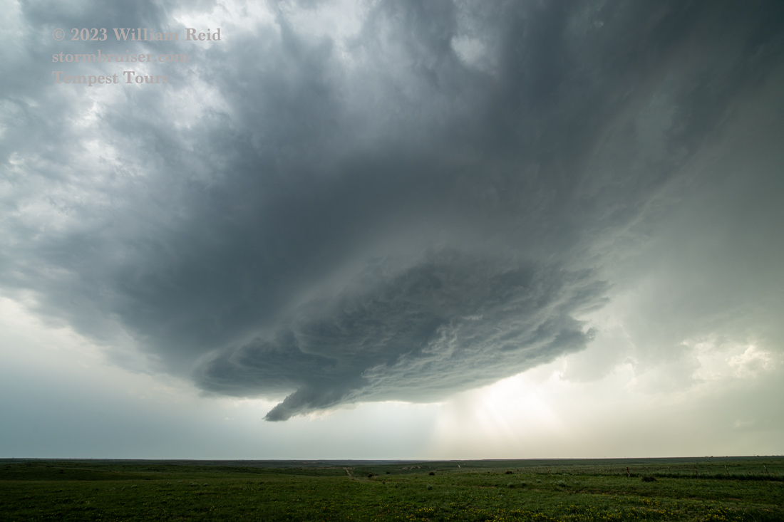
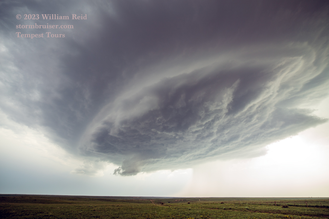
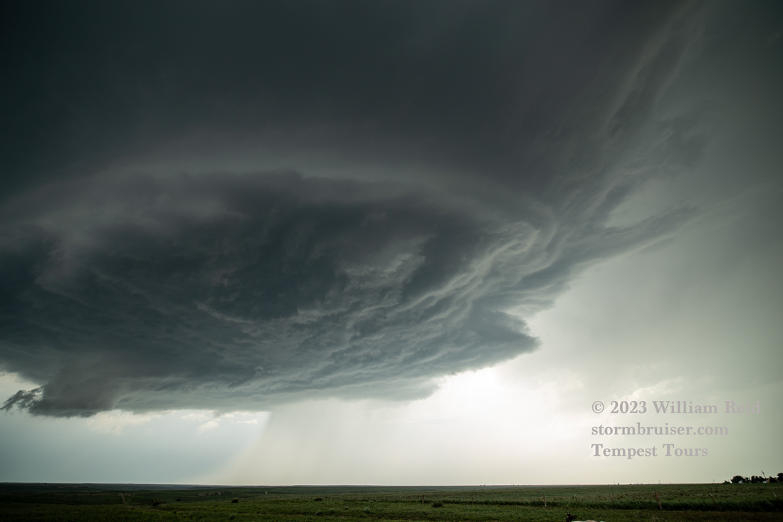
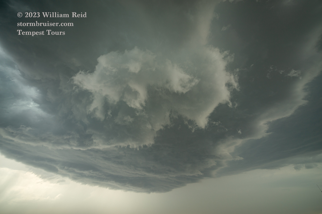
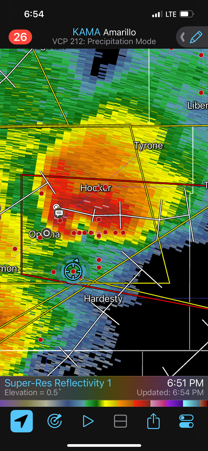
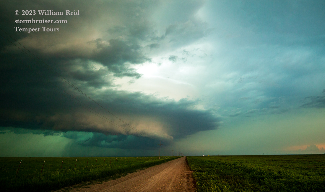
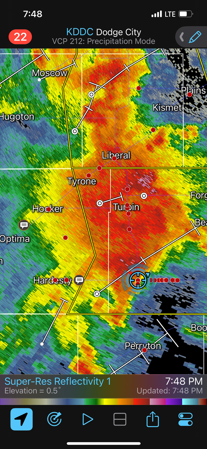
This supercell was looking quite decent. It was heading mostly to the east, towards Optima. I elected not to fiddle around near the hail core by dropping south to Guymon and then east on 412 towards Hardesty. We had a great look at the base and the storm structure at our stop NW of Hardesty.
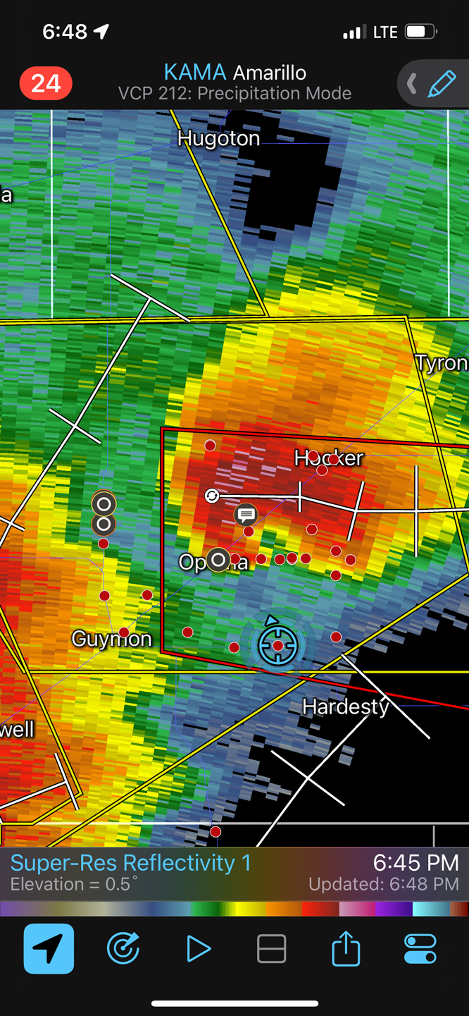
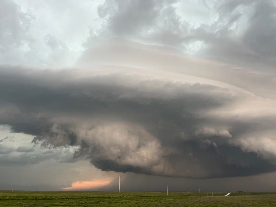
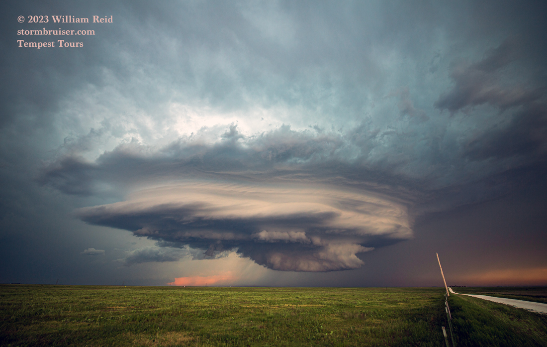
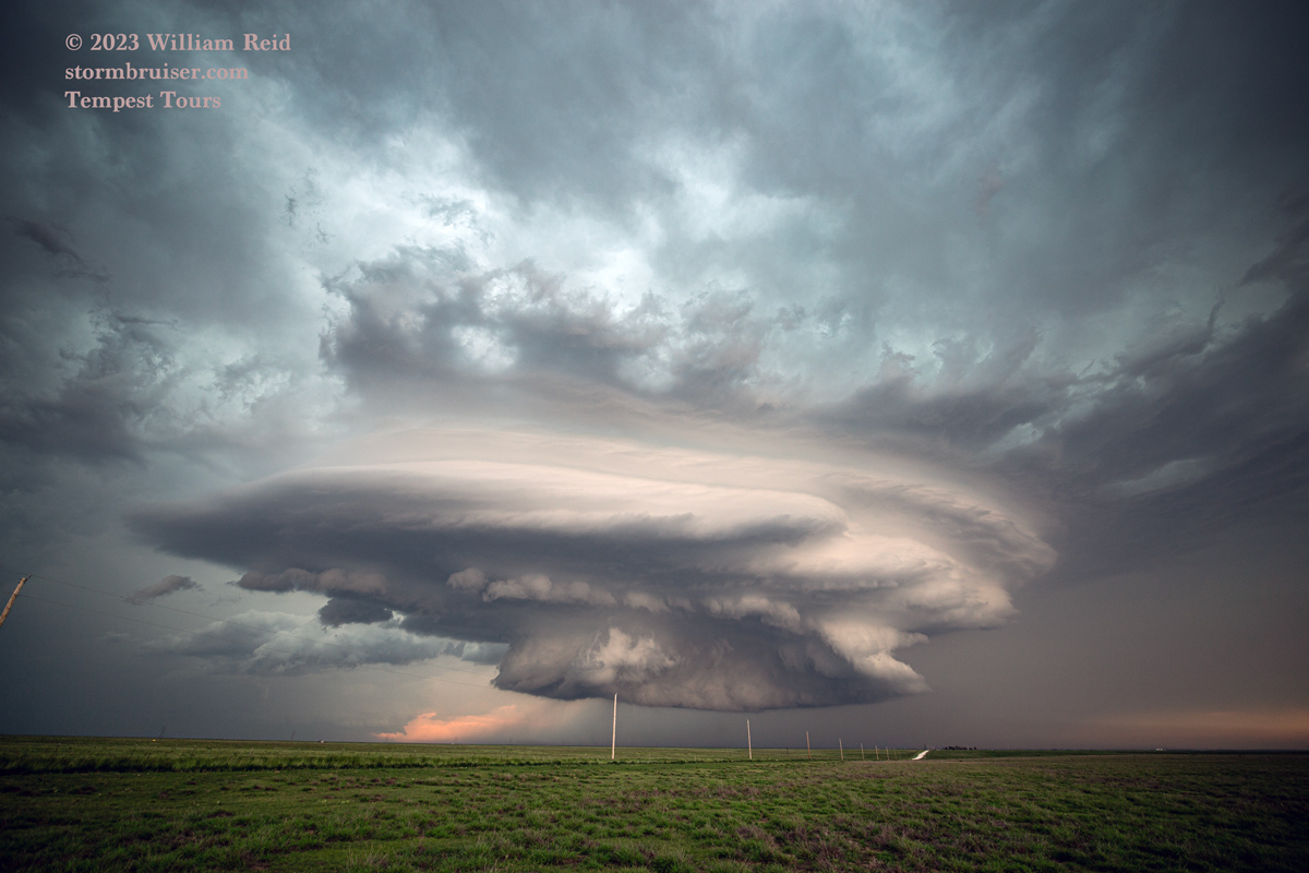
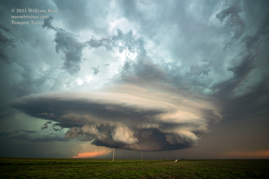
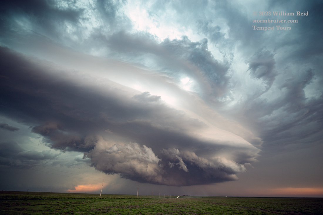
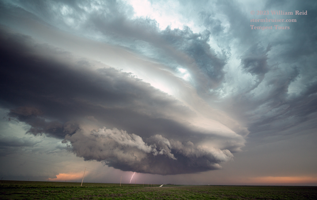
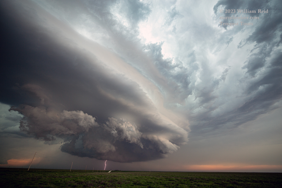
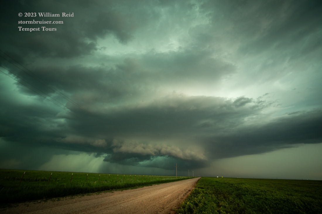
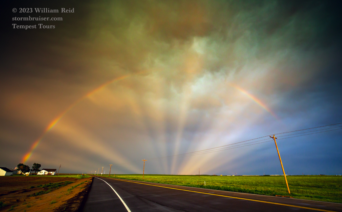
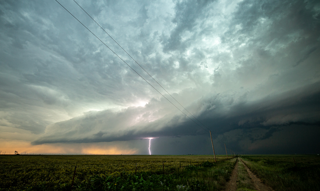
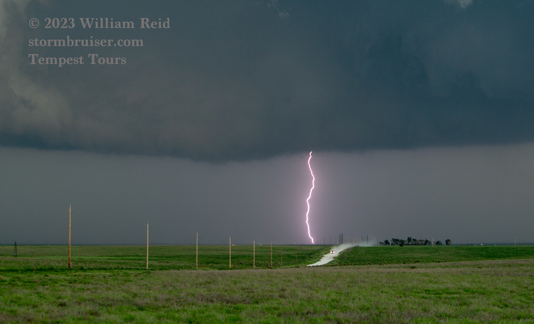
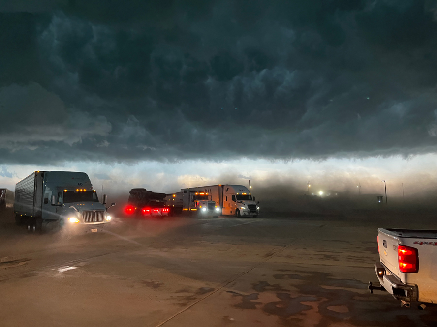
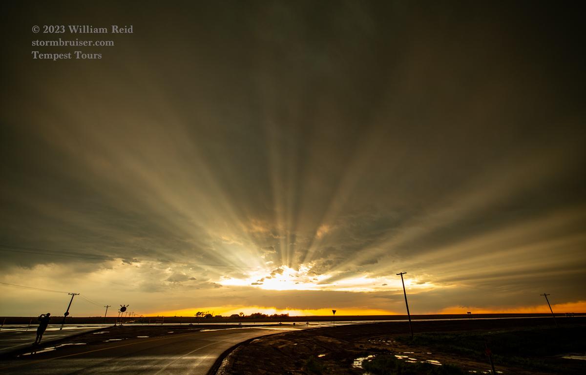
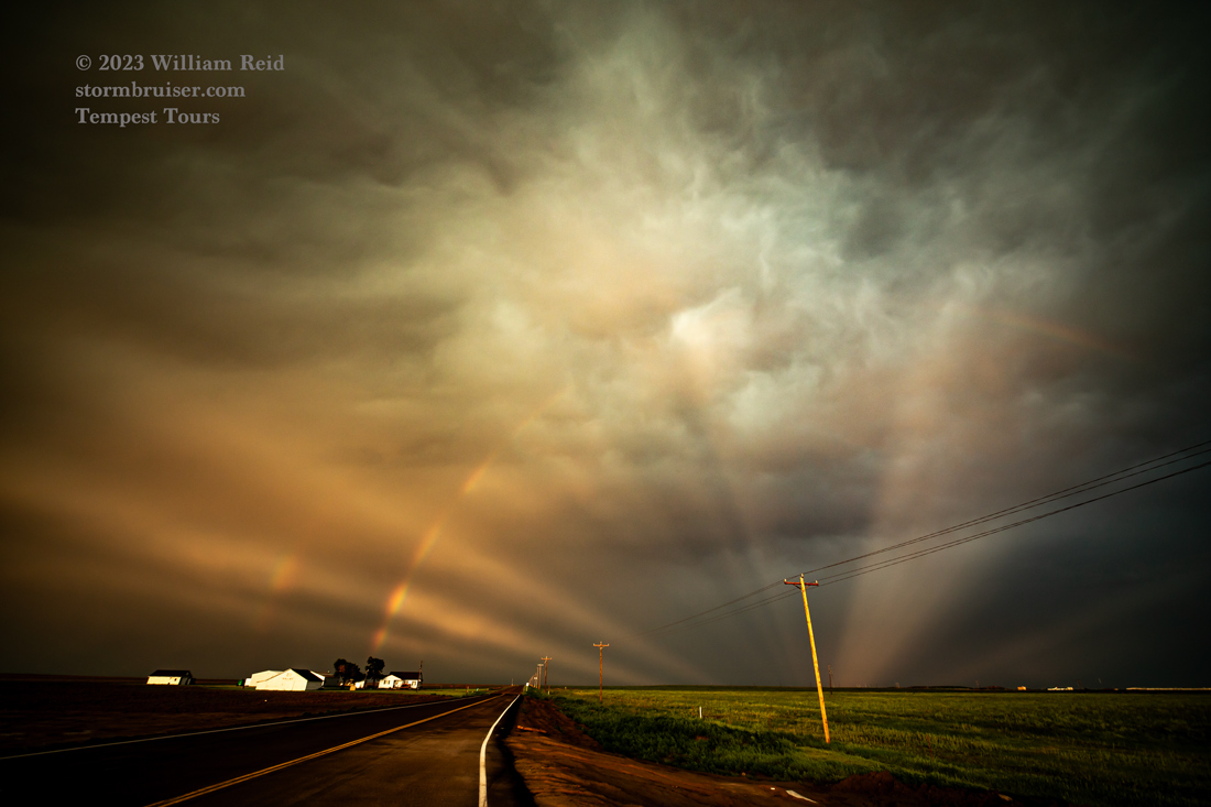
A tornado was near Adams (east of Optima) around this time, but it became rain-wrapped quickly, and I didn’t see it. A squall line was quickly advancing upon our supercell as we made our way east of Hardesty, and the supercell was not looking quite as good compared to earlier. We stopped to watch the squall approach, caught a CG or two, and then rode out the winds at the Balco store on 83. Today’s chase was done. We pointed the vans north to get a little head start for the next day’s chase (in southeast Wyoming again!), and were treated to some nice light behind the storm. Apparently there was a decent wind event near Turpin with the squall/supercell, but that occurred a bit before we went through.
Leave a Reply
You must be logged in to post a comment.