
Link to May 21, 2024 Tornado Chase in Iowa
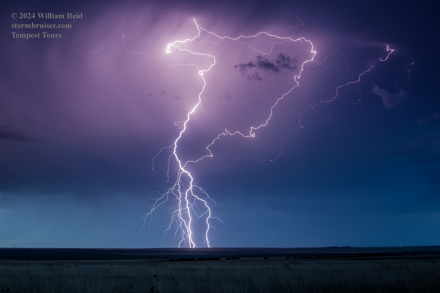
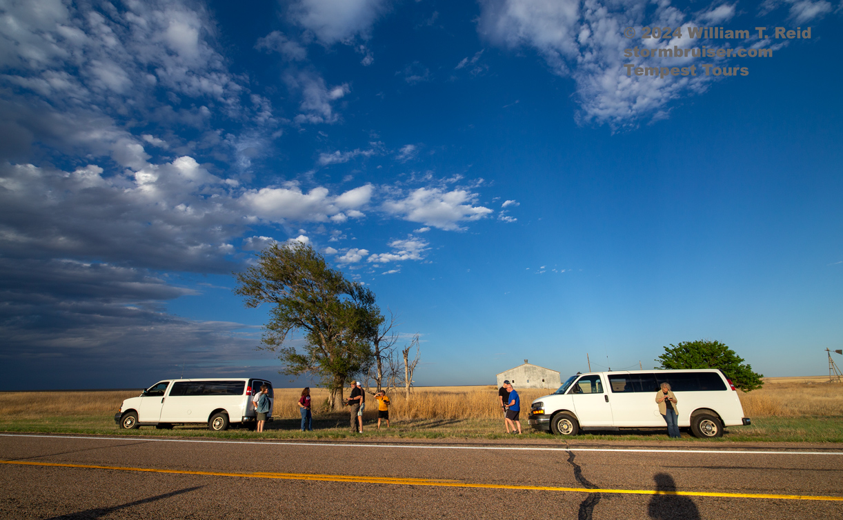
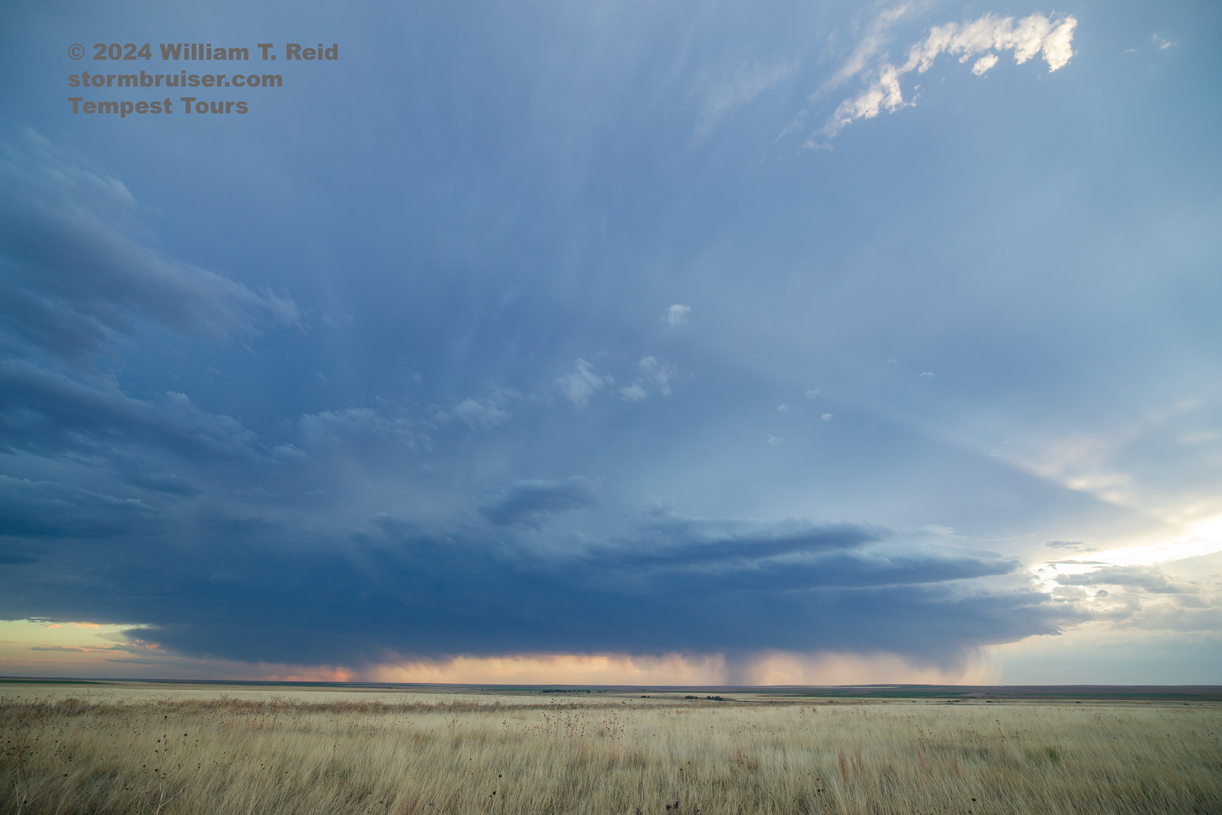
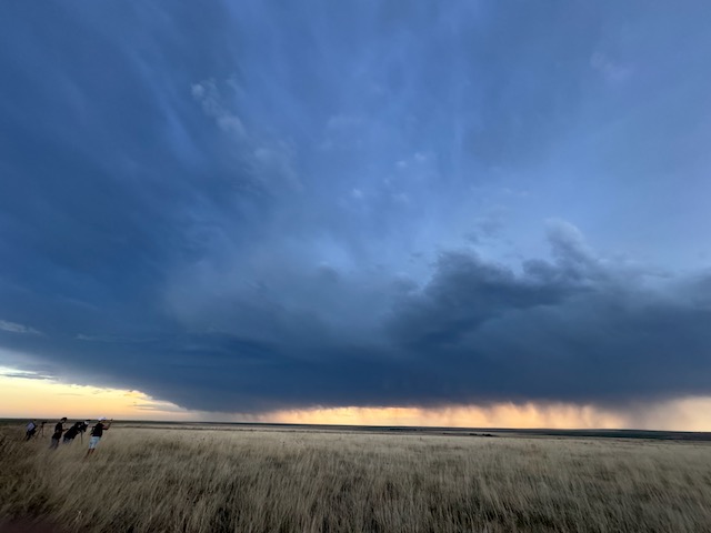
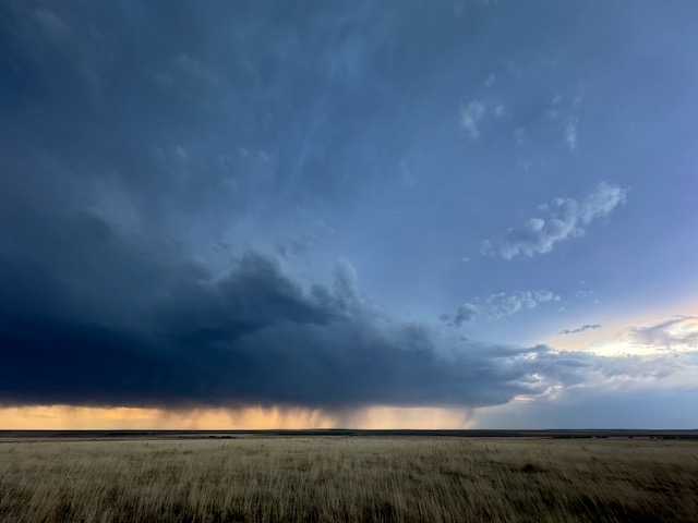
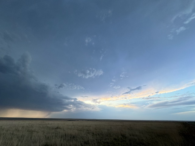
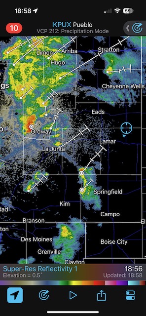
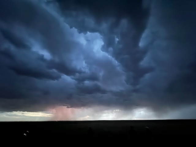
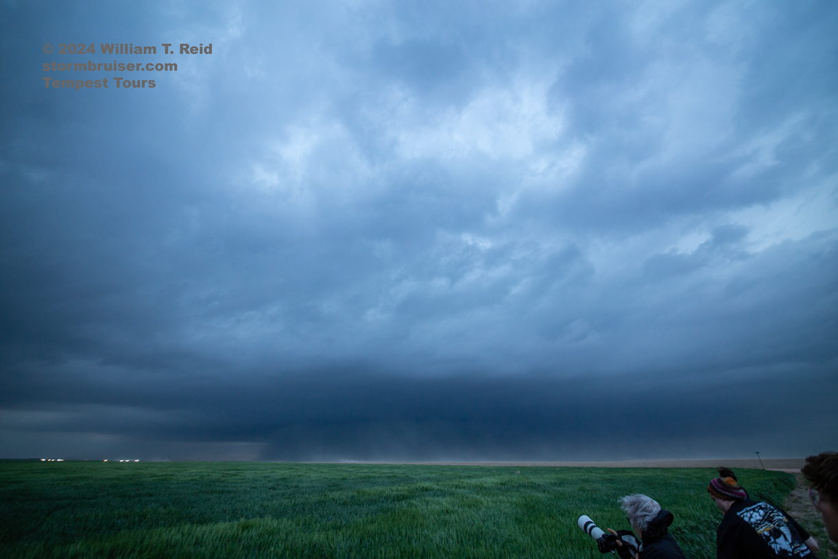
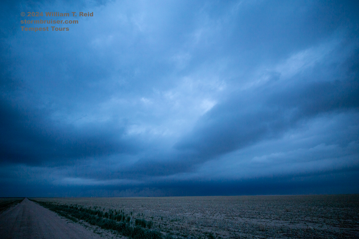
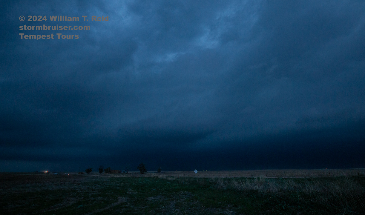
May 18/Lightning Show in SE Colorado
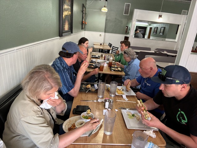
Begin: OKC/lunch at La Carlitos in Woodward, OK/End: Lamar, CO/465 miles
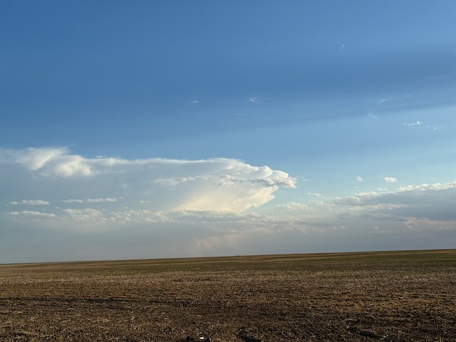
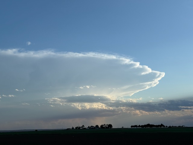
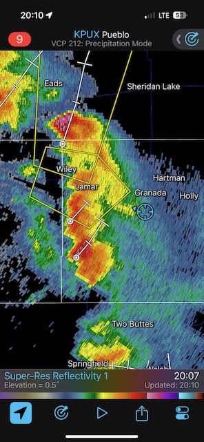
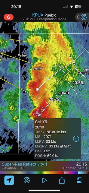
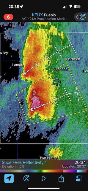
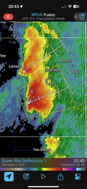
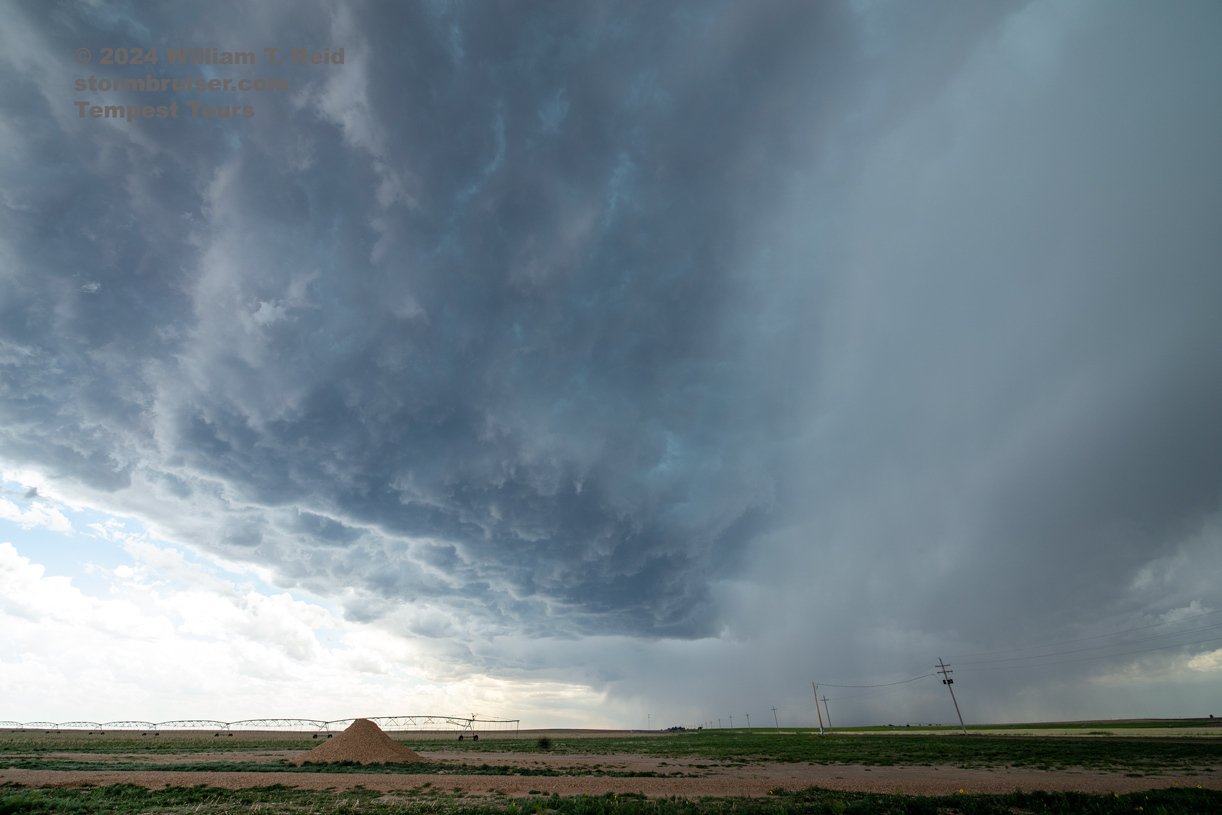
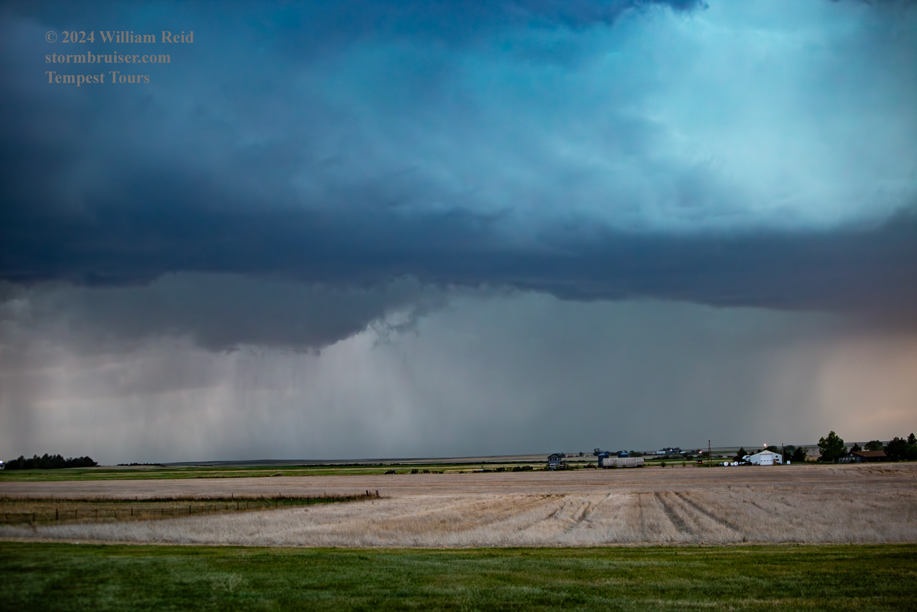
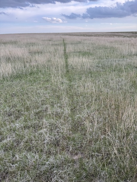
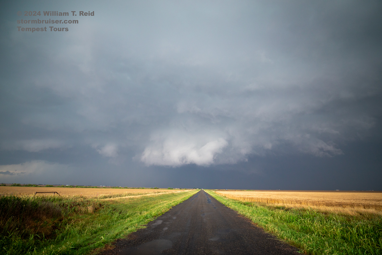
Our best bet today, the first day for Tour 4 out of OKC, was the High Plains of far eastern Colorado. Low-level moisture was poor, so I was hoping for a decent lightning show at dusk. We got just that! A line of strong to marginally-severe storms developed in Prowers counties around sunset. We watched from a spot southwest of Granada. That tail-end cell to our southwest looked rather nice on radar! I managed to get a few good CG images with the 70-200mm lens.
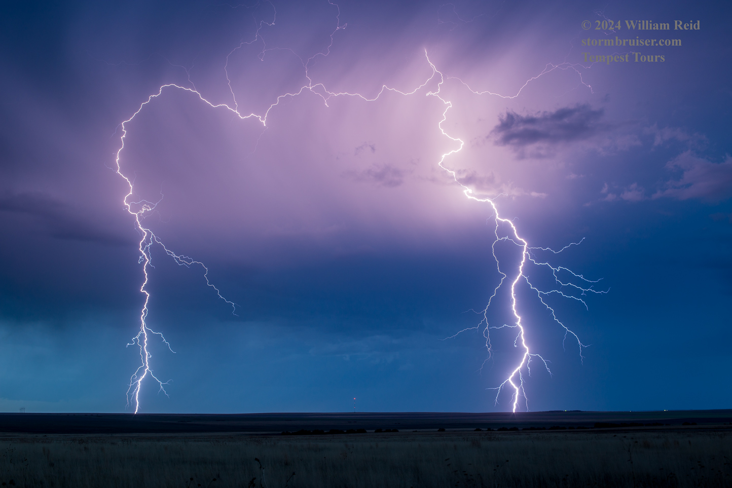
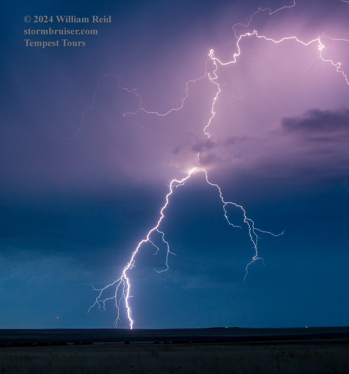
I-phone pics below
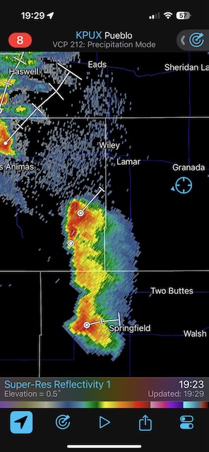
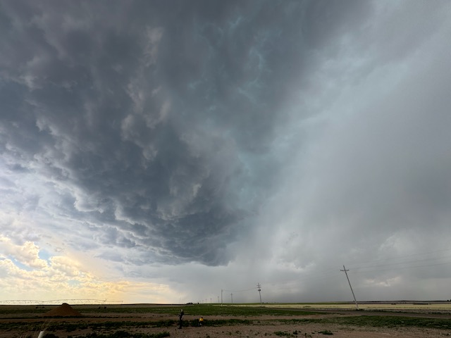
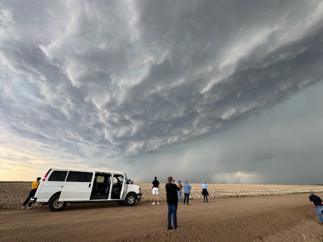
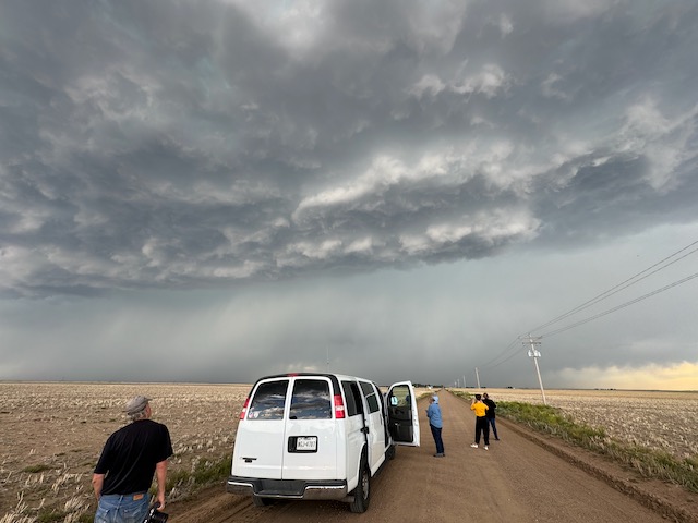
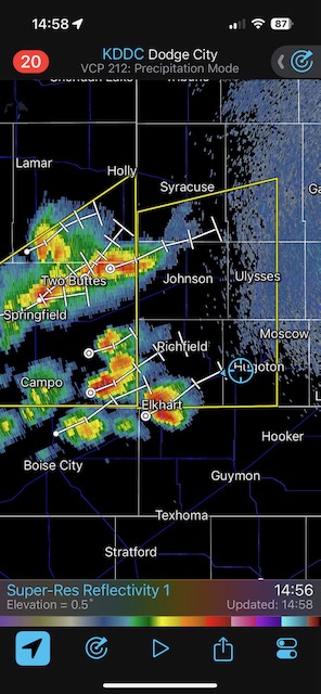
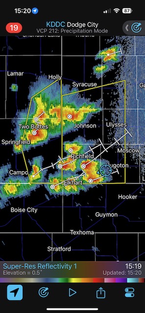
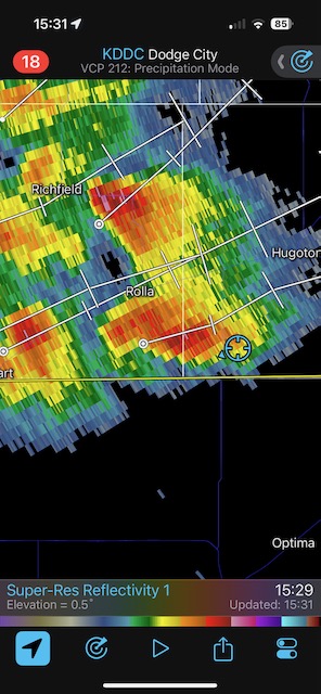
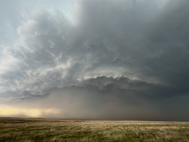
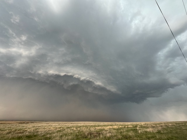
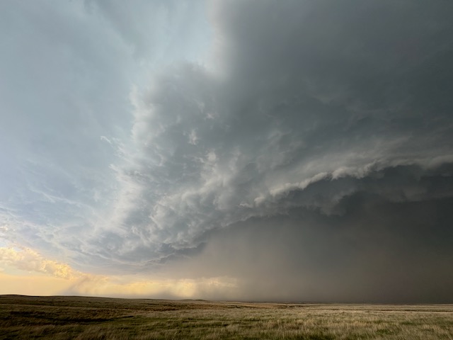
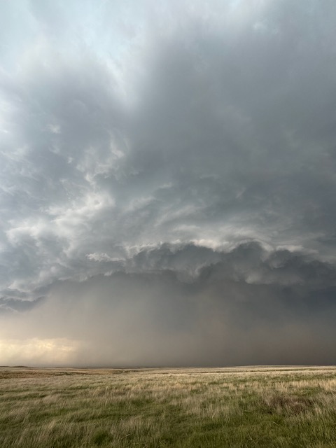
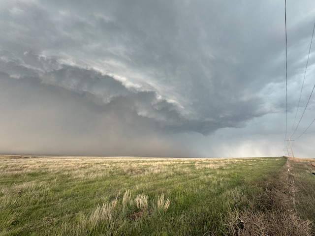
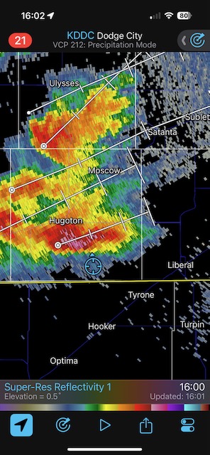
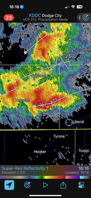
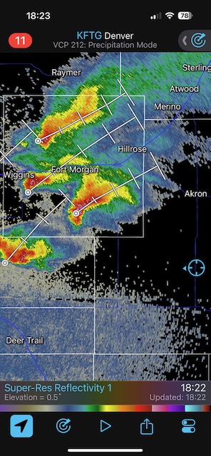
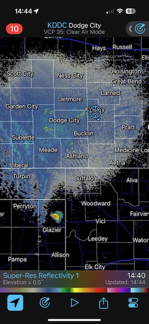
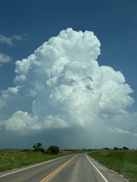
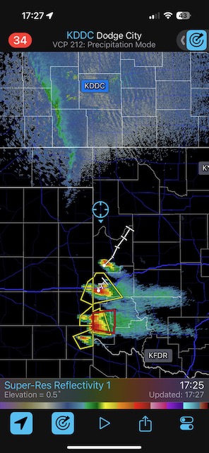
May 19/Outflow Fest near Hugoton, KS
Begin: Lamar, CO/lunch at Subway in Lakin, KS/end: Dodge City/379 miles
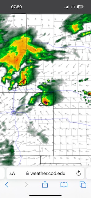
We played the convection coming off of the Raton Mesa today. This spread into southwestern Kansas during the mid-afternoon, and was high-based and outflowish. Yes, low-level moisture was still a little bit too meager. Most of the fun was around the Hugoton to Ashland area.
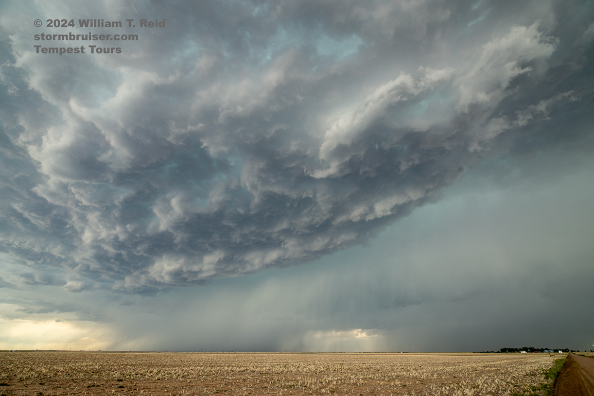

iPhone pics and radar screen grabs below
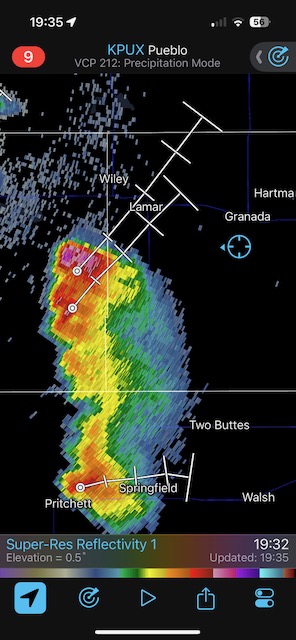
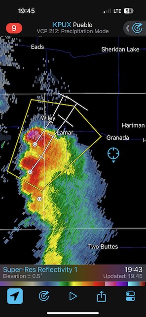
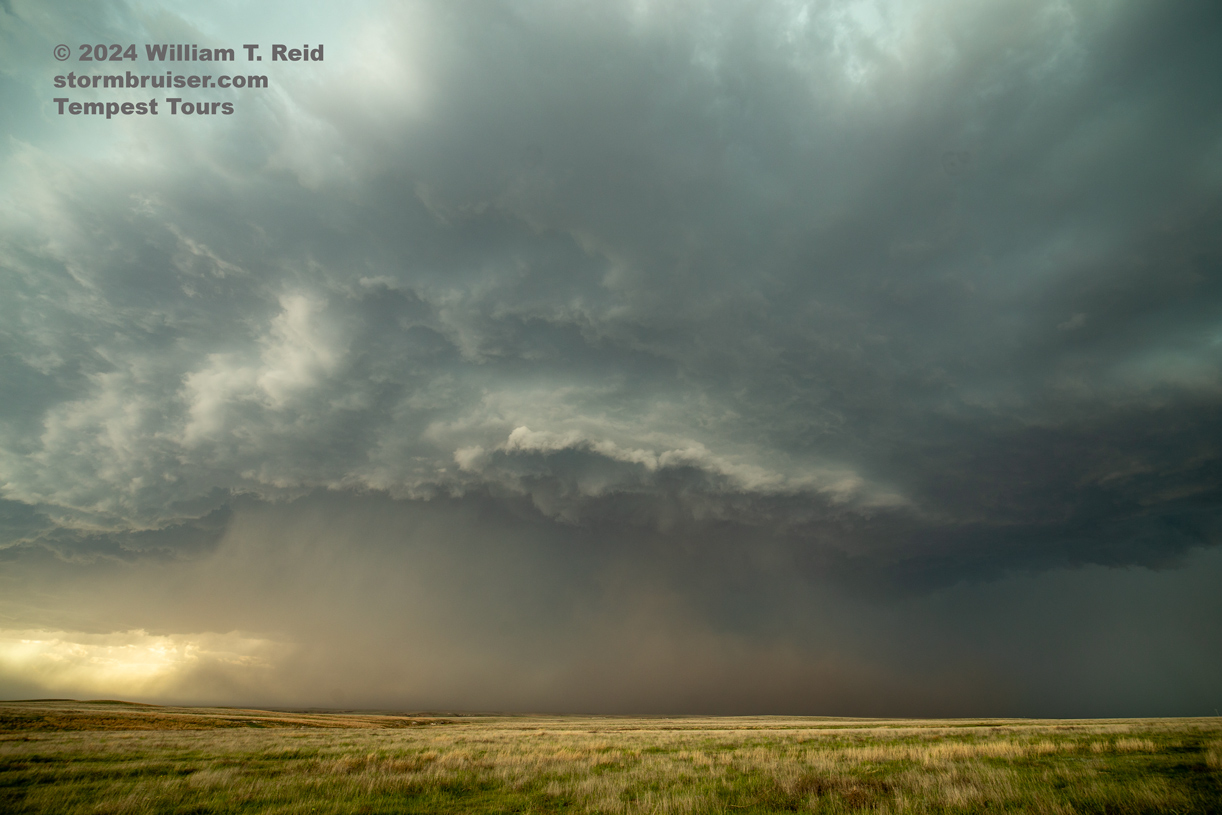
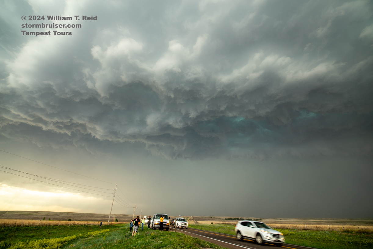
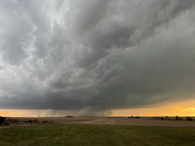
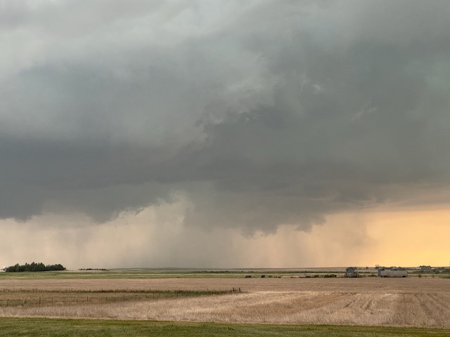
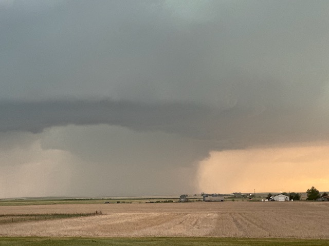
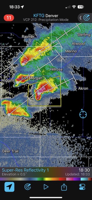
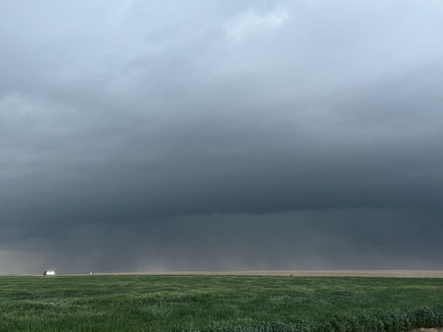
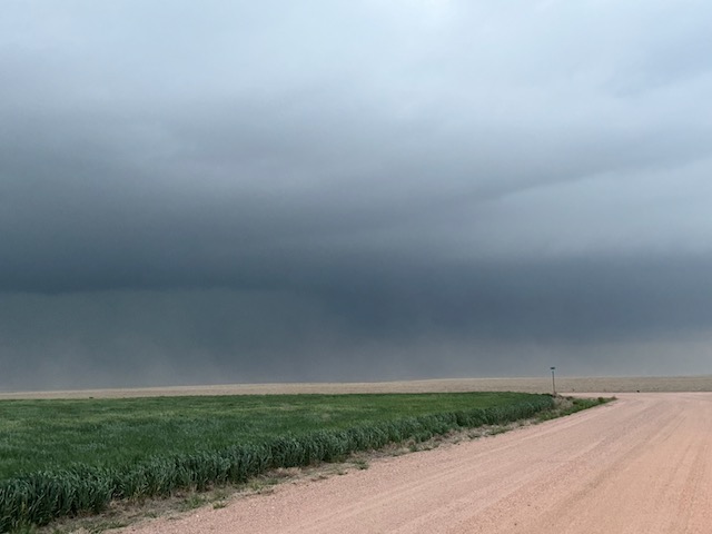
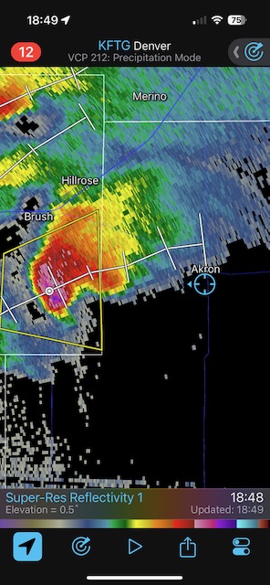
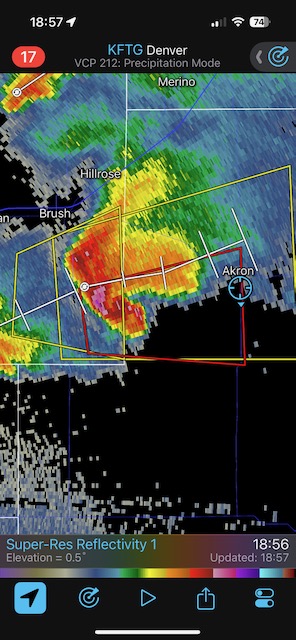
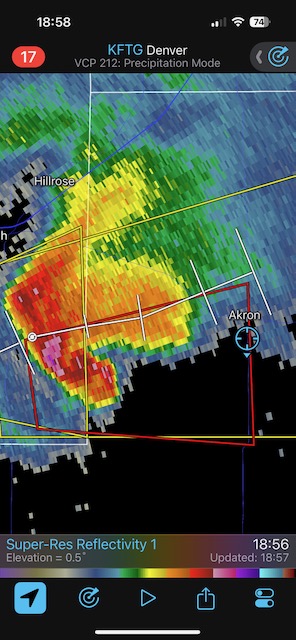
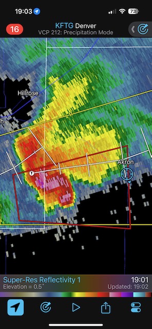
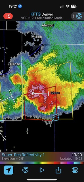
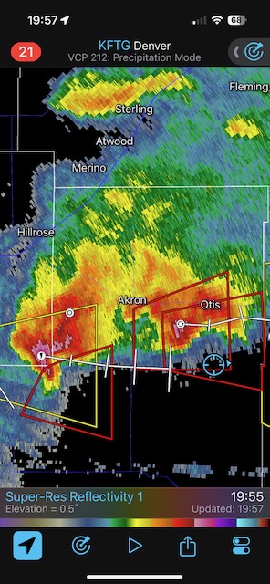
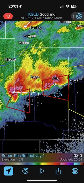
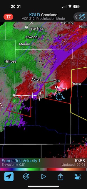
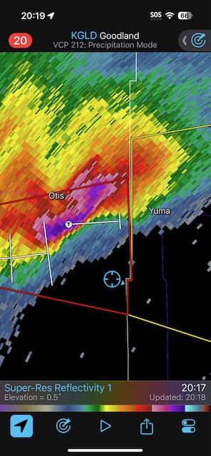
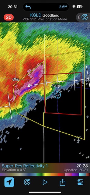
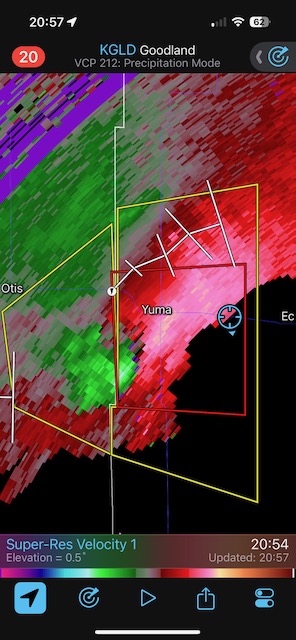
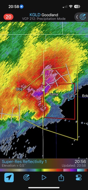
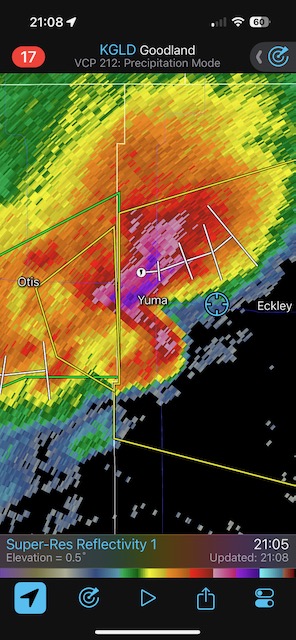
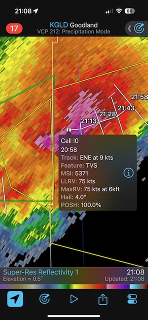
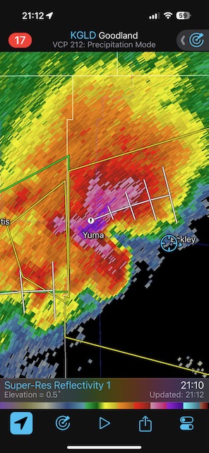
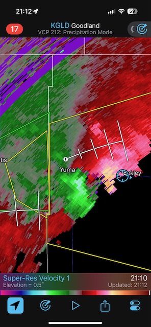
May 20, 2024 Akron and Yuma, CO, Supercells
Begin: Dodge City/lunch at the Welcome Home Cafe in Colby, KS/End: McCook, NE/533 miles
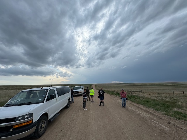
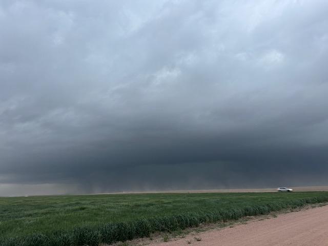
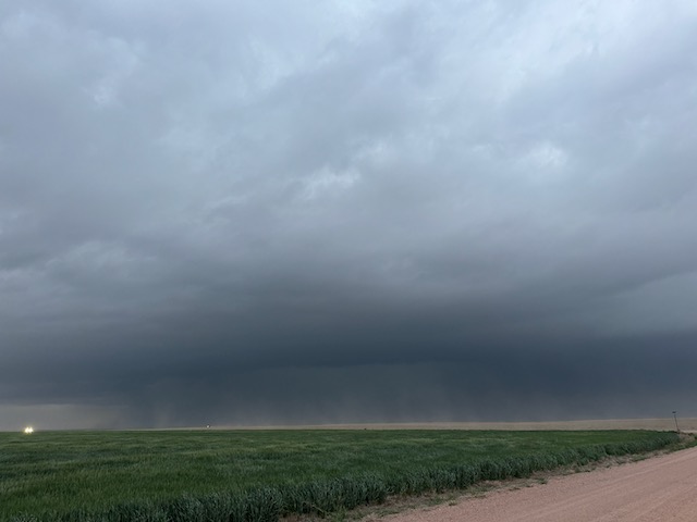
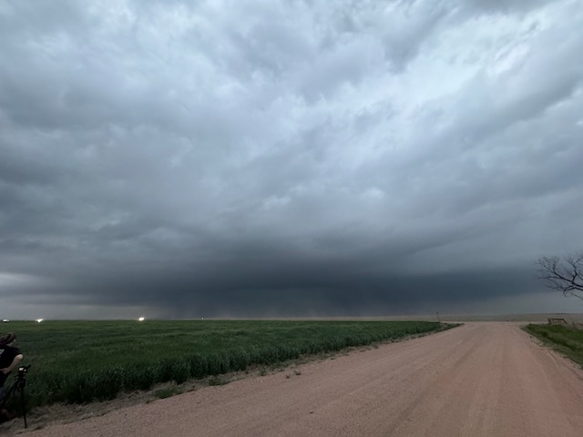
This was a bit of a doozy of a chase day. We were up in northeastern Colorado. Upslope flow north of I-70 was fabulous, but dew points were still really low (upper 40s) as convection finally got going in the late afternoon around Highway 71 (Last Chance to Brush). We waited for it south of Akron, and it showed some inclination to wrap up and make a tornado. Something spun up beneath the base.
We could not get ahead of this via 34, as the core was smacking Akron. We used a dirt road to get east and came up to Yuma. The storm was becoming a beast as decent moisture was finally finding its was into eastern Colorado from NW KS. However, it was more and more HP, and darkness was setting in. We scooted into Yuma and east a little (barely beating the core and the tornado-warned part), and stopped to look back to the west. There was a lot of lightning in the updraft to the west and overhead practically. Easterly inflow winds were screaming and there was far too much dust obscuring the storm. This was a classic eastern Colorado monster supercell, but I couldn’t really see what it had to show! The storm moved over Yuma and dumped tremendous hail amounts on the town. We weren’t going to venture westward to observe the calamity. It was dark and we had to get to McCook for a short night of sleep. Iowa was beckoning.


iPhone pics below
May 21, 2024 Southwestern Iowa Tornadoes
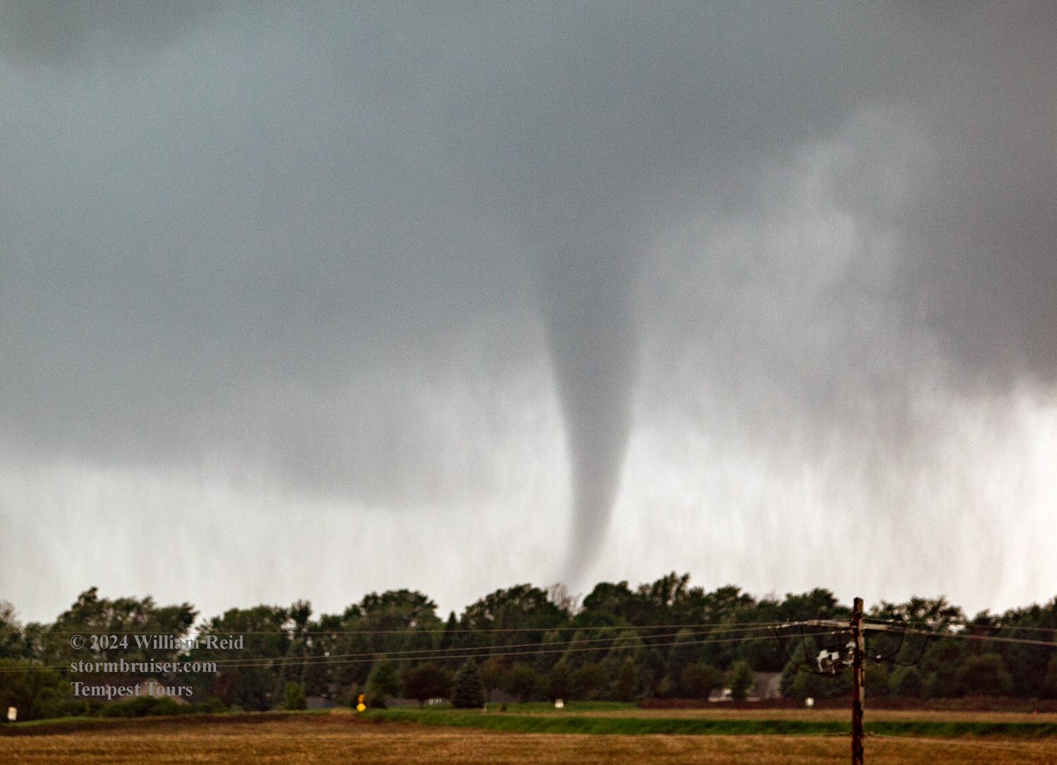
Begin: McCook, NE/lunch: grab-and-go convenience store somewhere around York/End: Hiawatha, IA/522 miles
Go to this link for the big chase in Iowa on May 21.
May 22, 2024 Agenda: Down Day/Reposition Day
Begin: Hiawatha, KS/brunch: Buzz’s Cafe in Sabetha, KS/end: Salina, KS/201 miles
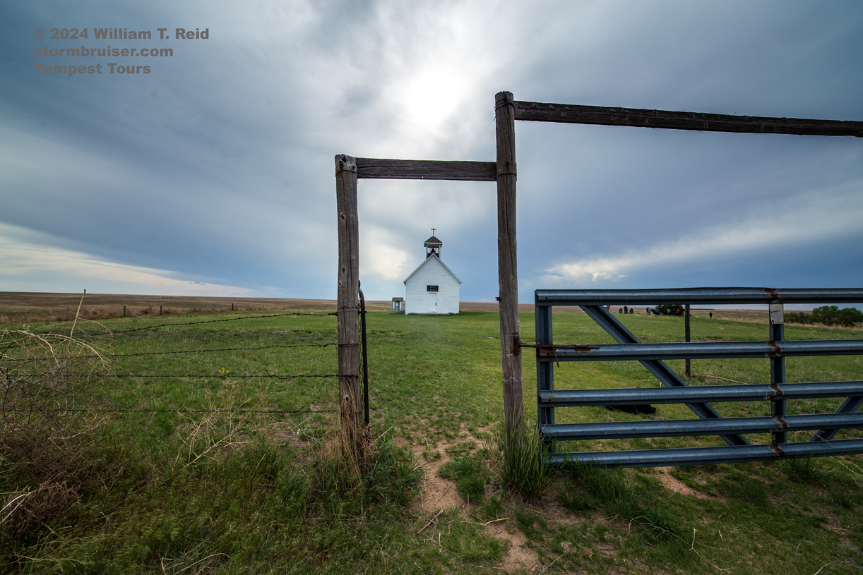
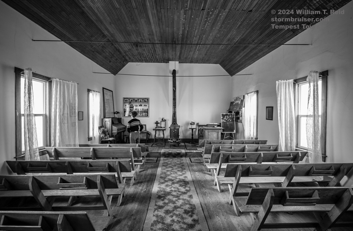
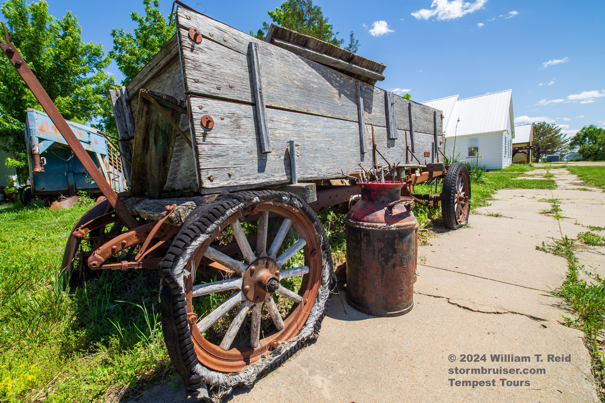
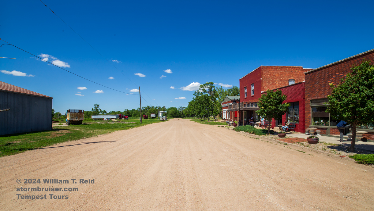
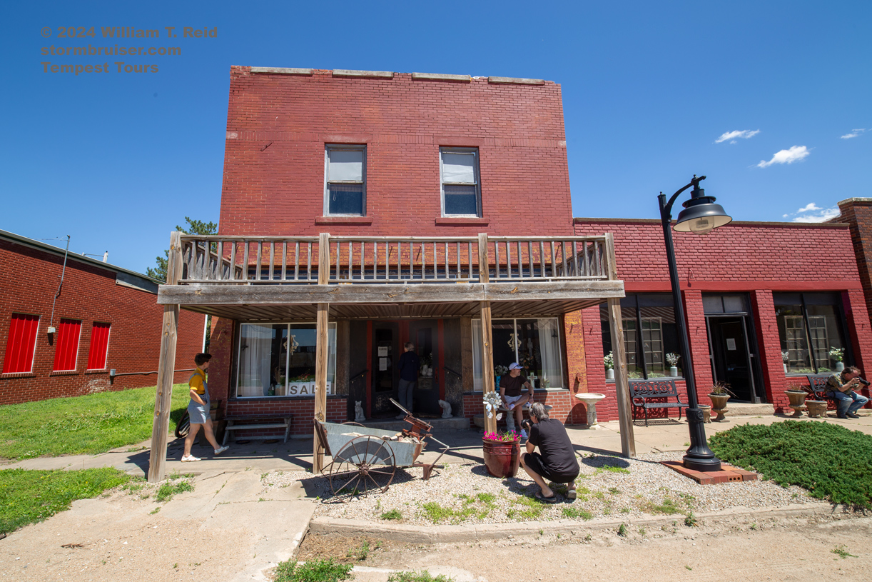
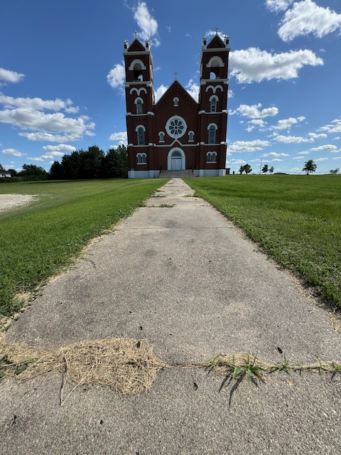
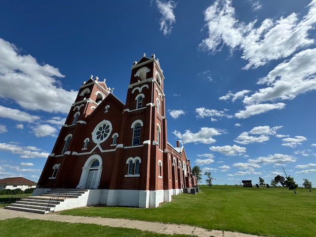
The outlook for the 23rd was looking quite good out west, and we had nothing to chase on this day. We sauntered westward through northeastern Kansas and made it an easy day, stopping in Salina for the night. One stop was at the little town of Agenda, Kansas.

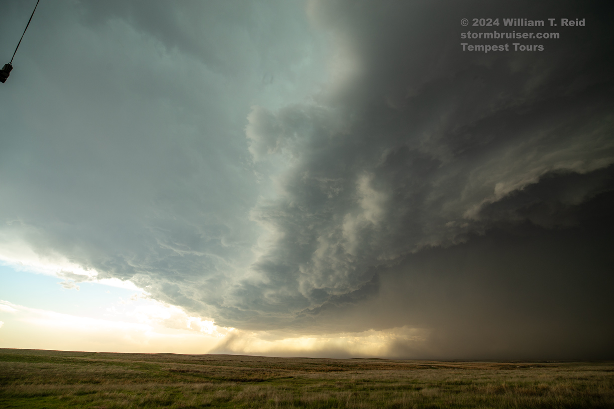
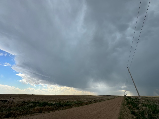
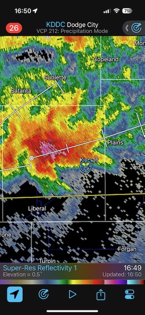
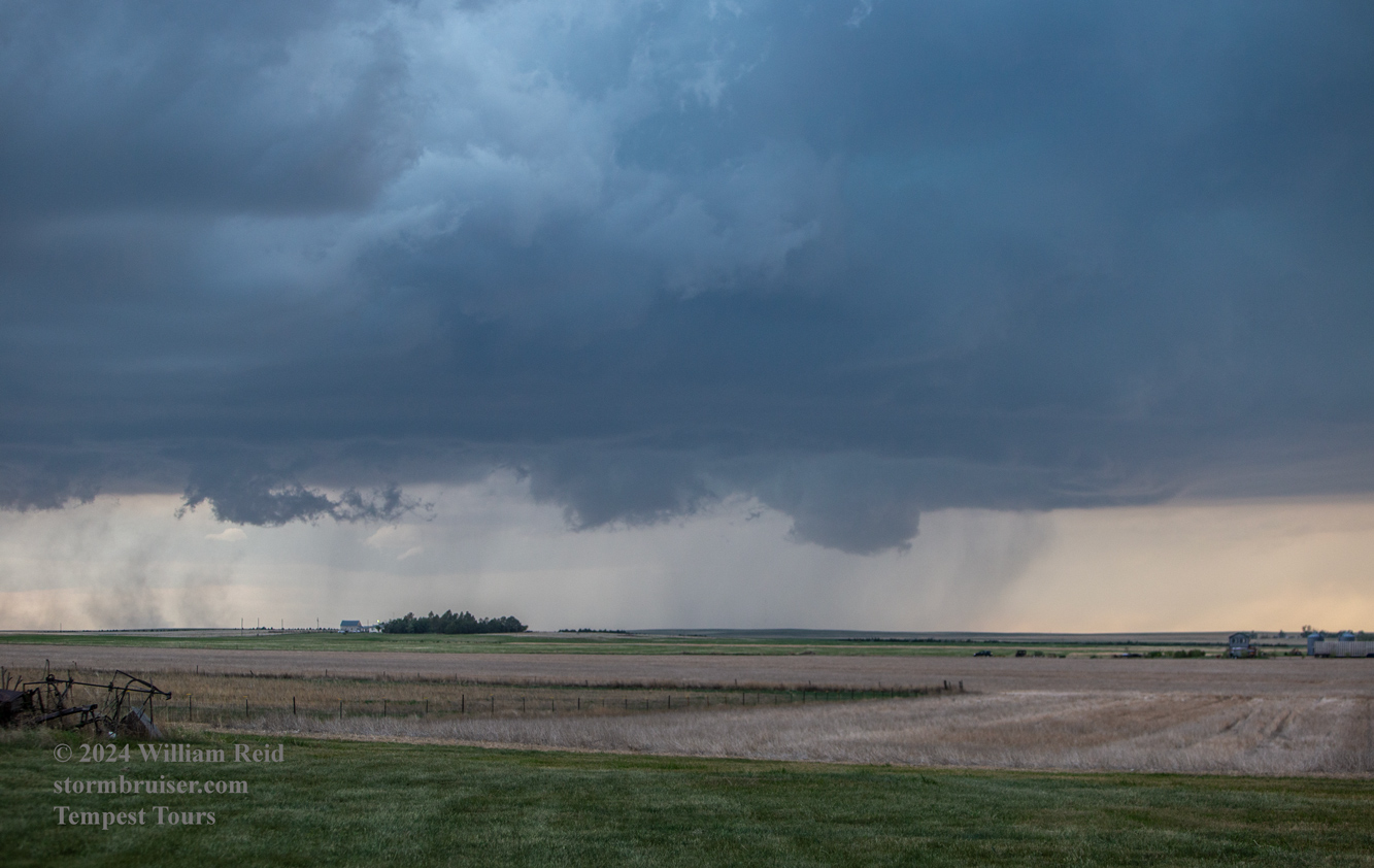
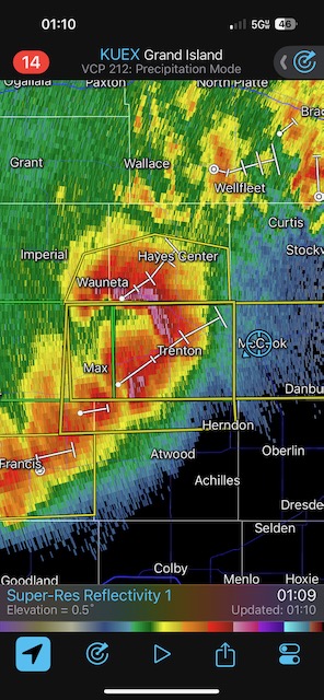
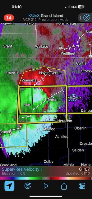
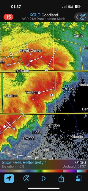
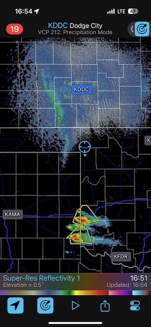
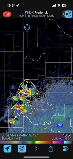
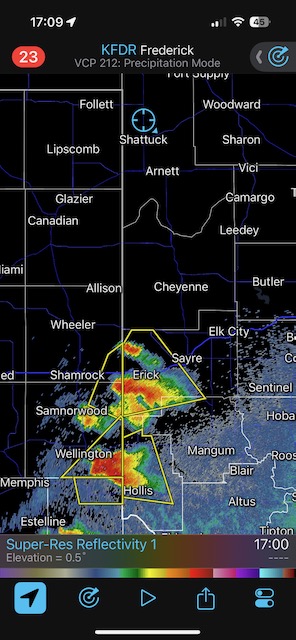
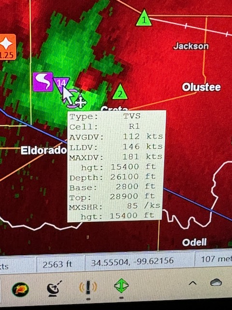
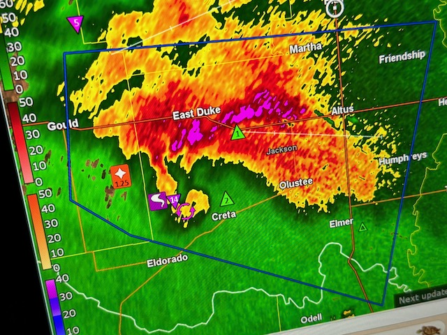
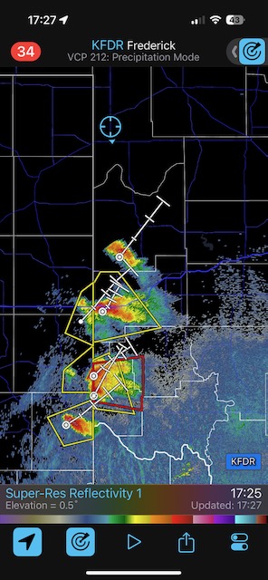
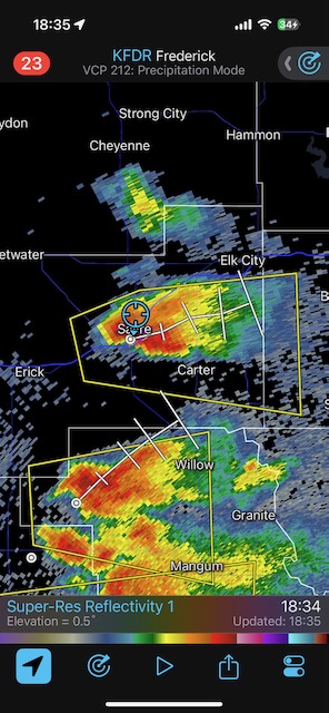
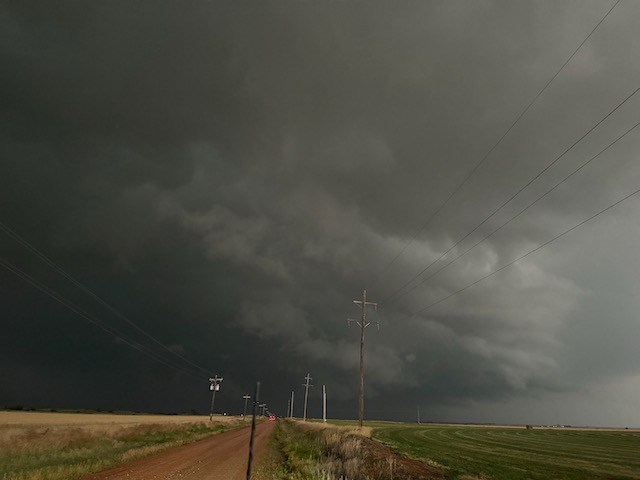
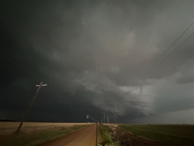
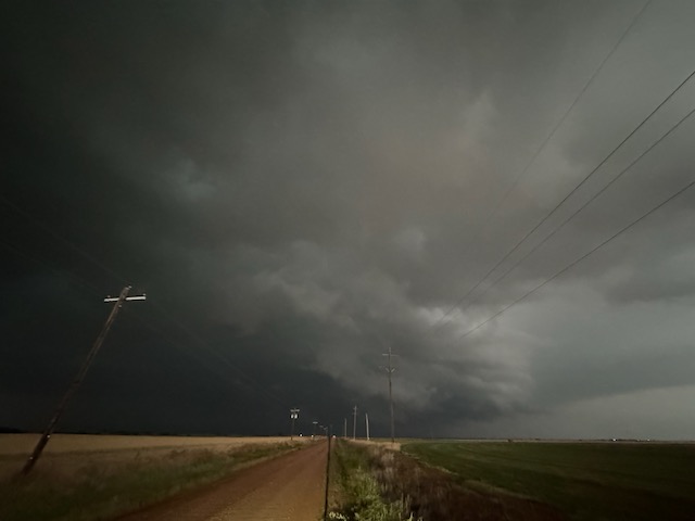
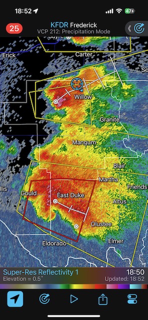
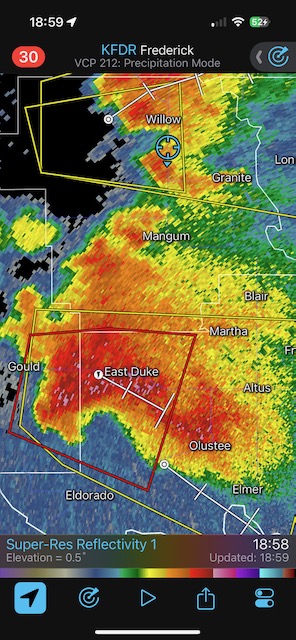
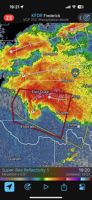
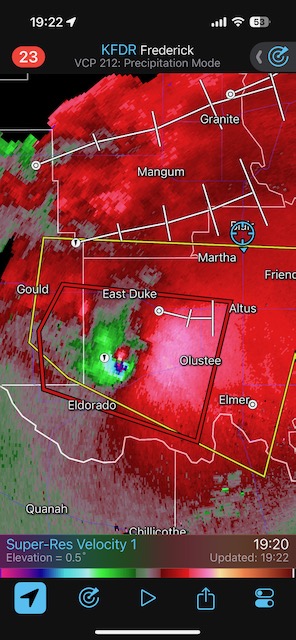
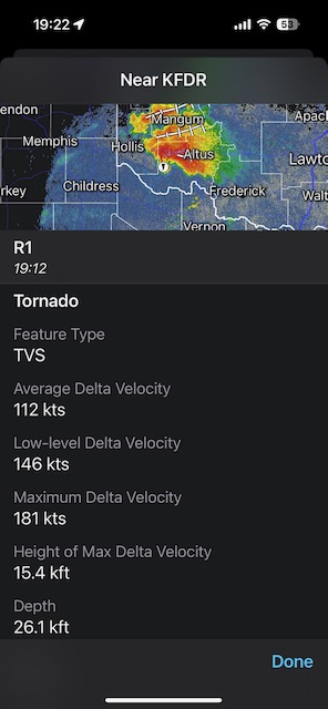
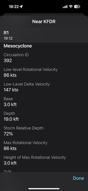
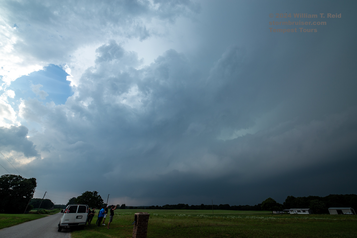
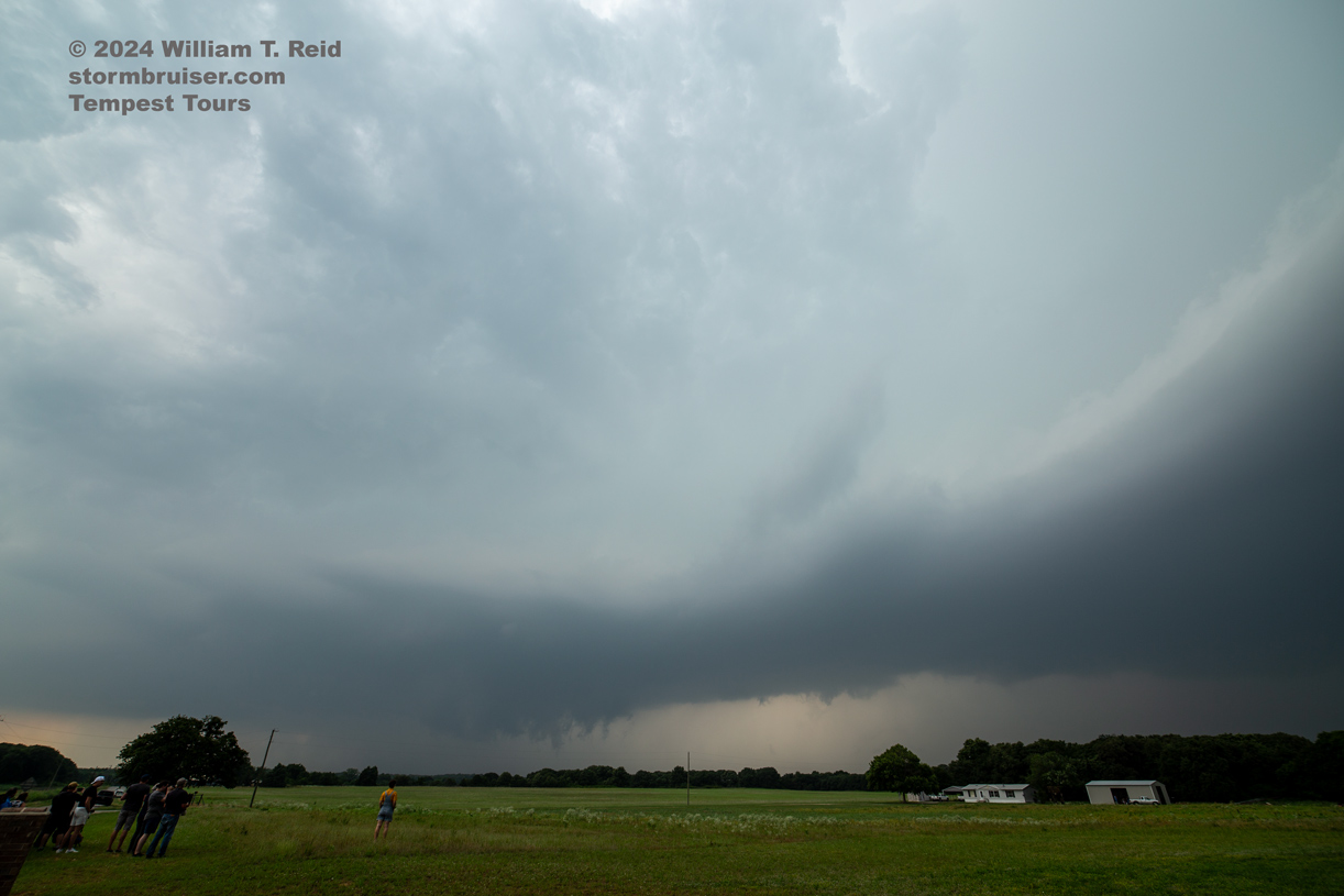
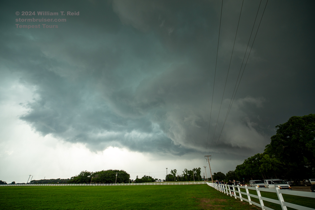
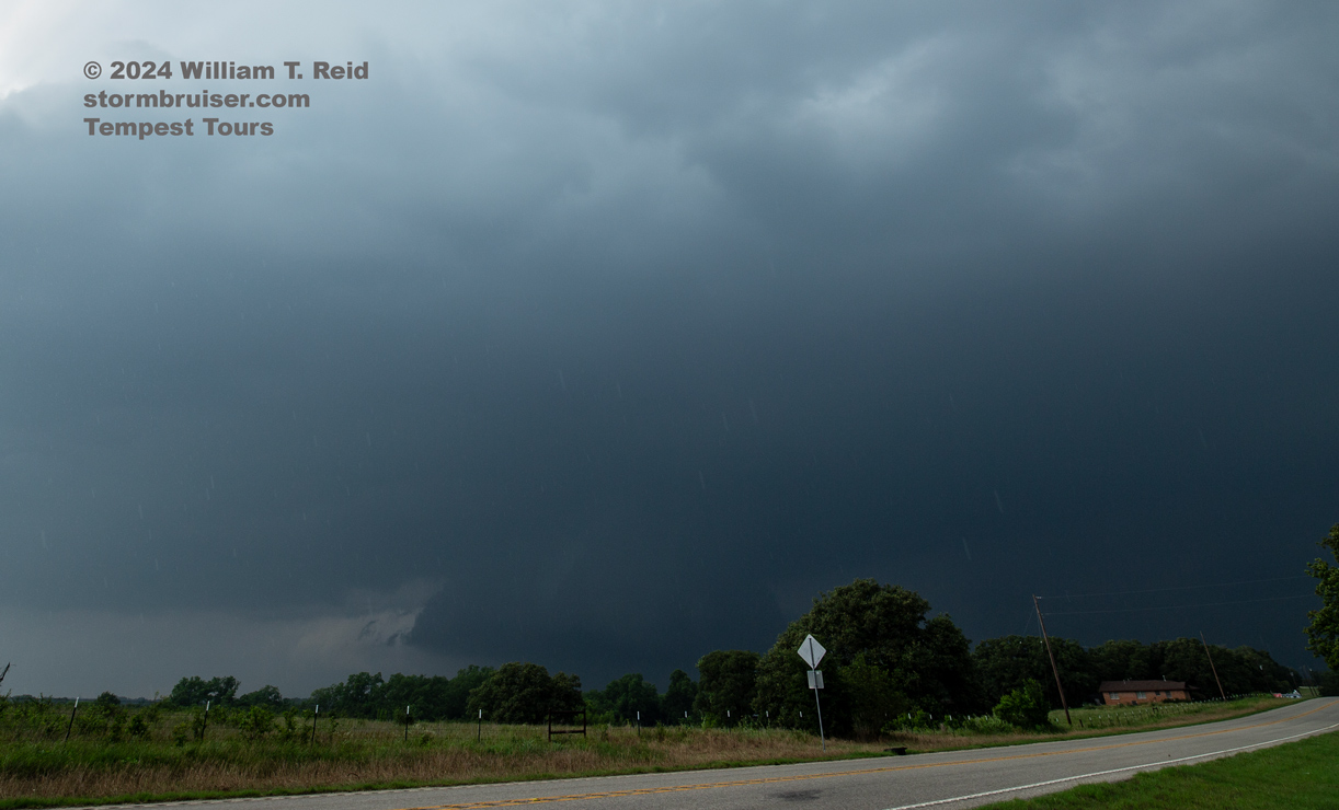
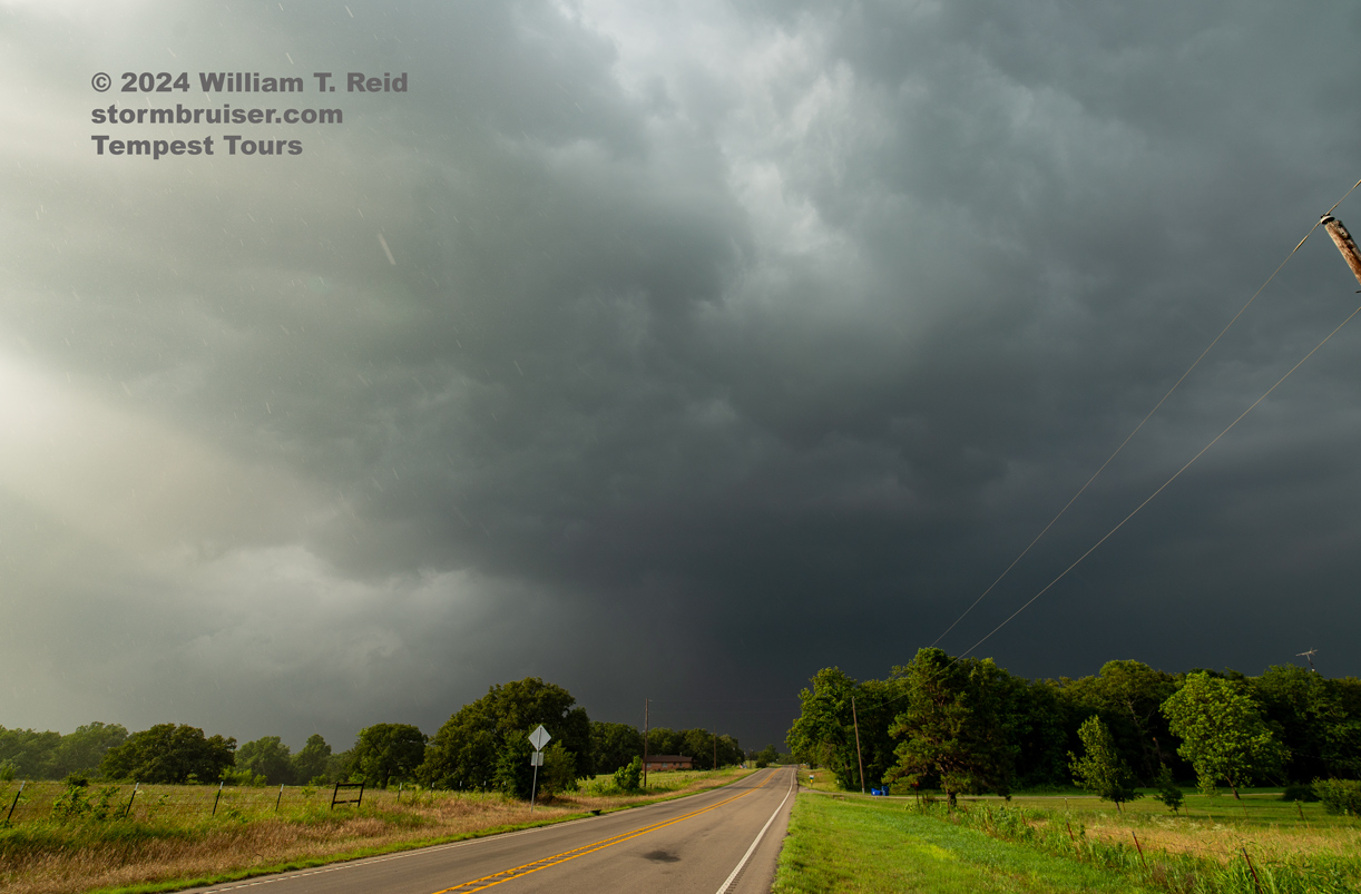
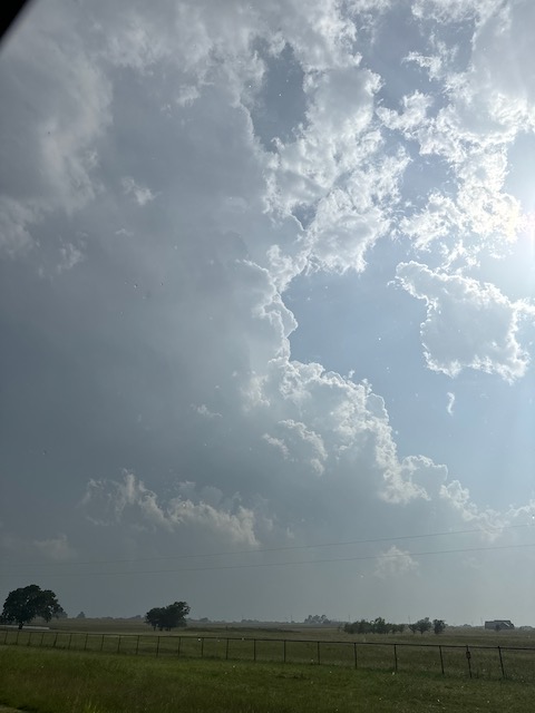
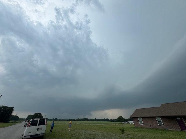
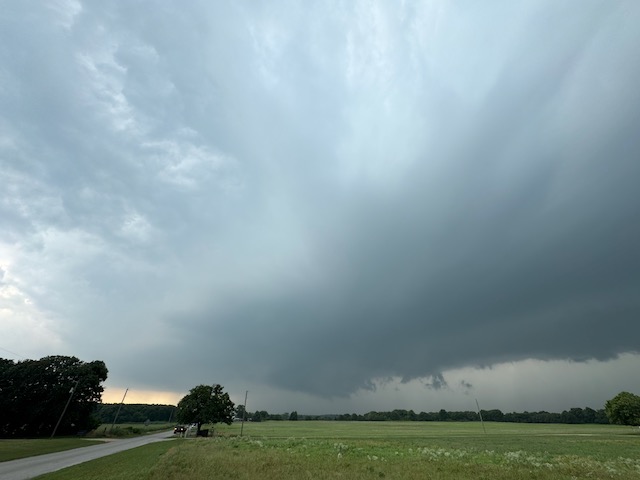
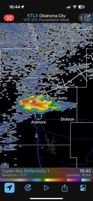
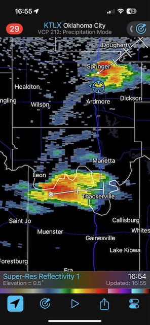
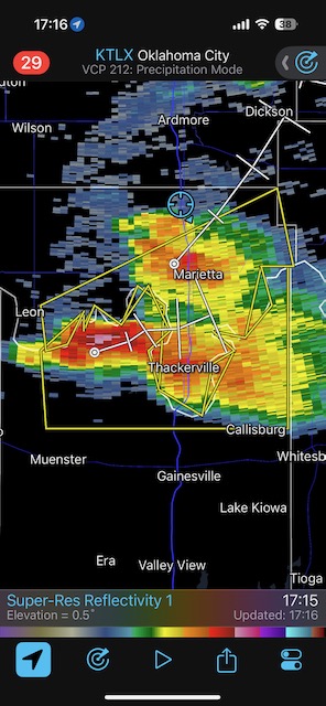
May 23, 2024 Duke, Oklahoma, Tornadic Supercell
Begin: Salina, KS/lunch: Delgado’s Mexican in Great Bend, KS/End: Wichita Falls, TX/533 miles
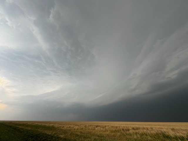
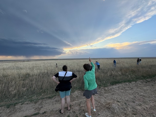
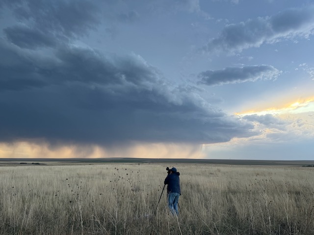
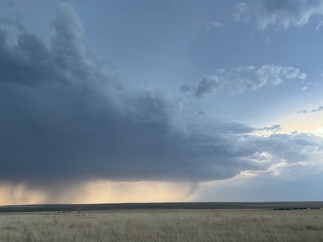
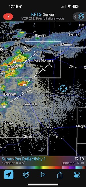
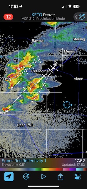
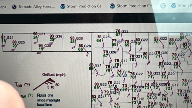
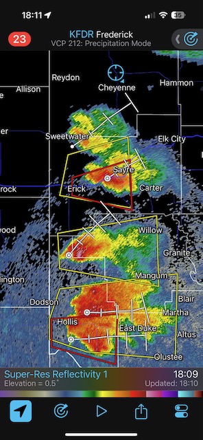
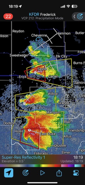
This is the one big chase day in 2024 that still eats at me, as we wound up a little late to observe the somewhat long-lived tornado in southwestern Oklahoma, near Duke. The SPC 5% tornado risk was not much help, extending from Abilene, TX, to near Yankton, SD. We made our way WSW from Salina towards the middle of Kansas, and I was favoring western Oklahoma a little bit, though I was rather torn between western OK and southwestern Nebraska. Western Kansas was not looking too favorable, so I had to commit to south or north after lunch in Great Bend. I went for western OK, even though I knew that SW Nebraska was almost a slam dunk for tornadoes. Western OK looked a bit more volatile with the better instability.
From Great Bend we continued to the WSW. I still liked the prospects in NW OK, though models were a little shaky on whether or not a decent storm would form north of I-40. Chris G and the Tempest photo group was staked out near Hollis, OK, in the extreme southwest corner of the state. That area also looked quite good. But it was rather iffy that we could make it to a storm near the Red River in time today.
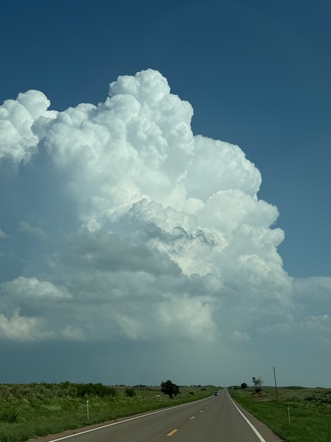
Some towers were going up to our west and southwest as we neared the KS/OK border near Sitka on U.S. 183. I wanted to continue to the south, as the SW OK play was looking better and better…at least compared to NW OK. But, the road (183) south to Sitka, KS, and Buffalo, OK, was blocked off. An officer at the junction said that a big rig was blocking the road to the south. We had to drive an additional and unwanted 15-20 miles west in order to continue to the south. That extra 20 minutes, and the extra 15-20 minutes it took to zig-zag back to the east, was the difference between seeing the Duke tornado and not seeing the Duke tornado.
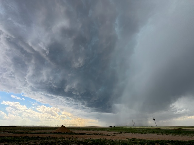
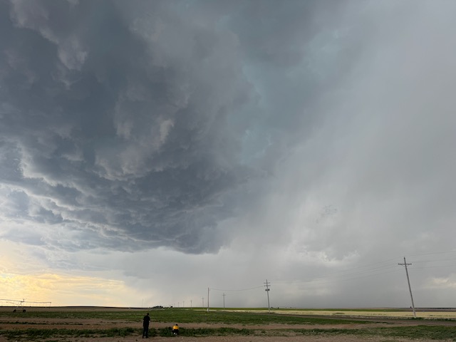
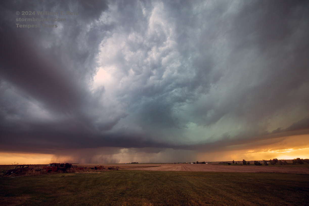
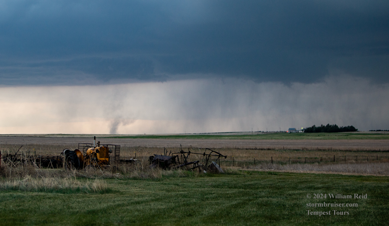
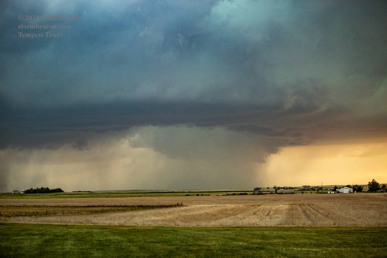
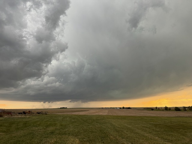
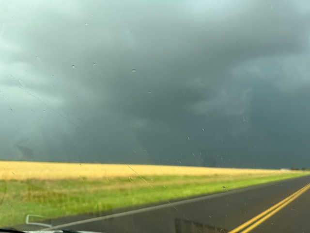
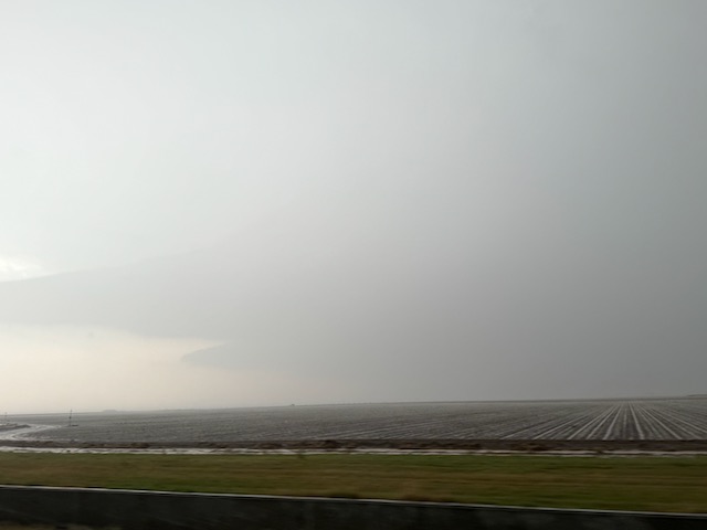
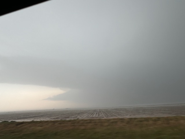
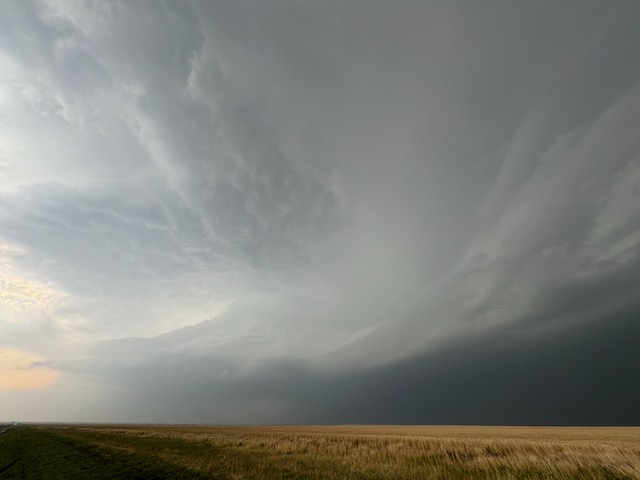
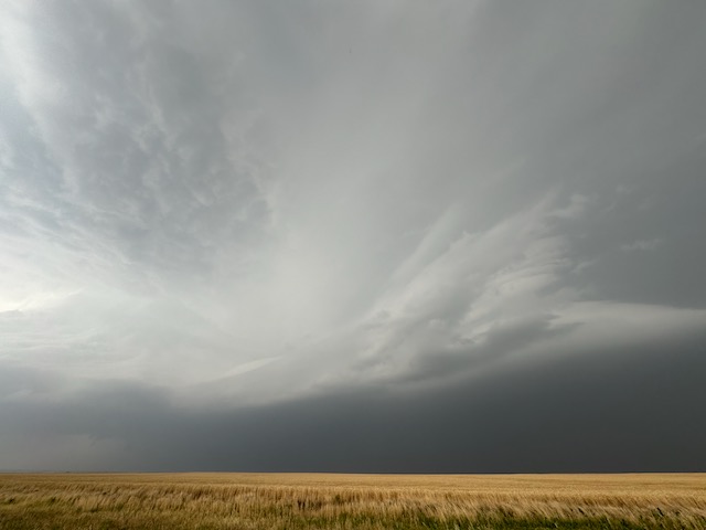
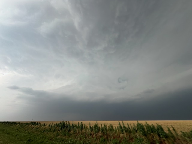
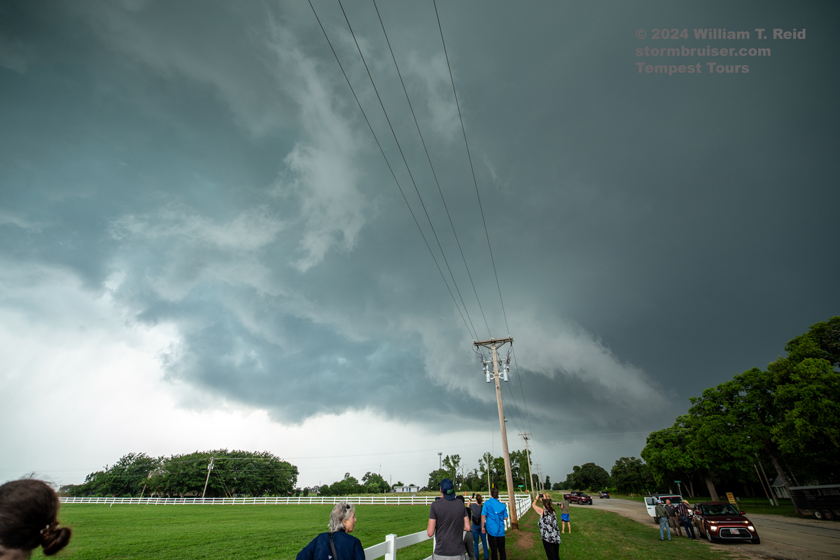
As we made our way south towards I-40 via Laverne and Arnett, we dodged a left-mover coming at us from the Sayre area. As we neared Altus finally, the big supercell had been tornado-warned for a little while and we knew that we were missing the show. We got east of the supercell south of Altus in time for some impressive structure. But, if the tornado was still in progress, it was heavily wrapped in precipitation. And that is one saving grace, I suppose, for this event! The tornado put on a good show for chasers early on, but then was wrapped in rain and quite difficult to see unless one was up close.
Of course, the Nebraska tornadoes materialized on schedule and were quite photogenic! I was THISCLOSE to choosing the Nebraska target early on this day! Shucks.
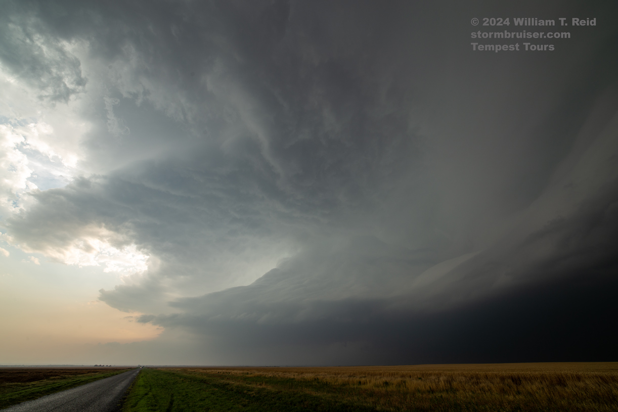
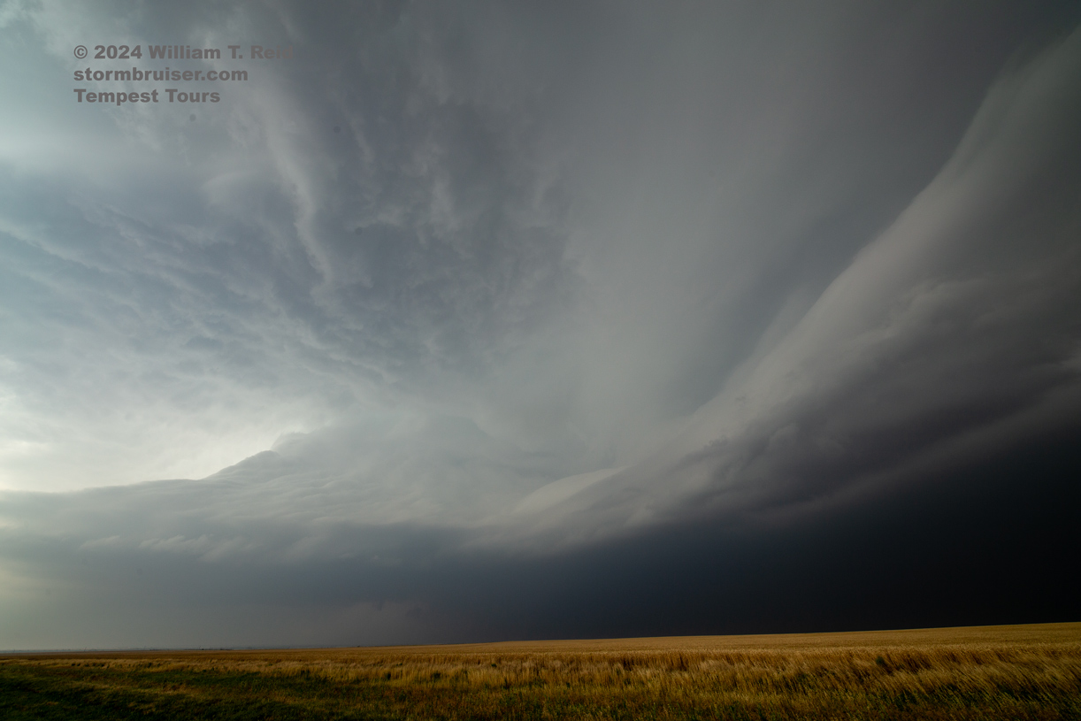
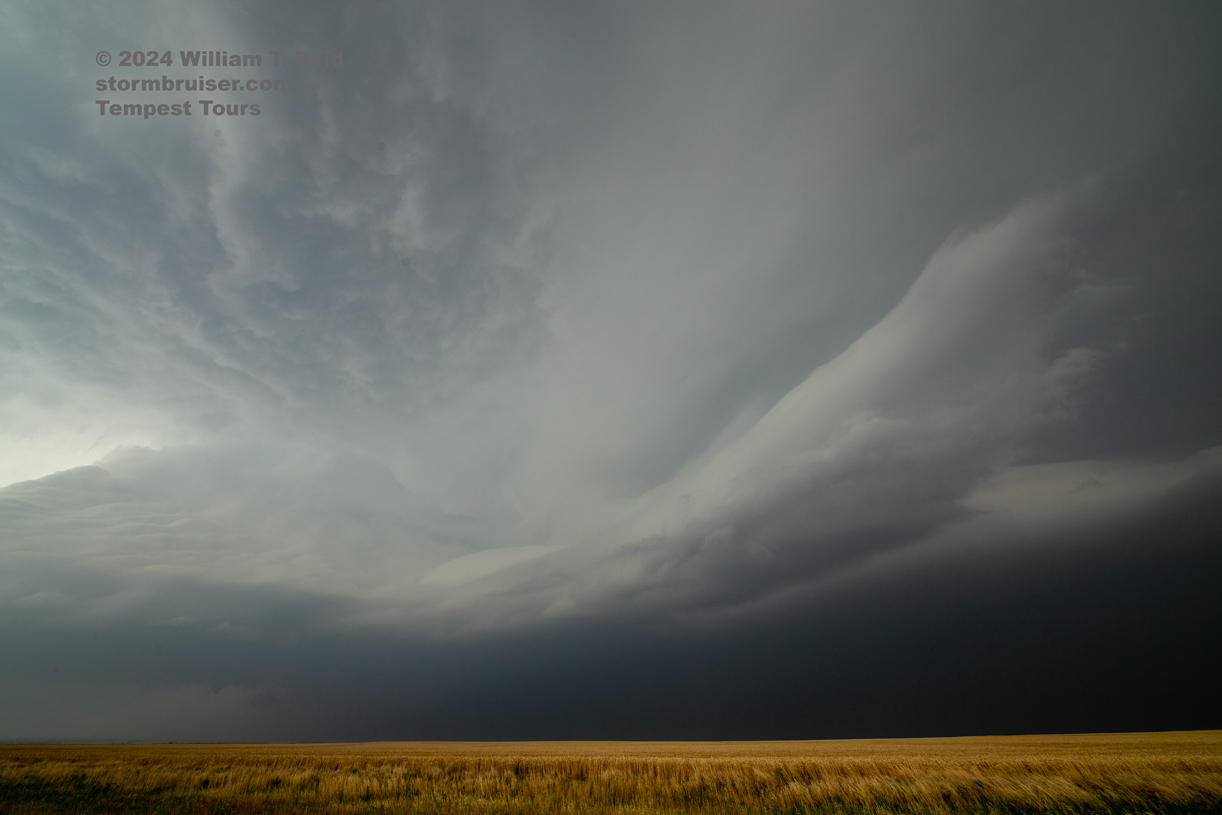
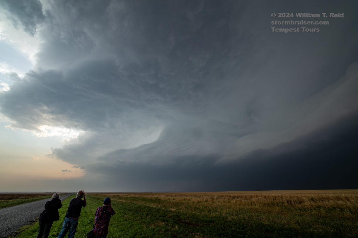

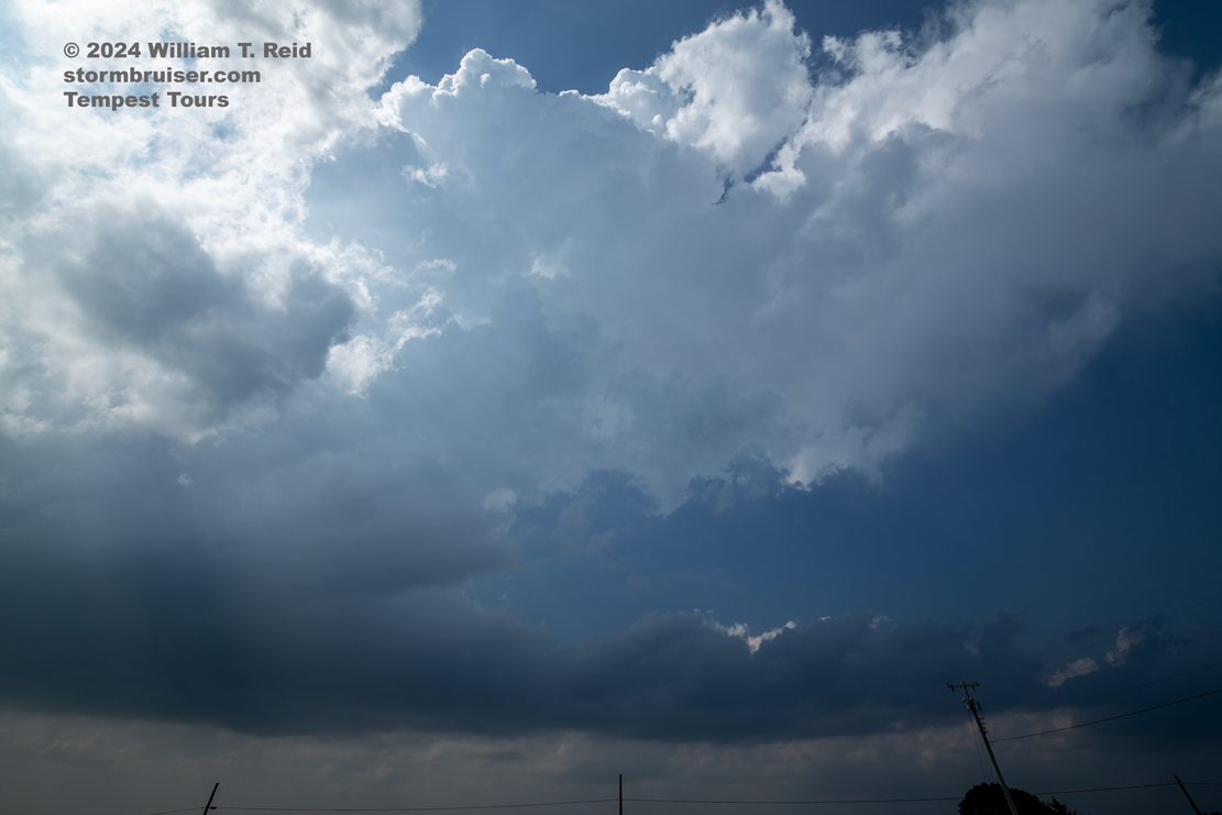
iPhone images and radar screen shots below. The structure shots were taken south of Altus by about six miles, and the wall cloud shots were looking north, southwest of Altus. The images and radar shots are out-of-synch time-wise.
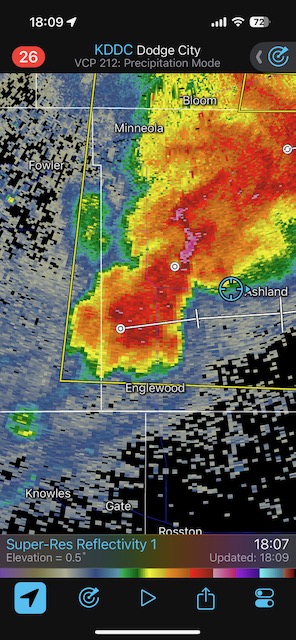
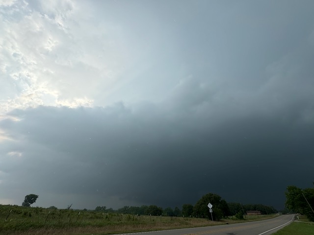
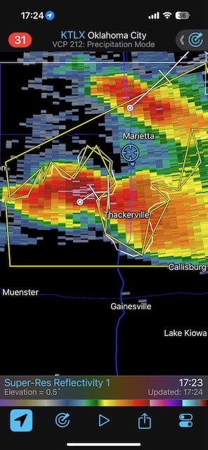
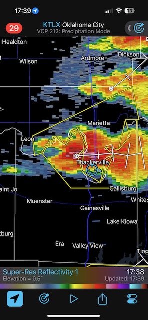
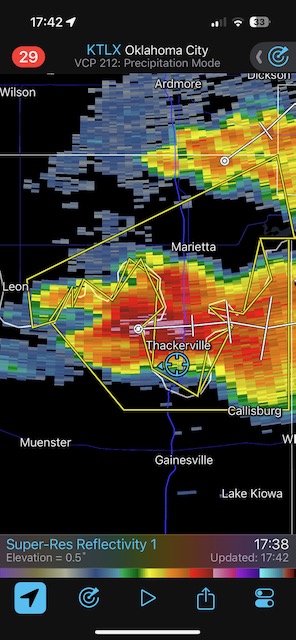
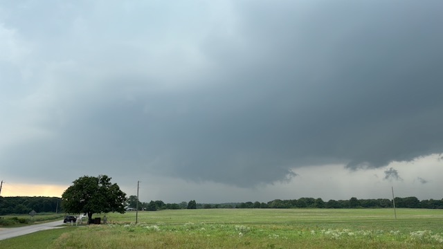
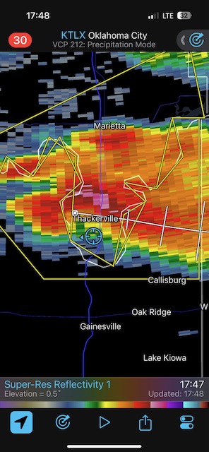
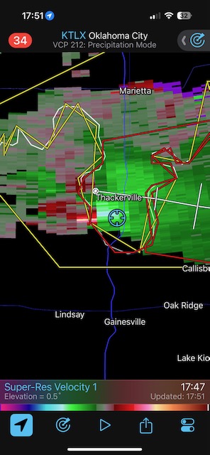
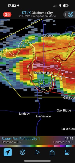
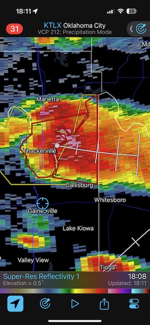
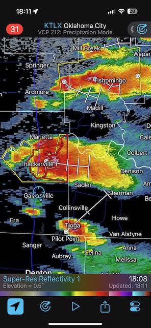
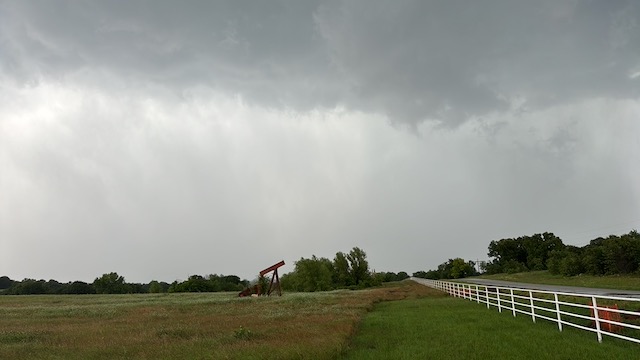
May 24, 2024 Thackerville, TX, Supercell
Begin: Wichita Falls, TX/lunch: Freddies in Gainesville, TX/end: OKC/395 miles
We had somewhat high hopes again for a high-end chase, but the supercell which drifted along the Red River near Thackerville was in no mood to make tornadoes! This was the final day of Tour 4, and we went back to Oklahoma City for the night.
iPhone images and radar screen shots below

Leave a Reply
You must be logged in to post a comment.