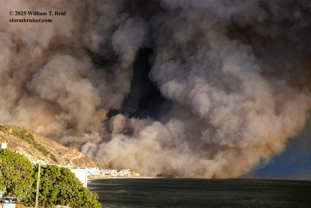
NOTE: This is a long account of my “wildfire chase” of the Palisades Fire, which is now one of the costliest disasters in the country’s history. Numerous lives were lost in both this fire and in the Eaton fire at Altadena. This entry is provided to serve as comprehensive documentation of what I experienced and to share images and video clips. Heartfelt condolences go out to those impacted by the fires.
Scroll down a bunch if you are primarily interested in the pictures and video clips.
There are some days that don’t wind up going very closely to how you figure they might. Tuesday, January 7, was one of those days for a lot of residents of the Los Angeles area; and it was for me also, someone who documents weather-related events. The region was being impacted by a strong “offshore” or “Santa Ana” wind event, and two devastating wildfires occurred. The Eaton fire in Altadena may have been started by the power grid system (i.e., sparks from the effects of strong winds upon the electric utility polls and wires). It might be that the Pacific Palisades catastrophe was due to a small fire a week prior that was still smoldering. These have not been determined for certain yet. For certain was that there was a very high fire danger for Los Angeles and much of coastal Southern California. Winter is the wet season around here, but winter storms and rains have not materialized yet. Most area stations have had less than a quarter of an inch of rain since mid-April. At my station in Westlake Village, we had a couple of drizzle days in November and December, and that’s been it so far since the rainless summer. Normal rainfall from October to December is around 4-5 inches. Thus, the fuels were dry…especially dry for early winter. Fire risk increased for the region with each Santa Ana wind event.
WARNING! Meteorology lesson in the next paragraph below.
The outlook for January 7th had been looking rather scary for several days prior. The National Weather Service was on top of things and highlighting the very high fire danger given expected strong Santa Ana winds on the 7th. The most intense Santa Ana wind events require three primary ingredients, and all three would come together by Tuesday evening. The typical (number one) ingredient for Santa Ana winds is the “offshore” surface pressure gradient, which just means that barometric pressure is higher to the north and northeast of Los Angeles (i.e., over the southern San Joaquin Valley and extending into the western Mojave Desert). For this event, the pressure gradient was about “minus 5” to “minus 8” millibars. These values are associated with moderate-to-strong offshore winds. When the pressure is higher inland, air is forced towards the coast. The well-exposed hilltops, the mountain ridges, and the canyons oriented N-S and NE-SW see the strongest winds. The higher-end Santa Ana wind events are typically also associated with cold-air advection and very strong upper-air support. The cold-air advection means that colder air is being pumped into the Mojave Desert region (from the north to northeast) and is bumping up against the area’s east-west-trending mountain ranges which separate the coastal sections from the desert. Since cold air is denser and heavier than warm air, this cold air spills easily through the passes and into the coastal and valley sections. (If the desert areas are warmer than the coastal sections, there will be no cold-air-advection support for a Santa Ana wind event.) Lastly, if the winds aloft are strong and from a favorable direction (namely from the north to northeast), then this can “supercharge” a Santa Ana wind event due to a “mountain wave” condition. On Tuesday the 7th, the wind speeds some 5000 to 20,000 feet above the Los Angeles Basin were around 60 to 120 mph from the north and northeast. This was due in part to an upper-level low (or cyclone) that was developing a little south of the Arizona border with Mexico. Given other favorable parameters over Los Angeles County, such as downward motion in the lowest 20,000 feet and a temperature inversion aloft, a mountain wave wind condition developed. The strong winds aloft strike the north sides of the San Gabriel Range, which is roughly 6000 to 9000 feet in elevation along the highest ridges from Soledad Pass to Cajon Pass. The strong flow is squeezed over the mountains, and then descends to areas downwind. The inversion and the general downward motion help to mix the very strong winds aloft to the surface. Meteorology professor John Monteverdi pt it this way in a weather discussion group: “Sufficient flow at right angles to the mountains with an inversion at ridge top is all you need for a hydraulic jump/downslope wind storm.” In these events with a pronounced “mountain wave” in progress, areas which are usually protected from strong Santa Ana winds in the lee of the San Gabriel Mountains can get BLASTED. It is kind of all-or-nothing for these foothill areas. Burbank Airport recorded an astonishing 83 mph gust with the this event on January 7th.
Before proceeding with the account and the pictures, I will provide a few weather maps which show the weather conditions at stations in and around the Palisade fire area during the afternoon and evening.
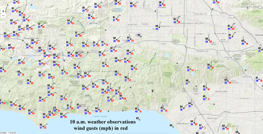
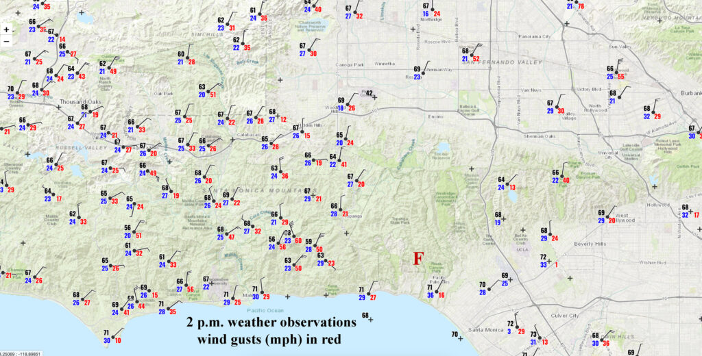
Surface plots for 10 a.m. (left) and 2 p.m. (right) on January 7th, 2025. An “F” shows the approximate initiation area for the Palisades fire. Peak wind gusts at the well-exposed stations near Saddle Peak and in the Malibu Hills were around 60 mph midday.
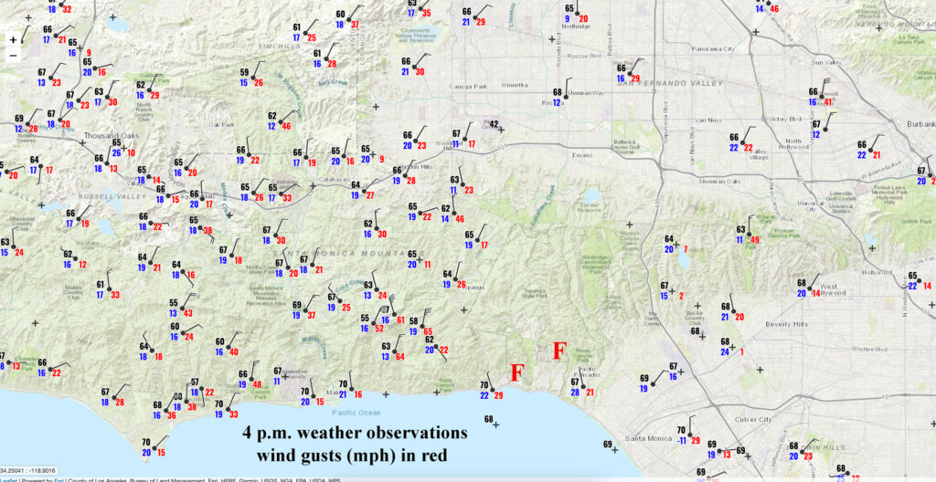
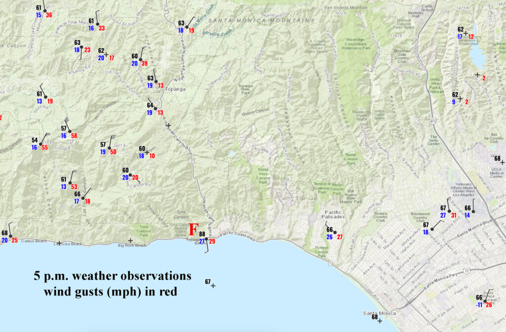
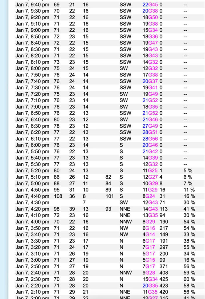
Above: Surface plots for 4 p.m. and 5 p.m., and ten-minute data from the SCE Topanga Beach station. Click on the maps for the full display. An “F” shows the approximate location of the fire. The 5 p.m. map shows an 88F temperature at the Southern California Edison station for Topanga Beach. This strongly suggests that flames were nearby, given the jump from 70F at 4 p.m. The 10-minute data from this station (on the right, above) indicates a temperature of 108F at 4:40 p.m.! The temperature report for 4:30 p.m. was missing, following the 98F measurement at 4:20 p.m. I suspect that the temperature that was measured at 4:30 p.m. was so high that it was summarily discarded by the weather-reporting software. If I had to guess, it was likely above 130F. (The SCE station called “Sumac Ridge” showed a temperature of 126F at 12:20 a.m. on the 8th when the firestorm was close by.). In addition, the wind shift shown by the Topanga Beach station from 4:20 to 4:30 p.m. (when the temperature was missing) is probably due to the pole or instrumentation rotating. The actual wind direction almost certainly did not shift to southerly. Perhaps the support for the wind vane was weakened by the great heat and the strong wind turned the instrument around on the power pole.
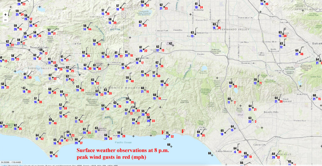
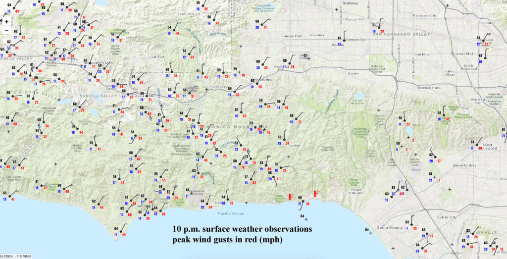
Surface plots for 8 p.m. and 10 p.m. above. The wind really ramped up in this section from Malibu Creek to Topanga Creek after 7 p.m. There were gusts greater than 80 mph at the Malibu Hills RAWS station at 1575 feet elevation (86 mph), the DW2363 APRS (private) station at 2385 feet (98 mph), and Saddle Peak at 2750 feet (84 mph).
This article does a good job of explaining this particular weather event.
Okay, end of meteorology segment. Given the very dry antecedent conditions regionally and the strong and dry N to NE winds associated with the developing Santa Ana wind (combined with the expected mountain wave effect, which greatly exacerbated the Eaton fire in Altadena on Tuesday evening), average wind speeds of 25-45 mph were expected in and around the San Fernando Valley, the Santa Monica Mountains, the western San Gabriel Mountains and the Santa Susanna Mountains. Gusts as high as 90 mph or more were possible where the mountain waves surfaced, and at the most-exposed stations on ridge tops and in favored canyons. For most areas, wind gusts of 45 to 65 mph would be common. Knowing the forecast, I made sure that all of my camera batteries were charging on the evening of January 6th! My area around Thousand Oaks was very vulnerable.
Fortunately, I was not scheduled to work on Tuesday the 7th. I received a text message from a weather buddy at 10:53 a.m. regarding a new fire in the vicinity of Pacific Palisades. The fire was about 20 miles to my ESE, near the eastern edge of Malibu (east of Topanga Canyon, west of the San Diego Freeway and the Sepulveda Pass, and northwest of Santa Monica) “Great SCOTT!” was my response to the text. Winds would blow it towards the ocean, so I did not have to be concerned about my immediate area when it came to this fire.
I was not going to sit around at home and watch this new fire event unfold on local television. My cameras and tripods were thrown into the Xterra and I headed south towards the Santa Monica Mountains from Westlake Village. My plan was to just get to the ocean at Malibu (via Highway 23 and Encinal Canyon Road) and then figure things out. The new fire would still be about 20 miles to my east, but PCH (Pacific Coast Highway/California State Route 1) could get me very close to it. Obviously, I knew that this could be a big and bad fire. Usually the key to getting close enough is to be “early on the scene” before the authorities decide to close the roads and start issuing evacuation orders. My mission was to document the event and to get some interesting pictures and video. I have little interest in driving right up next to burning homes.
Surprisingly, I received a text from Tanner Schaaf. He is a young chaser from Minnesota who was in Santa Monica this day. I haven’t met him in person yet, but we had corresponded a little. (Tanner was chasing some of the storms near Los Angeles last winter and we noted each other’s spotter network locations.) He wanted to document the fire, but he didn’t have a vehicle! I was rather eager to have someone along to help out, and he and I tried to figure out the best way to meet up. Tanner could take a bus towards Pacific Palisades from Santa Monica. But soon after his text (around noon) it was fairly obvious that meeting up would be too difficult. PCH was already jammed or closed near Sunset Blvd. I wasn’t going to go all of the way around to the 405 to the east side of the fire to meet up with Tanner.
During this timeframe of trying to coordinate with Tanner I turned around and came back a mile to the Ventura Freeway, thinking at the time that using the 101 would help me reach Tanner more quickly.
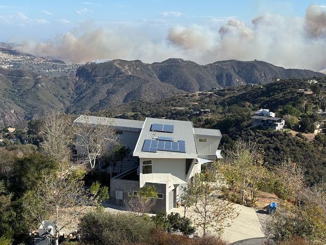
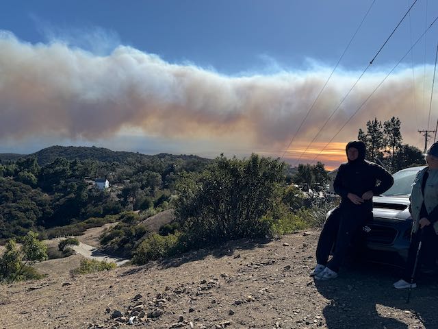
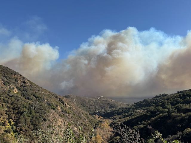
I exited at Lost Hills in Calabasas and headed south towards Malibu Canyon. Smoke was visible to my southeast (see photo above, looking SSE). Wind at this moment was just moderate, with gusts of only 20-25 mph in my vicinity. Surface observations are shown above for 10 a.m. (just before the Palisades fire started) and for 2 p.m. The peak of this wind event would be towards mid-evening, though, so conditions would worsen. I decided to head up Piuma Road to the Saddle Peak area, along the ridge of the Santa Monica Mountains. I could get a good look at what was happening from up there. By this time Tanner and I knew that meeting up was not going to happen. He said that traffic around PCH and Sunset was insane, and that he would just try to get as close as he could on the east side of the fire, perhaps by taking a bus.
Tanner wound up at a friend’s home in the fire’s path. They tried valiantly to protect the property, but had to abandon the attempt as a firestorm was upon them. Tanner’s video of the escape wound up on national news, and he was interviewed live on cable TV on the following day!
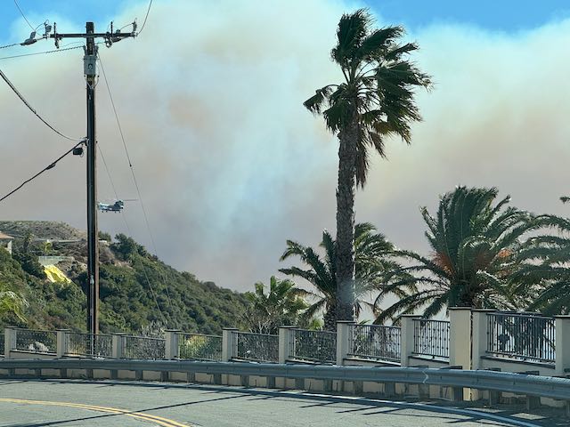
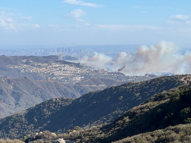
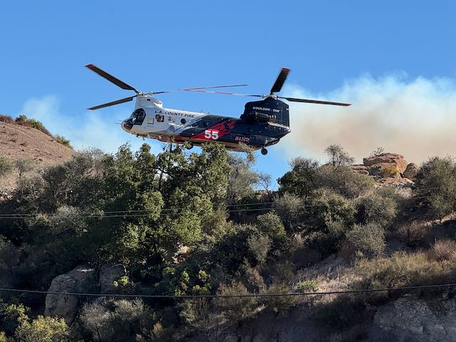
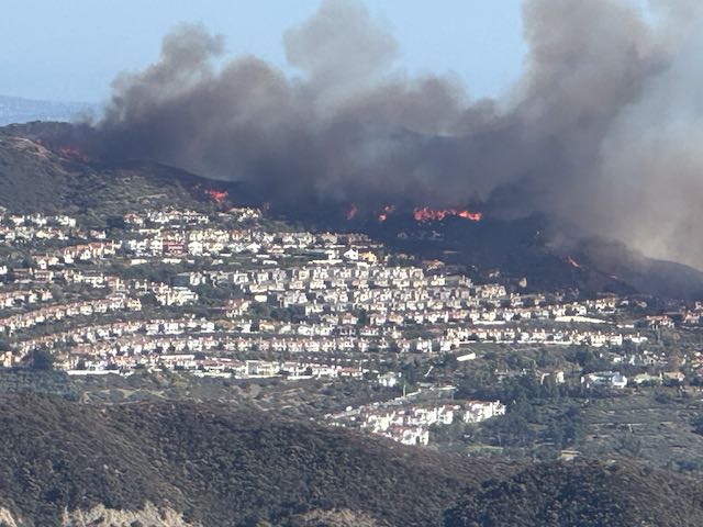
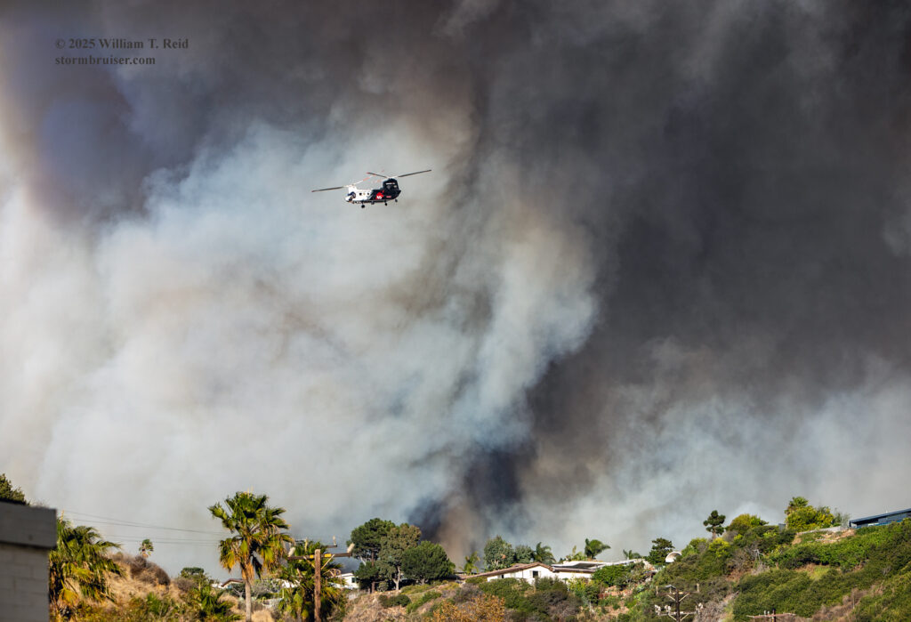
My decision to head up to Saddle Peak wound up pretty good. From a spot on Saddle Peak Road (just above Tuna Canyon Road) I had a great overview of the fire and surrounding landscape. Flames were along the eastern edge of a large residential area. I was up at this spot for close to an hour. A couple of LAFD helicopters were nearby, grabbing water from a tank on a hilltop and returning to the fire. The wind up here was getting a bit fierce at times, with dust swirling through.
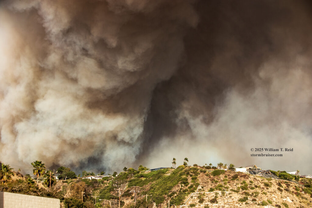
Below are images and video from Saddle Peak Road, taken from about 12:30 to 1:30 p.m. I have separated the Canon images (first) from the iPhone images (later).
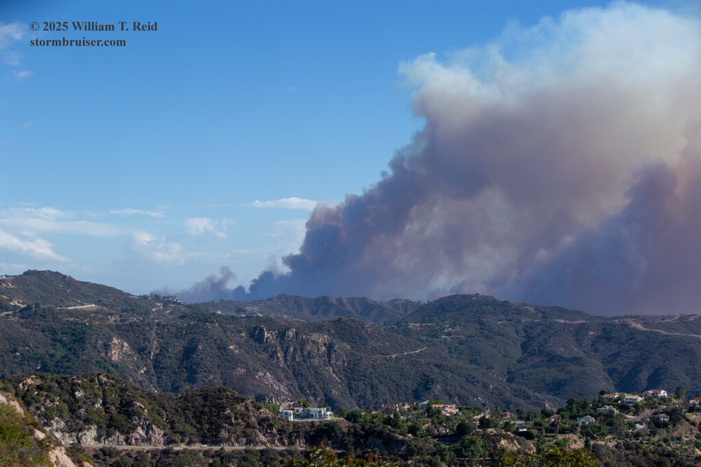
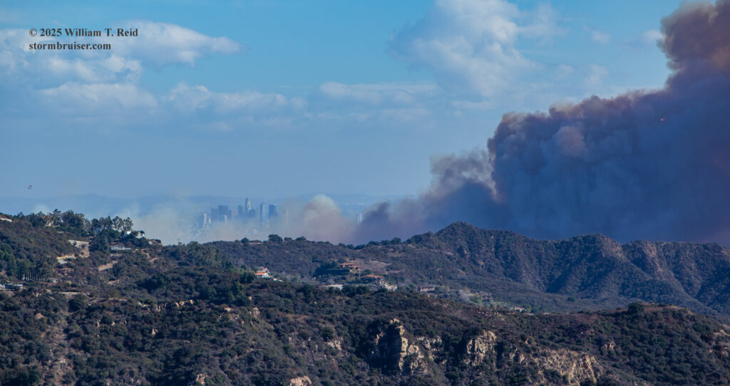
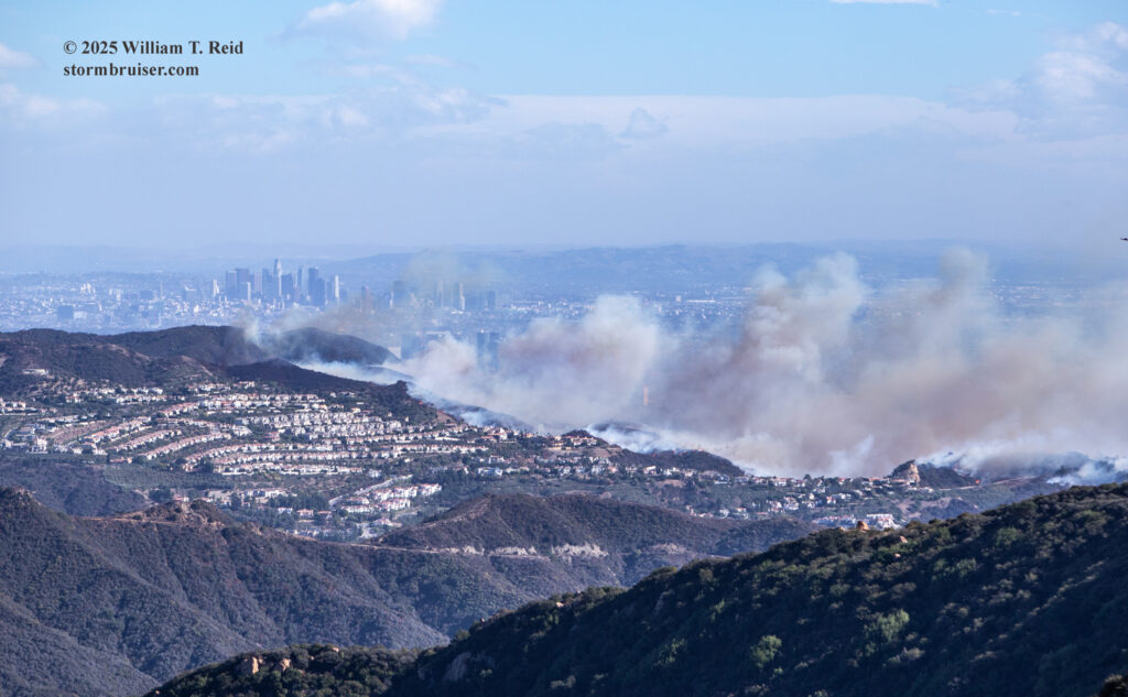
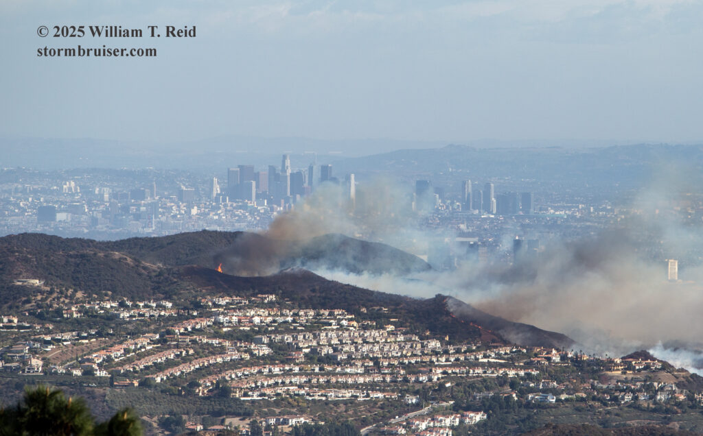
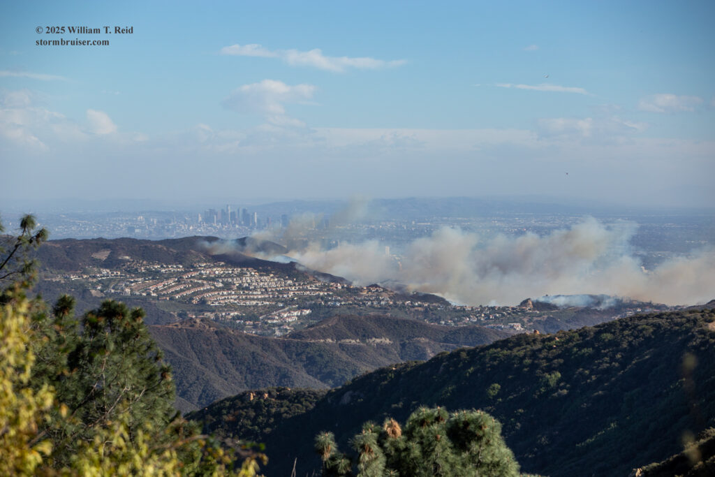
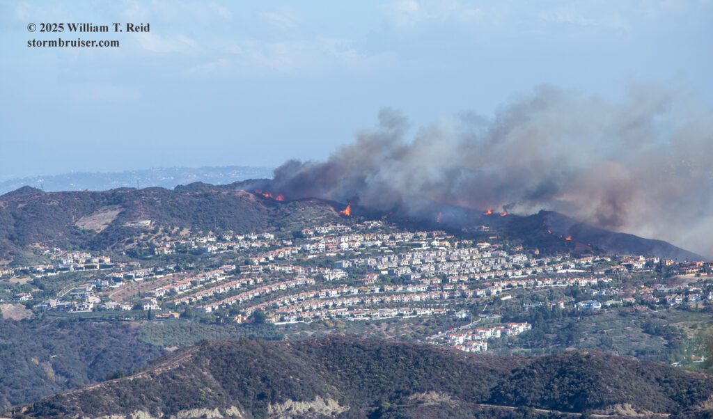
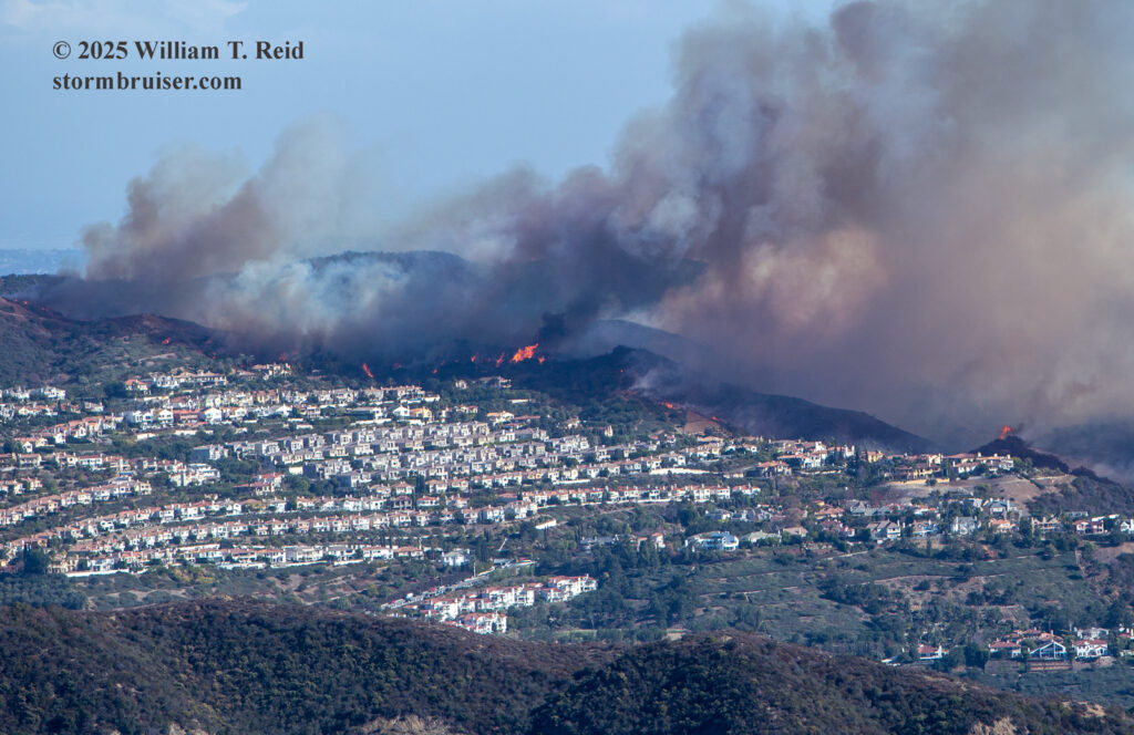
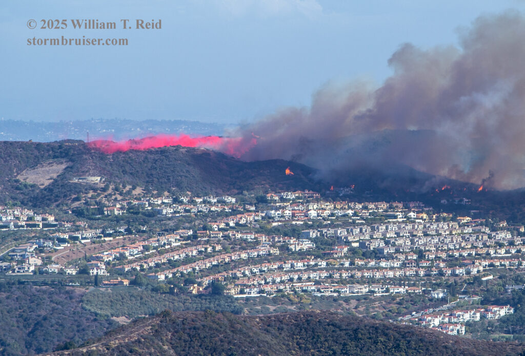
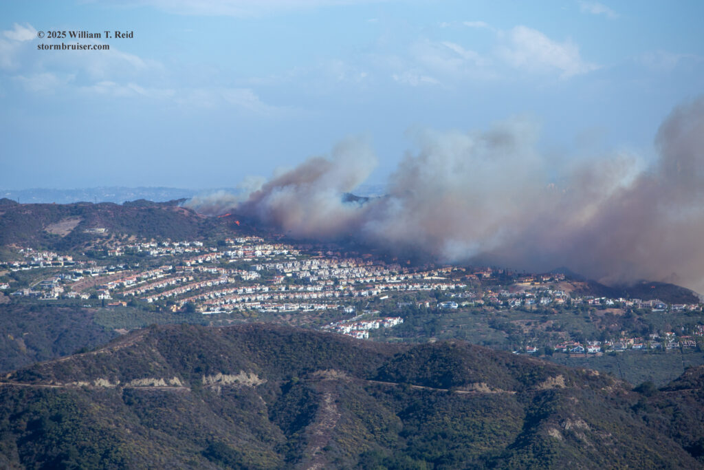
The views above are primarily towards the east, showing the fire on the east side of the northern portion of Pacific Palisades (called the Palisades Highlands). Wind is blowing the smoke and ash and embers towards the SSW and SW for the most part (left to right). At 1:00 p.m. the fire was confined primarily to the upper portions of Pacific Palisades. But by 2:30 p.m., areas on the west side of Pacific Palisades, near the eastern edge of Topanga Canyon and on the north side of the Parker Mesa were ablaze.
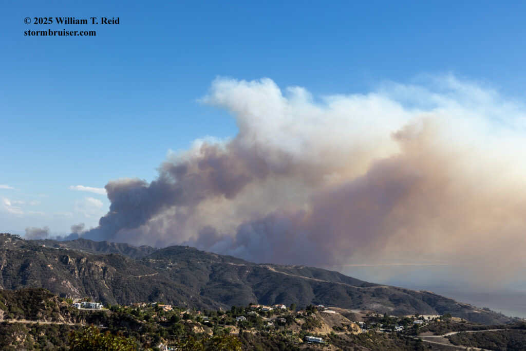
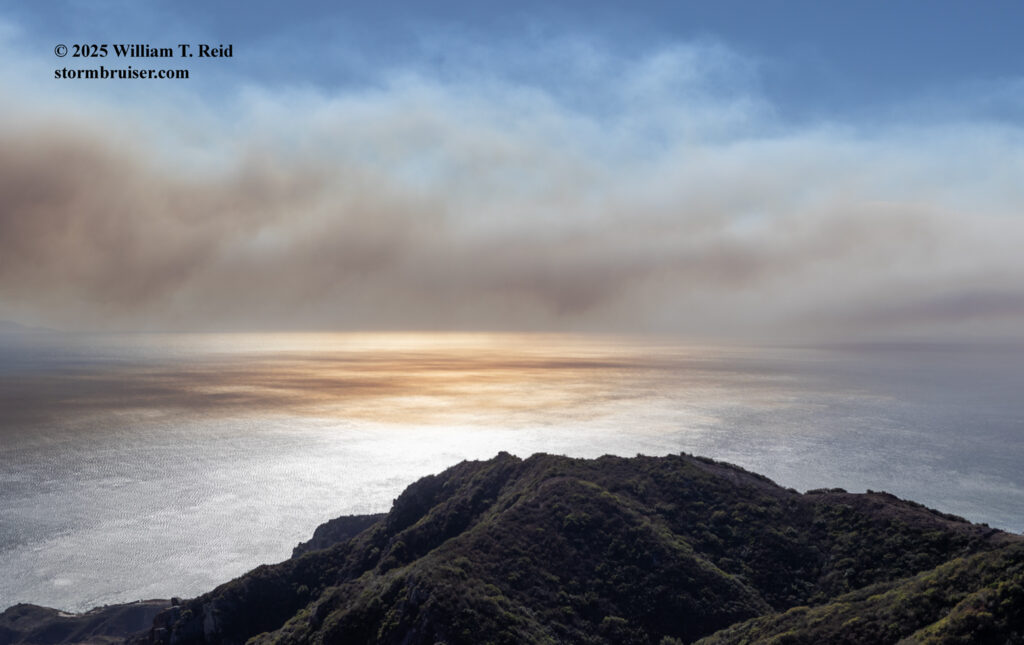
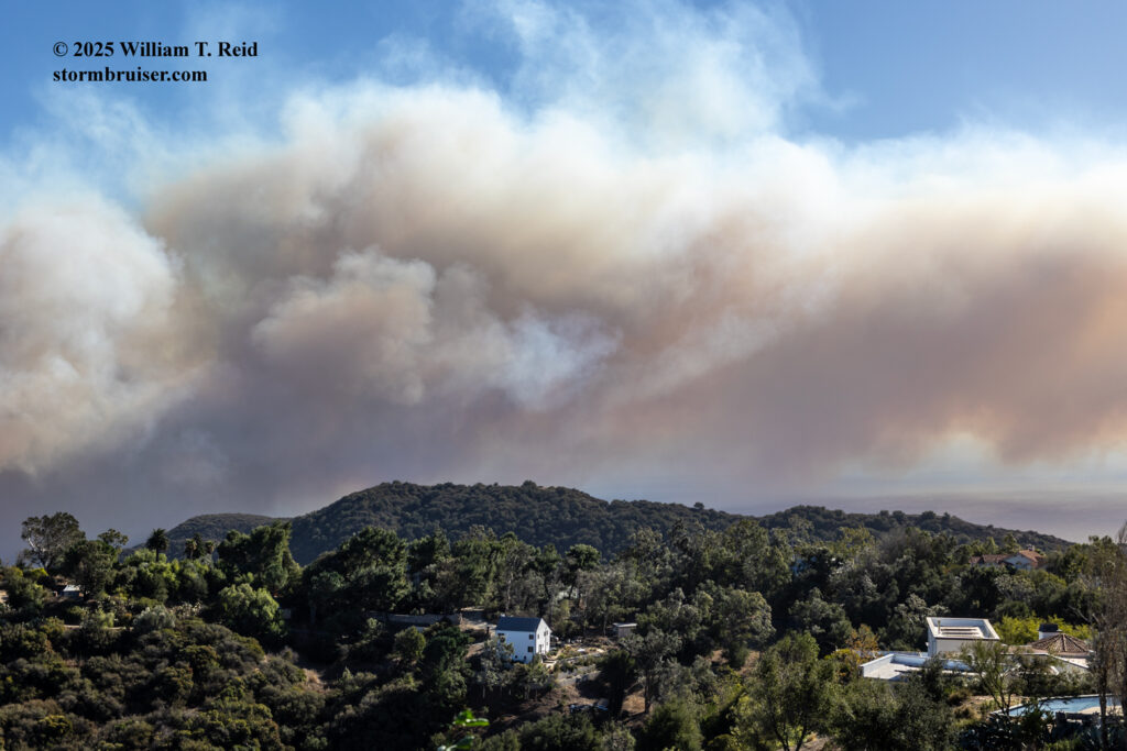
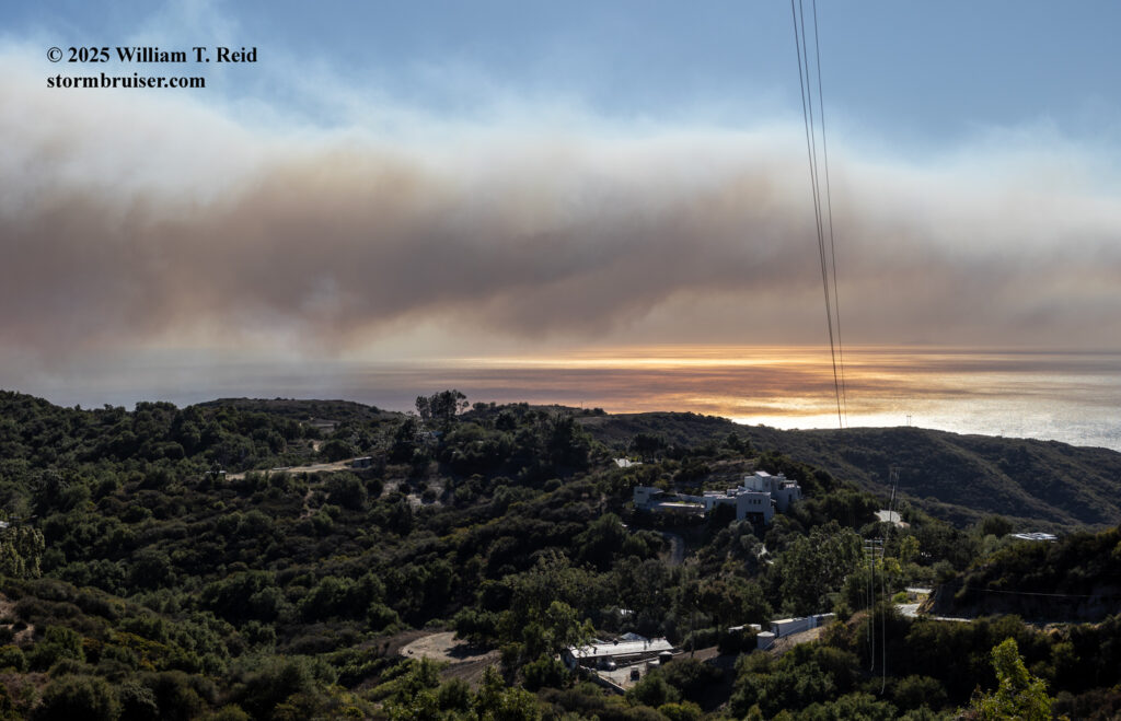
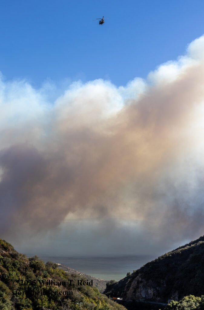
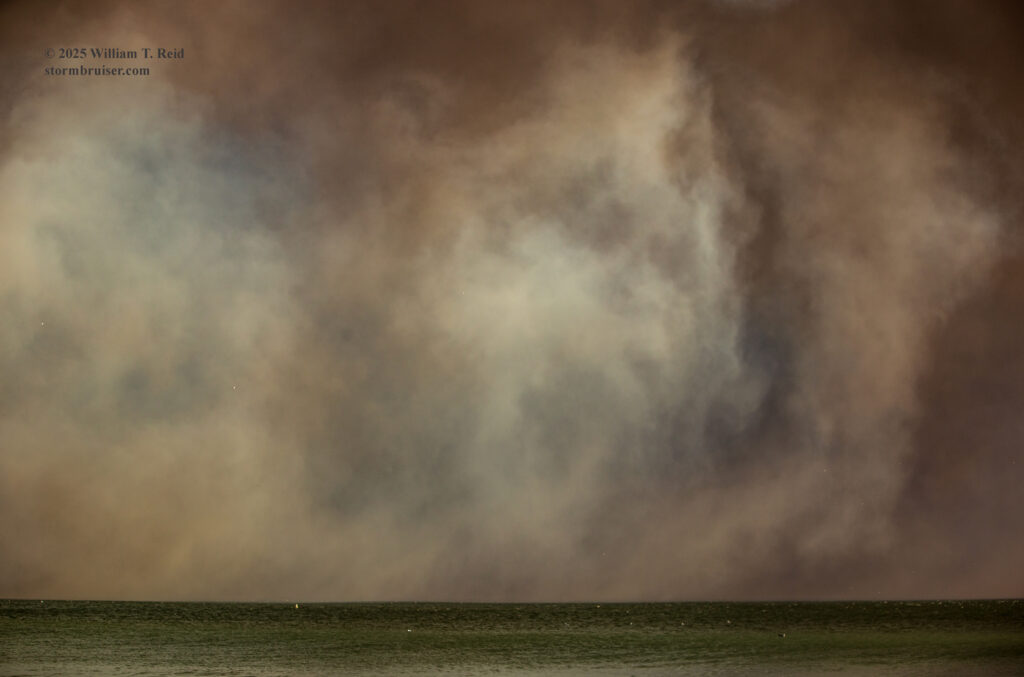
(Above) Some views towards the south of the smoke-covered Pacific Ocean and Santa Monica Bay.
Various iPhone pics in the group below from Saddle Peak Road prior to 1:30 p.m.



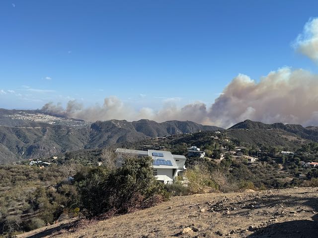
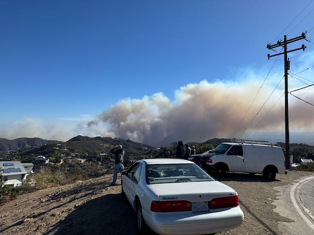
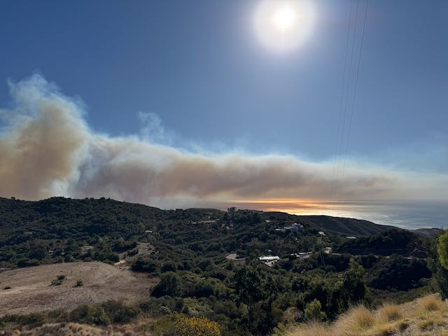
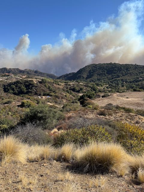
And, a few of my iPhone video clips below from Saddle Peak Road.
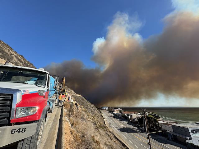
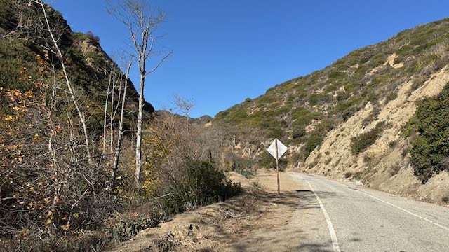
Around 1:30 p.m. I decided to make my move to get closer. One possible route for me was down into Topanga Canyon via Fernwood and Wildwood. From there I could take Topanga Canyon Blvd. (California Route 27) to PCH. But, I was a little uneasy about being in that deep canyon with a fire nearby with these strong winds blowing. (There was also the possibility that police weren’t allowing traffic down 27 to the coast, but I didn’t think about that at the time!) Fortunately, there was another road nearby which could get me to the coast and PCH: Tuna Canyon Road. I made a right turn off of Saddle Peak Road and followed Tuna through the narrow canyon. I had never been on this lightly-used road before, and it was quite lovely! But, consternation levels increased as I came up to a segment that was one-way only. Yikes — I was not aware of this one-way business! Fortunately, the only way permitted was downhill. I didn’t see any other vehicles along Tuna Canyon Road, and I reached PCH just before 2 p.m. The smoke plume was still to my east through south here at the bottom.
The iPhone pics in the group below were taken around 2 p.m. at Tuna Canyon Road and PCH. Most of the homes shown in these shots burned down completely later on the 7th.
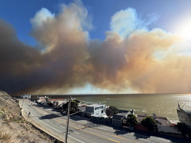
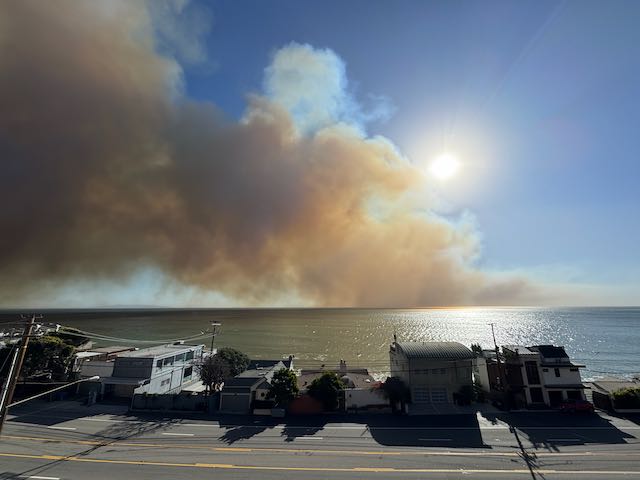
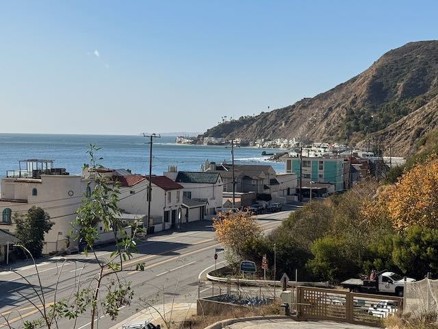
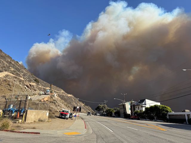
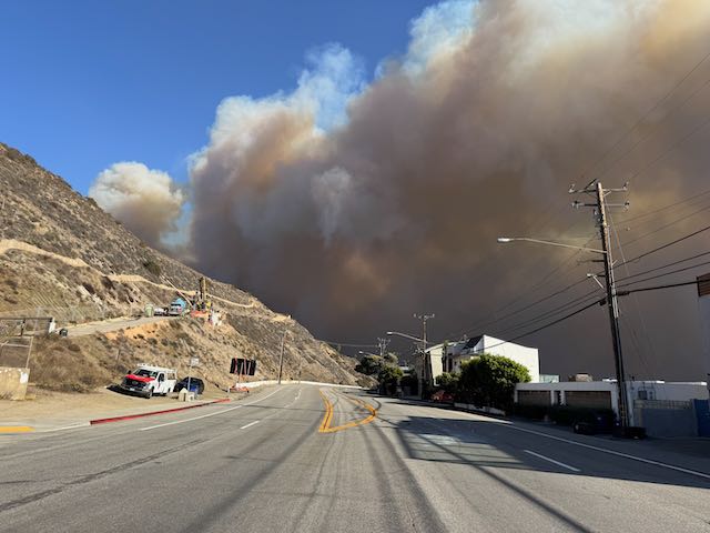
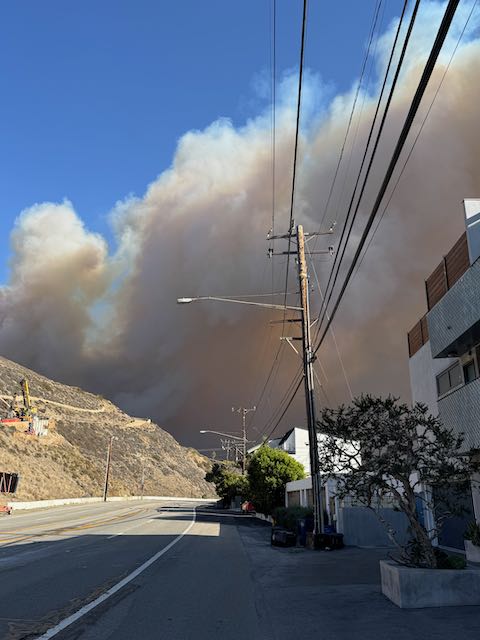
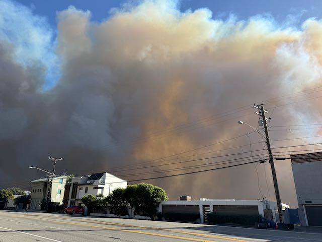
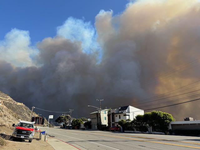
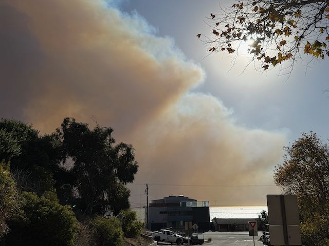
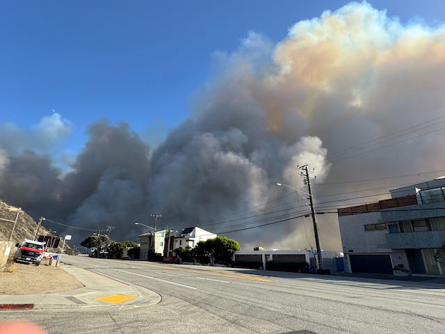
Below are a few straggler shots. The last one (on the far right) is a zoom down PCH towards the east, showing distant buildings across the bay towards Santa Monica. At this point in time, a little after 2 p.m., PCH was empty for the most part. Law enforcement must have had the highway closed a little to the west, perhaps at Las Flores. It is a little surprising to me that a stream of vehicles was not escaping the fire by using PCH and heading westward towards Malibu.
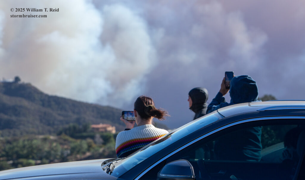
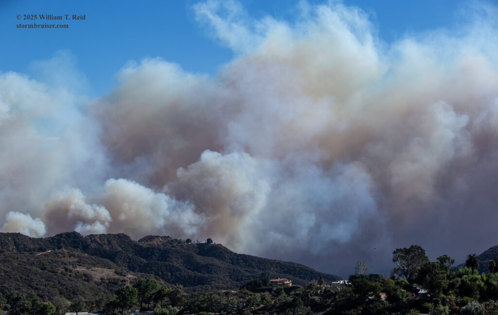
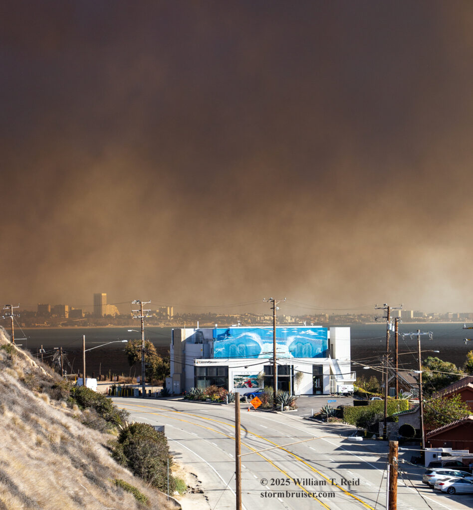
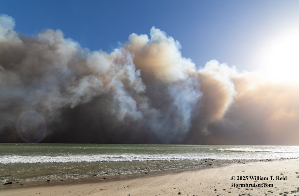
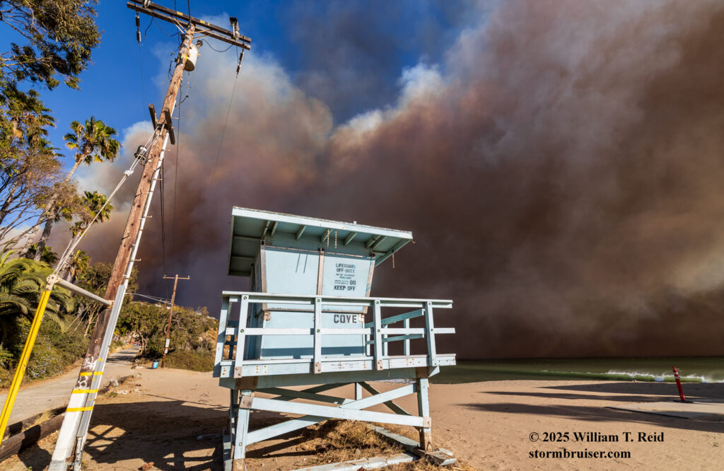
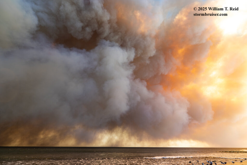
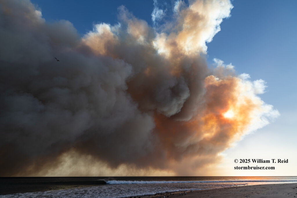
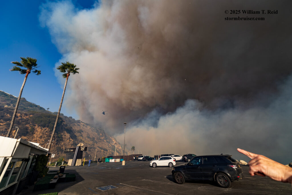
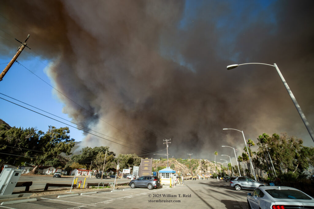
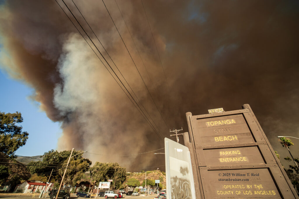
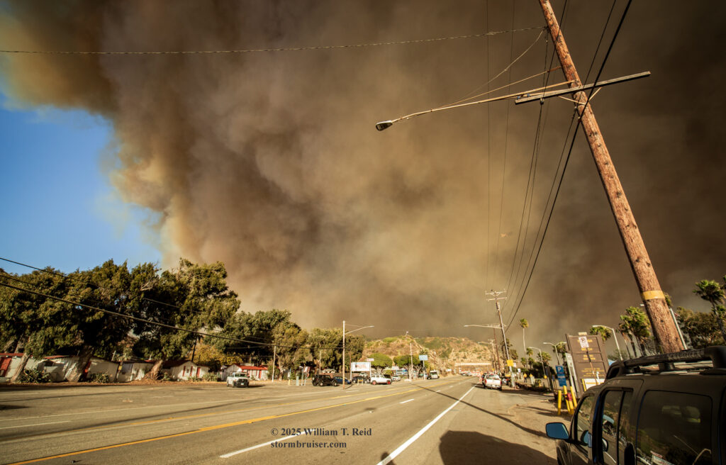
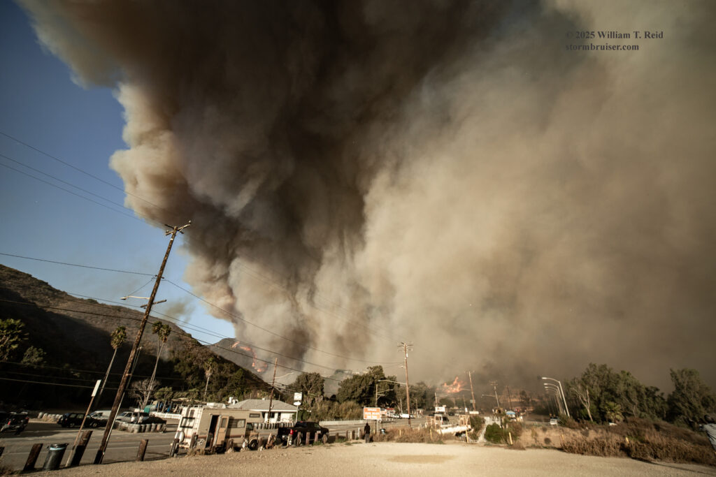
From this position I did not have a good view of the area that was burning. I headed eastward on PCH and quickly came up to Topanga Beach and Topanga Canyon Road. Continued progress to the east was blocked by the police. The wind was strong here, and very heavy smoke was hugging the ocean to my southeast and south. The contrast from bright and sunny blue skies against the dark pall of wind-swept Armageddon was stunning. I parked along the south side of PCH and made the short walk to the sand of Topanga Beach with a couple of cameras. I wound up shooting stills and video from this area from about 2:15 to 4:00 p.m. as the firestorm intensified a few miles to my northeast.
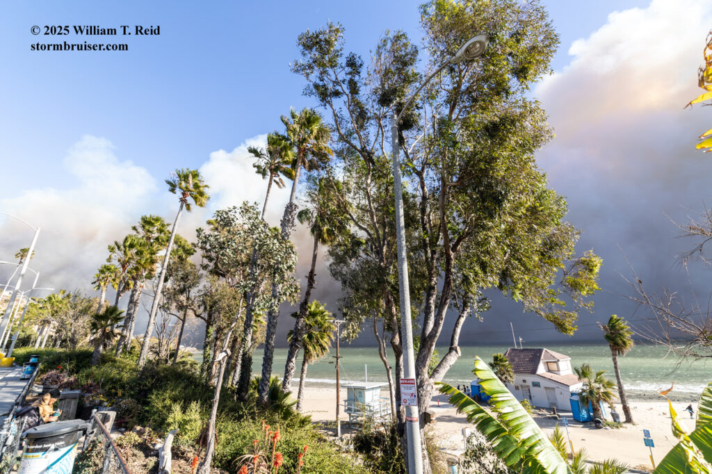
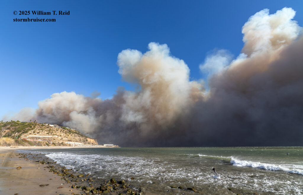
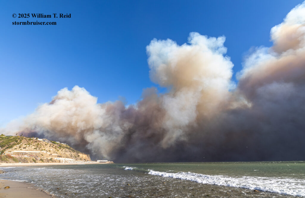
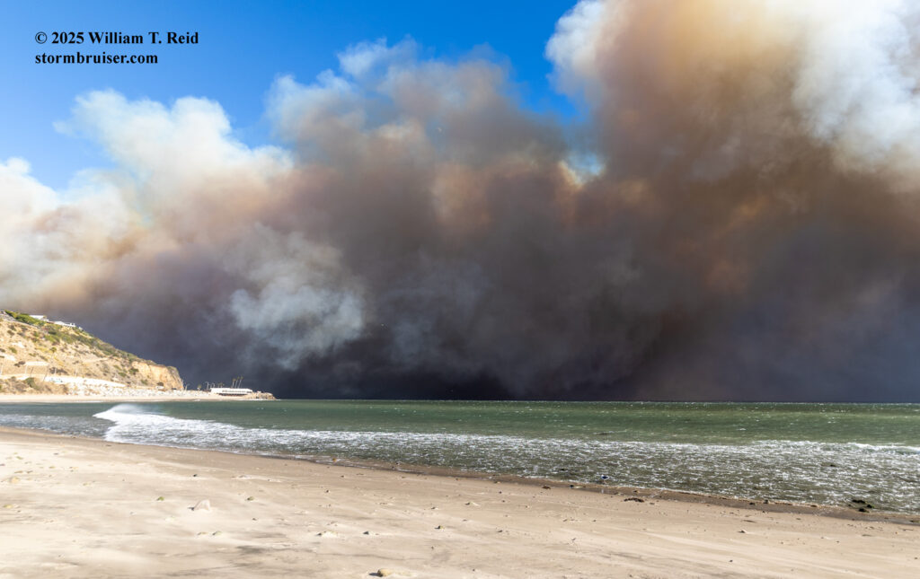
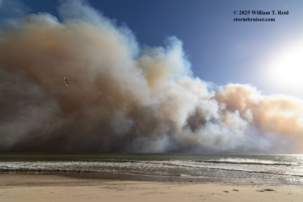
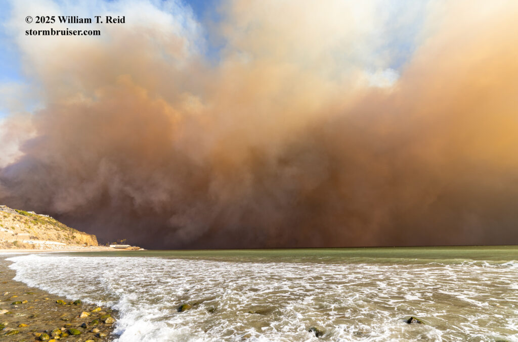
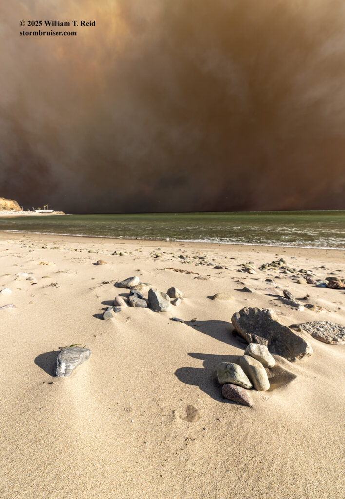
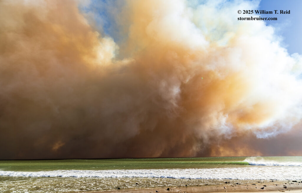
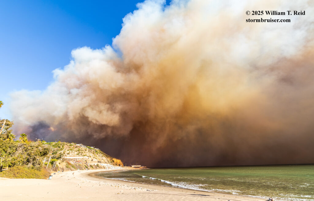
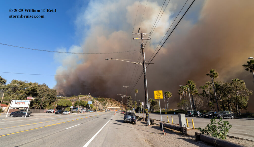
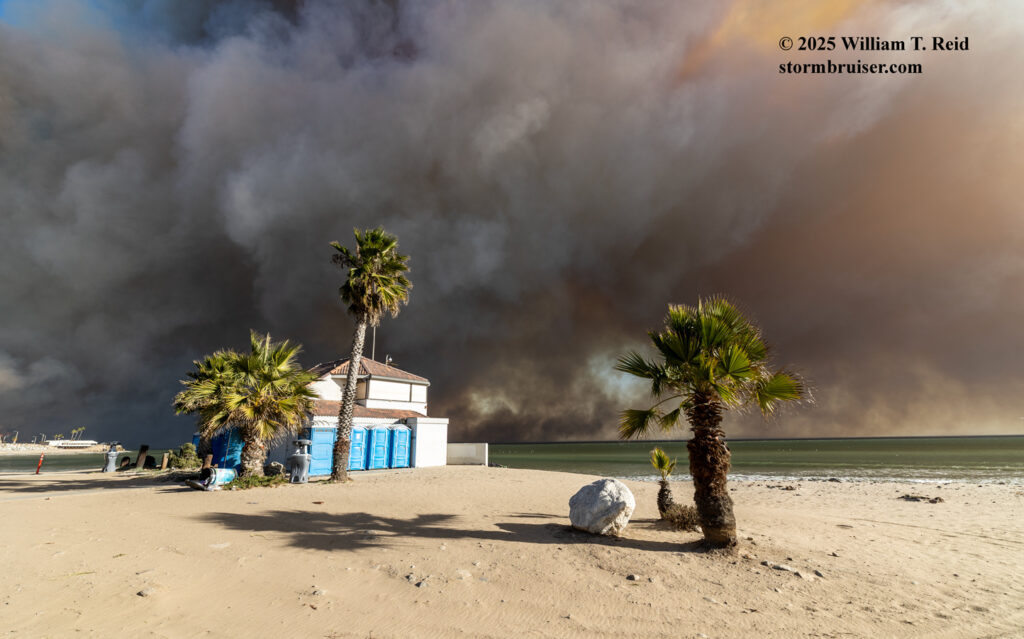
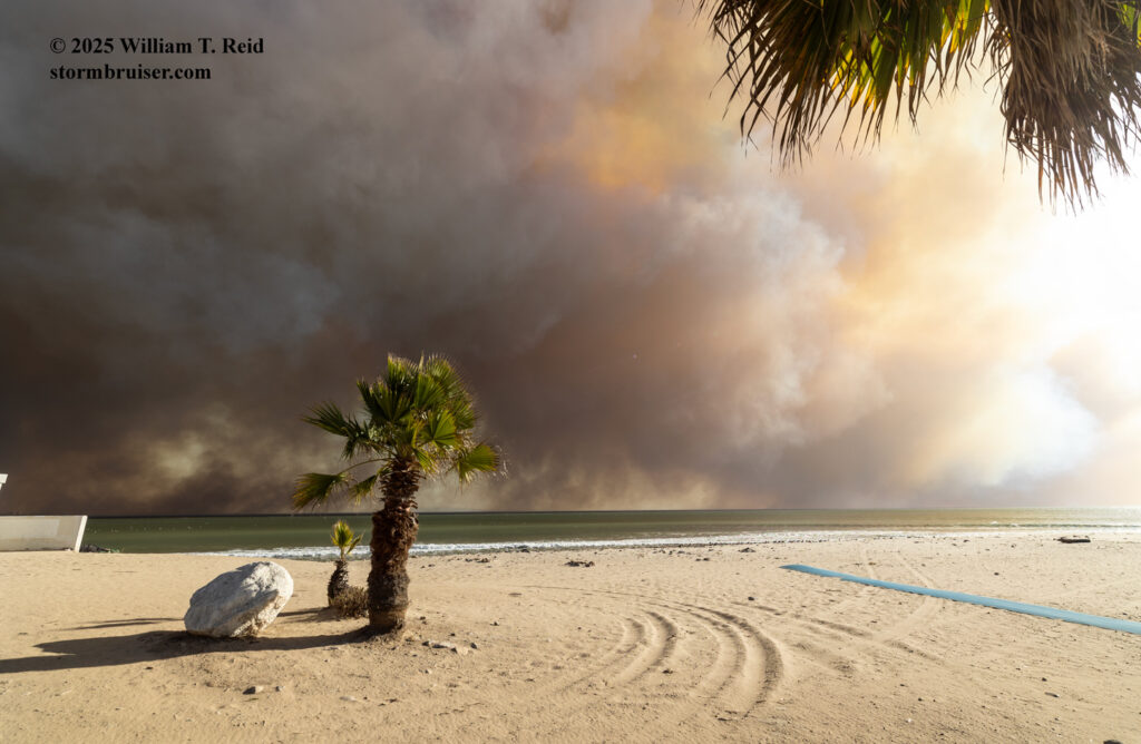

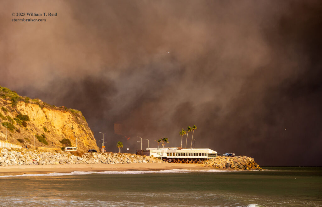
The white structure against the shoreline below is Mastro’s Ocean Club restaurant. Apparently it survived the firestorm!
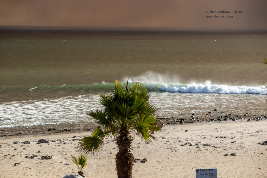
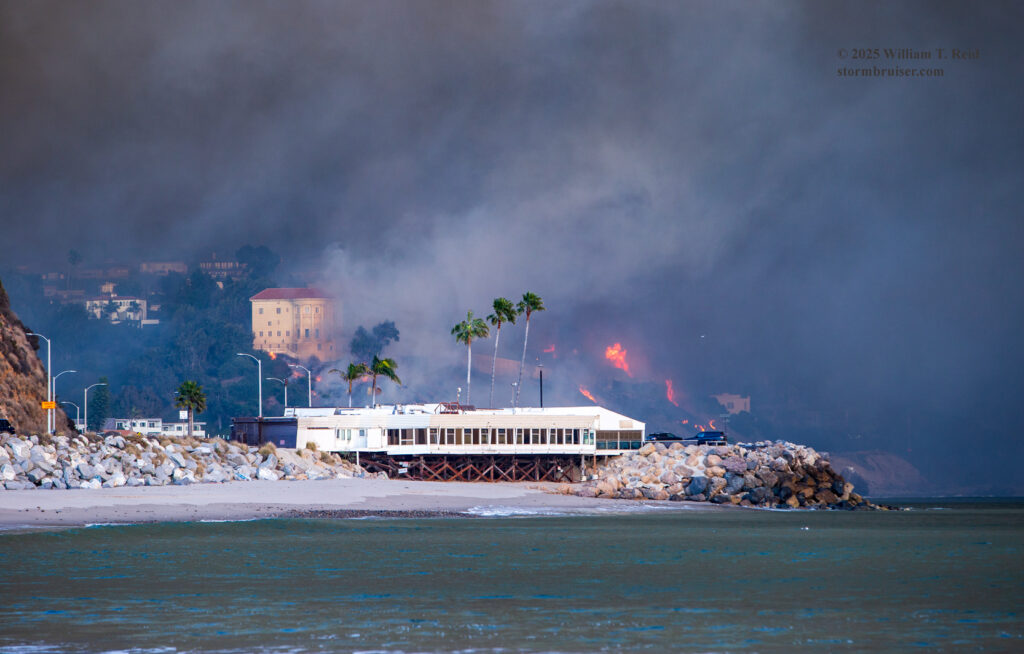
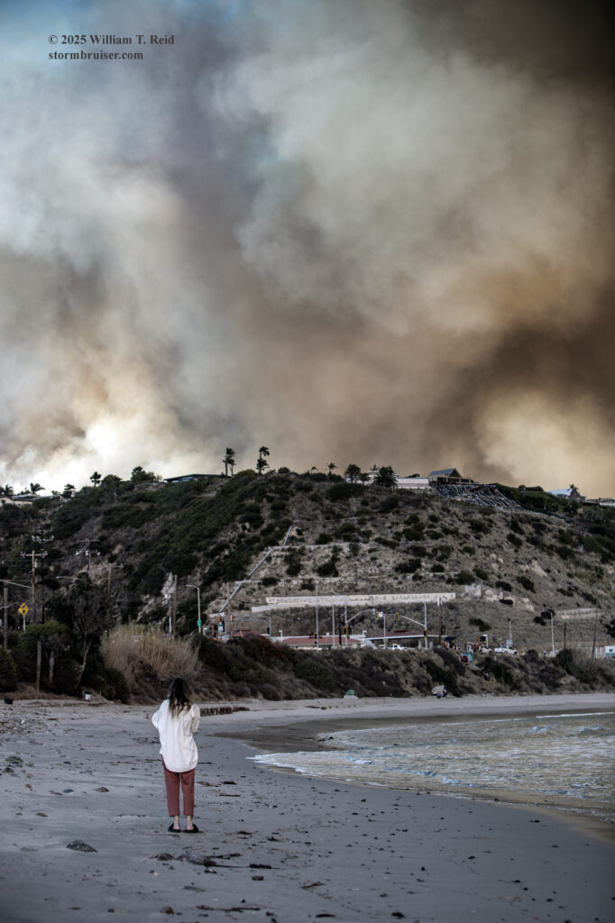
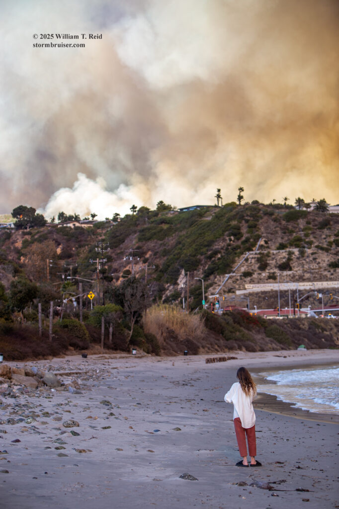
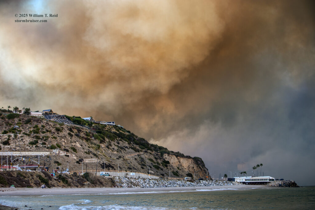
iPhone pics below, from about 2:15 to 3:00 p.m. My iPhone battery died around 3 p.m.
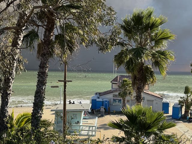

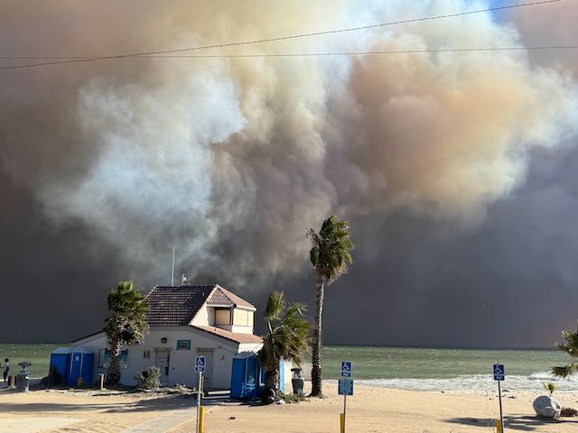
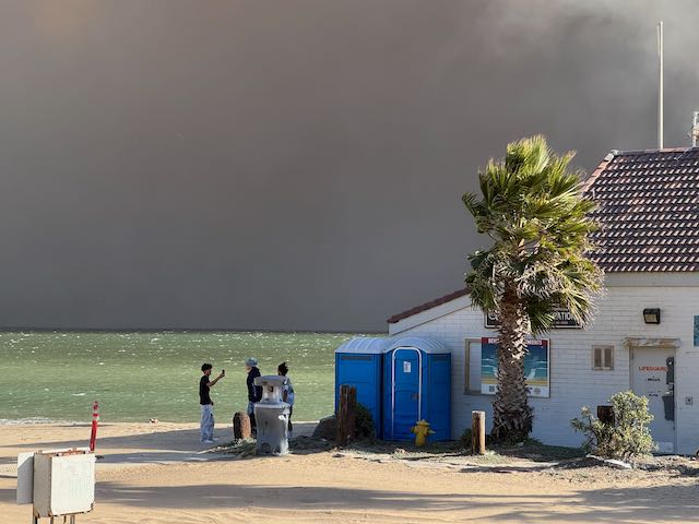
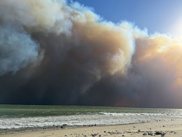
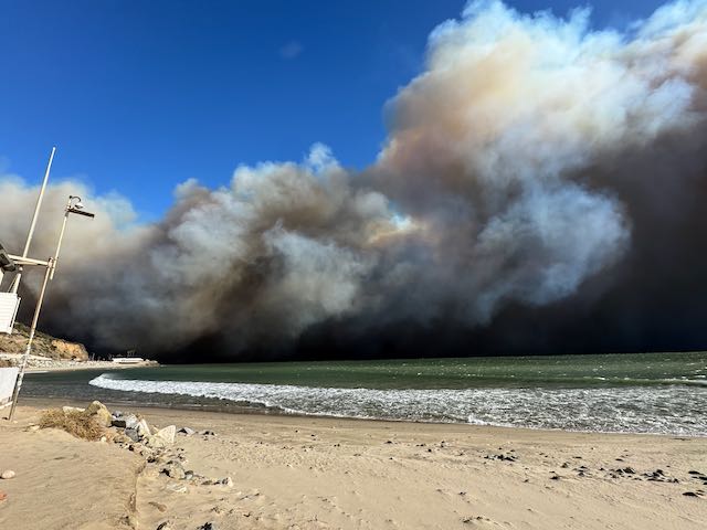
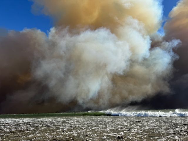
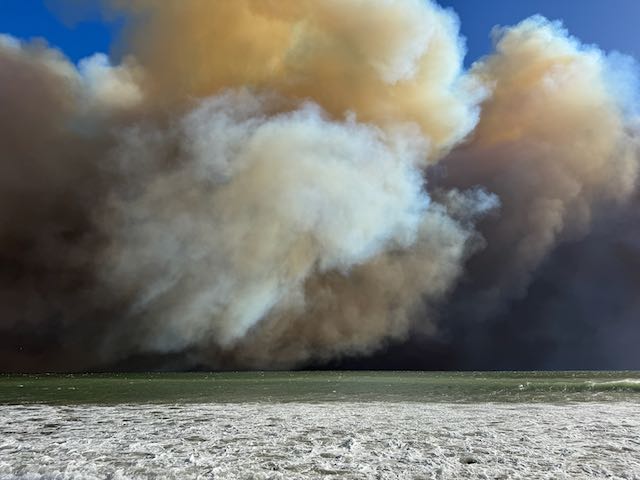
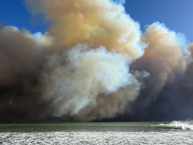
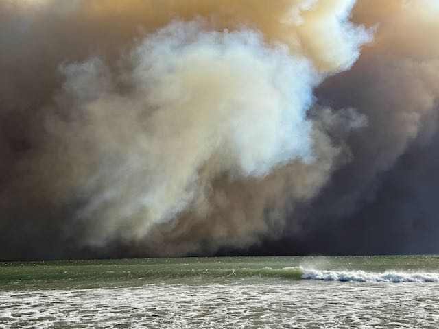
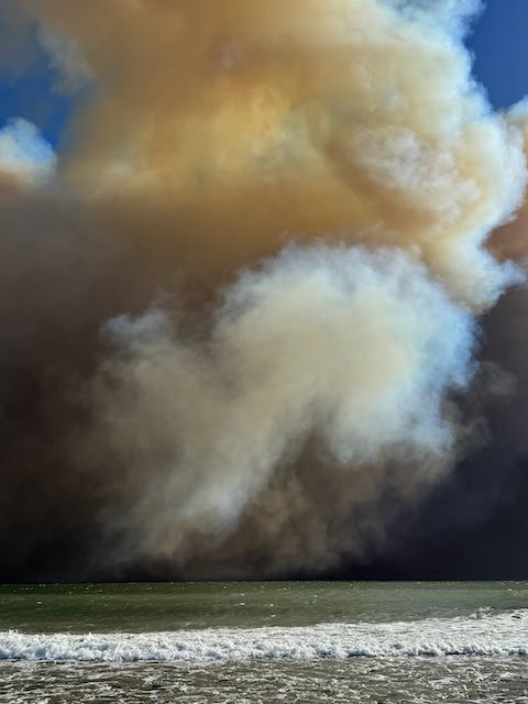

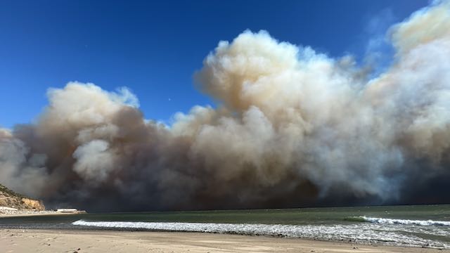
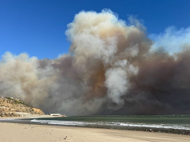
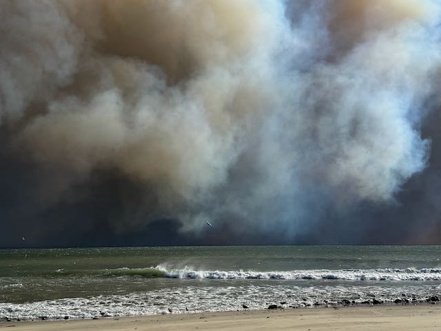
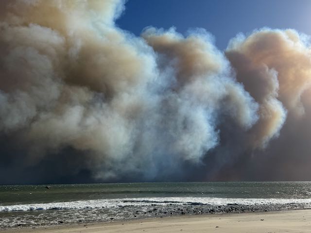
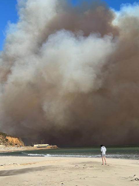
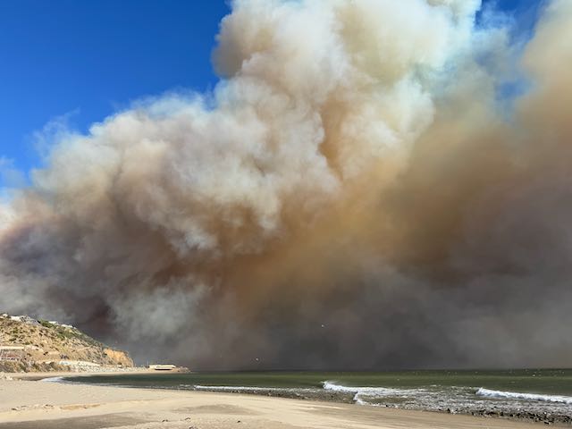

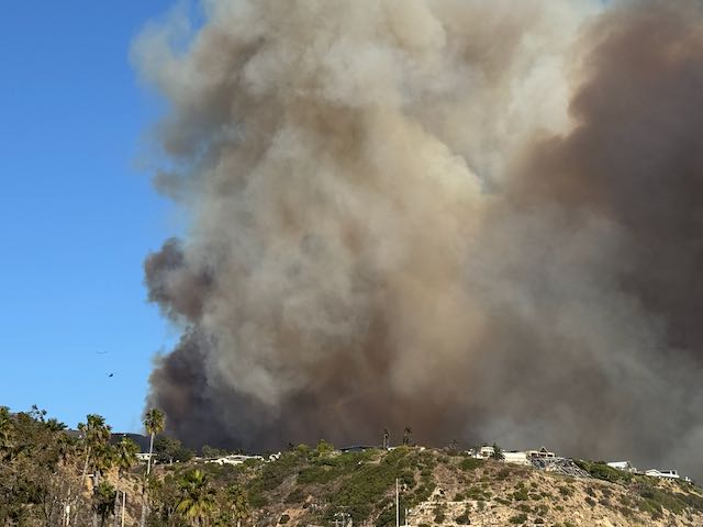
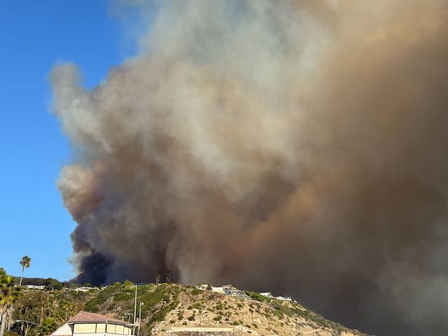
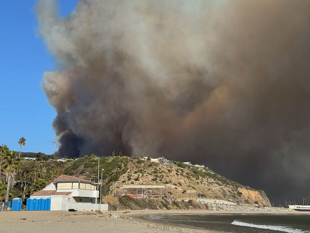
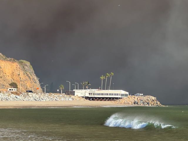
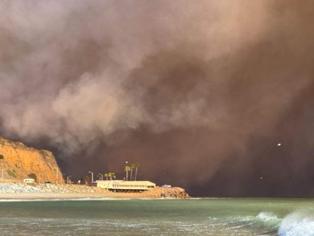
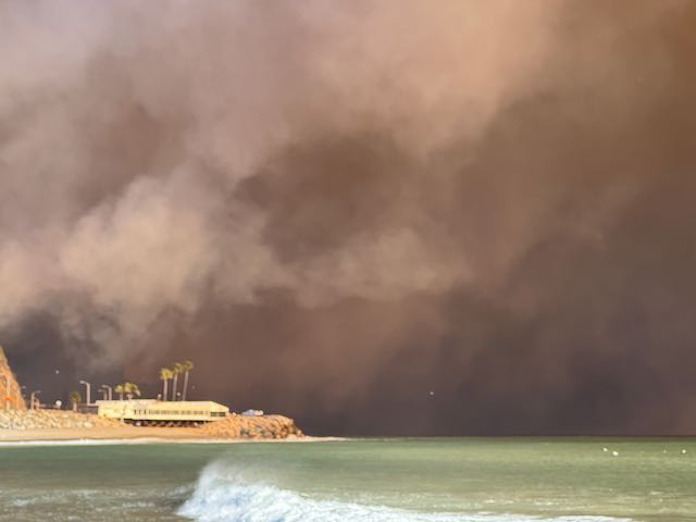
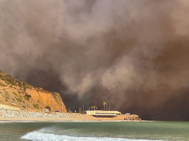
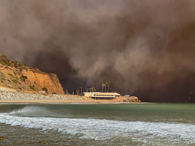
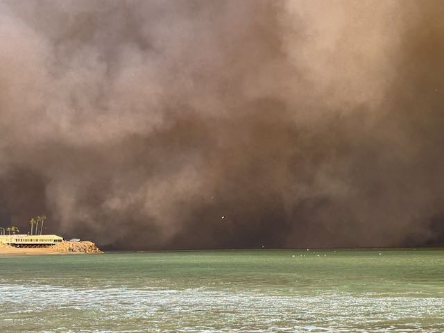
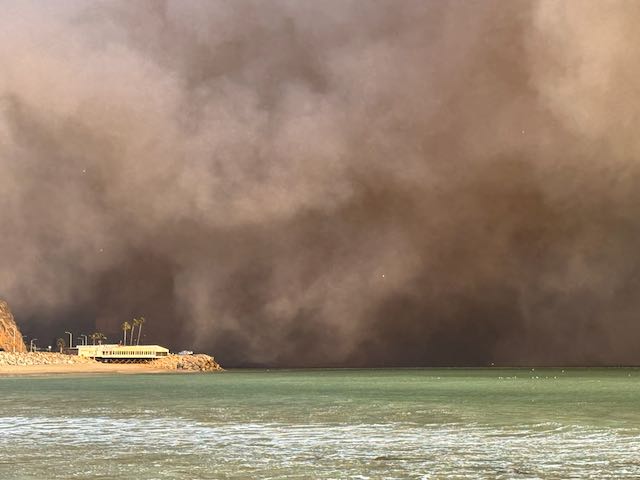
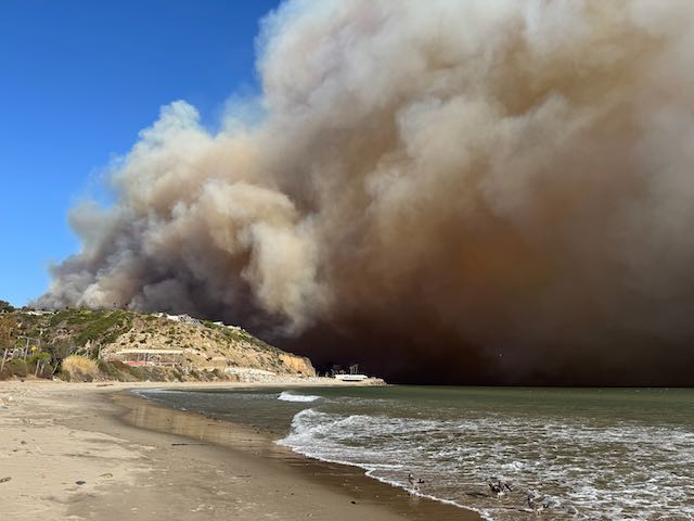
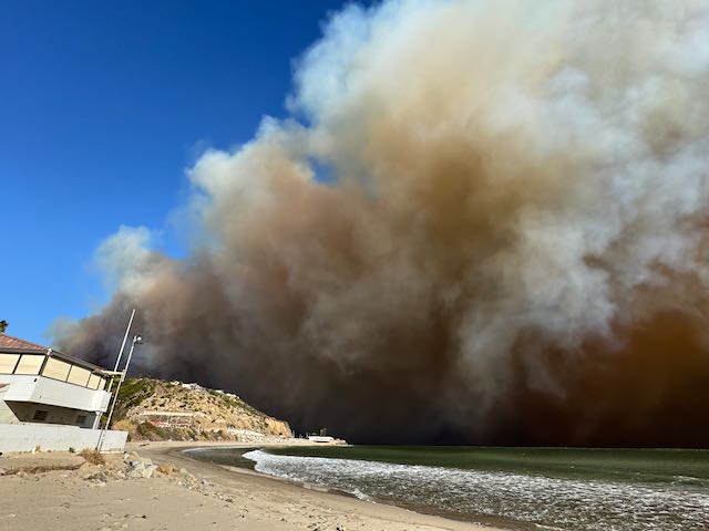
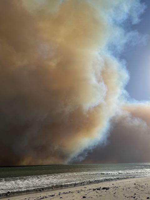
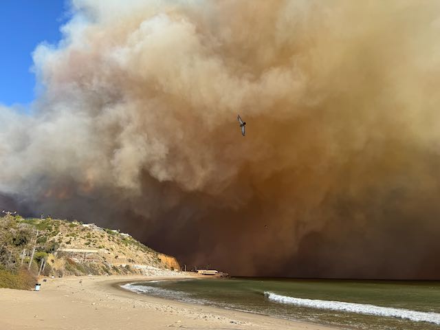
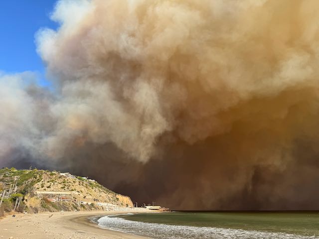

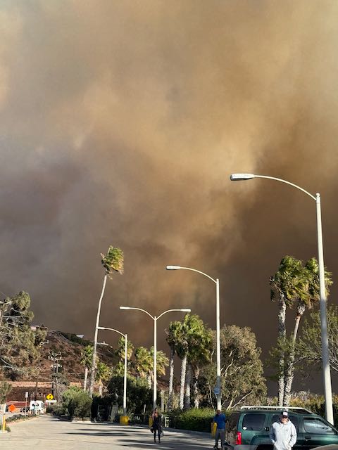
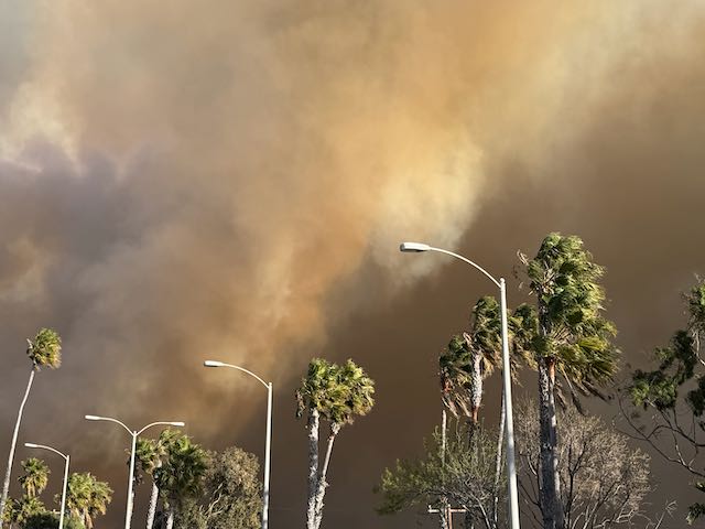
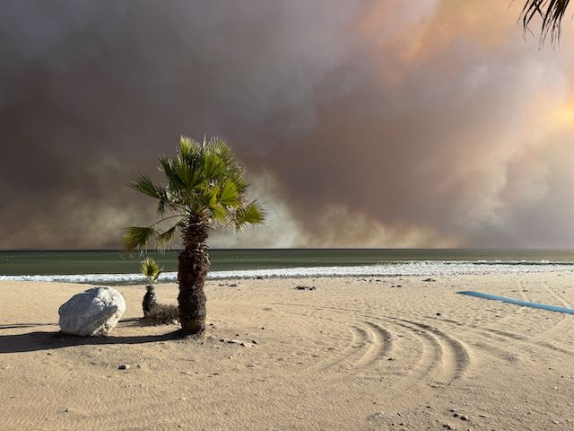
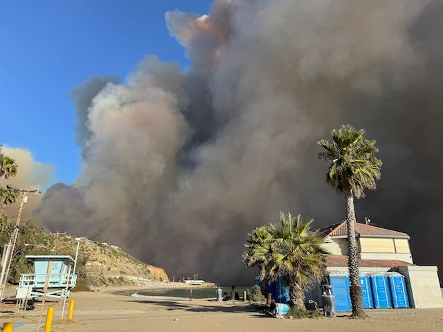
The six iPhone video clips below were shot from 2:15 to 3:00 p.m.
And, a few more iPhone shots below before the battery went dead.
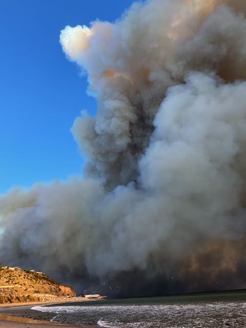
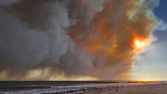
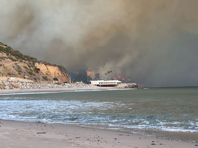
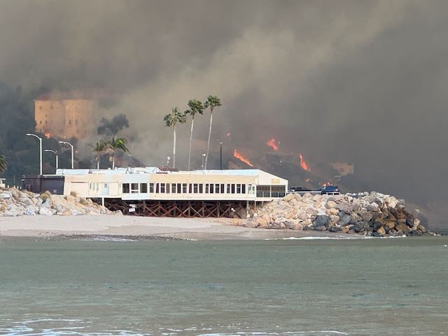
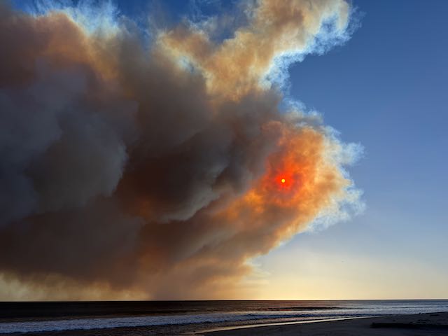
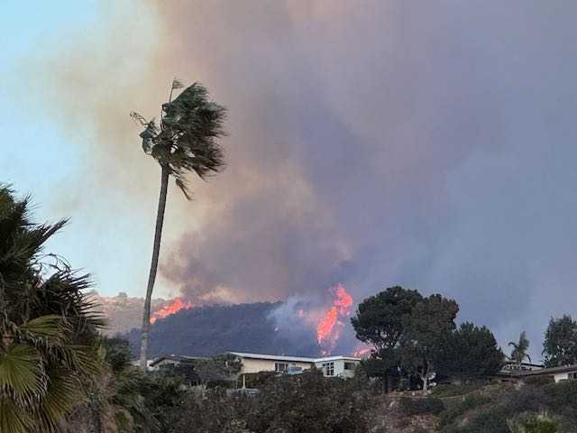
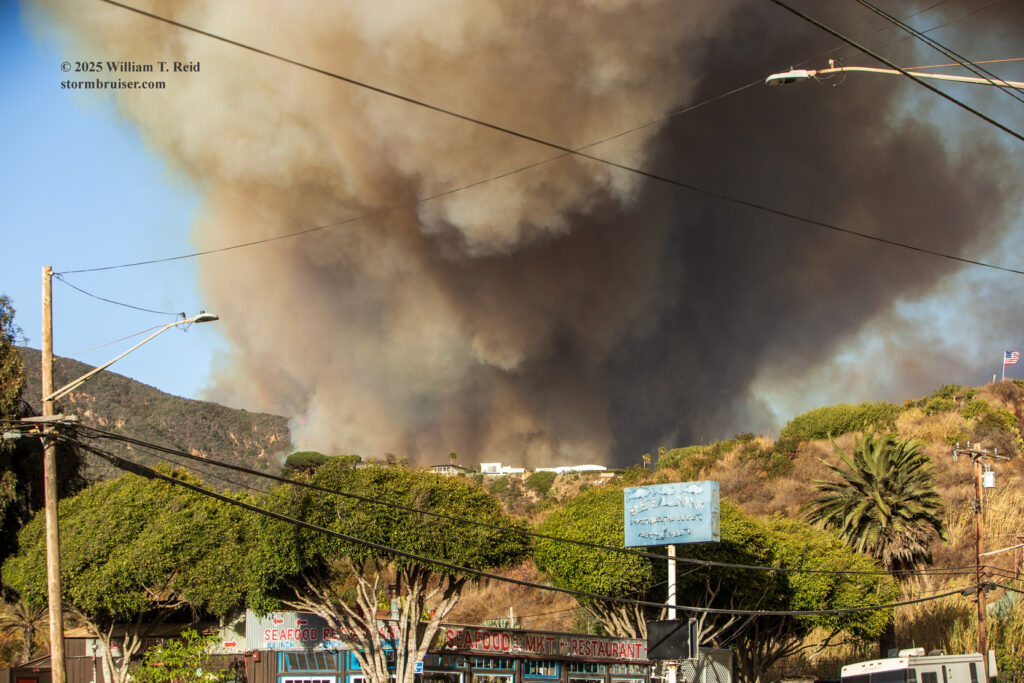
The remainder of the stills and videos (below) were with the Canon Digital SLR cameras, and were taken after 3 p.m. The bottom of the major smoke plume was still hidden behind the hill that was on the north side of PCH and just east of Topanga Canyon Blvd. Melissa, a fellow observer on the beach, joined me to walk up to Mastro’s in order to see what there was to see behind the little ridge. We took the scenic route along the sand, as the police probably would have shooed us back at Topanga had we been up on PCH. There wasn’t too much more to see from Mastro’s as smoke was hugging the ground just to the east…and seconds later smoke was blowing into our faces at the Mastro’s parking lot. I took a few pictures and then followed Melissa back to the lifeguard station.
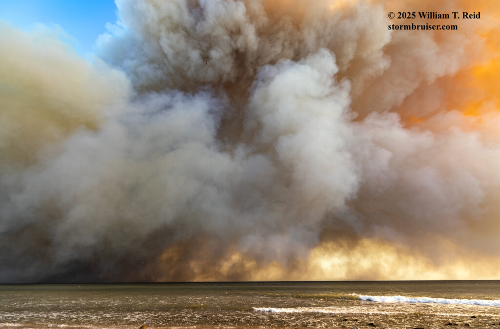
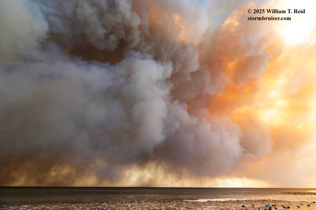
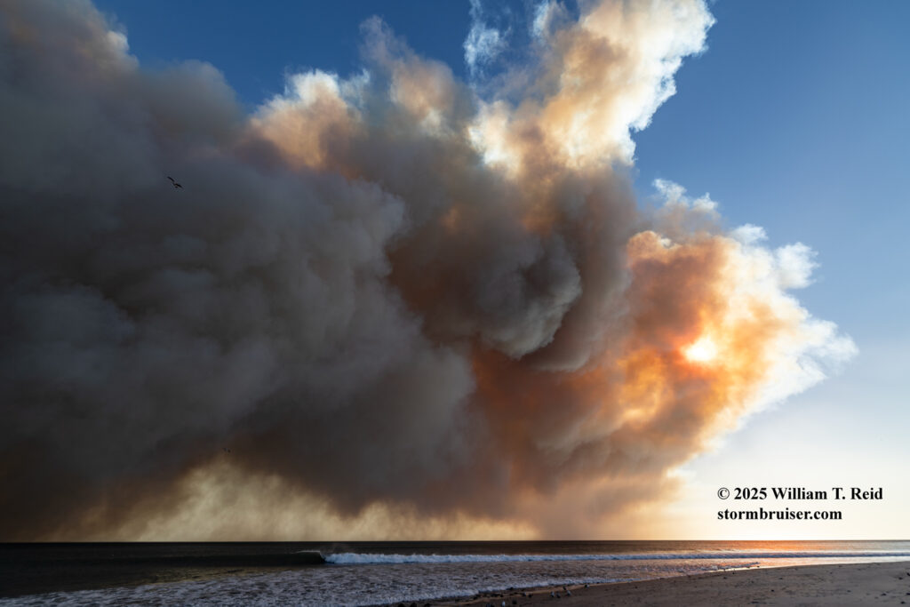
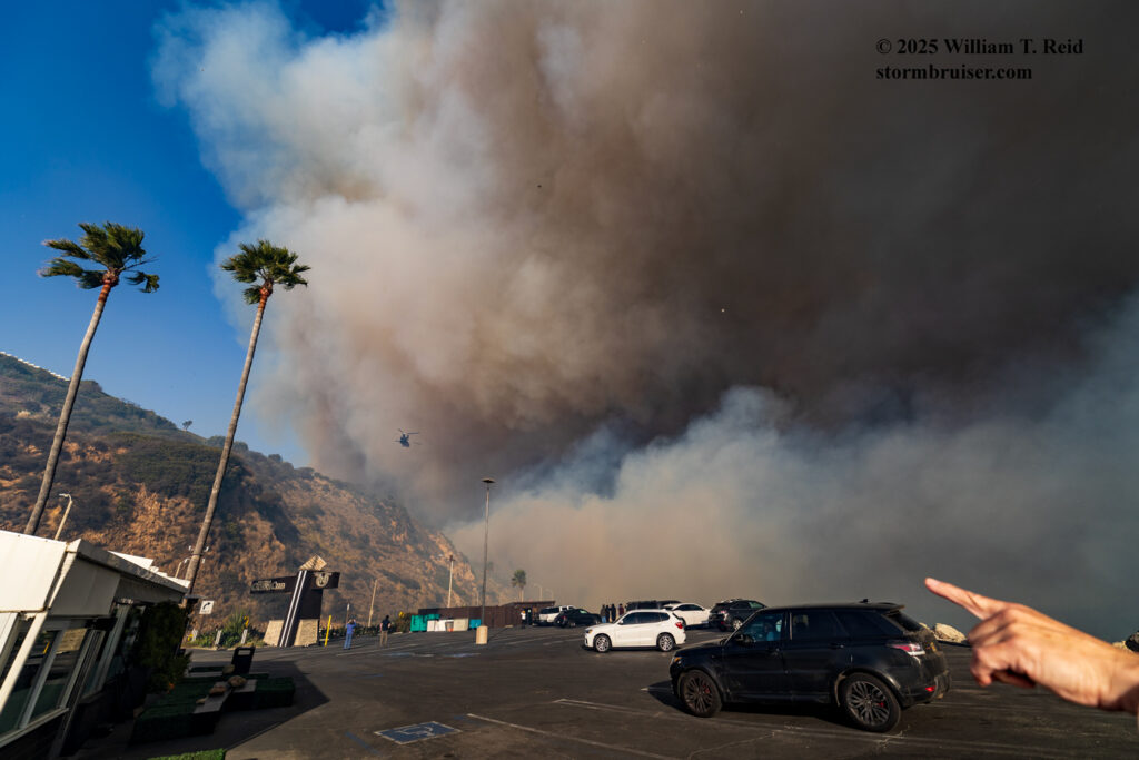
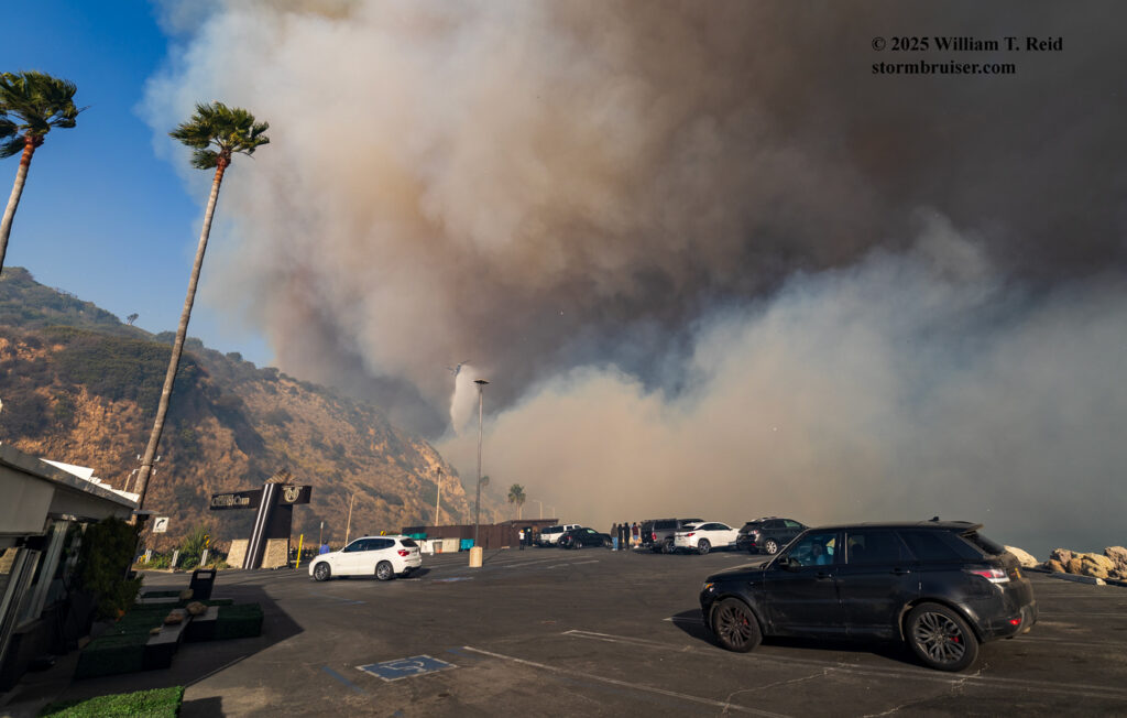
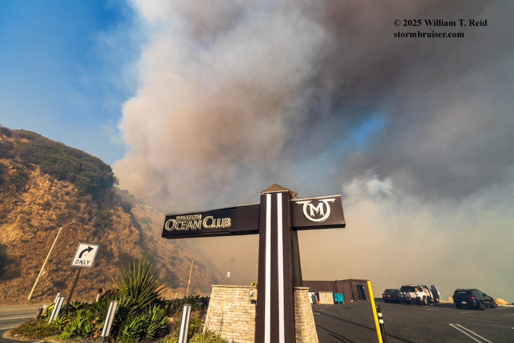
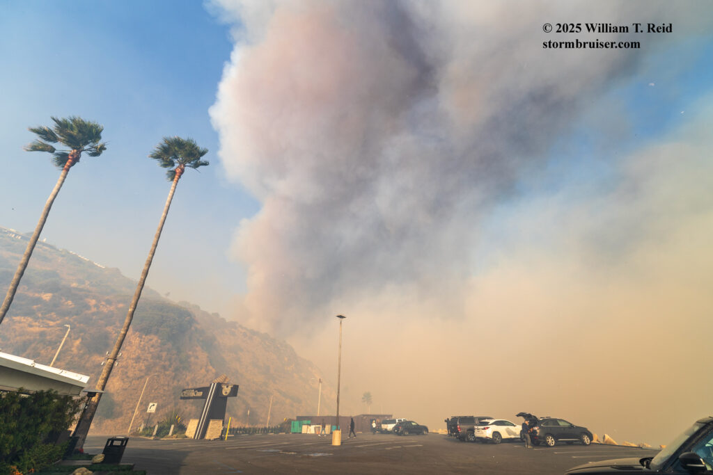
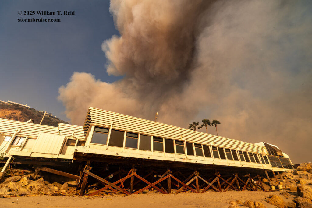
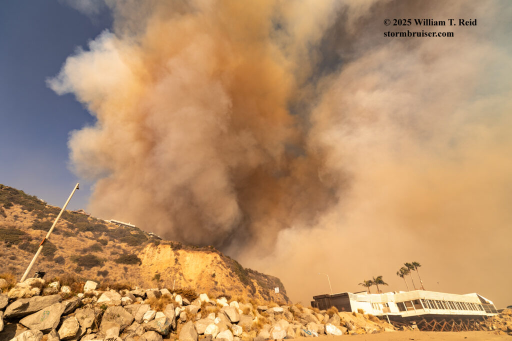
Back near the lifeguard station, I set the Canon with the wide-angle lens on the sand and let it run for a minute or two. These smoke plumes were showing some impressive rotation.
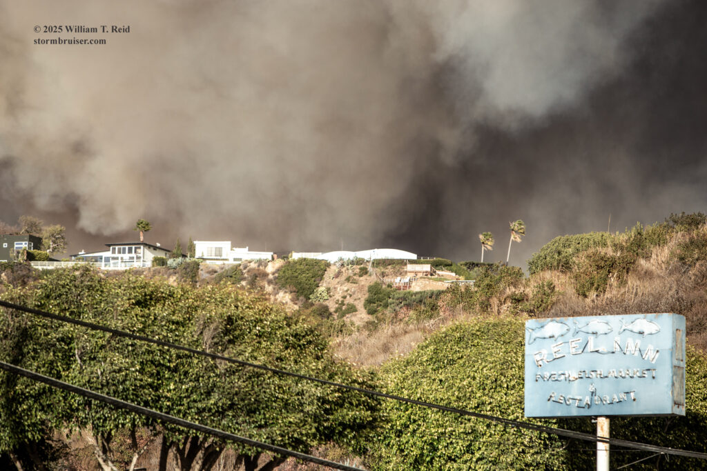
In the next few sets of images I was switching between the wide angle lens and the long lens. I went back up to PCH and took some shots of the signs across the street. The Reel Inn, the motel, the Cholada Thai restaurant…all would burn down within an hour or two.
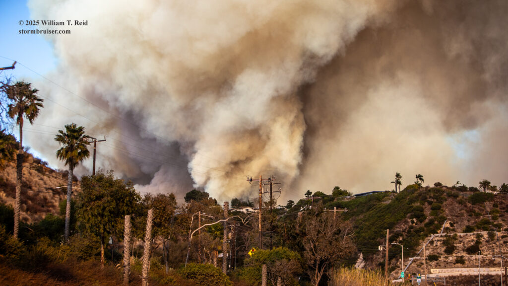
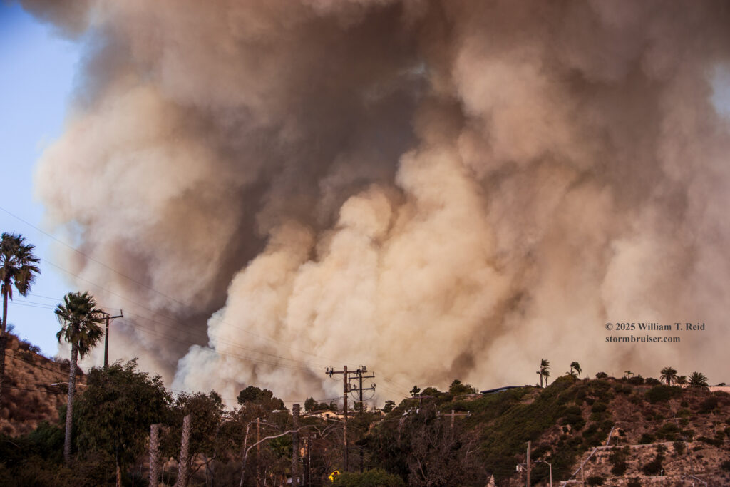
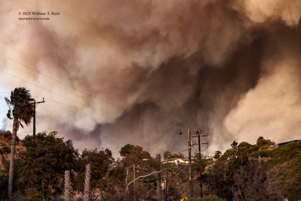
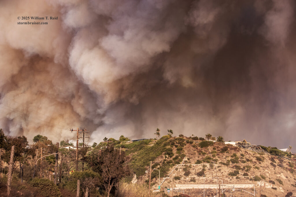
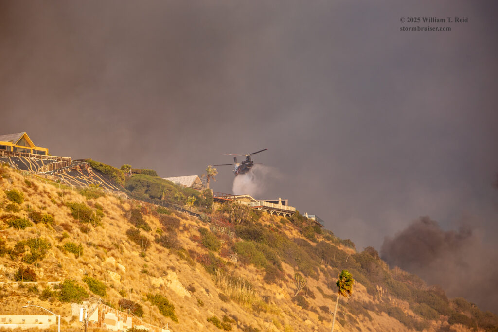
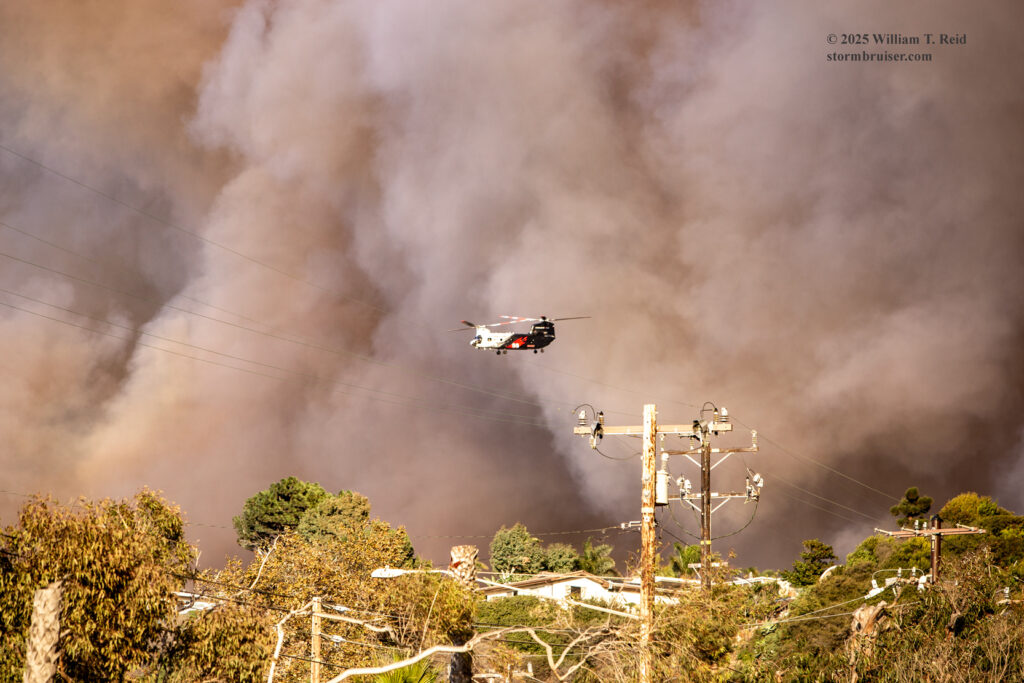
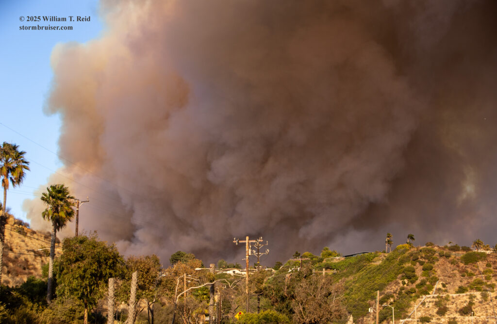
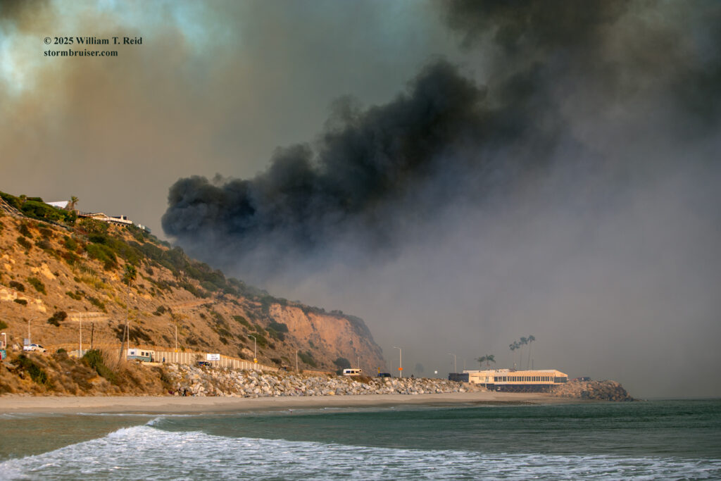
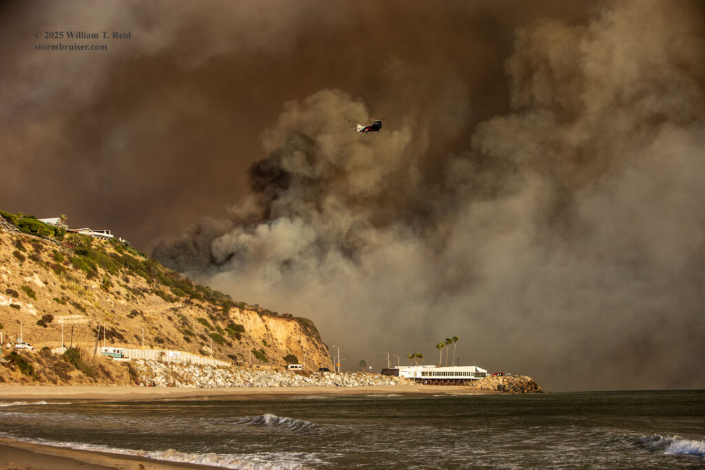
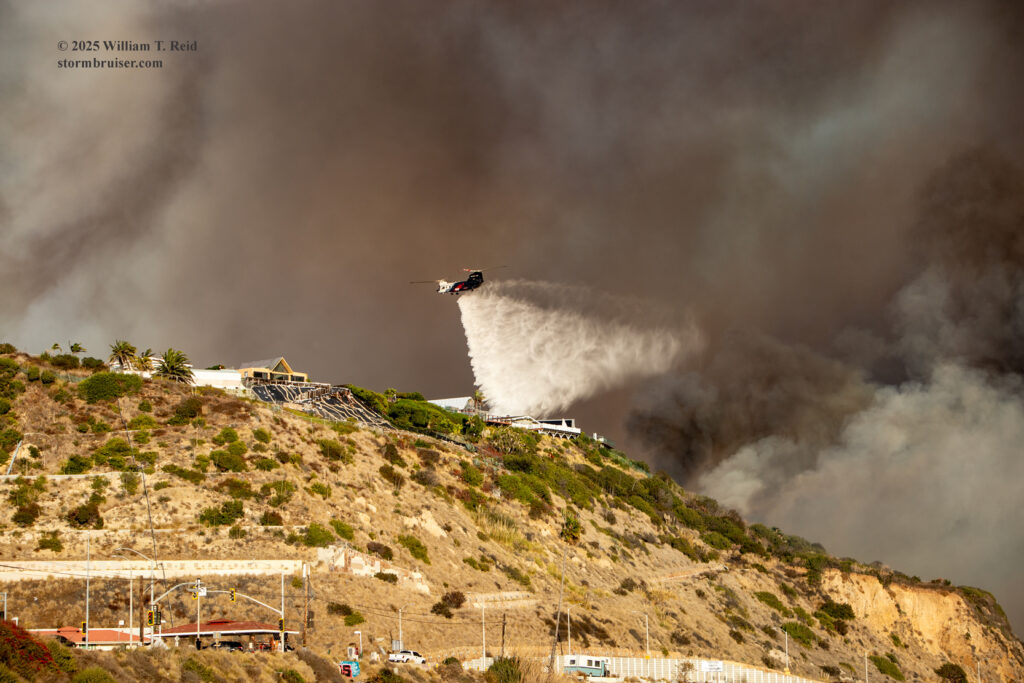

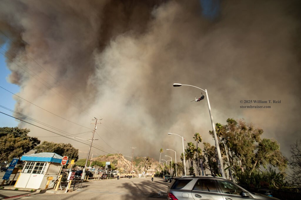
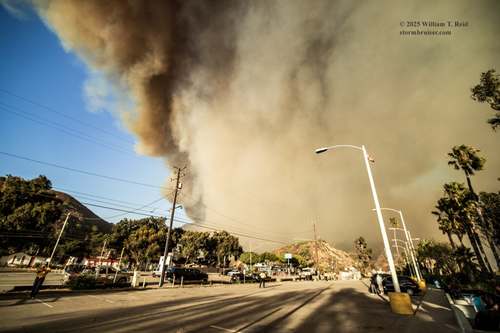
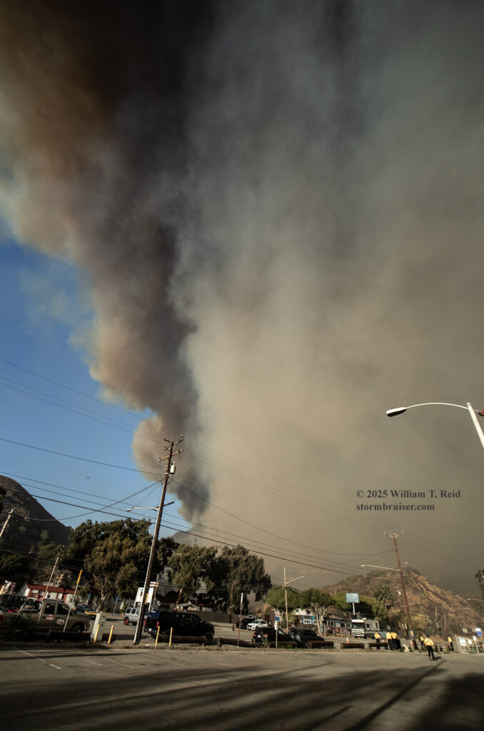
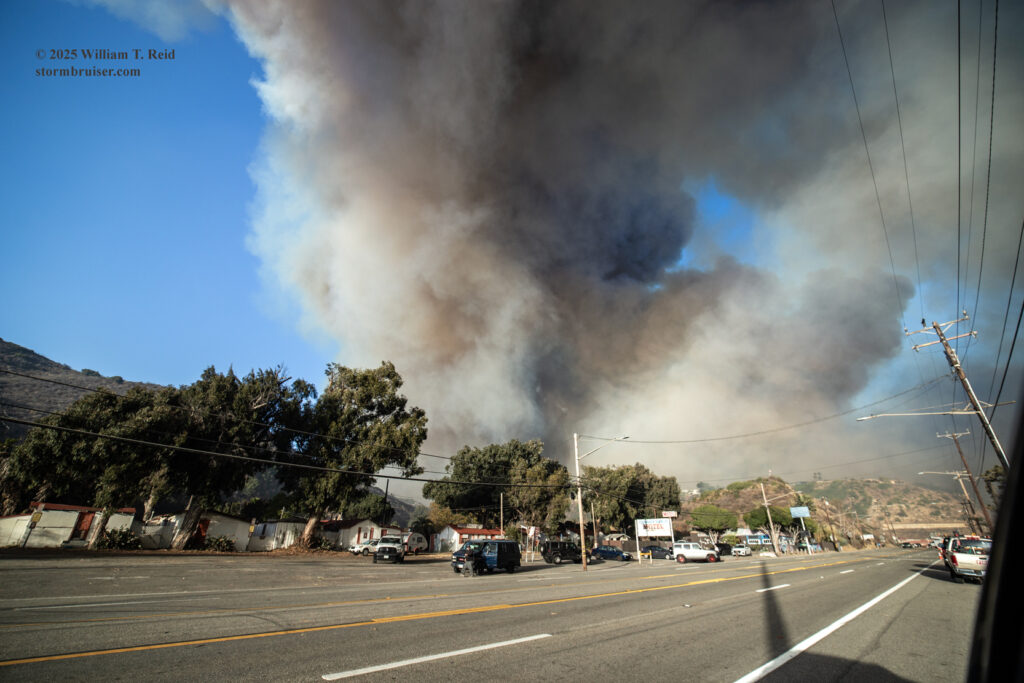
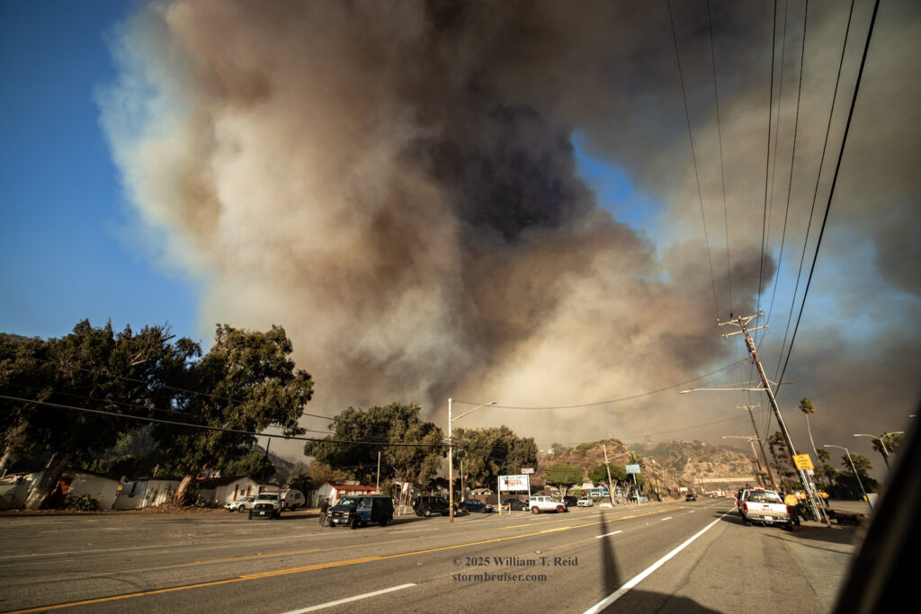
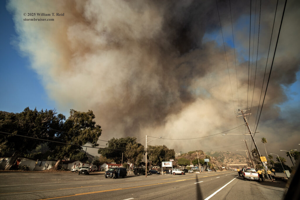
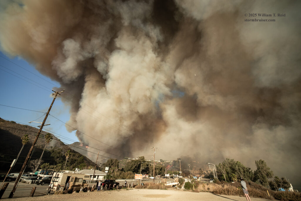
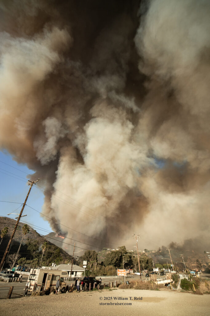
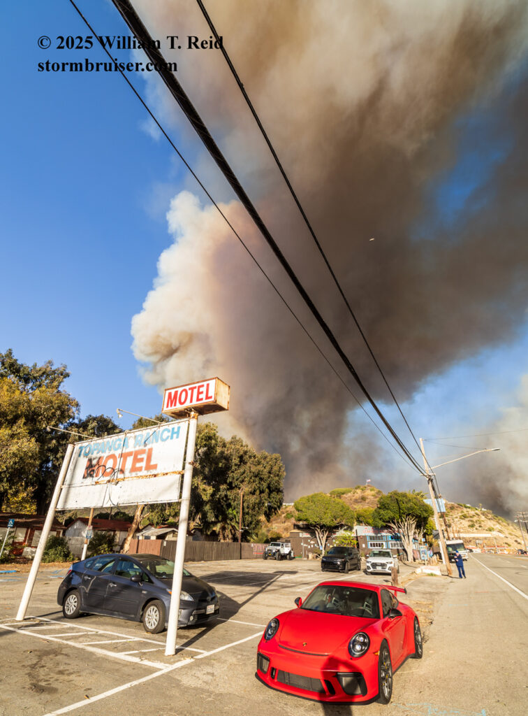
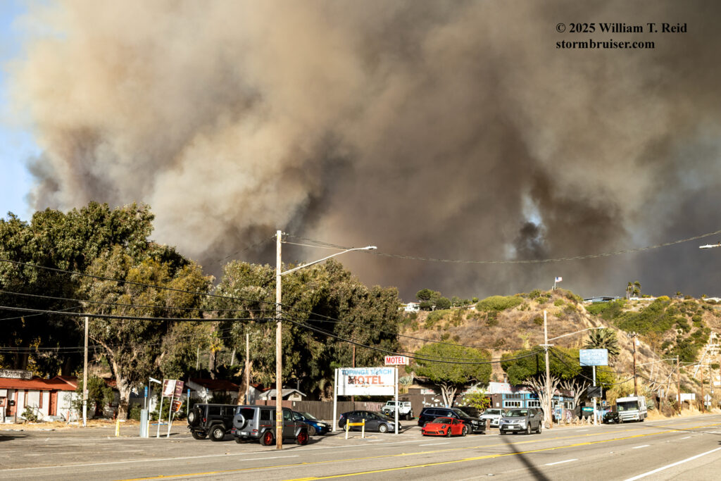
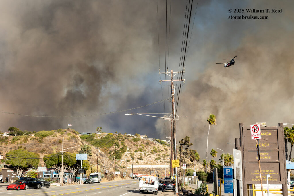
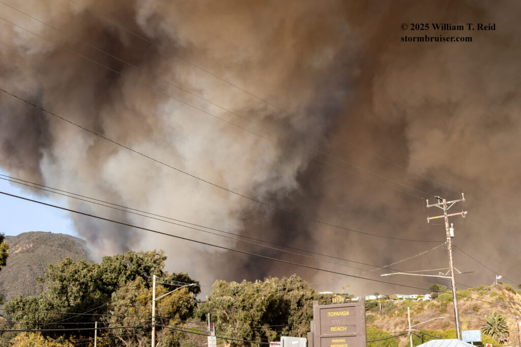
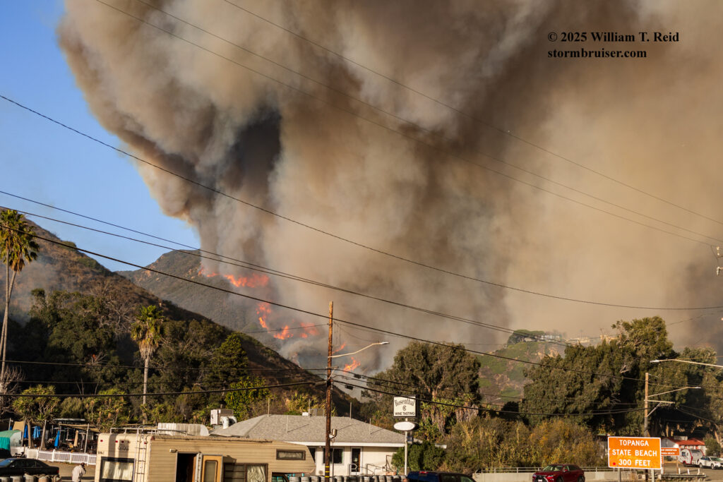
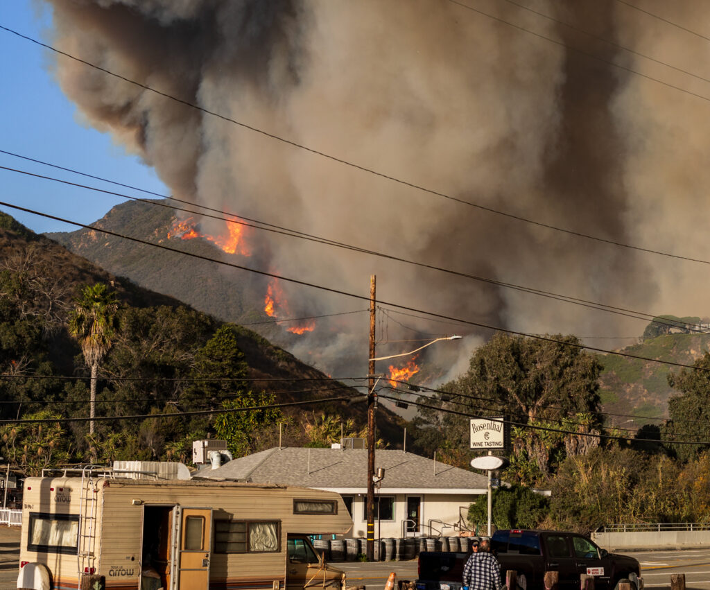
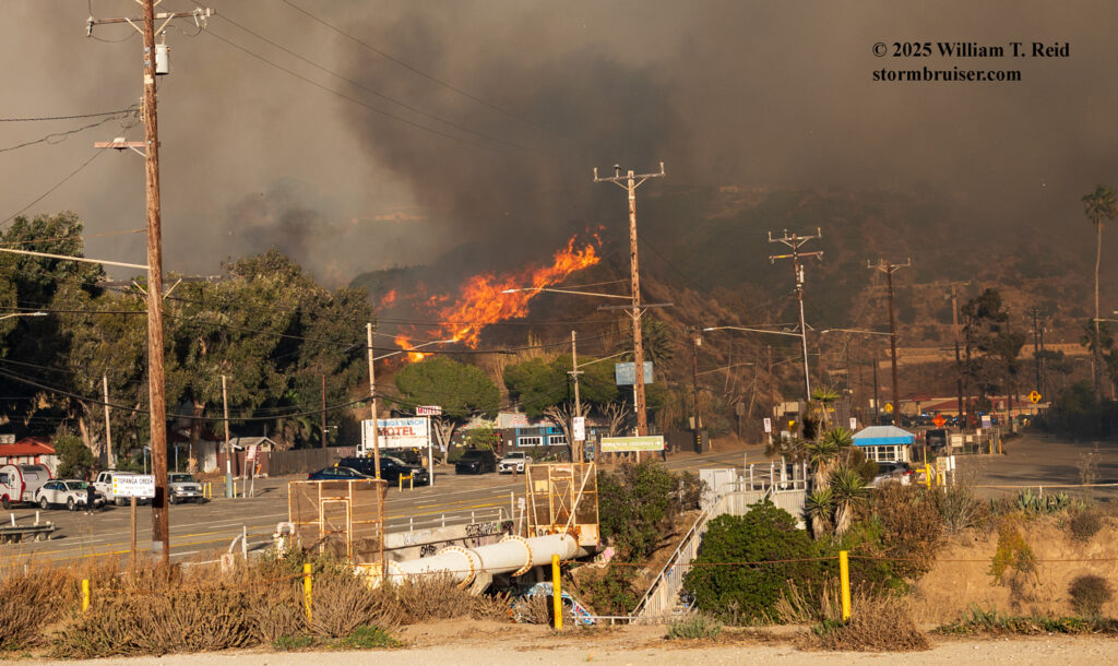
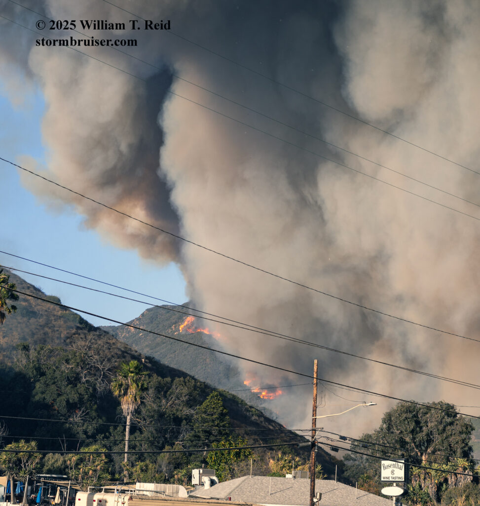
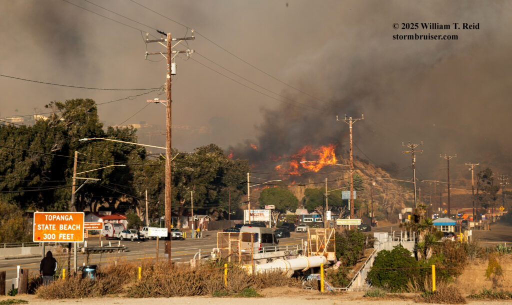
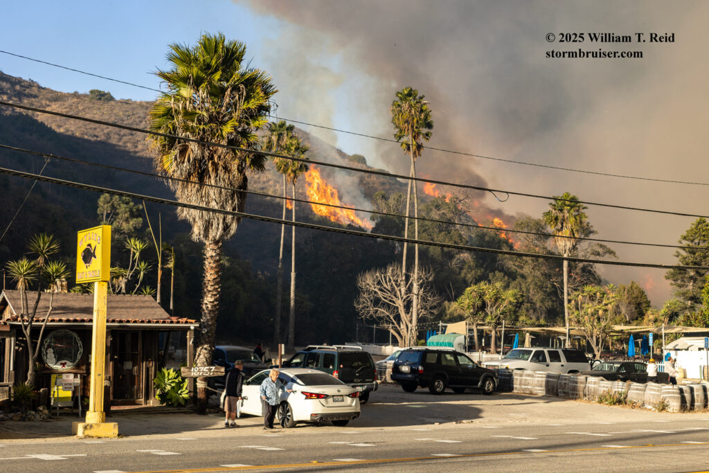
Above, the owner of Wylie’s Bait and Tackle heads to her vehicle to get out of the path of the fire. The store was lost.
From the images and video above you can see that the firestorm was getting close. Fire trucks and law enforcement were becoming much more numerous along this section of PCH, and I figured that it was time to back off a little bit. I headed a half mile or so west to Tuna Canyon Road, made a U-turn, and shot more video.
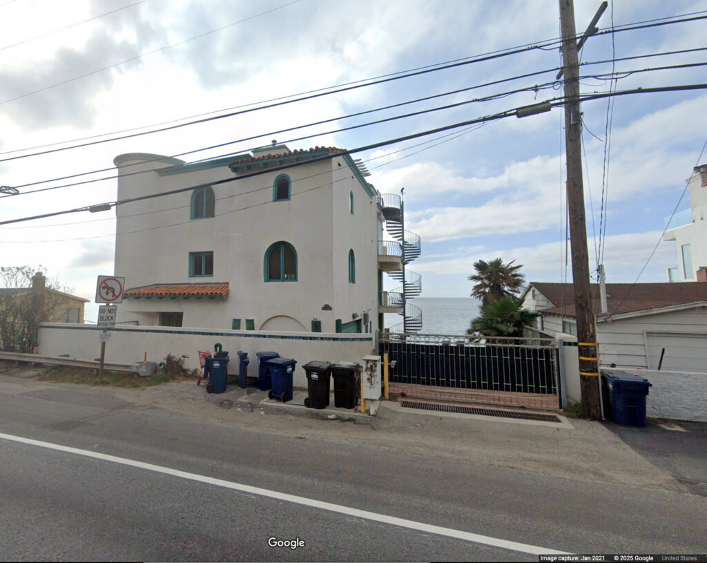
Apparently one of my cameras was off on the correct time by quite a bit. I was swapping between my two Canons at this point. The three videos above were shot fairly close together. It was between 4 and 5 p.m. Again, you can see that distinctive white house with the aqua trim which I had photographed a couple of hours earlier.
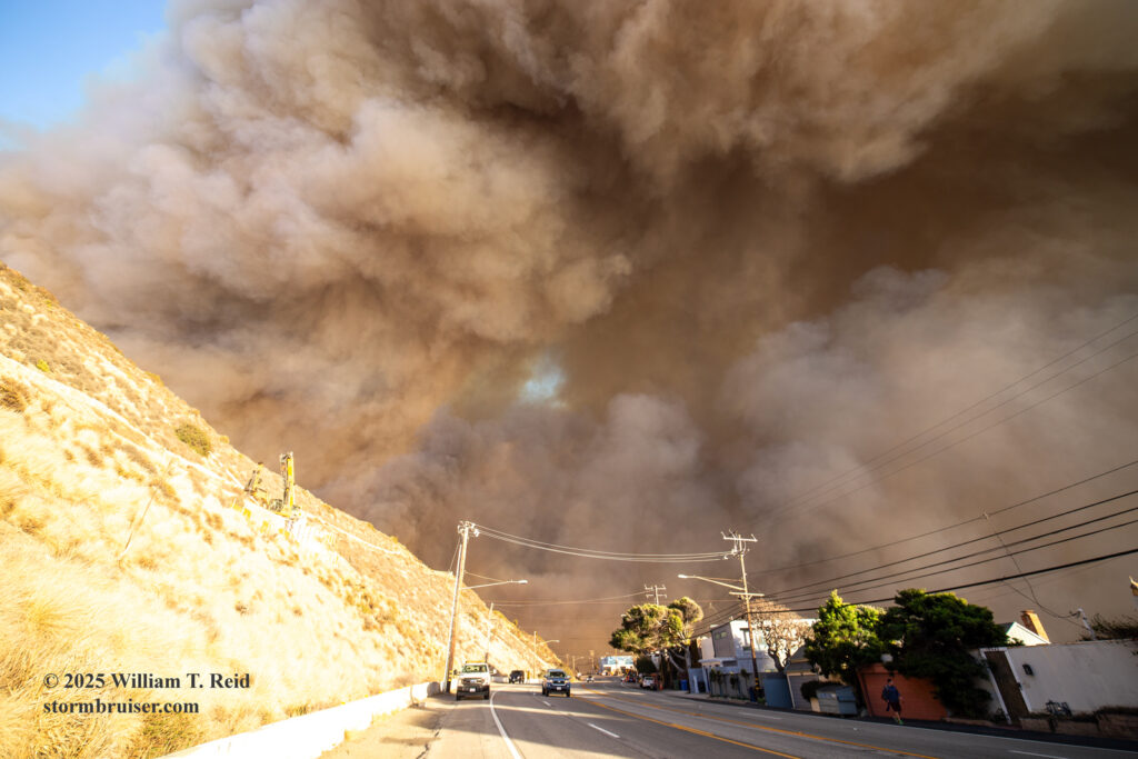
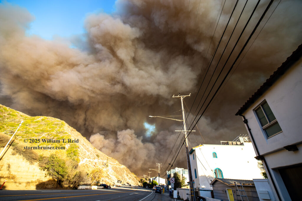
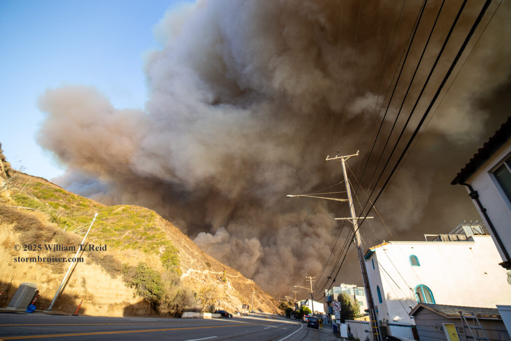
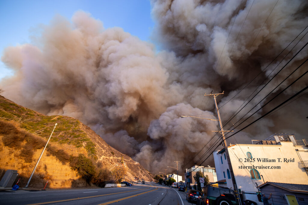
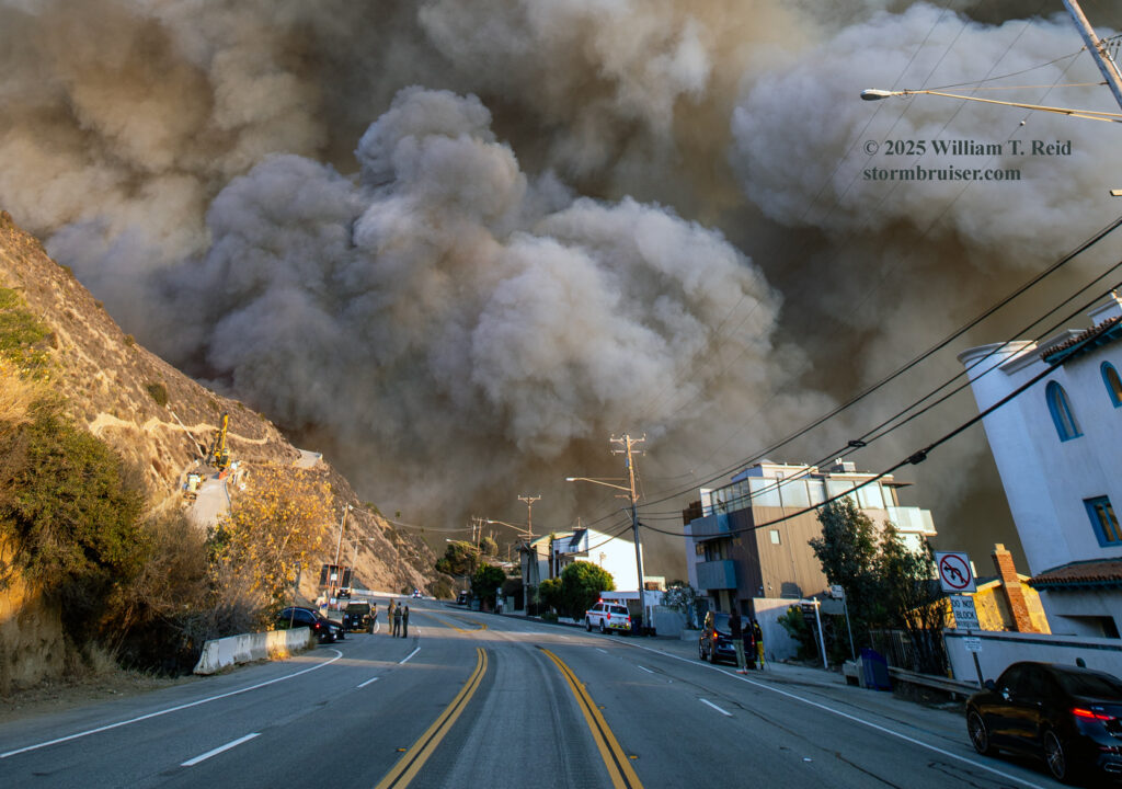
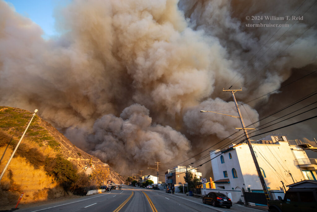
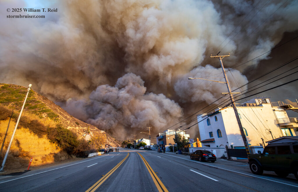
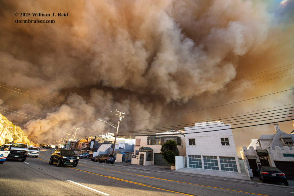
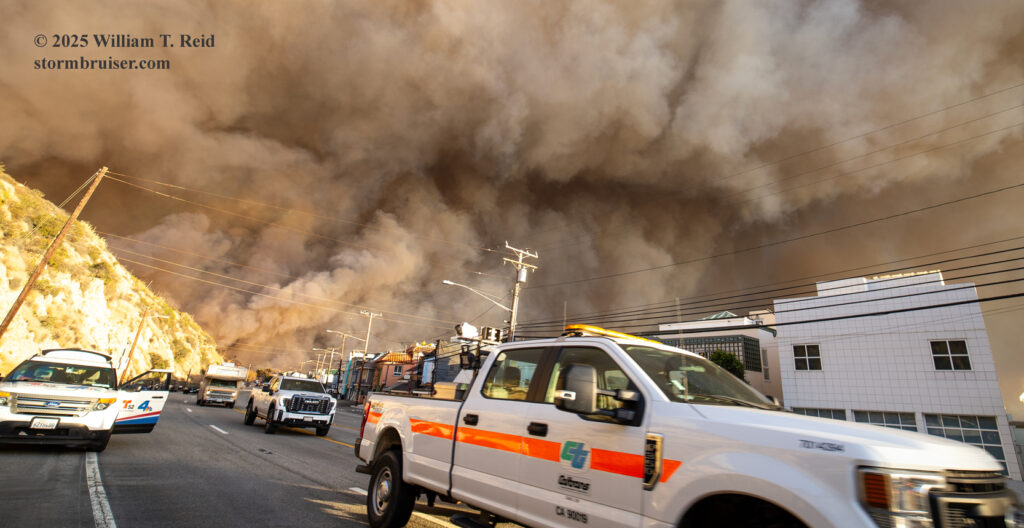
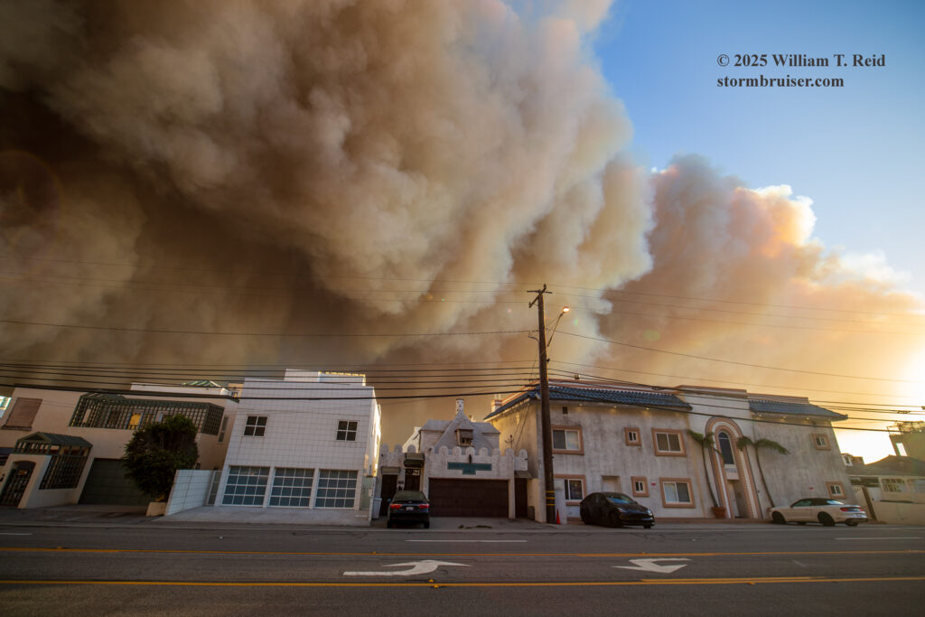
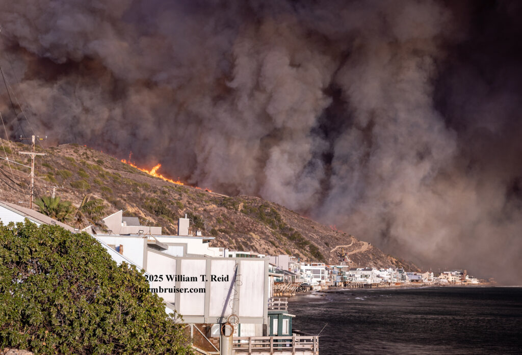
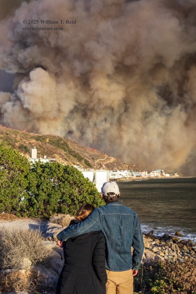
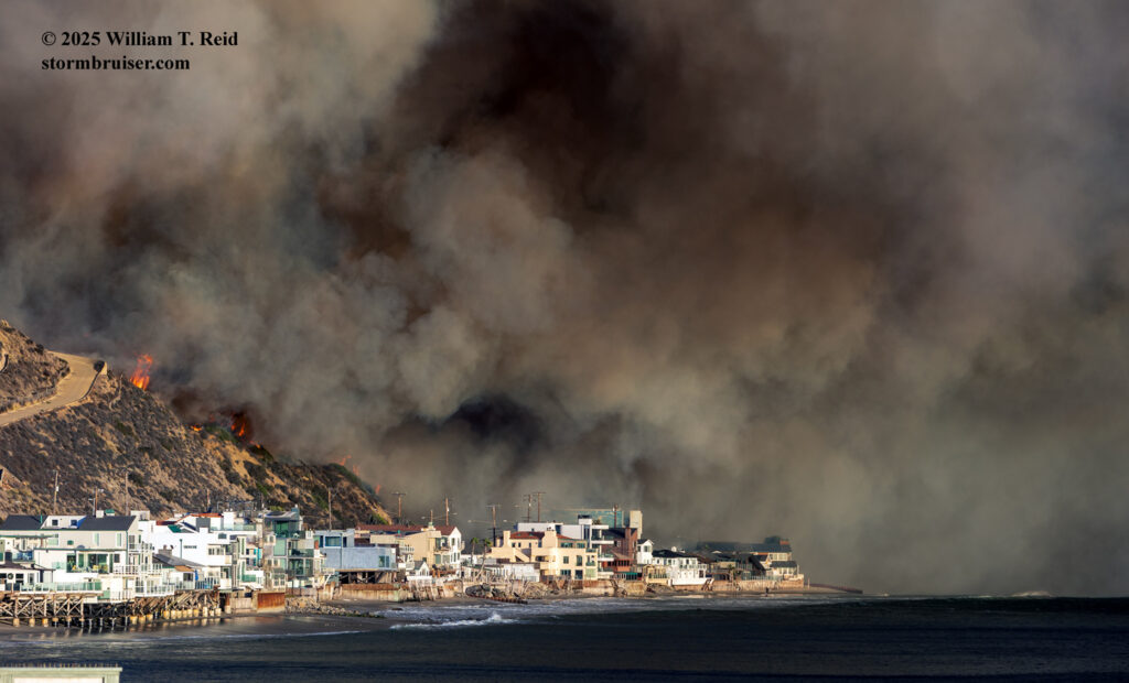
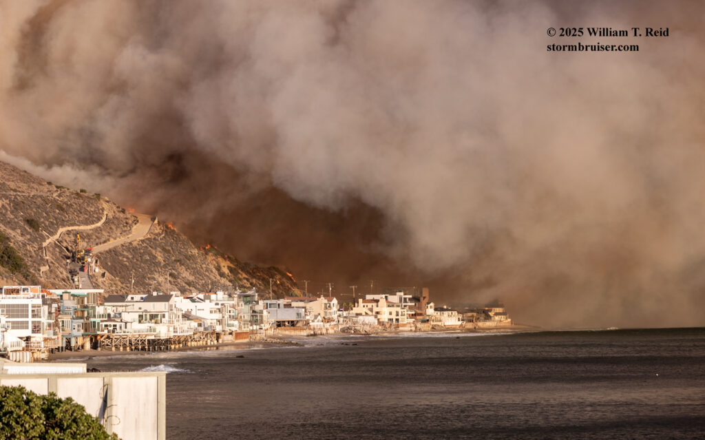
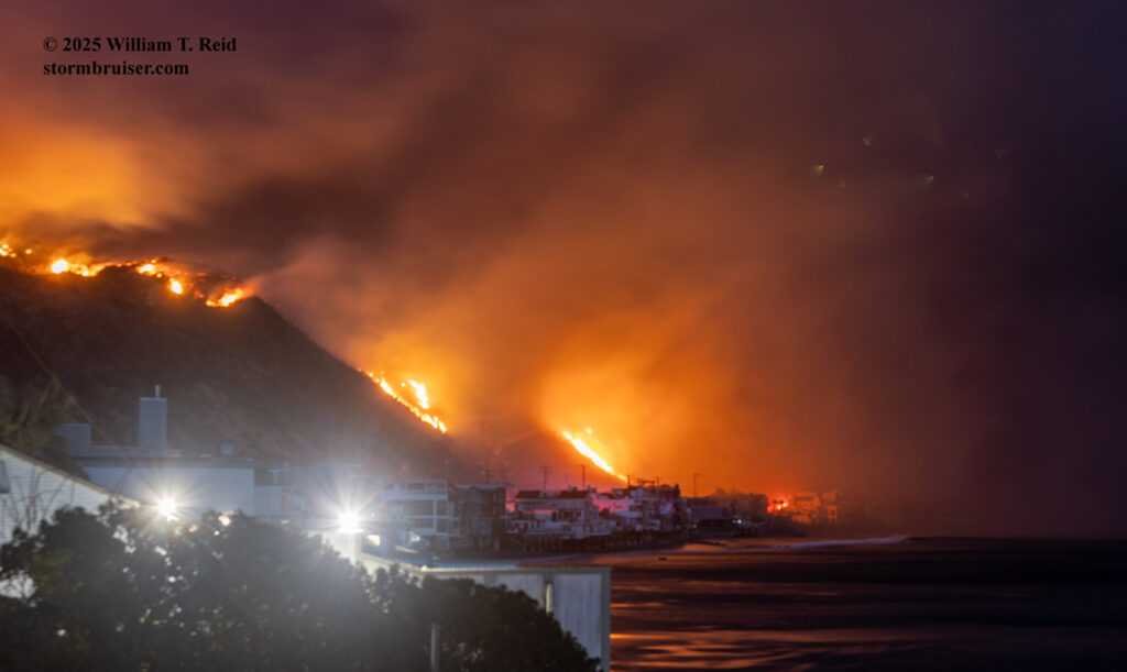
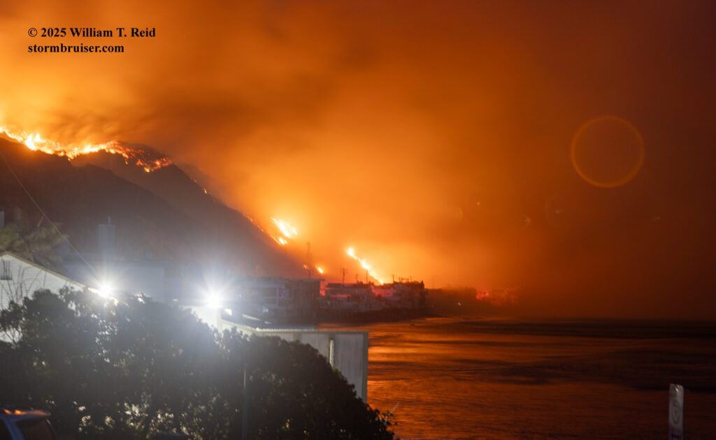
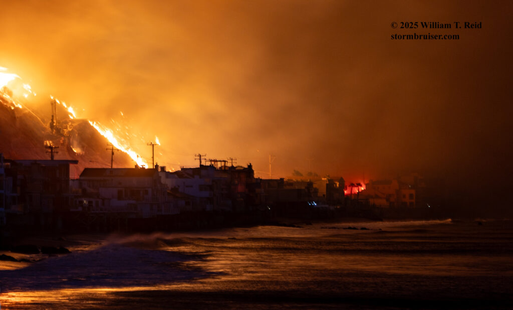
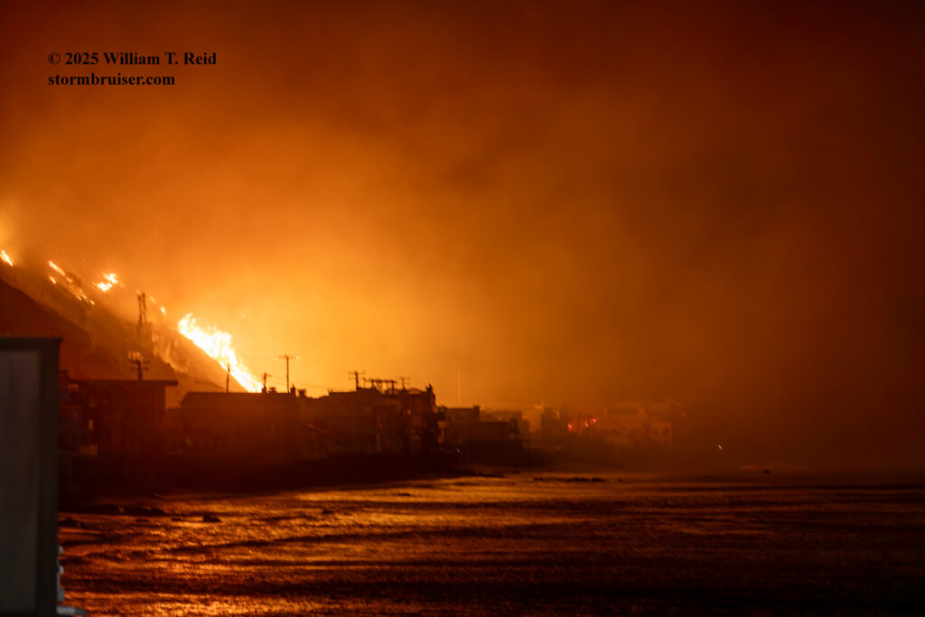
My final photo stop for the day was at the lifeguard station at Las Tunas Beach. This was just another half mile west of Tuna Canyon Road, or a mile west of Topanga Beach. I arrived here a little before sunset, which was very close to 5 p.m. on this date. This location afforded a great view of the row of houses along the water and PCH to my east, and of the hillside on the north side of PCH which was burning at dusk.
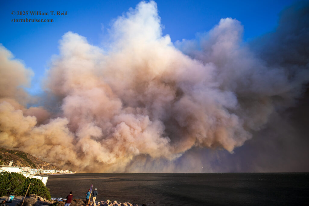
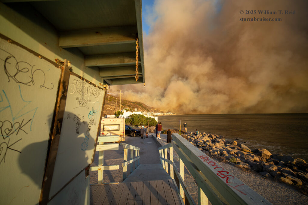
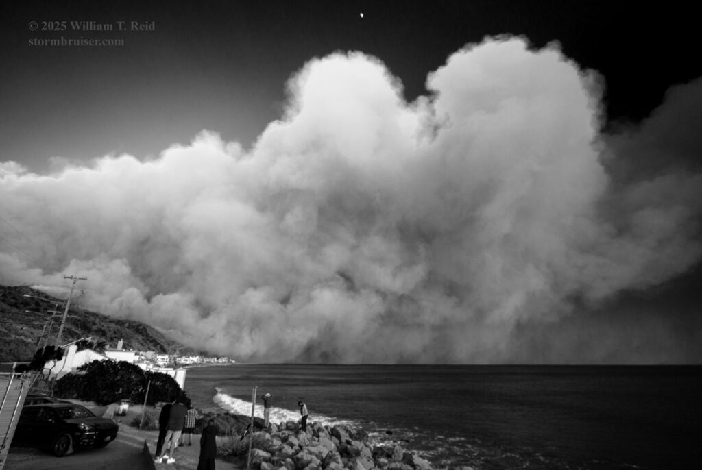
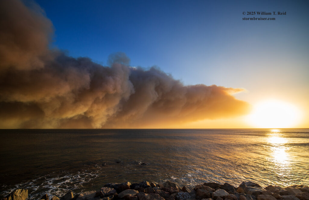
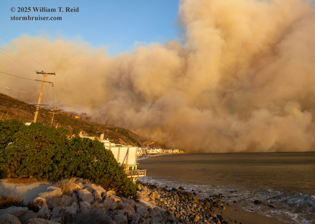
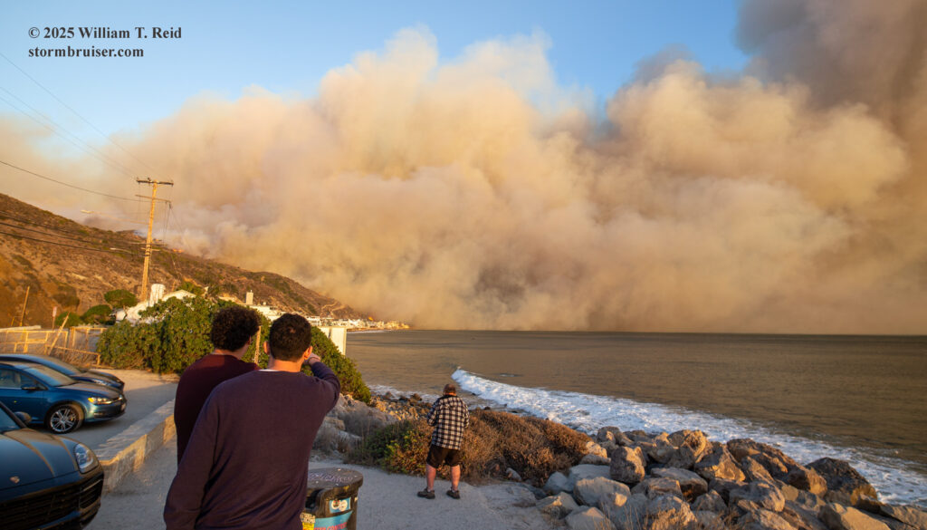
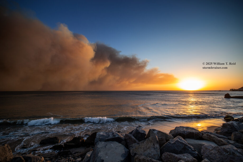
The Malibu sunset was gorgeous; the scene to the east was very grim.
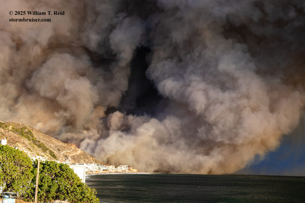
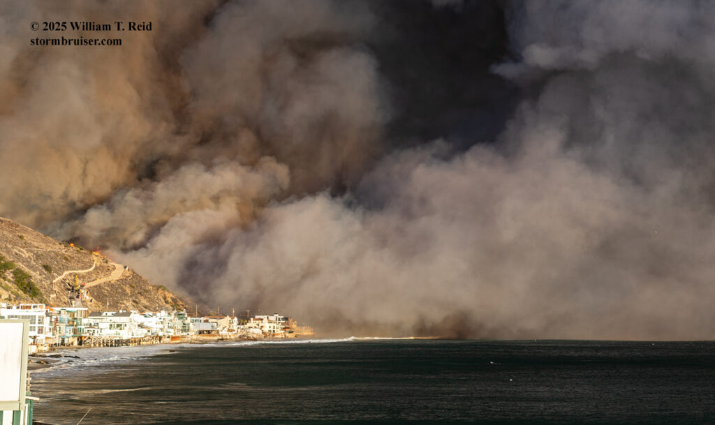
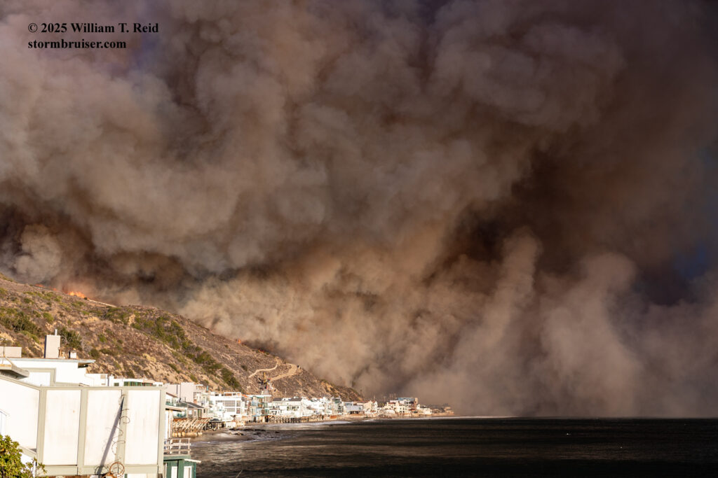
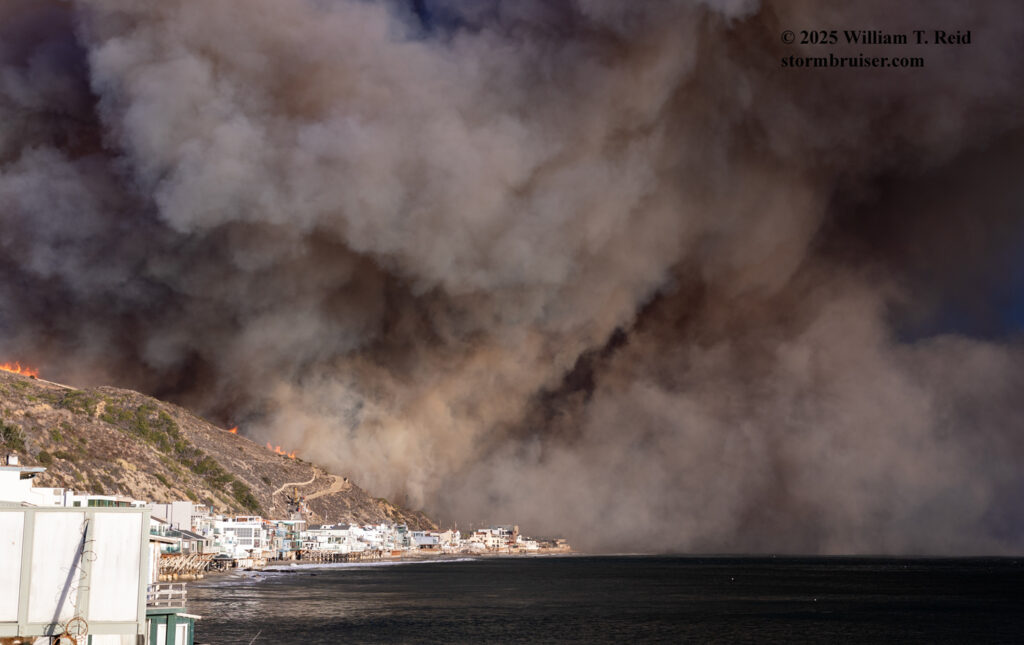
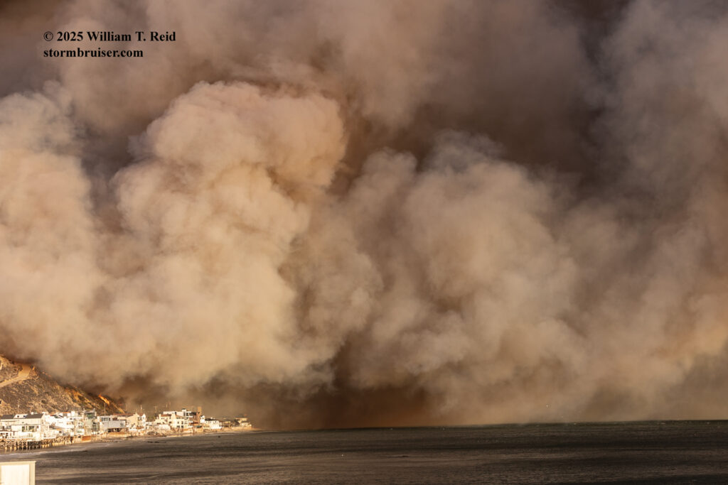
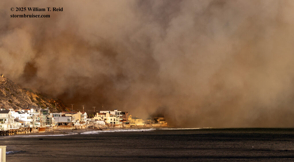
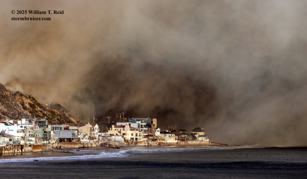
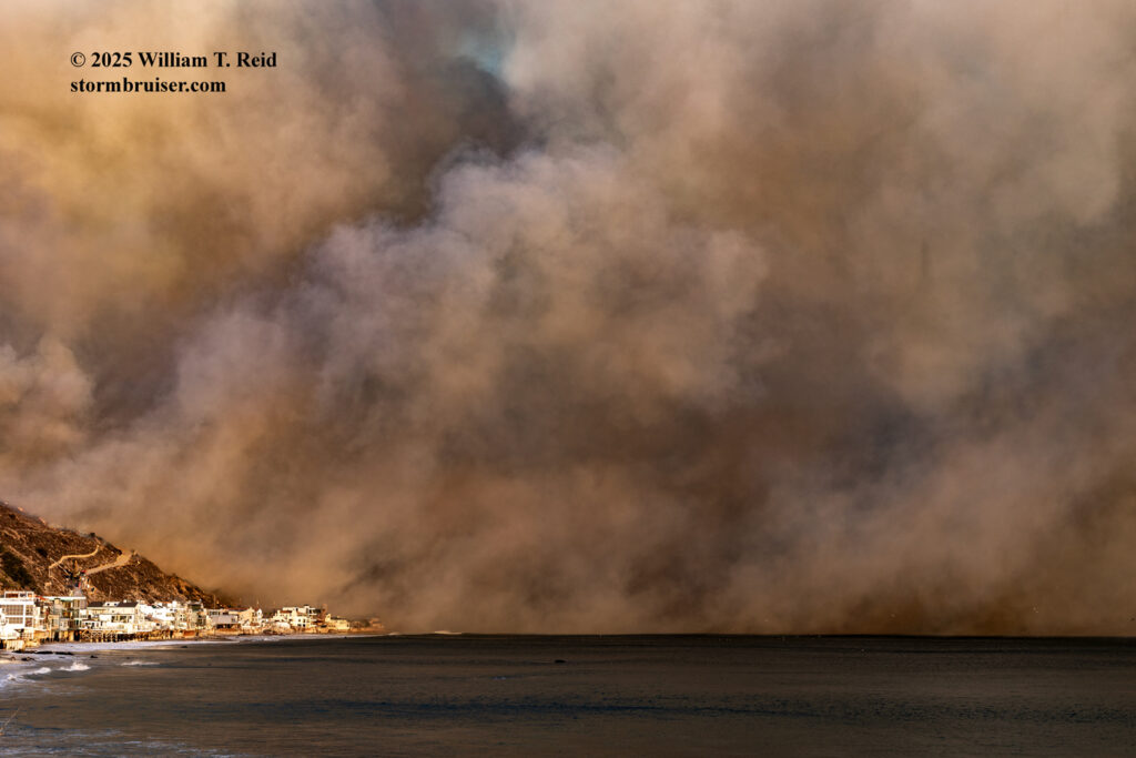
The time for the video above is likely closer to 4:45 p.m. PST.
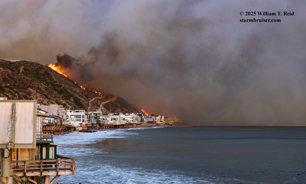
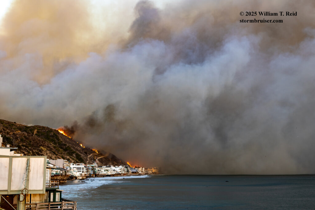
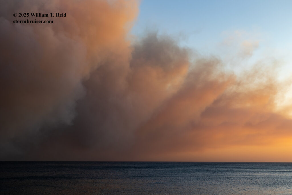
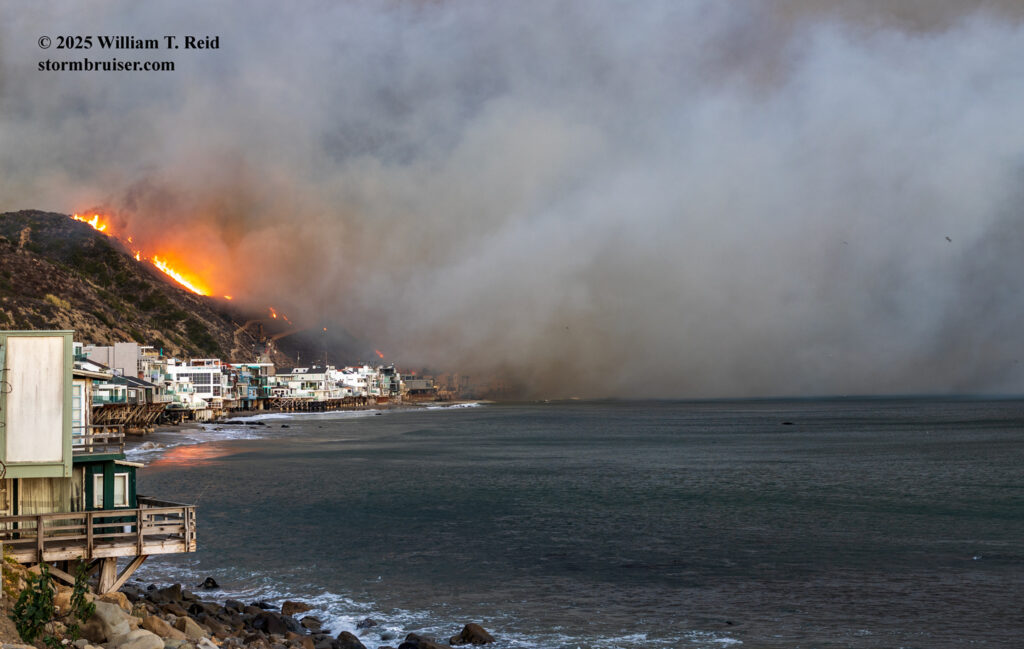
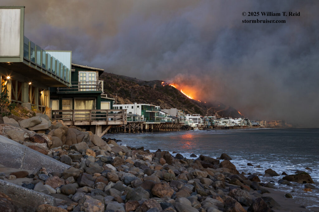
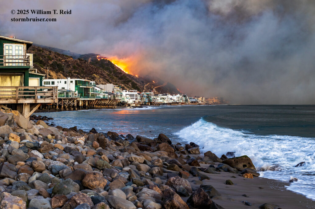
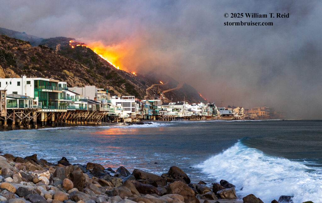
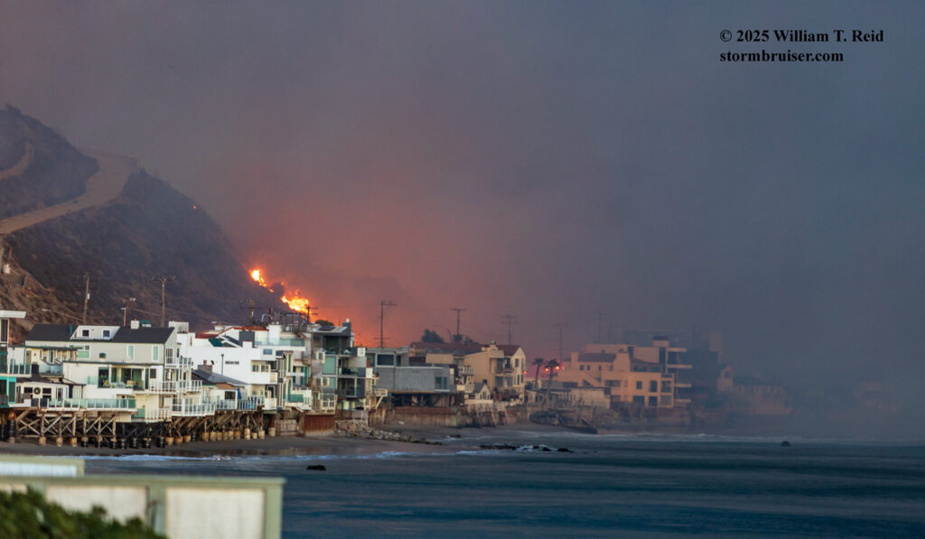
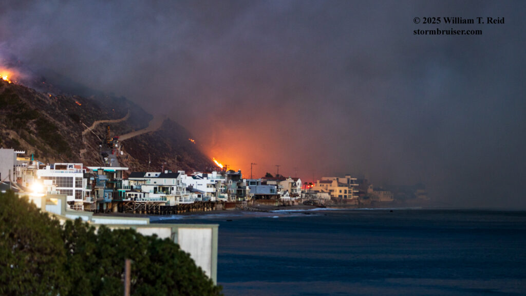
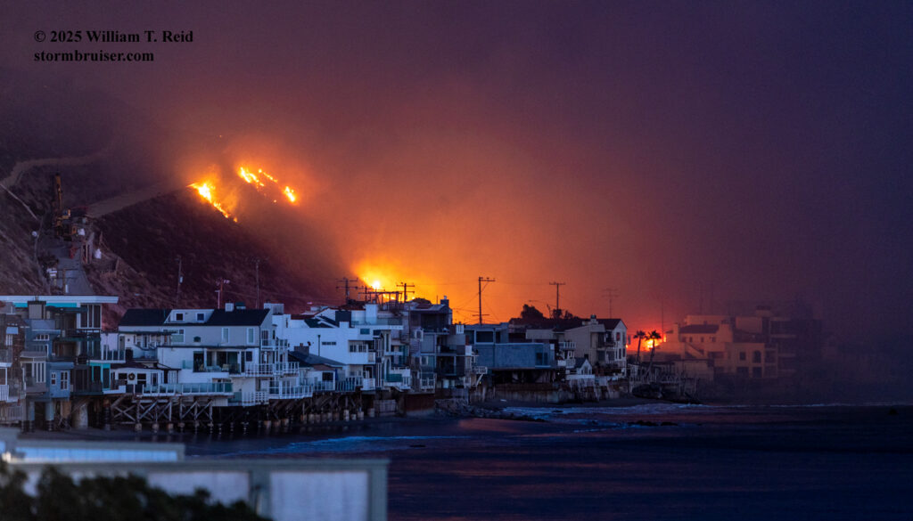
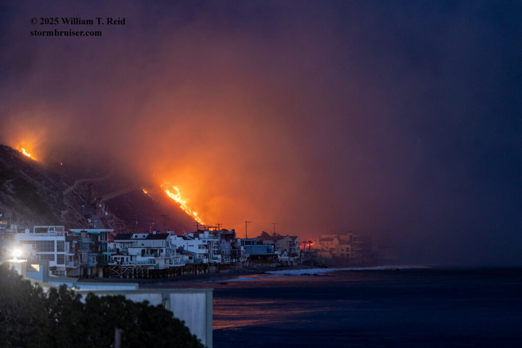
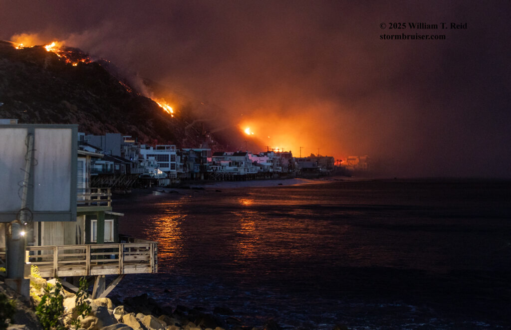
I shot stills with the long lens here at Las Tunas Beach for nearly an hour. The fire wasn’t advancing westward towards me particularly quickly. I spoke with someone who was renting a house across the street, on the north side of PCH. He put on a good facade of being cool and collected, but I think his insides were twisting around. The owner of the Bait and Tackle shop at Topanga Beach was also waiting it out here. The shop had been in operation since 1946.
Compared to my tornado chases, the one today was kind of in slow motion. I knew that the fire would persist well into the night and perhaps into the following days. Unlike the residents and business owners of this stretch of real estate, I was lucky. I could drive away and find a place to get a drink and some tacos. I could head to a home which was not being threatened, to an area where there was no heavy smoke or embers or sirens or people fleeing flames. After a few more still photos I had had enough of this disaster and I made my way west on Pacific Coast Highway.
Reuters story with images of the burned houses along this same stretch of PCH. The white and aqua-trim house, at Tuna Canyon and where I stopped a couple of times, had a spiral and metal staircase. See the first image in the Reuters story. Google street-view image below.
Miscellaneous clips of Topanga Beach and vicinity as the fire swept through, and aftermath:
Fire truck video along PCH, about a mile west of Tuna Canyon Road.
Clip from X showing burned businesses at Topanga Beach
Burning businesses at Topanga Beach
This clip shows the lifeguard station at Las Tunas during the fire (towards the end).
Youtube drive on PCH through Malibu after fire

Leave a Reply
You must be logged in to post a comment.