
May 17/Start of Tour 4 out of OKC/lunch at Pato’s in Clinton/End: Woodward/341 miles
May 18/Start: Woodward/lunch at Buffalo Diner/End: Enid/337 miles
On the 17th we watched some convection struggle in the eastern Texas Panhandle around Wheeler. A storm was semi-decent near Vici and Woodward at dusk. Inquire at the front desk for photos from this chase day.
Now, onto May 18:
Mesoscale Discussions 3:21 p.m. CDT. 5:11 p.m. CDT. 7:16 p.m. CDT 9:27 p.m. CDT
TT guide Bob Conzemius and company were also on the Arnett storm. His account is here.
Short YouTube clip of the Arnett storm.
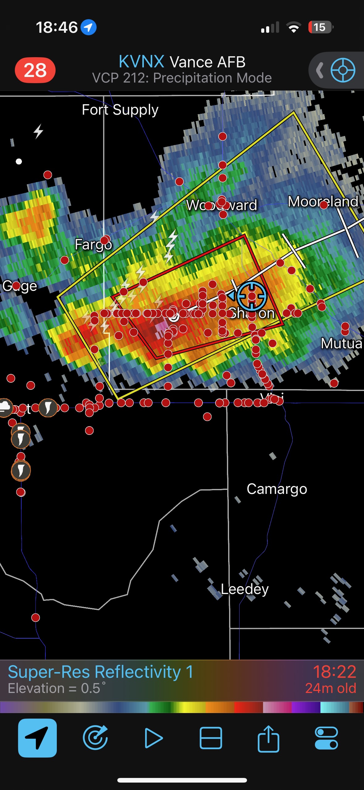
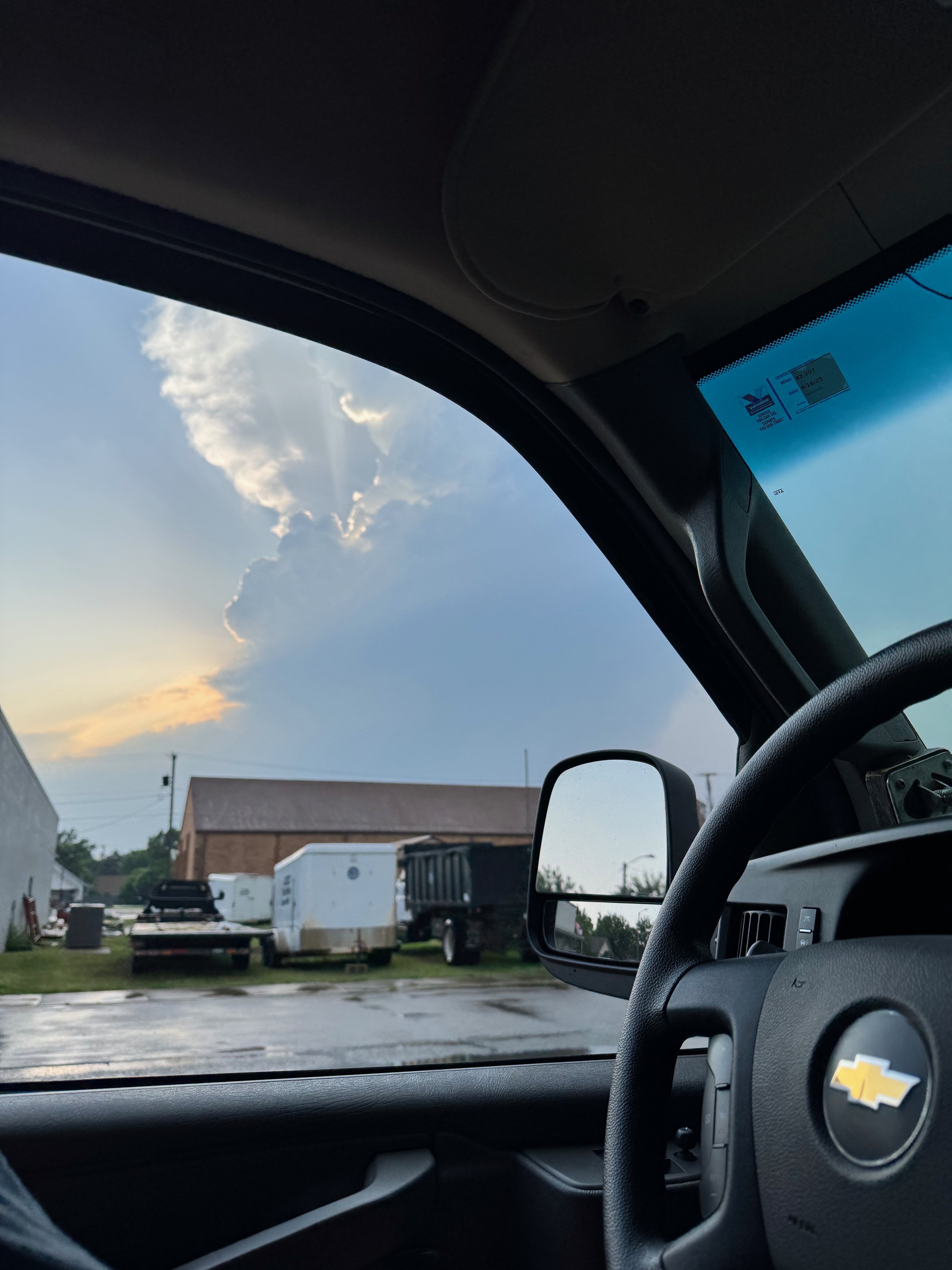
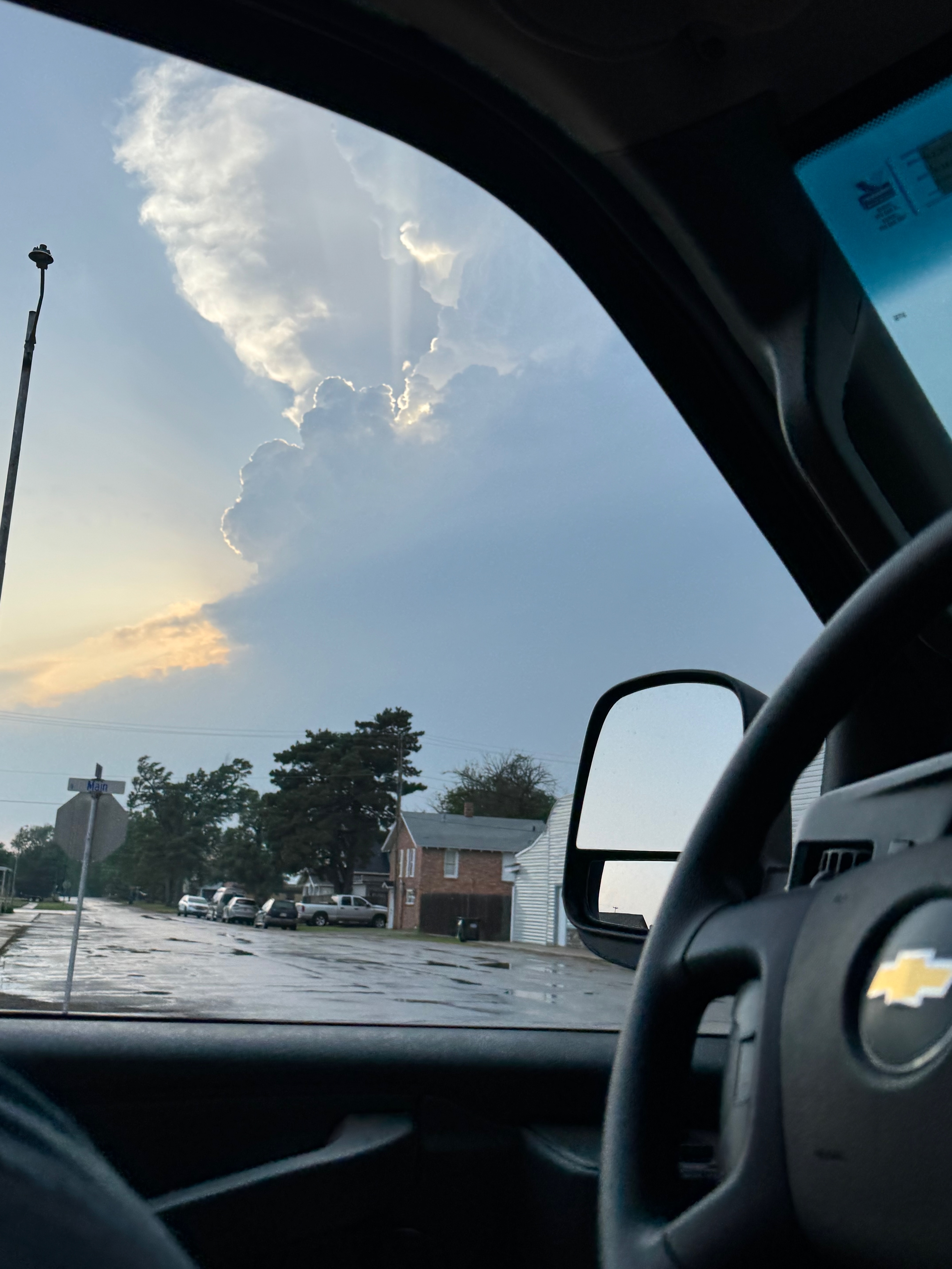
We woke up more-or-less where we needed to be on this chase day, in northwest Oklahoma. SPC had a moderate risk and a 15-percent hatched tornado outline east of a dry line from about Woodward to Dodge City and Wakeeney. There was little reason to wander too far from Woodward, but after the morning briefing it seemed prudent to edge slightly northward towards the middle of this moderate risk area in western Kansas. We had a relaxed lunch in Buffalo.
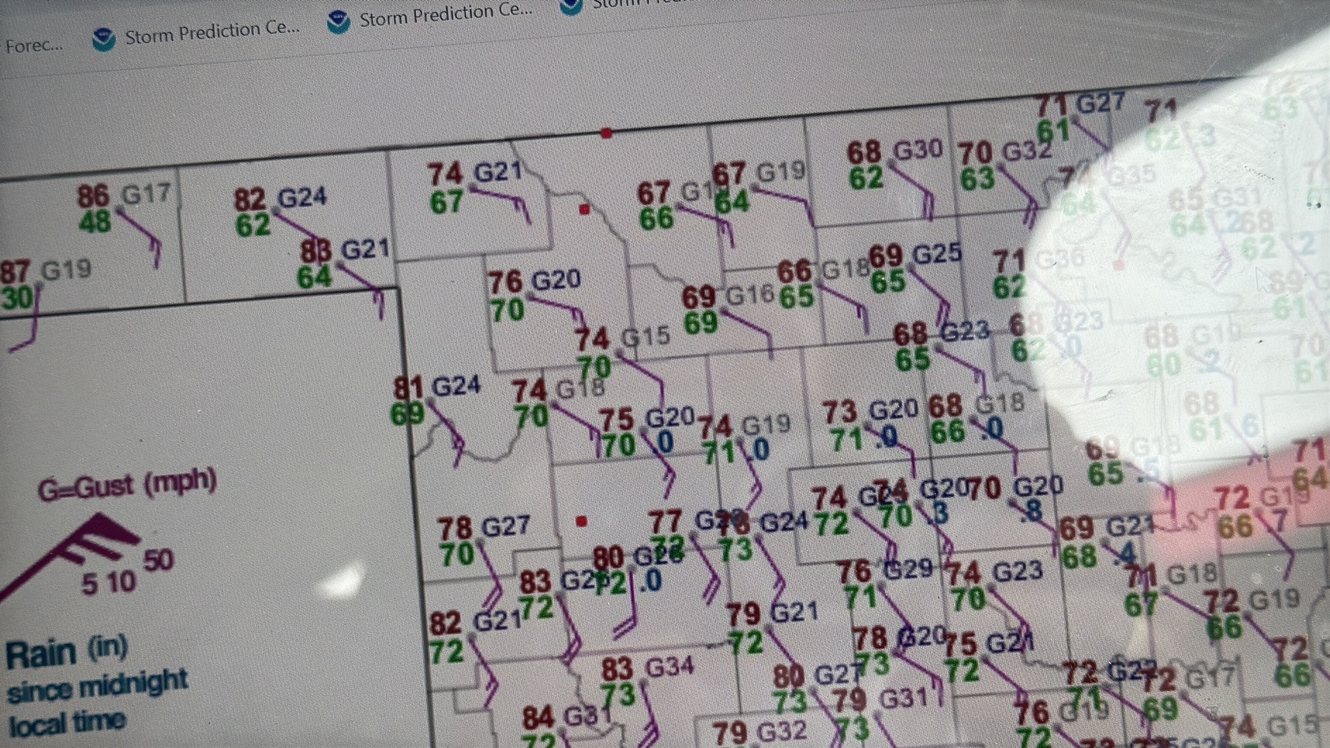
Today certainly looked great on paper. Hopes were high for a big tornado day in an excellent chase area. Dews were near 70F in northwest OK and wind profiles and instability were high-end for tornadic supercells towards dinnertime. Much of the focus meteorologically was along a warm front which was draped W-E across southern Kansas. But that area continued to be terribly cloudy and cool into the early afternoon. Thus, my initial thinking of getting a little into Kansas (after our lunch in Buffalo) was abating quite a bit. My attention turned more towards the dry line to the west a little bit, and we drifted south of Buffalo and back again to the Woodward area.
The three screenshots below from about 4 p.m. CDT show:
- our location near Fort Supply,
- the cool temperatures near the KS/OK border east of Buffalo,
- the nicely-backed winds with 70F dews surging into NW OK, and
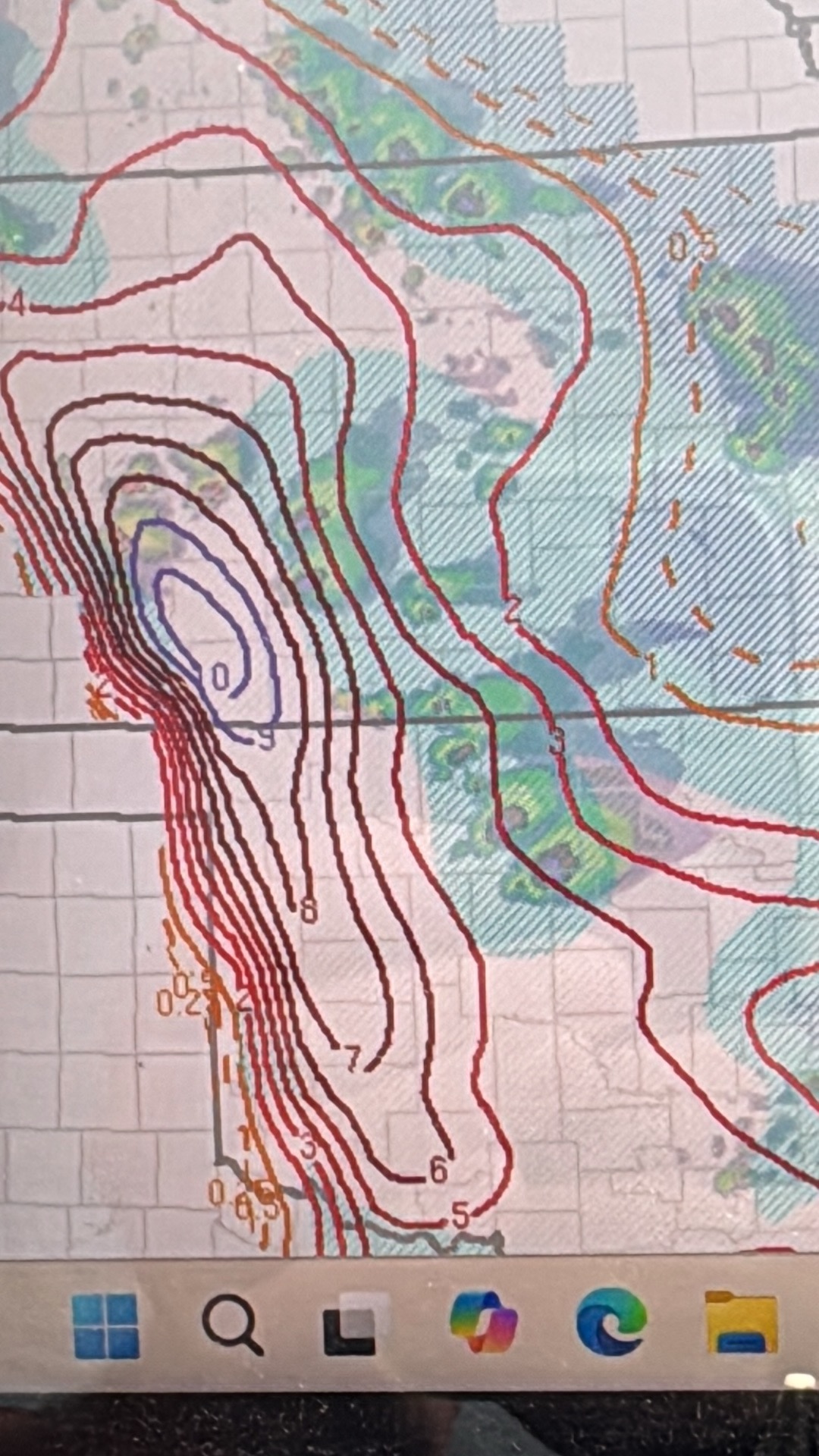
- the forecast STP (significant tornado parameter) values, 2 or 4 hours into the future.
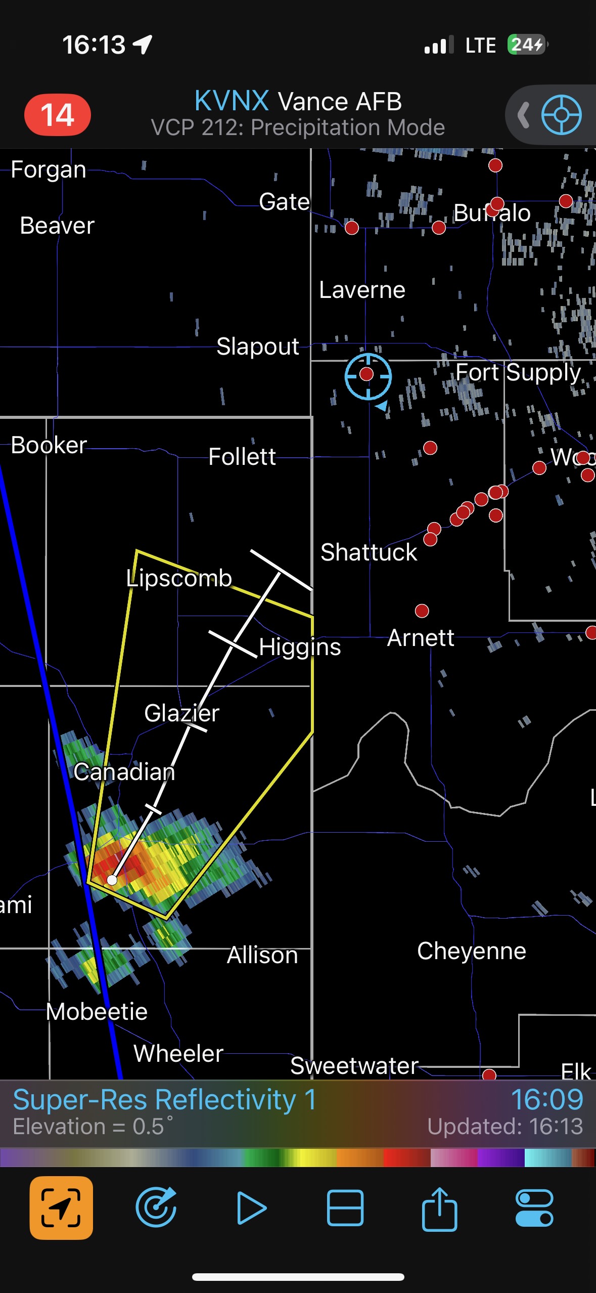
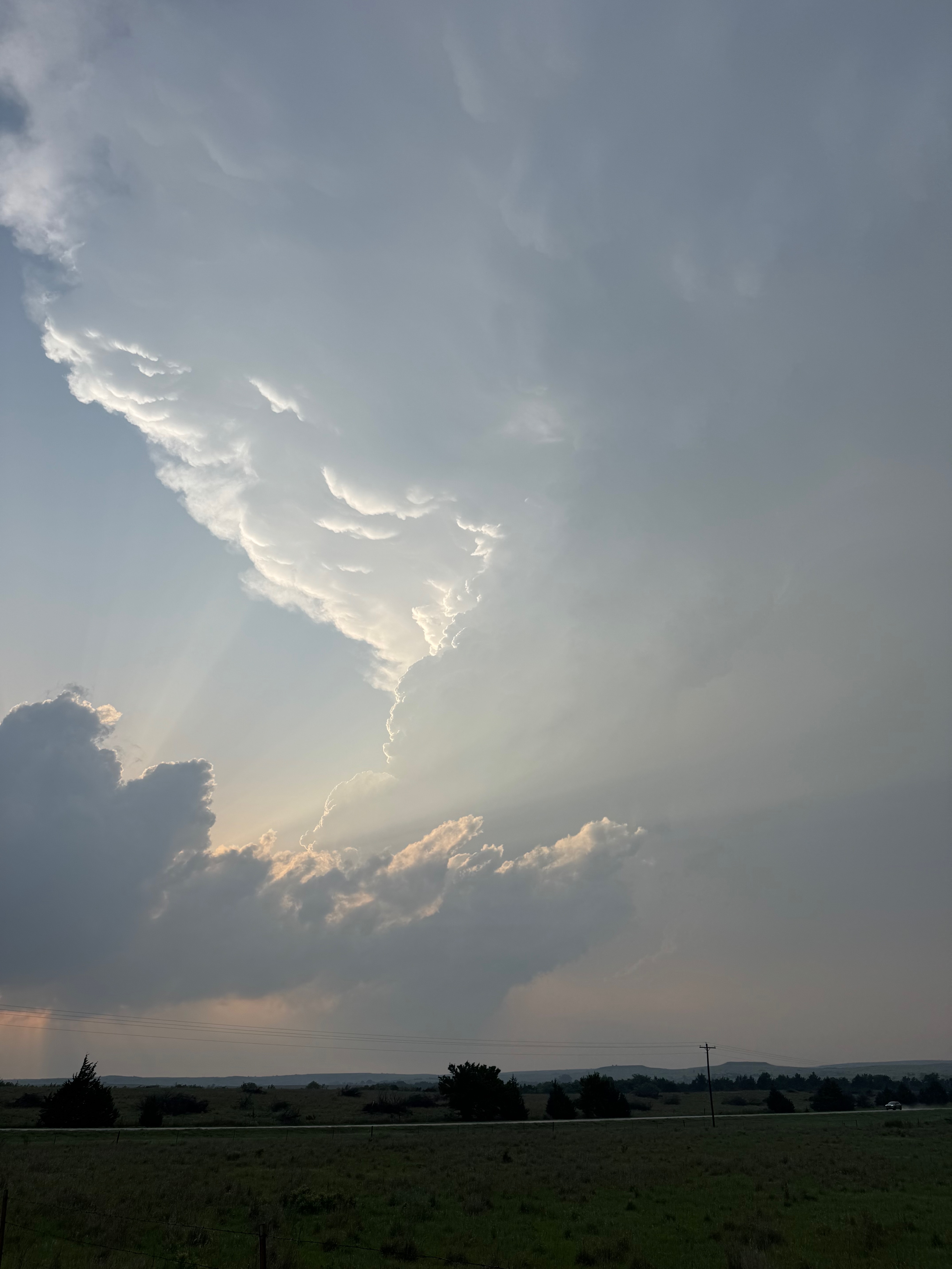
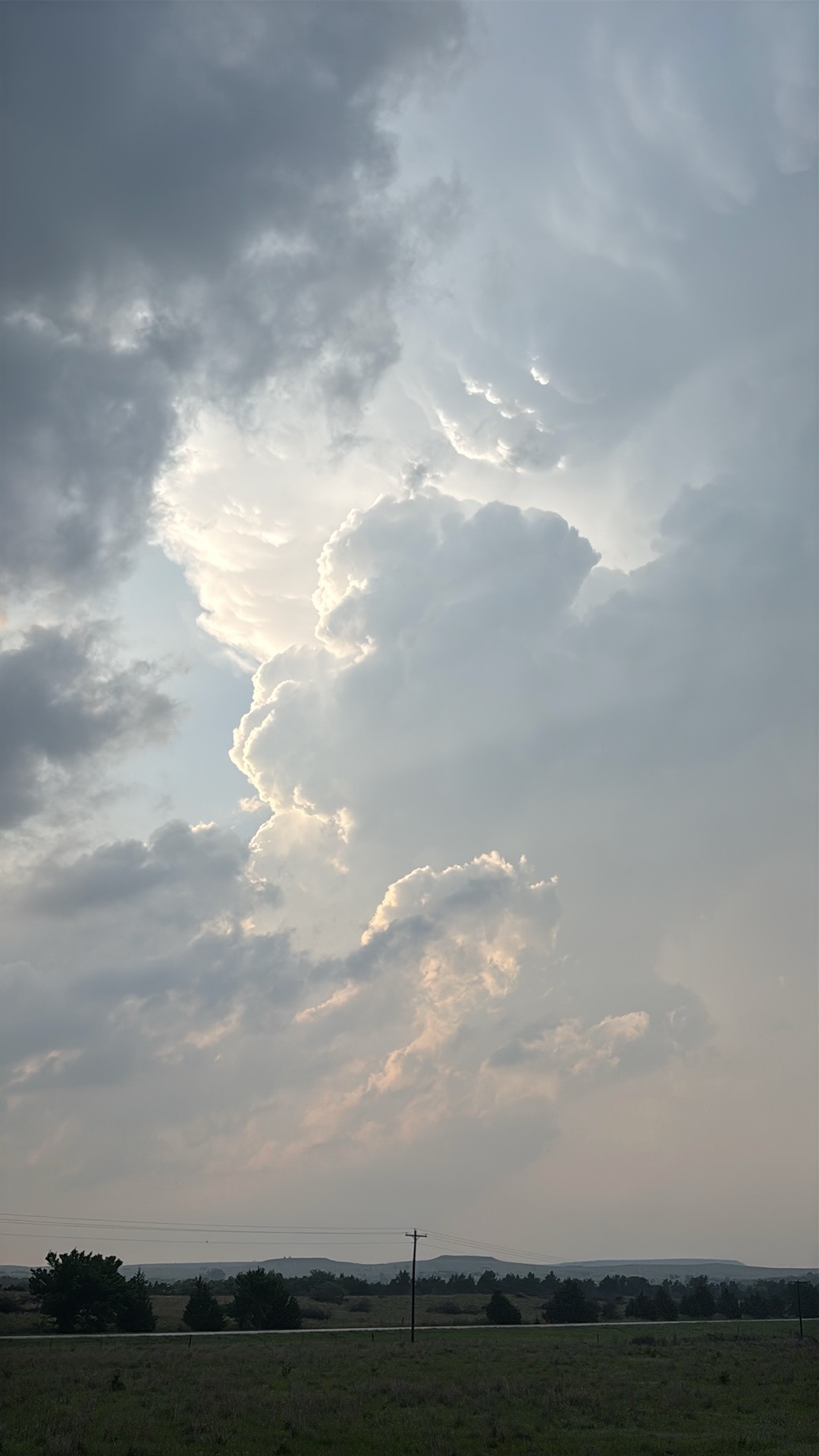
Radar already shows some weak storms near Minneola, but the air up there was slow to warm up. We were watching some weak bubbling cu to our northwest, and some new development is shown on the dry line in the eastern Texas Panhandle.
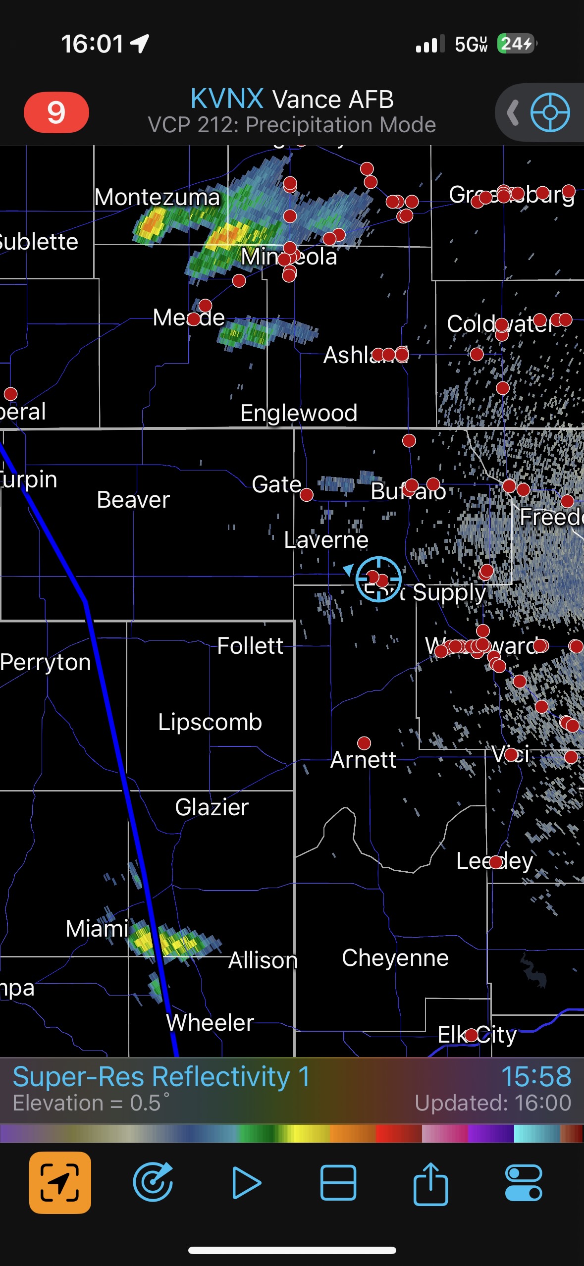
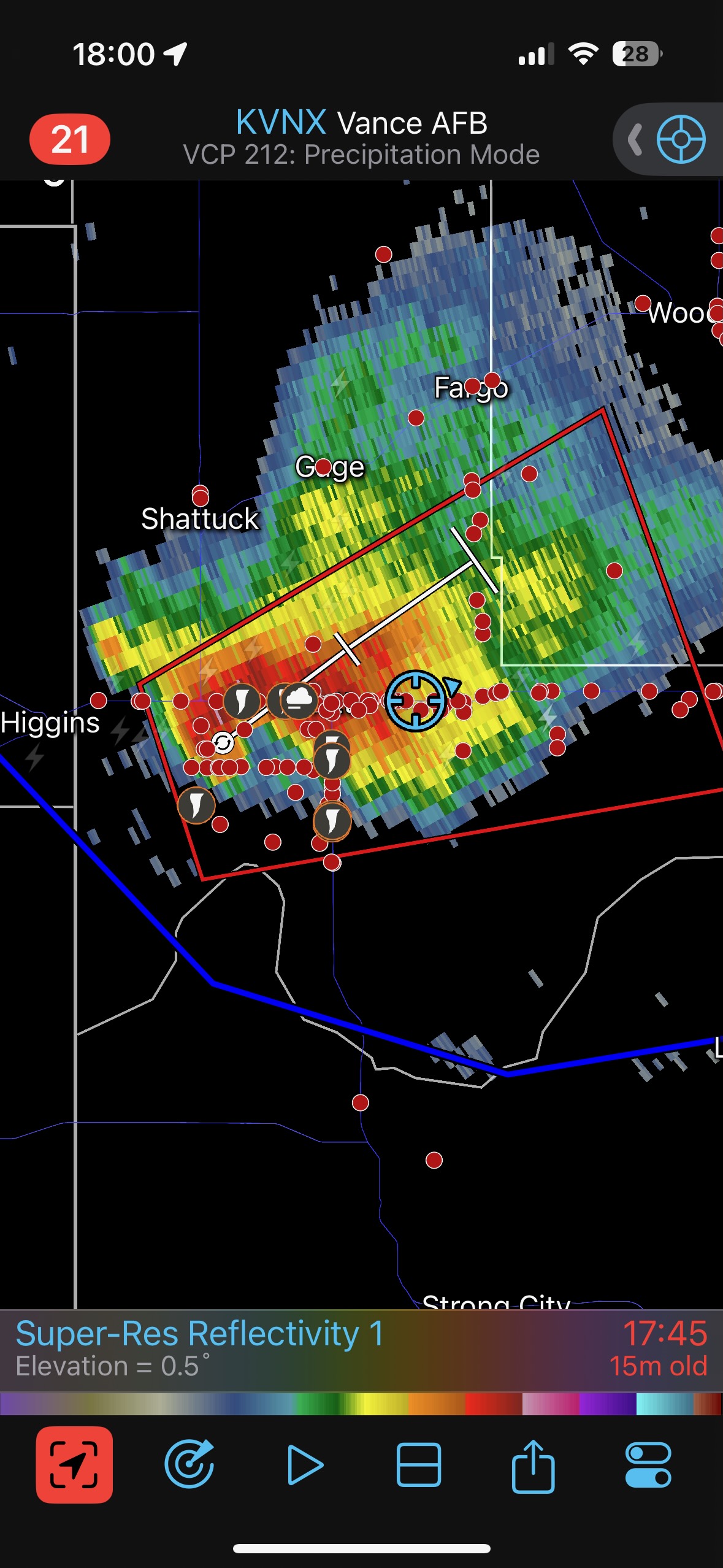
It was time to commit, and the best choice was to dive south in order to get in front of that growing storm near Canadian. If it continued to the northeast, then it would find itself in a very favorable environment in an hour or two. The target storm split, and an additional cell popped up not too far to our west. We had a decent look at these northern two cells (see radar grabs just before 5 p.m. below). But there was nothing happening here which was going to sway me from continuing southward to the Tail-end Charlie storm.
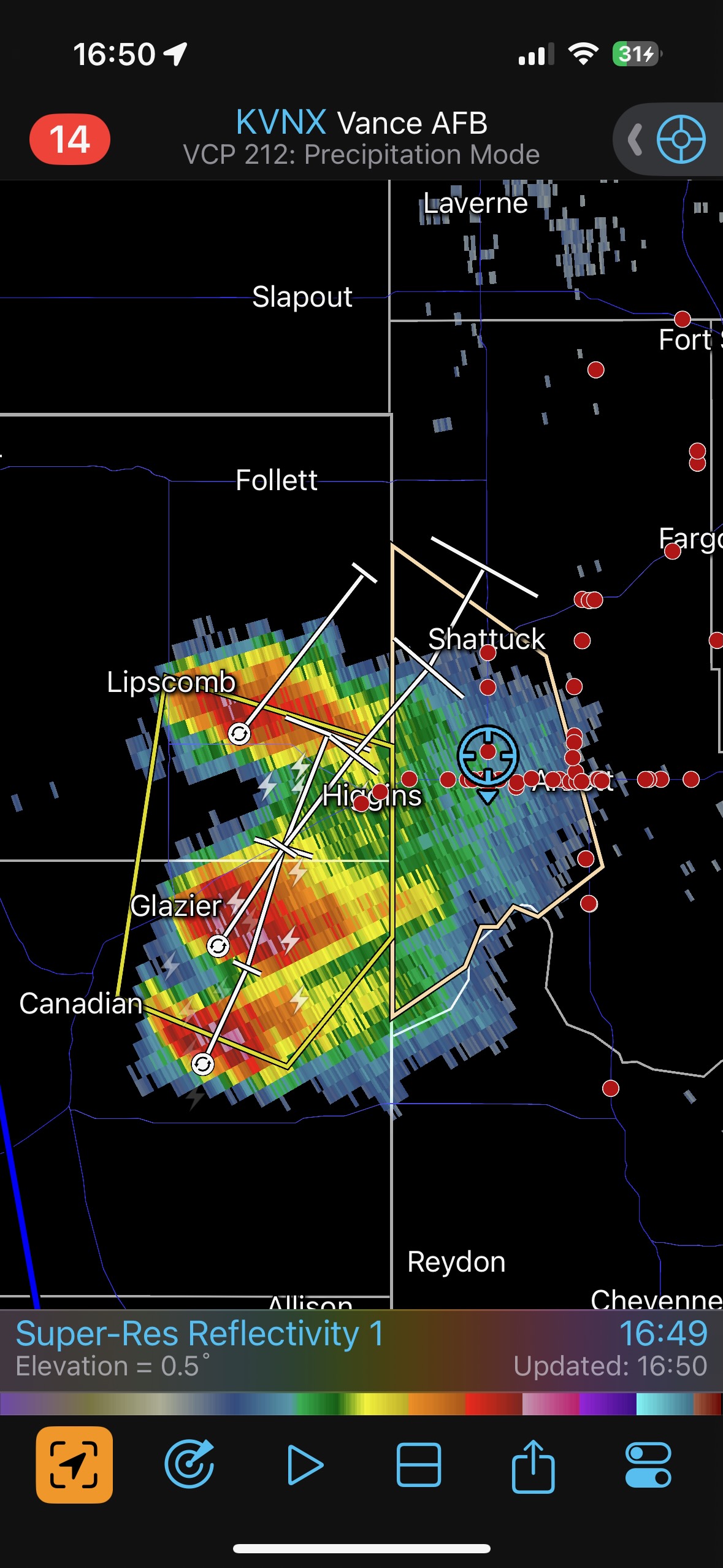
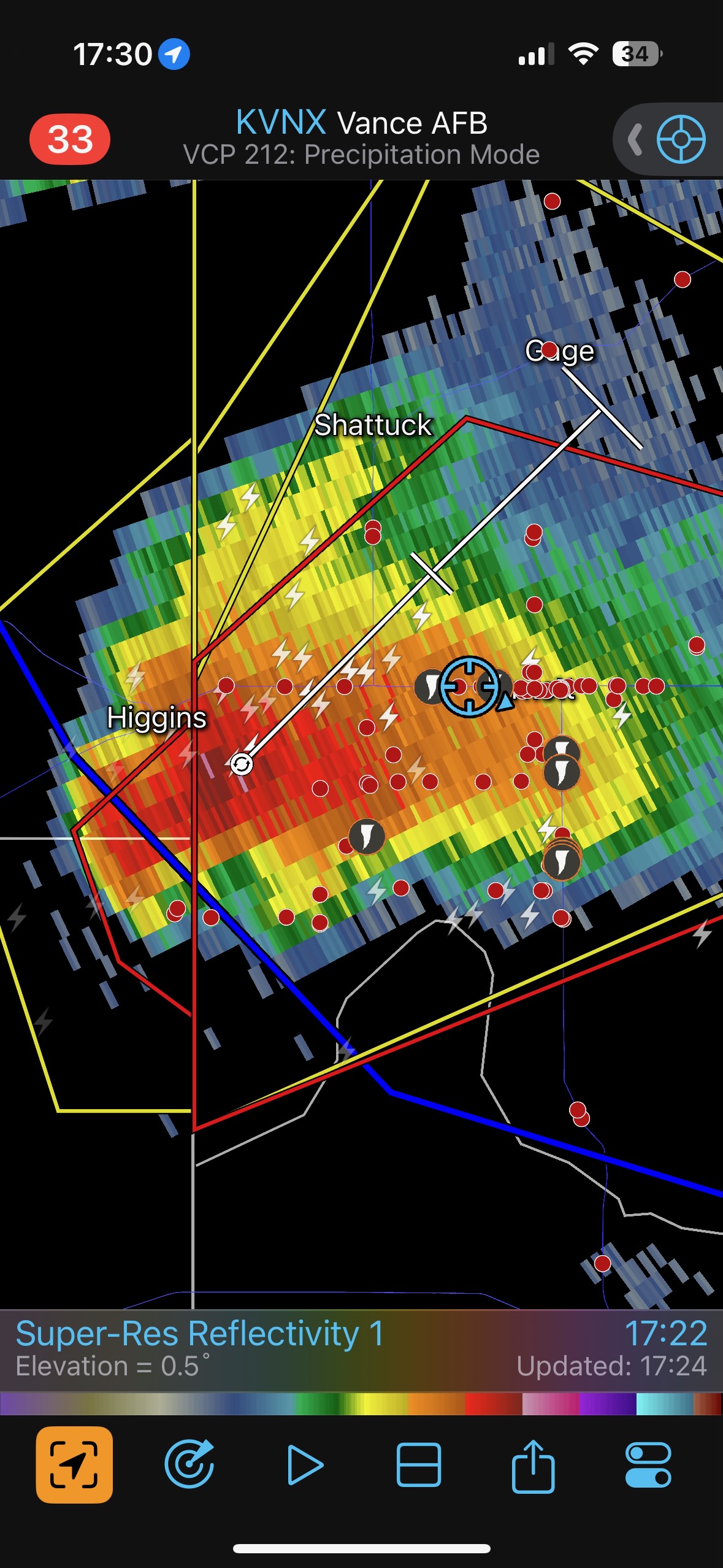
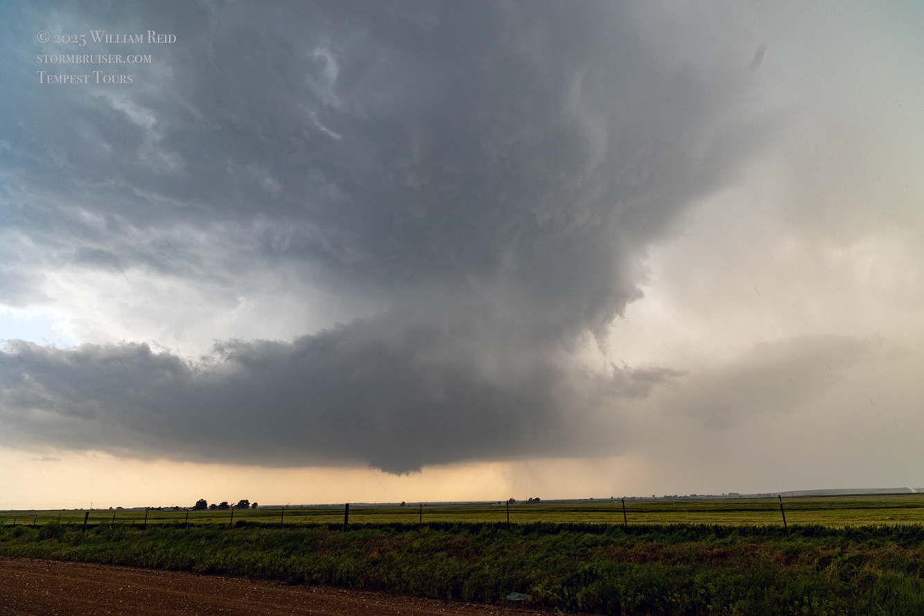
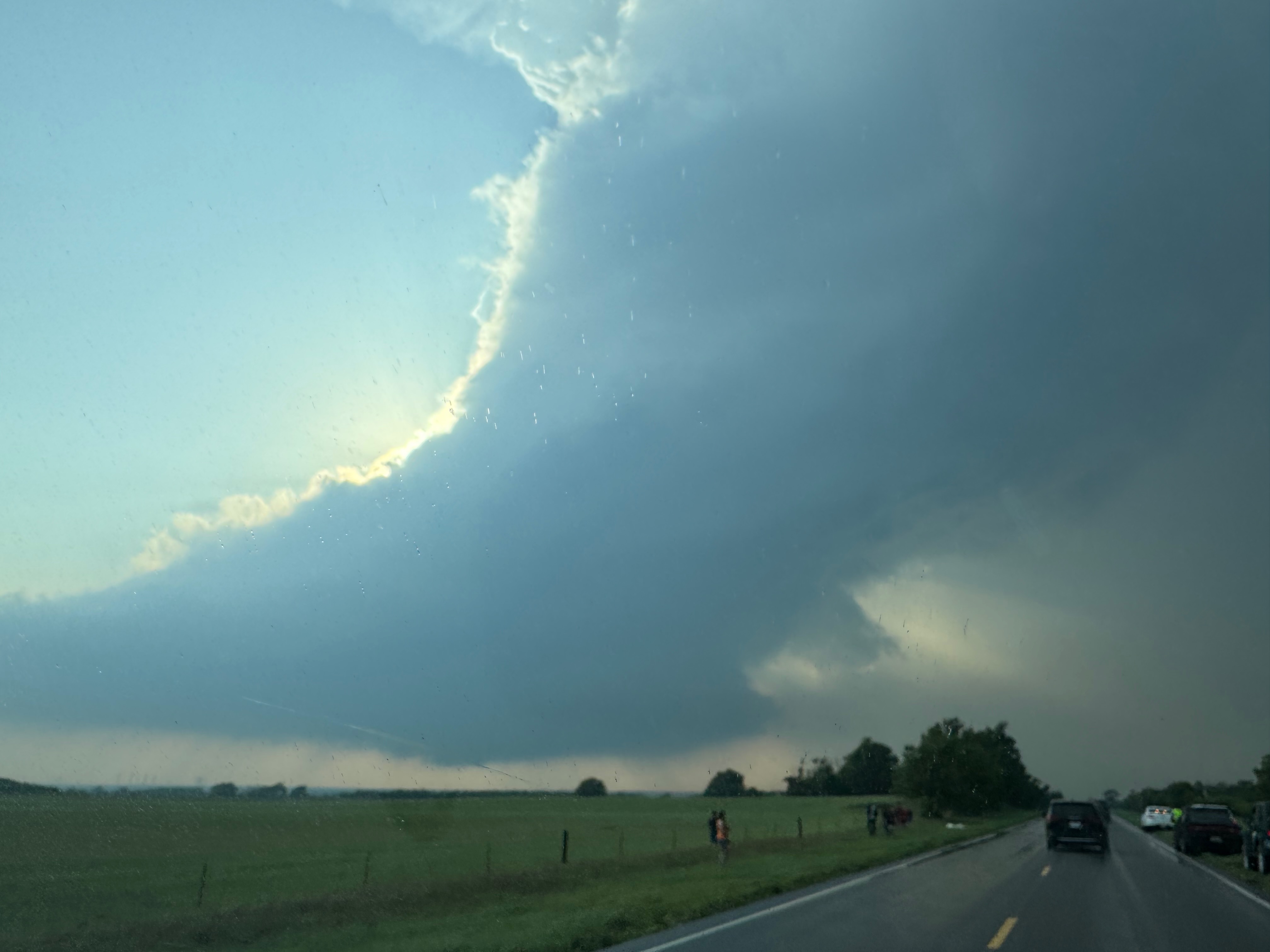
We headed south on 283 and managed a quick pit stop for the guests (and me) at Shattuck. We could start to see a fuzzy base in the distance as we approached E-W road U.S. 60, and we drifted west on 60 just a couple of miles (see radar grab at 5:12 p.m. CDT above). From here we were looking through rain and murk in the forward flank. There may have been a wall cloud and/or funnel to our SSW…but viewing wasn’t too good yet this far north.
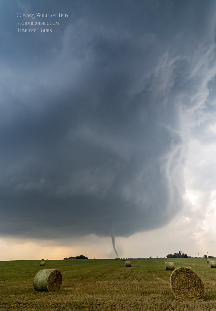
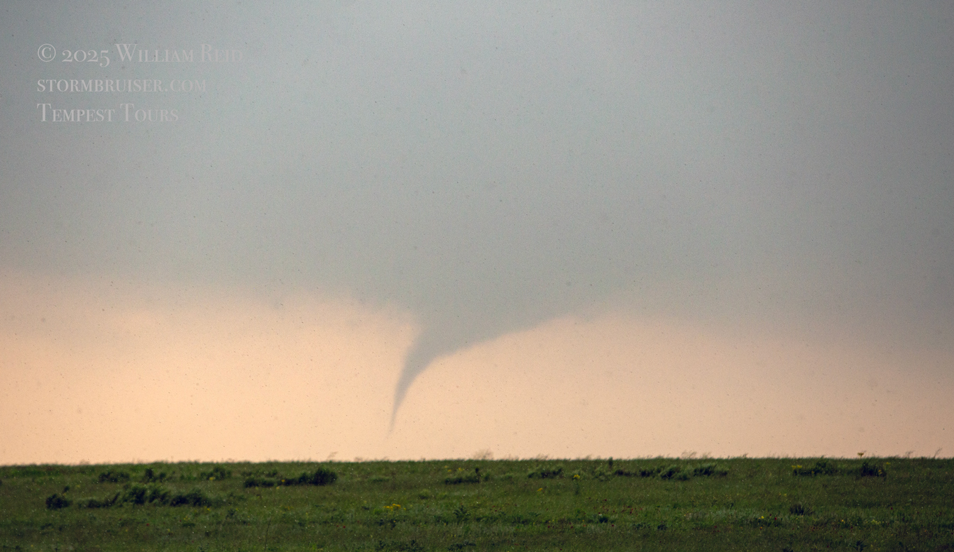
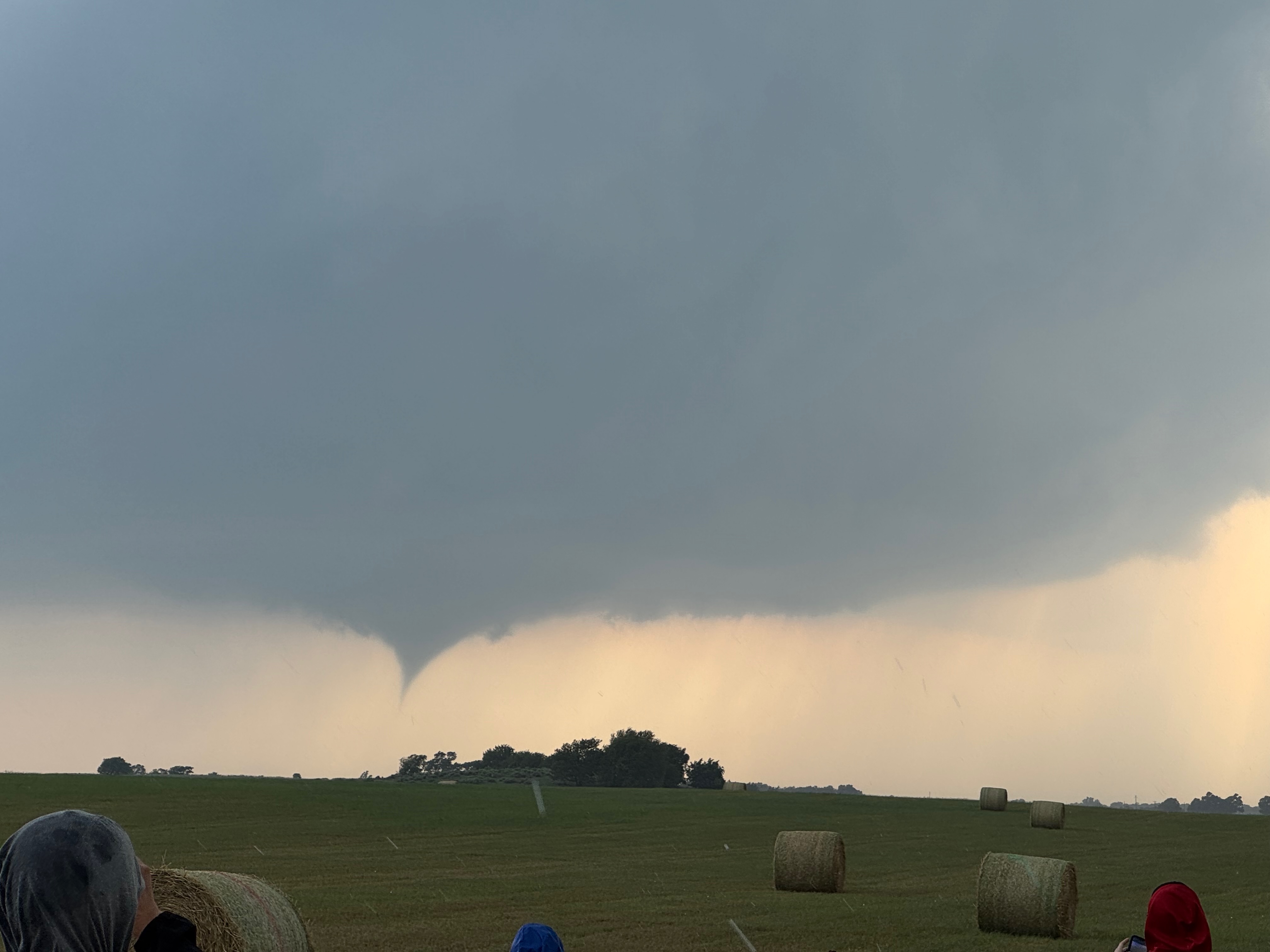
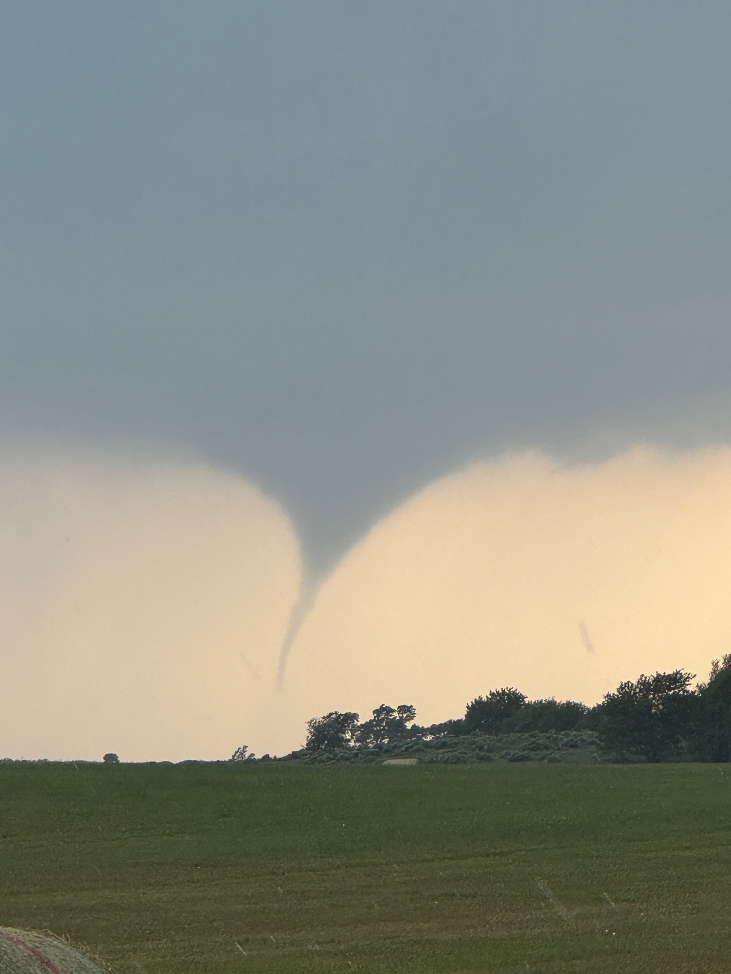
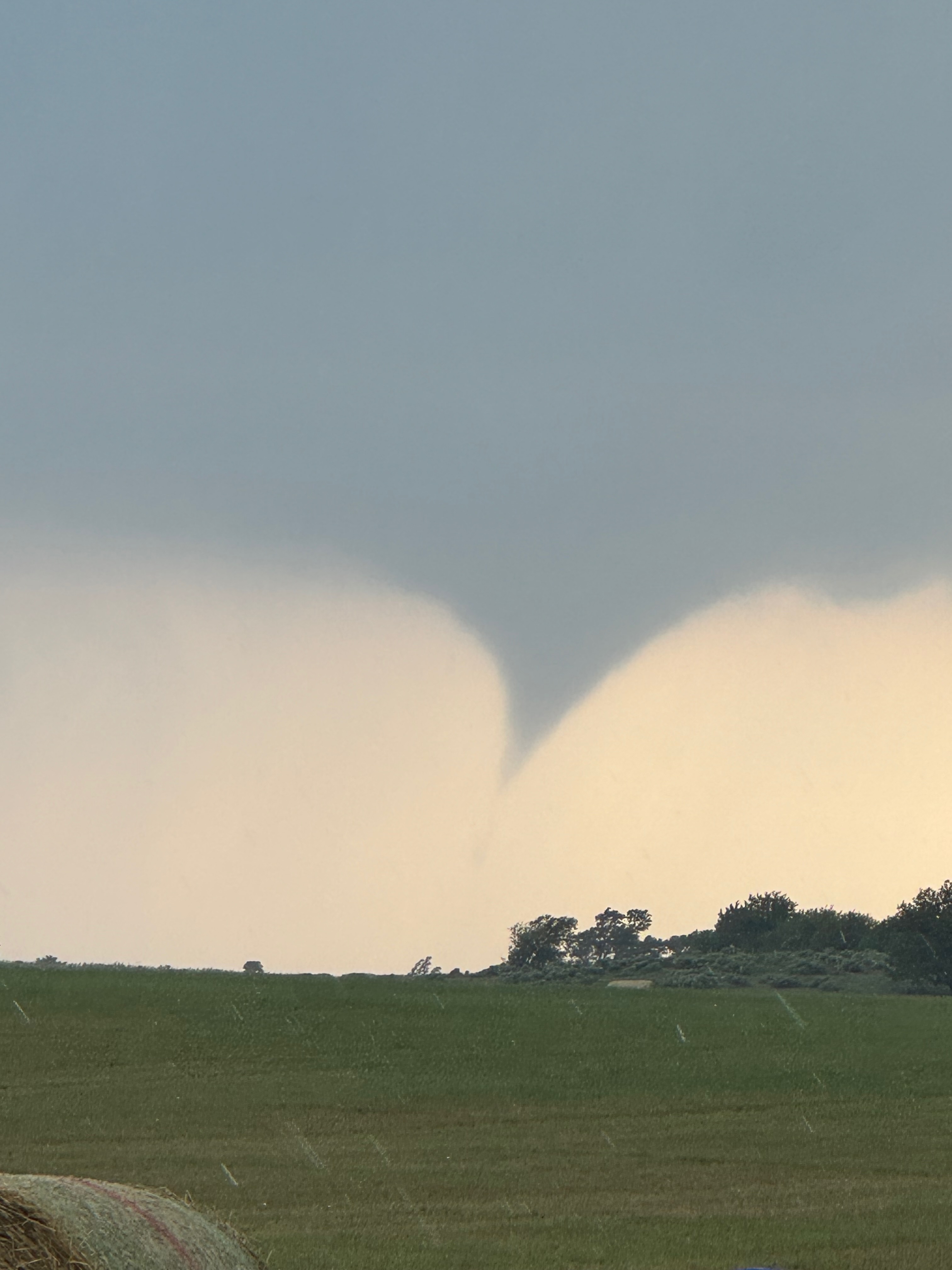
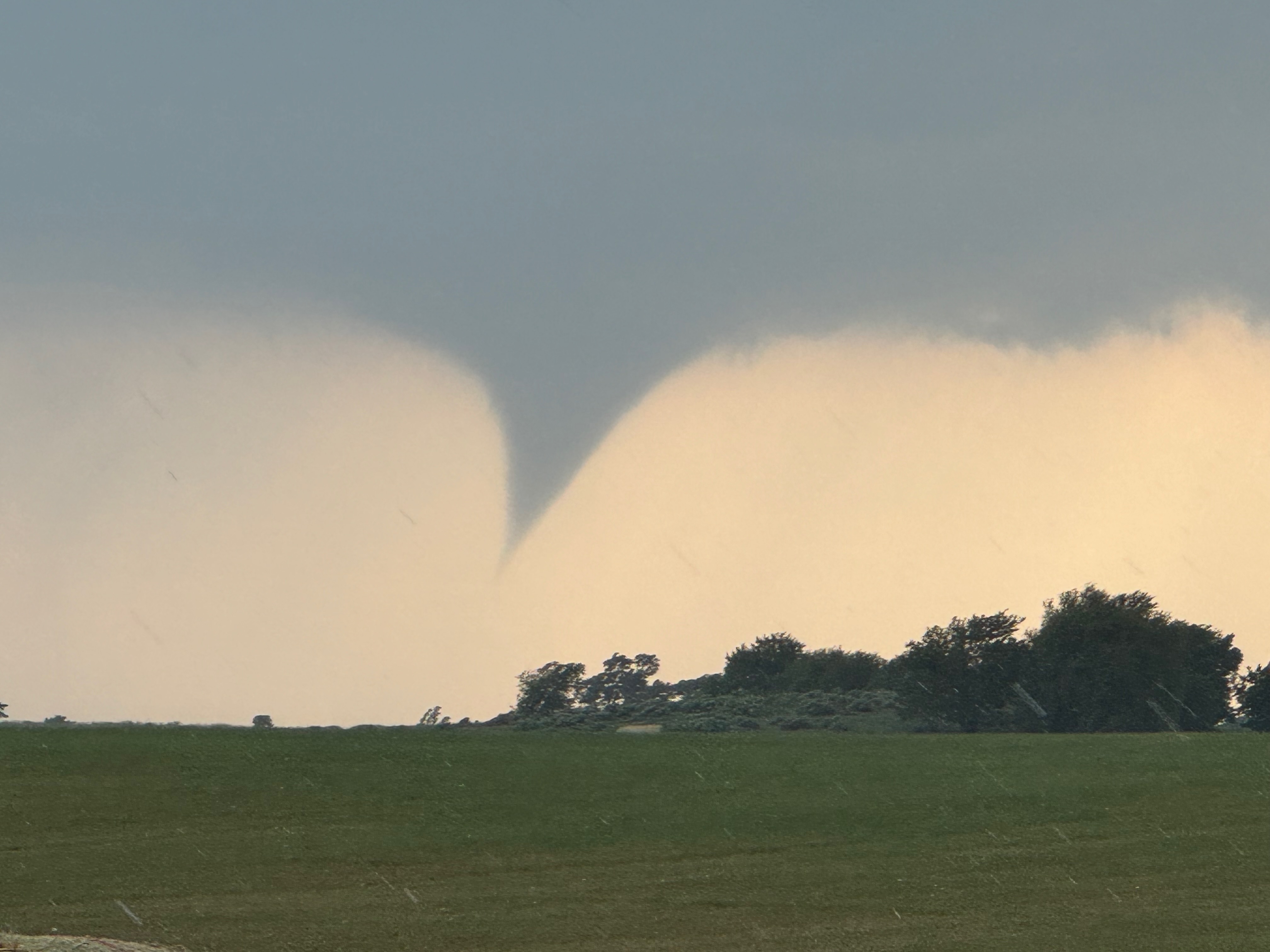
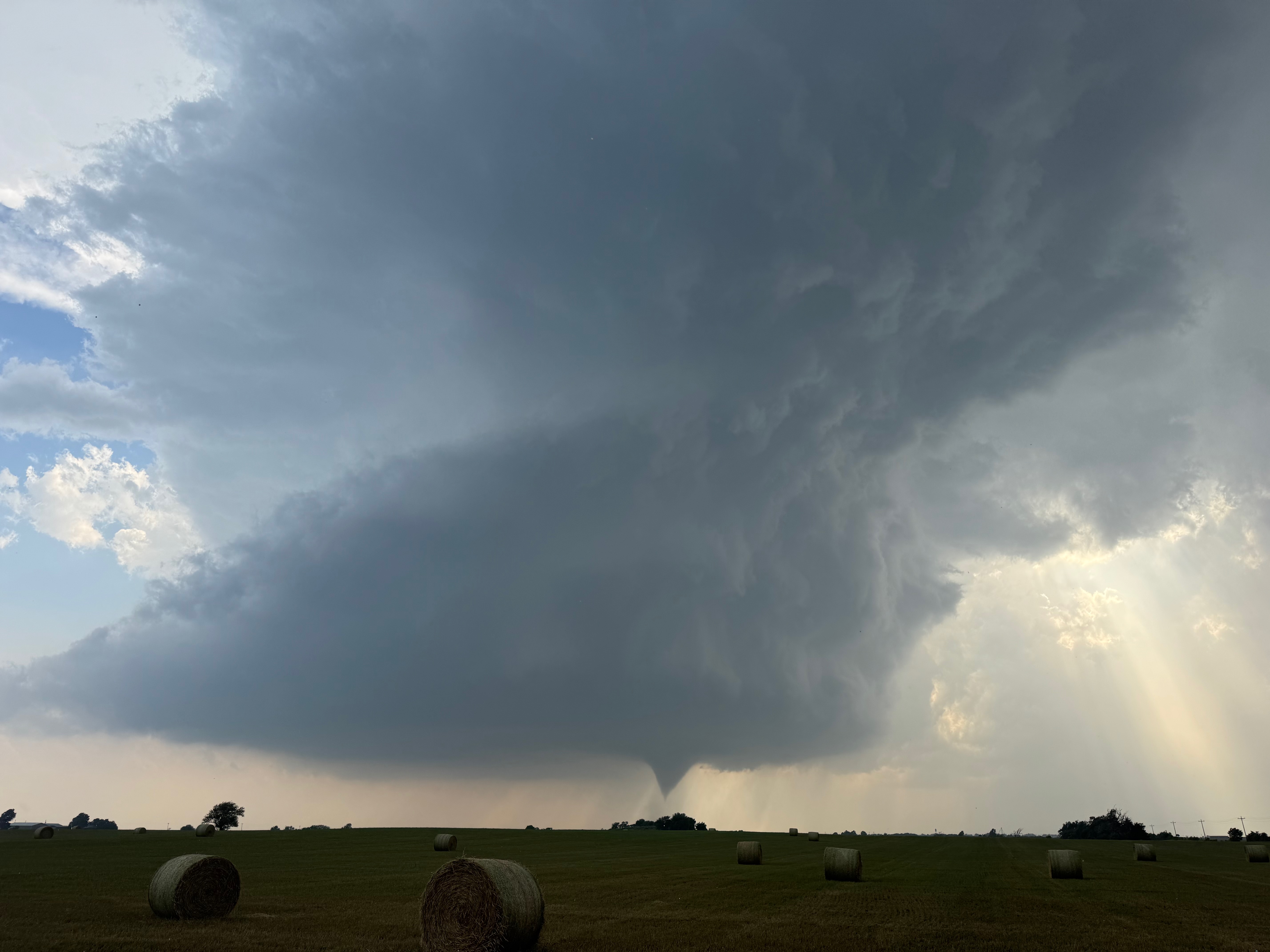
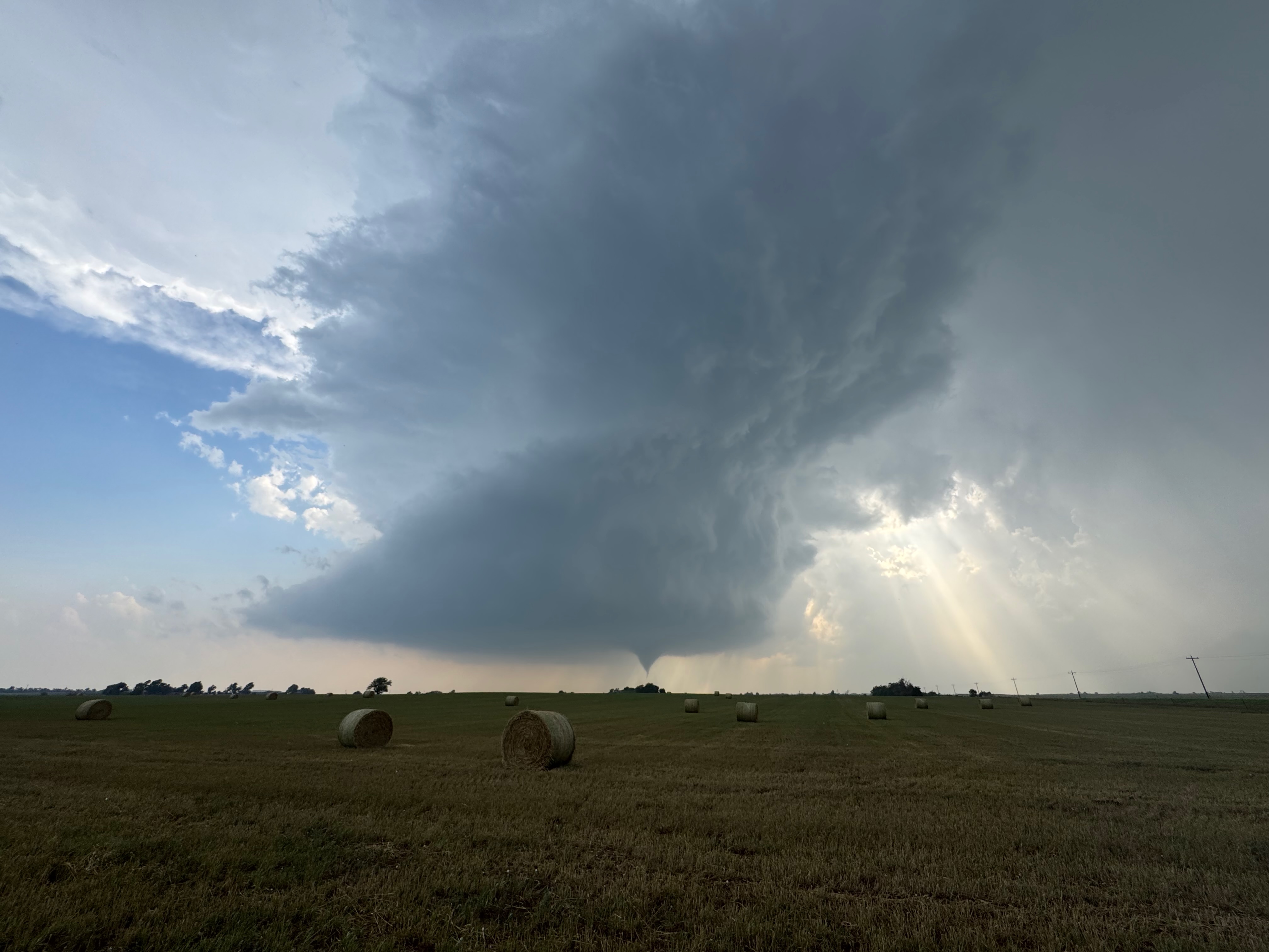
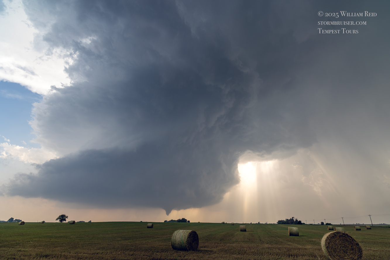
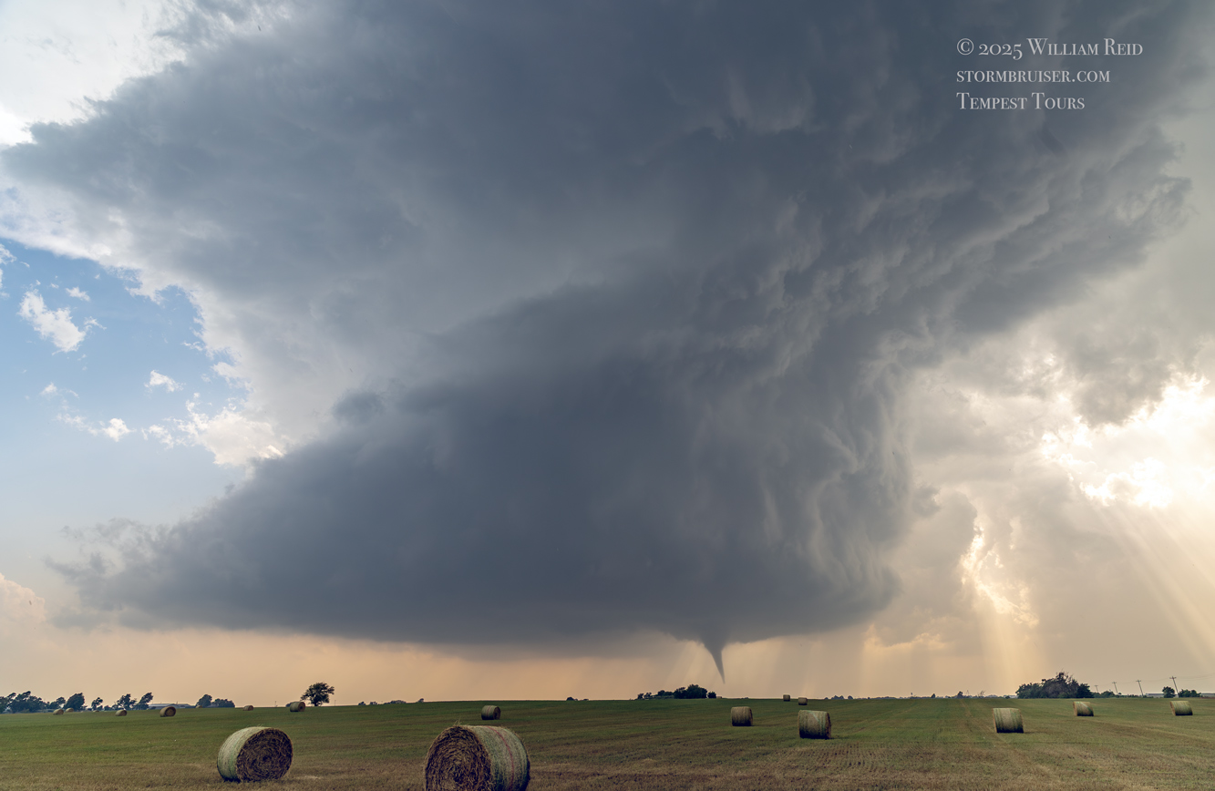
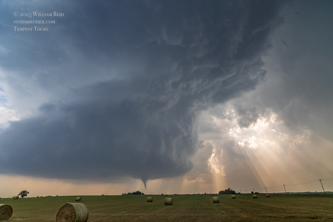
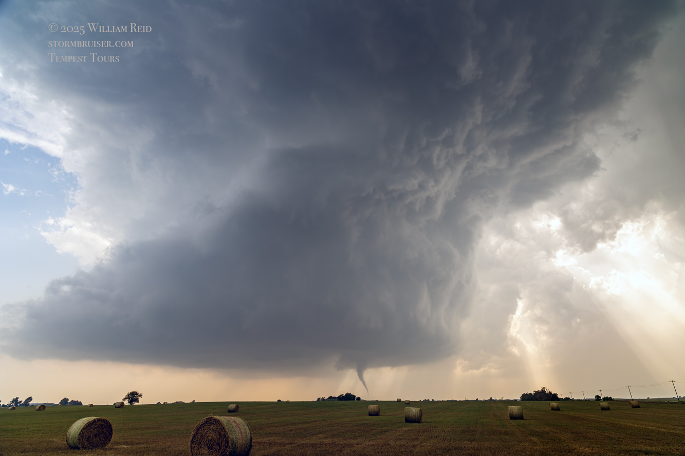
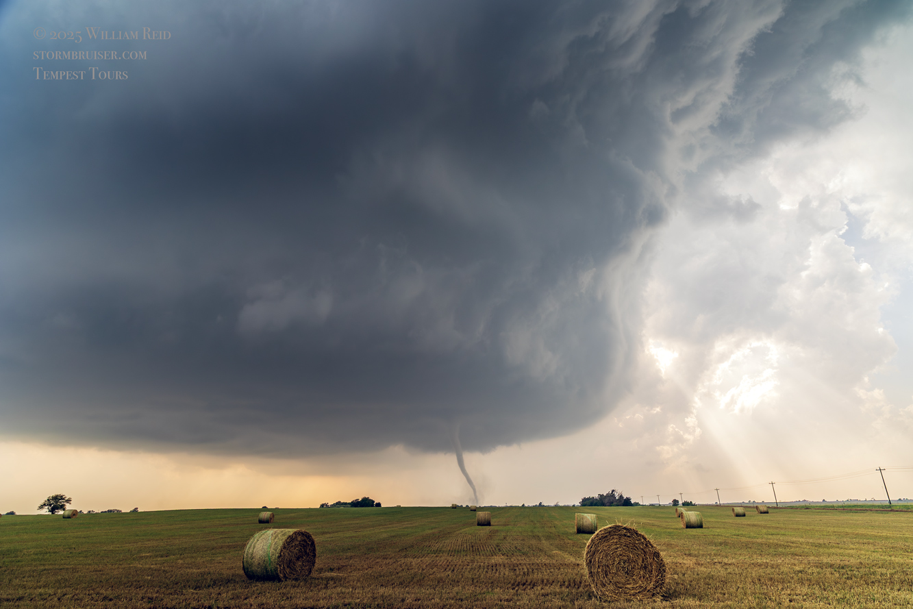
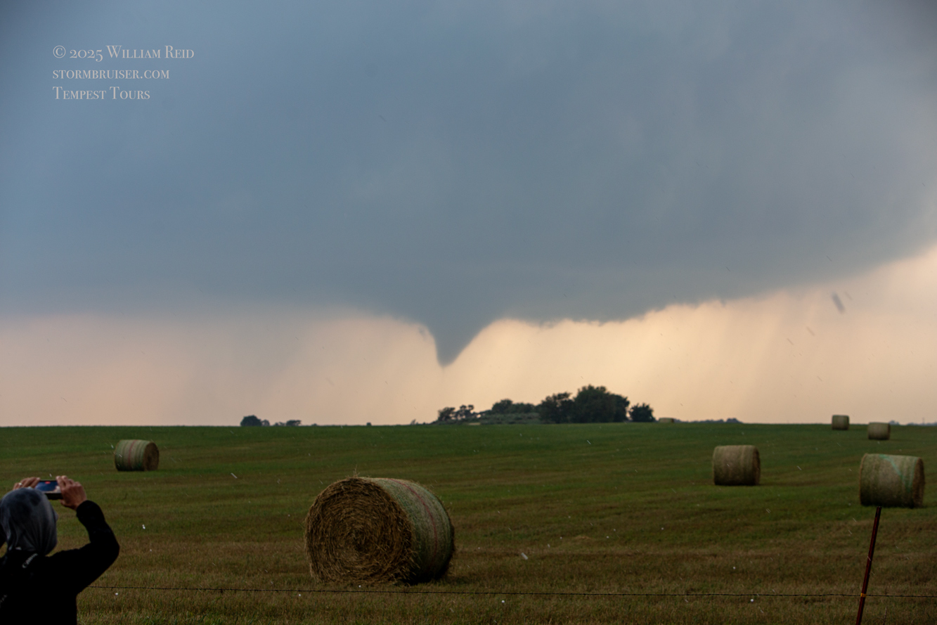
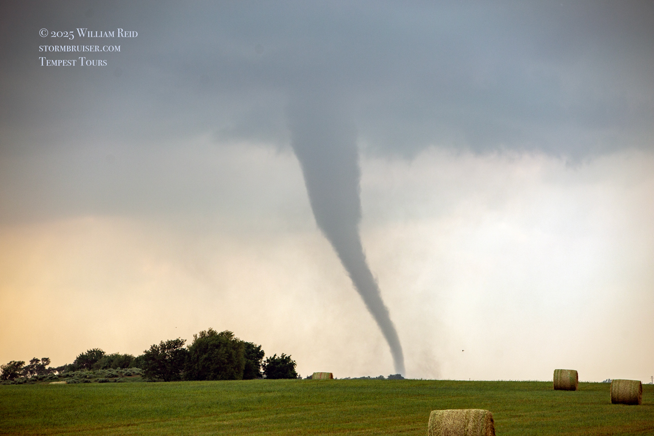
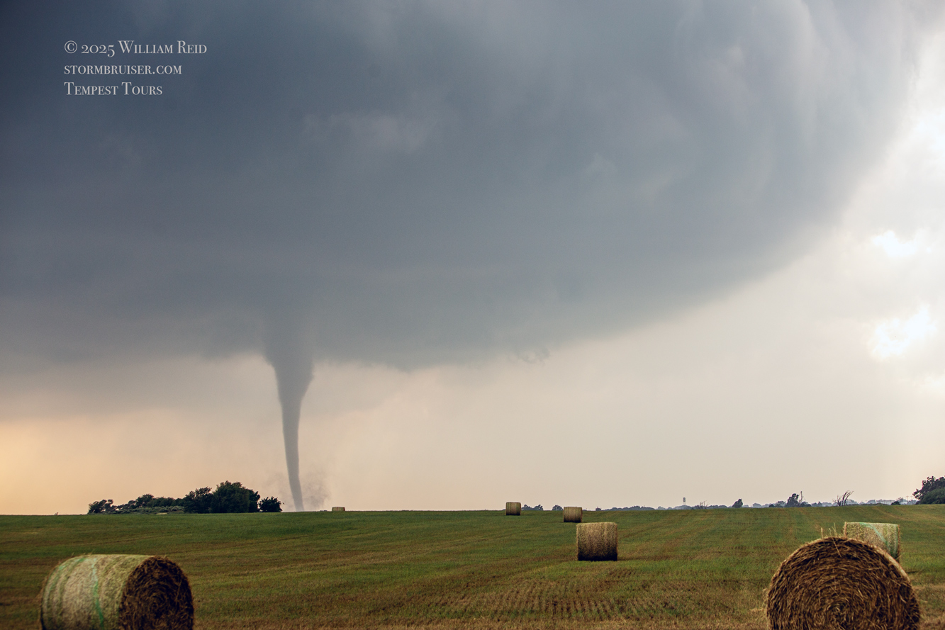
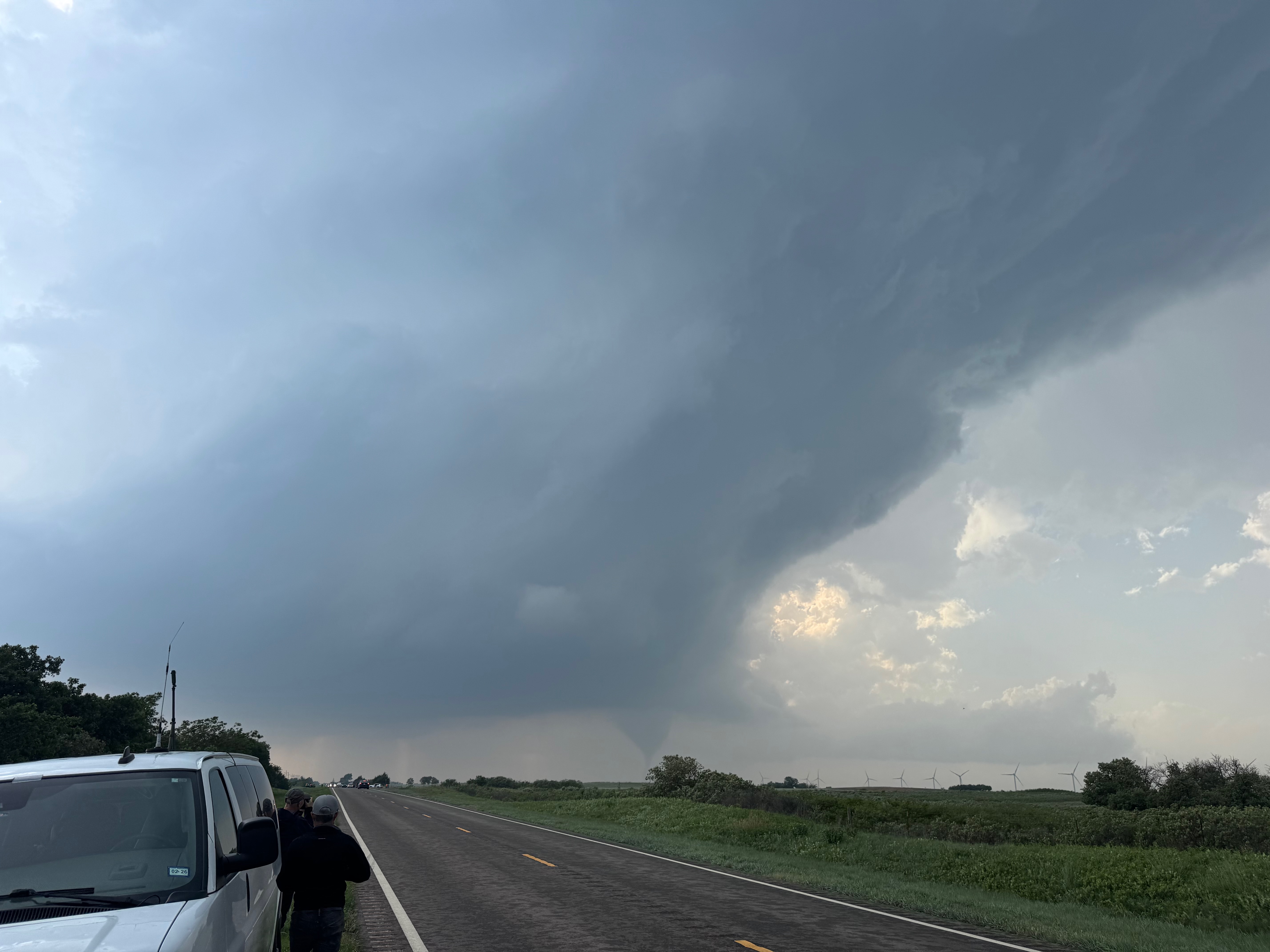
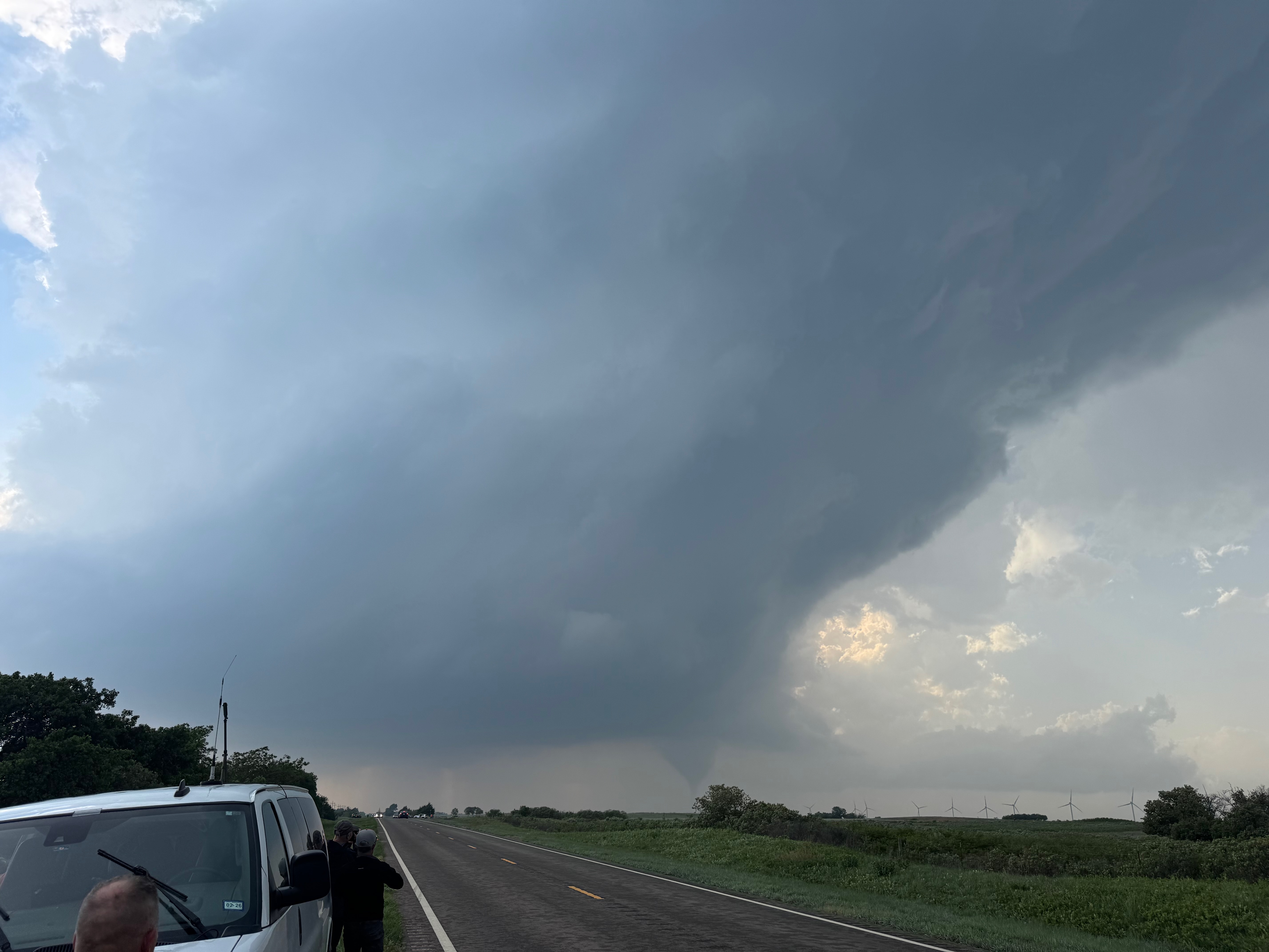
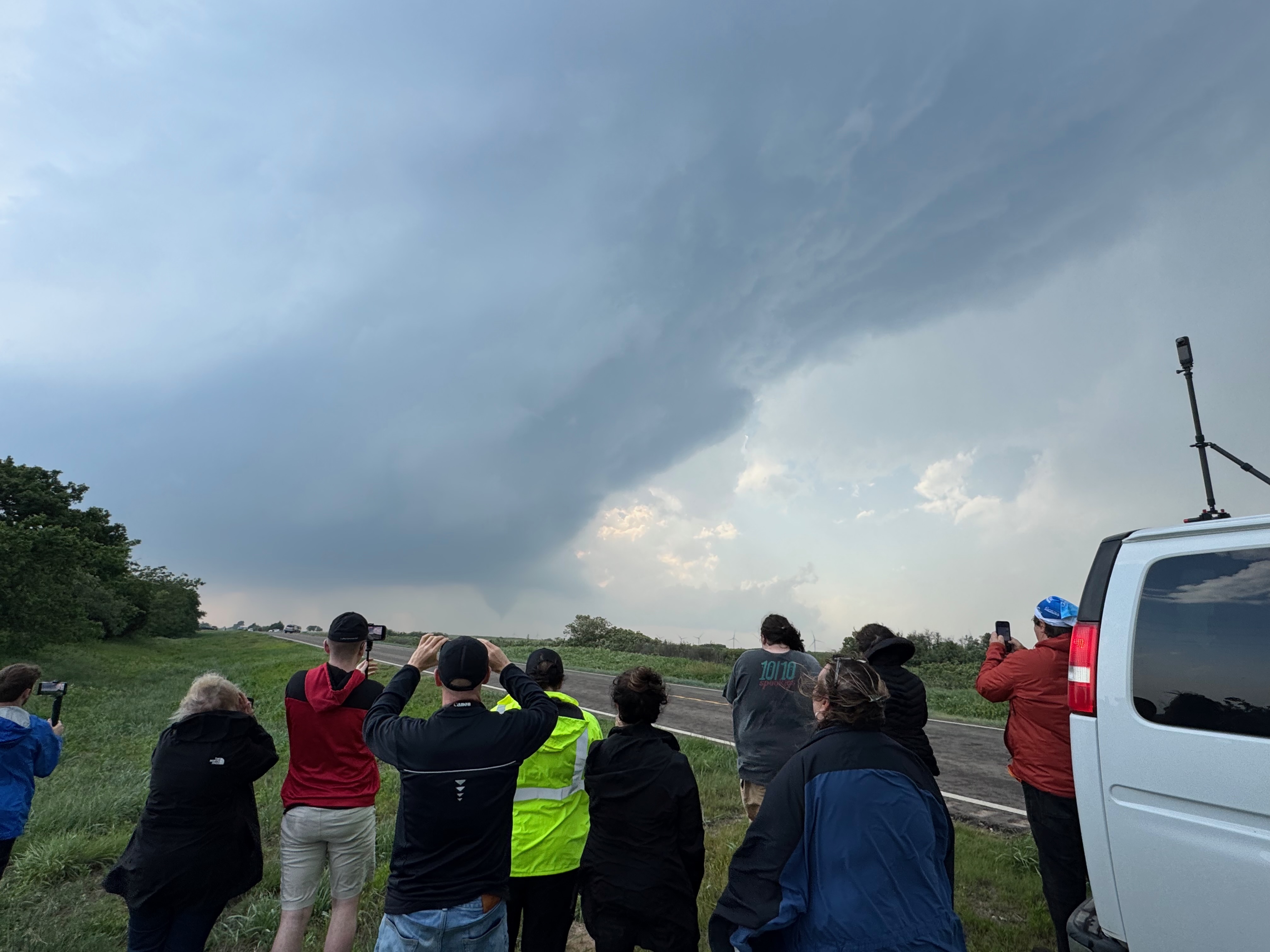
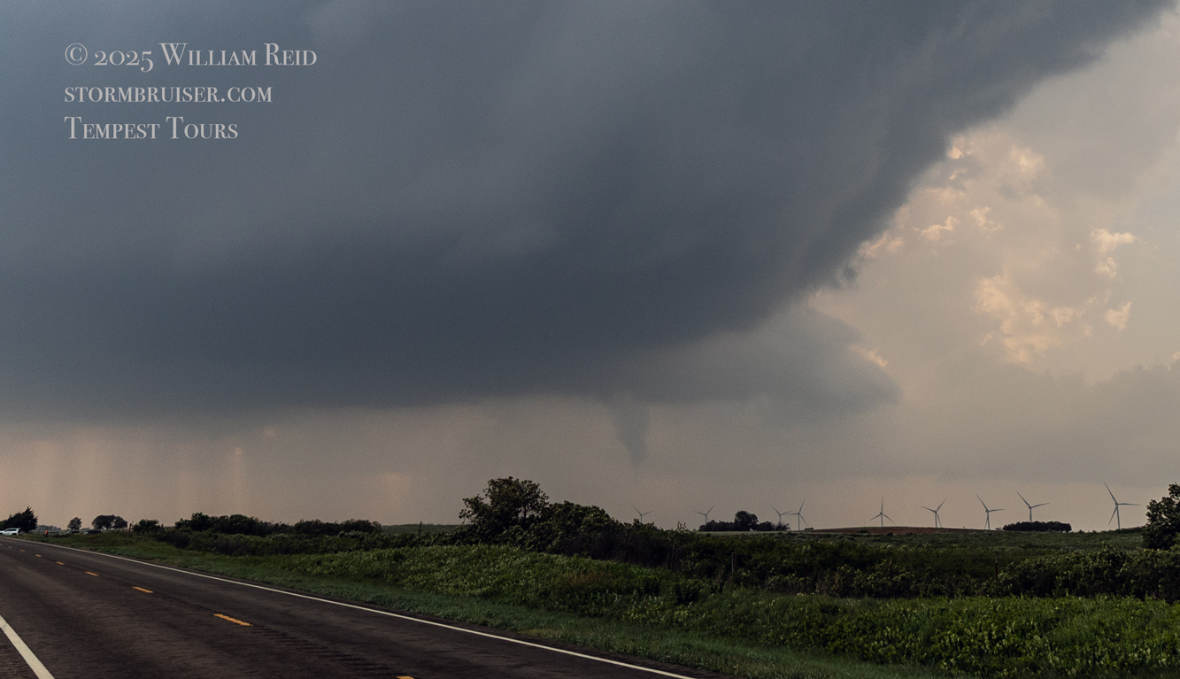
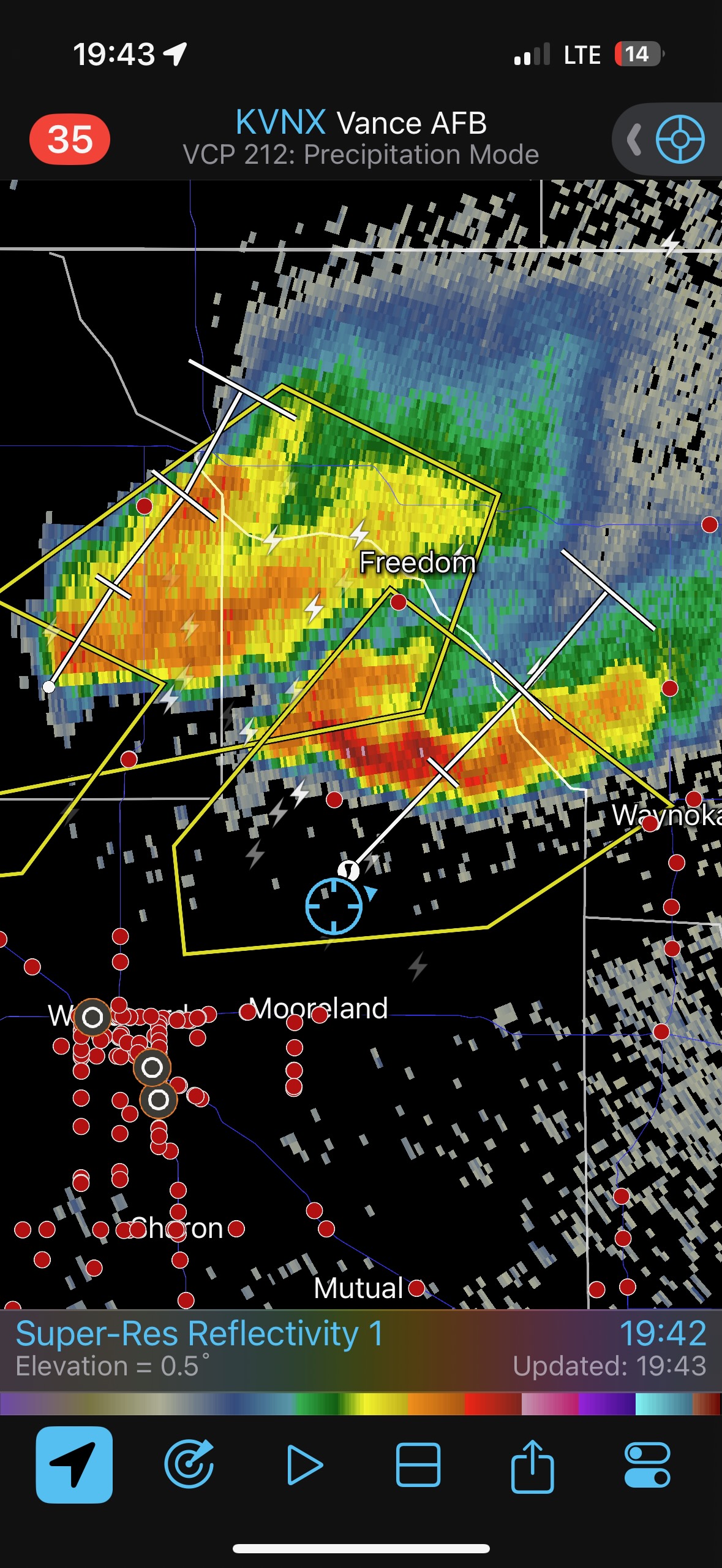
The storm was moving to the northeast, right at us, and light-to-moderate rain and a little hail were becoming bothersome. This precip forced us east several miles, and I stopped a few miles east of the 283/60 junction. The storm base was still a bit distant to our southwest from this spot, but the base was more distinct, and soon we had a little tornado going. This first tornado was rather short-lived, and we moved another couple of miles to the east again due to rain and hail (still west of Arnett).
It was close to 5:30 p.m. CDT now (see radar grab above), and once again a slender tornado developed. This one persisted for several minutes at least, and the storm edged nearer. See pics below.
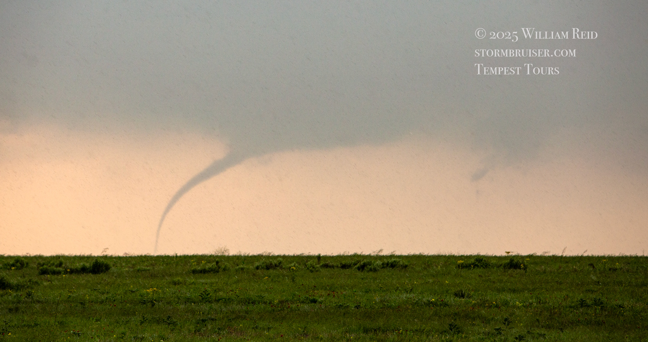
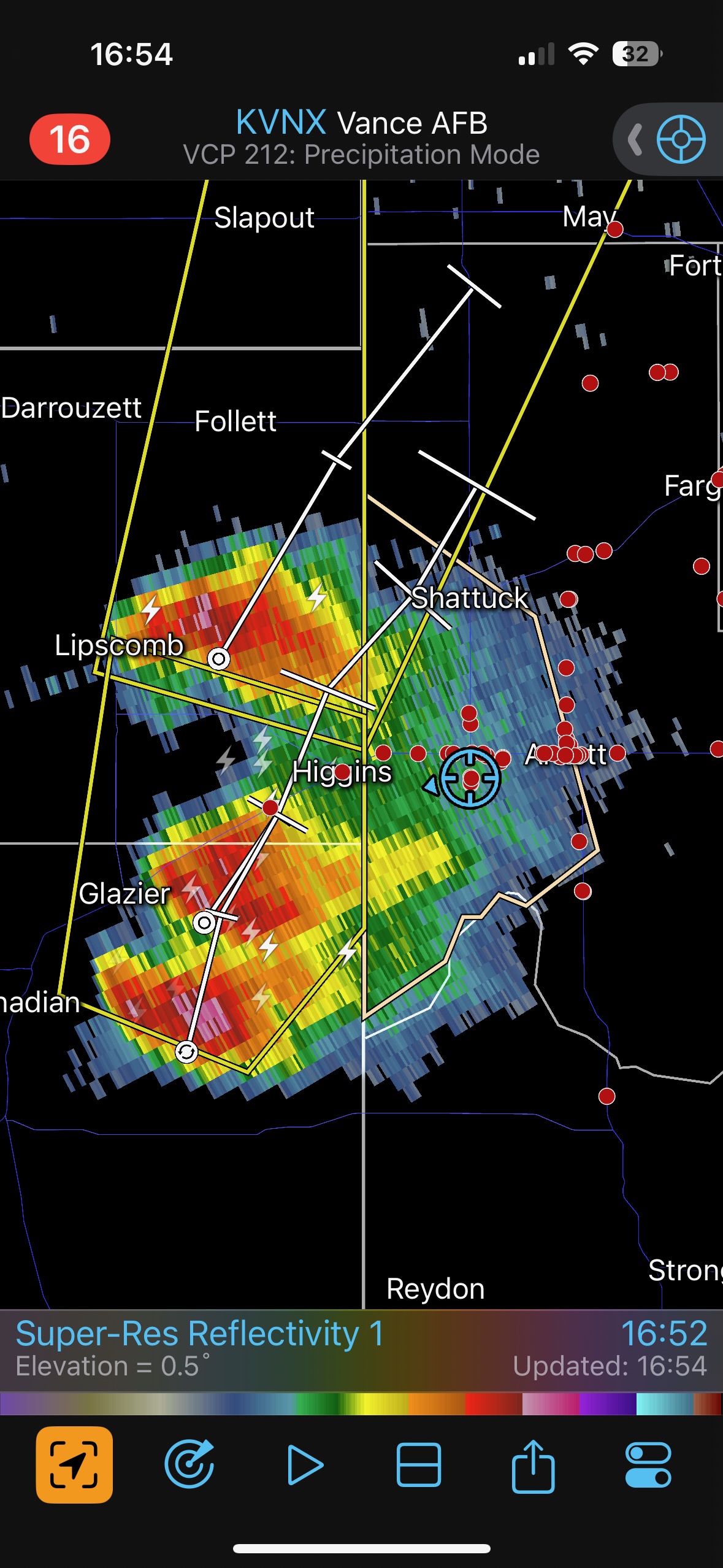
That was a pretty good show, but the tornado was quite distant. The good news was that the supercell continued its approach towards U.S. 60, towards Arnett, towards us, and towards even better air.
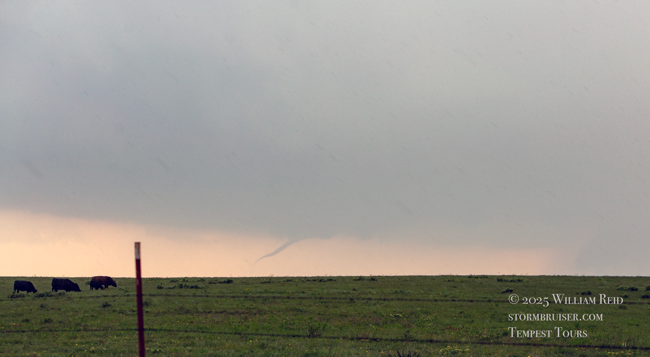
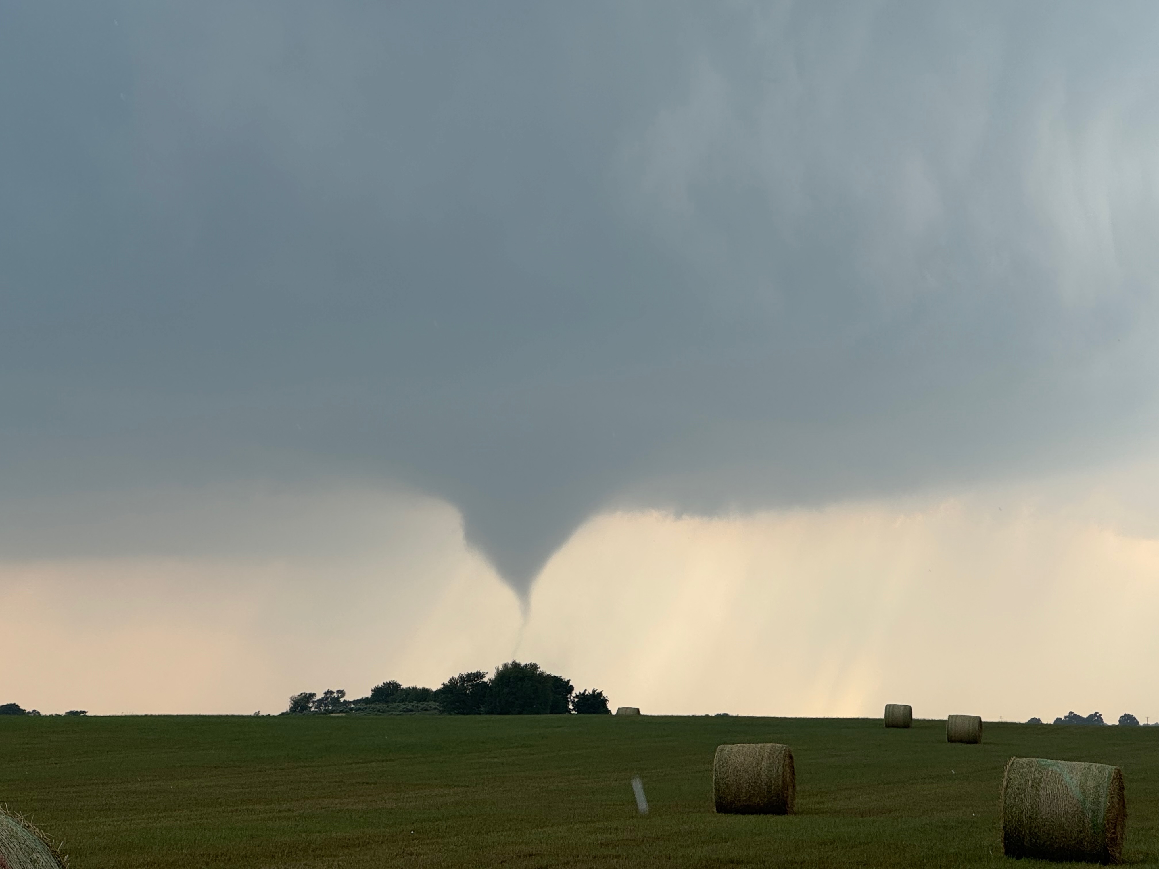
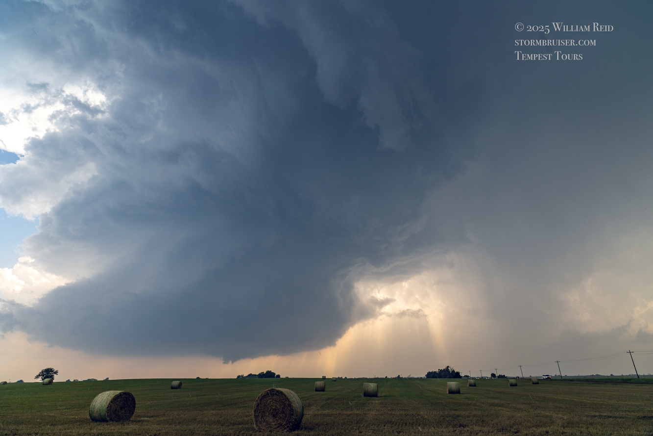
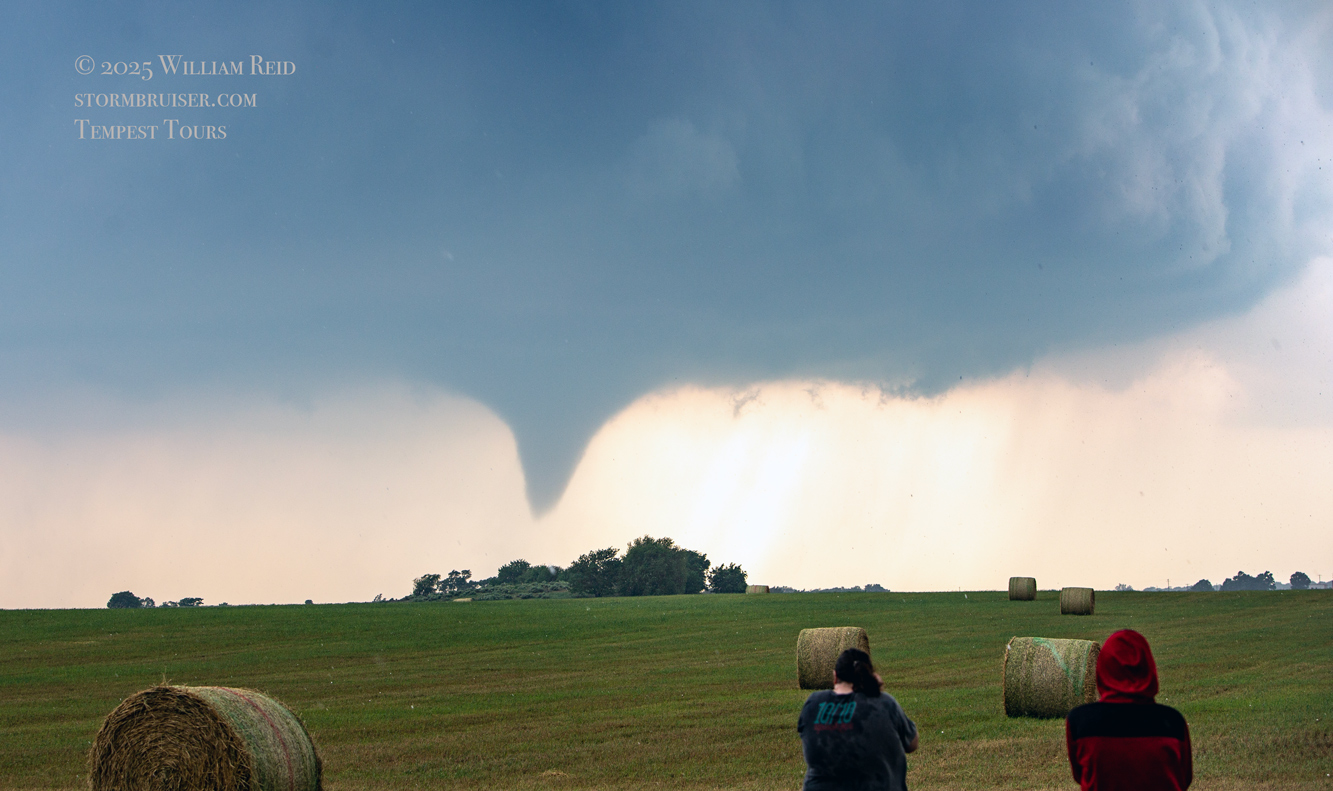
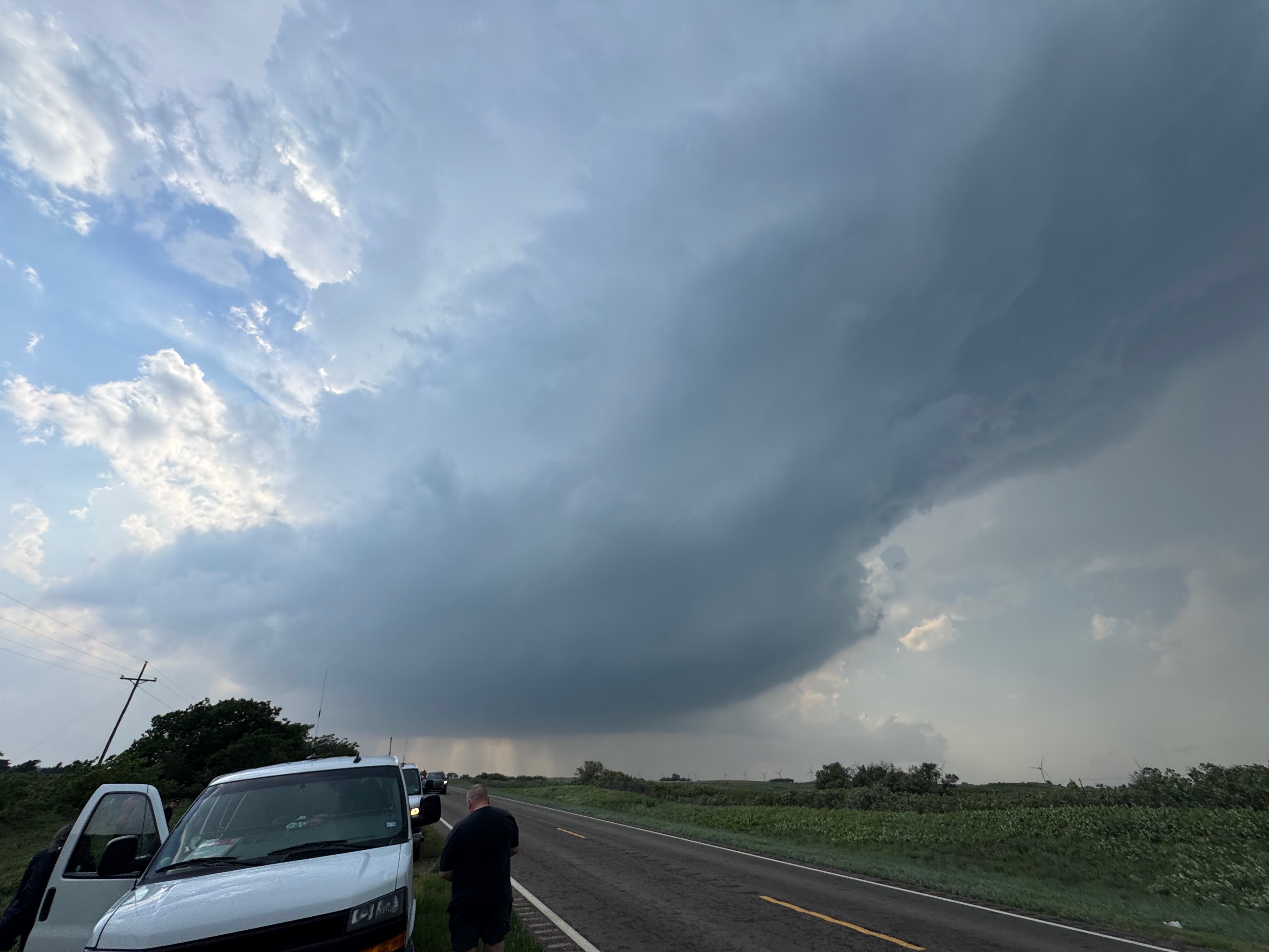
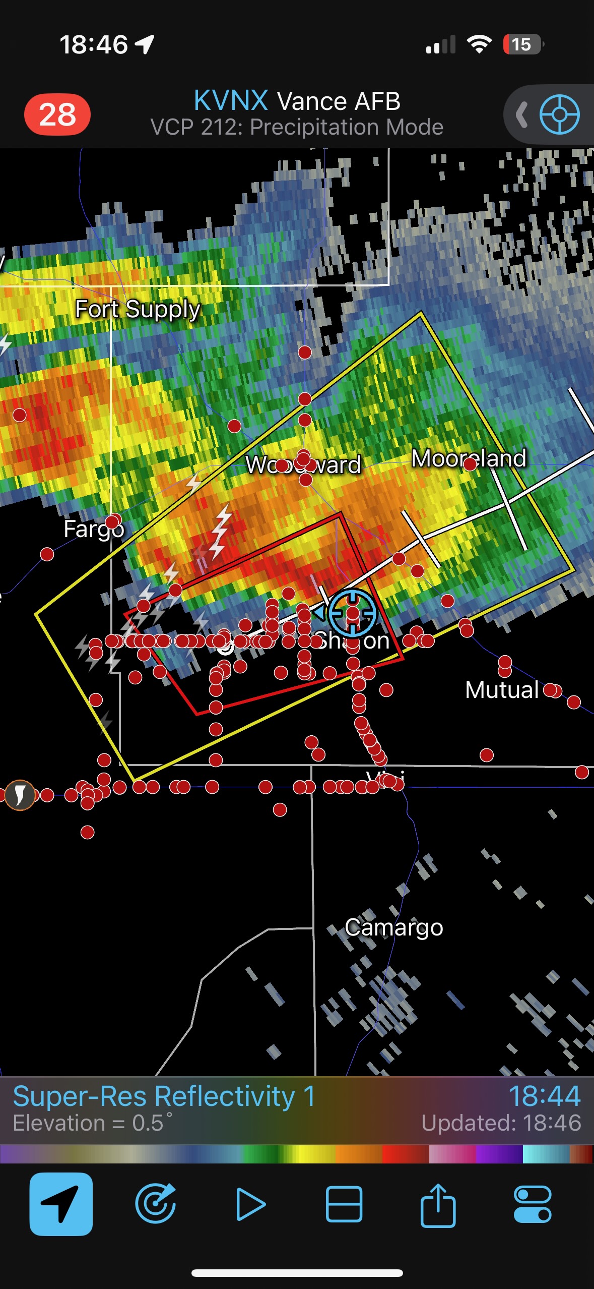
Yet again, our location was getting an annoying amount of rain and hail. This wasn’t exactly a surprise, since we were right underneath the storm’s anvil and in the path of the updraft base. The hail started to get uncomfortably large, around nickel-to-quarter size, so we shifted eastward once again. This time we went through Arnett and stopped maybe a mile or two east of town. I think we were a mile east of where 283 heads south again. The storm was moving more to the ENE versus the NE now, and the action area was still several miles south of U.S. 60., to our WSW.
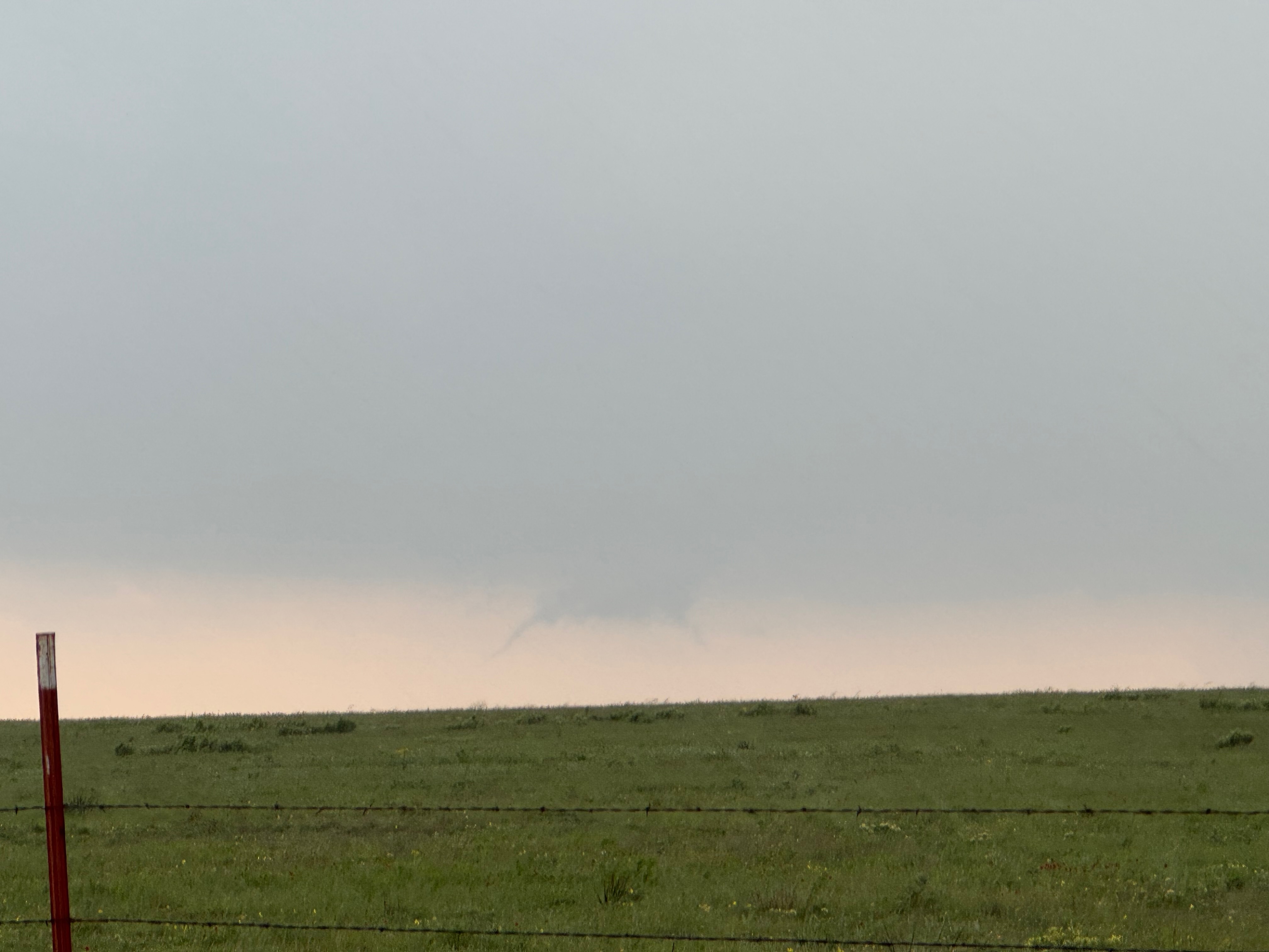
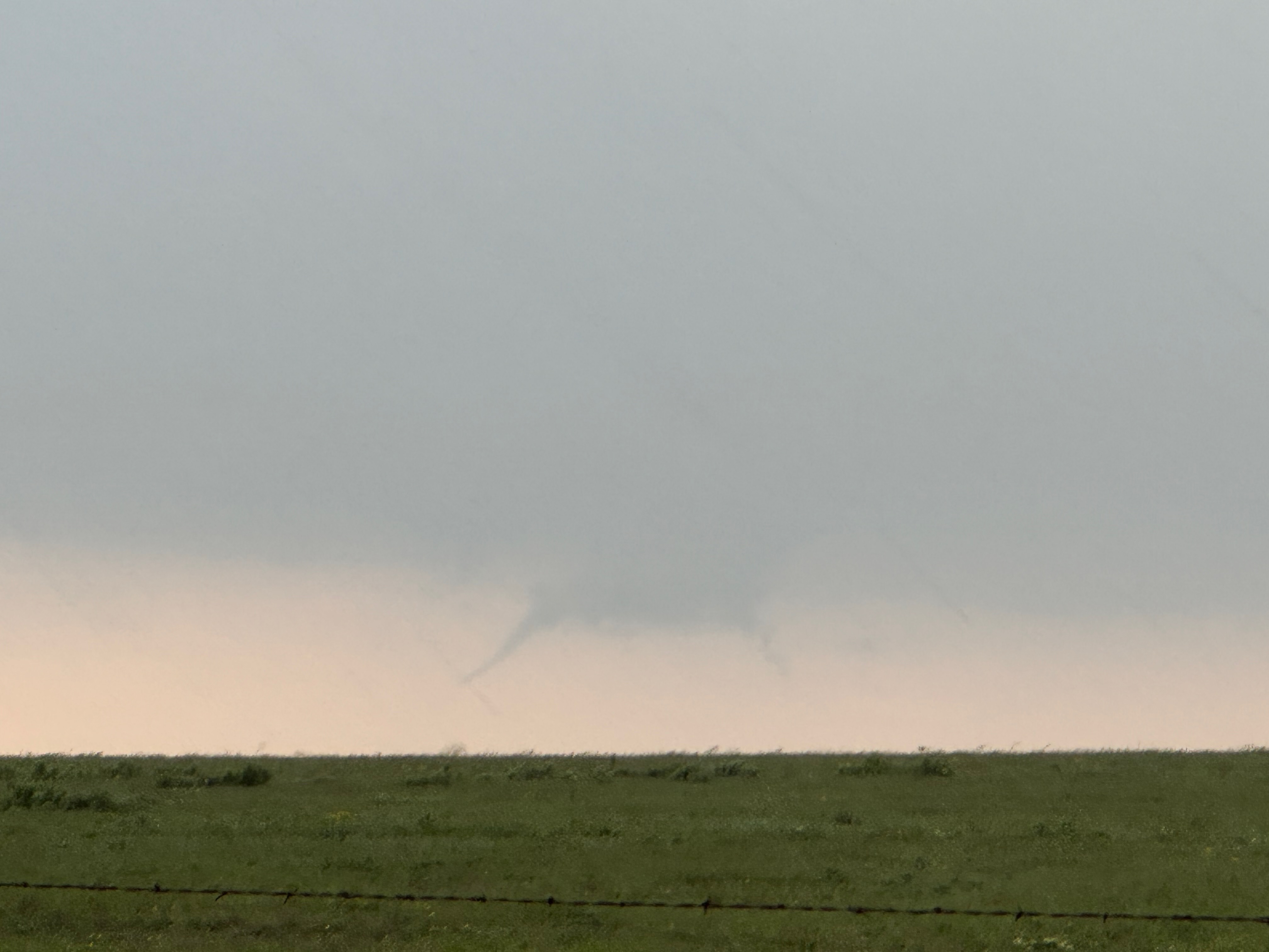
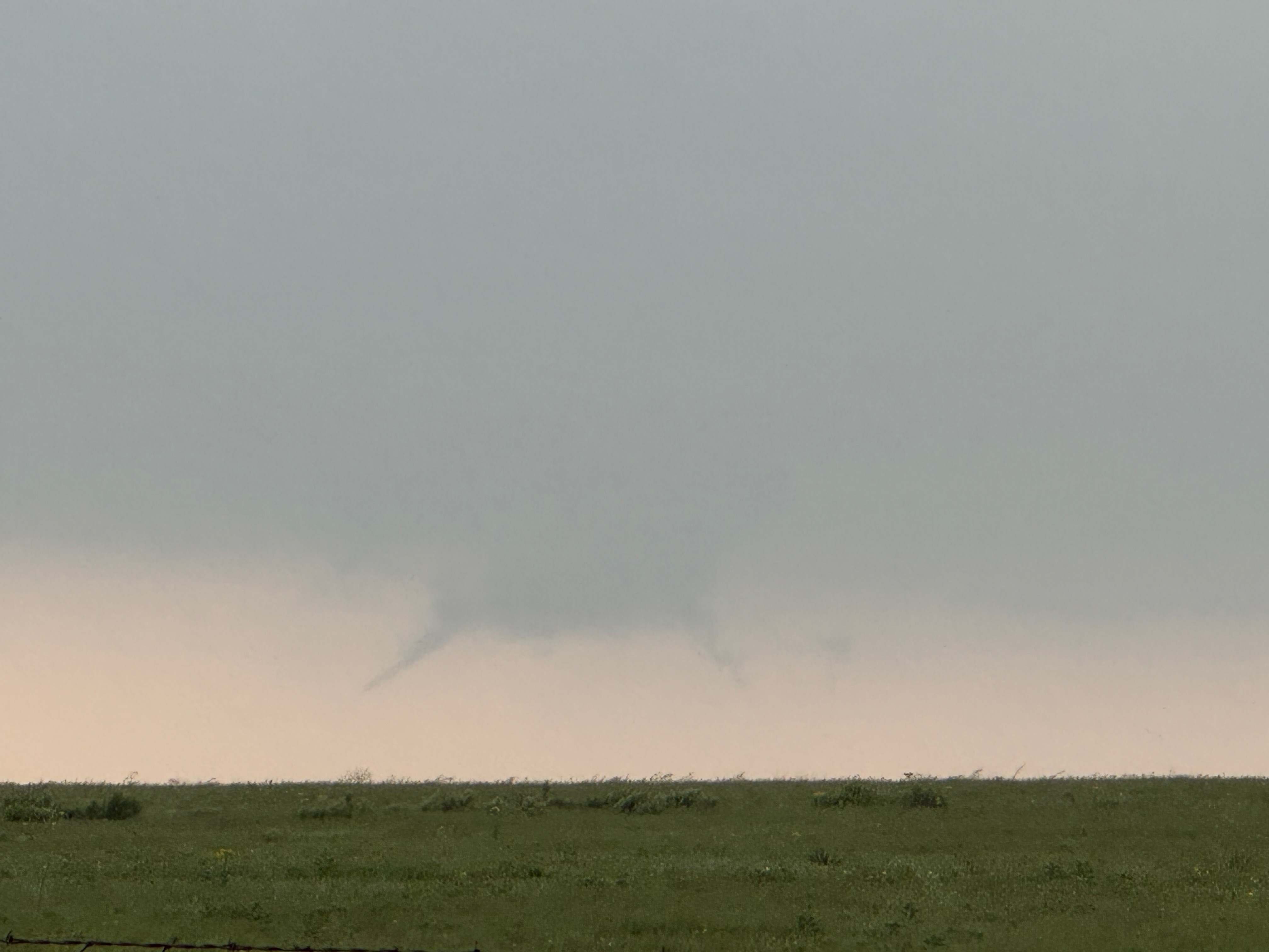
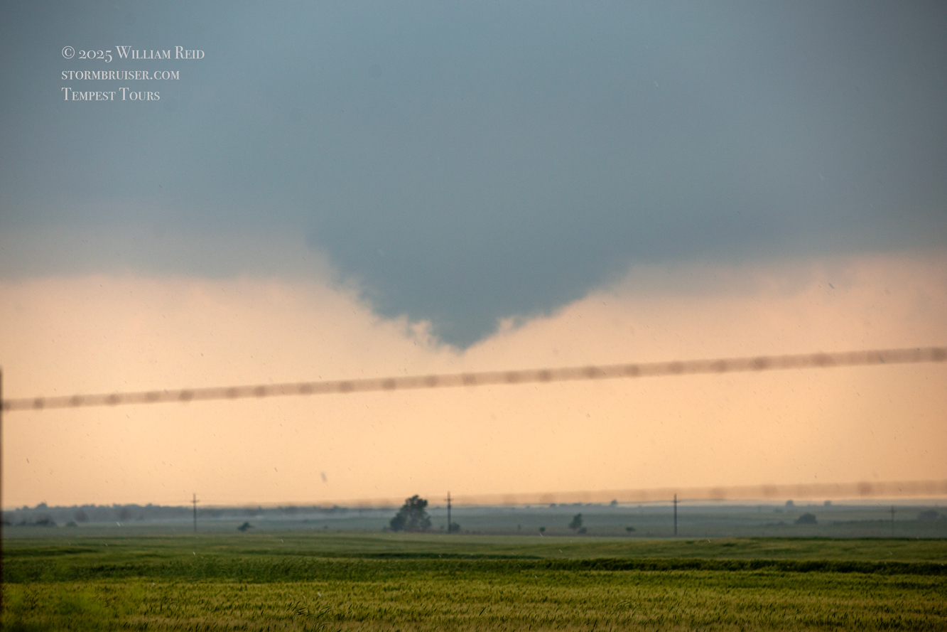
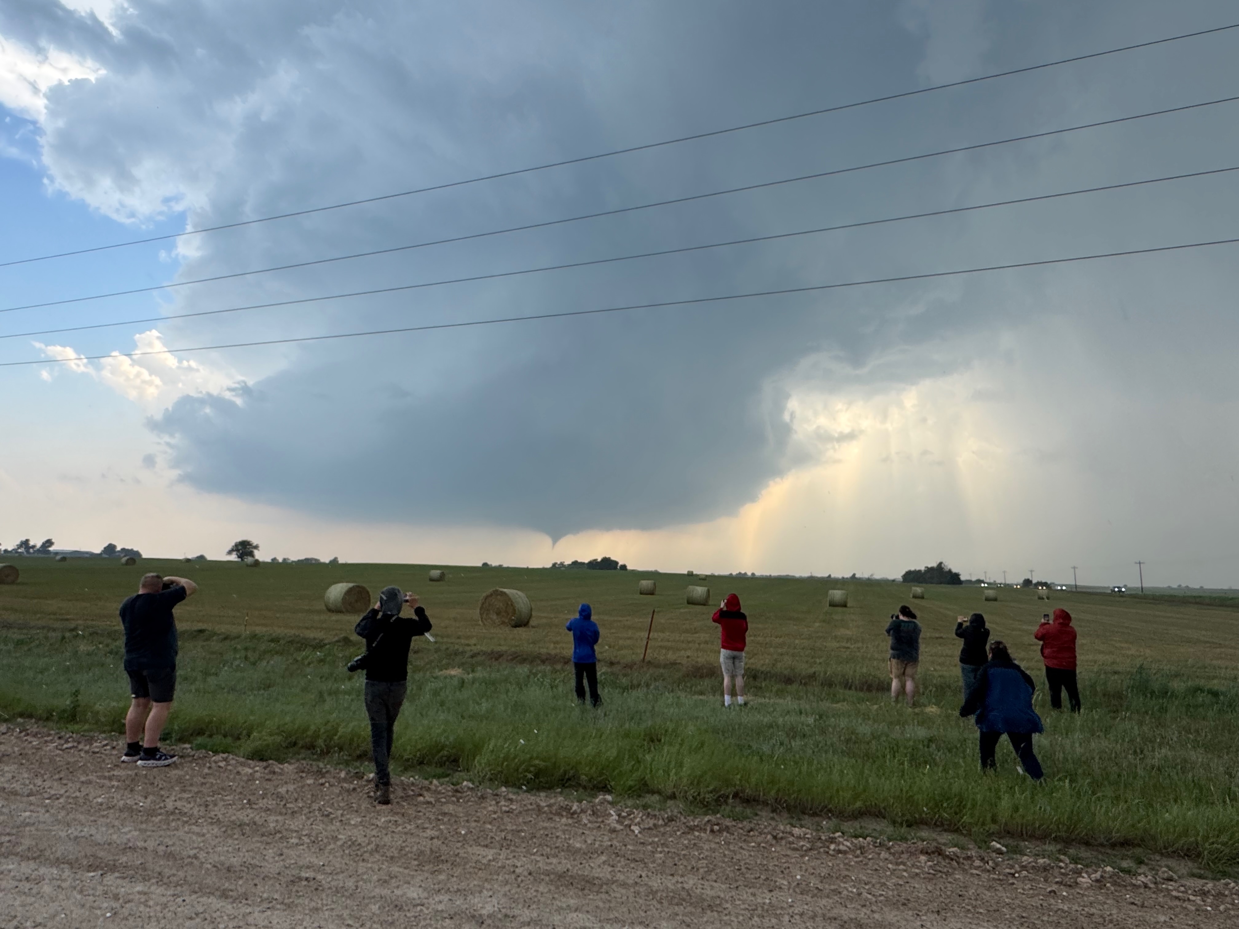
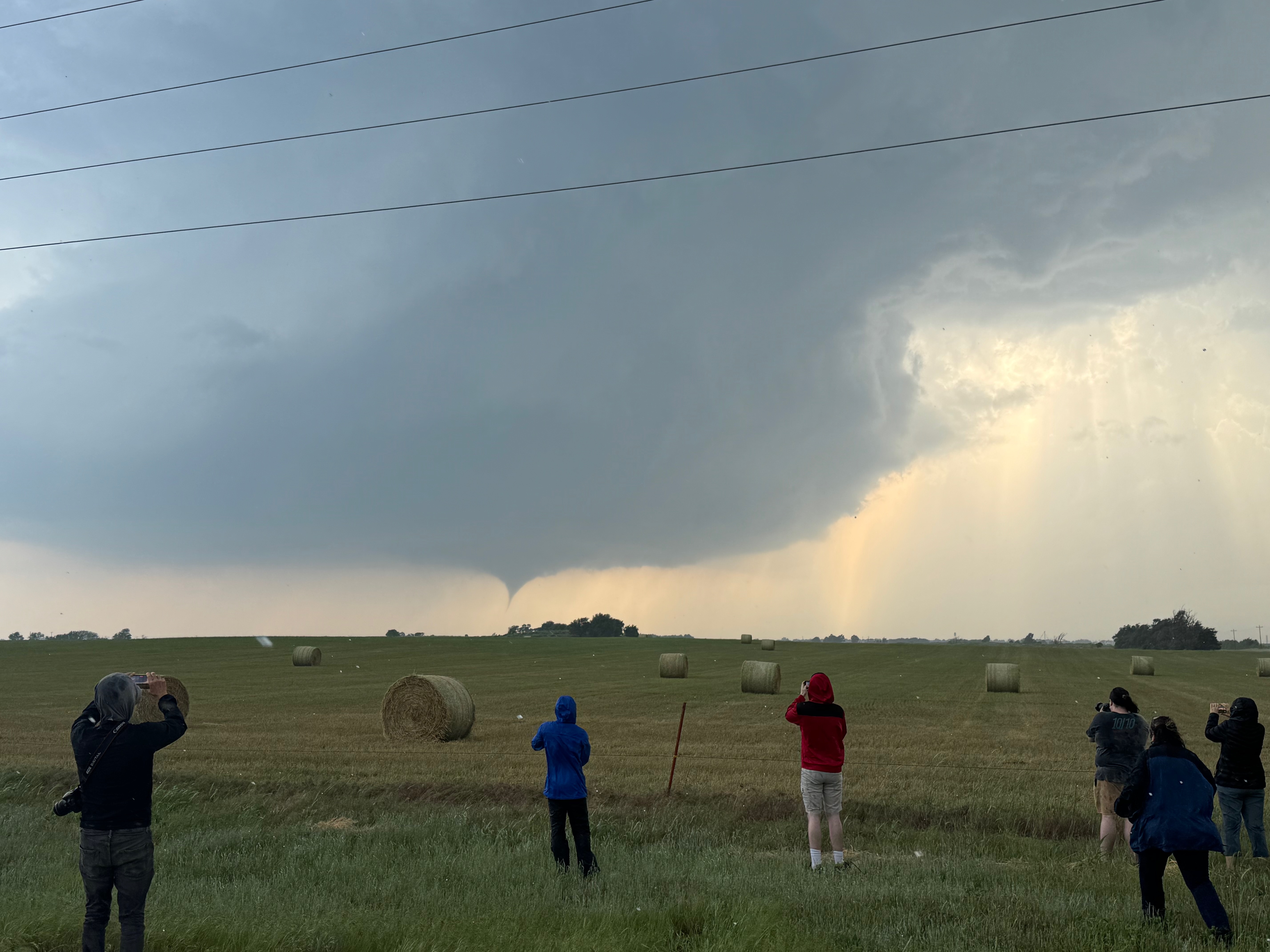
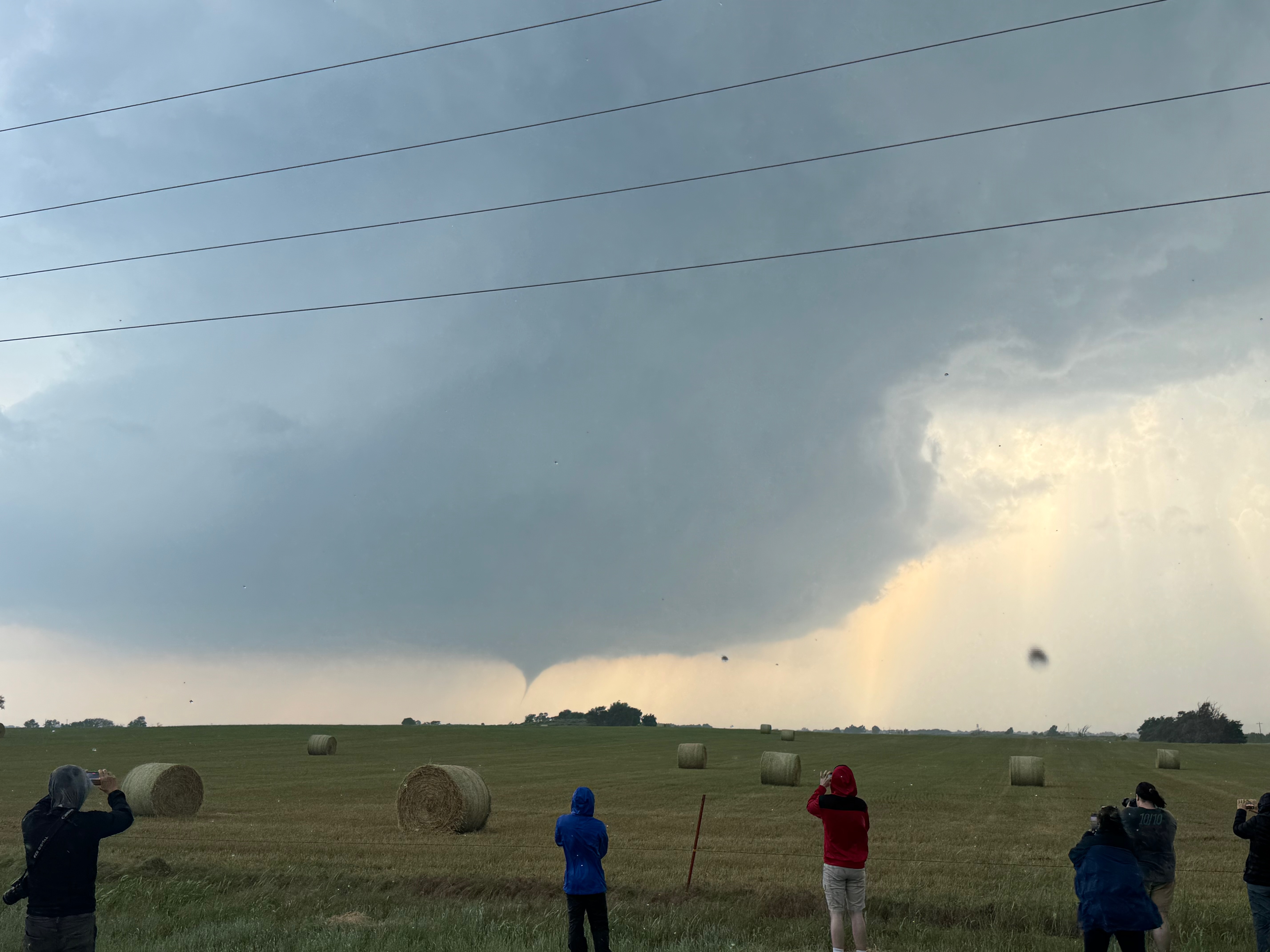
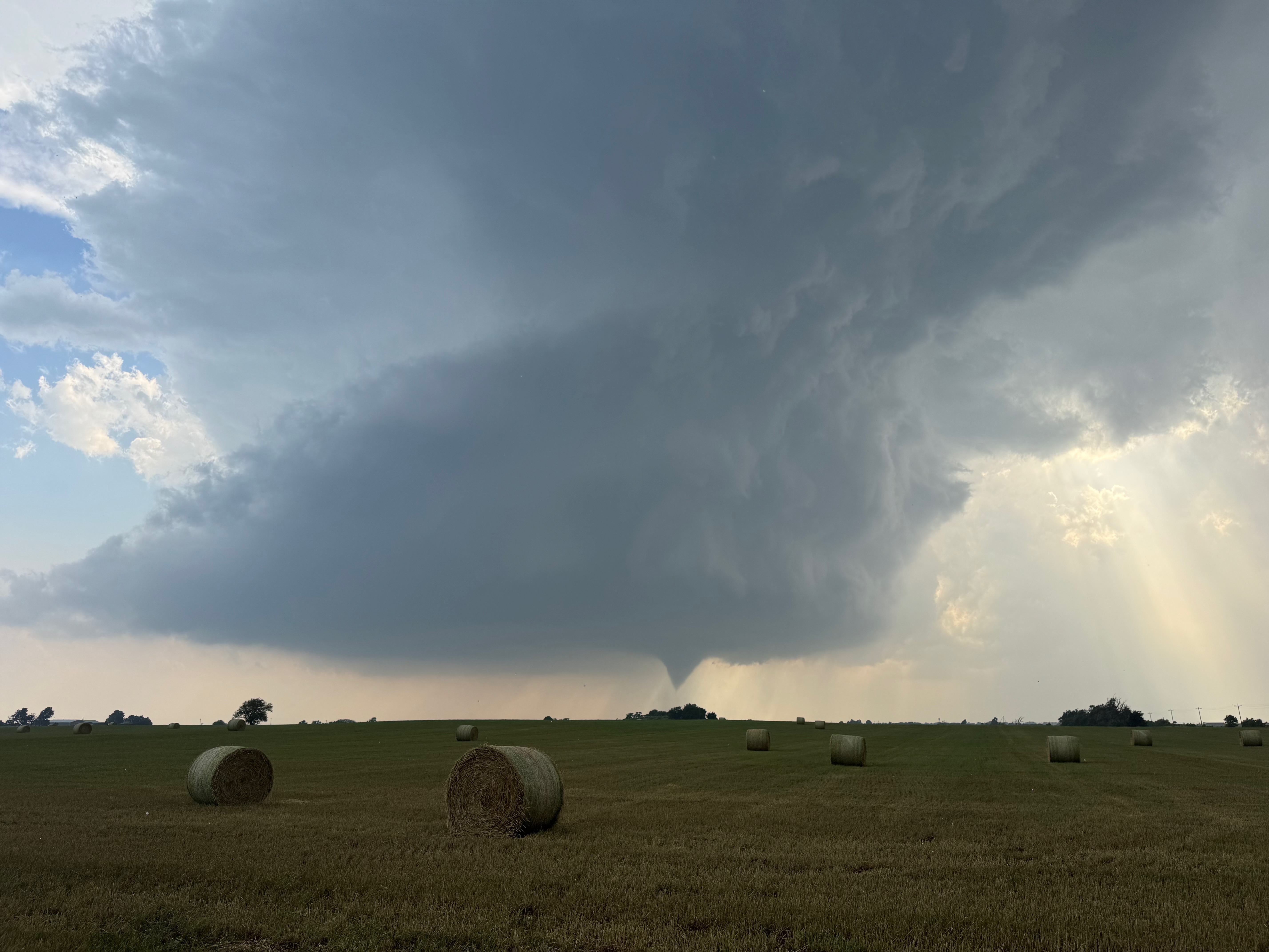
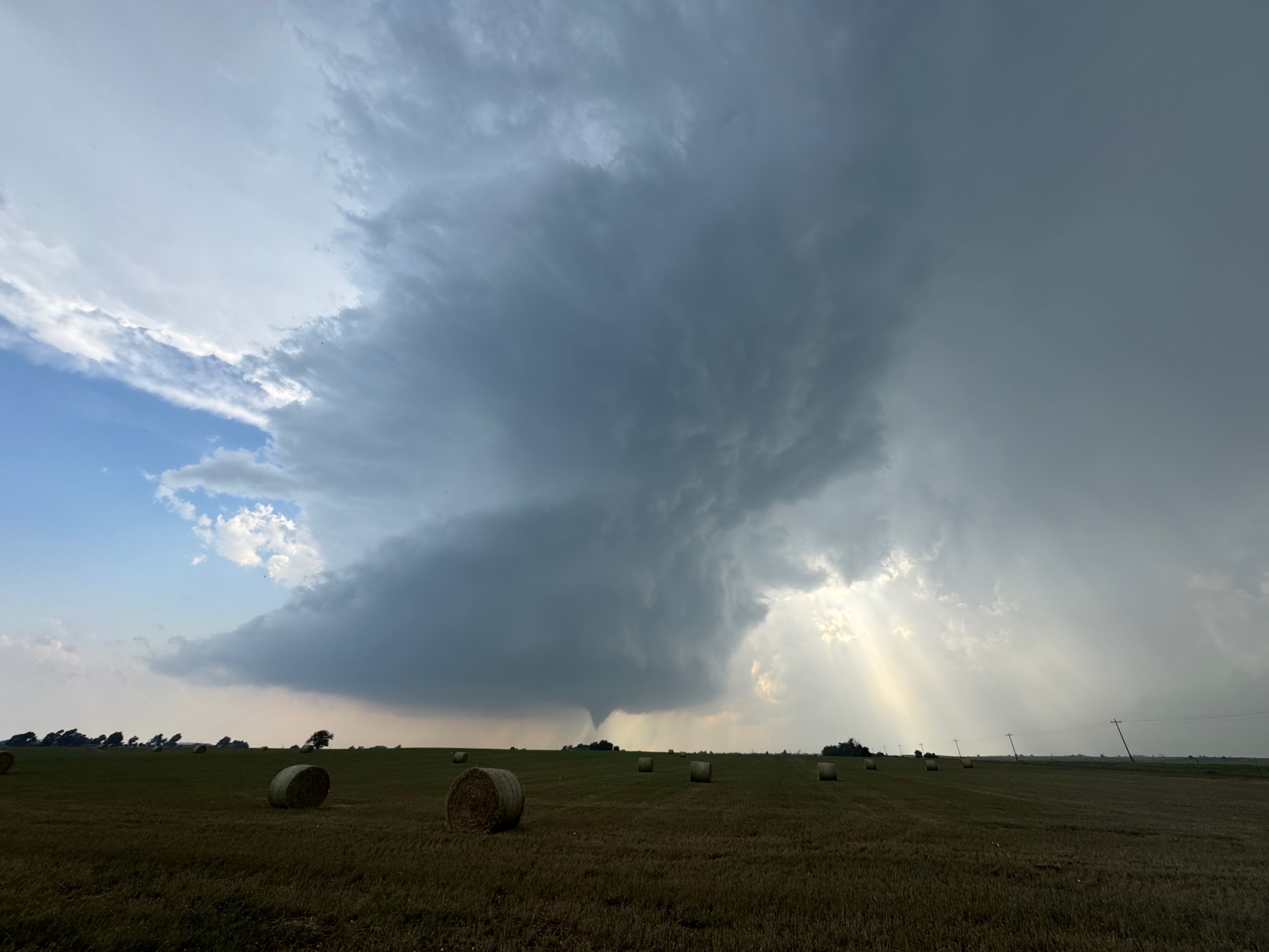
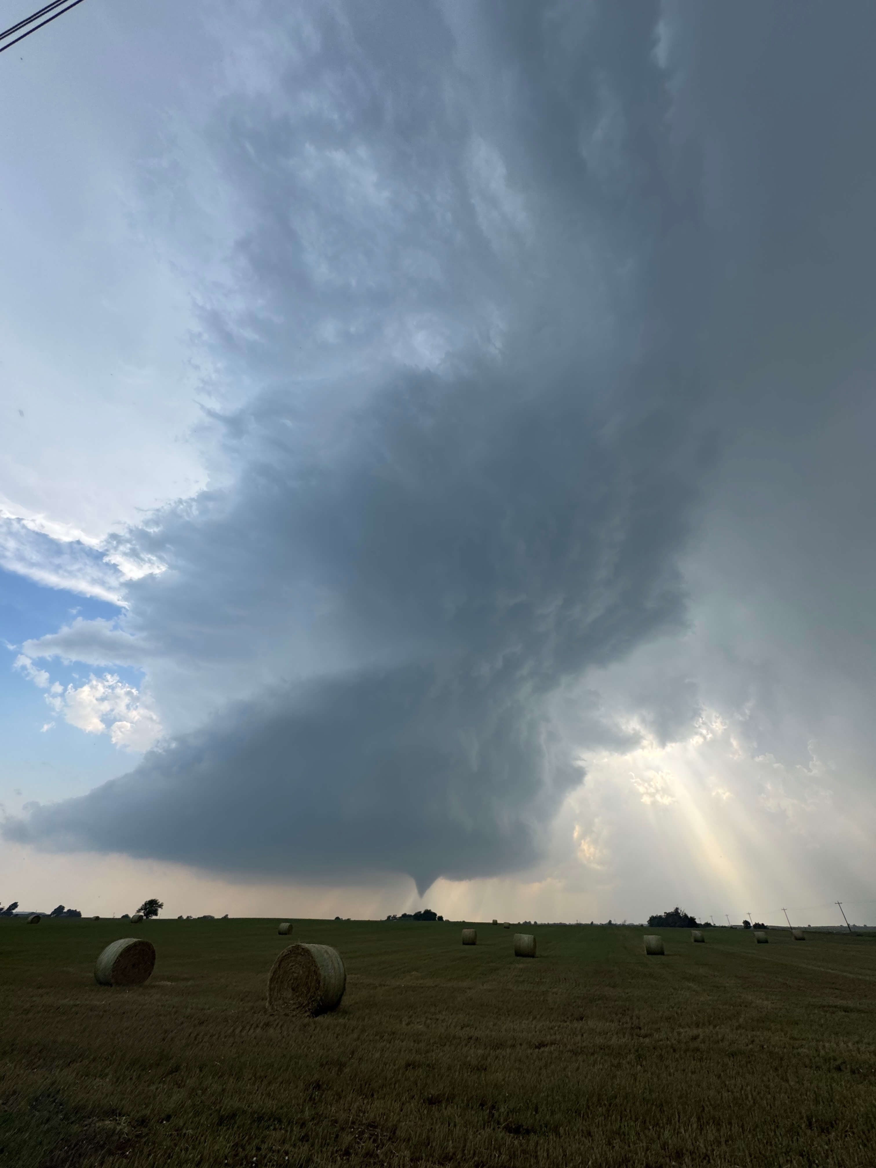
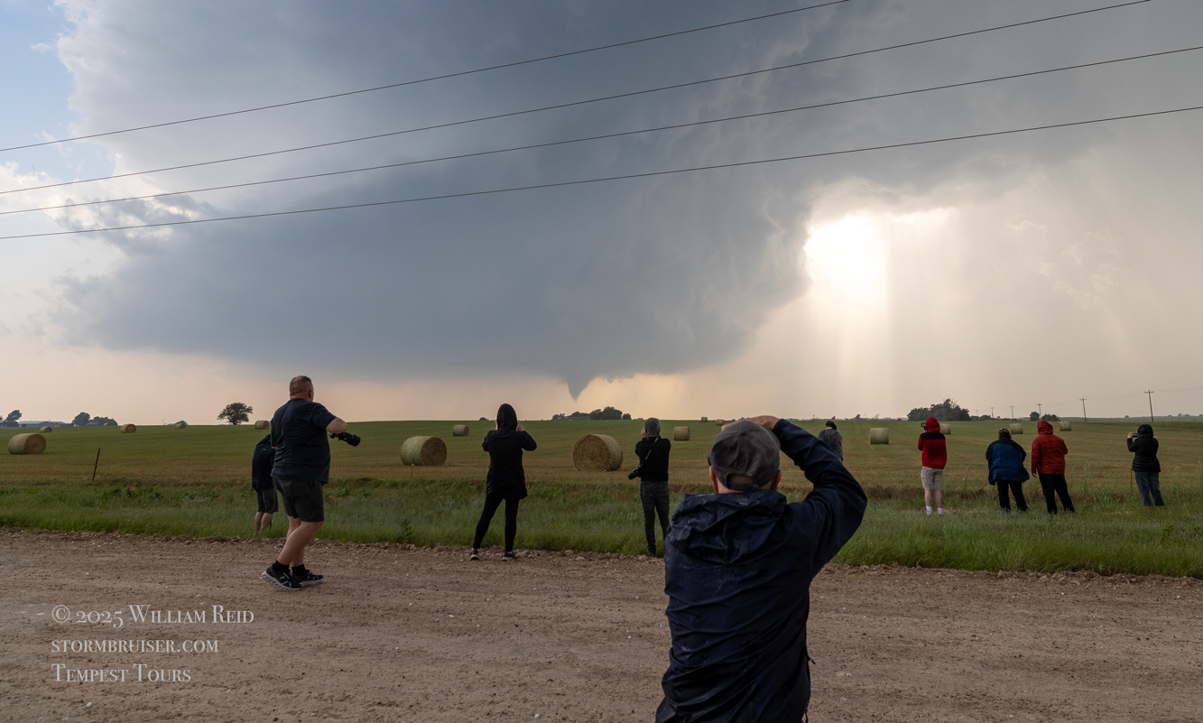
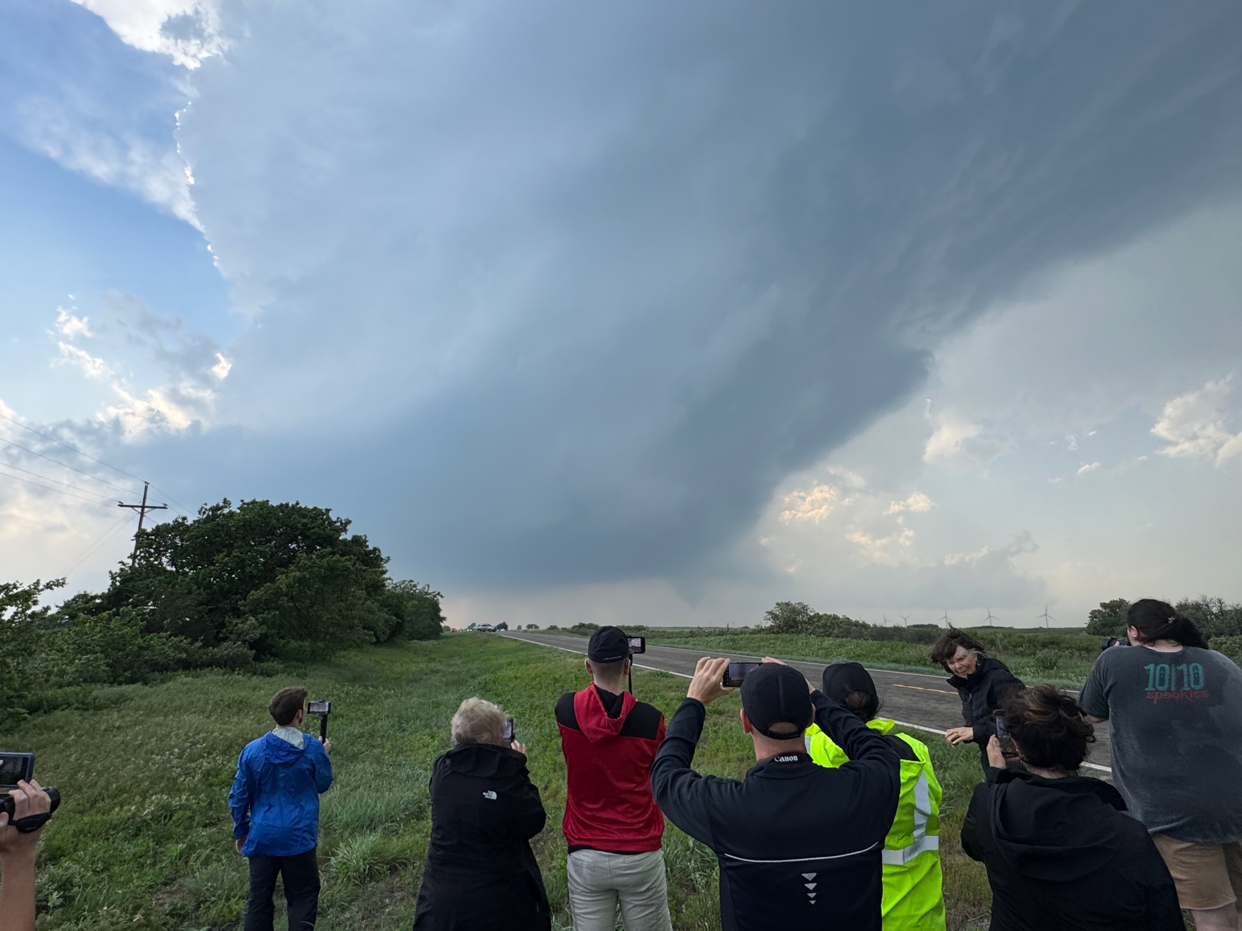
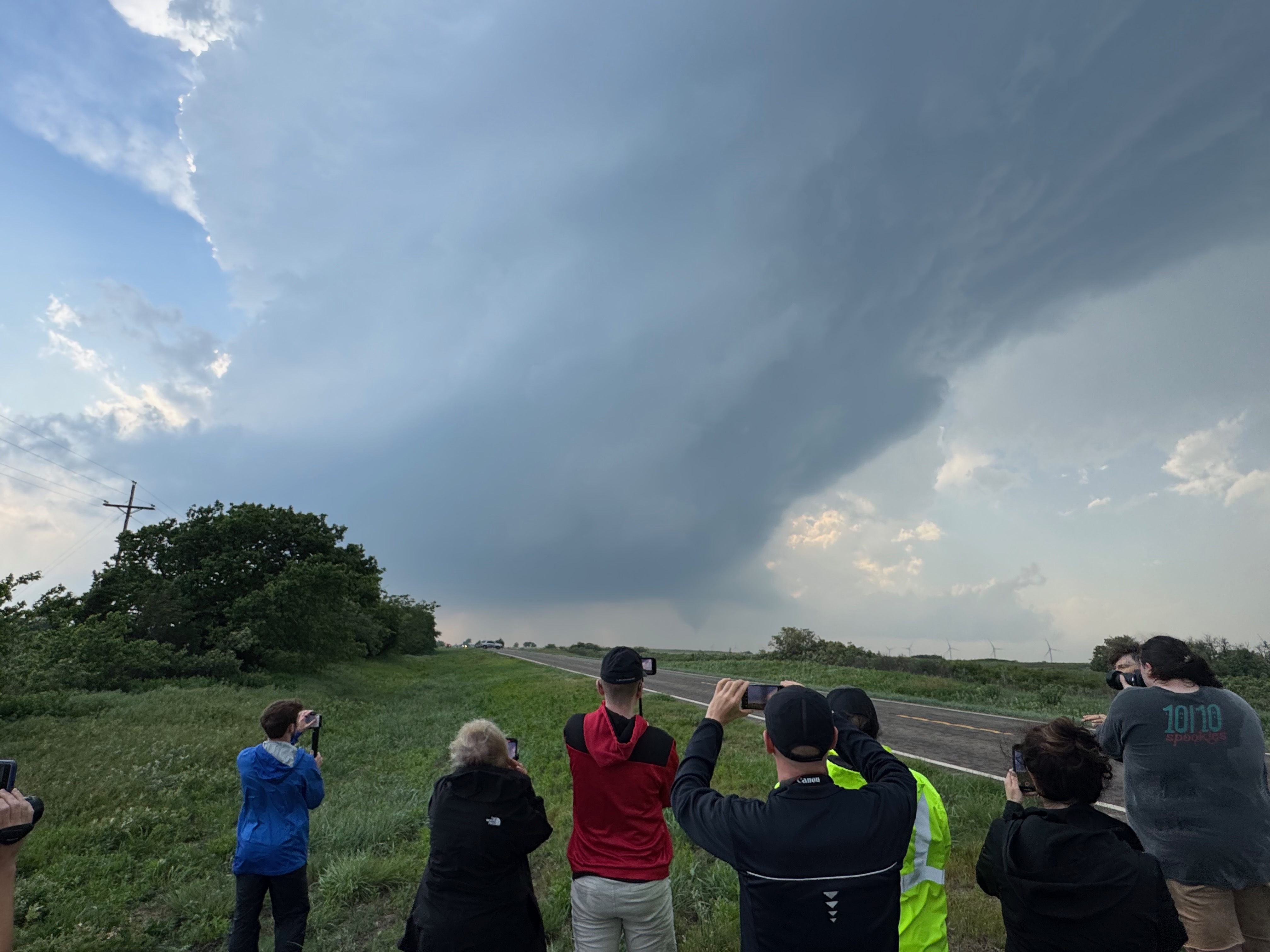
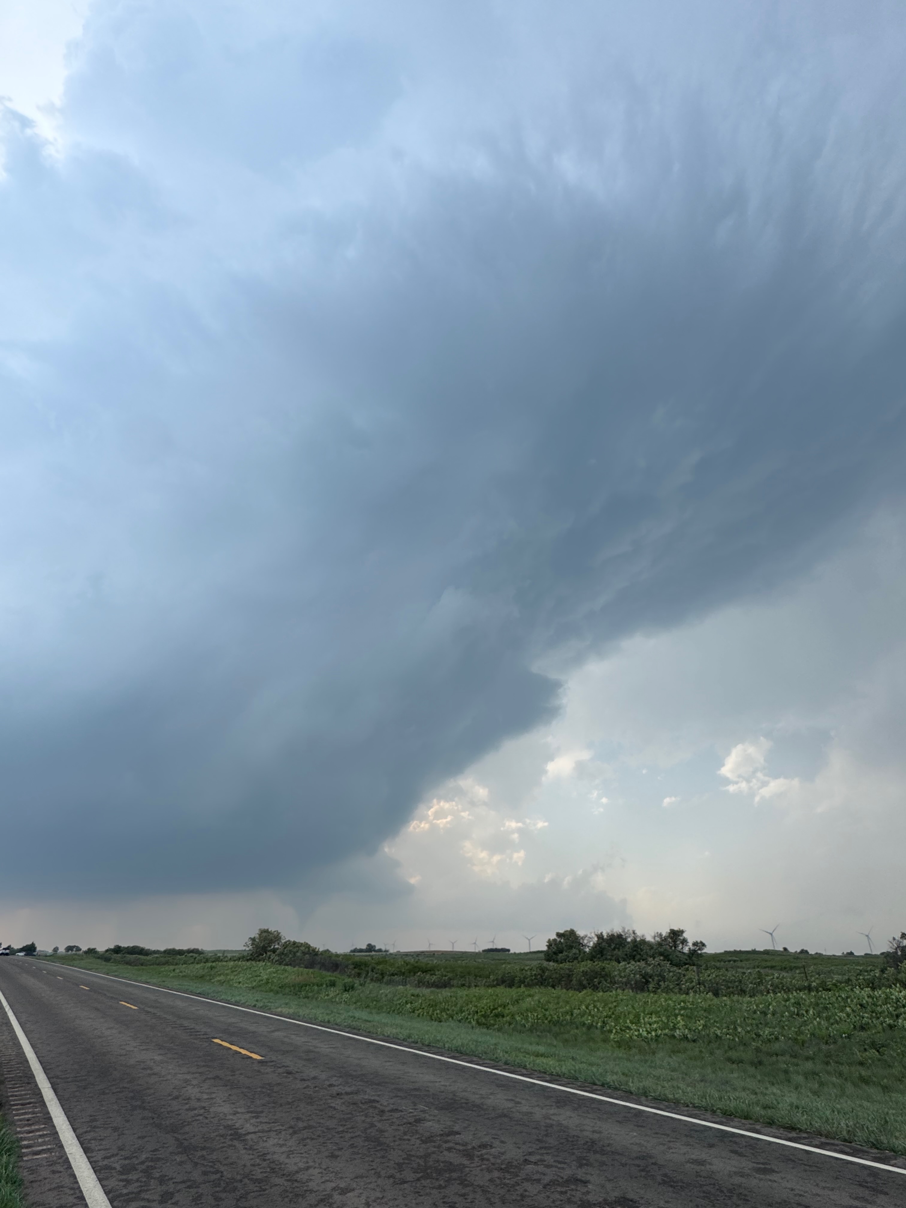
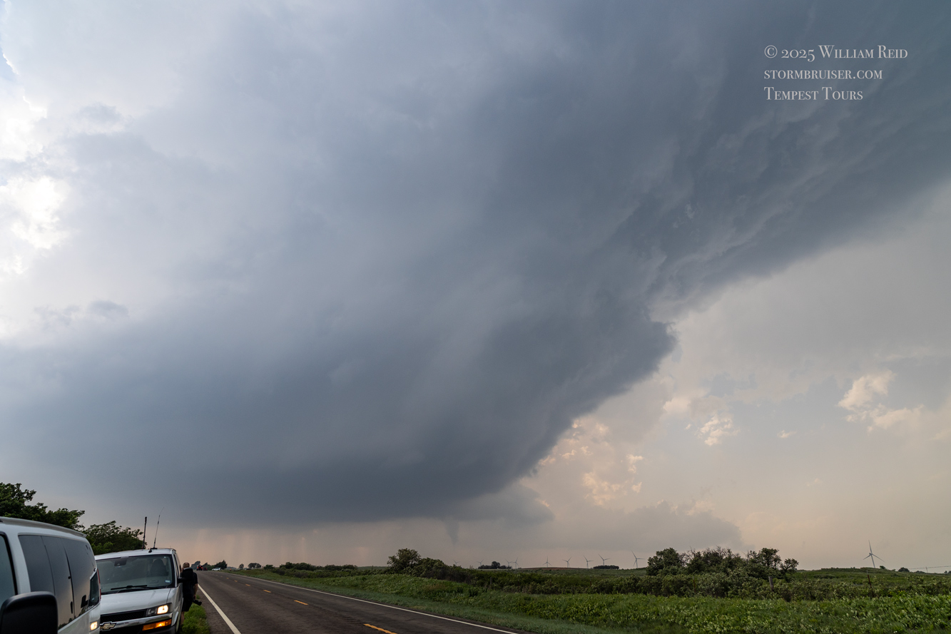
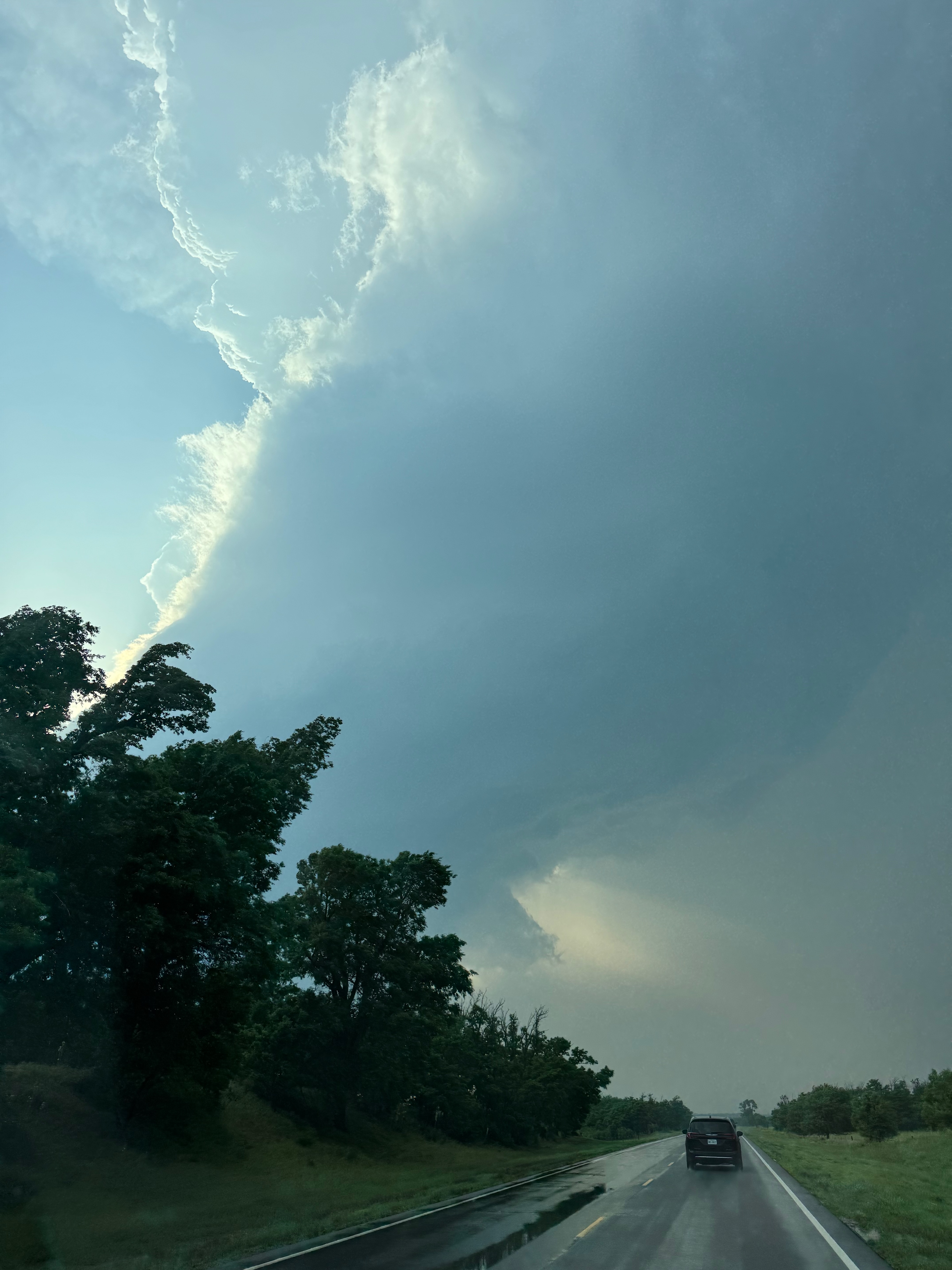
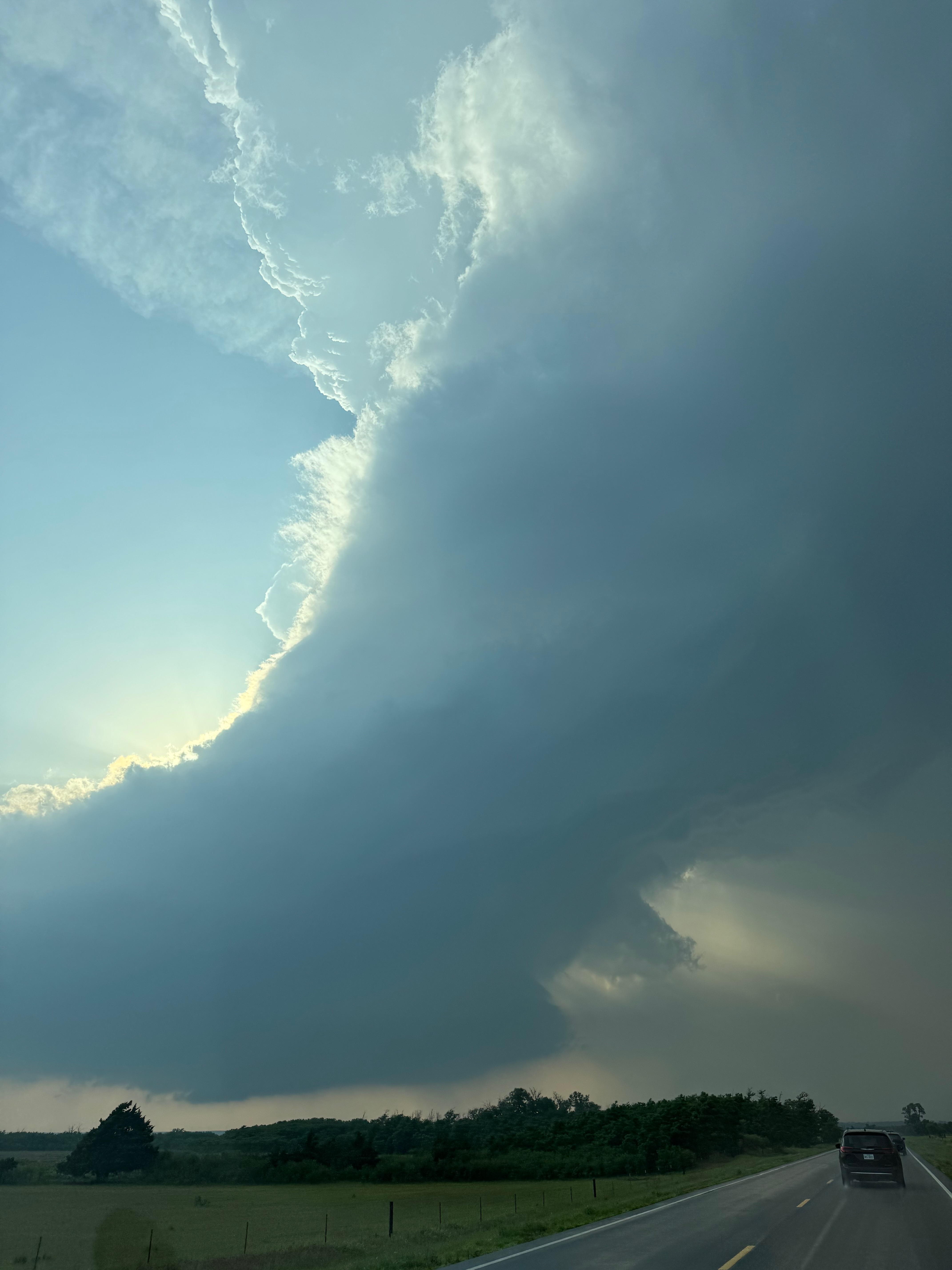
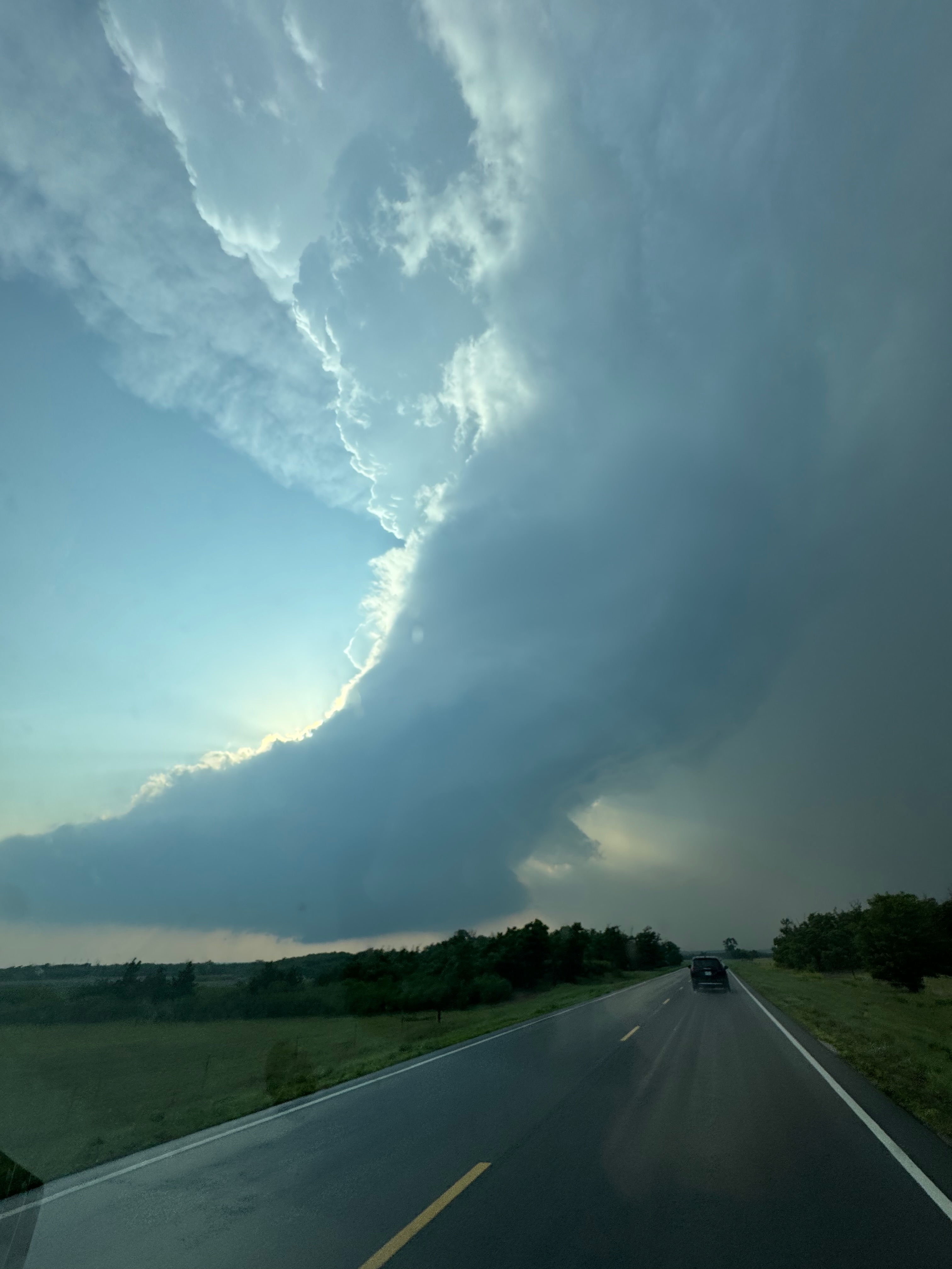
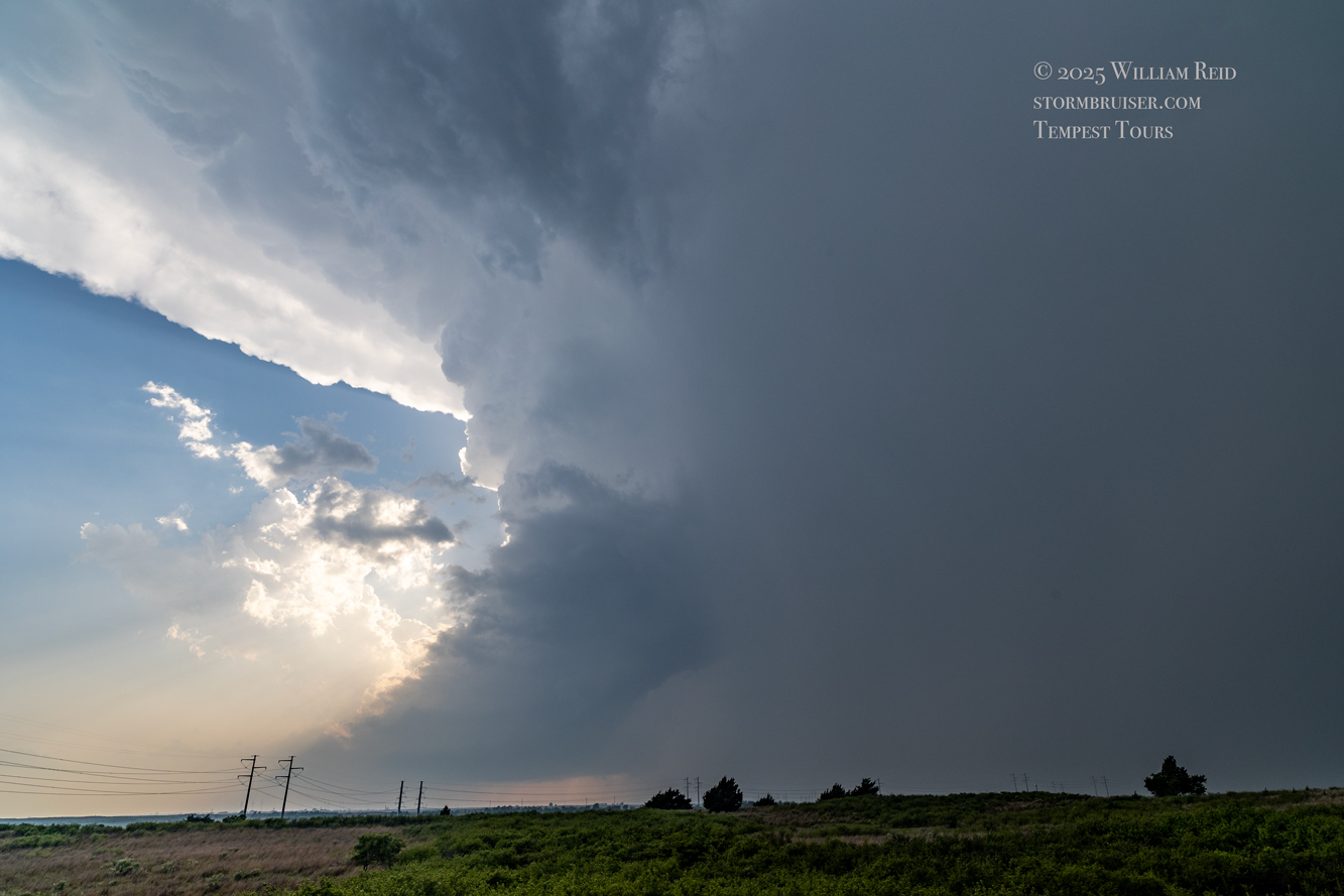
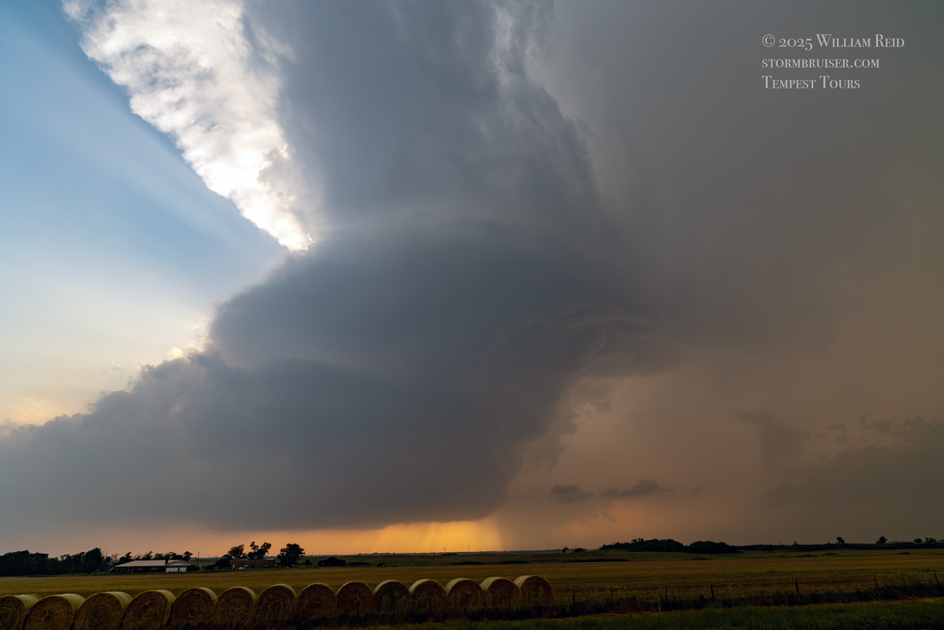
This stop wound up being the most fruitful and satisfying for the chase day. The next set of images below are from the iPhone, from about the time we stopped just east of Arnett to several minutes into the next tornado’s lifespan. The radar screen grab at 6 p.m. CDT was taken a little bit after the Arnett tornado, I think, when we were already heading east again.
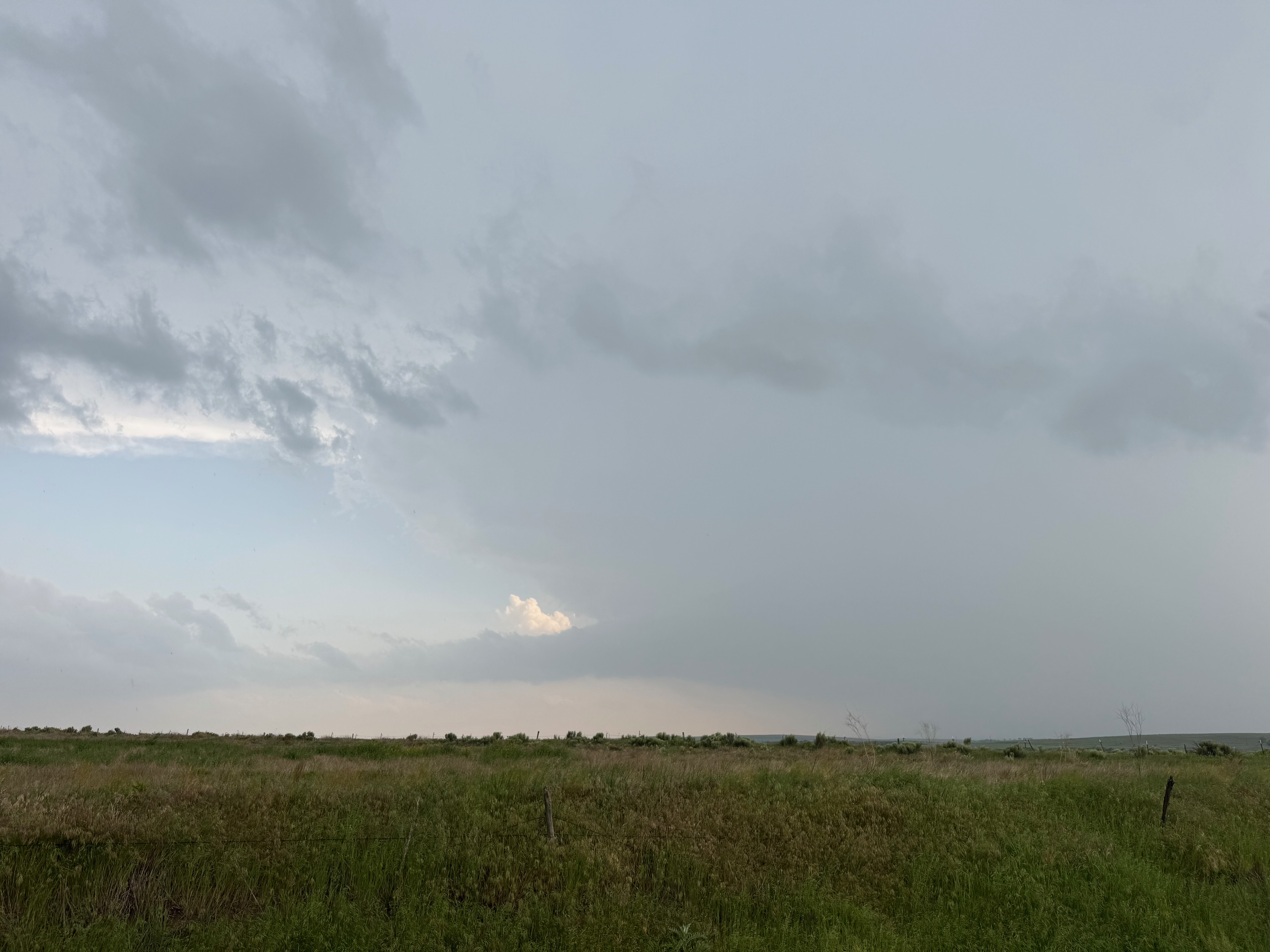
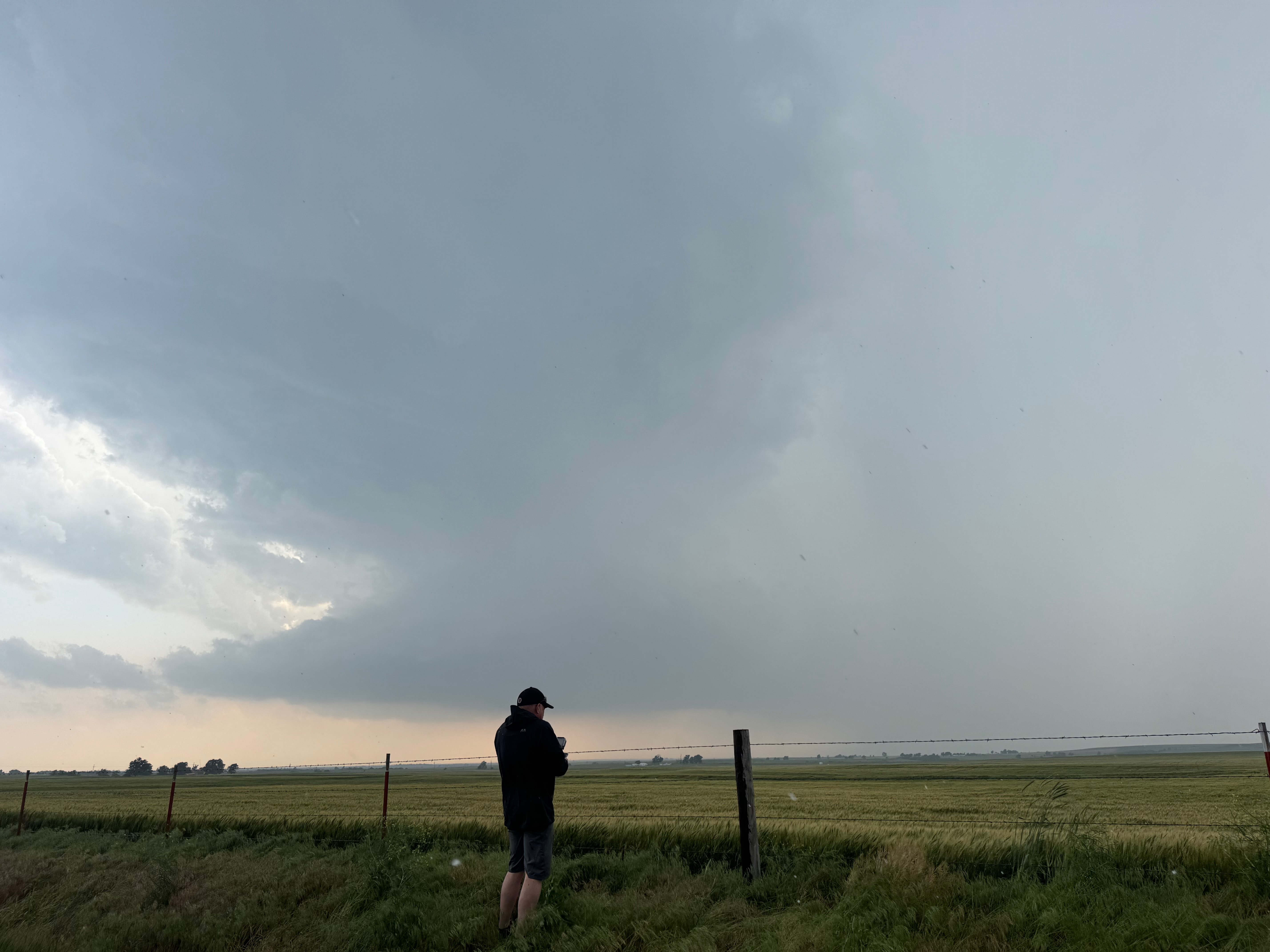
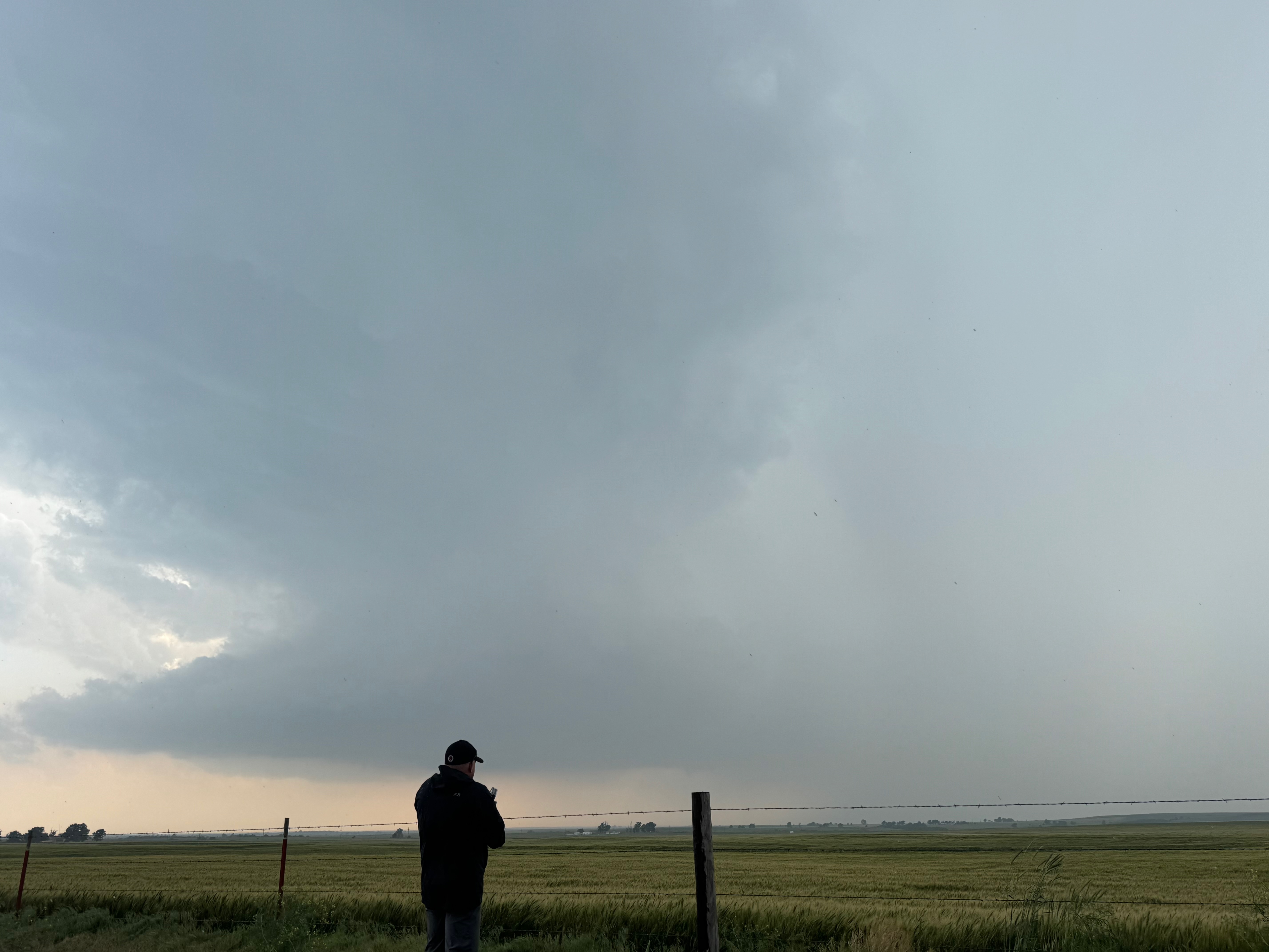
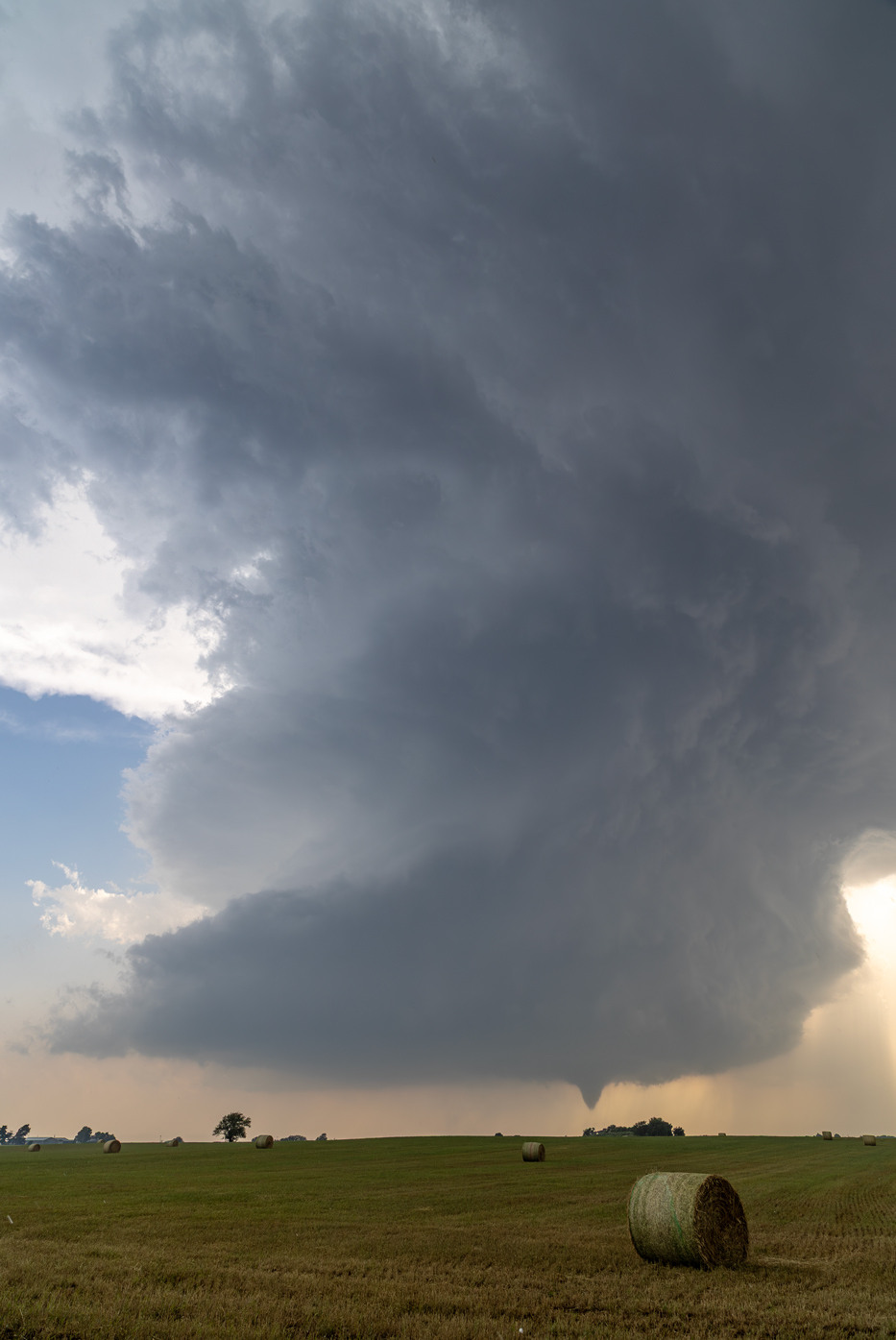
The first few photos show the updraft base without a tornado to our SW or WSW, around ten miles distant. A solid and persistent funnel cloud forms eventually, and a tornado is likely in progress as it moves behind a clump of trees. The wide-angle shots provide a great look at the sculpted and dramatic storm updraft.
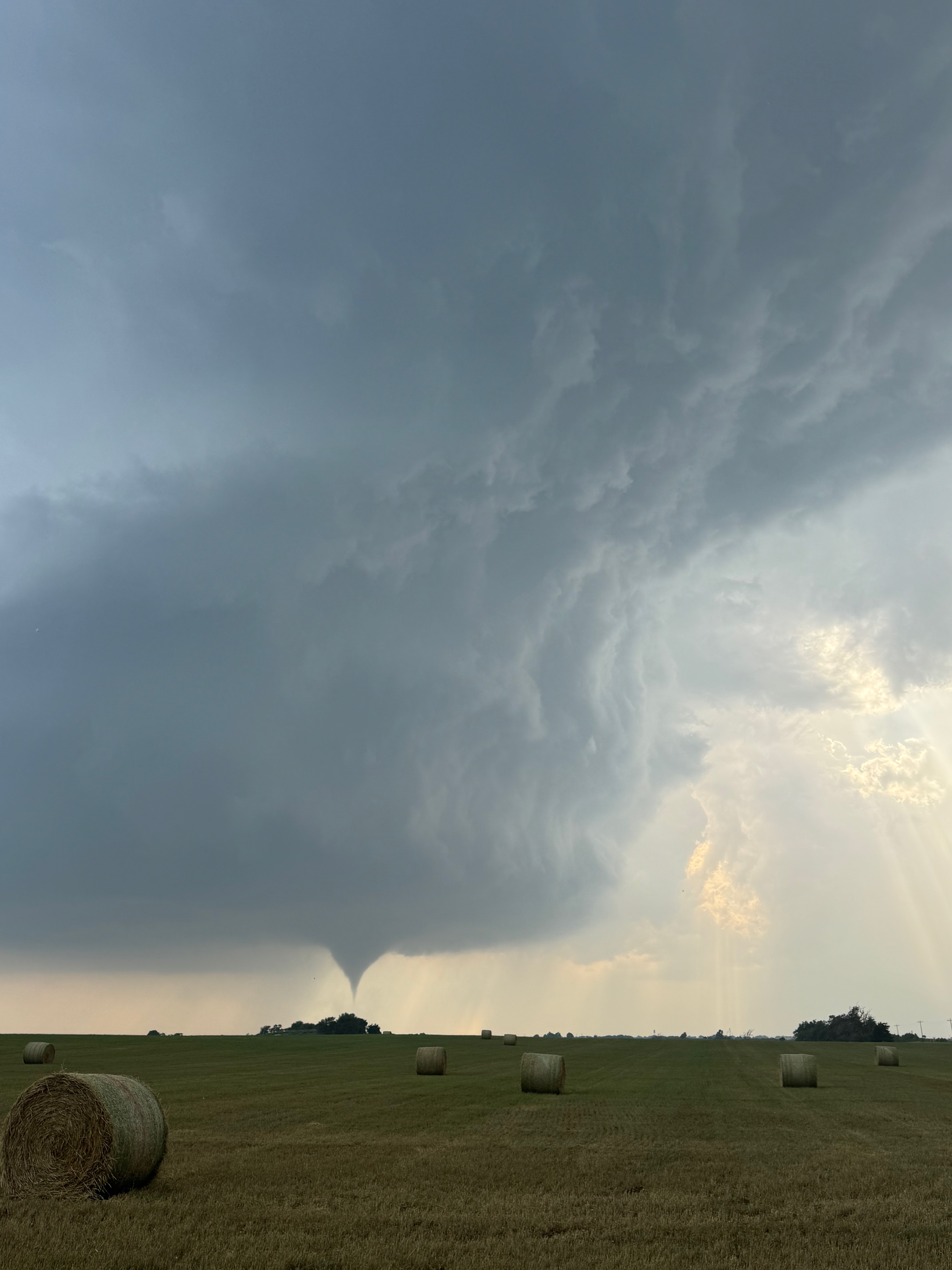
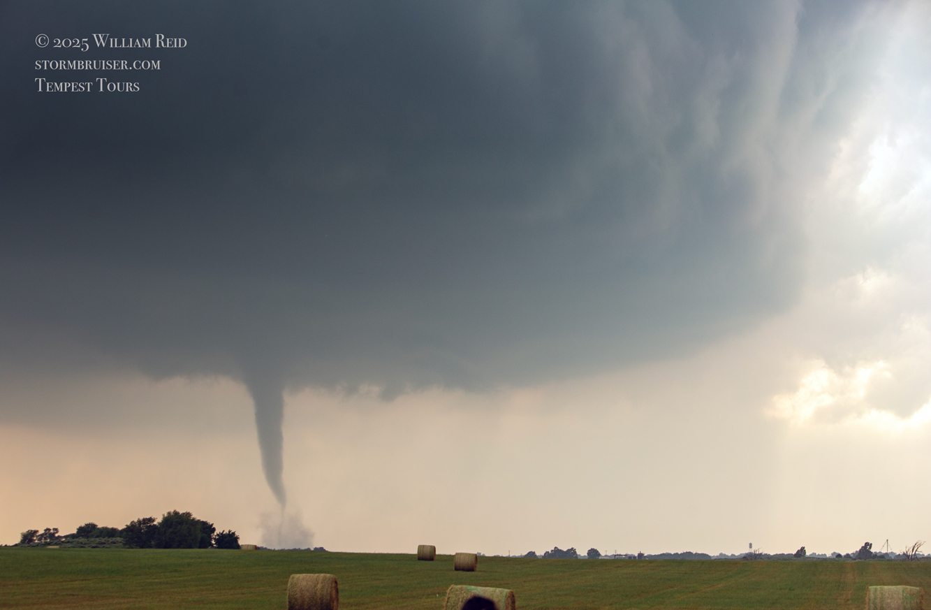
Switching to the Canon DSLR shots, wide-angle first and then zoom…
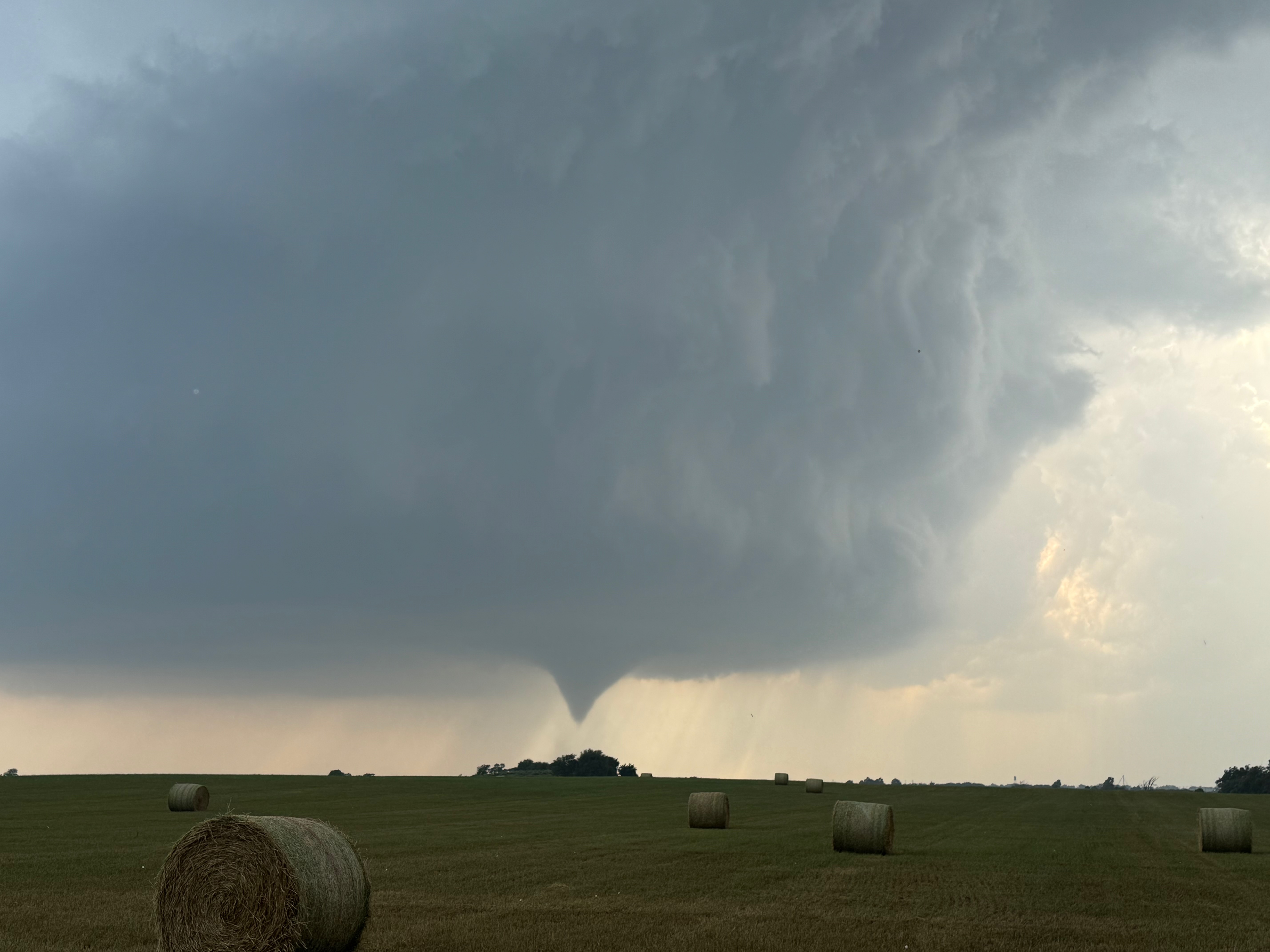
The storm base and tornado are moving left-to-right from our perspective here. The tornado roped out right about the time that it was due west of us, close to U.S. 60 and just west of Arnett.
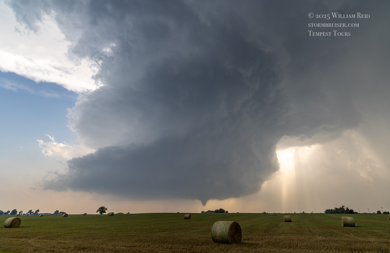
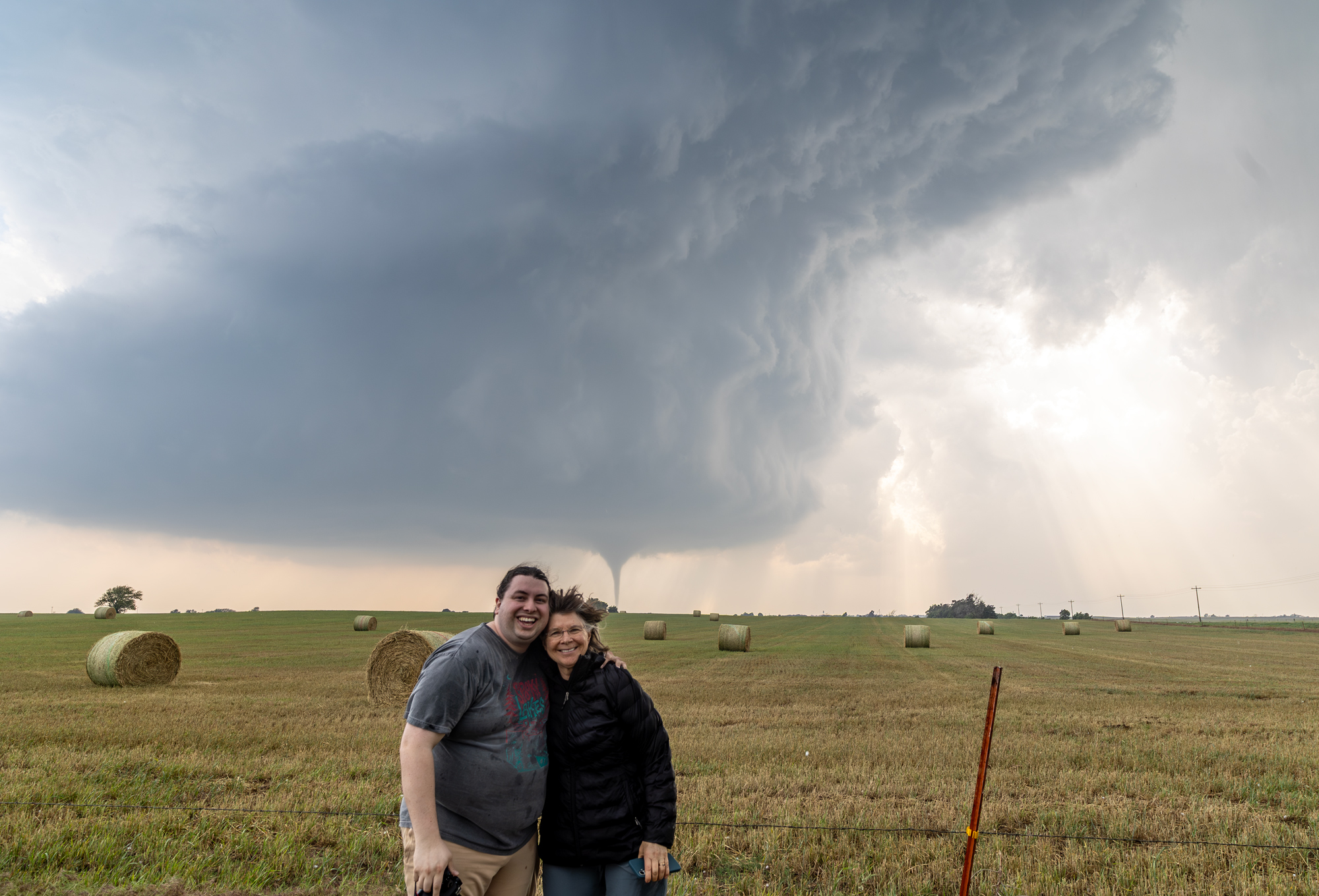
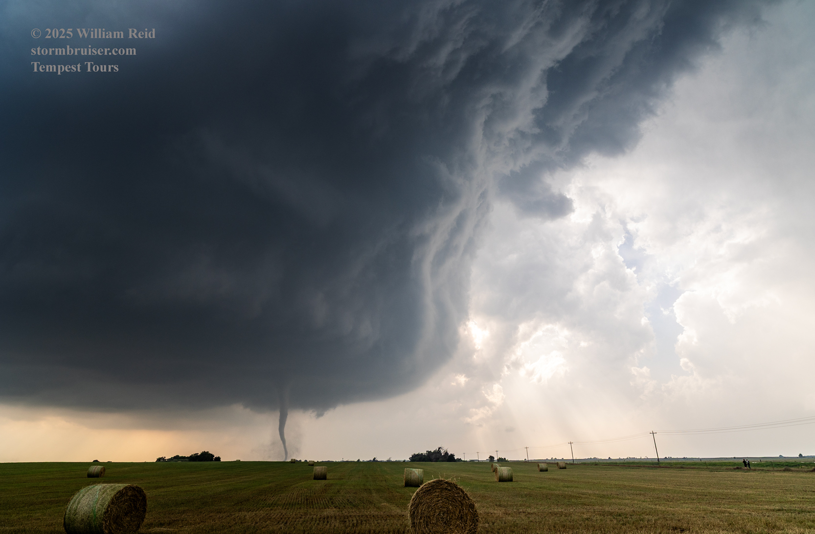
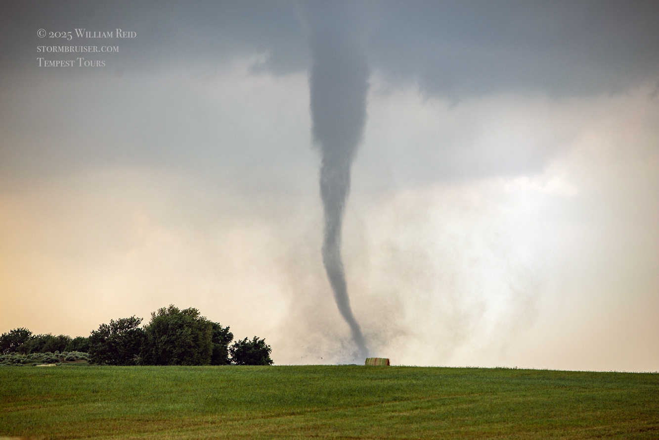
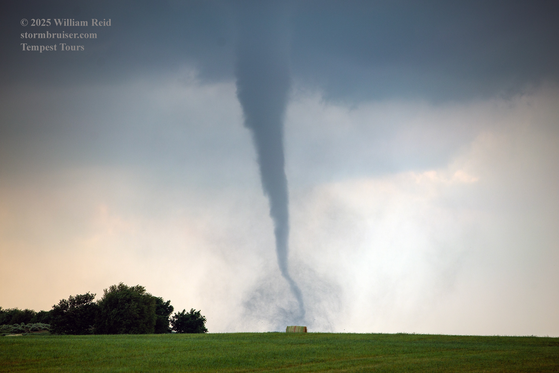
The Arnett tornado lasted a good 10 minutes, and luckily it quit before it reached the town. We again were getting rained on a little, but it wasn’t nearly enough to spoil the show. Chasers who ventured close to the tornado, west of Arnett, were battling two-to-three inch hail.
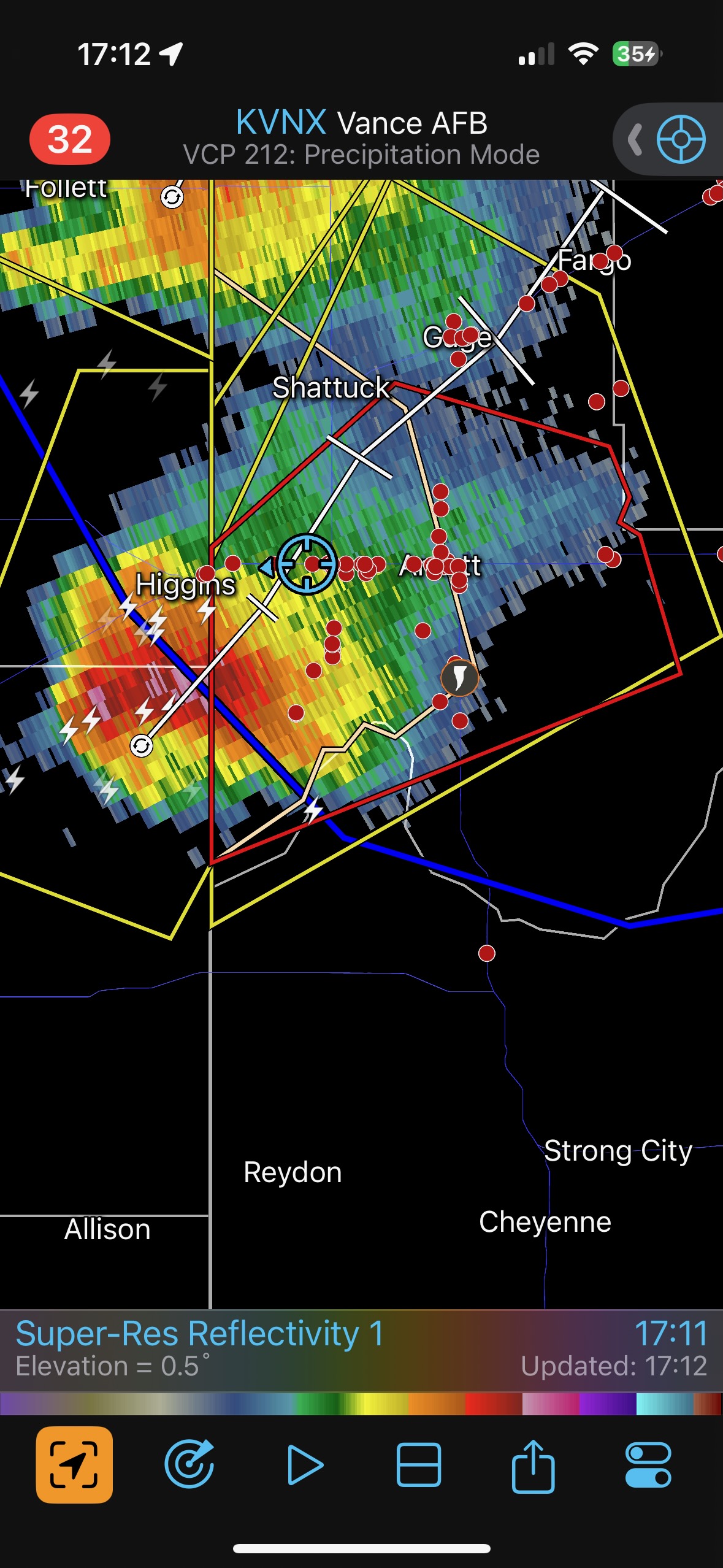
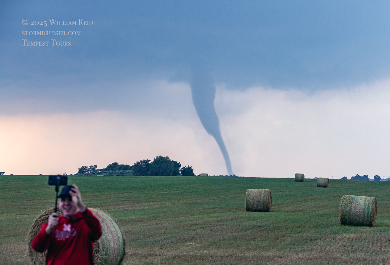
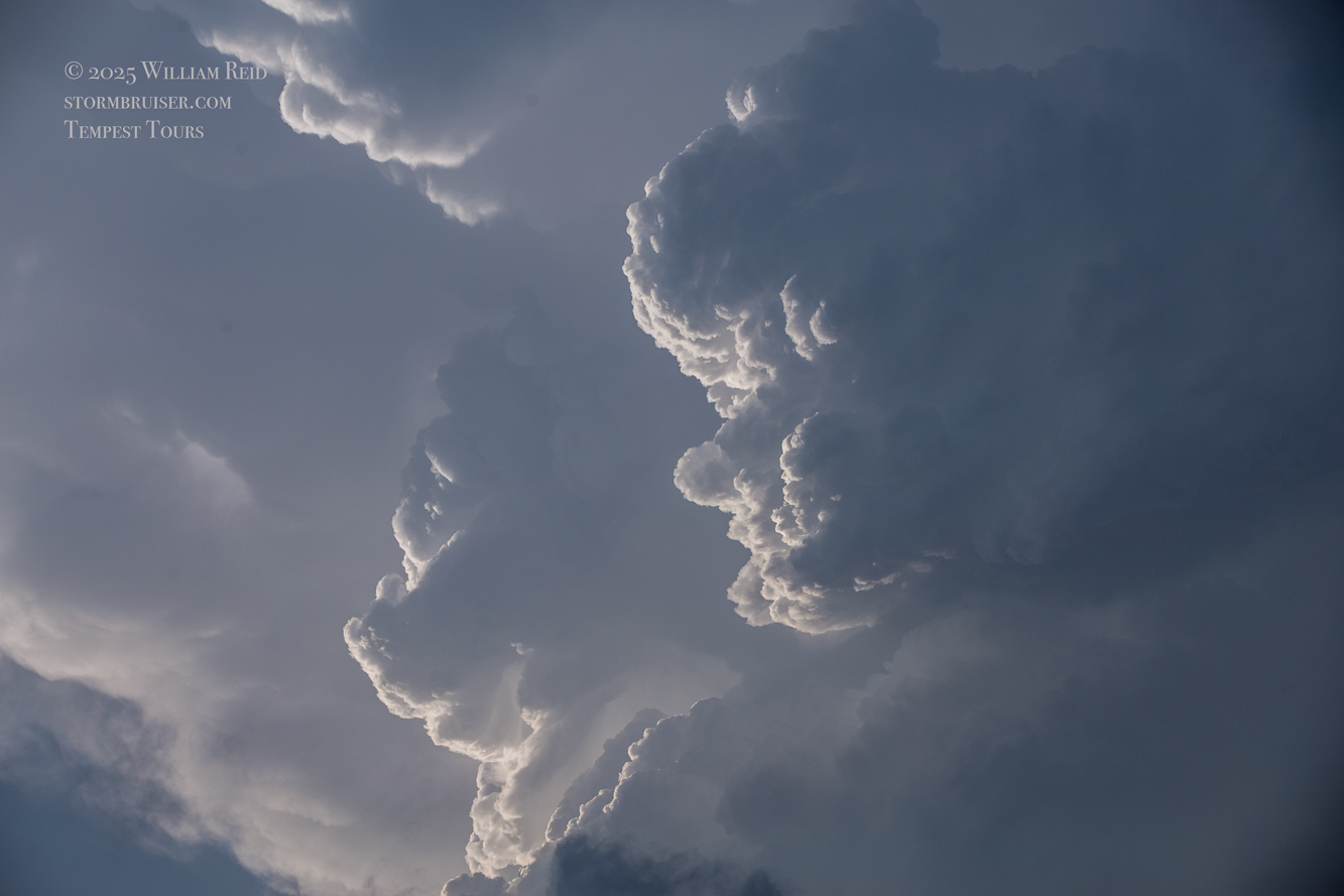
The storm was still looking great. It was still moving to the ENE at a moderate pace, maybe 25-30 mph, and its base was coming at us. The base was tornado-free, and it seemed VERY likely that another tornado would develop. This next tornado could be quite a bit larger and much more significant, based on SPC discussions. I wanted to get a bit in front of the storm again, which would afford another brilliant look at the storm structure, with or without a tornado. The problem, though, was that the next quality road to the north was the one through Vici, Highway 34. That was 25 miles east of here. I started eastward, but soon the guests were seeing another tornado with the storm! We quickly stopped and observed a tornado that was north of U.S. 60, just a little north of due west. This one looked somewhat beefy for a minute or so, but then either dissipated or got rain-wrapped. Look how sheared-over the updraft was above it in the iPhone shots below.
I managed just one or two shots with the long lens (below). Storm Reports has this tornado around three miles ENE of Arnett at 6:03 p.m. CDT (location is estimated).
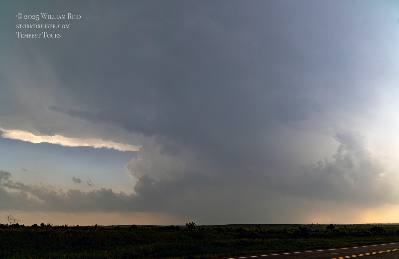
We were moving quickly east again once this most-recent tornado was done, and about a half hour later we were north of Vici on 34, east of the supercell, and looking for a decent high point in these hills to watch its approach. As far as I know, the storm did not produce another tornado during this repositioning. The iPhone images below show the storm when west of Sharon and later near Mooreland.
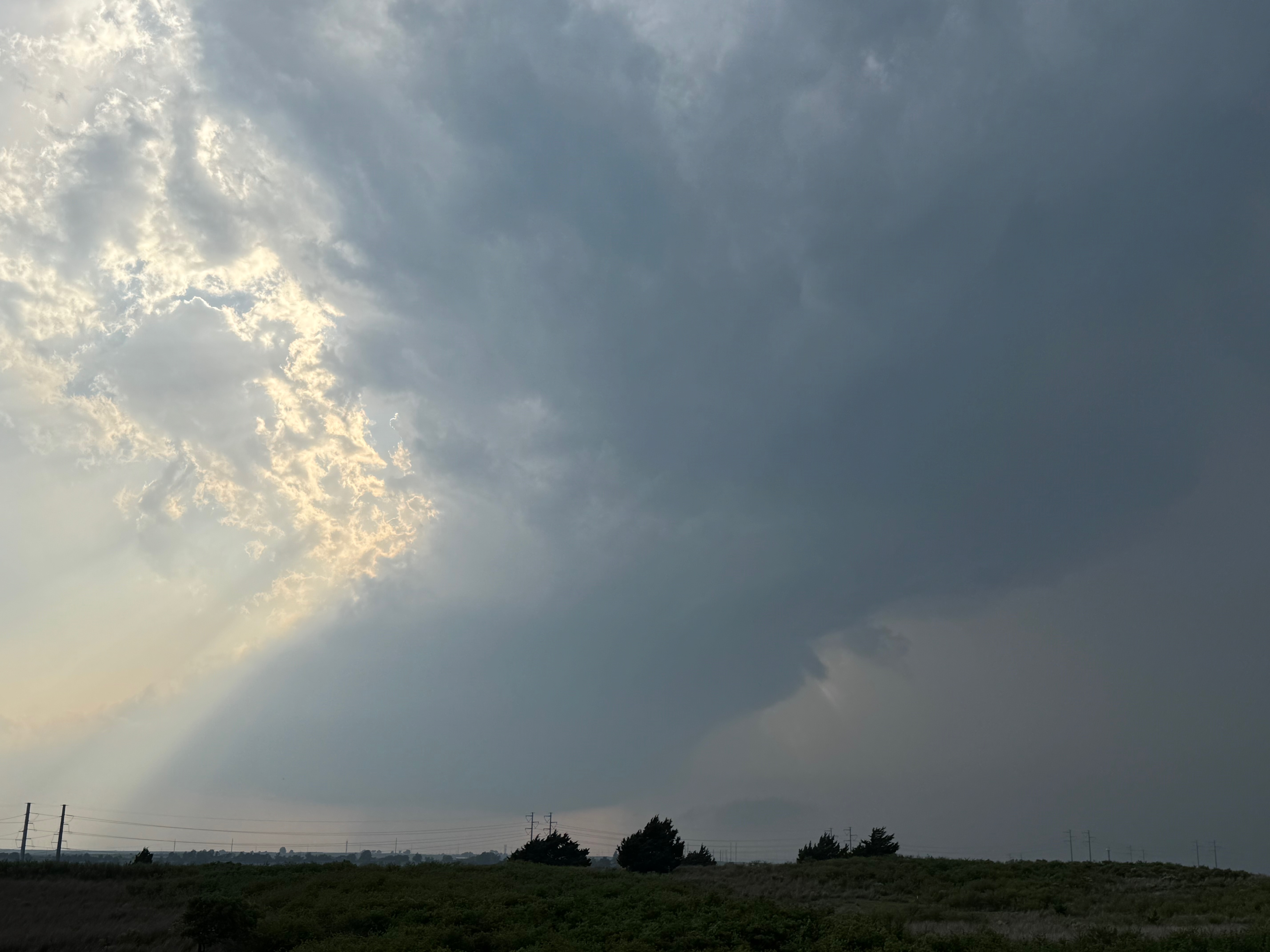
Below are a few more shots towards sunset as the storm went through the Sharon/Mooreland area. The updraft began to look a little sick, and its tornado moments were done. It apparently moved into that coolish and more-stable low-level air that was near the OK/KS border all afternoon. Instead of continuing to ramp up east of Arnett, the storm sputtered.
About this time the storms in western Kansas WERE beginning to ramp up, and a number of them went tornadic in the hours around dusk. I suspect that the stronger cap over western OK, comparably to that over Kansas, was also important in causing the demise of the Arnett supercell. We headed eastward into Enid for the night.
Leave a Reply
You must be logged in to post a comment.