
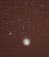
I became aware of Comet Holmes several days ago. It brightened suddenly from magnitude 17 to about magnitude 2.5 on October 25th. I had Tuesday… [Read More]
July 7, 2007 Colorado Rockies
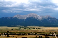
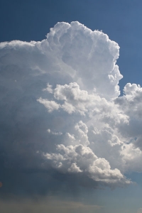
This was a sight-seeing day on the drive back to Denver from South Fork via Gunnison and the Arkansas River valley.
July 5, 2007 New Mexico Rockies

This area is north of Taos near the Colorado border.
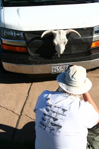
July 4, 2007 Perryton, TX
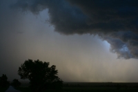
The target on this day was southwest Kansas, but shear was blah and the chances for a supercell were slim. We lingered around “old town”… [Read More]
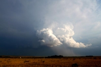
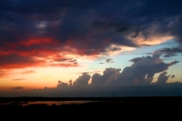
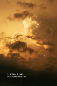
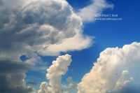
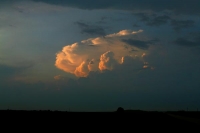
July 2, 2007 Brockton, MT, supercell
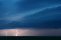
This was the first full day for Tour 7, and my driver was Brad Carter. Much like the first day of Tour 6 a week… [Read More]
July 1, 2007 DIA funnel
Developing CB between Denver and Bennett, near I-70, midafternoon. Slender funnel cloud about an hour later from a second dying, pathetic cumulus cloud, several miles… [Read More]
June 29, 2007 Laramie, WY
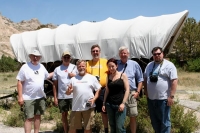
Tour 6 group on Scotts Bluff and Tour 6 group on instruments… This is Ames Monument, just south of I-80 and east of Laramie, WY…. [Read More]
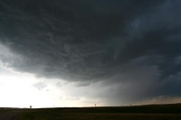
June 28, 2007 Torrington, WY
Rotating updrafts south of Torrington, WY, were strongly deviant and moved west in weak northerly flow aloft. This one above has a dinky, bare-bones rotating… [Read More]
June 27, 2007 EC Wyoming
High-based storms on this day in extreme eastern Wyoming were not entirely uninteresting. But almost.
June 26, 2007 western ND Badlands
The potential for storms was nil, so we spent an afternoon at Theodore Roosevelt National Park in western North Dakota. .
June 24, 2007 central ND
This day is a blur. I think we had lunch in Bismarck, and targetted an area southwest of Bismarck. Storm towers went up late in… [Read More]
June 23, 2007 SW Manitoba supercell
June 23 was a Saturday, the first full day of chasing for Tour 6—-a day which was doomed from the start. This was the day… [Read More]
June 21, 2007 North Platte, NE severe storm
I spent a few non-chase days in Omaha from the 18th to the 20th, and had to be in Denver for the start of Tour… [Read More]
June 17, 2007 NE North Dakota supercell
short version: Brian and I got out of Pierre by 11 a.m. and targeted the Grand Forks, ND, area. The cap was strong, and held… [Read More]
June 16, 2007 Gillette, WY severe storm
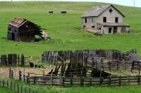
Short version: Brian and I spent some time exploring an abandoned farmstead west of Union Center, SD, and then were compelled to blast west towards… [Read More]