
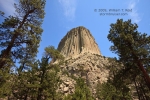
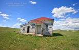
My target area for today was generally Crook County, WY, which is in the northeastern corner of the state. Severe chances appeared to be good,… [Read More]
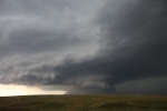
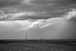
July 1, 2009 Capitol, MT storm
Our group began this chase day in Lemmon, SD, and our target area was not too far away—southeast MT and into extreme western SD. We… [Read More]
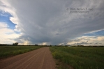
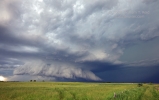
June 30, 2009 Carlyle, MT, Tornadic Supercell
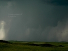
A big day in Montana, and my first Montana tornado! We went north from Baker, MT, about 18 miles, and came upon a developing supercell… [Read More]
June 29, 2009 Alliance, NE high-based mediocrity
What more can be said about this chase day that hasn’t already been said? Well, a whole bunch, given that today’s activity was run-of-the-mill and… [Read More]
June 26, 2009 Big Springs, NE Supercell
This was the final chase day for Tour 6, so we were hoping to wind up the day within a few hours of Denver. Mother… [Read More]
June 25, 2009 Badlands “Bad” Storm Day
That’s “Bad” as in “yuck”. The target was Rapid City upon departure from Mitchell — an easy 3 or 4 hour drive on I-90. A… [Read More]
June 24, 2009 Fulton, SD tornadic supercell
The forecast target for this day was not particularly clear-cut when we departed Lexington, NE. There was, however, decent potential for another fabulous supercell as… [Read More]
June 23, 2009 Logan County, NE tornadic supercell

Today’s Logan County, NE, tornadic supercell was quite the treat, though it fell short in terms of easily-viewed tornadoes. I liked the high CAPE values… [Read More]
June 22, 2009 McIntosh, SD junky storms
I called the storms on this day “junky”, though I suppose there were some supercell characteristics to them. The surface setup was weak, so expectations… [Read More]
June 21, 2009 Ziebach County, SD supercell
This was the first full chase day for the Tour 6 guests, and my chase team of Chuck Doswell, Rob Petitt, and Doug Raflik. On… [Read More]
June 18, 2009 Nebraska Panhandle lightning
This was the final chase day for the lucky Tour 5 folks. They had observed supercells on eight out of eight of their chase days… [Read More]
June 17, 2009 York County, NE, CB and Lightning

June 17th was the day of our Aurora, NE, tornado intercept. As the parent supercell continued its trek eastward from Hamilton County to York County,… [Read More]
June 17, 2009 Aurora, NE tornado

Short version: I finally managed a few good stills of a tornado this season—we caught the Phillips, NE, tornado (aka the “Aurora” tornado), between Grand… [Read More]
June 16, 2009 Chase update
It has been a wild week and a half since I flew back to the Plains from L.A. after resting up at home for five… [Read More]
June 16, 2009 Menno, SD tornadic supercell
The daily parade of impressive June supercells continues. Our tour group began the day in Hastings, and lunched at a local deli restaurant that Doug… [Read More]