
Start: Turkey, TX Lunch: Subway in Dimmitt End: Lubbock, TX (345 miles) NWS Lubbock Tornado Survey and Analysis Storm Reports SPC Day One Outlook/20Z SPC… [Read More]
May 21, 2022 Waco area strong storms

Start: Oklahoma City Lunch: Braums in Denton End: Waco (426 miles) Storm Reports SPC Day One/20Z Tour 4, with John L and Ron R as… [Read More]
May 15, 2022 Okemah, OK Supercell
Start: Woodward, OK Lunch: Fast food in Enid End: Shawnee (350 miles) Storm Reports SPC Day One/20Z There was little consternation with regard to where… [Read More]
May 14, 2022 Englewood to May Supercells
Start: Kiowa, KS Lunch: Plum Thickett Inn in Kiowa End: Woodward, OK (306 miles) Storm Reports SPC Day One/20Z Van roof cam/timelapse by Tempest guide… [Read More]
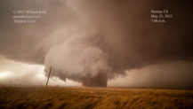
May 13, 2022 Barber County LP Supercell
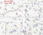
Start: Chamberlain, SD Lunch: grab-and-go convenience store in Nebraska End: Kiowa, KS (627 miles) Storm Reports SPC Day One/20Z We awoke at Chamberlain, along I-90… [Read More]
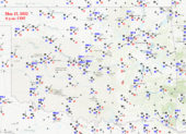
May 12, 2022 Redfield, SD supercell
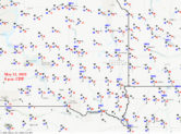
Image above courtesy of Chris Gullikson Start: Worthington, MN Lunch: Culvers at Mitchell, SD End: Chamberlain, SD (490 miles) Storm Reports SPC Day One/20Z Like… [Read More]
May 11, 2022 Severe Squall IA/MN
Start: Vermillion, SD Lunch: Whimps Place in Burbank, SD End: Worthington, MN (410 miles) Storm Reports SPC Day One/20Z Van-top timelapse video of MN/IA portion… [Read More]
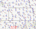
May 4, 2022 Crowell, Texas Tornado
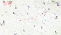
Start: Childress Lunch: Galvan’s Mexican in Turkey, TX End: Vernon, TX (415 miles) Storm Reports SPC Day One/20Z Video of Crowell tornado by Chris Gullikson… [Read More]
May 2, 2022 Alva, OK, supercell
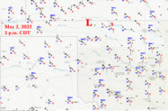
Start: Childress Lunch: Woodward fast food End: Lawton, OK (541 miles) Storm Reports SPC Day One/20Z Wow — this was shaping up to be a… [Read More]
May 1, 2022 Denver City to Seagraves Supercell
Start: Shamrock, TX Lunch: Joe Taco in Canyon End: Childress (569 miles) Storm Reports SPC Day One/20Z SPC drew a large 5% tornado area in… [Read More]
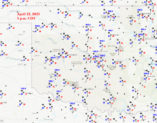
April 29, 2022 Andover Kansas Tornado
Start: Kiowa, KS Lunch: Hardtner/Yur Place End: Oklahoma City (500 miles) Storm Reports SPC Day One/20Z NWS Wichita page on the Andover event. This page… [Read More]
April 27, 2022 Texas Panhandle supercell

The last few days of Tour 1 were slow, and we spent a couple of days poking around the Rio Grande (April 25 and 26)…. [Read More]
April 24, 2022 Sheffield, Texas Supercell
Start: Wichita Falls Lunch: BBQ Barn at Buffalo Gap End: Fort Stockton (566 miles) Storm Reports SPC Day One/20Z Like the day prior, I had… [Read More]
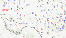
April 23, 2022 Chattanooga, OK, Supercell
Start: Dodge City Lunch: Woodward/Braums End: Wichita Falls (476 miles) Storm Reports SPC Day One/20Z Today’s severe risk extended from the Red River to the… [Read More]
April 22, 2022 Moscow, Kansas, Supercells
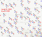
Start: Dodge City Lunch: Oakley Subway End: Dodge City 561 miles Storm Reports SPC Day One/20Z This chase day had very high potential, as a… [Read More]