
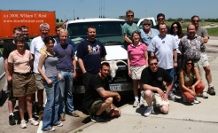
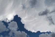
Back to southeastern Kansas again! This was the final chase day for Tour 3, so it was nice that our target wasn’t too far from… [Read More]
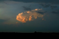
May 27, 2008 Willow, OK Stormus Dissipatus
With hopes at a modest level at best, we scooted west into western OK as thunderstorms developed. A couple of updrafts looked good briefly, but… [Read More]
May 26, 2008 More Kansas storms
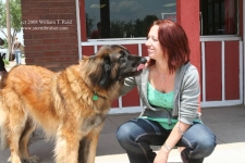
Thunder the Wonder Dog joined us for lunch in Offerle (west of Kinsley). Like the day prior, today’s storms were less than impressive. The initial… [Read More]
May 25, 2008 Central Kansas Storms
The big play this day was in Iowa, where the Parkersburg monster tornado formed. We began the day in Salina and played central Kansas. We… [Read More]
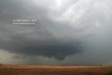
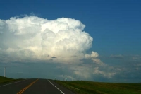
May 24, 2008 Hennessey, OK Tornadic Supercell
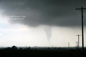
A lone, isolated supercell was a prolific tornado producer as it moved slowly through Kingfisher County and Garfield County in Oklahoma on May 24, 2008. … [Read More]
May 20, 2008 Keota, CO High Plains Gets Shafted
Or, High Plains gets a fun hail shaft. The previous four days were down days. Our group poked around Big Bend on the 16th and… [Read More]
May 9, 2008 Grant, NE supercell

Great Scott……I had a tough decision to make on this morning in Dodge City. Should I play today or tomorrow? Today—a good chance of a… [Read More]
May 8, 2008 Jetmore, KS supercell
Also known by precious few as the famous Shallow Water/Jetmore/Kinsley supercell, this storm began its life by spitting out landspout-type tornadoes in Wichita County, KS,… [Read More]
May 7, 2008 Red River Storms
We awoke in Childress to cold drizzly weather and northwest winds, as a cold front had just passed through. Fortunately, the front was not advancing… [Read More]
May 6, 2008 Southern TX Panhandle storms
On this Tuesday we hit the road a little on the early side (from Dodge City), as we needed to be in the Lubbock, TX,… [Read More]
May 1, 2008 Hail Fredonia

And “Tornado Fredonia”, too, but we could not see it, despite looking at the supercell on its southeast side as it came up to Fredonia,… [Read More]
June 17, 2007 NE North Dakota supercell
short version: Brian and I got out of Pierre by 11 a.m. and targeted the Grand Forks, ND, area. The cap was strong, and held… [Read More]
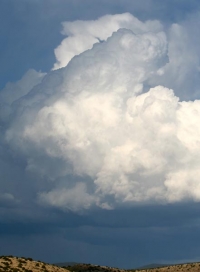
June 15, 2007 Central South Dakota CB
short version: Brian and I were almost ready to blow off the day, chase-wise, from SW ND, when a cell developed to our SSE in… [Read More]
May 30, 2007 Capulin, NM LP Supercell
The chase prospects on May 30th were fairly slim, but one must always be mindful of High Plains Magic. Or, in this case, Raton Mesa… [Read More]
May 16, 2007 Reserve, NM CB
Our only hope for strong convective exhibitions on this day was in western New Mexico. Some so-so cells went up north of Silver City, NM,… [Read More]