
After lunch in Kadoka, we moseyed east on I-90 to Murdo, on U.S. 83. Unfortunately, it looked like we were exactly between two areas of… [Read More]
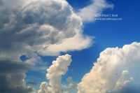
June 24, 2008 Isabel, SD Cumulonimbus and mammatus sunset
A long and somewhat disappointing day culminates in a spectacular sunset on the back side of severe storms in Corson County, SD. We started out… [Read More]
June 18, 2008 SW and SC Nebraska severe cells

A strong cell became established somewhat early in the afternoon south of Ogallala, and dove SE towards McCook. We blasted east from Wray and plunged… [Read More]
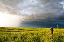
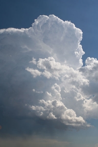
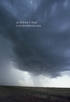
May 14, 2008 Texas Big Country Supercells
Yet another big day with somewhat high hopes for tornadoes! My forecast target spot was a little west of San Angelo, TX, and that worked… [Read More]
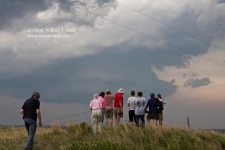
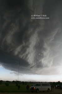
May 13, 2008 Graford, TX storm

There was a fairly decent chance of tornadic supercells on this day along the I-35 corridor in OK. In fact, I think we had a… [Read More]
March 26, 2008 Panamint Valley and Owens Valley, California
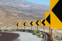
Charlie B. and I took a day trip into the deep basins three hours north of L.A. —- the Panamint and Owens valleys. We were… [Read More]
July 1, 2007 DIA funnel
Developing CB between Denver and Bennett, near I-70, midafternoon. Slender funnel cloud about an hour later from a second dying, pathetic cumulus cloud, several miles… [Read More]
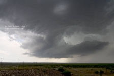
June 21, 2007 North Platte, NE severe storm
I spent a few non-chase days in Omaha from the 18th to the 20th, and had to be in Denver for the start of Tour… [Read More]
June 12, 2007 Timber Lake, SD
Halfway junky storms in NC SD! This cell looked good for about 36 seconds.
June 1, 2007 Portales, NM Supercell
We targeted the extreme western Texas Panhandle, had lunch at the Big Texan in Amarillo, and moseyed down U.S. 60 to Bovina. A cell went… [Read More]
May 19, 2007 Lame Deer, MT CB and CGs
Prospects for a nice storm were decent on this chase day. We took U.S. 212 west from Belle Fourche into Montana, and as far west… [Read More]
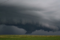
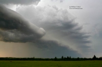
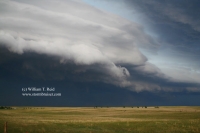
May 17, 2007 Cedar Crest, CO Laminar shelf cloud and ghost town

Cedar Crest is a lonely, semi-abandoned cafe, fuel stop and farmstead along Route 10, halfway between Walsenburg and La Junta. Maybe it is completely abandoned…. [Read More]
December 18, 2006 Lenticulars over L.A.
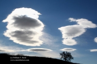
Standing Lenticular Altocumulus clouds can be quite spectacular. These were photographed on a chilly and windy day in Southern California, from the hills of Calabasas… [Read More]
June 23, 2006 Agate, NE supercell and mammatus
Wow, a beautiful supercell near Harrison, NE (in the extreme northwest corner of the Nebraska Panhandle) was photographed from the south, near Agate along Hwy… [Read More]
June 22, 2006 N TX Panhandle squall
Shear was weak on this day. We began tour 6 out of OKC and headed for the northeastern TX Panhandle, near Borger. The late-afternoon cells… [Read More]
- « Previous Page
- 1
- …
- 3
- 4
- 5
- 6
- Next Page »