
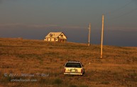
Our tour group was up and on the road at the ridiculously early hour of 8 a.m. out of Ulysses, KS. A strong upper system… [Read More]
April 21 and 22, 2012 Down time on the chase
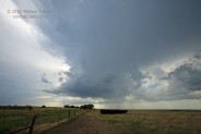
The first chase tour for Tempest Tours began on April 21, and the weather pattern was woeful for chasers. We headed west out of Arlington… [Read More]
January 26, 2012 Van Nuys AP Planes and Lenticulars
I worked a rather rare midweek afternoon shift at Van Nuys AP, and brought my camera with me. It was a bright and beautiful day… [Read More]
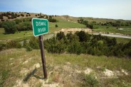
July 4, 2011 eastern Dewey County, SD supercell
The forecast for Corson County, SD, and vicinity worked out marginally well on this day. We began in Belfield, ND, and worked our way east… [Read More]
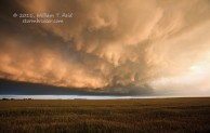
July 2, 2011 Black Hills region supercells

After yesterday’s chase in sw MN, we overnighted in Plankinton (west of Mitchell, SD) and headed west for some upslope severe weather. Here is the… [Read More]
June 27, 2011 Palmer Divide Supercell Machine

Today was the final chase day for the Tour 8/Doswell group. The previous day featured the murk and messy nonsense in central and eastern NE,… [Read More]
June 24, 2011 Highway 20 storms, Lusk to Hay Springs
On the 24th we moseyed southward from Sundance to Lusk and had lunch. My target was the Lusk area, and storms began to develop by… [Read More]
June 23, 2011 Sheridan, WY strong storm

The prospects for a good severe storm were rather slim on the High Plains as low-level moisture was marginal and upper-level flow was so-so. We… [Read More]
June 12, 2011 Just me myself and I, OKC to DEN
After dropping the Tour 5 guests off in OKC midday on the 12th, I threw all of my earthly possessions into my Xterra and made… [Read More]
June 3, 2011 Angelus, KS colorful sunset
This was the final full chase day for Tour 4. We began in Murdo, SD, and had to be back in OKC by early… [Read More]
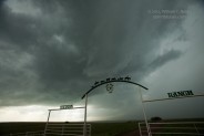
May 20, 2011 St. Leo’s Fire (Kingman County, KS)
Two Stormbruiser pages were made for today — the chase account, and this one, which contains the colorful storm images captured near sunset. The atmosphere… [Read More]
May 19, 2011 Central KS severe
It had been ten days since a decent, long-lived supercell had been observed. Chase prospects finally appeared good on this day, somewhere in and around… [Read More]
June 21, 2010 Yuma County, CO HP Beast
The day of the summer solstice, 2010, was long, long, long, and we needed every minute of it! The day prior featured a great look… [Read More]
June 17, 2010 western KS supercell
We began the final day of this 4-day tour in Dumas, TX, and headed north into western Kansas towards a dry line/cold front intersection. Initial… [Read More]
June 15, 2010 Tatum, NM LP Supercell

This was Day 2 of the short 4-day “mini-tour” out of OKC, and our group was in Lubbock. SPC showed a slight risk for severe… [Read More]
- « Previous Page
- 1
- …
- 16
- 17
- 18
- 19
- 20
- …
- 22
- Next Page »