
CLICK HERE FOR VIDEO (video begins at 24-second mark) Howdy all! It is May 1 as I write this, my first post since… [Read More]
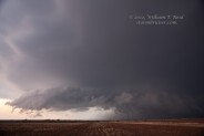
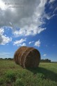
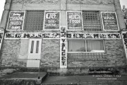
April 29, 2012 Lubbock, TX supercell
This day began in Vernon, TX, and we targeted the warm front/boundary that was in the Lamesa area midday. It lifted north a tad during… [Read More]
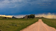
April 27, 2012 Council Grove, KS brief tornado
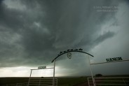
Our tour group was up and on the road at the ridiculously early hour of 8 a.m. out of Ulysses, KS. A strong upper system… [Read More]
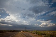
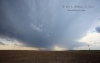
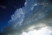
April 26, 2012 Baca County, CO supercell
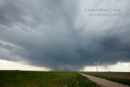
We started today in Yuma, CO, and headed due south towards our target area — generally around Baca County, CO, and Cimarron County, OK. I… [Read More]
July 5, 2011 southern Campbell County, WY, supercells

This was a great way to wrap up the final tour of the year! We observed three significant supercells in northeastern Wyoming. The first one… [Read More]
July 4, 2011 eastern Dewey County, SD supercell
The forecast for Corson County, SD, and vicinity worked out marginally well on this day. We began in Belfield, ND, and worked our way east… [Read More]
July 2, 2011 Black Hills region supercells

After yesterday’s chase in sw MN, we overnighted in Plankinton (west of Mitchell, SD) and headed west for some upslope severe weather. Here is the… [Read More]
July 1, 2011 Siouxland Supercell

A beast of a severe storm left a swath of wind and hail damage from Flandreau in se SD all of the way northeast to… [Read More]
June 27, 2011 Palmer Divide Supercell Machine

Today was the final chase day for the Tour 8/Doswell group. The previous day featured the murk and messy nonsense in central and eastern NE,… [Read More]
June 24, 2011 Highway 20 storms, Lusk to Hay Springs
On the 24th we moseyed southward from Sundance to Lusk and had lunch. My target was the Lusk area, and storms began to develop by… [Read More]
June 11, 2011 Texas County, OK supercell
This was the final chase day for Tour 5, out of OKC, and we had to be back to OKC by noon the next day. … [Read More]
June 10, 2011 southeastern KS supercells
Finally — a decent supercell for the tourists. The day began in Topeka, and we drifted southward towards the mostly empty pastures around Yates Center…. [Read More]
June 7, 2011 southeastern ND supercell
We managed to get on a mildly interesting storm today ESE of Bismarck, ND. It looked like the best tornado prospects were from around Grand… [Read More]
June 2, 2011 western SD severe and lightning
On June 2 we worked our way north from Valentine towards central South Dakota. My chase account for CFDG was written the following morning: The… [Read More]
June 1, 2011 Lexington, NE supercell
May 31—There was little or no risk of storms in the Plains, and the next day’s target looked to be up towards Cherry County near… [Read More]
- « Previous Page
- 1
- …
- 22
- 23
- 24
- 25
- 26
- …
- 30
- Next Page »