

Our group was in pretty good shape position-wise as we gathered for the morning briefing at the motel in Chadron. We had some time to allow Chuck to give a presentation, and then we enjoyed a fast-food lunch in town. SPC put most of the Nebraska Panhandle in a slight risk area, which also covered most of the Dakotas. I felt that our best prospects would be nearby, with convection developing not too far to our west and then drifting east during the afternoon. Tornado prospects were low, but shear and instability values were very good for rotating updrafts.
In the early afternoon, SPC circled the NE Panhandle and southeastern WY and shared their thoughts regarding severe weather potential:
MESOSCALE DISCUSSION 0862
   NWS STORM PREDICTION CENTER NORMAN OK
   0137 PM CDT TUE JUN 02 2015

   AREAS AFFECTED...ERN WY...WRN SD...WRN NEB

   CONCERNING...SEVERE POTENTIAL...WATCH LIKELY

   VALID 021837Z - 021930Z

   PROBABILITY OF WATCH ISSUANCE...80 PERCENT

   SUMMARY...ISOLATED SEVERE THUNDERSTORMS ARE EXPECTED TO FORM OVER
   SOUTHEAST WY THIS AFTERNOON...SPREADING INTO PARTS OF WESTERN SD/NEB
   BY EVENING.  LARGE HAIL AND DAMAGING WINDS WILL LIKELY BE A CONCERN.
    WW WILL LIKELY BE NEEDED IN THE NEXT HOUR OR SO.

   DISCUSSION...VISIBLE SATELLITE IMAGERY AND RADAR LOOPS SHOW
   THUNDERSTORMS DEVELOPING ALONG AN AXIS FROM EAST OF CPR TO WEST OF
   CYS.  THIS ACTIVITY IS FORMING IN A REGION OF MODERATELY STRONG
   WESTERLY FLOW ALOFT /500MB WINDS OF 30-35 KNOTS/...AND ALONG THE
   WEST EDGE OF RICHER LOW LEVEL MOISTURE.  STORMS WILL LIKELY
   INTENSIFY IN THE NEXT COUPLE OF HOURS AS THEY BUILD EASTWARD INTO A
   REGION WHERE MLCAPE VALUES RANGE FROM 1000-1500 J/KG.  LATEST
   SURFACE ANALYSIS INDICATES A WEAK BOUNDARY EXTENDING FROM THE NEB
   PANHANDLE INTO SOUTHERN SD...WHICH MAY HELP TO FOCUS ACTIVITY.  CAM
   SOLUTIONS ARE IN AGREEMENT THAT ROTATING STORMS WILL AFFECT PARTS OF
   THIS AREA THROUGH THE EVENING HOURS...WITH A LOCALIZED RISK OF HAIL
   AND DAMAGING WINDS.

   ..HART/MEAD.. 06/02/2015
I was not inclined to go after the typical and early high-based development in eastern Wyoming, and by mid-afternoon we were observing some strong convection organize just southwest of Crawford, NE, which is just a 30-minute ride west of Chadron.


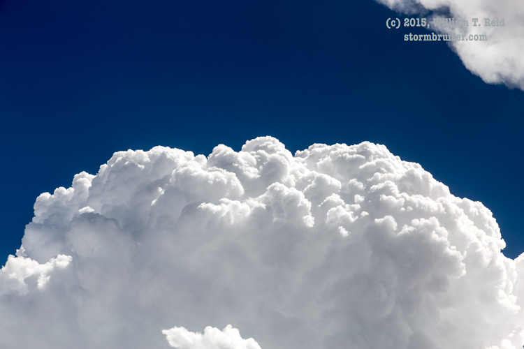

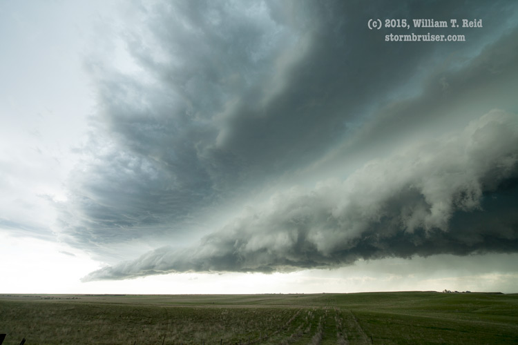
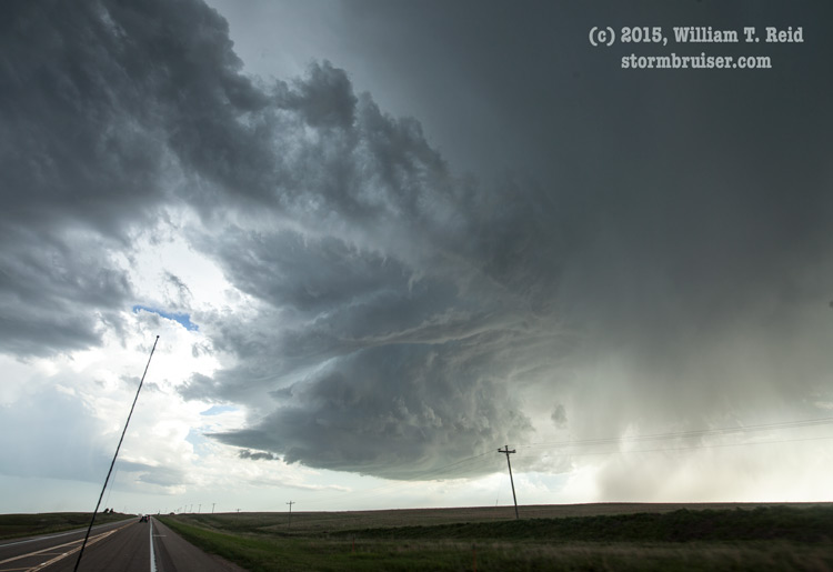
The storm base shown above began to get a good look to it. It enjoyed a nice, unimpeded low-level flow of moisture from the southeast, so it was time to get into position. We dashed south into the pine trees along Hwy 2/71 in the Nebraska National Forest and stopped a couple of times as the base continued to spin and move east towards our N-S road.

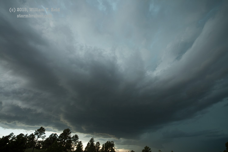
The base sported a decent RFD cut, and a rather low wall cloud threatened to issue a funnel cloud. Strong westerly RFD winds with the “atomized” raindrops slammed us, cloud motion nearby got rather crazy, and I was pretty excited that a tornado could develop. But, like yesterday, this supercell was unable to put a tornado down. The supercell continued to the east through an empty area without paved roads, and we stopped again, near Marsland, to check the storm’s structure to our northwest and northeast.
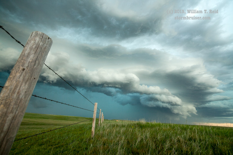
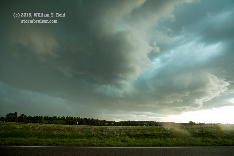
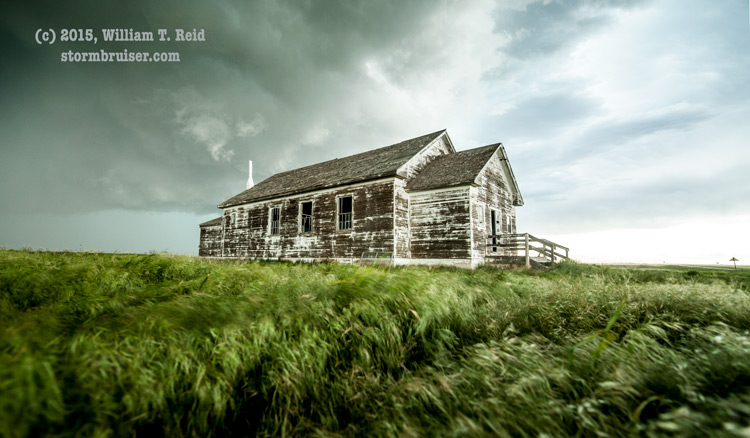
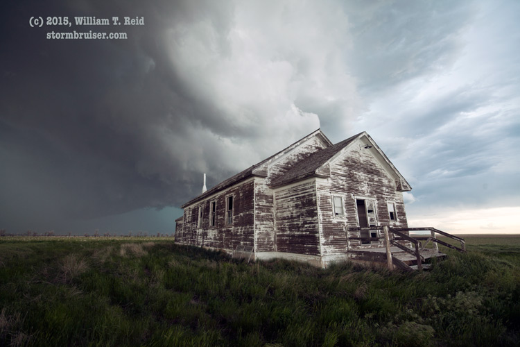
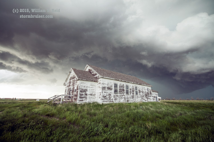
It was not bad at all! The storm was getting rather HP-ish, and chasers lined up on Hwy 385 south of Chadron had a great view. In the meantime, other convection was developing nearby. When we reached the “Hemingford” schoolhouse along Highway 2, we had a minute or two to shoot the school and sky before getting too wet.
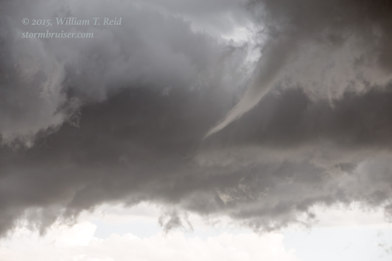
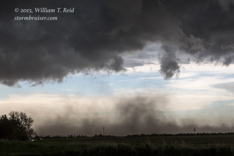
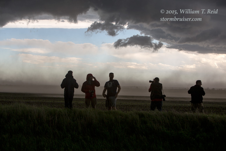
On our way east to Alliance, a storm base to our south became quite perky, featuring a brief funnel cloud and a lot of outflow and blowing dust:
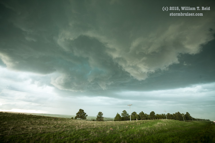
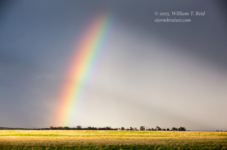
This storm and the original storm to our north looked more HP and less discrete as we reached Alliance. So, instead of venturing into the Sand Hills to the east to stay with these, I directed Tom and Woody southward to newer updrafts, towards Angora and Bridgeport. Here, we came upon another rotating updraft, which sputtered upon arrival and offered a rainbow in apology.
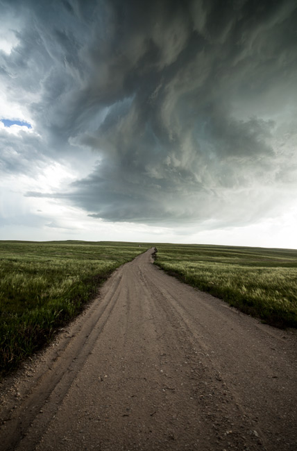
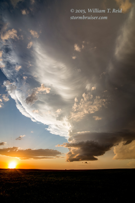
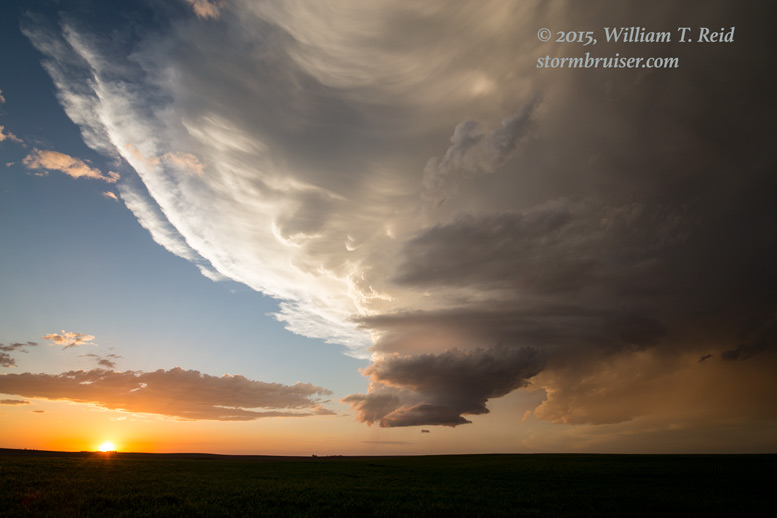
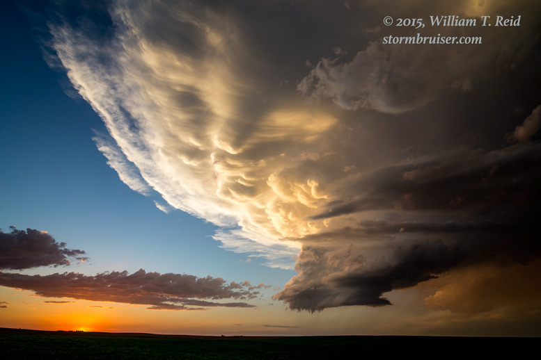
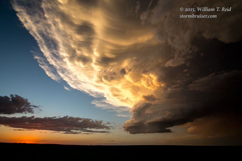
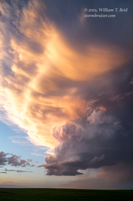
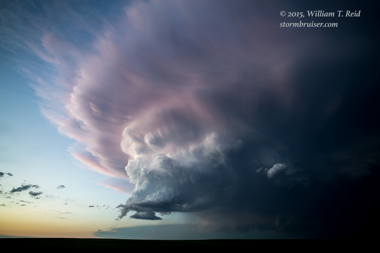
The sun had another hour or so of shining scheduled, and yet another updraft beckoned a little farther south. From Dalton, NE, we headed west on an unpaved road to position ourselves a little south of a nice LP supercell. The updraft was smallish, but the anvil and sunset colors were spectacular. I have two sets of “LP sunset” images to share — the 21mm versions and the 15mm versions. First, the 21mm shots:
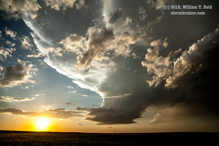
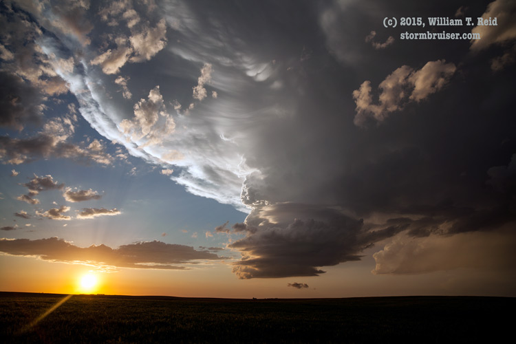

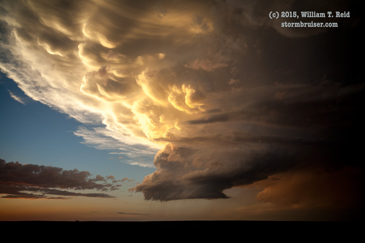

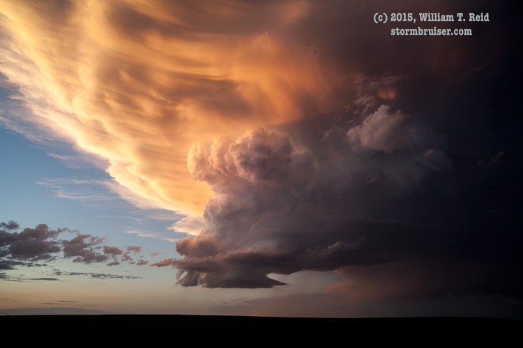
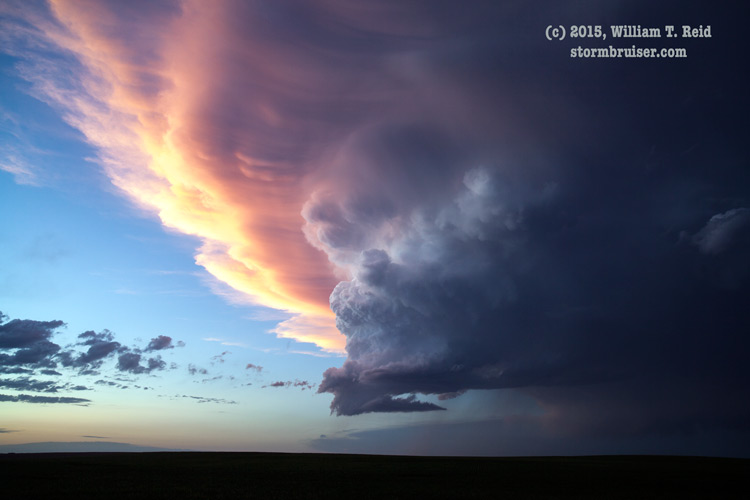
and, the 15mm shots:


text
Leave a Reply
You must be logged in to post a comment.