
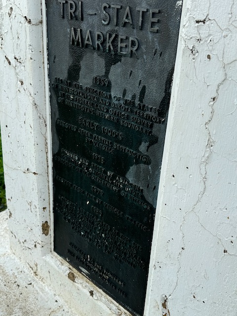
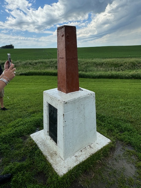
Start: Mitchell, SD/brunch: Milton’s in Mitchell/End: Columbus, NE/406 miles
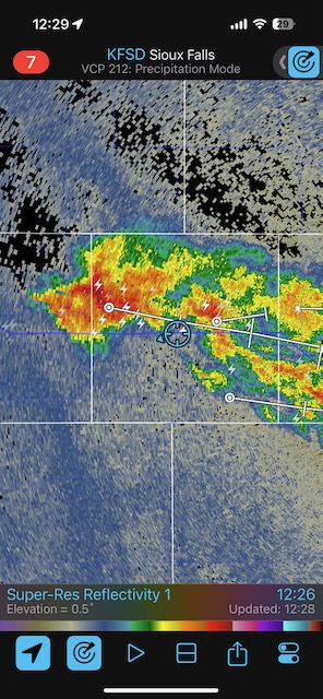
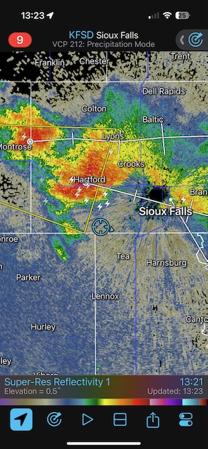
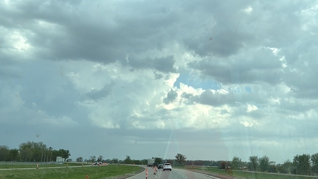
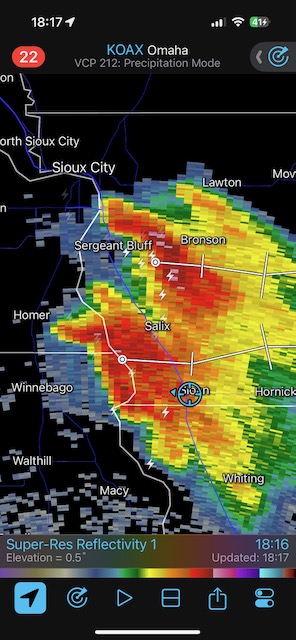
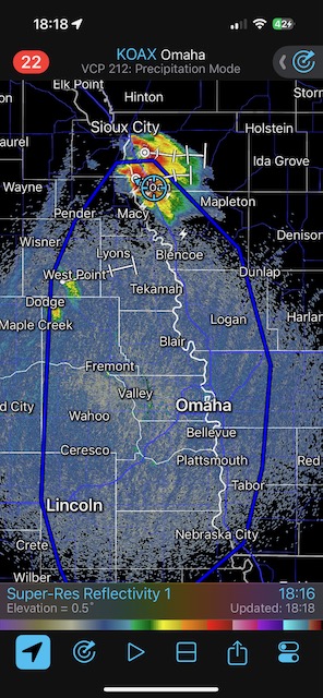
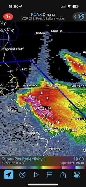
SPC showed a hatched area for hail with a tornado chance broadly north and northeast of Sioux Falls. But areas north of I-90 did not appear too favorable to me, probably due to extensive cloud cover and morning convection nonsense. I stuck close to I-90 not too far west and southwest of Sioux City in South Dakota. I thought that the Siouxland area looked reasonable for a storm chase.
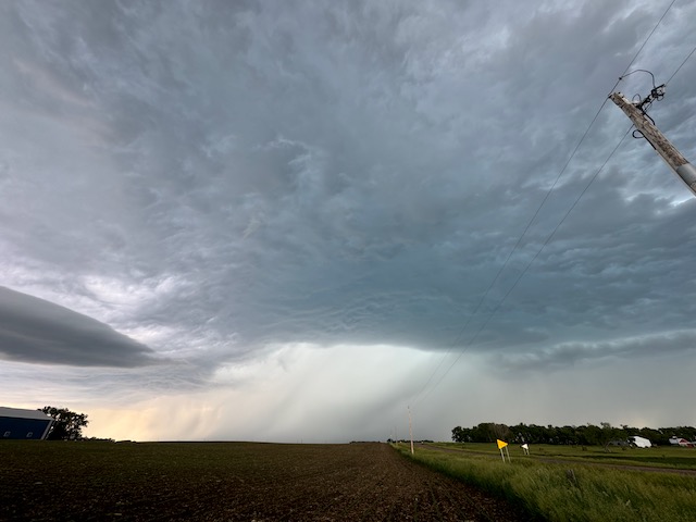
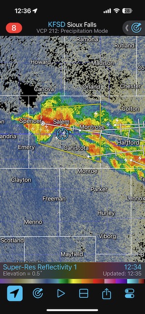
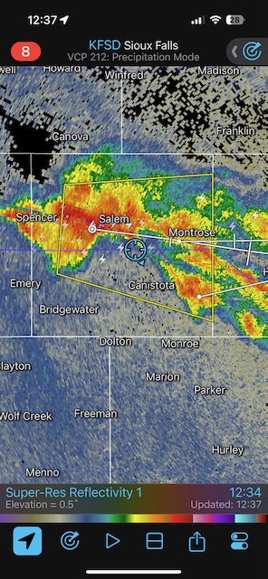
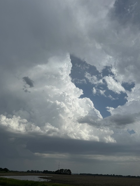
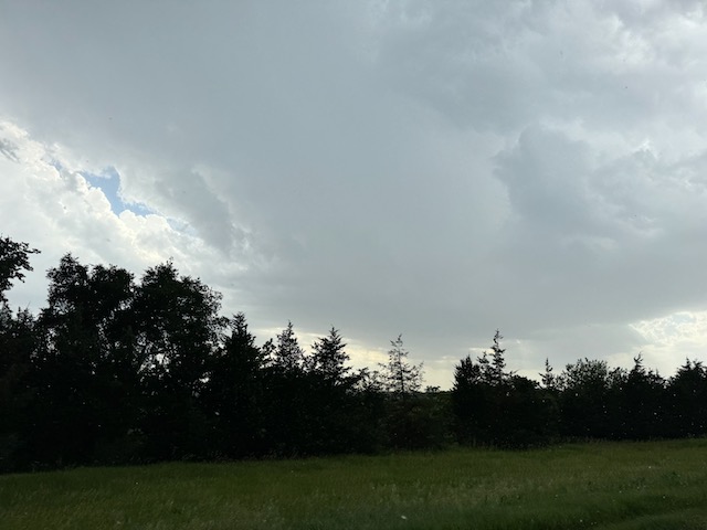
Not too long after brunch in Mitchell we had some high-based junkola to watch southwest of Sioux Falls. It failed to impress due to too much stable air in the low levels, and forced us south towards Sioux City to find better convergence and better air.
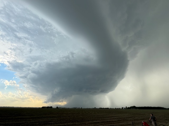
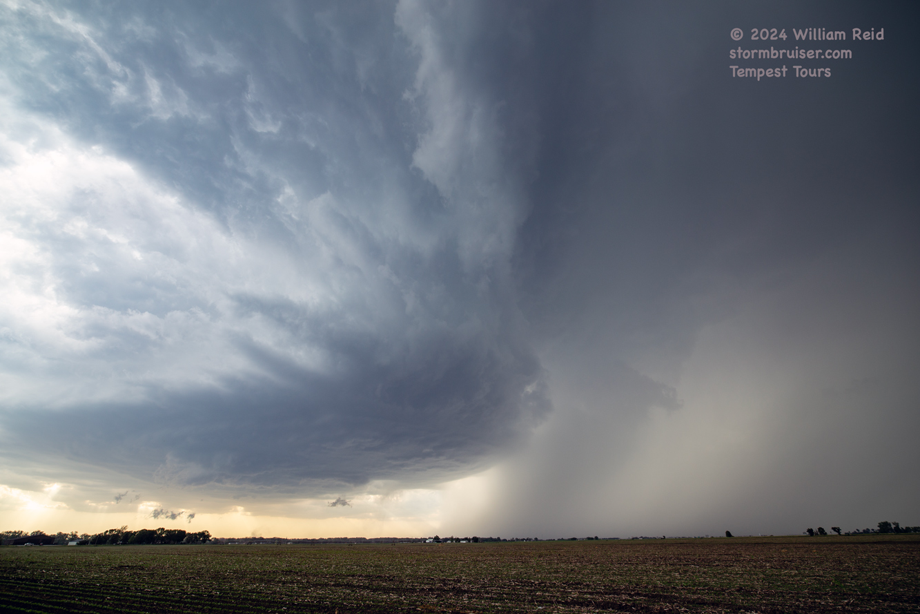
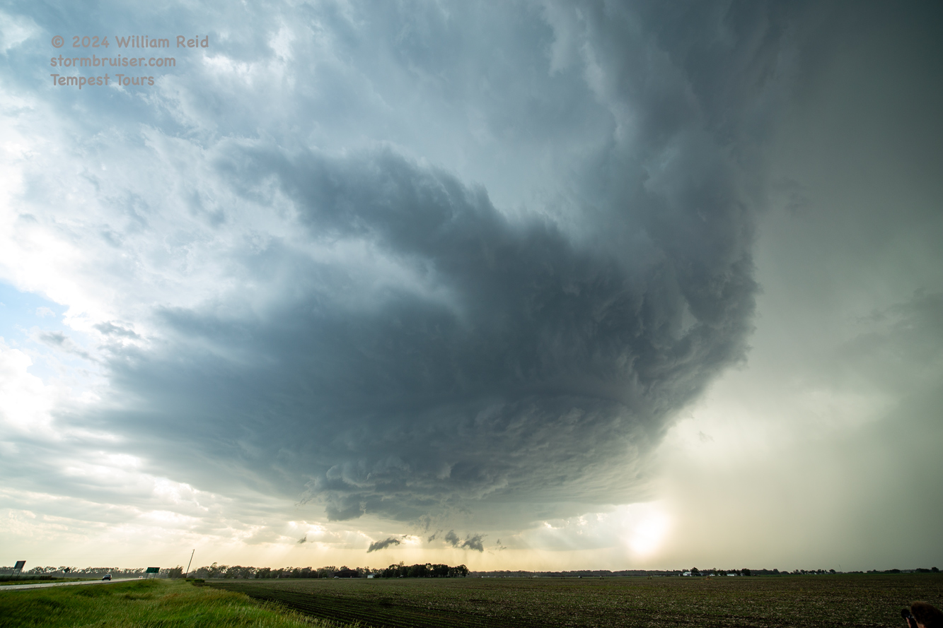
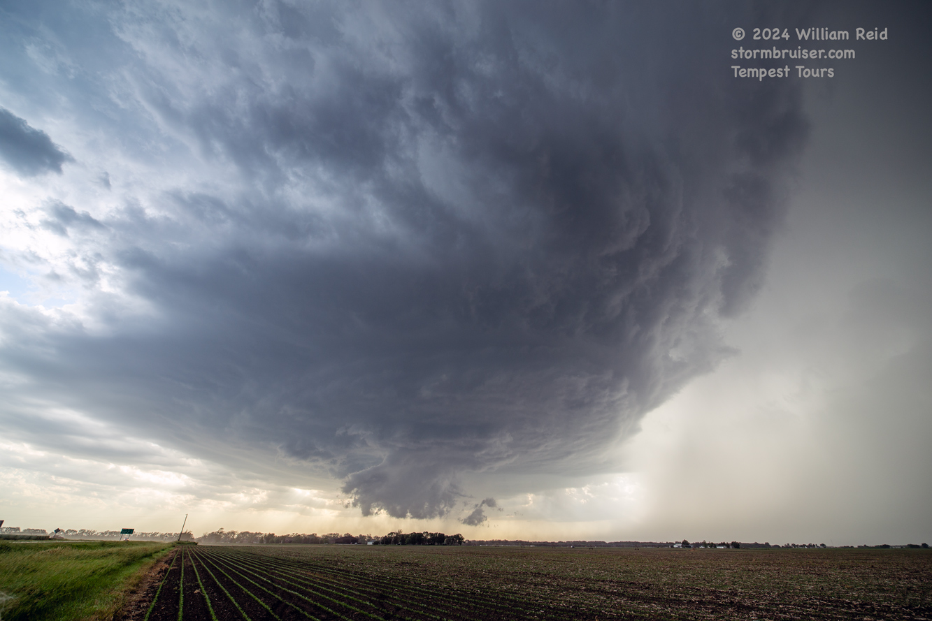
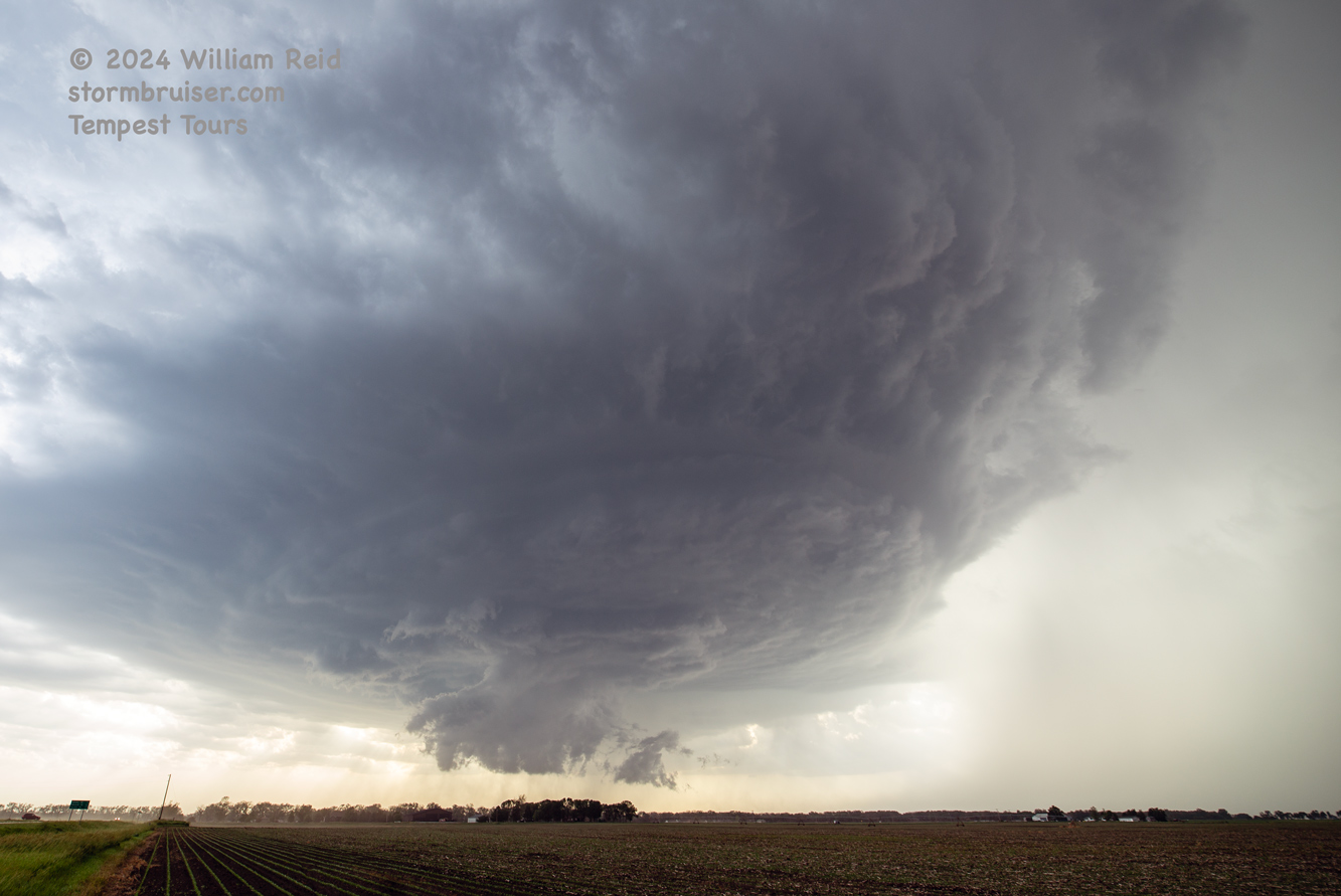
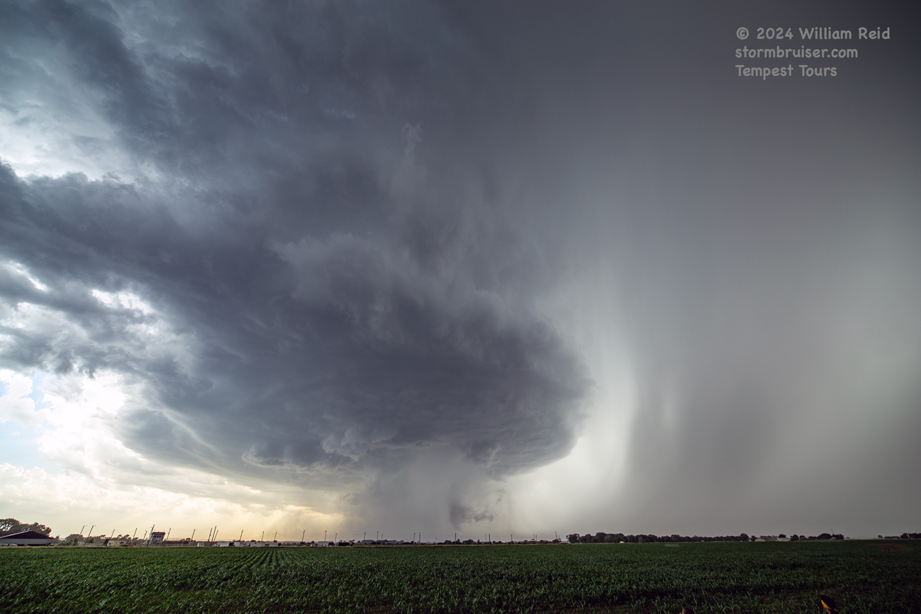
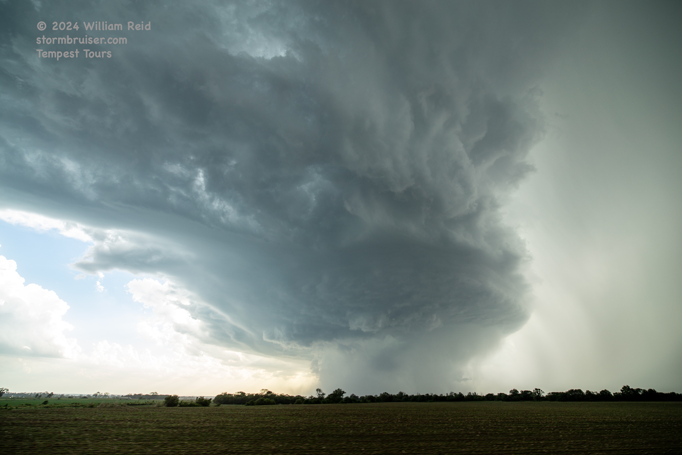
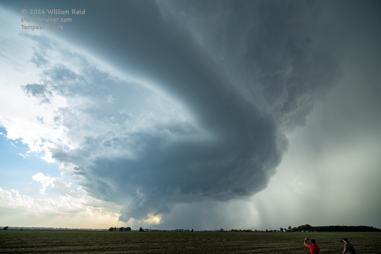
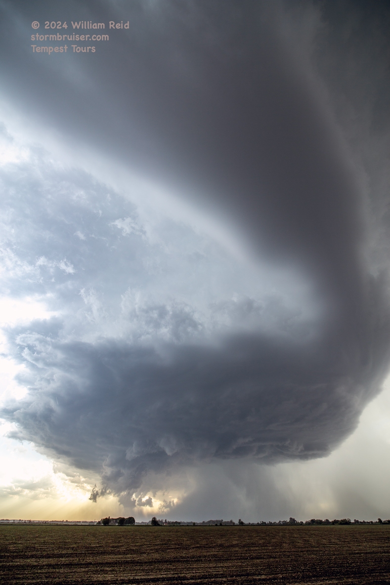
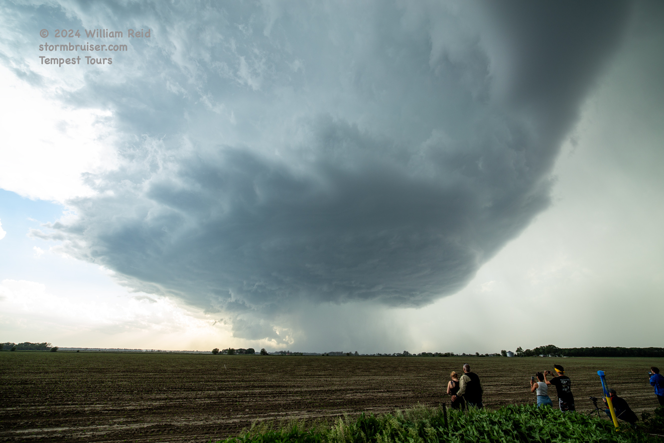
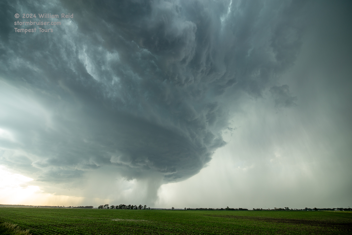
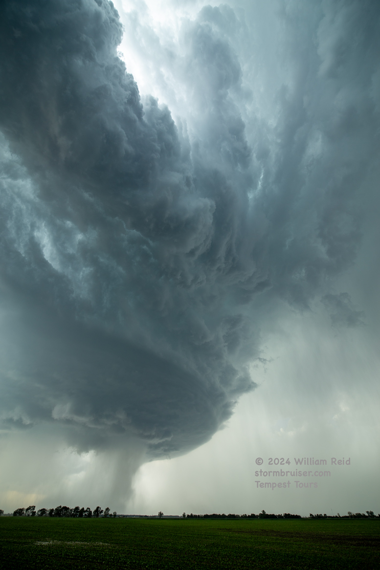
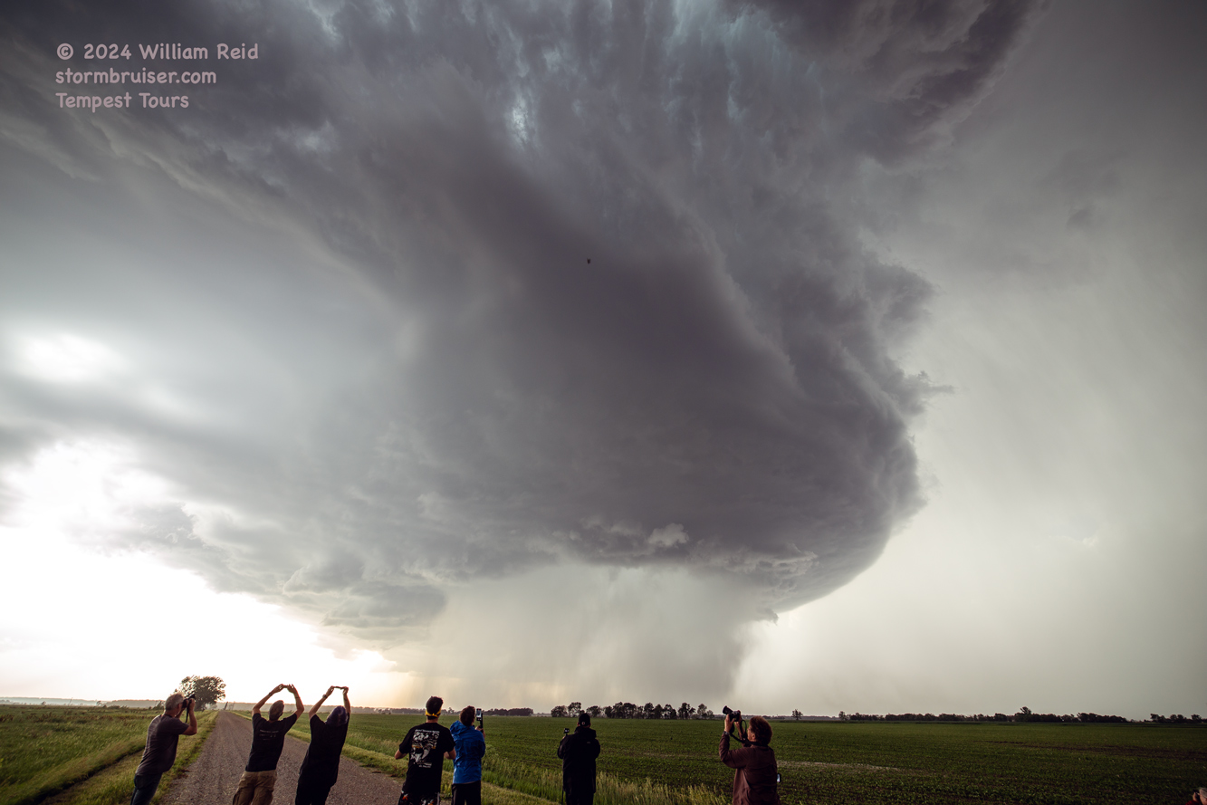
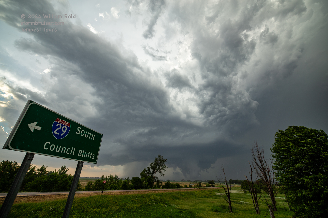
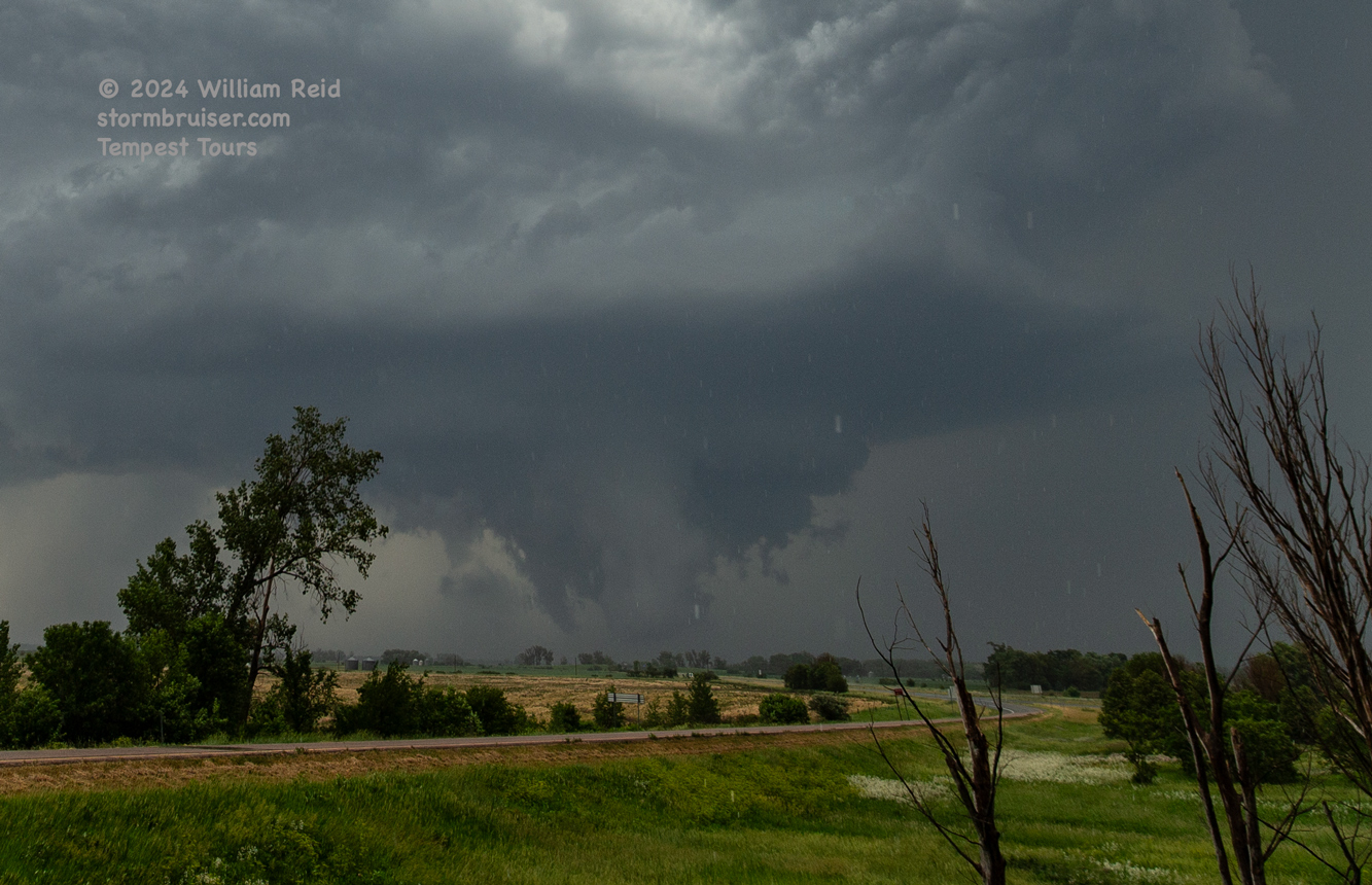
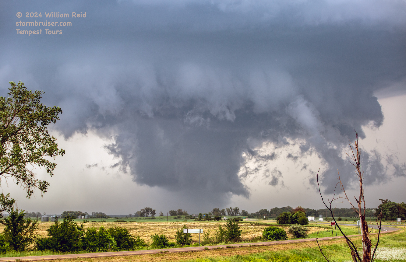
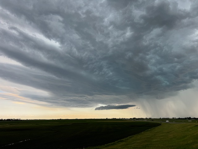
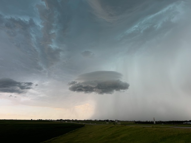
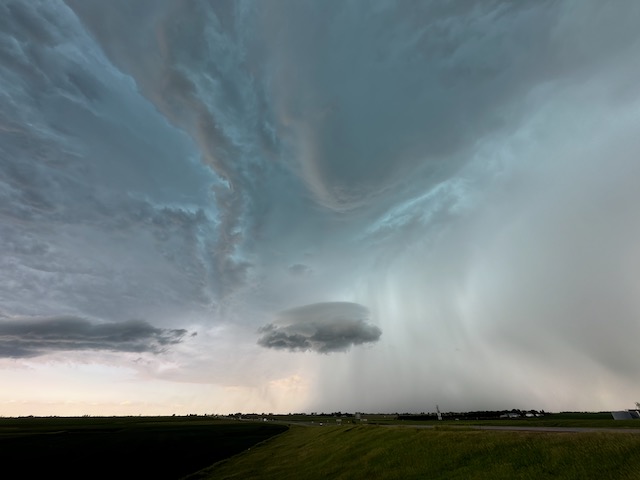
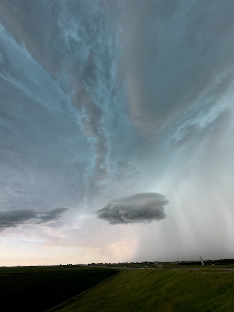
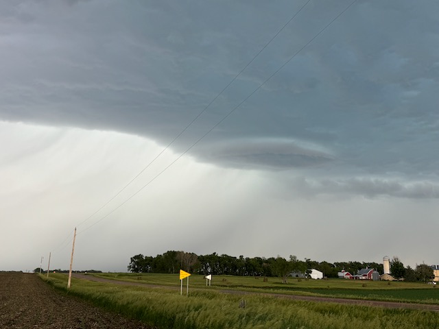
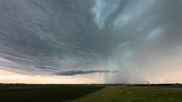
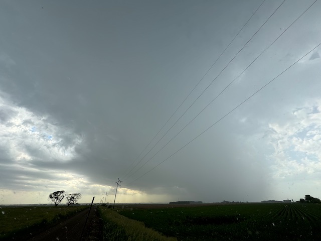
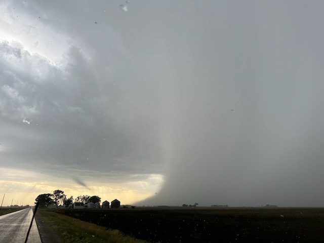
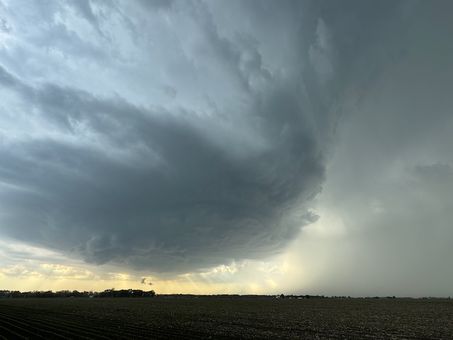
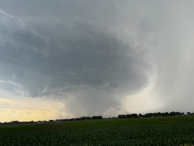
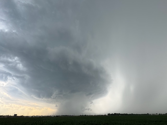
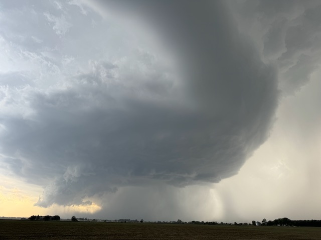
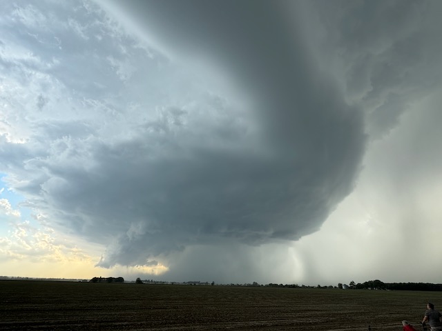
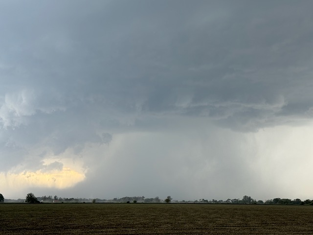
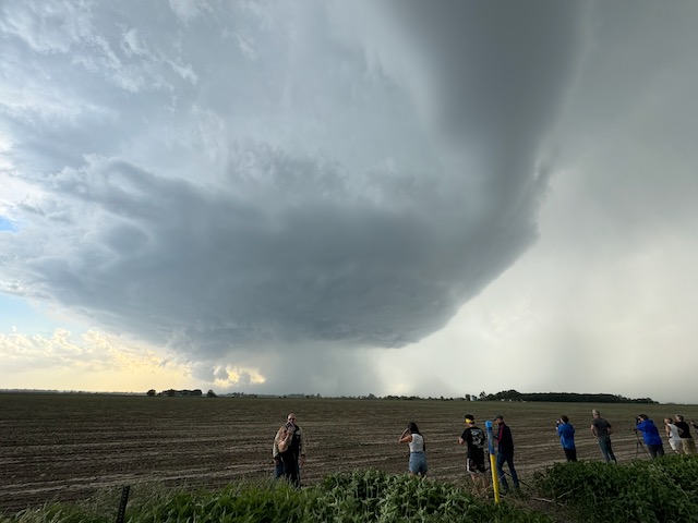
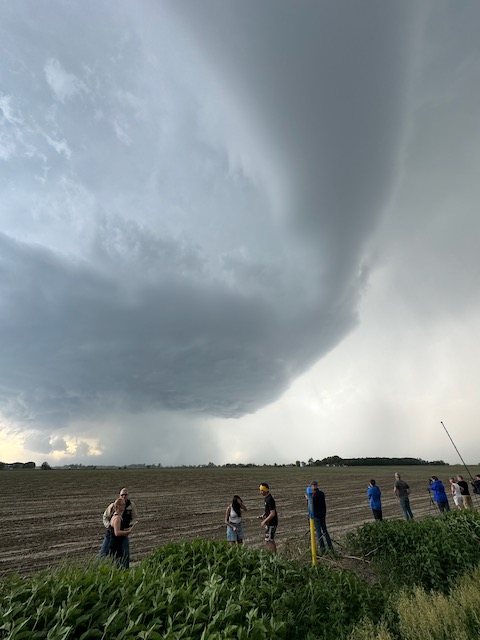
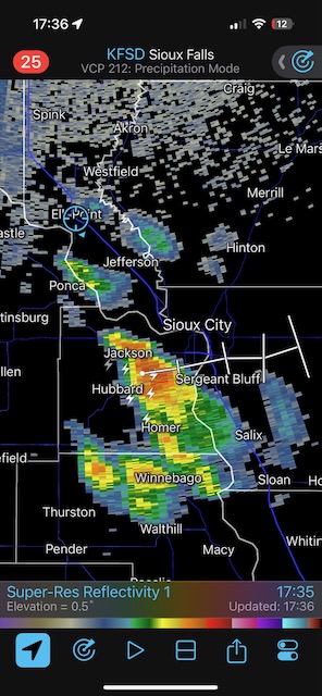
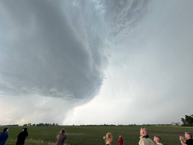
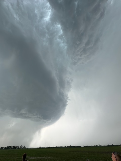
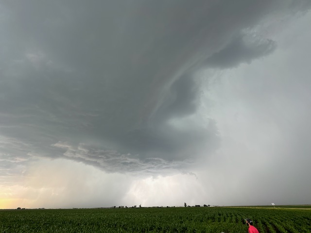
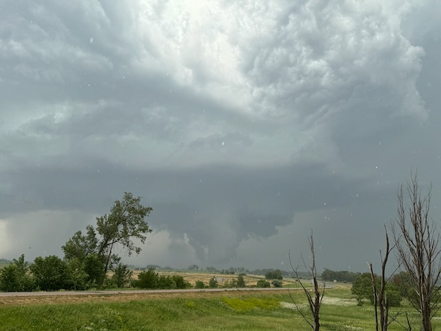
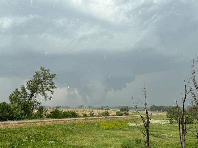
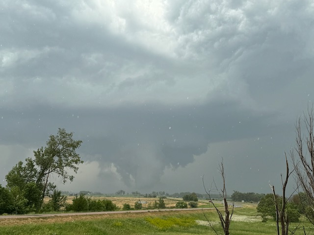
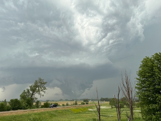
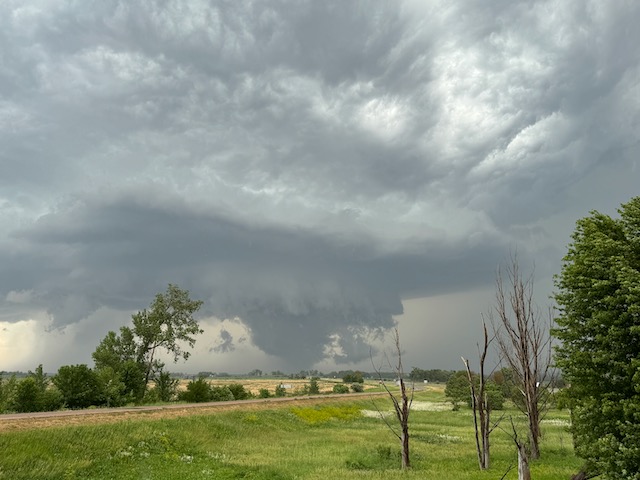
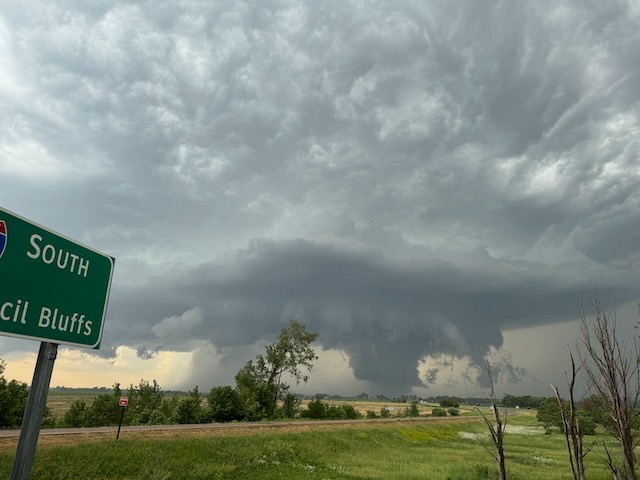
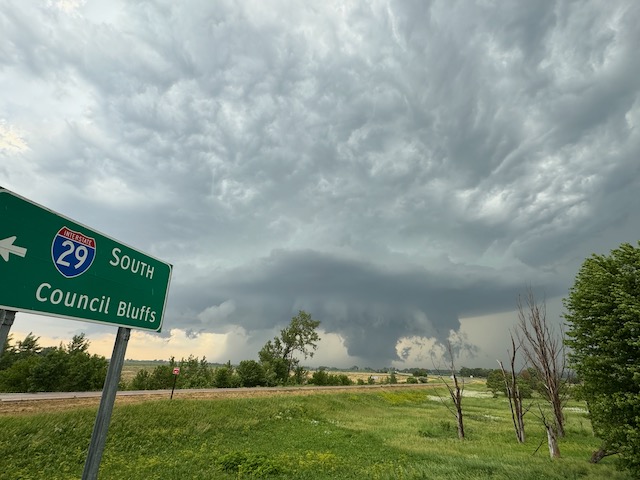
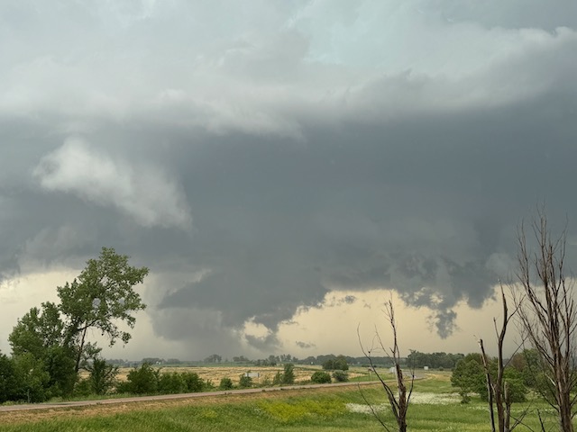
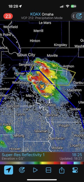
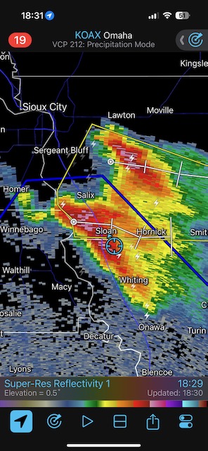
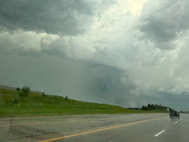
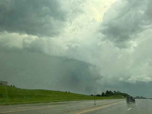
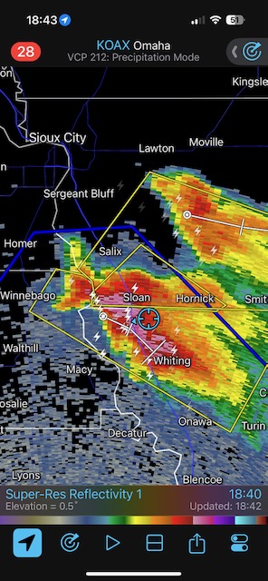
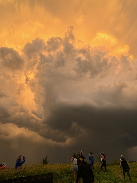
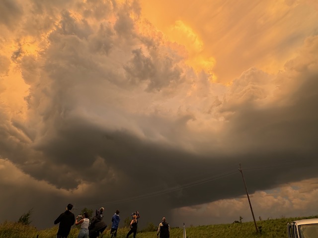
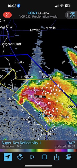
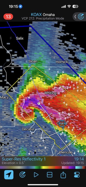
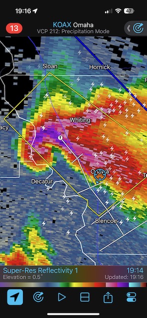
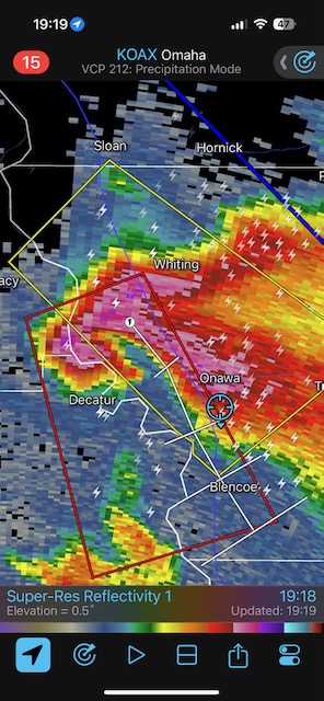
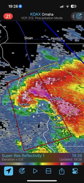
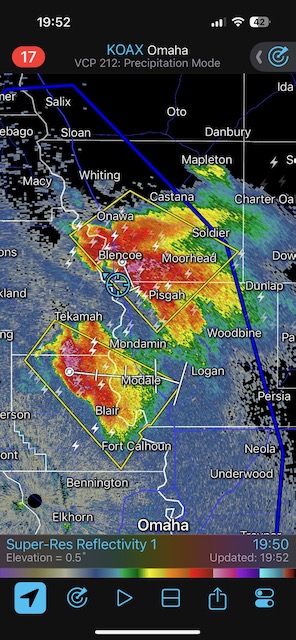
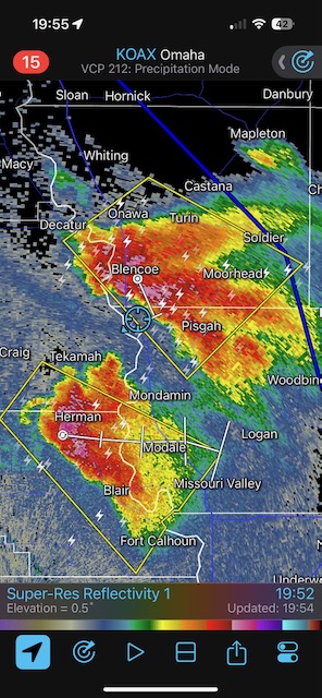
We managed to get in front of a supercell that was moving SSE down the Missouri River from Sioux City. It took on a really nice circular structure, and produced a one-minute tornado near Decatur, Nebraska, that we may or may not have seen from near Onawa, Iowa.
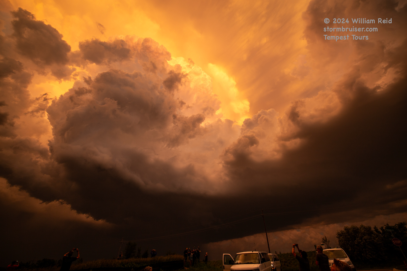
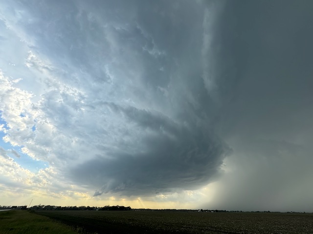
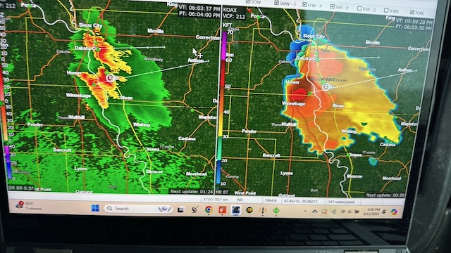
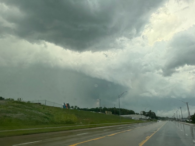
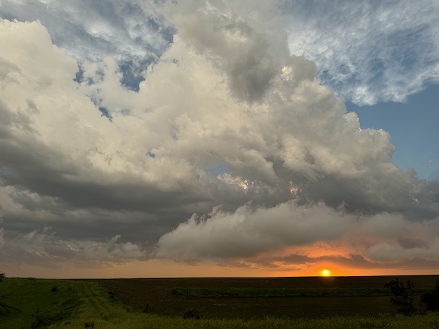
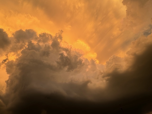
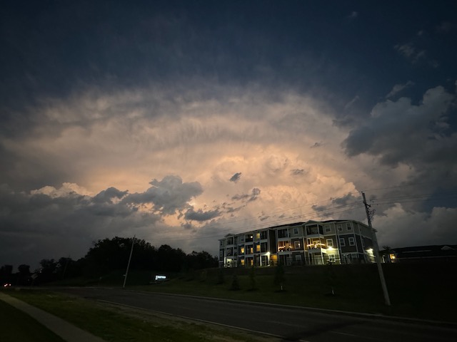
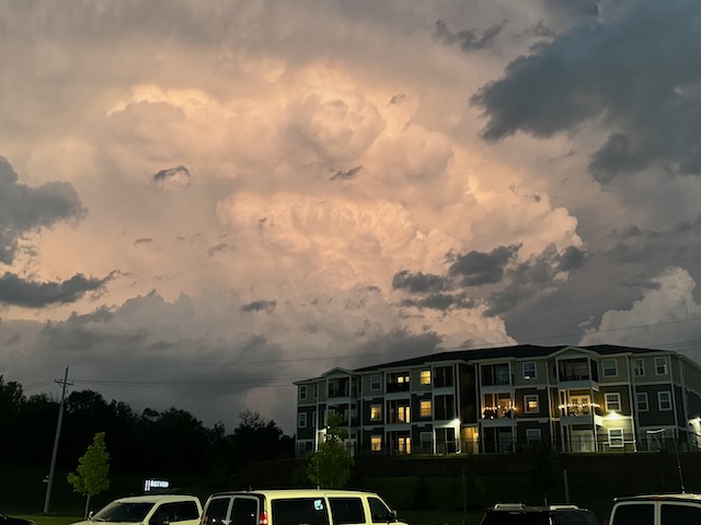
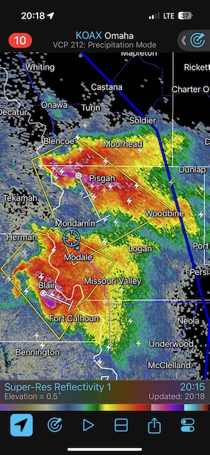
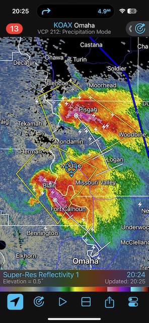
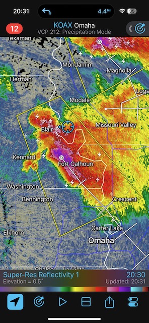
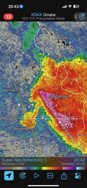
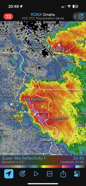
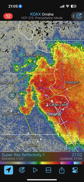
A second supercell to our SSW, near Blair, NE, was looking good on radar and was interfering with our Onawa/Decatur storm. We tried to get close to the action area of this one between Blair and Omaha. It really wasn’t in the cards due to traffic and the storm tracking right into Omaha with large hail. We stopped at sunset south of Blair and WNW of Omaha to watch the storm towers drift away. Two-to-three inch hail was common in parts of Omaha.
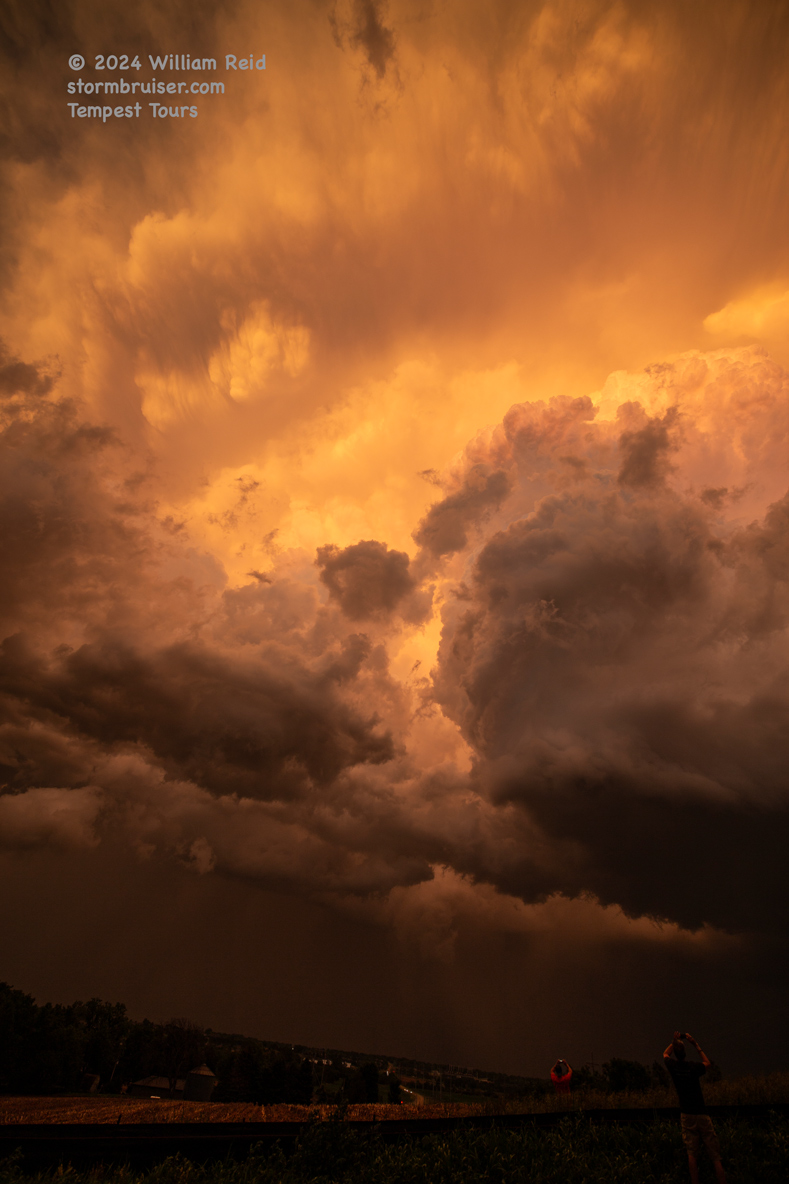
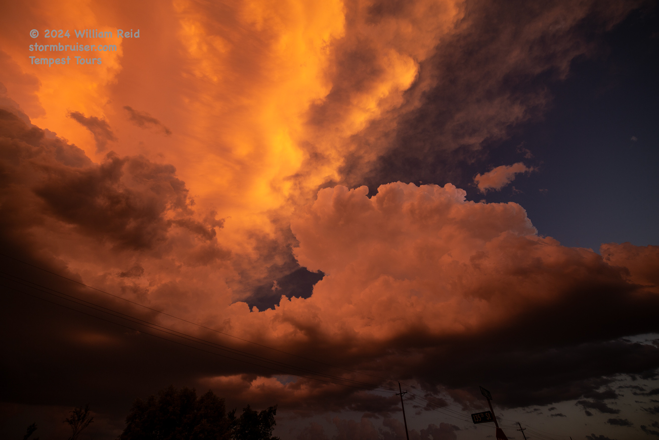
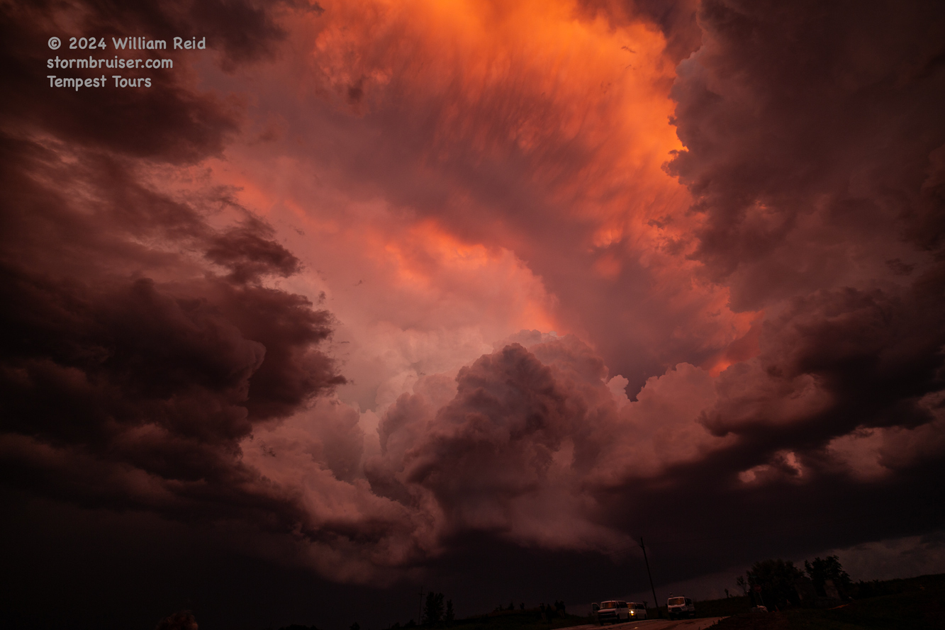
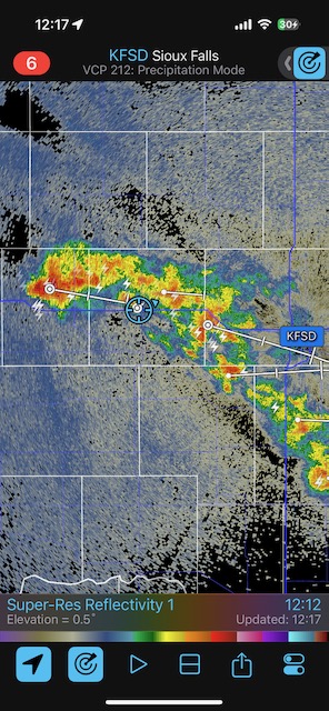
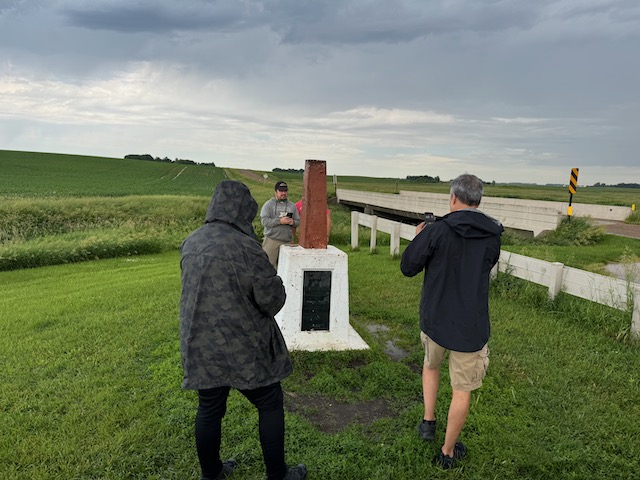
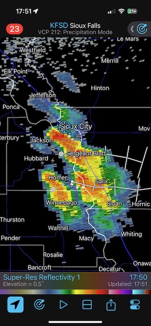
iPhone pics below. Radar screenshots here are generally for two hours earlier in the picture sequence.

Leave a Reply
You must be logged in to post a comment.