
Start: OKC/lunch: quick fast food in KS/end: York, NE/601 miles
The mesoscale discussion for 7:37 p.m. (above) shows some surface observations.
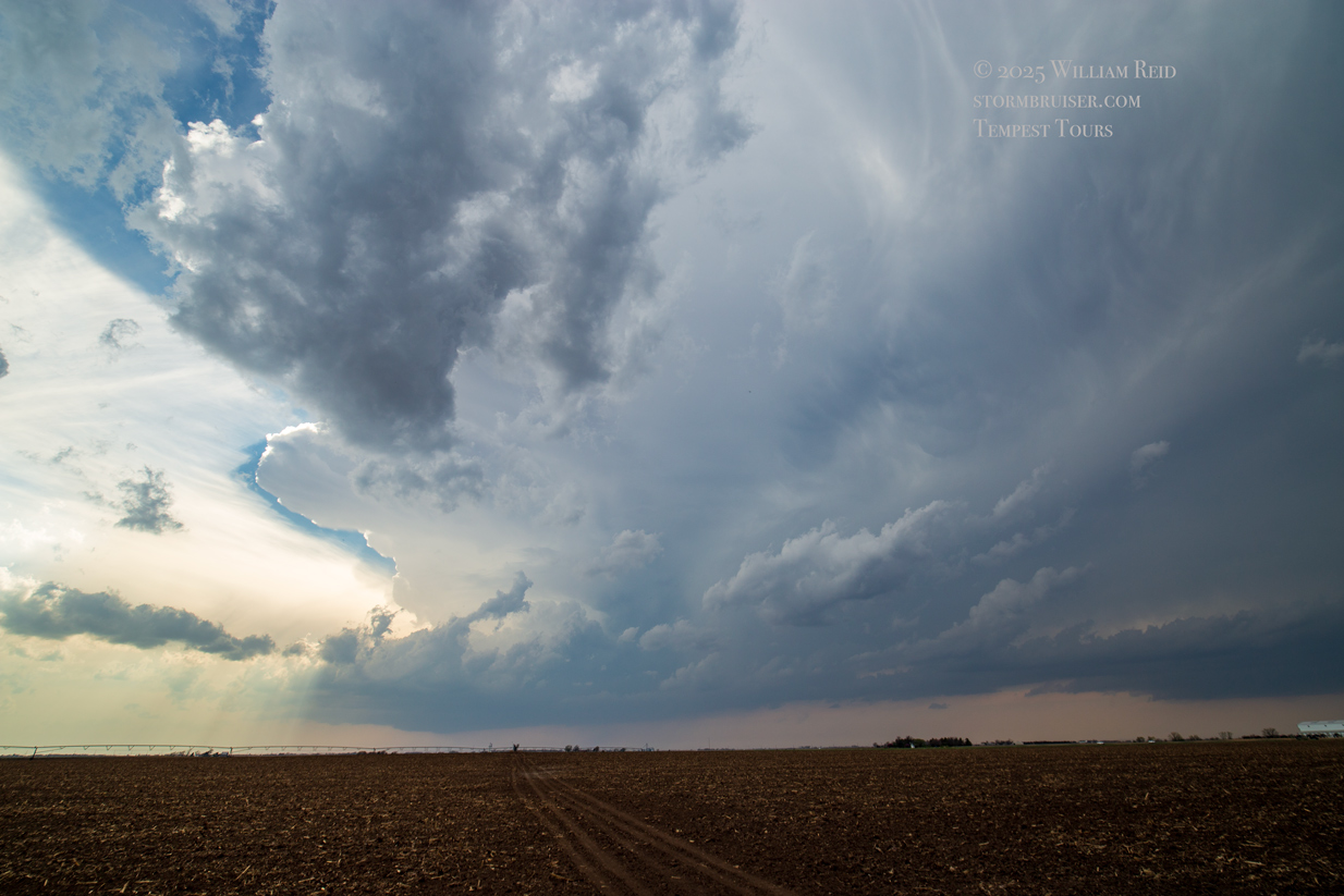
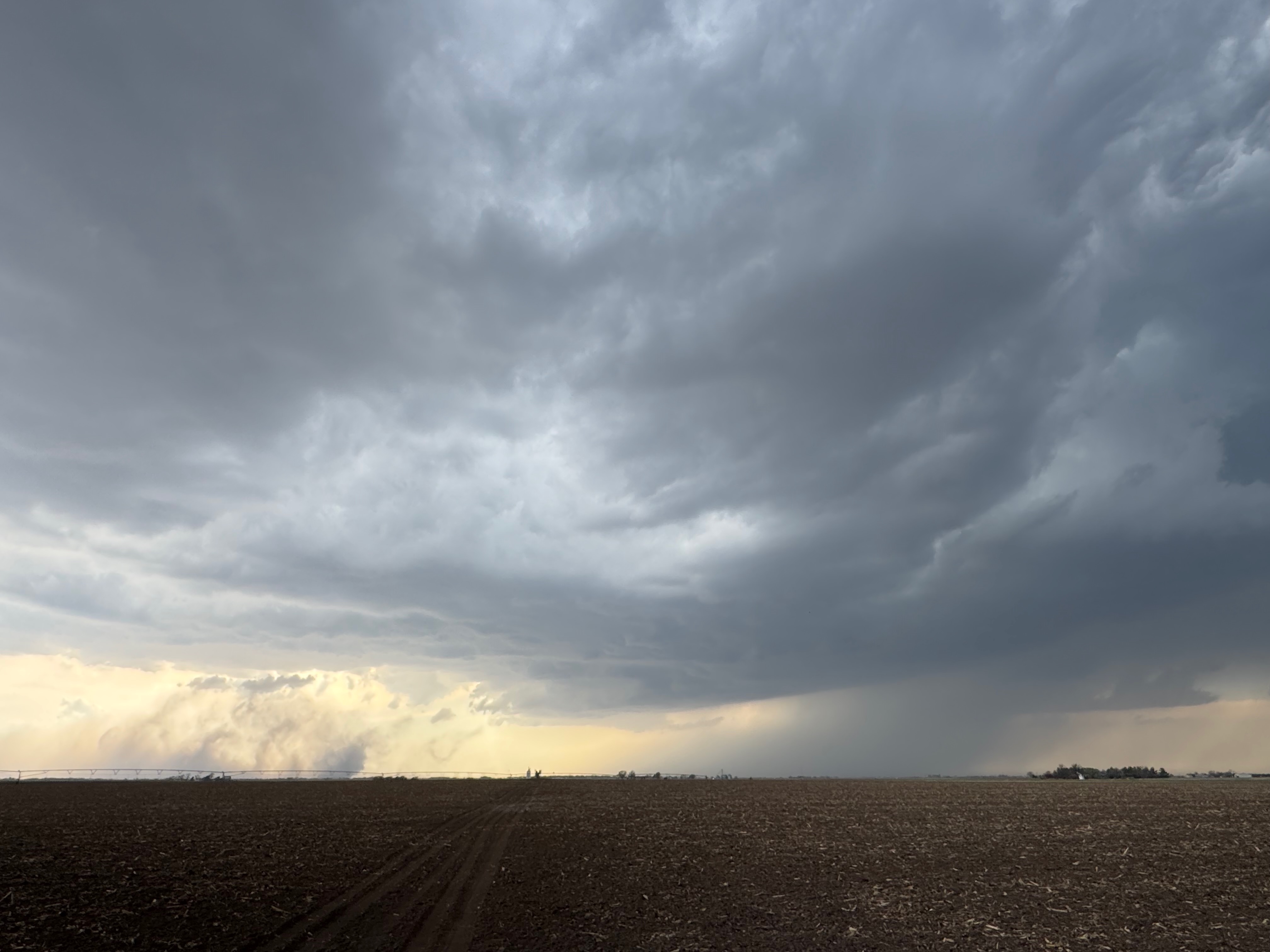
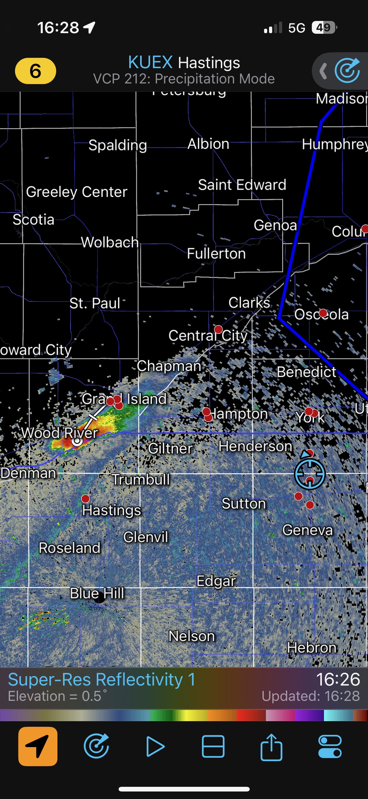
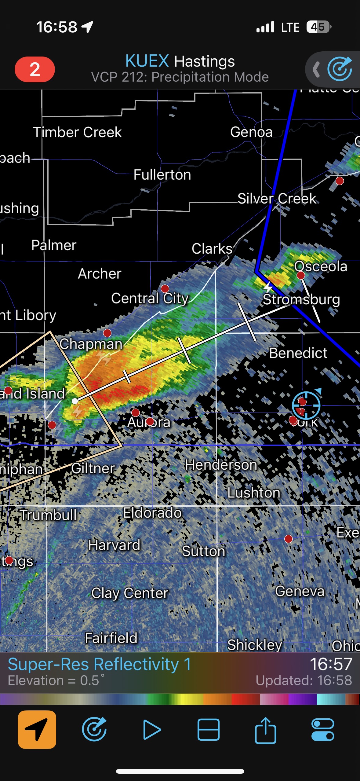
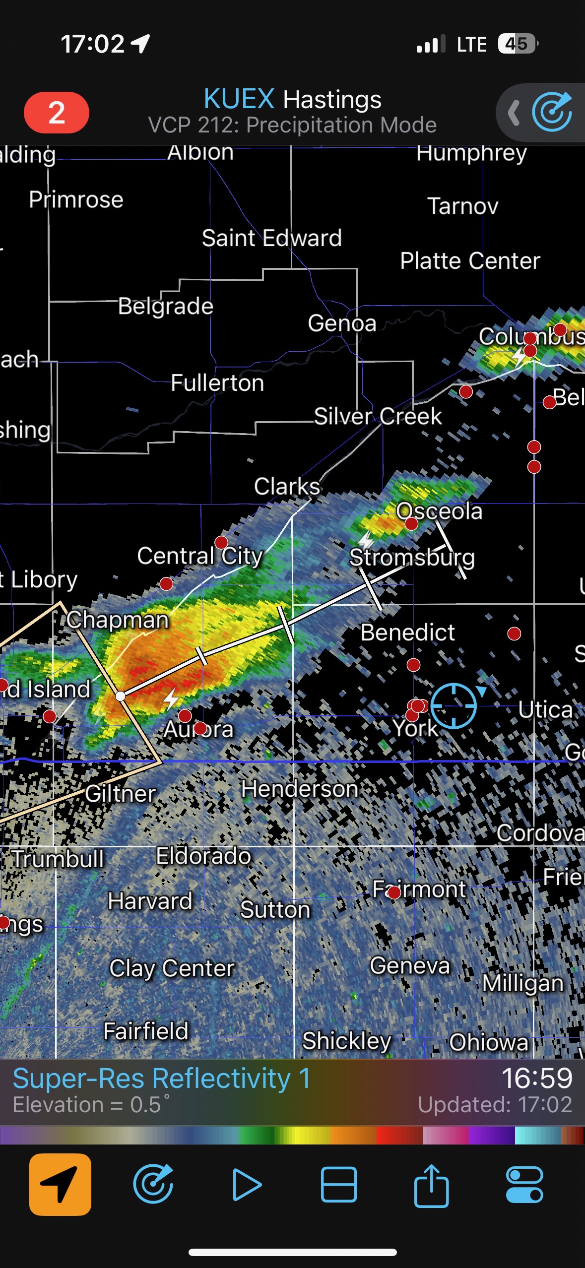
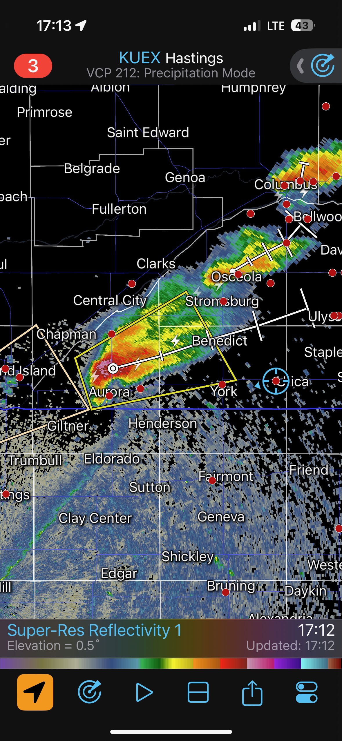
Our first Tempest Tours chase day for the season, with Tour One out of OKC, had fairly good prospects with a 5% tornado area by SPC showing up east-west along I-80 in eastern Nebraska. We just had to get ourselves through OK and KS in time! The low-level moisture was somewhat low-end, with dews near 60F south of a front. This would mean rather high storm bases, at least starting out.
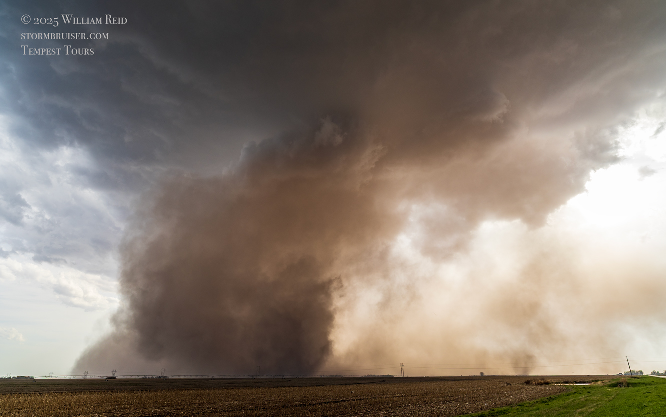
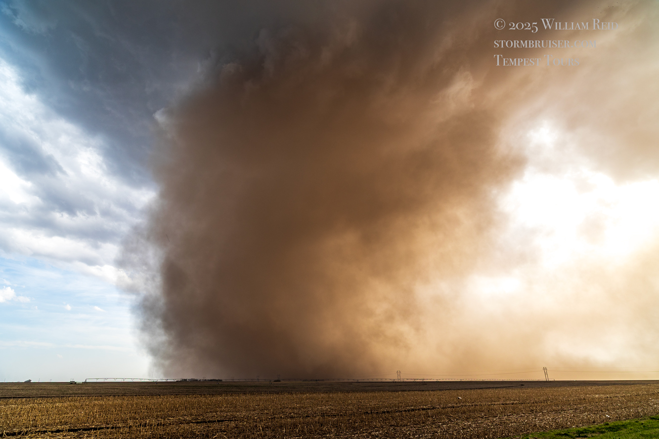
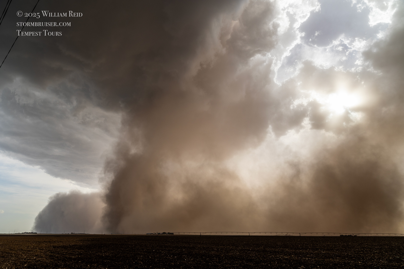
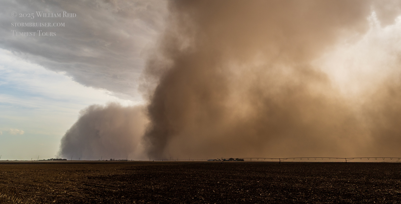
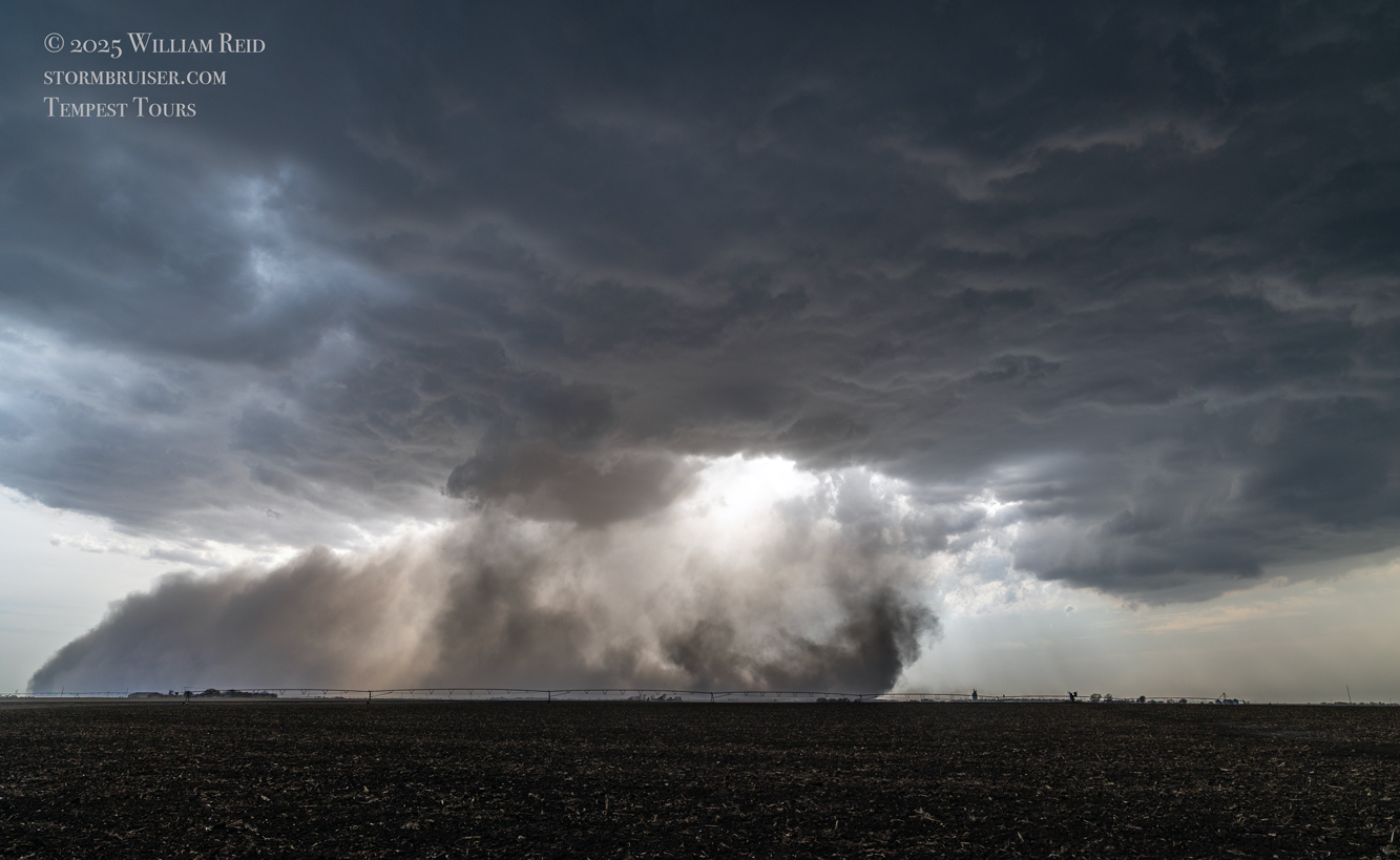
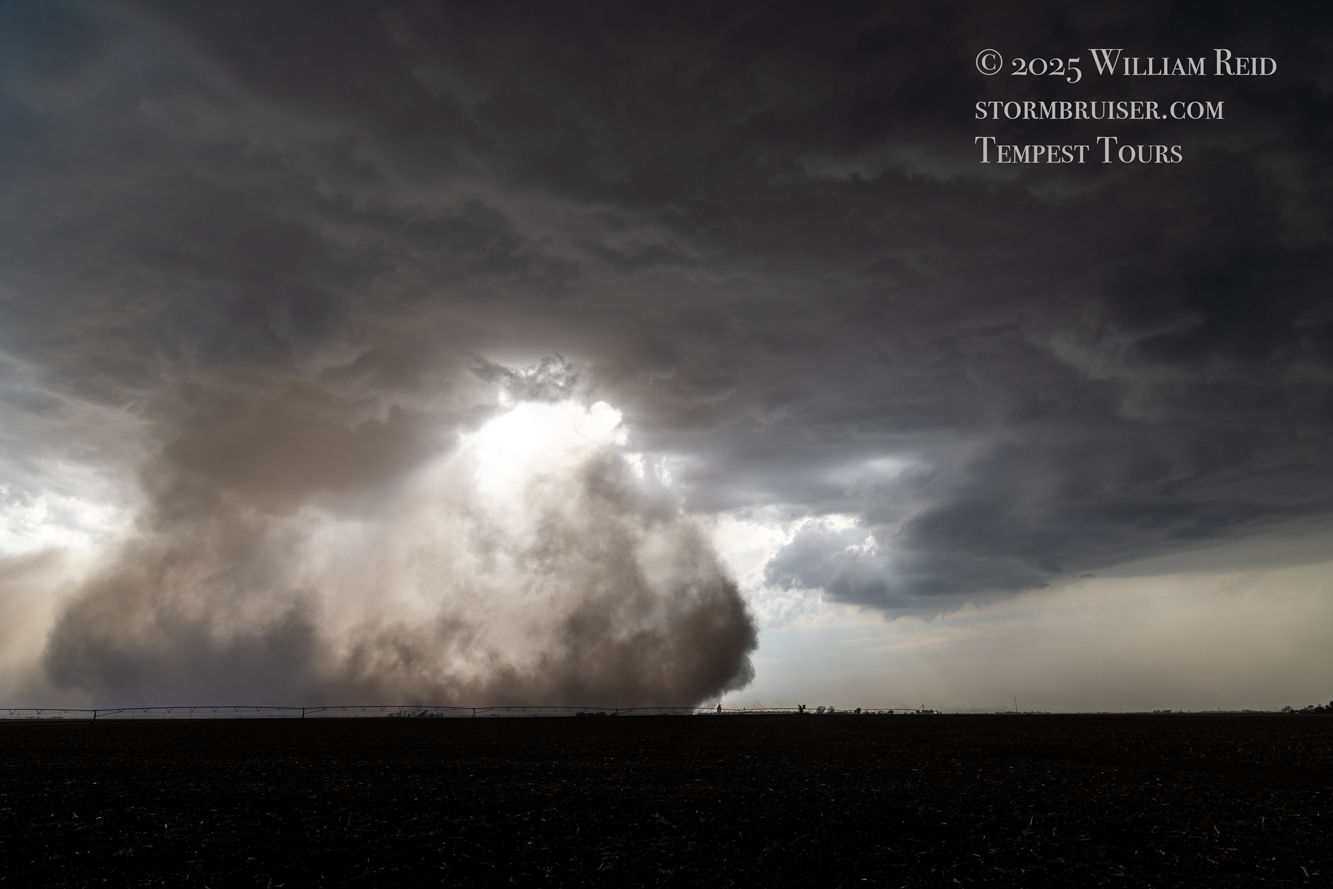
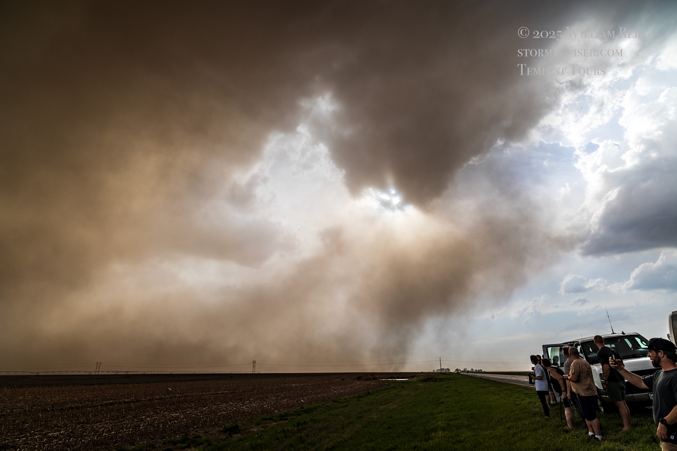
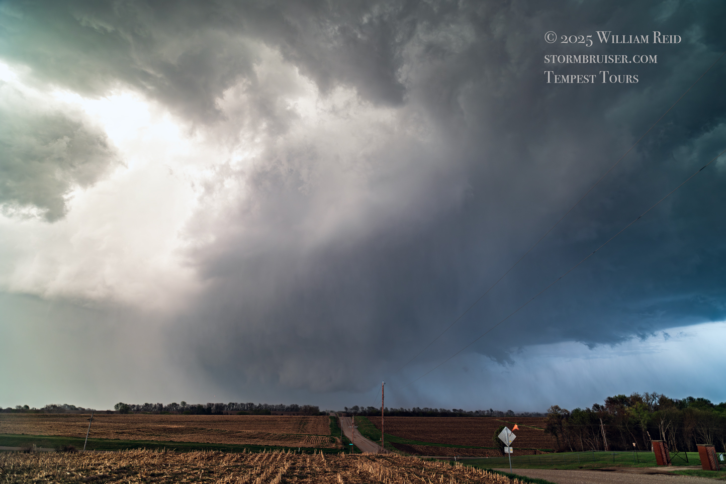
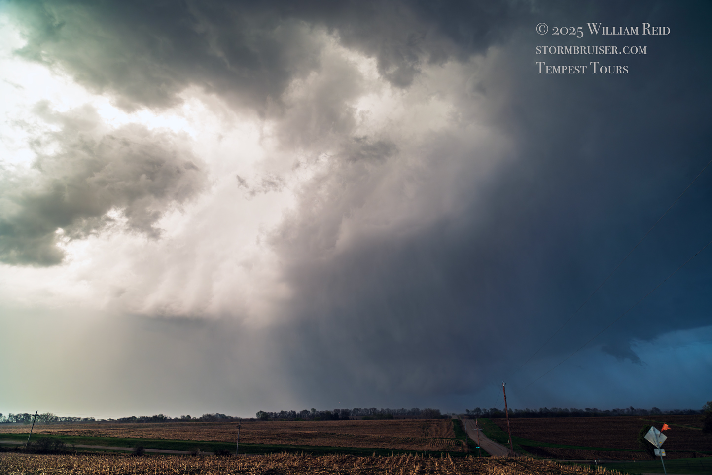
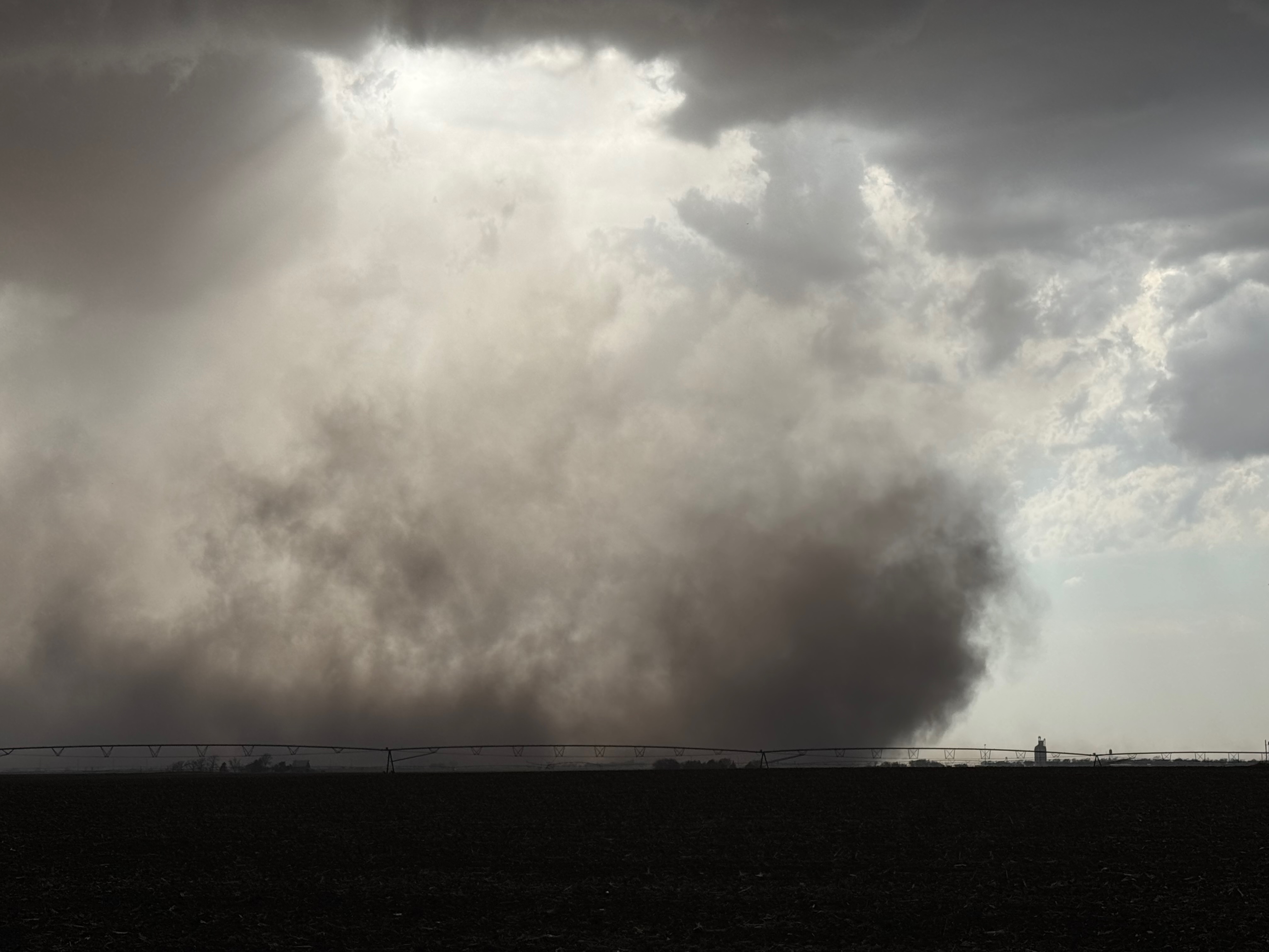
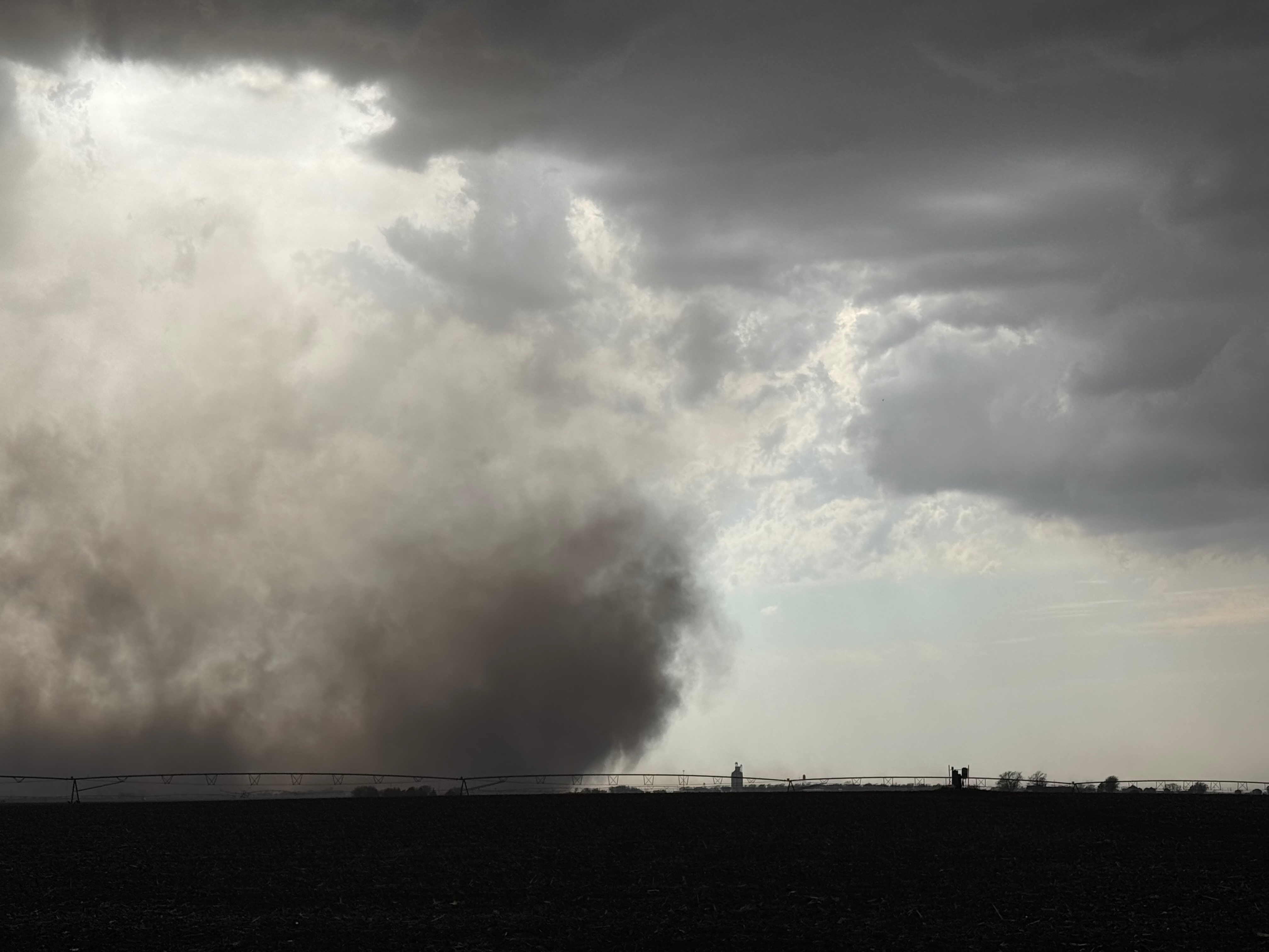
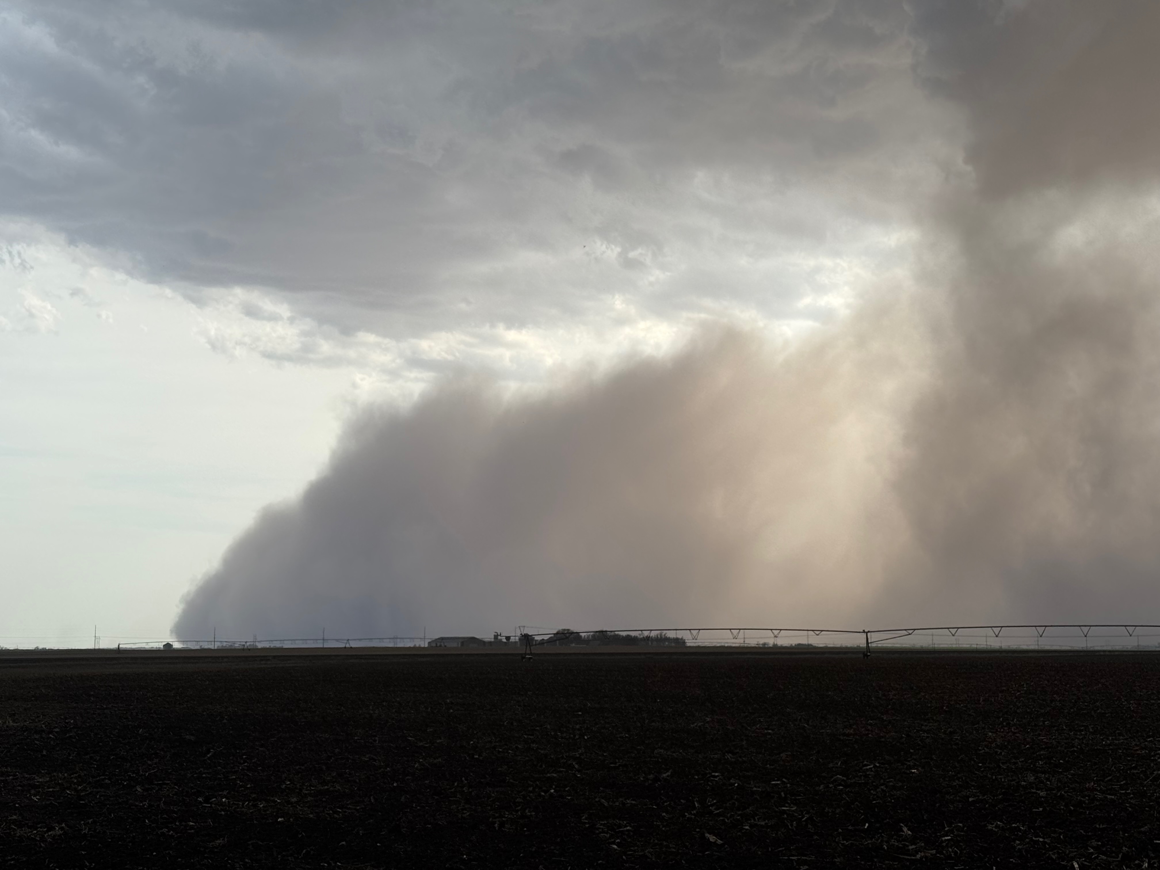
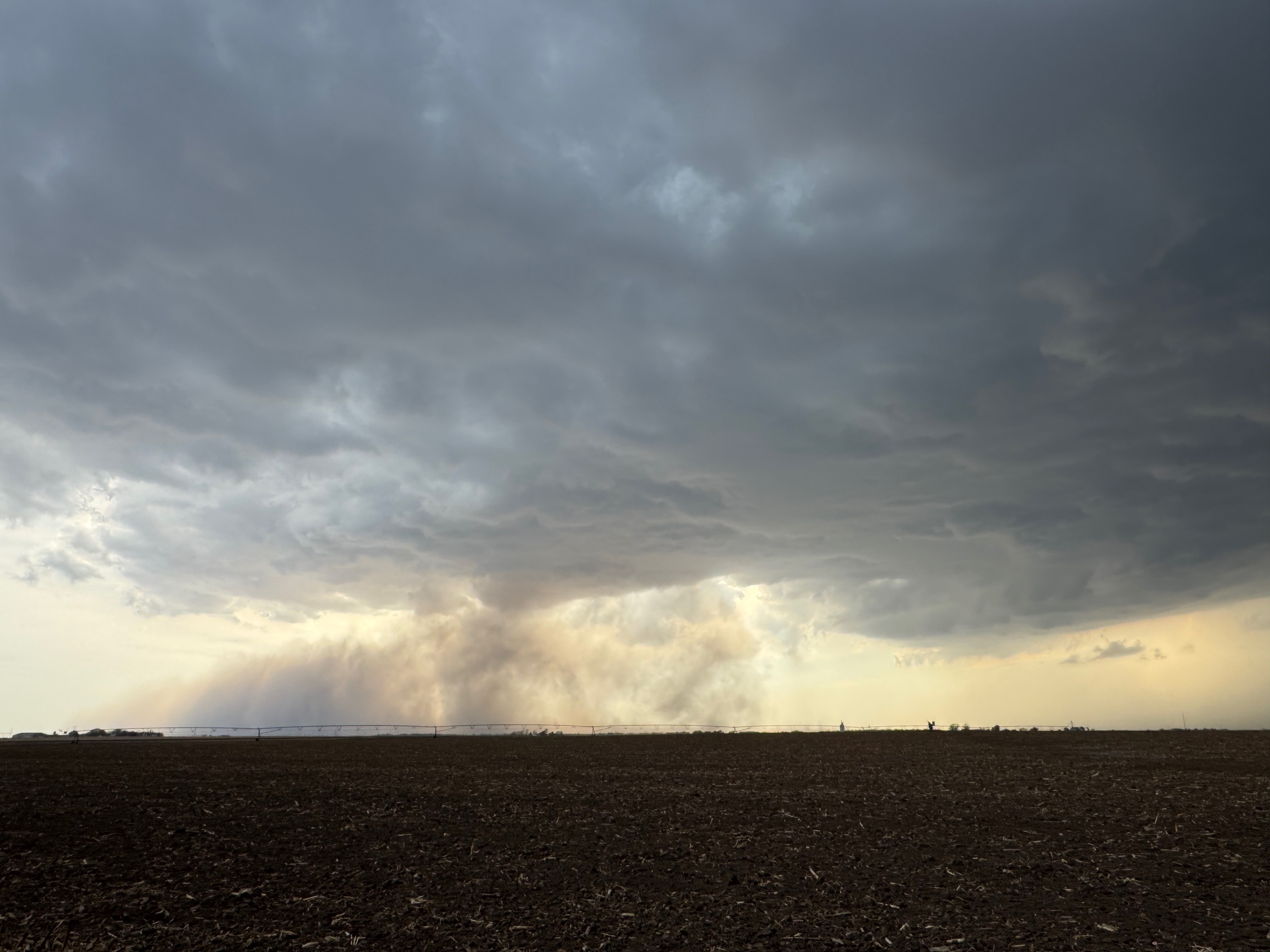
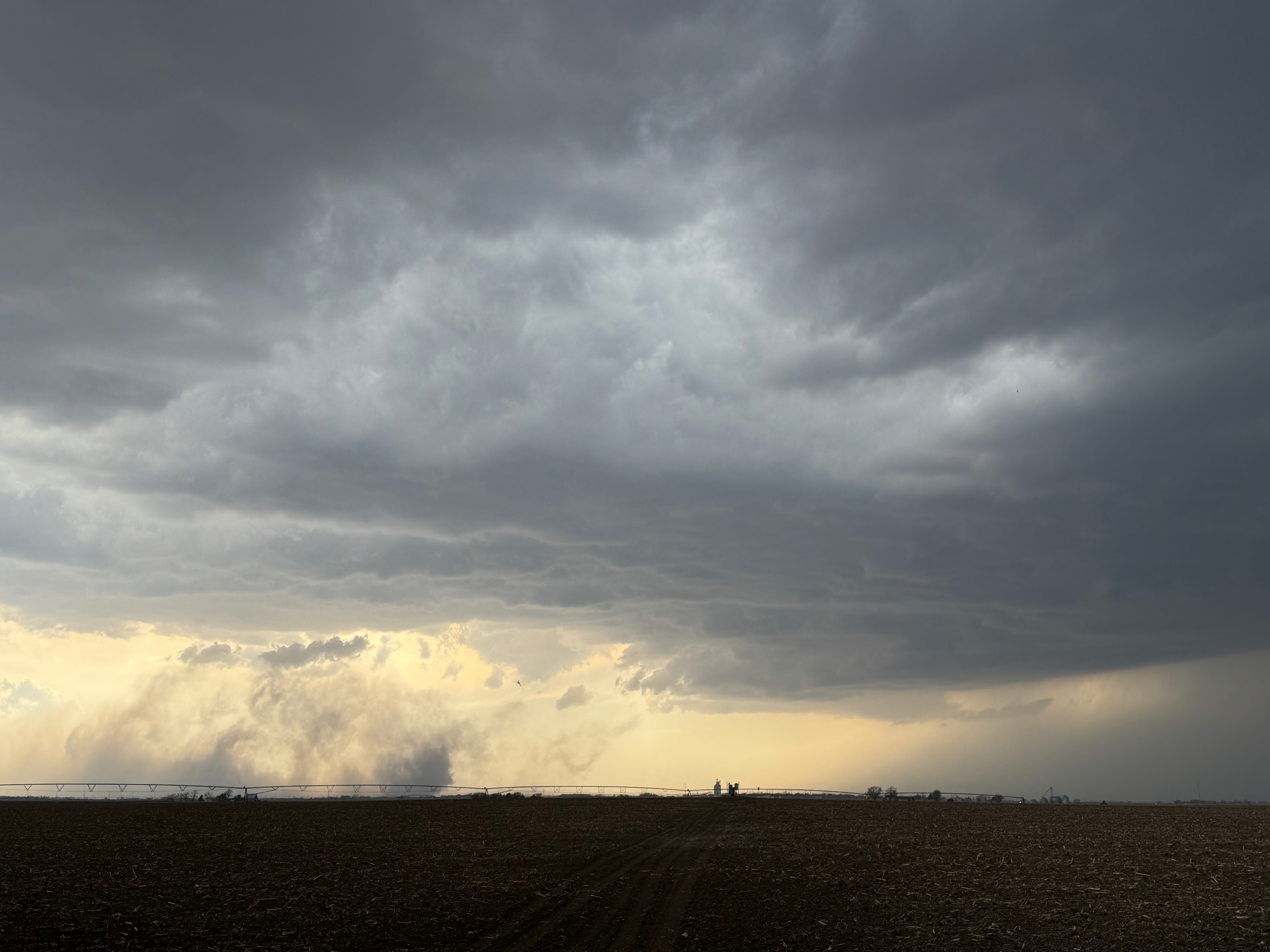
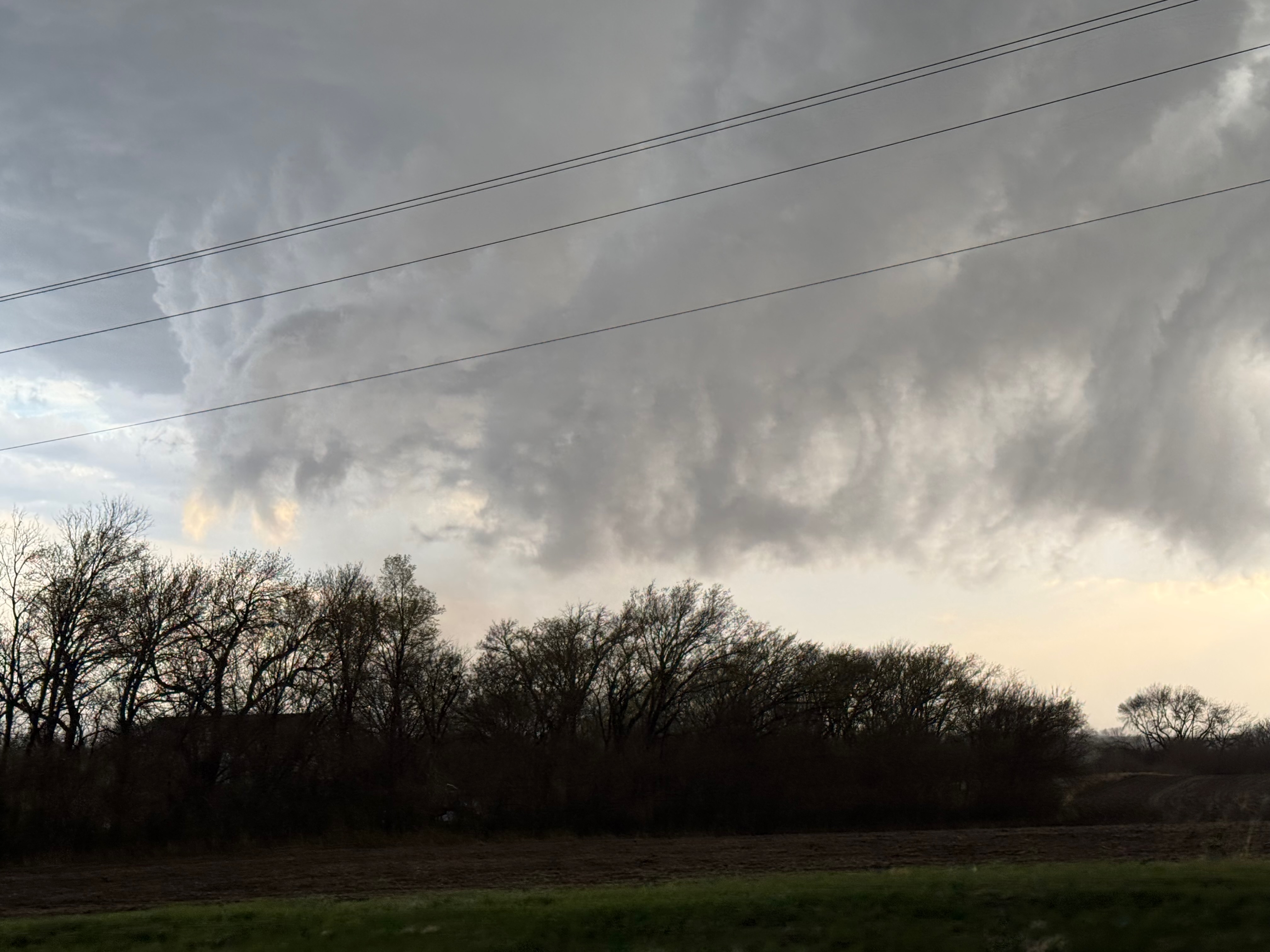
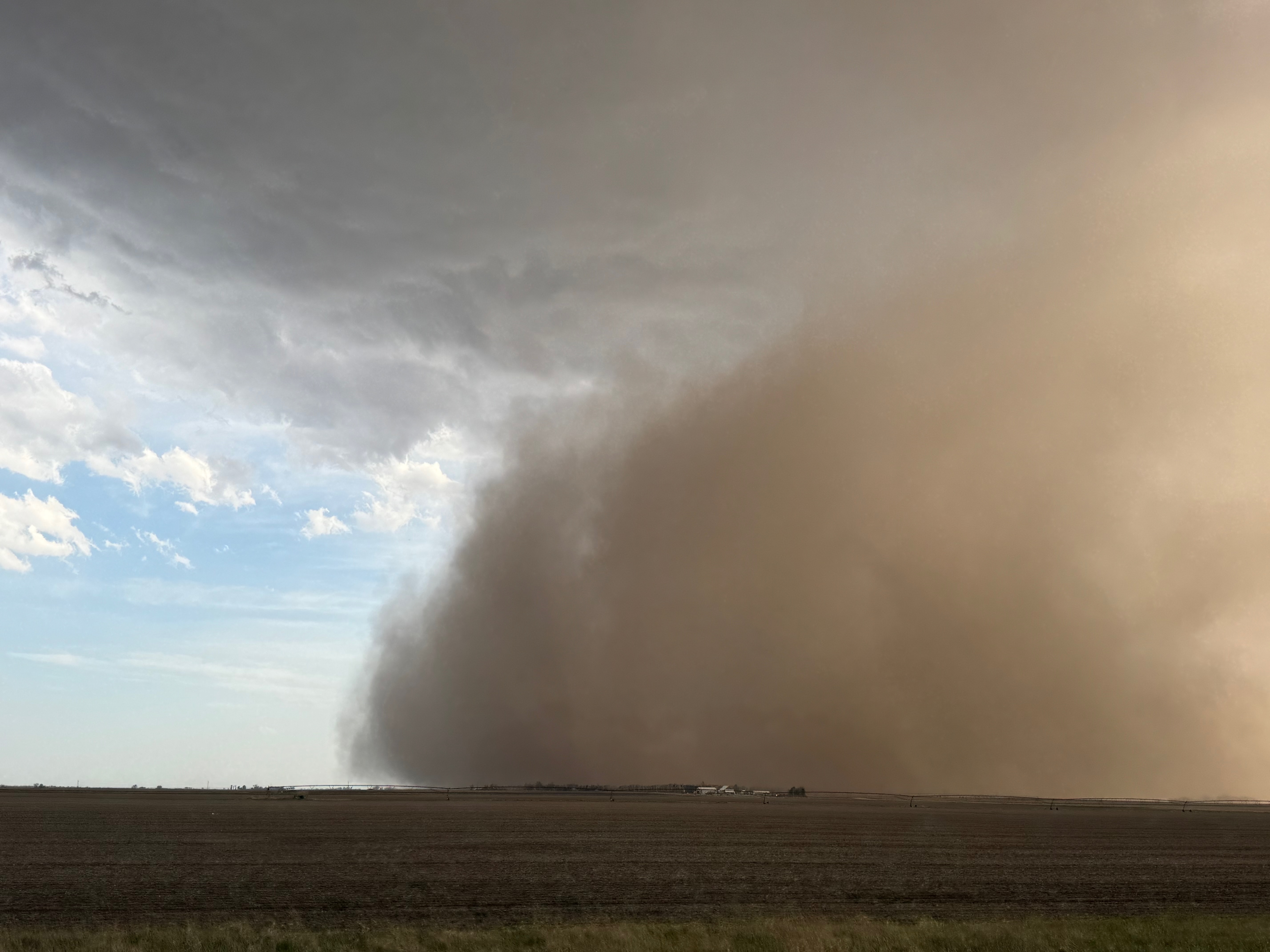
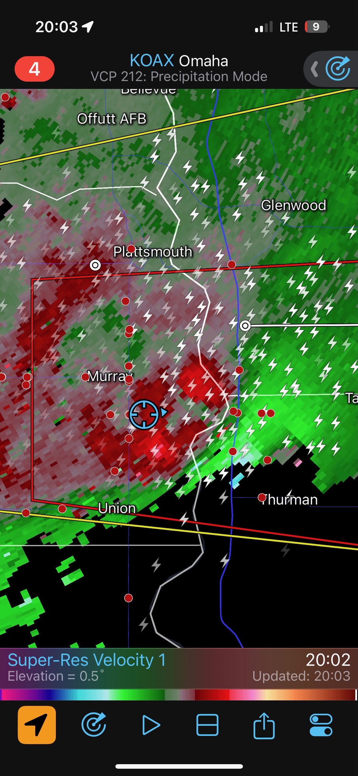
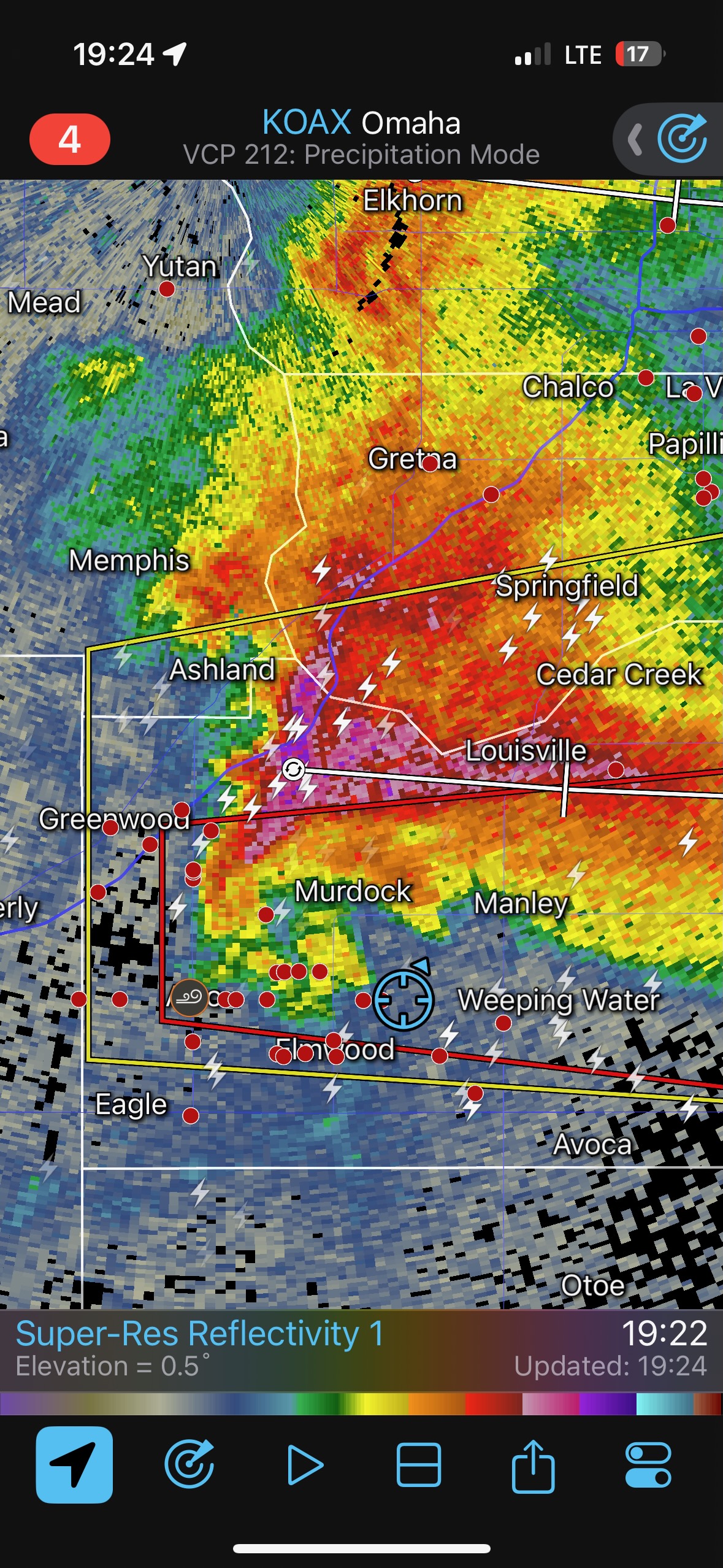
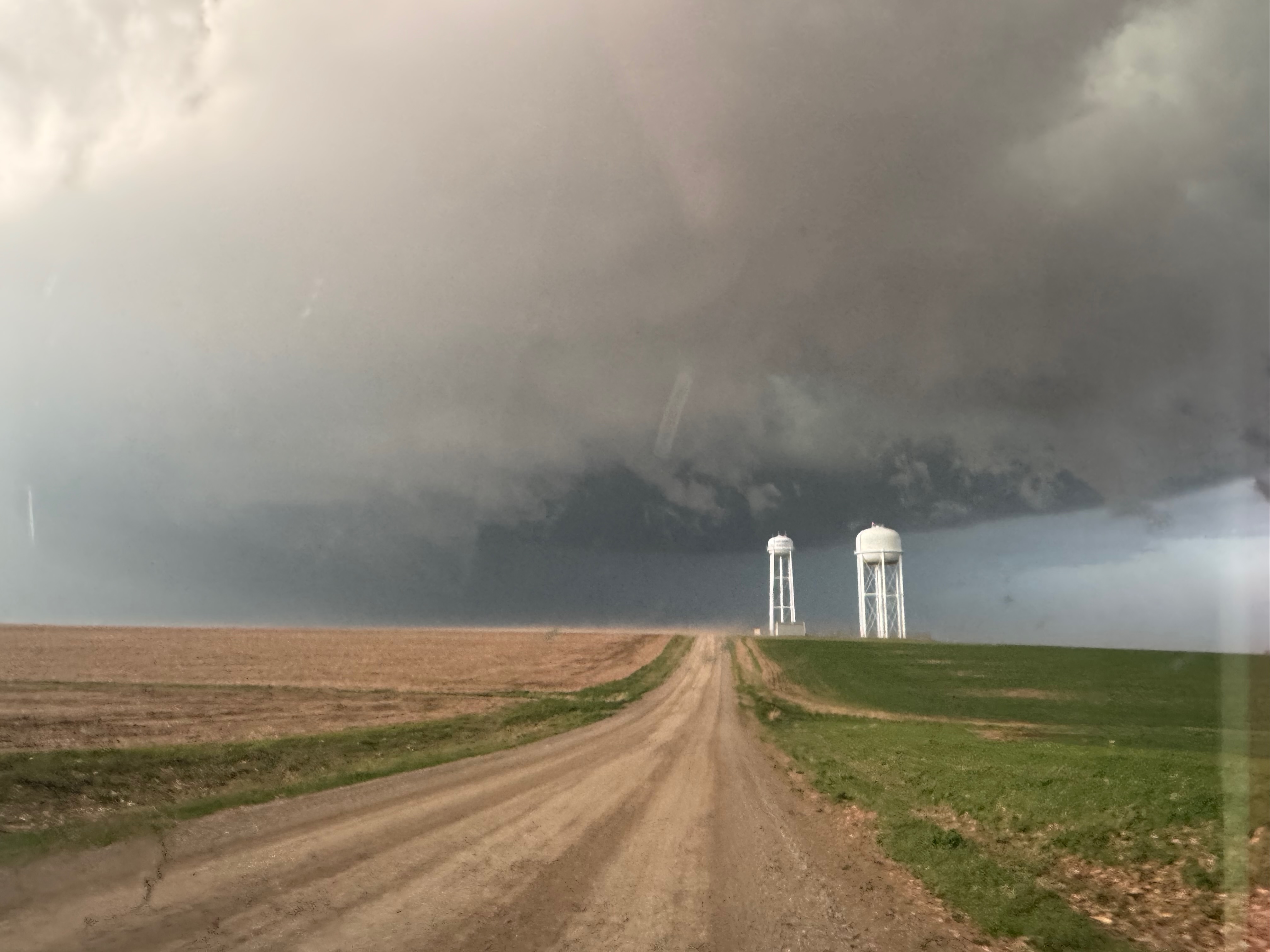
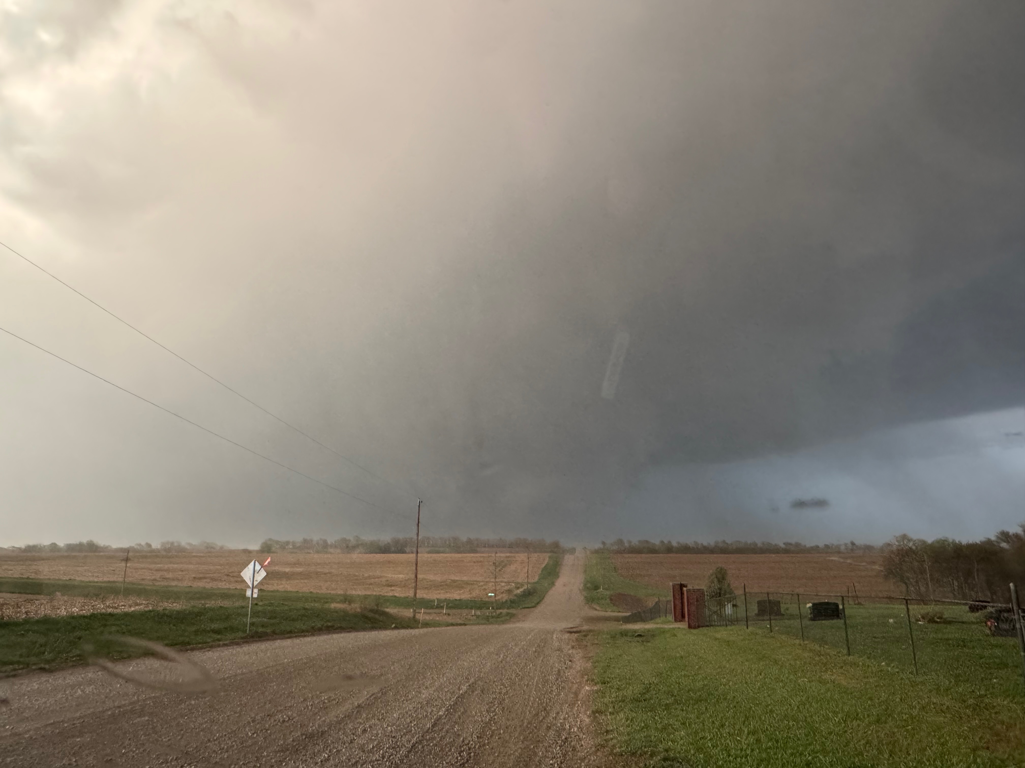
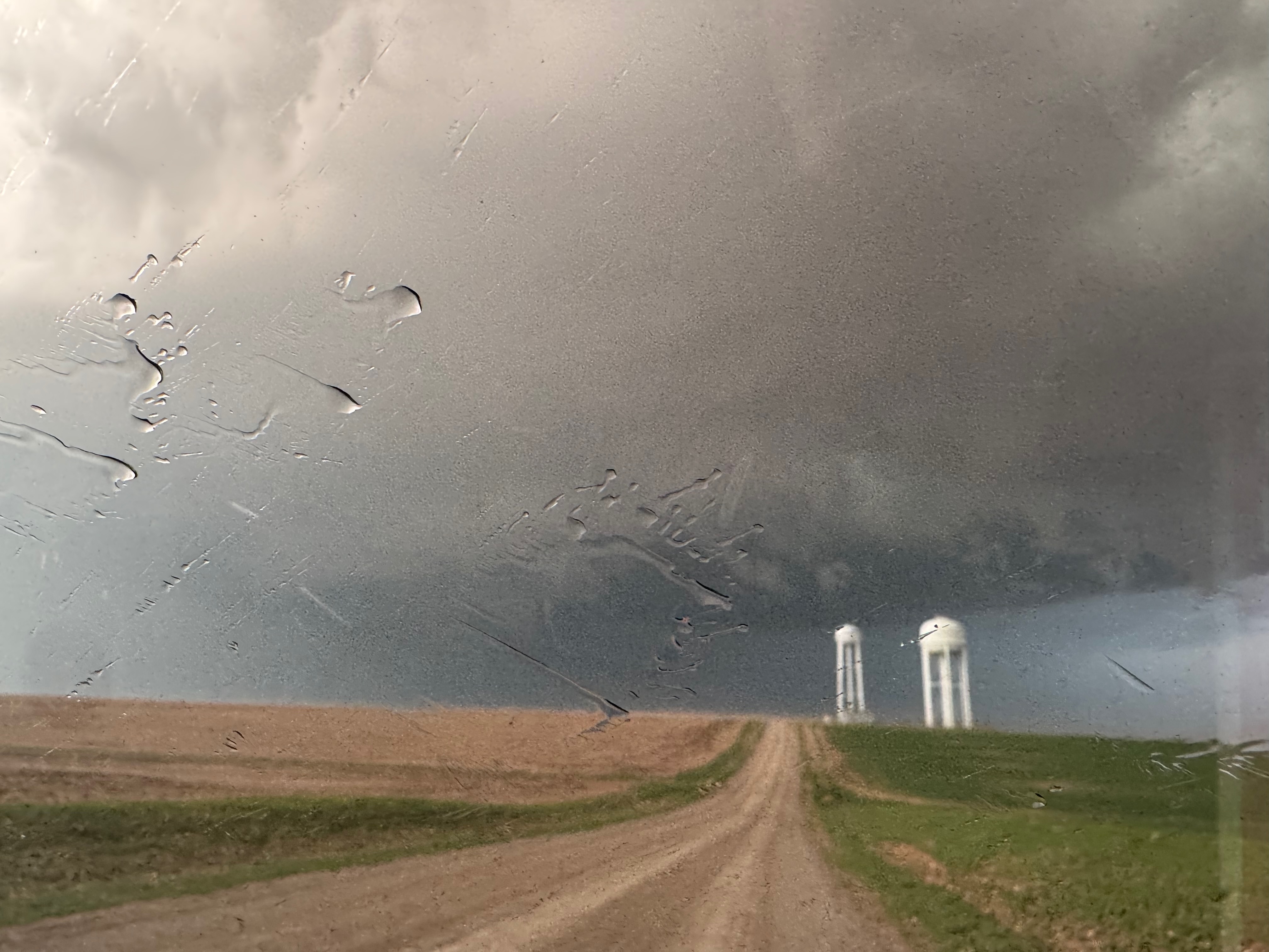
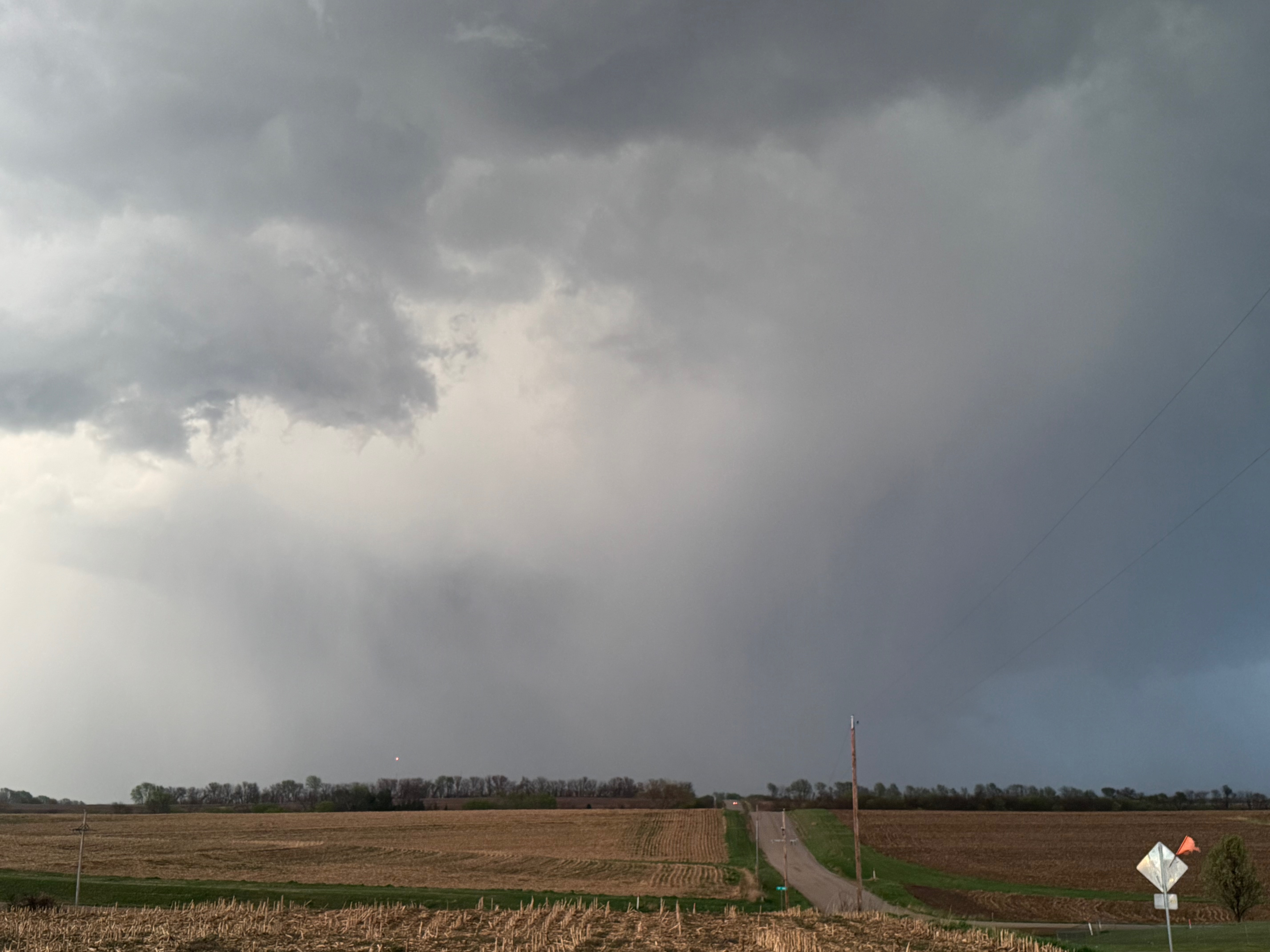
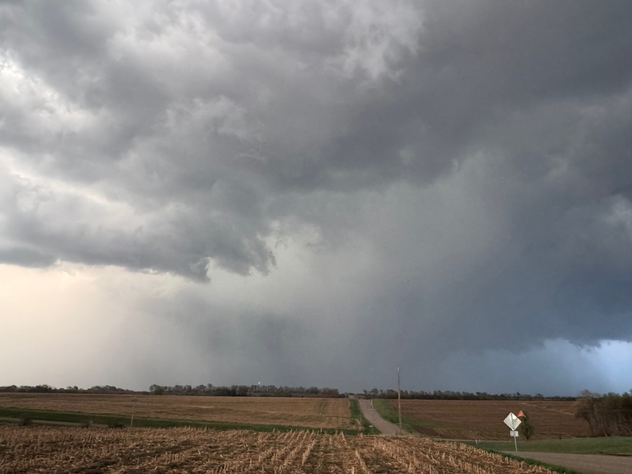
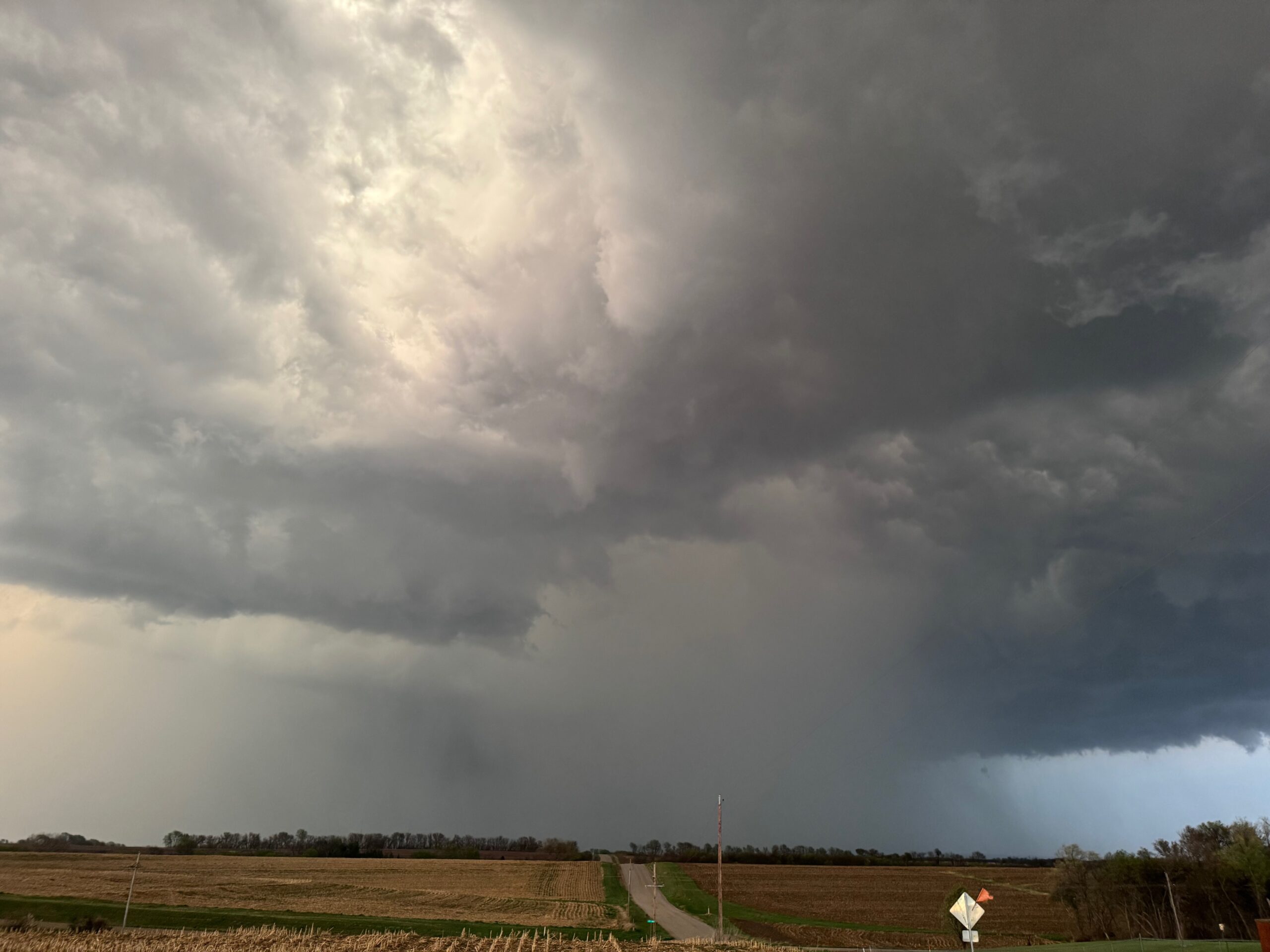
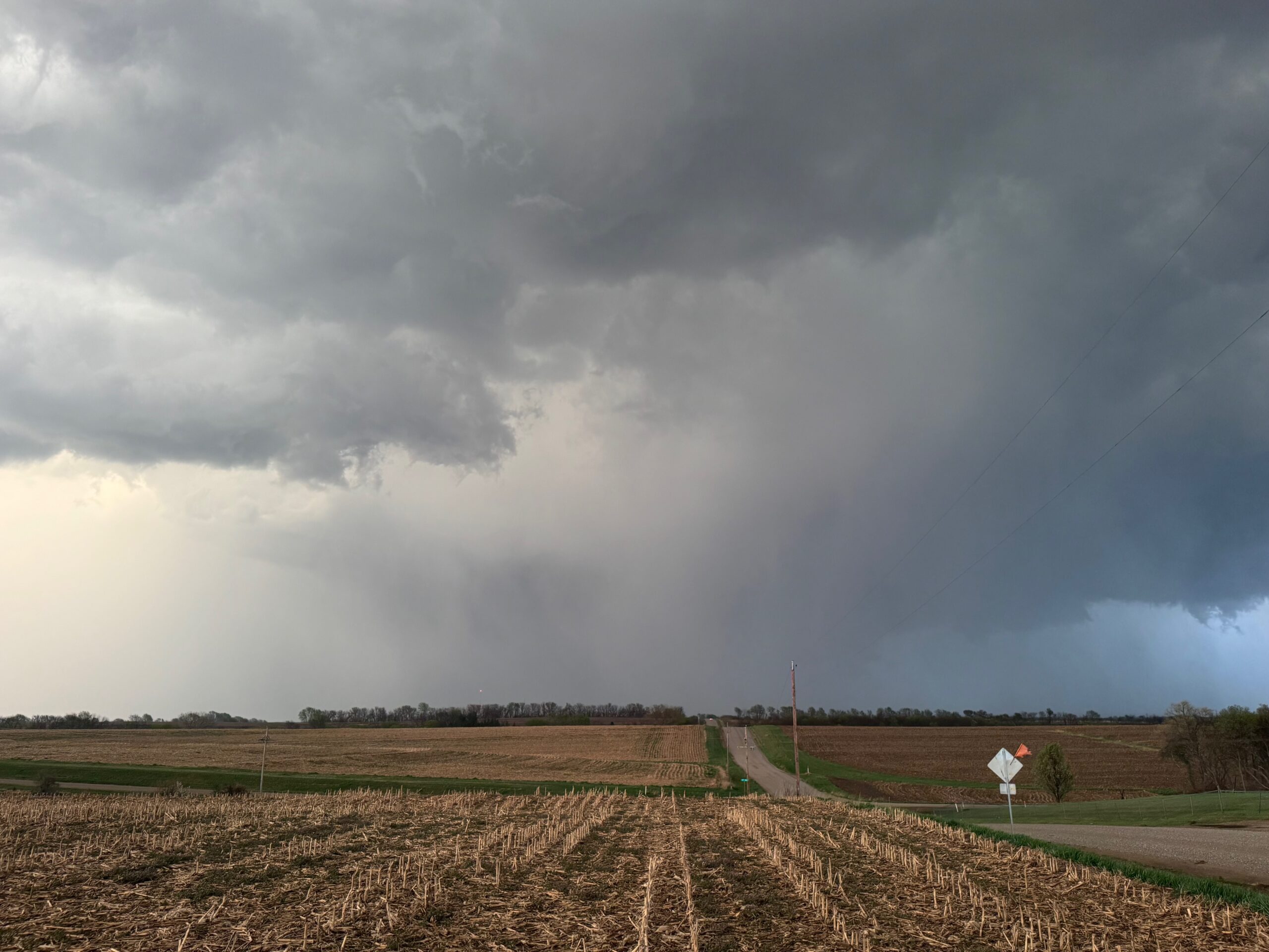
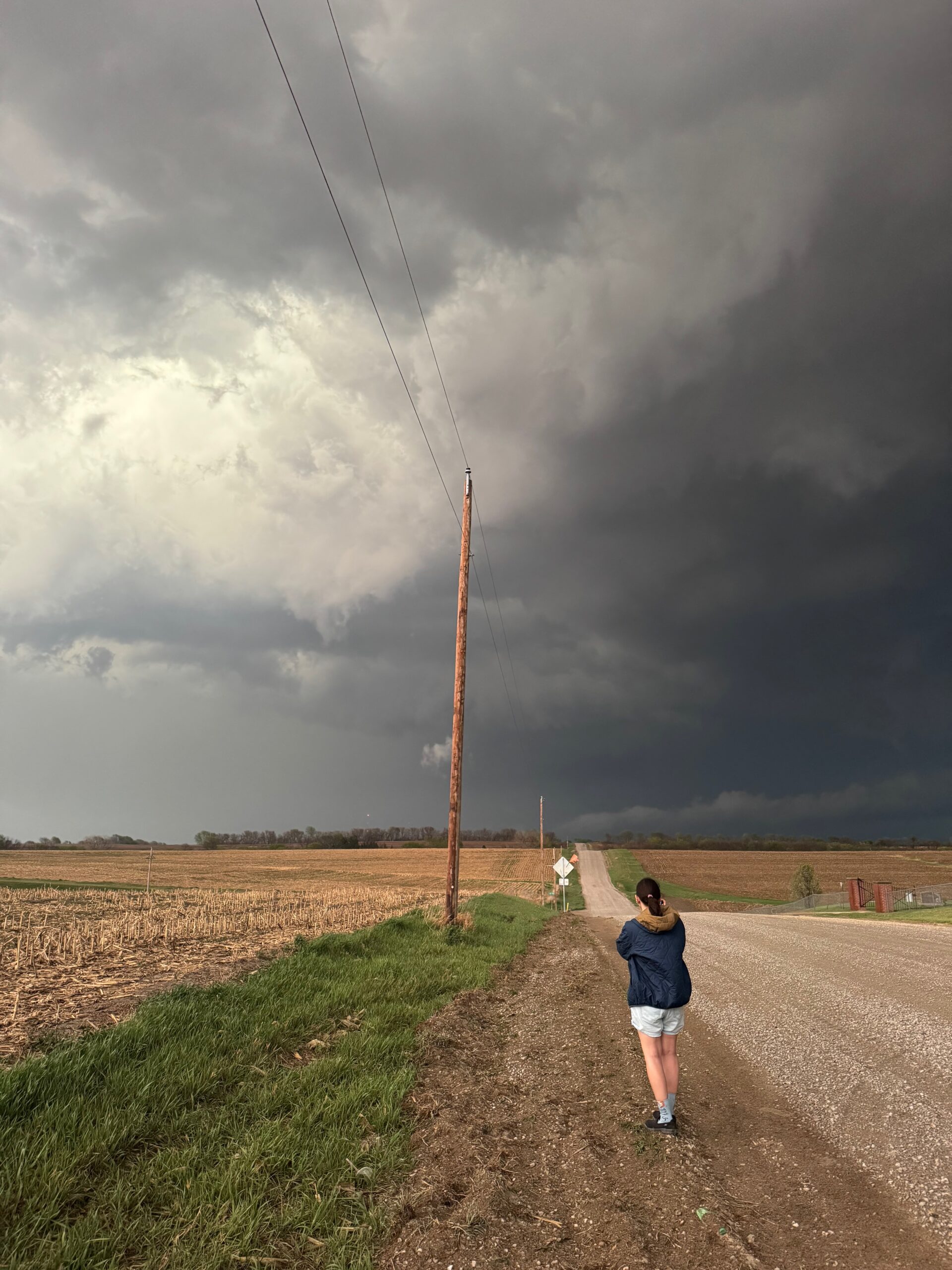
We got ourselves up to I-80 near York in time to watch a big storm or two go up not too far to our west. These were moving eastward. The tail-end one dragged us around the north side of Lincoln, and thereafter was rather active with some weak tornadoes towards the Missouri River. We watched dusty spin-ups in the vicinity of Alvo, Murdock, and Weeping Water. This occurred primarily after 00Z while we were on Fletcher Avenue, west of Weeping Water, in Cass County. There wasn’t much to see with regard to condensed funnel clouds, but the ground was dry enough to allow a lot of dust and dirt to get kicked up beneath the active storm base. At the time, I was not sure if these were legitimate tornadoes or maybe strong gustnadoes. Given where they were with respect to the storm base and RFD, and given their longevity and strength, I think we can say that we observed a tornado or two.
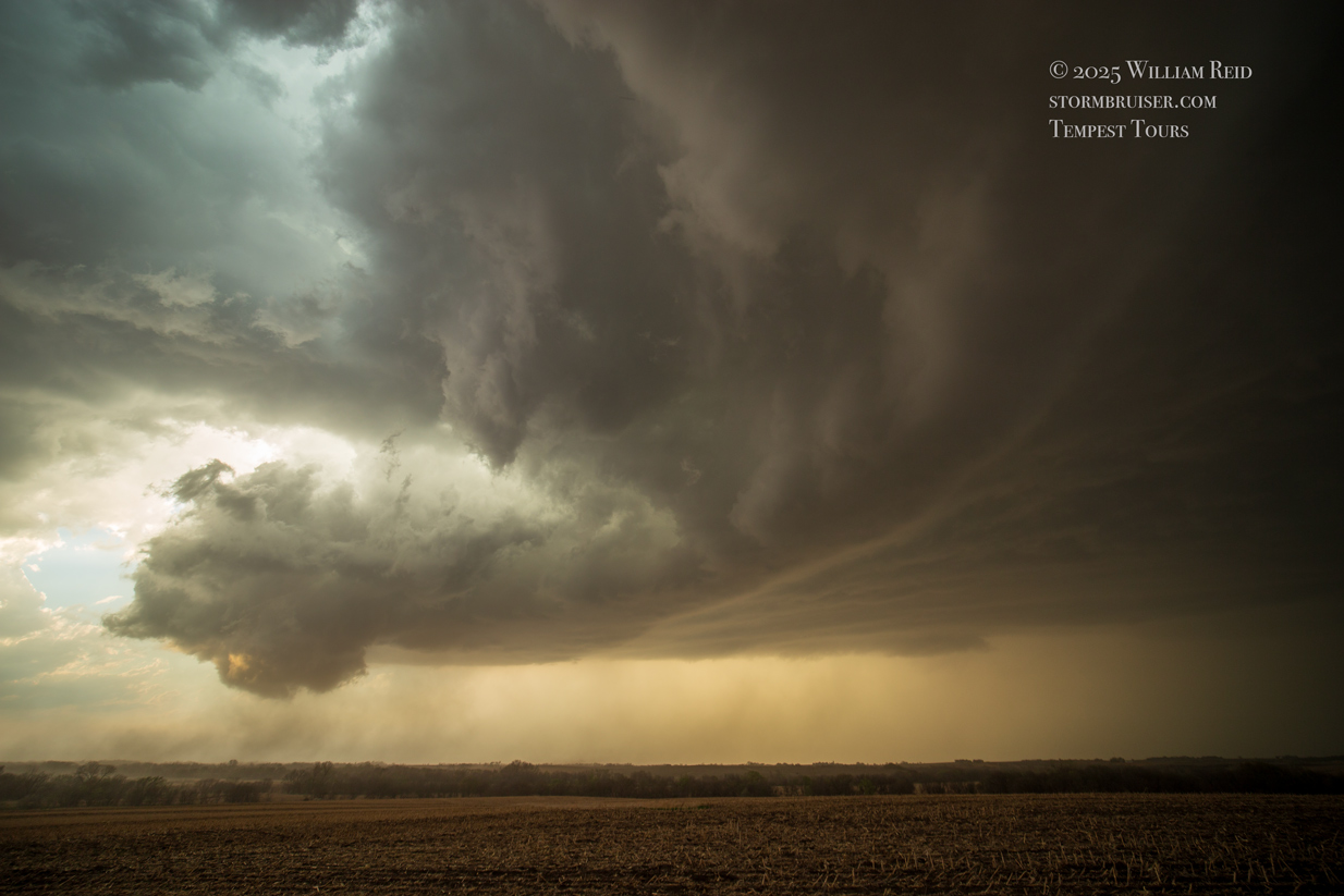
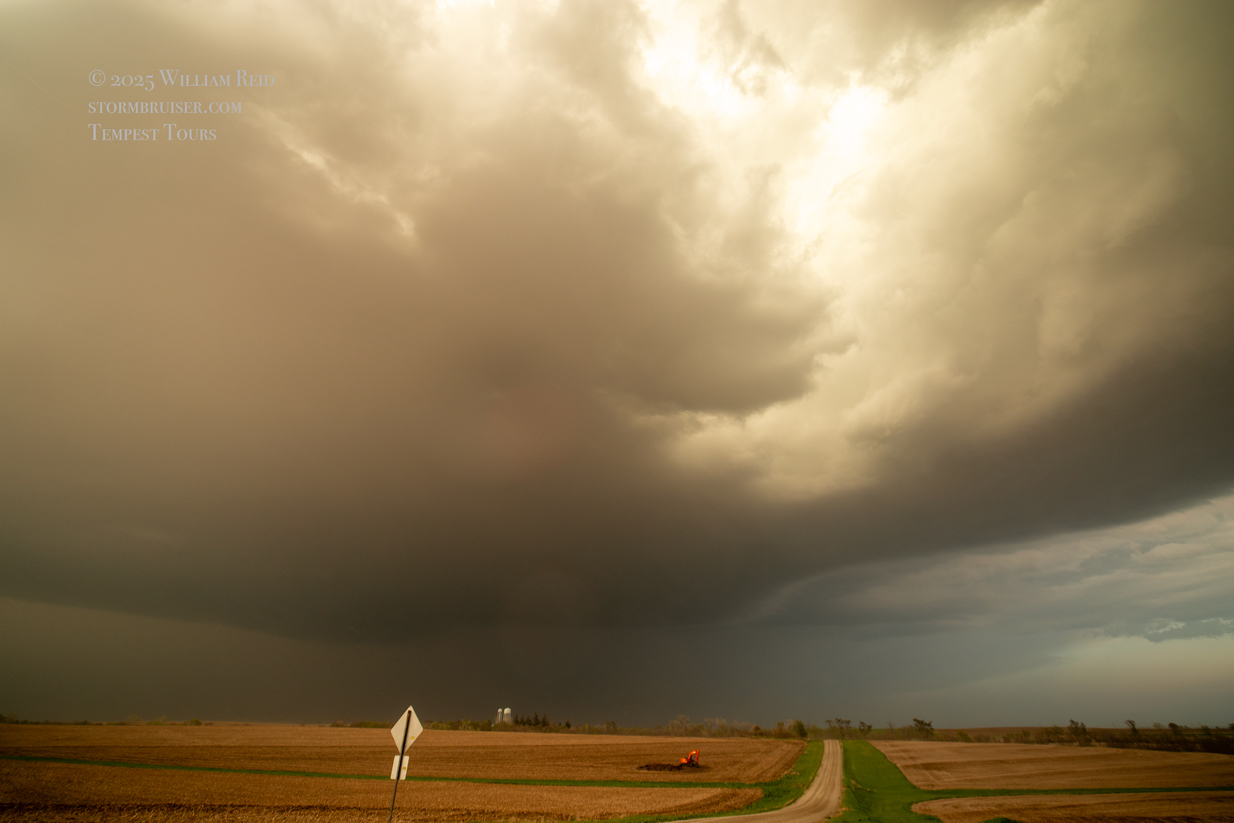
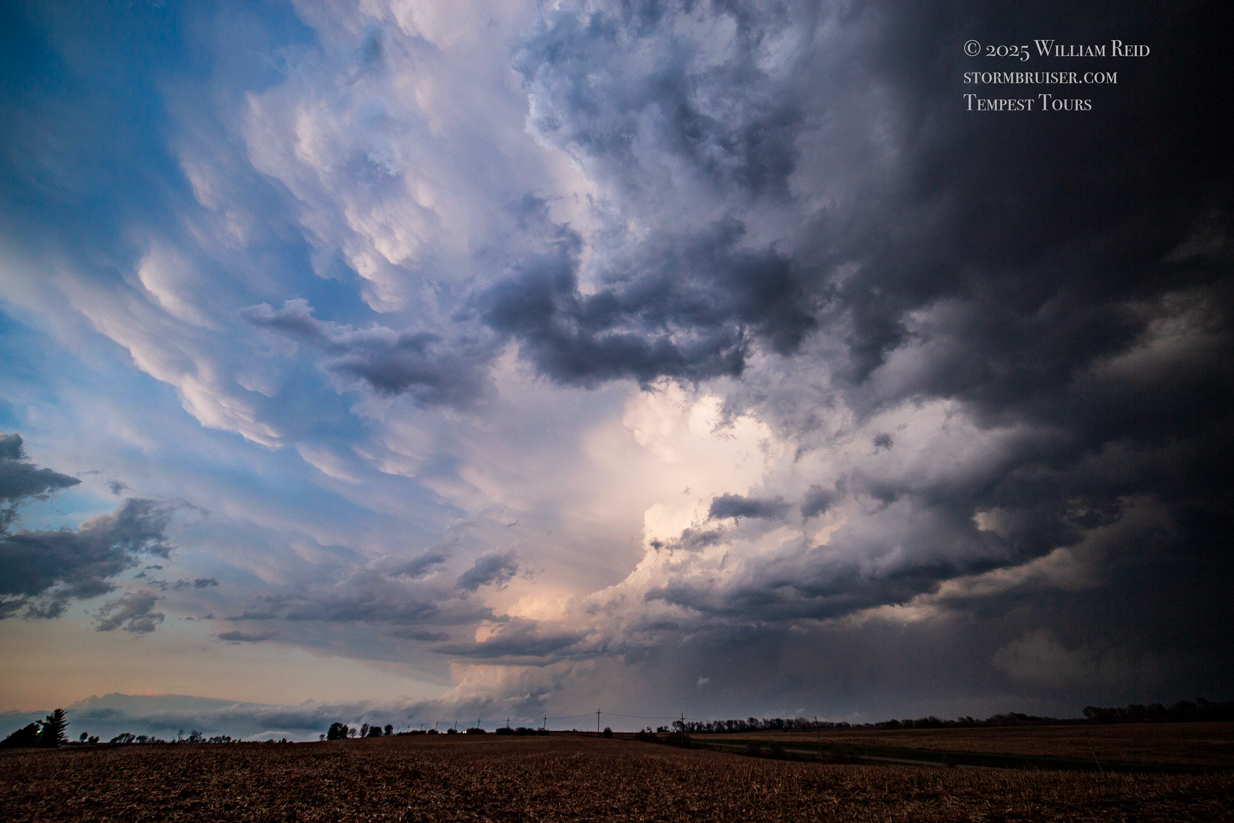
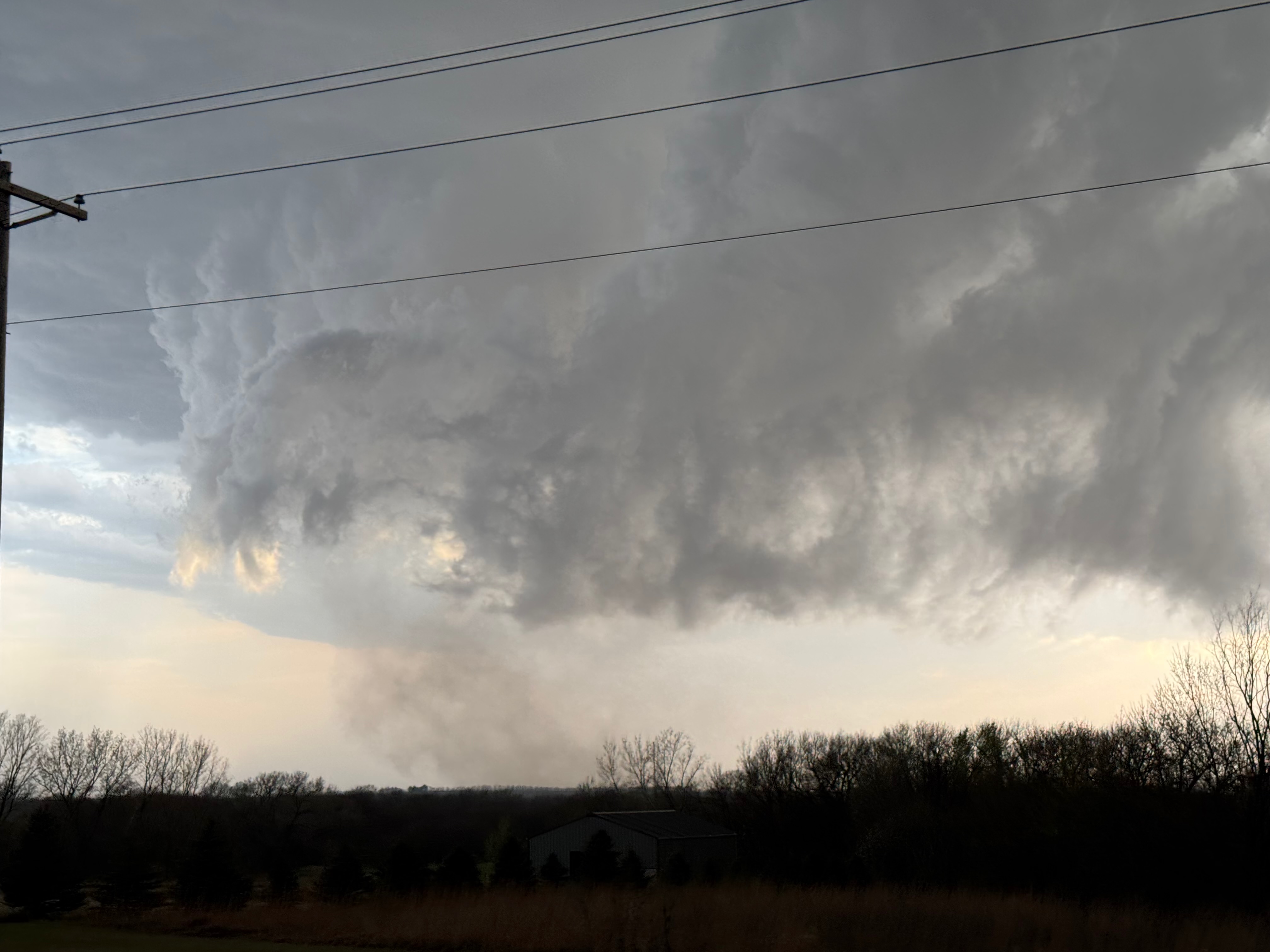
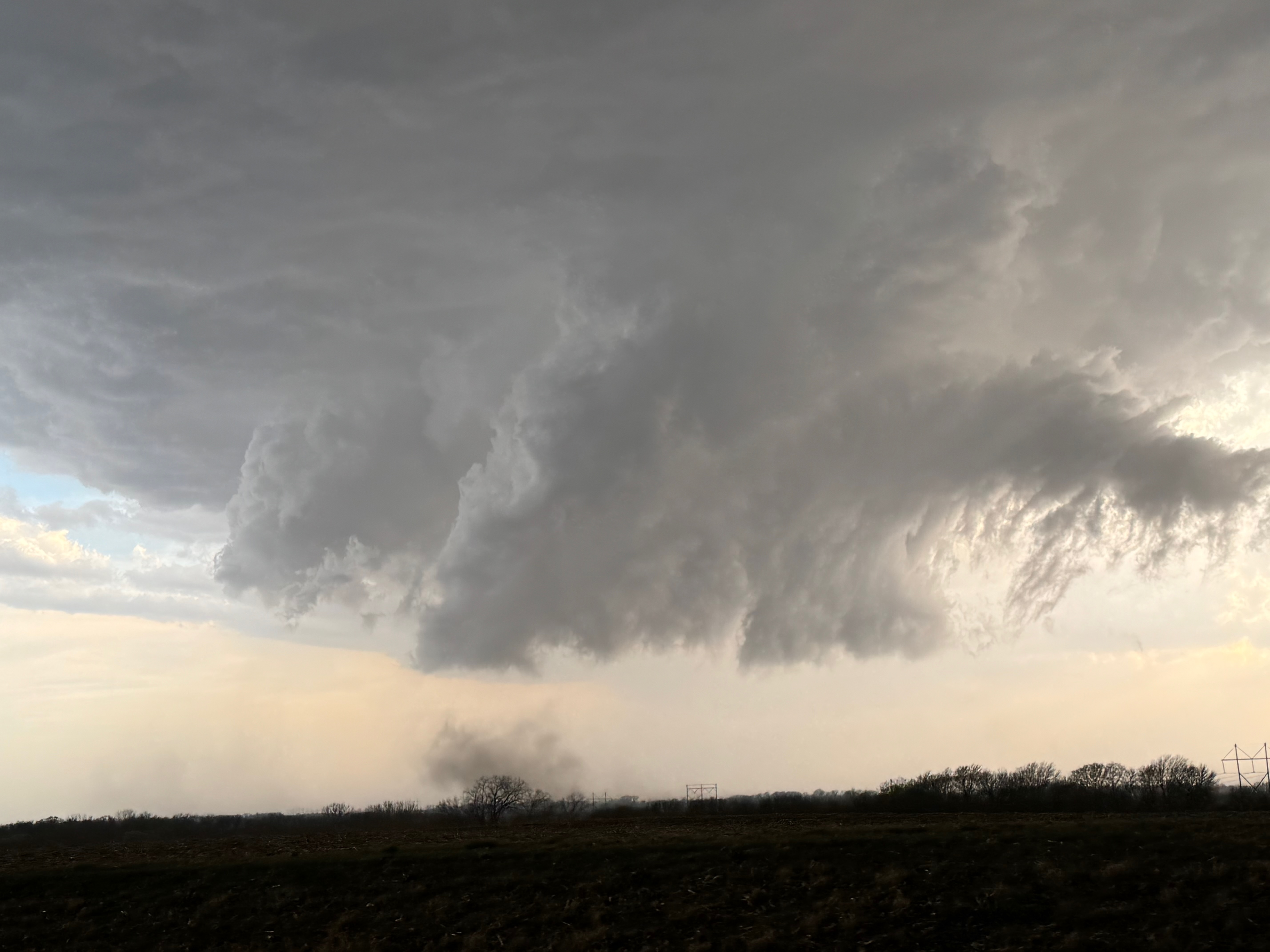
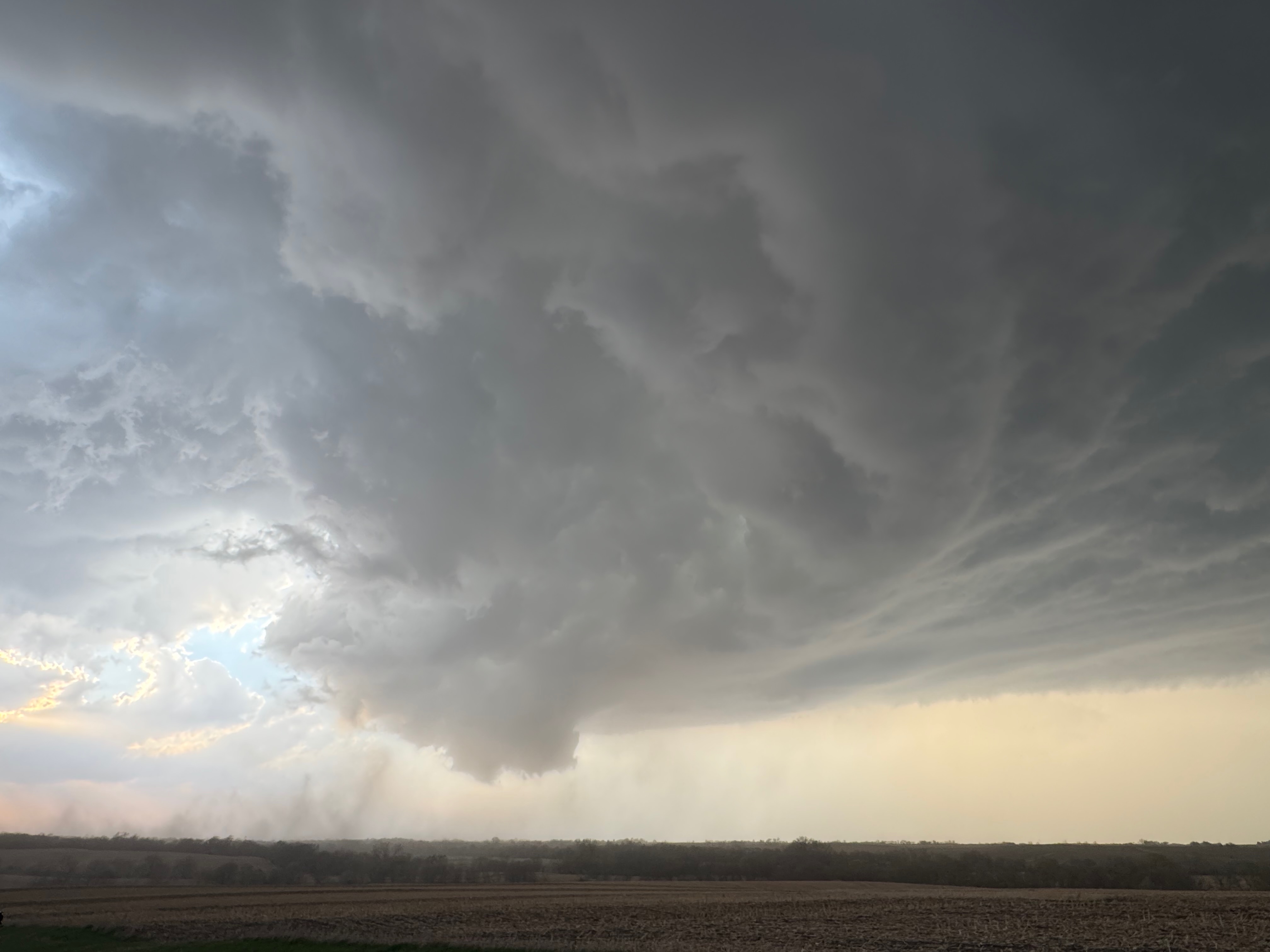
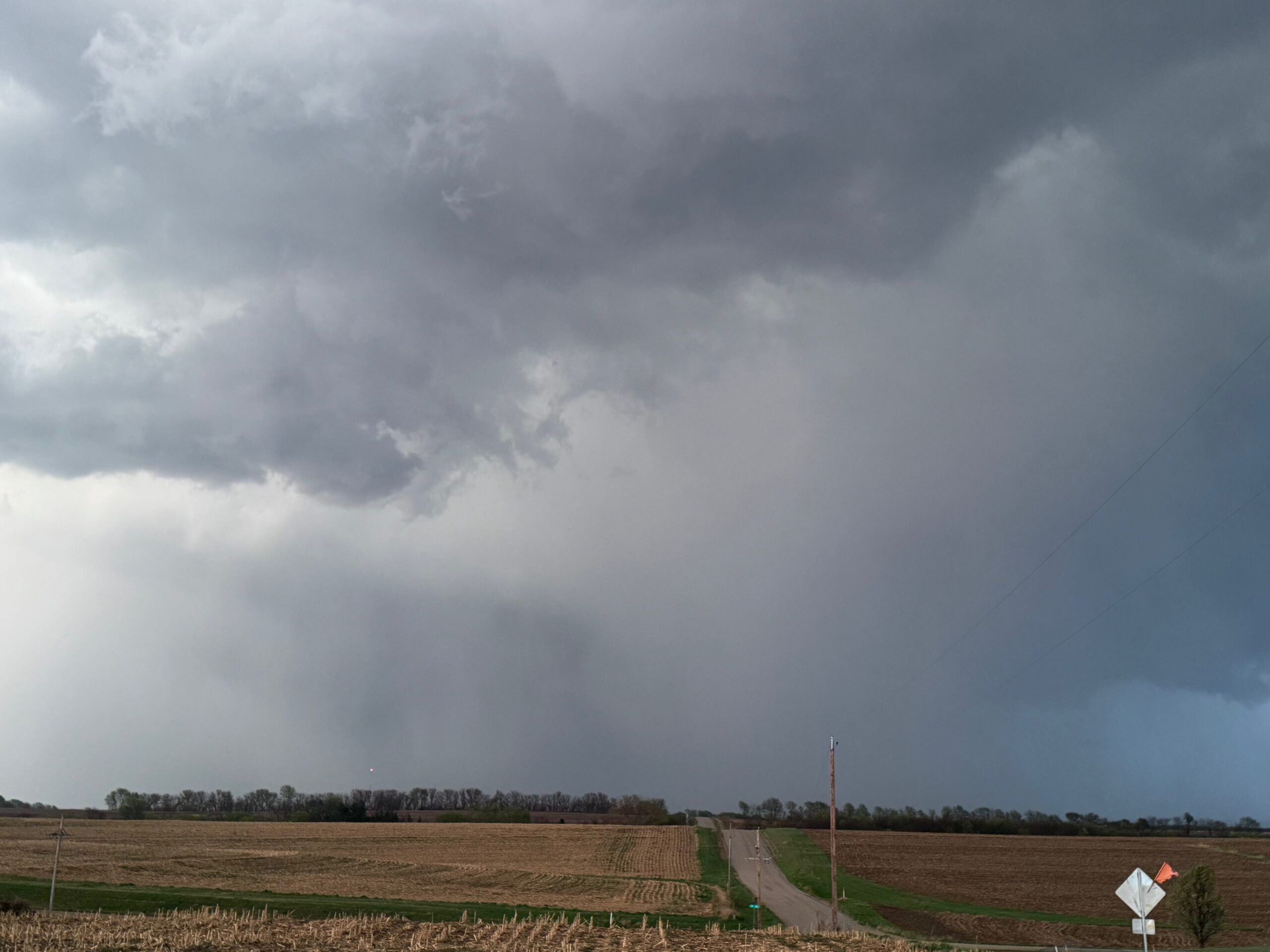
The environment for tornado-making was expected to get a little better around the Missouri River and into Iowa a county or two as a low-level jet kicked in around sunset. We stayed with the supercell to U.S. 75, but ran out of daylight and roads as the storm crossed the river. Some of my shots towards the east at dusk (below) showed suspicious stuff going on beneath the storm base, at the same time that Iowa spotters and chasers were reporting tornadoes. We were unable to stay close as the river crossings we required were not available.
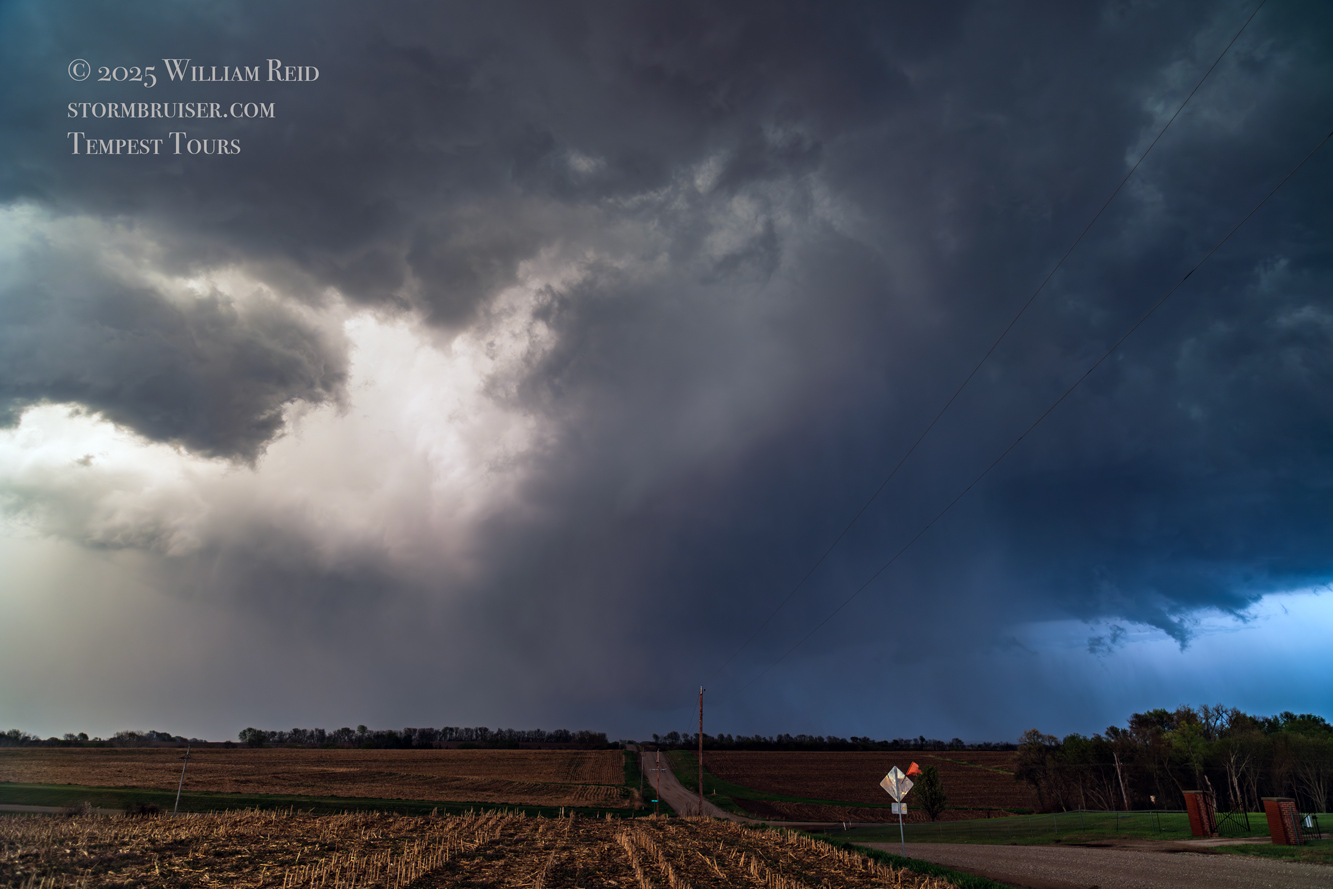
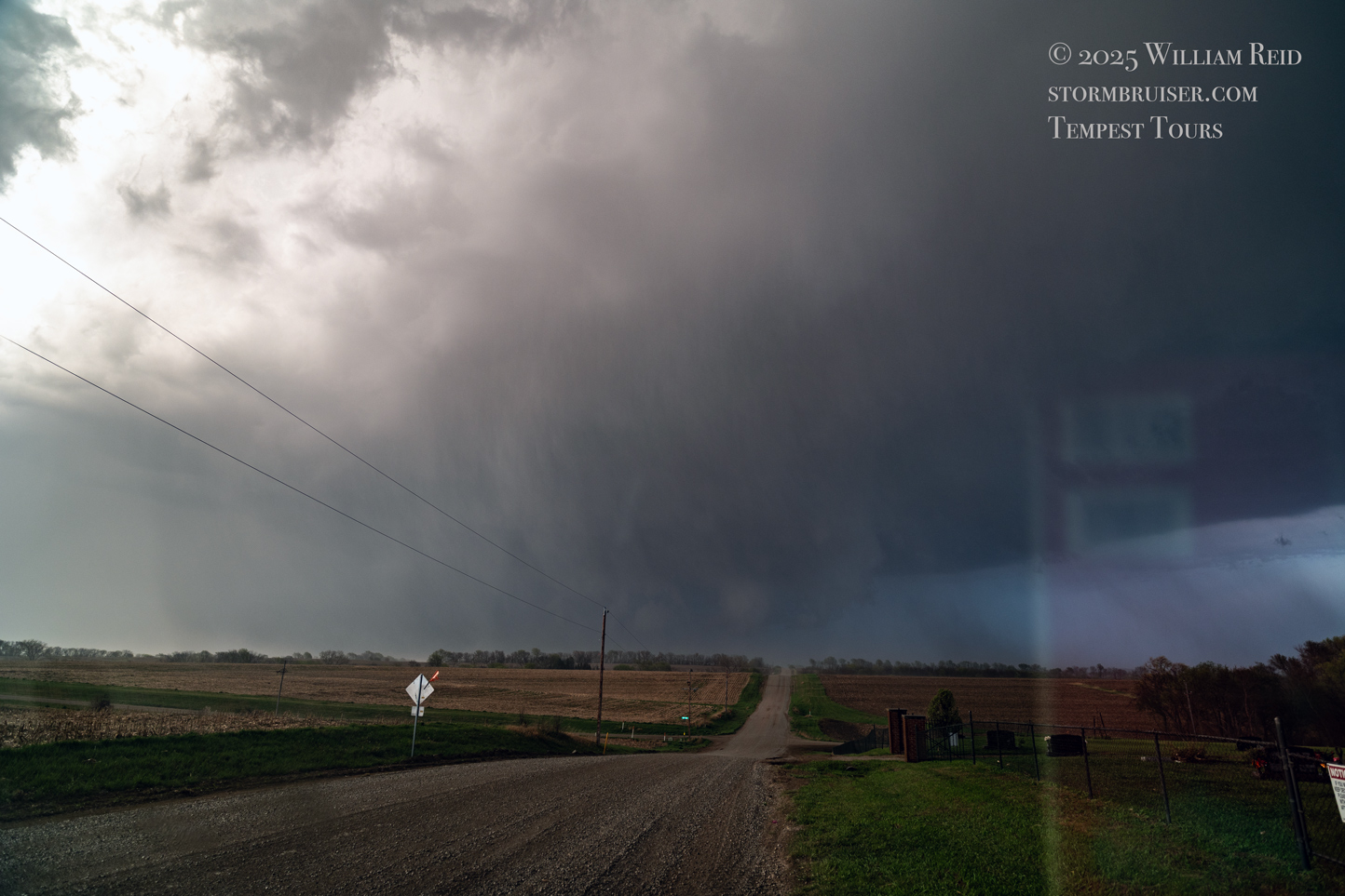
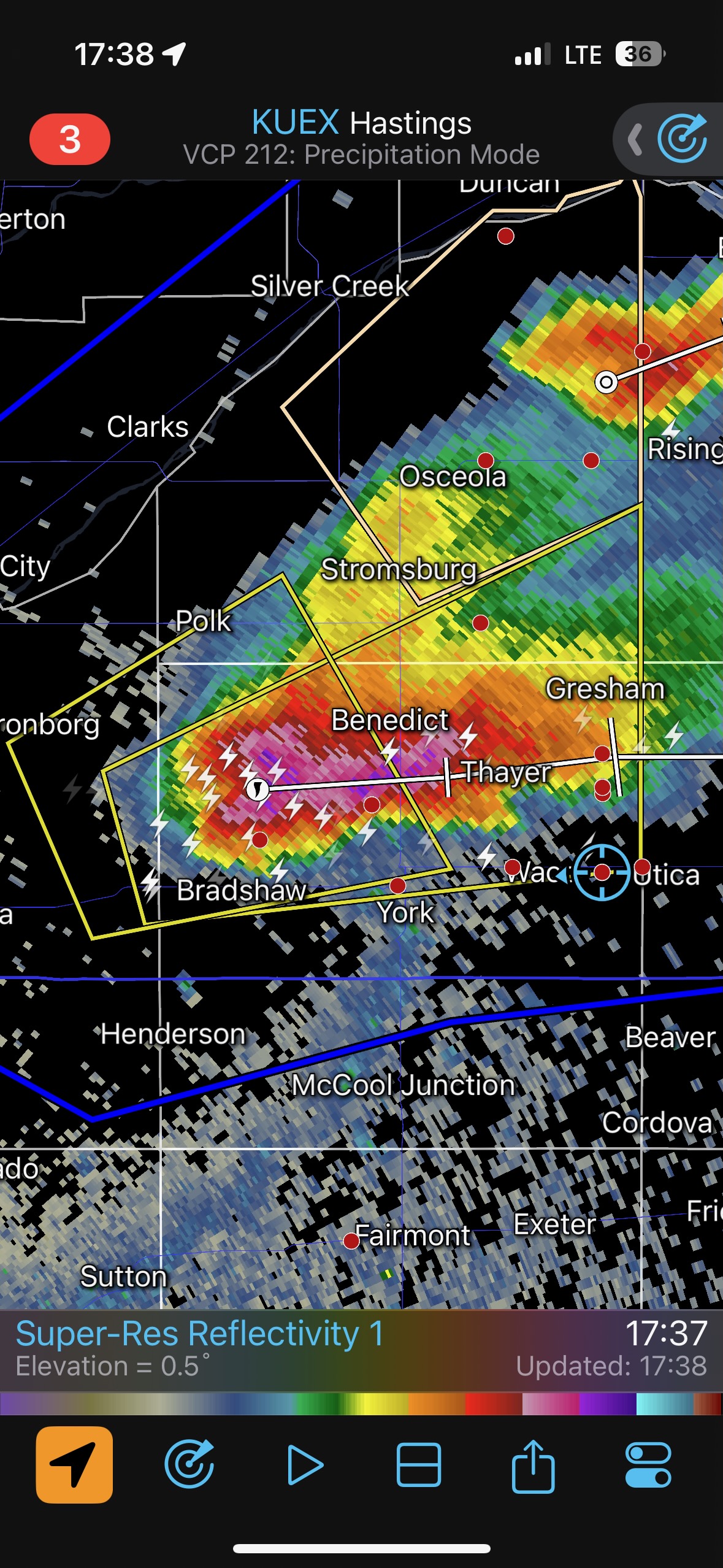
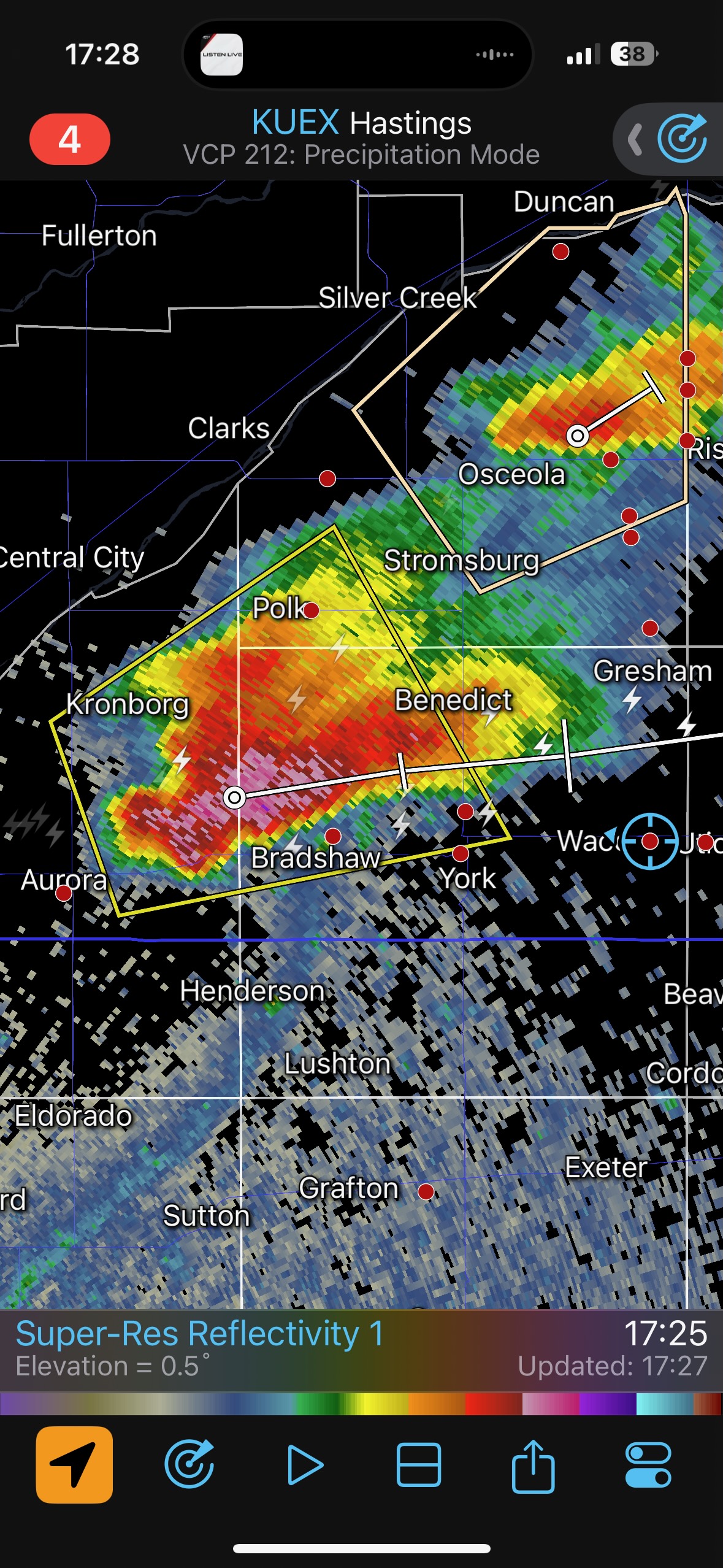
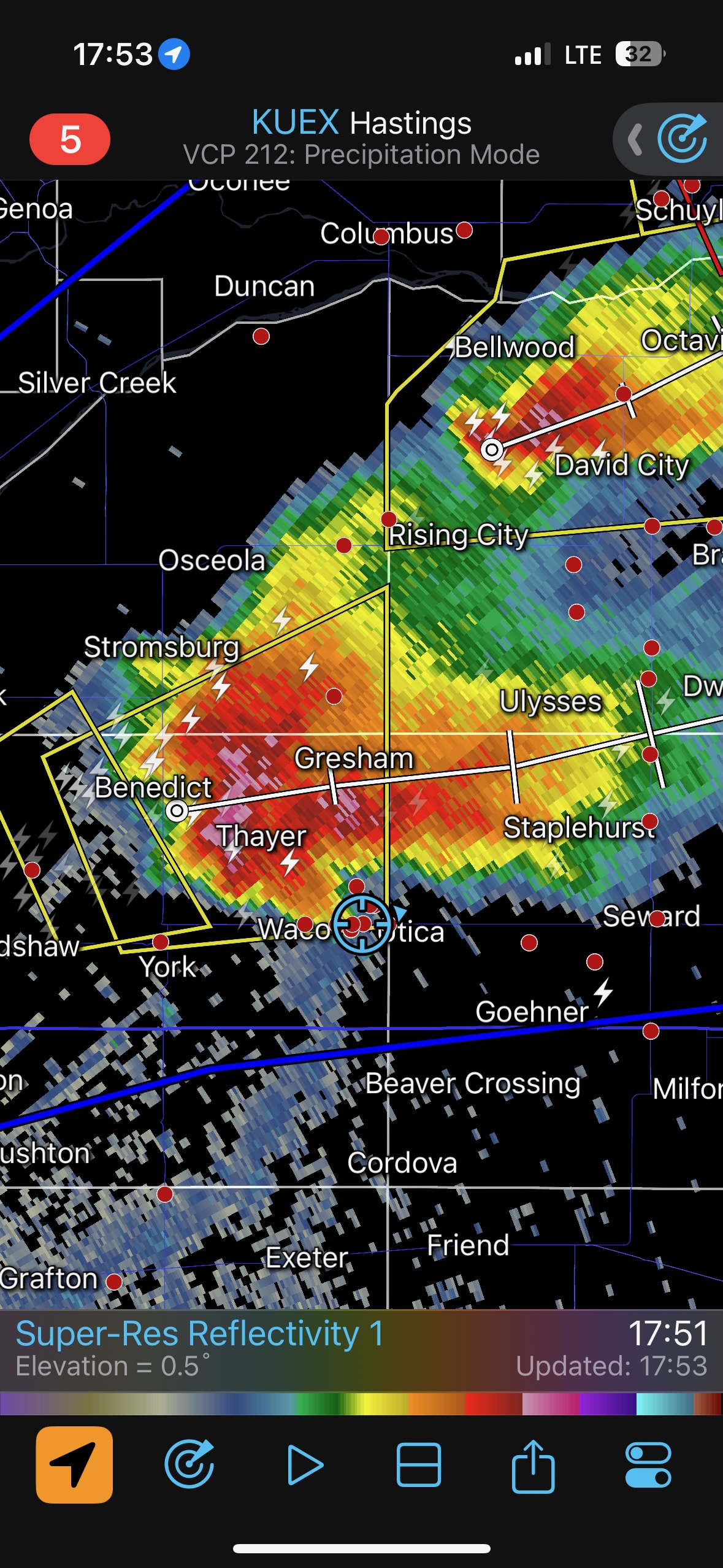
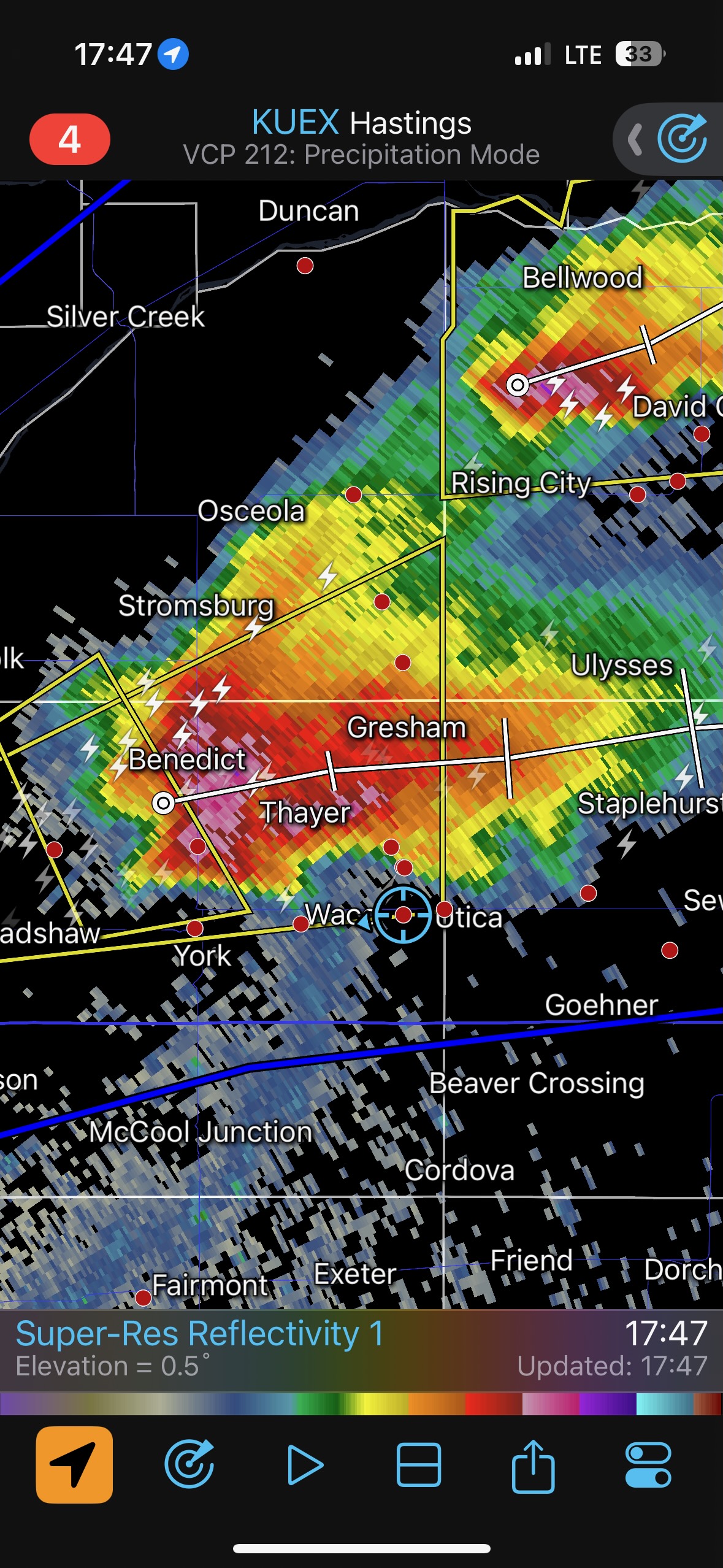
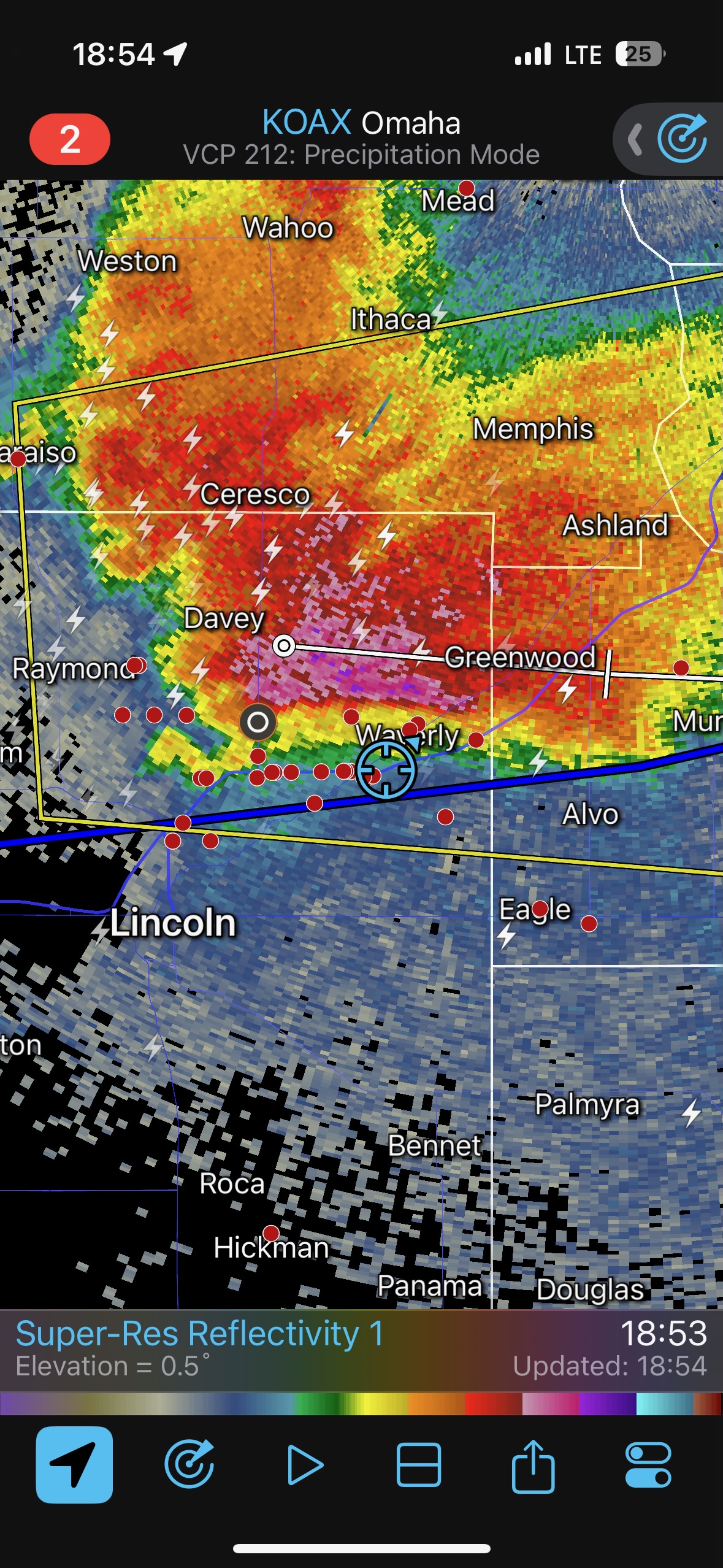
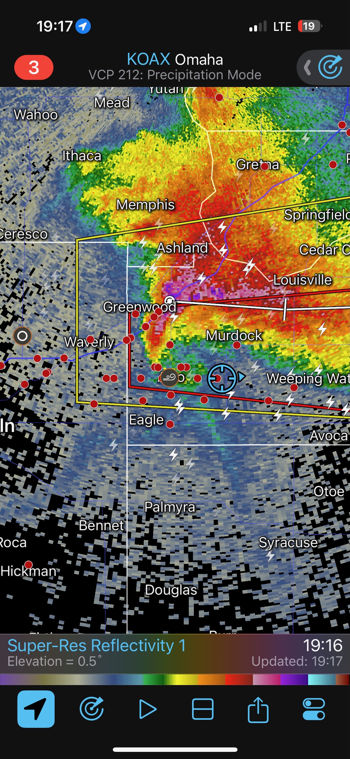
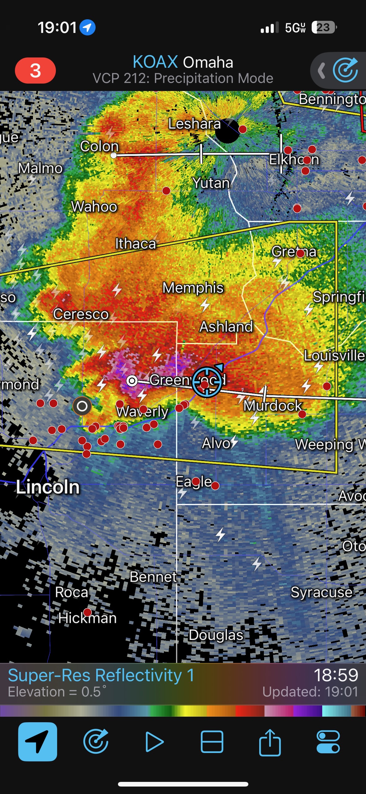
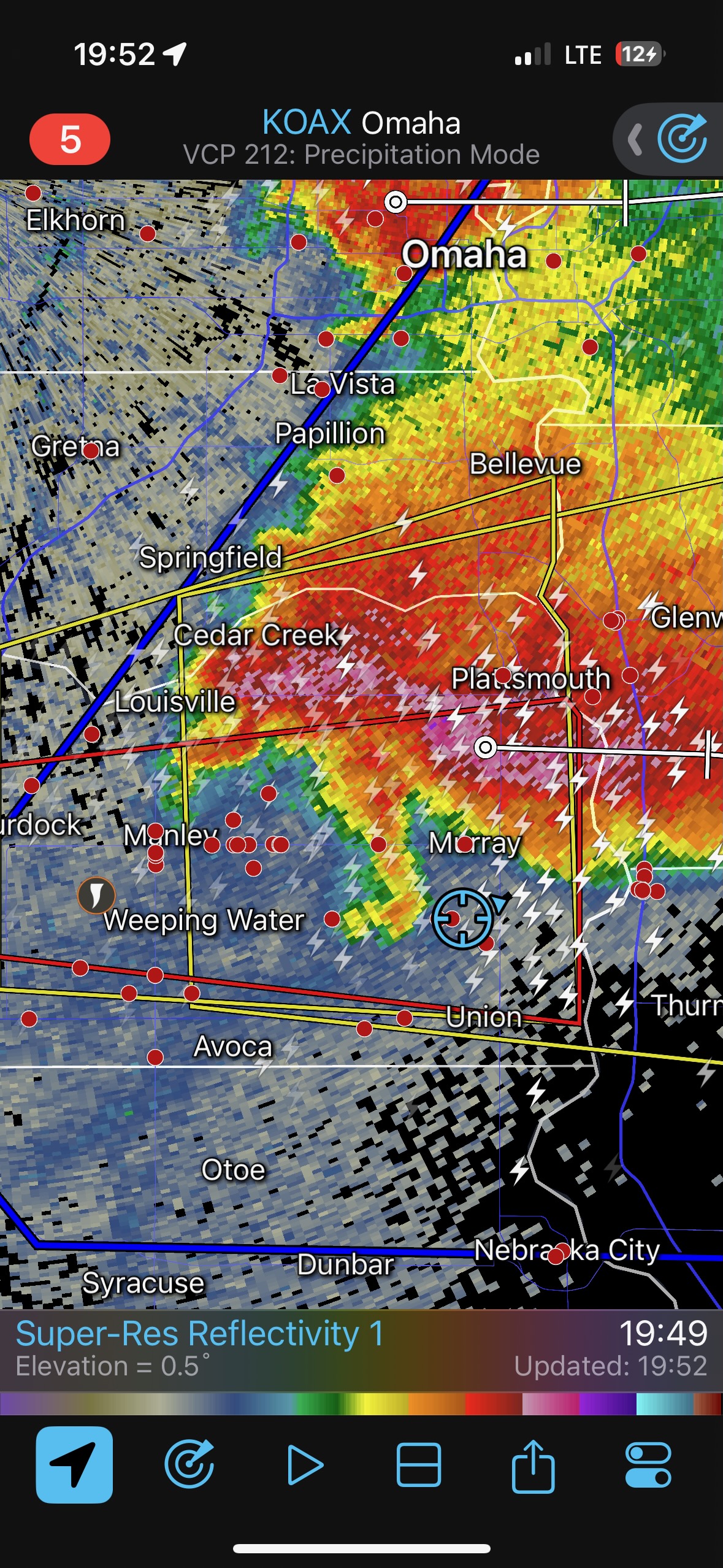
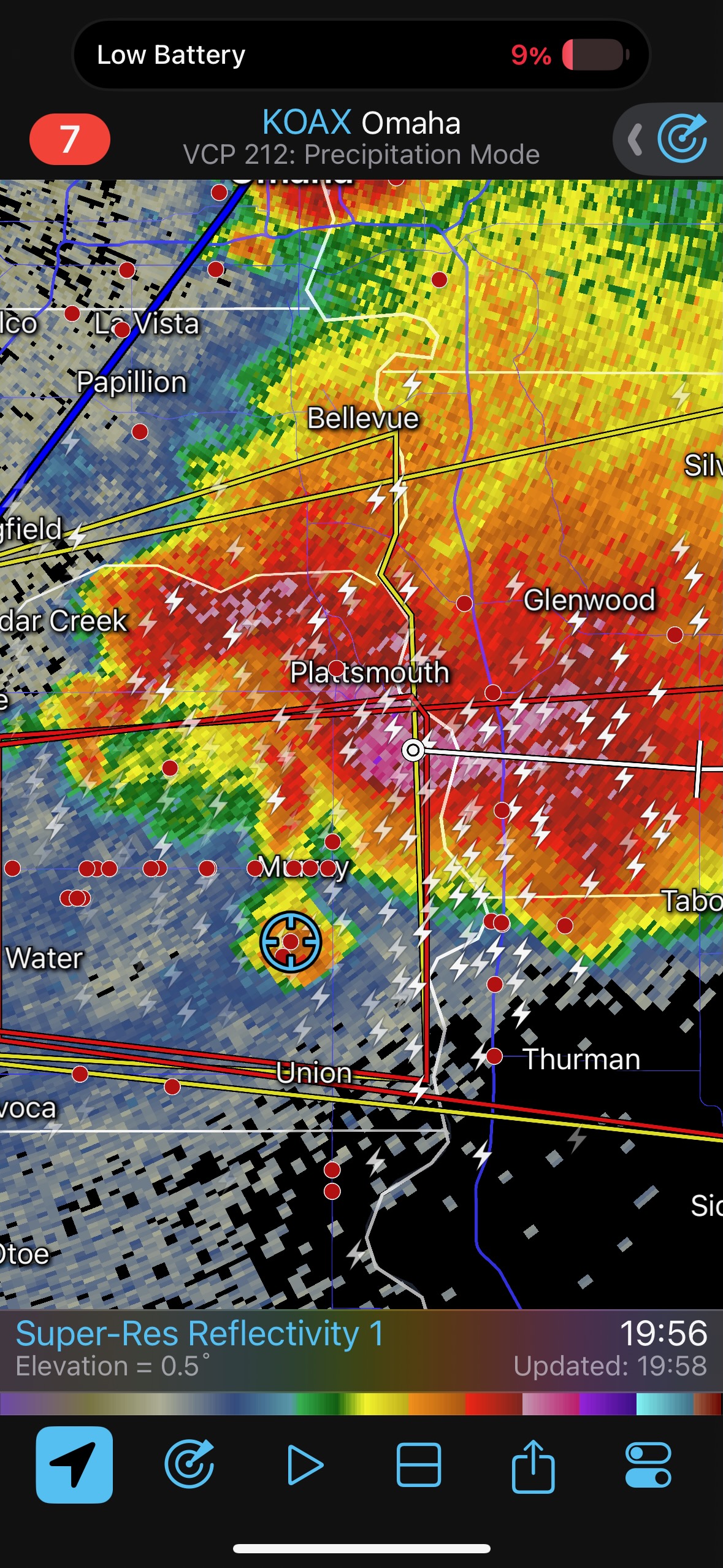
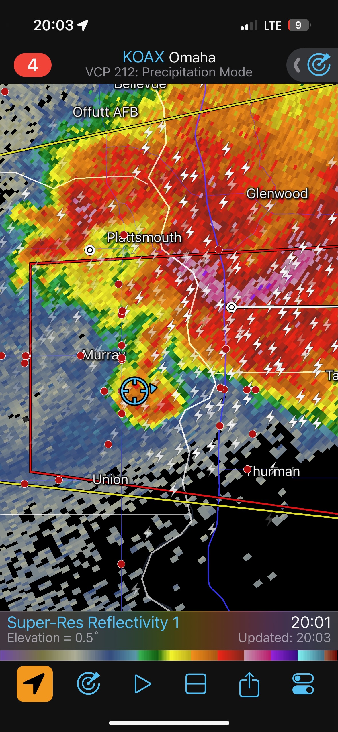
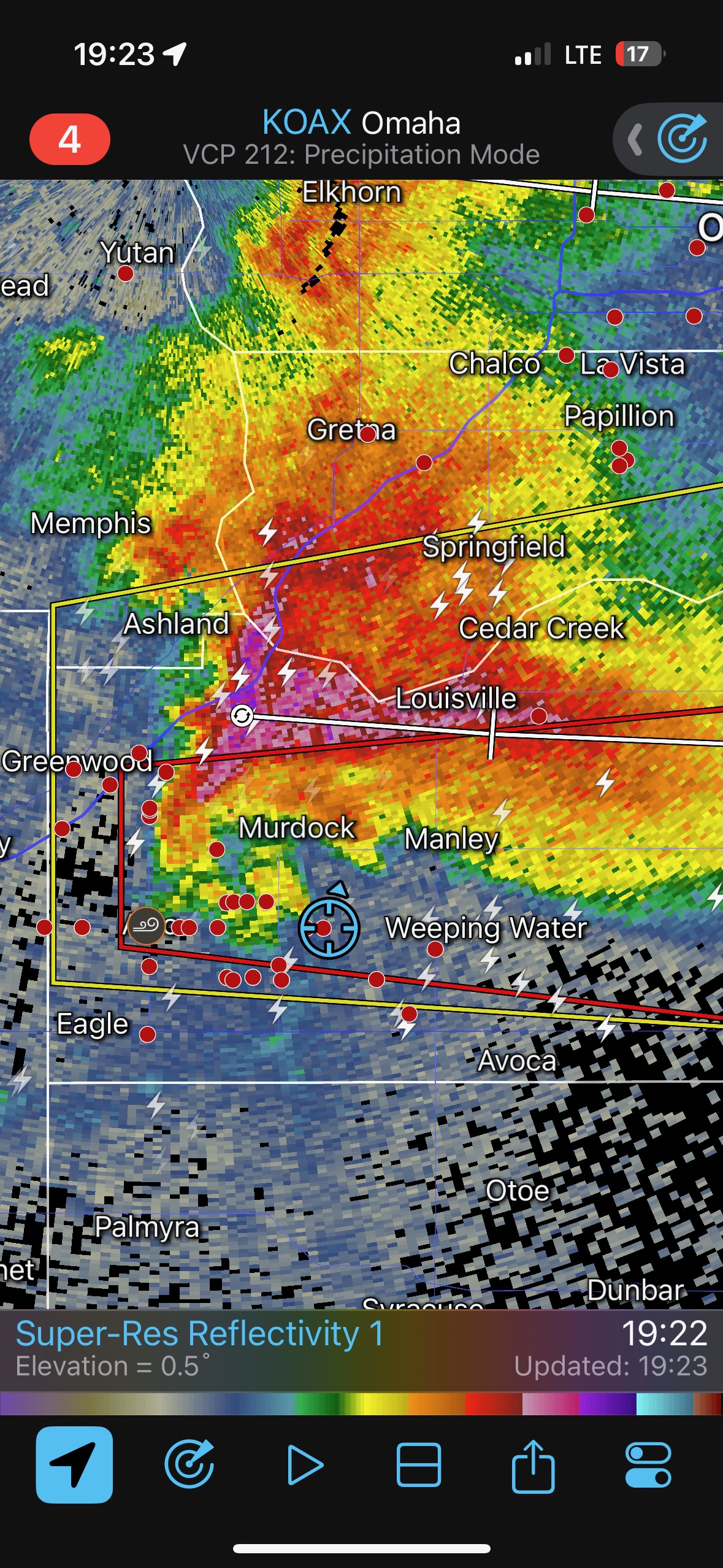
The radar screen grabs below show us right there in a nice hook echo for a bit around 8 p.m. CDT. We had some RFD wind, but I don’t recall experiencing any big hail or damaging wind.

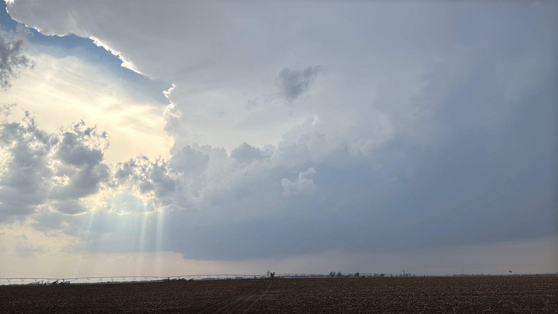
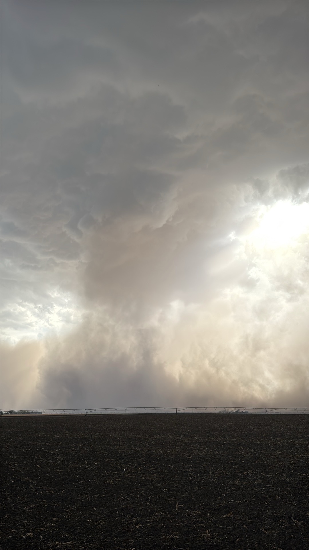
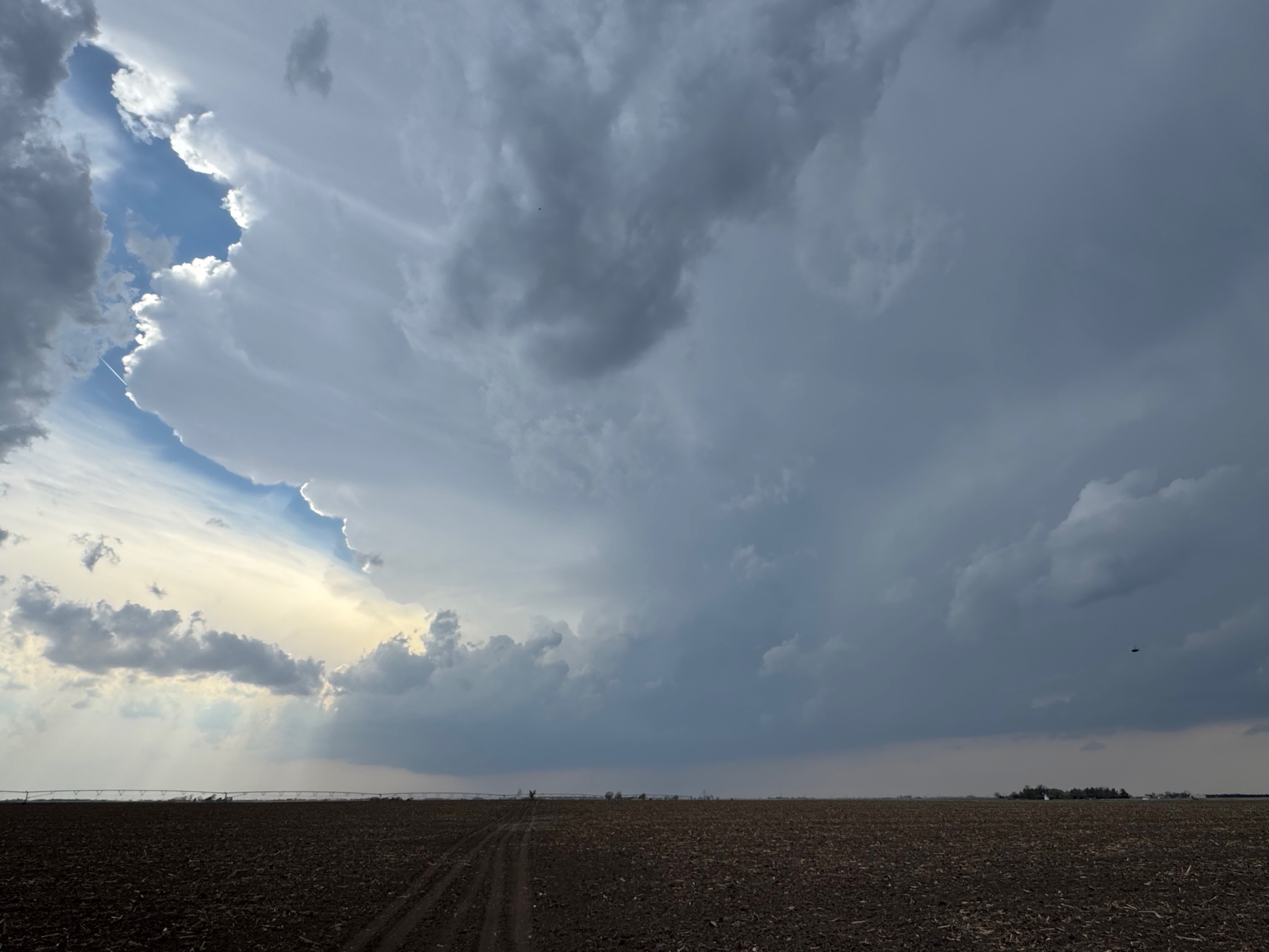
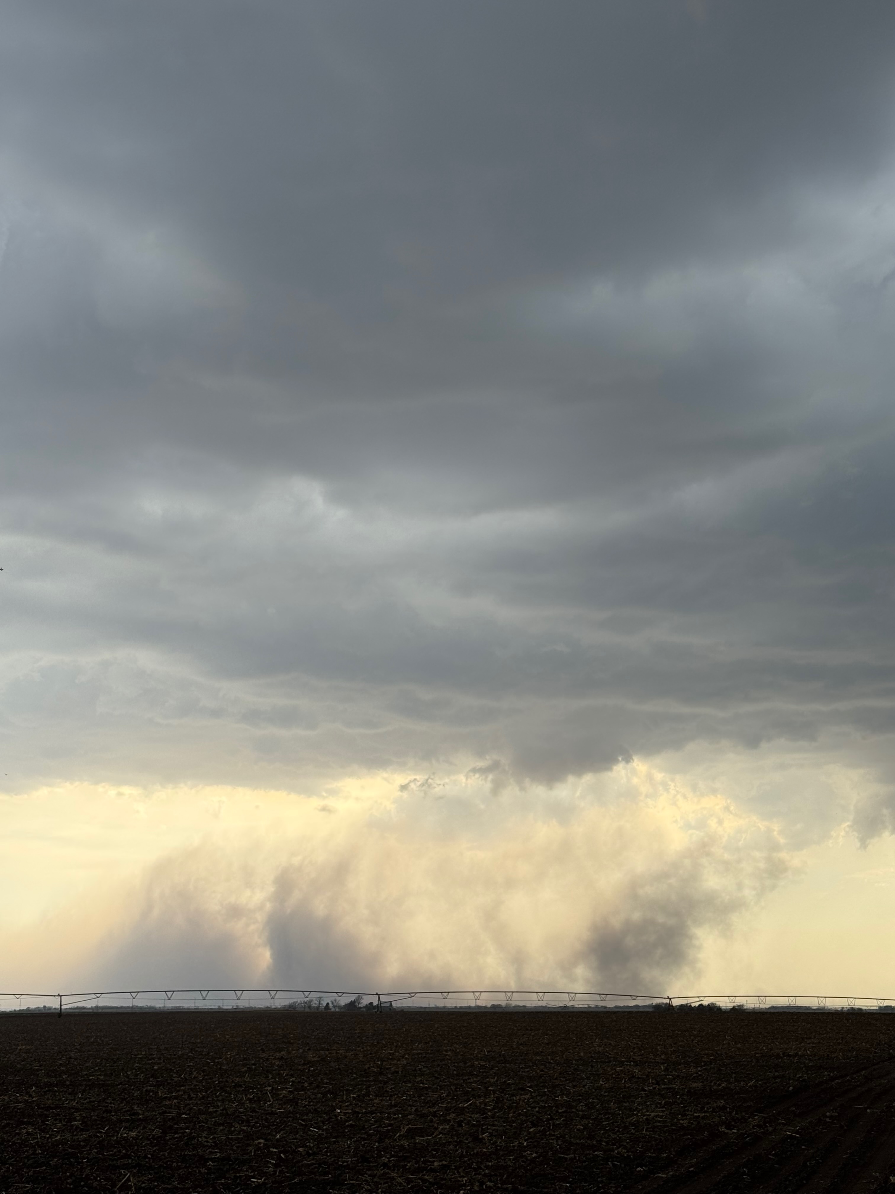
iPhone shots below
Note: check times on the radar screen grabs. They are not all in the right sequence. Times are all CDT.
Leave a Reply
You must be logged in to post a comment.