
Start: Amarillo/lunch: Big Texan in Amarillo/End: Shamrock, TX/370 miles
SPC Mesoscale Discussions 2:06 p.m. CDT 6:34 p.m. CDT 7:44 p.m. CDT 8:51 p.m. CDT
NWS Lubbock review of this event (with a nice radar loop included)
This was a fine chase day, with little consternation as to where to target, a short drive, and a supercell which spit out a few tornadoes and wasn’t moving too fast. The only thing to complain about was that the storm moved off of the Caprock of the eastern Texas Panhandle and into the sparse paved road network. Thus, we were playing more of a “structure” game later on when the storm was producing a good-sized tornado.
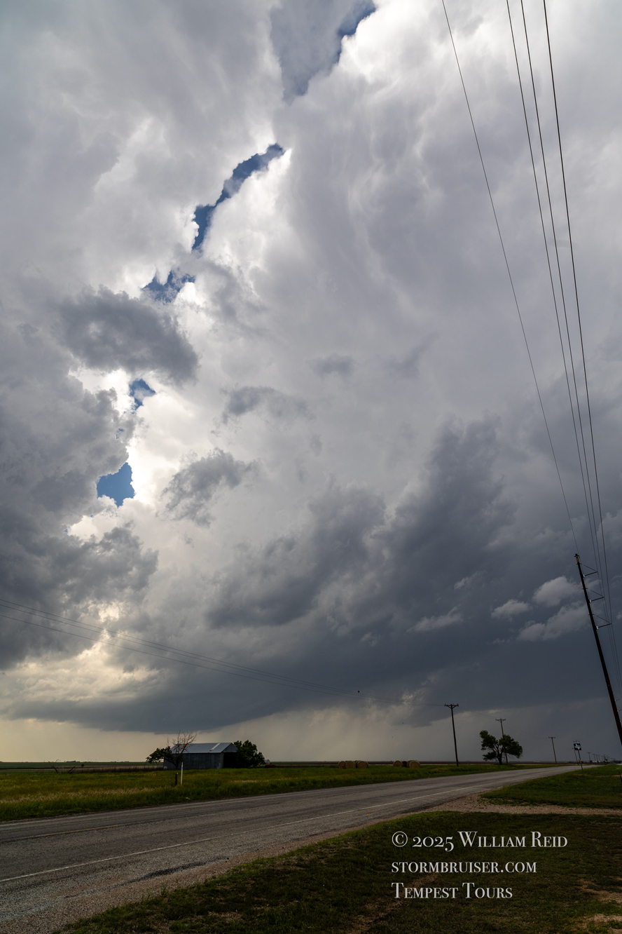
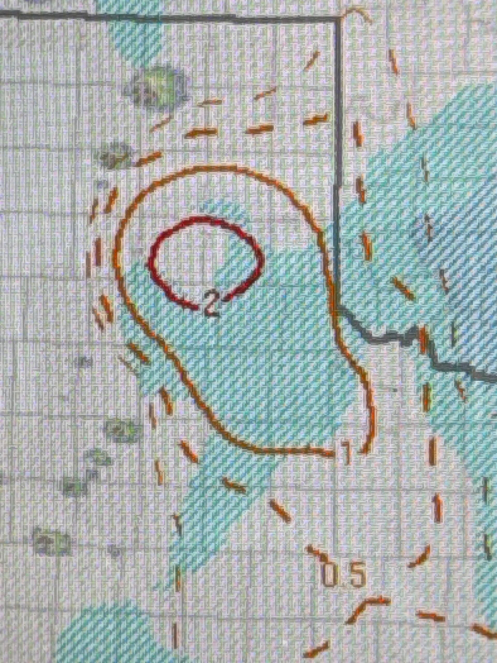
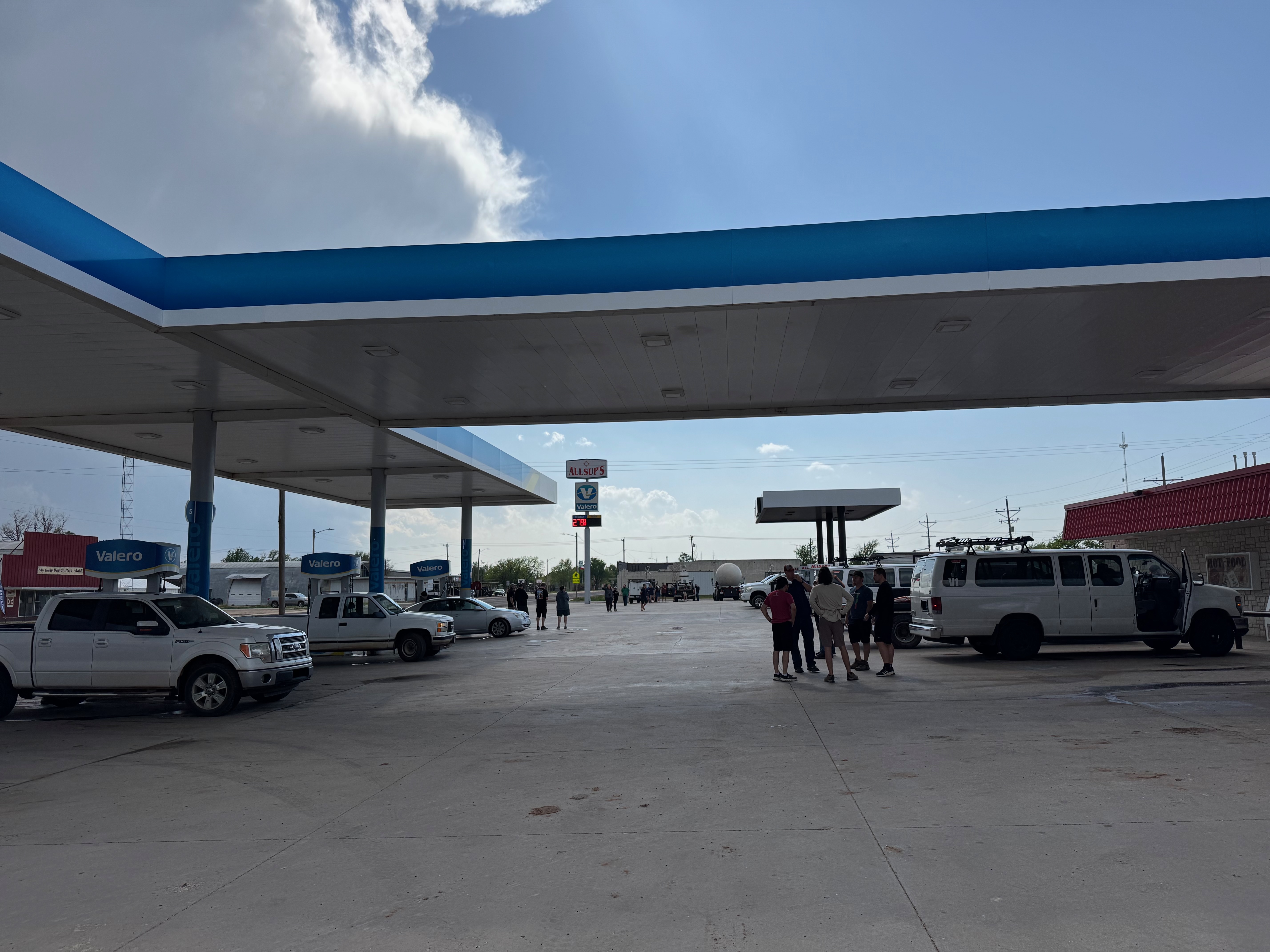
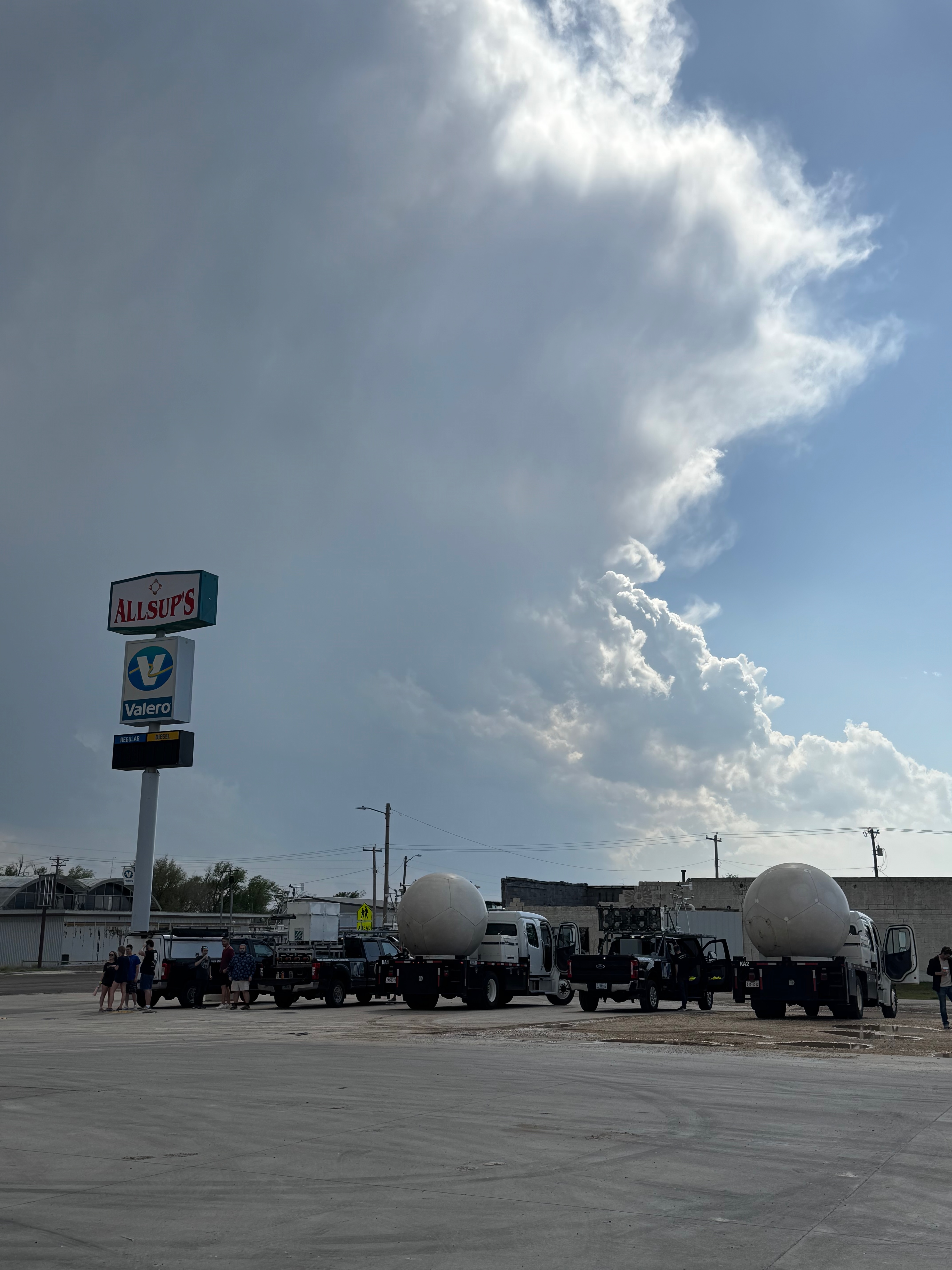
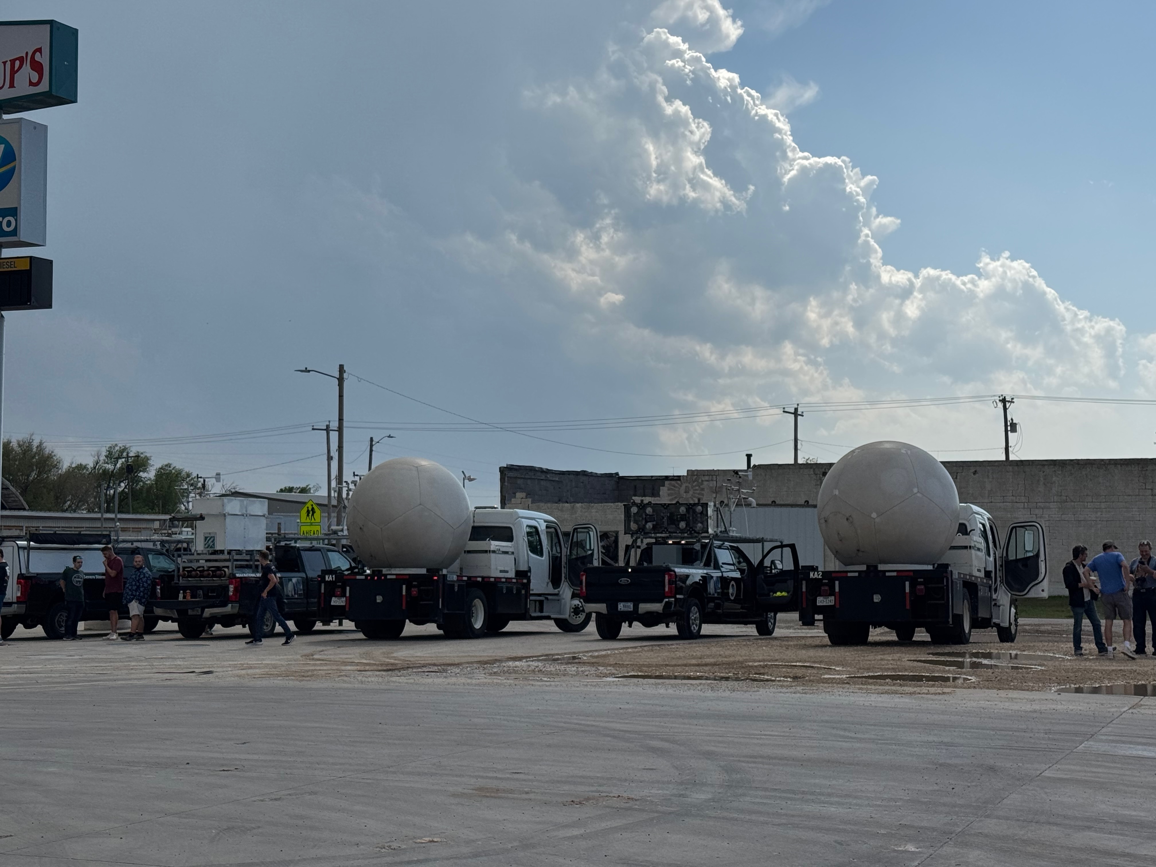
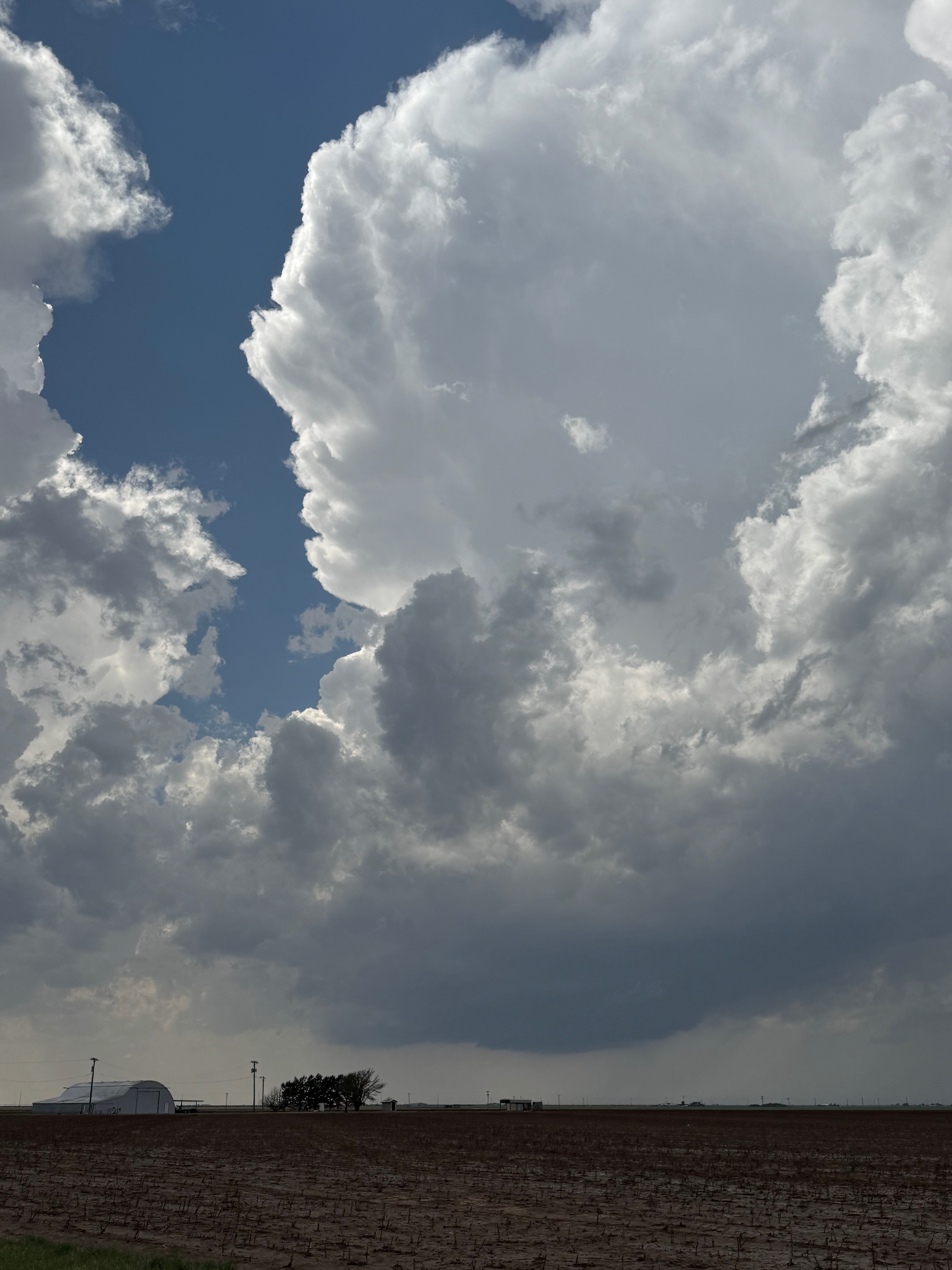
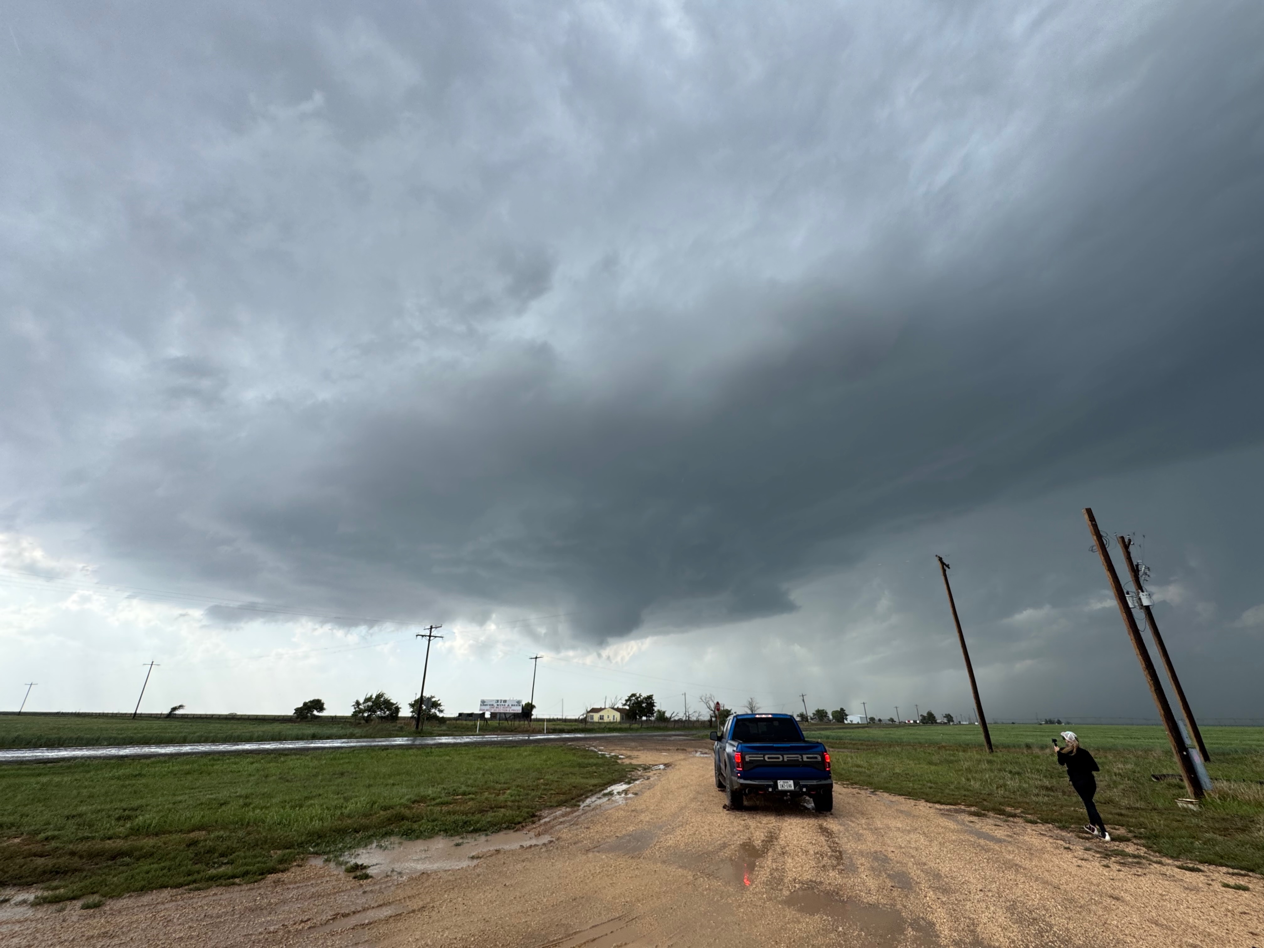
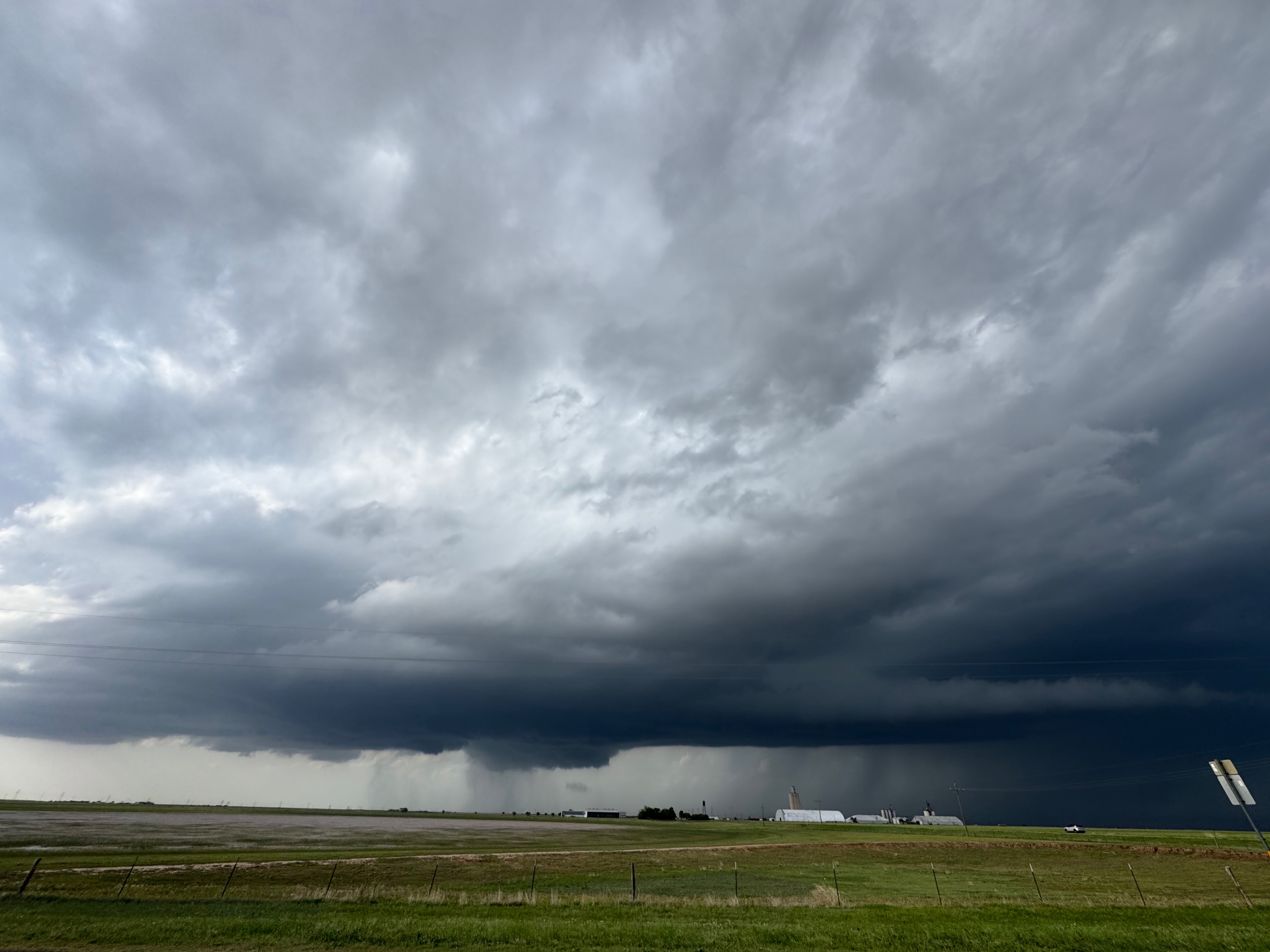
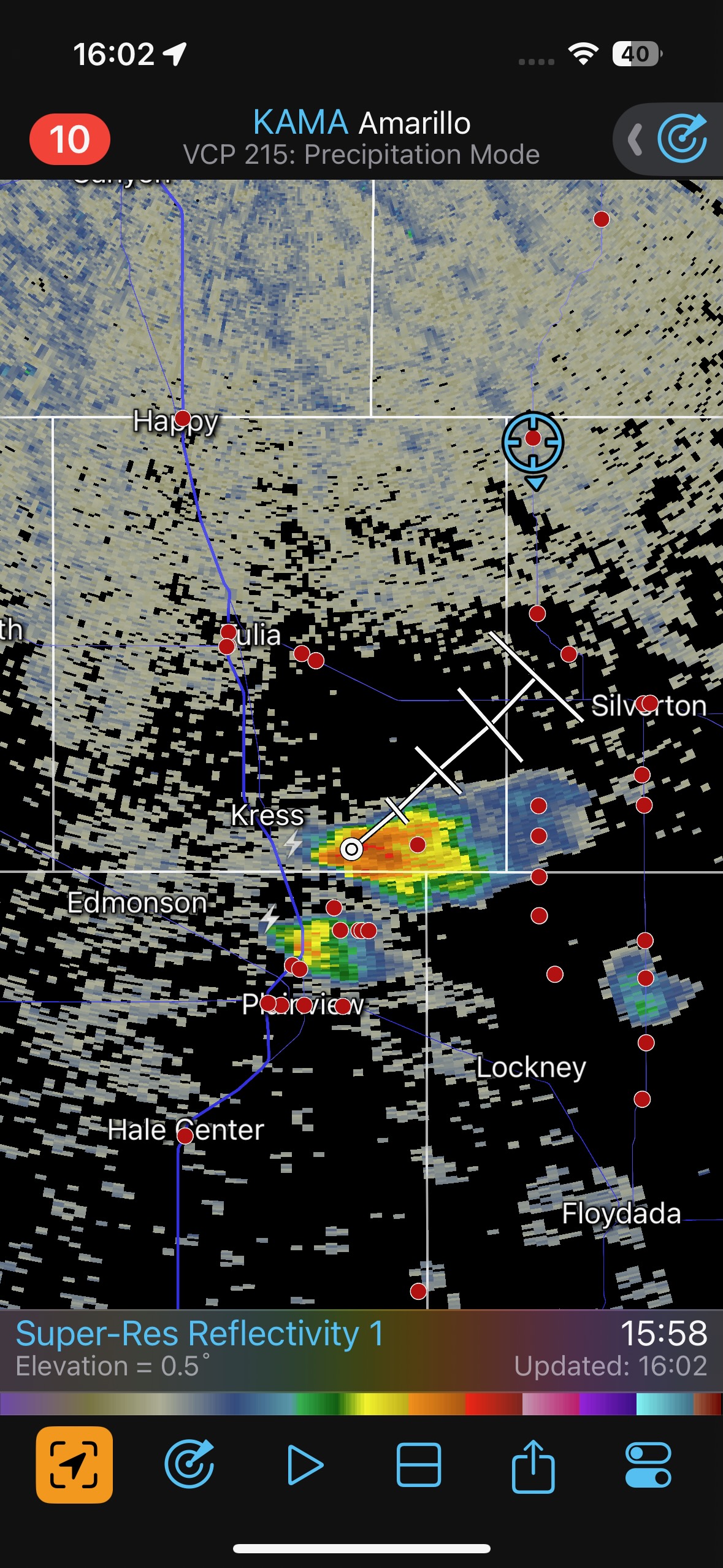
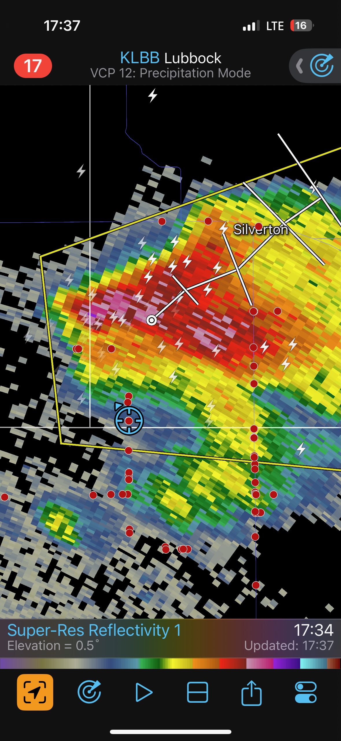
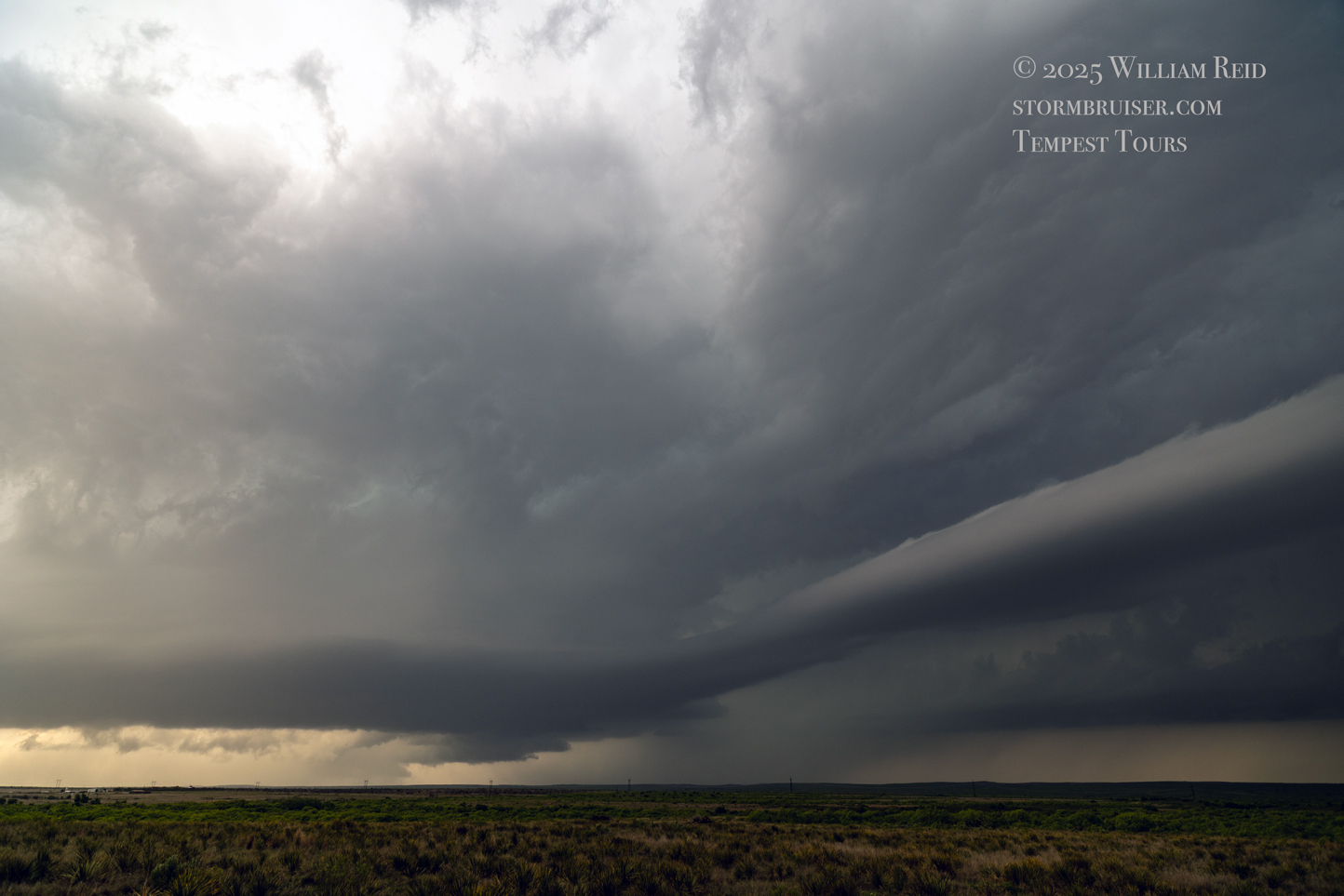
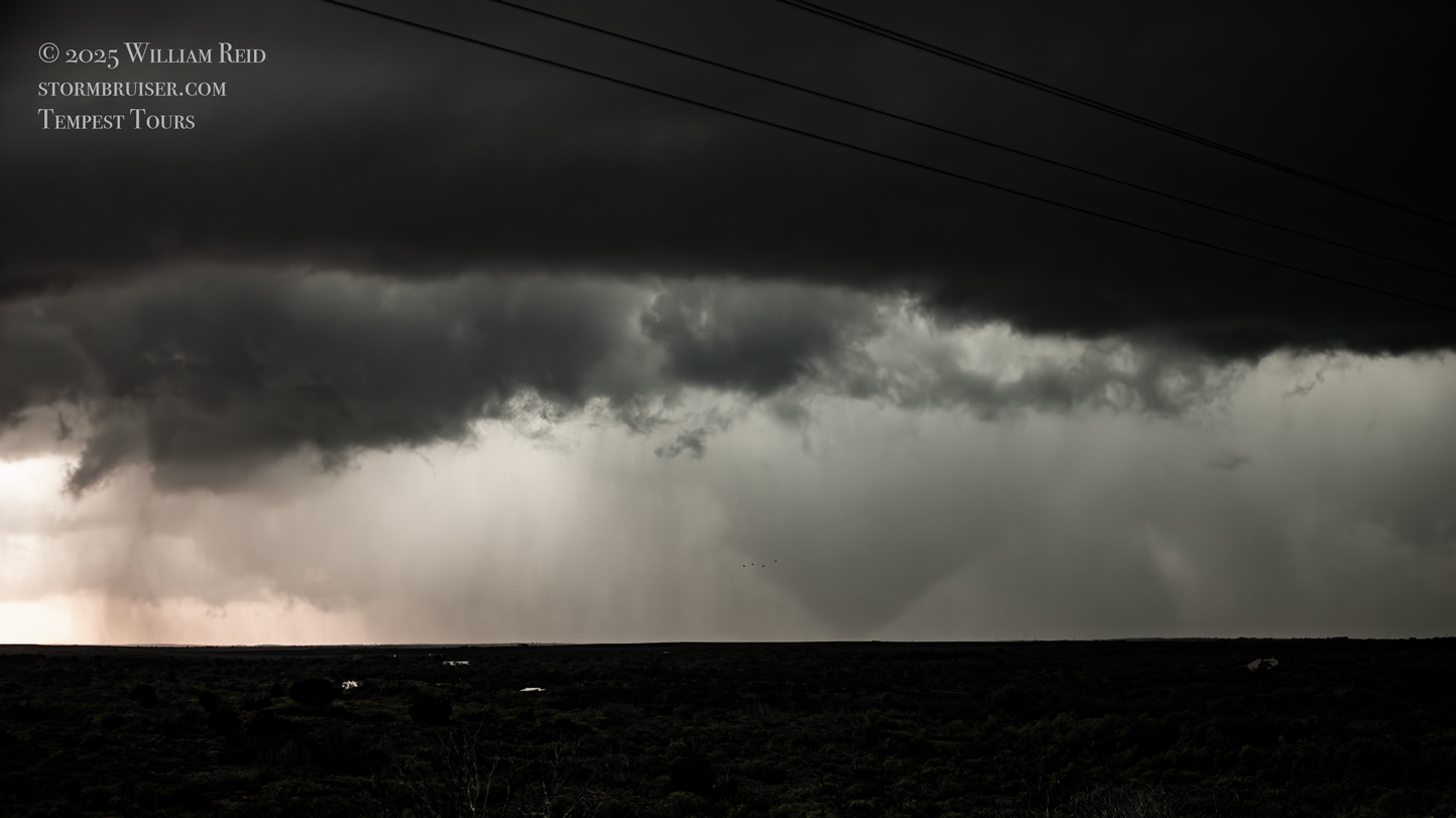
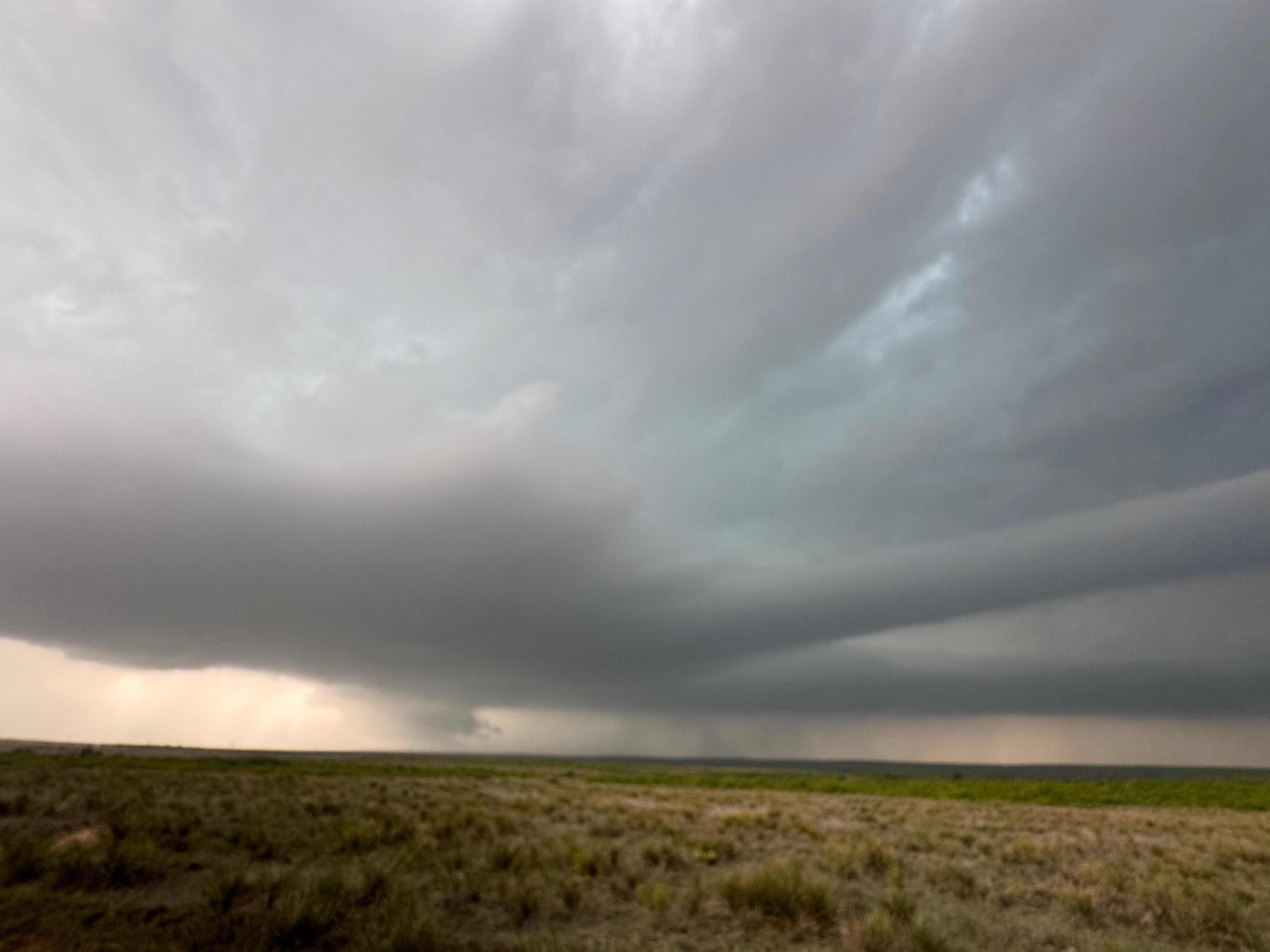
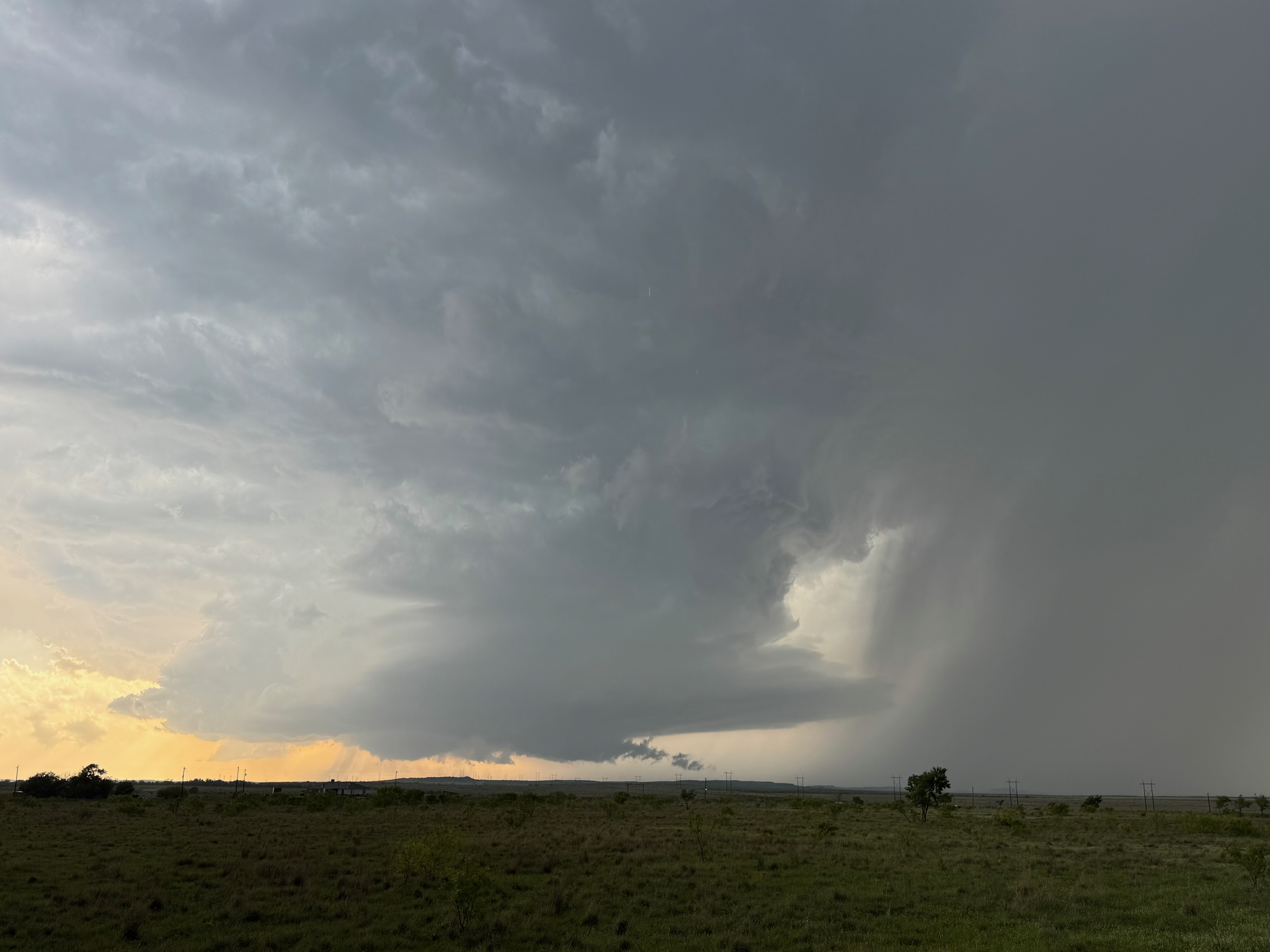
We began in Amarillo. By early afternoon (after stops at Cadillac Ranch, the Big Texan and Buc-ee’s) we were focused on an obvious E-W outflow boundary that was stationary or sagging slowly southward, about two counties south of Amarillo. Amarillo was on the cold and drizzly side of the boundary, but the sun was making an appearance finally. We headed southward on FM 207 through Palo Duro Canyon, and came back up onto the flats just east of Wayside. By now (around 4 p.m.) the radar was showing some new storm formation to our SSW around Plainview and Kress. It didn’t seem like this initial stuff was worth dashing towards (and it was approaching us, more-or-less), so we made a pit stop in Silverton. A lot of chasers were milling about here at the Allsups. The atmosphere had a bit of that pre-tornado feel and look to it, with dews in the low-mid 60s and great shear at low levels. SPC had bestowed a 5 percent tornado outline around Silverton, with a 30 percent hatched hail area, too. From Silverton we moseyed south some on 207 to Whitney and South Plains, with a strong updraft or two to our west and northwest. On the radar grabs below it shows our location on N-S road 378, northwest of South Plains. The storm that is southwest of Silverton now has decent organization, and is severe-warned by 5:30 p.m. CDT. The storm looked to be along that outflow boundary, its base was fairly low, and it was sucking on good air from the southeast. You know what that means.
The first batch of images below takes us about up to the time of the first tornado.
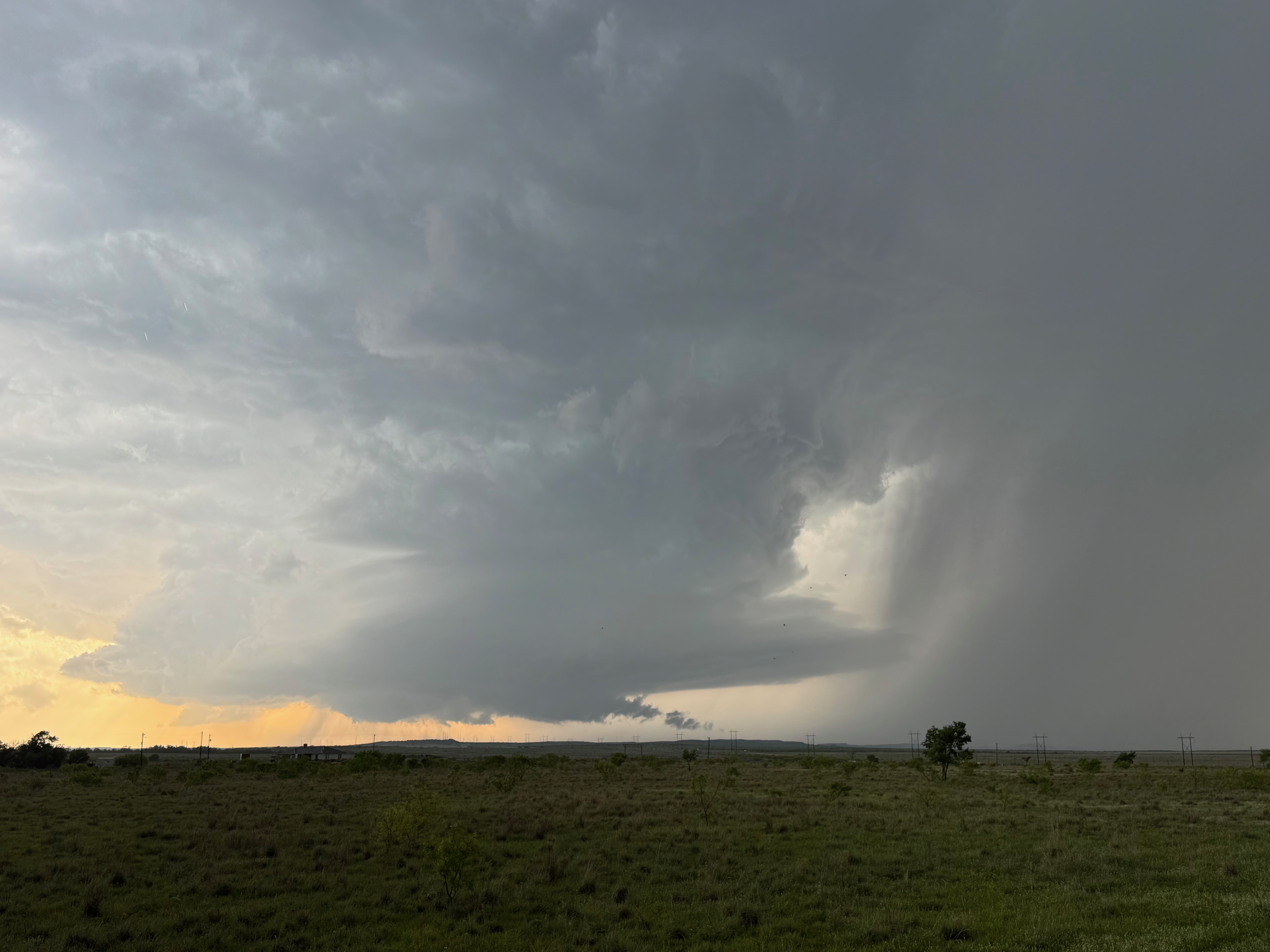
That is the town of South Plains on the extreme right side of those last two pics, just prior to the first tornado.
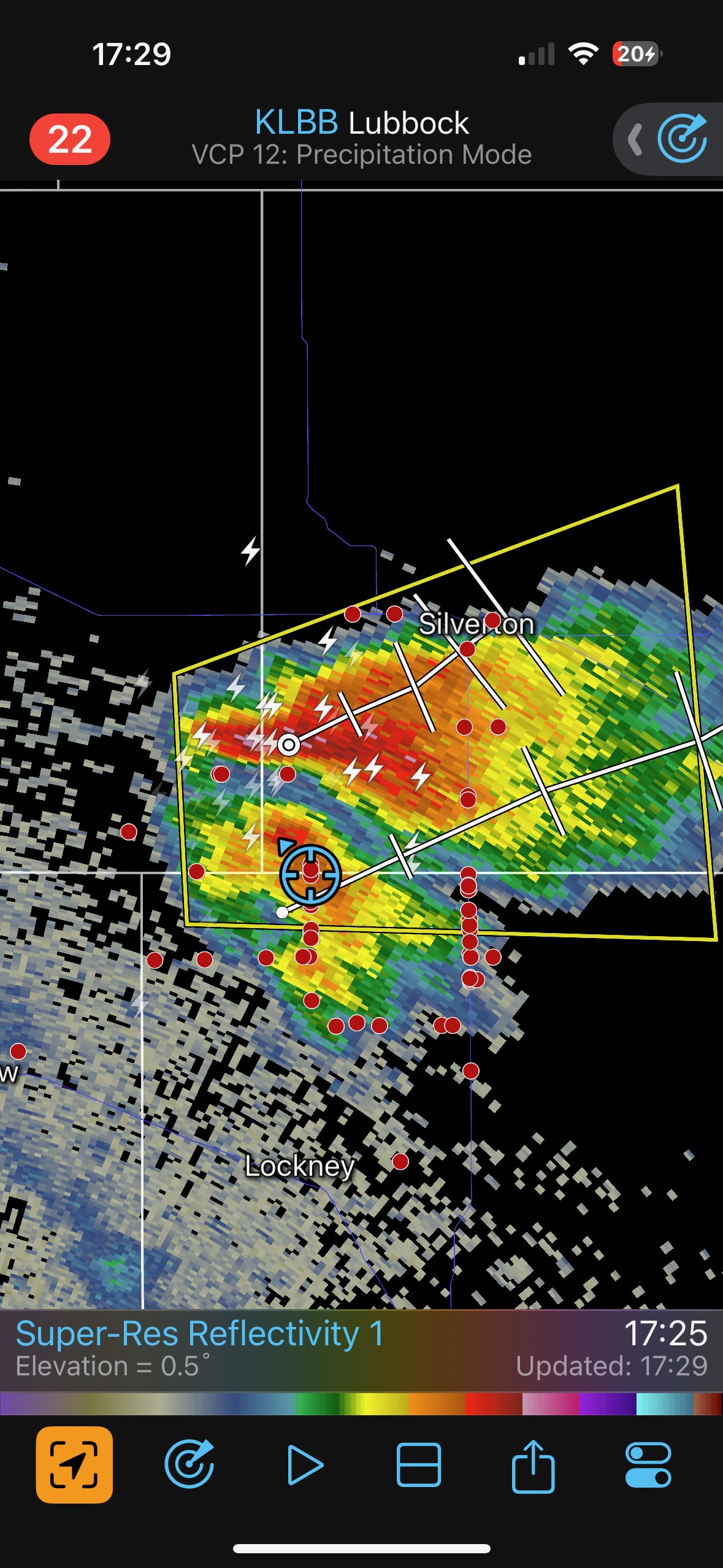
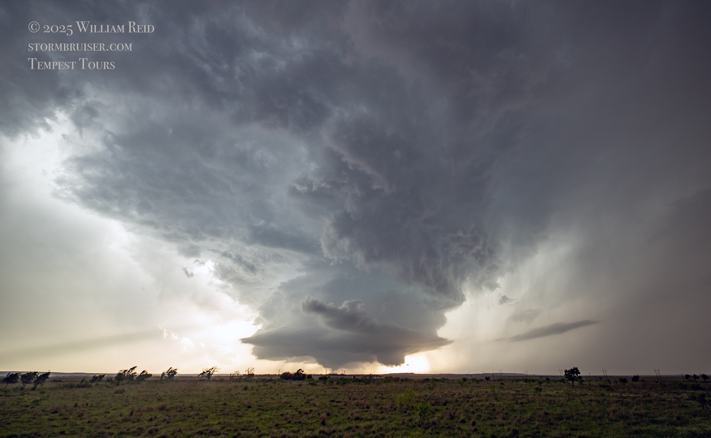
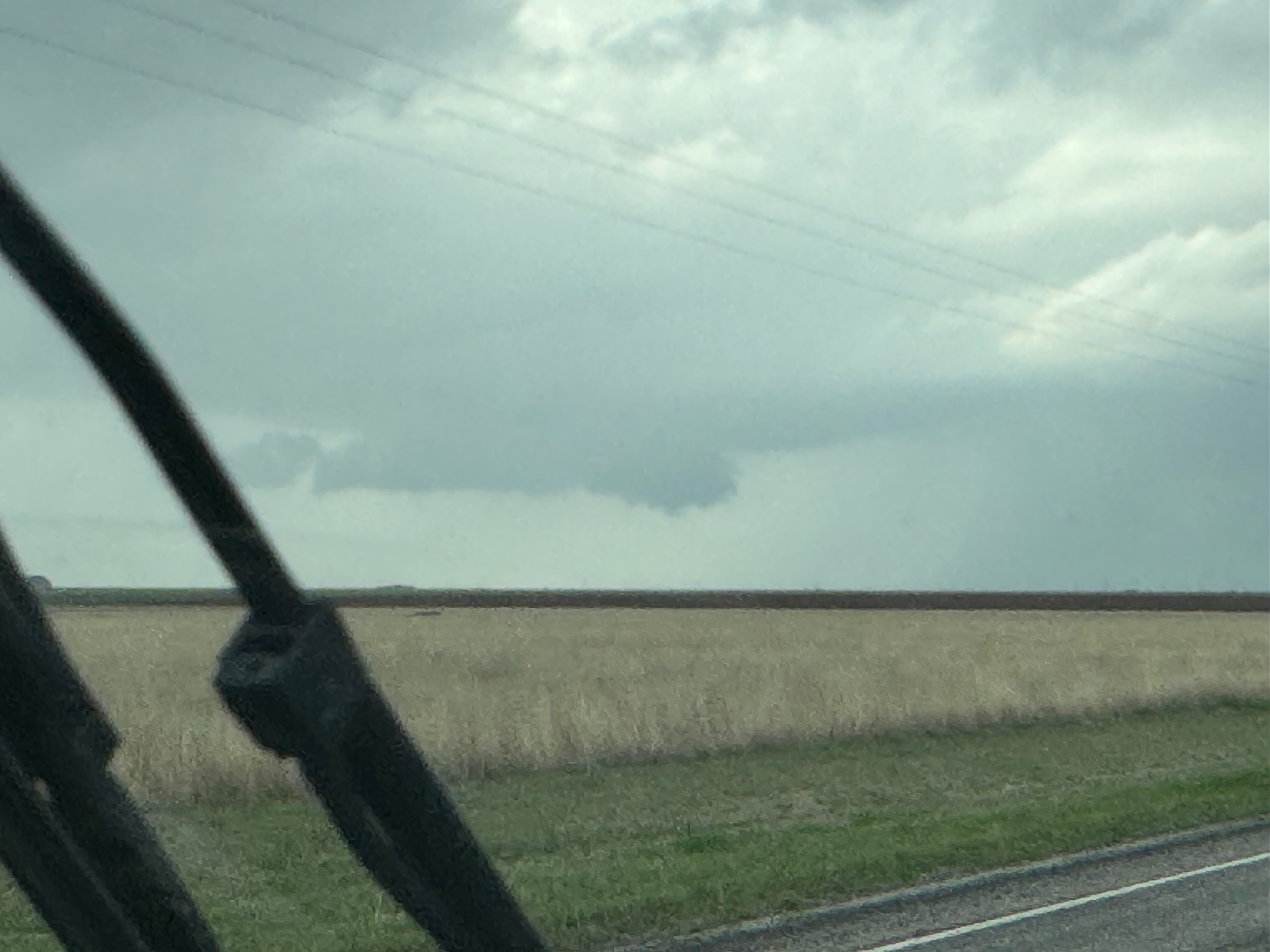
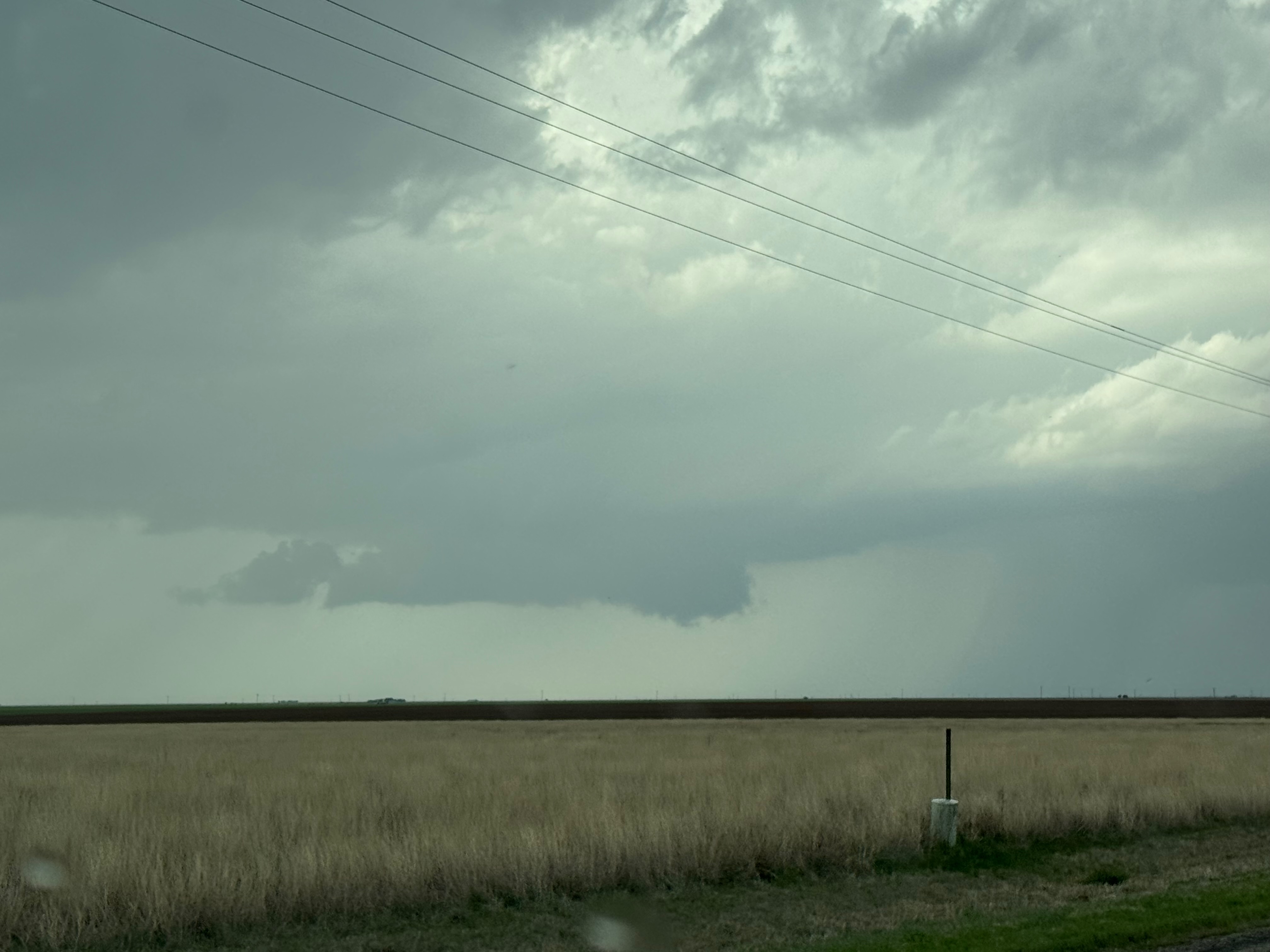
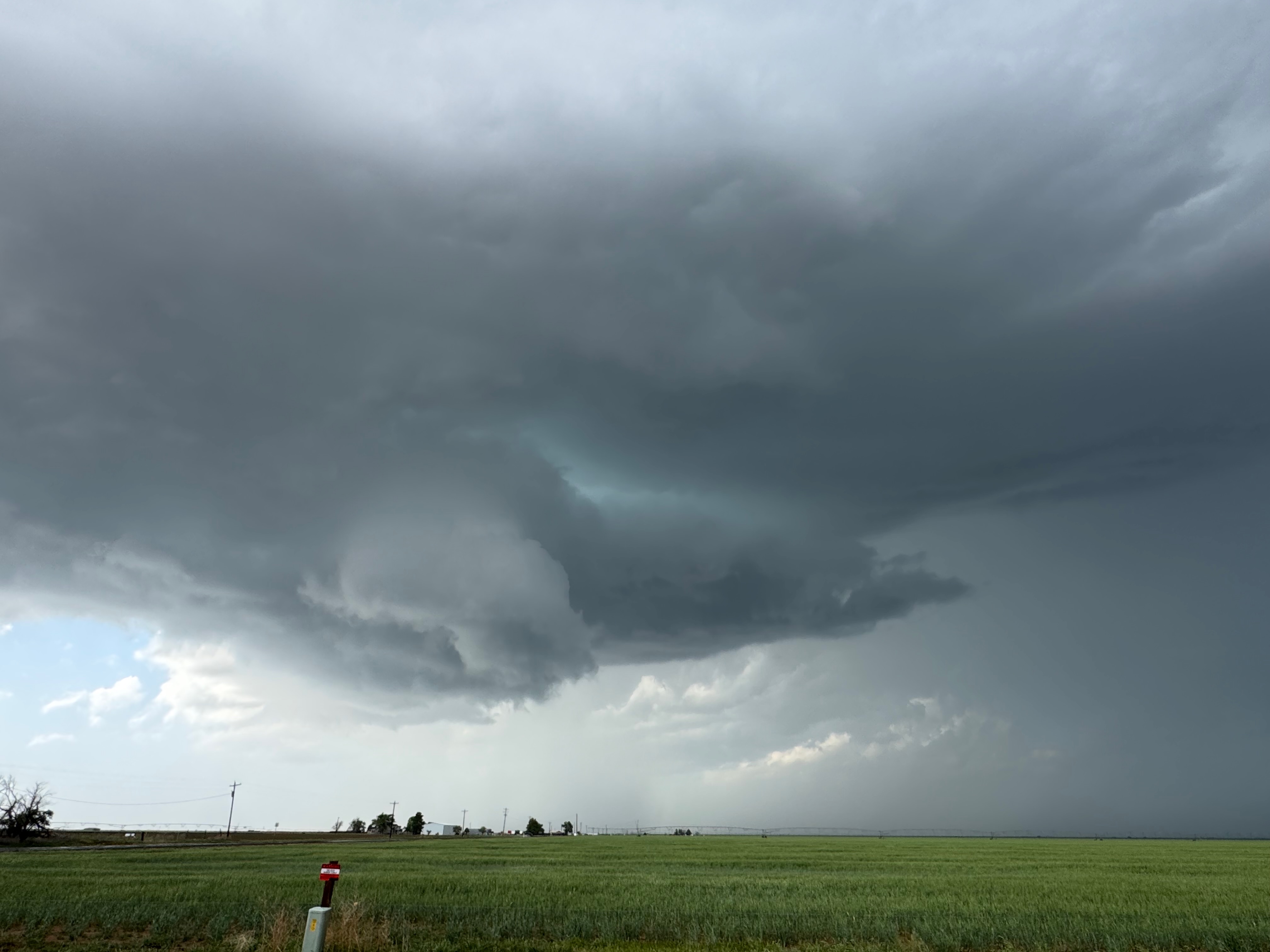
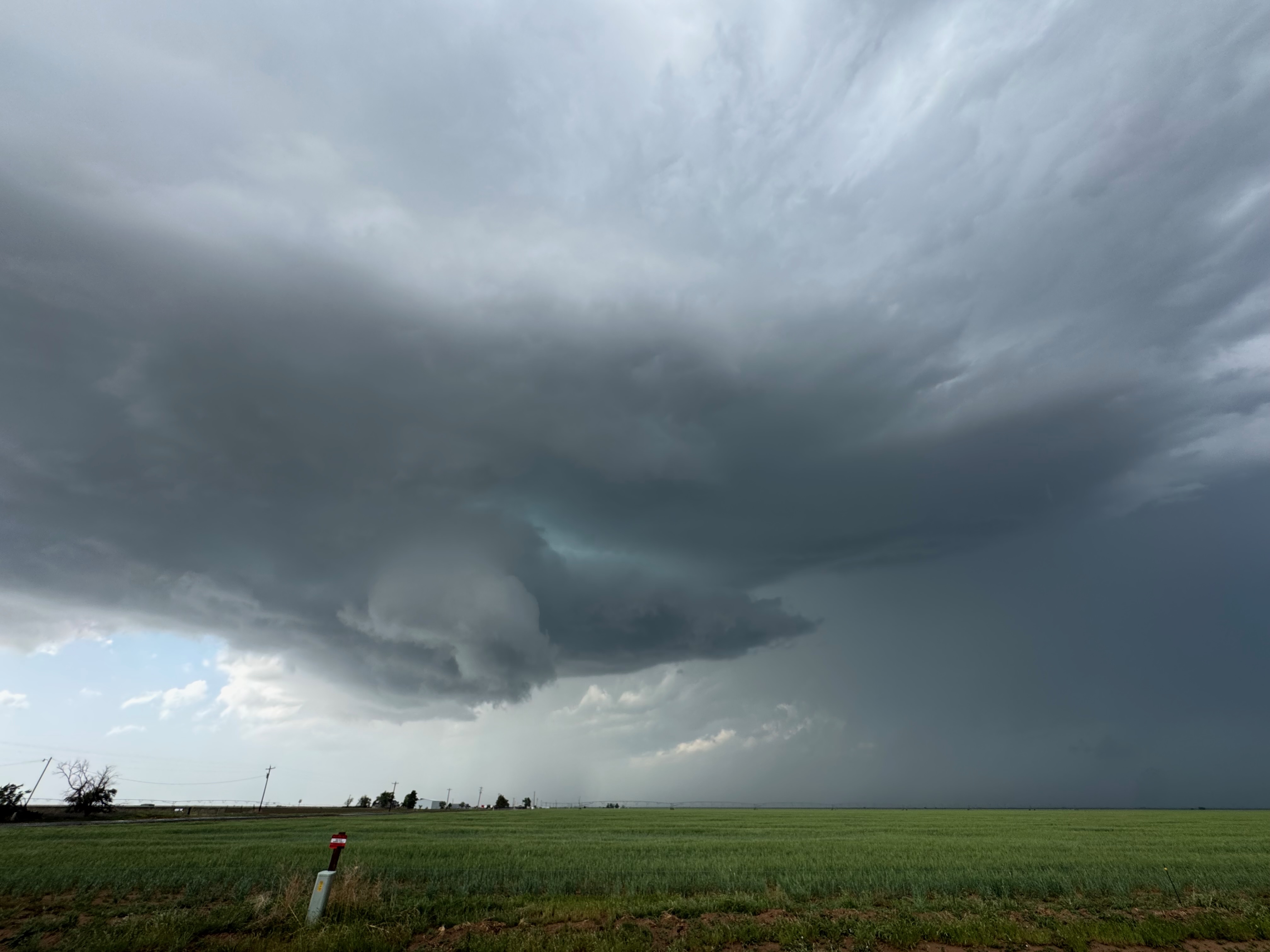
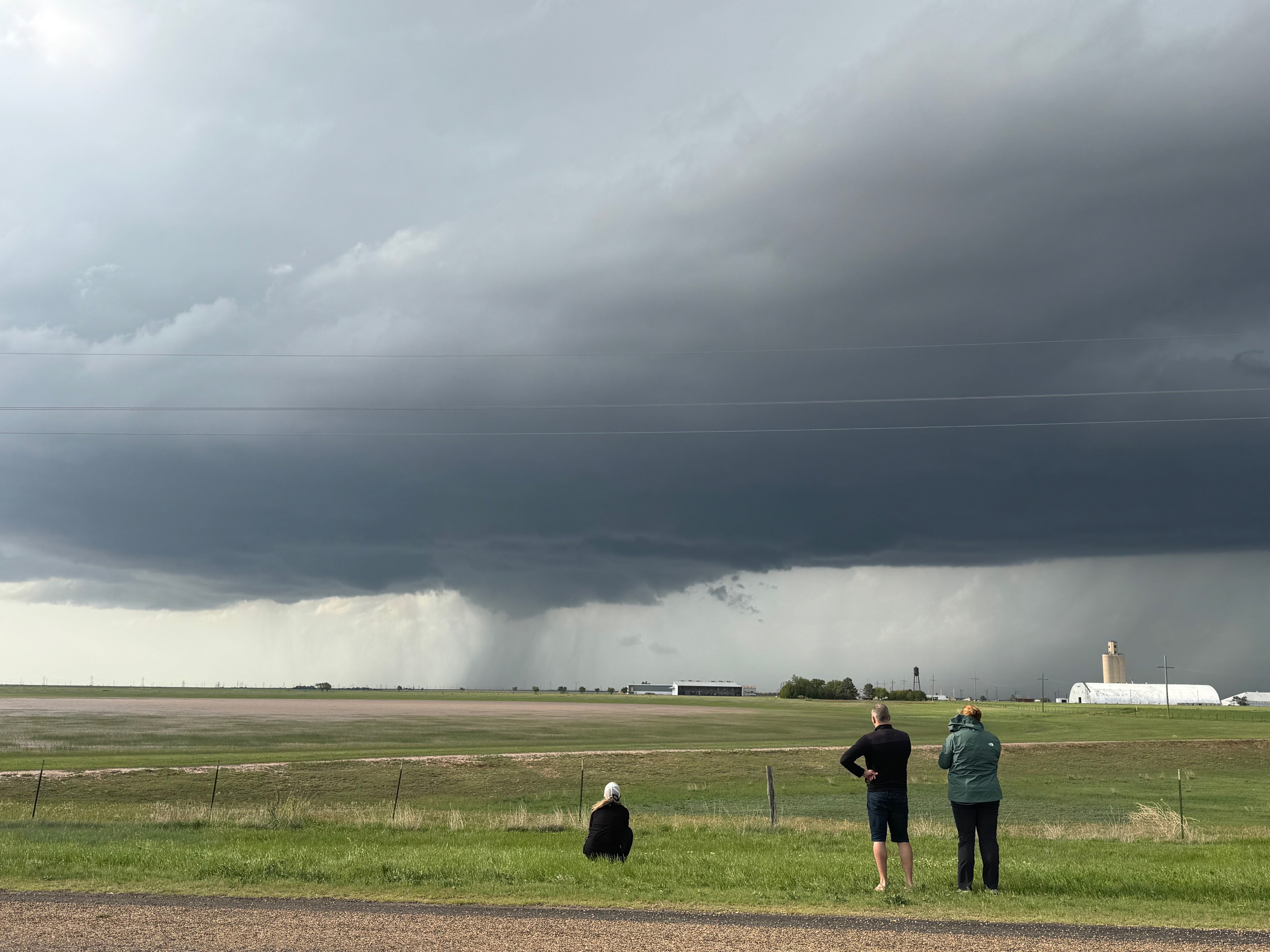
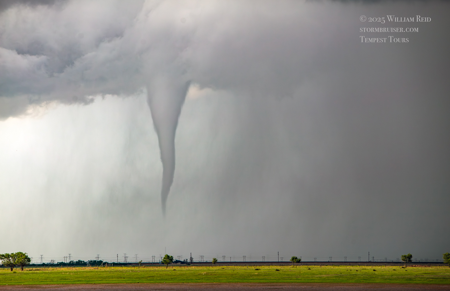
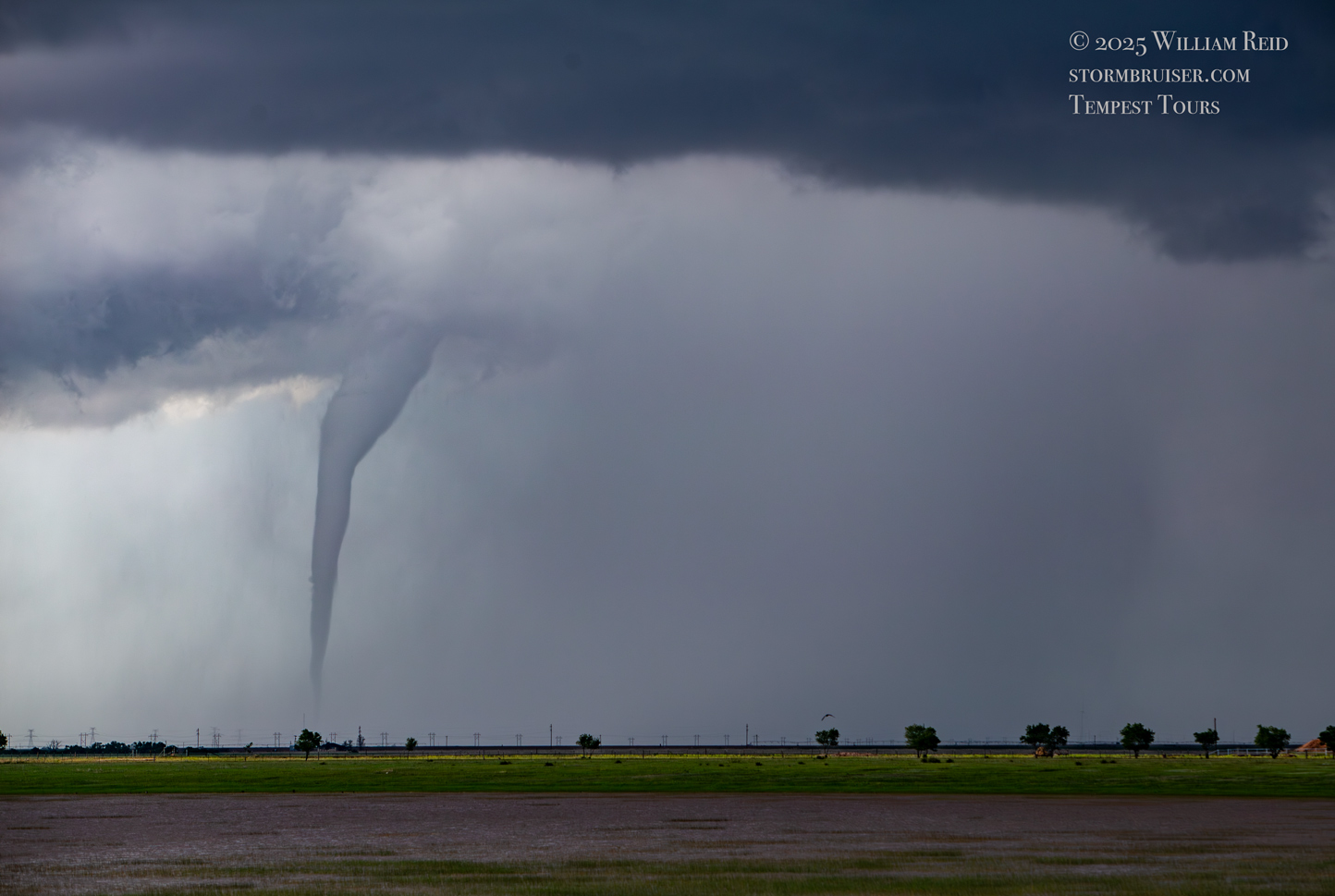
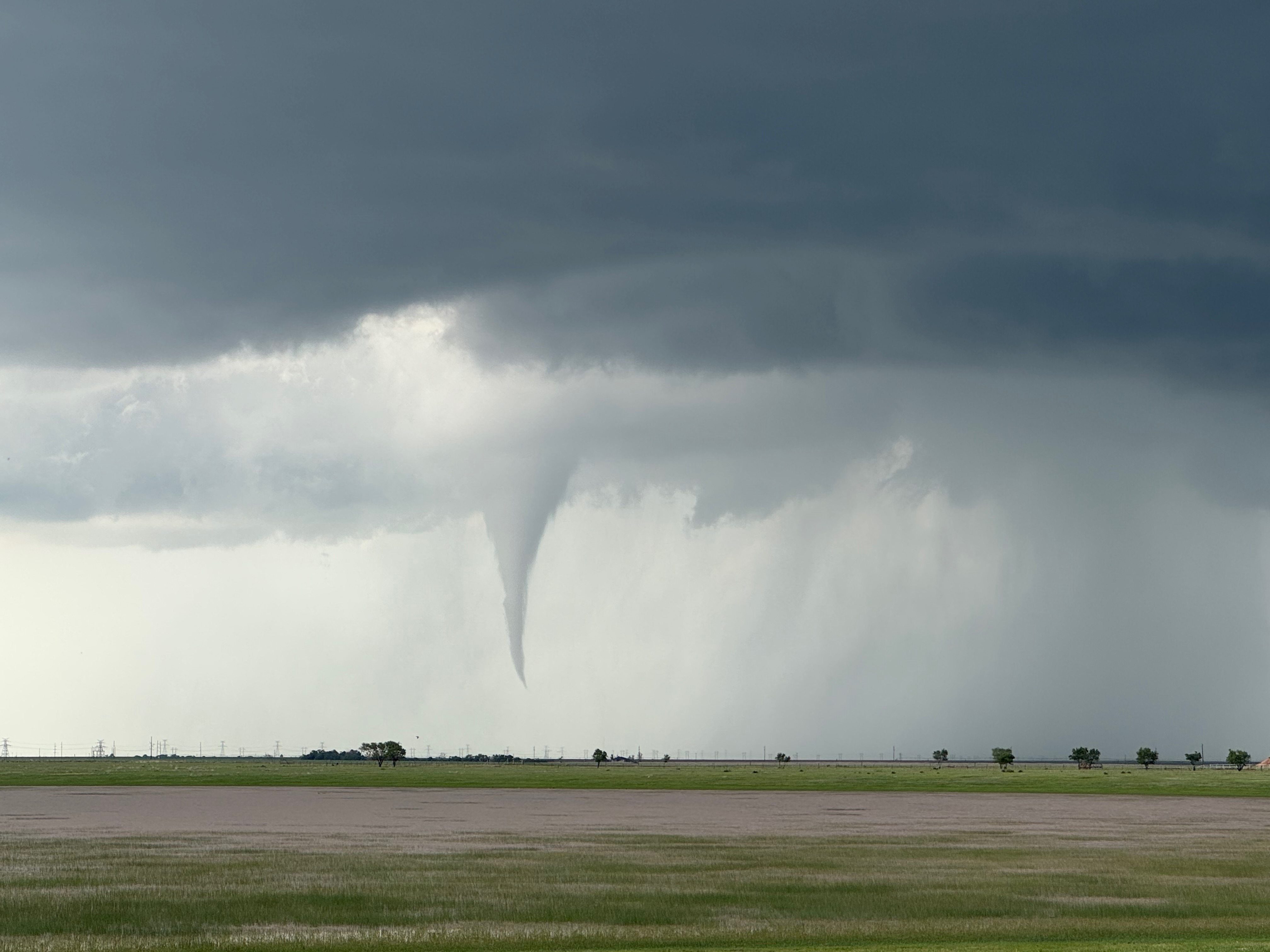
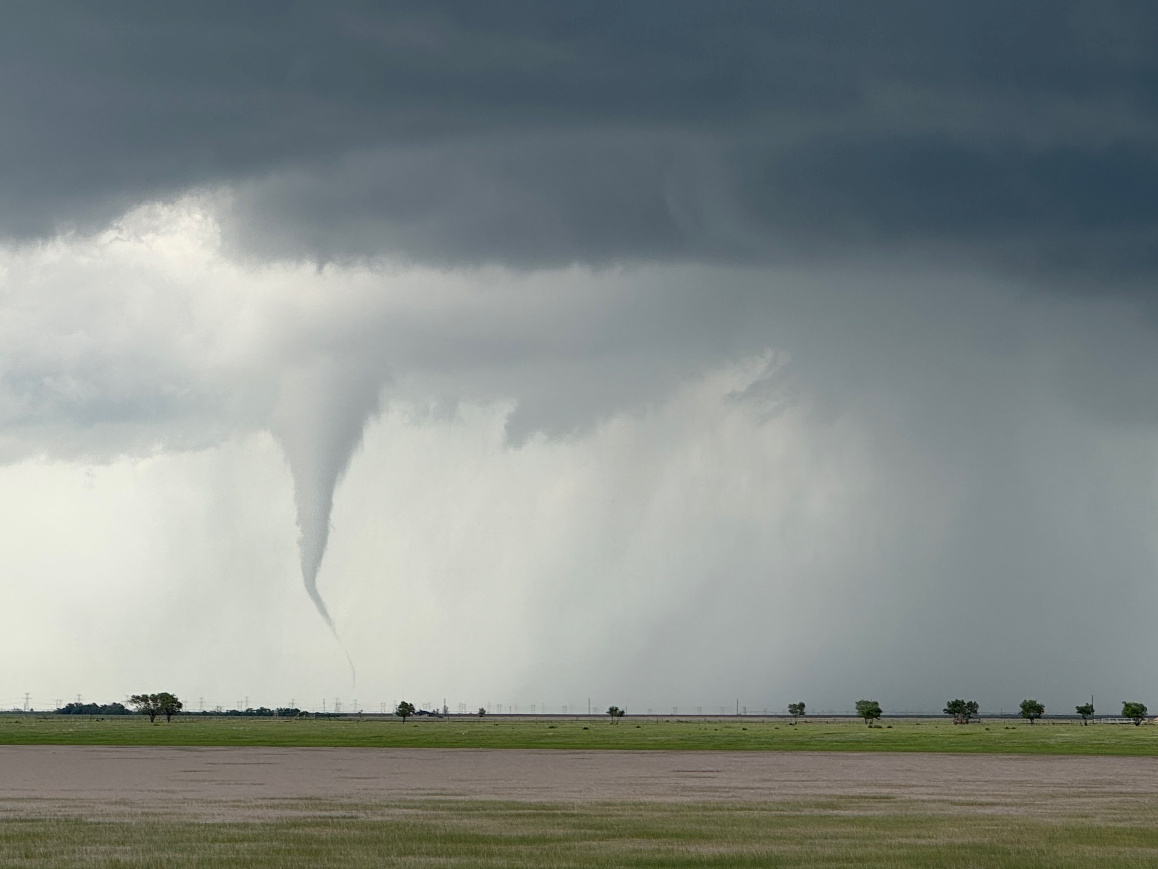
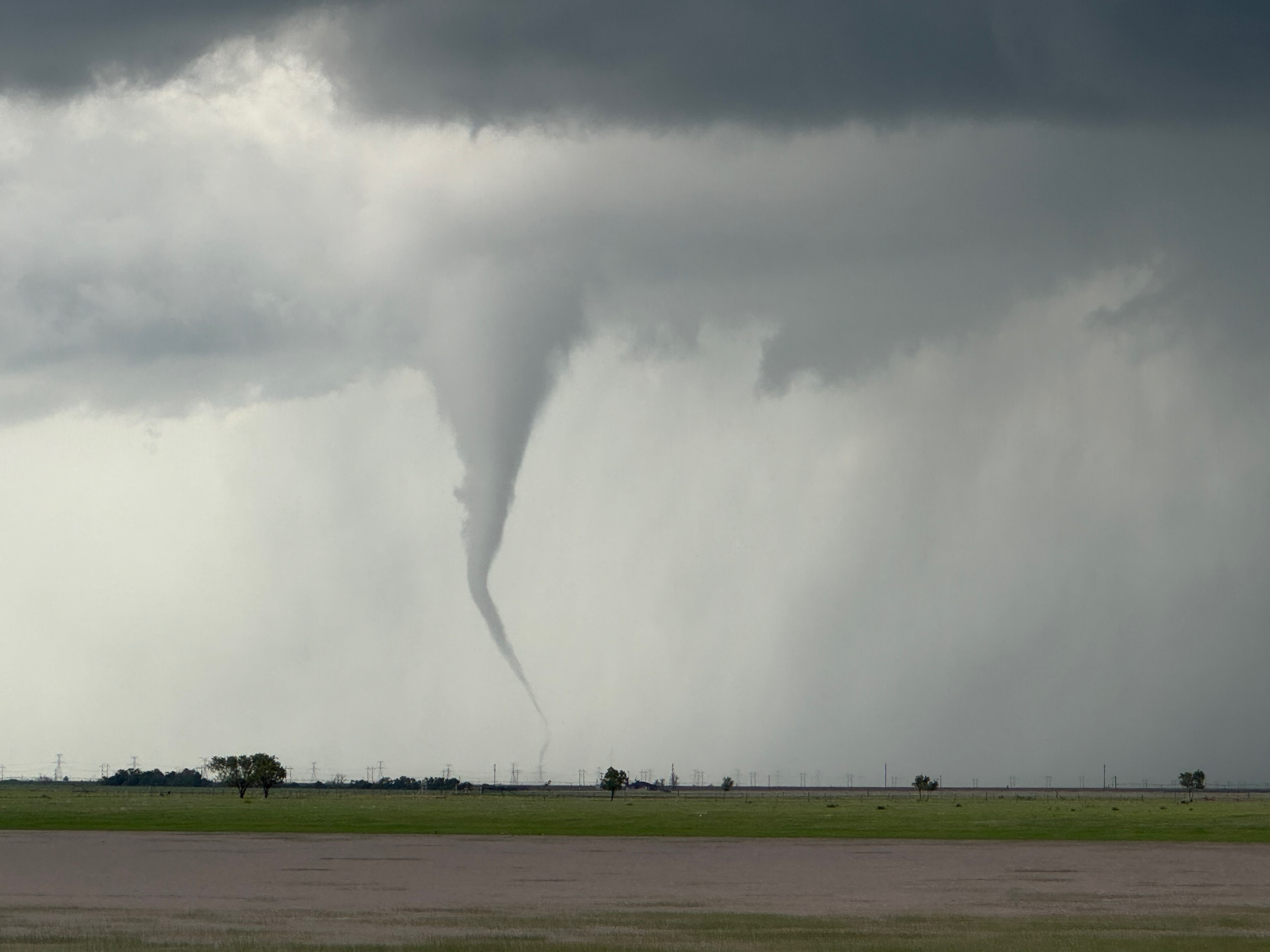
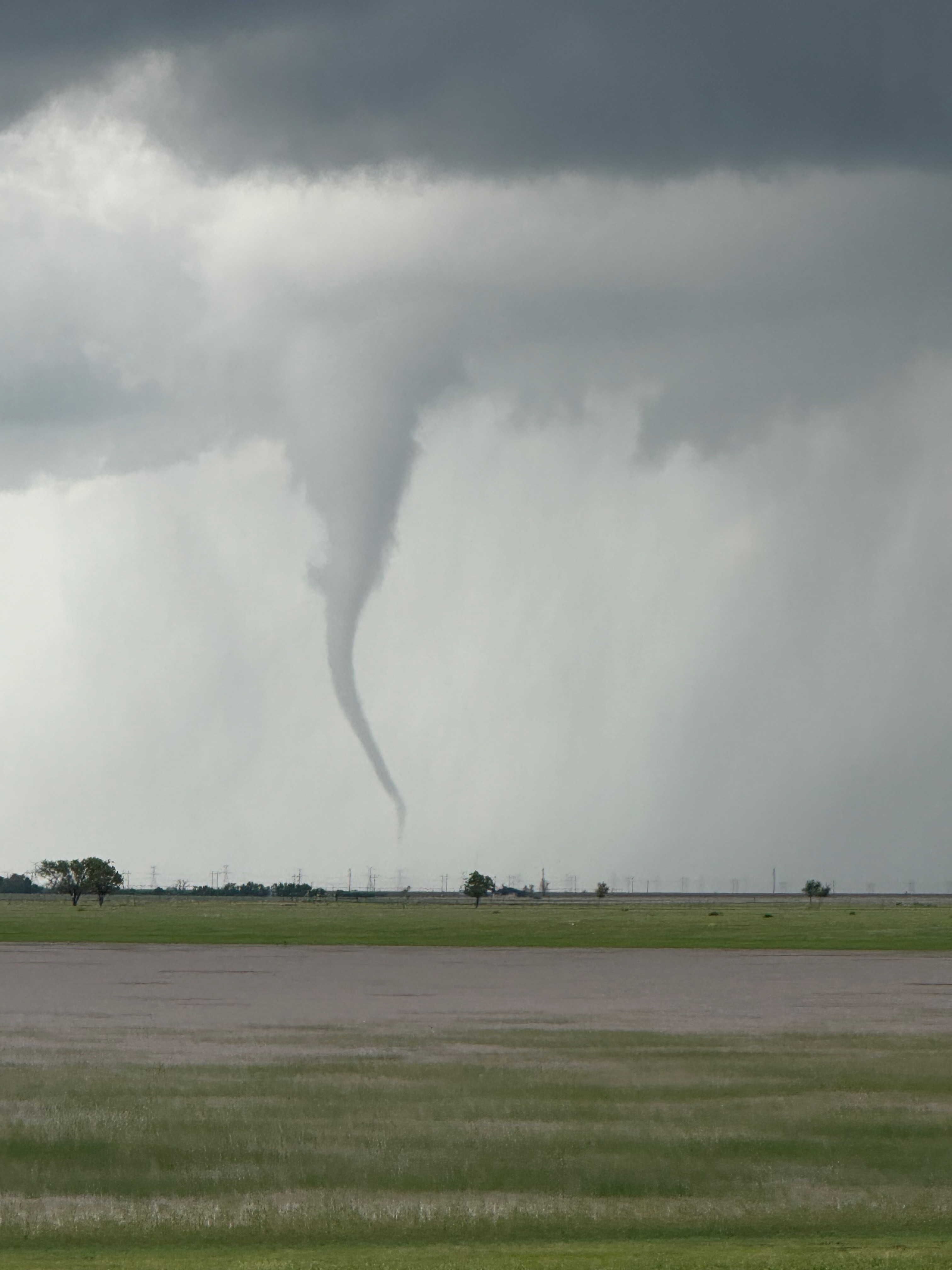
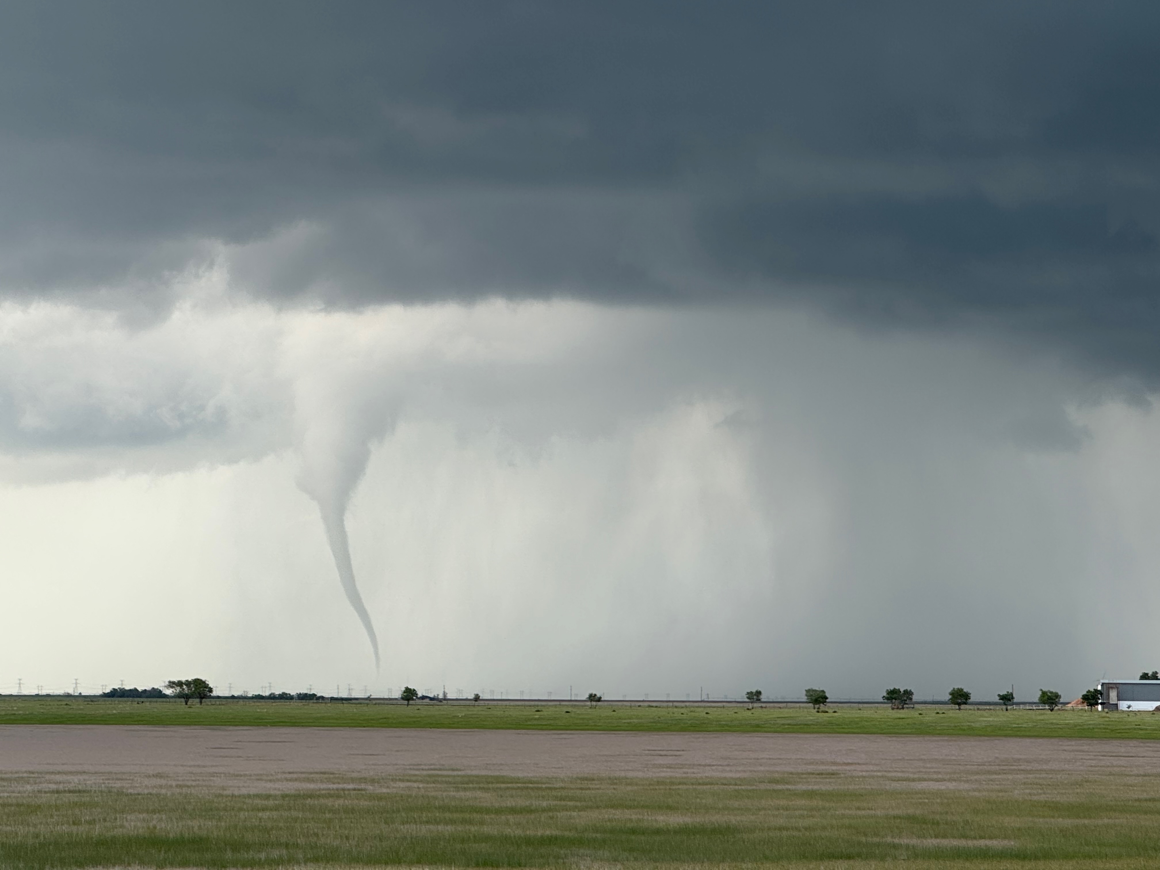
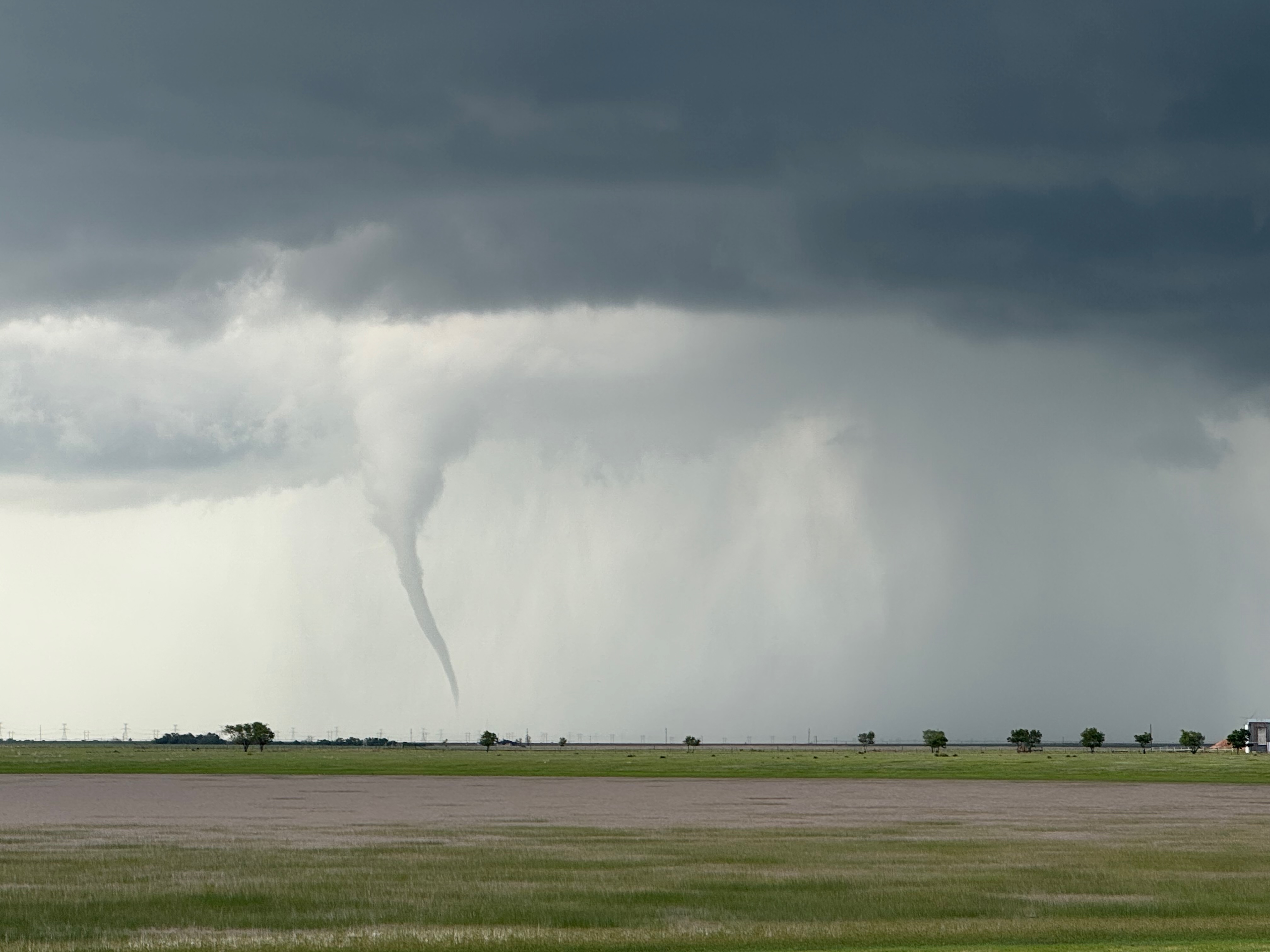
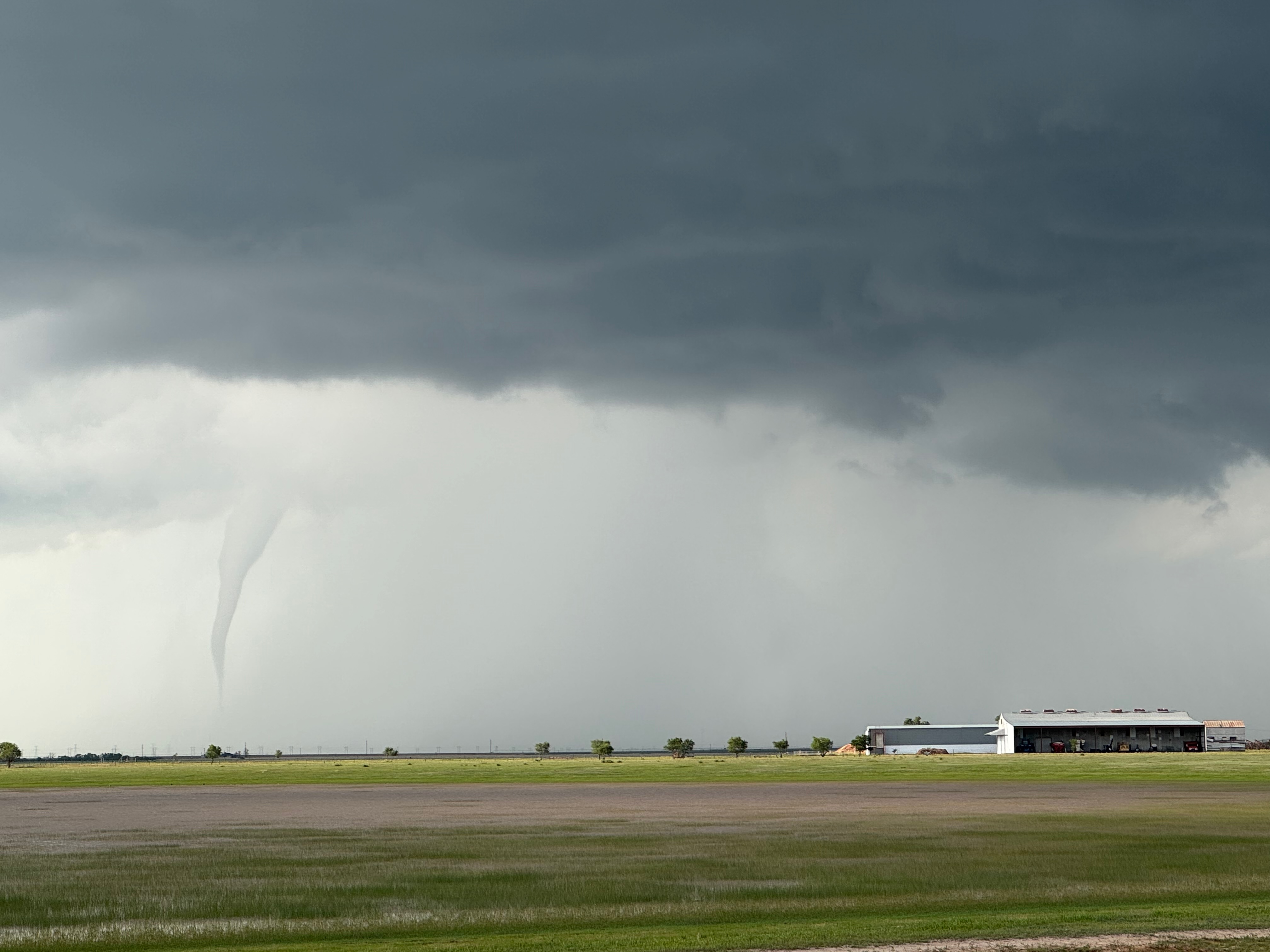
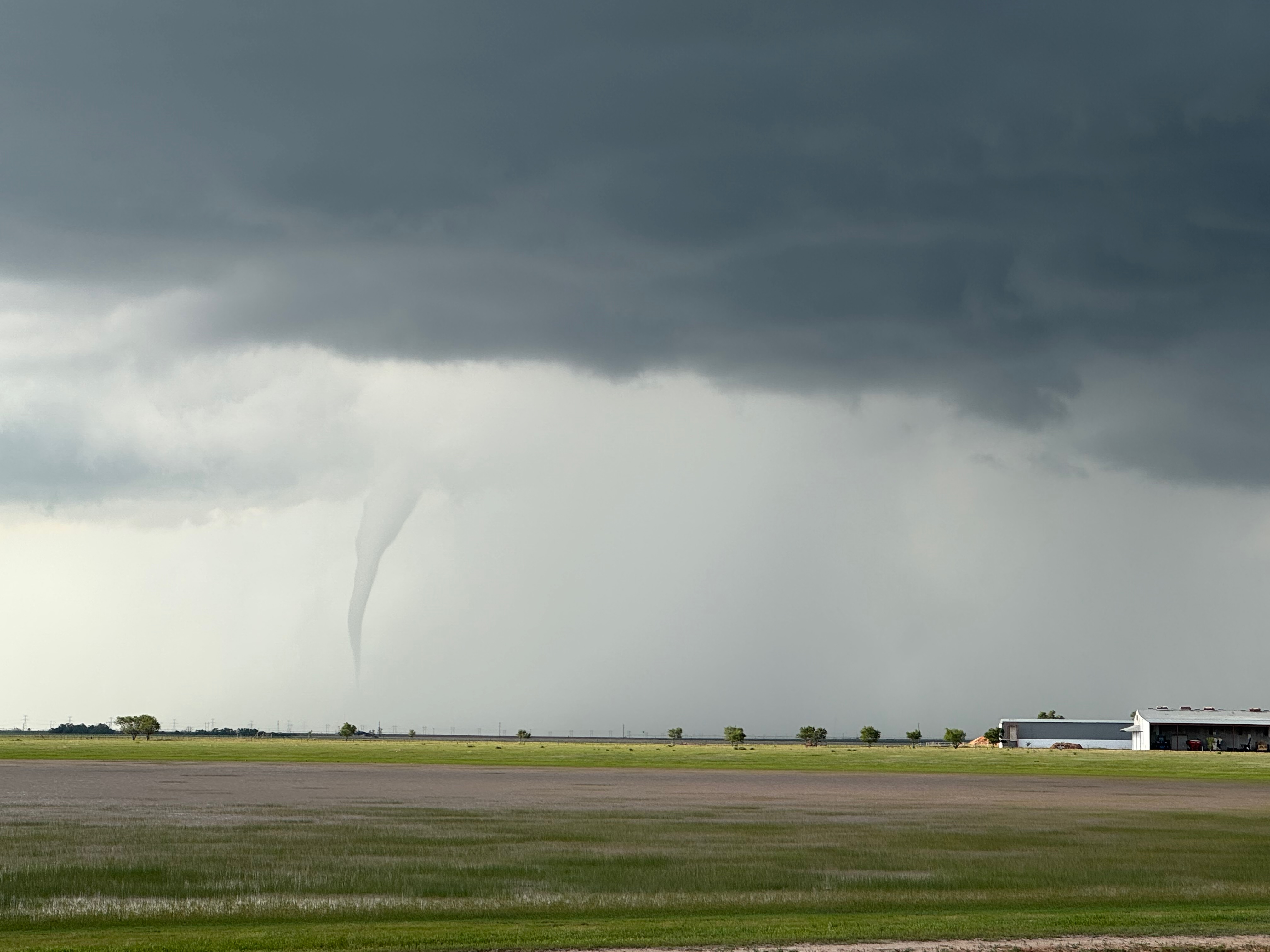
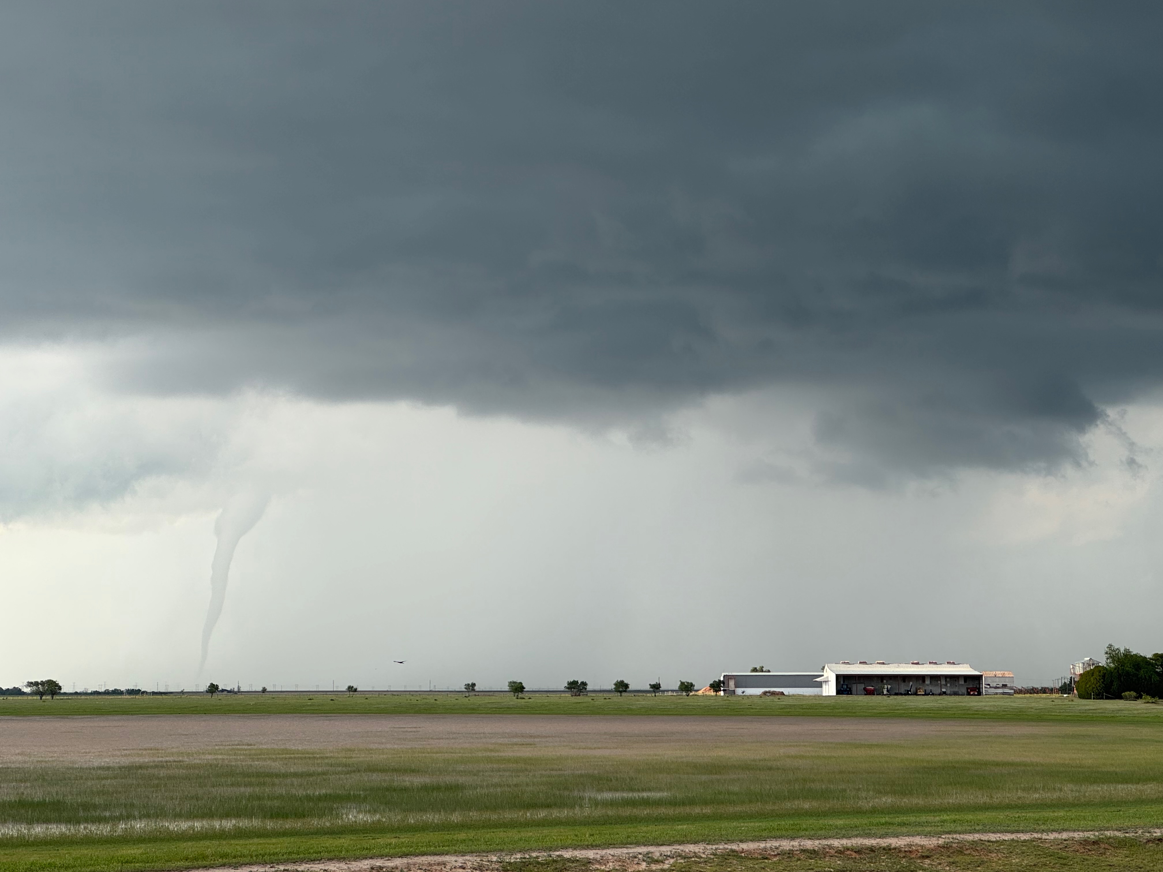
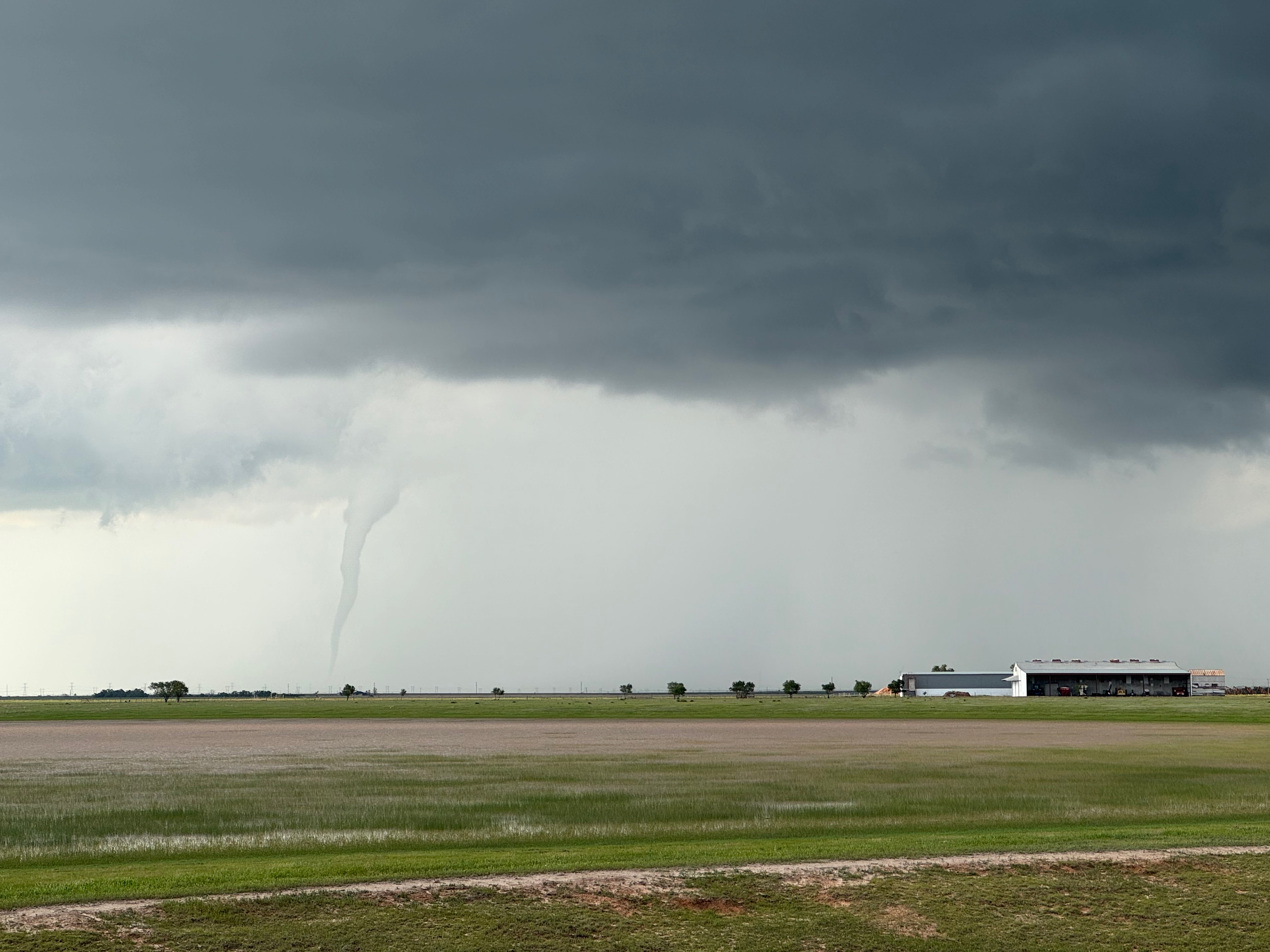
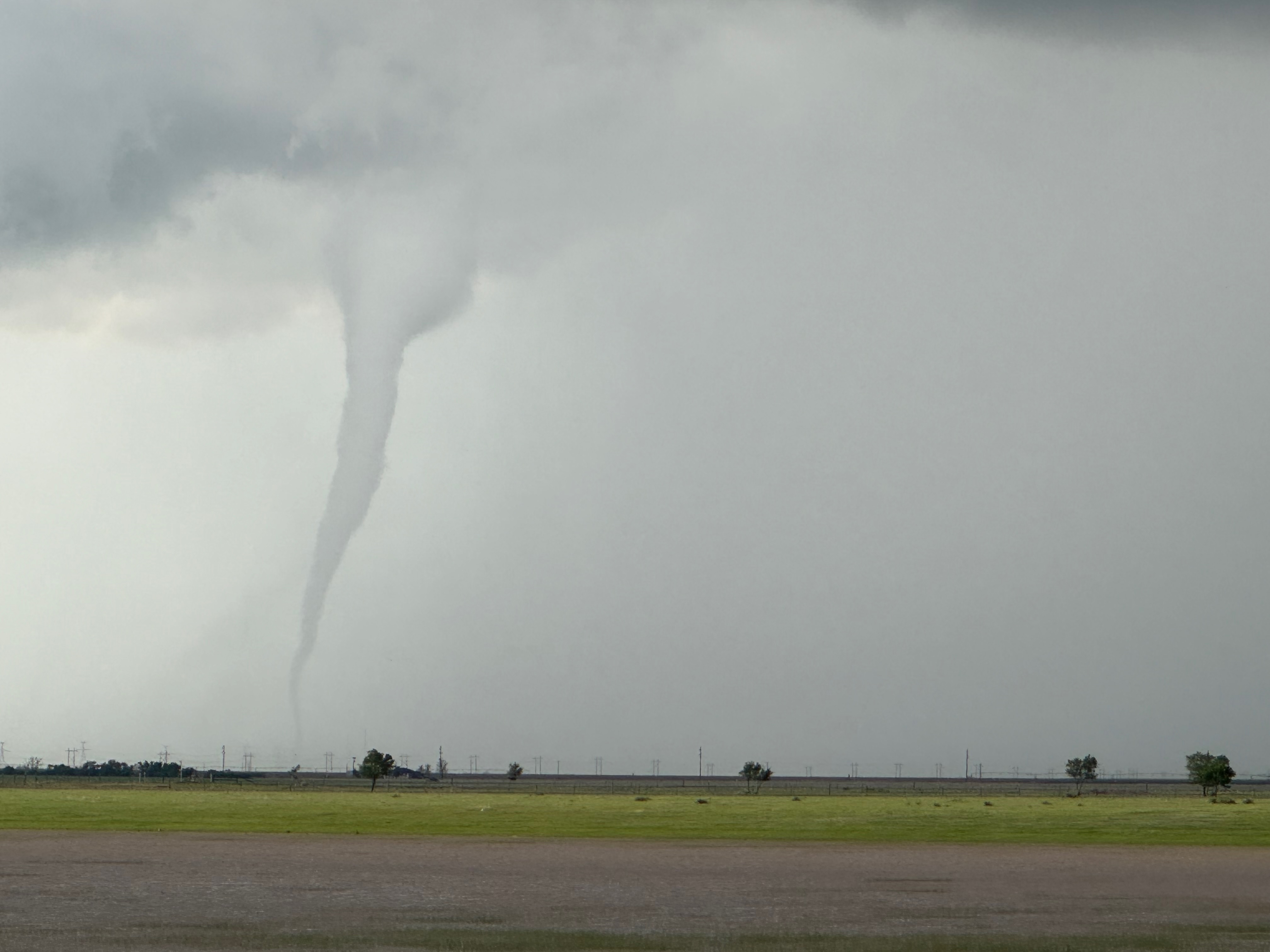
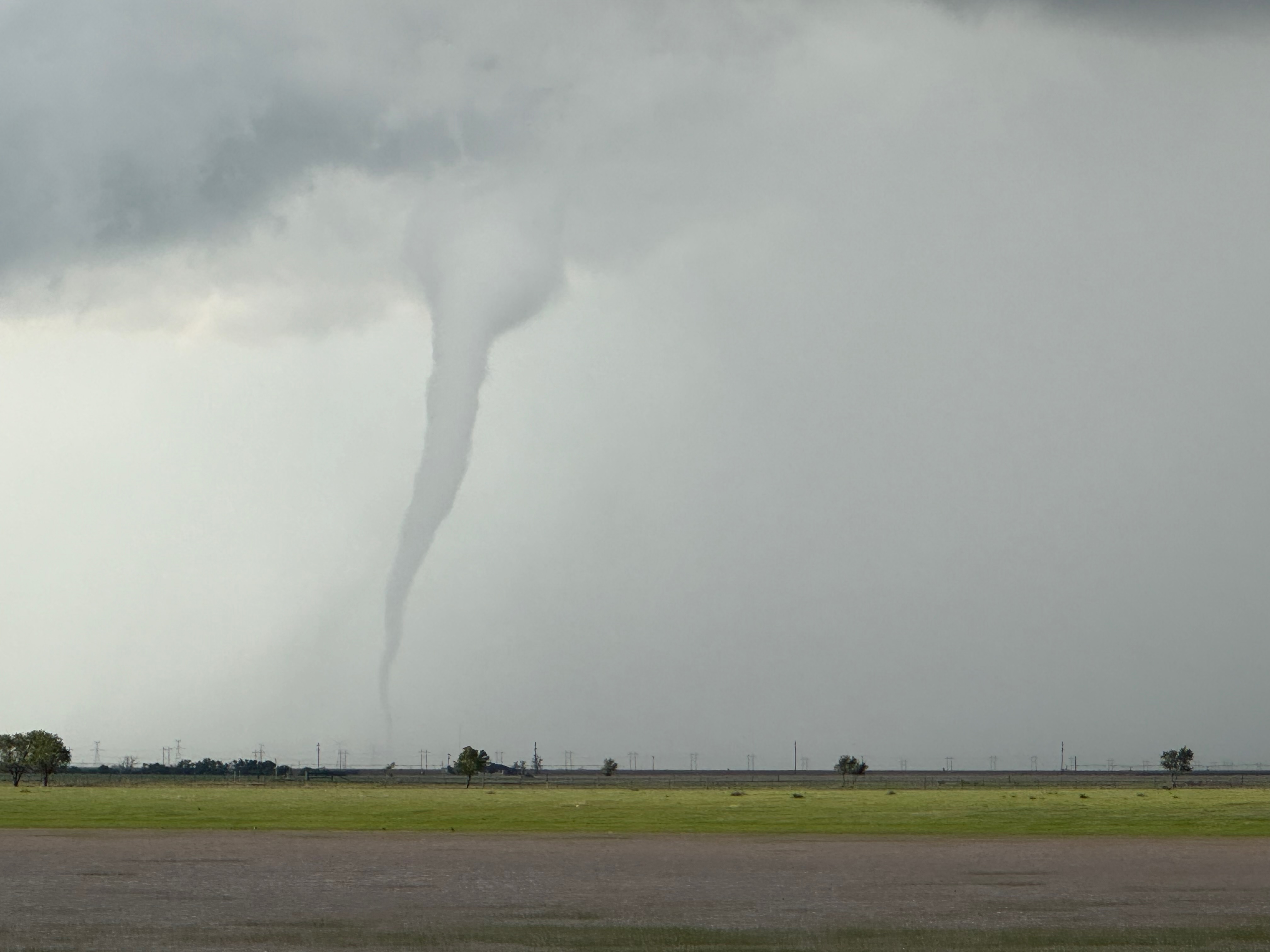
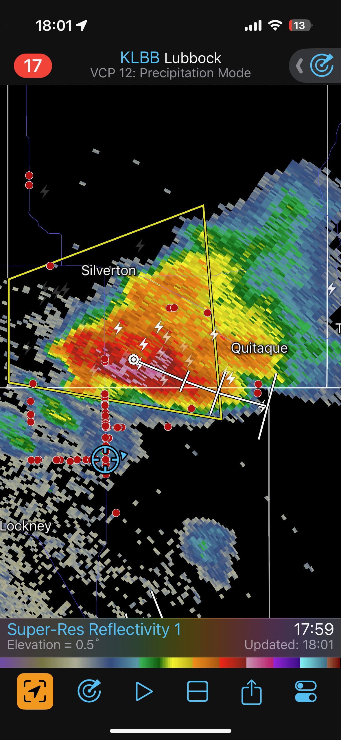
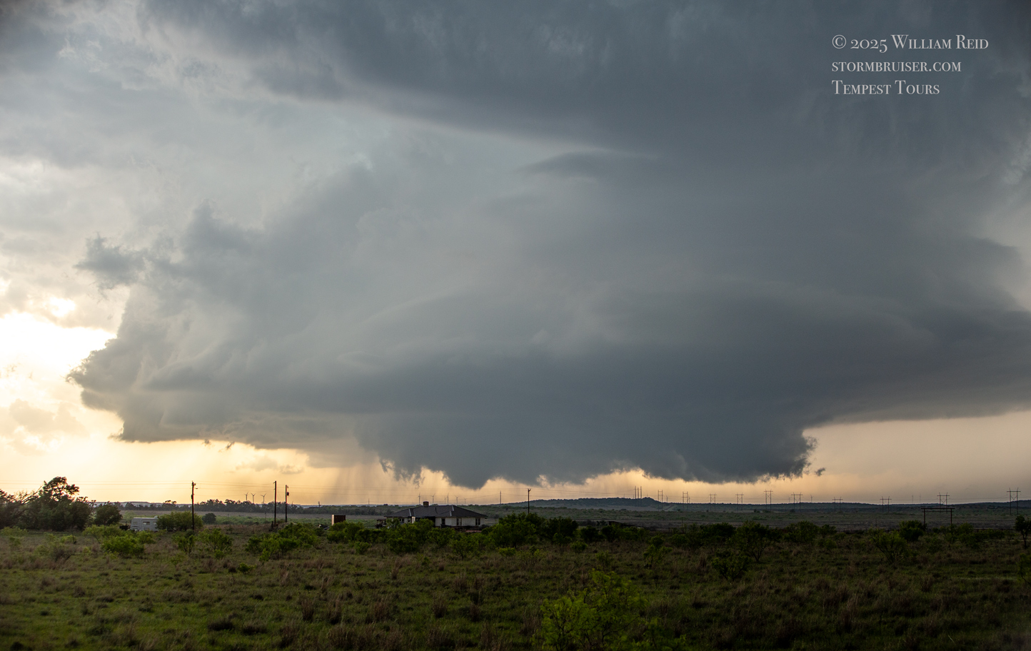
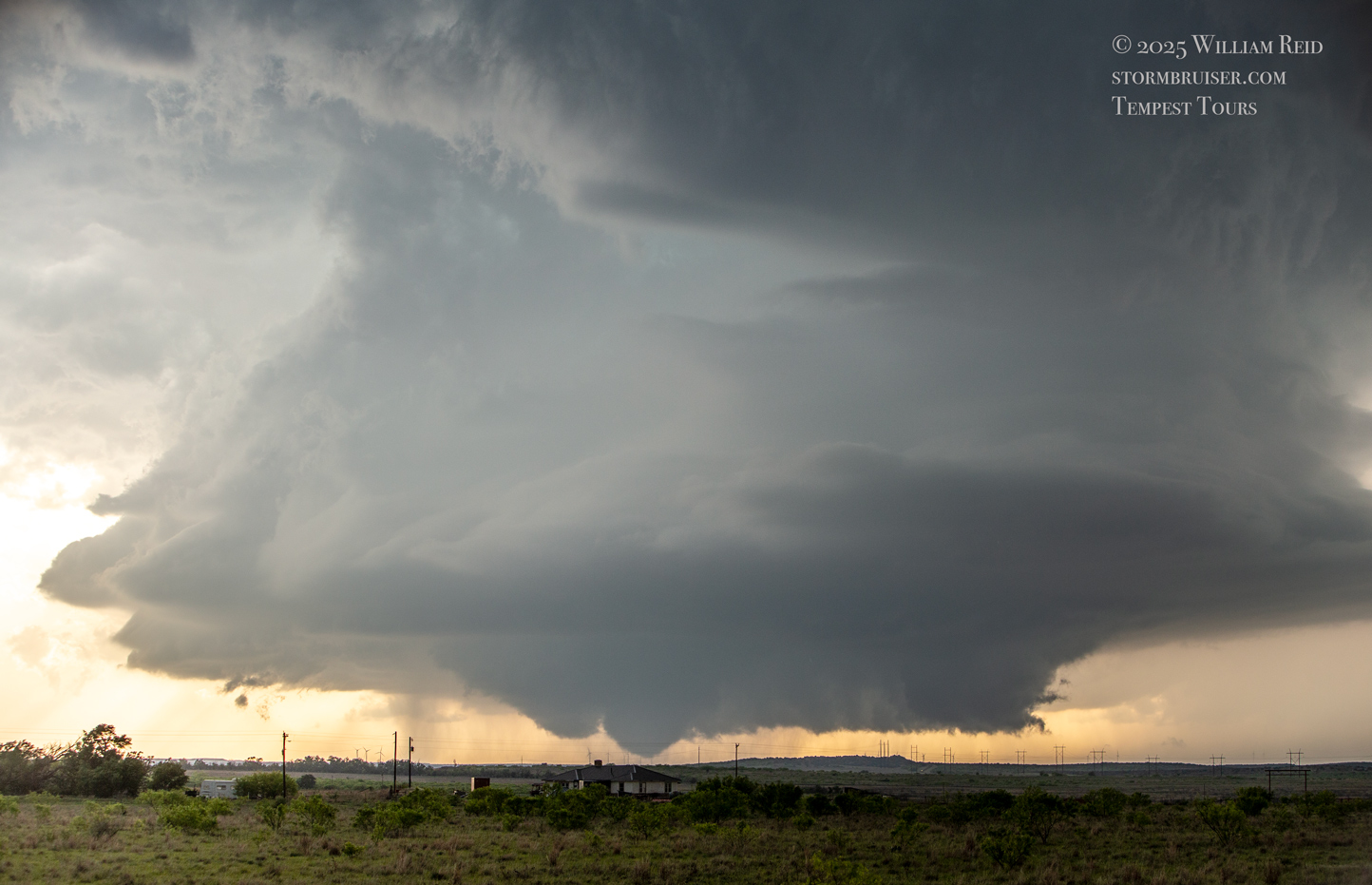
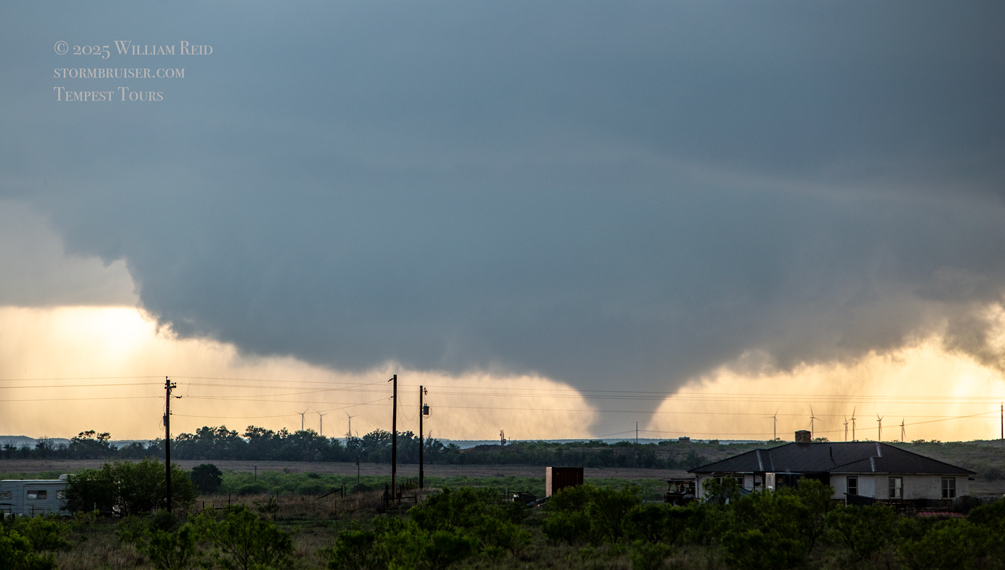
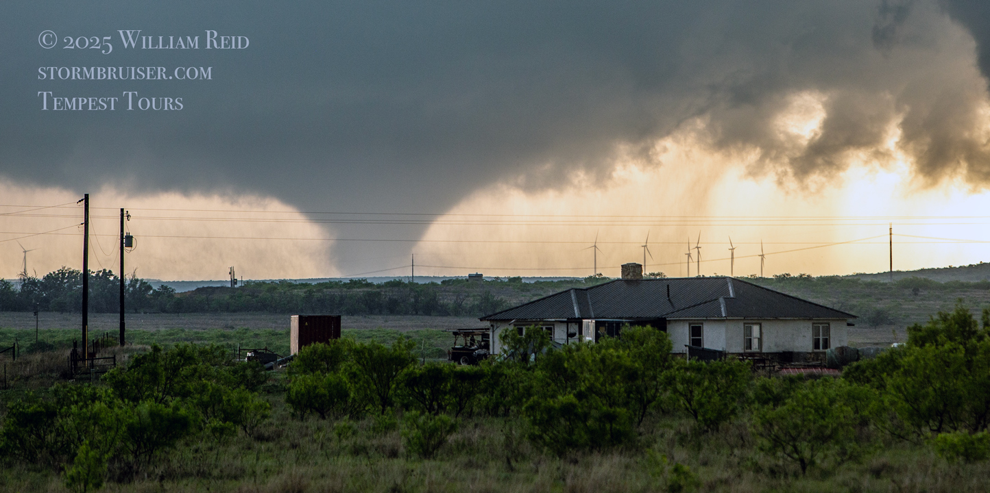
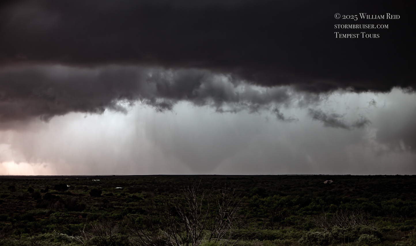
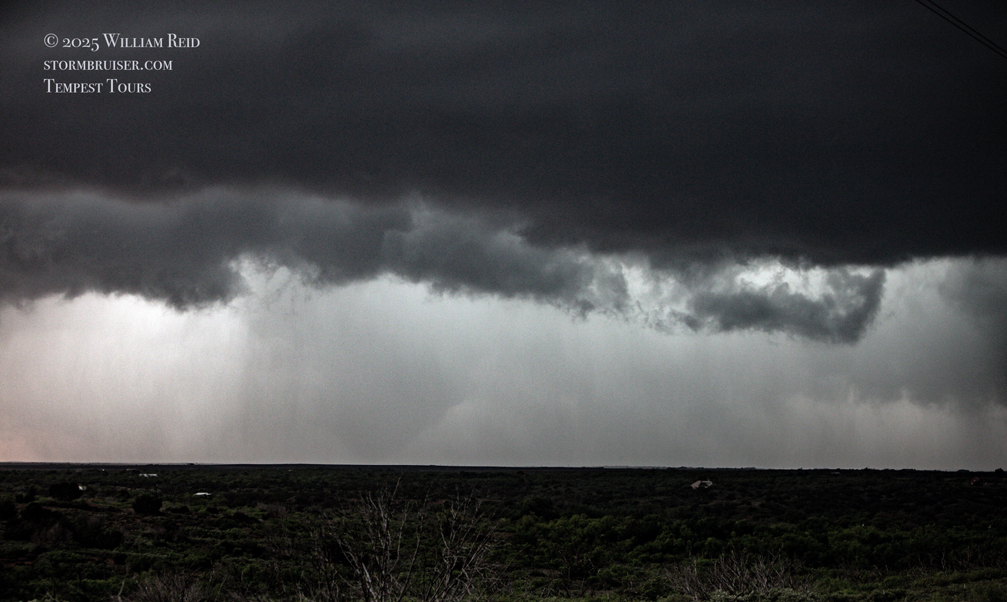
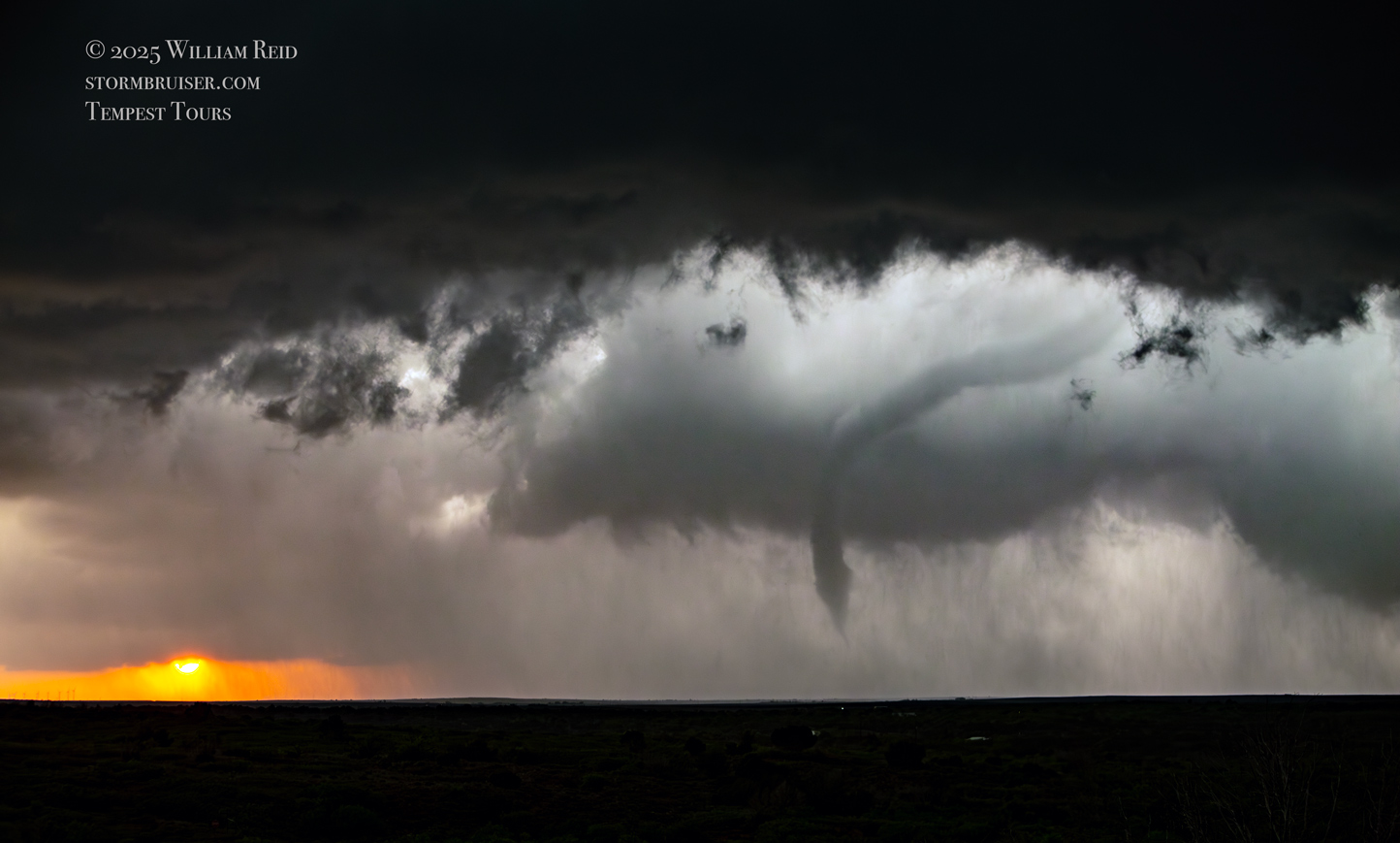
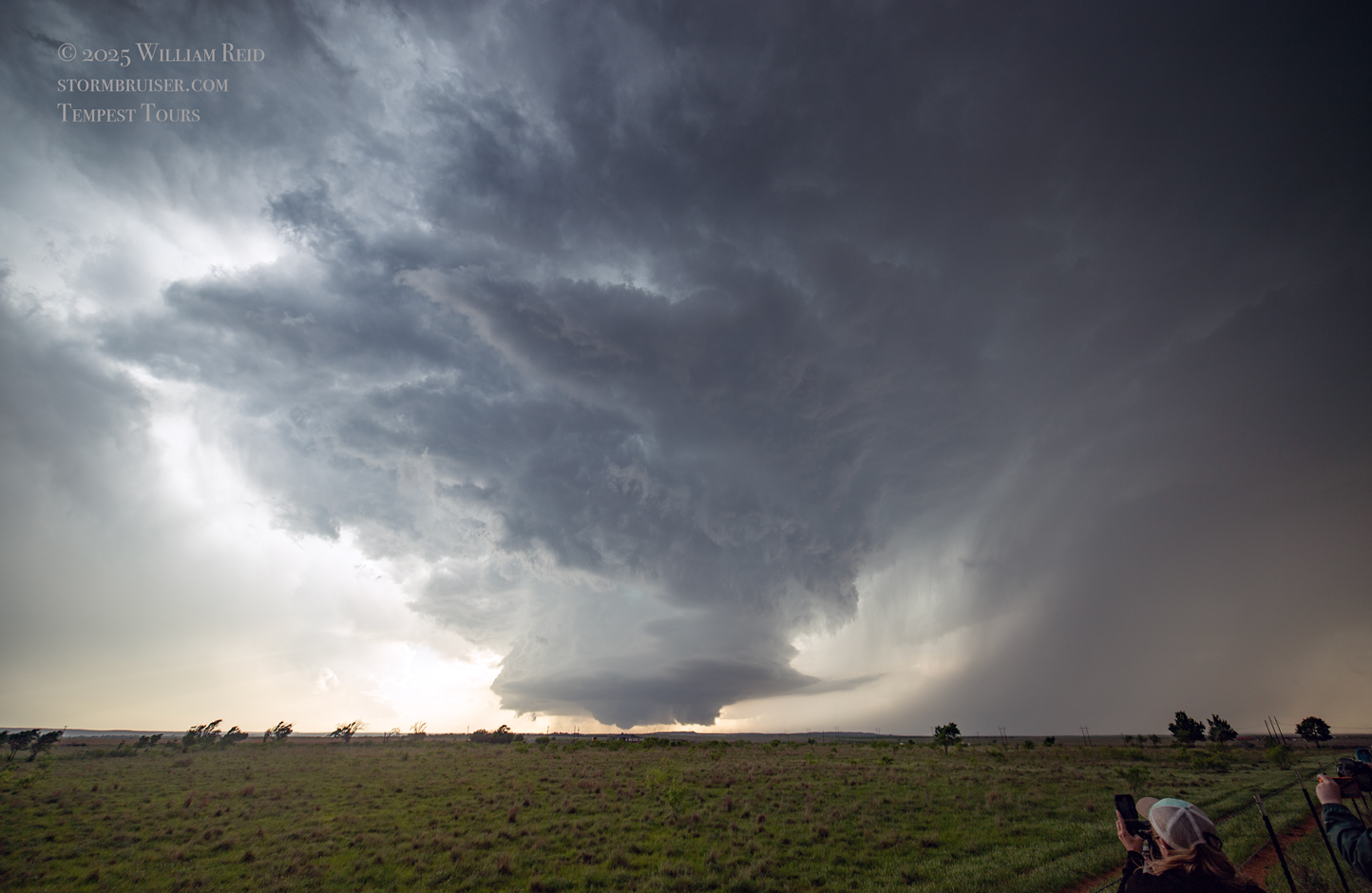
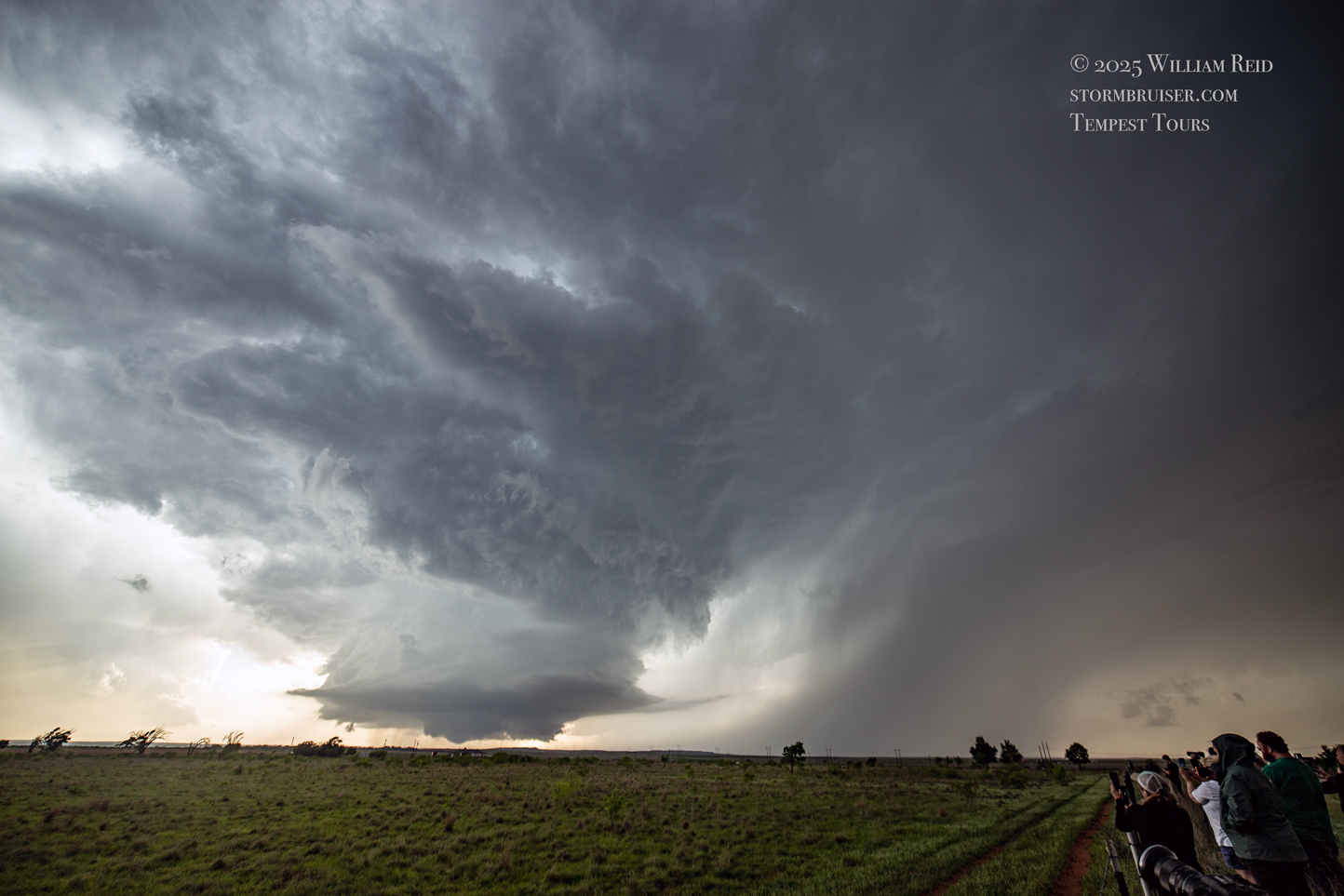
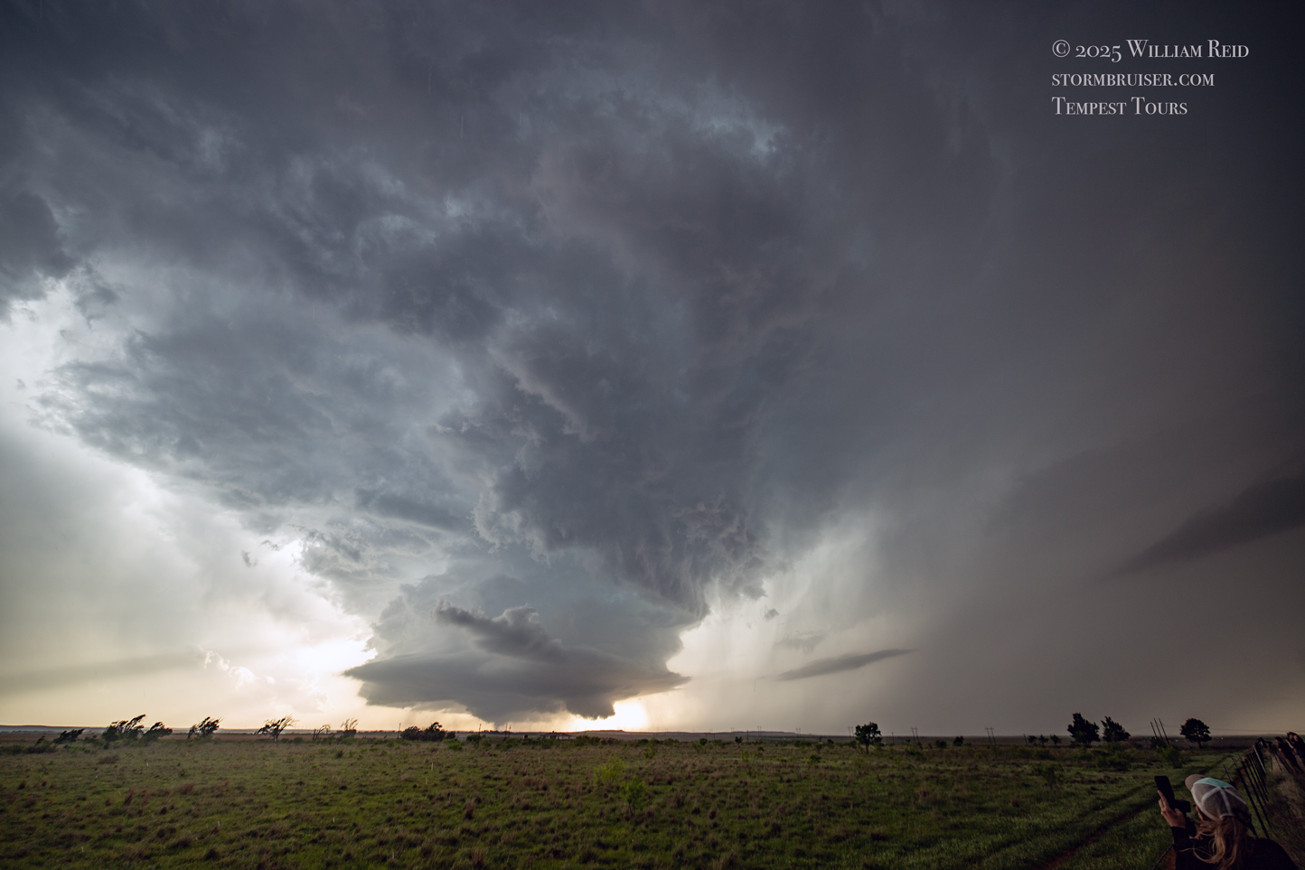
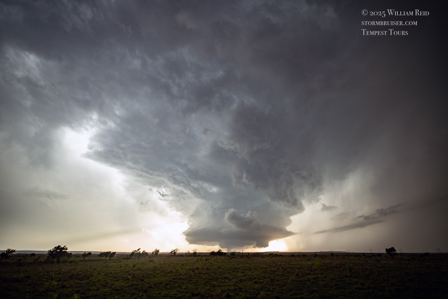
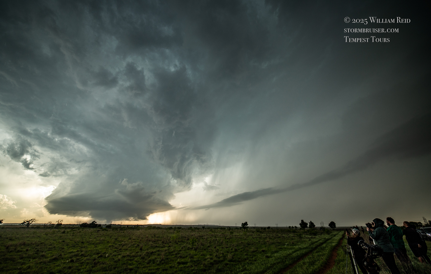
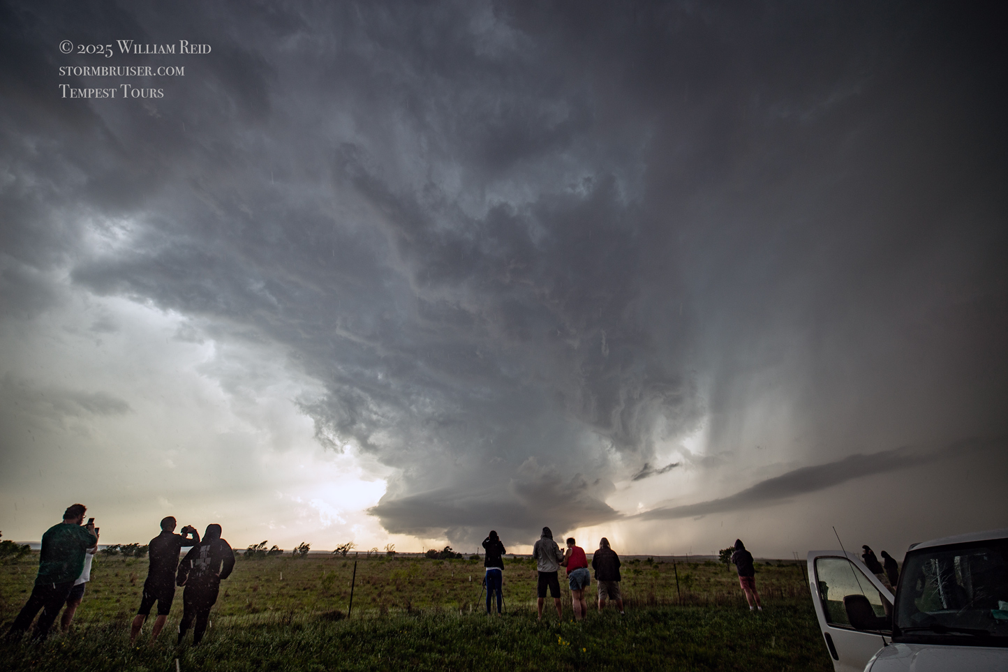
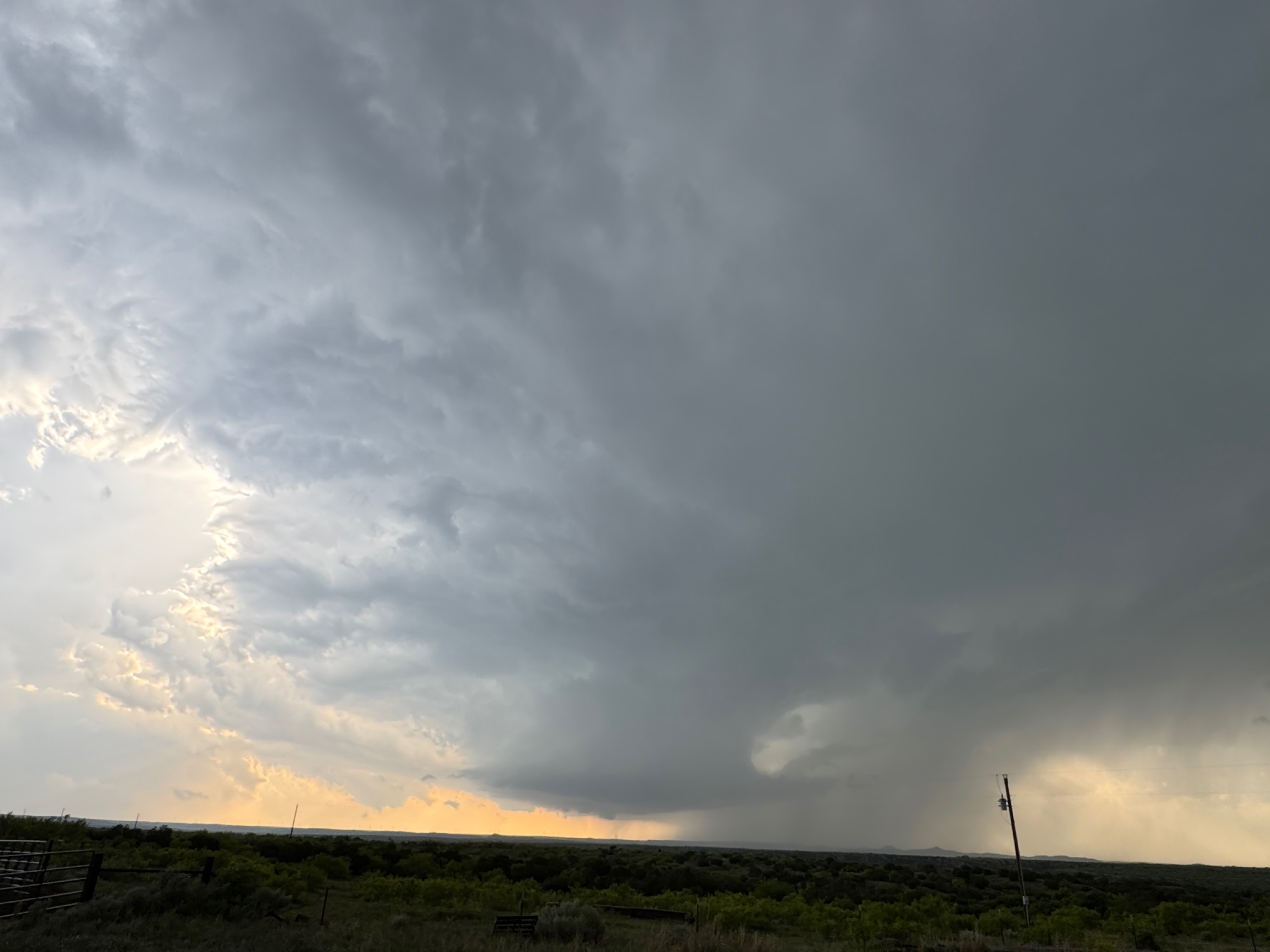
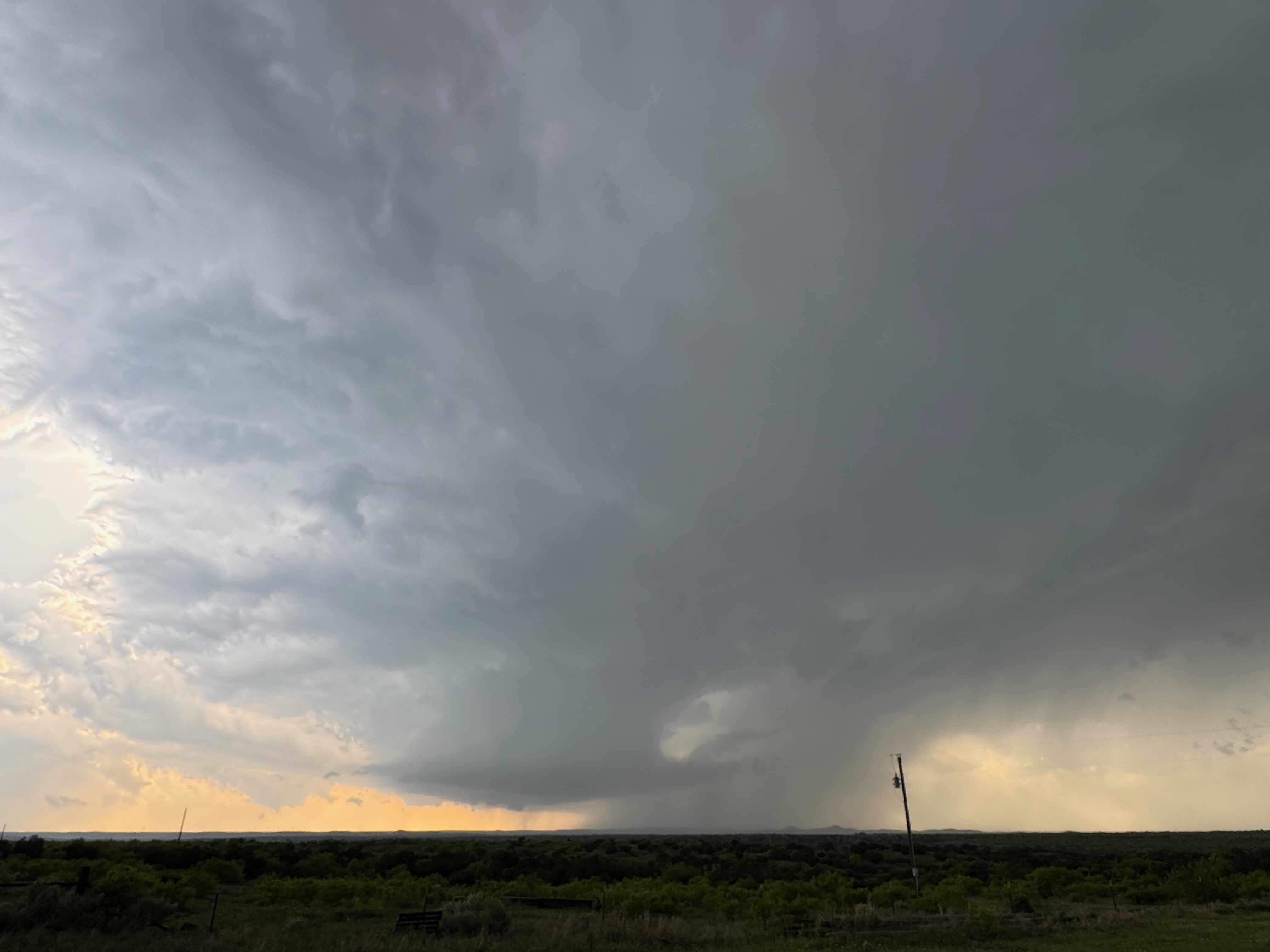
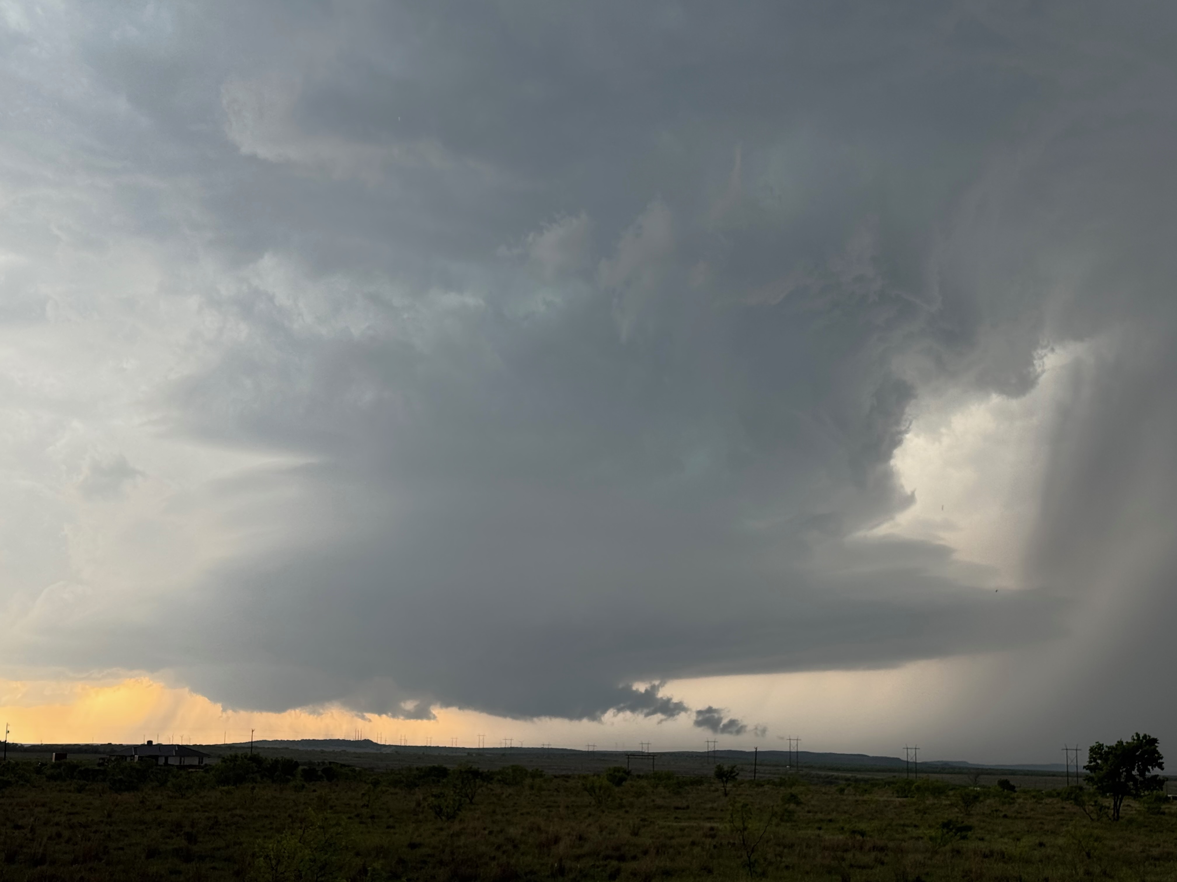
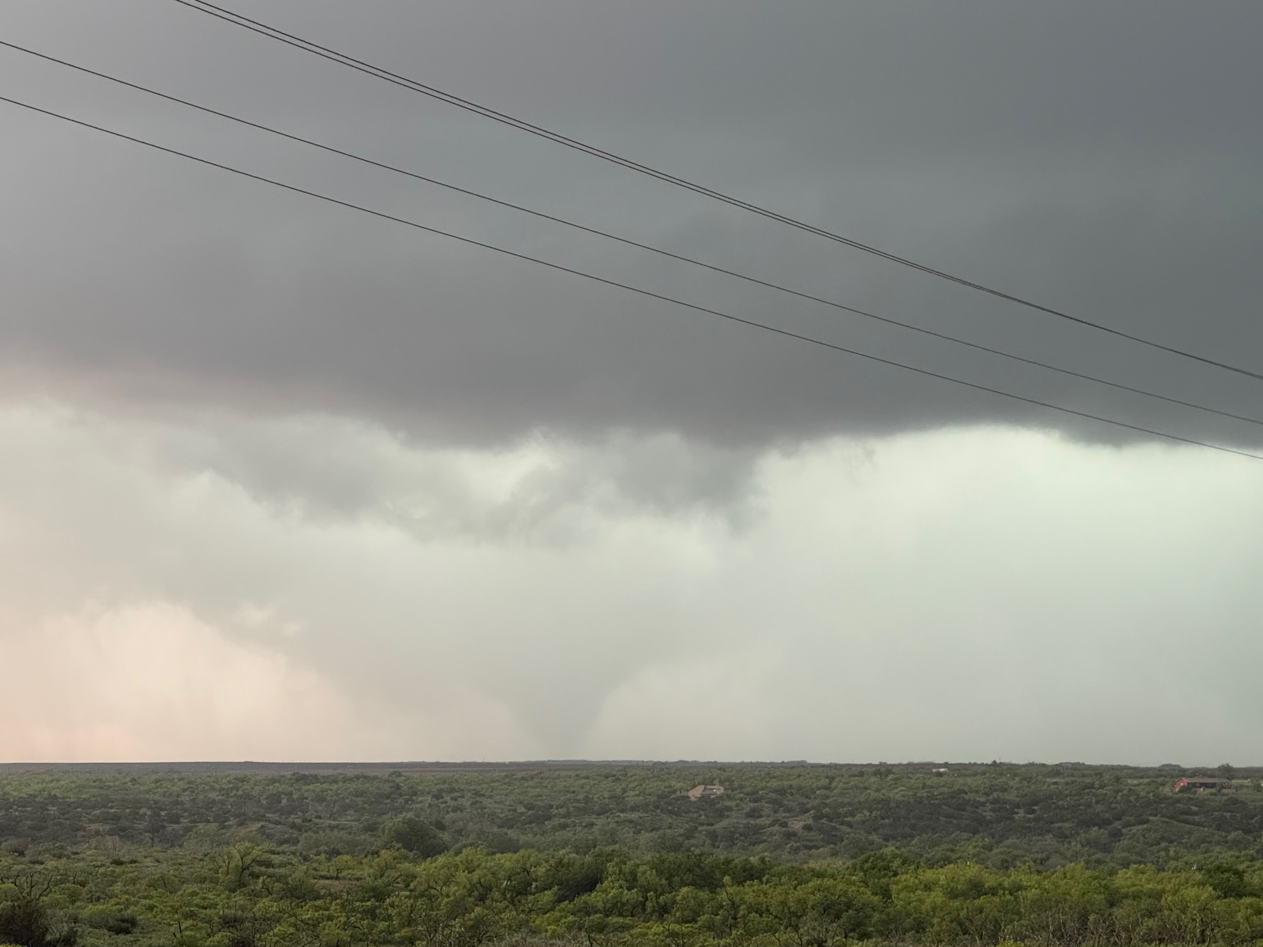
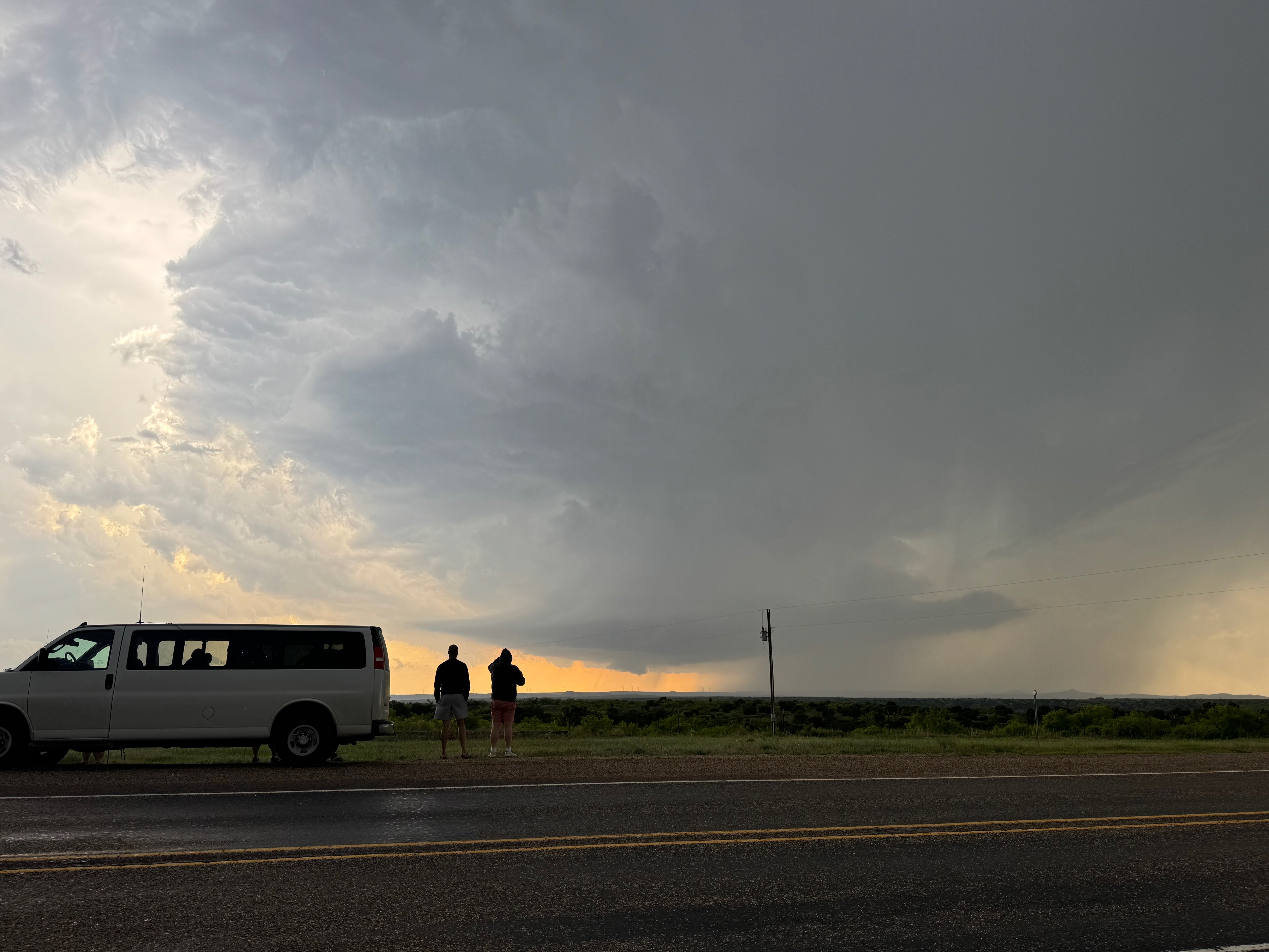
We watched a prominent wall cloud churn some beneath the base of the organized cell, just to our north. This was on 378, west of Whitney. The storm was moving to the east, or maybe starting to turn some to the ESE, and I wanted to get back in position a bit southeast of it. The previous week or two had been quite wet in these parts, so unpaved roads were not an option. We went all the way back south five or six miles to FM 2286, and then most of the way east to FM 207, near South Plains. From here the supercell’s storm base was perhaps five miles distant, and we had a good look. A slender funnel cloud formed to our NNW and we had a tornado soon after — see pics below. This tornado was anticyclonic and persisted for six minutes or so. It looked like it was on the north side of the clear slot, so it was surprising that it was rotating anticyclonically. I was able to set the camcorder up on a tripod and get decent, steady, zoomed-in video. An area of rain was near the tornado but it never totally obscured our view of it.
This tornado was west of 207 and closer to South Plains than it was to Silverton. The little place on map along 207 called “Whitney” was likely closest to the tornado.
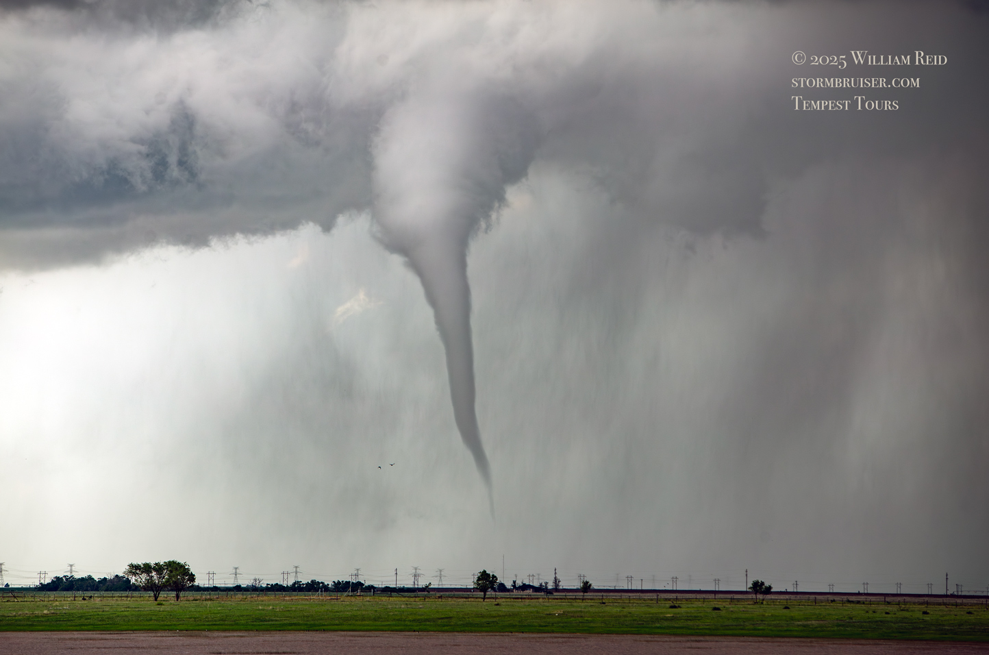
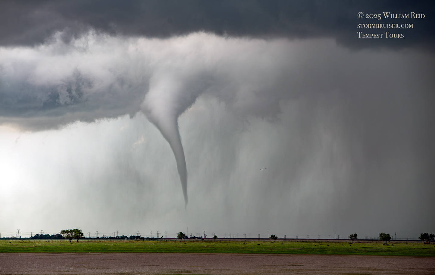
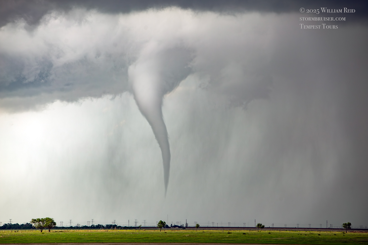

I should mention that an area of light-to-moderate rain that was associated with a very weak cell was moving northeastward towards the supercell prior to the tornado. This may have been an important ingredient in prompting the tornado formation. Similar scenarios occurred for Matador I and II and for the Hawley event, to name a few examples.
When the tornado roped out, I had the group back in the vans fairly quickly. The supercell was now definitely moving more to the ESE or SE, and would soon be just east of the flat Caprock (and above a more-pathetic paved-road network). If we were to stay ahead of the storm, and stay fairly close, then I would need to go five miles south of South Plains to the east option, FM 97. The problem with this route, though, was that it headed northeastward significantly from Cedar Hill to Flomot, which is due east of South Plains. So not only would I be backtracking northward, I would be flirting with the storm’s hail core. The other option to get us over to Route 70, at Matador, would be to head another 10 miles or so south to Floydada, and then east to Matador on U.S. 62.
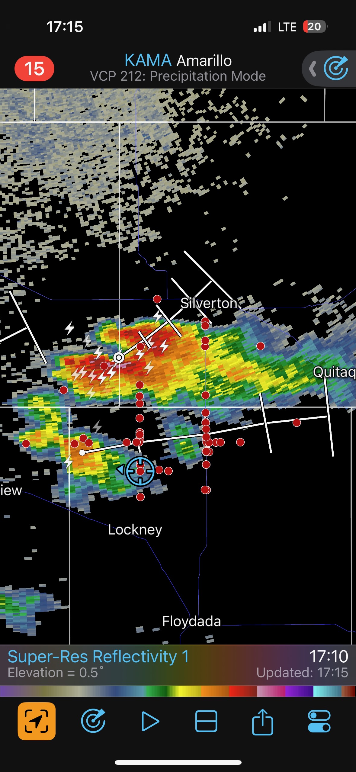
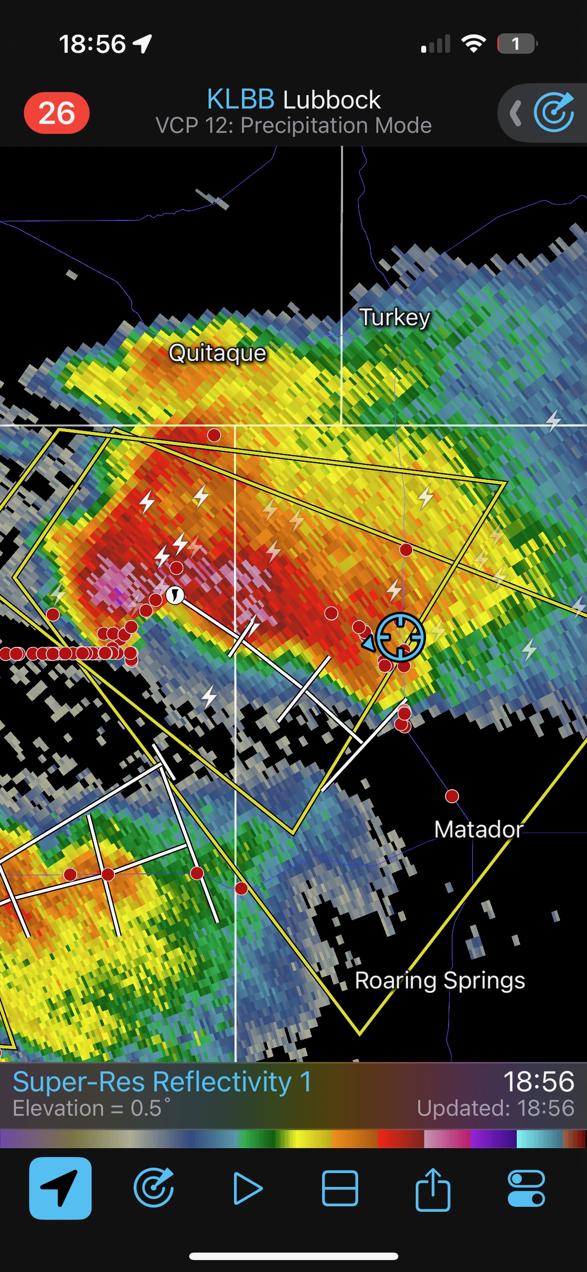
It looked like the hail core would not be a problem as long as we didn’t dilly-dally eastward (and northeastward) on 97 to Flomot. So that is what we did, and we were even able to stop briefly on a high spot halfway to Flomot to admire the storm structure to our west. We had some small hail on 97 and made it to Flomot and then to State Route 70 (see radar depiction at 18:56 below). A long line of chasers clogged FM 97 back near 207 (see the red dots), and these folks had to decide between dealing with the damaging hail core or taking the safer and longer way via Floydada. The storm was now diving southeastward.
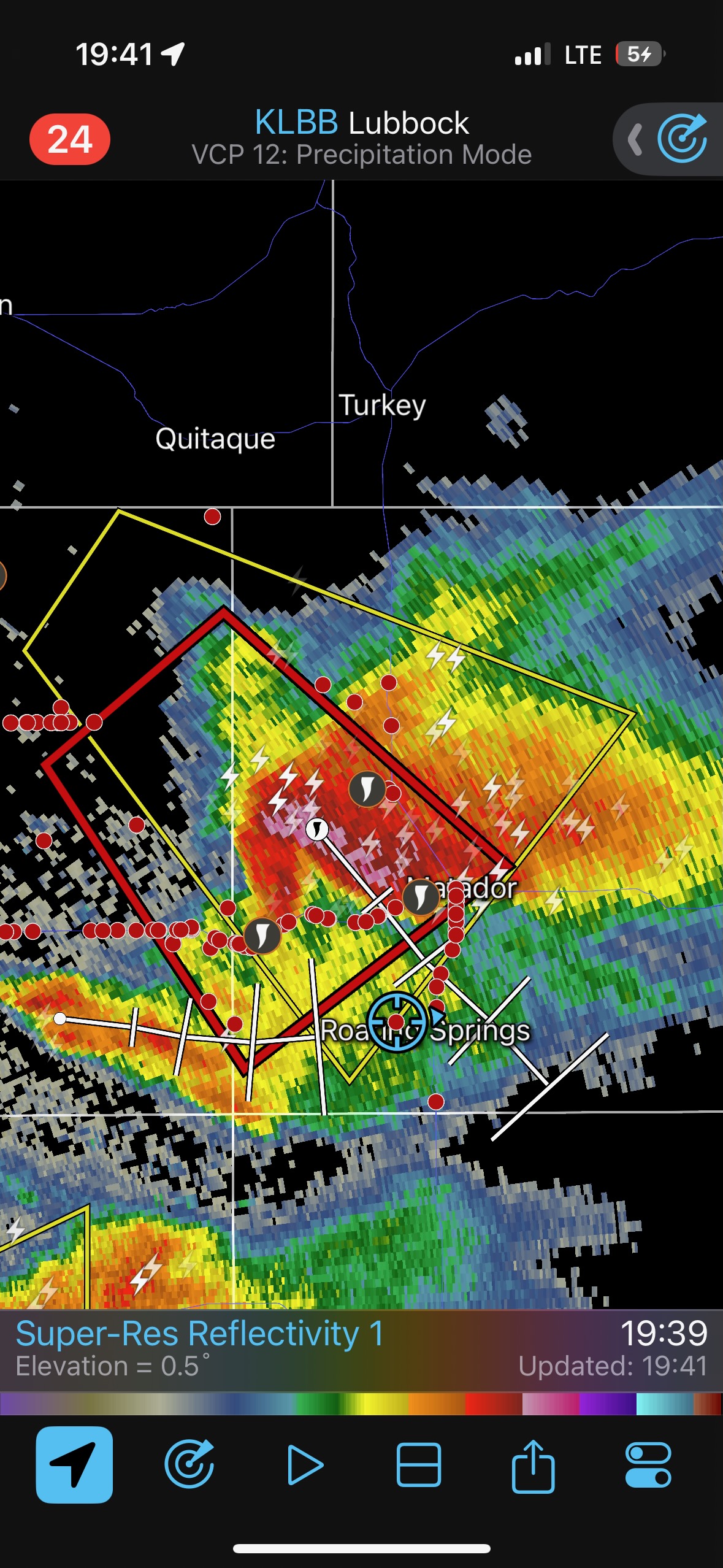
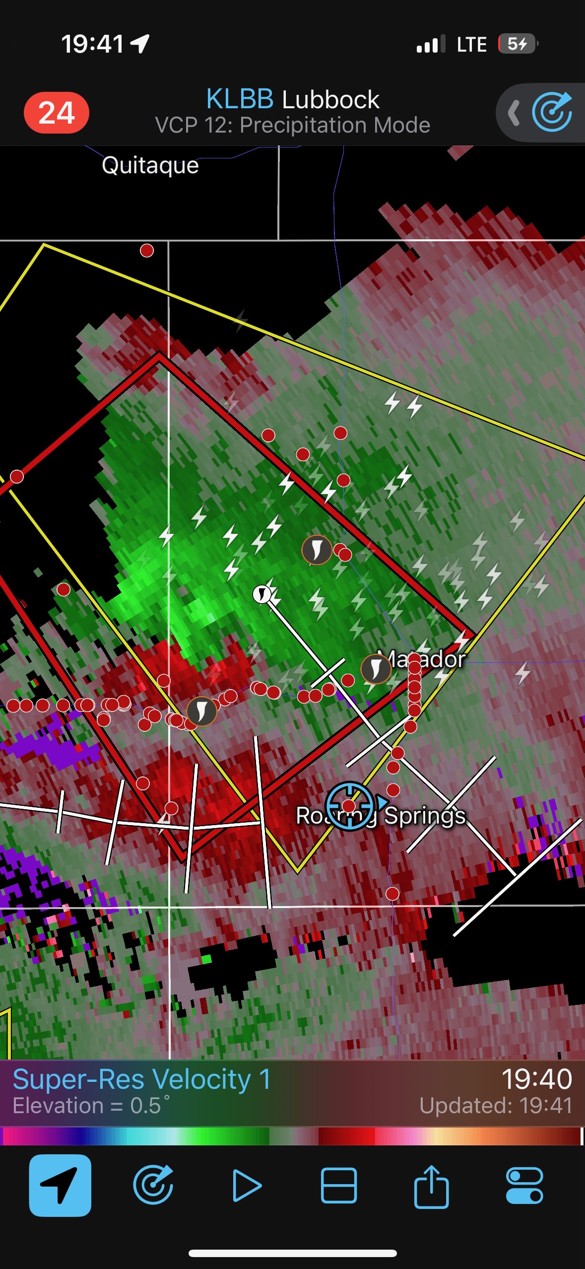
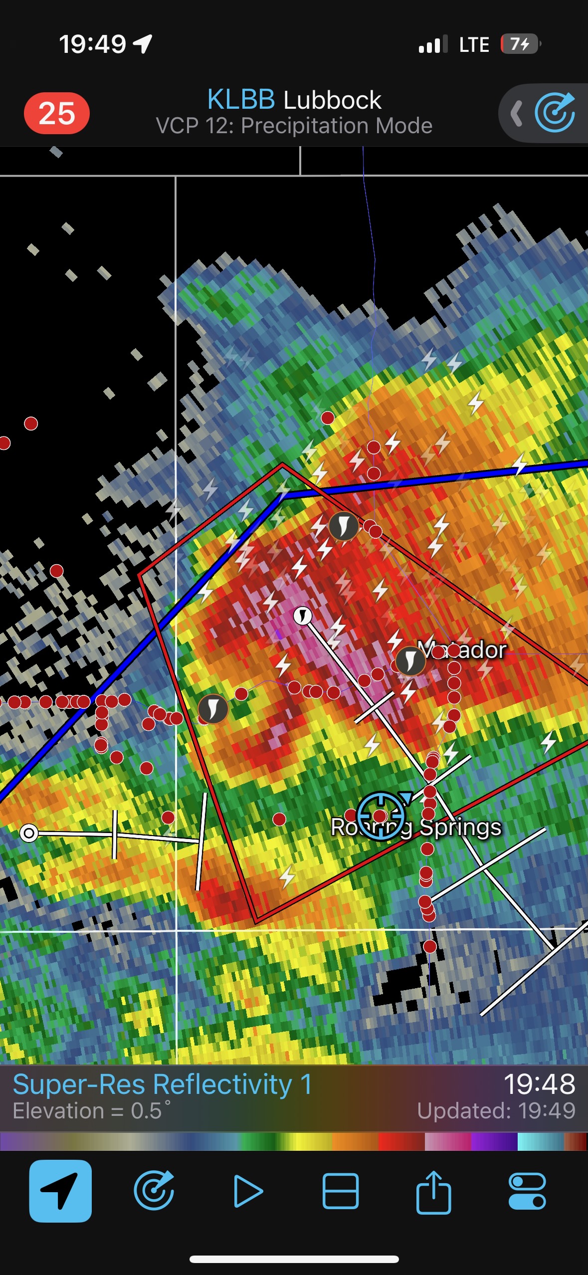
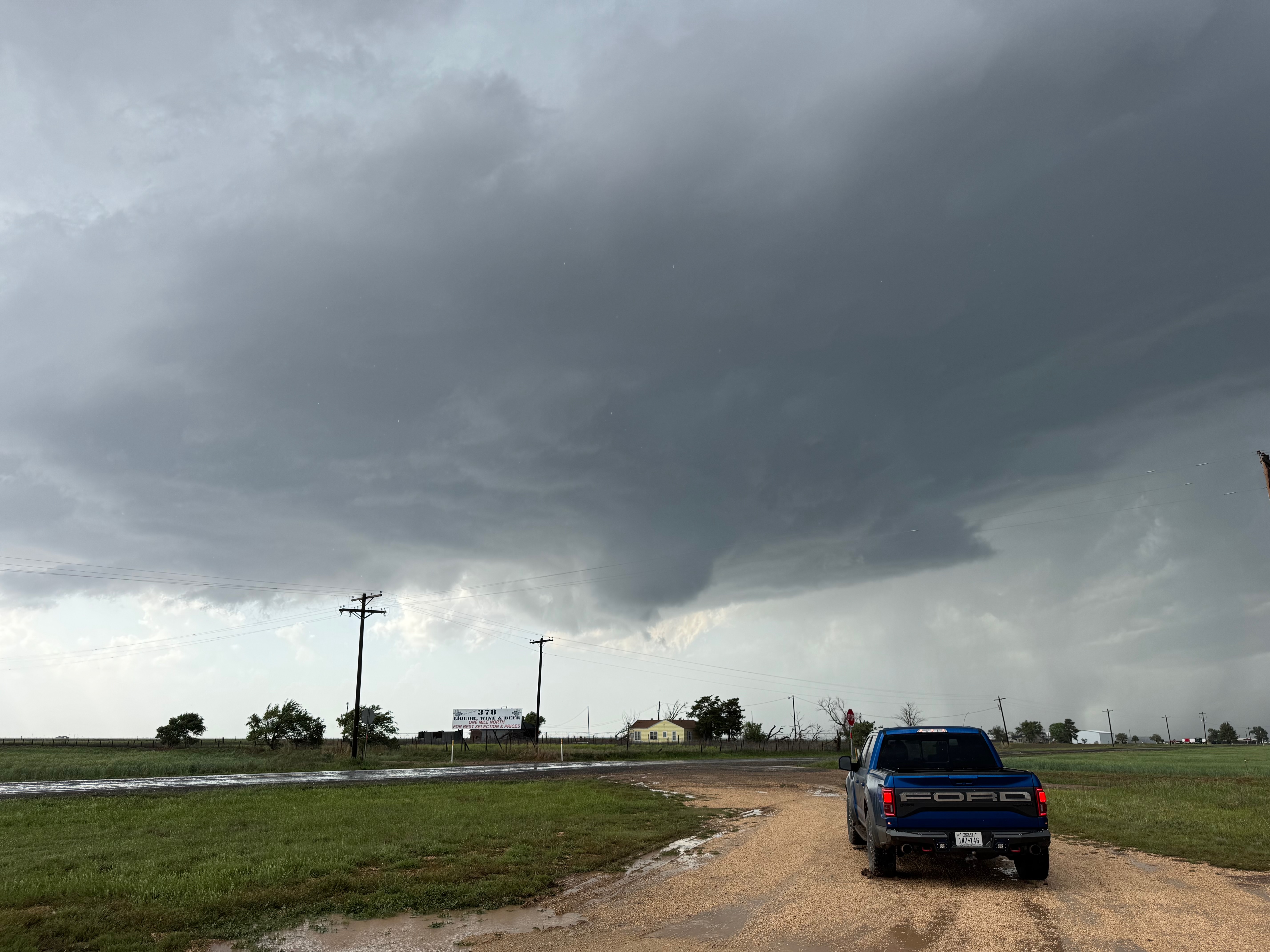
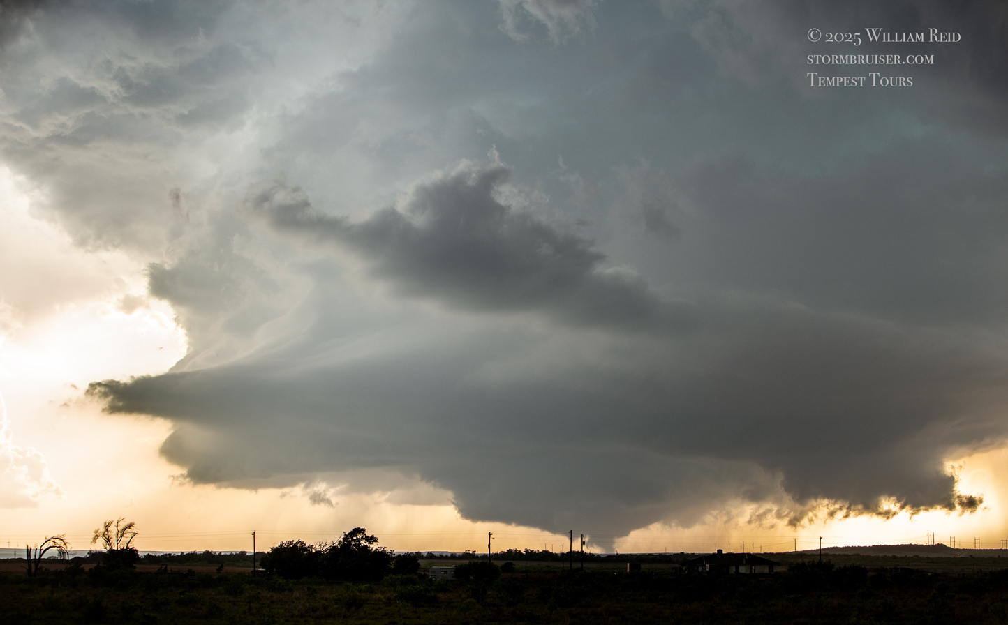
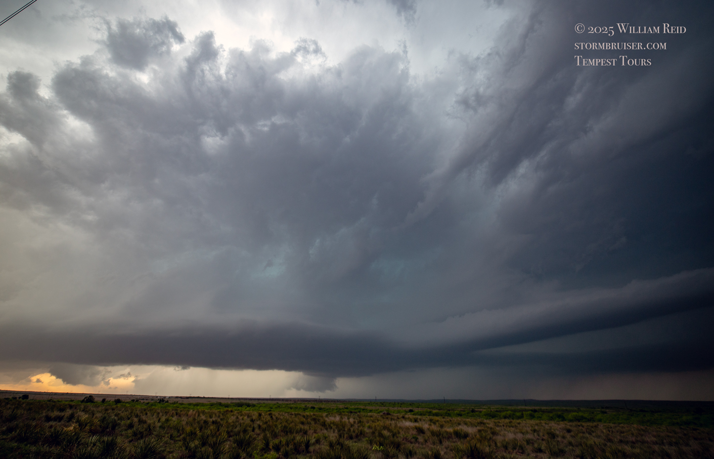
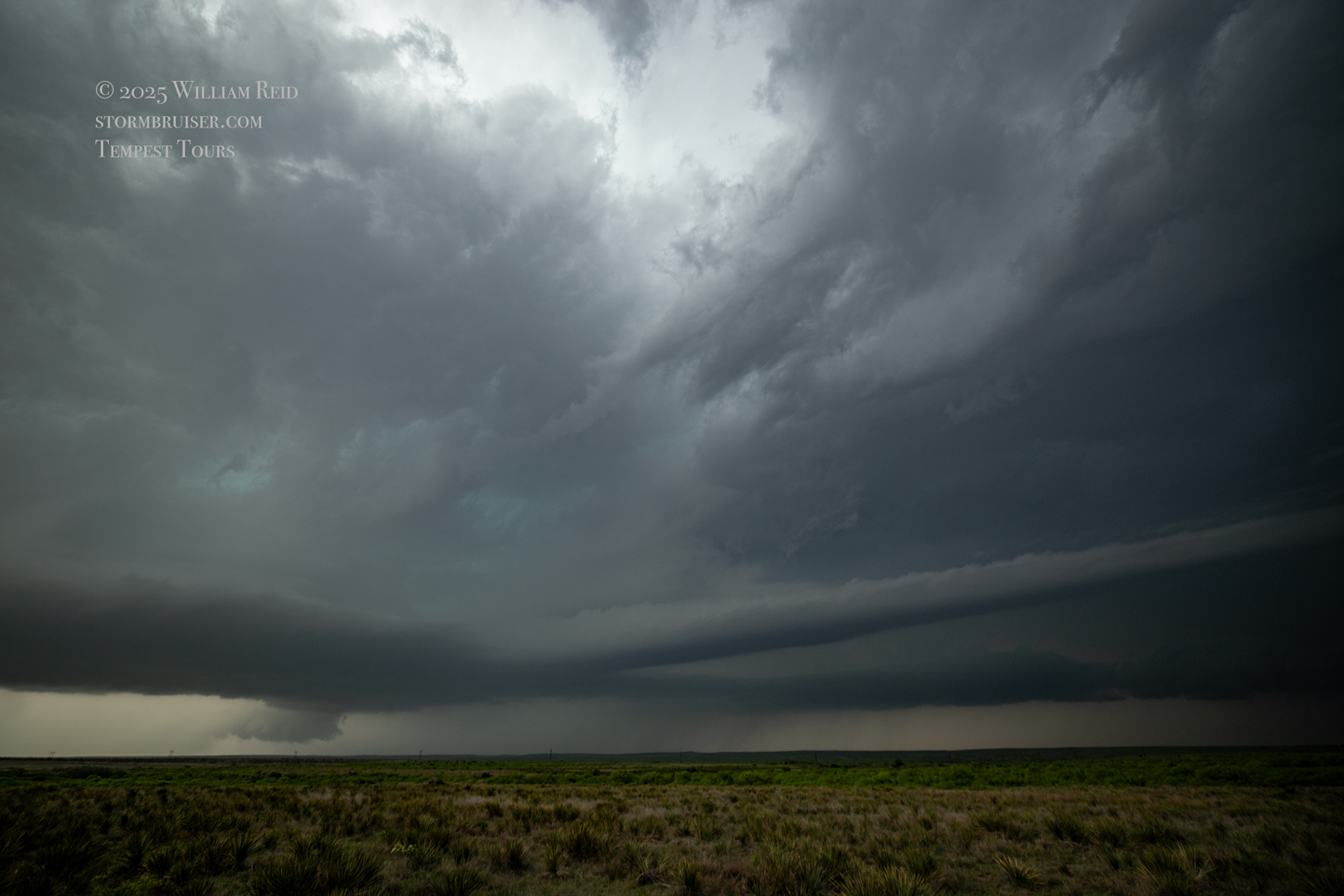
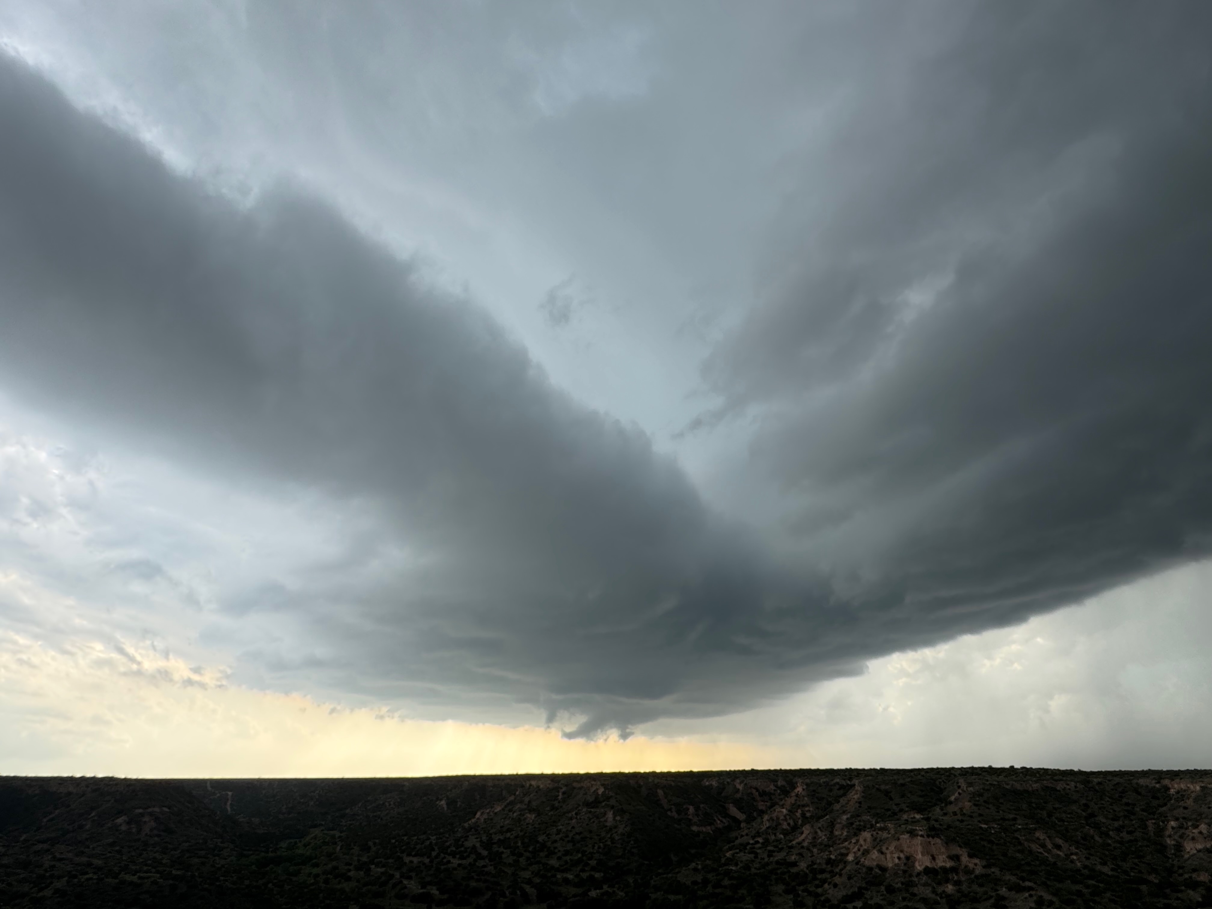
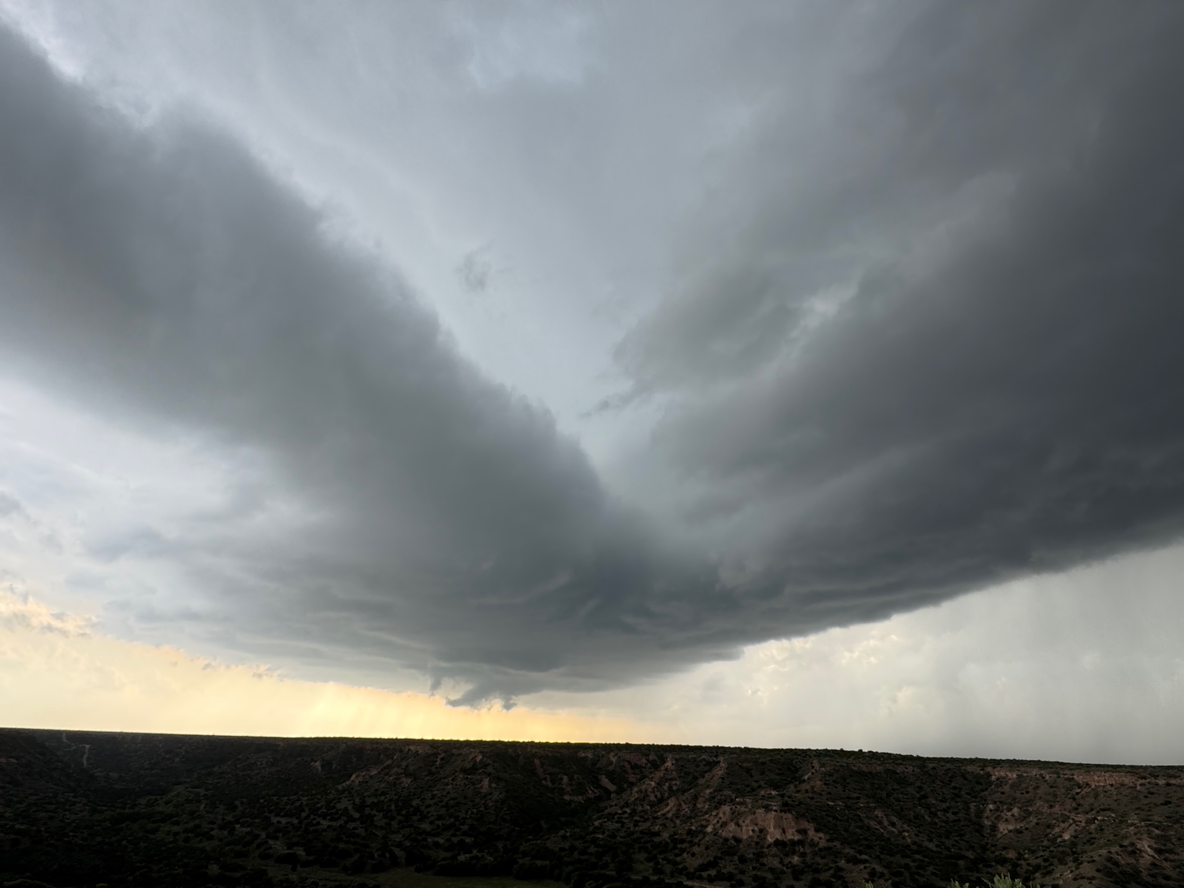
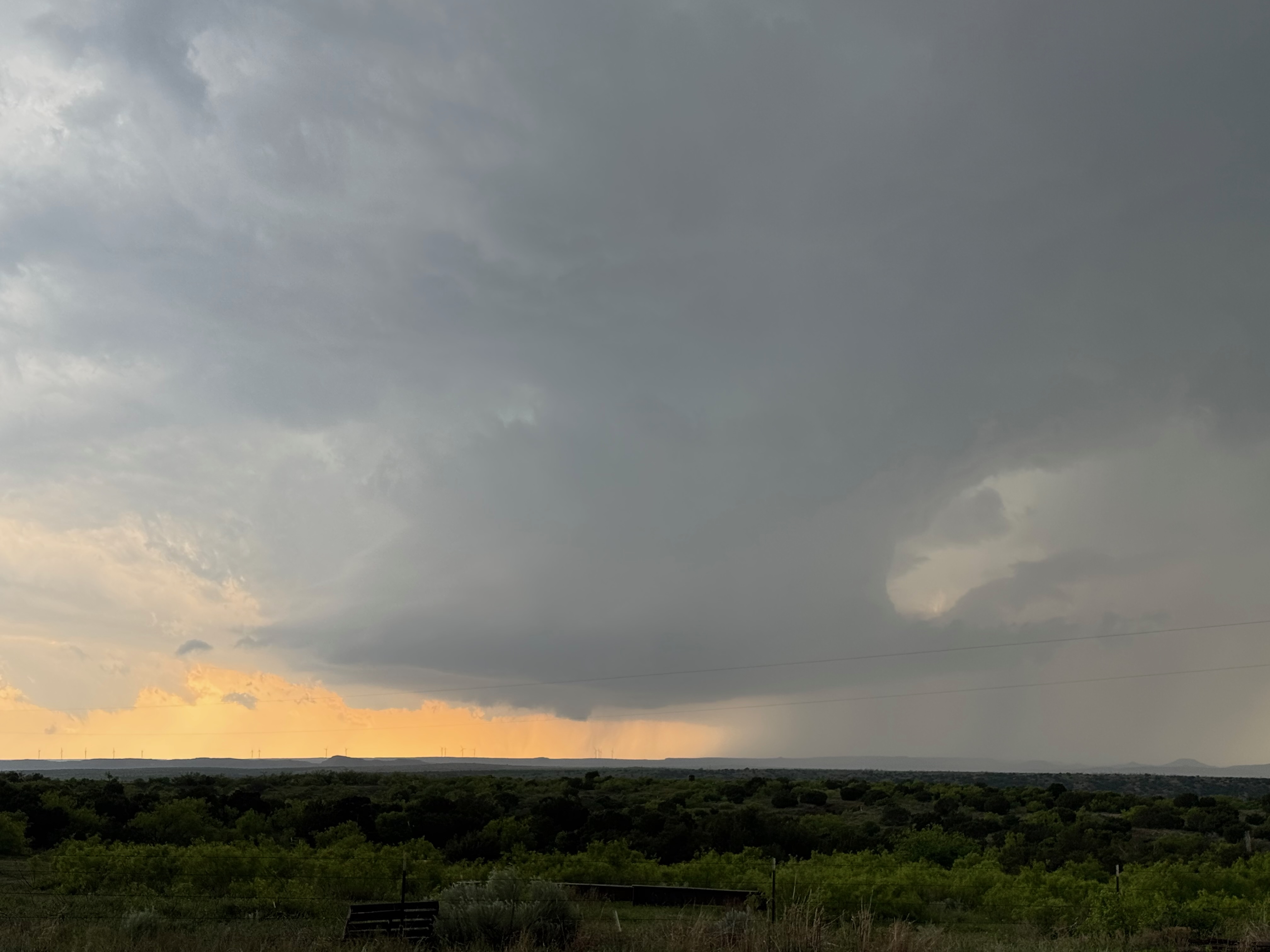
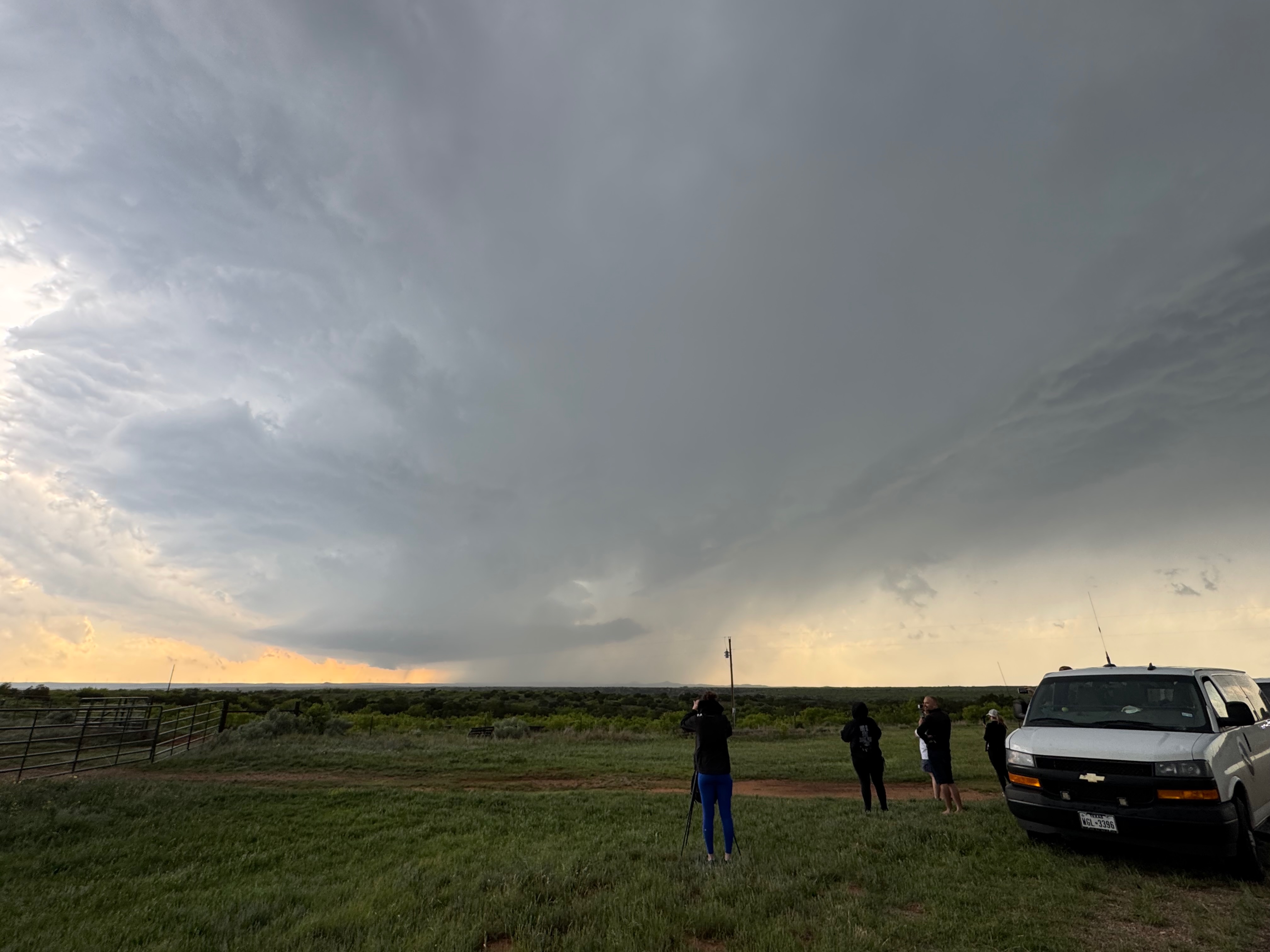
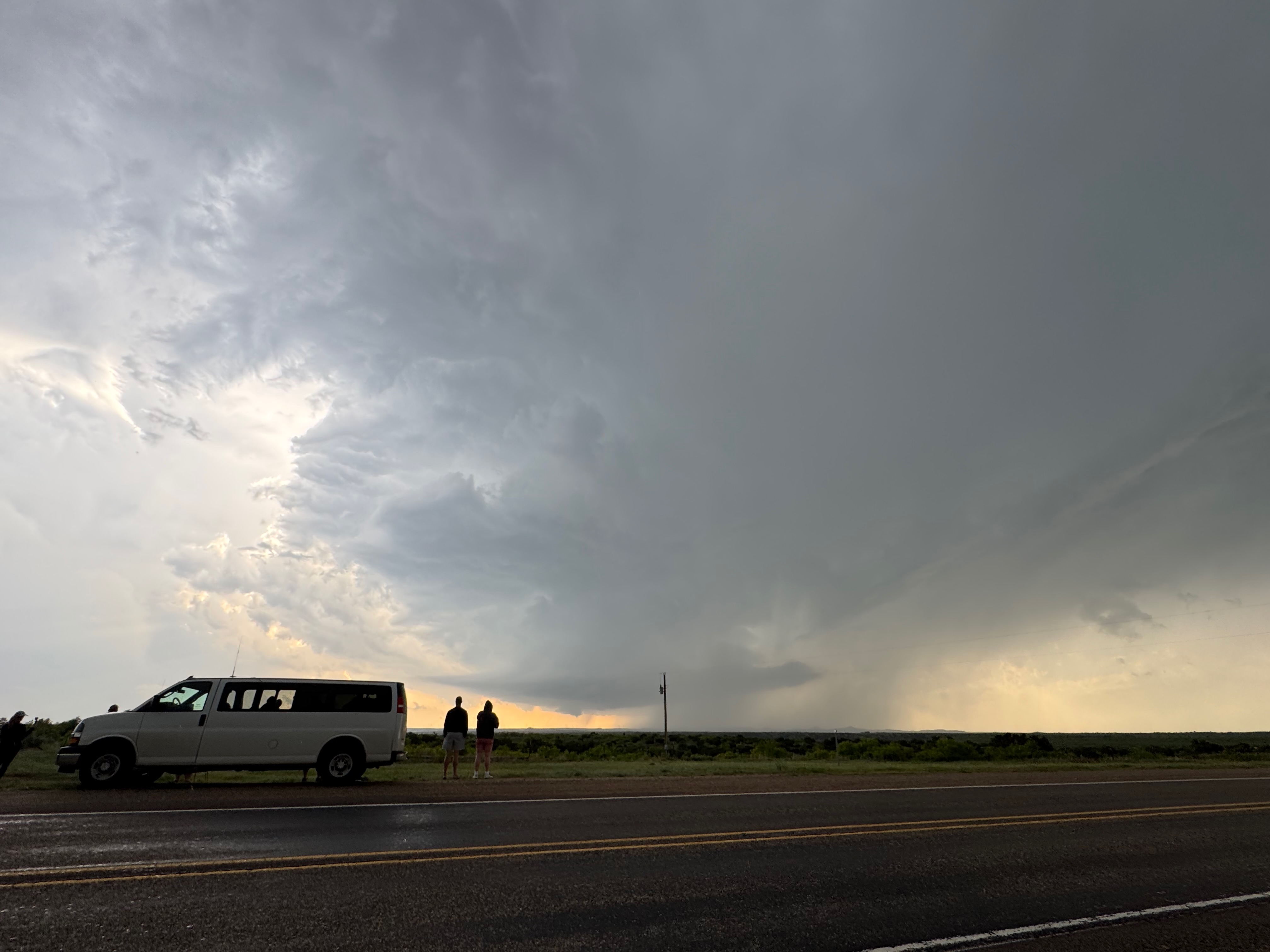
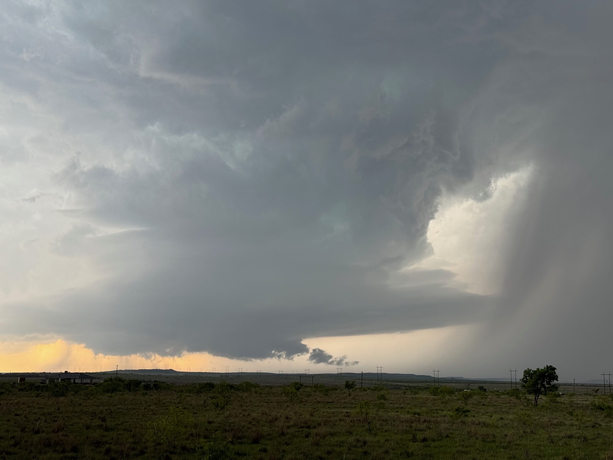
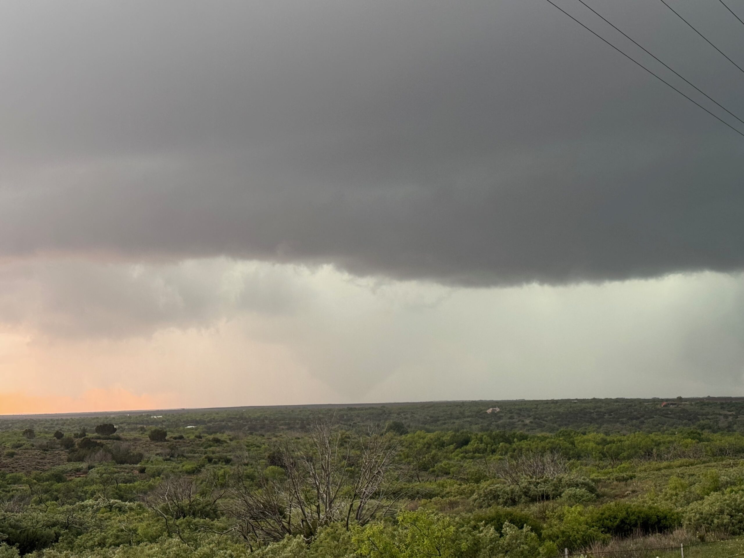
These were my last radar grabs for the chase. We stopped briefly just south of the forward flank precipitation, NNW of Matador (perhaps near Whiteflat), and then continued past Matador to Roaring Springs. This positioning placed us directly in the path of the supercell’s action area. I found a nice high spot a little WNW of town. The storm looked nicely organized, but no tornado was apparent. I think there was some rain from another nuisance cell here, and then we were getting some nasty and close lightning strikes. I got a bit spooked by this, and decided to back off some. We repositioned to a spot just a little south of Roaring Springs along State Route 70.
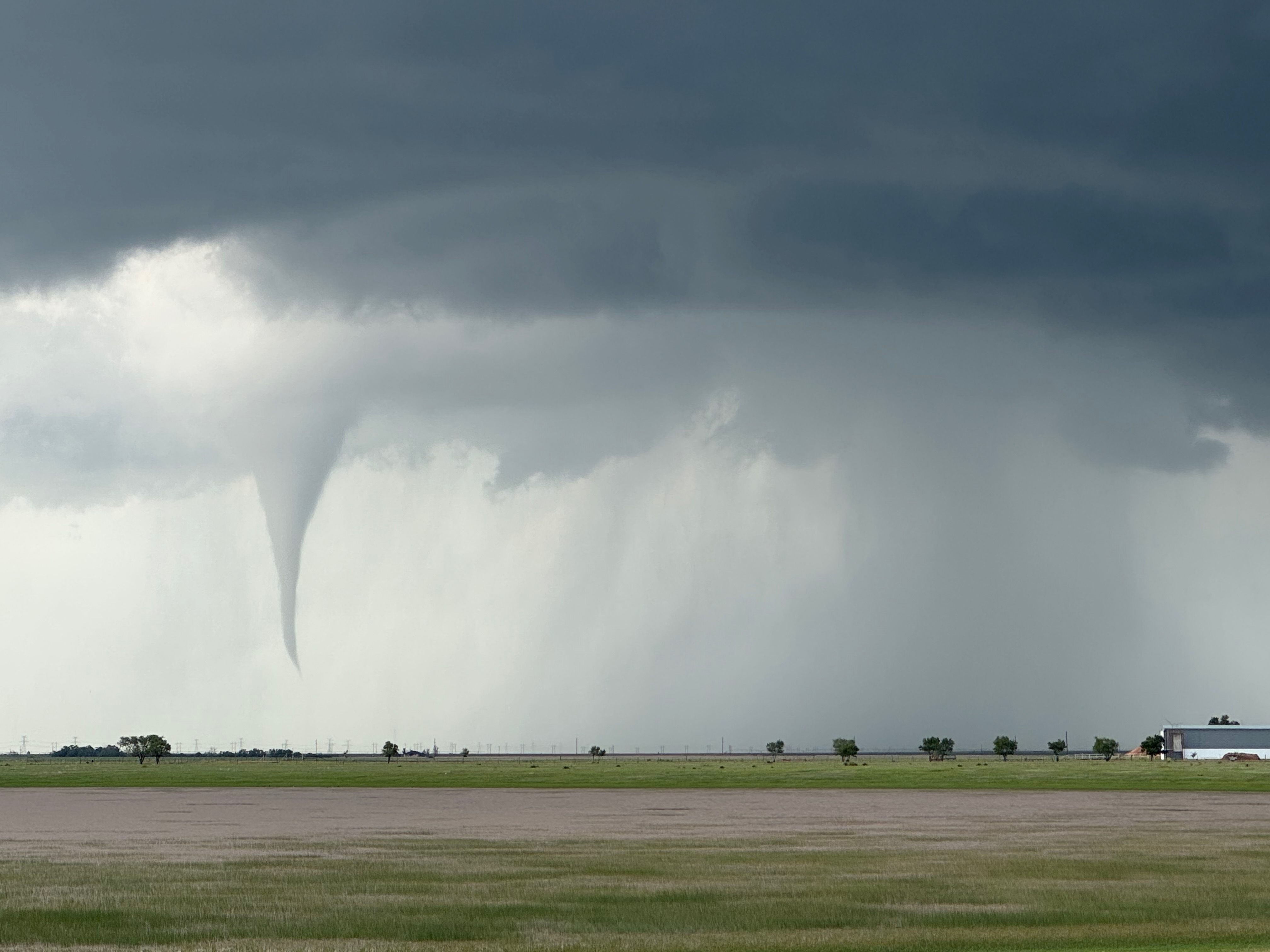
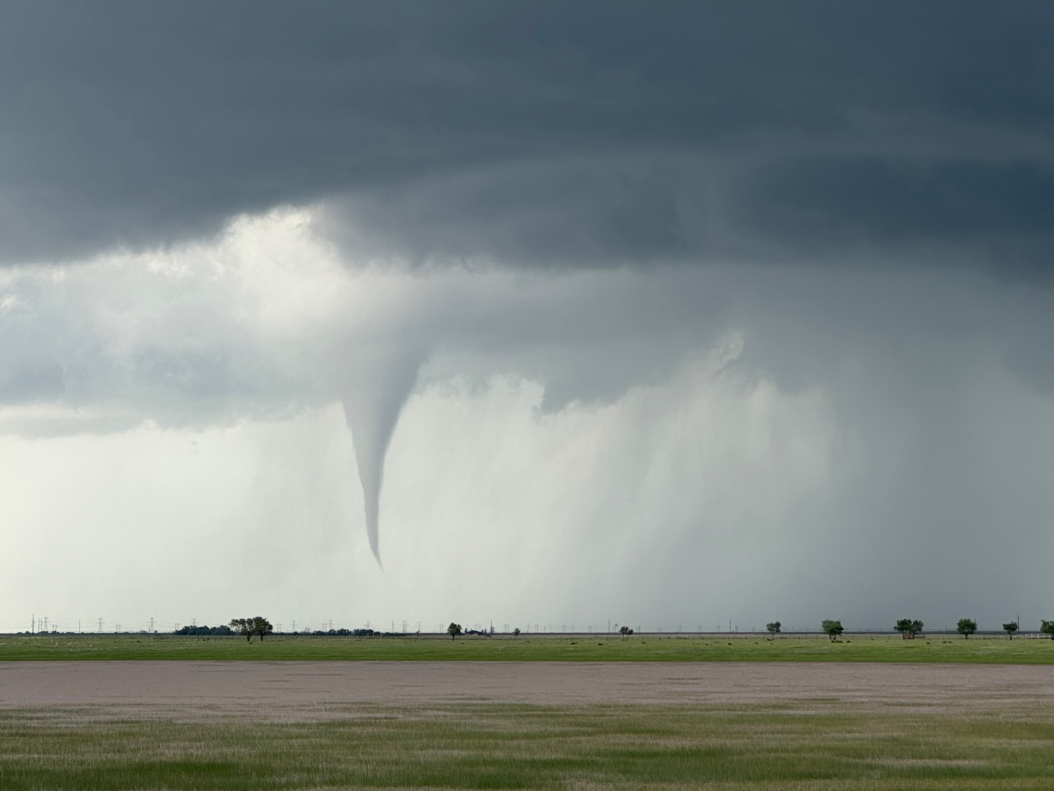
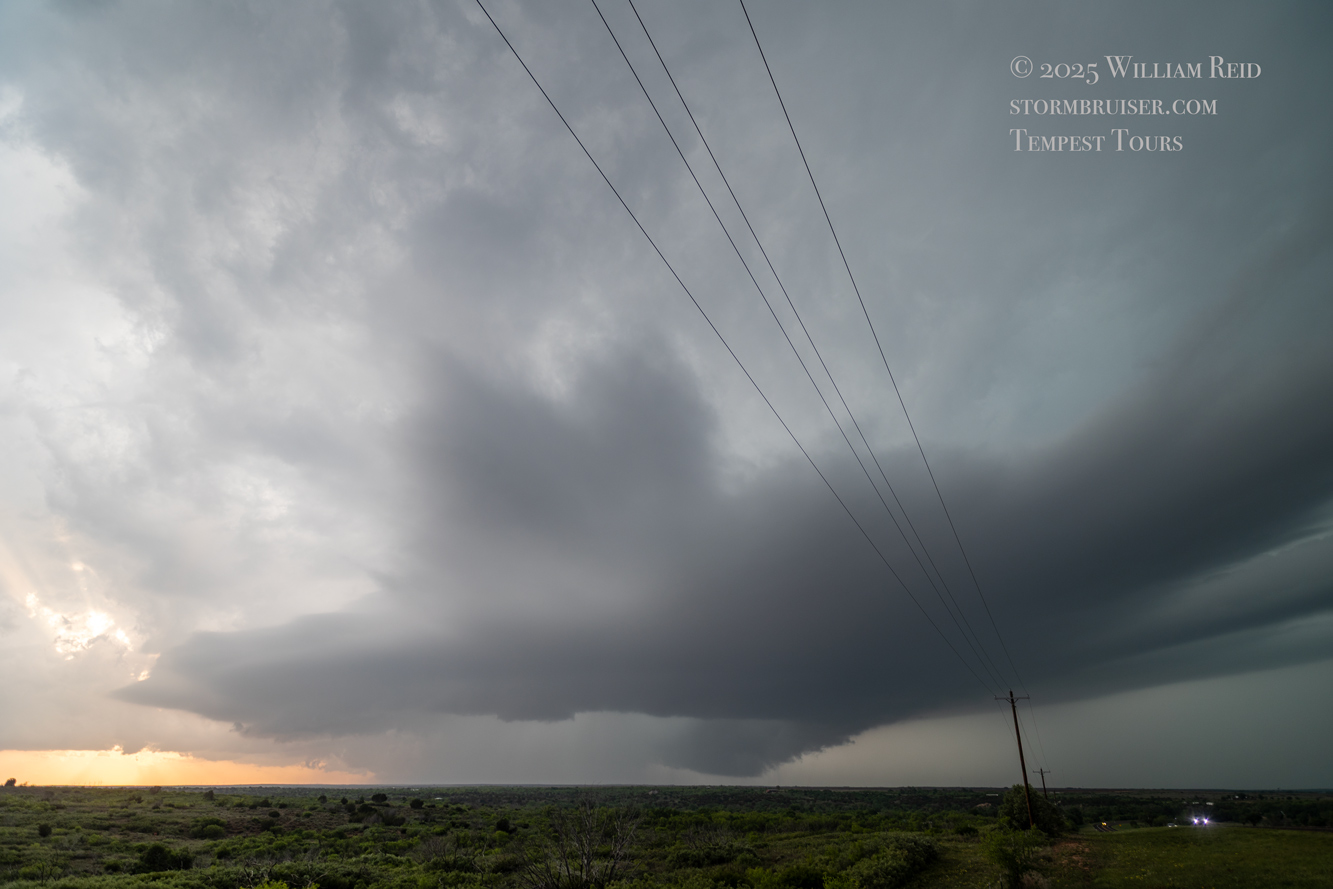
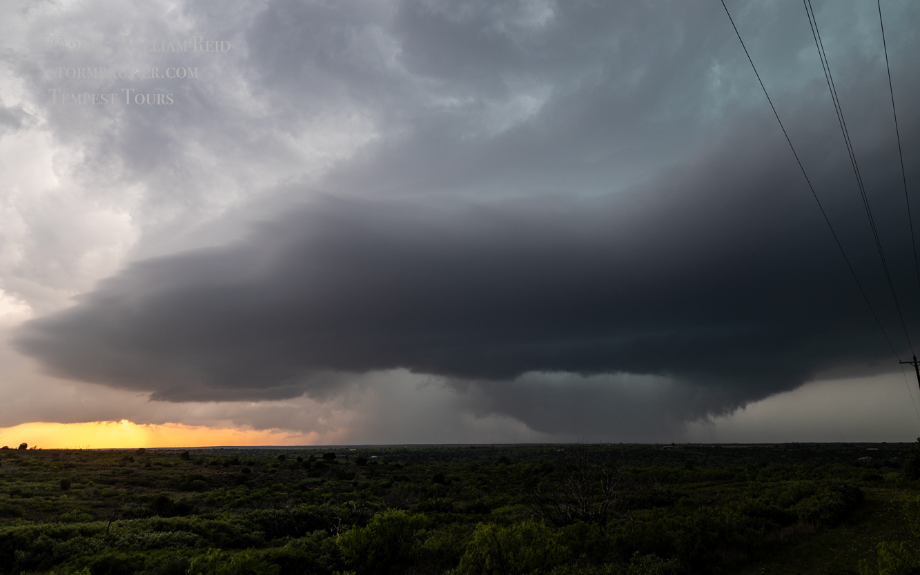
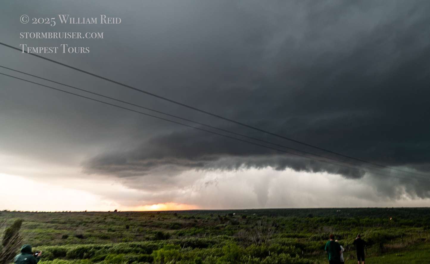
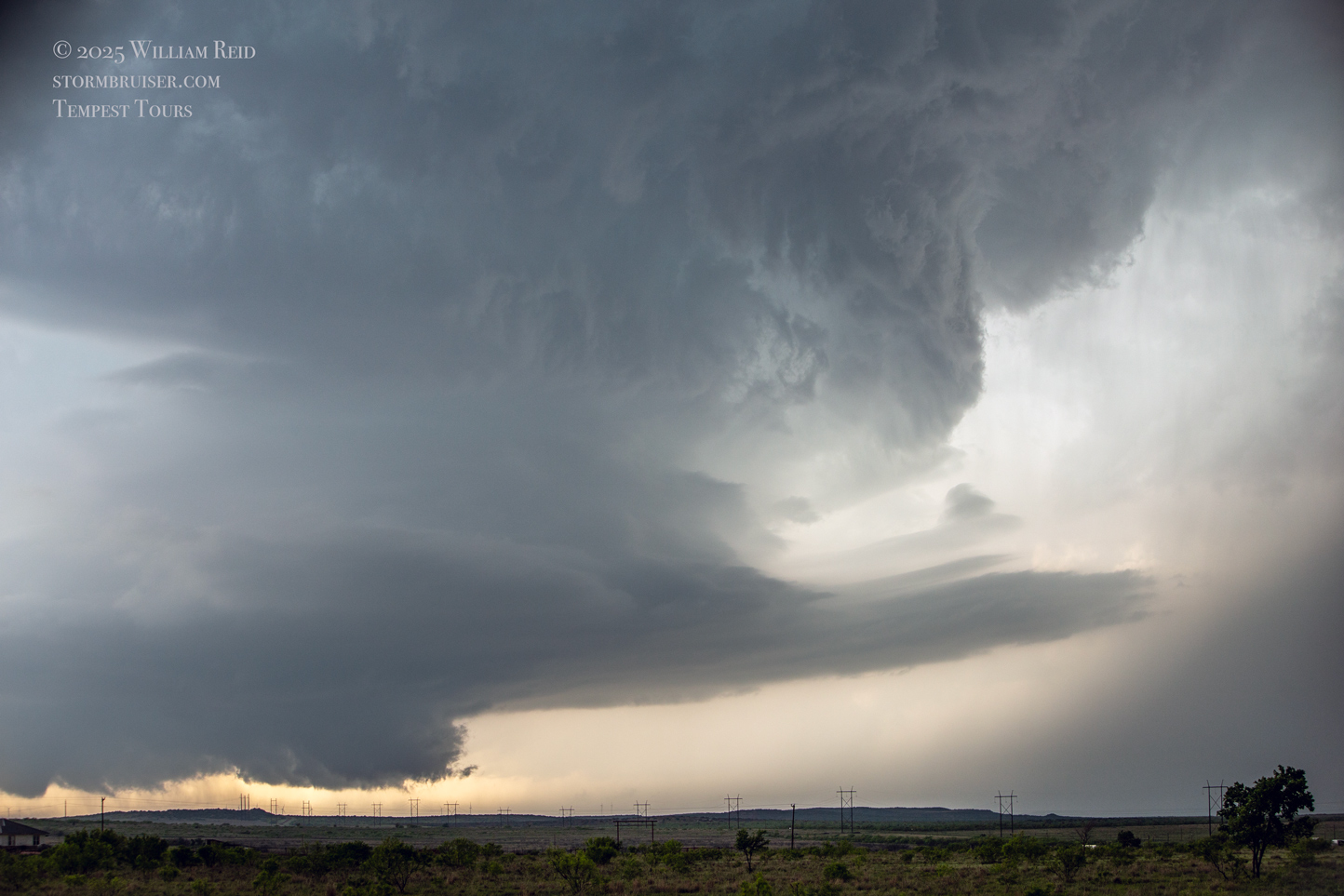
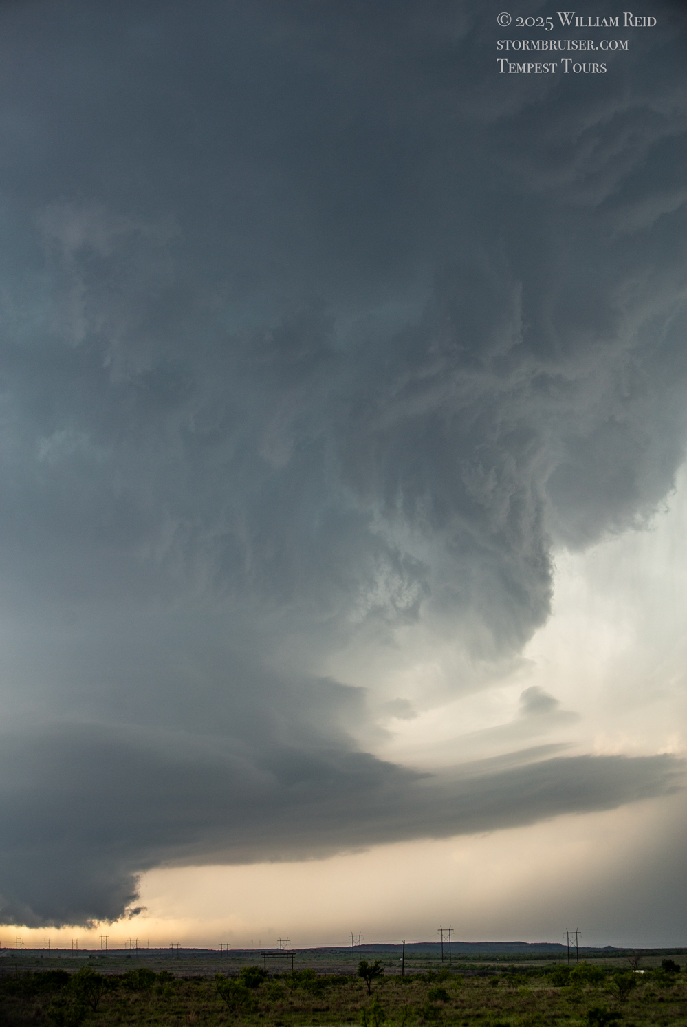
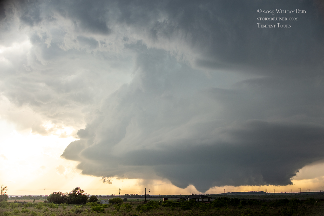
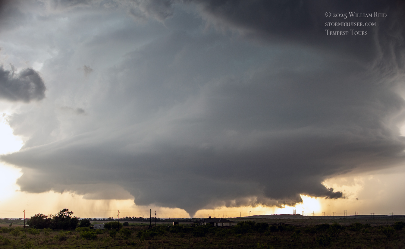
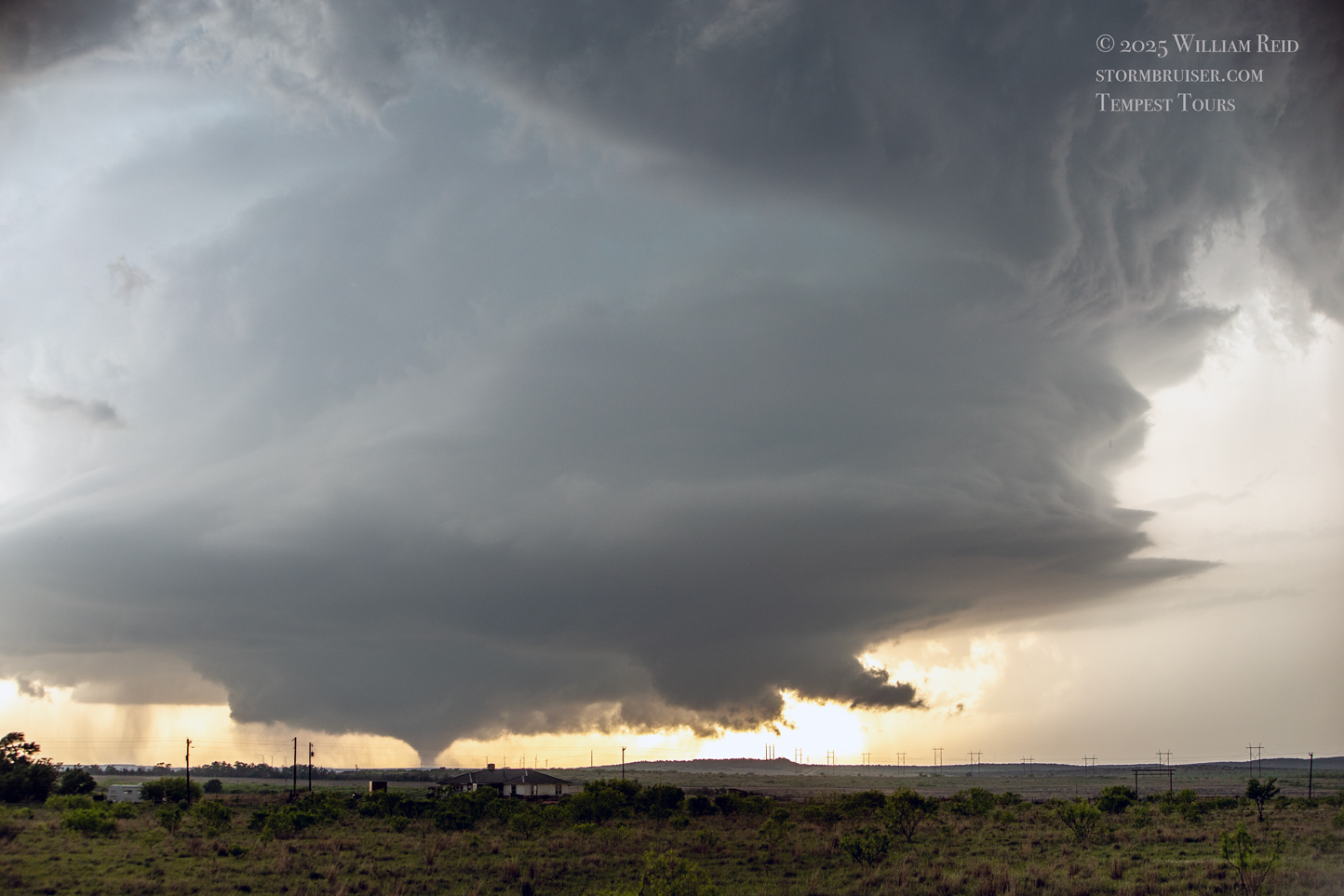
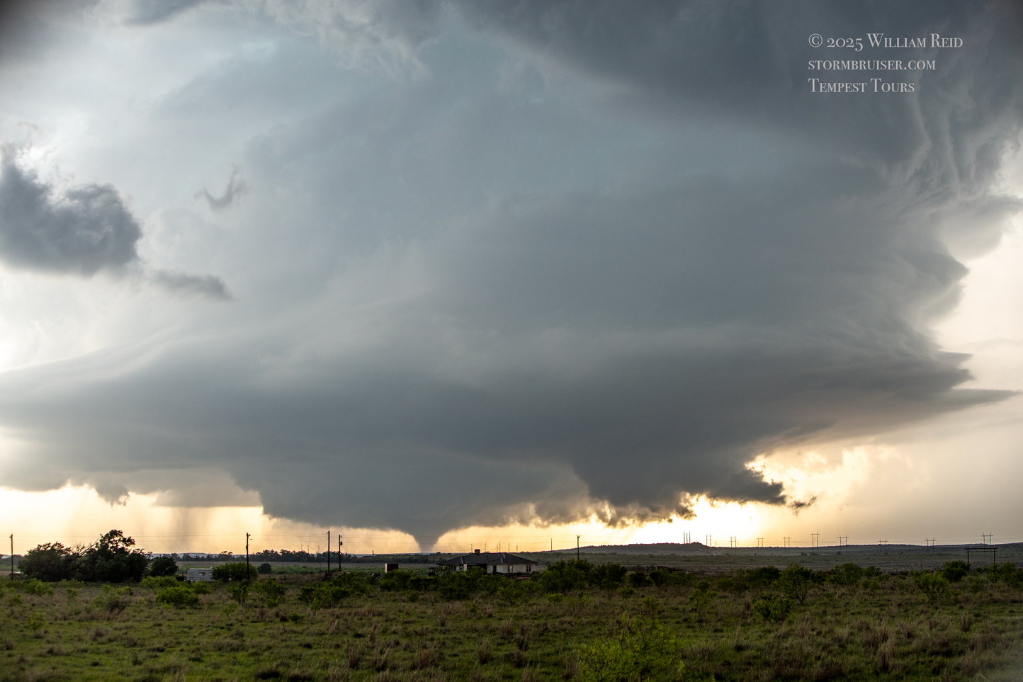
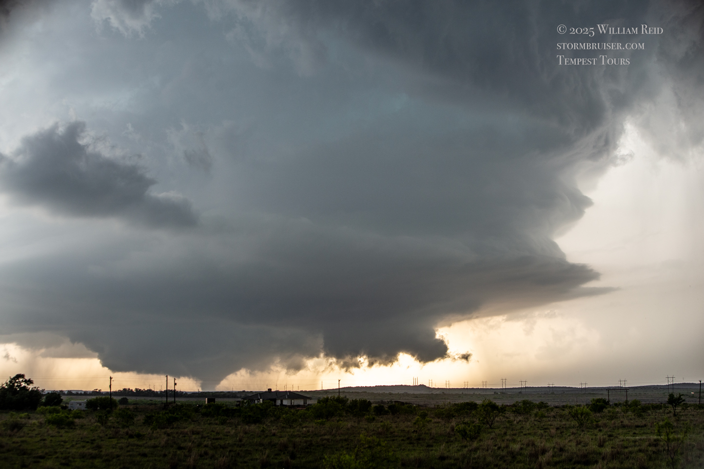
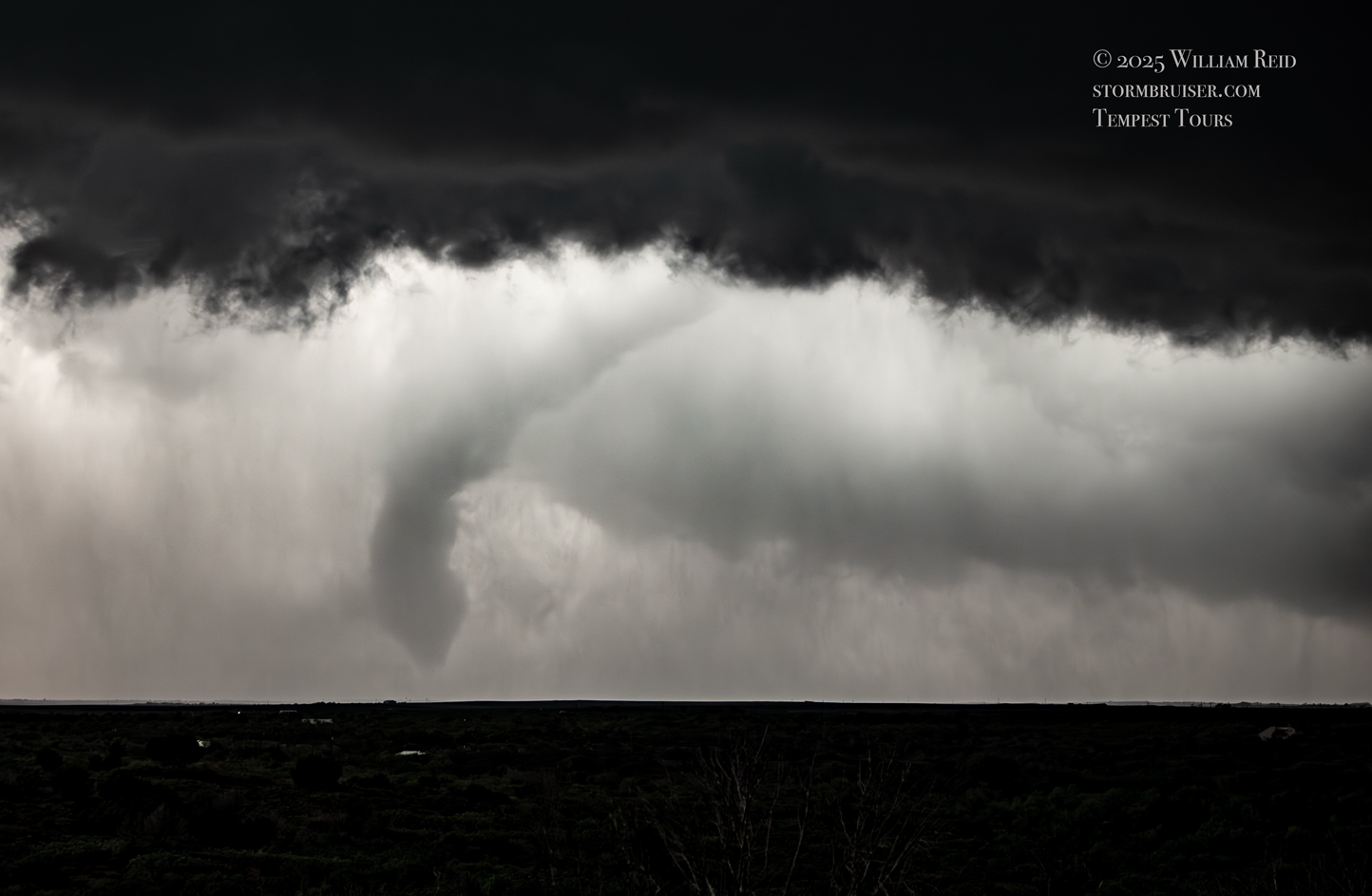
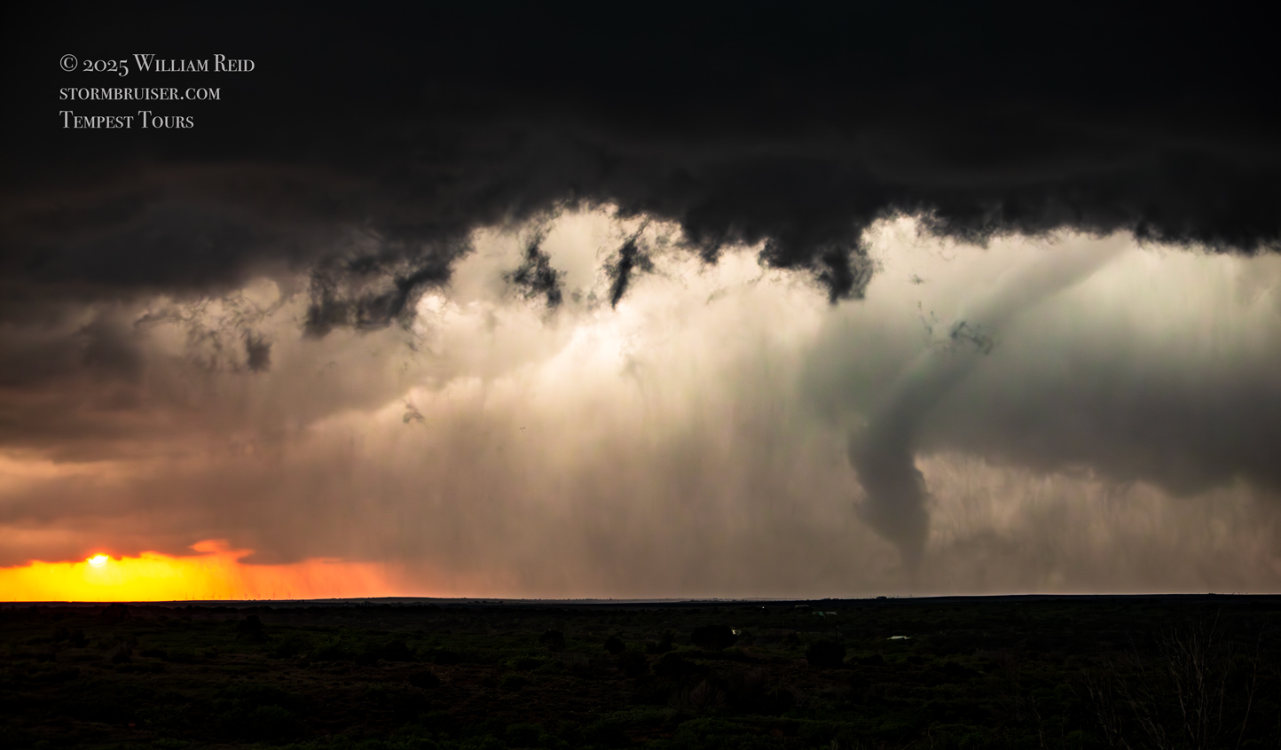
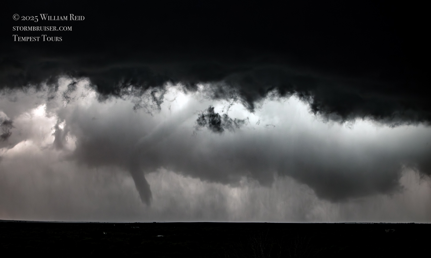
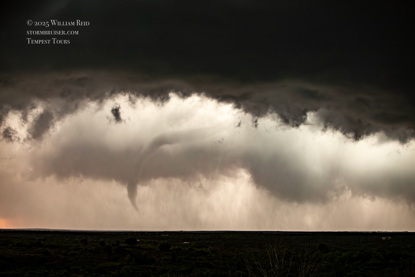
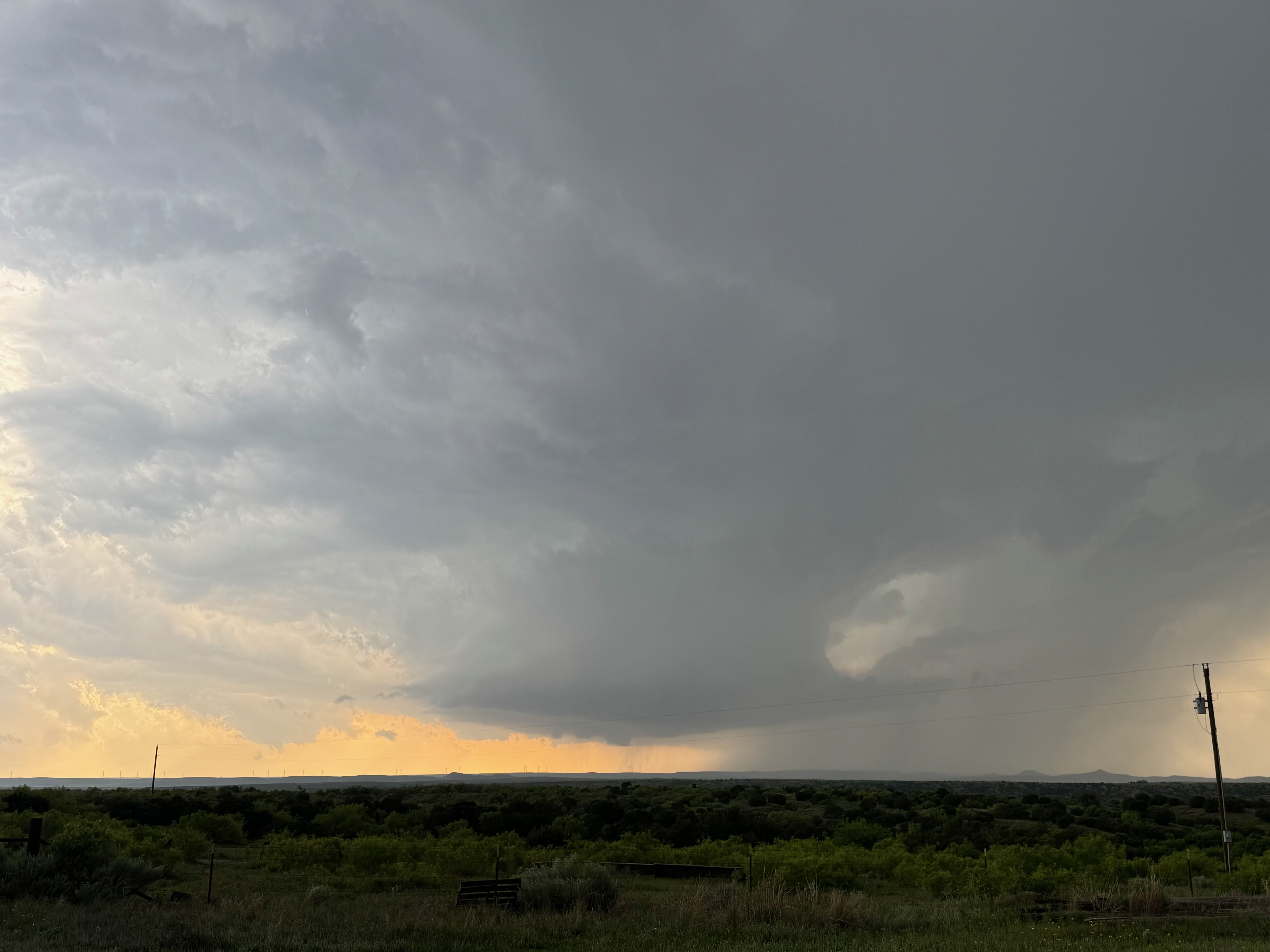
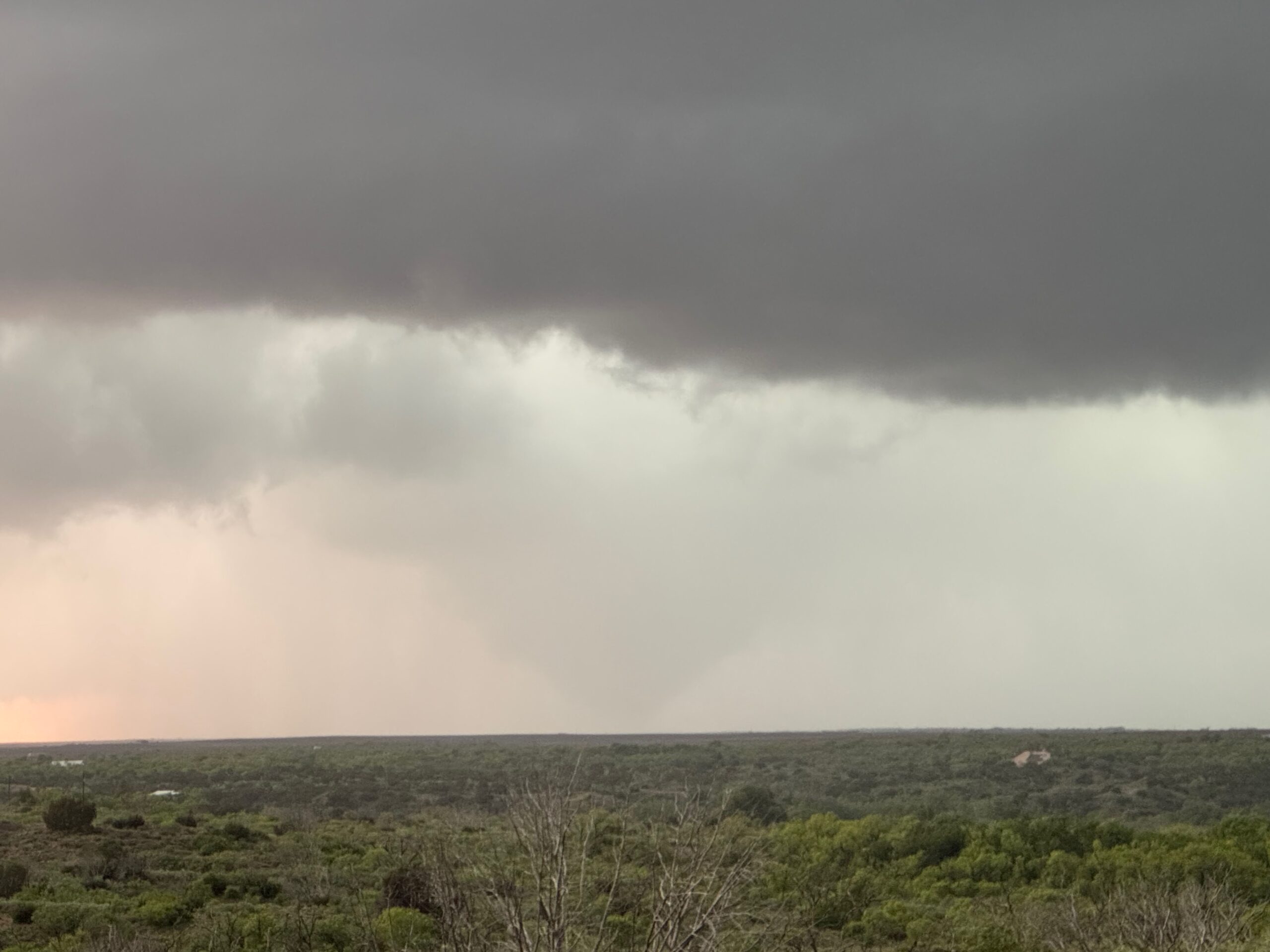
We spent a good amount of time here. The supercell structure improved, and then a wispy tornado took shape beneath the base to our WNW. This tornado then morphed into a solid black wedge for a little bit! I had some wide-angle video going on the tripod, and was shooting a lot of stills with the long lens. As the storm approached our N-S road, more and more precipitation around the base was making it difficult to see what was going on. Close to sunset the rain cleared some and a narrow tornado showed itself. It was possible that a long-lived tornado had just occurred with the storm, but we just couldn’t see it for part of the time. I think that this tornado event started near the Floyd/Motley county line, to the northwest of Roaring Springs, and then sagged to the SSE or SE in western portions of Motley County. It was close to 60 minutes in elapsed time from the beginning of this tornado to the rope out at sunset.
I will wrap this up now and lump the remainder of the structure and tornado images below. These were taken from near Roaring Springs. I had reserved rooms in Shamrock for the night, which was a fairly easy drive back to the north and east a little. But at dusk the supercell and its hail core was stationary right over 70 to our north. I waited 20-30 minutes and gave up on it moving out of the way. We had to go south to Dickens, east to Guthrie, and north on 83 to finally reach Shamrock around midnight.
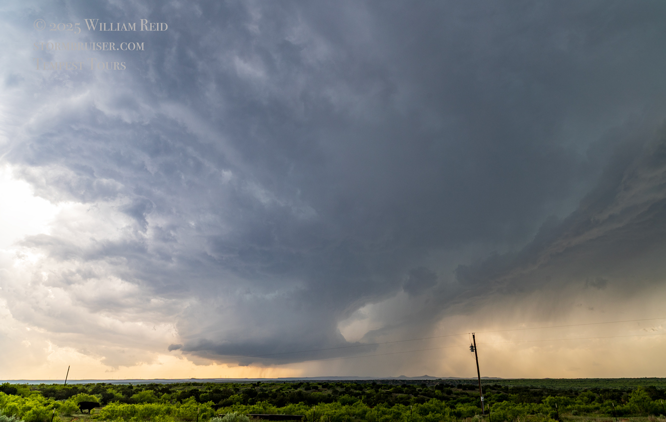
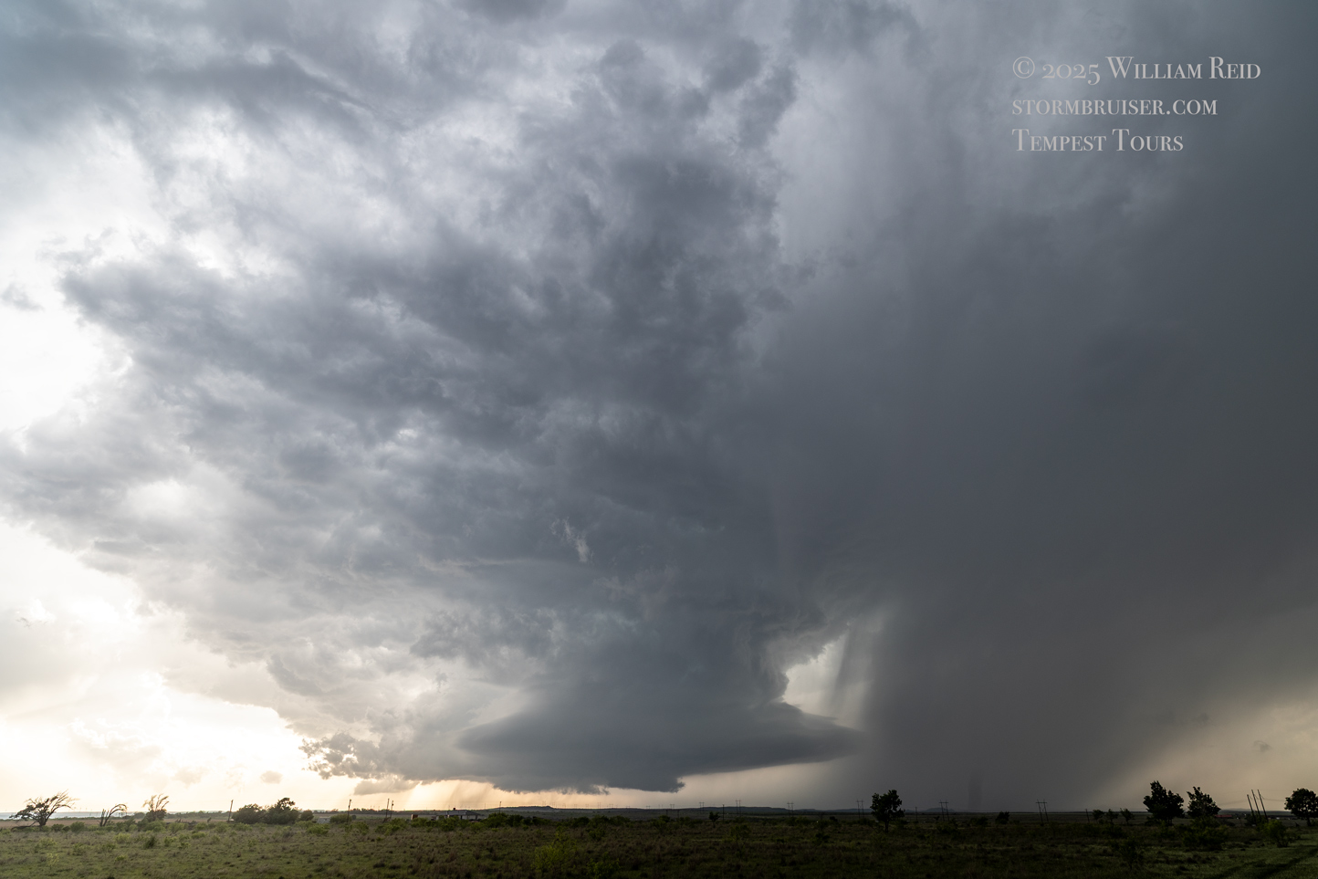
I think the group above was with the Canon R6 and the 15 mm lens. The first two pics were taken just NNW of Matador, and the remaining near Roaring Springs.
The shots below were with the Canon 6D and the long lens (70-200mm).

And some wide angles…

And, finally, a dump of the remaining iPhone images…it doesn’t look like these are in chronological order, but they were all taken in the last hour before sunset along 70, not too far from Matador and Roaring Springs.

Leave a Reply
You must be logged in to post a comment.