

Start: Wichita Falls, TX/lunch: TC Ponderosa in Dickens/End: Turkey/354 miles
SPC Meso Disc 2:32 p.m. CDT
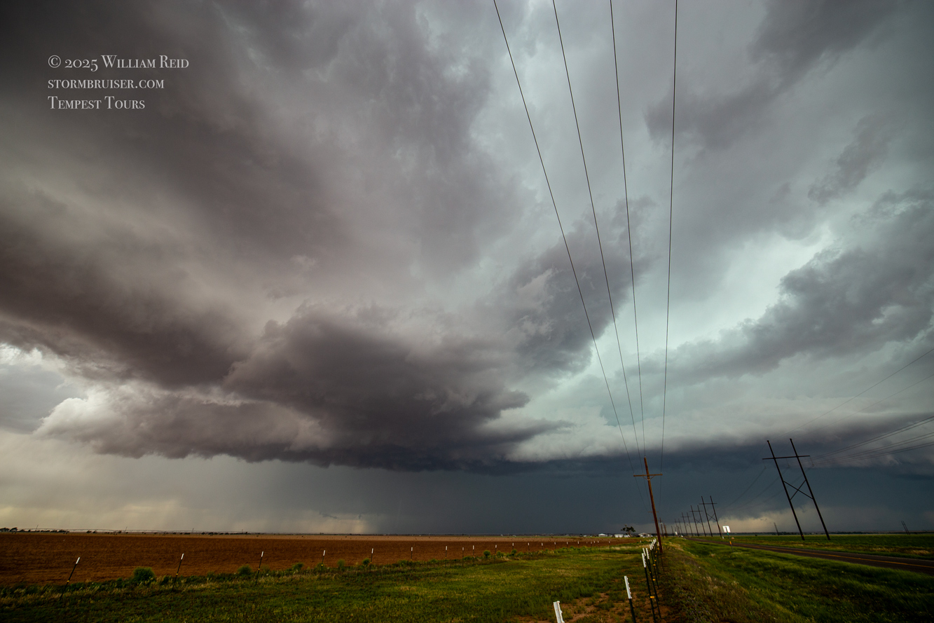
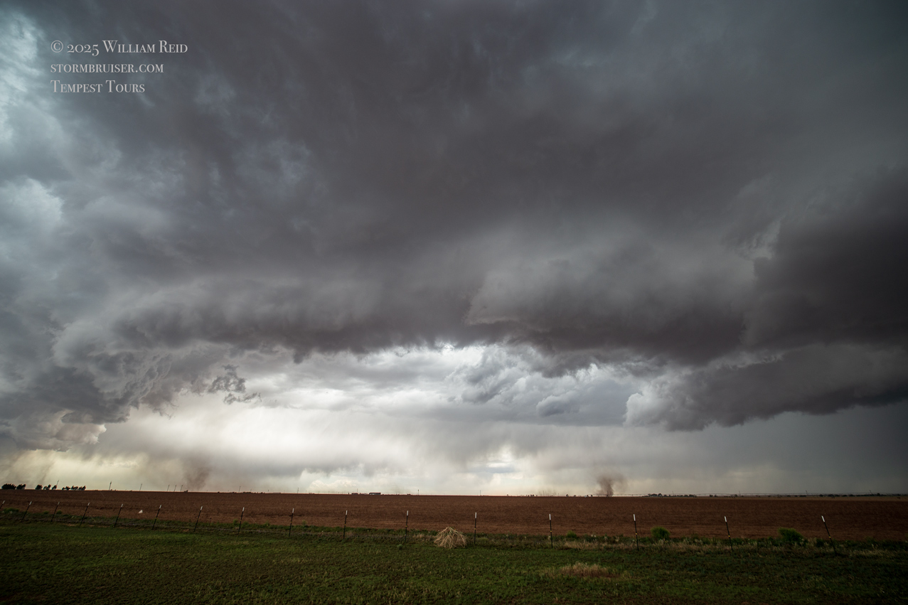
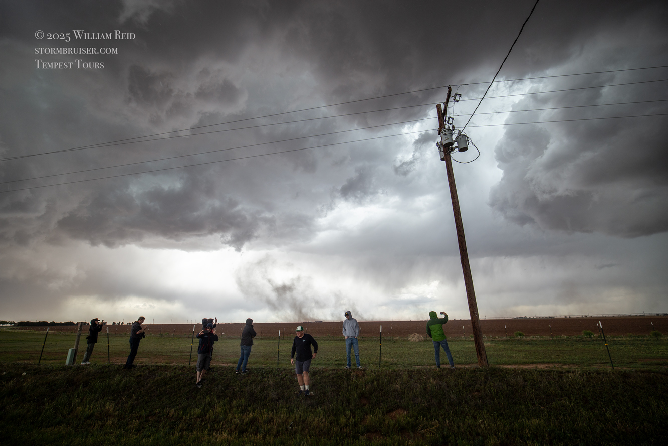
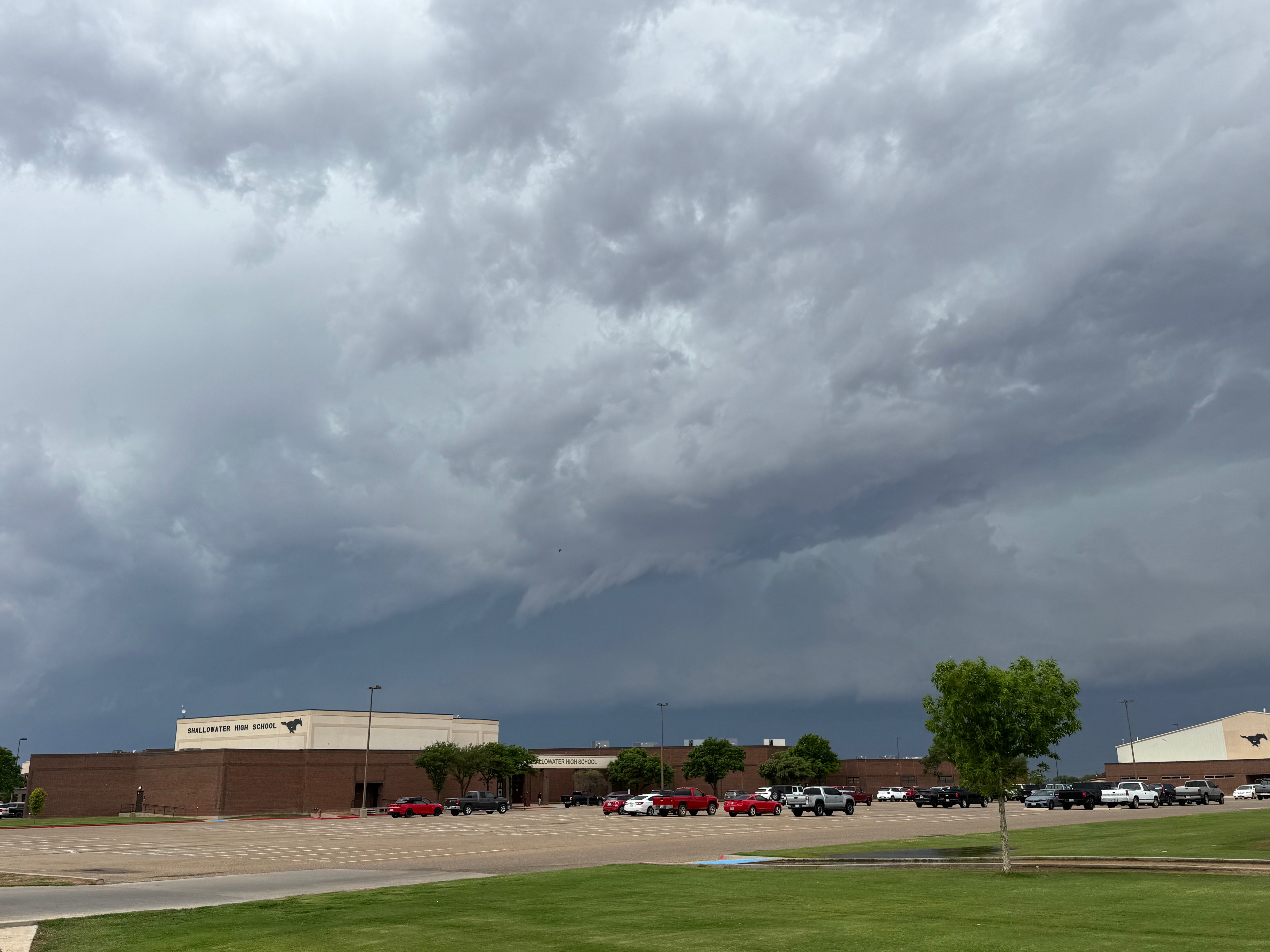
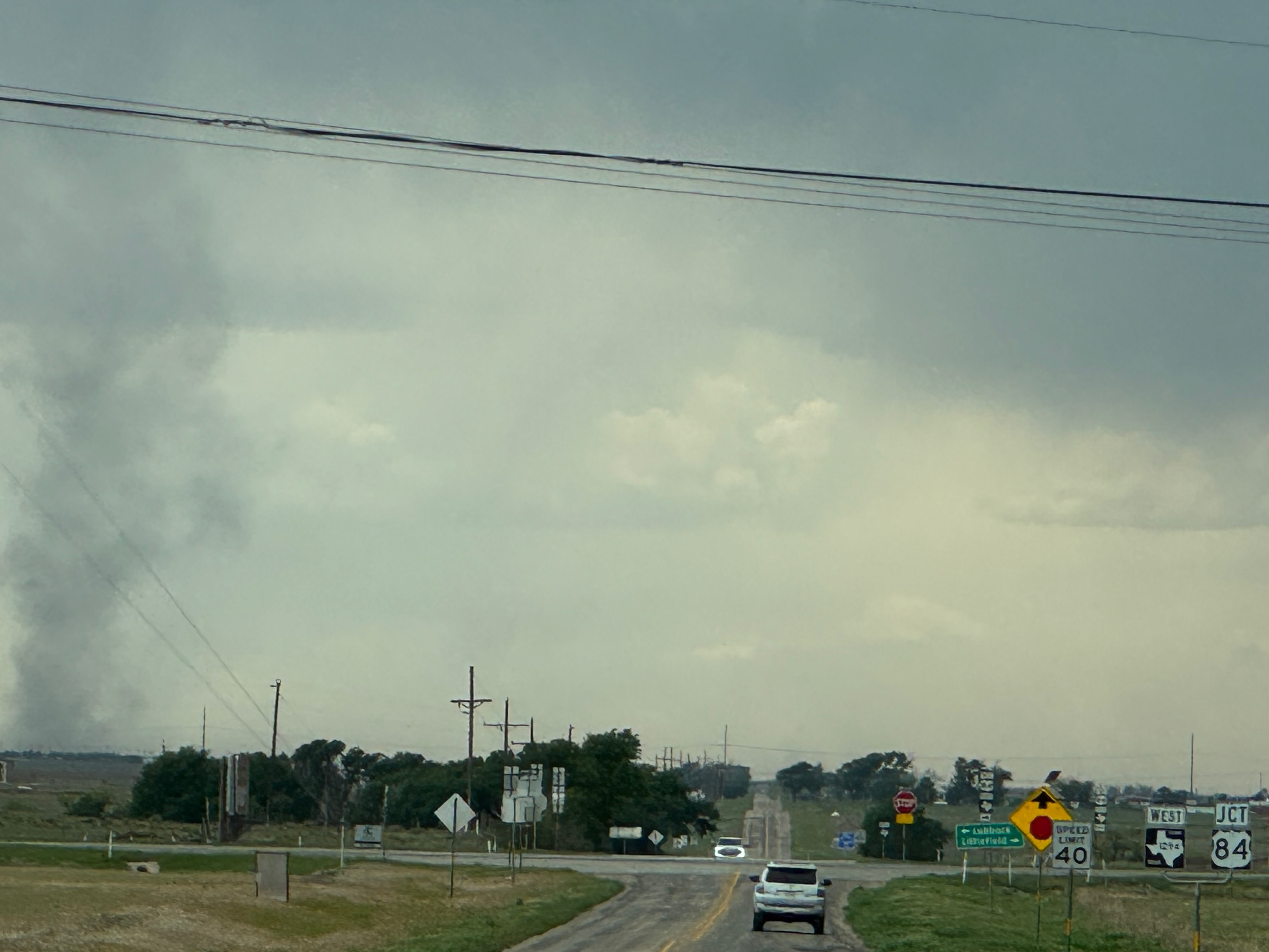
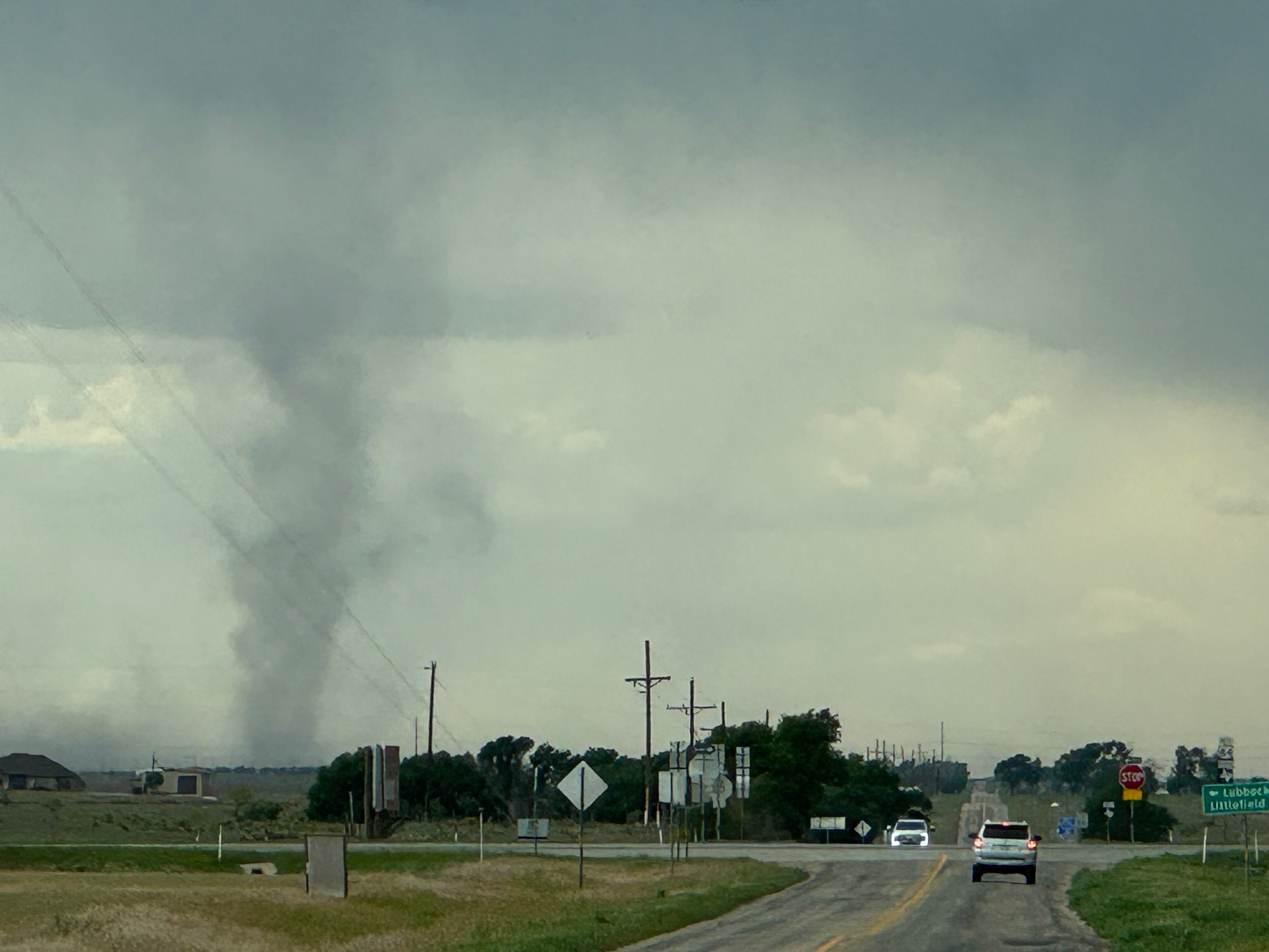
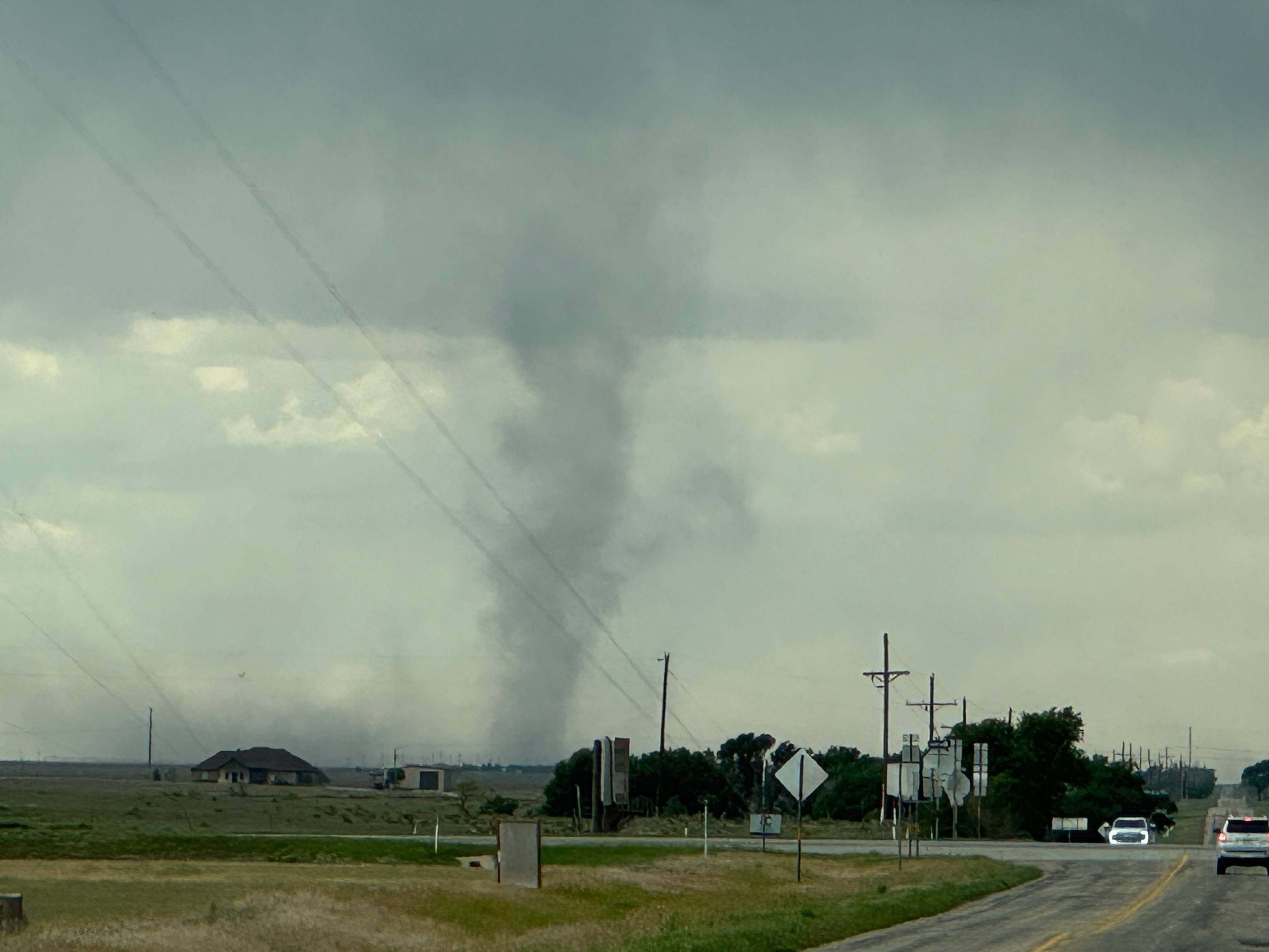
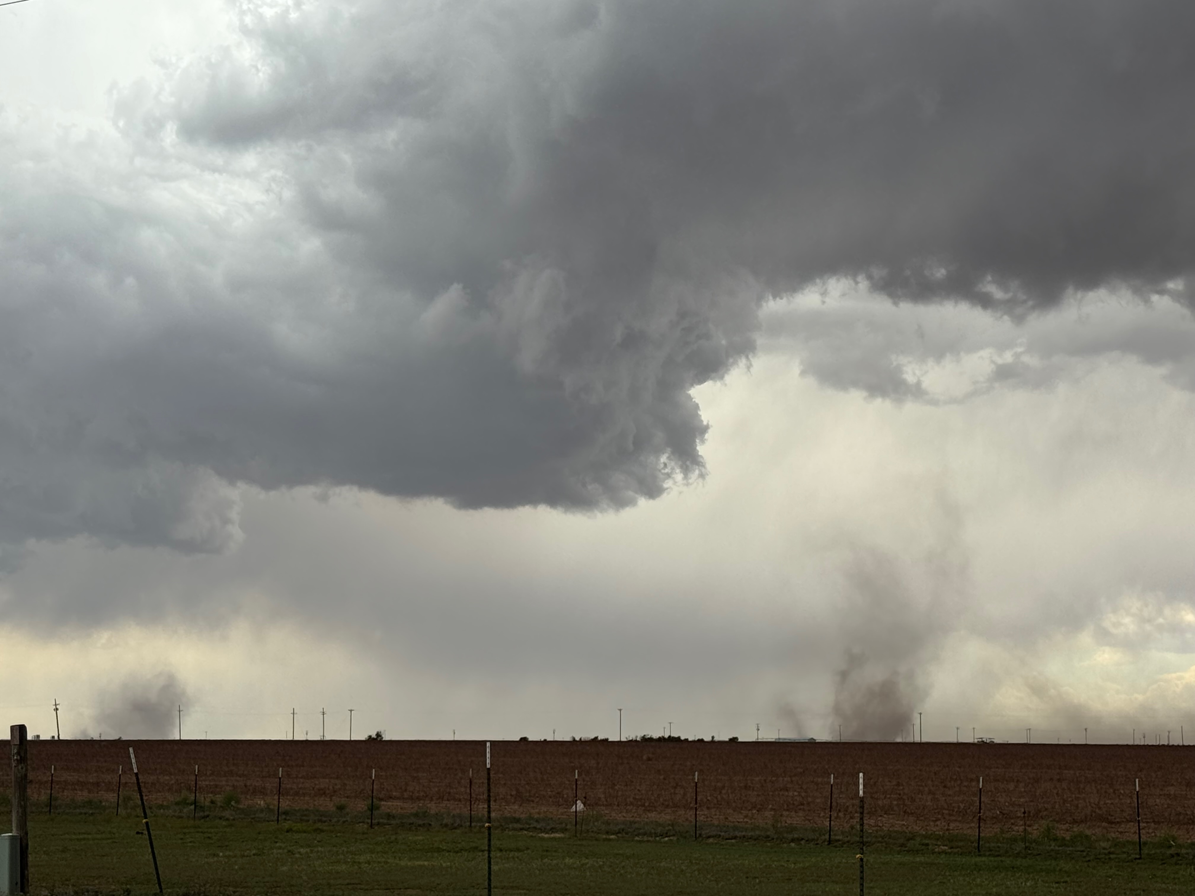
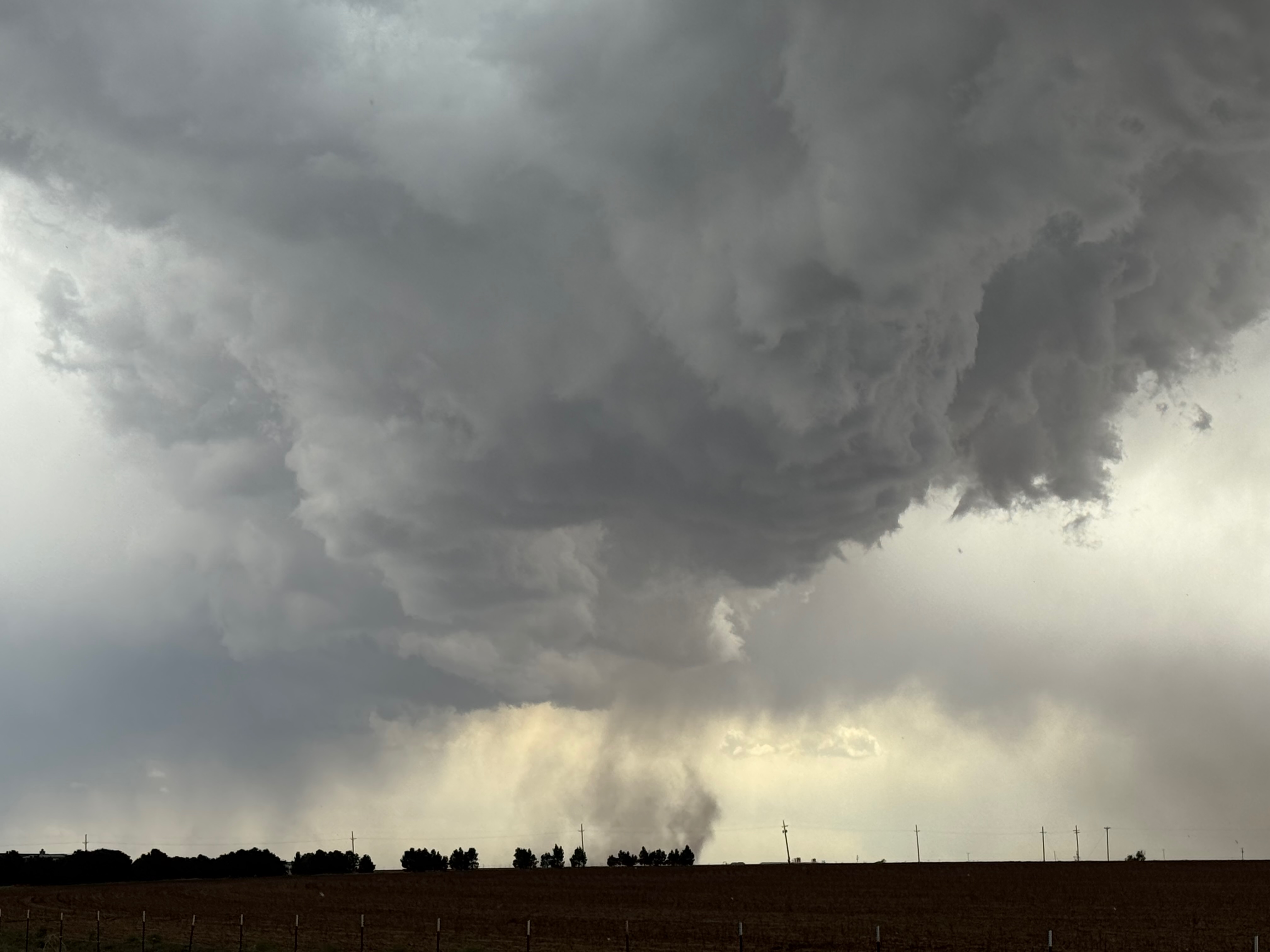
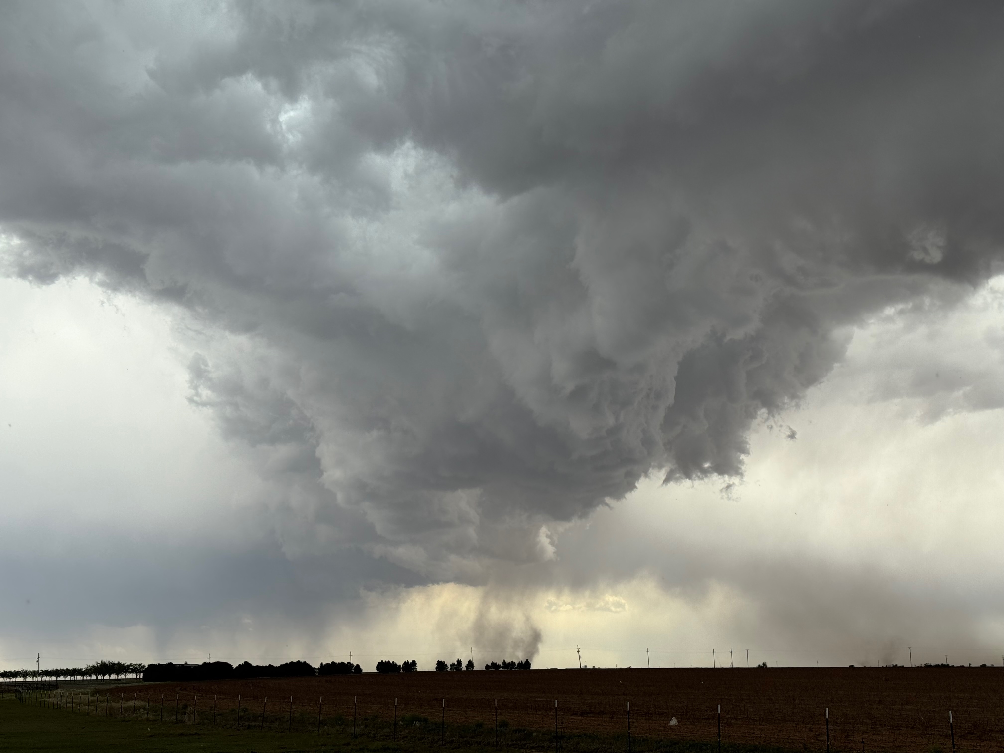
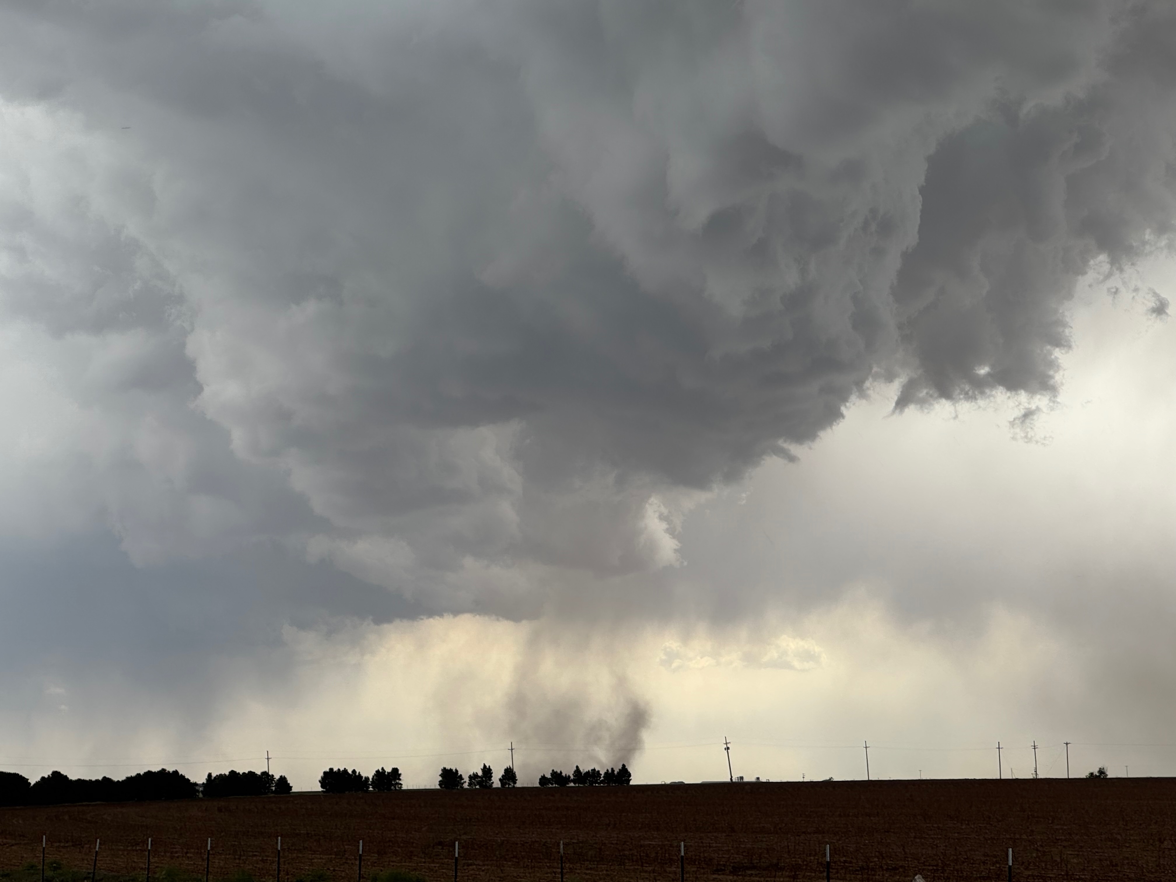
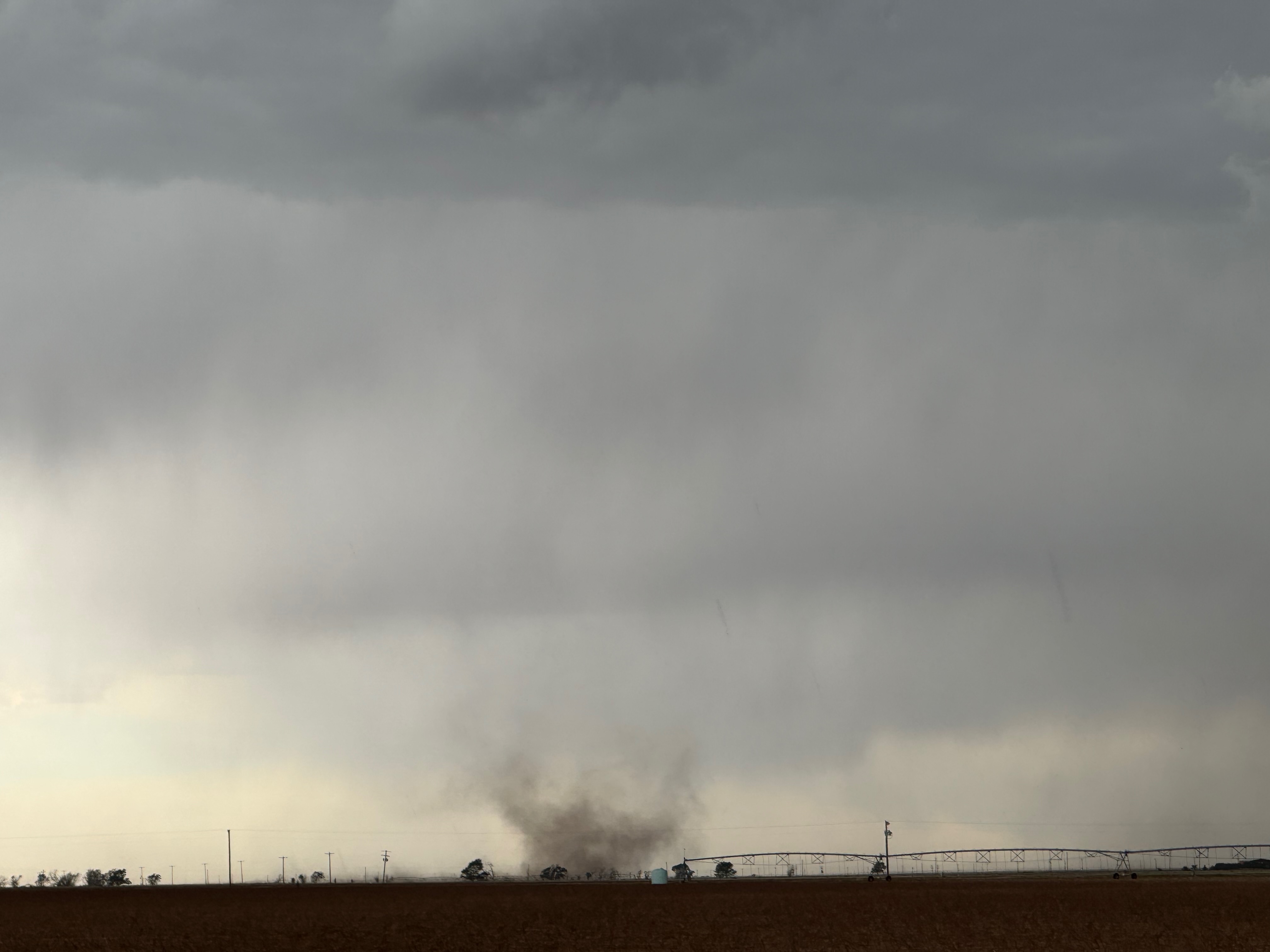
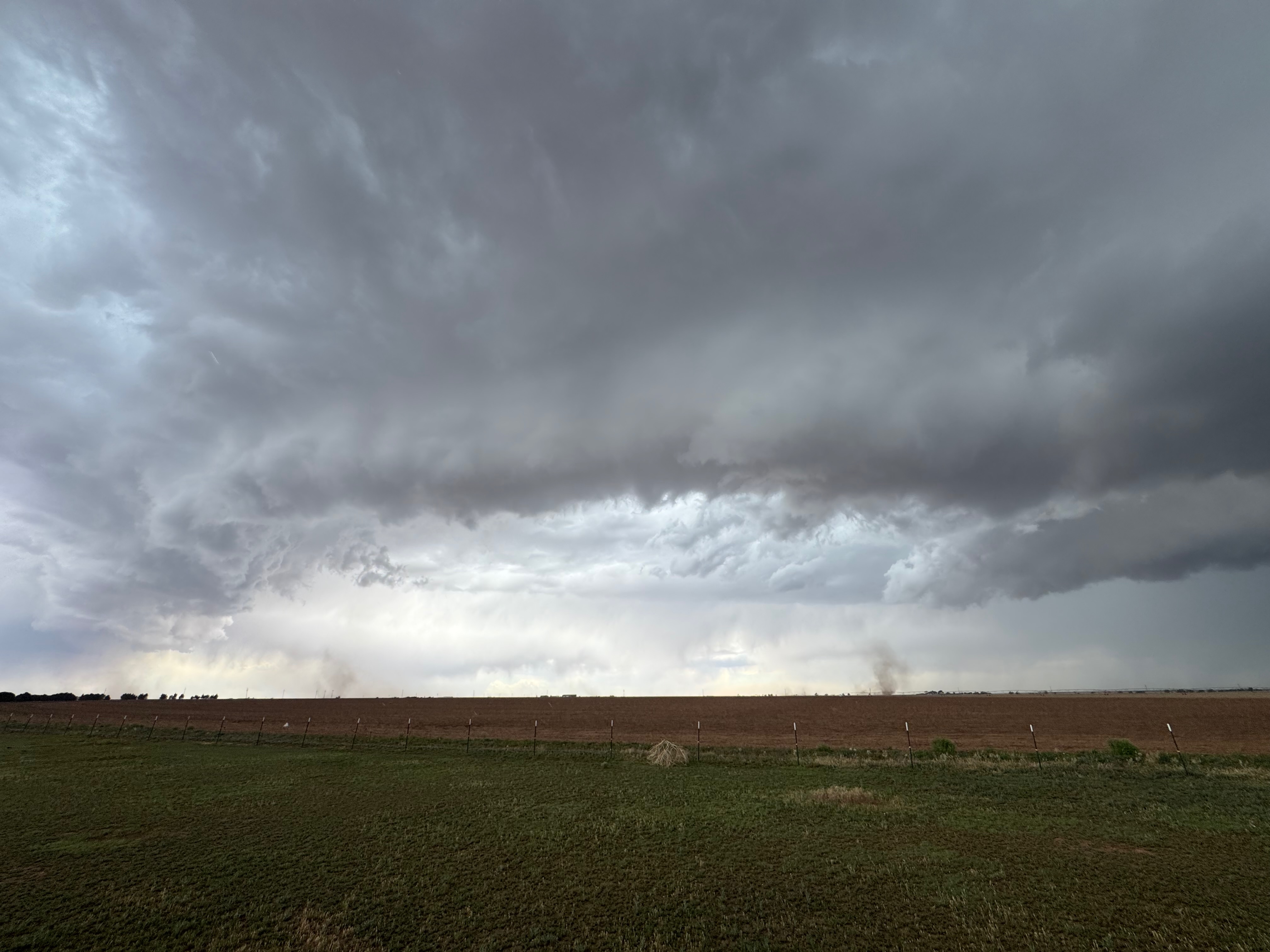
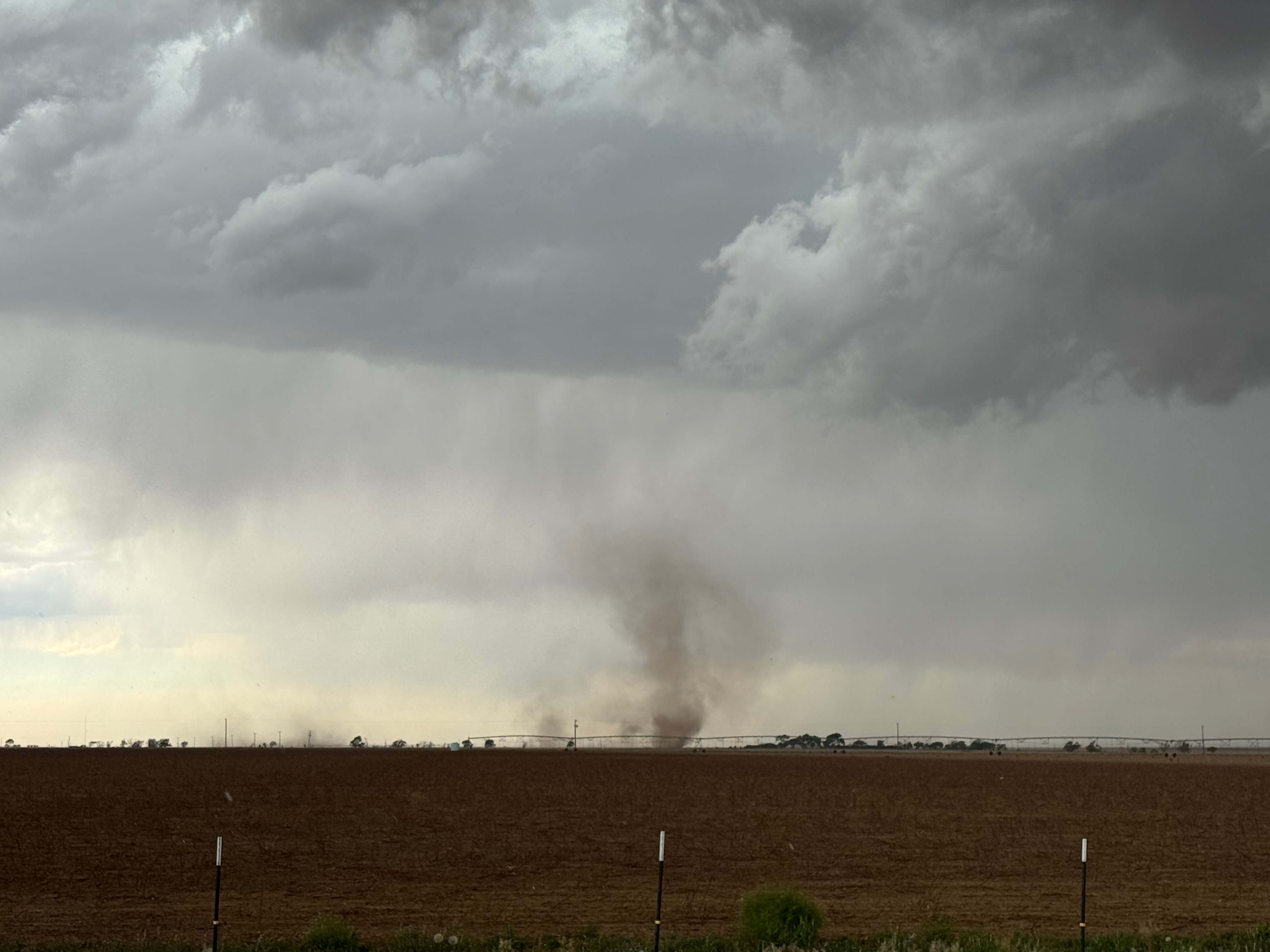
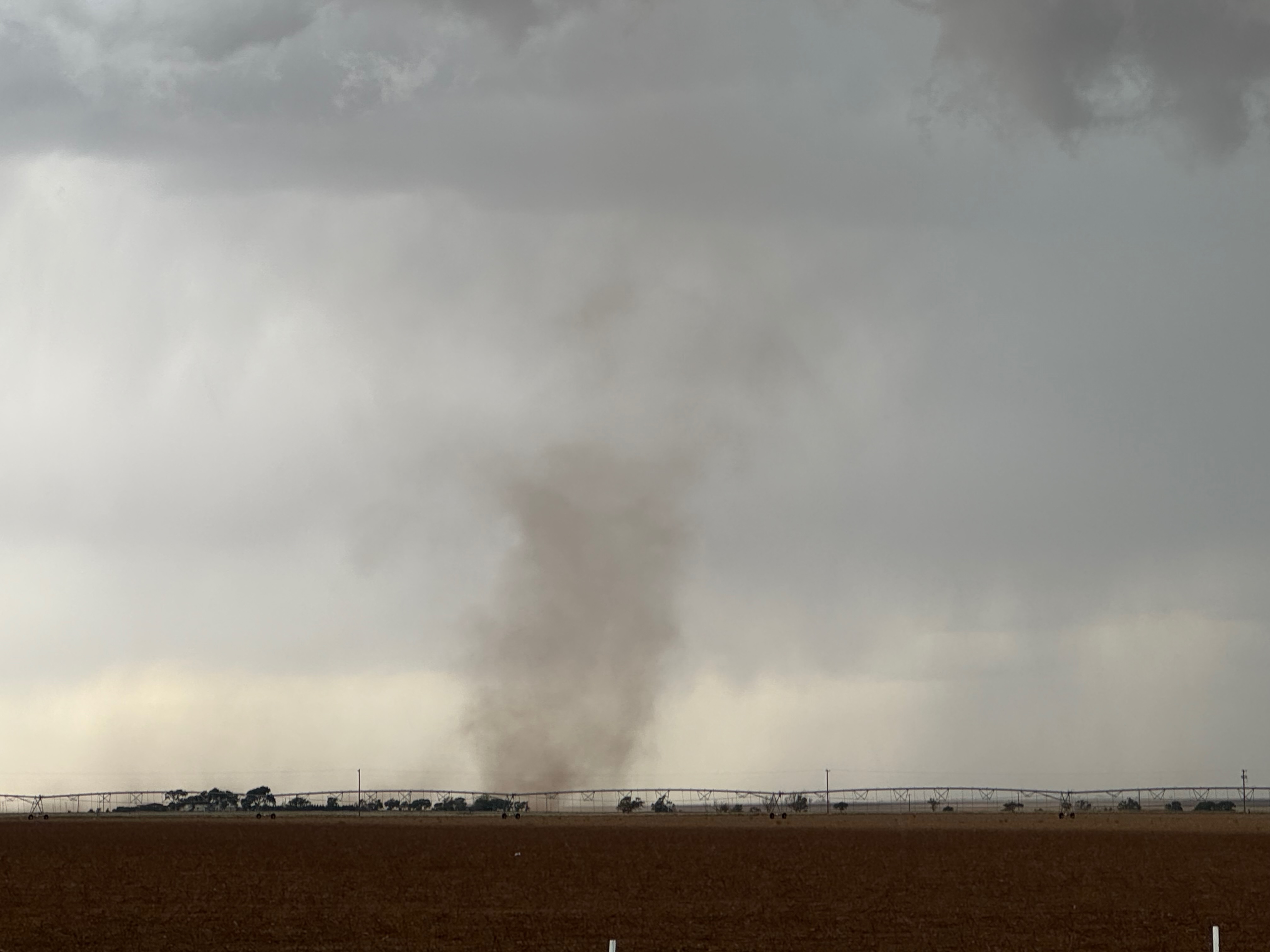
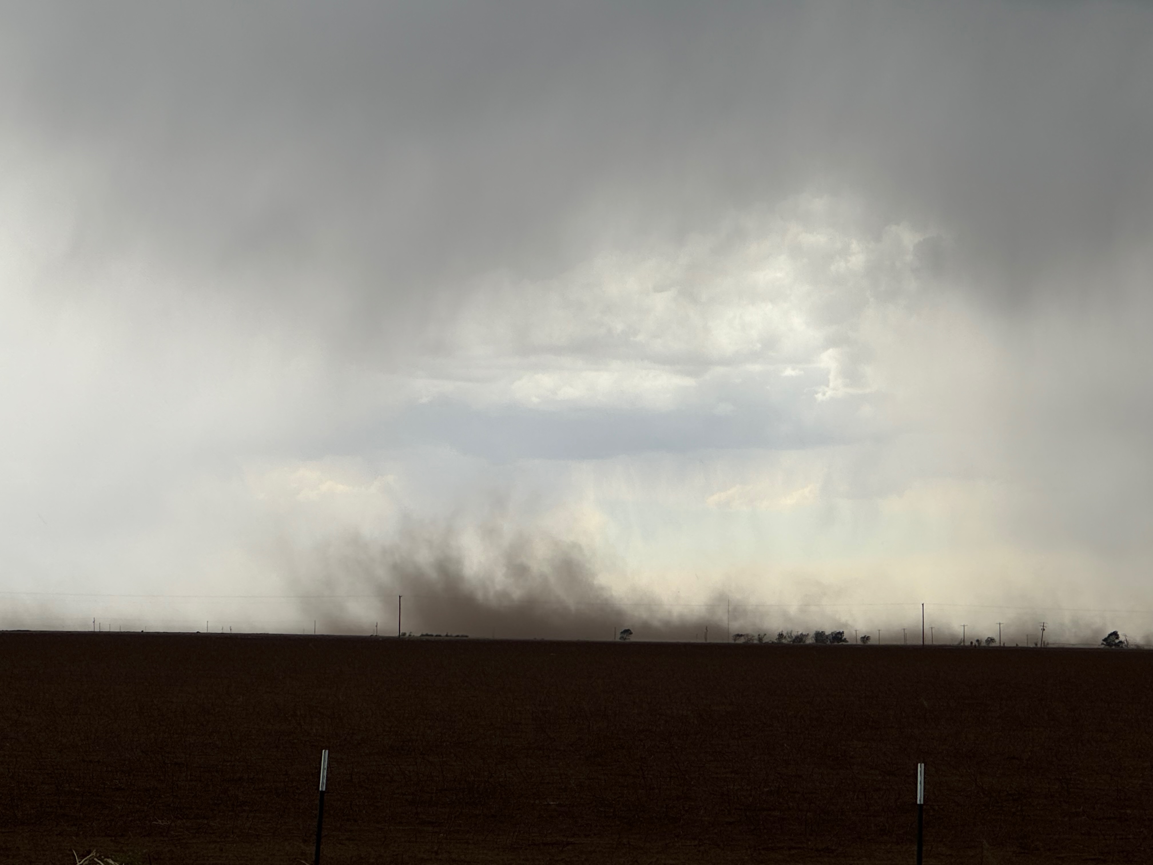
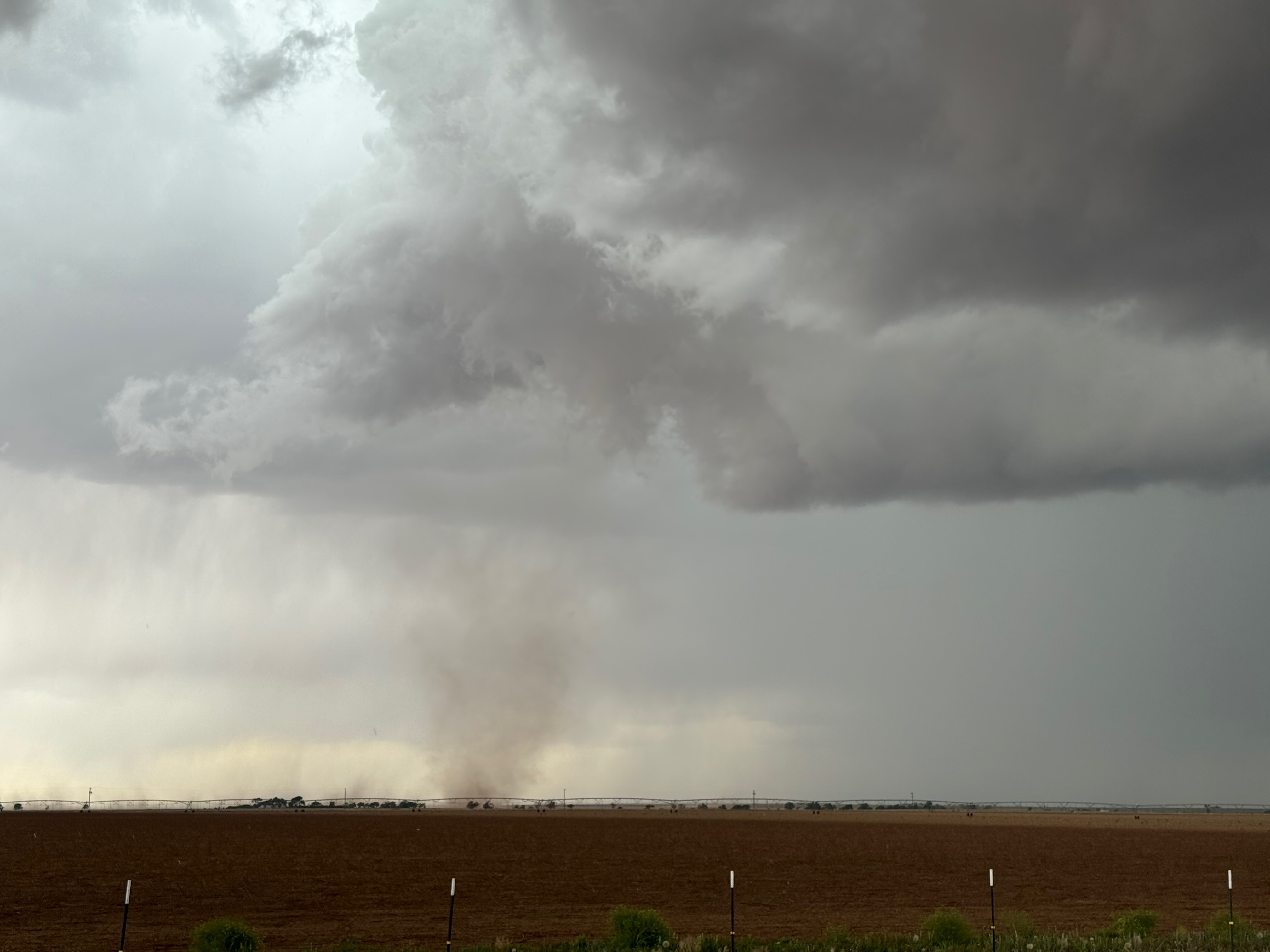
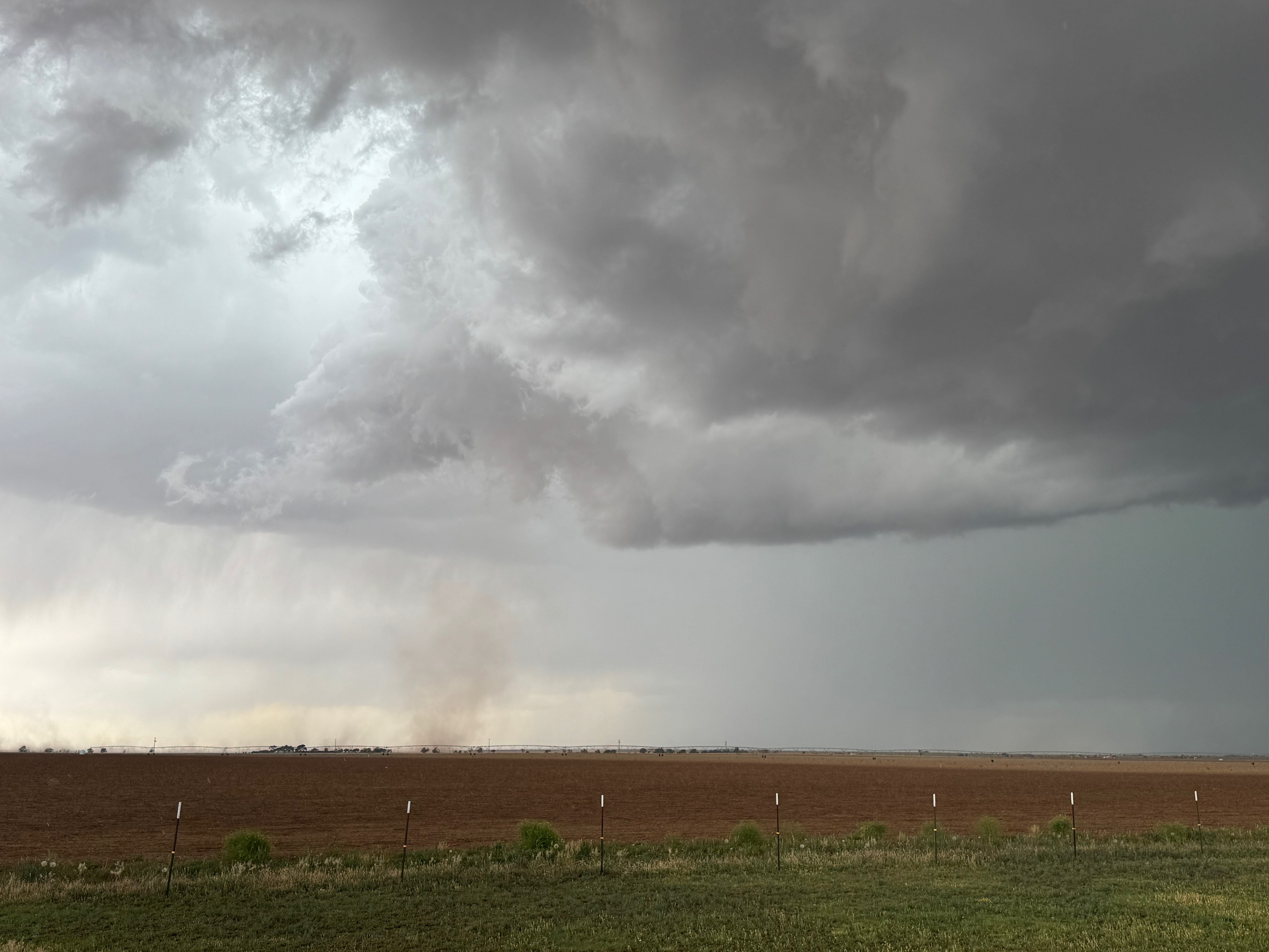
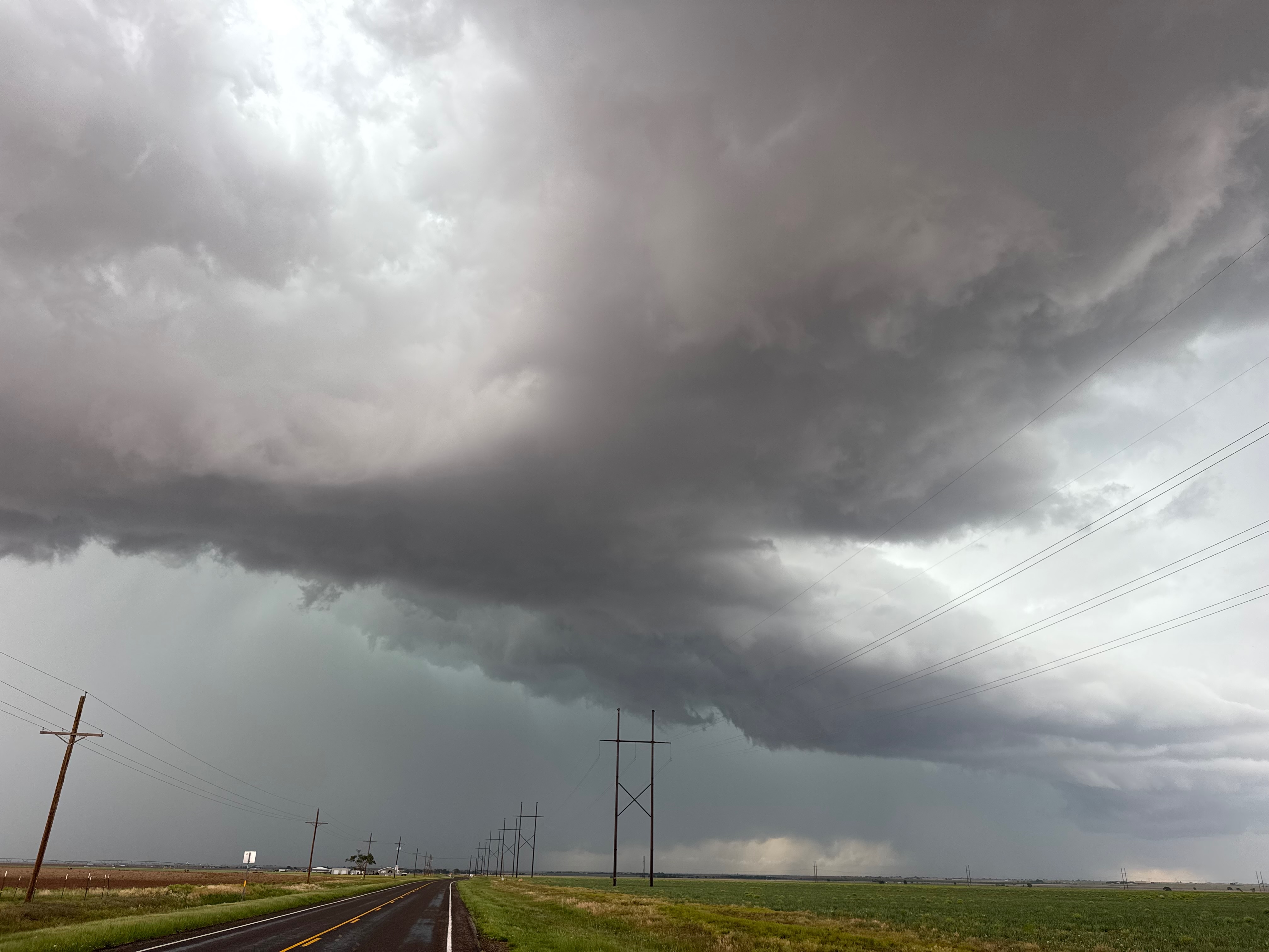
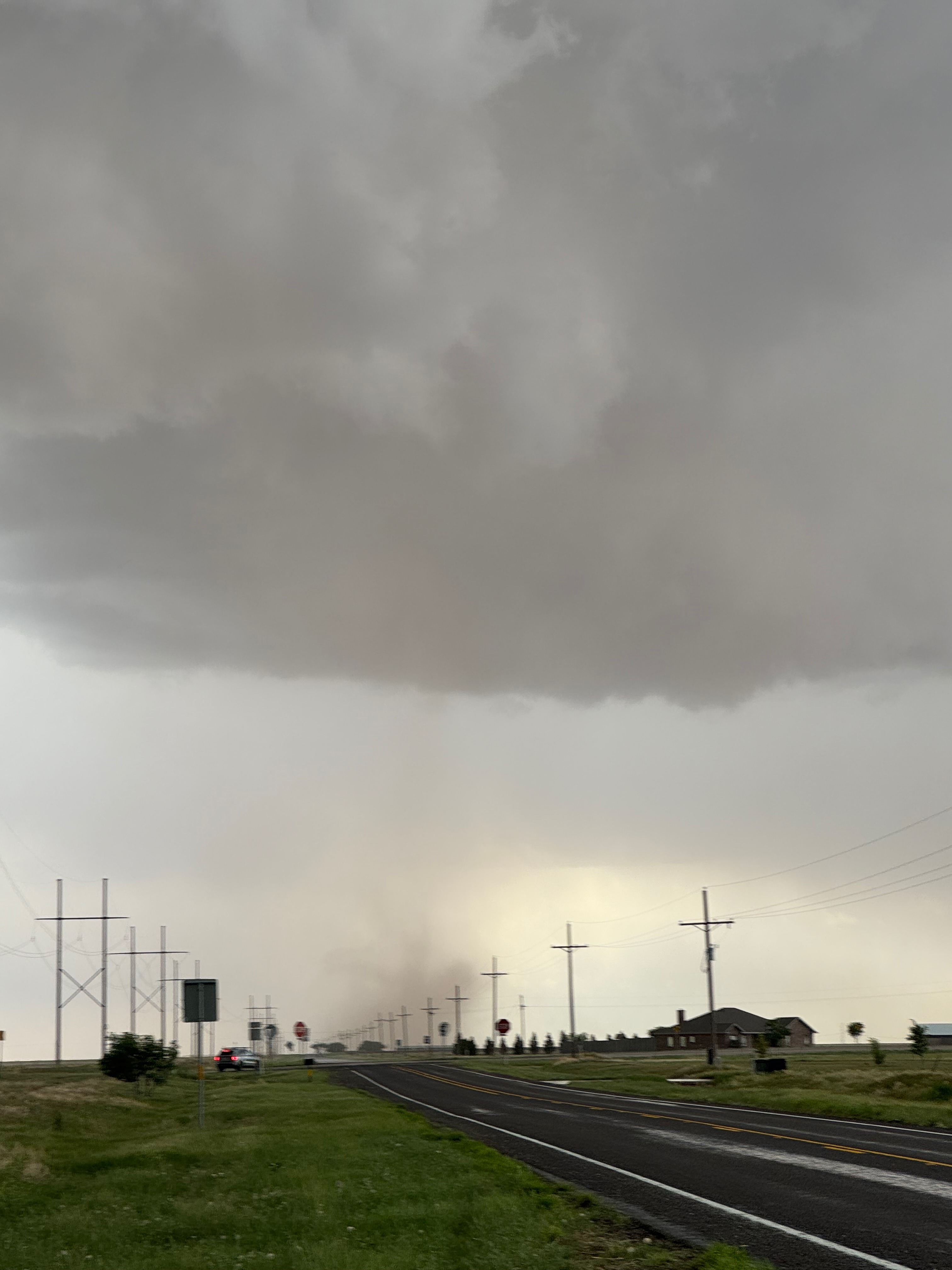
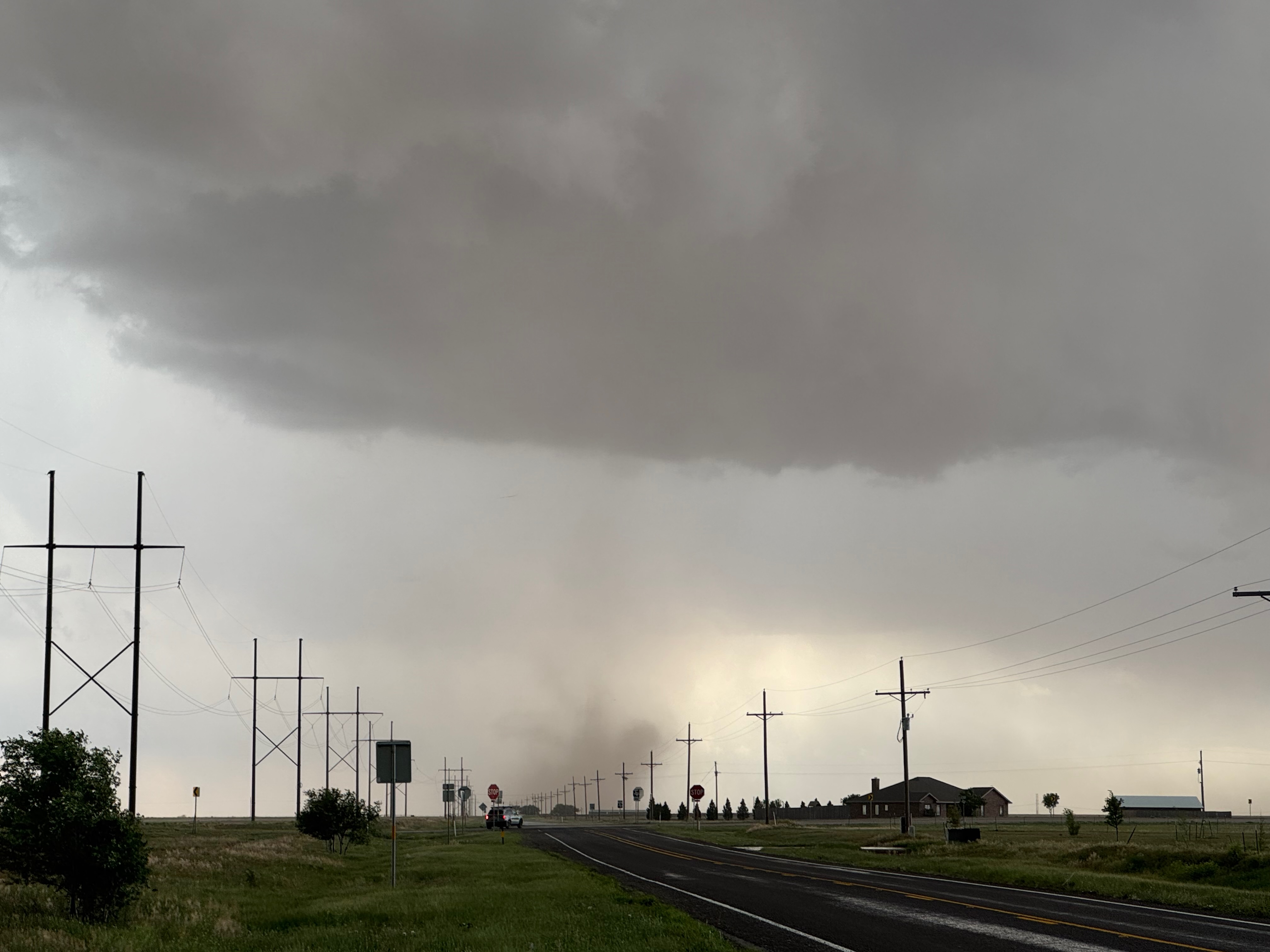
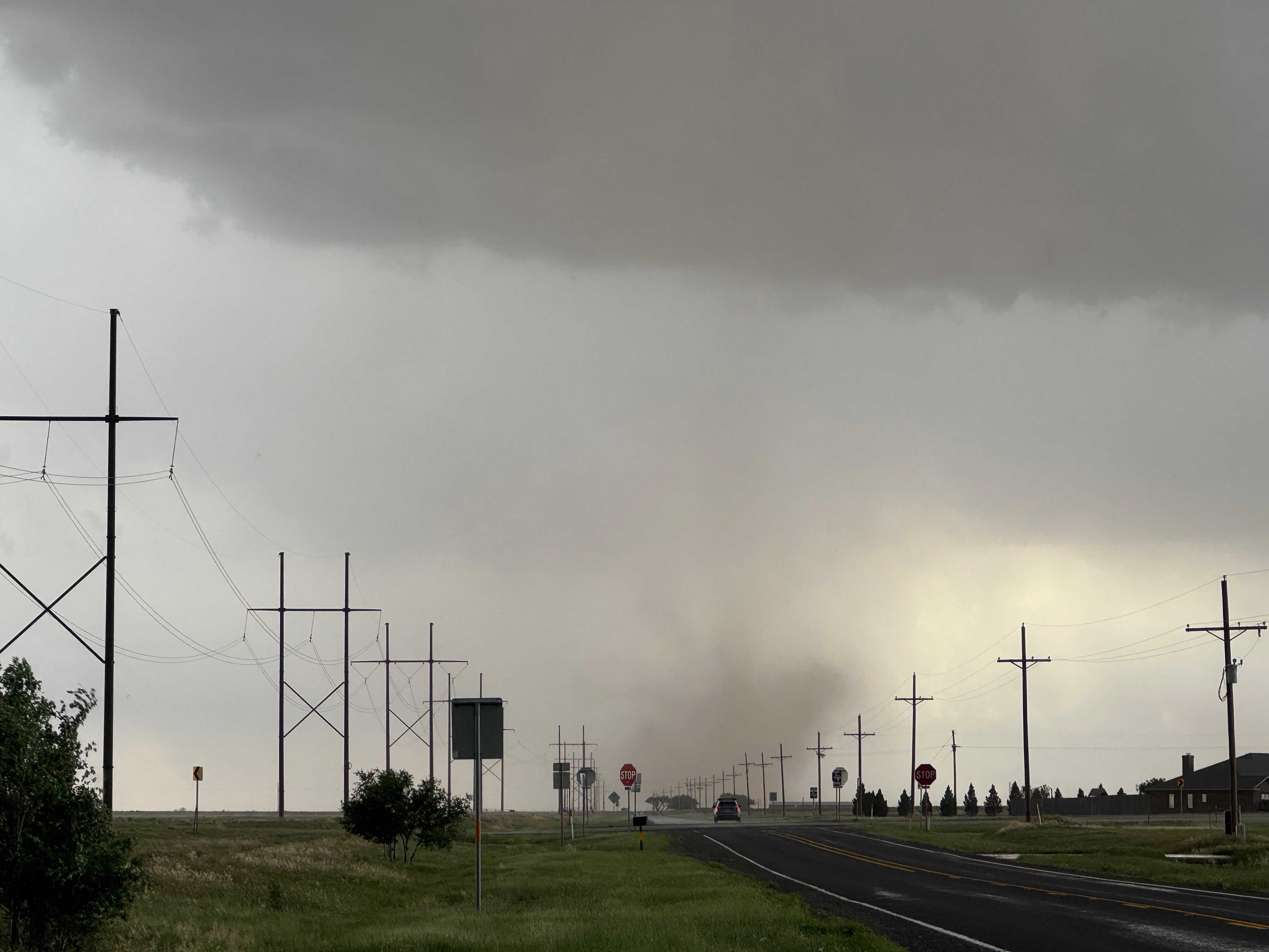
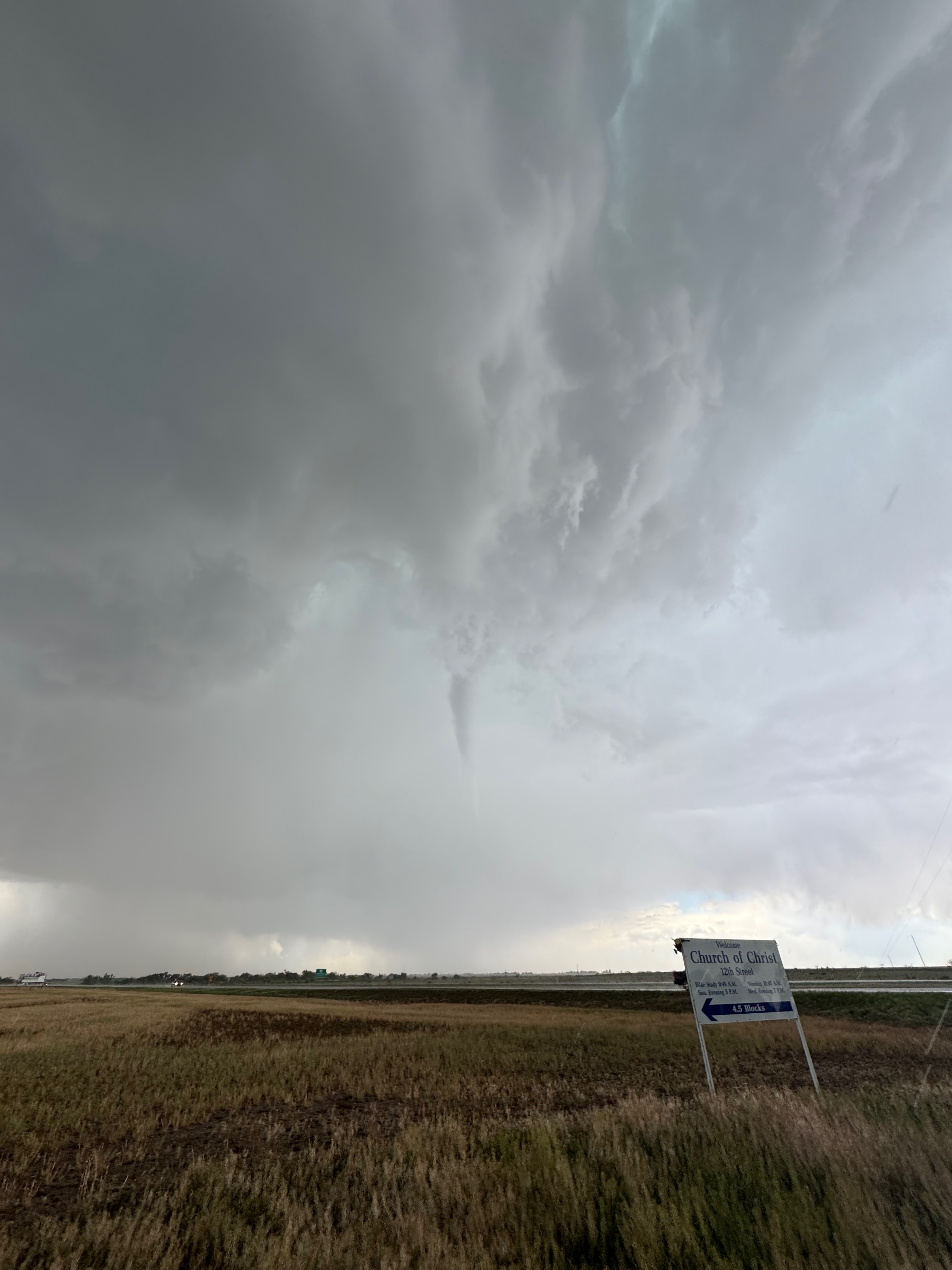
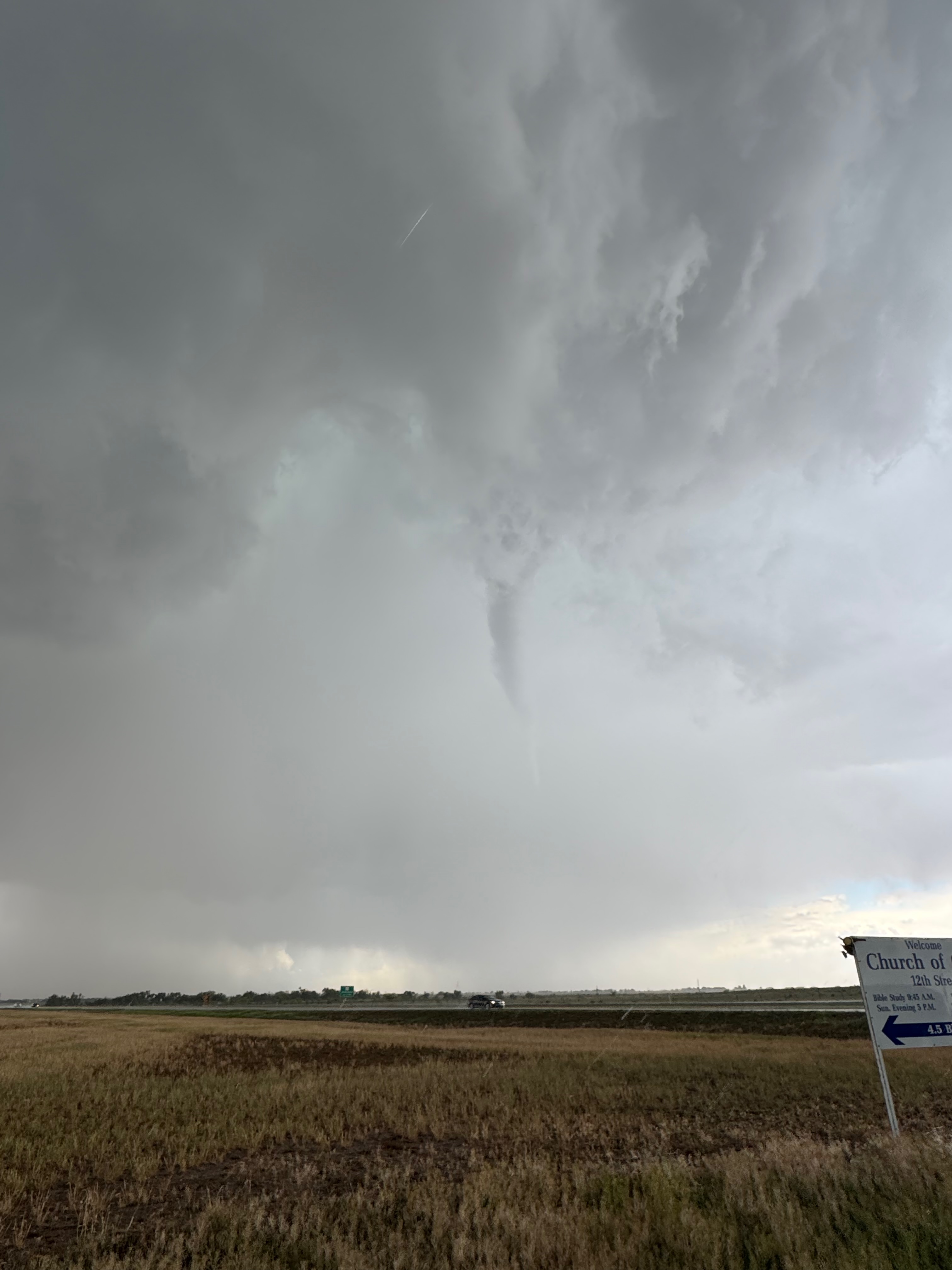
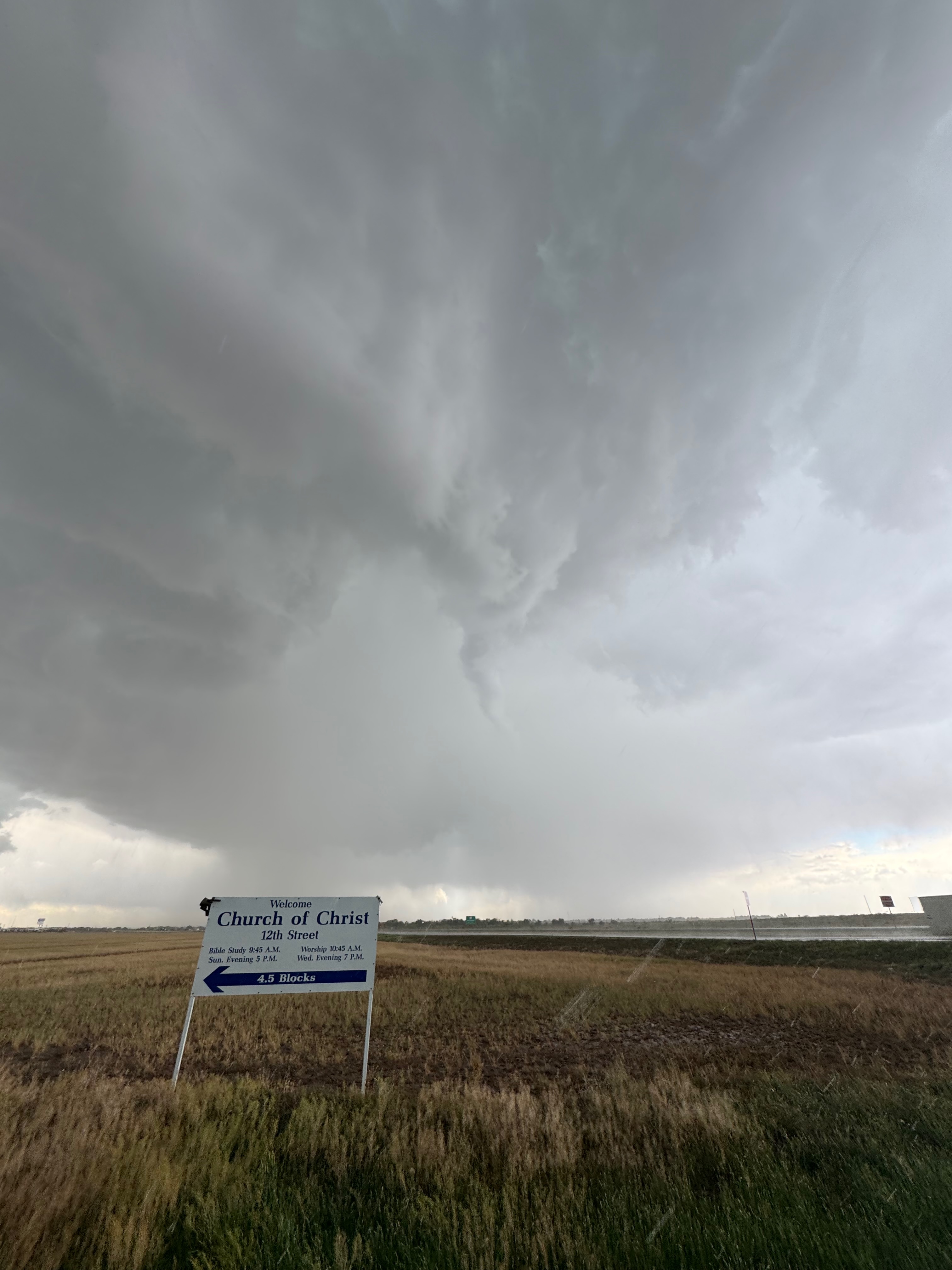
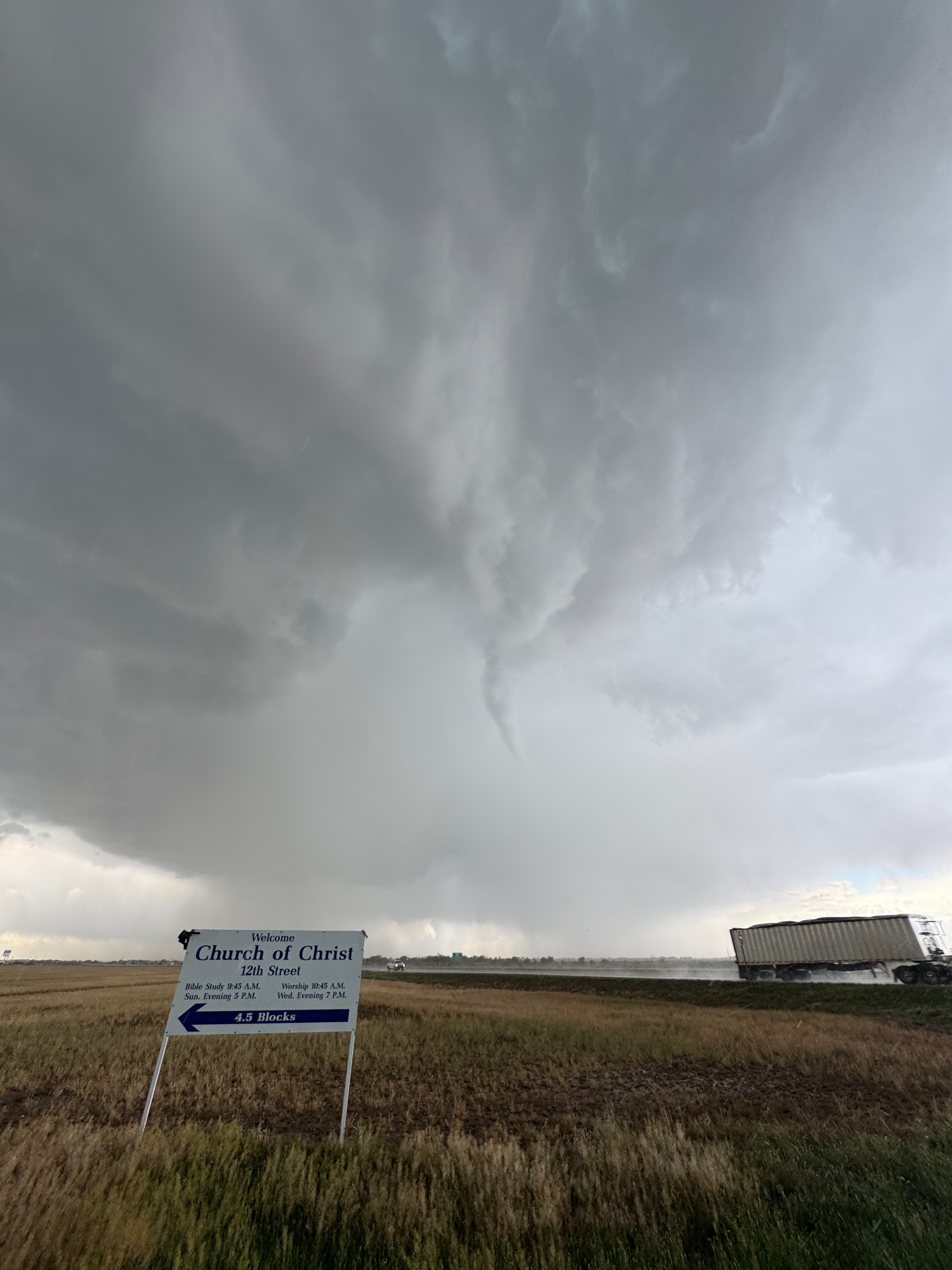
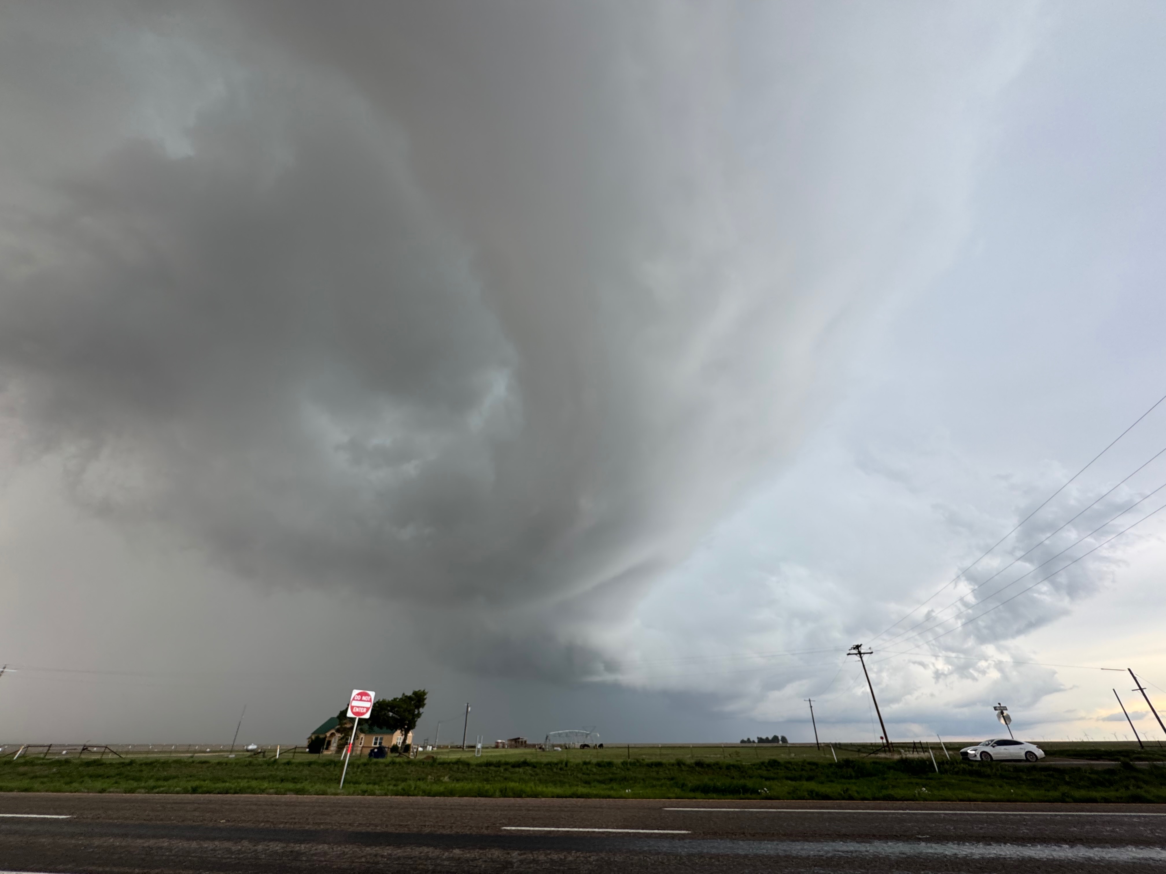
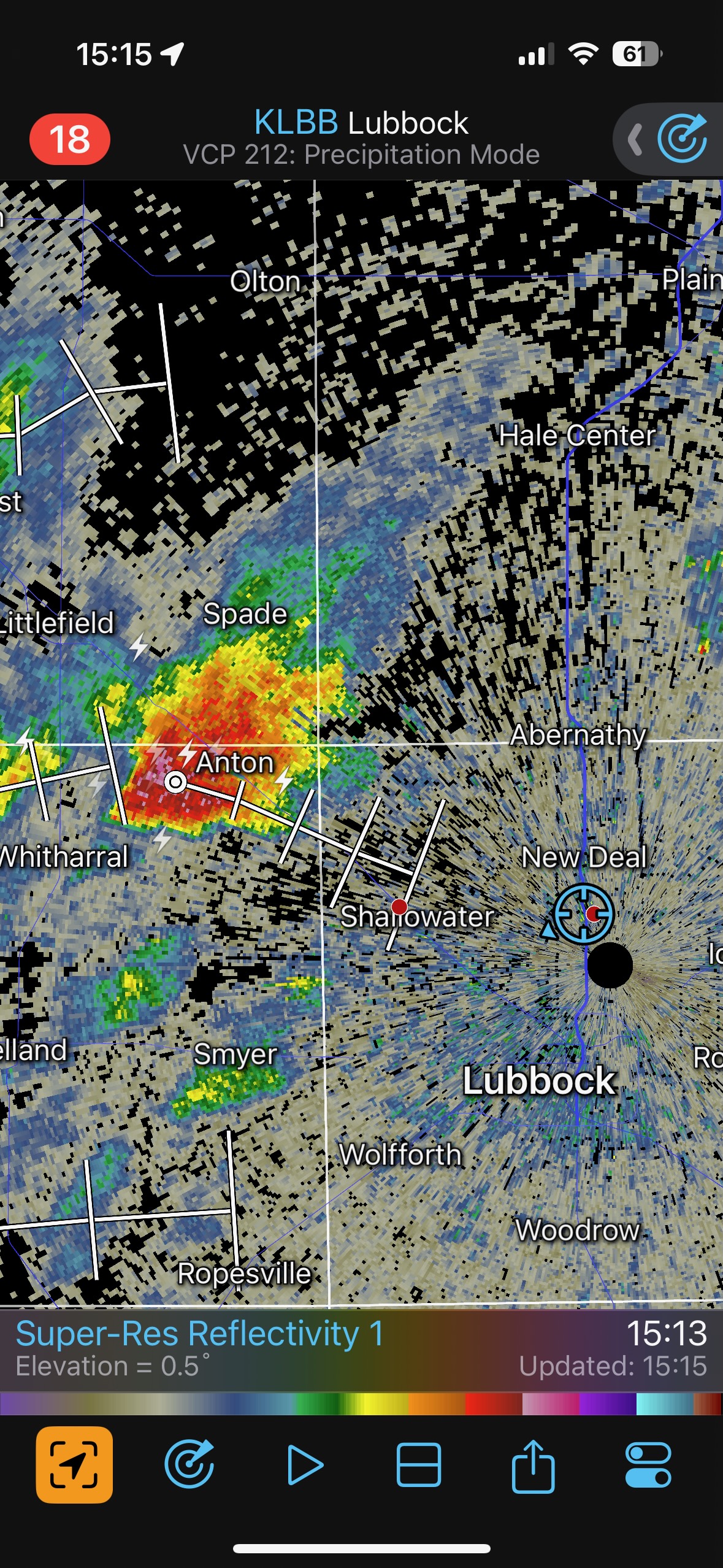
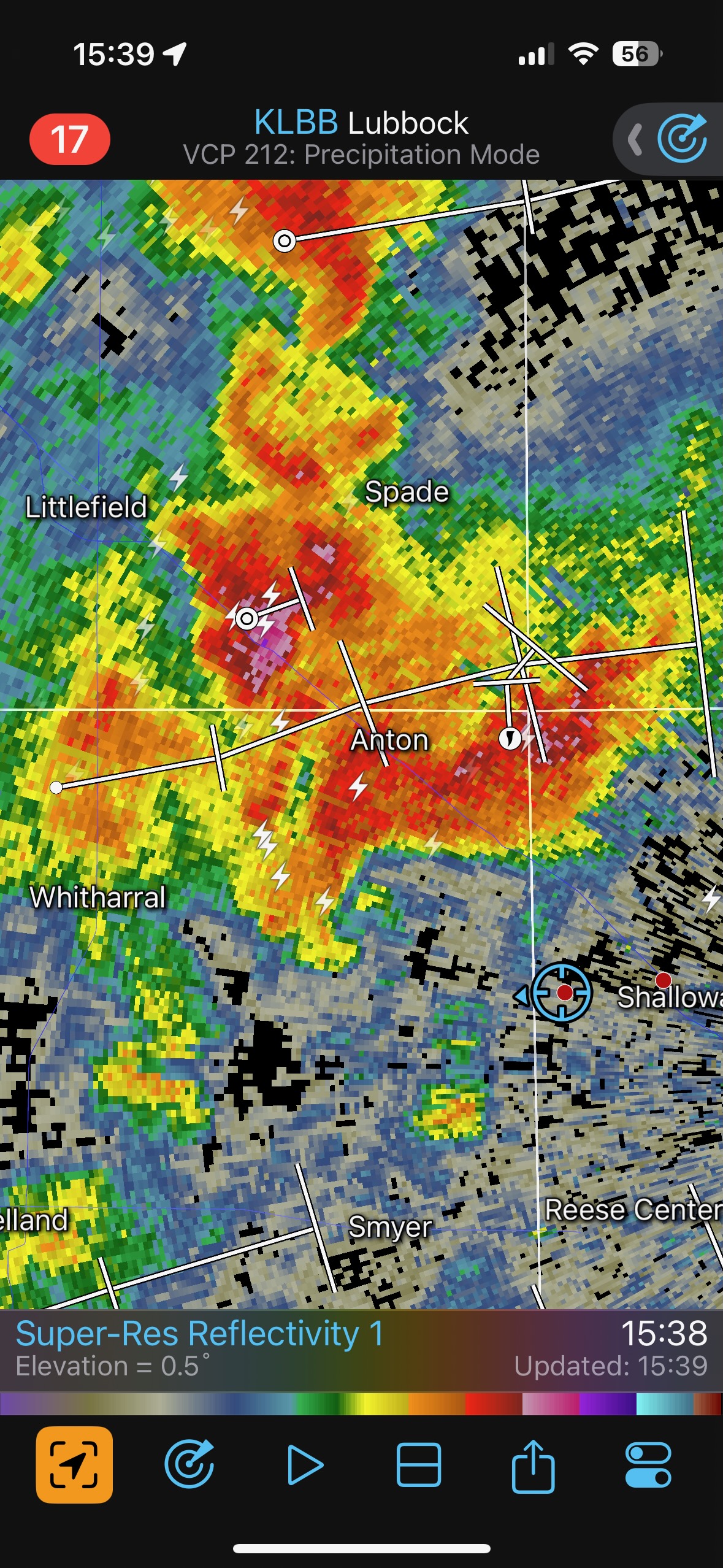
SPC showed a couple of 5 percent tornado risk areas in the trees from Austin to Little Rock, and around St. Louis. These areas were not appealing for a variety of reasons…mostly logistical…and trees…and distance…and trees…and trees…and Messy McJunky storms. There was a lot of annoying morning convection cruising through the Red River area. I opted for the Texas Panhandle west of I-27 near Lubbock, as CAMs showed some halfway interesting storms there by late afternoon. We had our fill of BBQ at Dickens, and then headed west to the Caprock. After a pit stop around New Deal (I was not in much of a rush, even though a cell had just popped up to our WNW near Anton), we continued west and soon saw a dusty circulation due west. We had a landspout tornado! We stopped a couple of miles west of Shallowater. A large storm base extended about SW to NW, and I was having some difficulty trying to figure out if this thing was a supercell or not. It kind of looked like there was some organization. Shortly thereafter we had a few dusty spin-ups going beneath the medium-high base, and then a couple more. All of these were landspout tornadoes, just a few miles distant. There were some lumpy lowerings in the base above the landspouts, but no impressive condensation funnels. (See first five images below.)
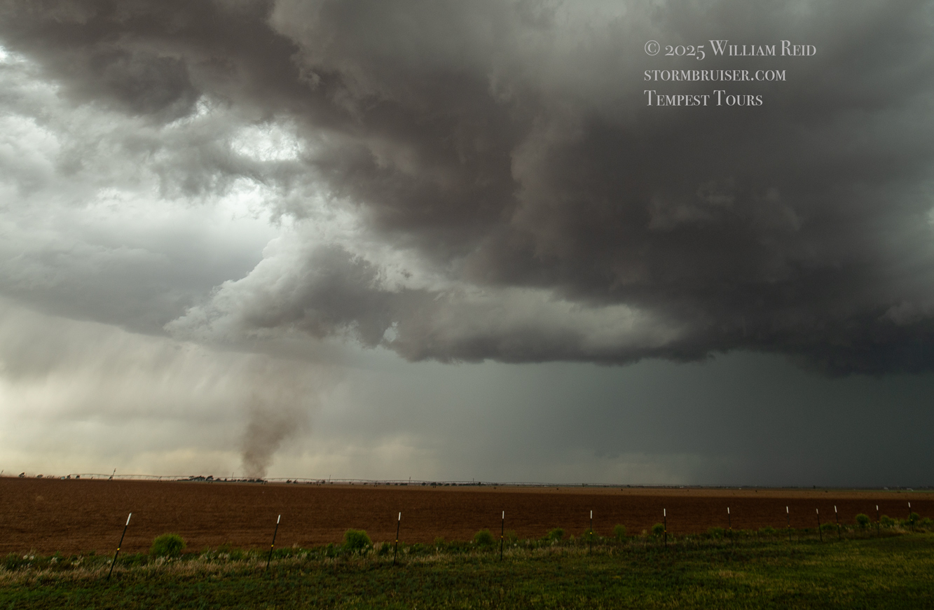
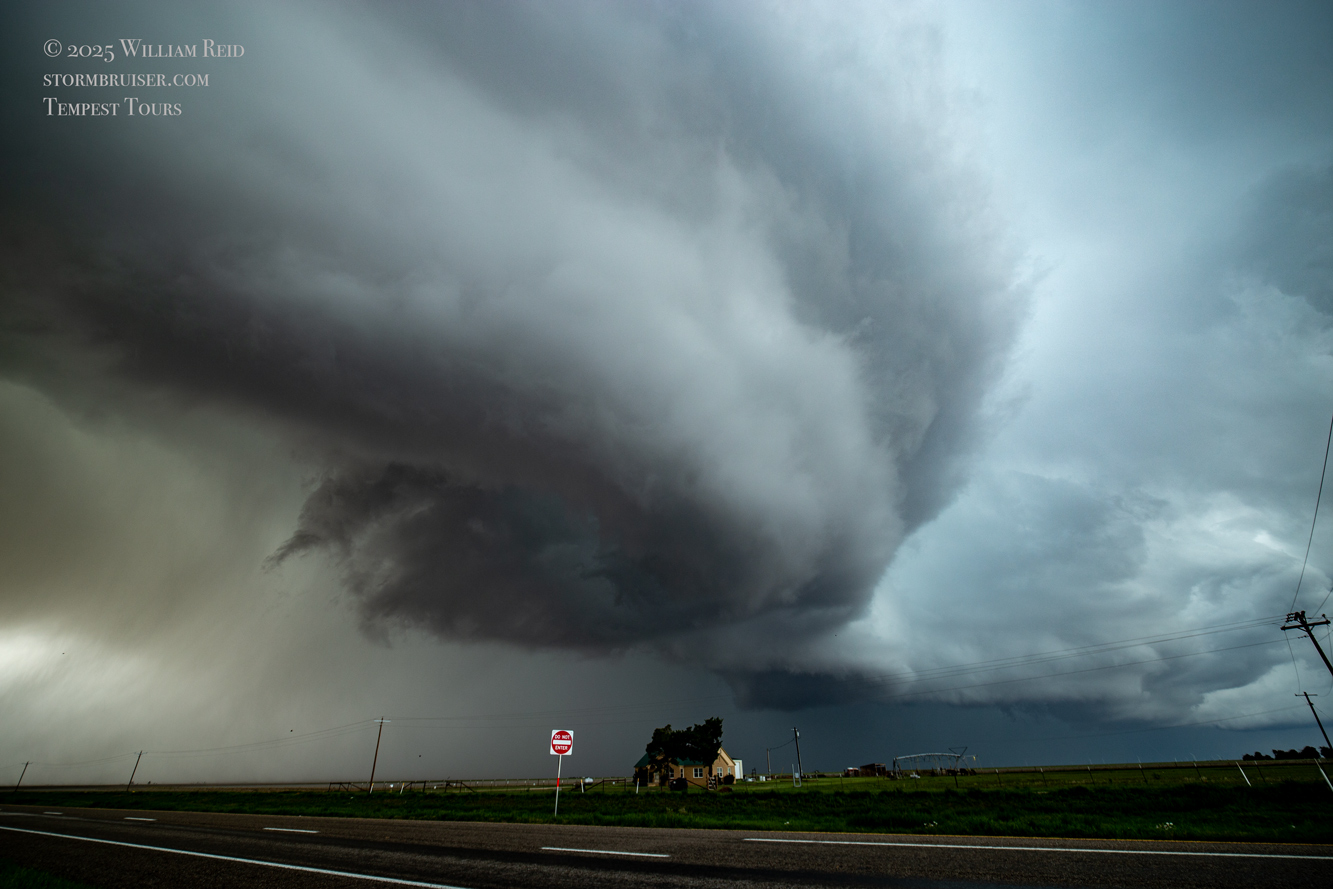
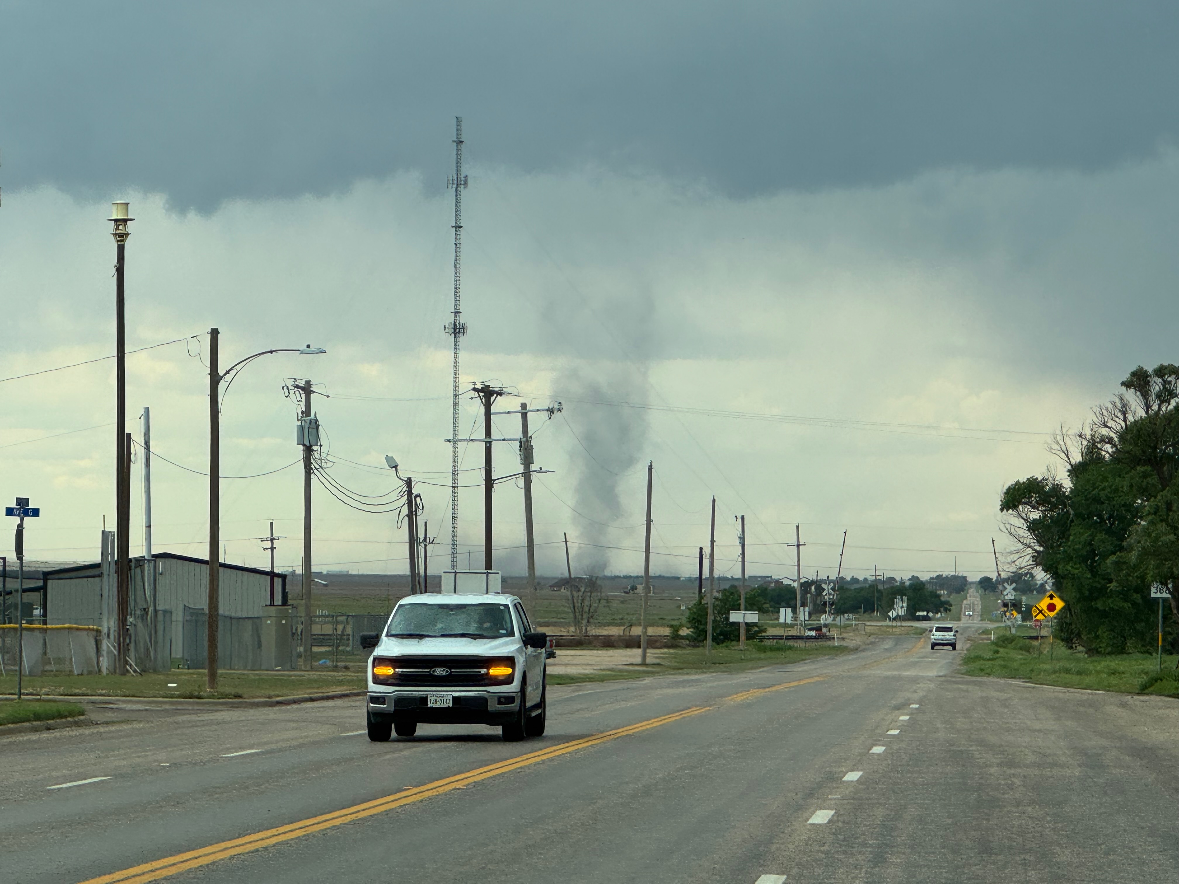
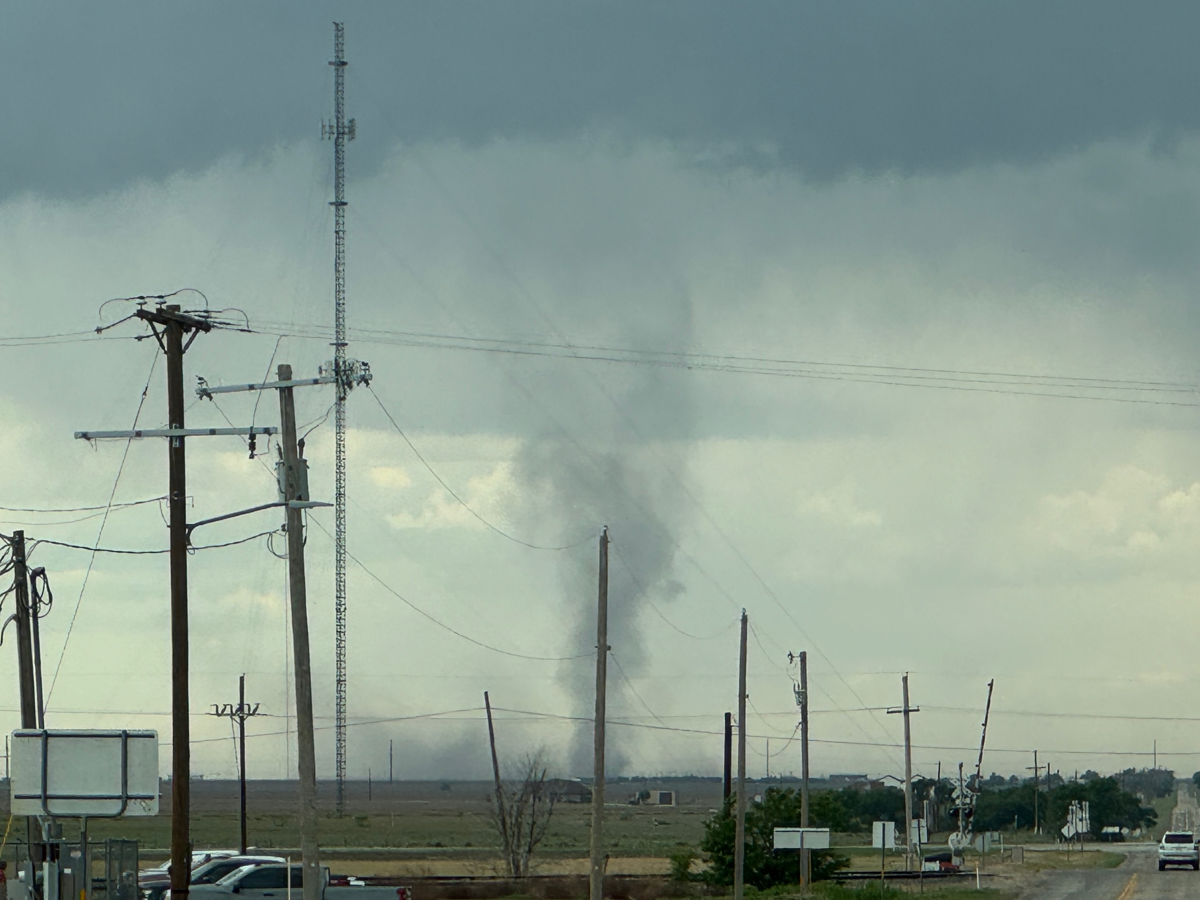
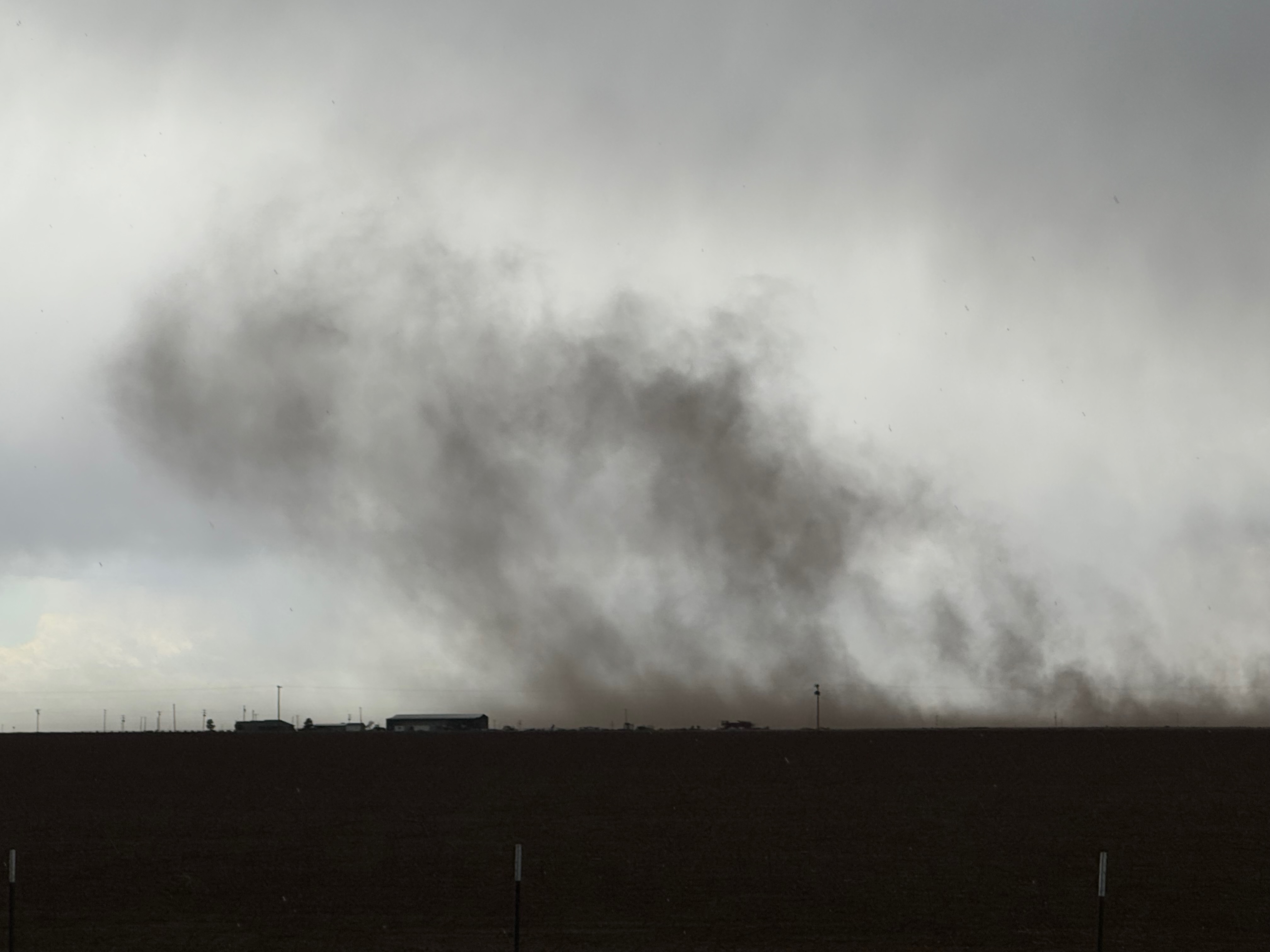
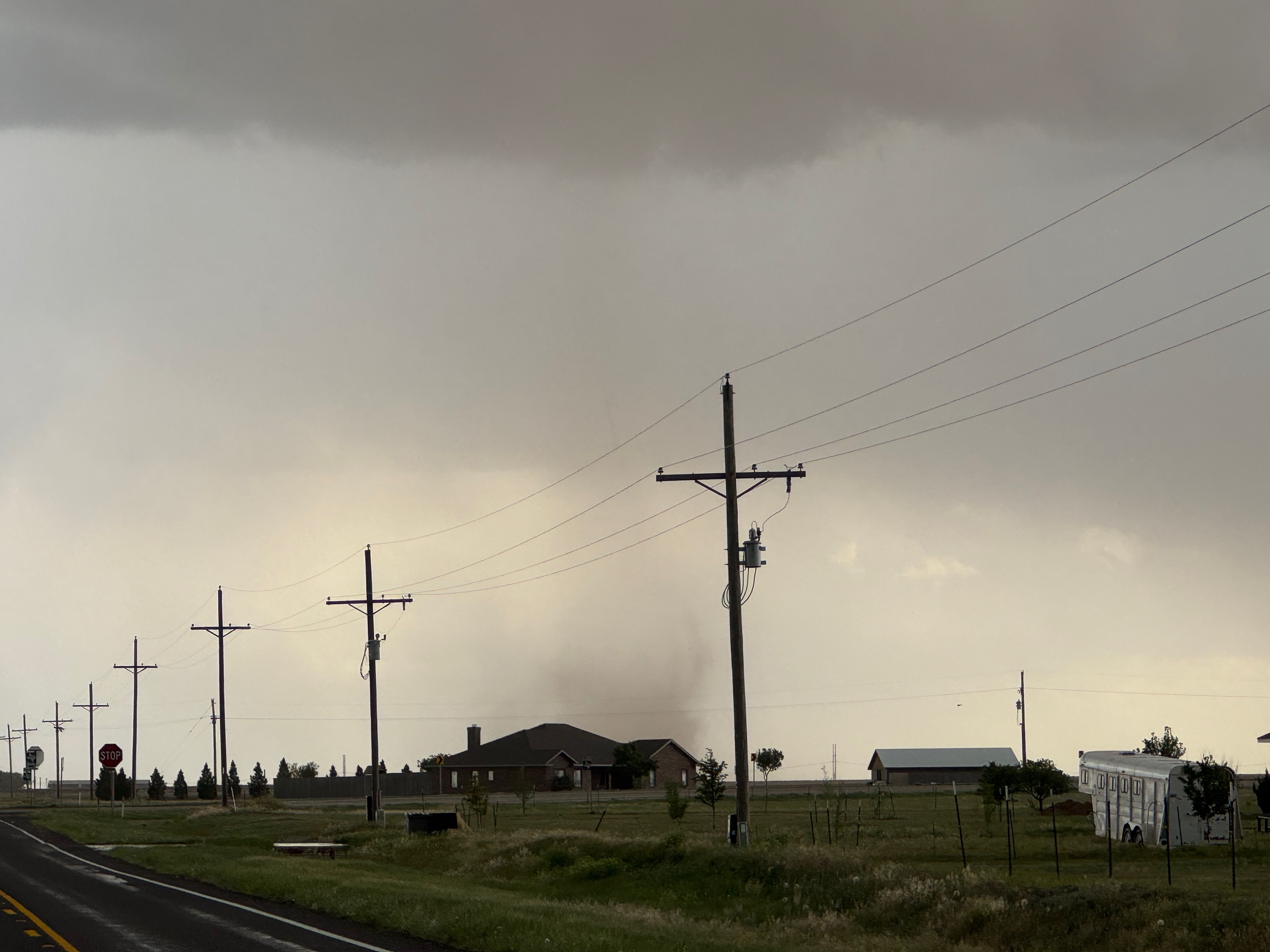
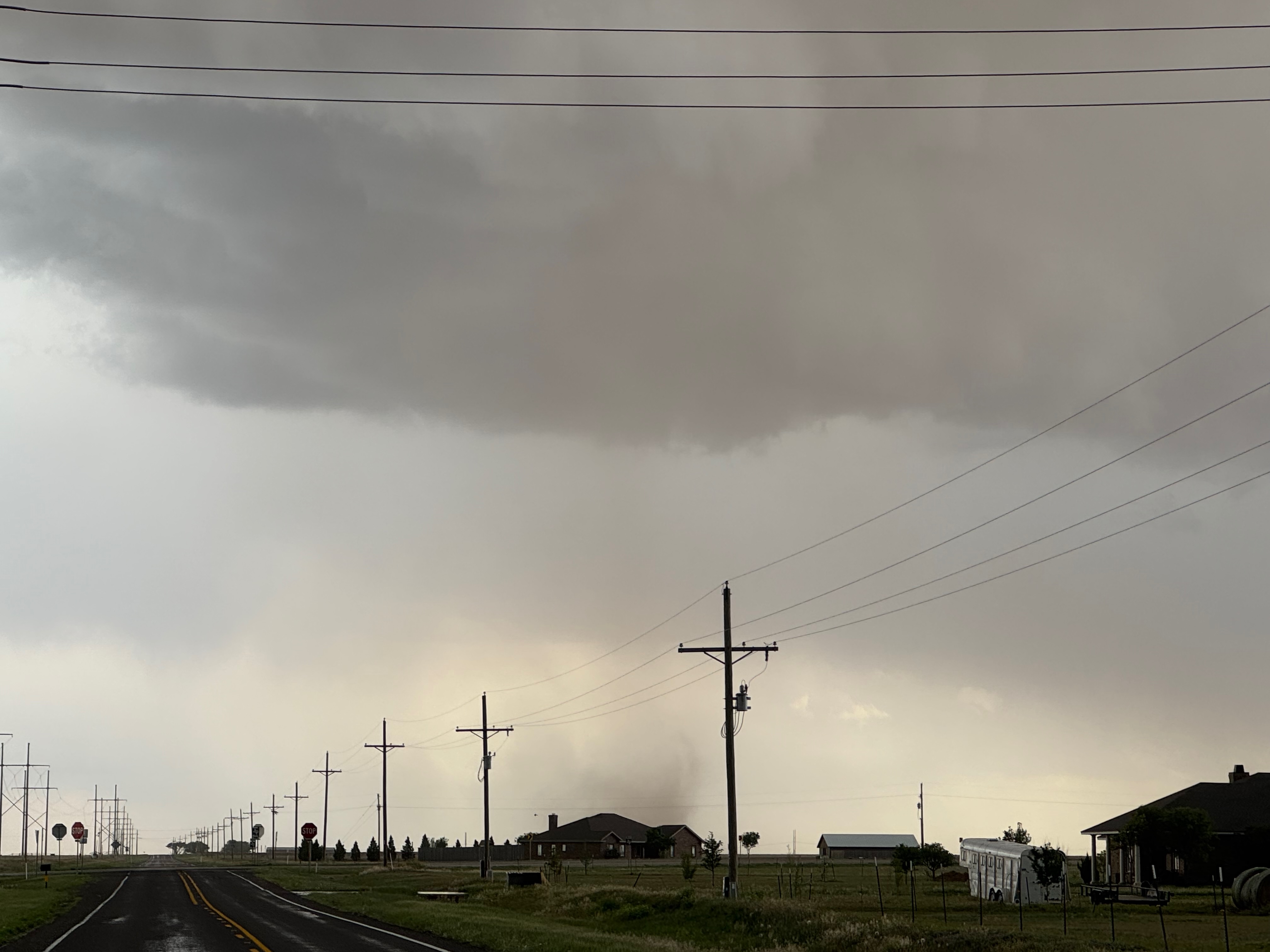
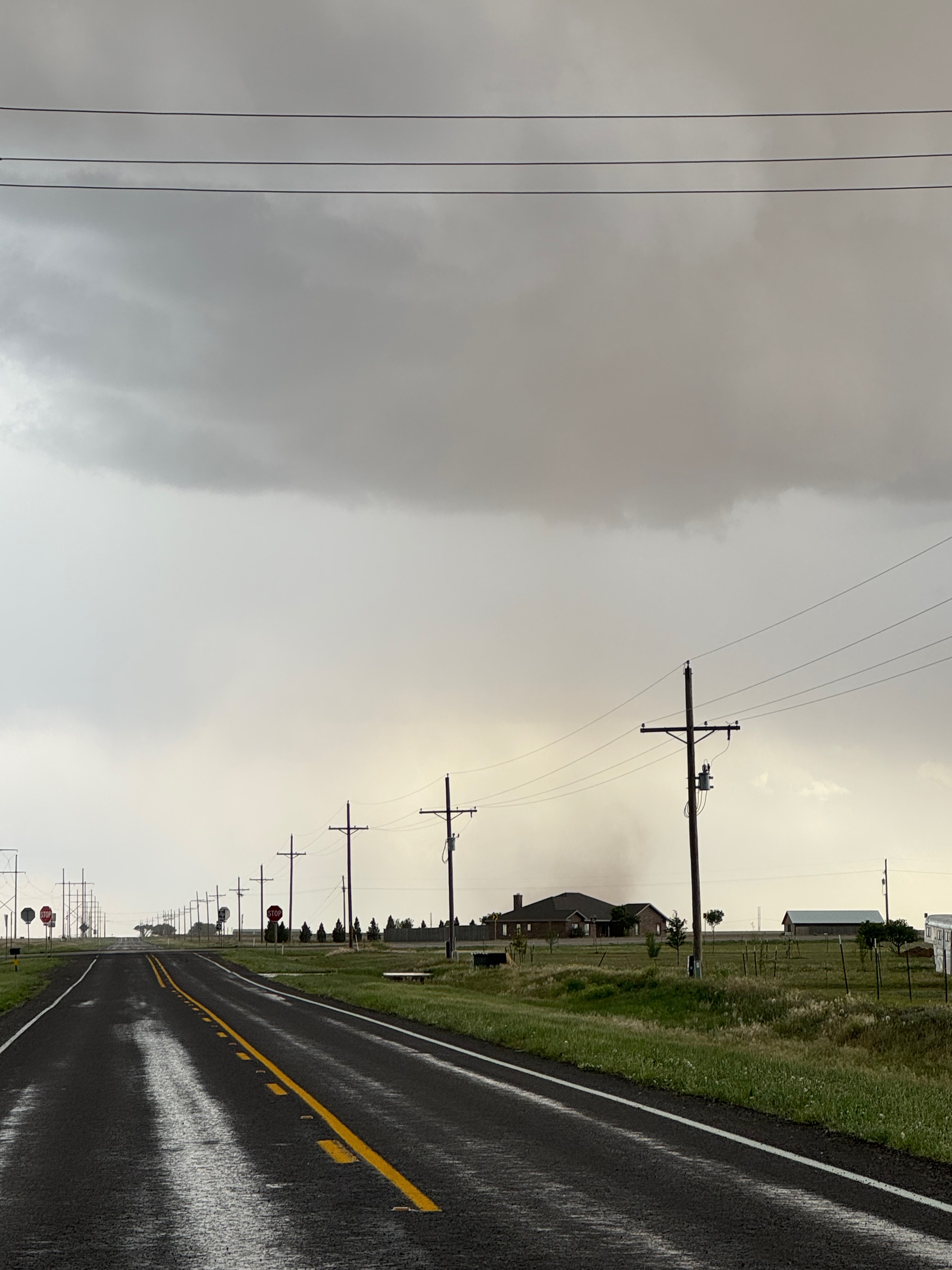
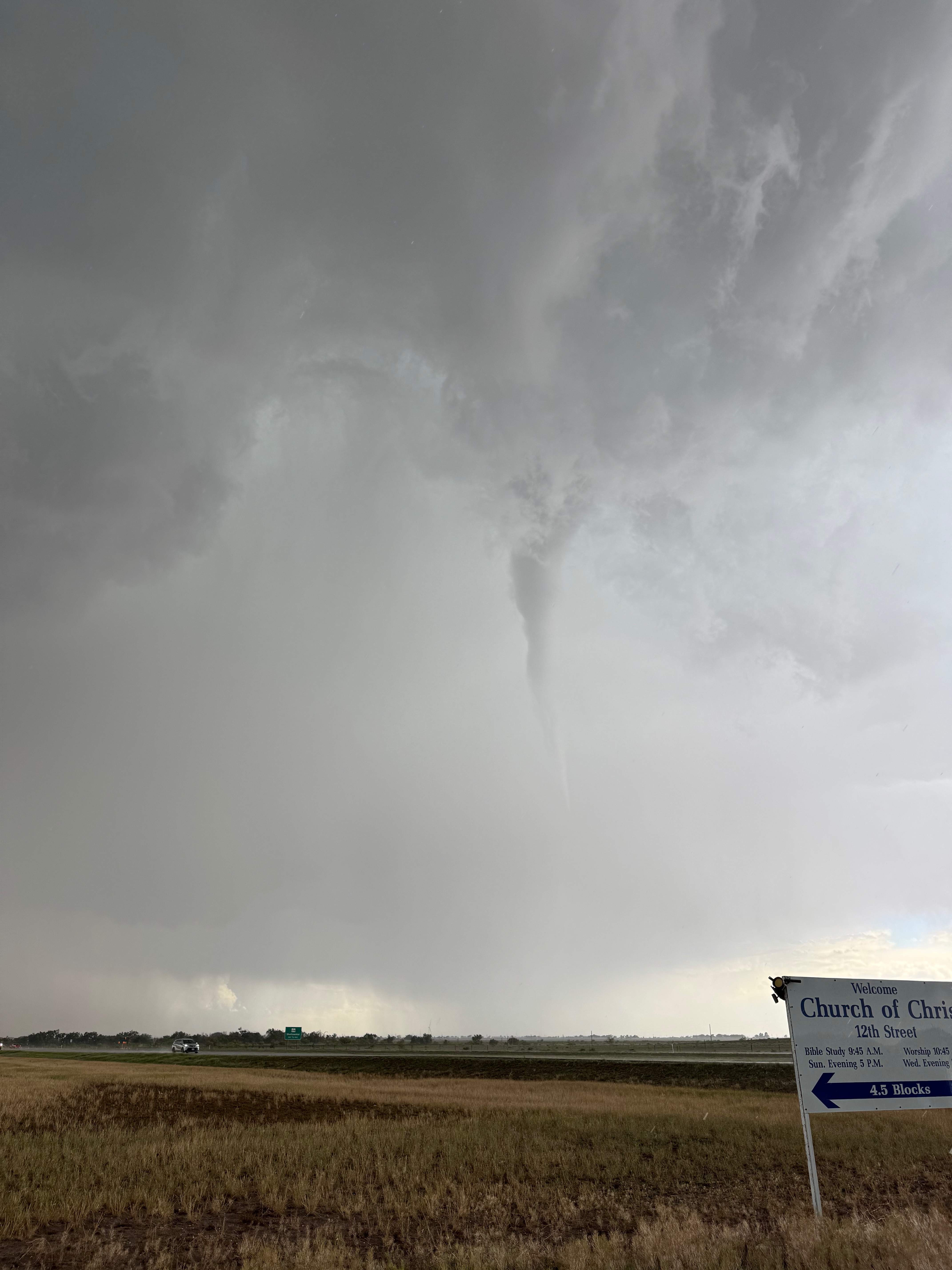
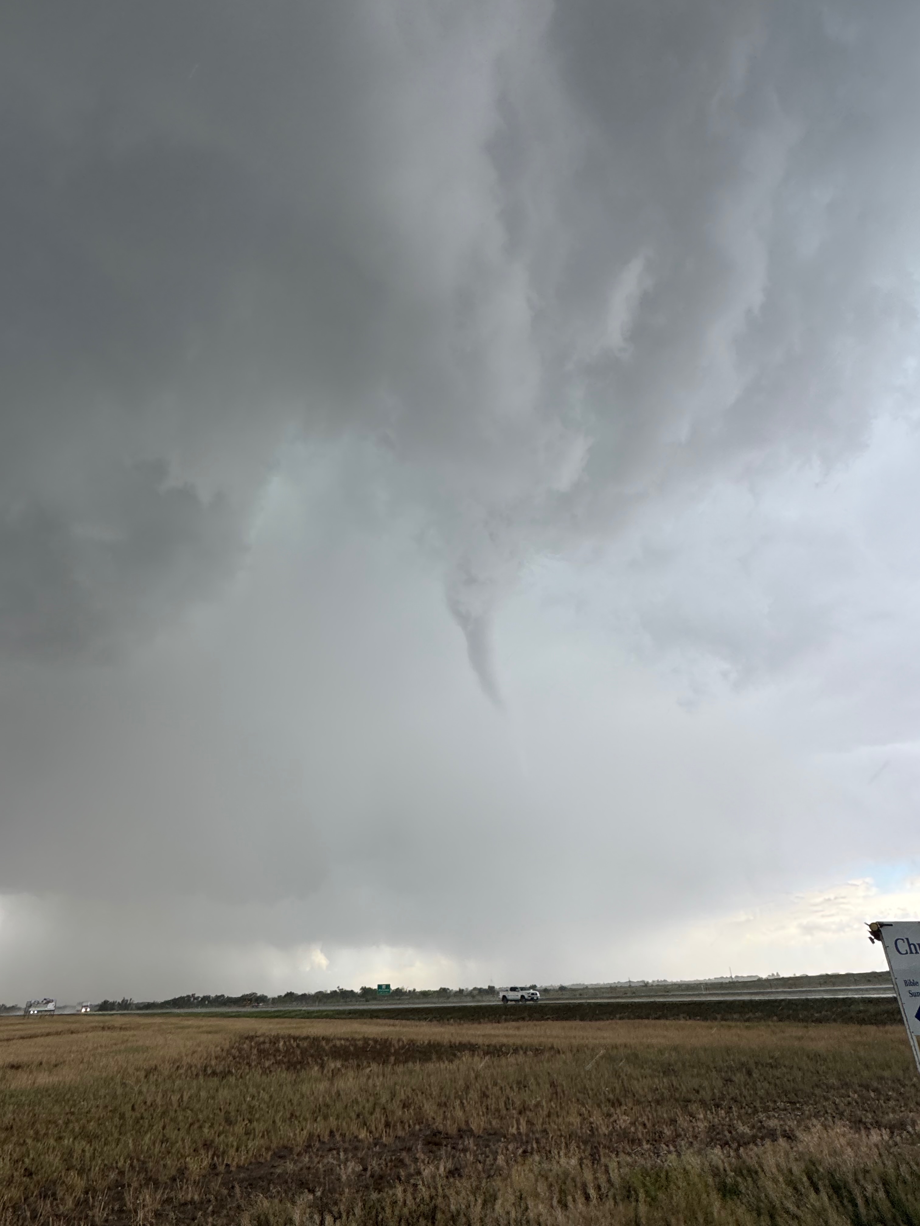
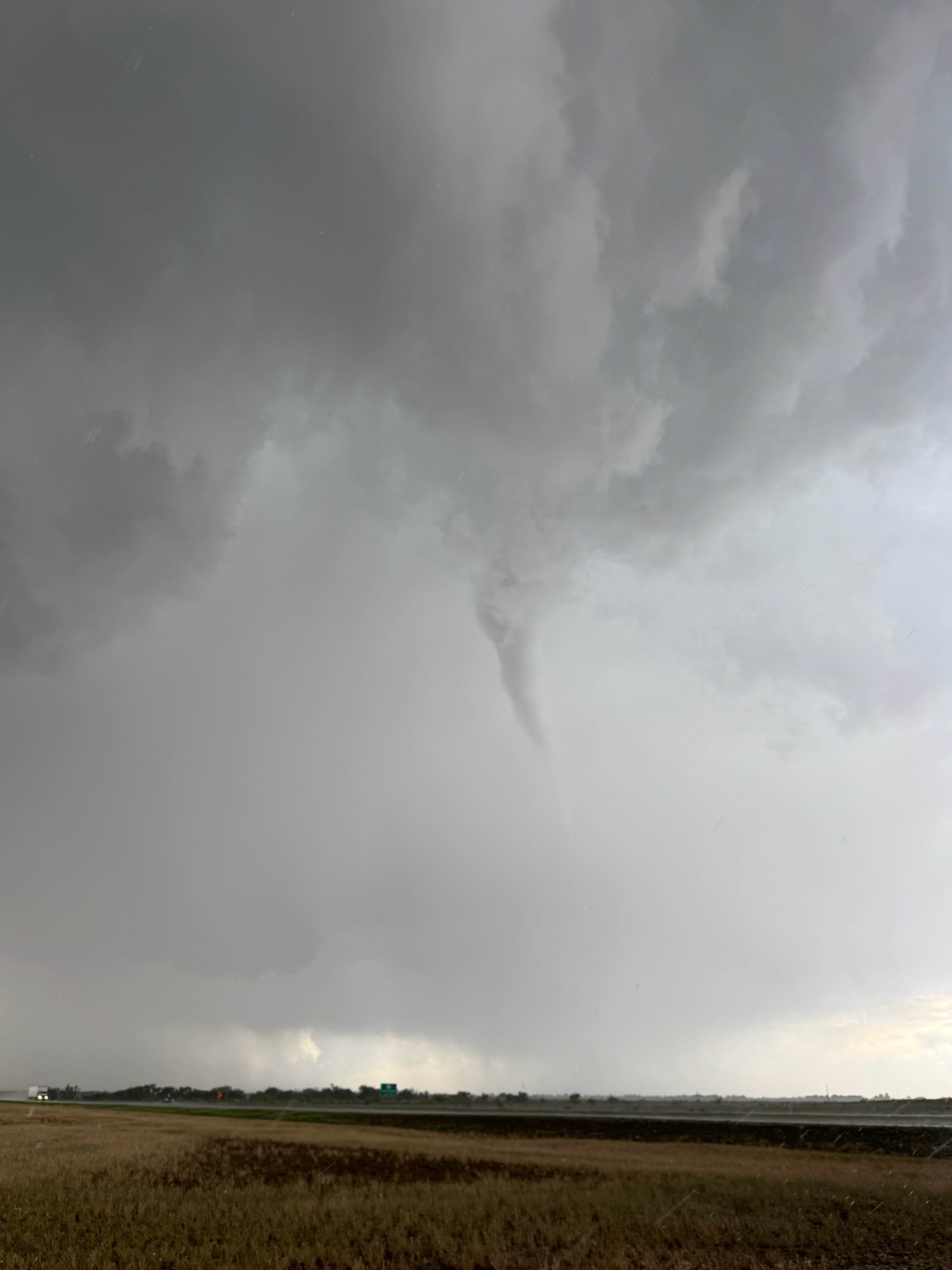
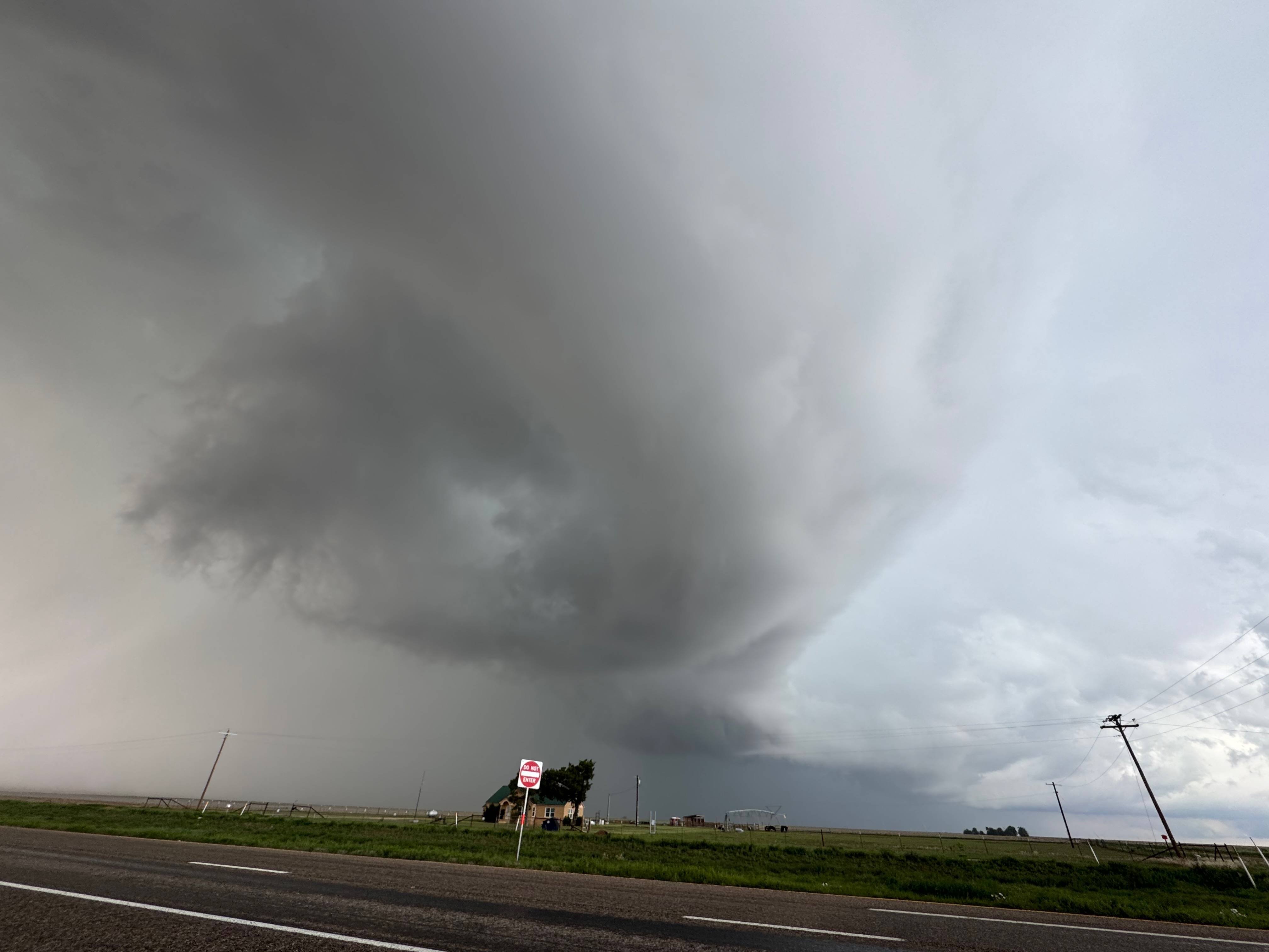
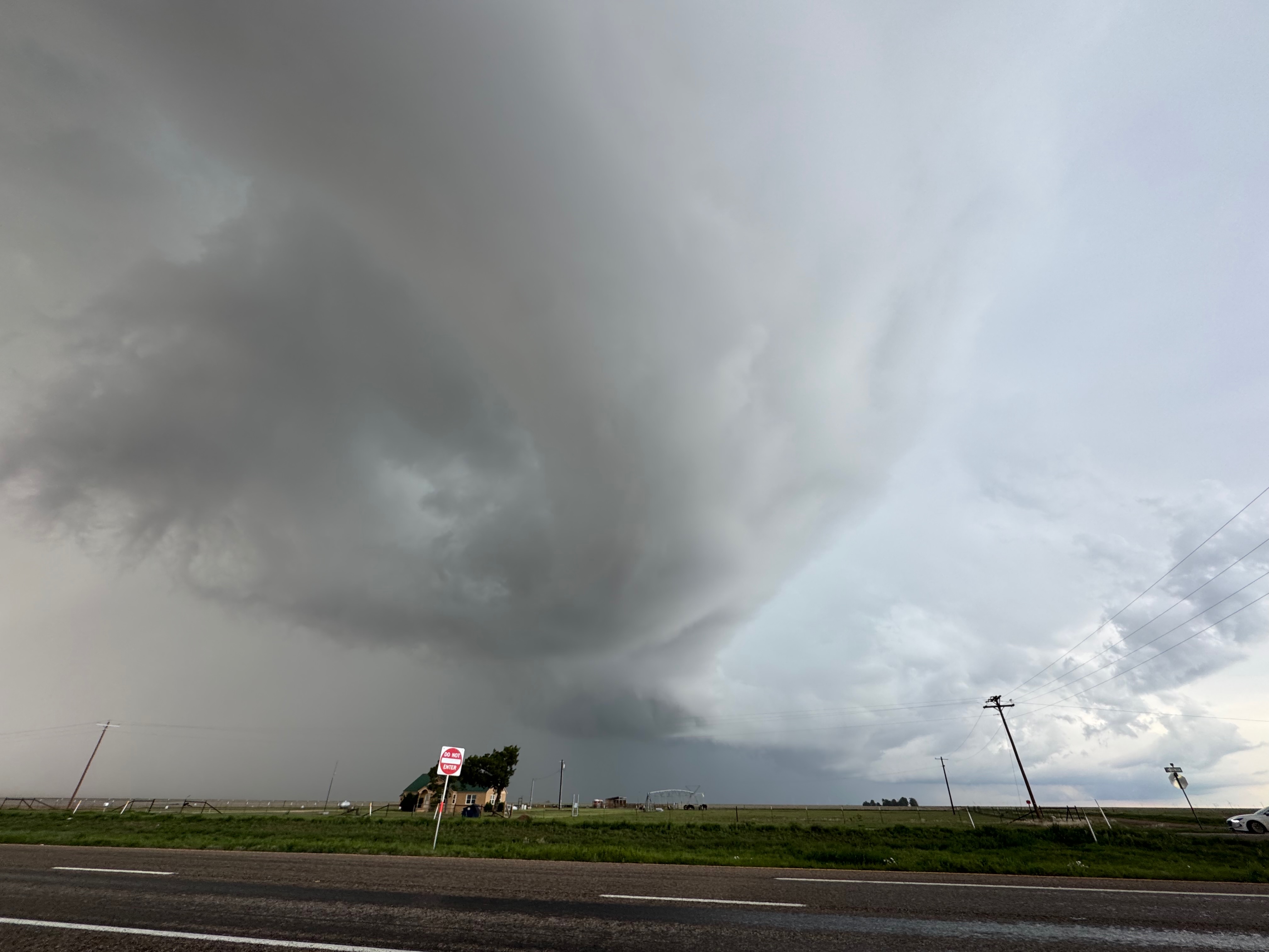
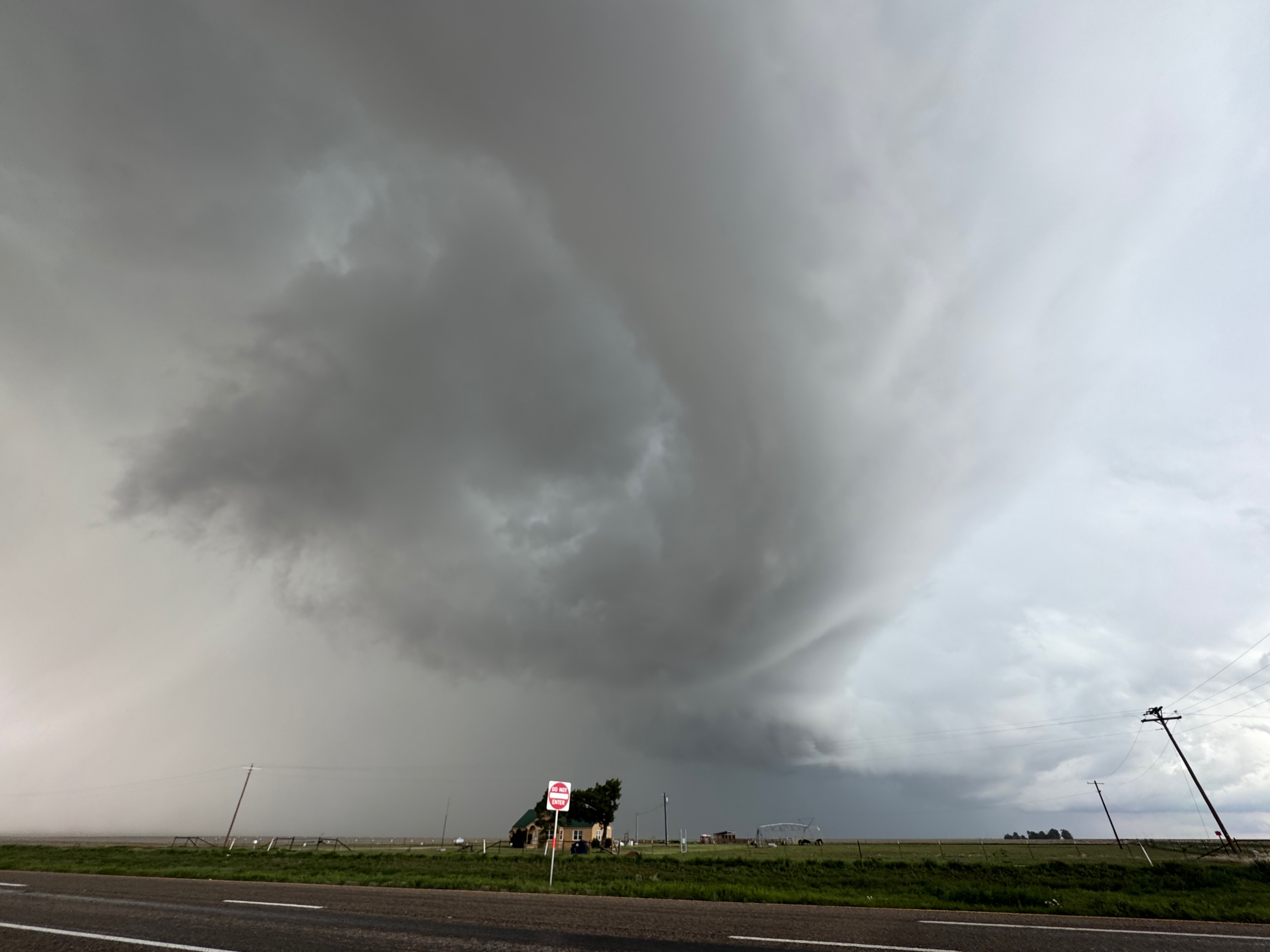
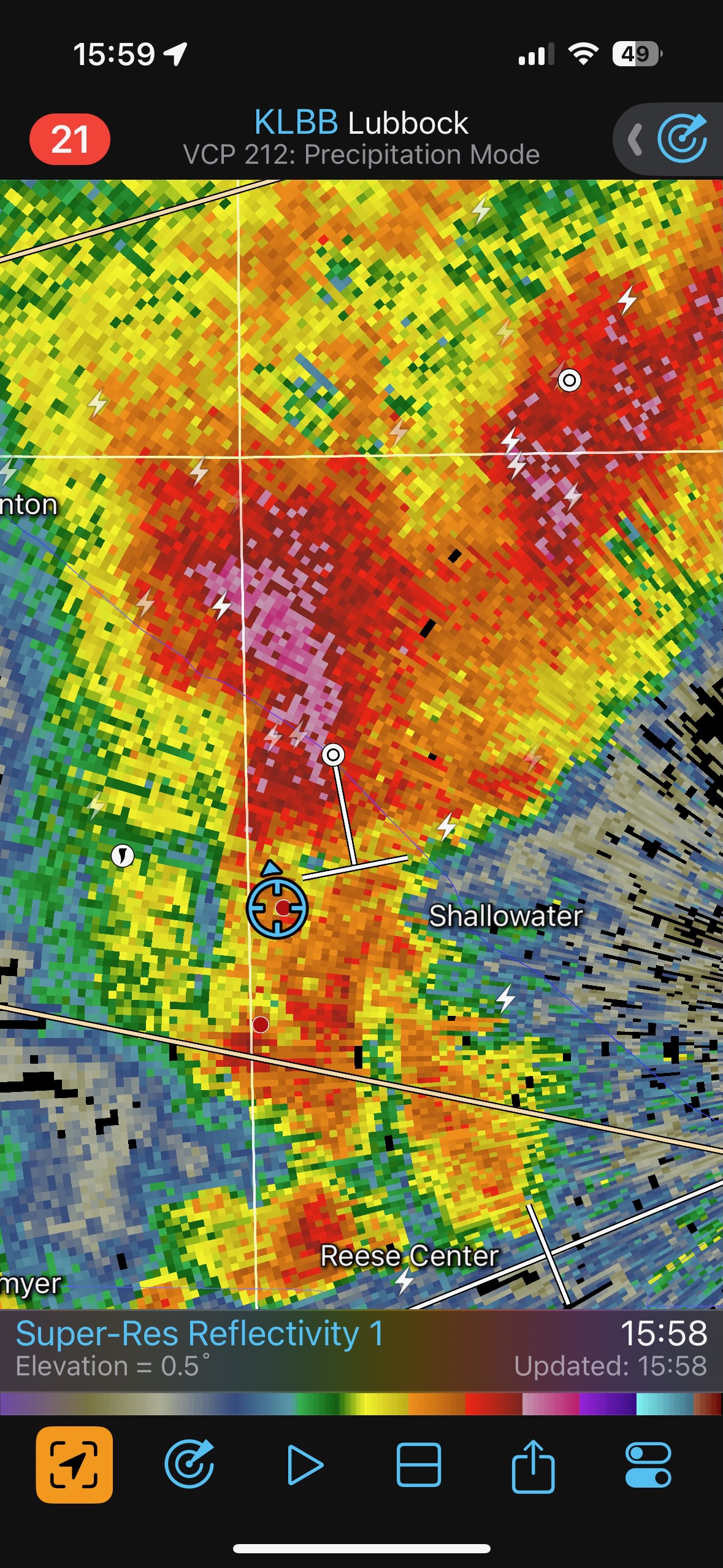
This spurt of weak landspouts came from a rather benign-looking updraft base, around 4 p.m. MDT. It looked like the real action area, if you are playing the “supercell-tornado-cascade” game, was more to the north. After maybe ten minutes of landspout observing, the rain became too obnoxious and drove us east just a little bit — less than a mile — back to near the western edge of Shallowater. I looked out my window to the south and had Roger stop quickly, as a pretty good funnel cloud was hanging down nearby. Where did that come from?! We piled out of the vans and managed a few shots of this new landspout. Its lifespan was not very long…unless it came out of the dust-plume area to our southwest that we had been watching several minutes prior. I am not sure how all of that transpired. One thing that was kind of strange was that we had just witnessed a handful of decent landspout tornadoes with good dust whirls and no condensation funnels, yet this close one to the south had a long and skinny condensation funnel and not much of a dust presence on the ground.
Our driver, Roger Edwards, provides his thoughts on this last landspout tornado (with the decent condensed funnel cloud):
“That last tornado was inside the whale’s mouth of a shelf cloud. I don’t know how the hell to classify it. I’ve never seen that happen before. The cloud base around the condensation funnel was rotating too; a dust blob did show up before the condensation, as we were pulling out of our prior stop a couple minutes before (remember we were speculating it was a leftover spout or gustnado). Now, I only can speculate that, similarly to the nontornadic in-line vortex to our N (later near US-82), a ribbon of cyclonic vorticity wrapped up on the edge, then occluded into and behind that shelf edge. That embedded misocirculation *somehow* pulled in a channel of enough inflow-layer buoyancy from the warm sector for a landspout-style stretching spinup, despite the cool ambient outflow air where we were.”

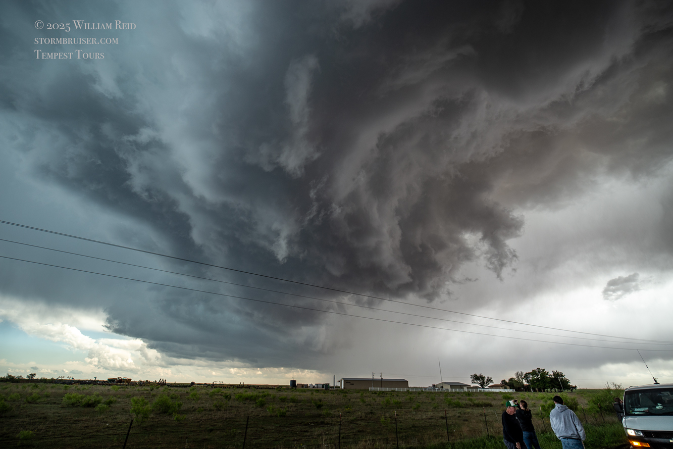
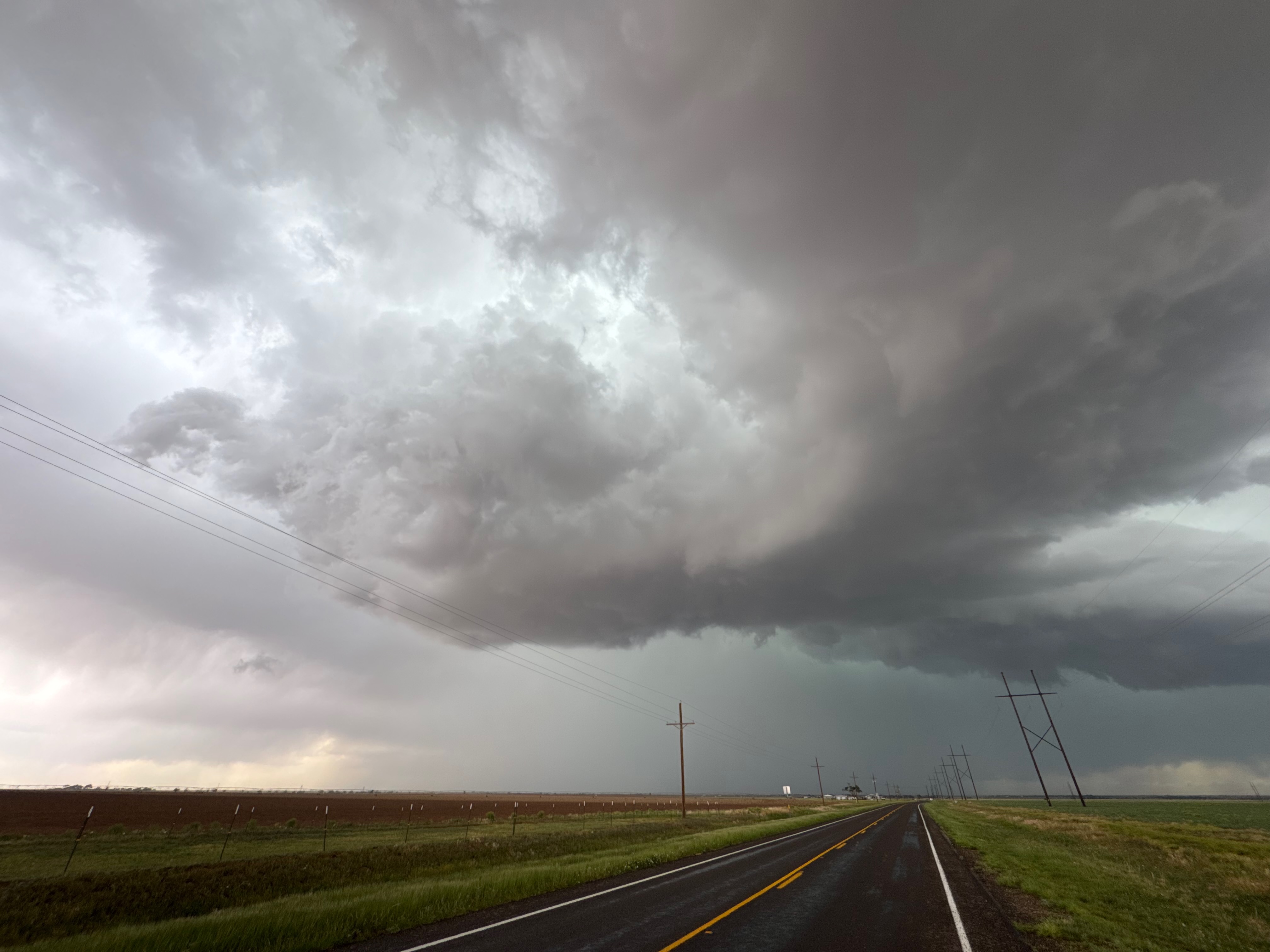
Following this semi-close encounter with the weak but brief Shallowater landspout, we scooted east as this advancing storm was picking up speed and becoming more squall-like. It was also starting to spill out some strong outflow, and was kicking up the Panhandle dust. I think it was between Ralls and Lorenzo when I got a shot of this rotating feature, just north of Highway 82. it kind of looks like the north side of a book-end vortex. I didn’t see a ground-base circulation with it.
The iPhone stills are below.
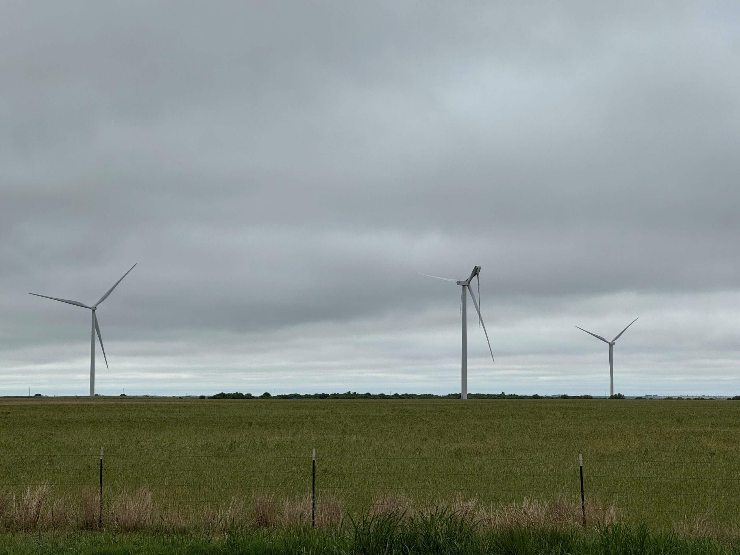
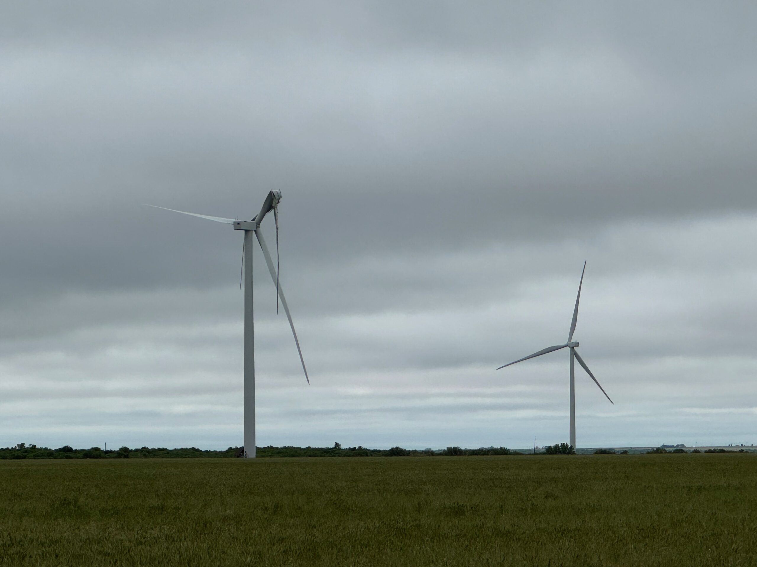
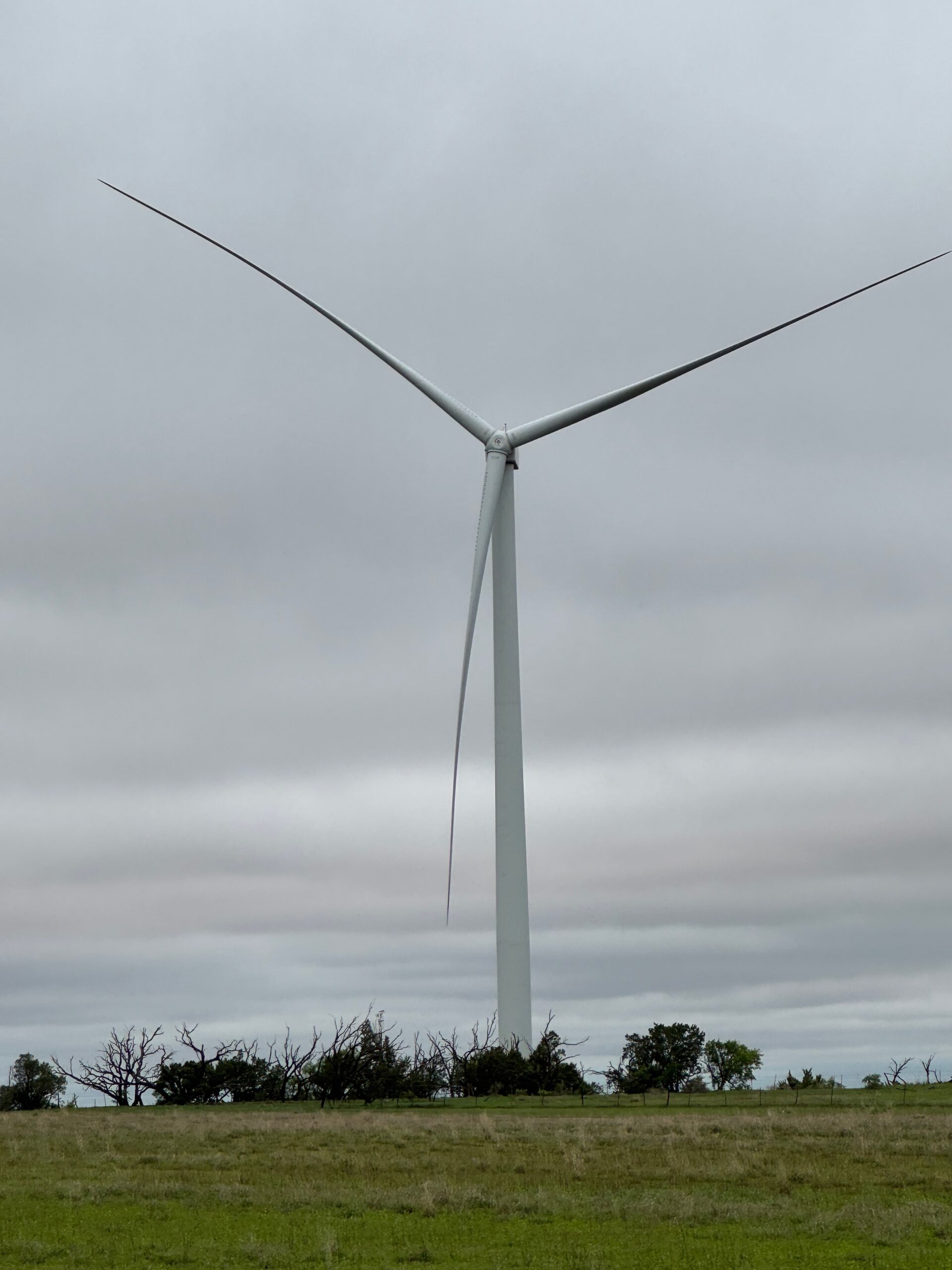
At the start of the drive westward this morning, we passed through Seymour on our way west from Wichita Falls. A handful of giant wind turbines (below) were not looking too good, having been damaged in the strong thunderstorm winds of the previous evening.
Photos 5-9 below are of the first landspout observed, pretty much due west of Shallowater as we were driving through town. It was cool to wind up with a bunch of these landspout tornadoes in an area without a tornado outline by SPC. But you know what they say: “If it’s May, you chase. Even if it is April 30th.” And they also say “Panhandle Magic.” And they don’t even need a verb.

Leave a Reply
You must be logged in to post a comment.