
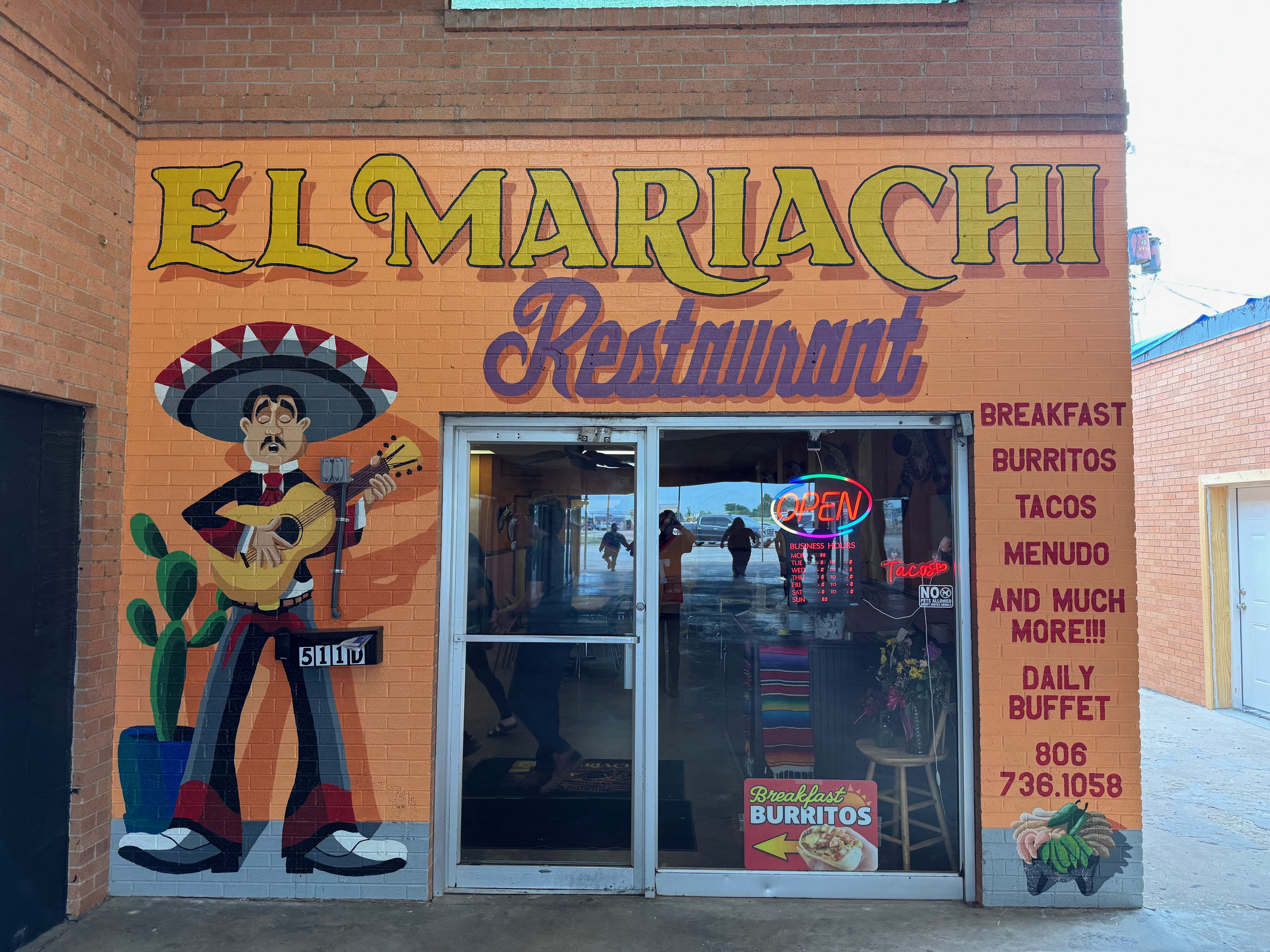
Start: Shamrock, TX/lunch: Spearman El Mariachi/End: Dodge City, KS/about 515 miles
Mesoscale Discussions 1:53 p.m. CDT. 5:09 p.m. CDT. 7:26 p.m. CDT. 9:10 p.m. CDT
Link to timelapse and video clips on Youtube
Link to Bob’s account for May 23. Bob and his 4B group made it up into southeastern Colorado with our group, but Bob was not keen on heading deeper into Colorado given the long drive back to OKC. As prospects around Baca County and the OK PH were looking bleaker and bleaker an hour or two before sunset, his group headed to Woodward for the night.
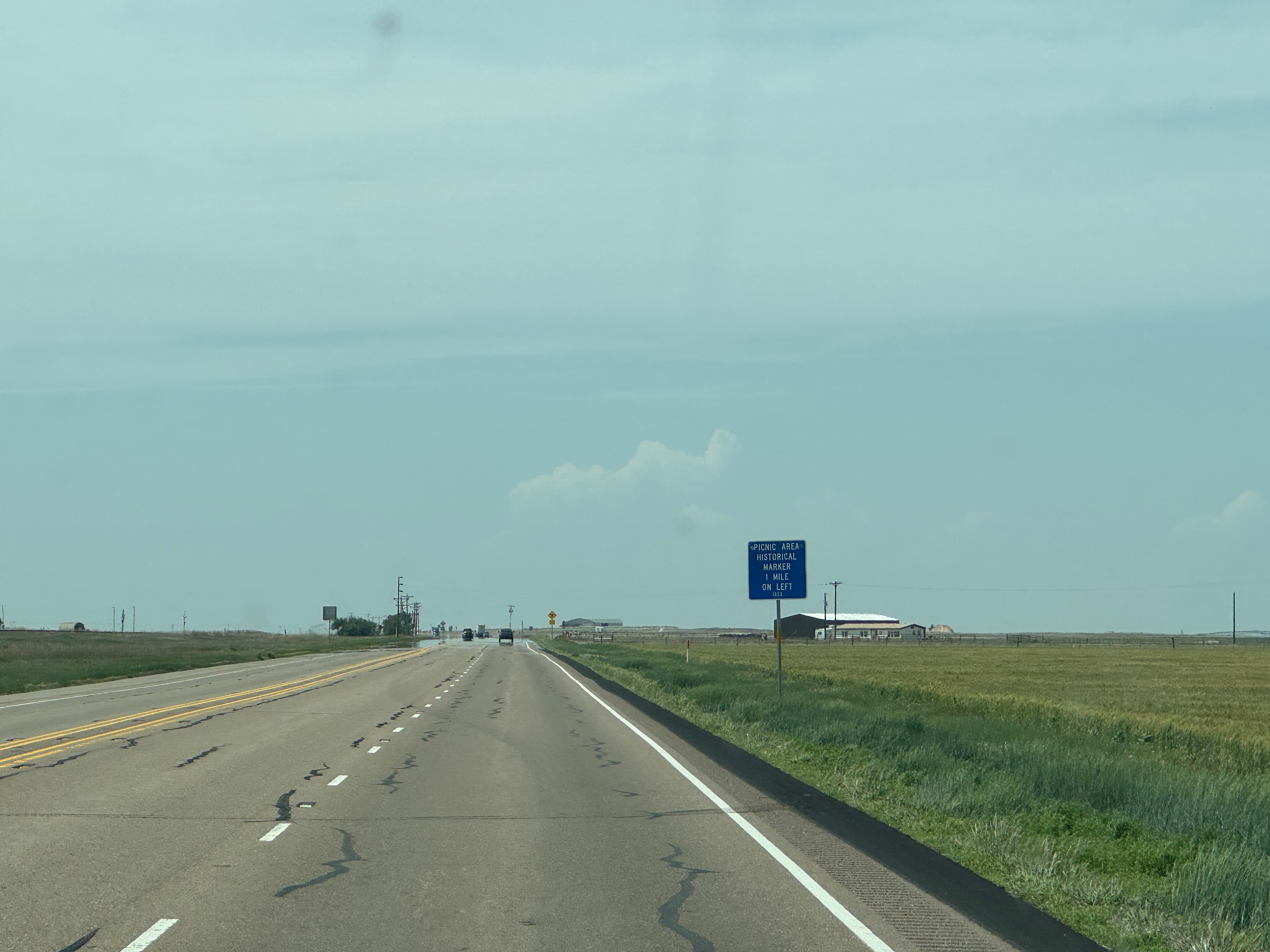
This was the final chase day for my Tour 4A group. We had a great start to the tour with the Arnett, OK, tornado of May 18th, but the middle of the tour was rather ho-hum, with a couple of low-end chase days and a couple of total down days. SPC showed a large slight risk covering much of the High Plains from near Kimball to Woodward. The best chance for tornadoes today was definitely up in northeastern Colorado, in my favorite chase area around northern Washington County. But, unfortunately, I had to target areas that were closer to Oklahoma City, since we had to be back there by early afternoon on the following day. We made our way northwestward through the Texas Panhandle, with a tentative target of Baca County and vicinity in extreme southeastern Colorado.
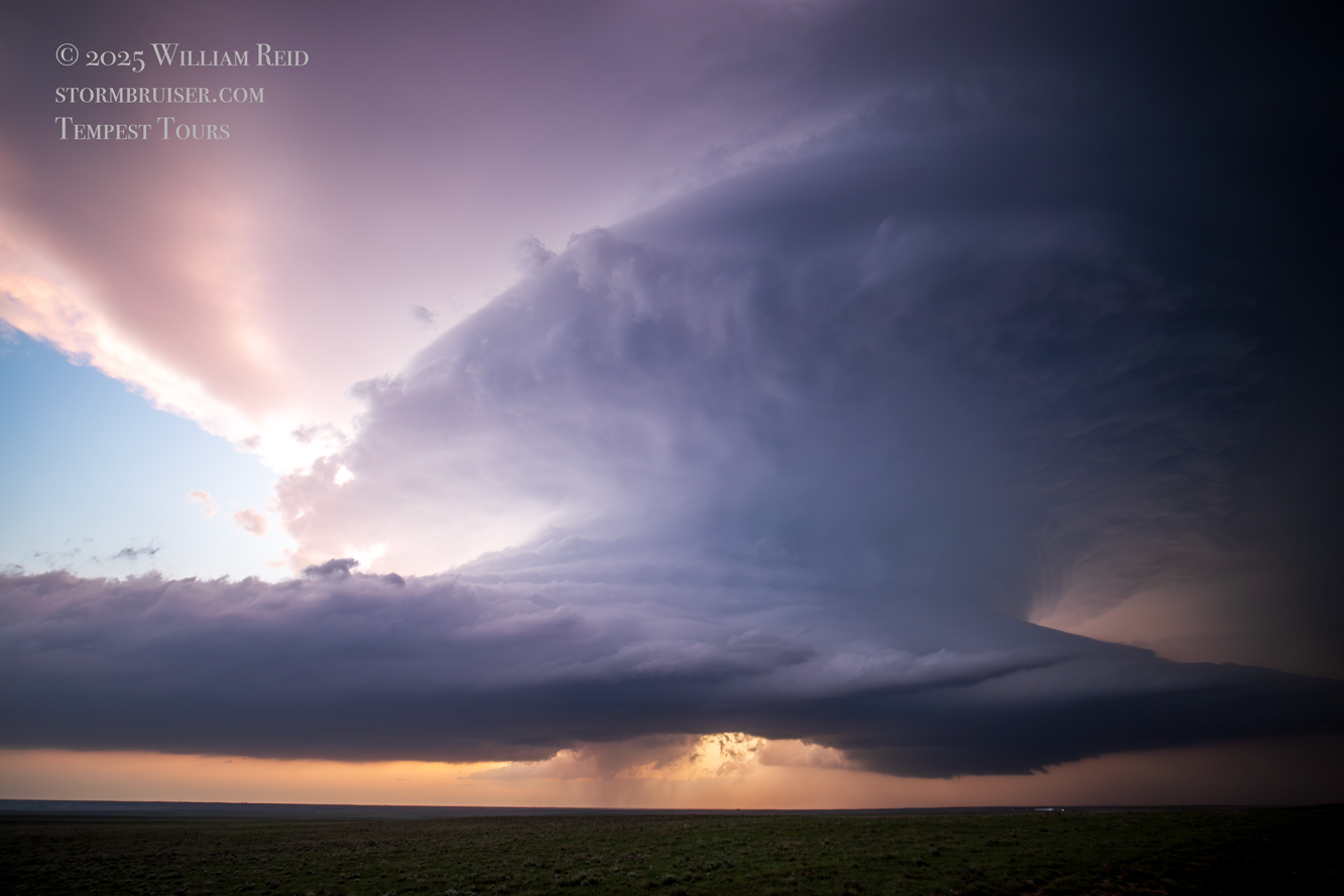
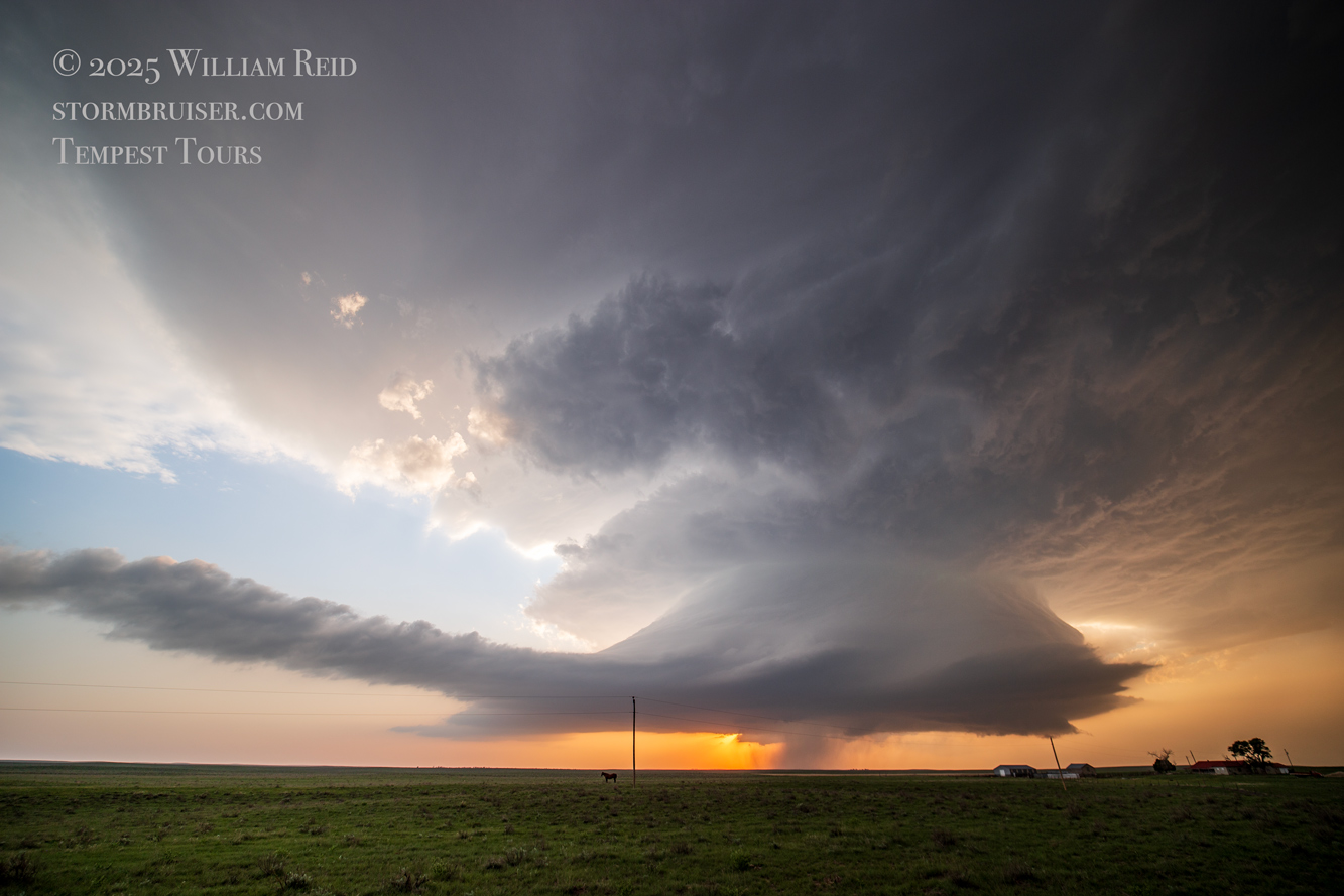
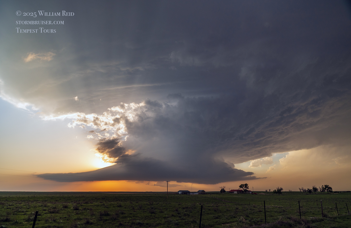
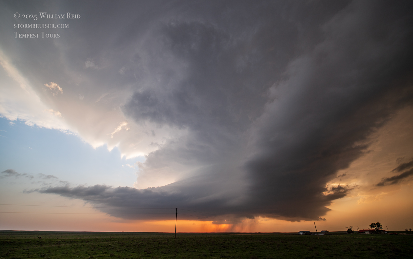
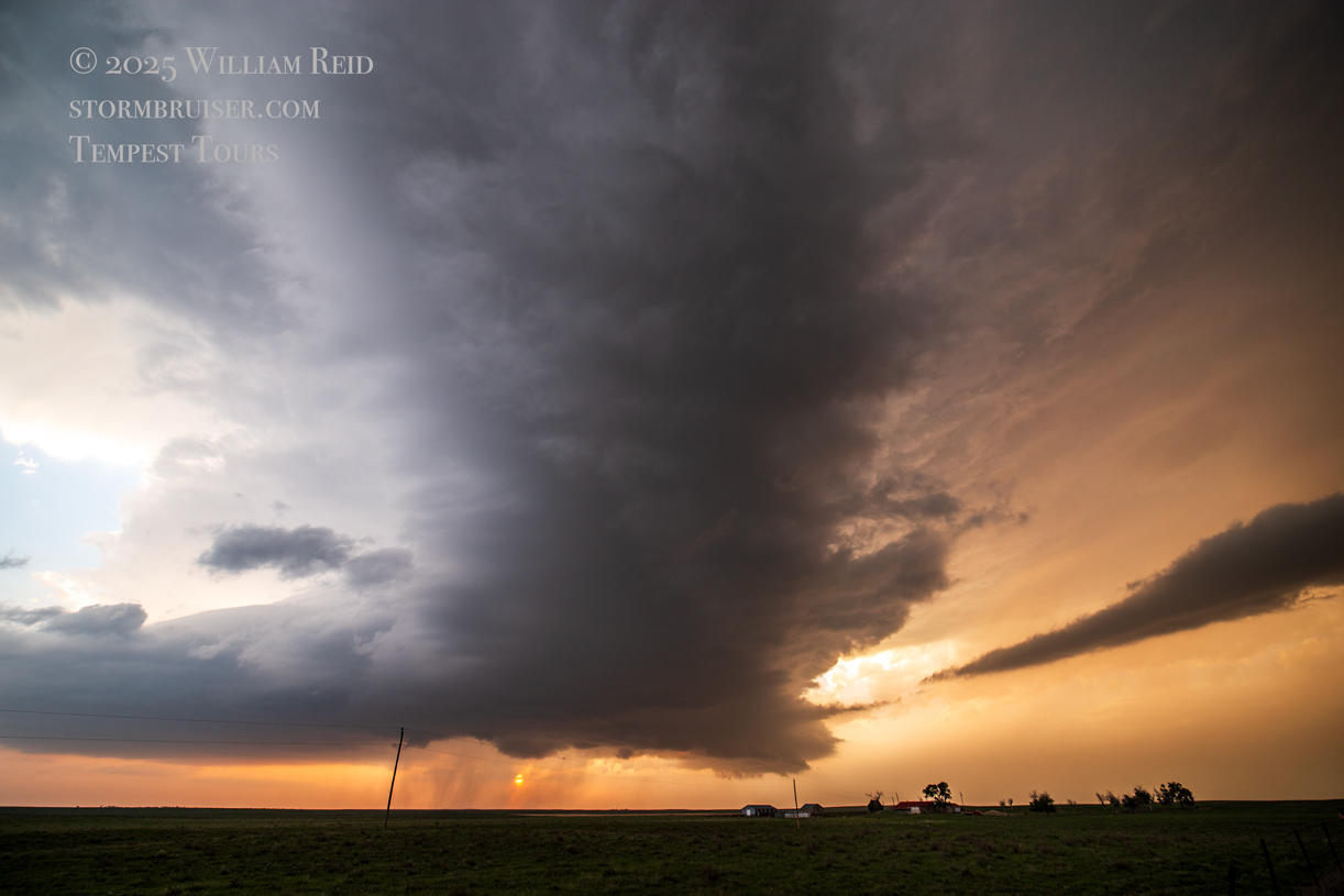
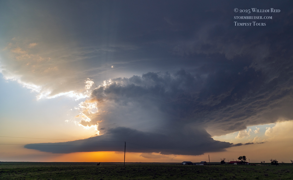
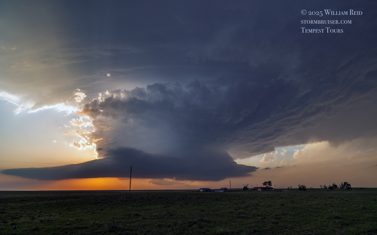
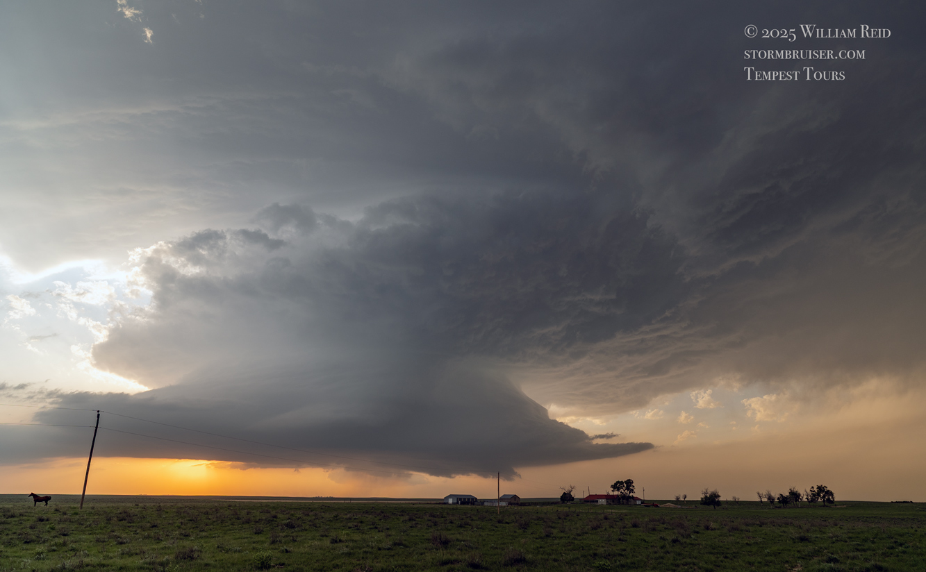
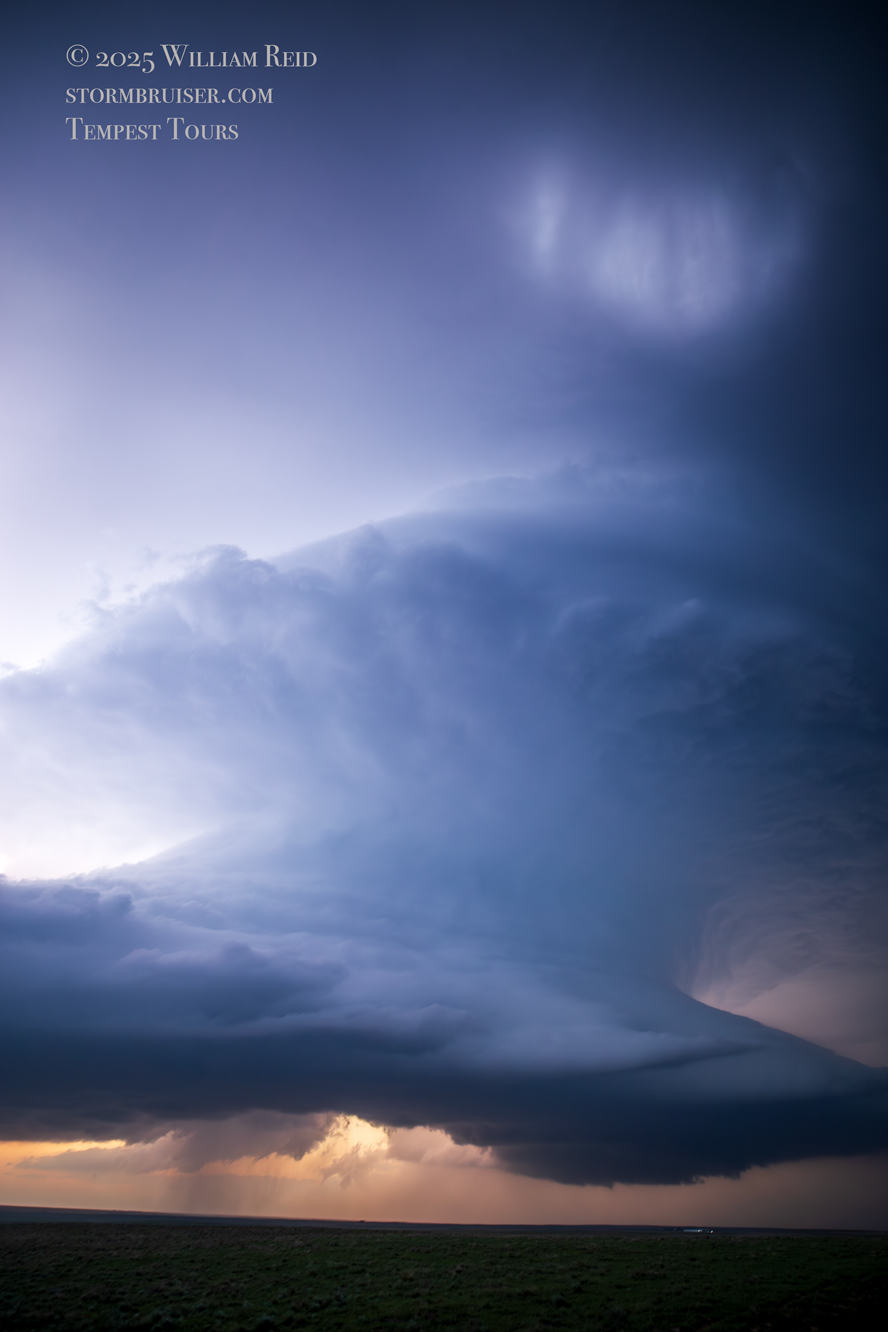
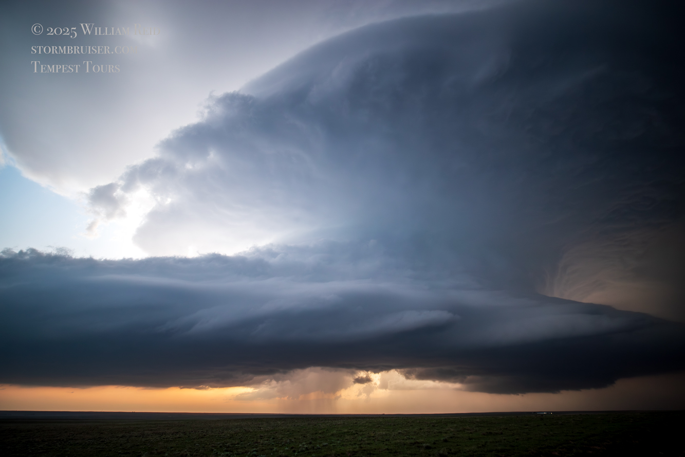
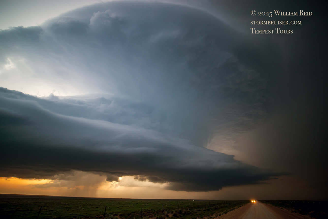
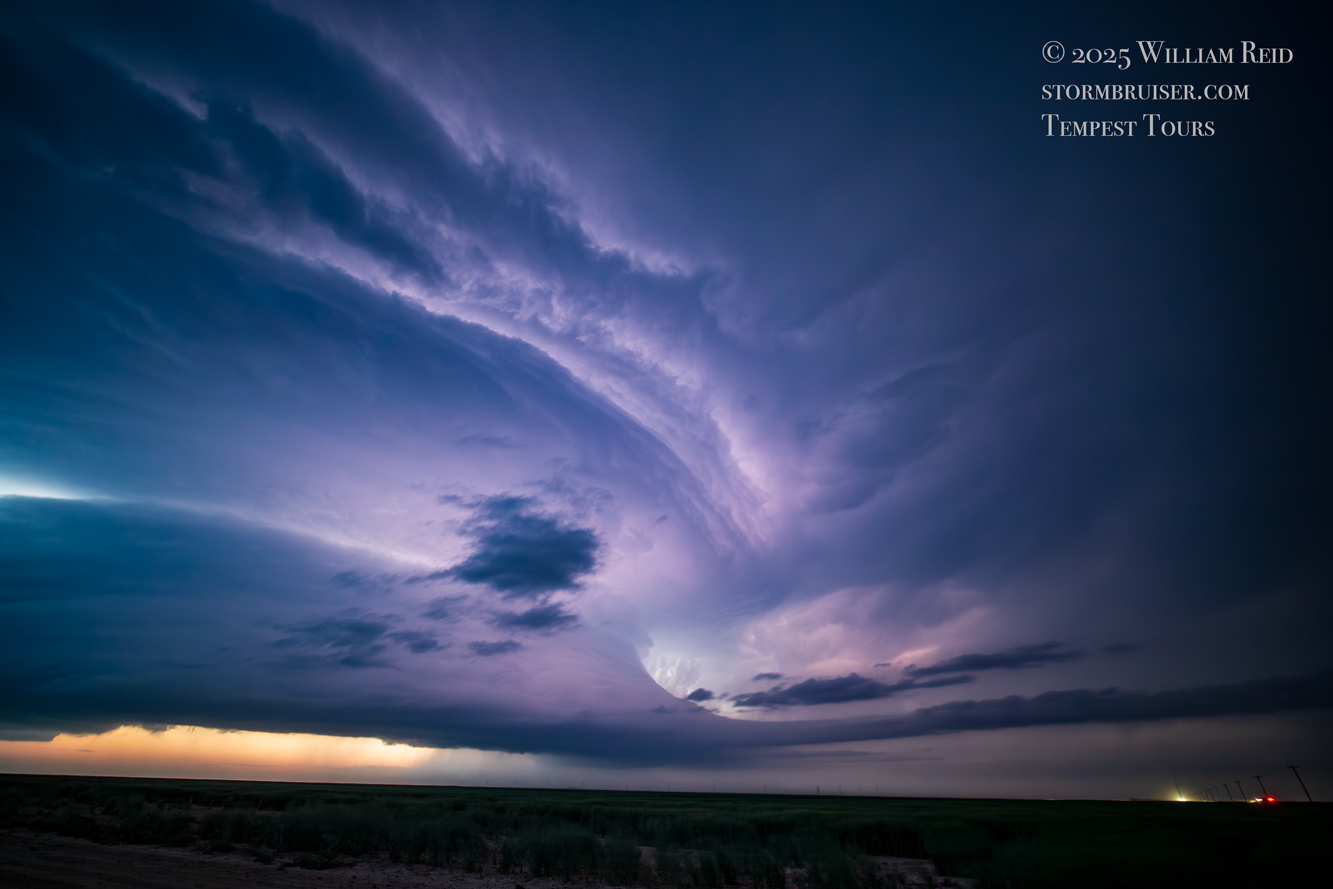
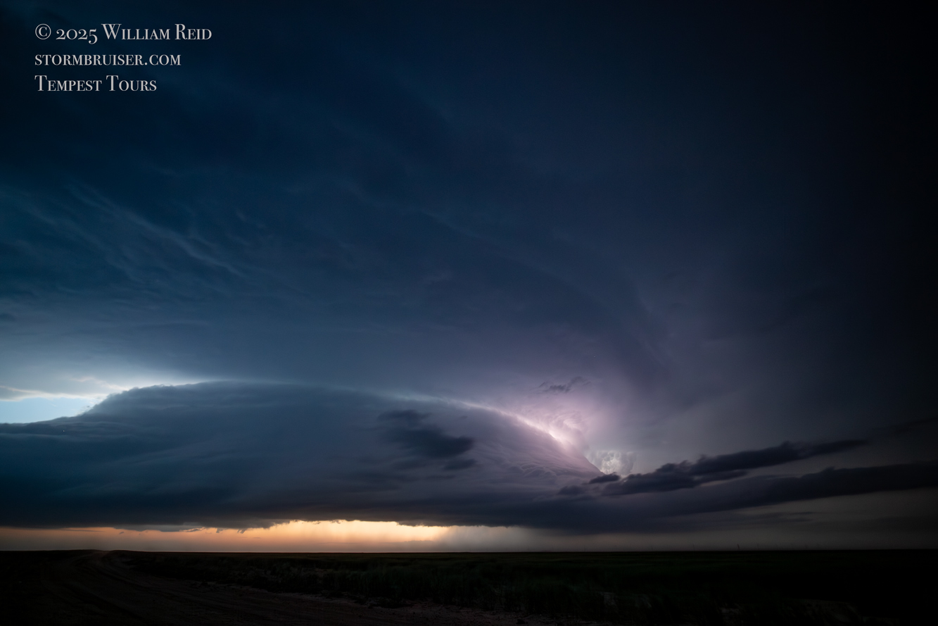
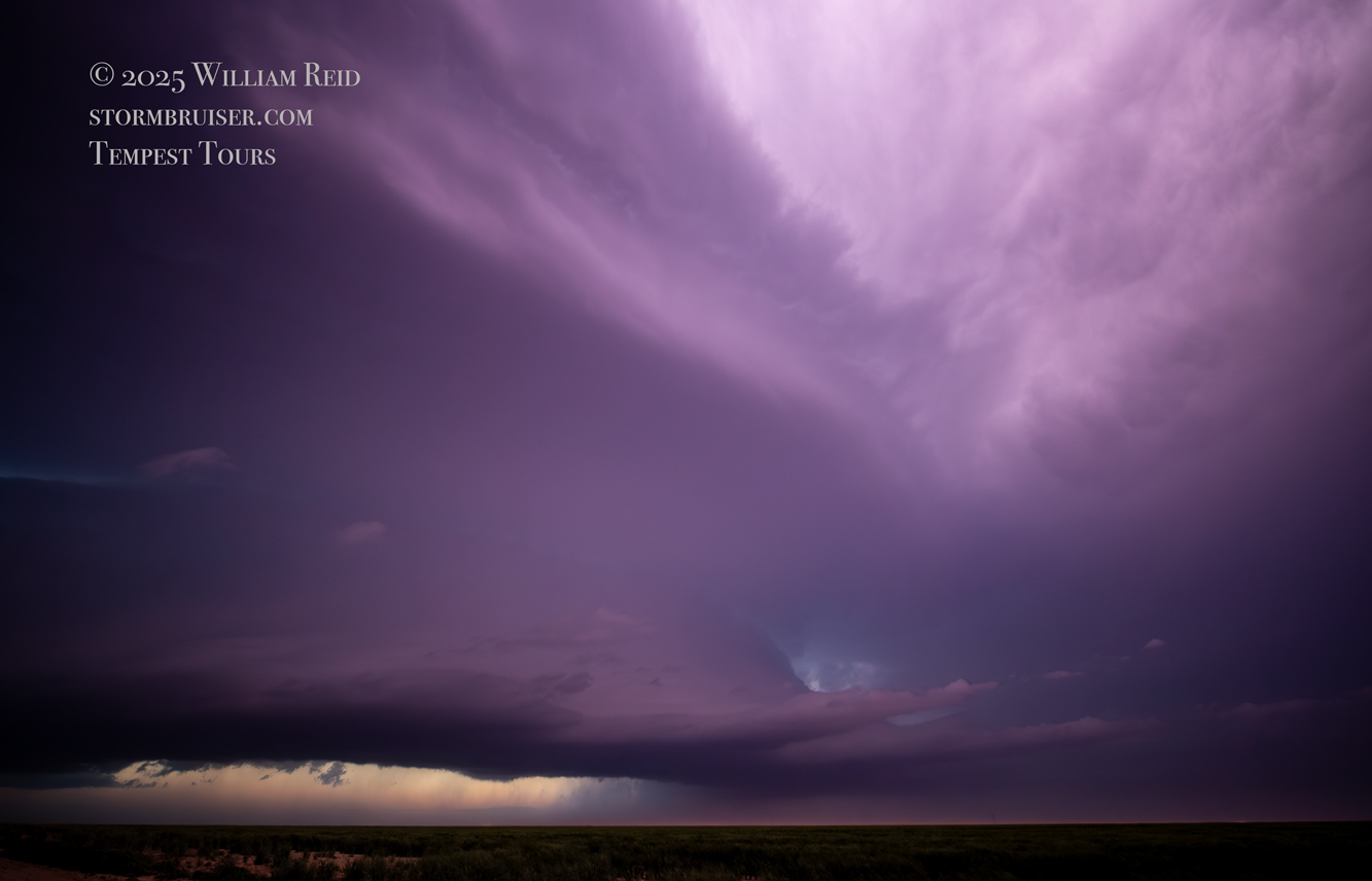
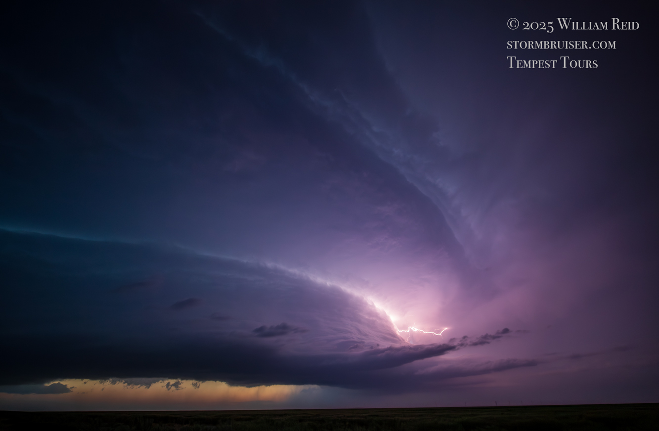
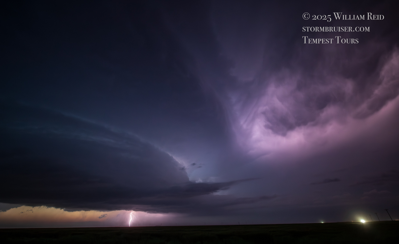
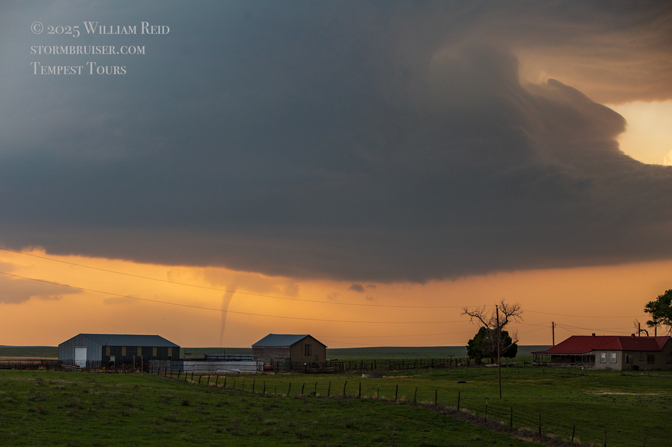
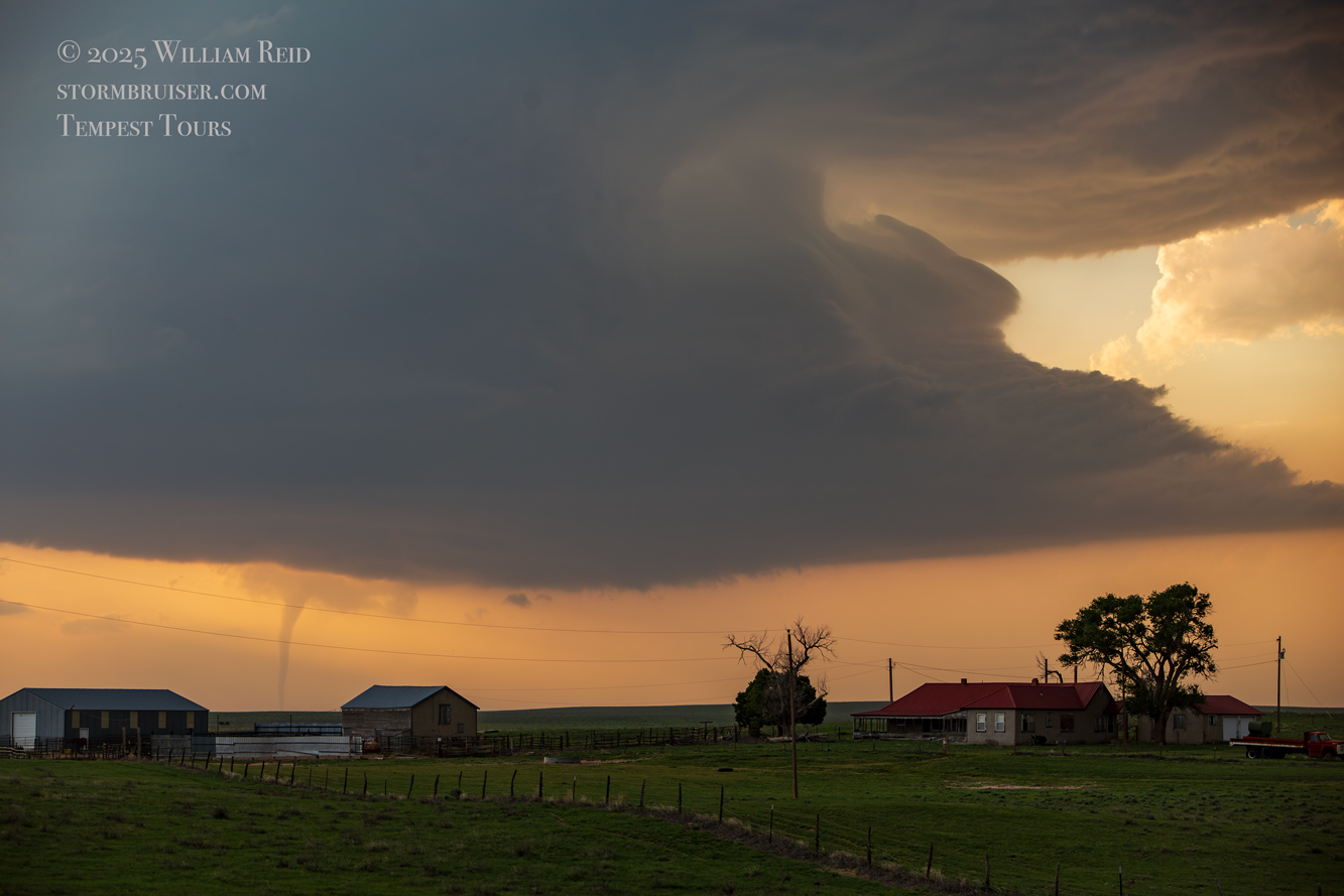
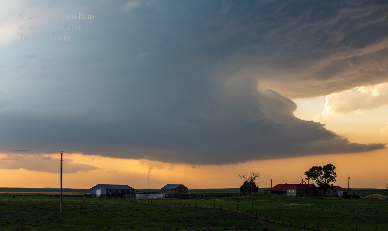
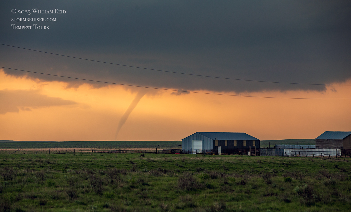
Images below: Stills with the Canon cameras of the tornadic supercell from near Kit Carson south-southeastward to about Chivington, Colorado. Shots of the tornado to our northwest, taken with the long lens, are at the bottom of this group.


iPhone shots and radar grabs below
The CAMs (models) suggested a nice long-track supercell around Baca County and/or around the OK Panhandle towards sunset (in addition to the near-certainty of supercells north of I-70 in northeastern Colorado). Dews and instability were fairly good for eastern CO for late May, and low-level winds were decidedly upslope. Still, the cap was rather strong. Some models, and some model runs, were very skimpy on decent convection south of I-70.
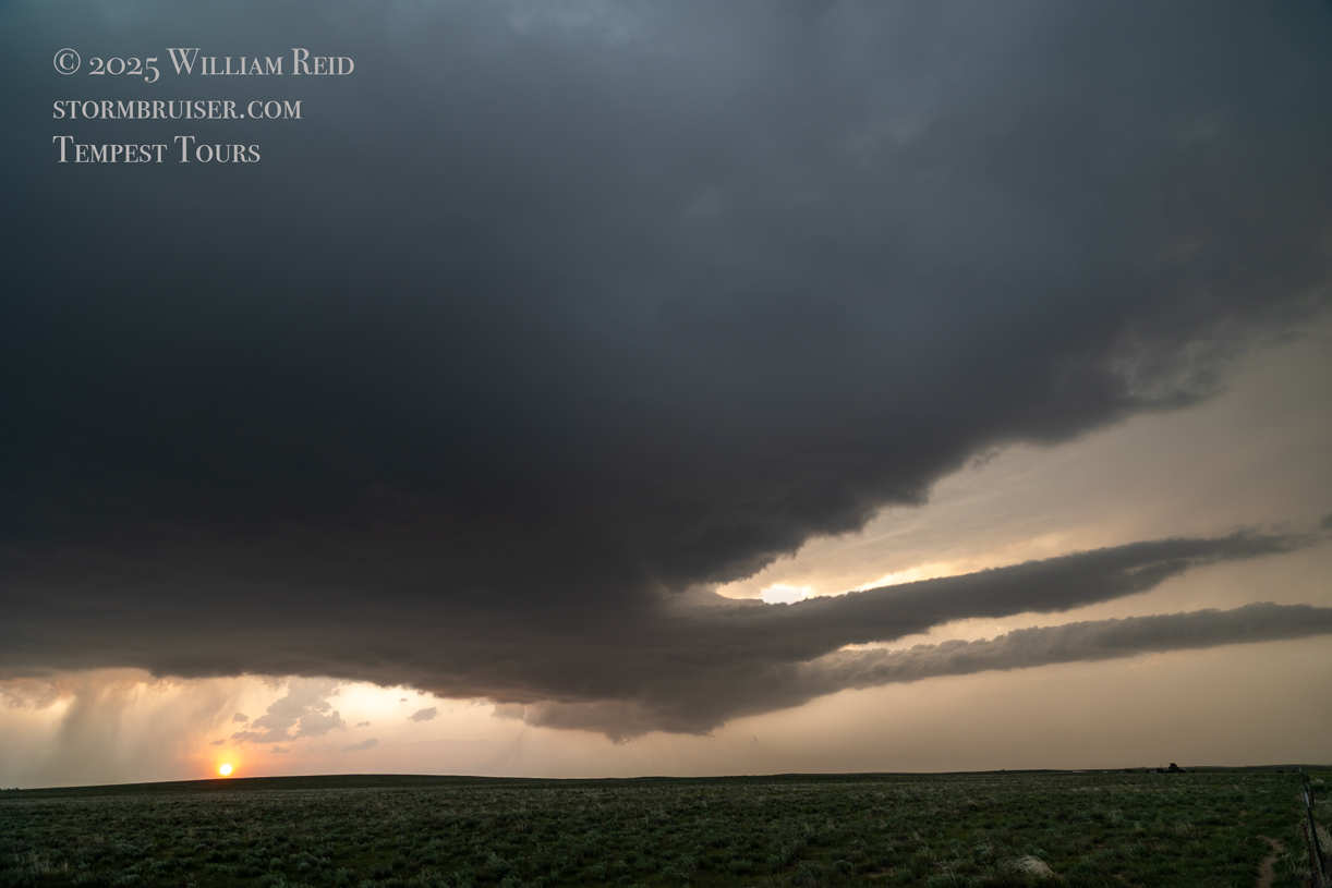
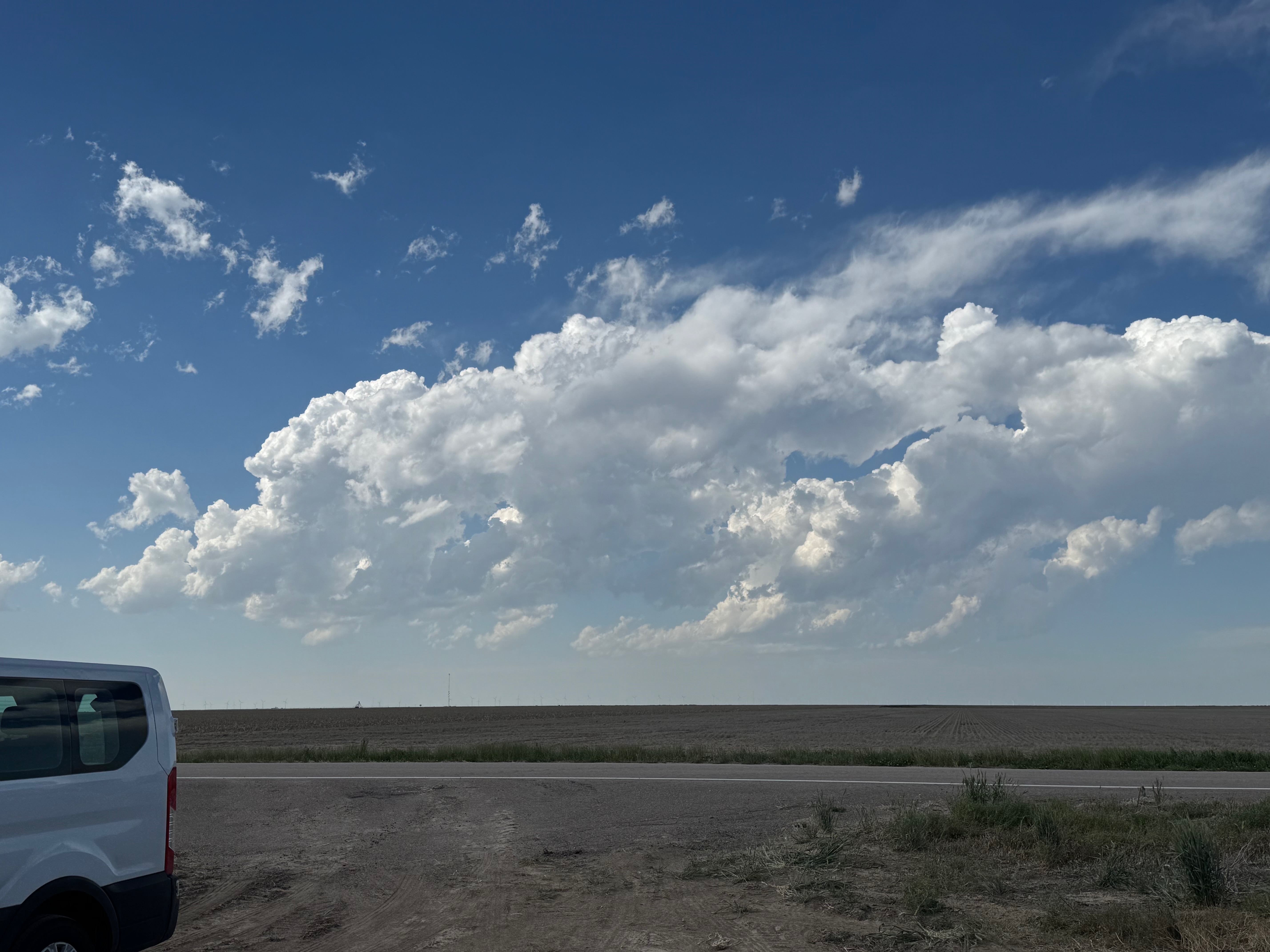
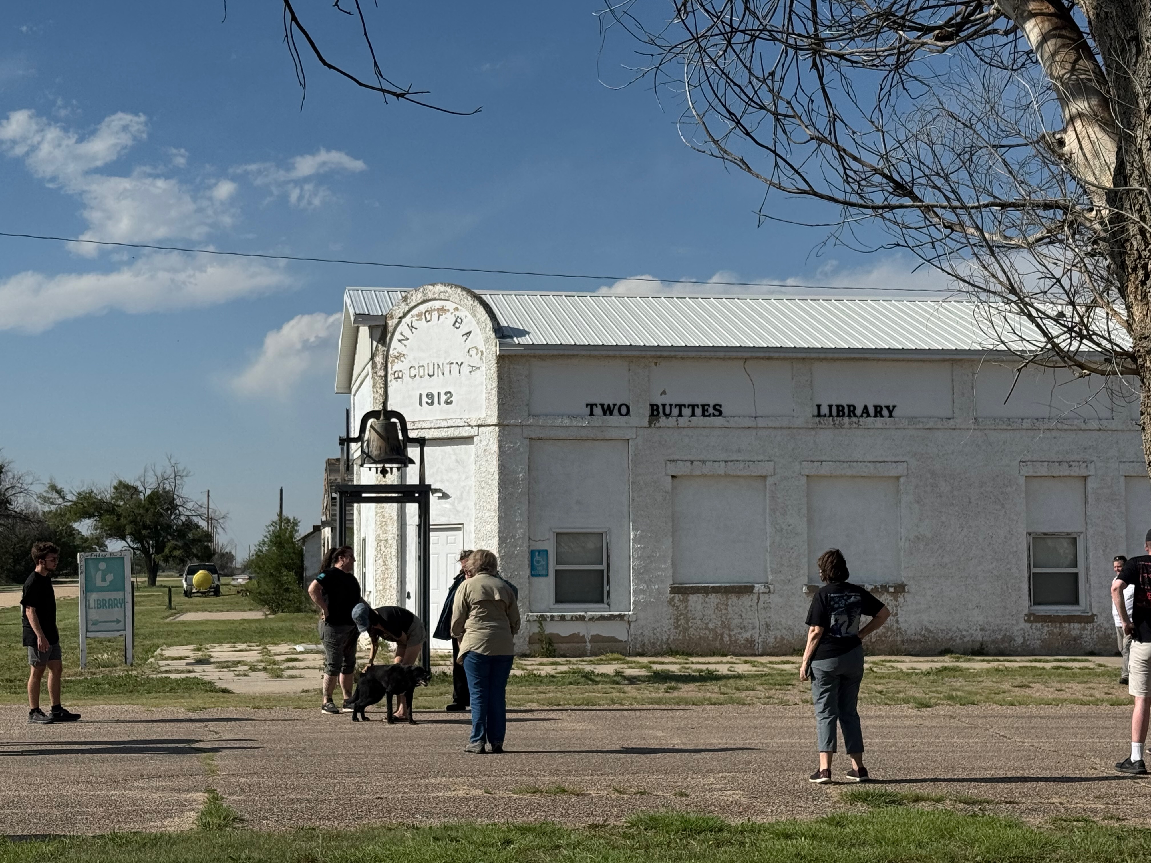
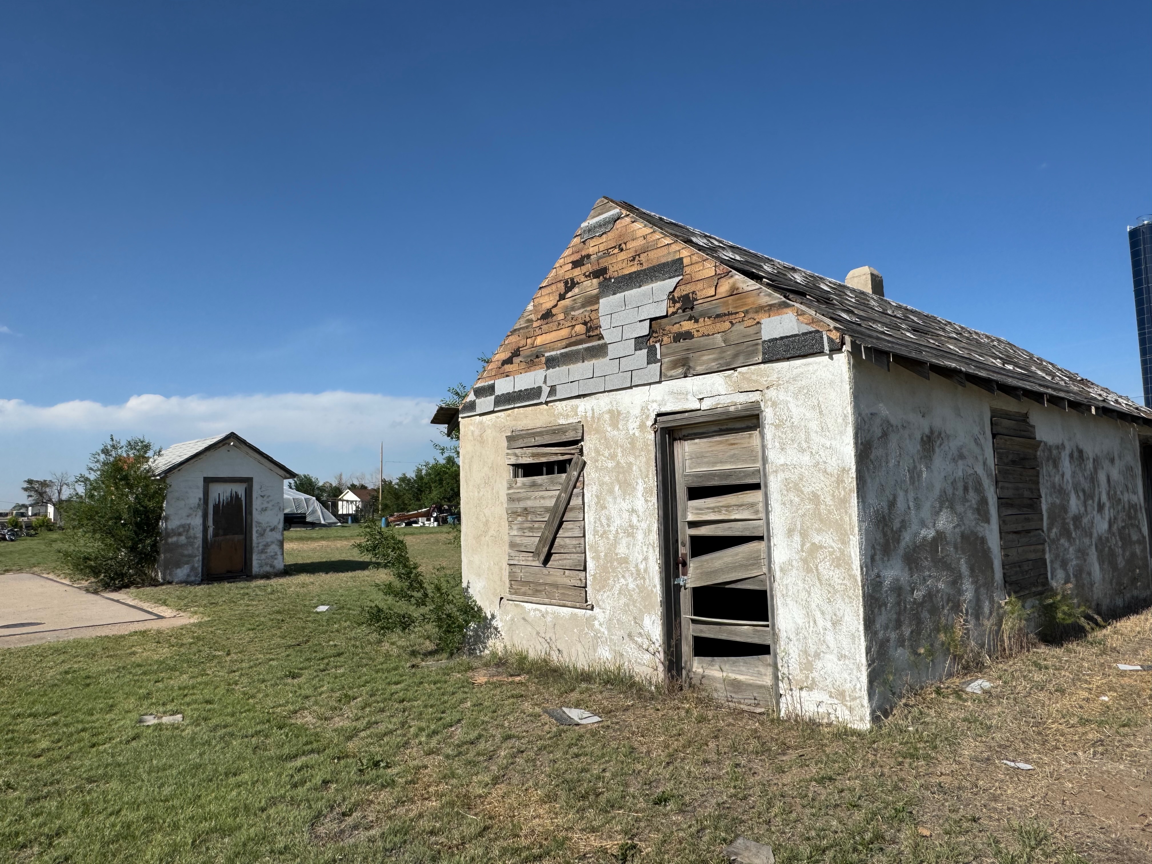
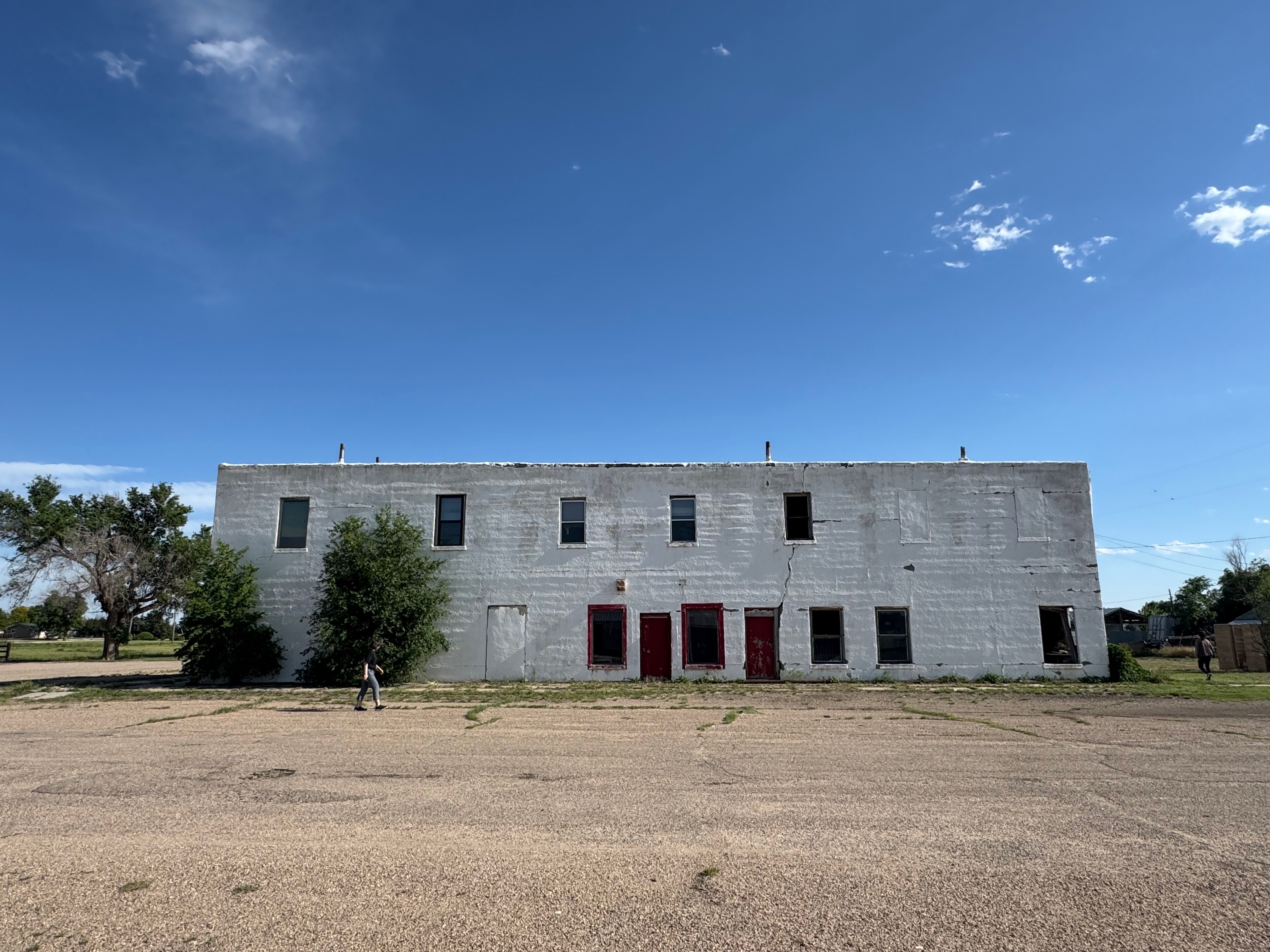
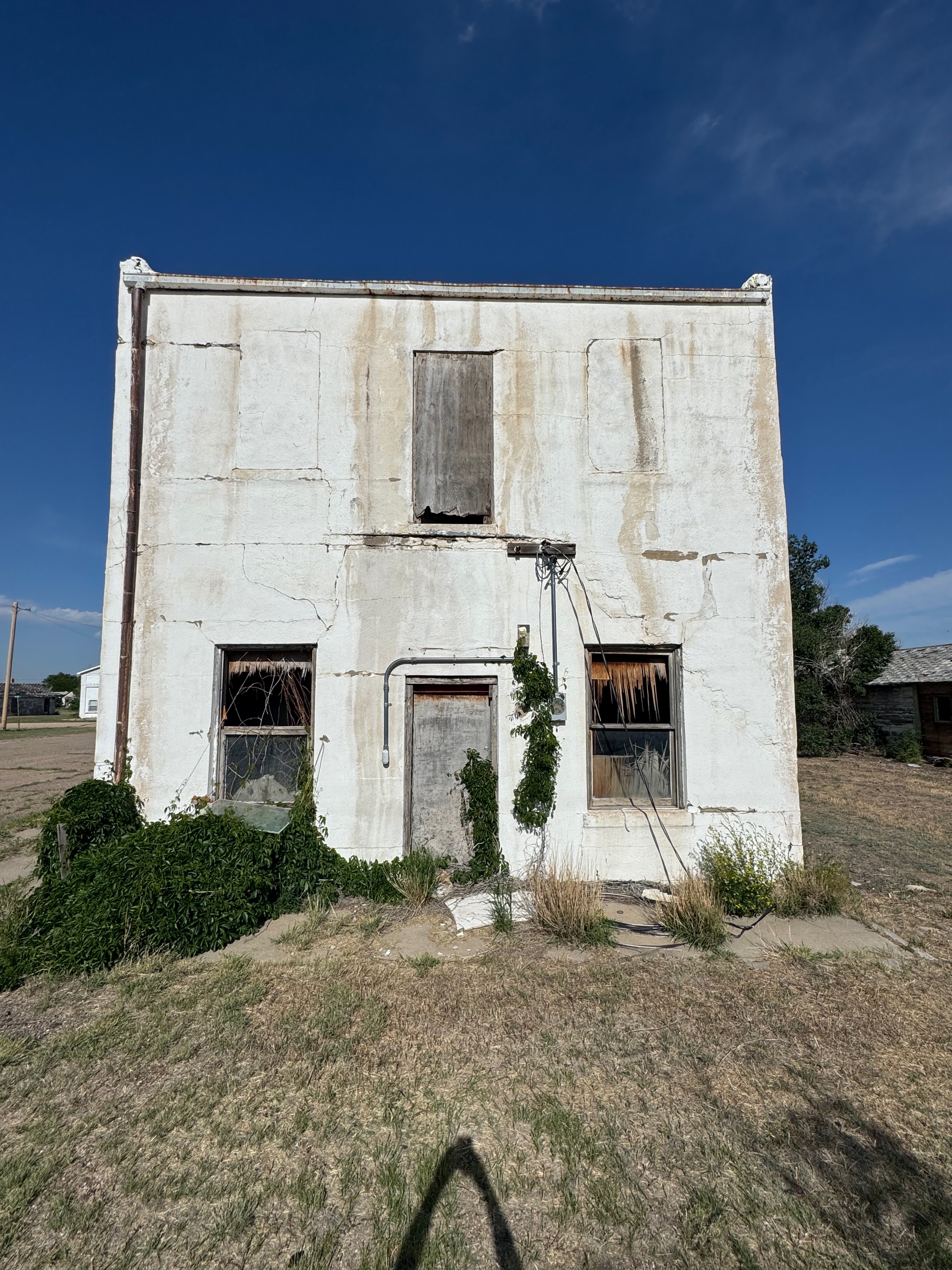
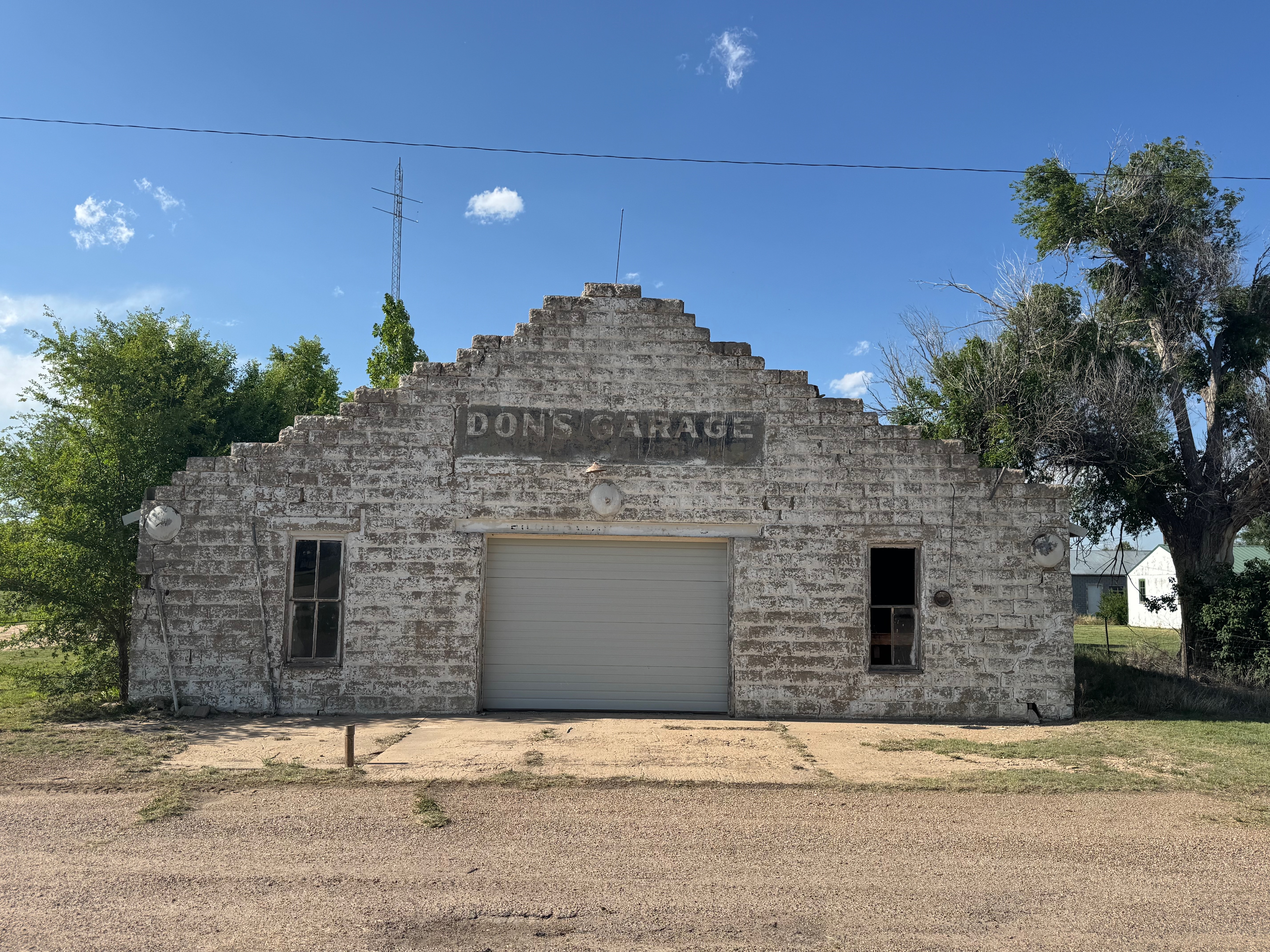
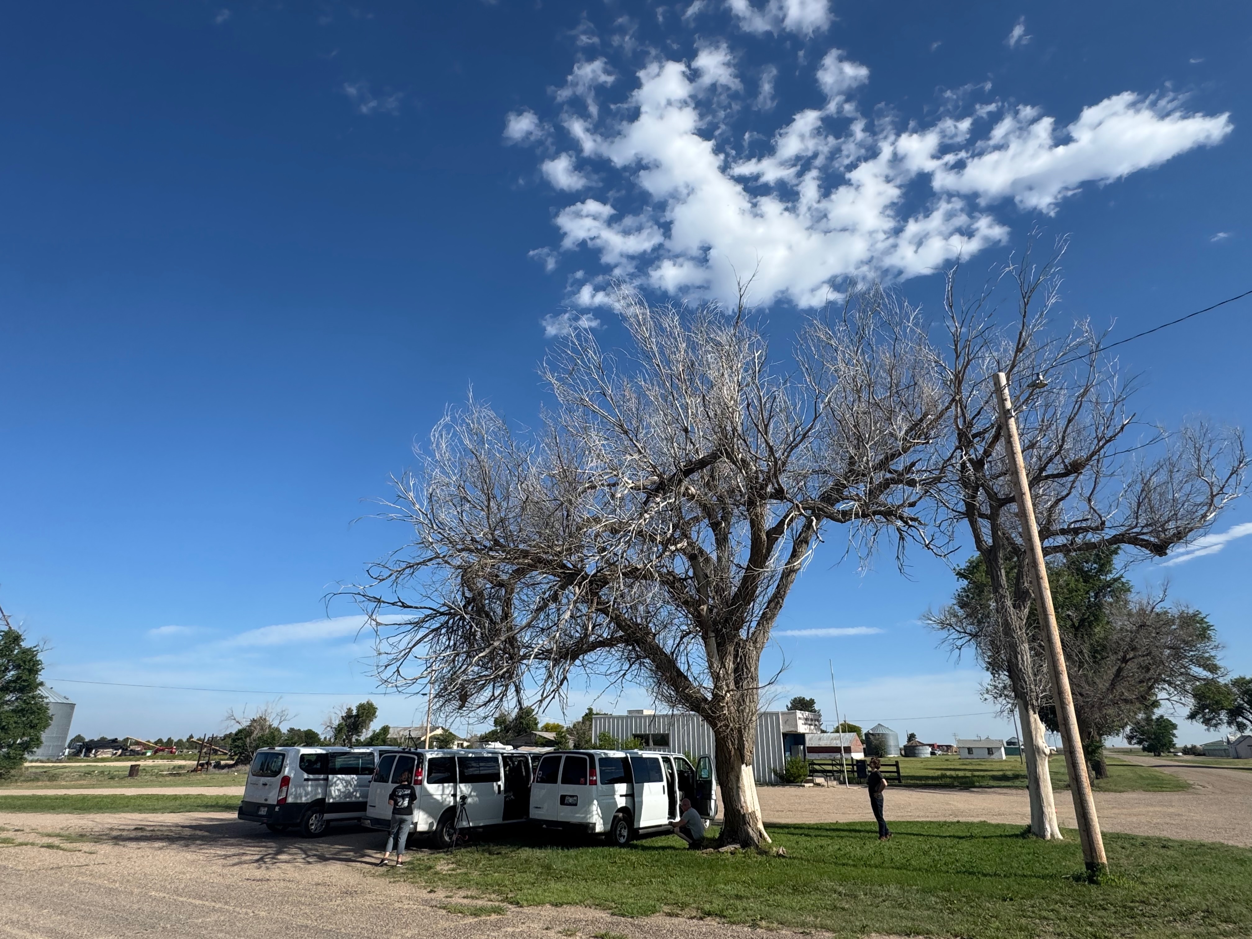
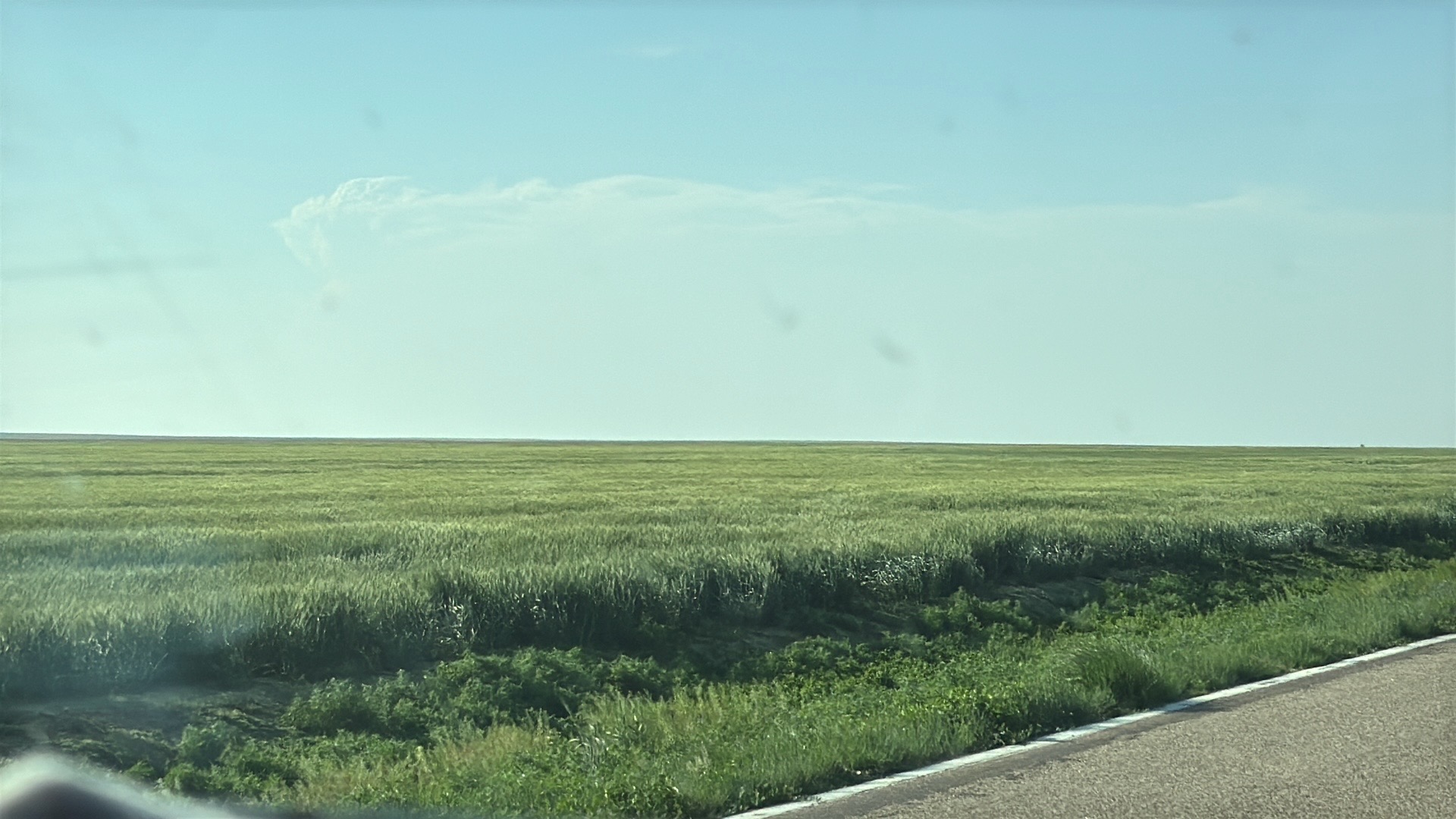
From Boise City we continued northward into Baca County and the Springfield area. Some towering cumulus here gave us some hope, but these were barely able to produce a sprinkle or two. We drifted eastward to Two Buttes on 160. I was kind of hoping for a miracle nearby, but as the 5 o’clock hour (MDT) neared it was not looking good at all. There was a little bit of interesting stuff to photograph in Two Buttes, but not in the skies here. It was Cap City.
Around this time we knew that we were missing a pretty good tornado show in northeastern Colorado. There was a fairly long-lived tornado near Akron. The chase logistics today were killing me and causing long faces. In the back of my mind I was thinking that if something could develop somewhat close to I-70, about 2.5 hours north of us, and then turn right and drop southeastward, then maybe we could wind up with SOMETHING close to sunset. Yes, I would be dreading the longer drive back to OKC, but if you don’t try, you can figure on seeing little or nothing.
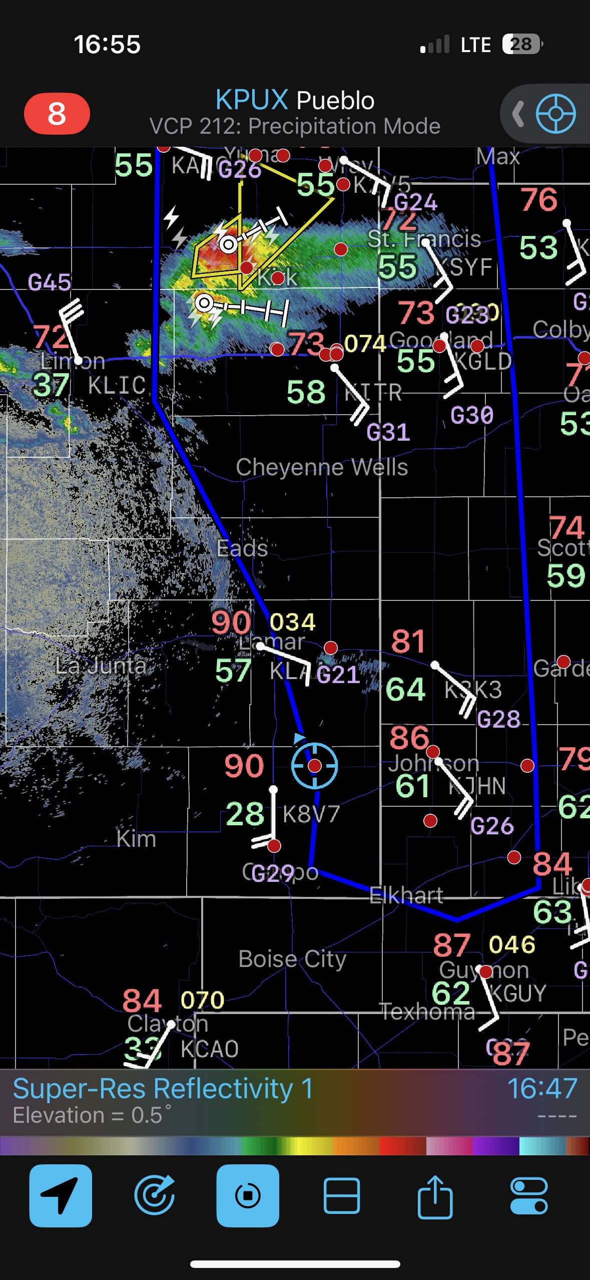
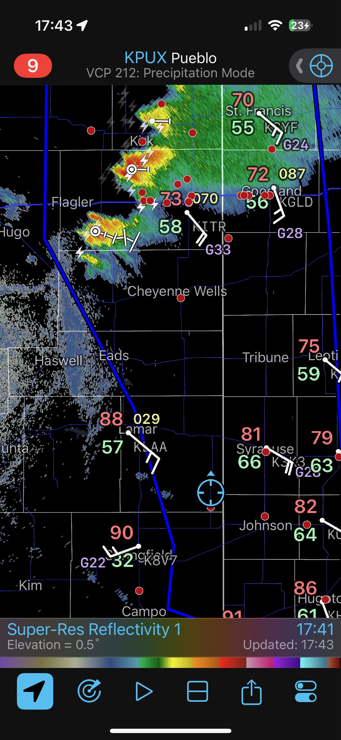
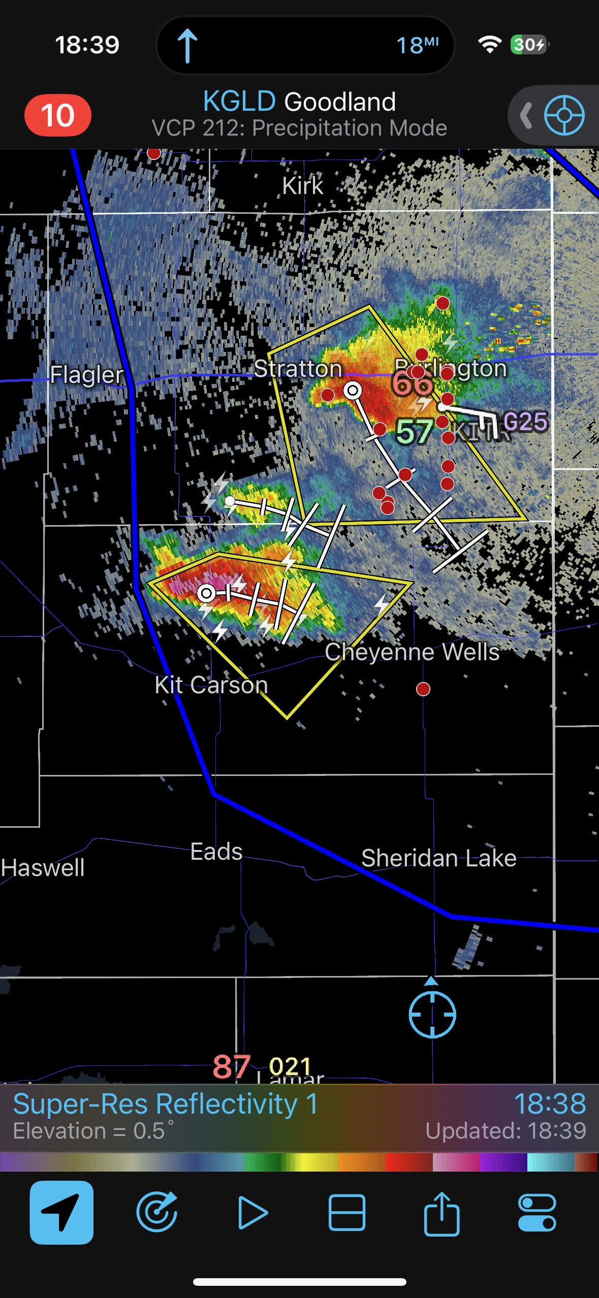
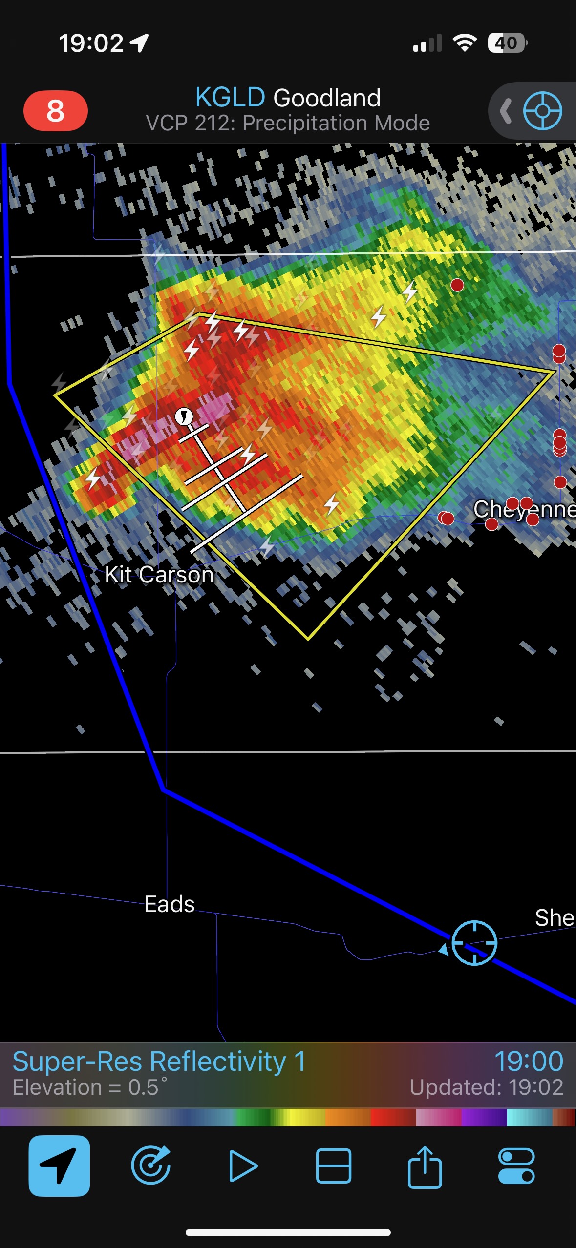
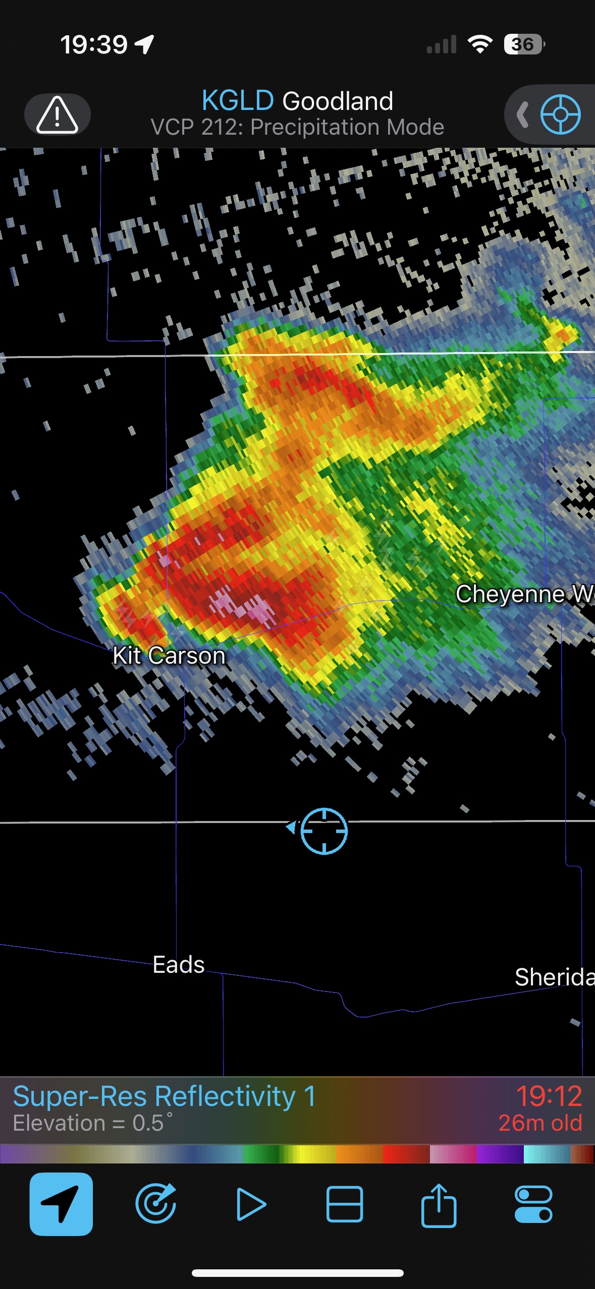
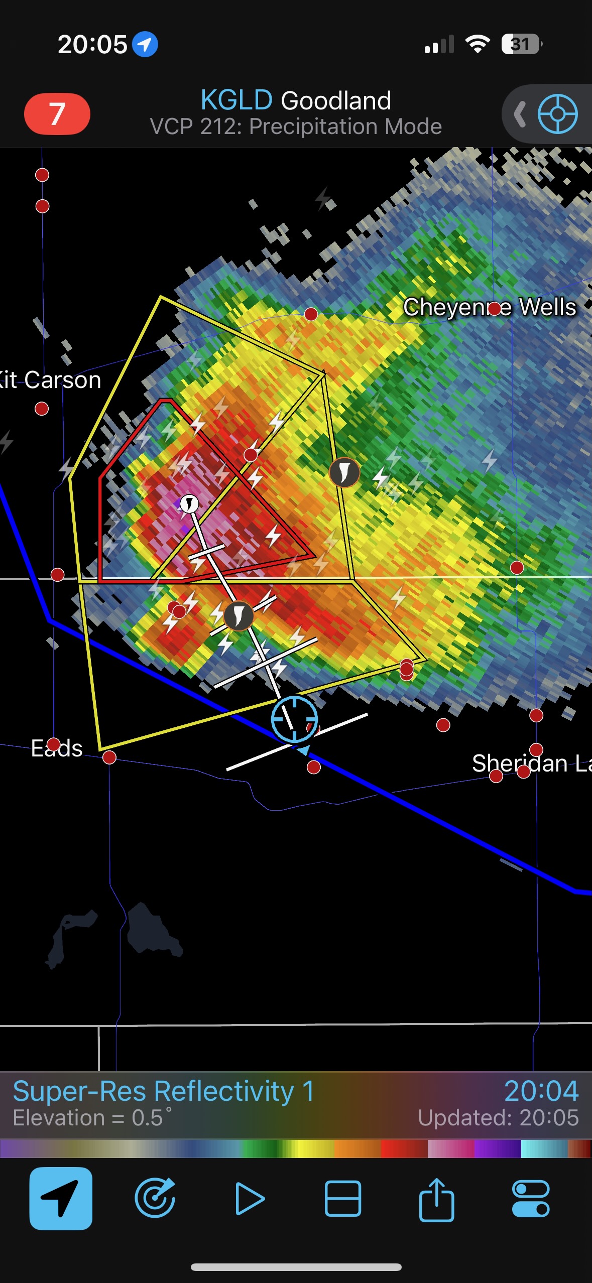
Take a look at the radar grab for 16:55 below. We are still in Baca County, at Two Buttes. There is a storm up near Kirk, north of I-70, but that is/was too distant to consider. By 17:43 (5:43 p.m. MDT), the radar shows that activity has increased southward some, and is a little south of I-70. YES! The situation is similar for the 18:05 radar. These latter two radar screen grabs show that our tour is on its way northward. I was seeing enough positives in the data and the current trends which suggested that a decent storm just might get going in east-central Colorado in the next hour or so. We had enough daylight to make the effort worthwhile, barely. I just needed a nice rotating storm that would move to the southeast and make it a lot easier for us. Around 5:30 p.m. MDT I had Richard and Shane first take us east to Highway 89, and then north Lycan to Holly. Though that activity just south of I-70 was still ugly (ugly-pathetic), we needed to get closer just in case.
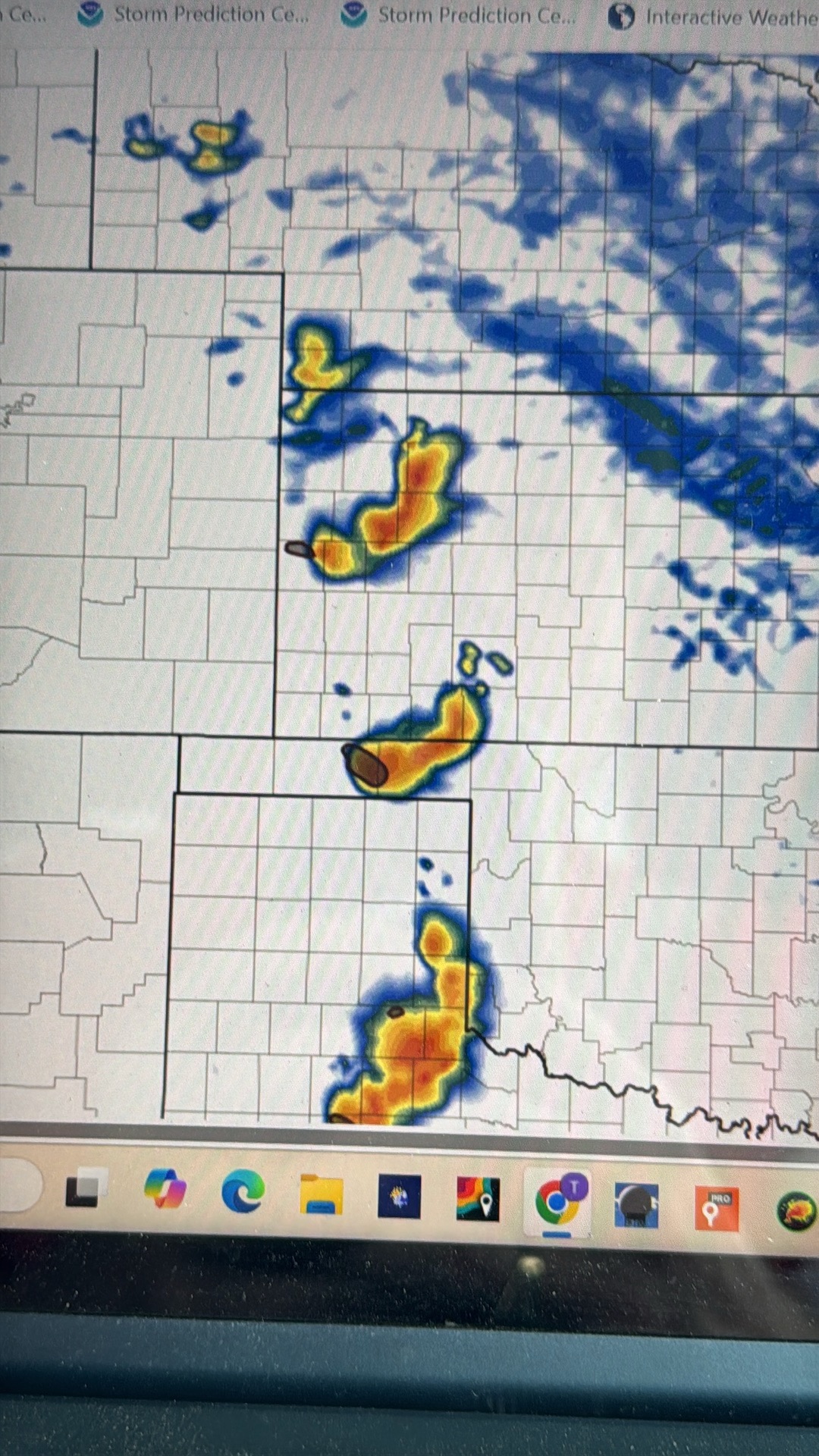
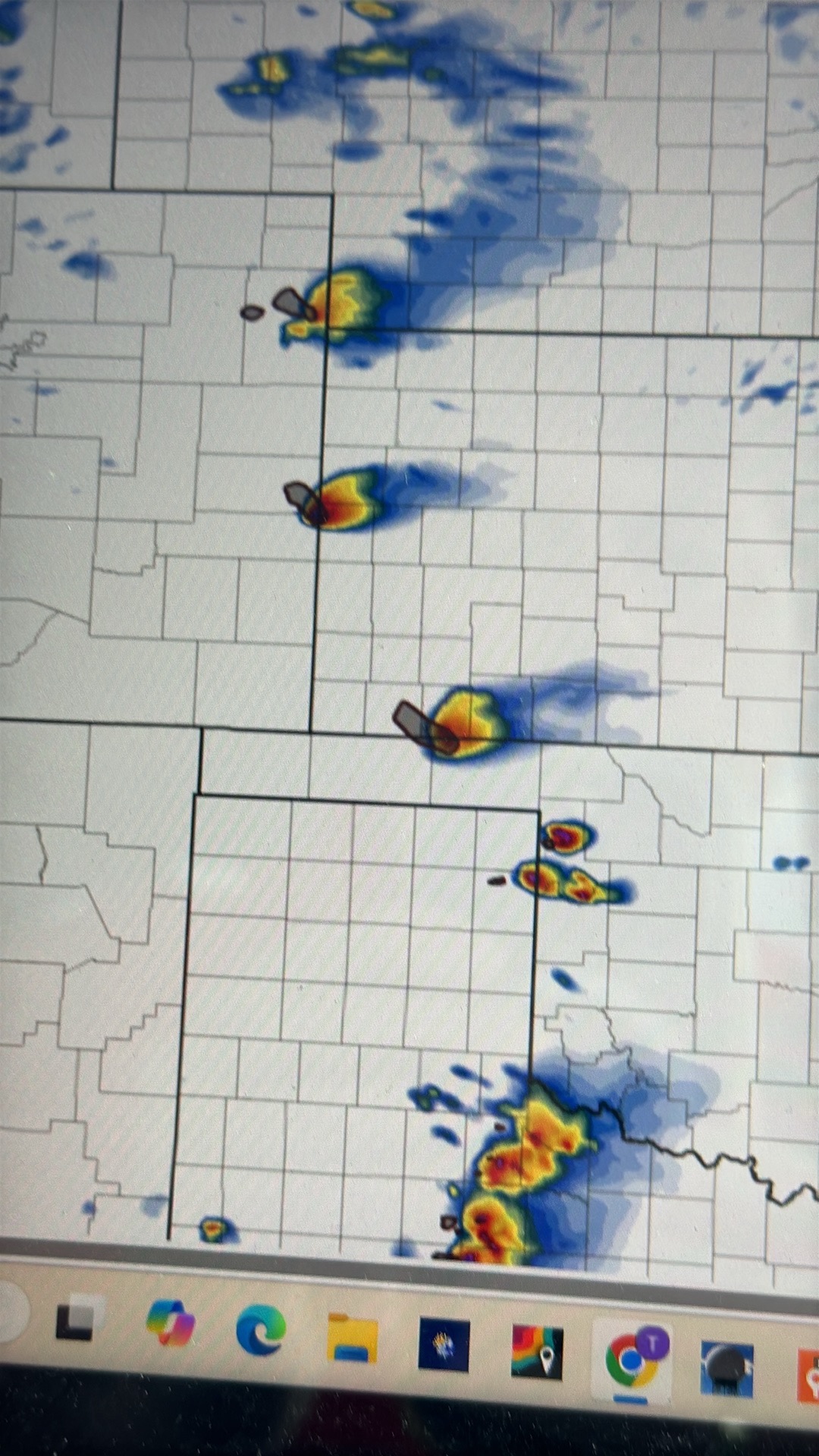

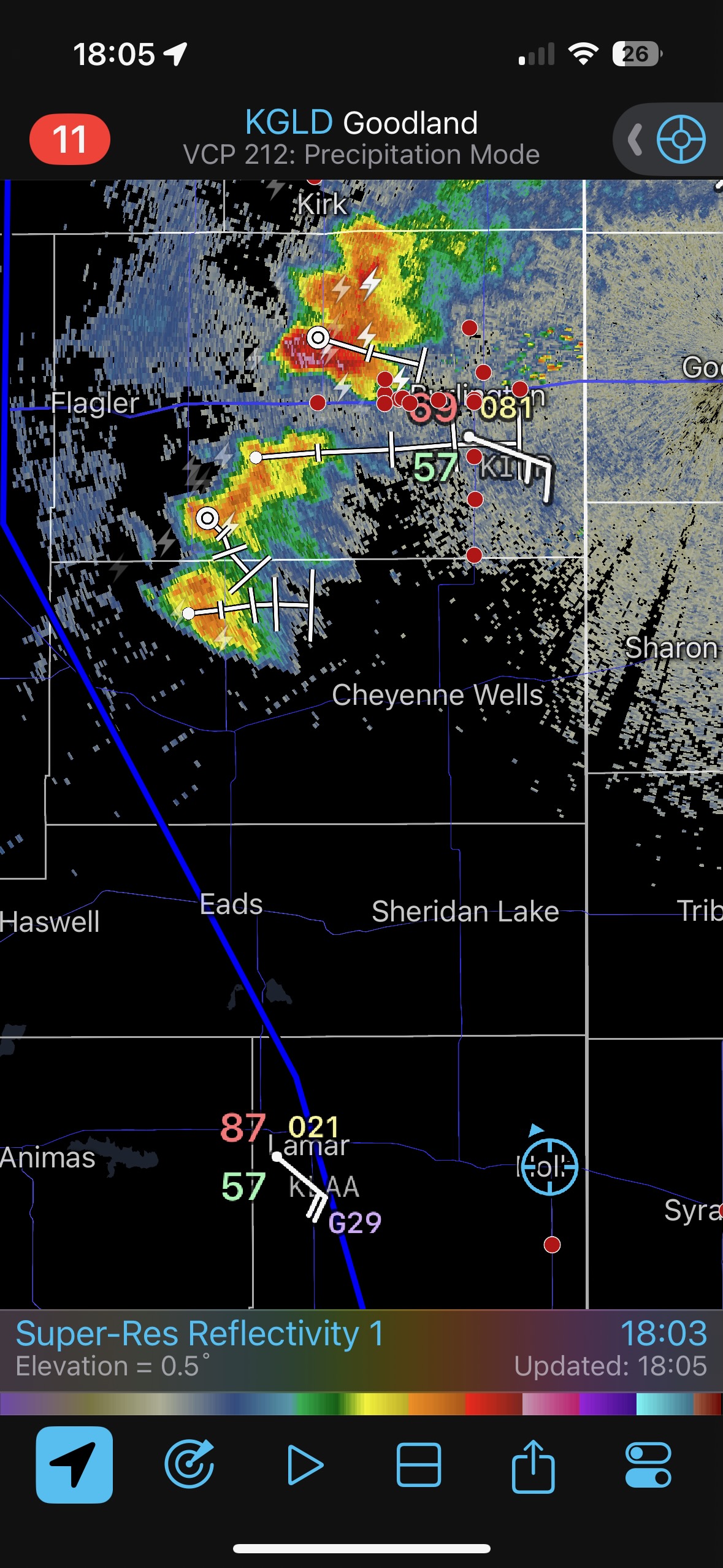
By 18:05 we are at Holly. The first image below shows the very distant storm to our NNW as we motored northward towards Holly. The distant storm showed a decent spurt or two visually. It was nice to be able to see something worthwhile, and spirits were up! The radar grab at 18:39/6:39 p.m. MDT shows our location on U.S. 385 south of Sheridan Lake. Our target storm, the southern-most cell, north of Kit Carson, has taken on a kidney-bean shape and is severe-warned. This suggests decent organization and probably a supercell. It is moving dreadfully slowly though, to the E or ESE. C’MON!!
If I could have snapped my fingers and transported our group instantly, I would have wanted to go to Kit Carson. This would have put us just south of the updraft base. The spotter network shows a bunch of chasers in front of a supercell west of Burlington. Only one chaser is relatively close to Kit Carson storm.
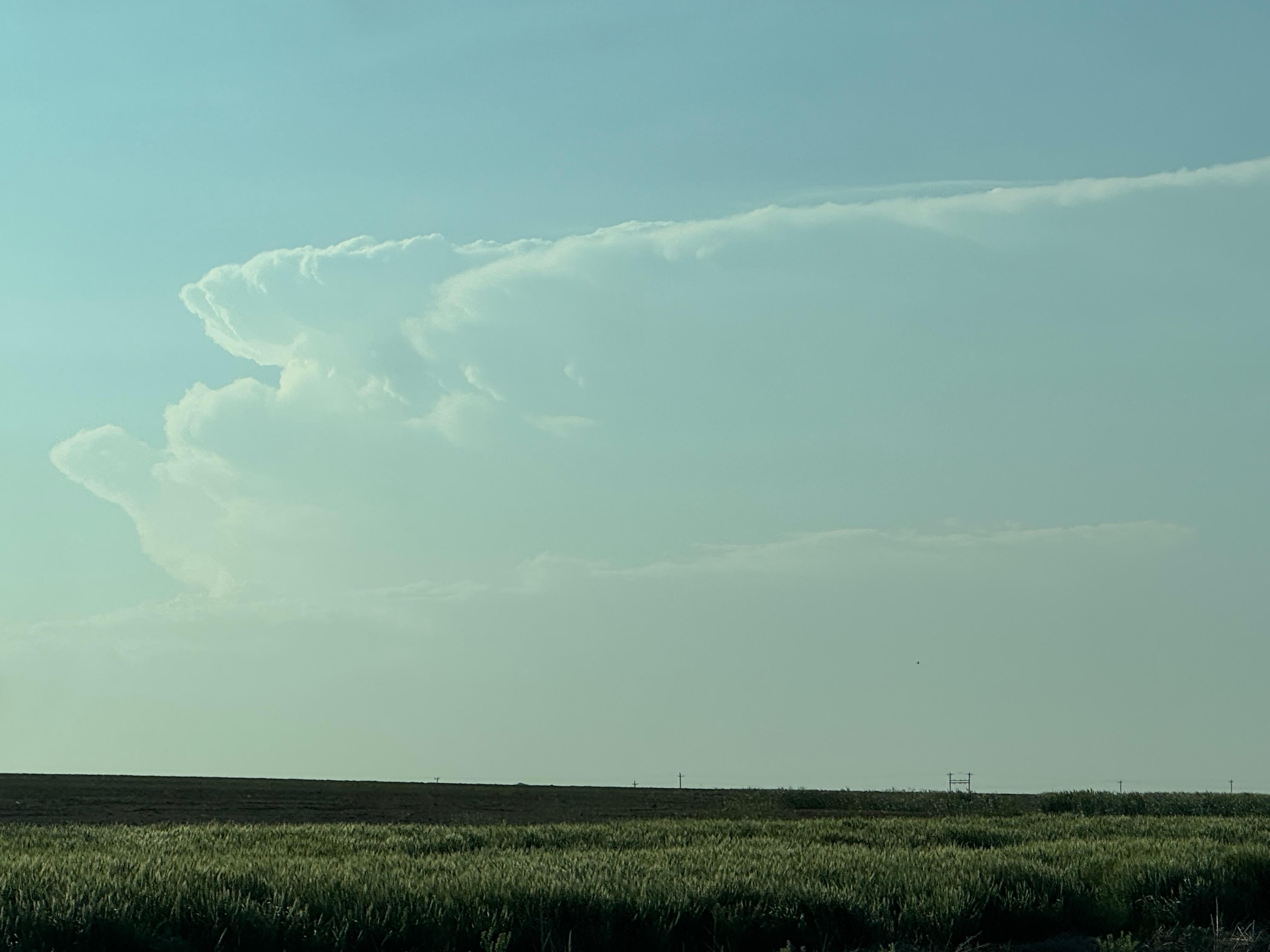
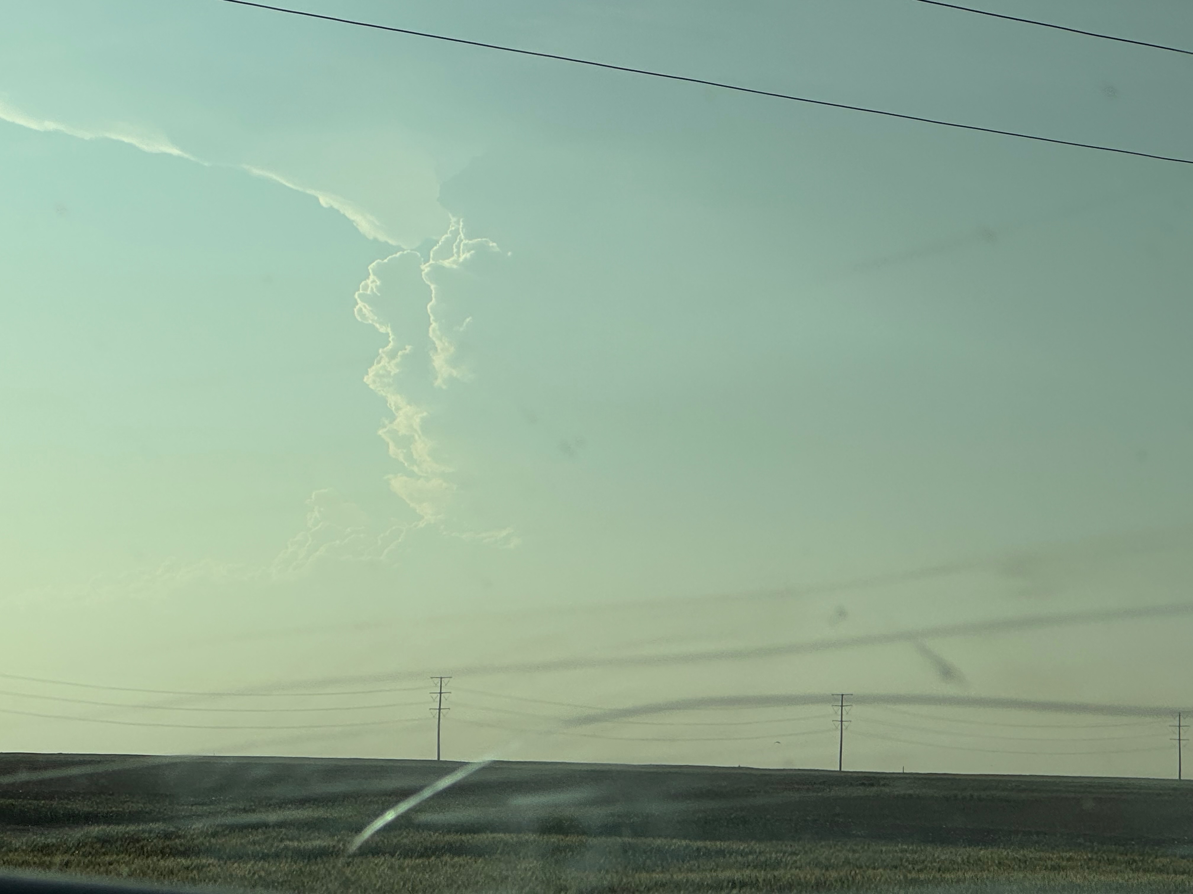
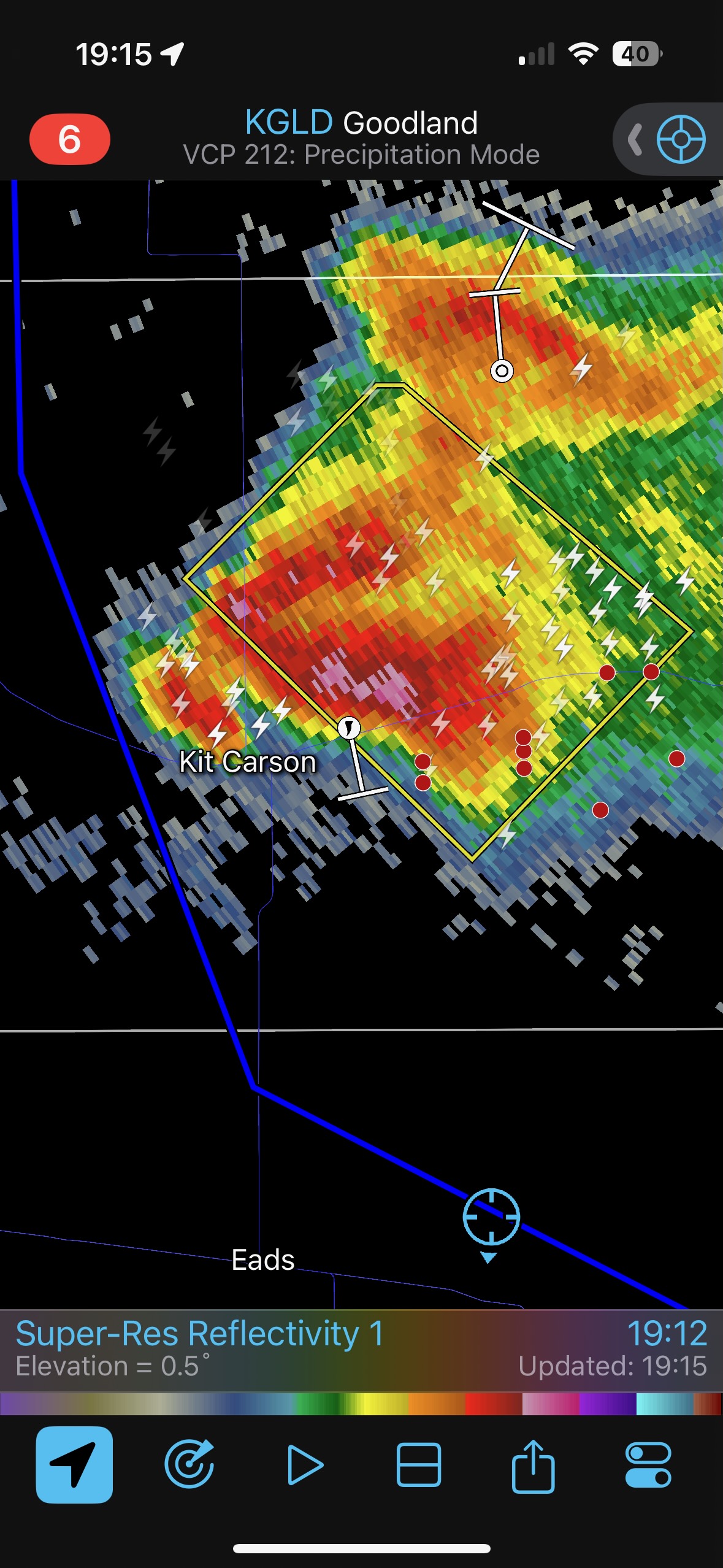
The next few radar shots show that the Kit Carson storm is strengthening nicely, and rather quickly. We are headed west from Sheridan Lake on U.S. 40 at 7:02 p.m. MDT, the anvil of this storm has grown tremendously, and the radar shows a developing hook echo! Still, the storm is north of Kit Carson and is reluctant to move much to the southeast yet.
We needed to get ourselves up there NOW! But we were maybe 50 miles distant. I needed to figure out where we needed to be in 30-60 minutes, around sunset time. One option was to head all of the way west to Eads and then north to Kit Carson. This might work and might get us close fastest. But the storm was showing just a bit too much motion towards the east, and we might wind up too far west if I utilized U.S. 287. I scoured the Delorme Gazetteer for Colorado for decent dirt roads northward from U.S. 40. There looked to be a good one about 5-6 miles west of Chivington, County Road 49 in Kiowa County. It looks like the radar grab at 19:15/7:15 p.m. MDT shows our location on County Road 49, just after turning north off of Highway 40. We were heading north again and closing in!
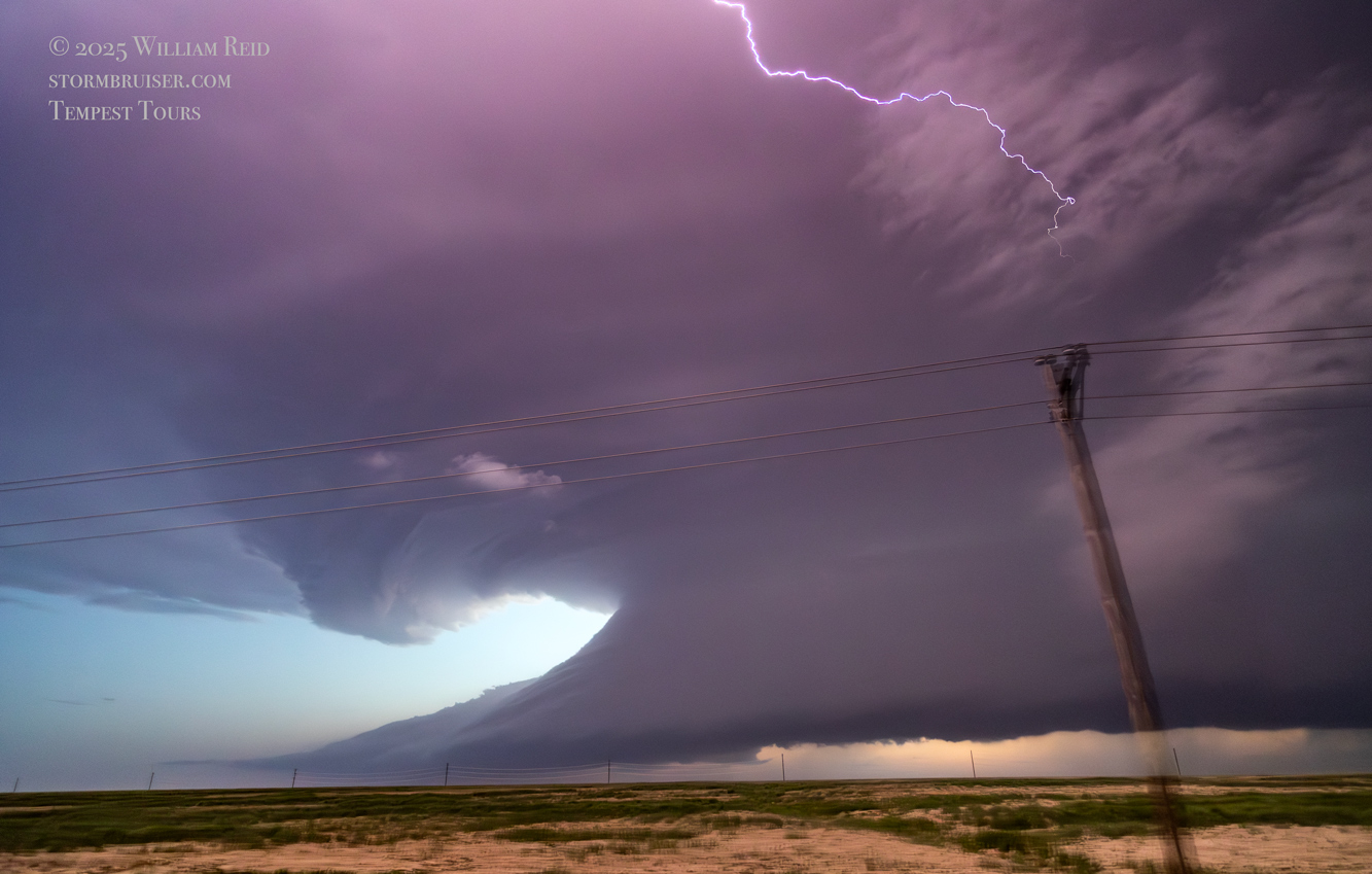
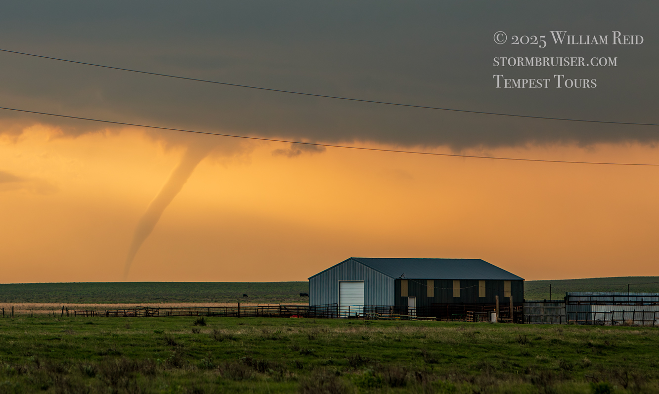
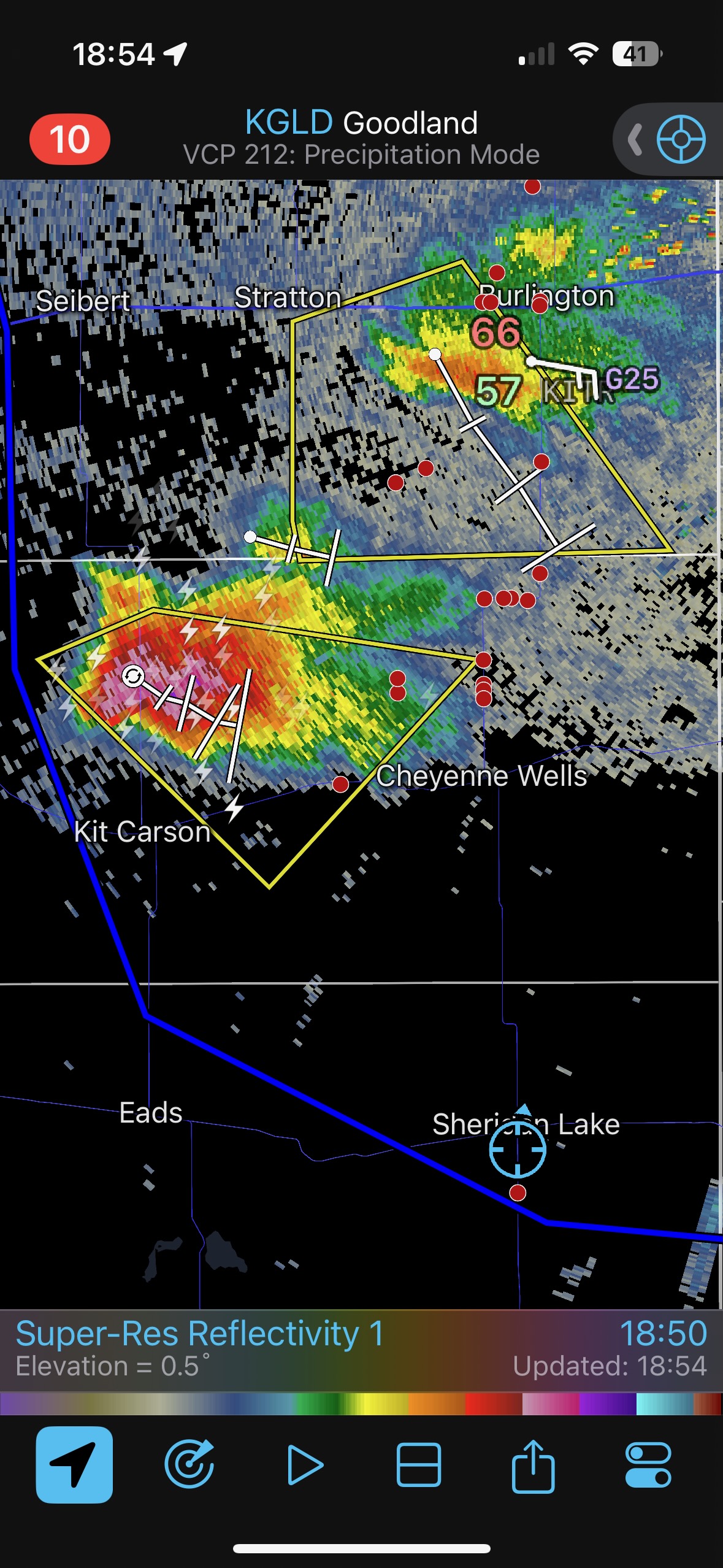
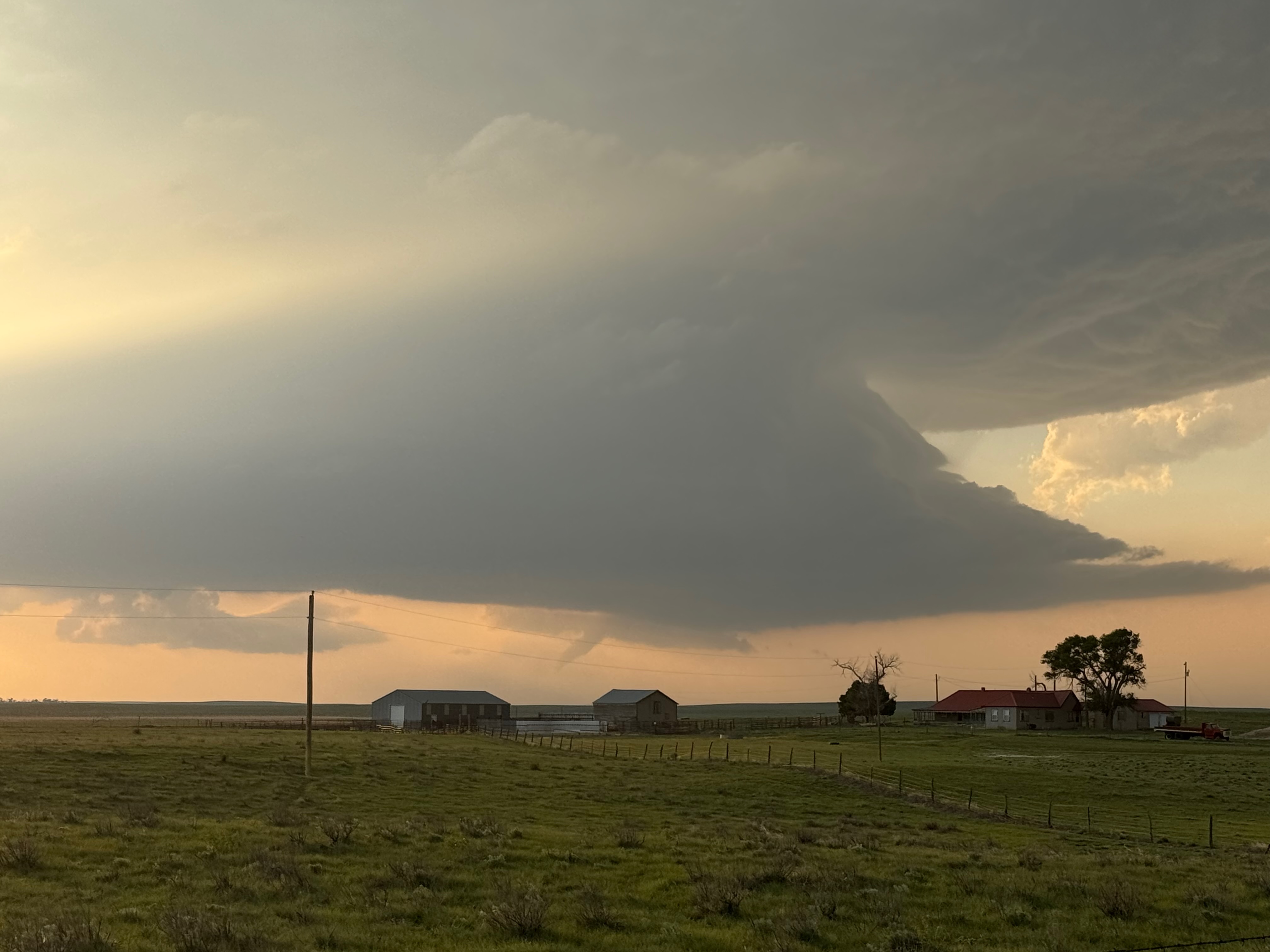
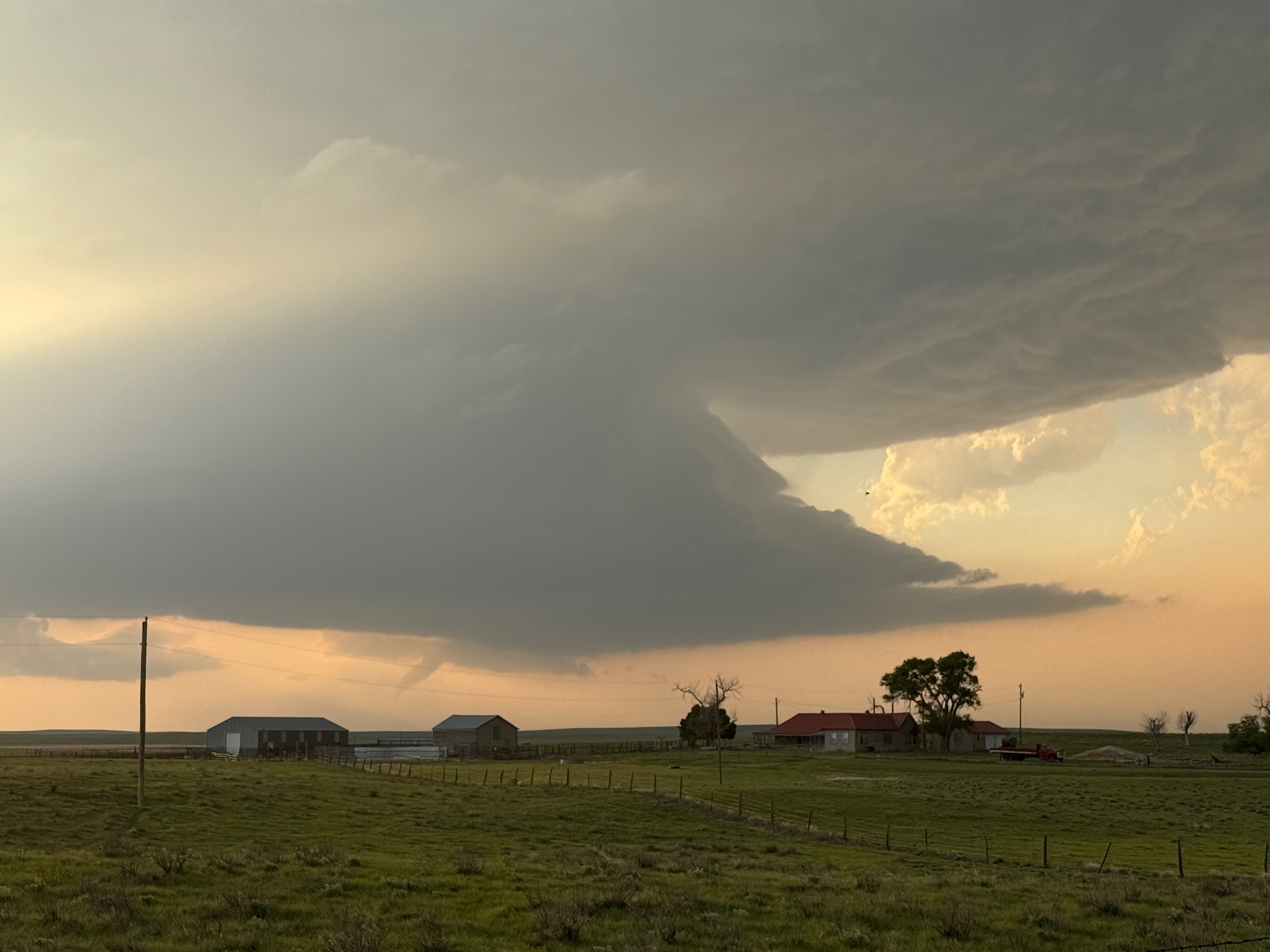
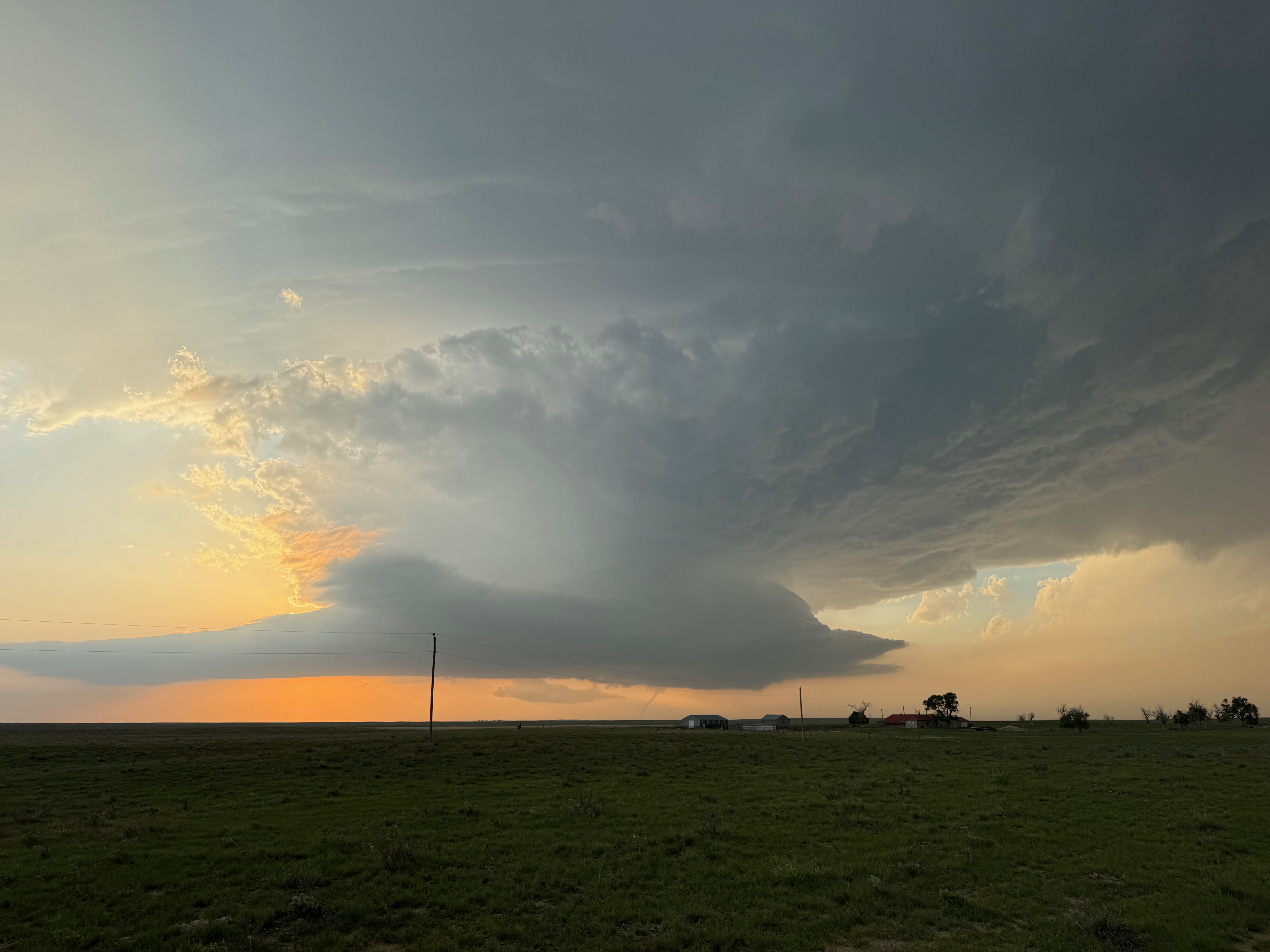
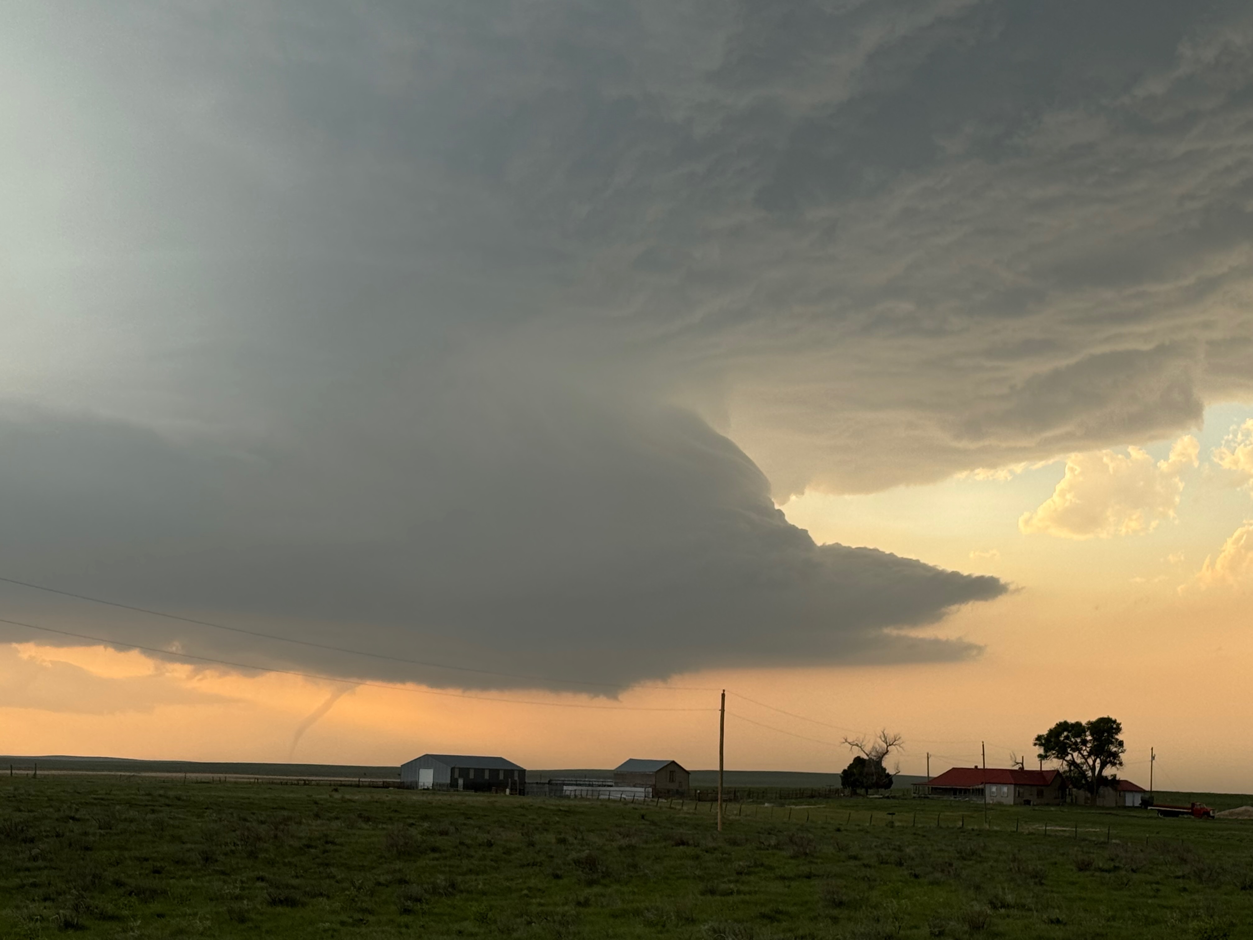
We had to scoot east a mile in order to continue northward, now on County Road 50. The storm base was coming into view, and it was showing great structure! Ideally, I would have liked to have continued north several more miles, but our County Road 50 began to deteriorate quite a bit near a ranch house, very close to the E-W Kiowa/Cheyenne county line (see our position on the 19:39/7:39 p.m. MDT radar image below. The radar data shown is old, for 7:12 p.m.). We started up a small hill with two ruts for the van tires, just beyond the ranch house. I wanted to get to the top of this hill, at least, as it should have afforded a great view to the northwest. But this dang road was sandy and just too lousy. We turned around to find a good place to stop, and the guests started shouting out that they were seeing a tornado with the storm! The SPC storm reports show a tornado ongoing at 7:28 p.m. MDT, one mile east of Kit Carson.
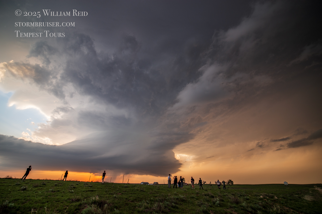
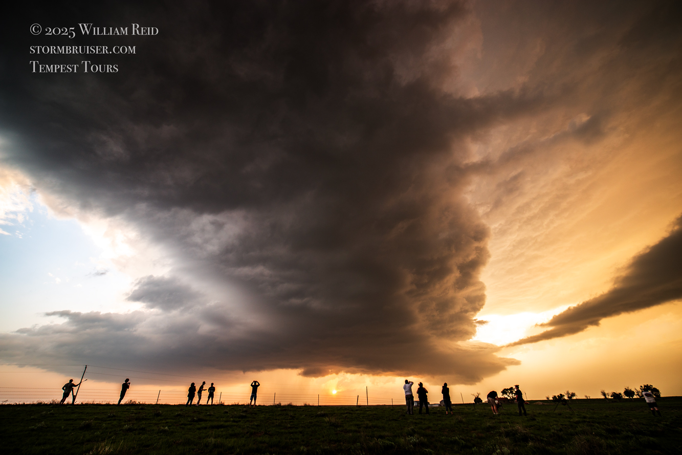
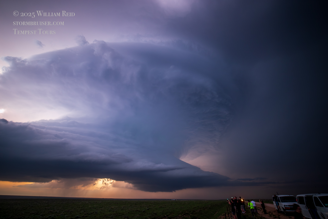
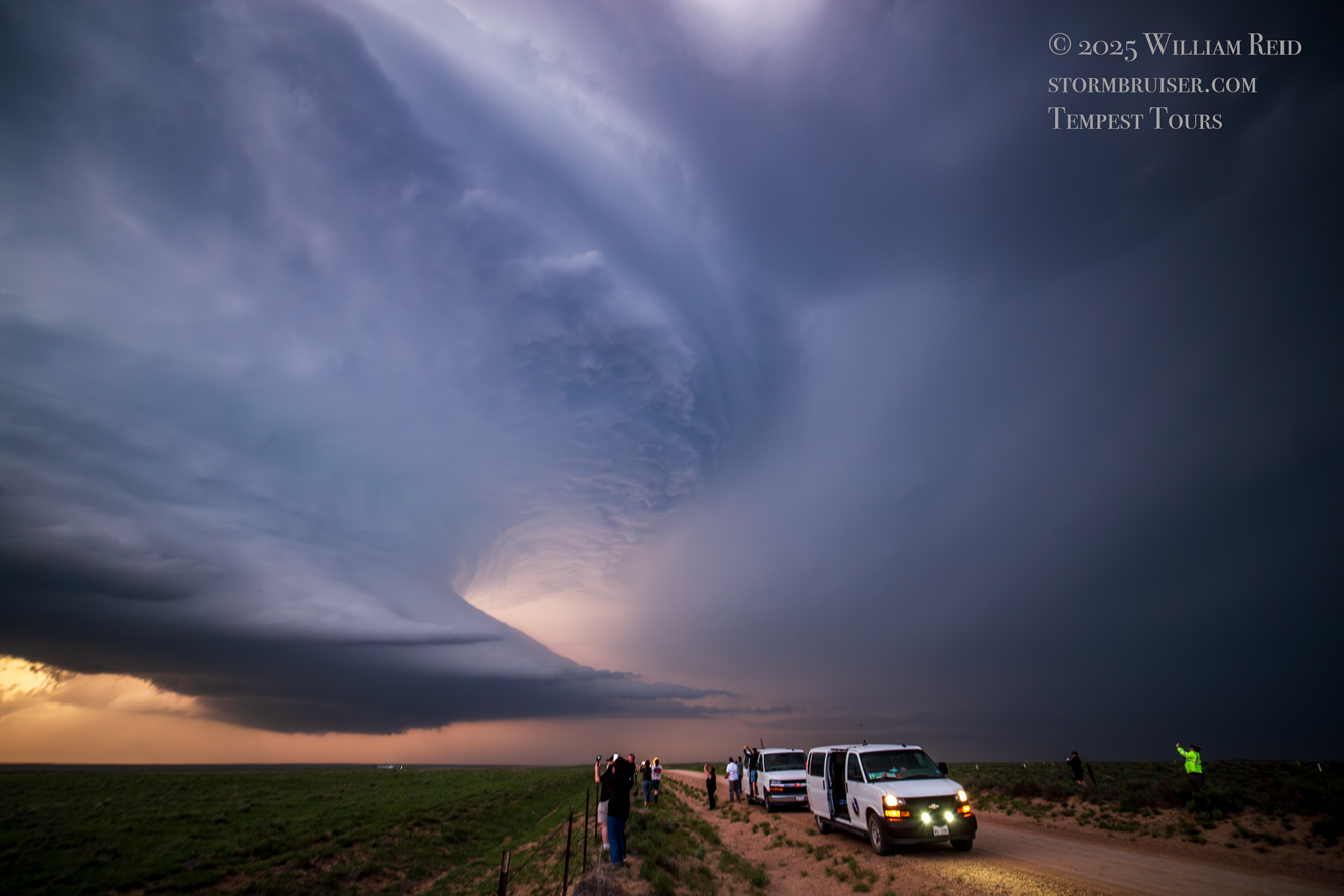
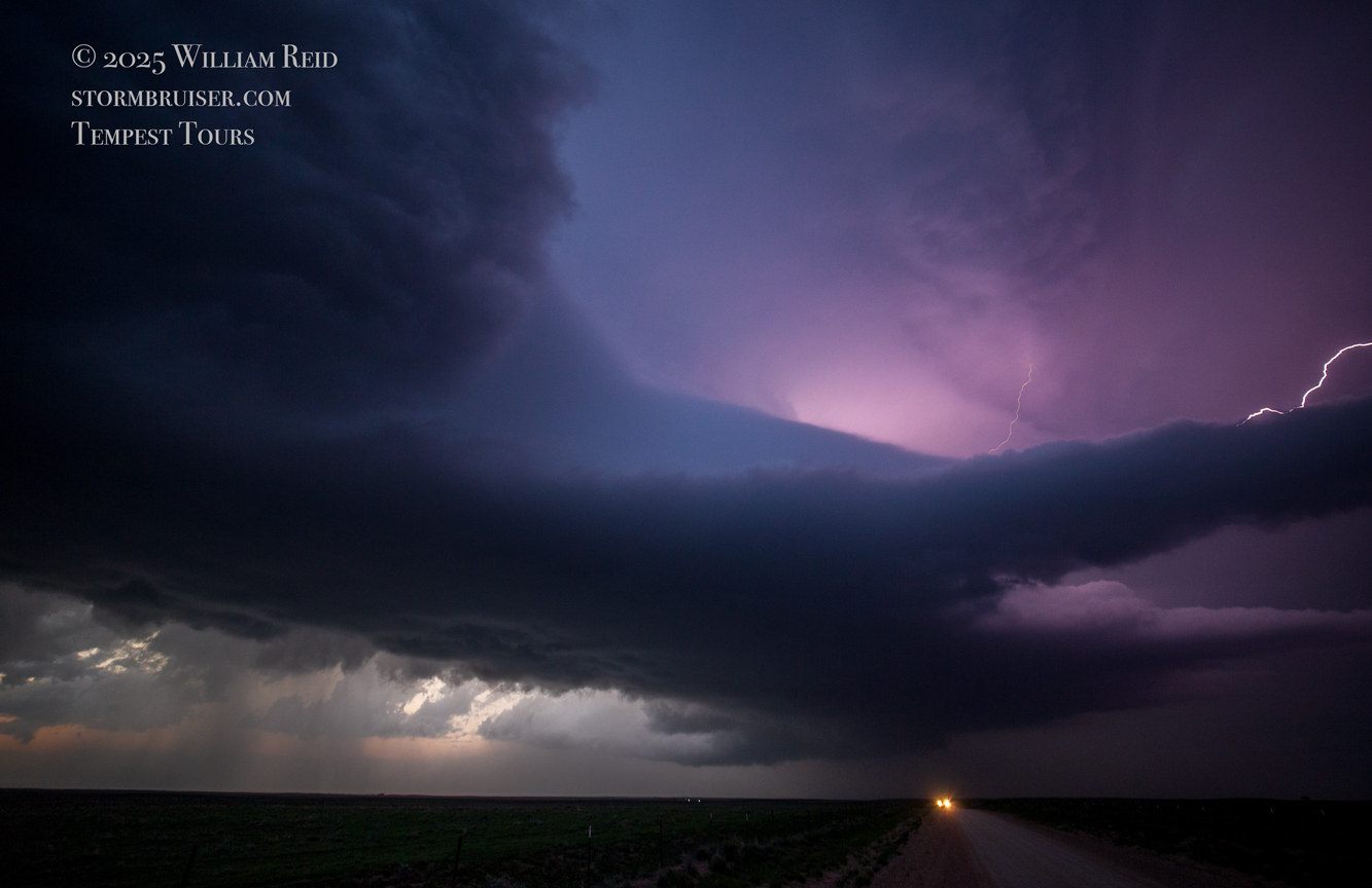
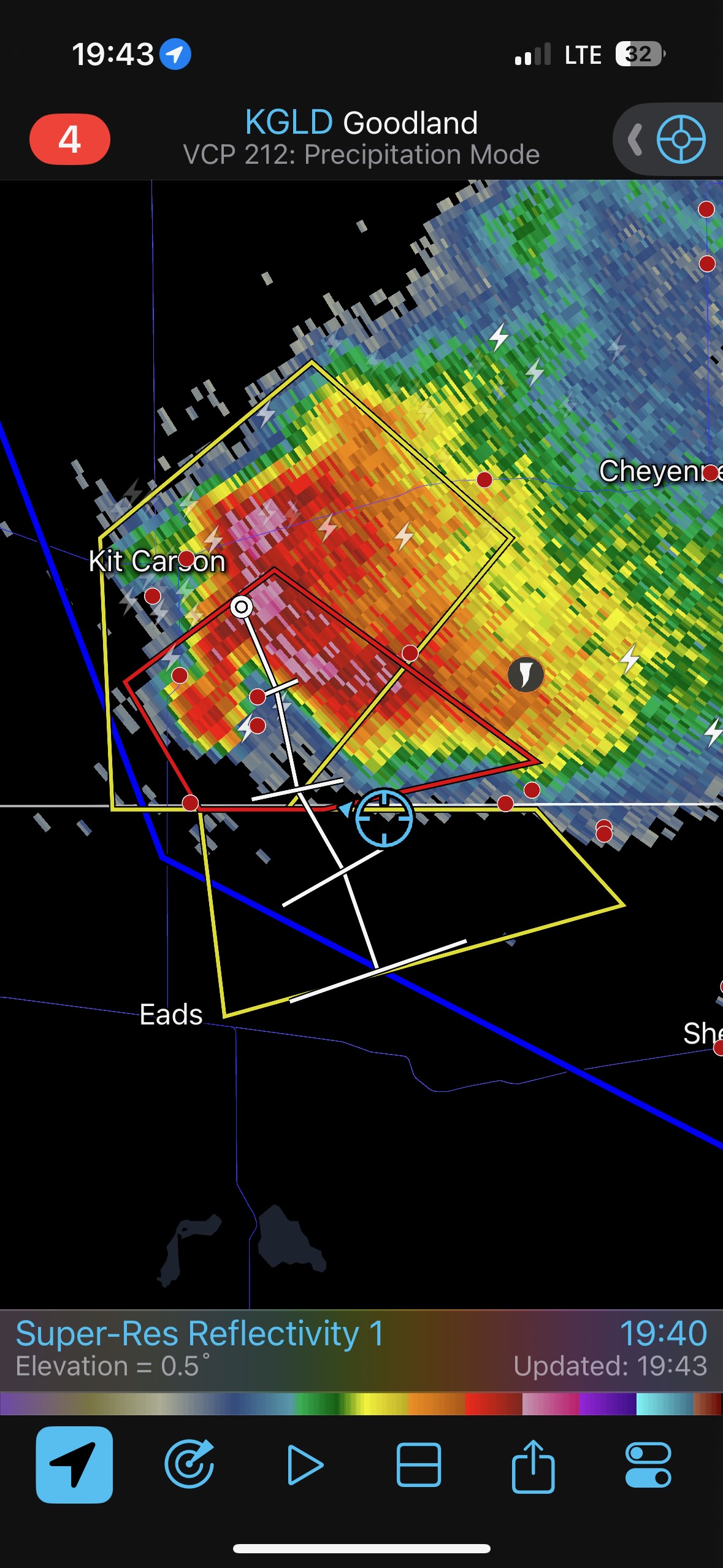
If memory serves correctly, I think this first tornado quit, but then there was another one soon after which persisted for at least a few minutes. I managed to get a handful of shots of it with both the wide angle and long lens. Check out how nice and beefy the hook is on radar at 19:43/7:43 p.m. MDT. And, the storm has started to make a move finally, towards the SSE! The action area is approaching our position perfectly. The iPhone images of the storm (below) should synch properly, chronologically, with the radar grabs. It was a pity that there were no subsequent tornadoes as the storm moved closer to us, but we were happy campers having observed a distant tornado and now with a gorgeous supercell at sunset.
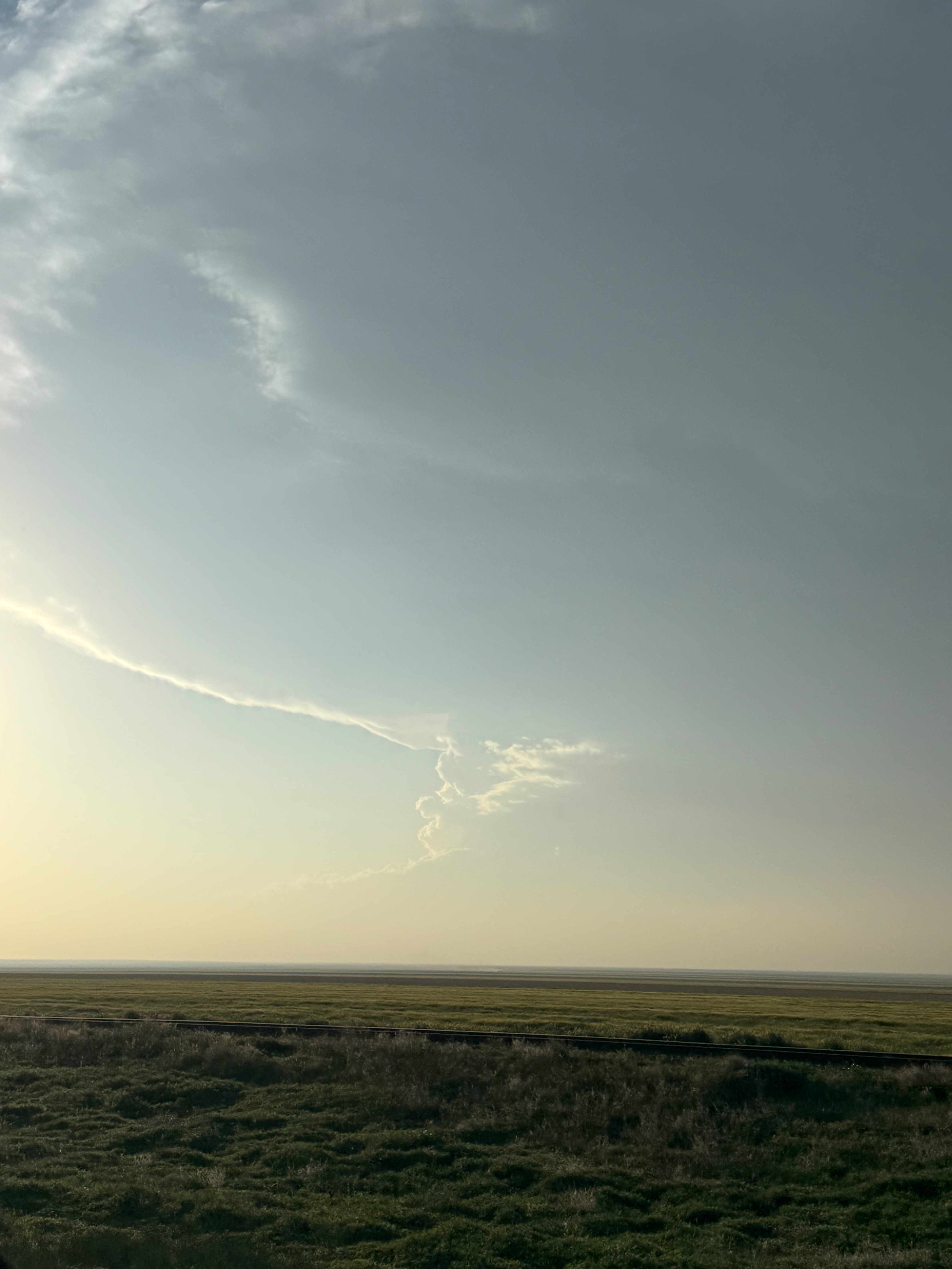
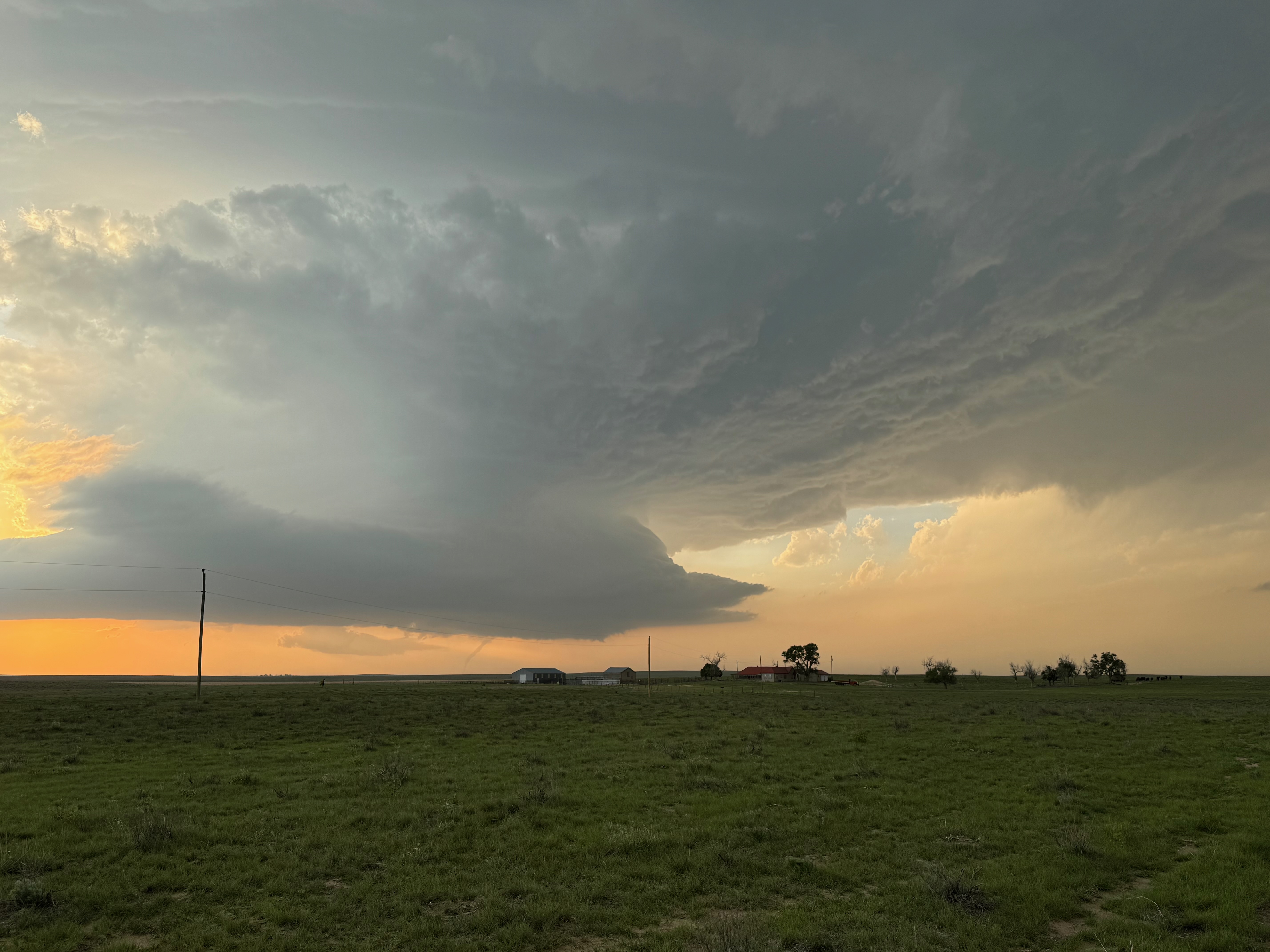
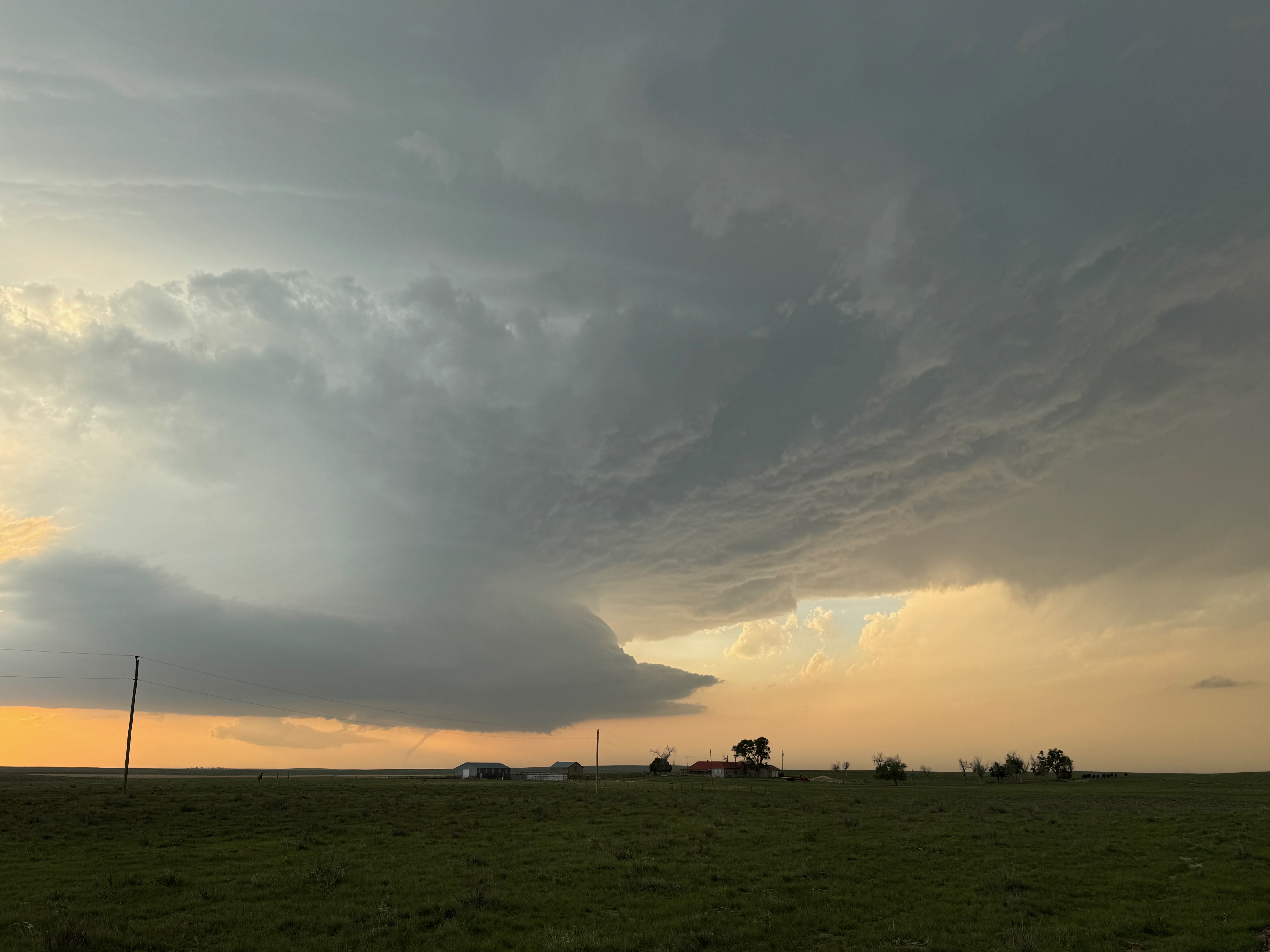
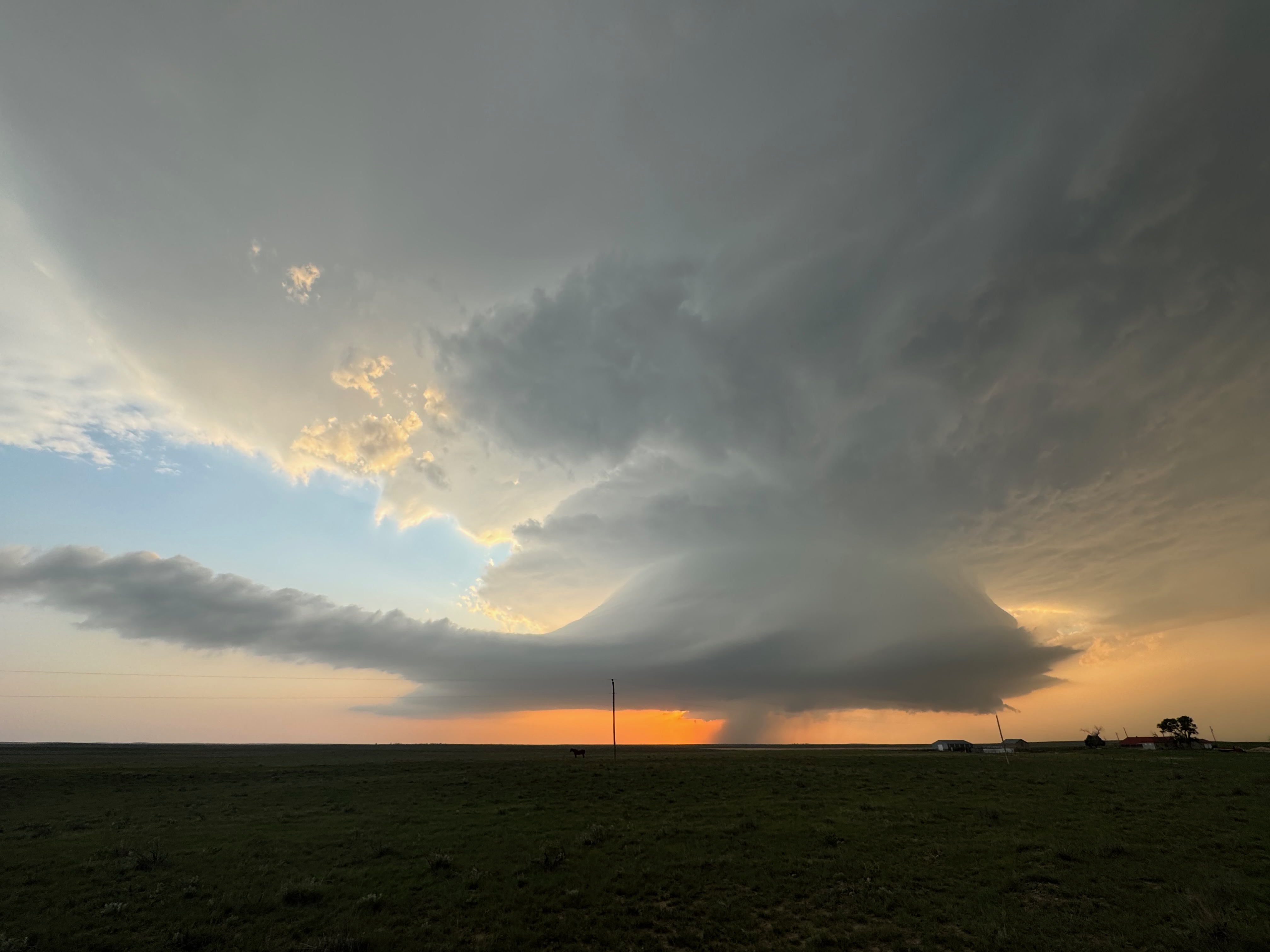
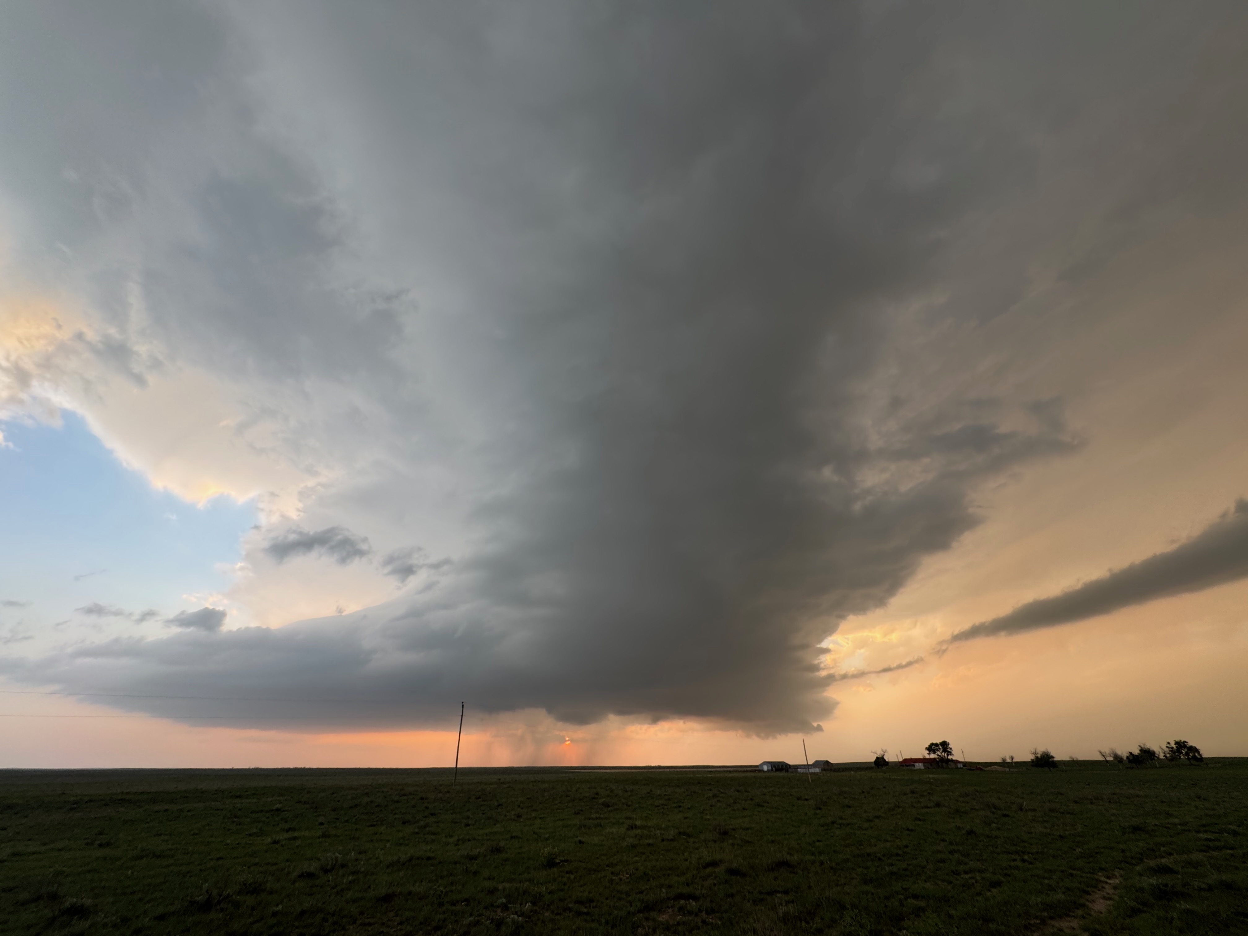
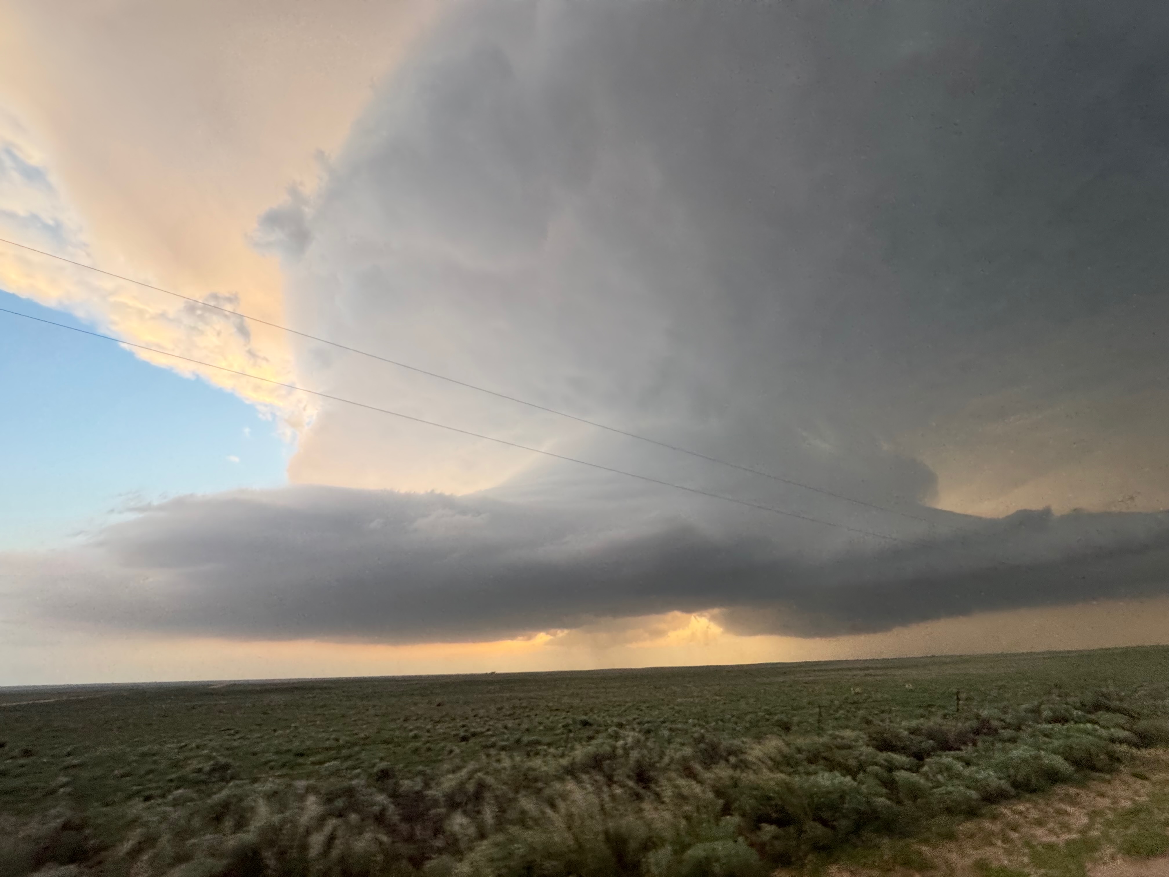
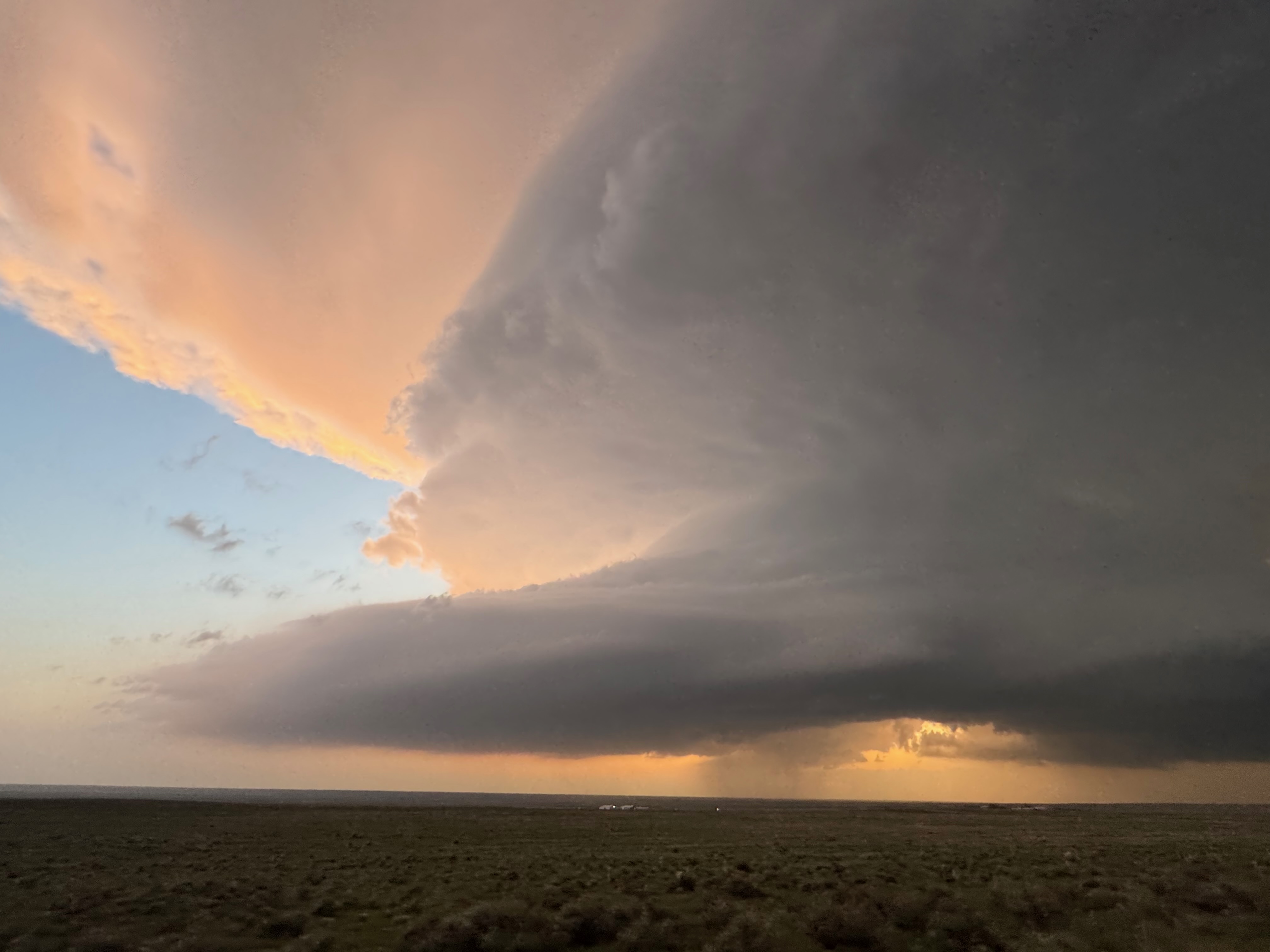
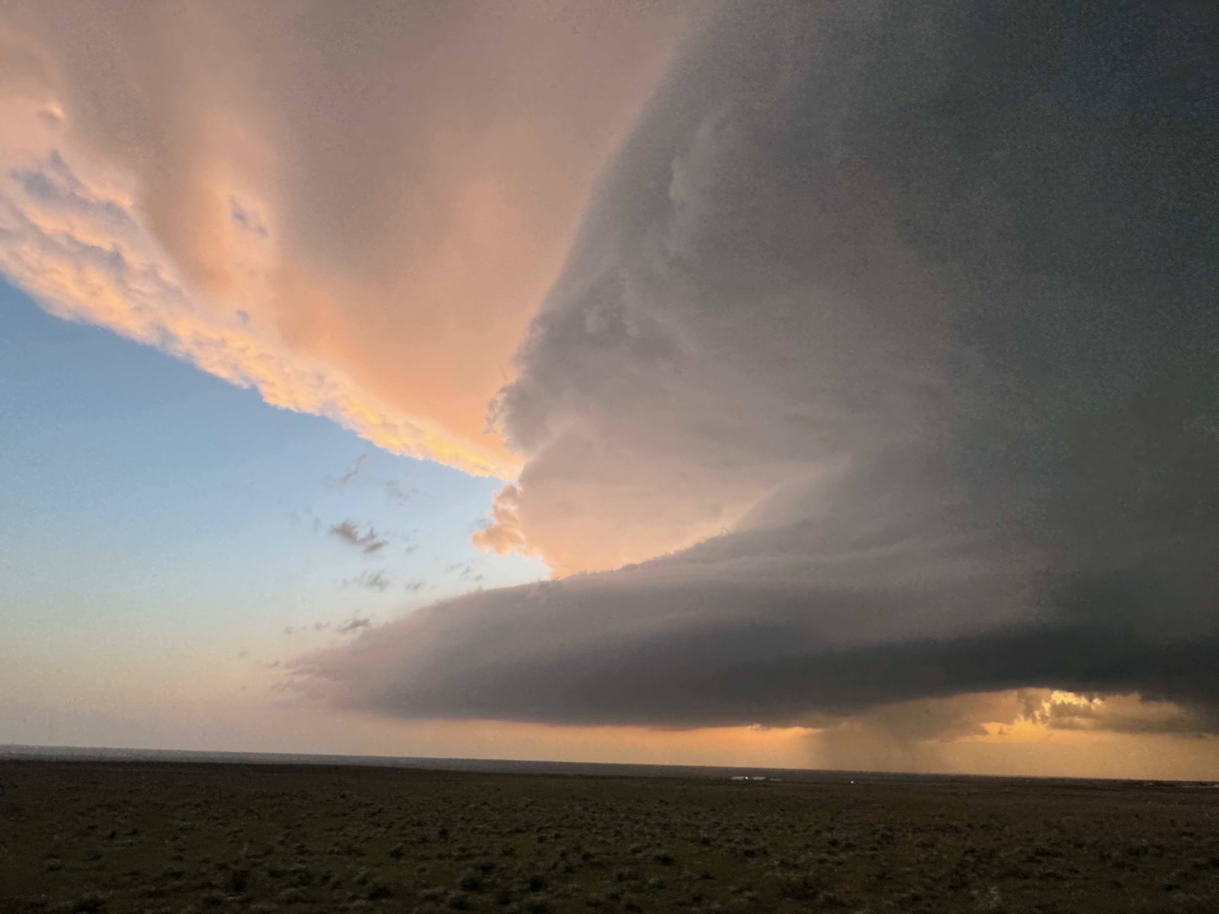
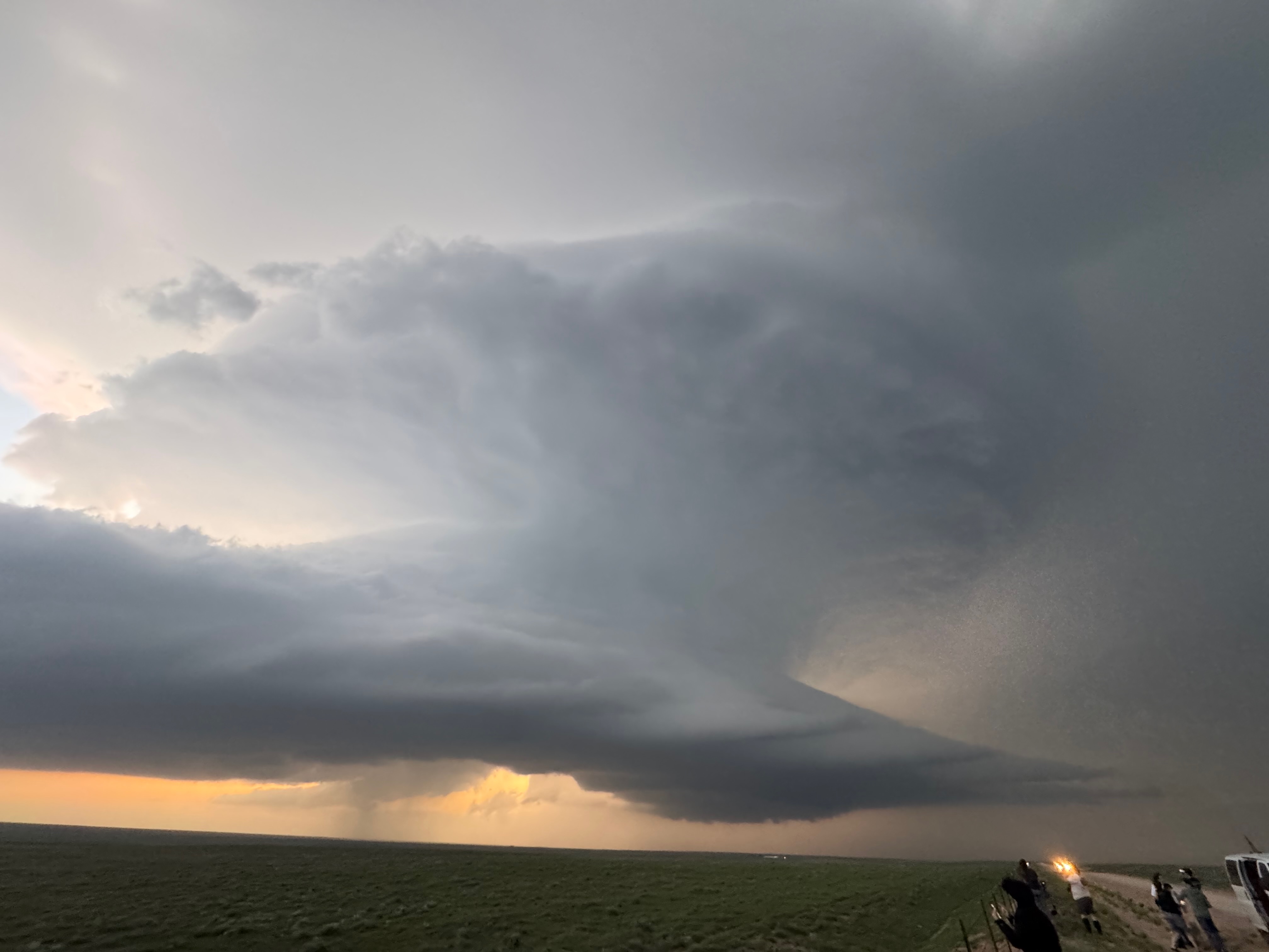
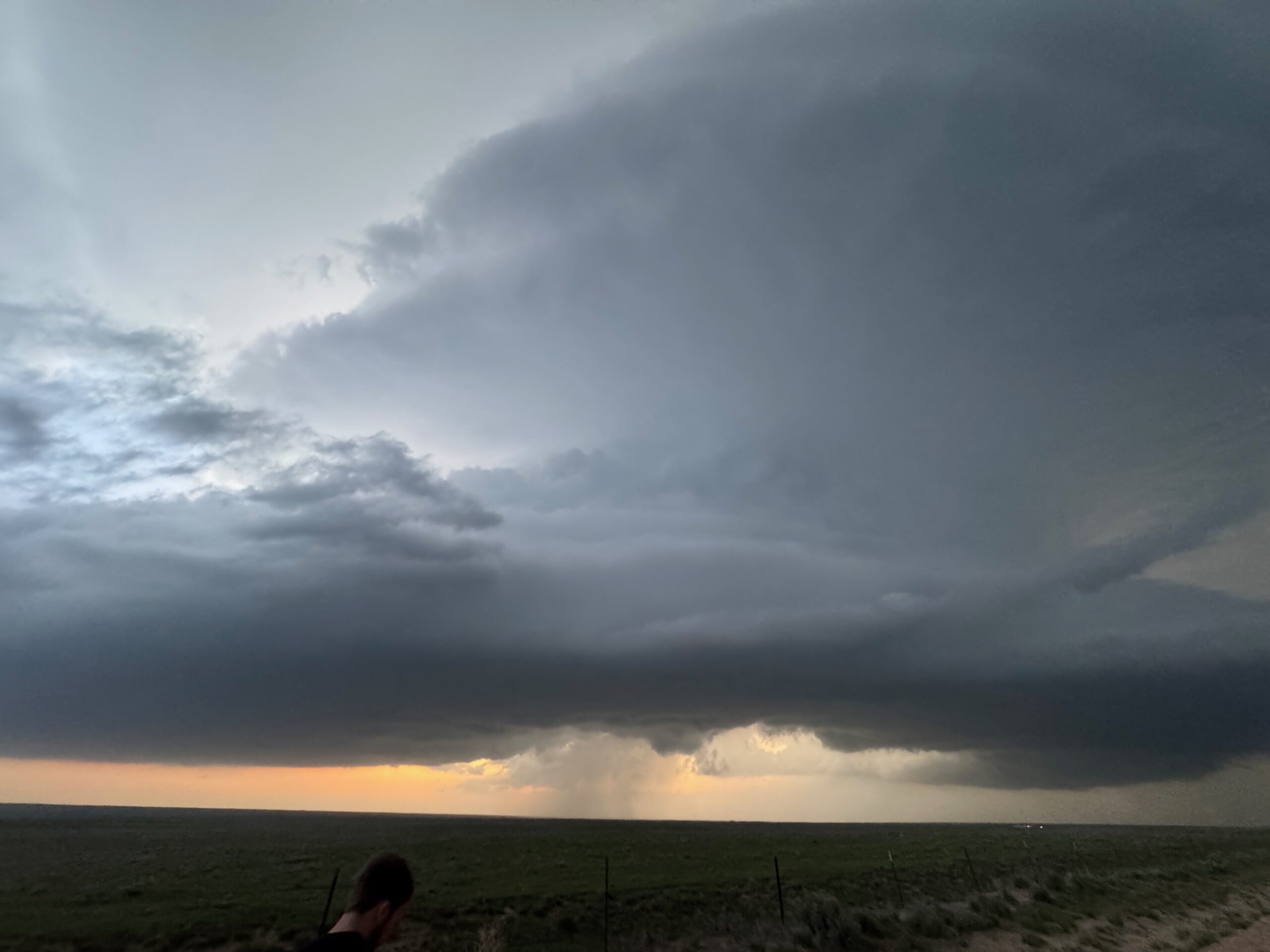
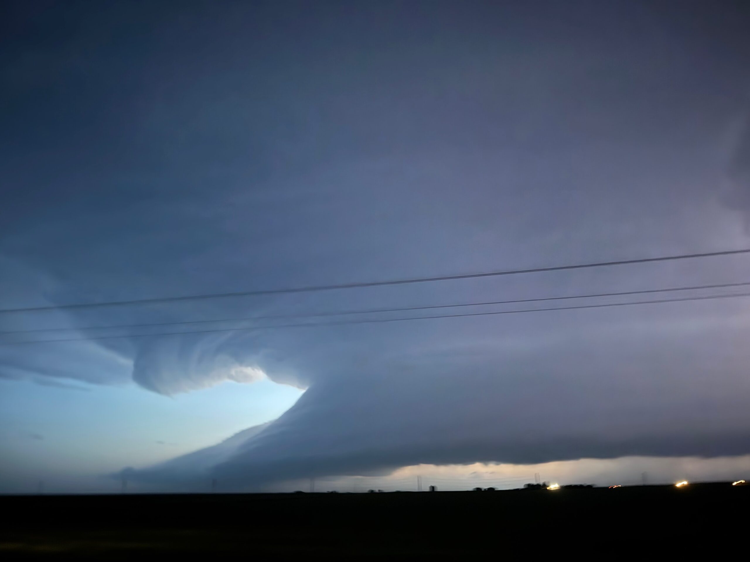
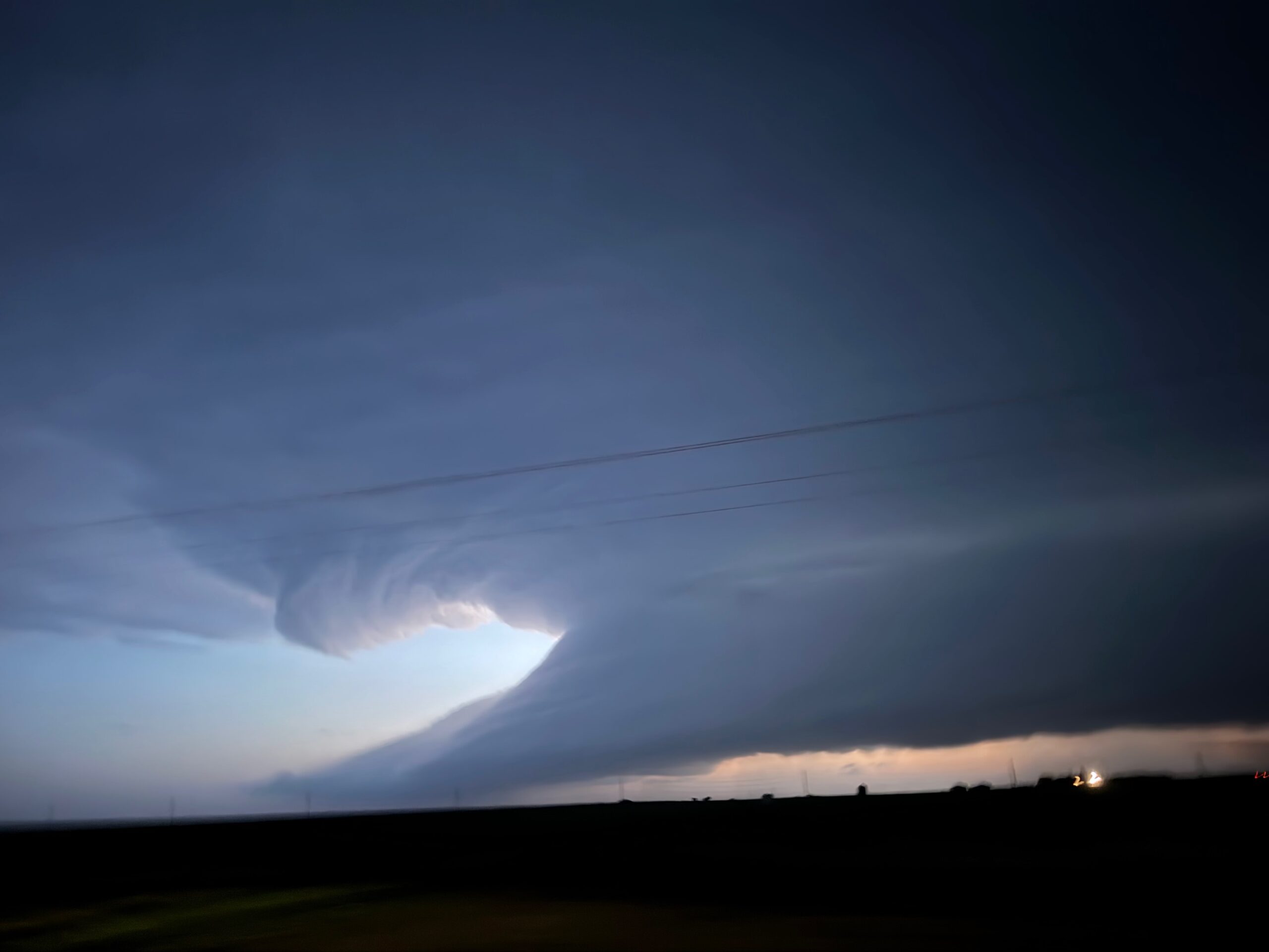
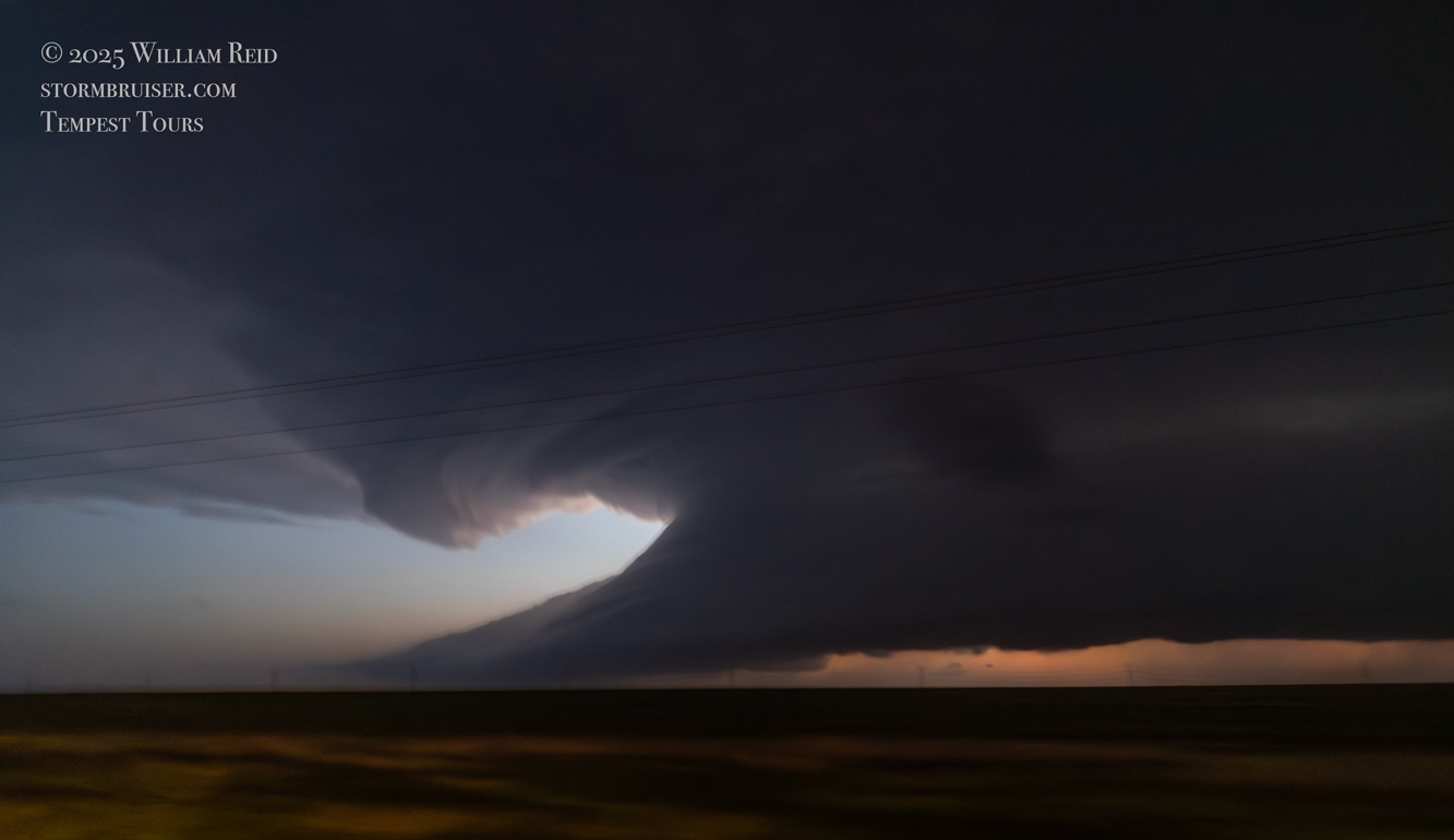
By 8 p.m. MDT the sun had set and the forward flank precipitation was encroaching. We zig-zagged a bit south and east and south again for the next amazing view, stopping north of Chivington by maybe 8 miles. The wide-angle Canon shots in the first batch of images in this account (closer to the top, above), some with lightning, show the impressive supercell structure. At dusk we had a tremendous view of the laminar low-level structure to our west, near Chivington.
It was dark when we reached Chivington, and it appeared that the storm was not quite as impressive. That was okay — we needed to start our drive back towards Oklahoma City, and to our motel for the night in Dodge City.
Leave a Reply
You must be logged in to post a comment.