
Start: Roswell, NM/lunch: Wendys in Dalhart/End: Canadian, TX/585 miles
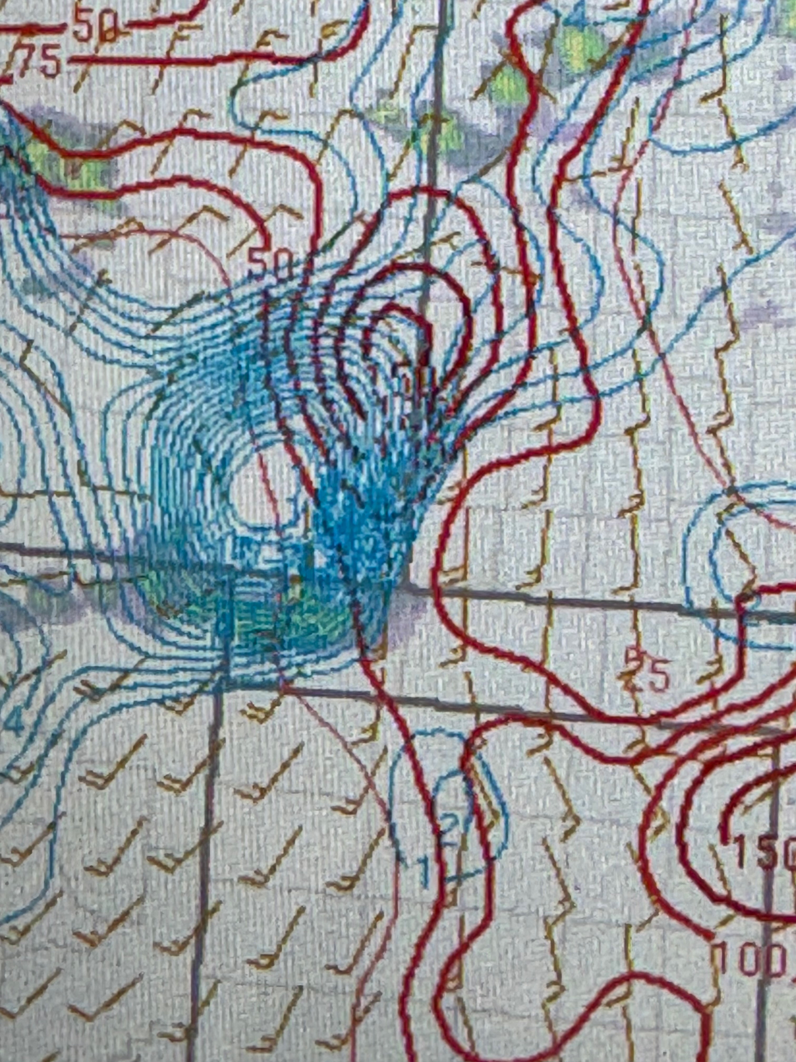
Mesoscale Discussions. 12:53 p.m. CDT. 3:34 p.m. CDT. 5:22 p.m. CDT. 7:04 p.m. CDT. 7:48 p.m. CDT. 9:14 p.m. CDT.
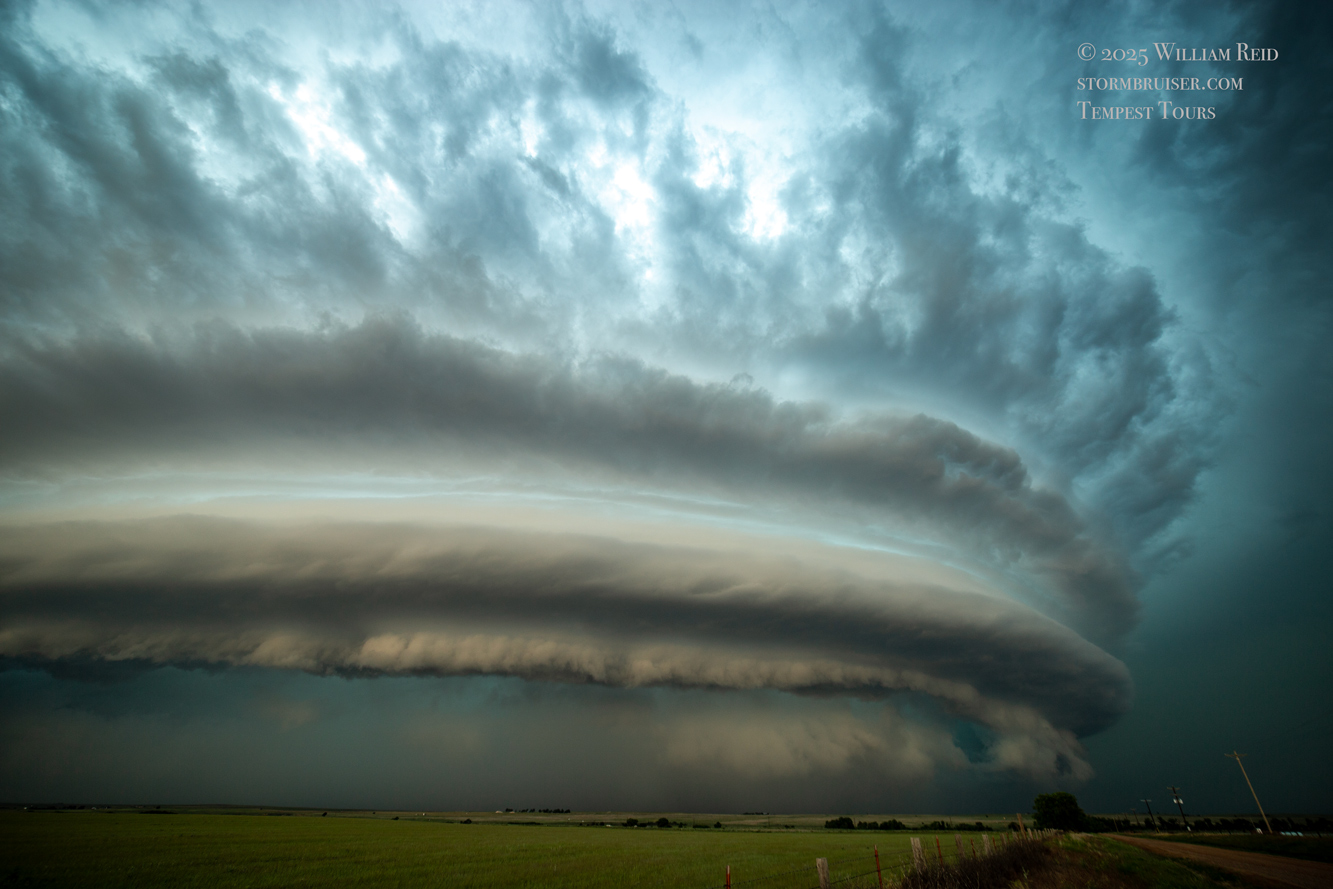
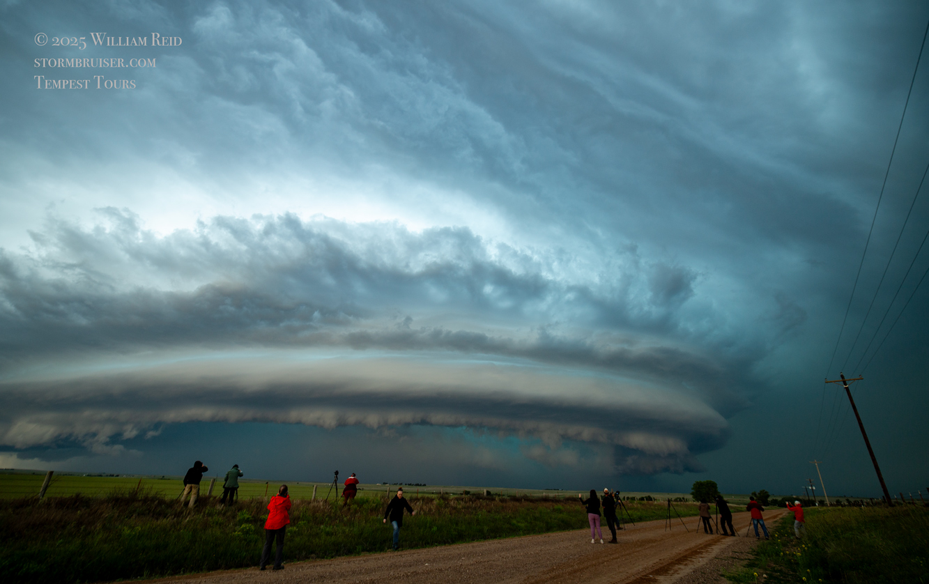
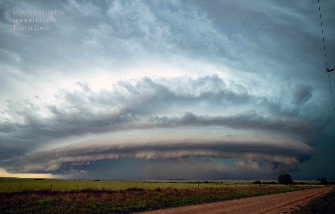
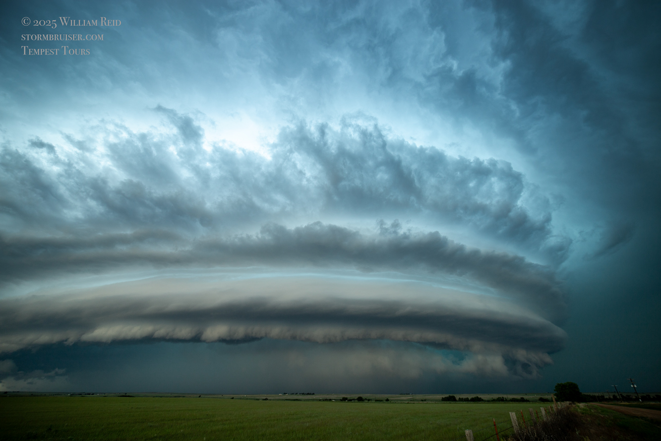
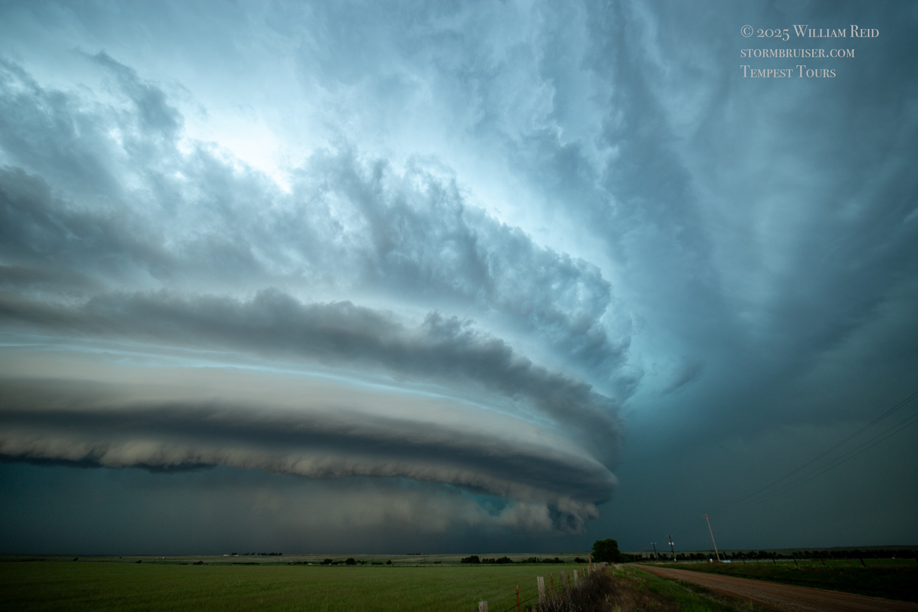
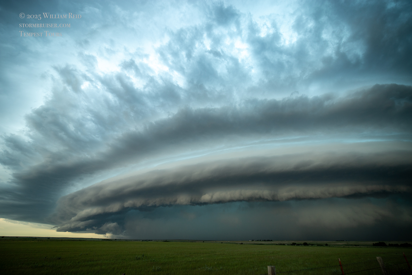
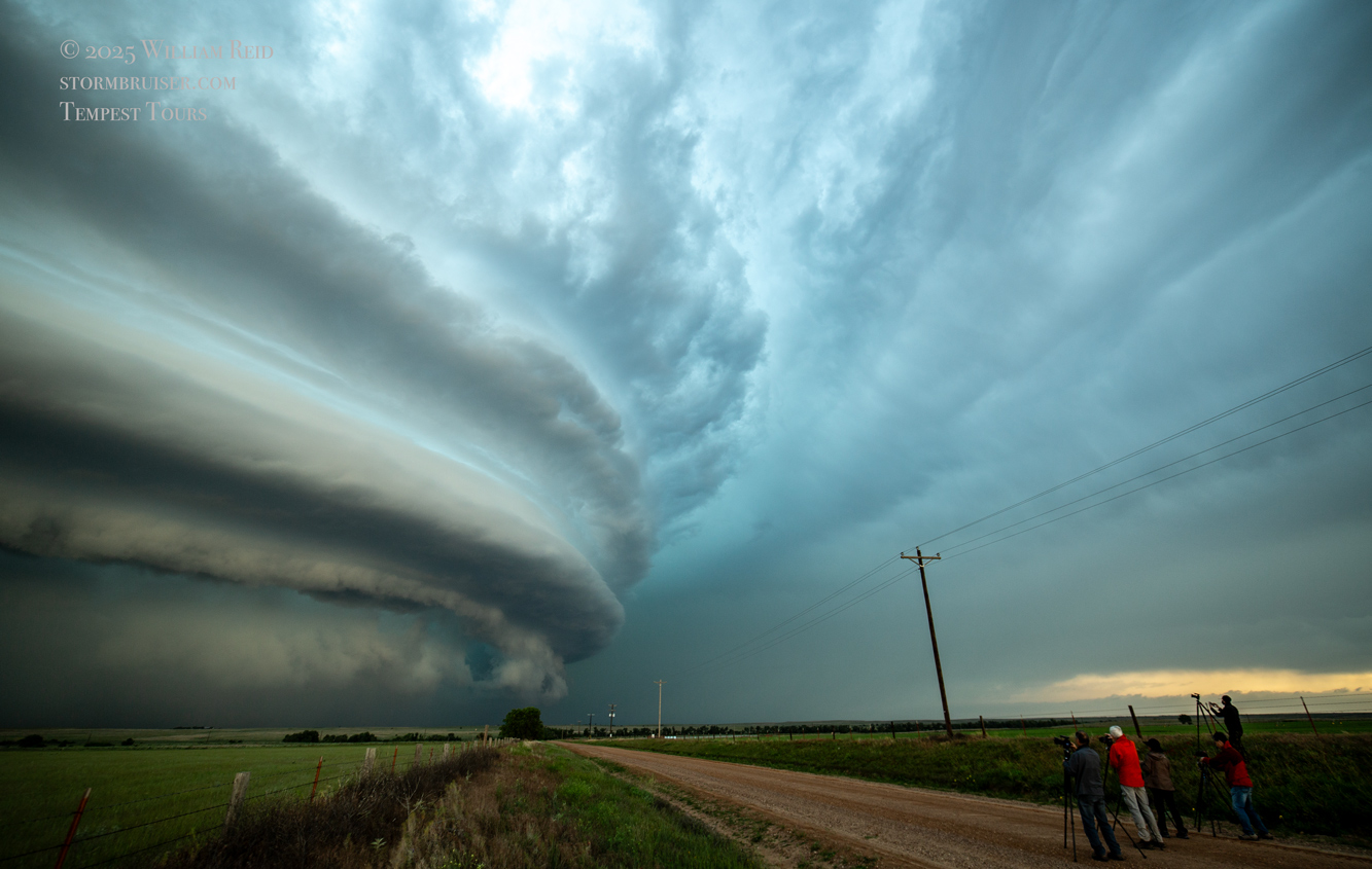
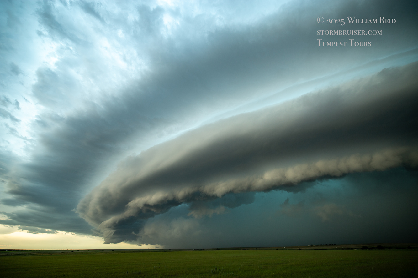
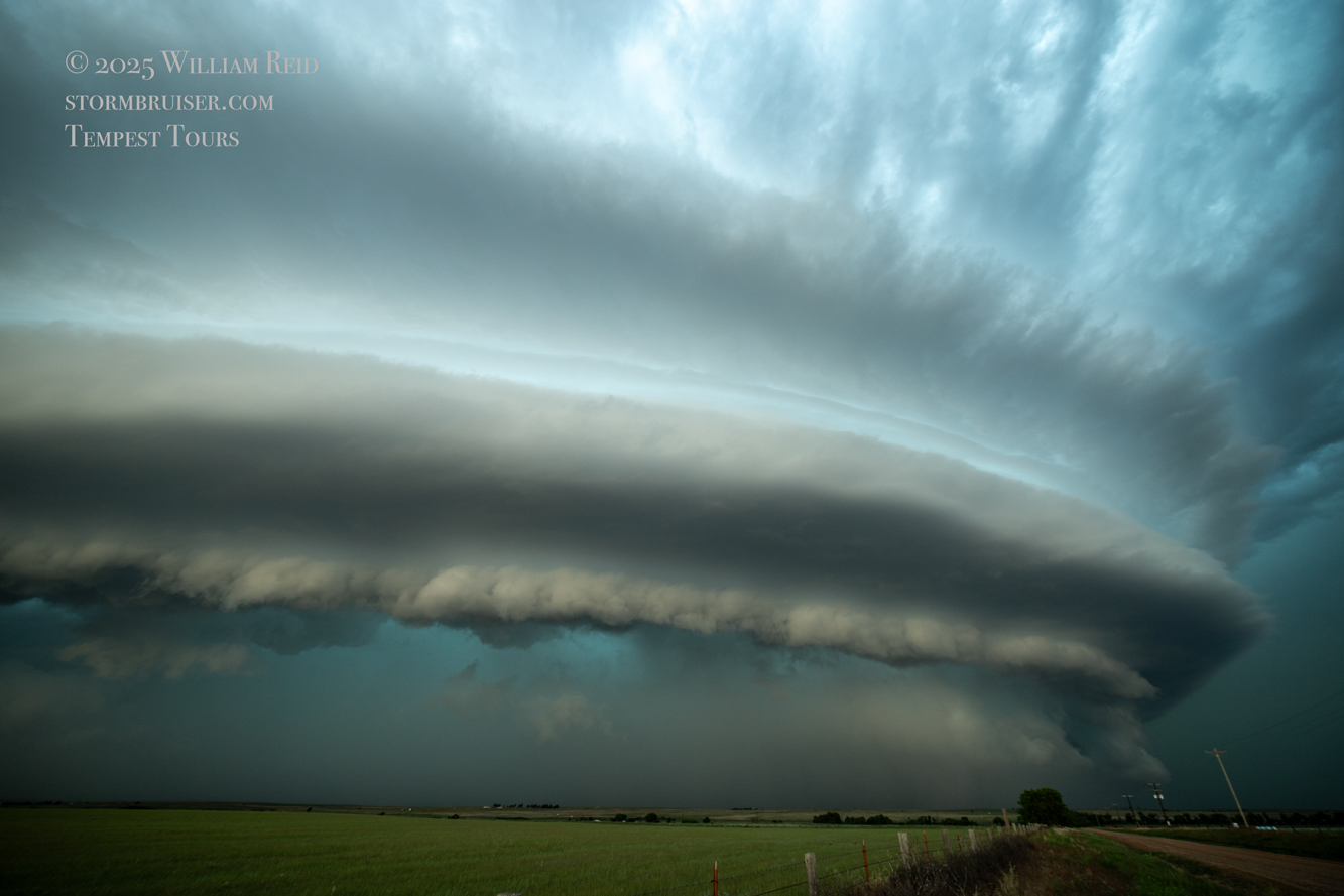
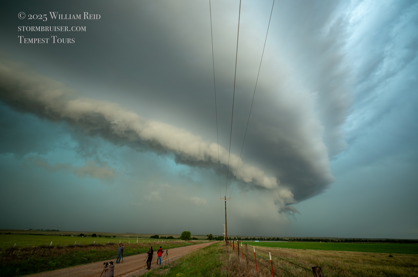
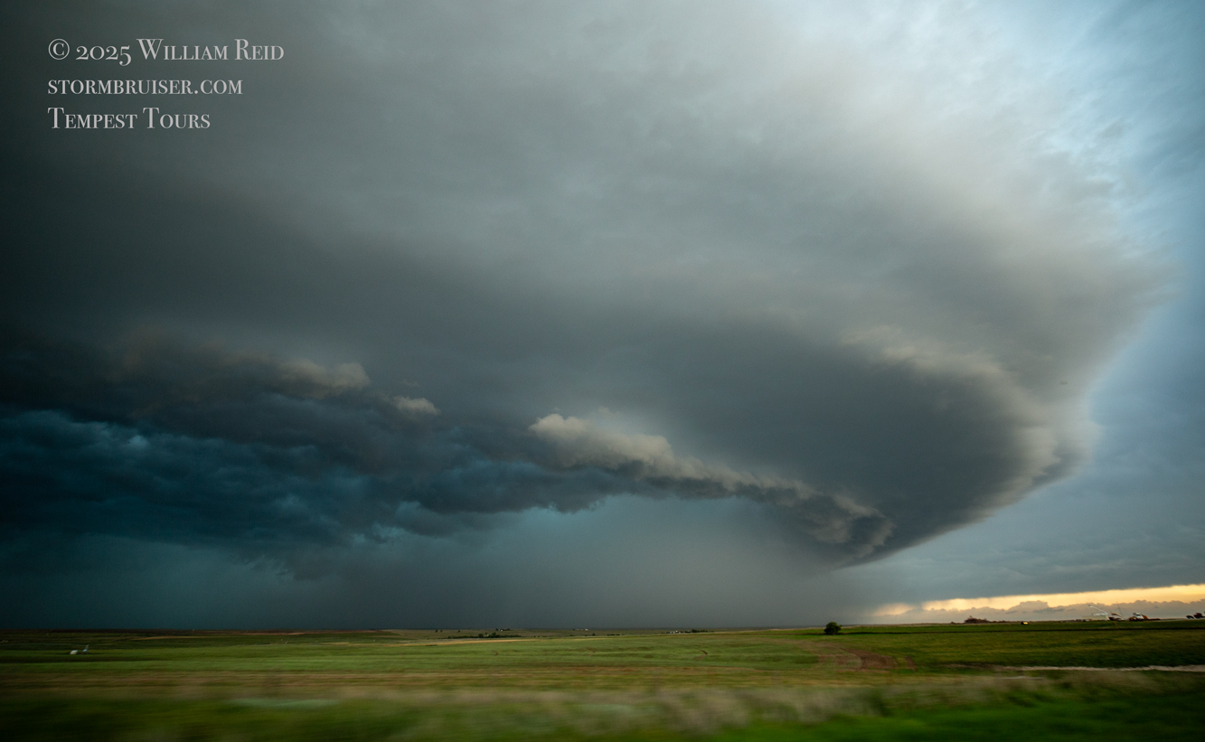
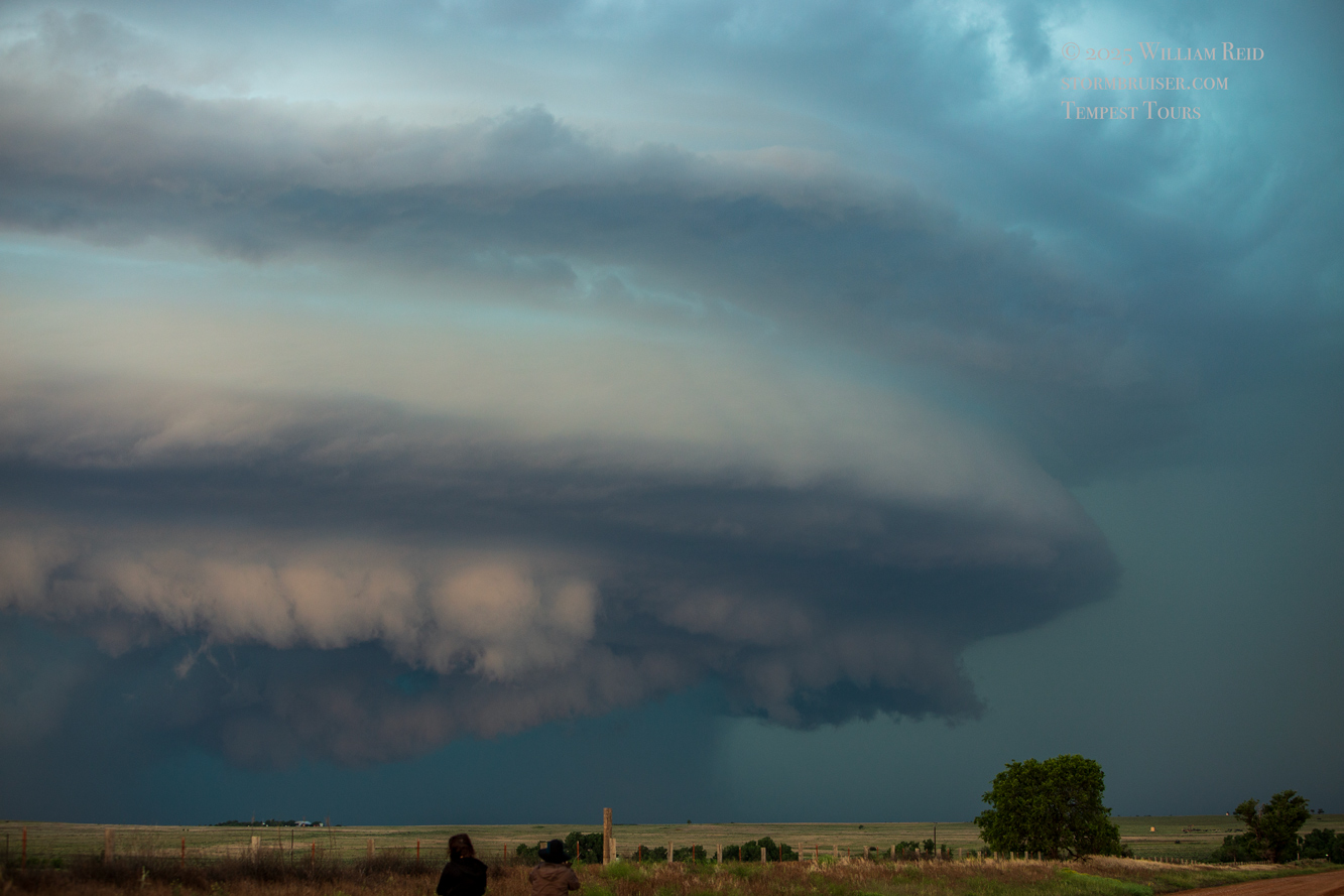
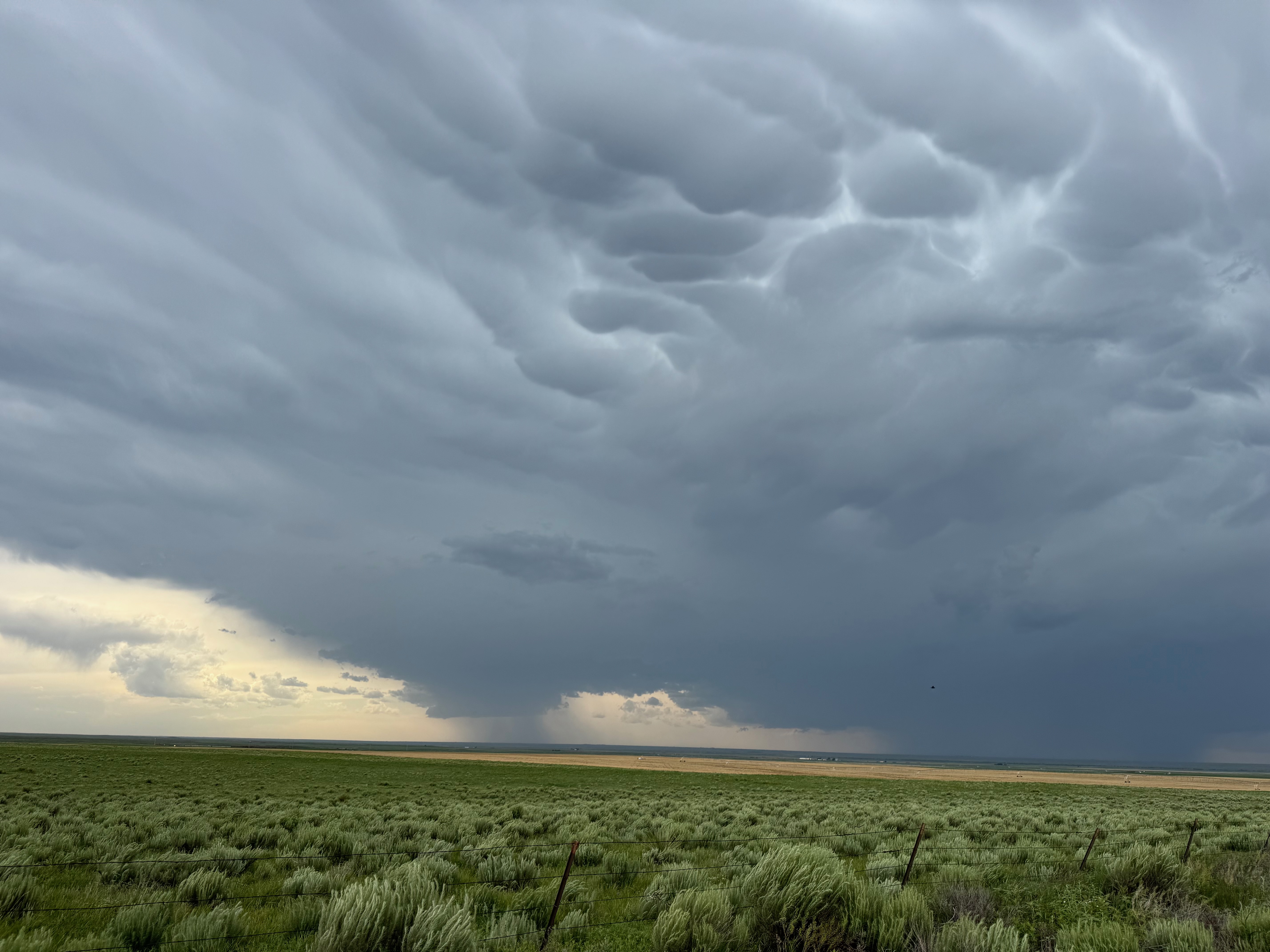
The images below are from the Canon. The first two images show a somewhat distant storm base to our north from the OK/KS/CO triple point. The remainder are of the beastly supercell that is tracking southeastward through eastern Beaver County in the Oklahoma Panhandle.


Today was looking pretty good for severe weather on the High Plains, and SPC even showed a 5% tornado risk over extreme eastern Colorado into western KS and the eastern OK Panhandle. My general target area was around Morton County, KS, in the corner of southwestern Kansas. It looked like the best tornado chance might be around the OK Panhandle towards sunset, as a low-level jet kicked in. As it turned out, the tornado threat did not pan out. We did manage to catch a high-end supercell with great structure around Slapout and Elmwood.
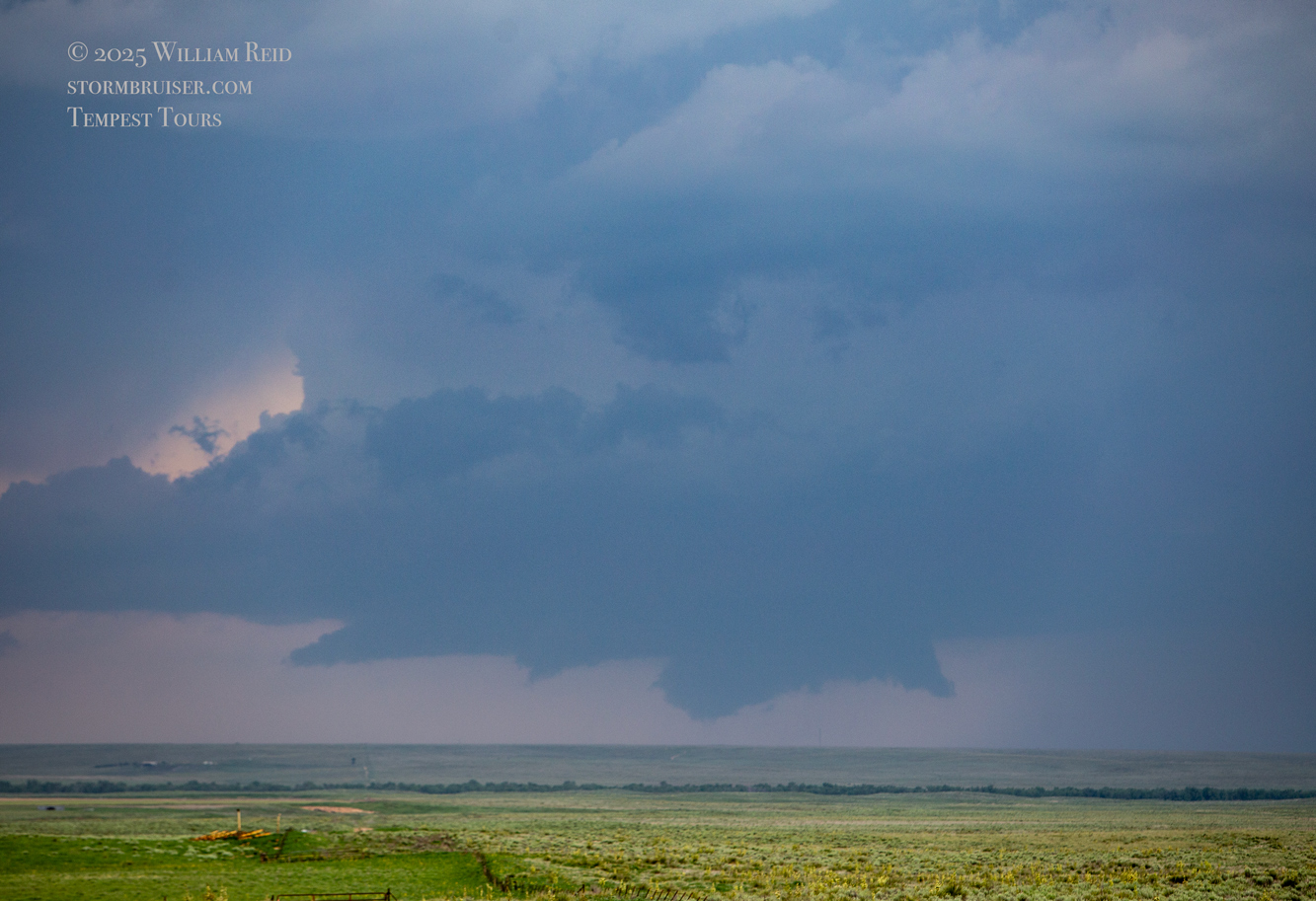
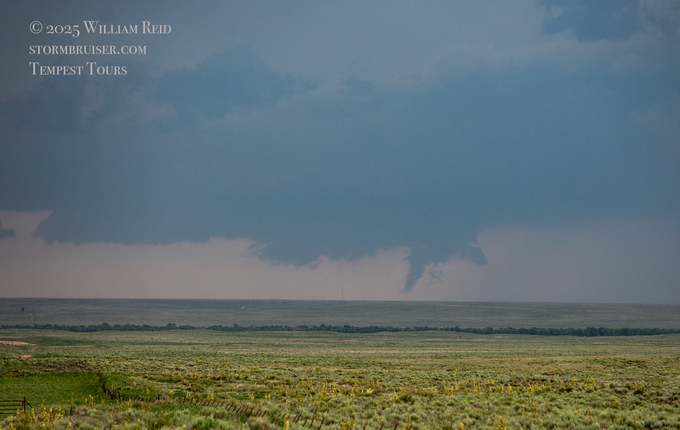
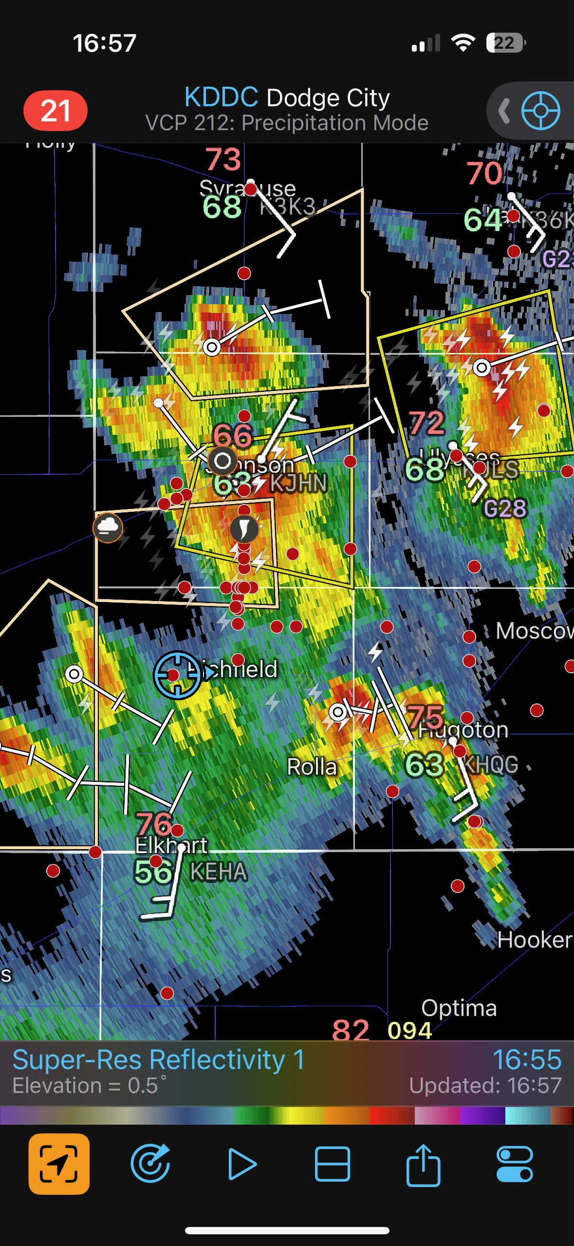
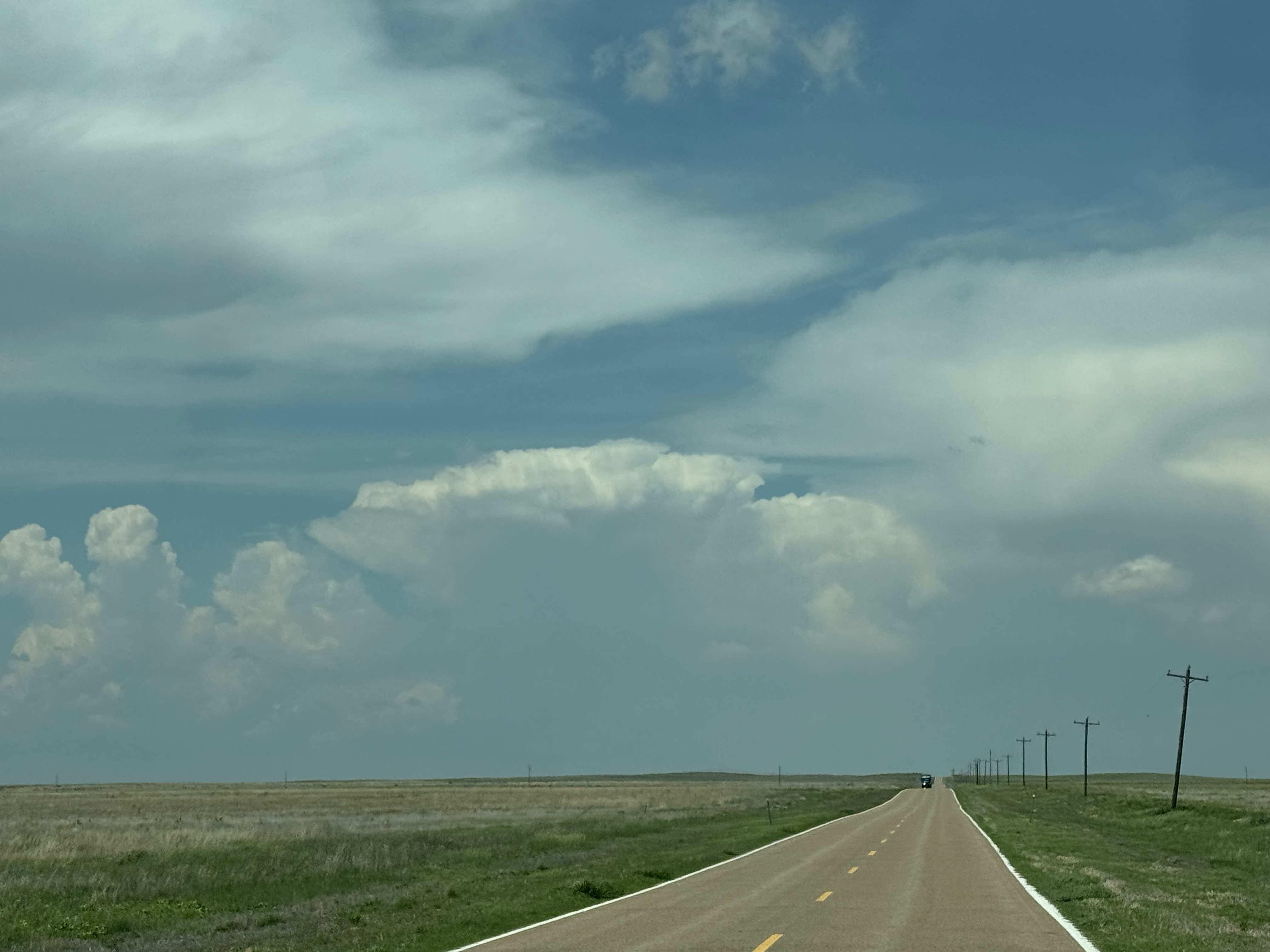
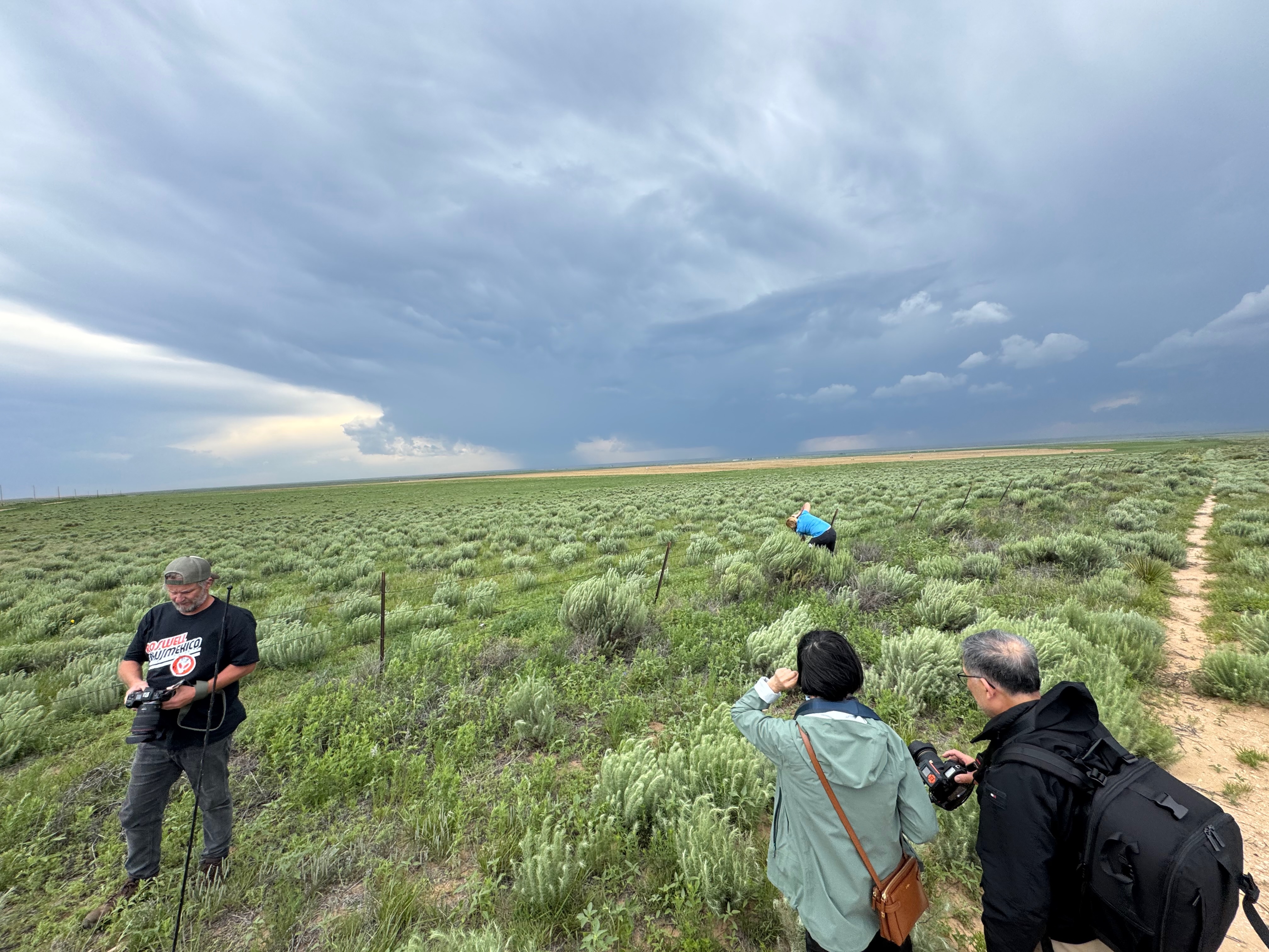
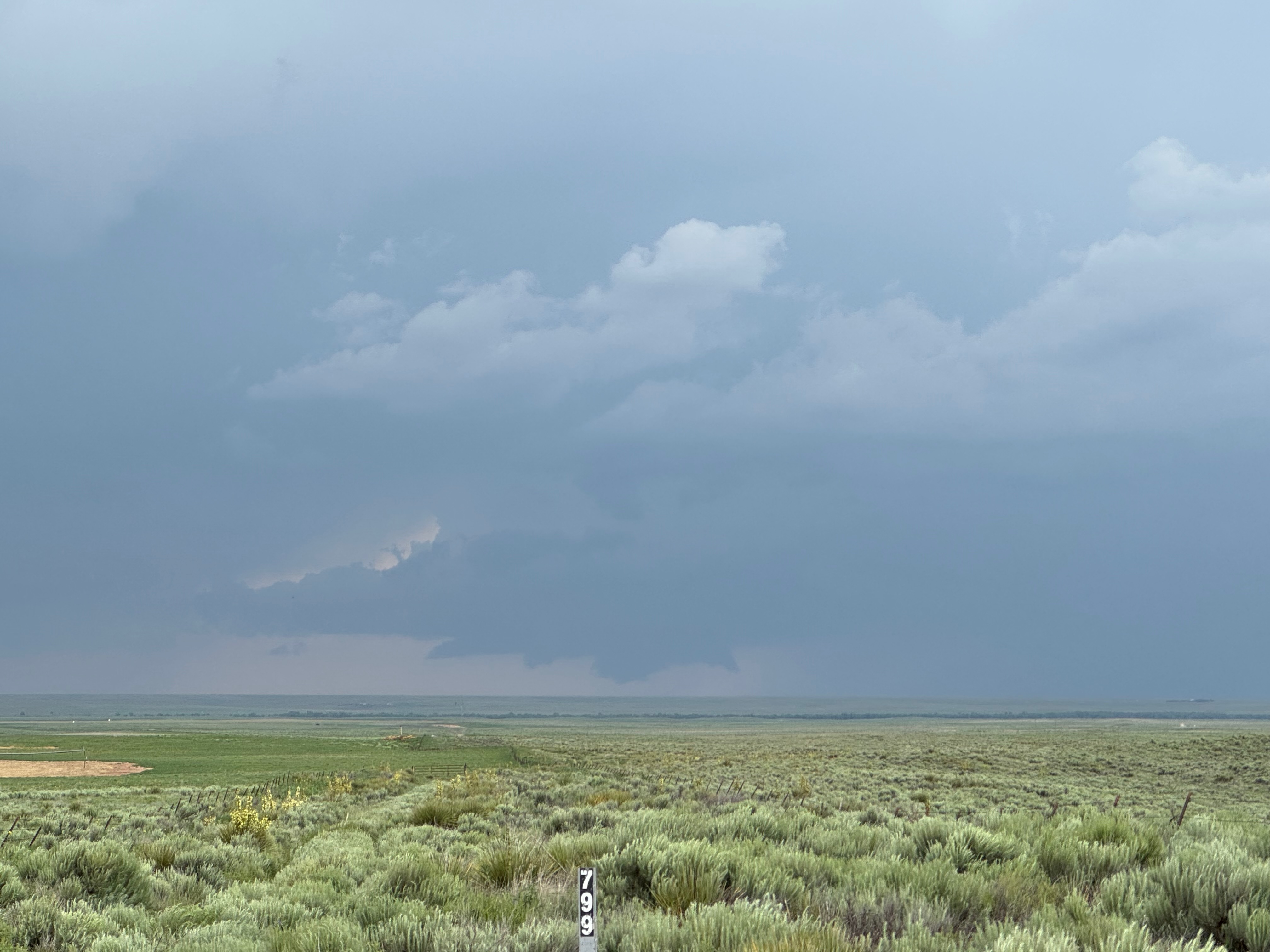
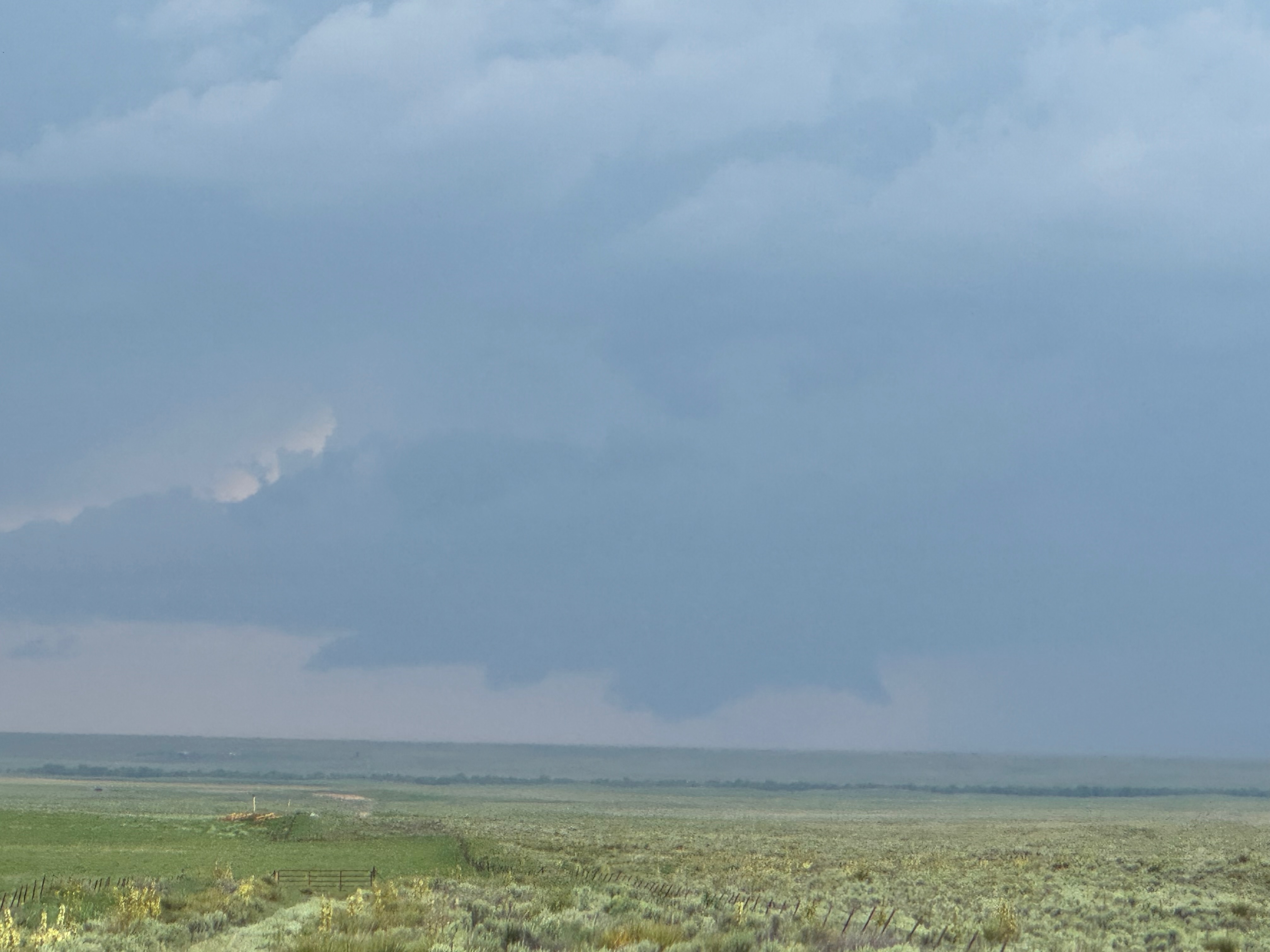
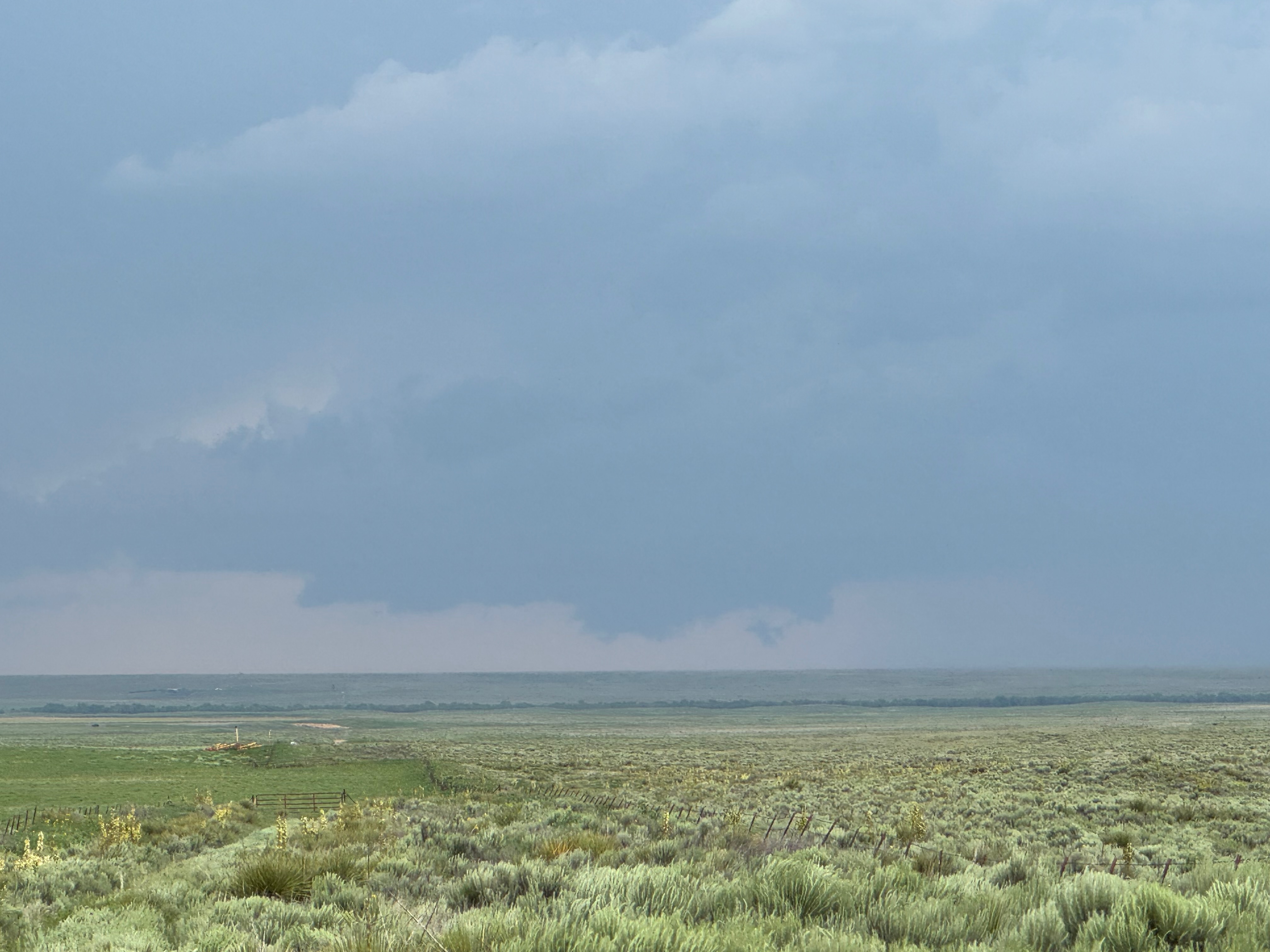
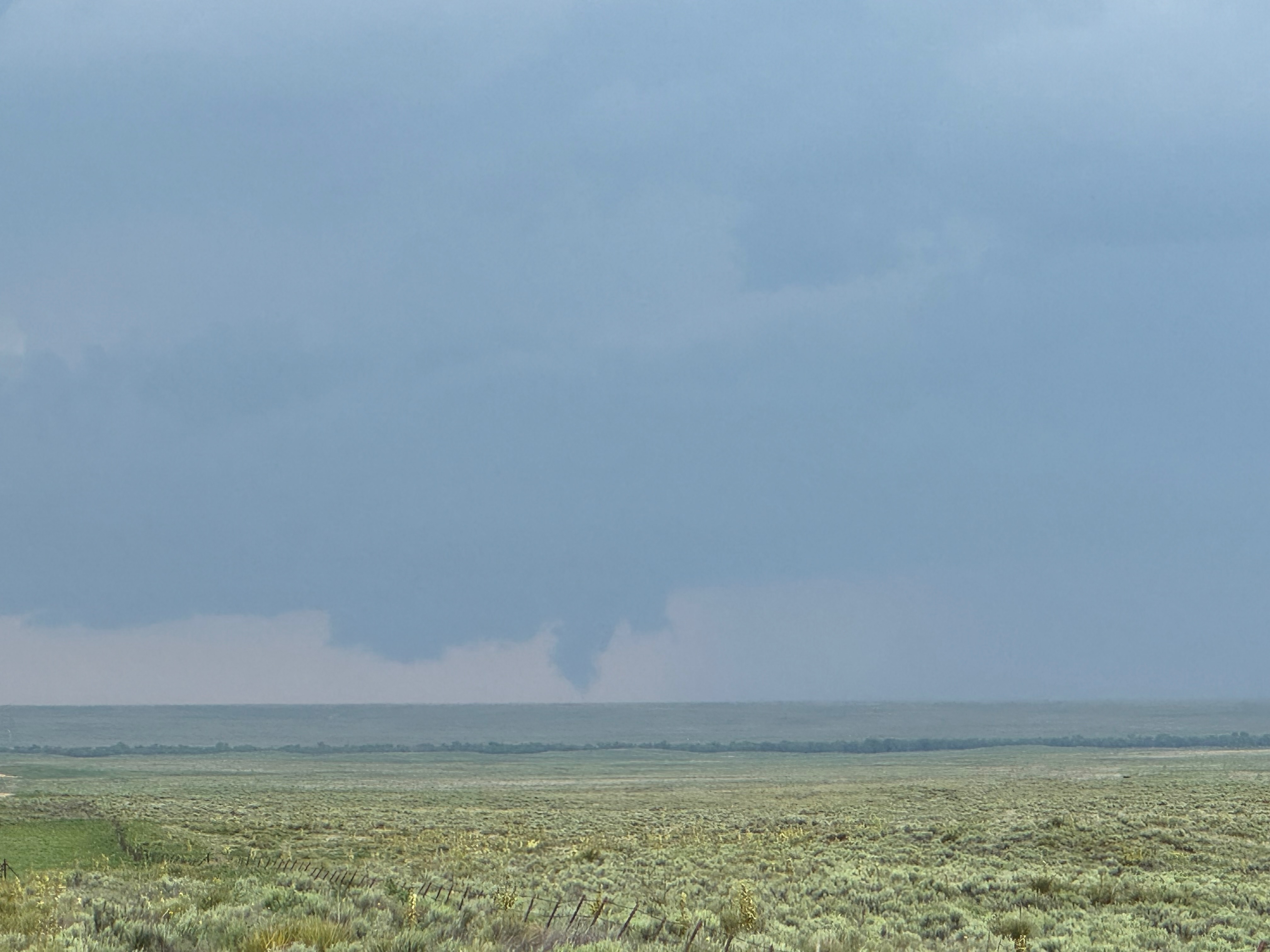
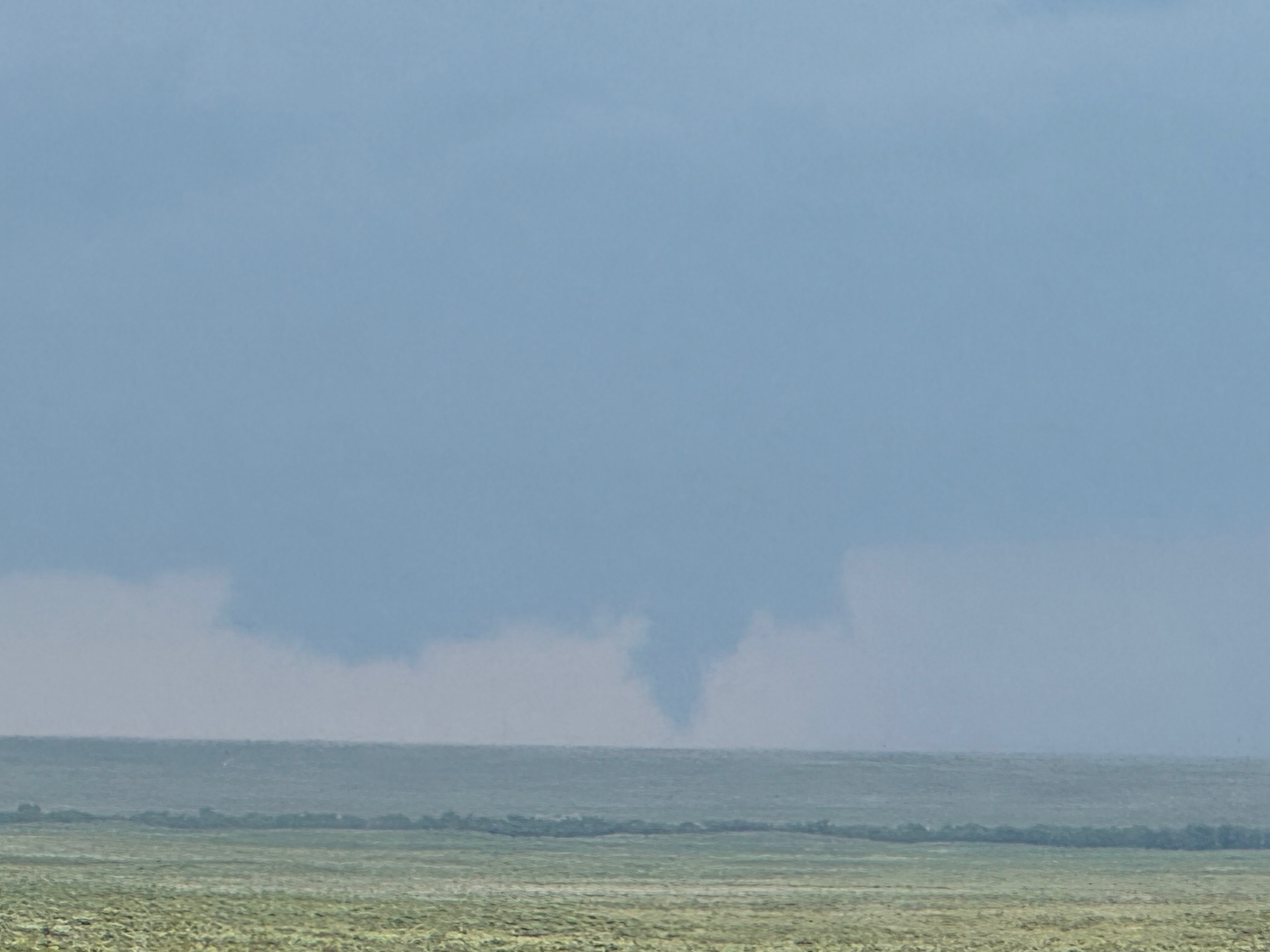
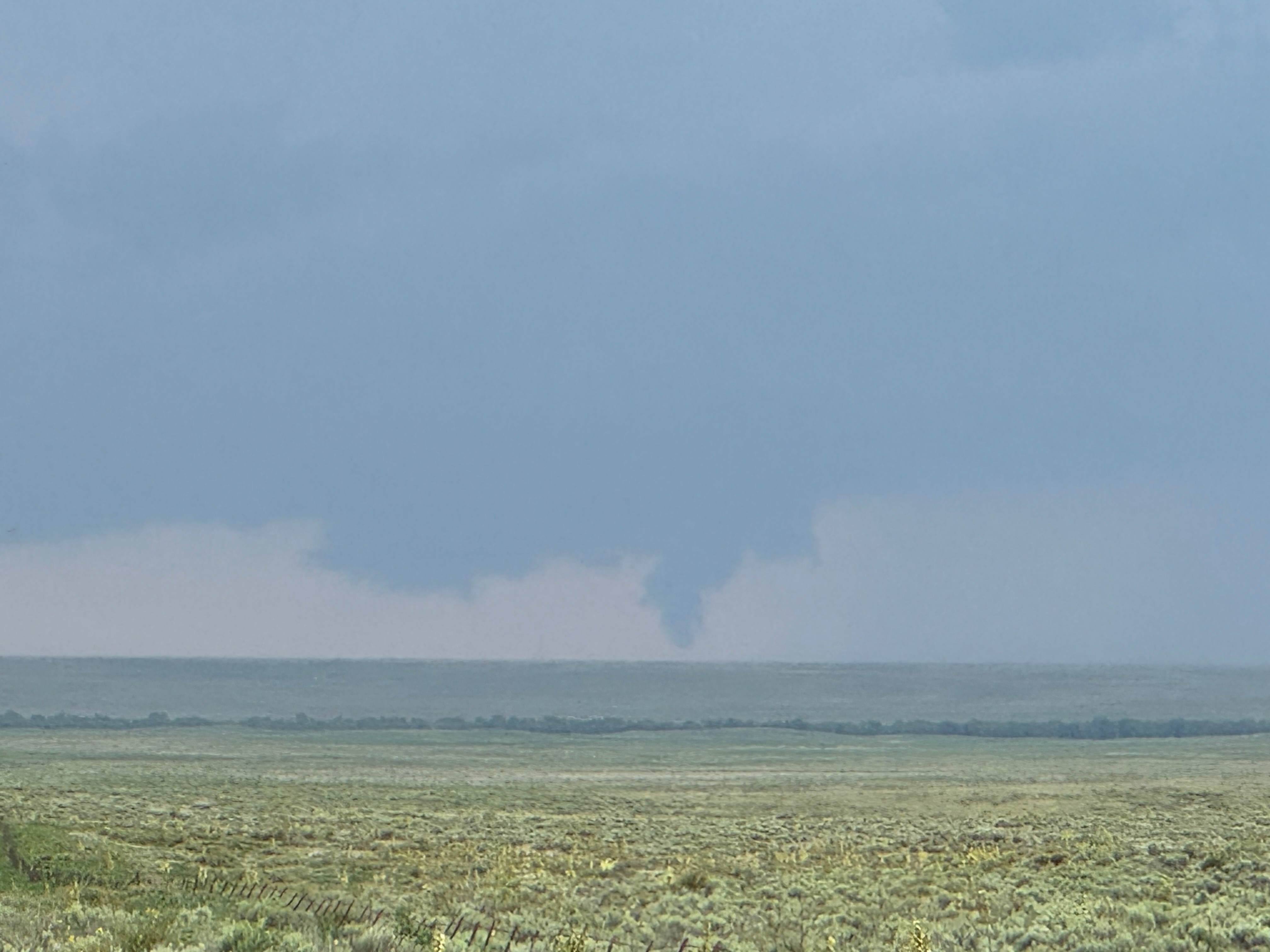
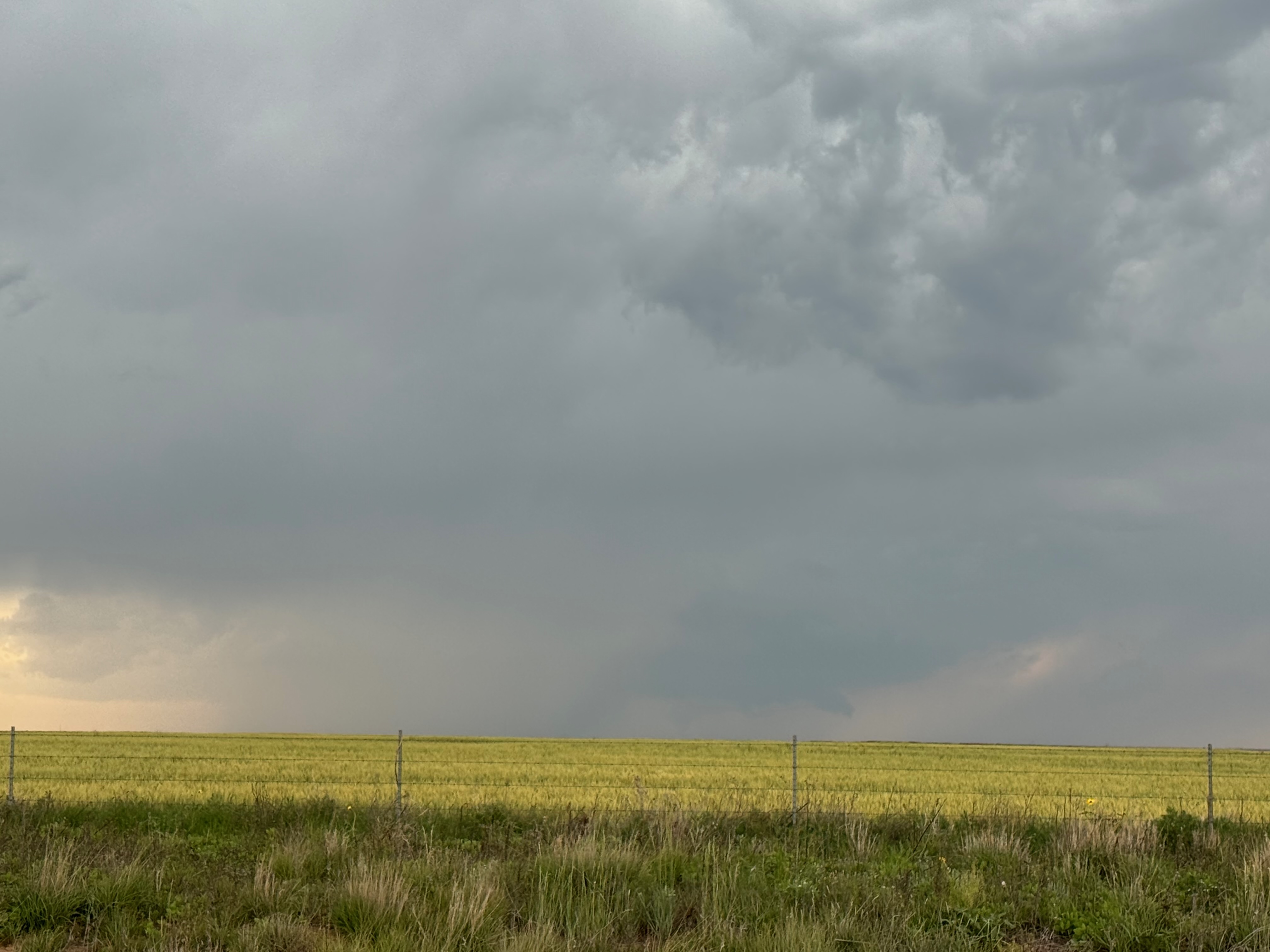
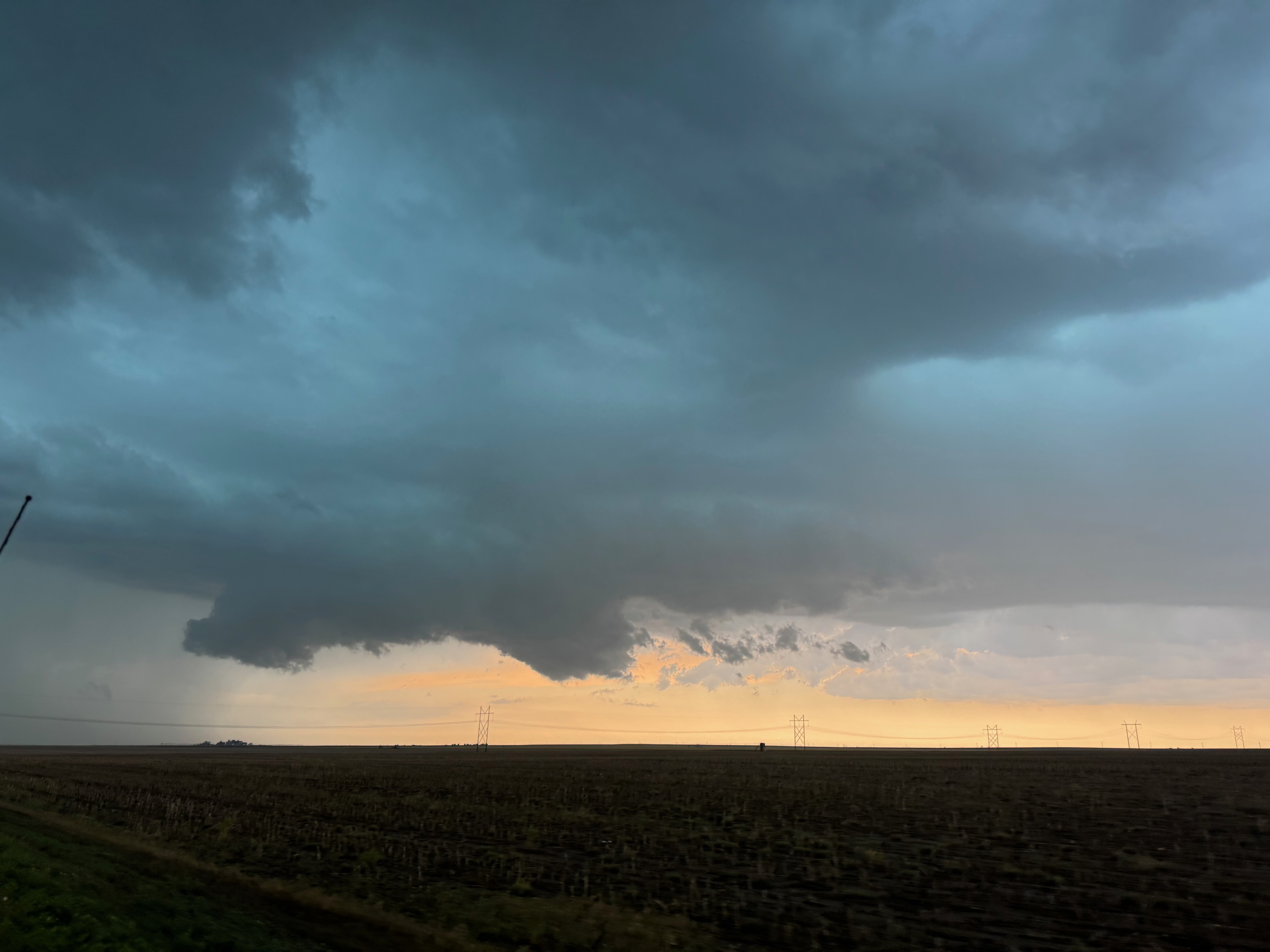
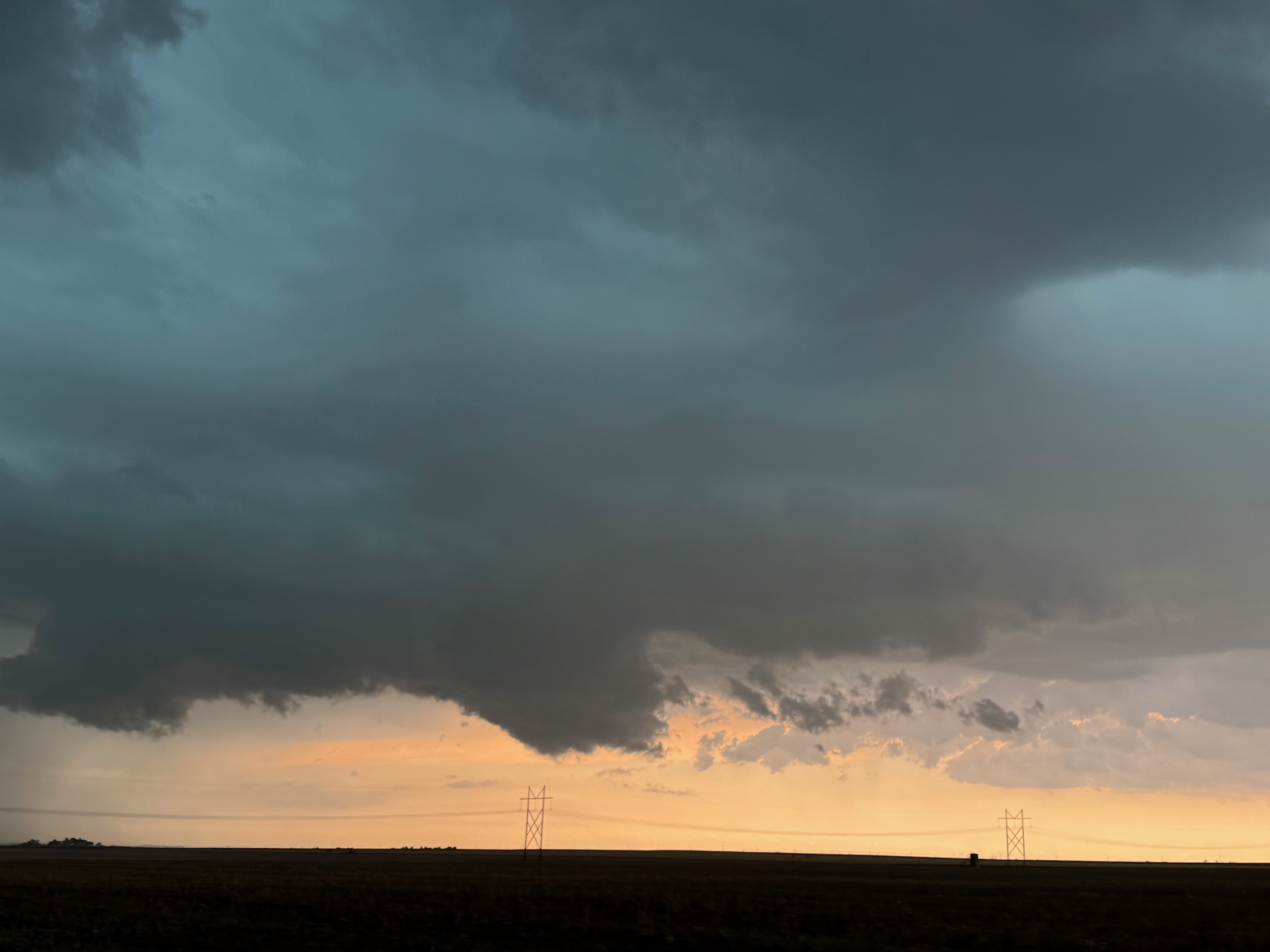
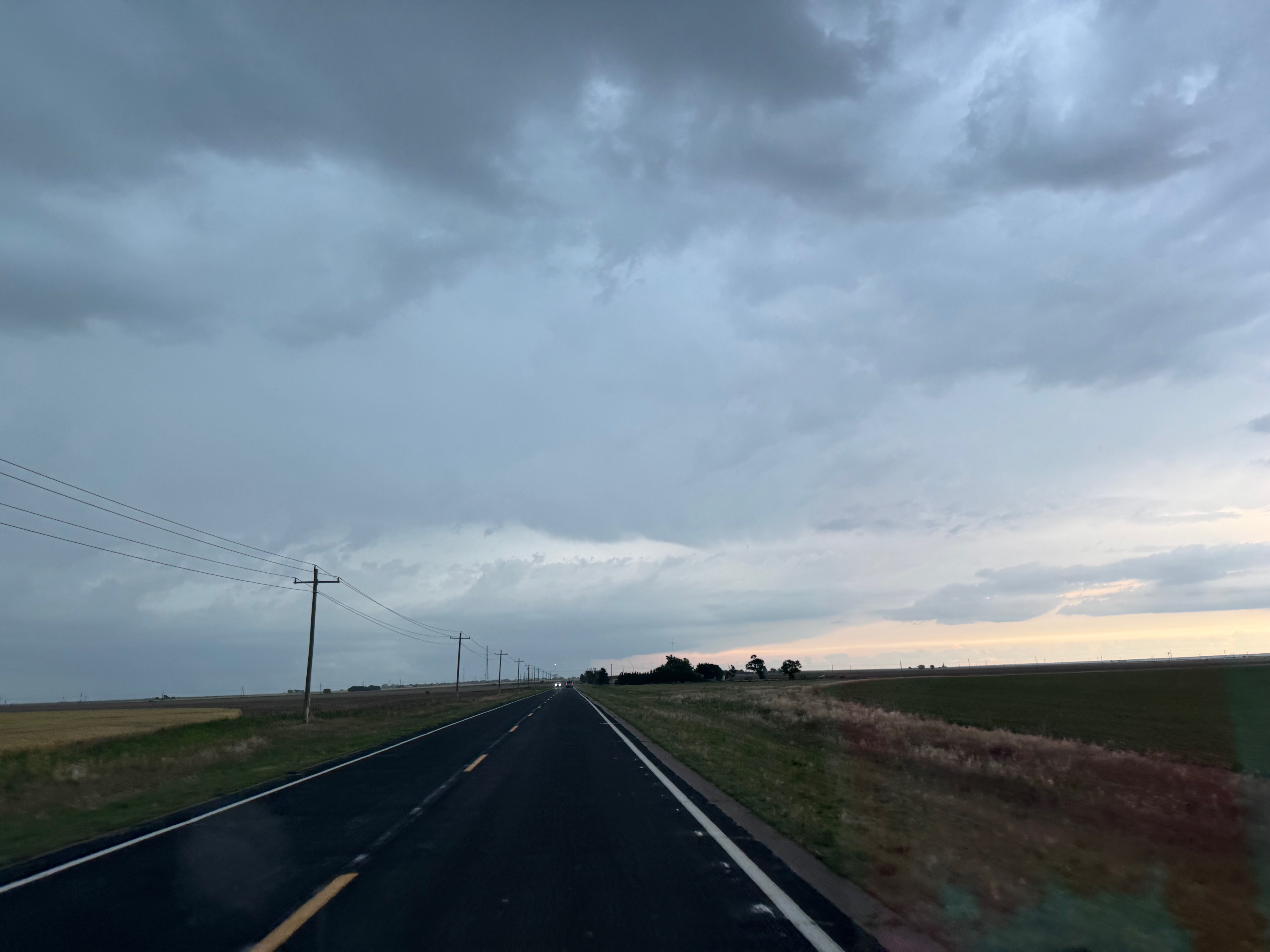
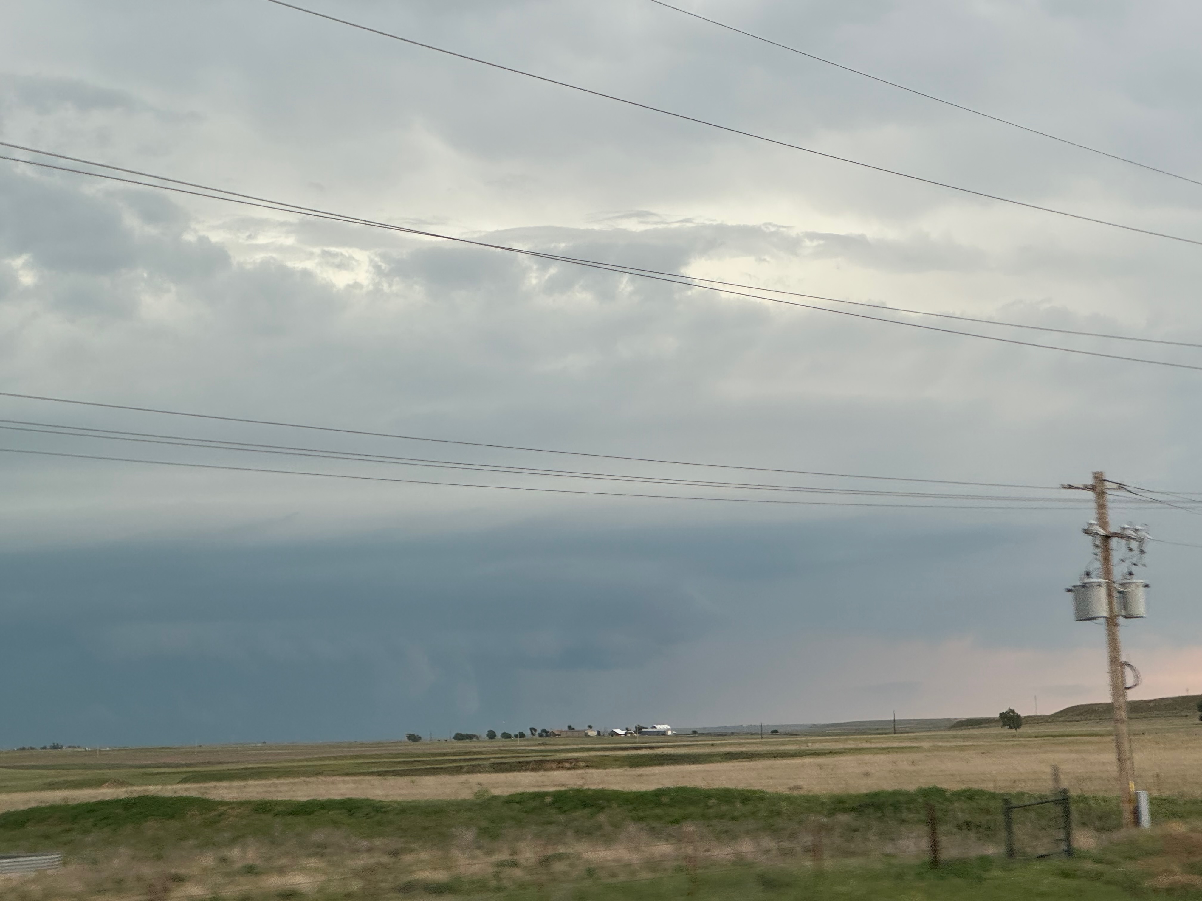
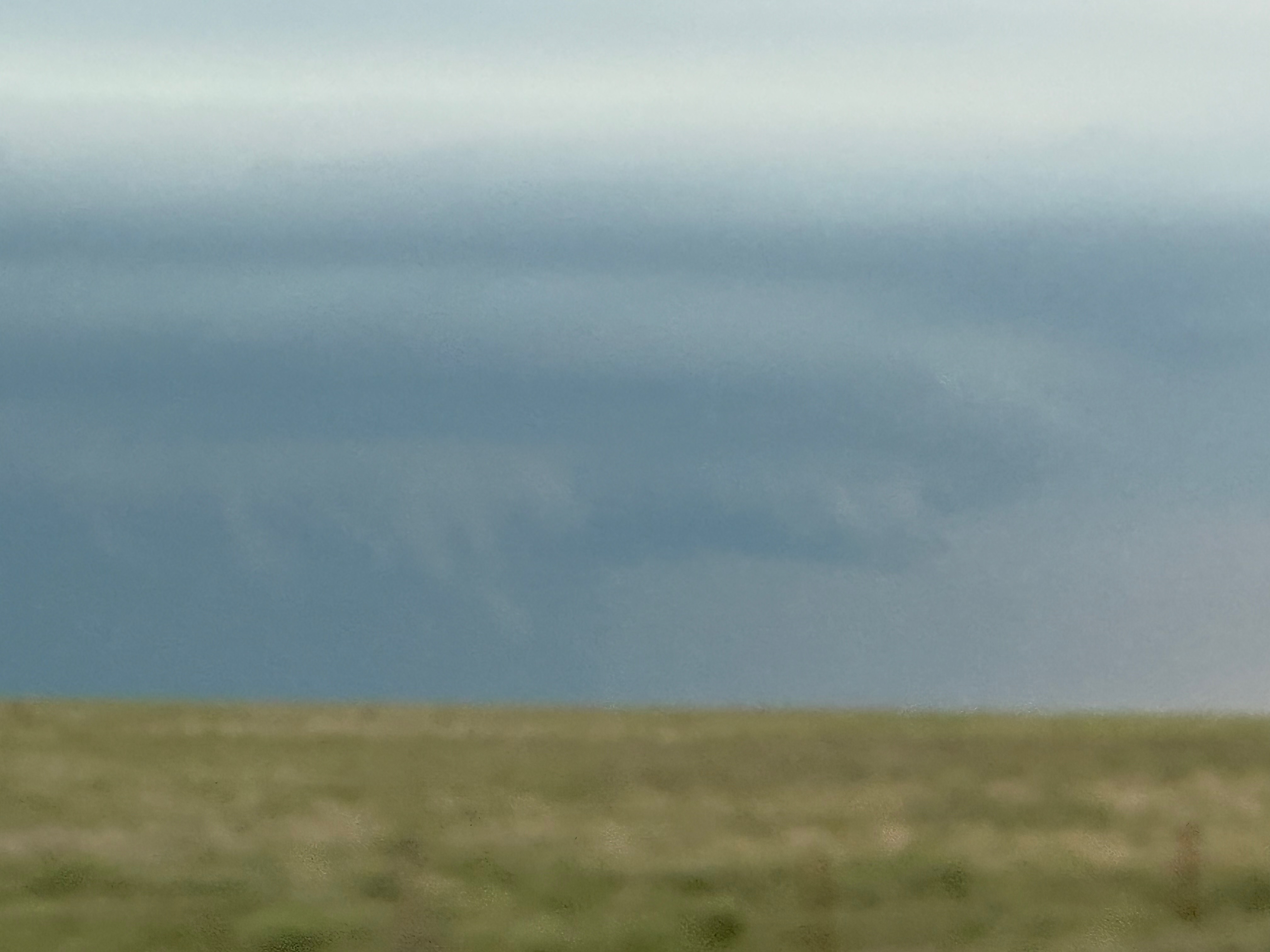
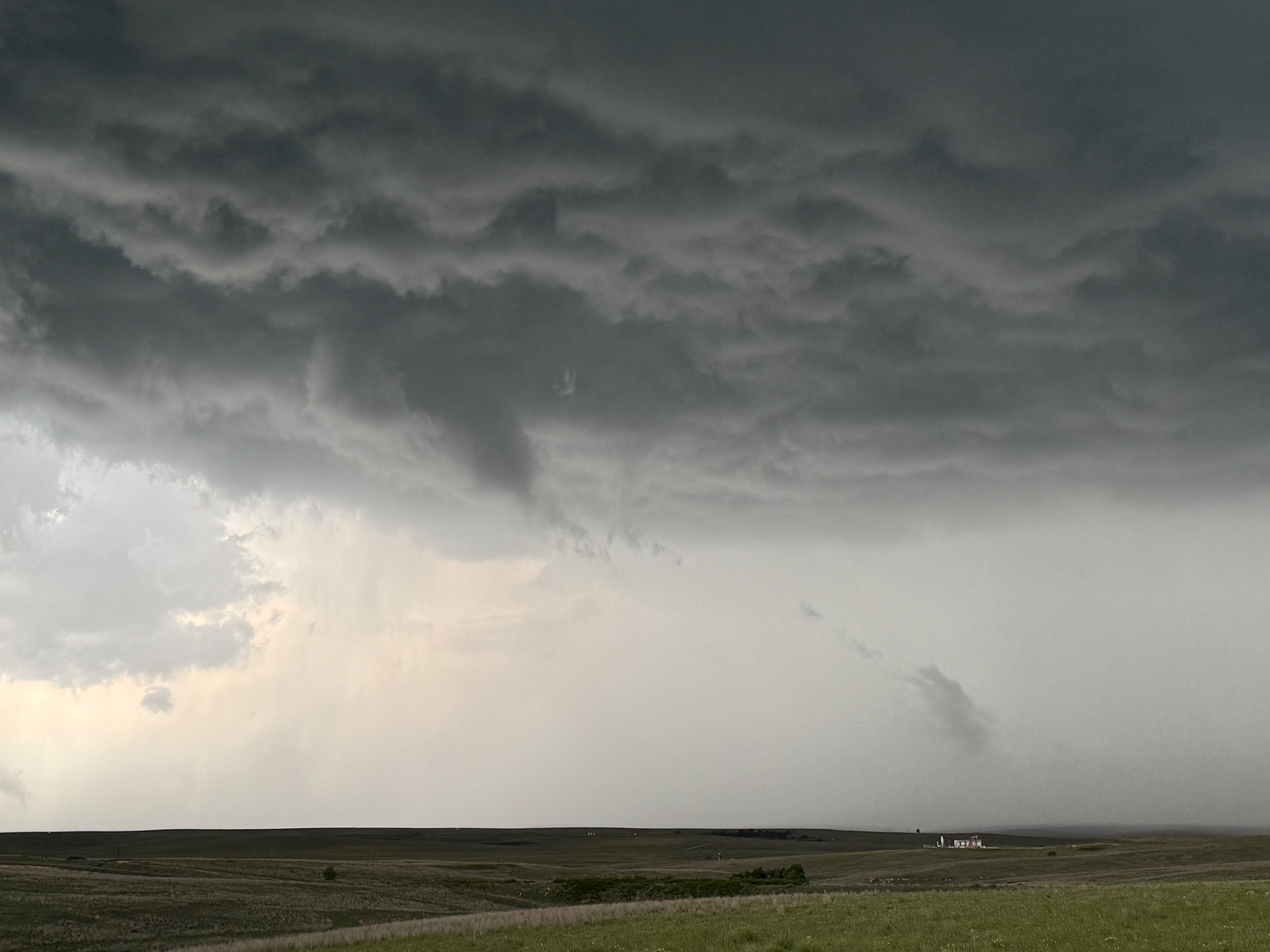
The first order of business was to get up north from Roswell, NM. Storms were in progress already as we motored to the OK/CO/KS triple point sign in extreme southeastern Baca County. To our north by maybe 15 miles was a severe storm that was moving to the east into Morton County, KS. Its base showed a very suspicious lowering which we thought might be a tornado…but it was not. Usually if you are not sure whether or not a distant item is a tornado or not, it is not (see first two pics above). I kept looking for the spotter reports of a tornado up there, but none were forthcoming. (Well, there was one report, but I don’t know if it was legitimate or not.)
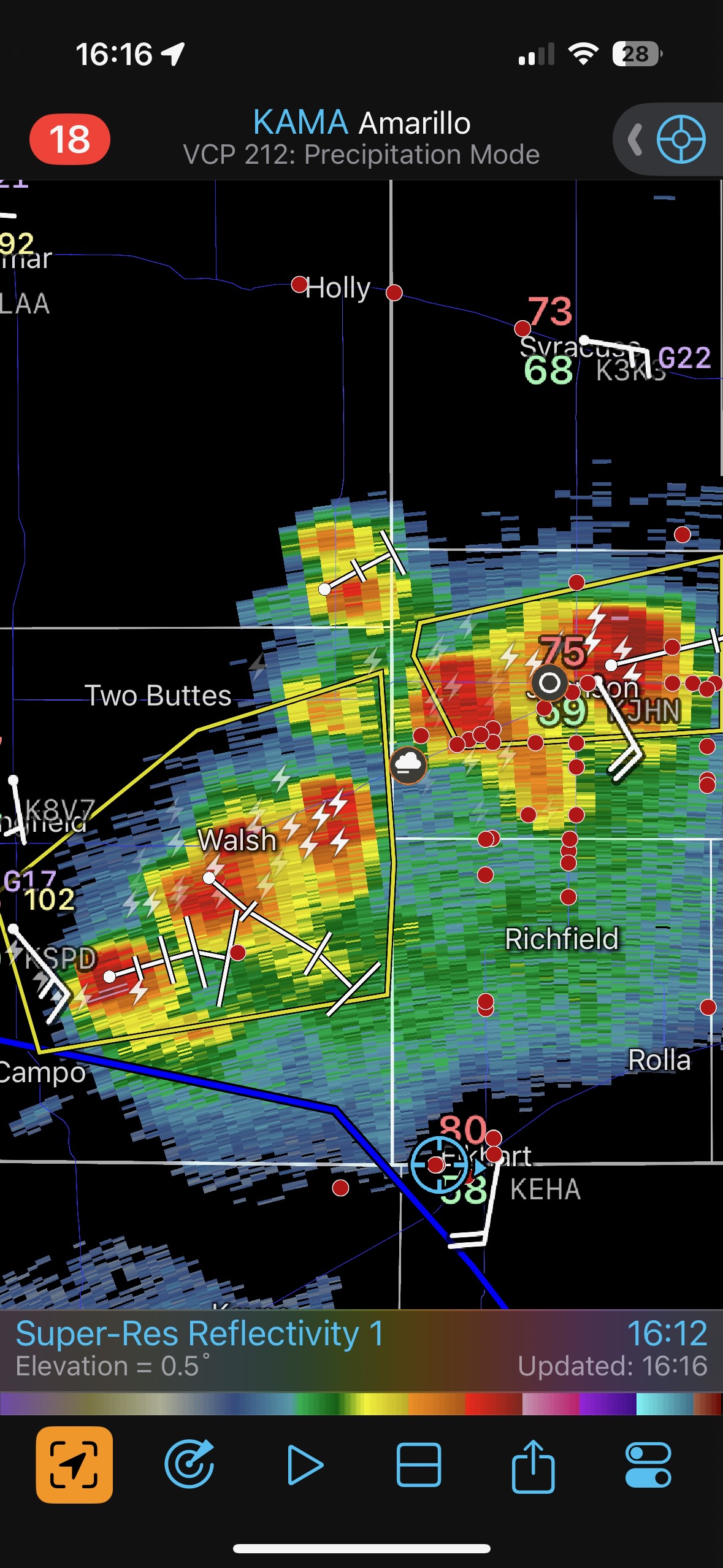
I was eager to get north and/or northeast to get on this storm that was north of Elkhart. We had to wait for a bit at a road construction area. Soon after we were heading north towards Richfield I knew it was a mistake because new storms were forming a little to our east and southeast. Thus began our long sprint eastward, with a jog or two to the south, in order to get into position on a new severe storm along the KS/OK line, especially near Hooker and Turpin. See the radar grabs below. It is fortuitous that we never were as far north as that gaggle of chasers north of Richfield.
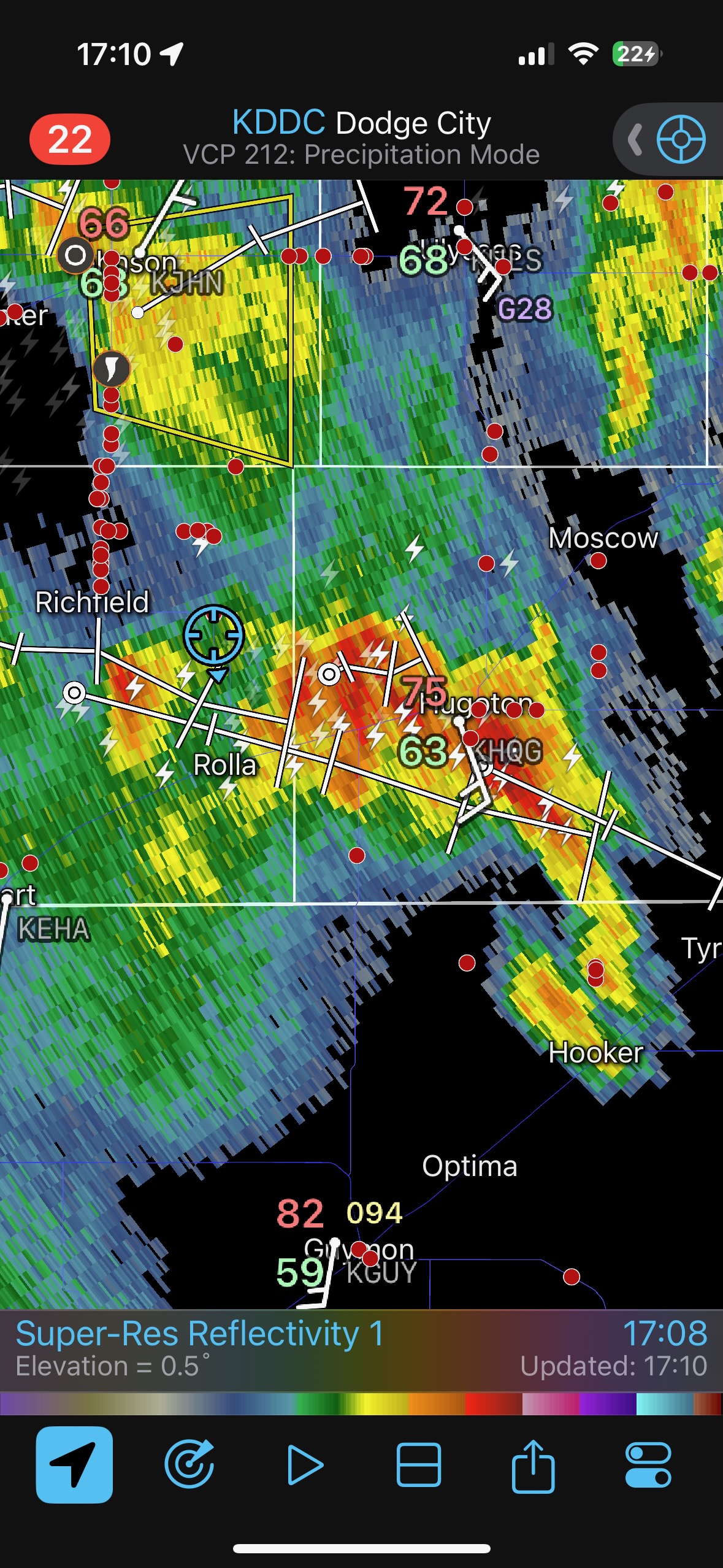
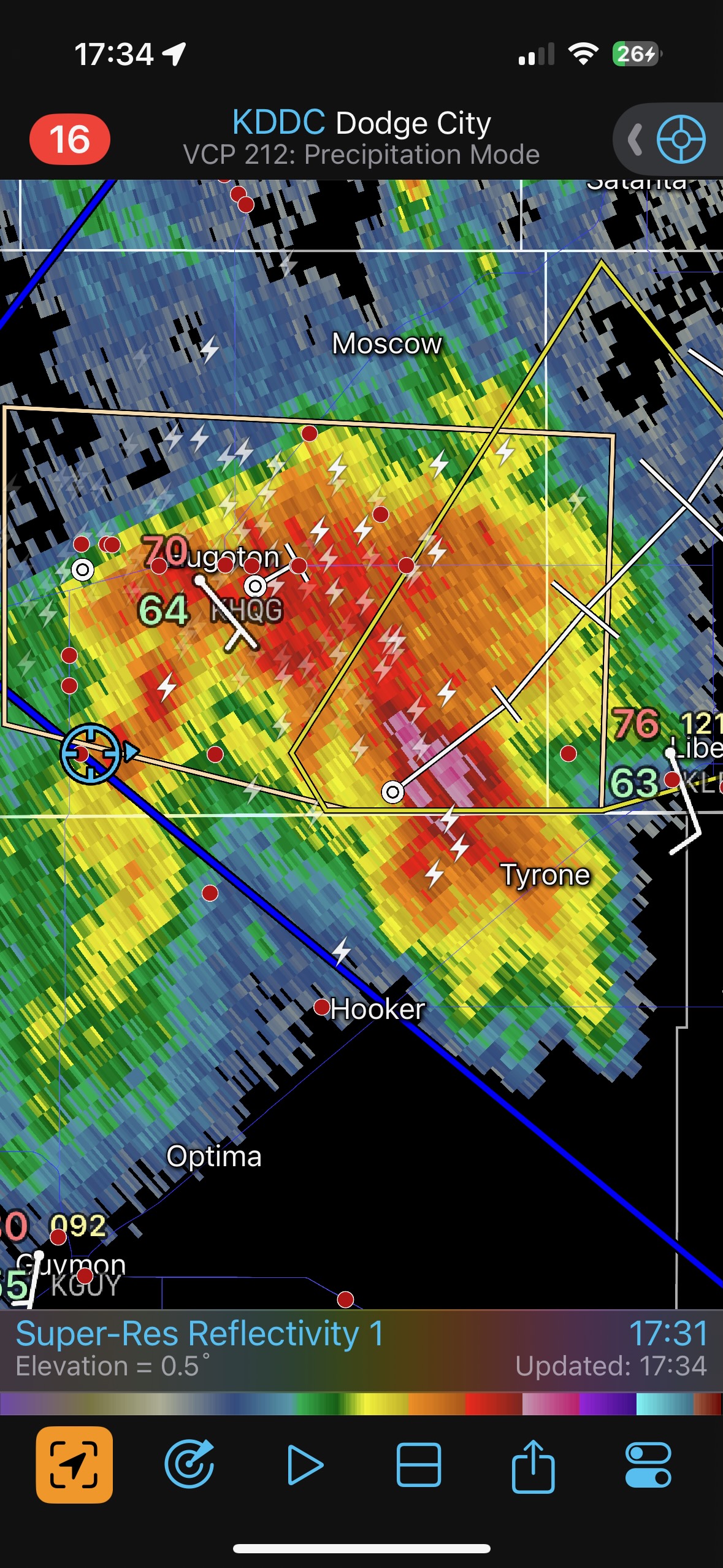
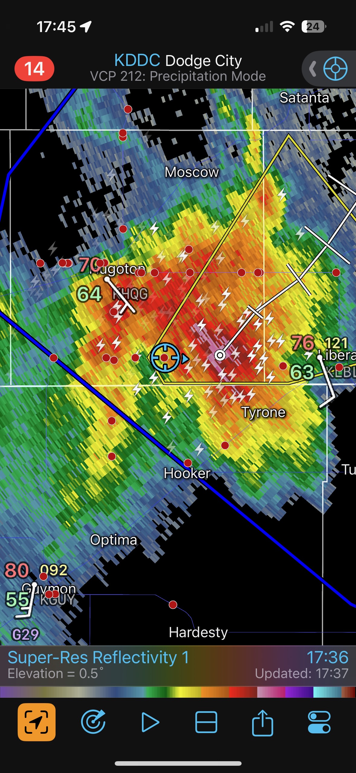
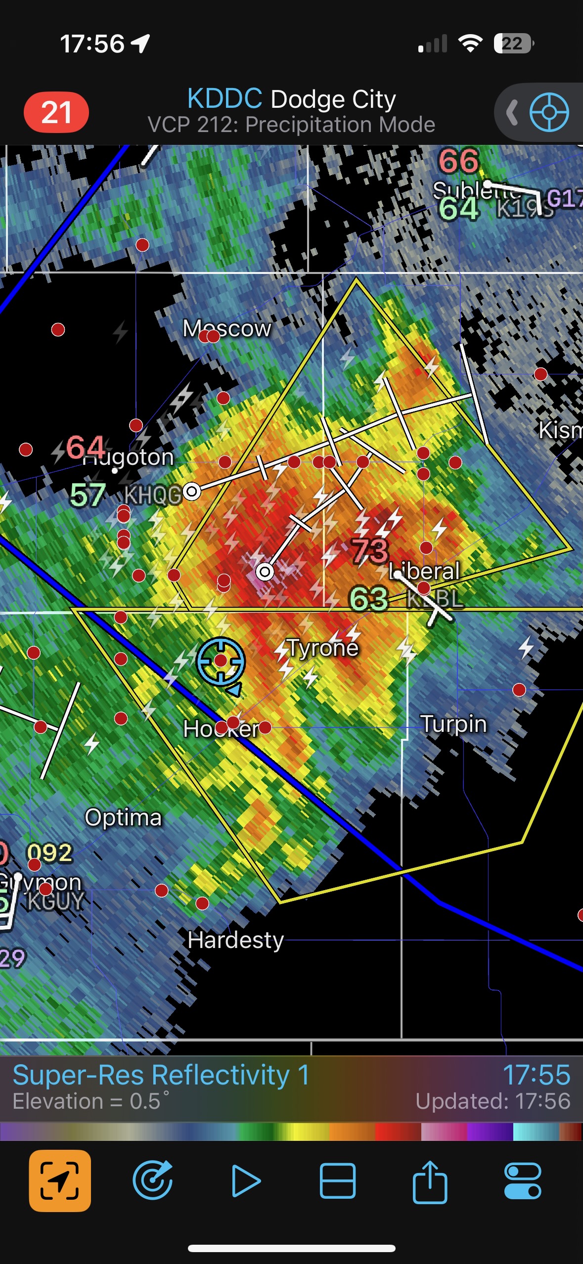
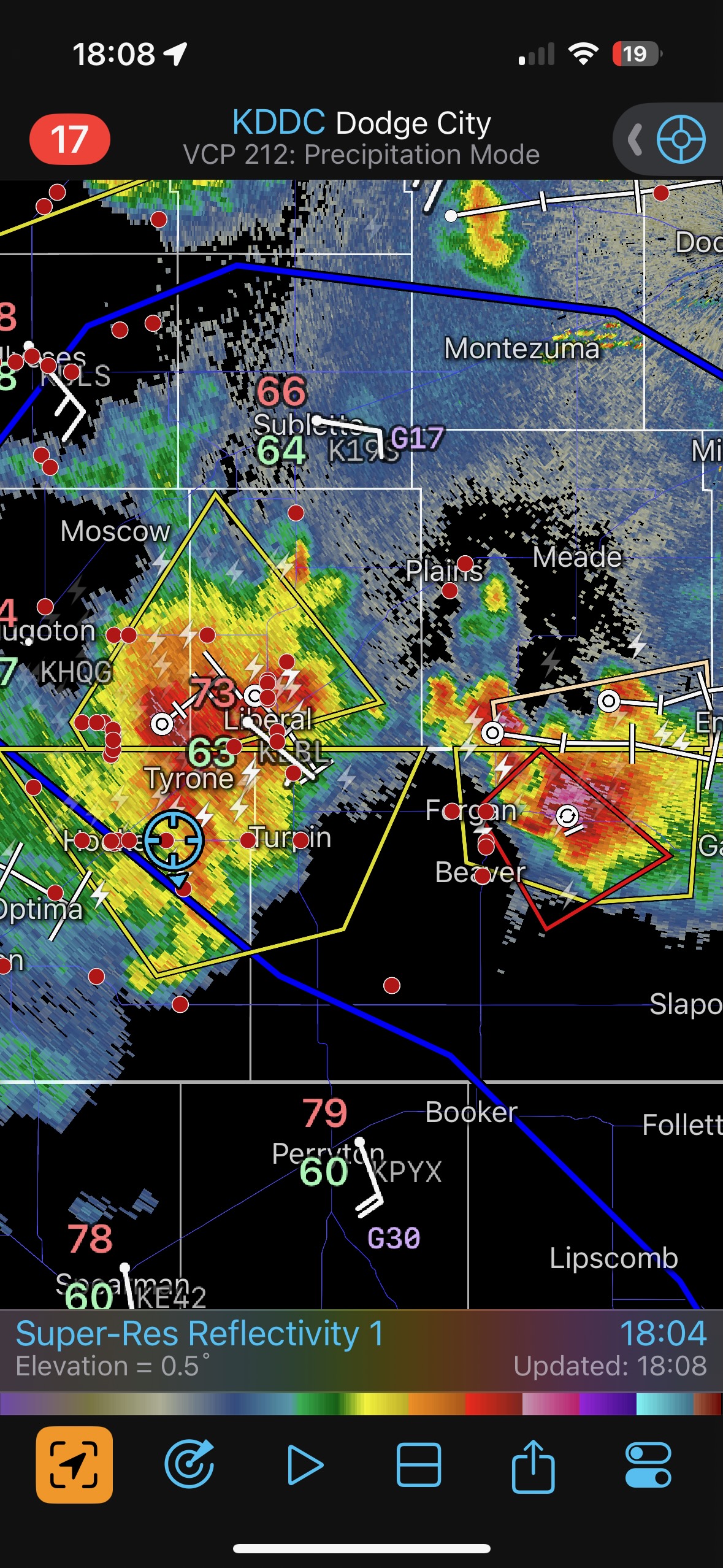


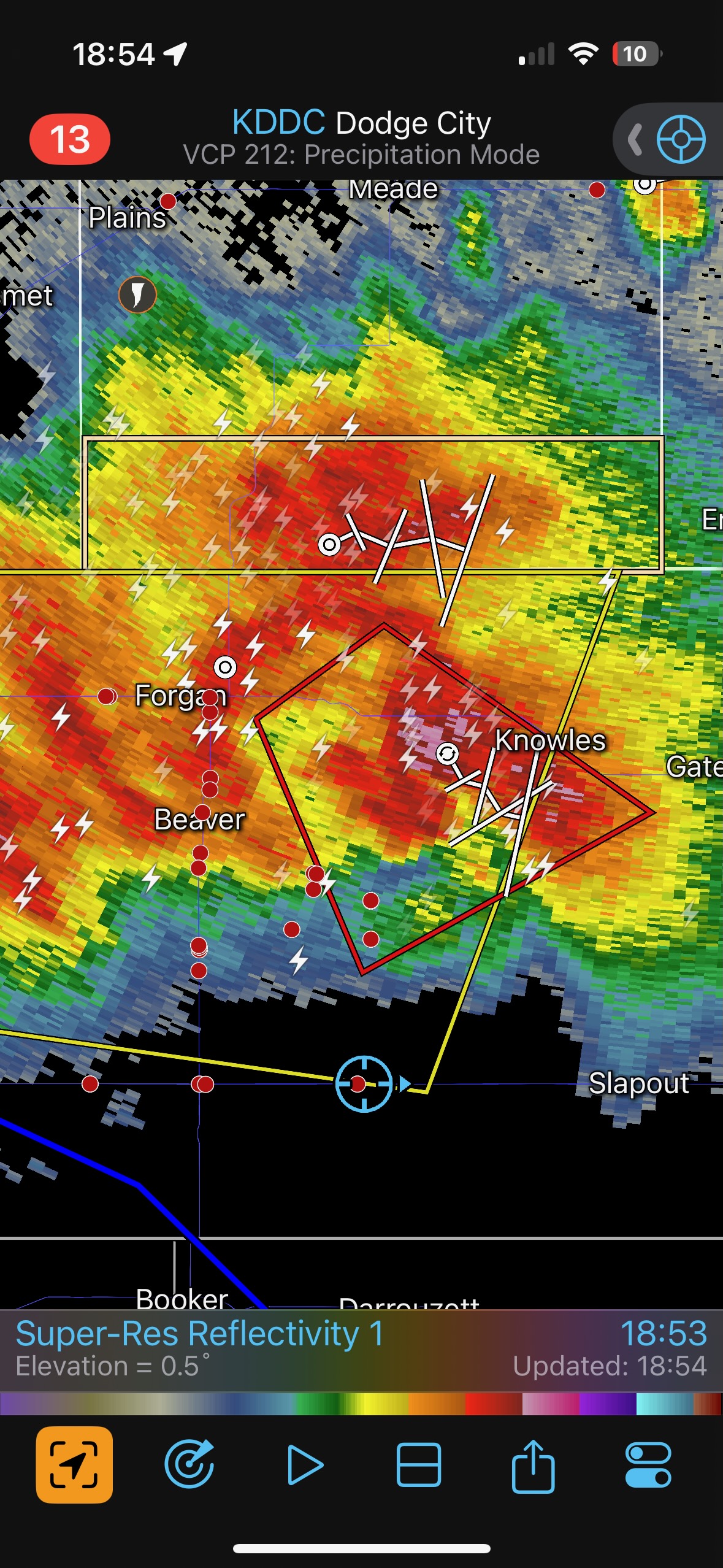
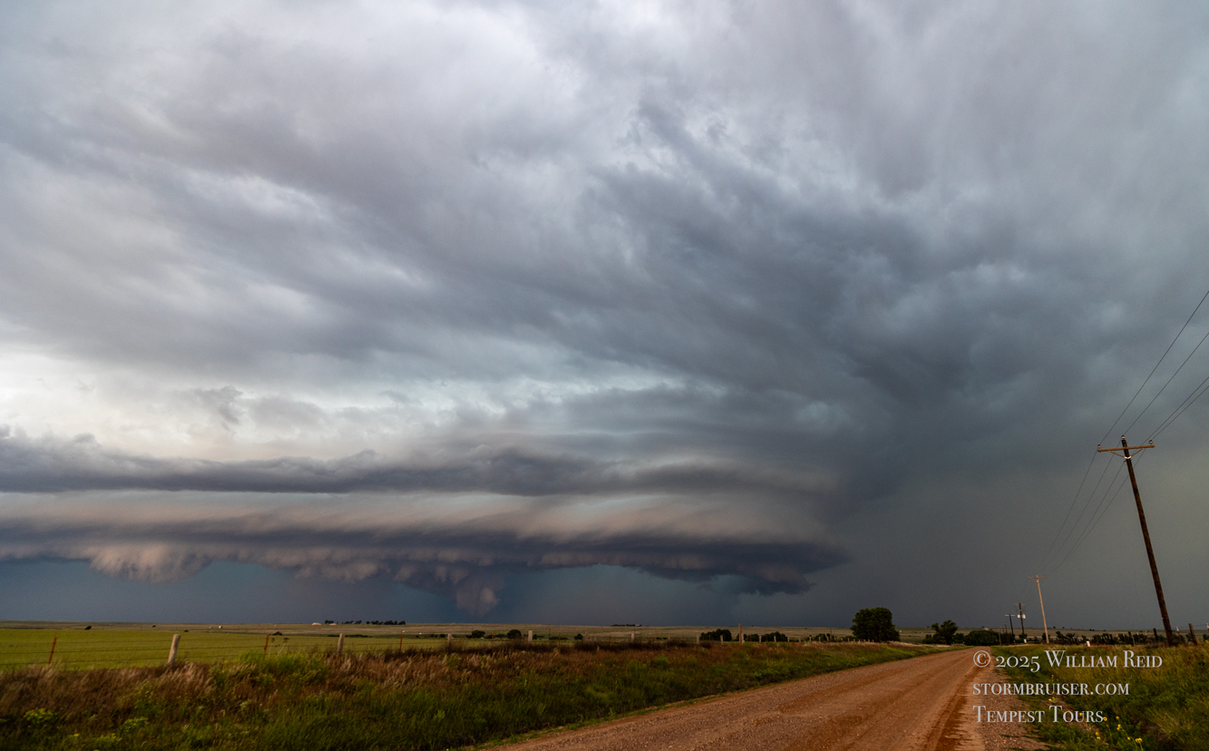
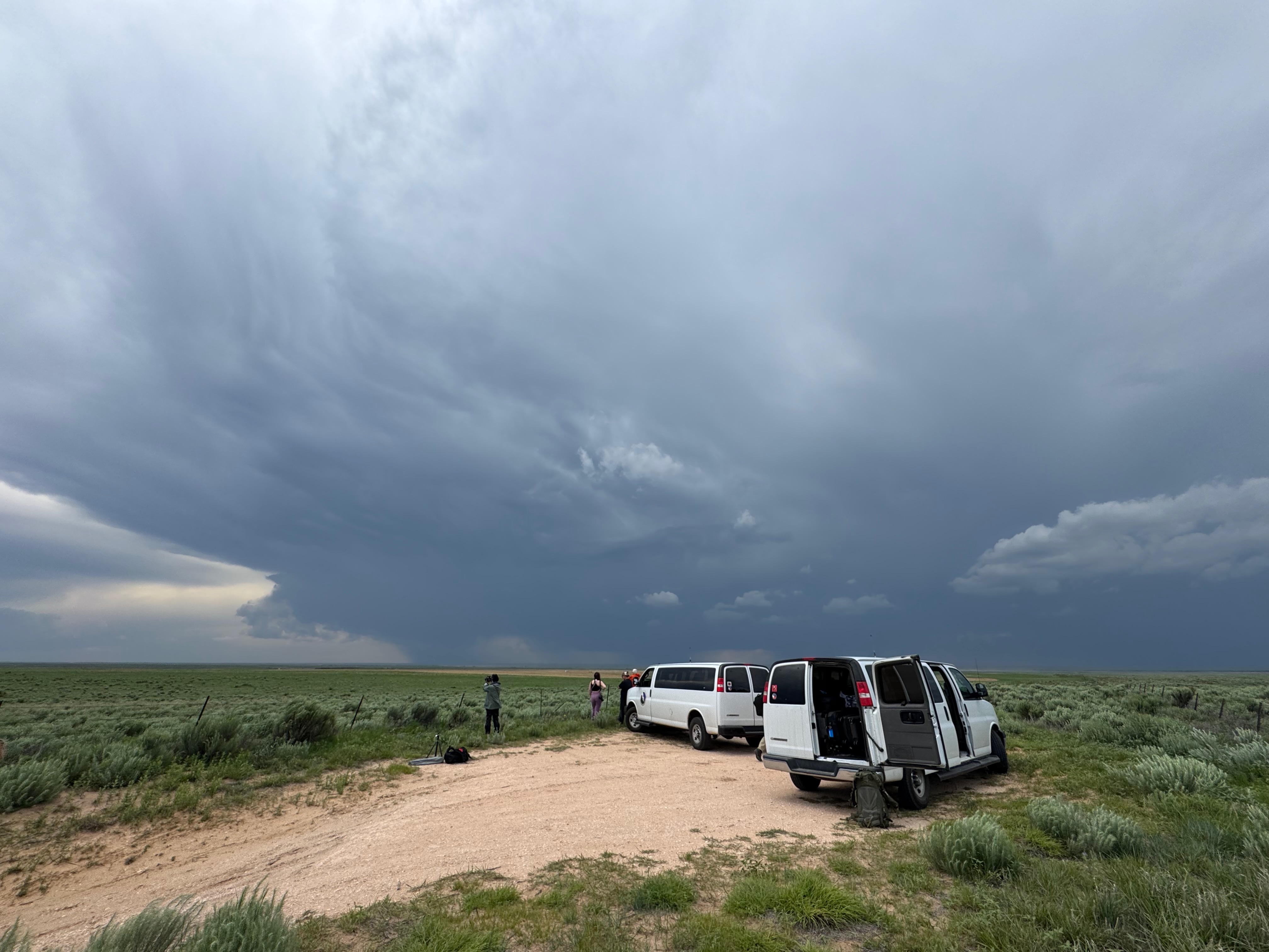
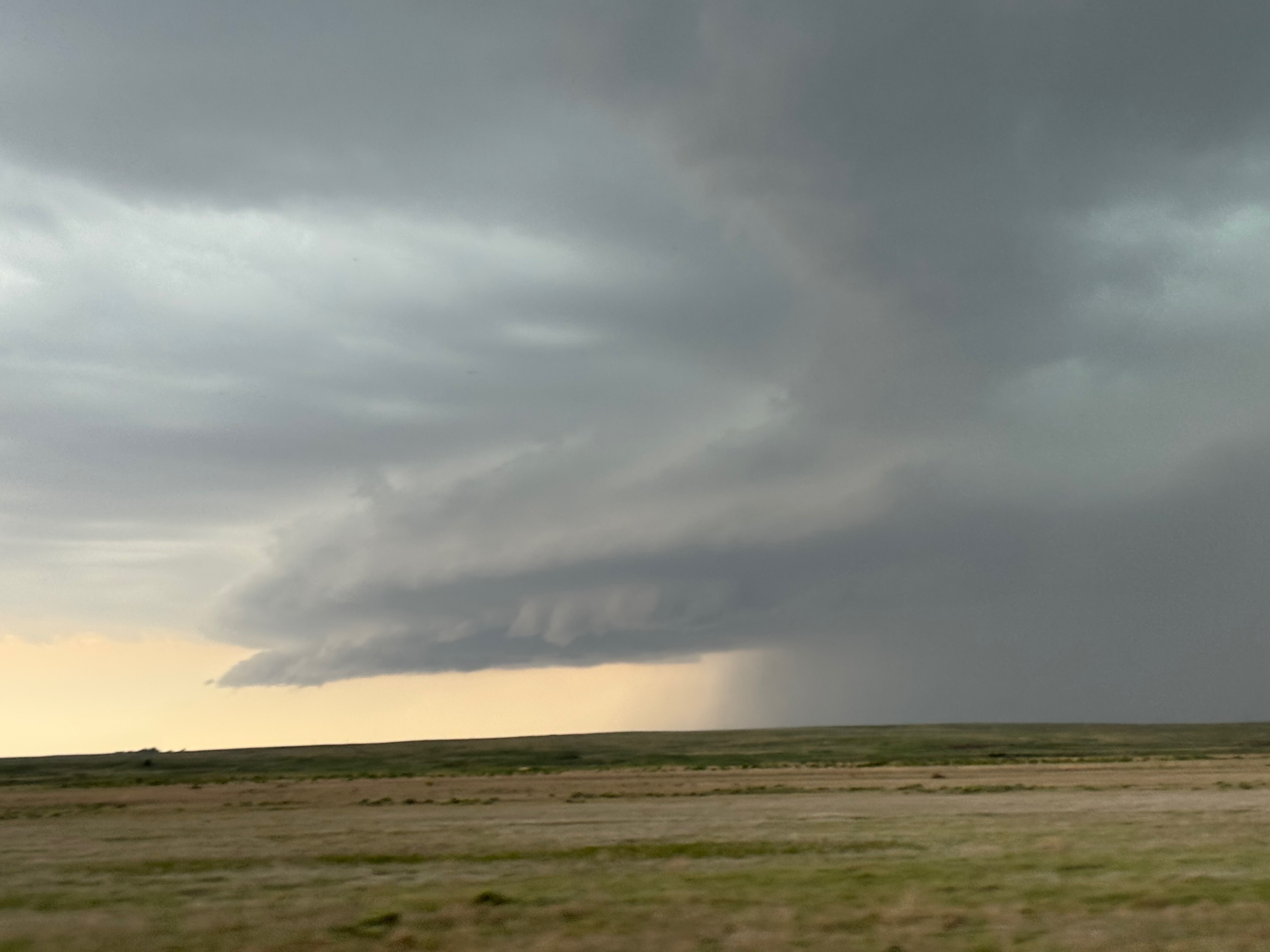
We were close to an action area near the KS/OK line north of Hooker around 6 p.m. I thought that we might get a good-sized tornado nearby as the thing wrapped up. We were just behind a rotating wall cloud! But, no tornado. This one was sagging to the southeast a little, and we raced south to Hooker and then east again. This storm that we were on was looking a bit meh now, and another new storm to our east became tornado-warned. Now it was time to do another jog south and a blast eastward on 412 to get south of this one. After maybe 30-40 minutes we were far enough east (a little east of Elmwood, I think), and I went a mile or two north on a dirt road to watch it approach. We never saw a tornado with this supercell, and apparently none were reported. But the structure along the leading edge was outstanding, as the Canon shots above show.
The first batch of iPhone shots below are of that Baca County/Morton County storm with the suspicious lowering to the north.
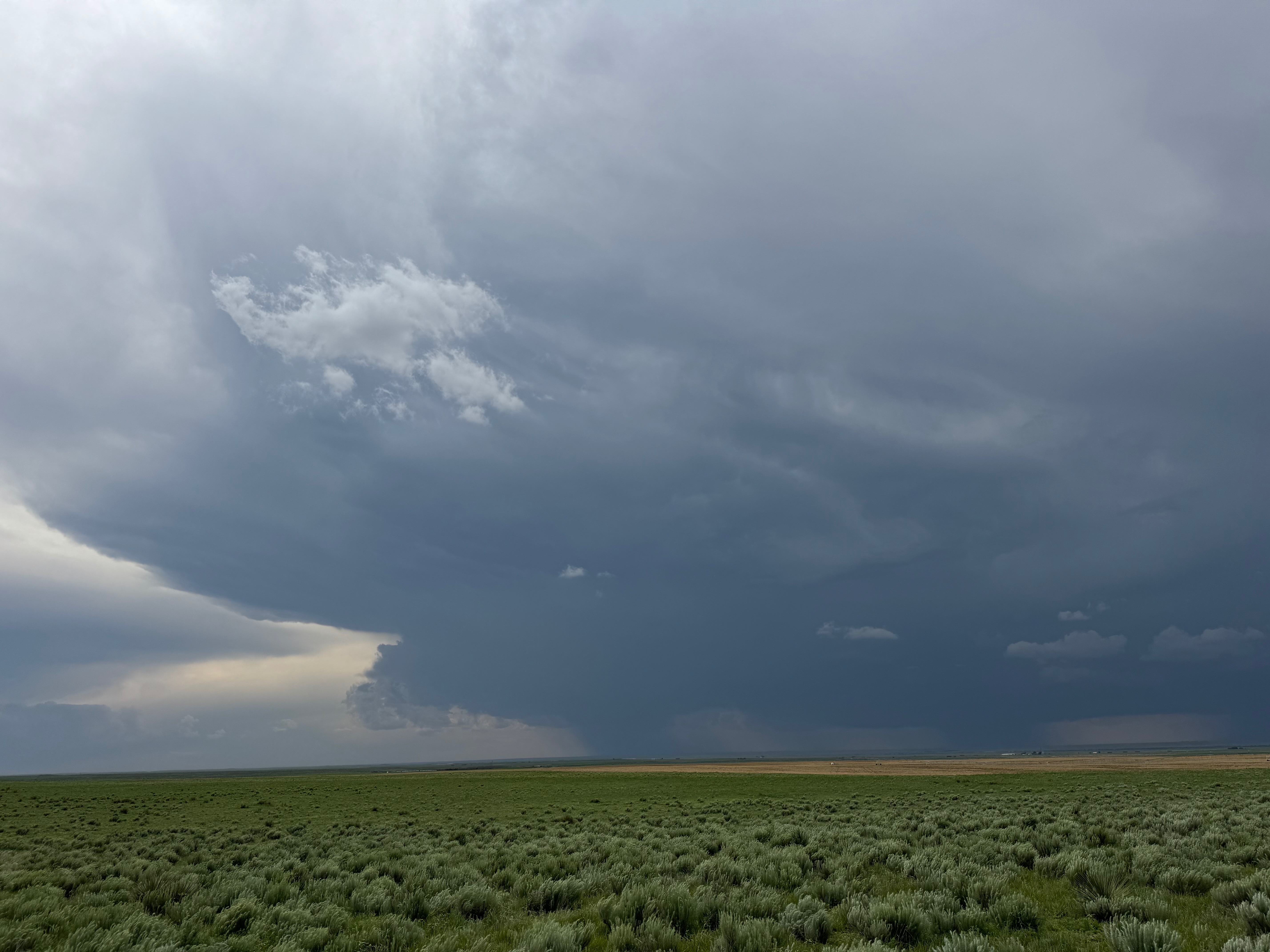

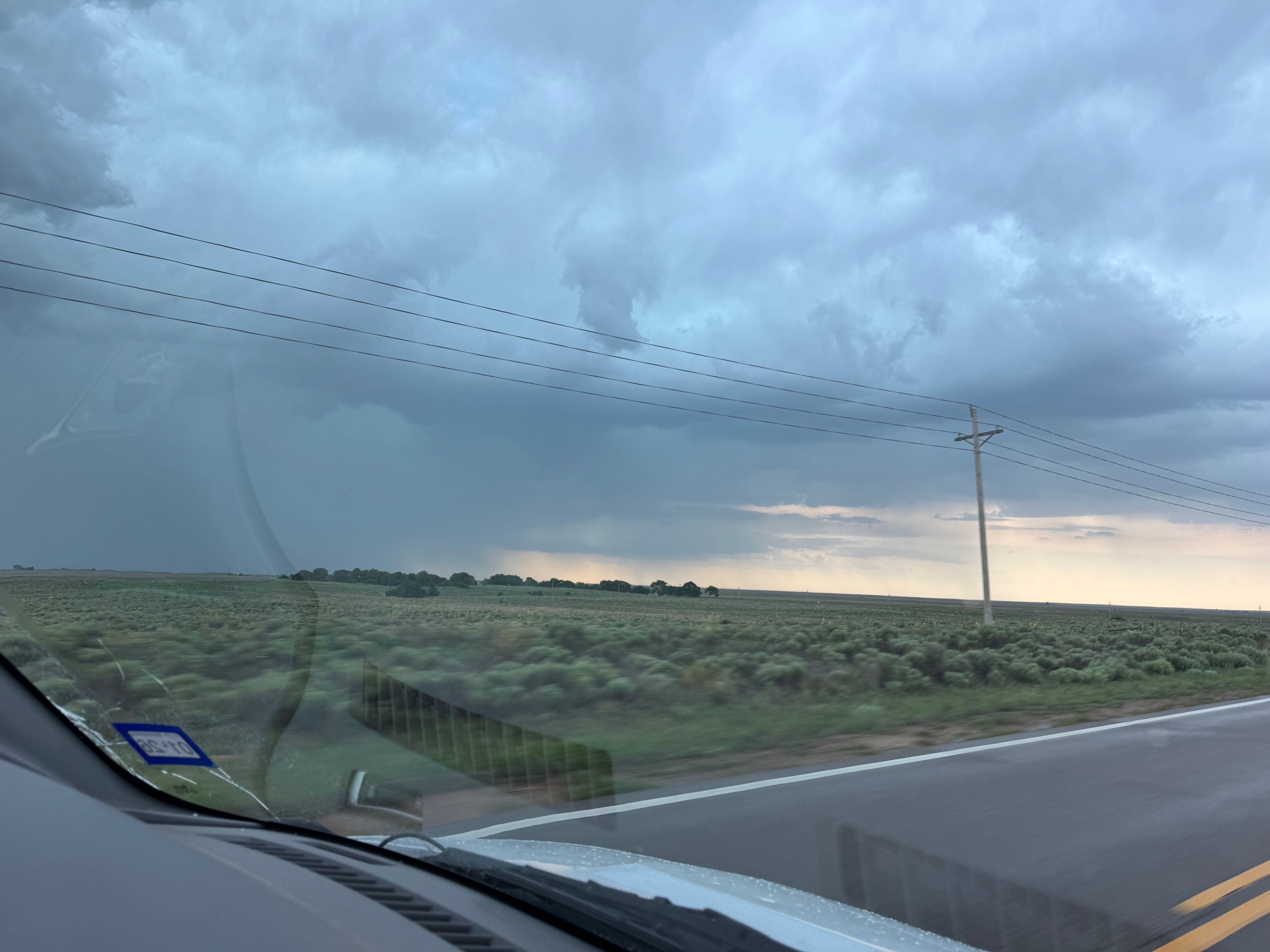
In the group of iPhone shots below, the first six or so shots show the nearby base with a lowering north of Hooker, OK. The subsequent shots show the approach eastward towards the tornado-warned storm that was north of Elmwood in Beaver County. (The final three shots are of mediocre cells towards sunset.)
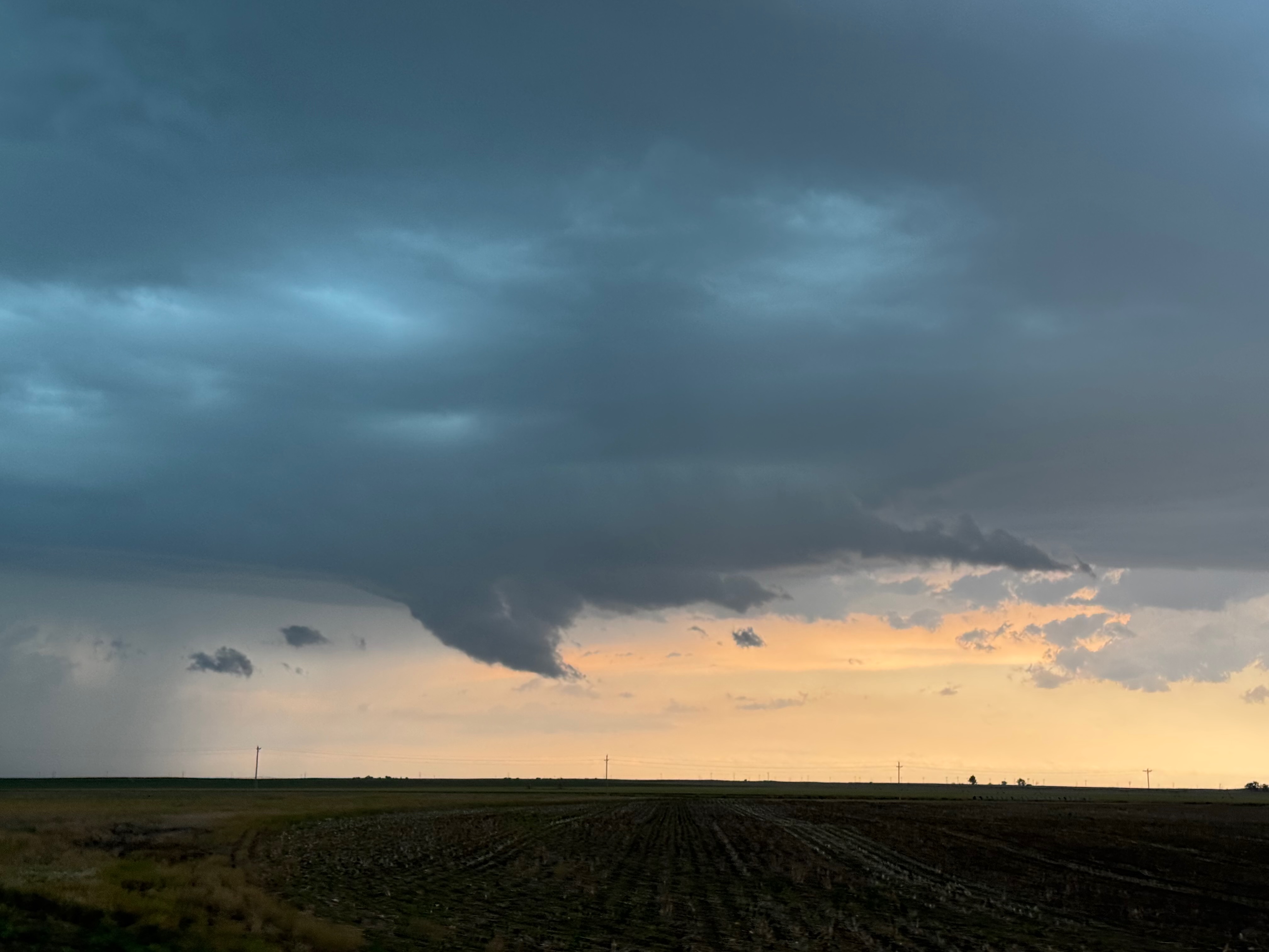
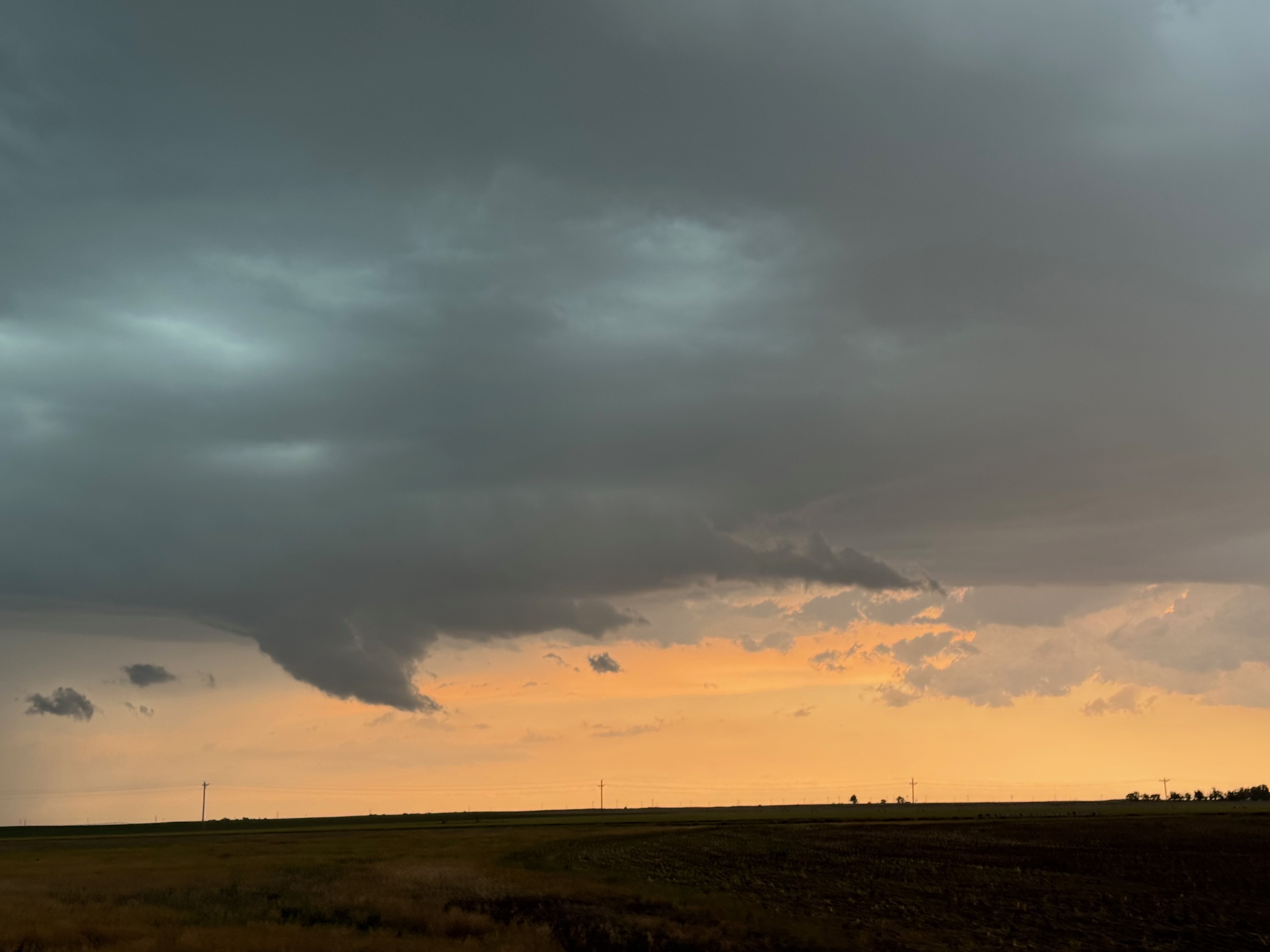
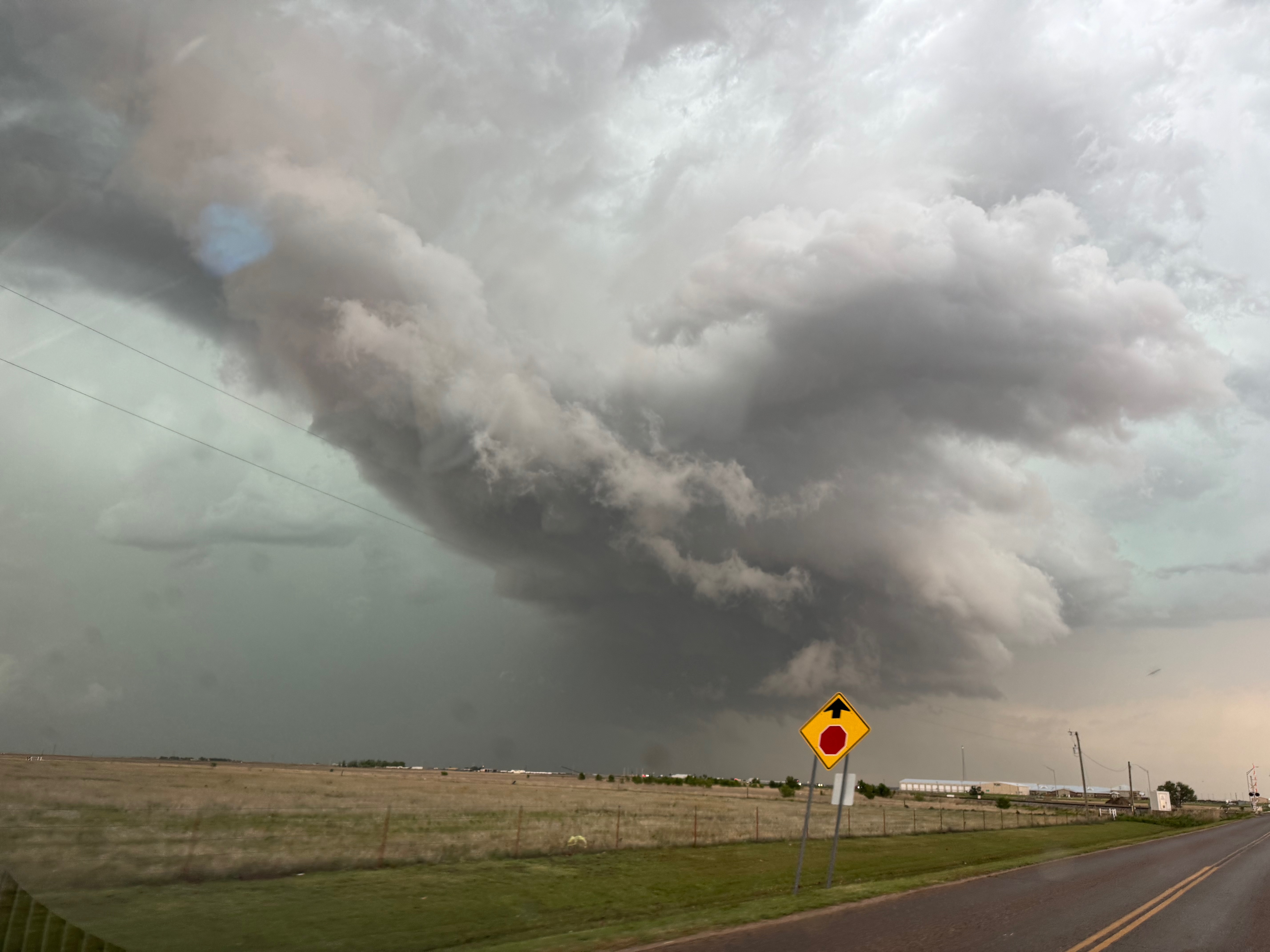
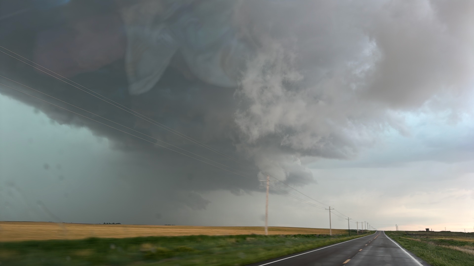

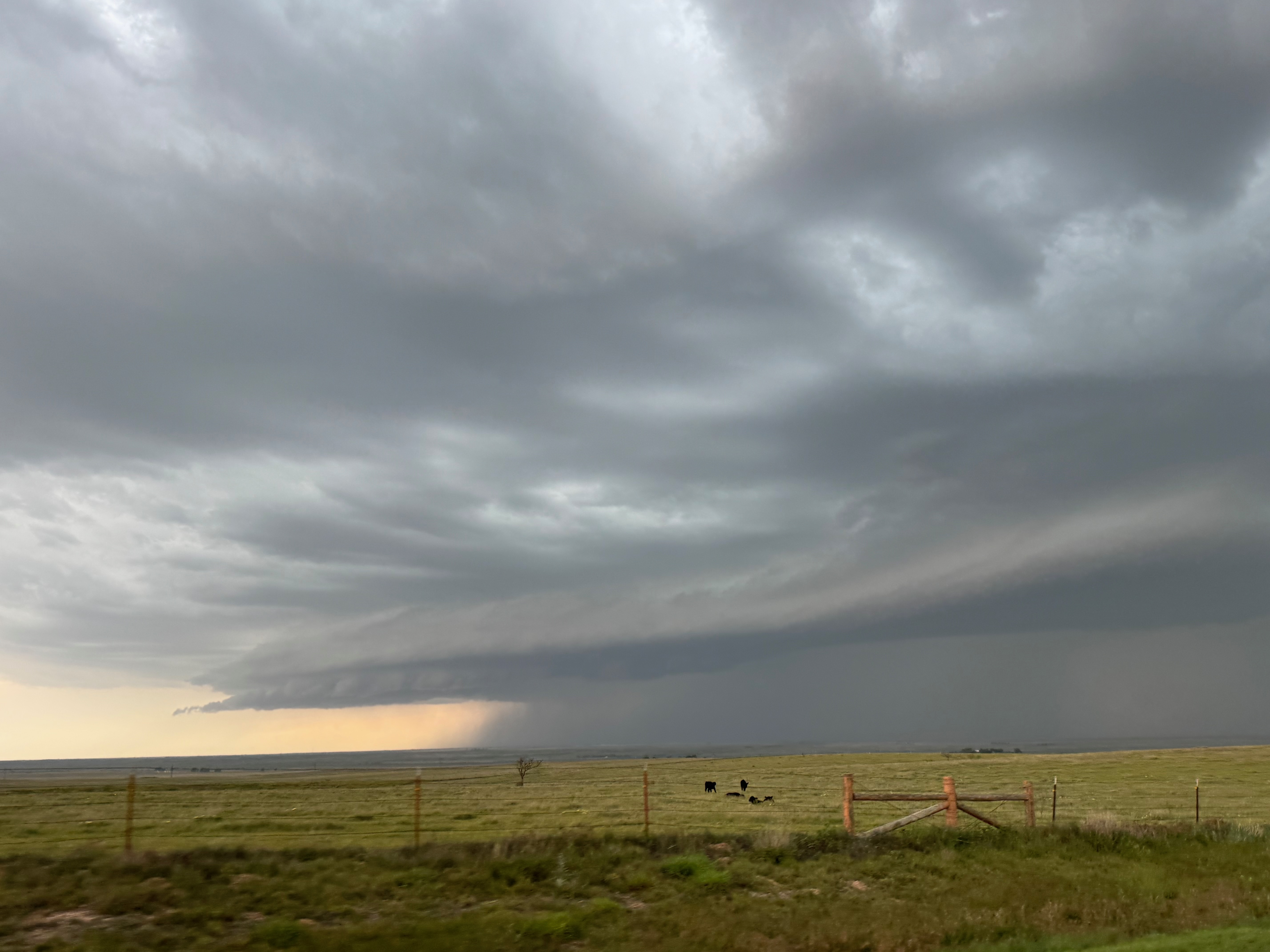


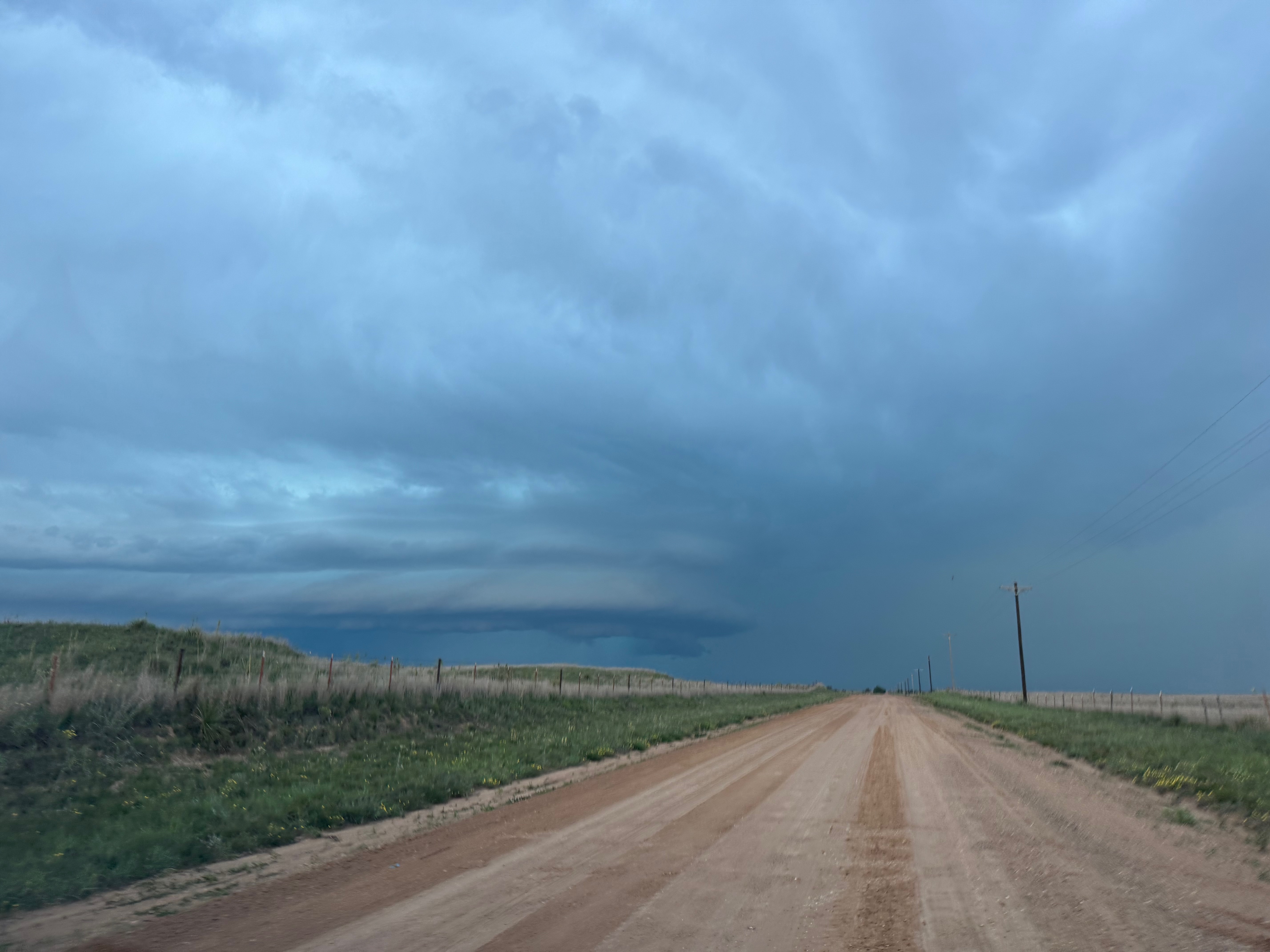
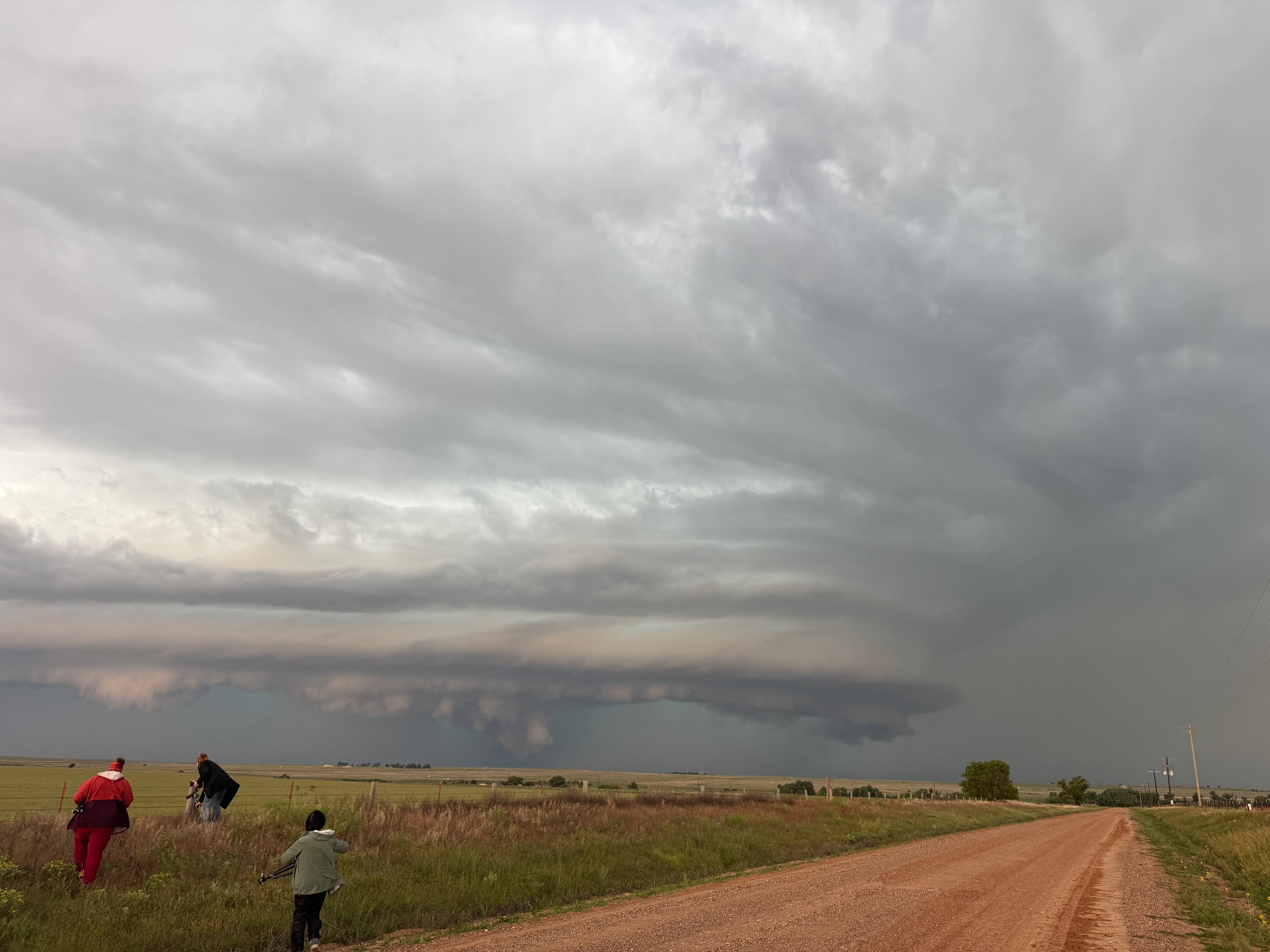

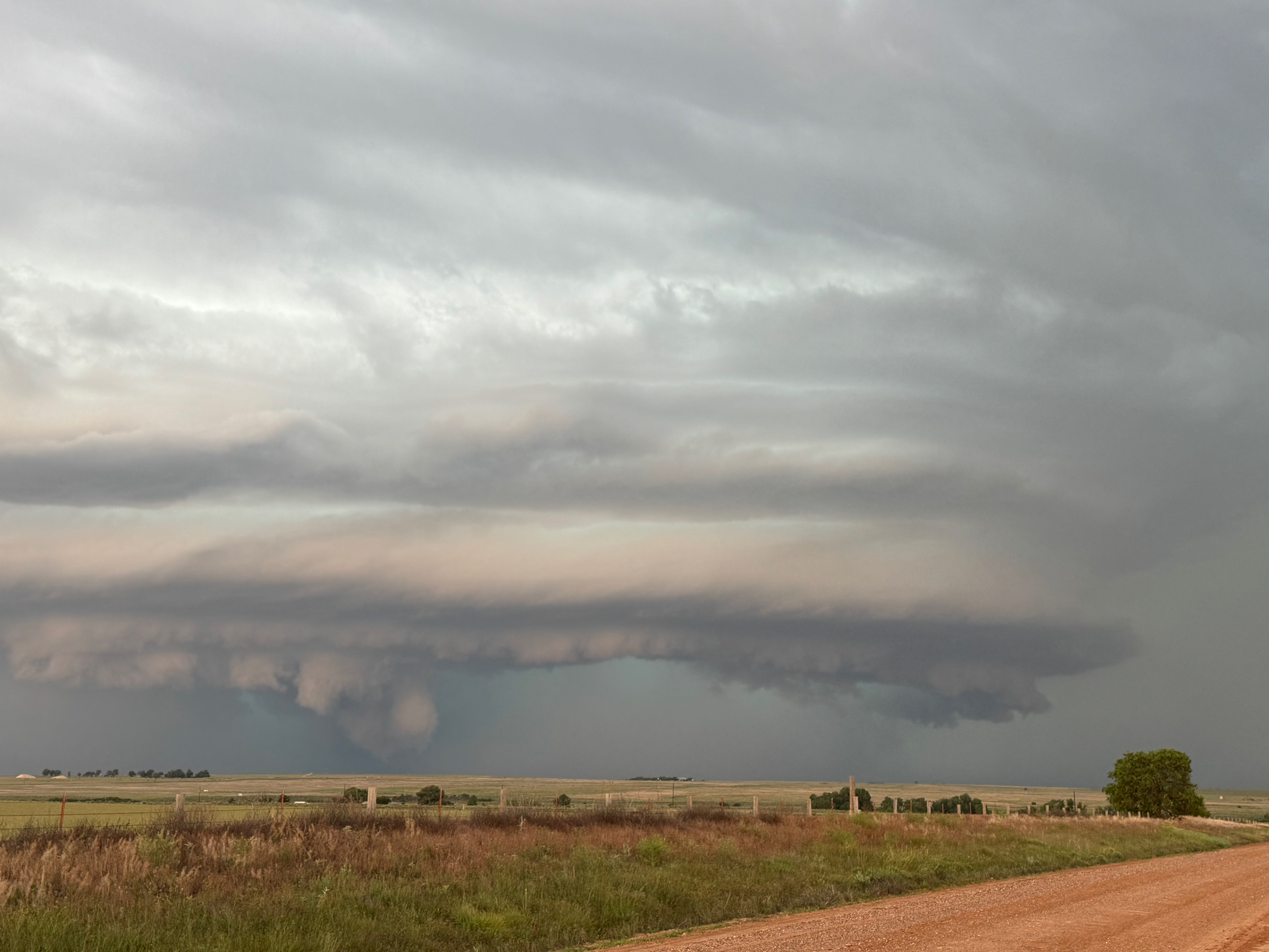
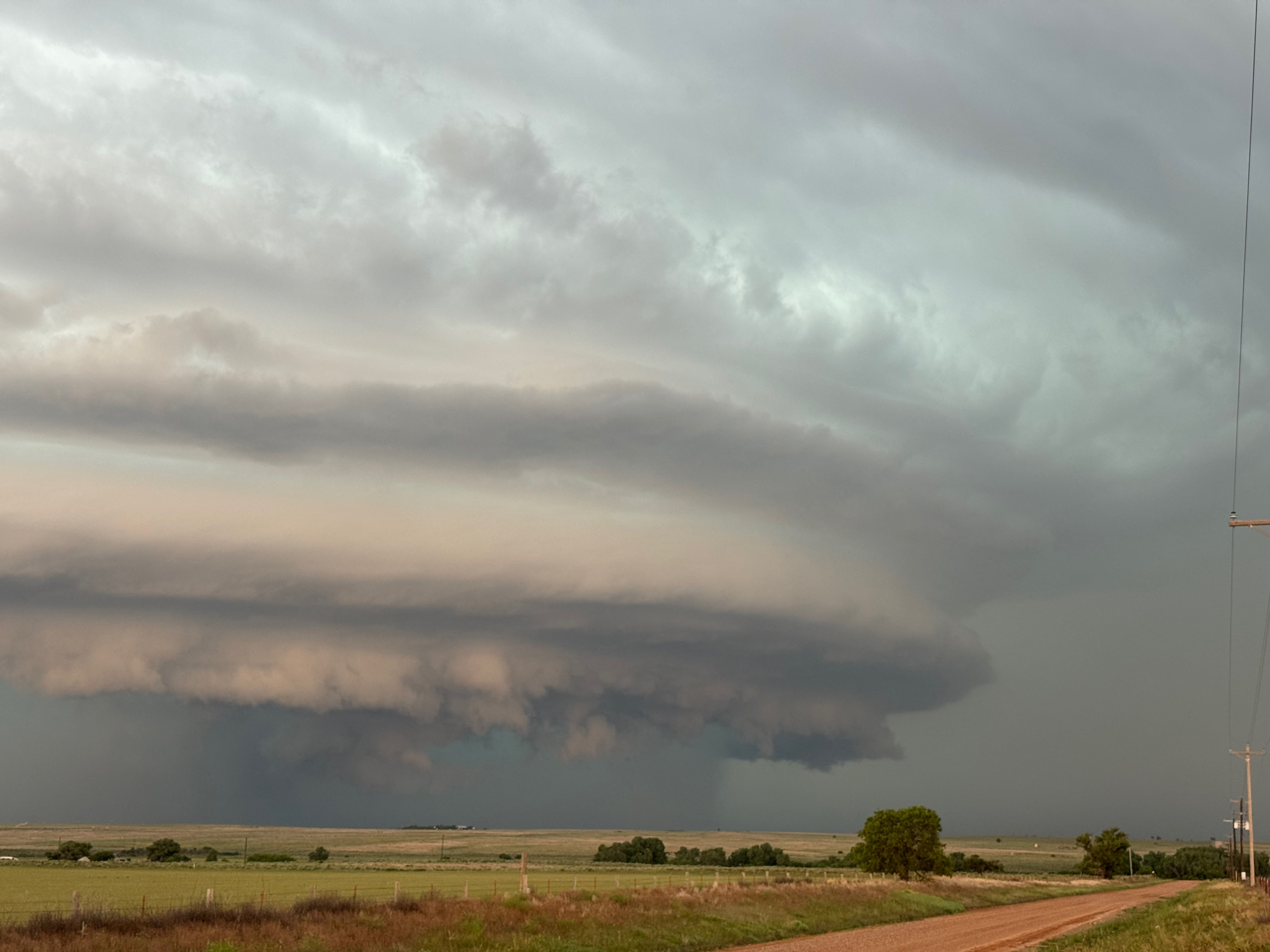
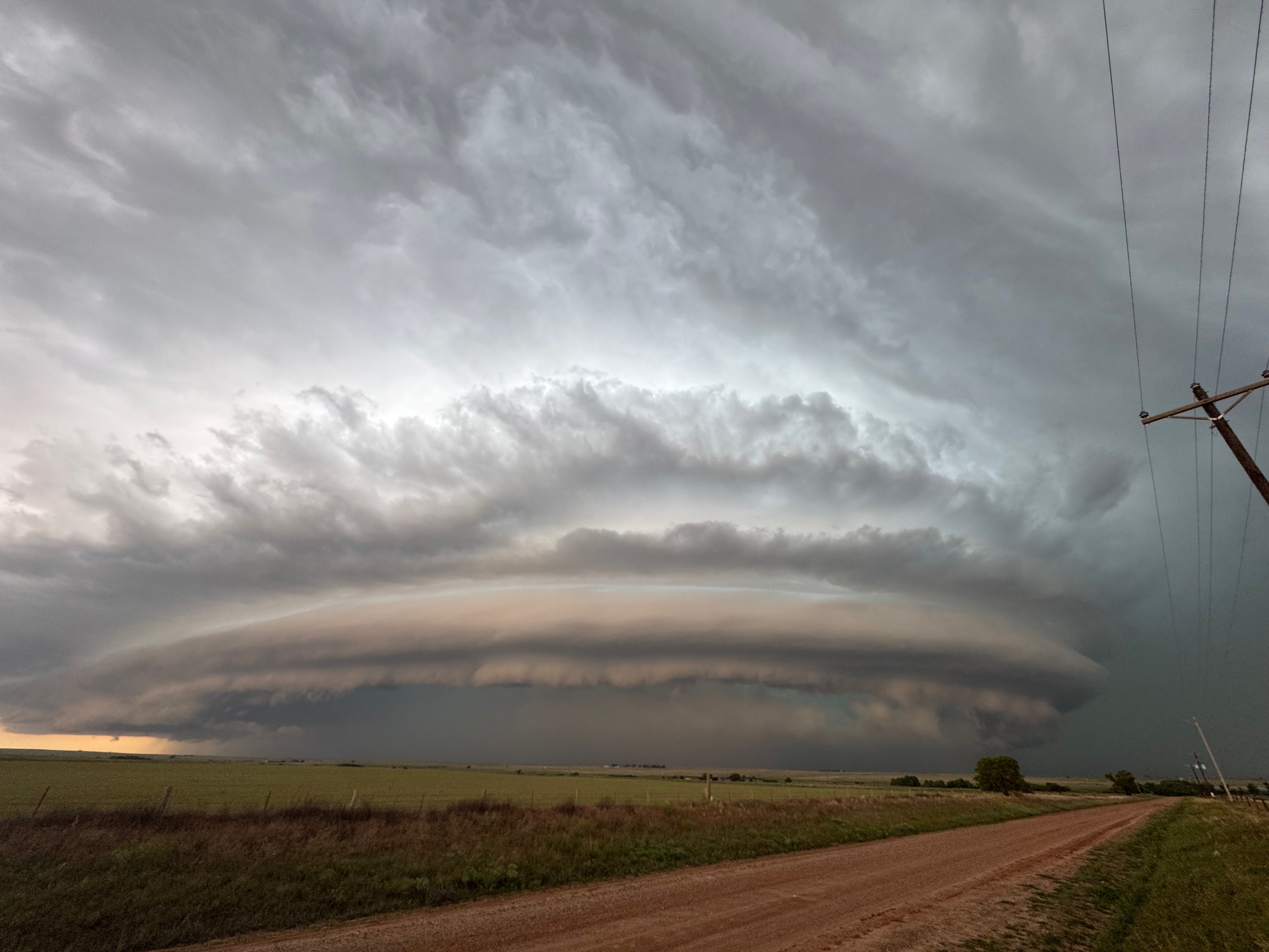

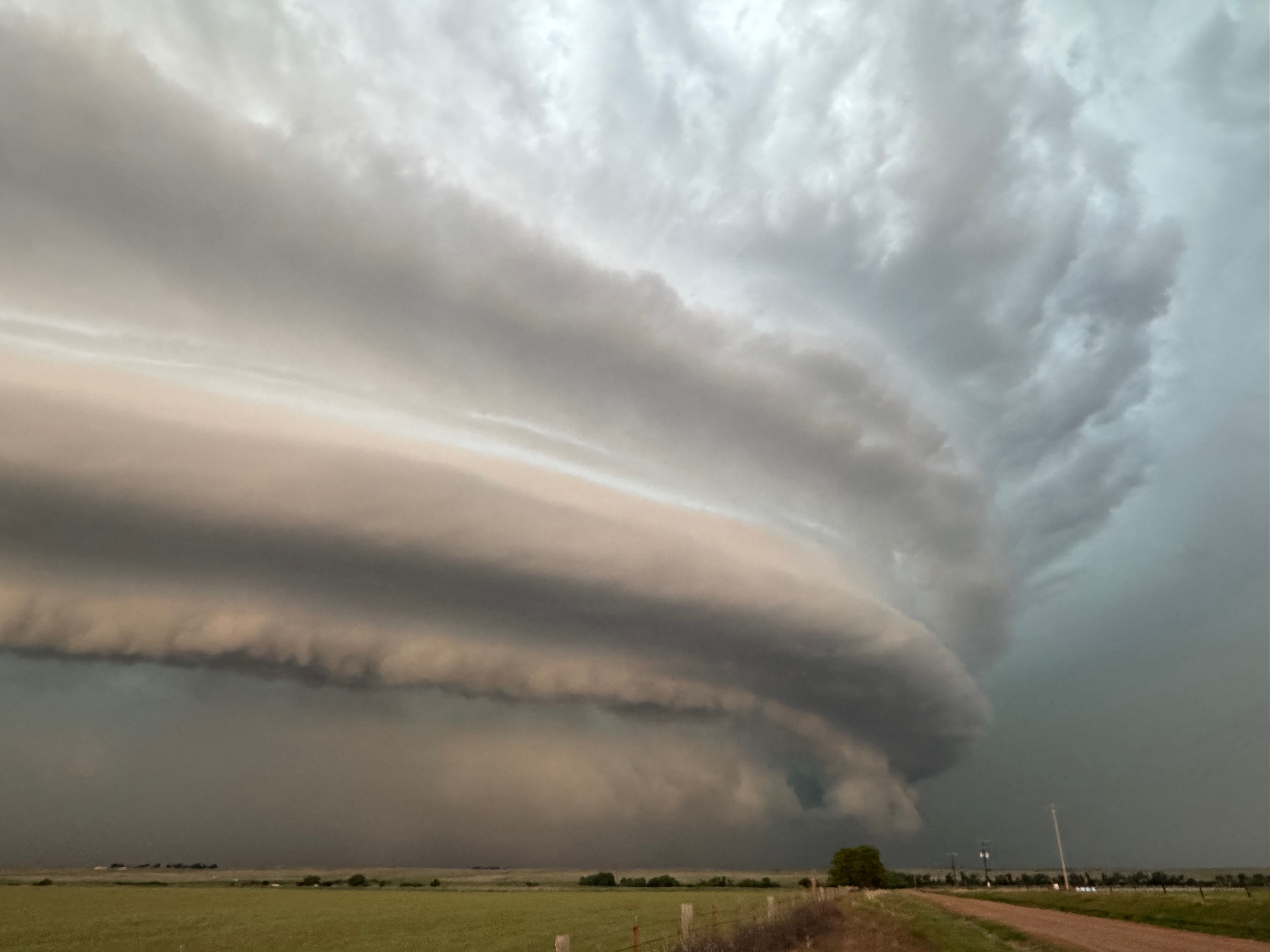
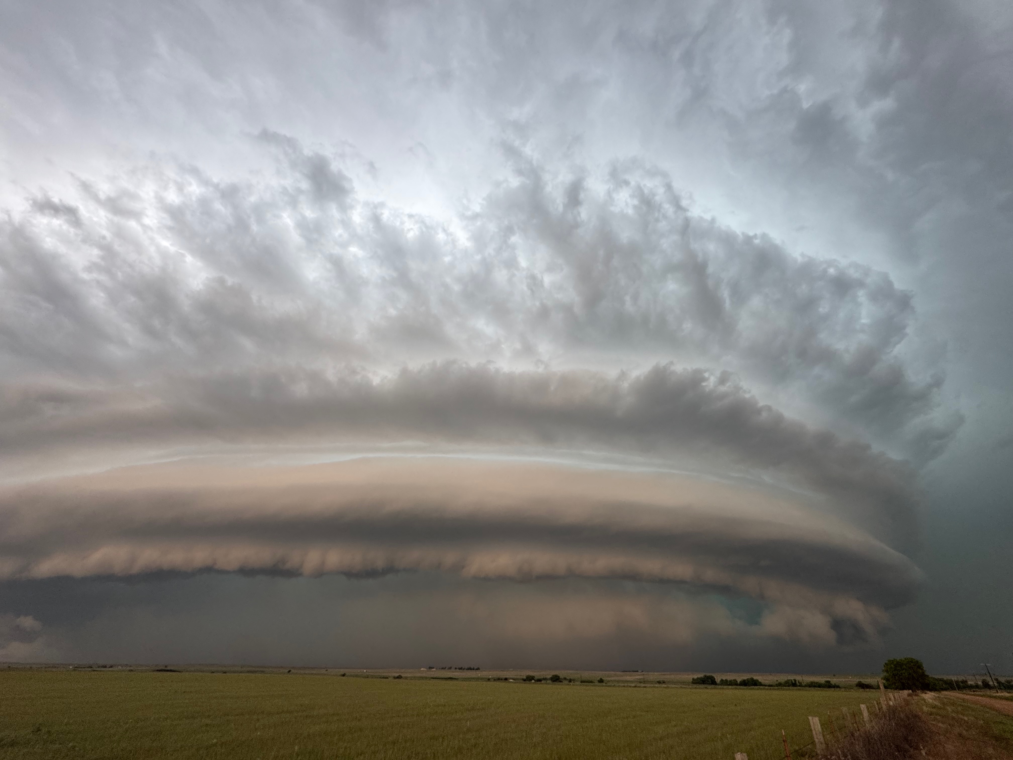


The Elmwood/Slapout storm chased us eastward on 412, and for a few minutes it was a little dicey as the core approached and we were dealing with some one-lane road construction stops with the automatic traffic signals. Our supercell began to wind down rather quickly as it went outflowish and ho-hum looking. We were fortunate to get in front of it to see the great structure show. Few other chasers were able to make it far enough east and south.
Leave a Reply
You must be logged in to post a comment.