
Start: Clovis, NM/lunch: Allsups junk food in Morton/End: Littlefield, TX/333 miles
Mesoscale Discussions. 11:03 a.m. CDT. 12:27 p.m. CDT. 12:42 p.m. CDT. 2:45 p.m. CDT. 3:46 p.m. CDT. 6:05 p.m. CDT. 9:16 p.m. CDT.
The 3:46 p.m. and 6:05 p.m. CDT discussions linked above are primarily concerned with the tornadic supercell to the west of Lubbock which we chased.
My video of the Morton tornado.
Youtube link for video by Chris Gullikson, including rooftop timelapse. Chris and the Tempest Tours photo group were generally within a few miles of our location in the Morton area. He did not scoot east to Morton as early as I did, and wound up with a great look at the dusty wedge to his north.
On this Thursday we woke up quite close to where we needed to be for the chase later on. We began in Clovis, NM, and needed to sag south just a county or two along the NM/TX border and attach ourselves to a “convectively reinforced quasi-stationary surface boundary” (also called a “psuedo warm front/outflow boundary”). These terms are courtesy of SPC. This E-W boundary was maybe moving slowly northward. There was warm and juicy air on its south side, with some clouds and a lot of sunshine. It was cooler and mostly cloudy (low clouds) north of the front. The wind along the boundary had some easterly component, so low-level shear was quite good. It looked like a decent tornado day was shaping up, generally from the Lubbock area westward into New Mexico a bit. SPC teased us with a 10% hatched tornado outline. It wasn’t too difficult to determine where we should hang out: near the western end of the 10 percent hatched tornado outline. This is where the E-W boundary found itself closer to the N-S surface trough and hotter air…where storms are most apt to initiate.
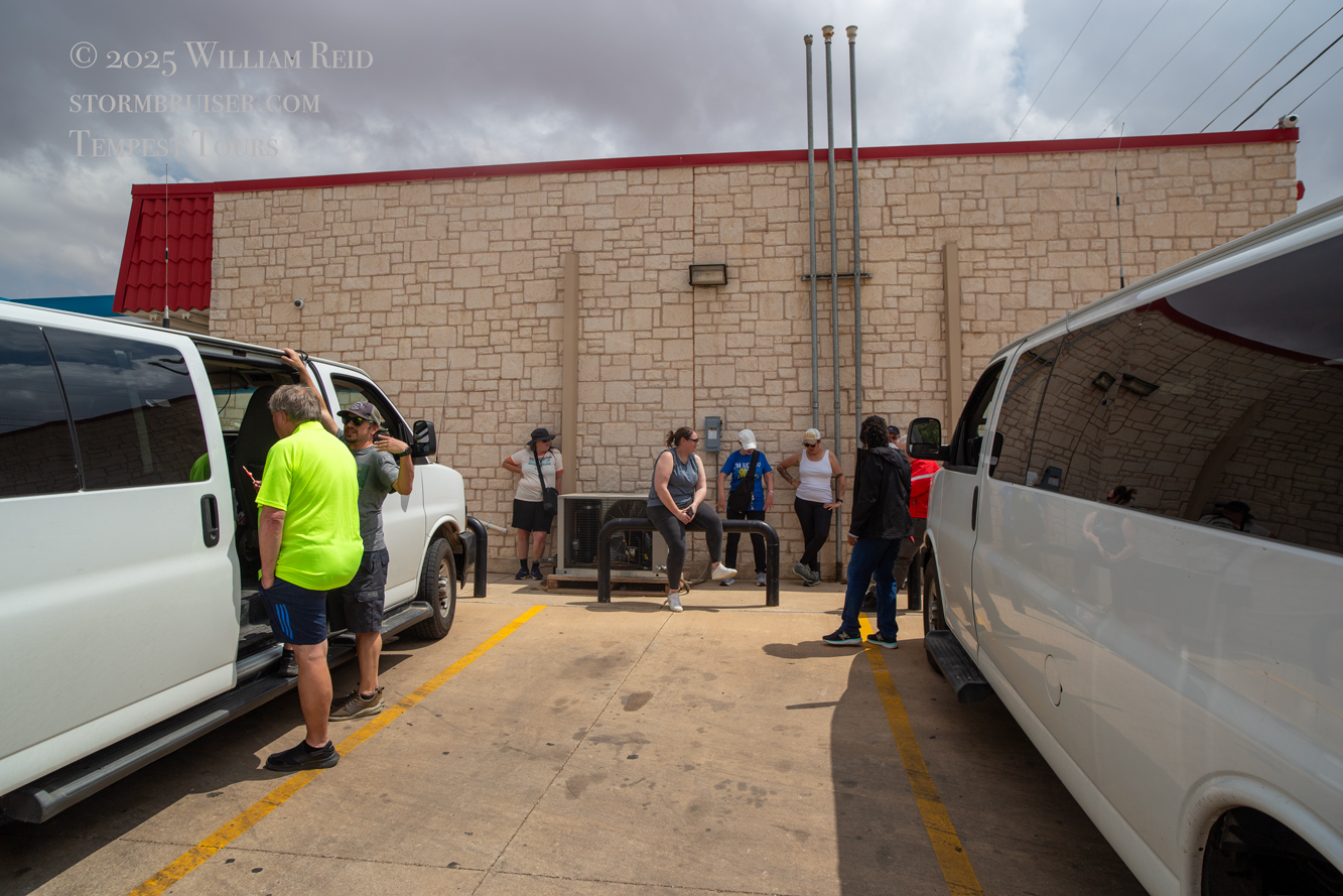
From Clovis we dropped south (late morning) on the Texas side of the border to Morton. That took barely over an hour, and the plan was to have a leisurely and decent lunch in Morton. The small town was just south of the important E-W boundary. We found a good place for lunch (the only place in town, apparently) but the staff wasn’t sure if they would be able to get our group of 16 in and out in a suitably short time. SPC had just issued a mesoscale discussion for our target area (the one at 12:27 p.m. CDT above). The low stratocumulus clouds around Morton were already starting to get a little perky. Was the show going to start early today? I could not take the chance of getting stuck at a restaurant on a day like this, so I reluctantly told the group that lunch today would be at Allsups convenience store (see pic above).
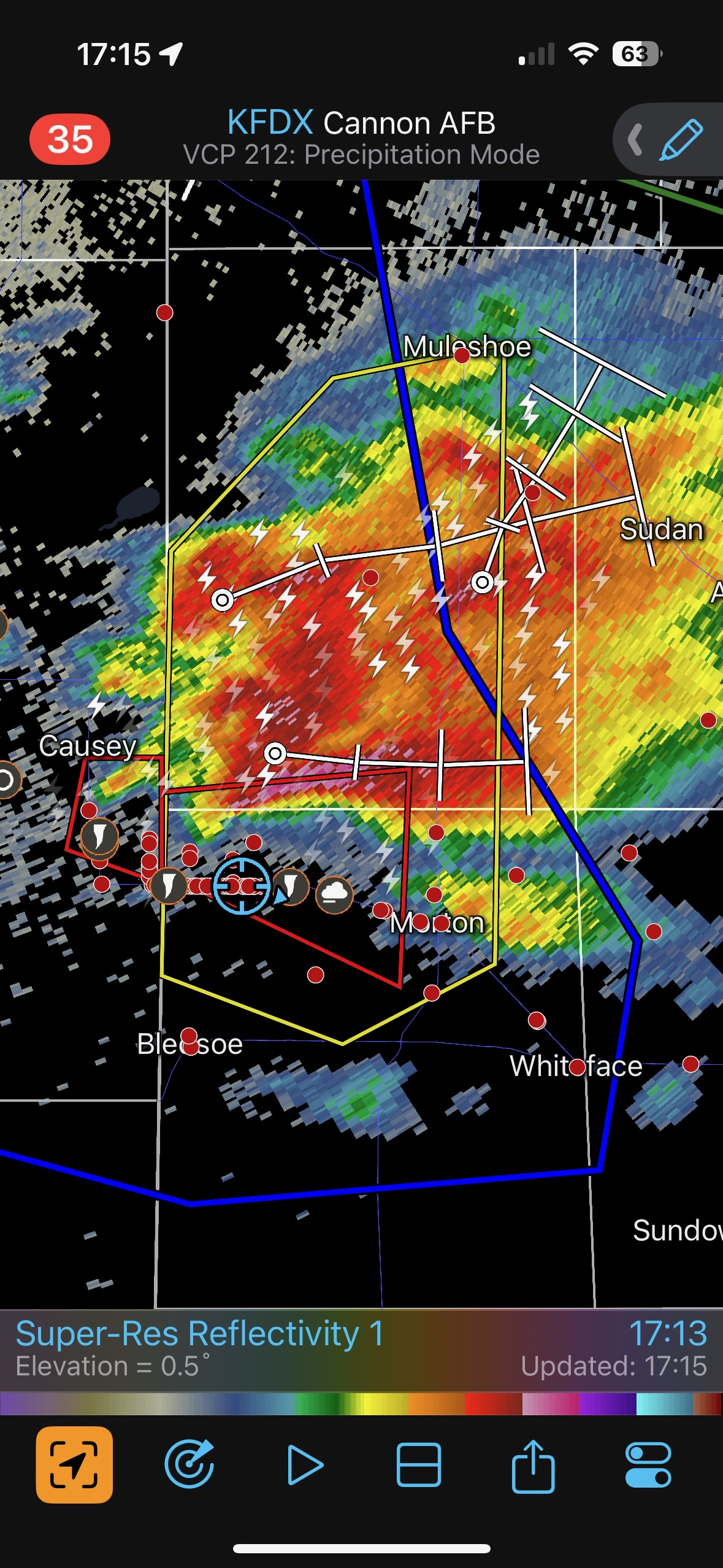
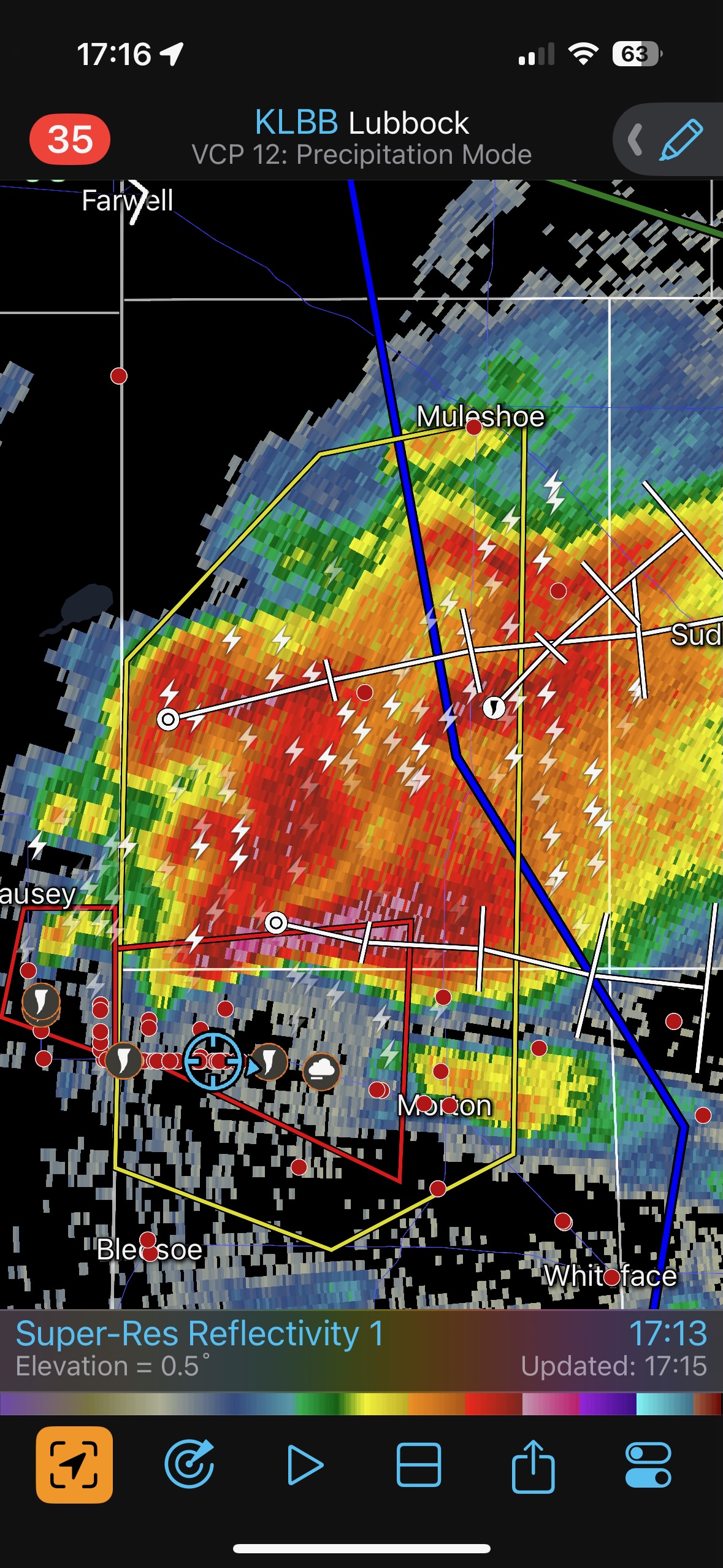
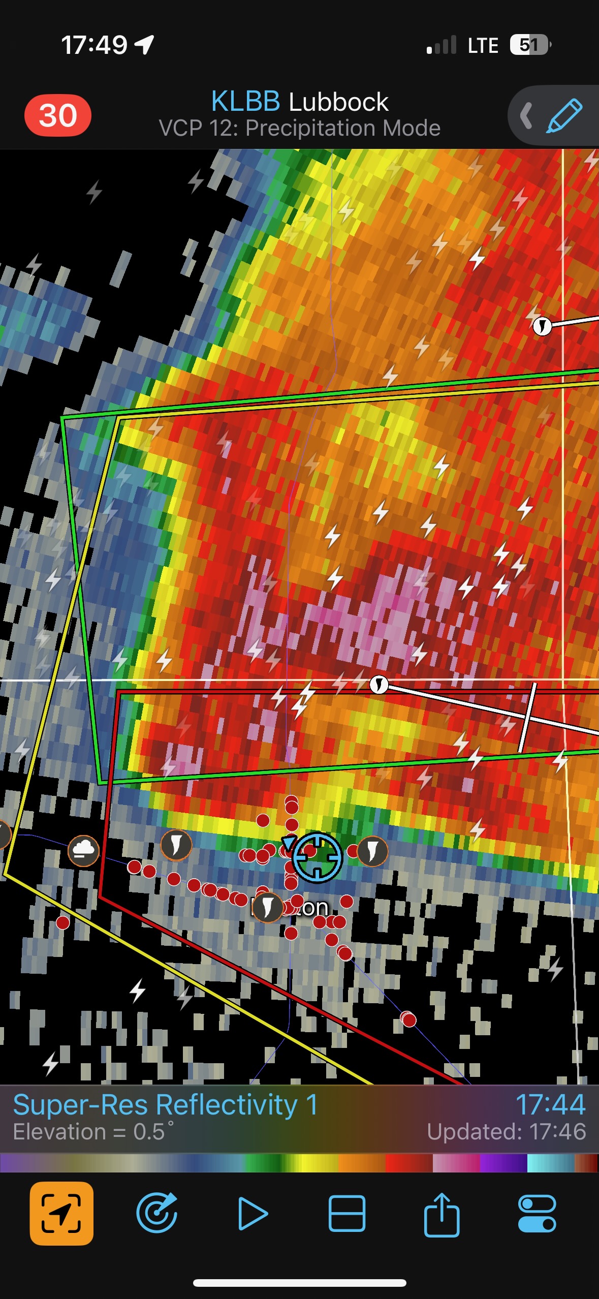
A little cell developed to our south, and at 2:15 p.m. we were next to it in southern Cochrane County (see radar image). But this little updraft did not amount to much. It died and we were back at the Allsups in Morton an hour later.
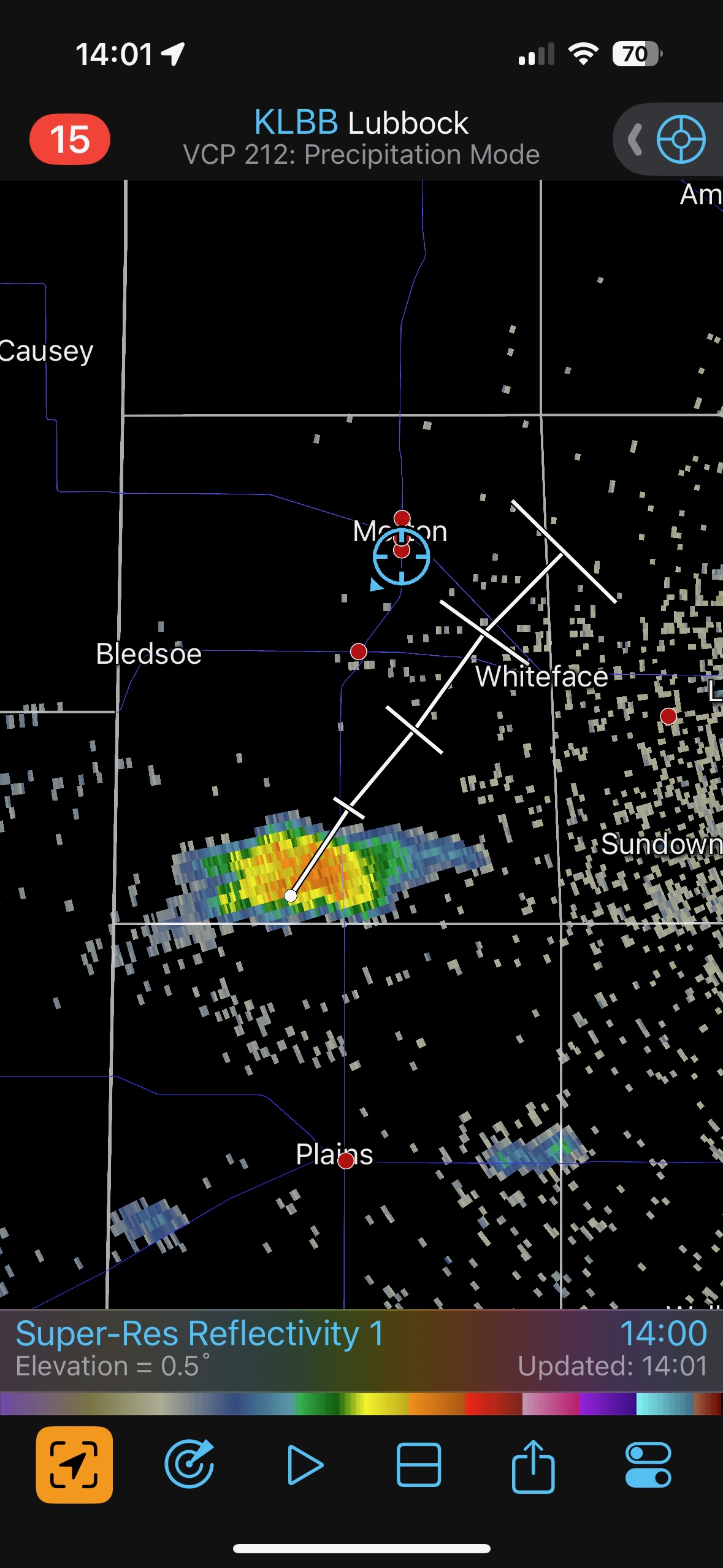

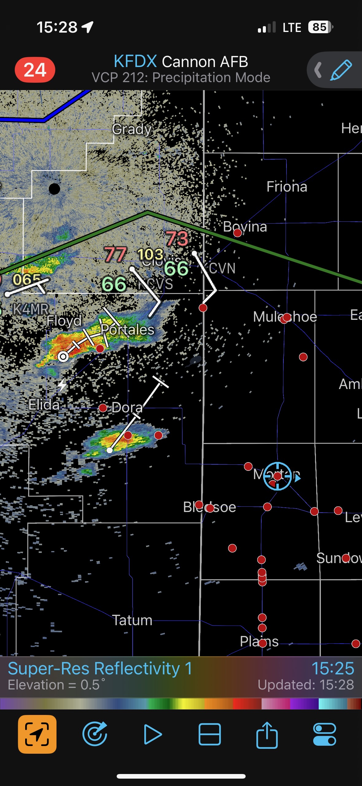
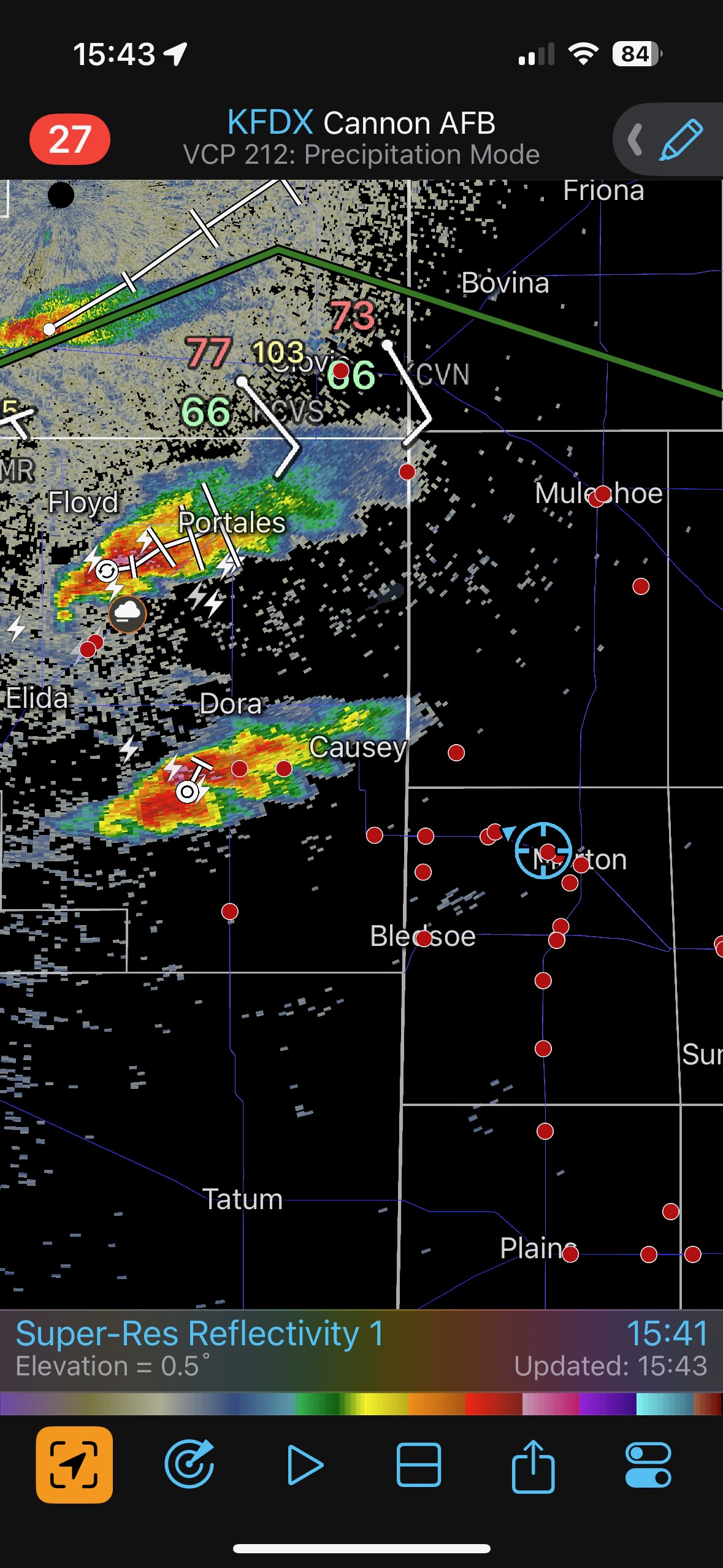
While still at the Allsups radar started to show new storm development in New Mexico to our due west. This was perfect! The southern cell was likely on or near the boundary (just south of Dora 3:30 p.m. CDT). Ten minutes later this storm was looking much better on radar (last screenshot above), and we were rolling westbound on FM 114 out of Morton. This chase was like taking candy from a baby.
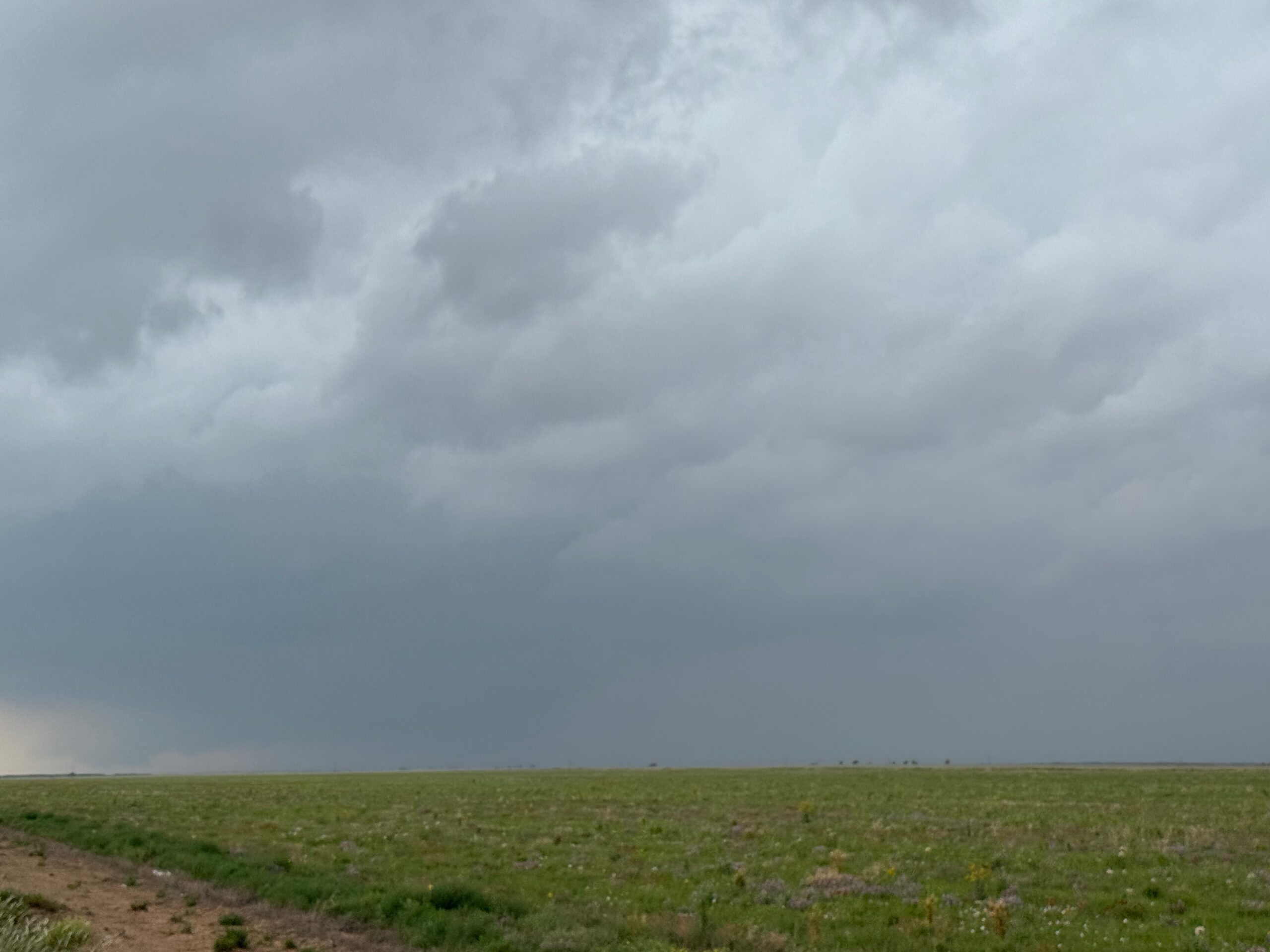
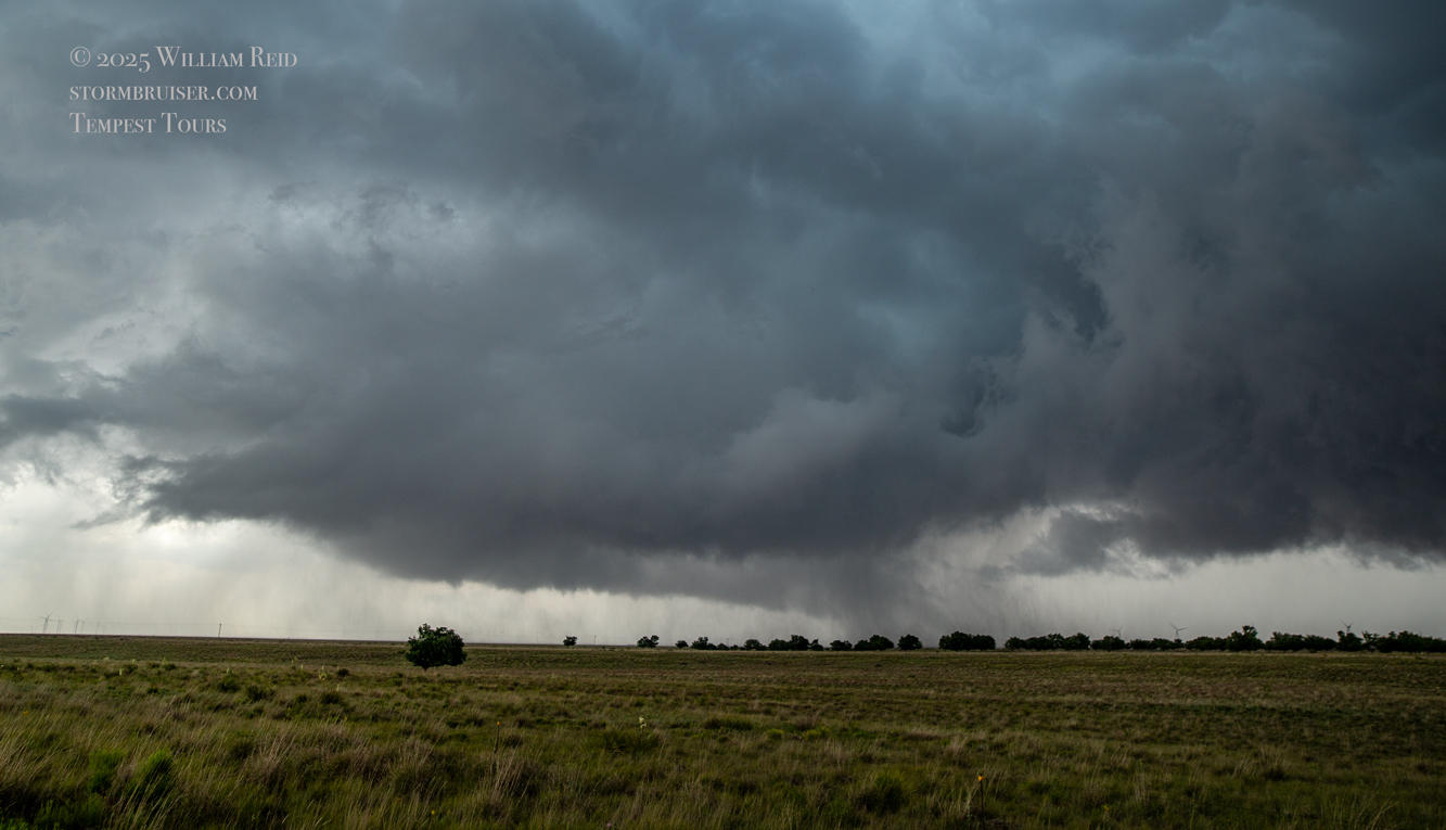
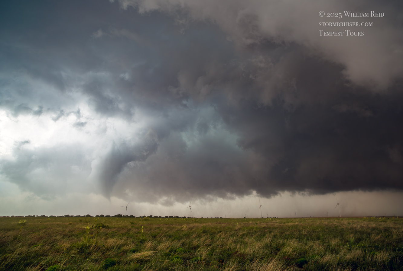
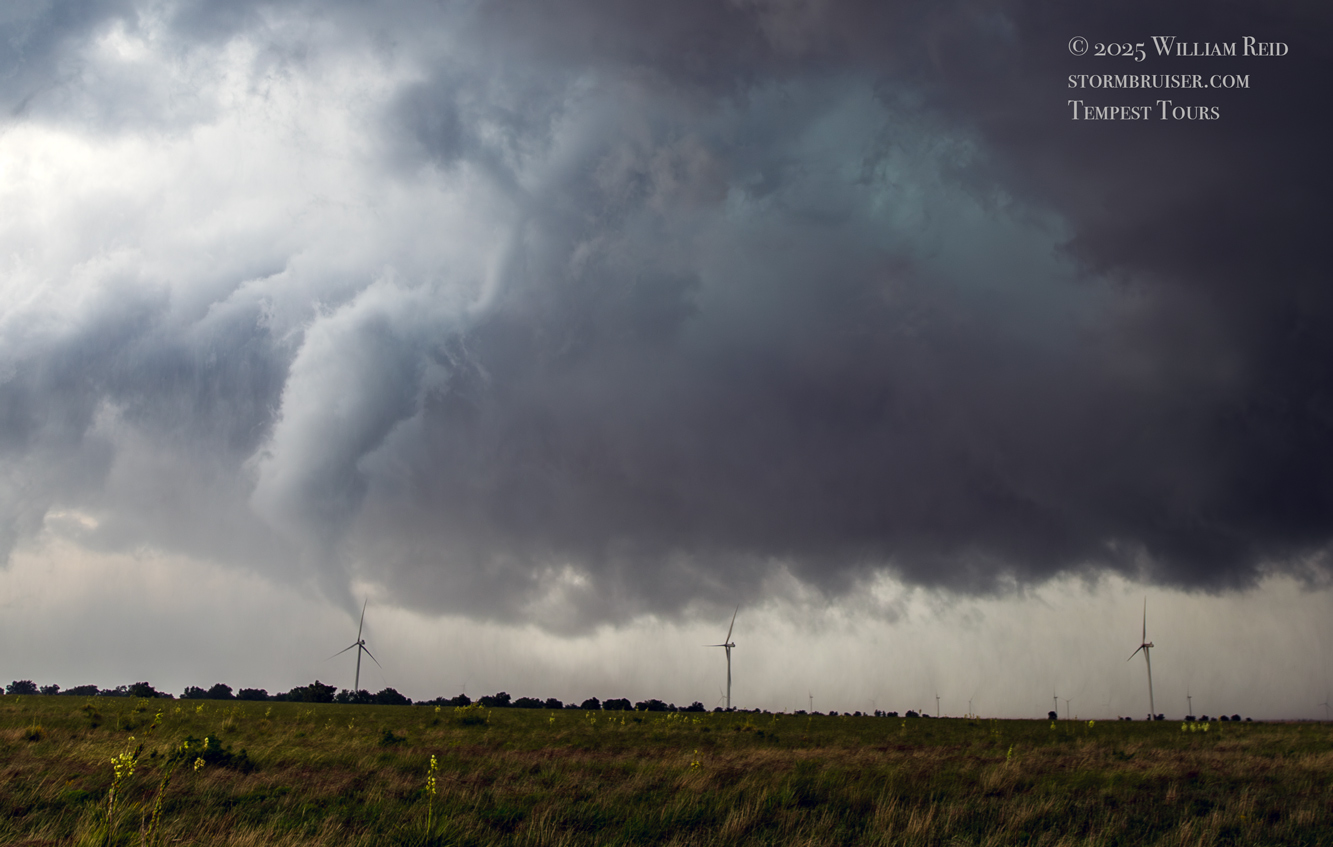
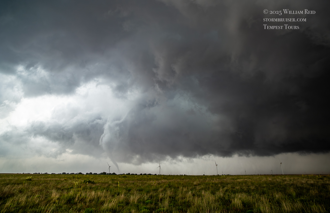
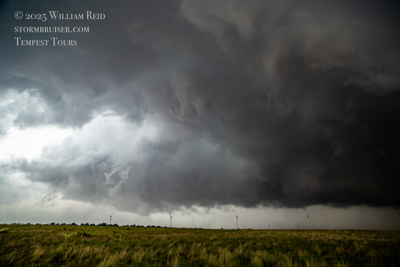
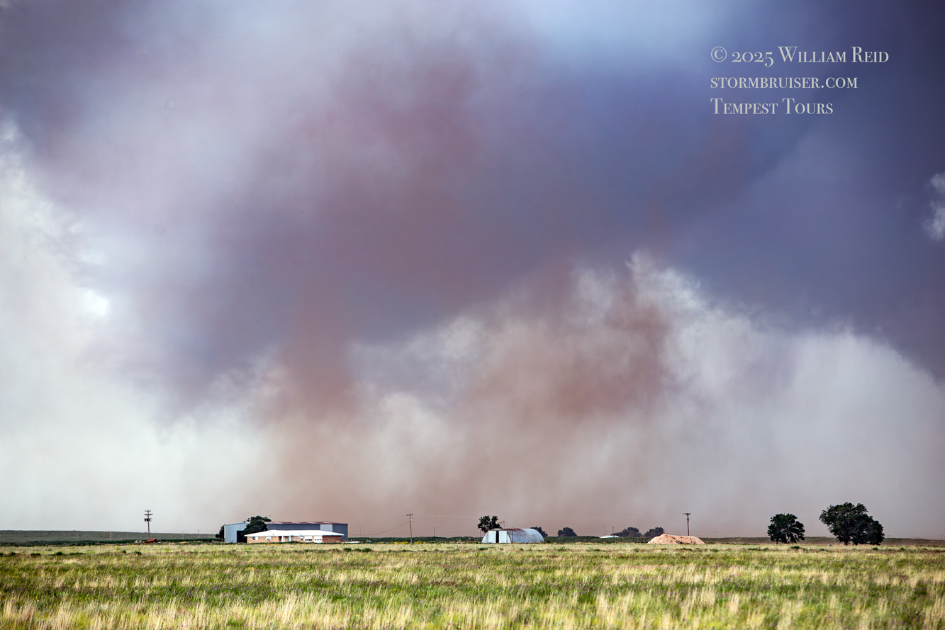
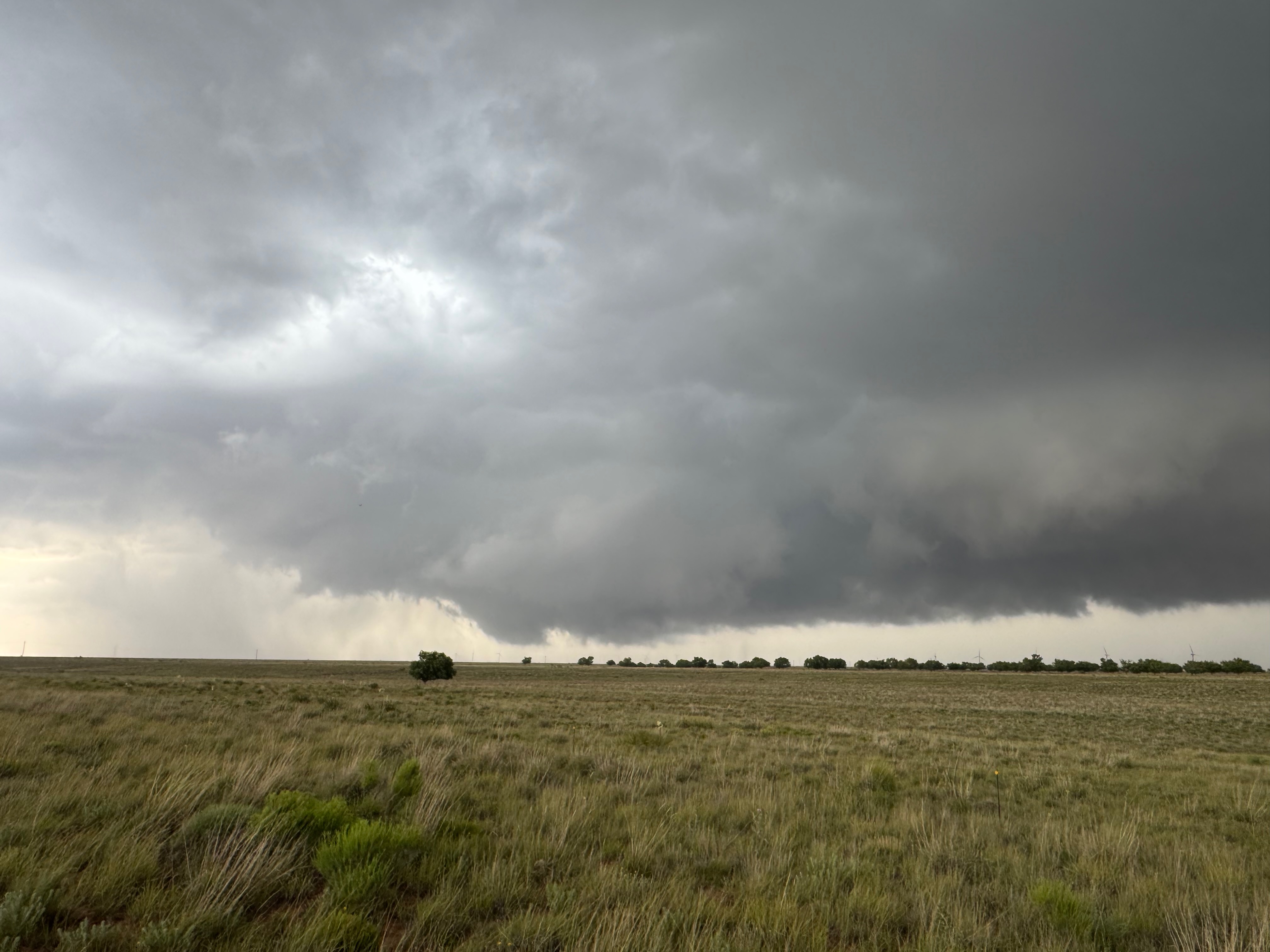
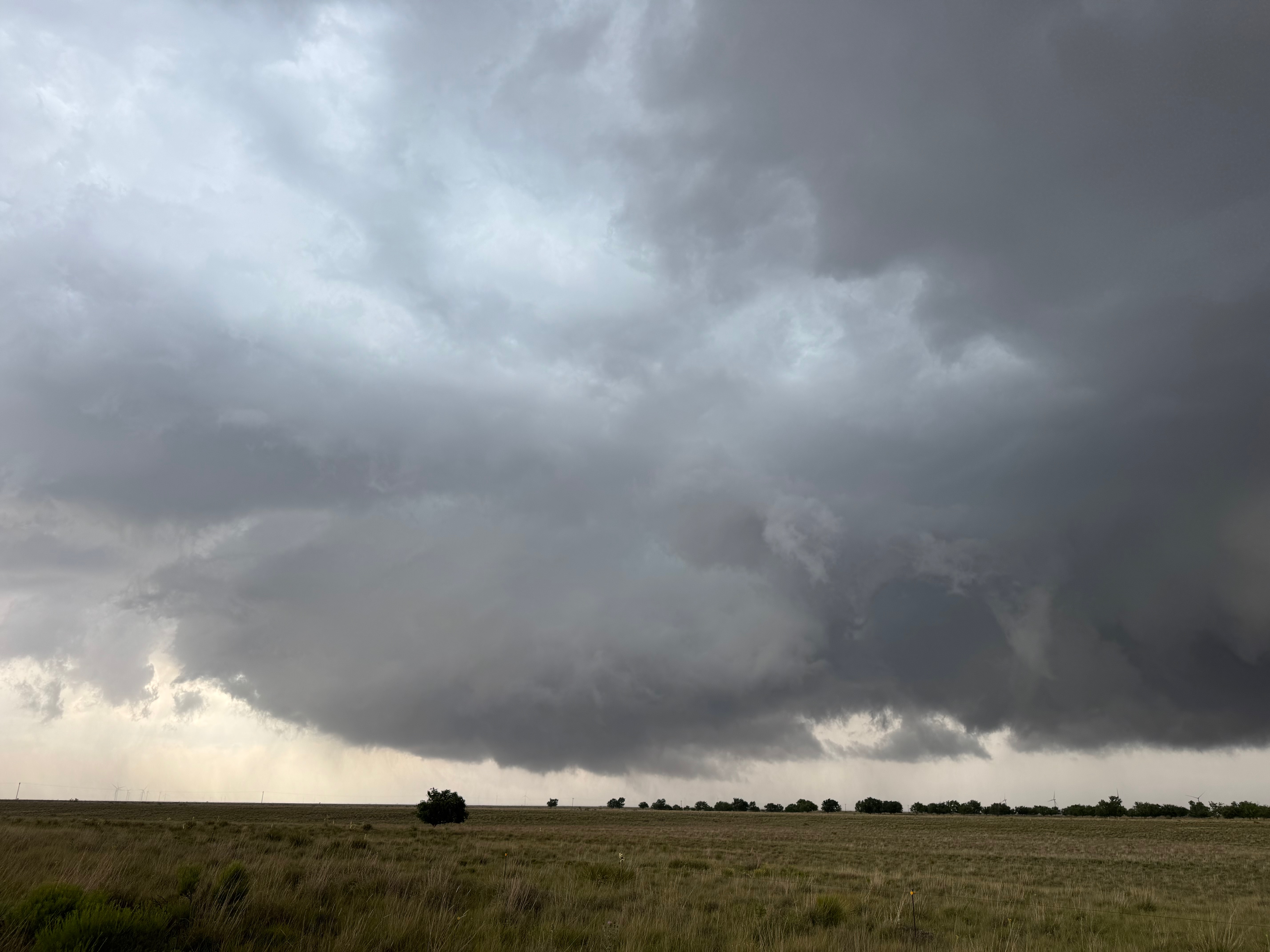
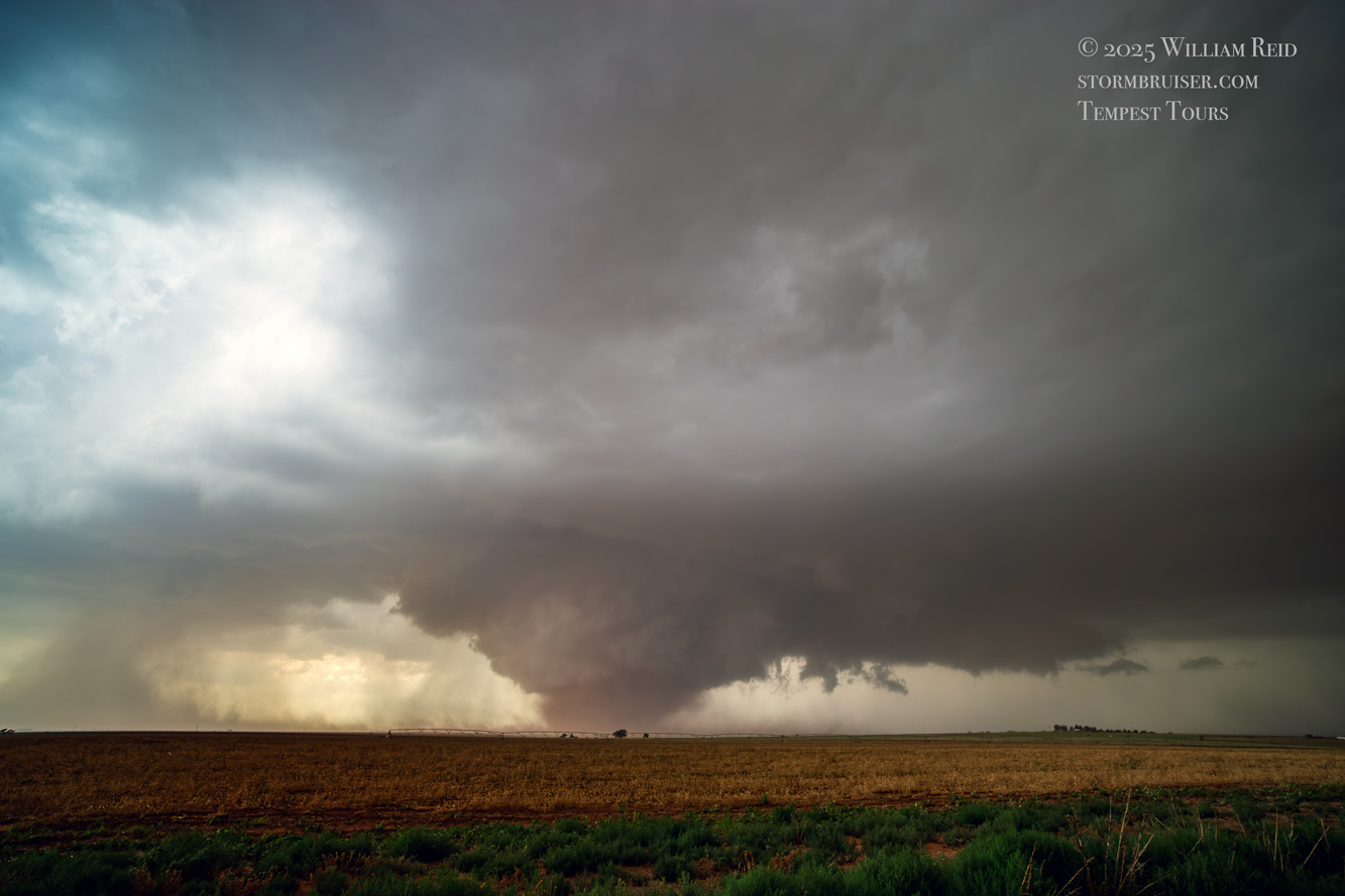
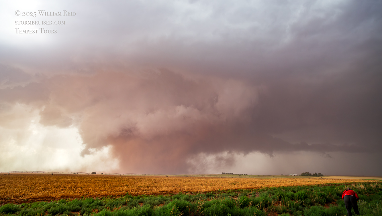
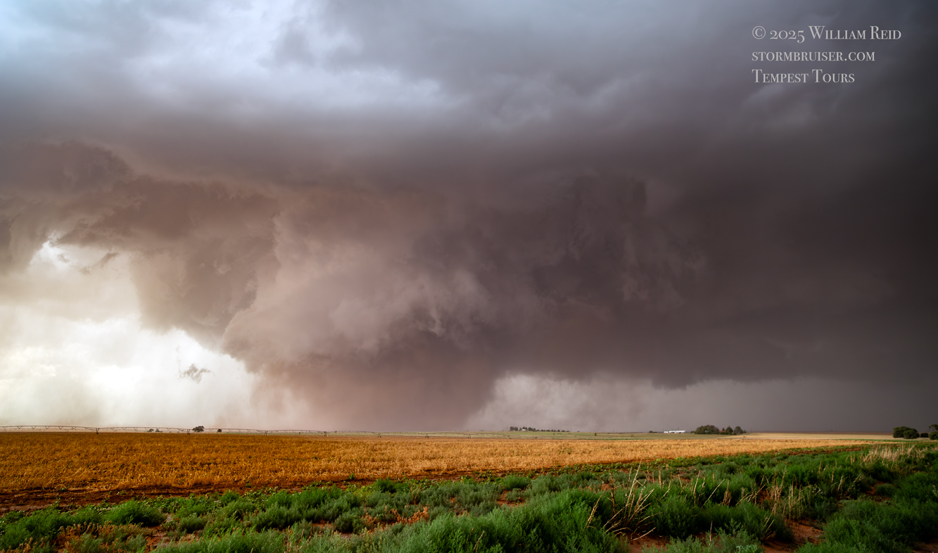
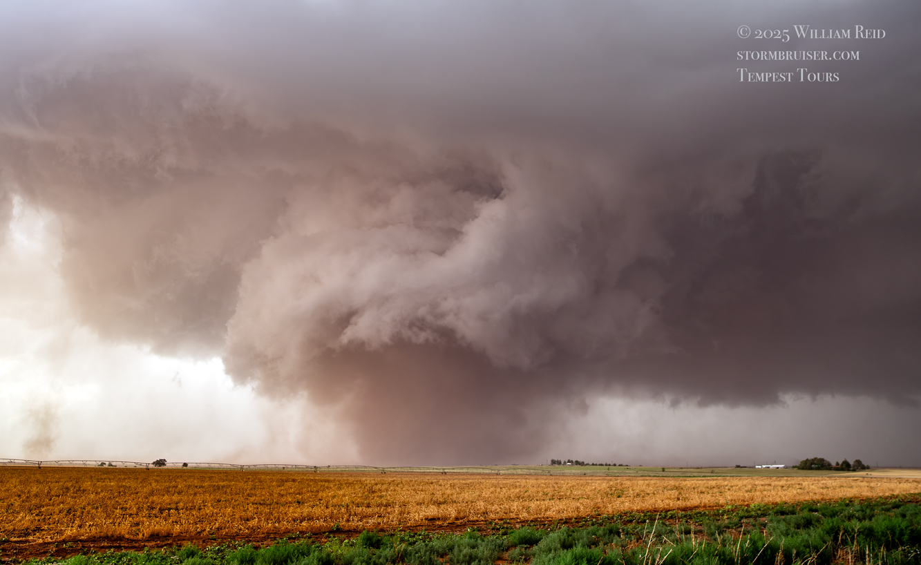
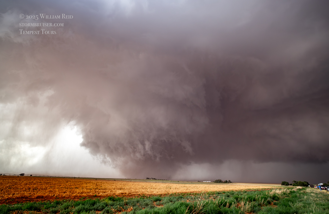
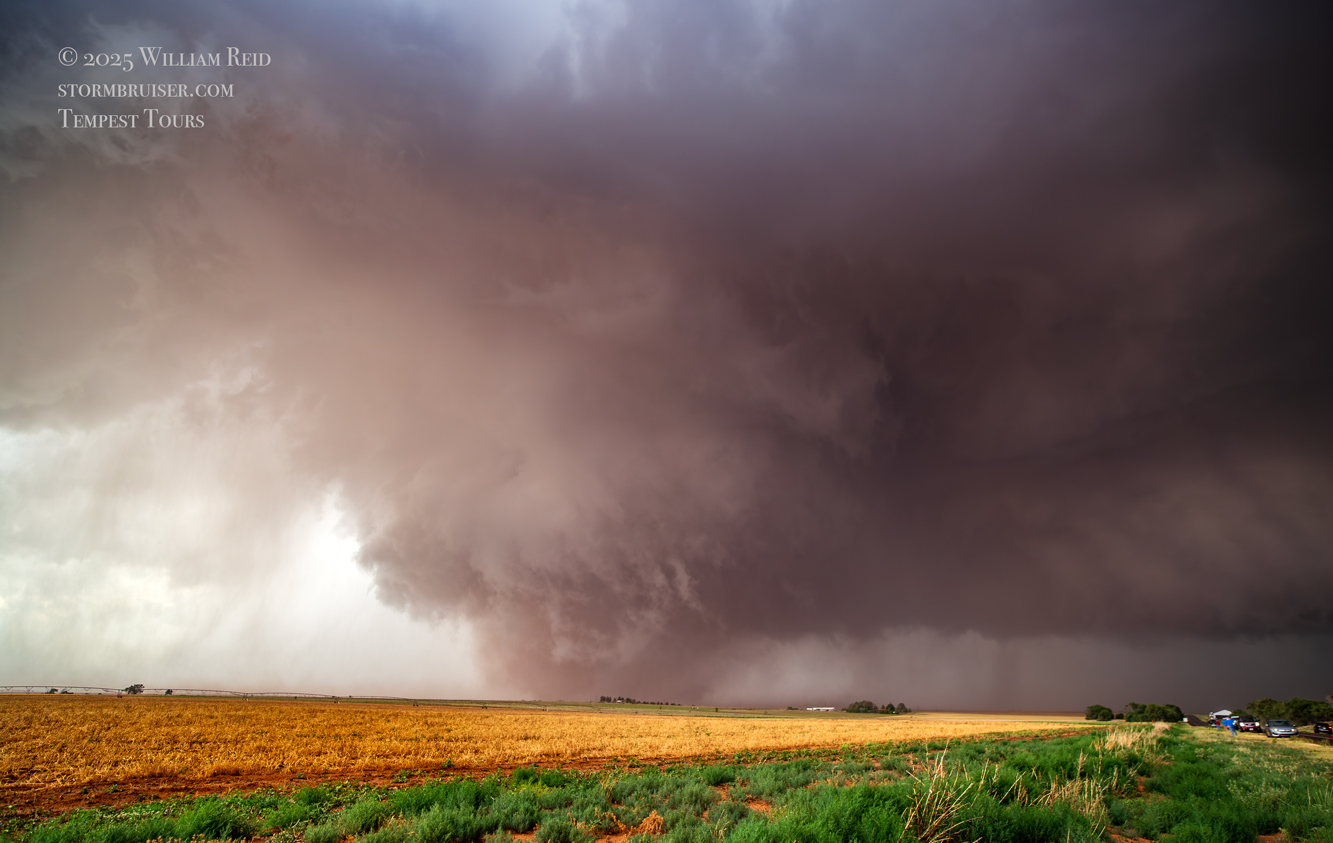
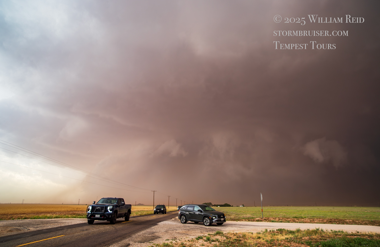
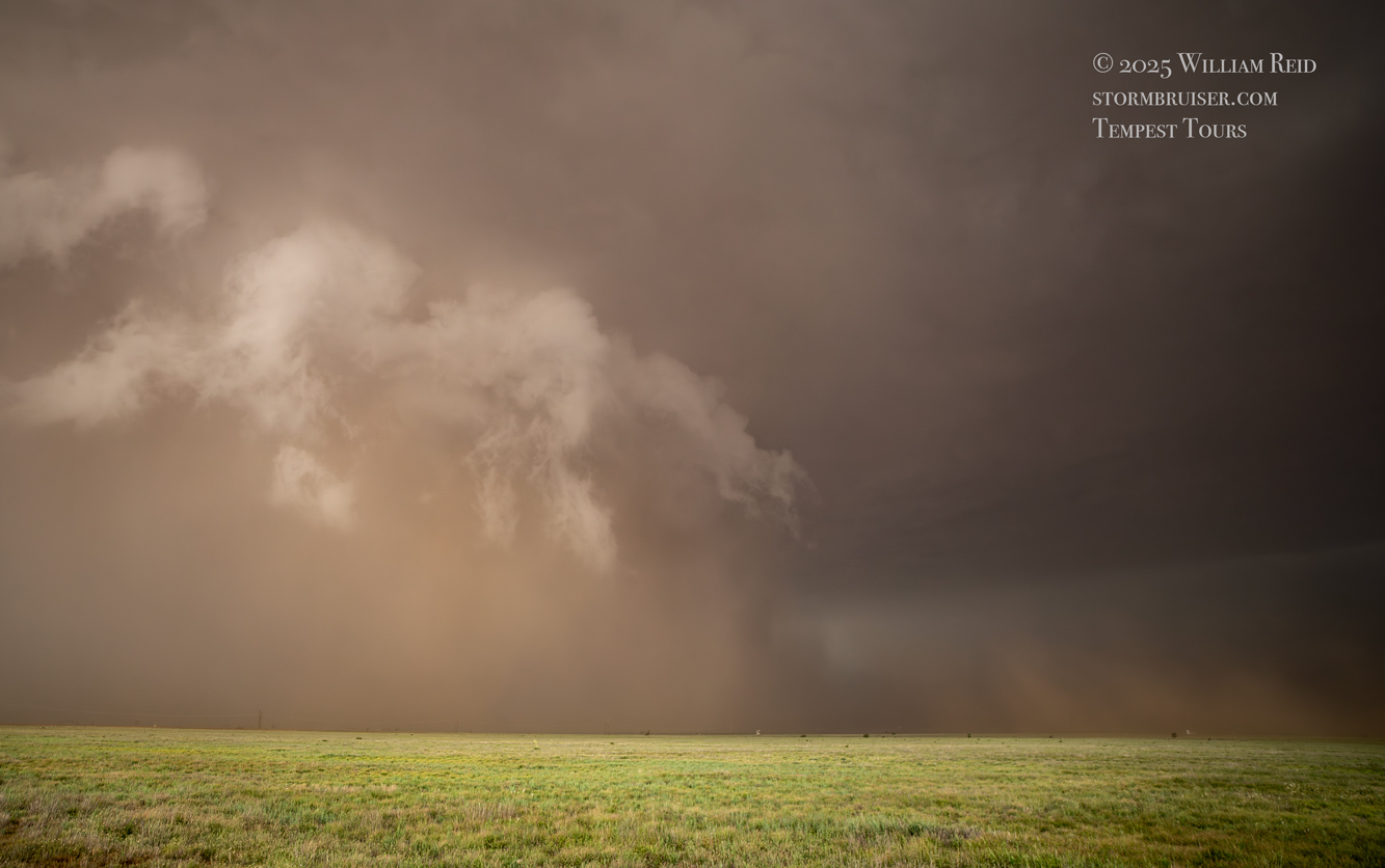
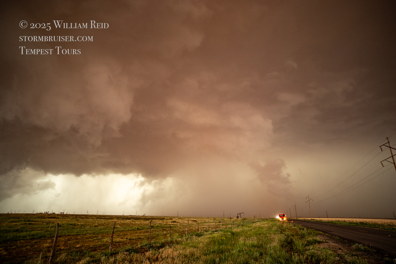
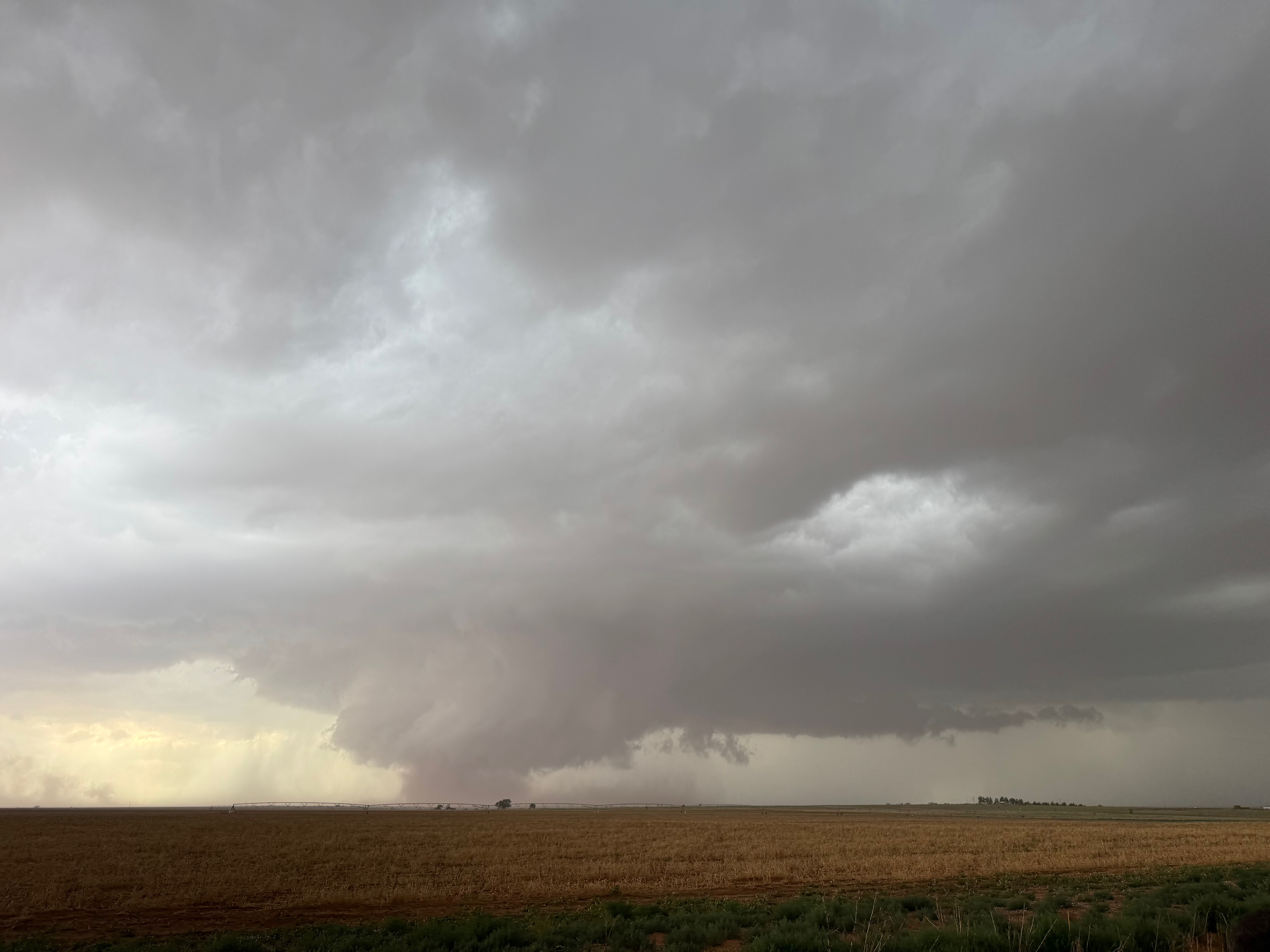
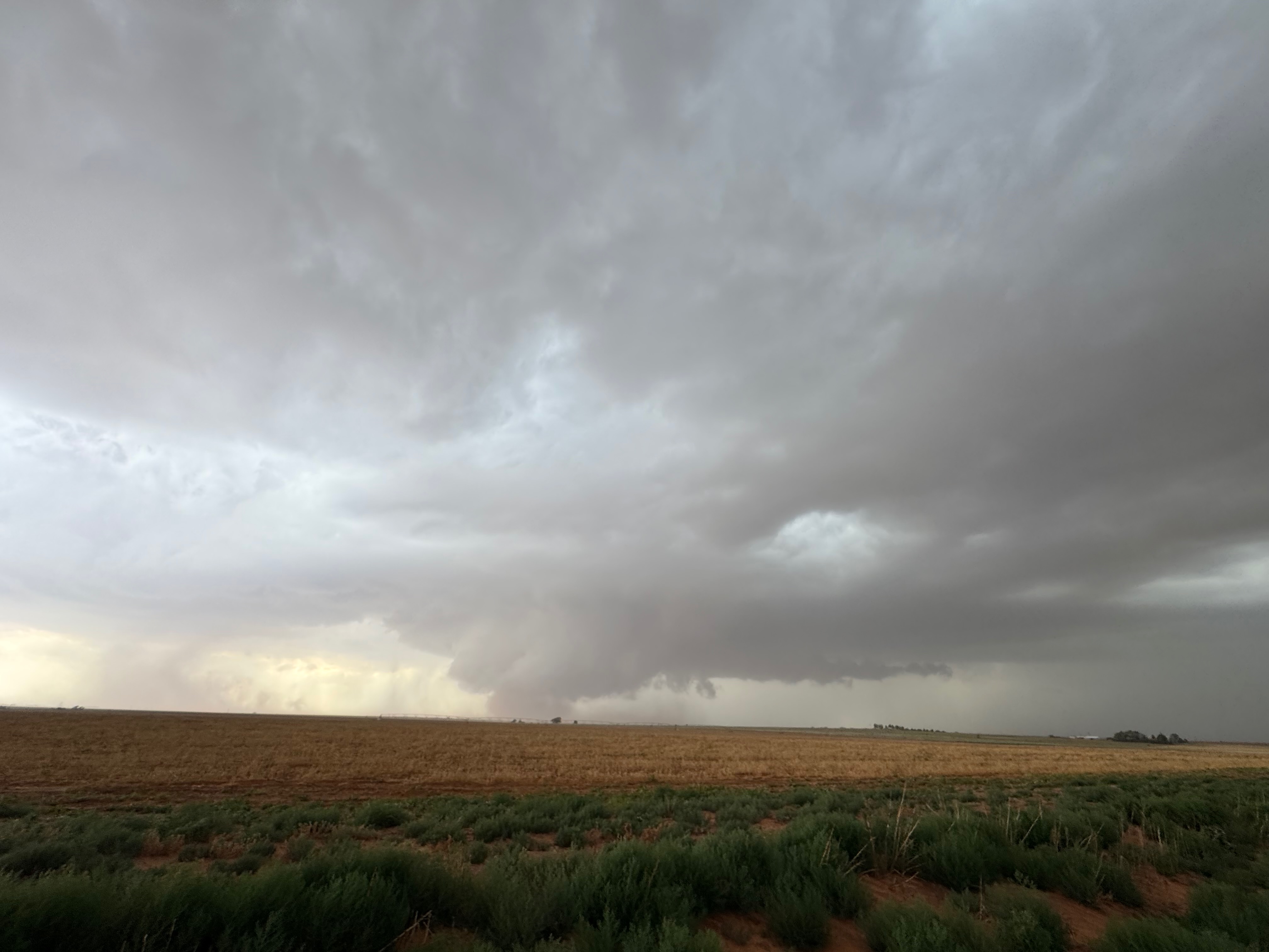
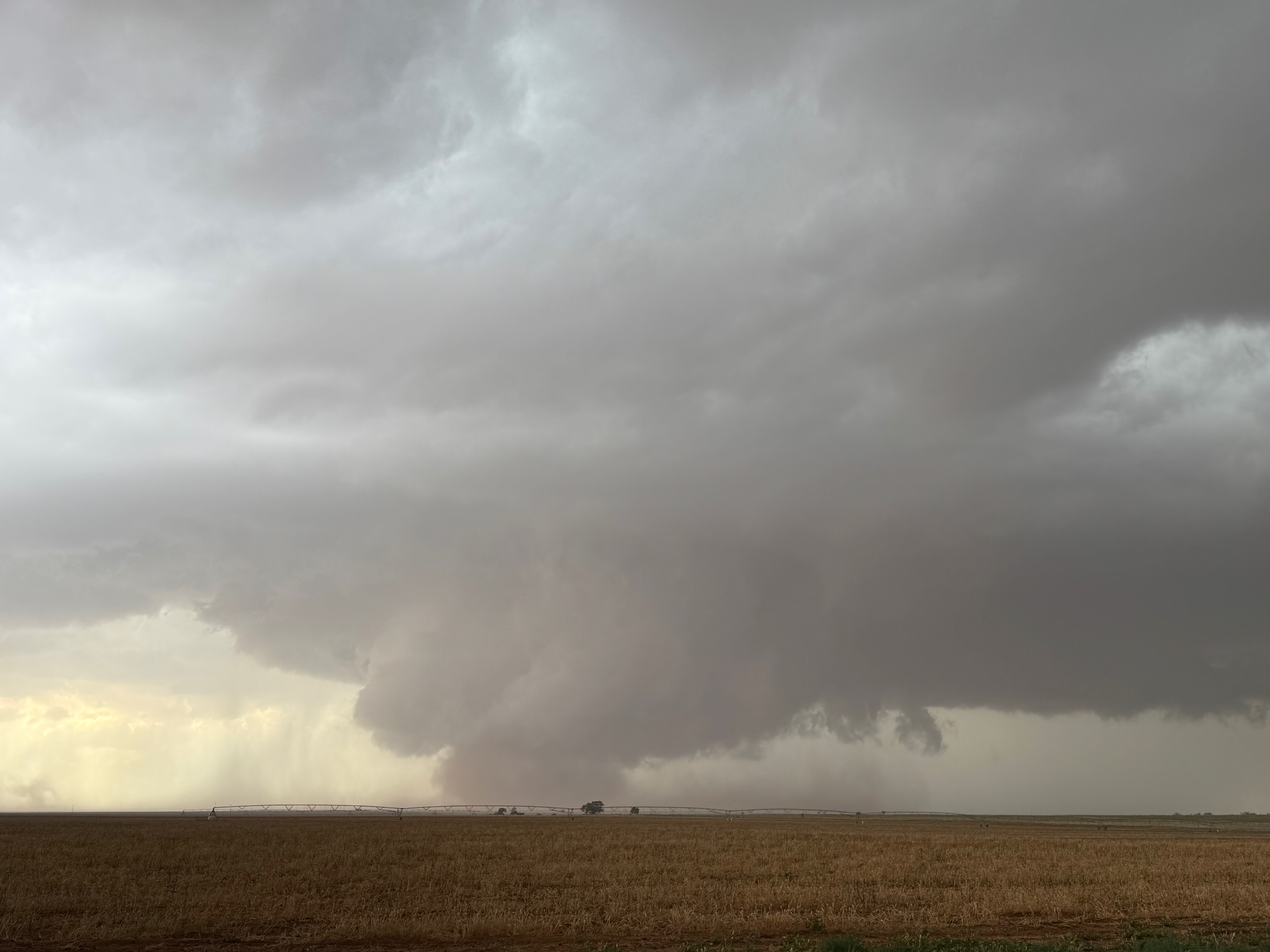
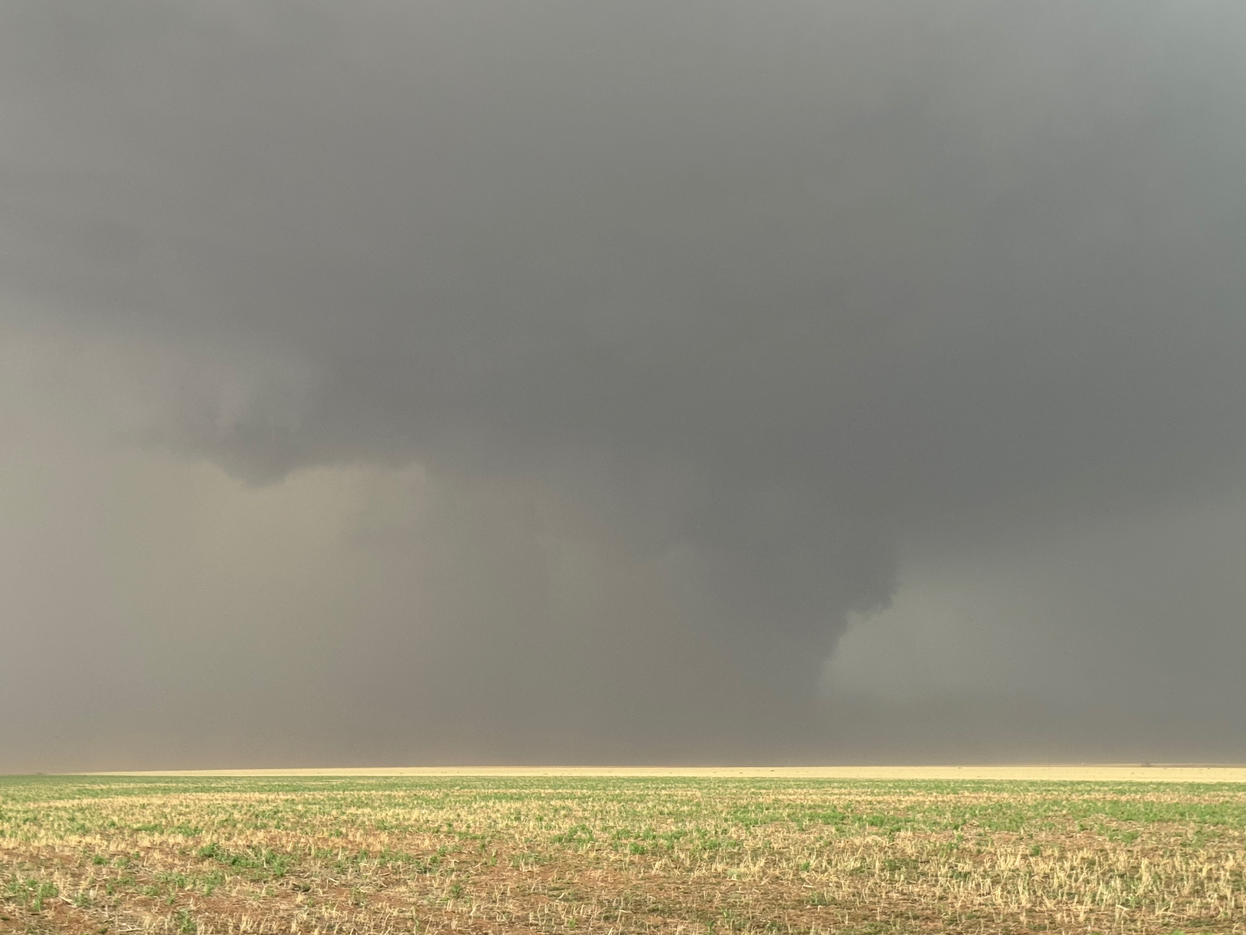
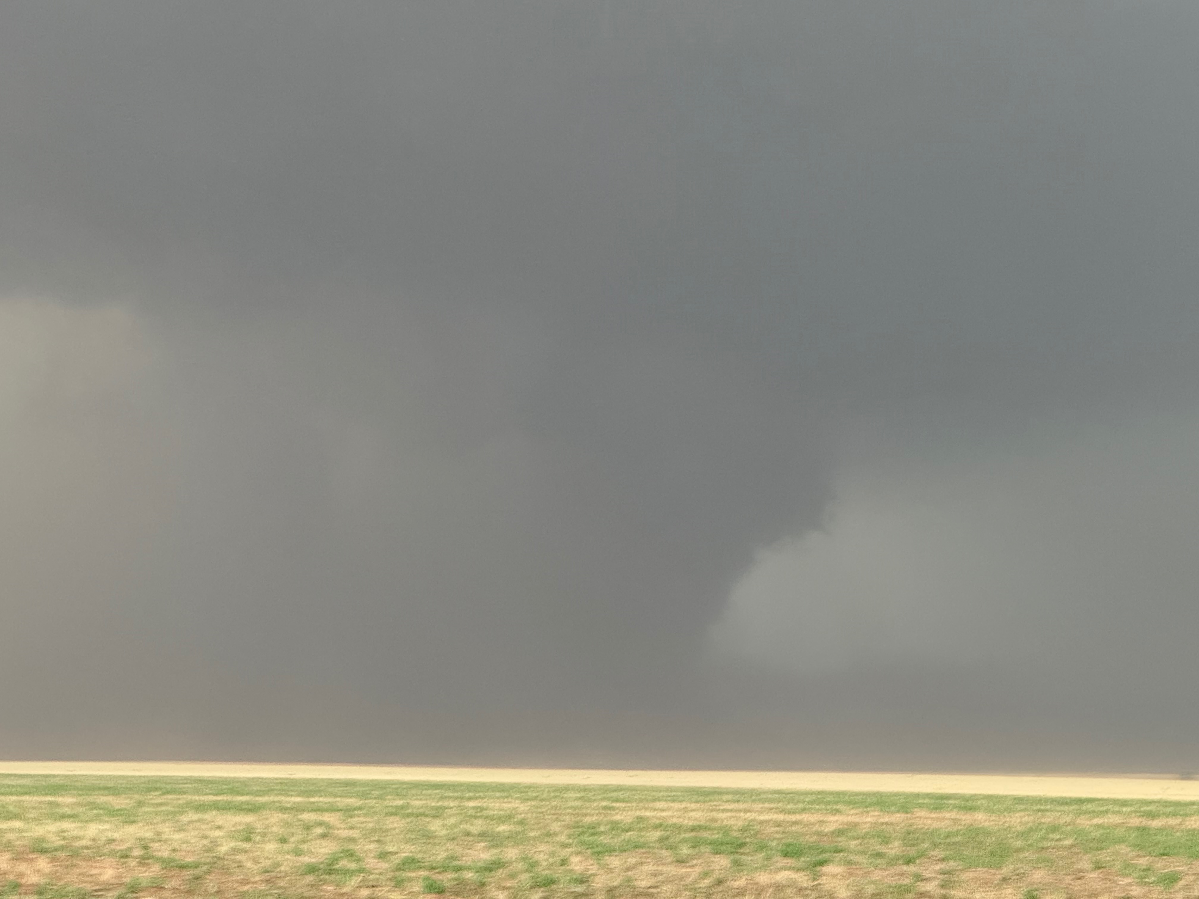
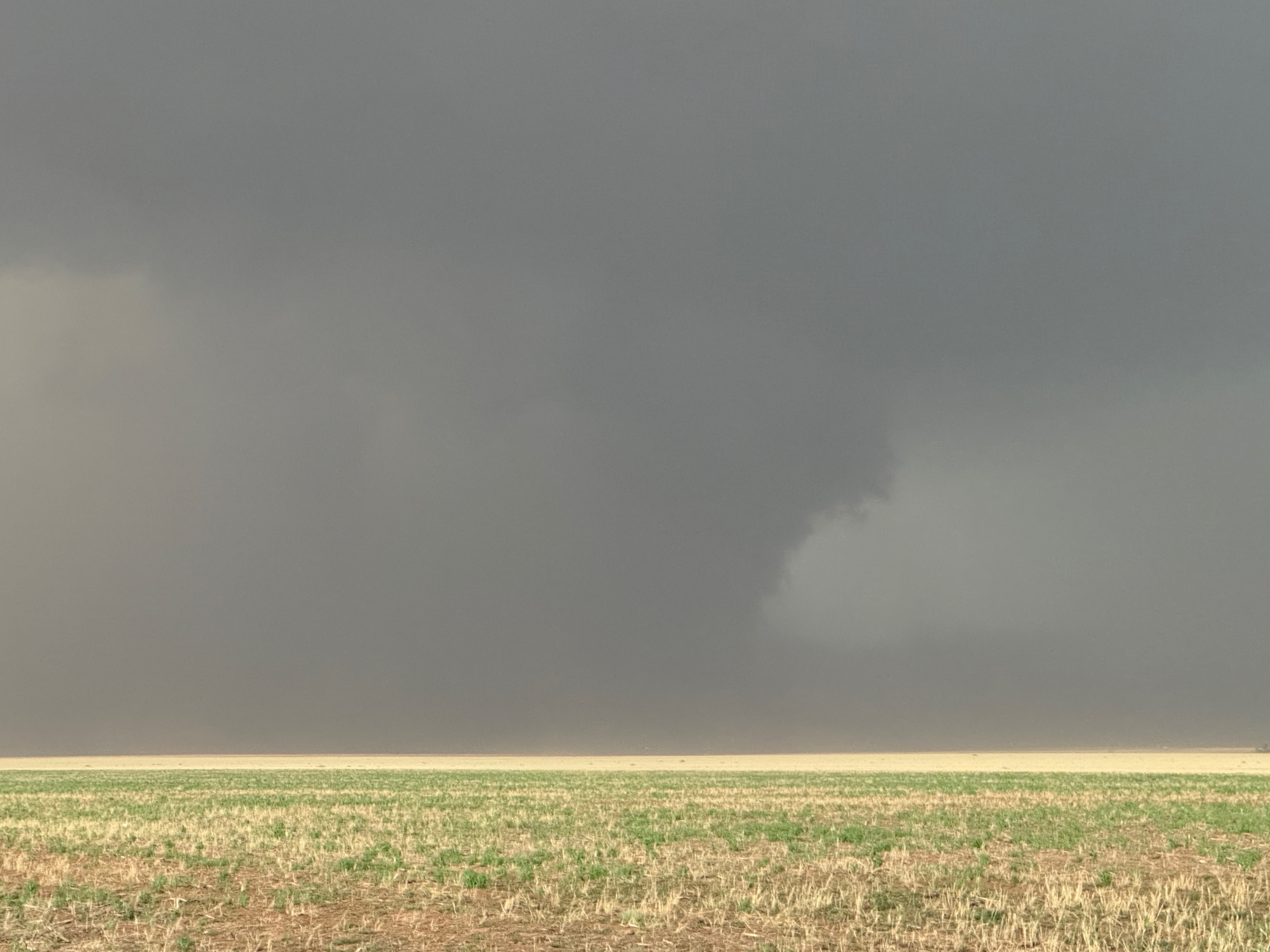
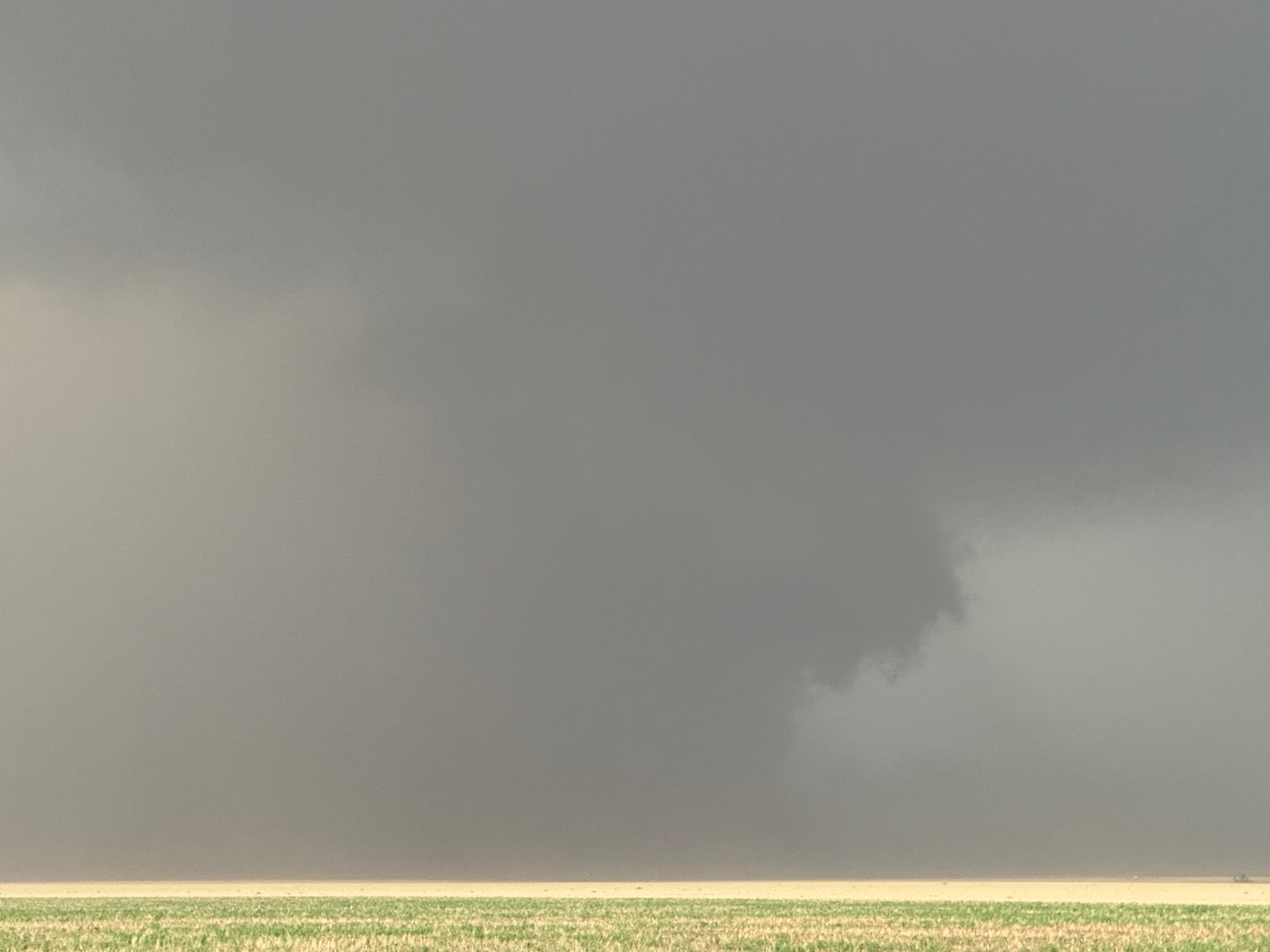
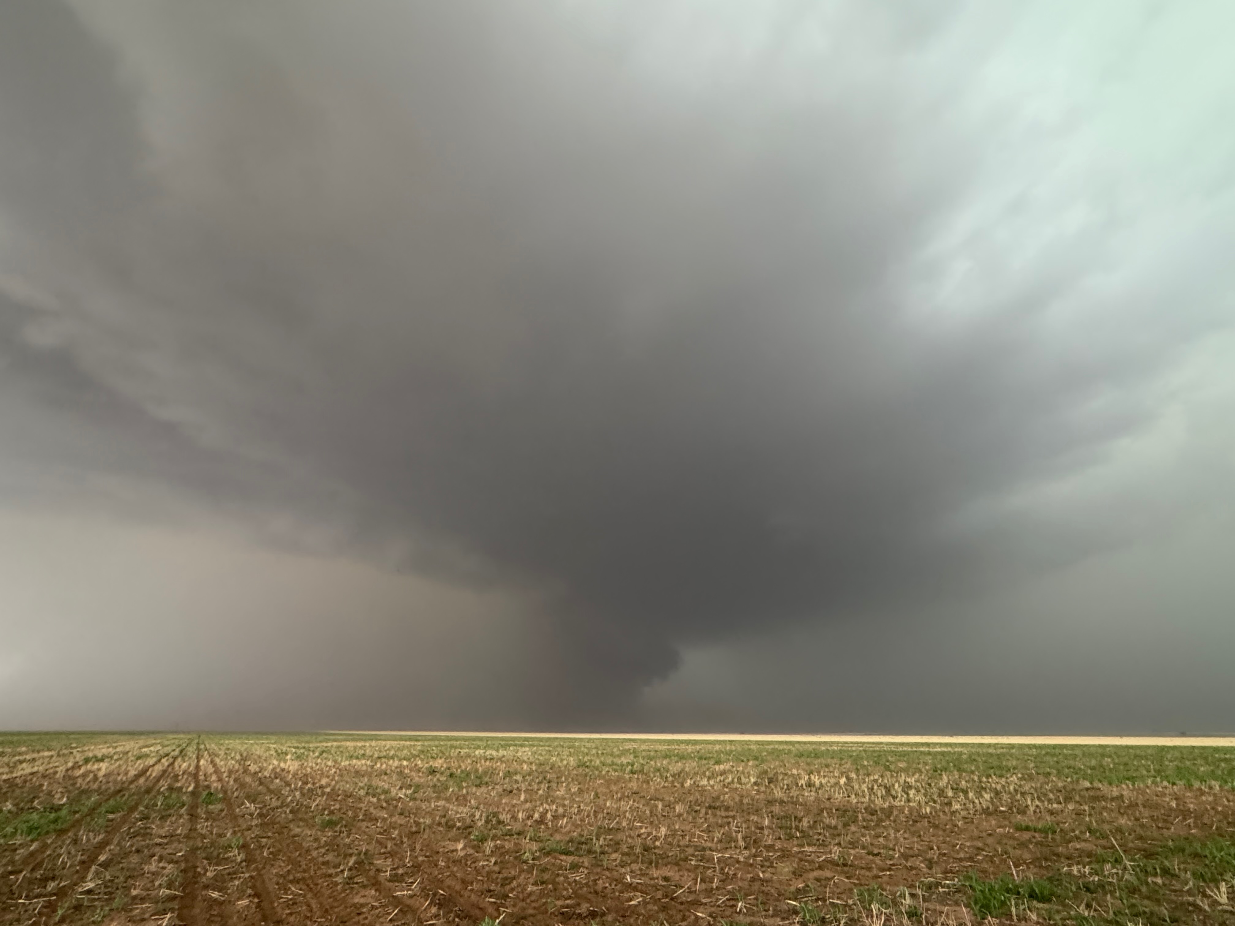
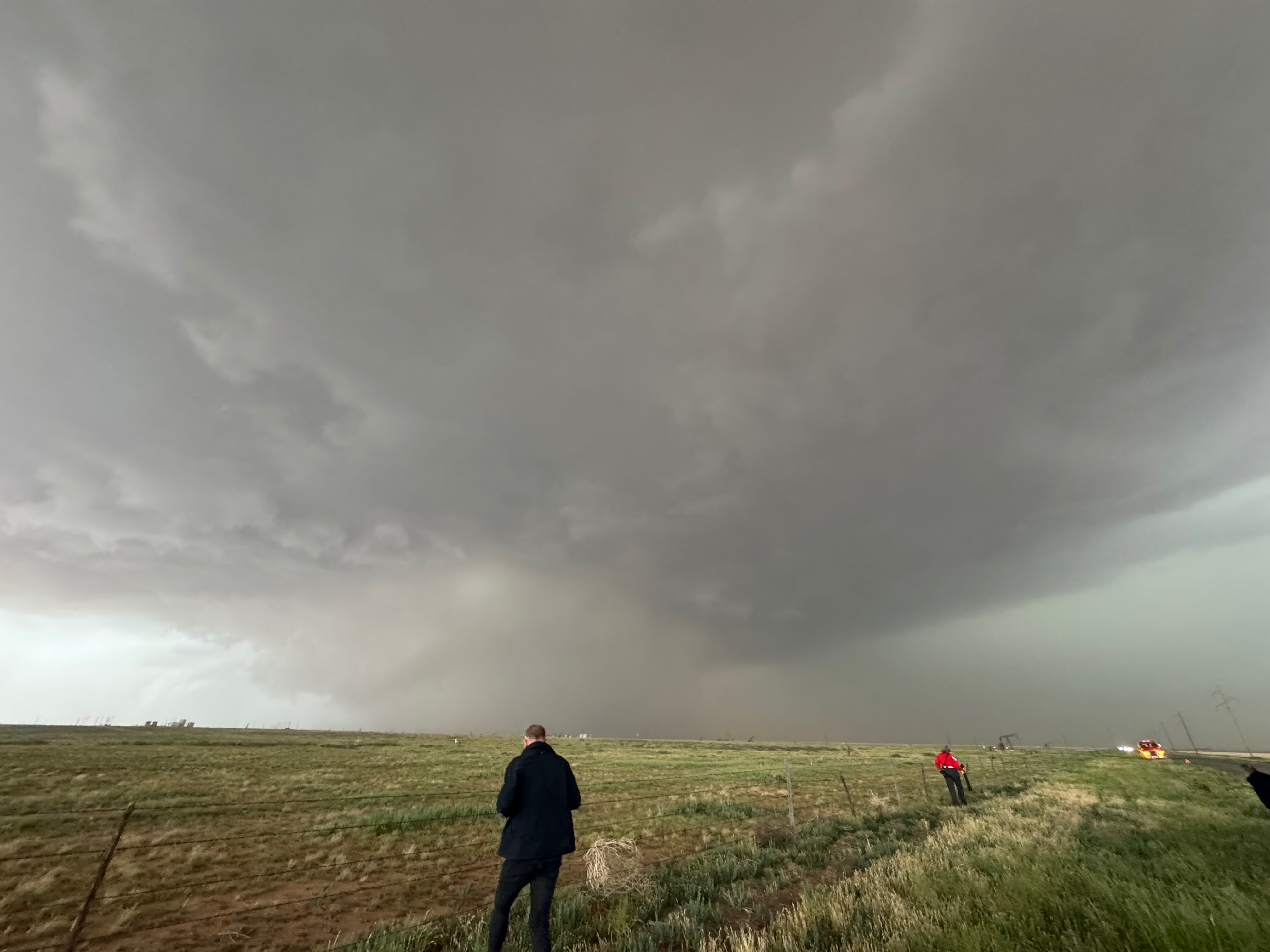
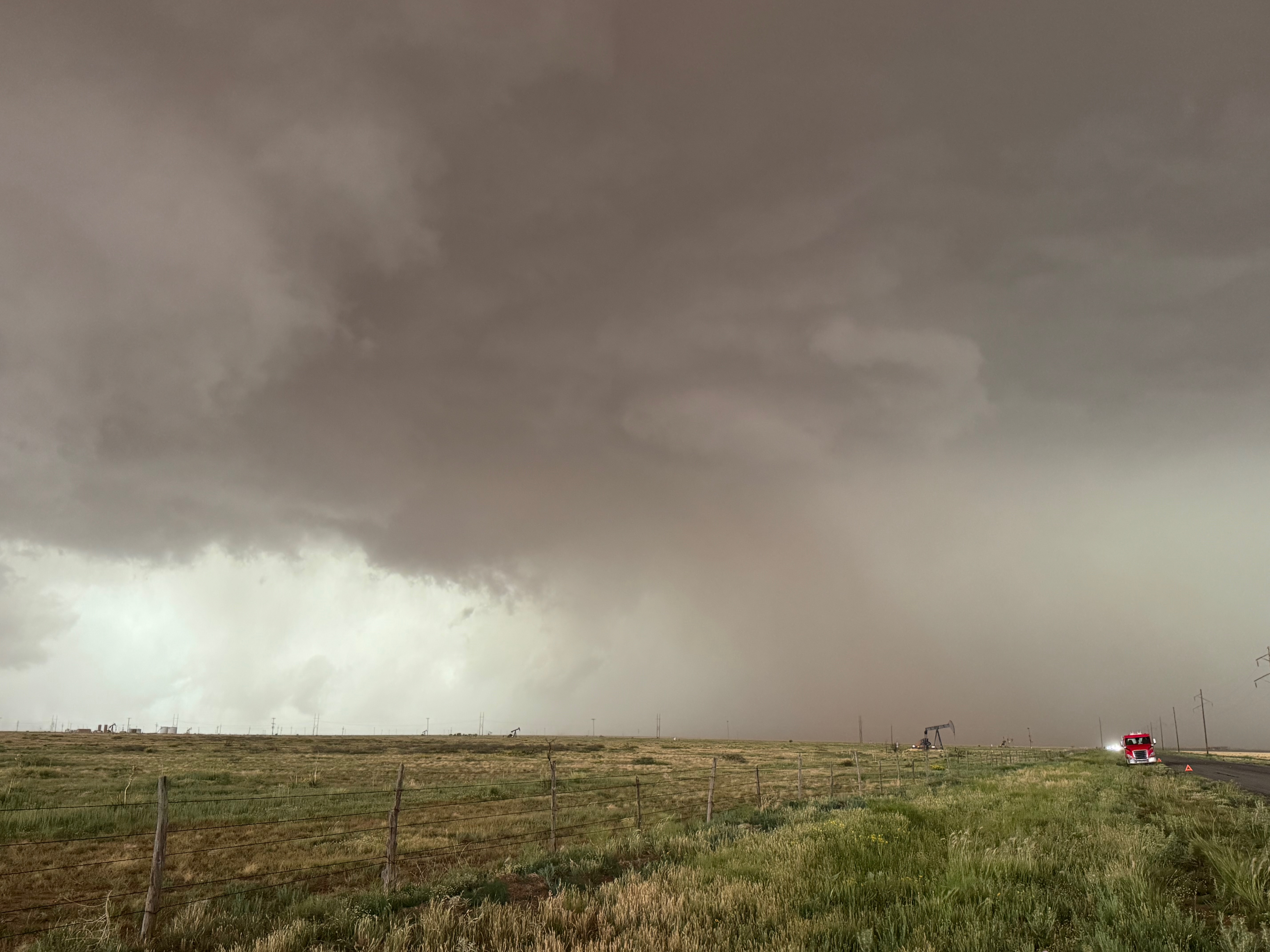
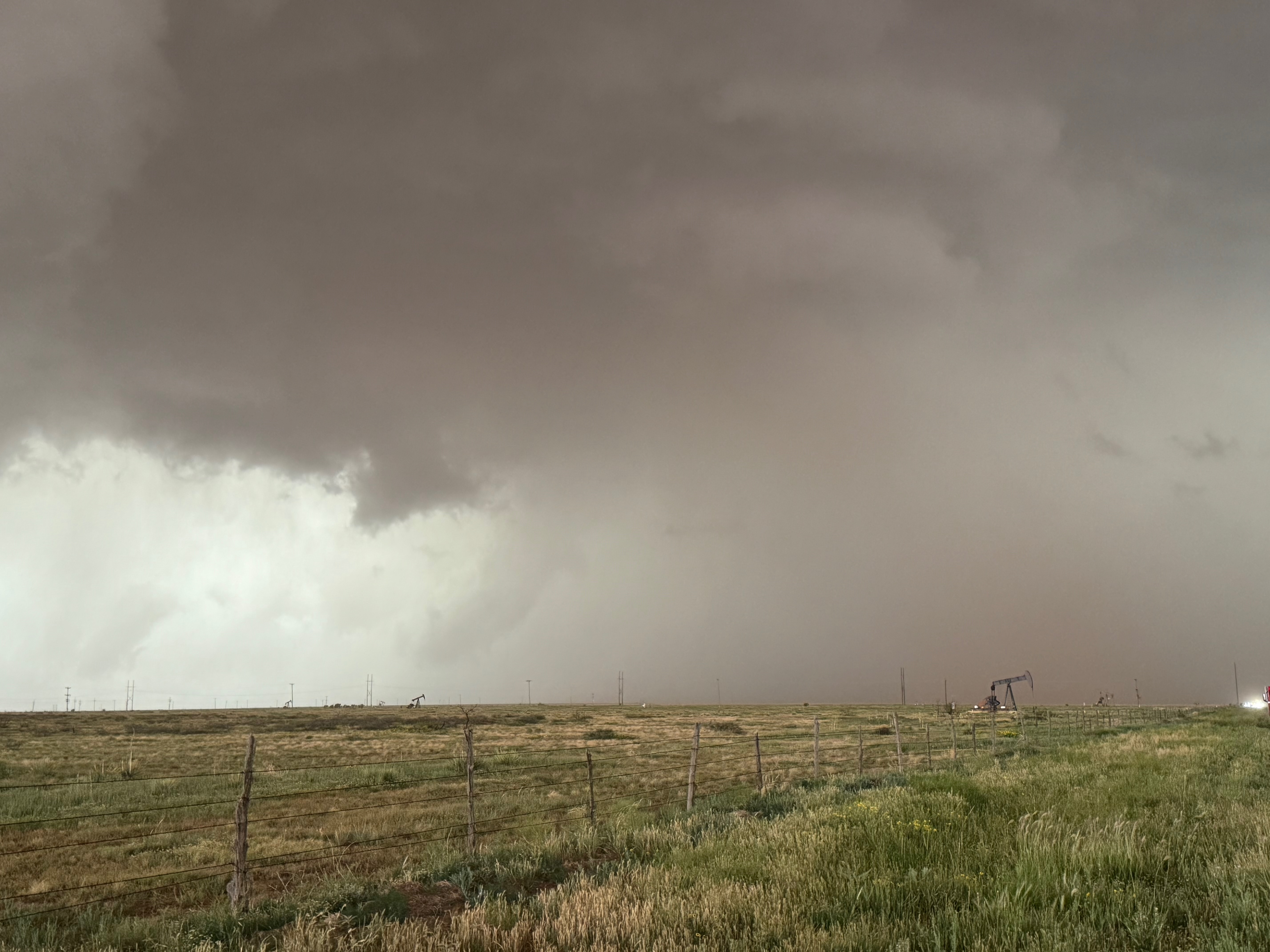
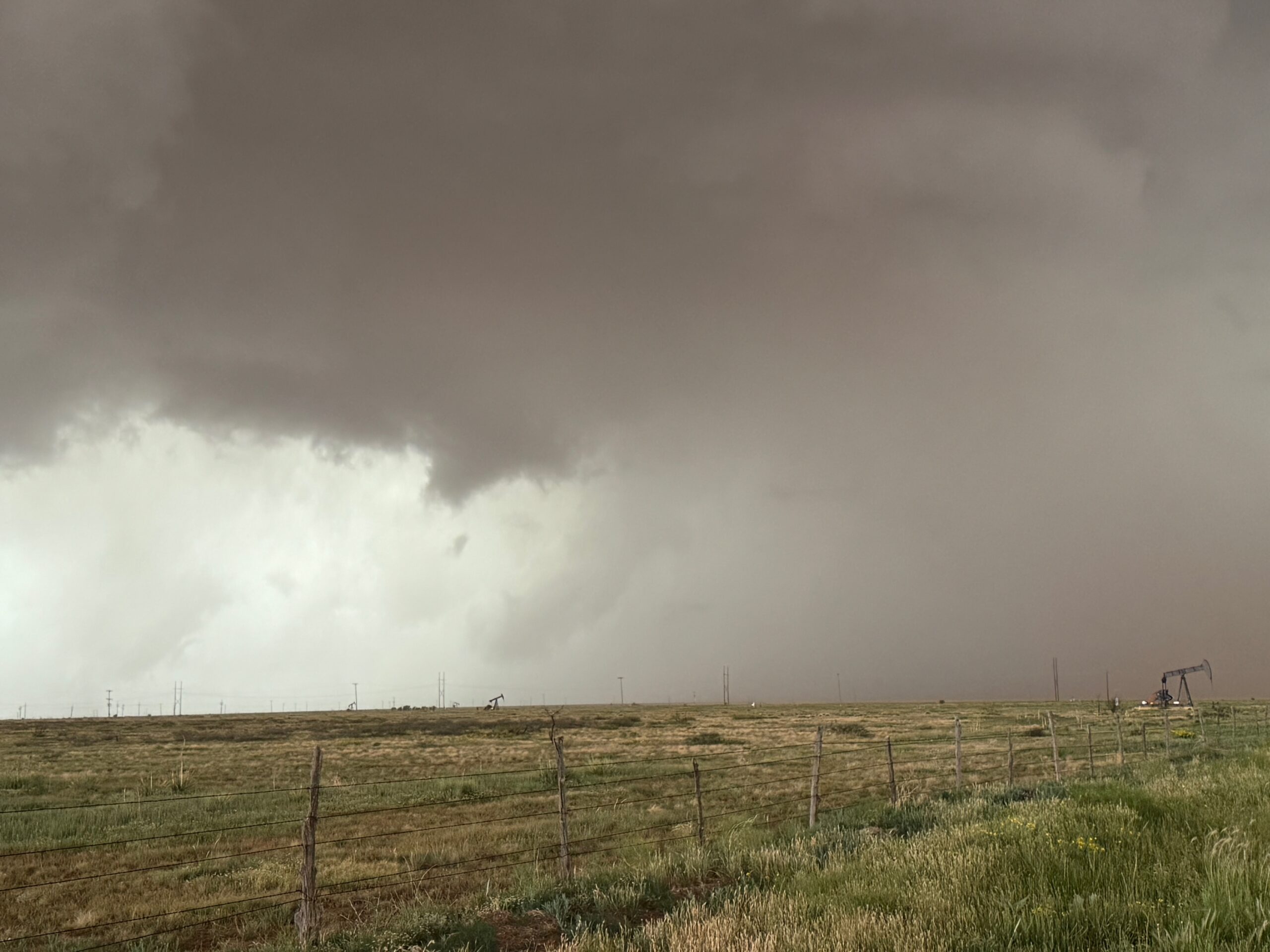
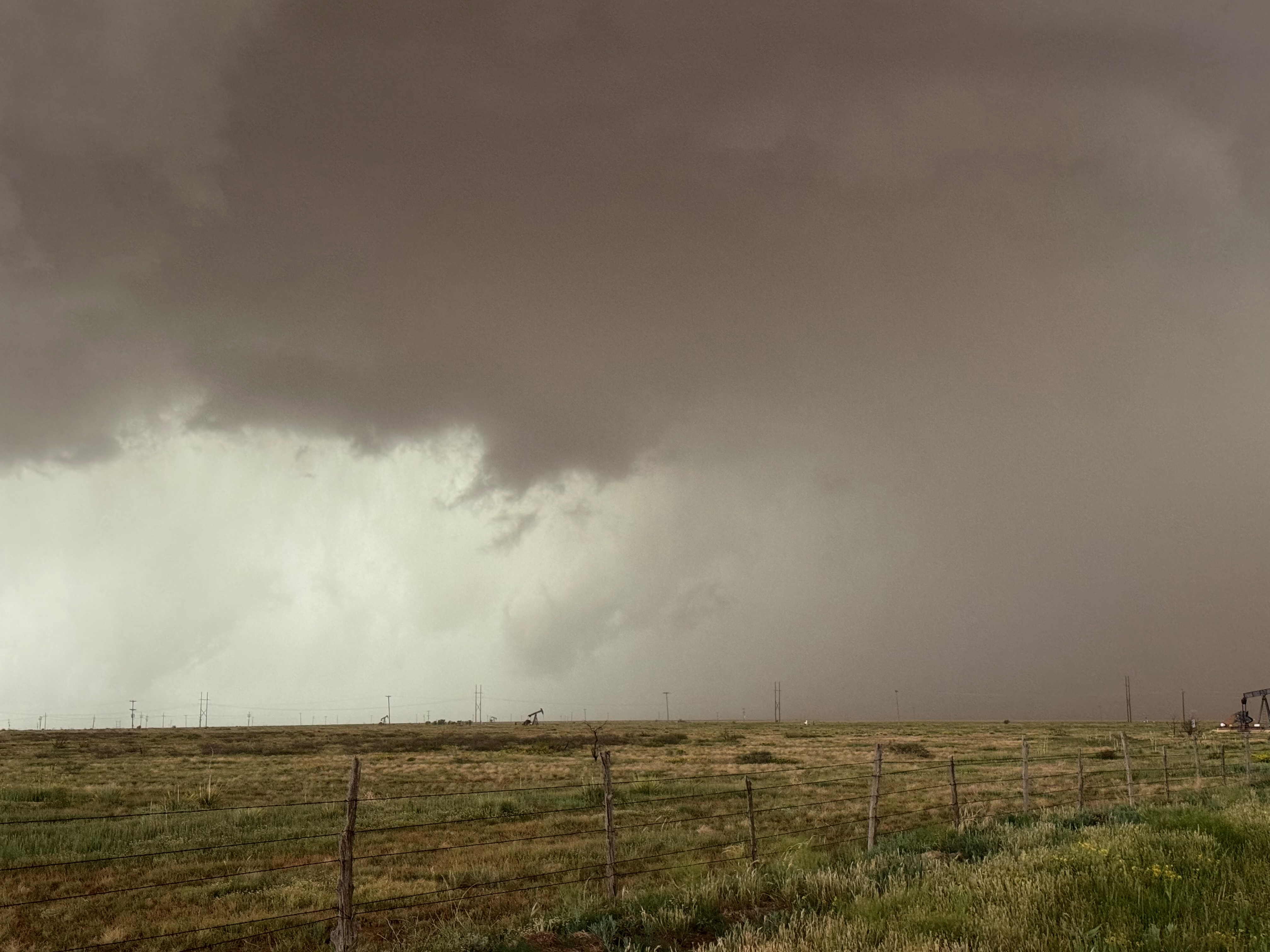
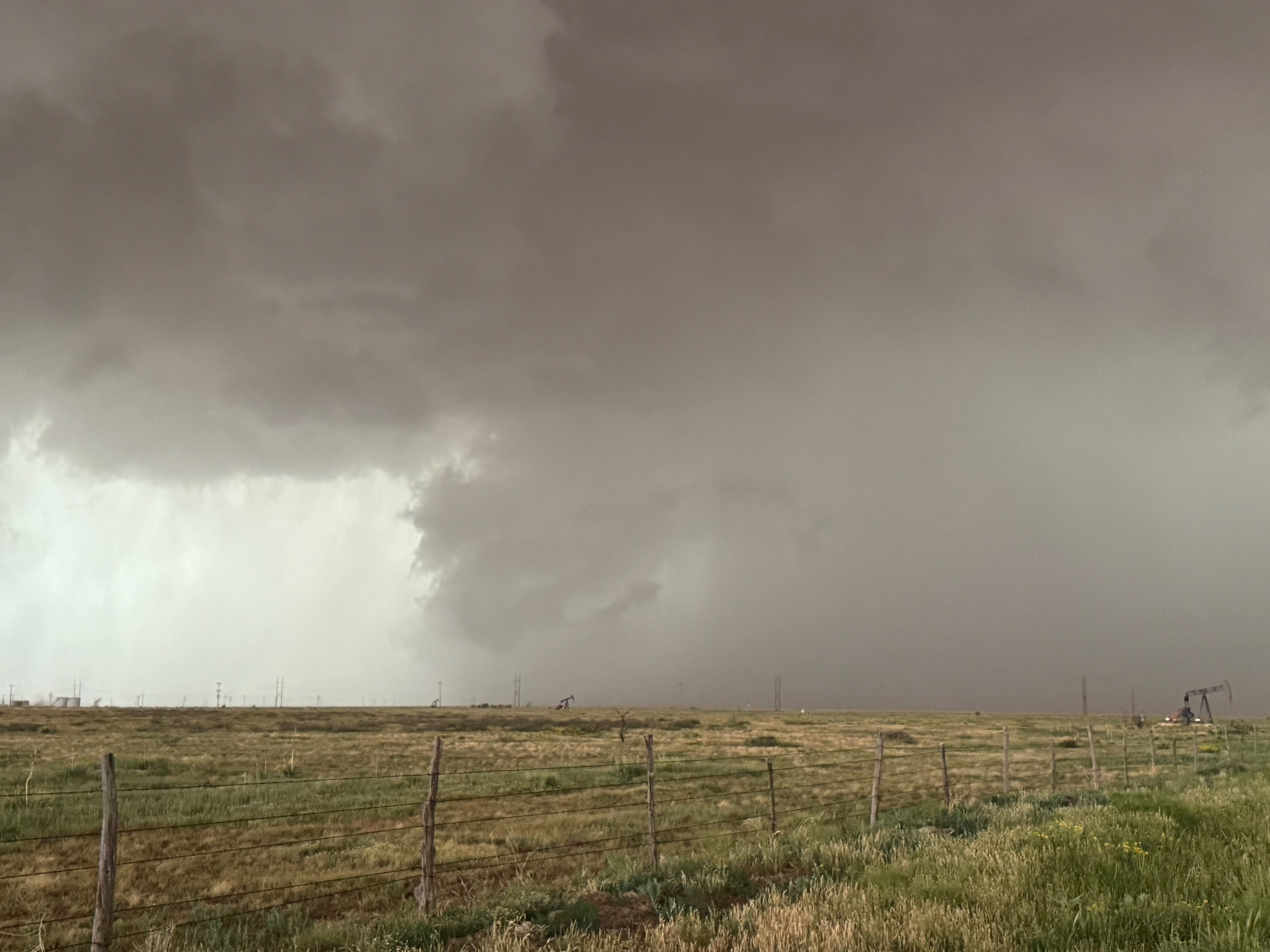
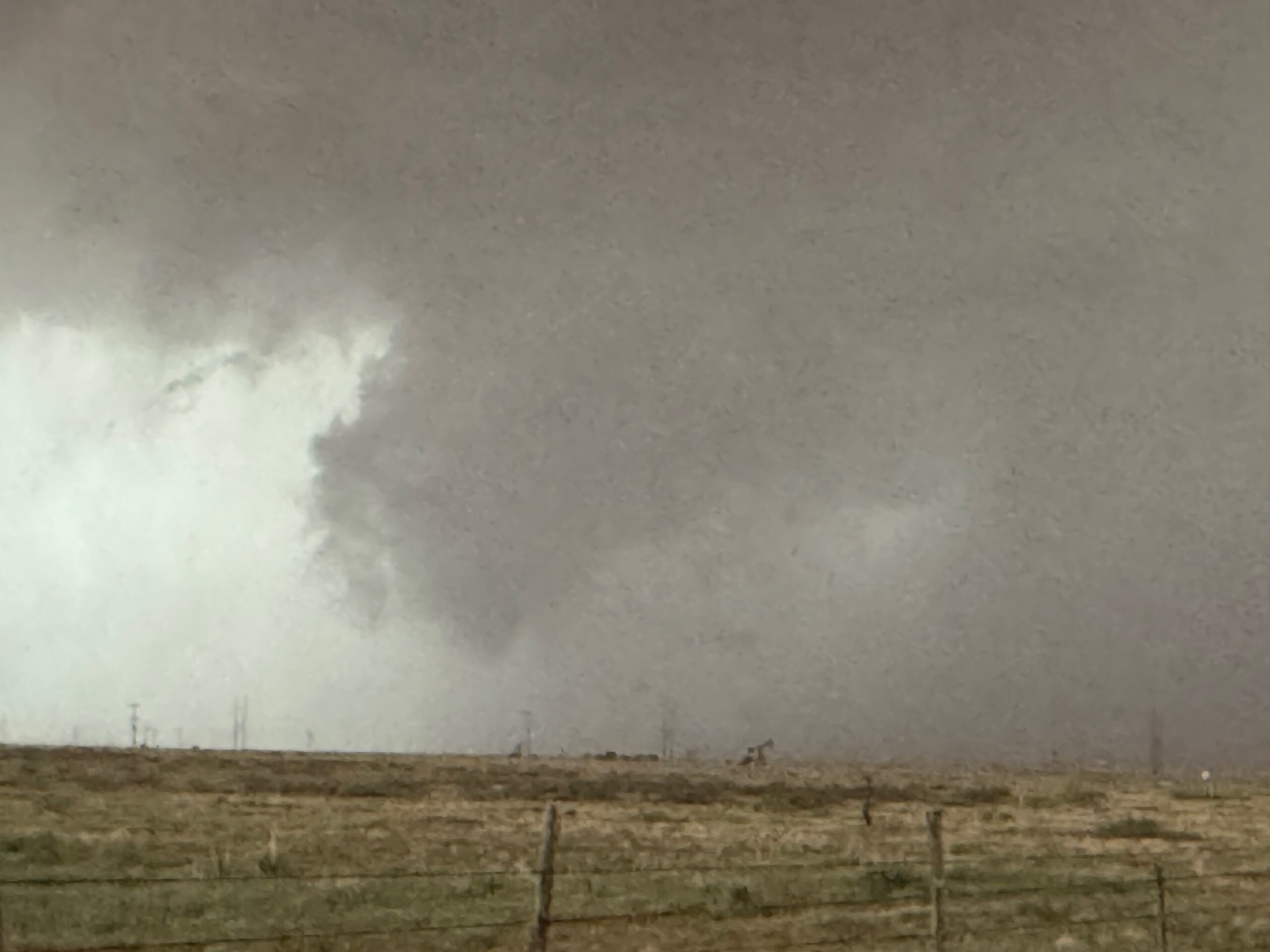
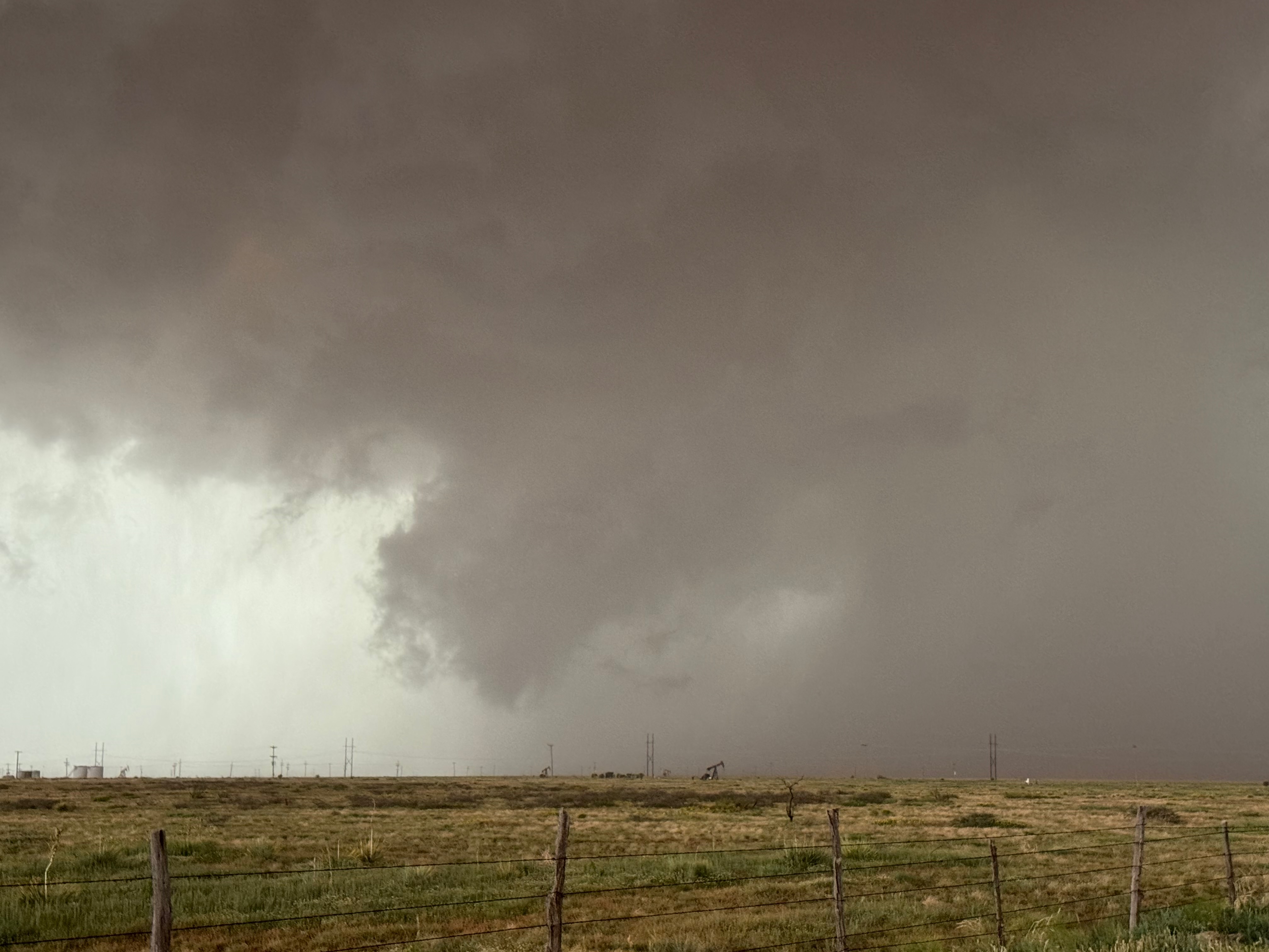
The forward-flank precipitation of this developing supercell was spreading over Causey, NM. We could stop to wait along this N-S segment of 114 just over the border in New Mexico, south of Causey. But I wanted to get closer to the action area to the west, as this new storm was looking quite good already. I had Alex and Matt take us west on a dubious dirt road from Lingo. We stopped after maybe five or six miles, and this spot provided a great look at the front end of the updraft and the storm base. There was a low-level inflow feature feeding in on the east side (first pic below), and the base was LOW LOW LOW! A wall cloud with that “pregnant lowering” look was practically scraping the ground (pics 4 to 9 below). I told the group that it would be impossible for this storm to NOT produce a tornado.
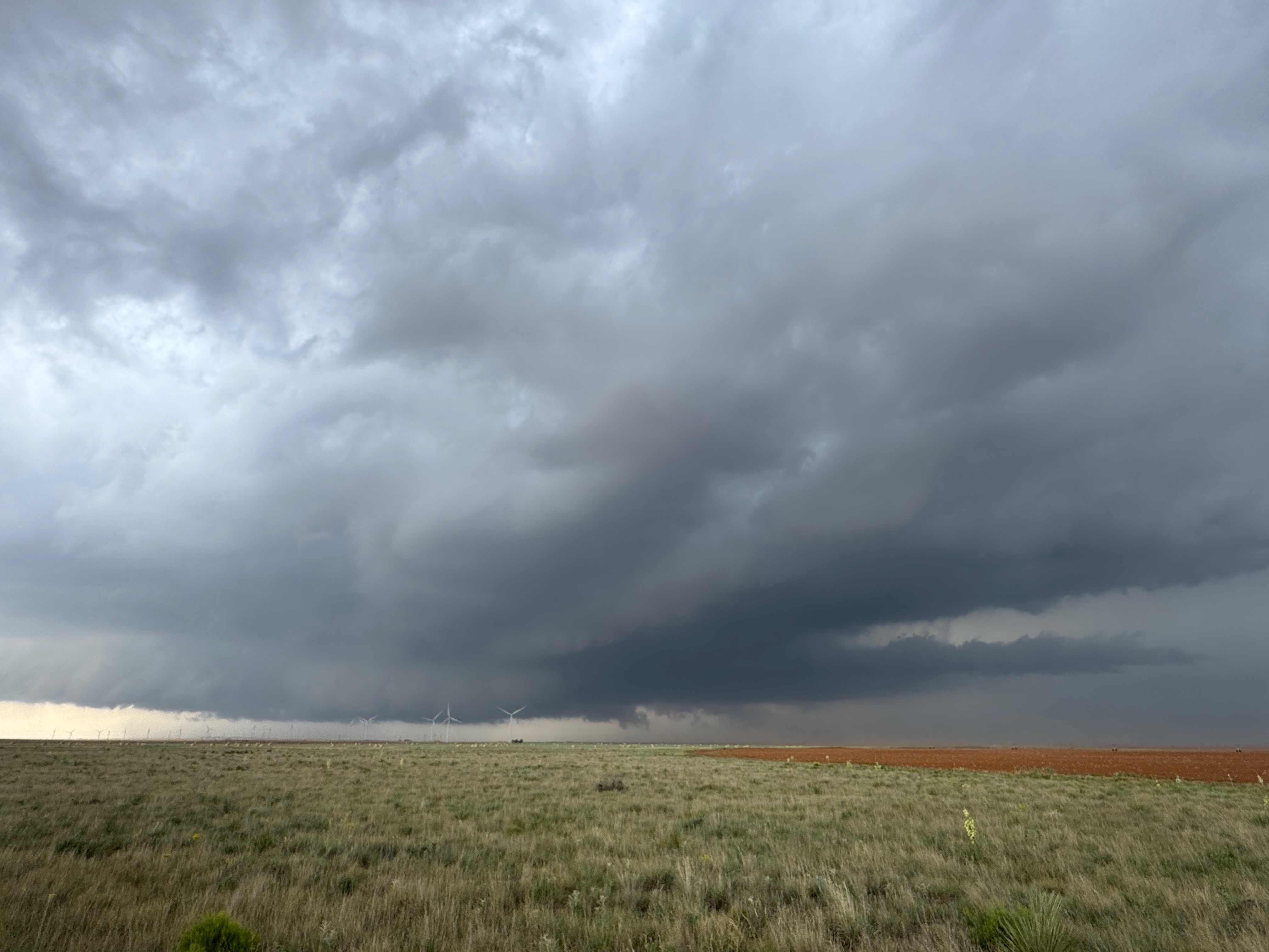
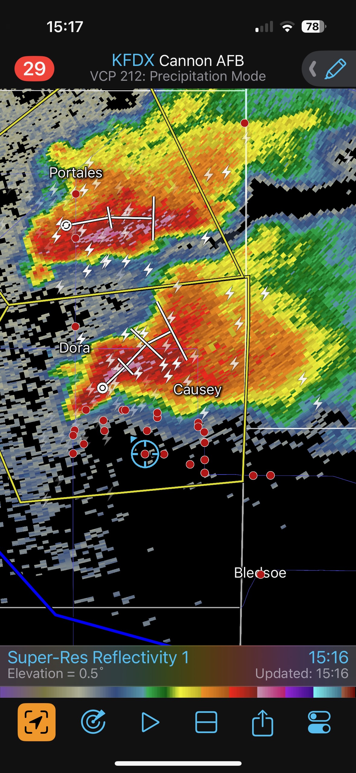
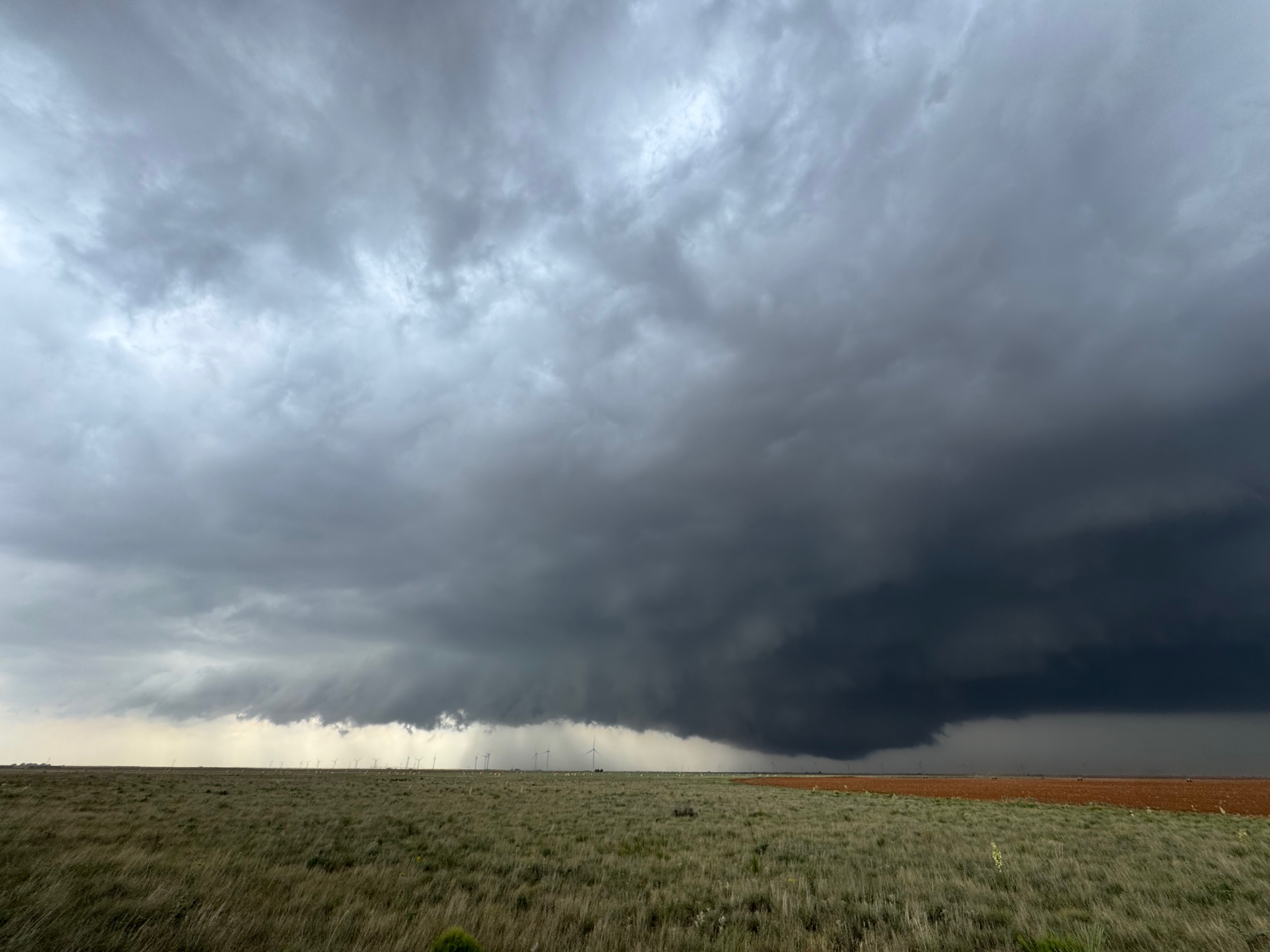
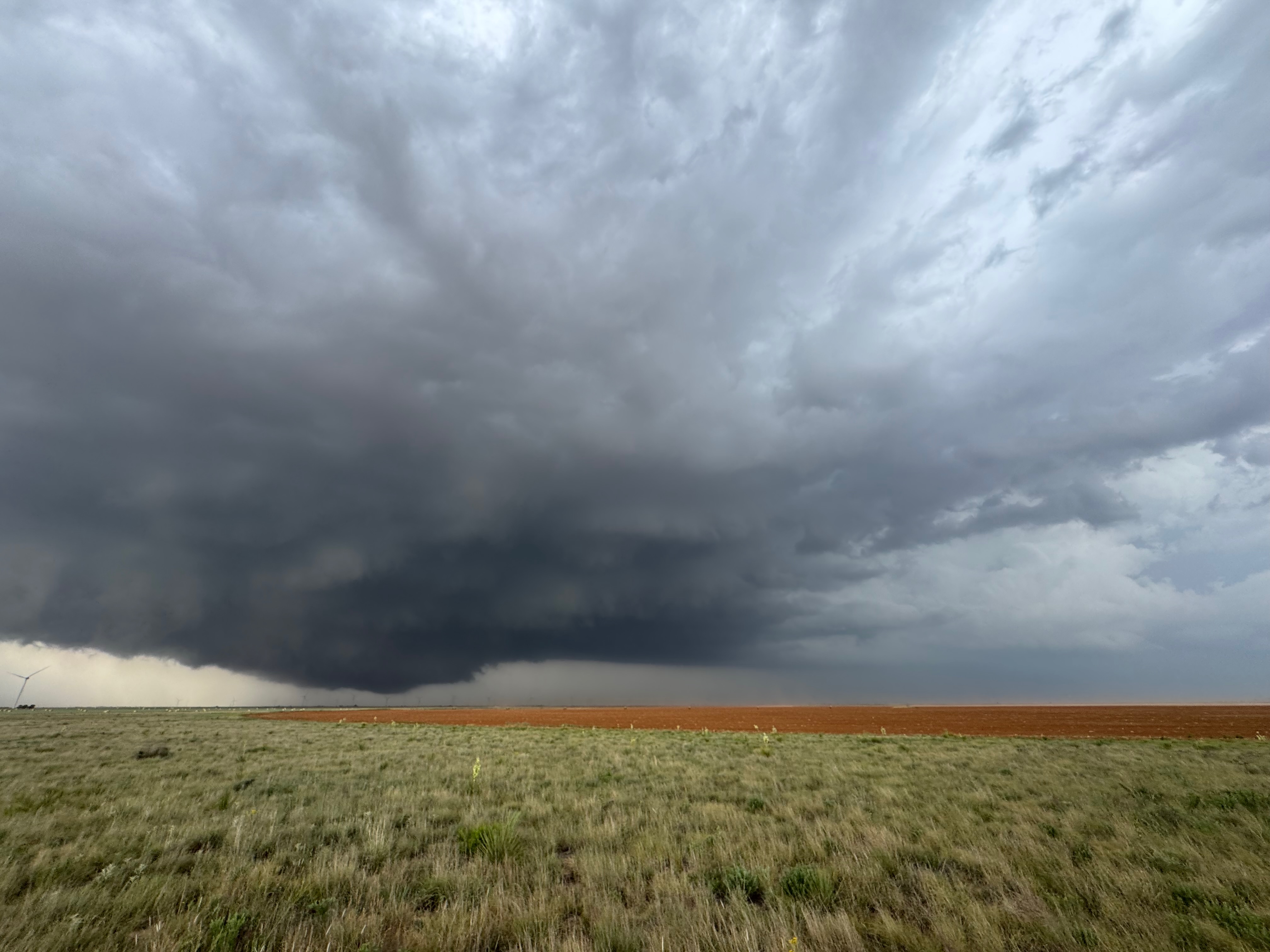
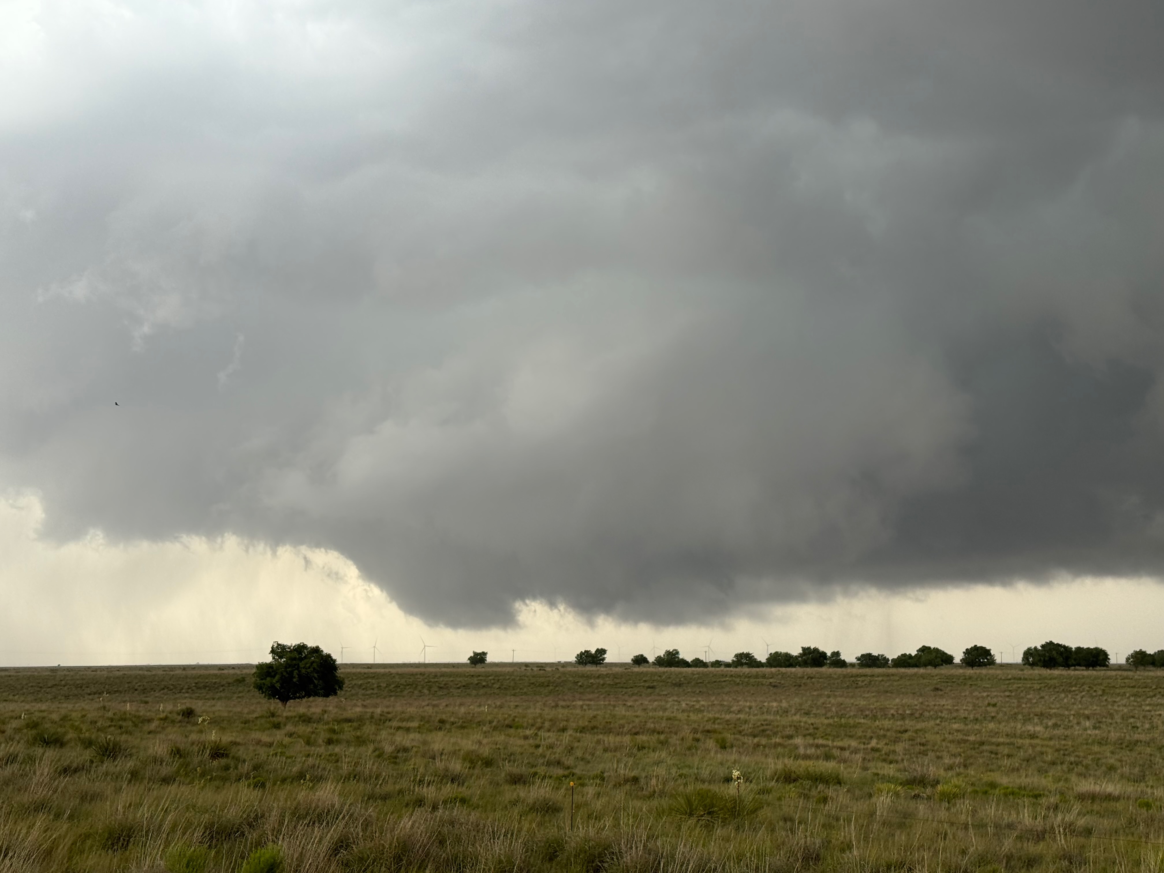
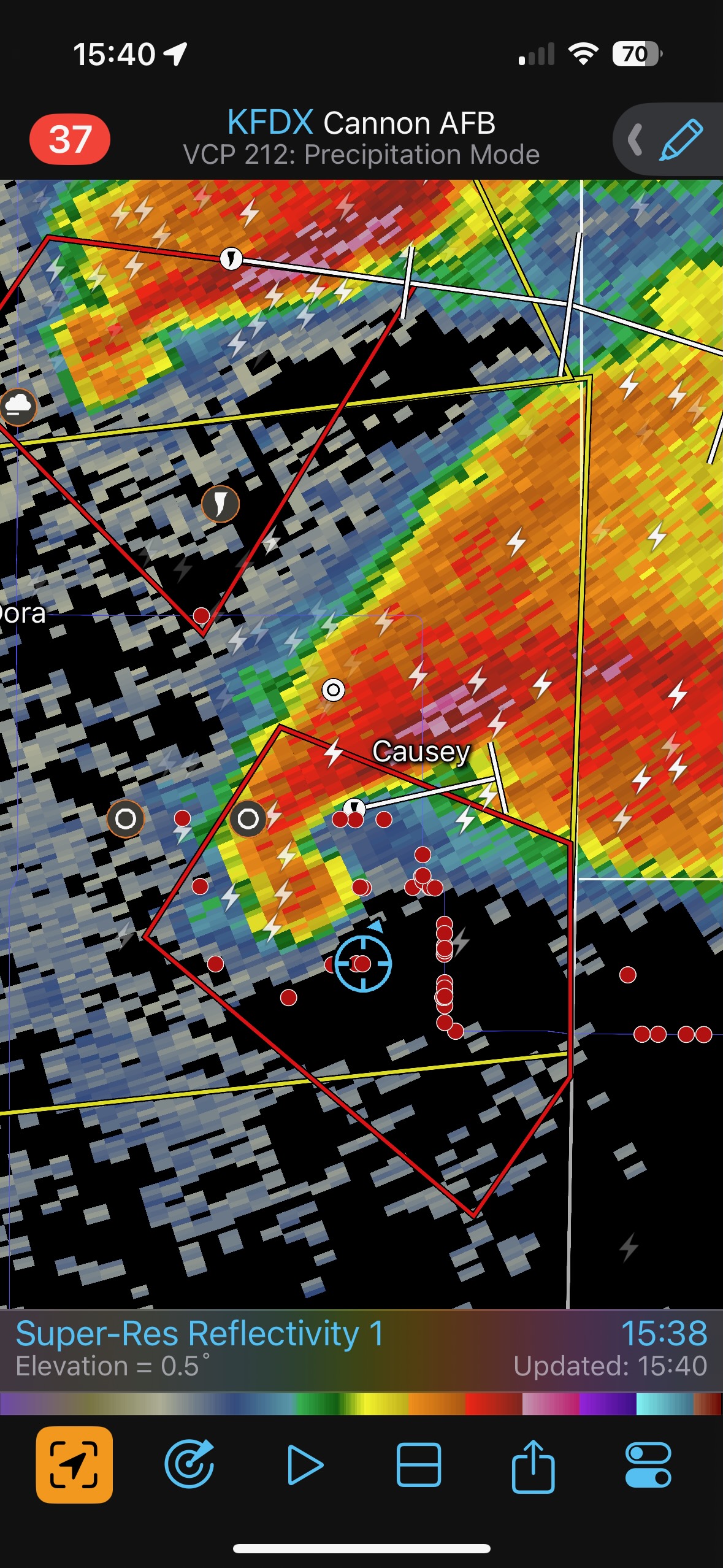
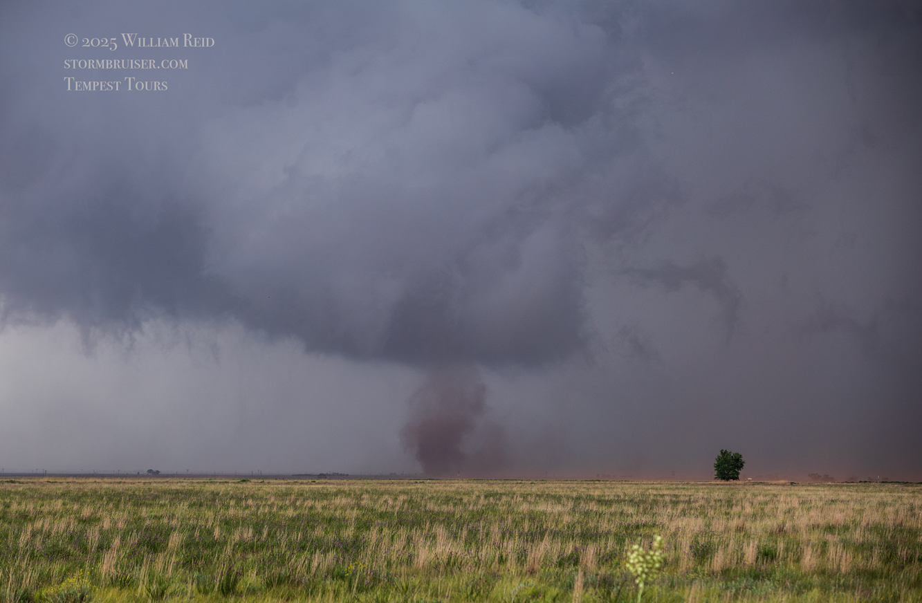
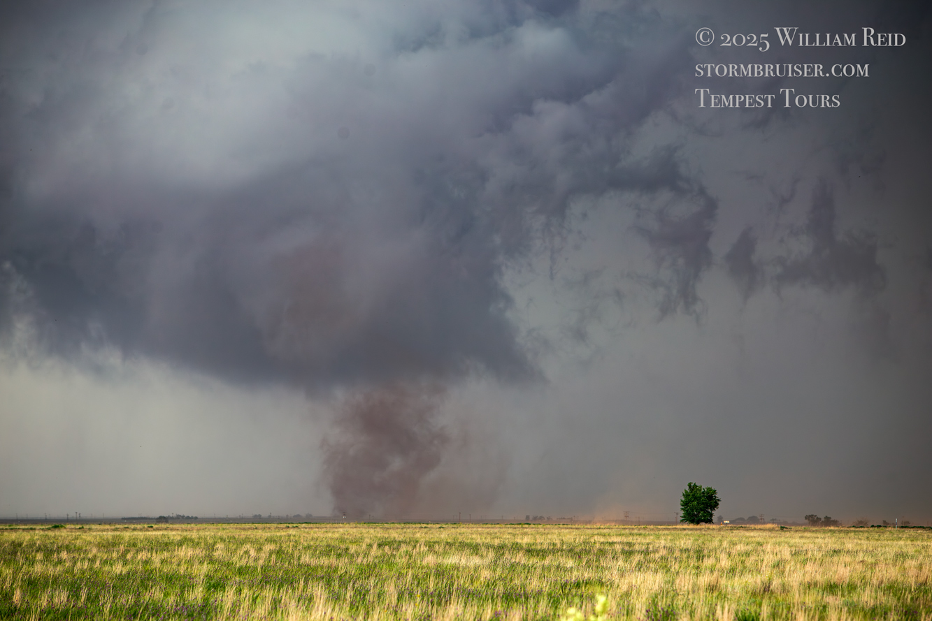
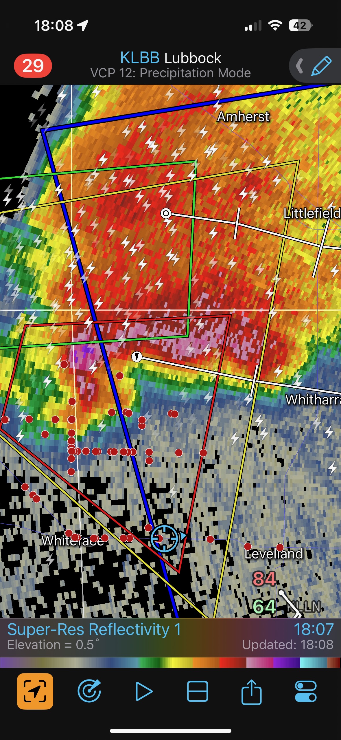
The very low wall cloud was to our northwest and was moving to the east. There was some rotation with it, but it wasn’t particularly strong rotation yet. The radar started to show a prominent hook echo with the supercell about this time (see 3:38 MDT/4:38 CDT radar image above). We started to get hit with some strong west winds, and plenty of dust was sweeping eastward along this dirt road. This was RFD wind, and I decided it was time to reposition to the east a couple of miles. A tornado began to our NNW and we stopped to take a look!
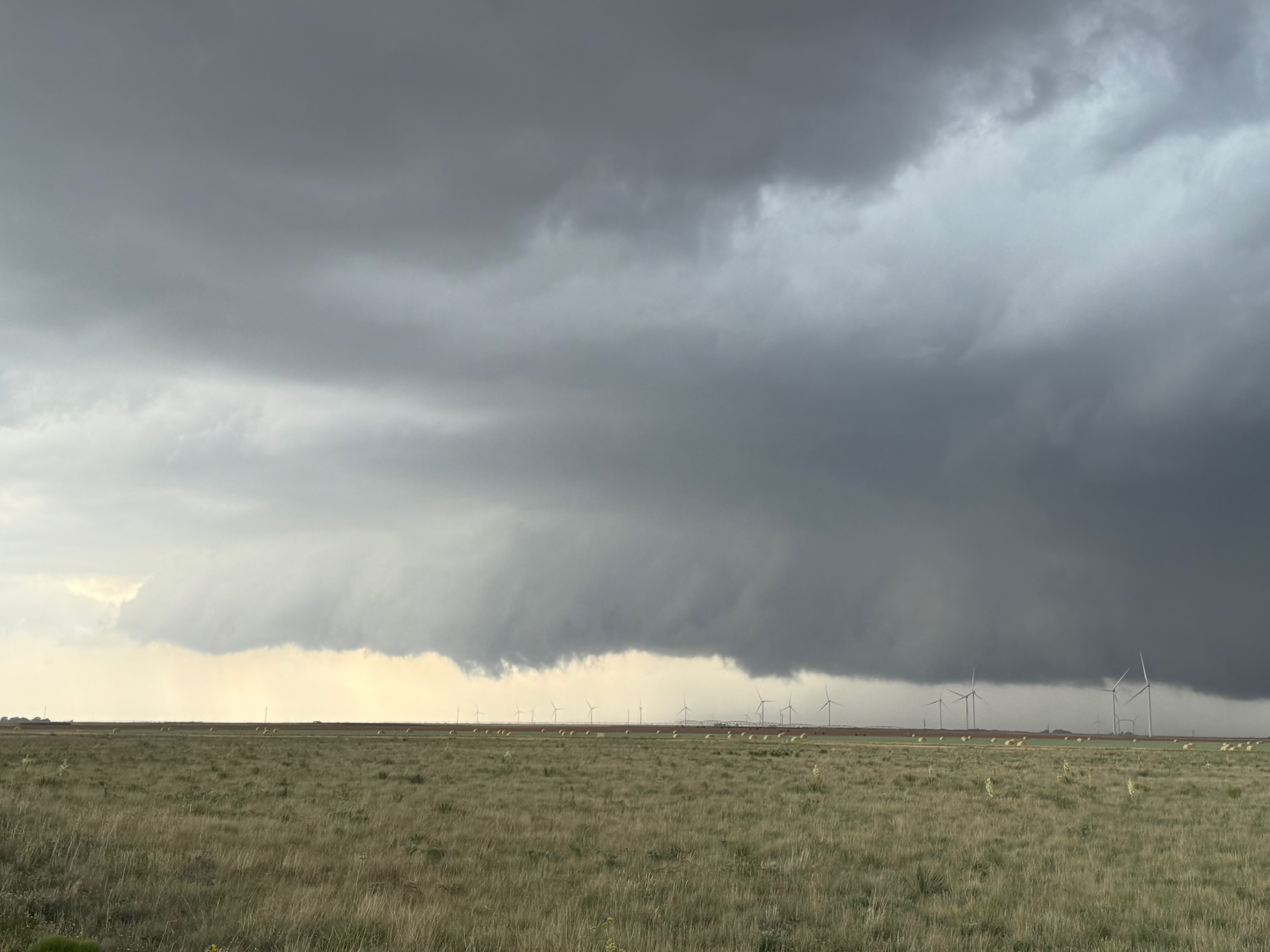
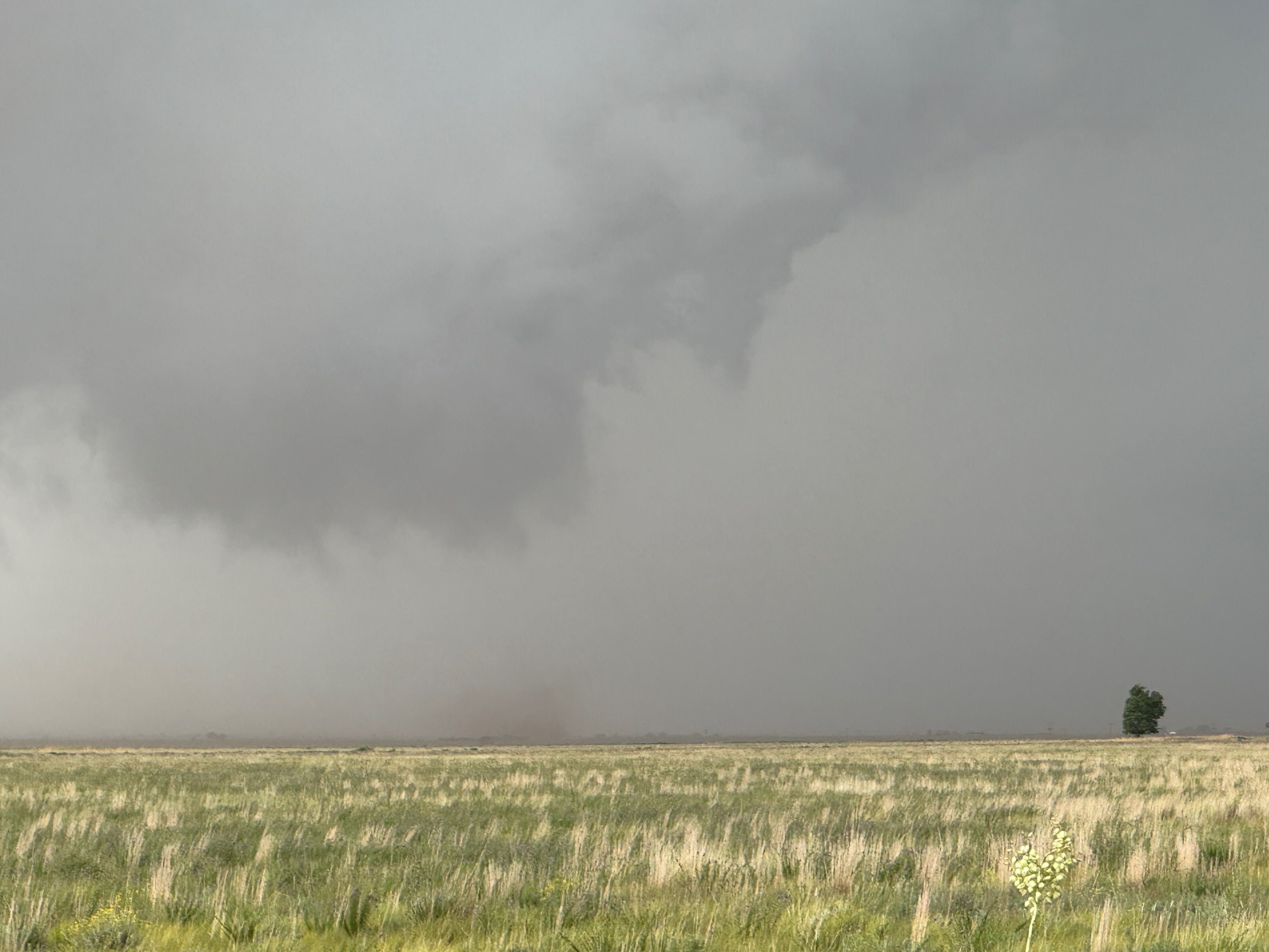
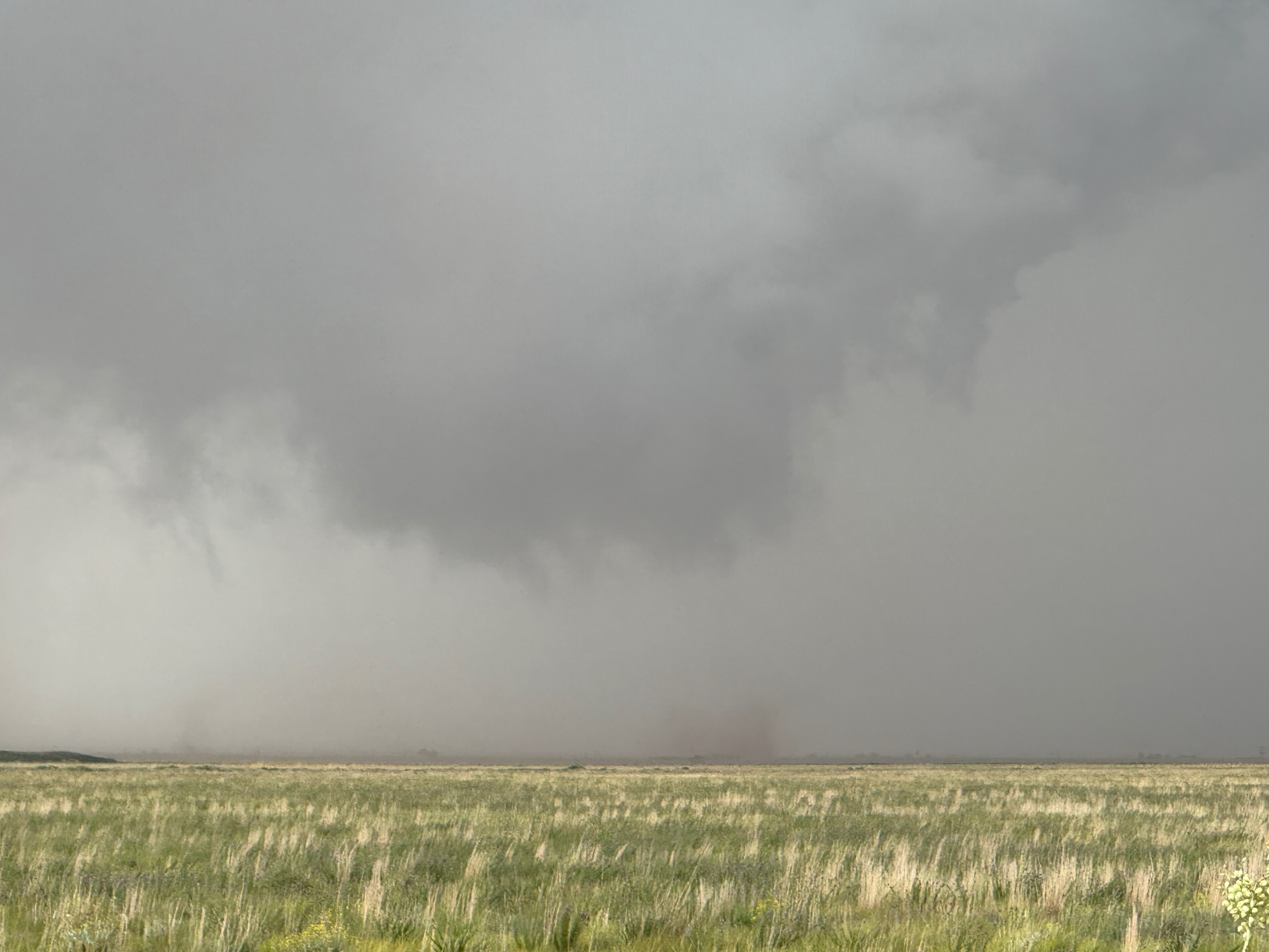
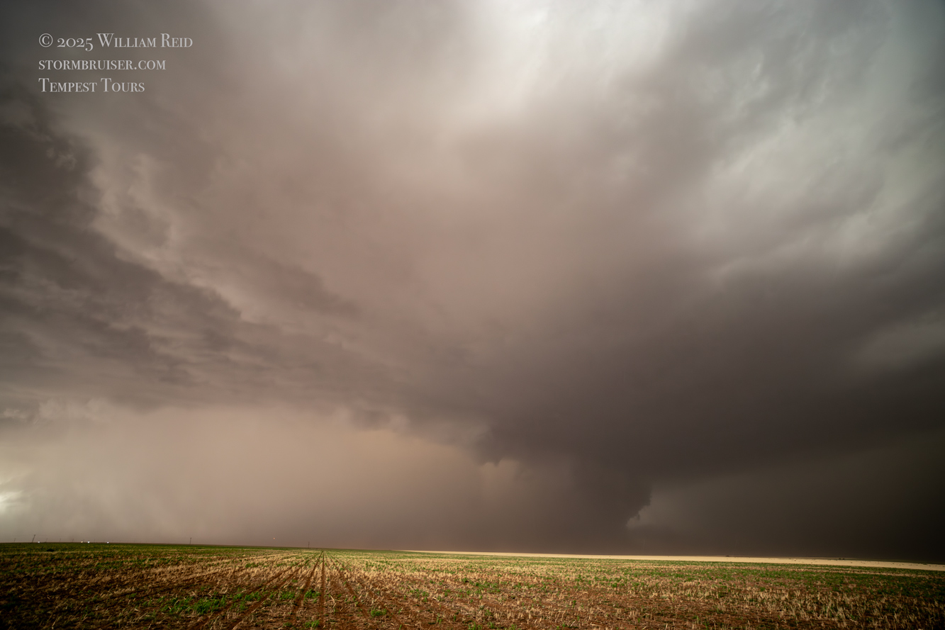
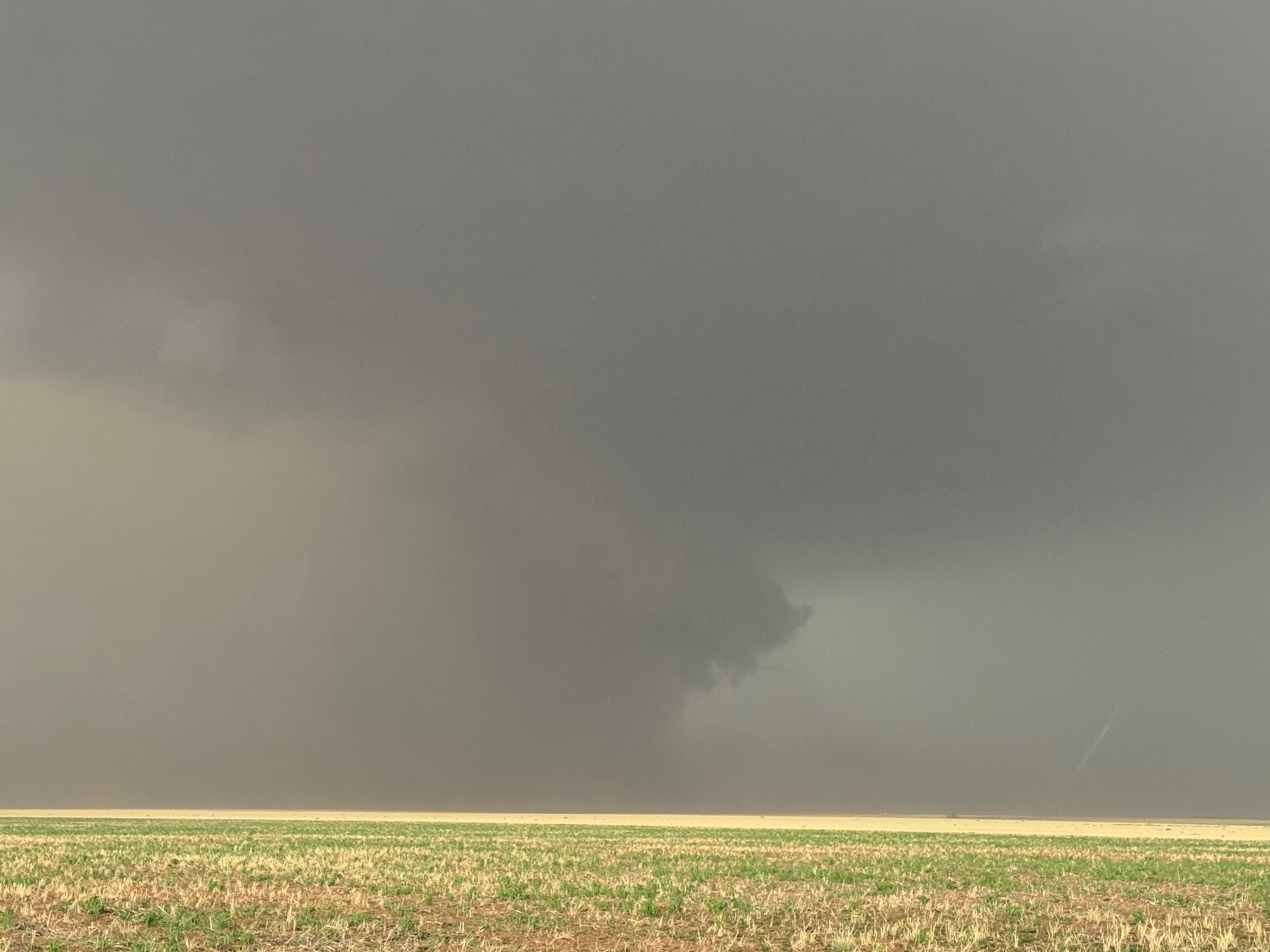
The block of images below is from my Canon camera. The first three shots again show the low storm base some 5-15 minutes prior to the first tornado, and the next seven images show the tornado to our north. A prominent clear slot can be seen adjacent to the tornado. This tornado was WNW of Lingo and SW of Causey around 3:38 p.m. MDT, approximately.
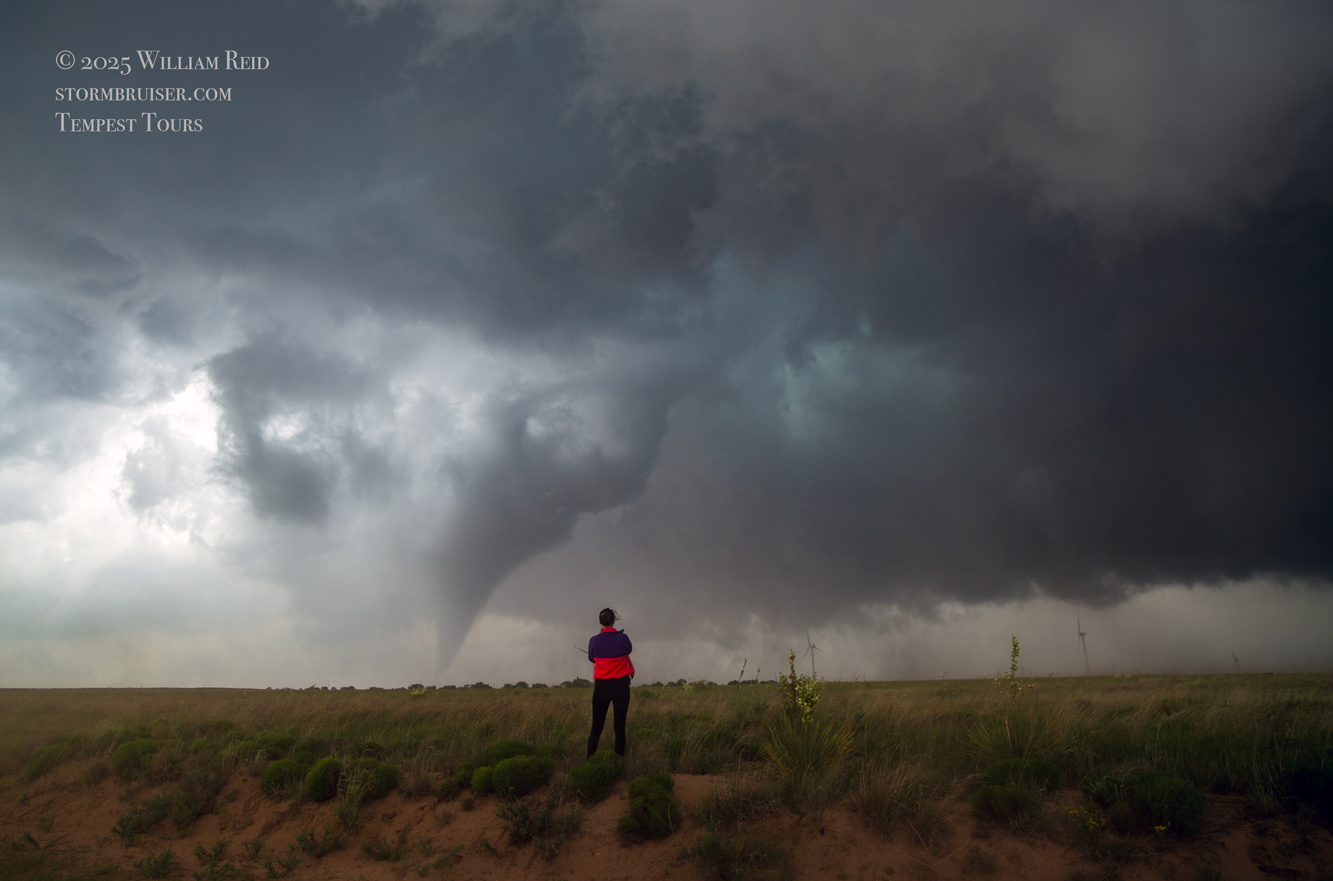
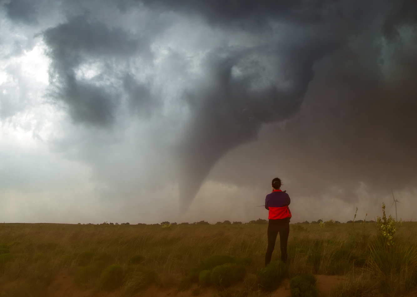


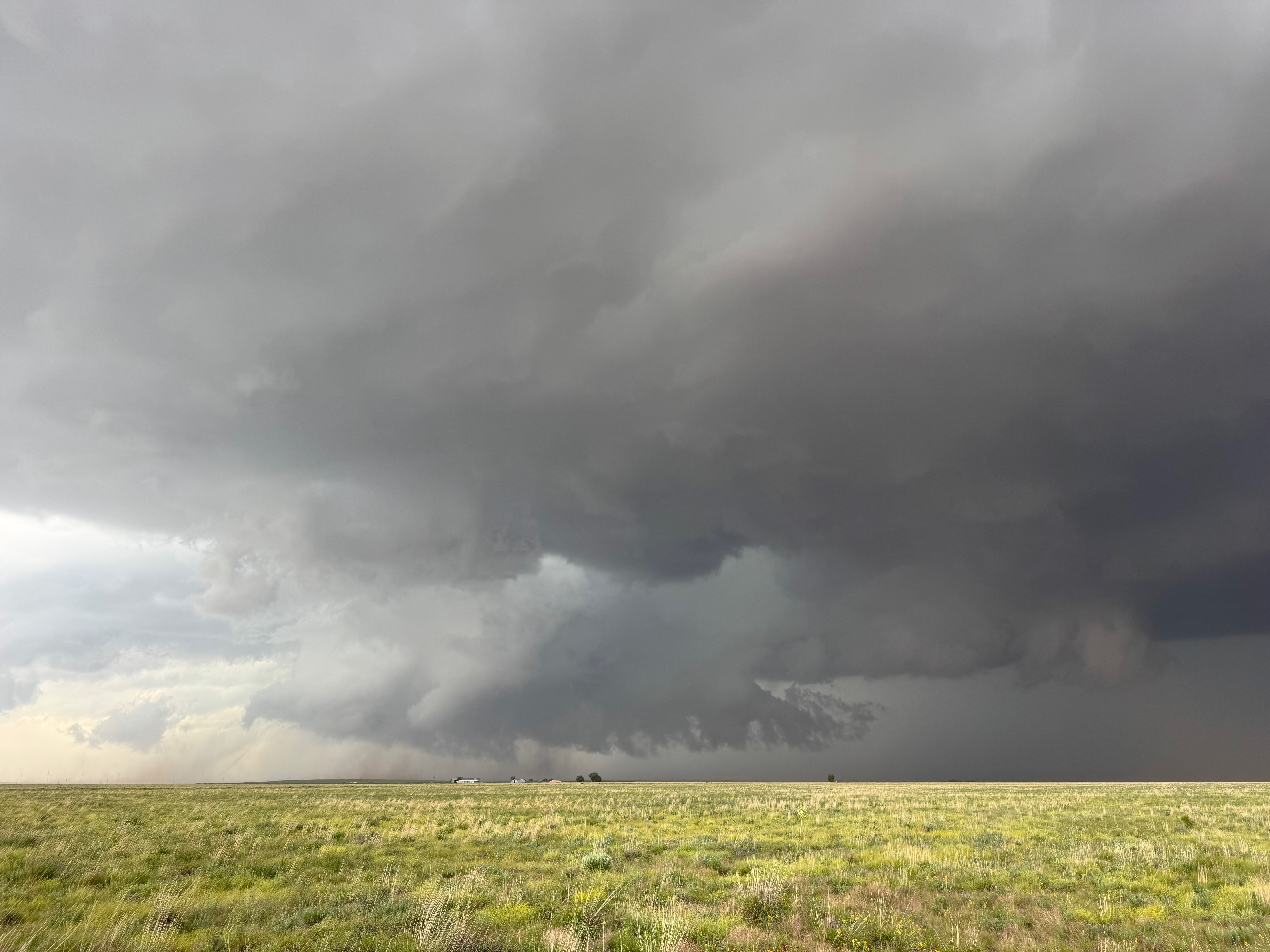
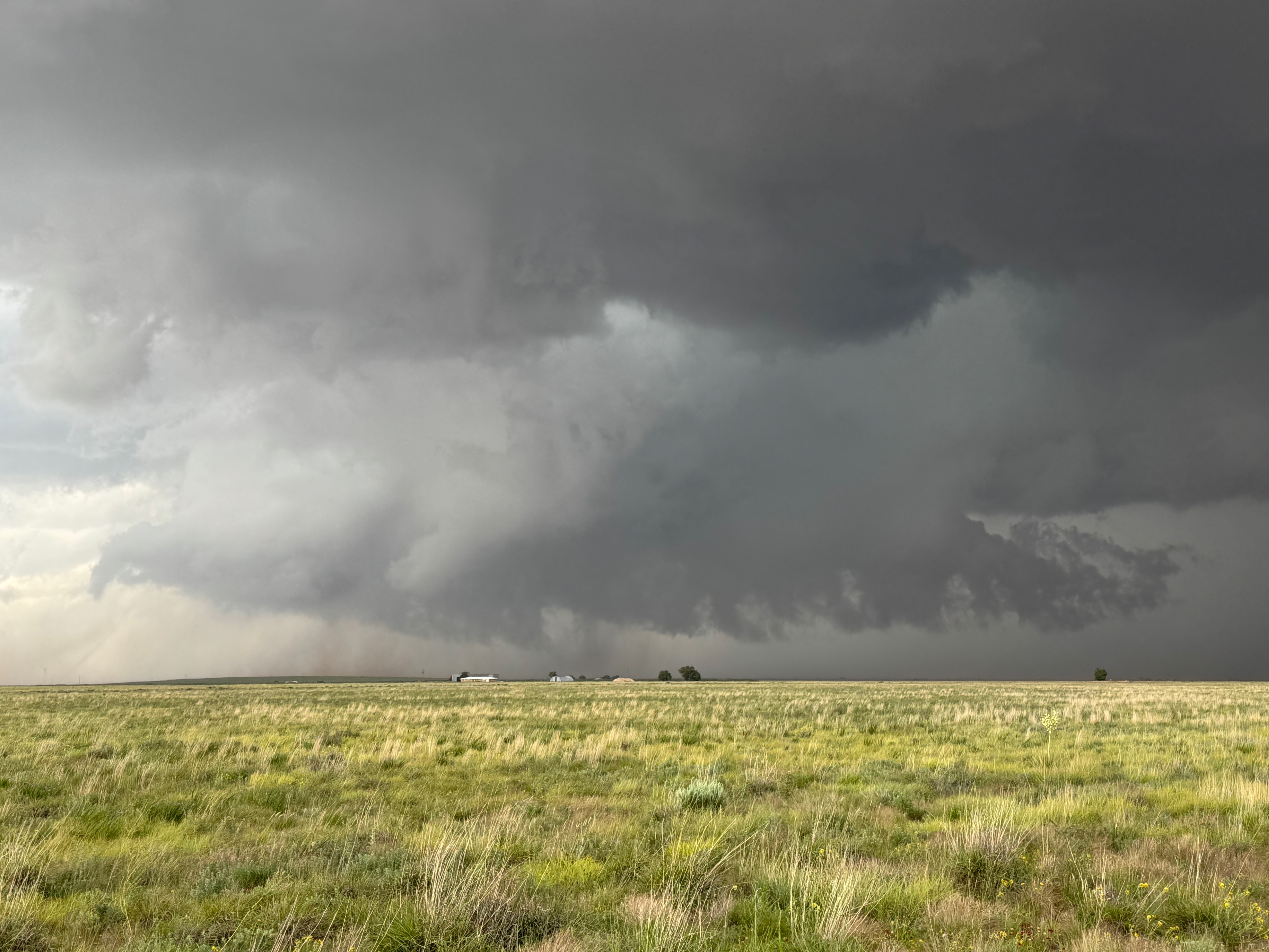
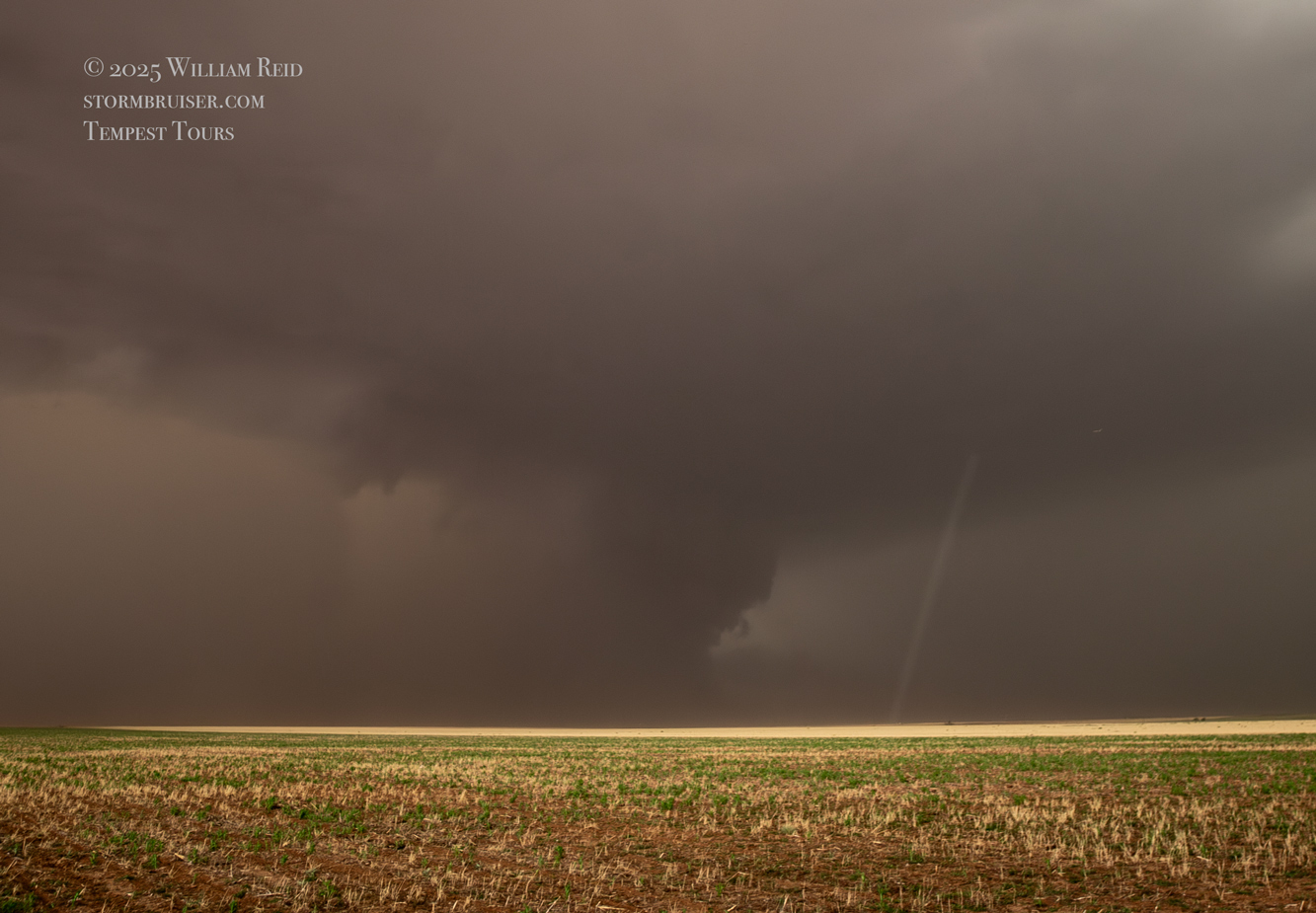
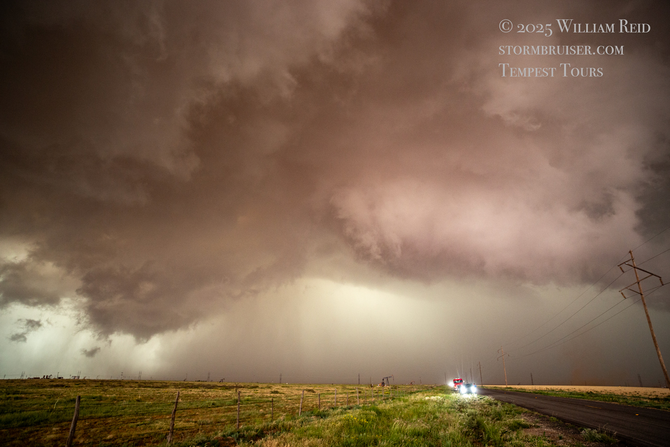
This first tornado lasted maybe 2-3 minutes and was just the appetizer. Our supercell was strengthening and moving eastward into a very favorable environment along the boundary. We needed to get farther east again, and FM114 was about perfect, taking us south two miles from Lingo and then eastward to the Texas border. We stopped very close the TX/NM border, and to our NNW was (no surprise) a low wall cloud with dust beneath it (last 7 images above). Dusty spin-ups, some with condensation funnels and some without, were almost continuous from the storm’s action area just a few miles to the north of FM114. We went another few miles east, stopped again, and watched sporadic dusty spin-ups several miles to our north.
The group of iPhone shots below provide looks to the north during this phase near the NM/TX border along 114.
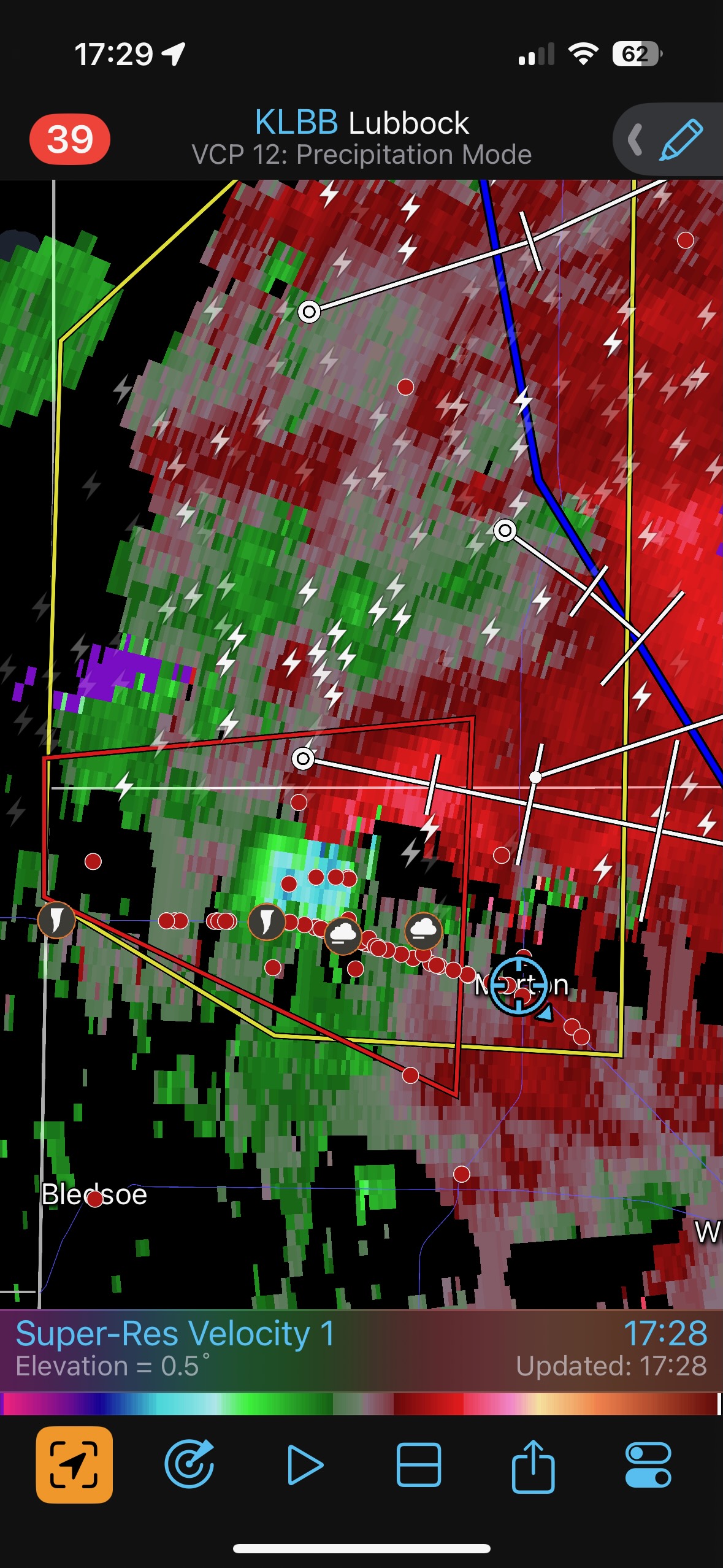
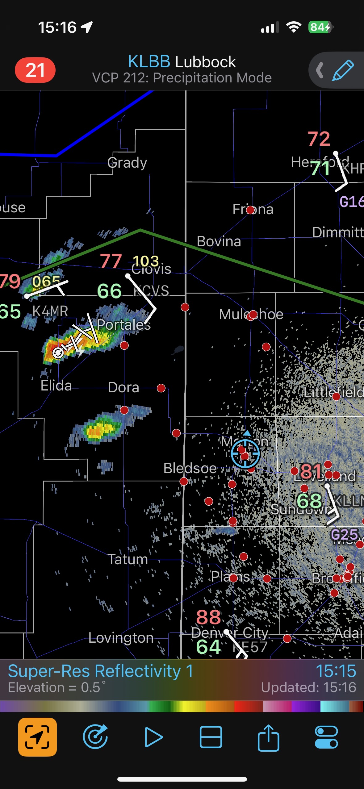
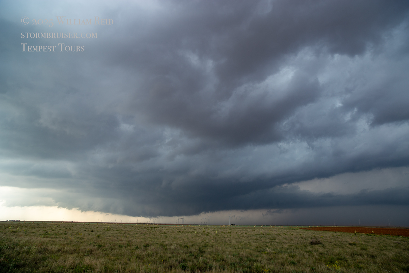
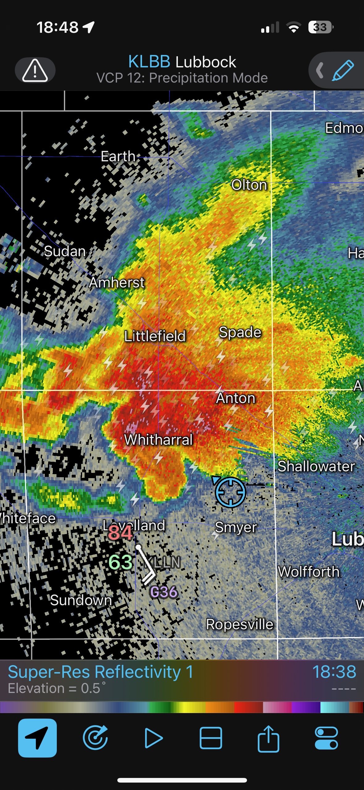
The radar screenshots above show our location at 5:16 p.m. CDT just east of the state line, and at 5:29 p.m. CDT we are in Morton, about ten miles farther E to ESE. When we started east from the stop a few miles east of the state line around 5:16 p.m., the storm was continuing to tease us with plenty of dust and weak tornadoes beneath its active wall cloud. I planned on stopping again in a few miles, but we were soon getting into strong dust-filled inflow. We didn’t want to stop in that, so I decided to head all of the way to Morton. From there, we could go north a bit on 214 and probably get a really good look at the storm and its structure…with hopefully no problematic blowing dust. Another reason I elected to go ahead and reposition so far to the east was because 114 angles to the ESE to Morton here, taking us farther south than I wanted to be. I didn’t want to play around on dirt roads now.
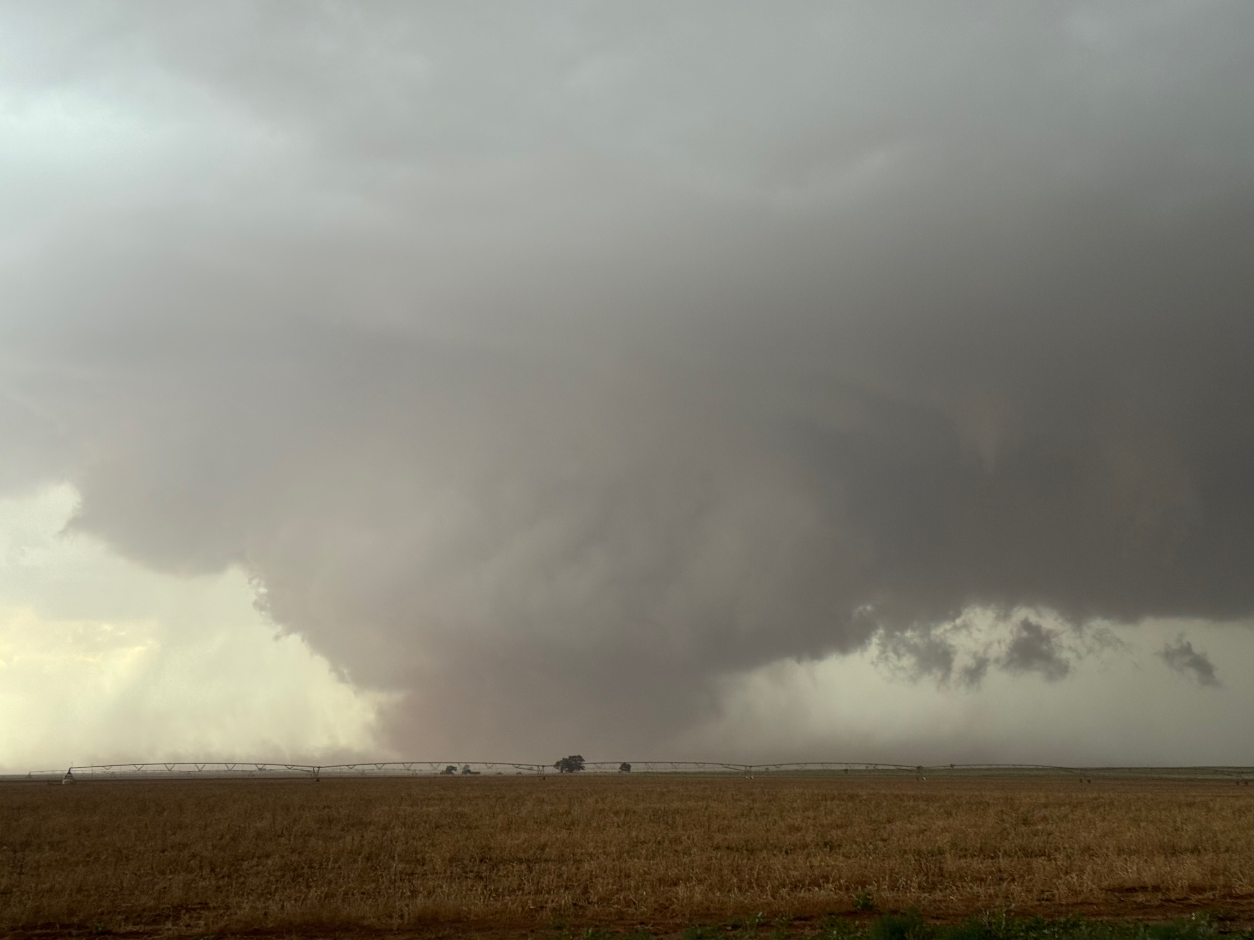
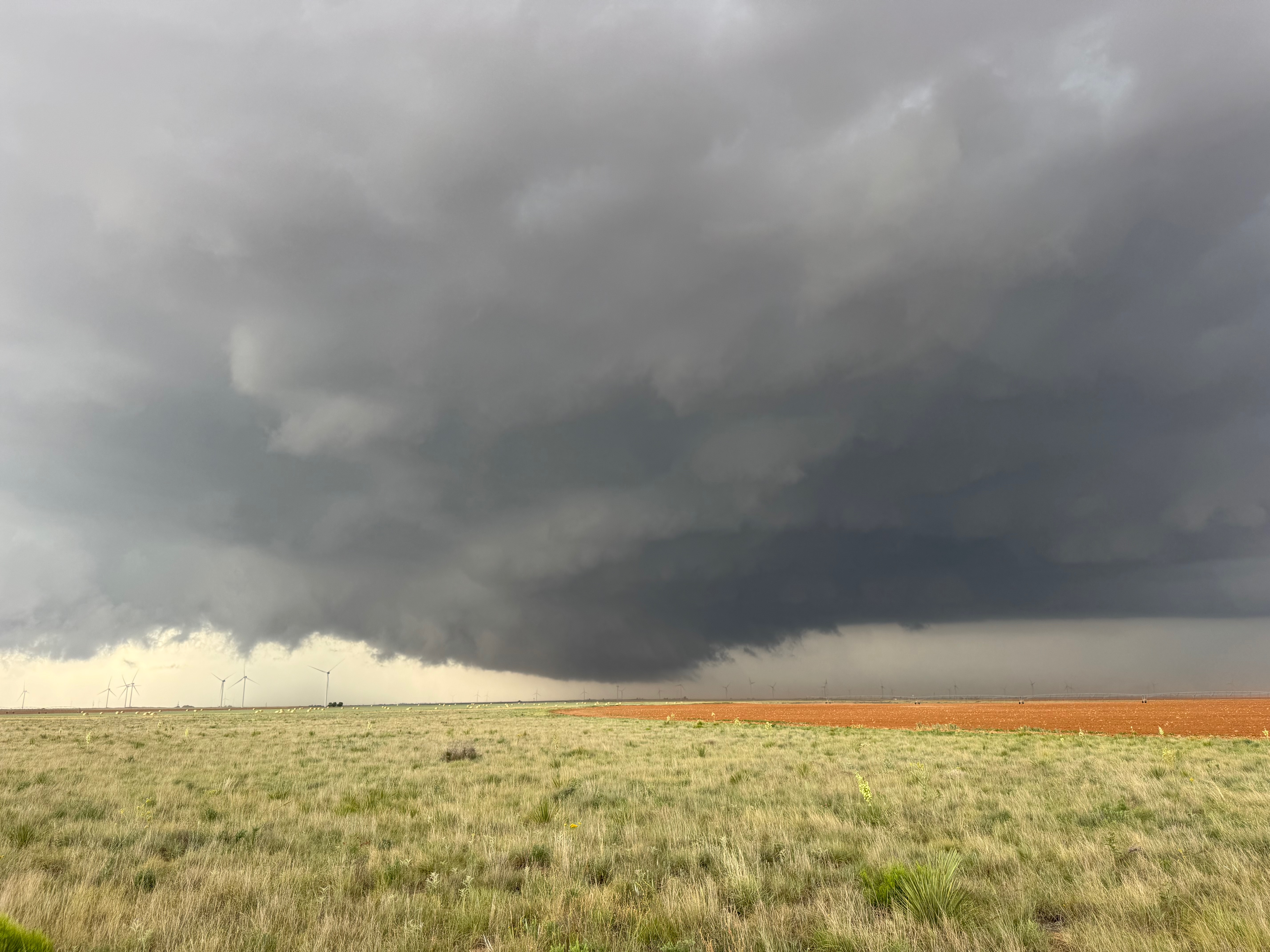
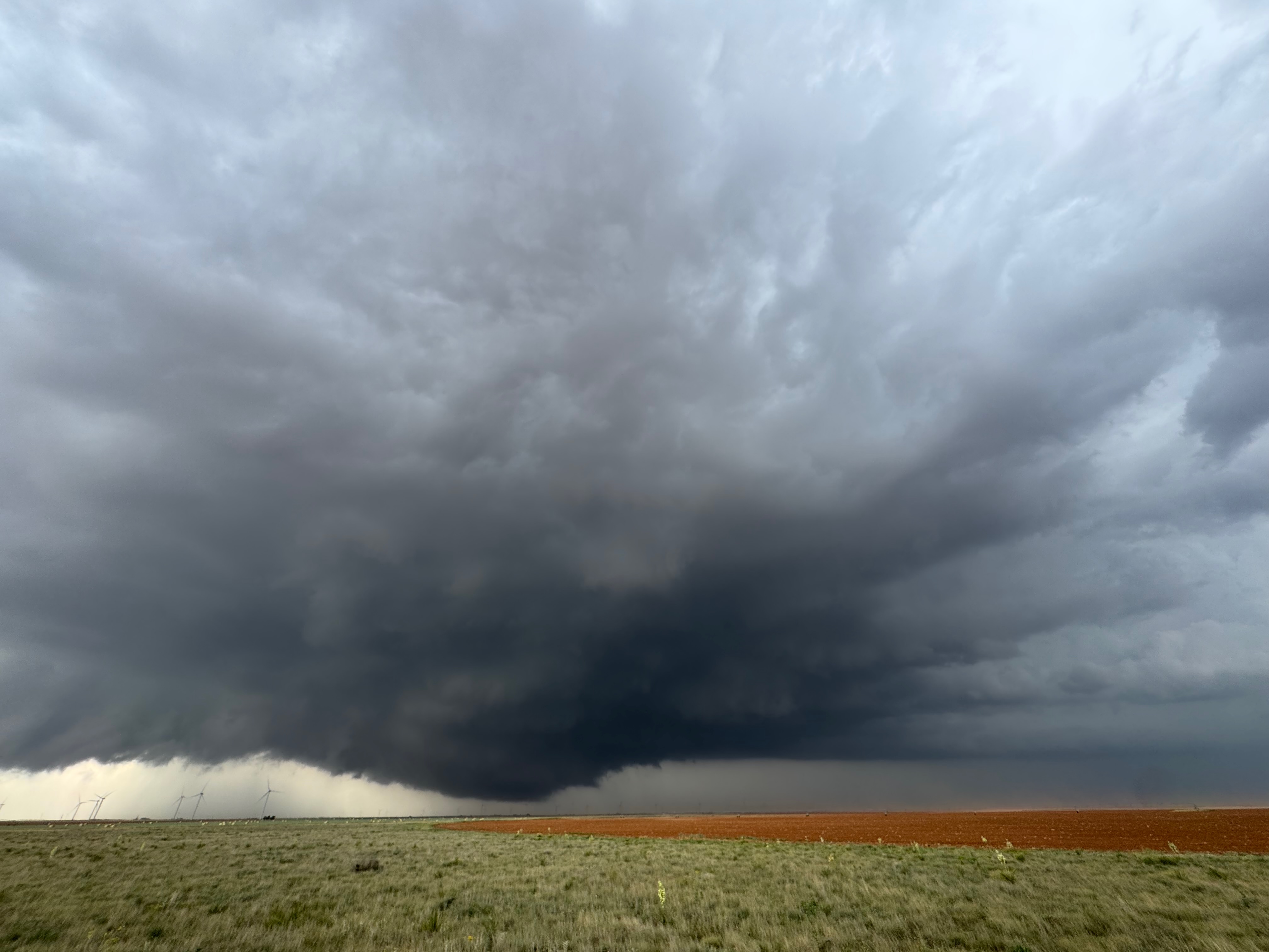
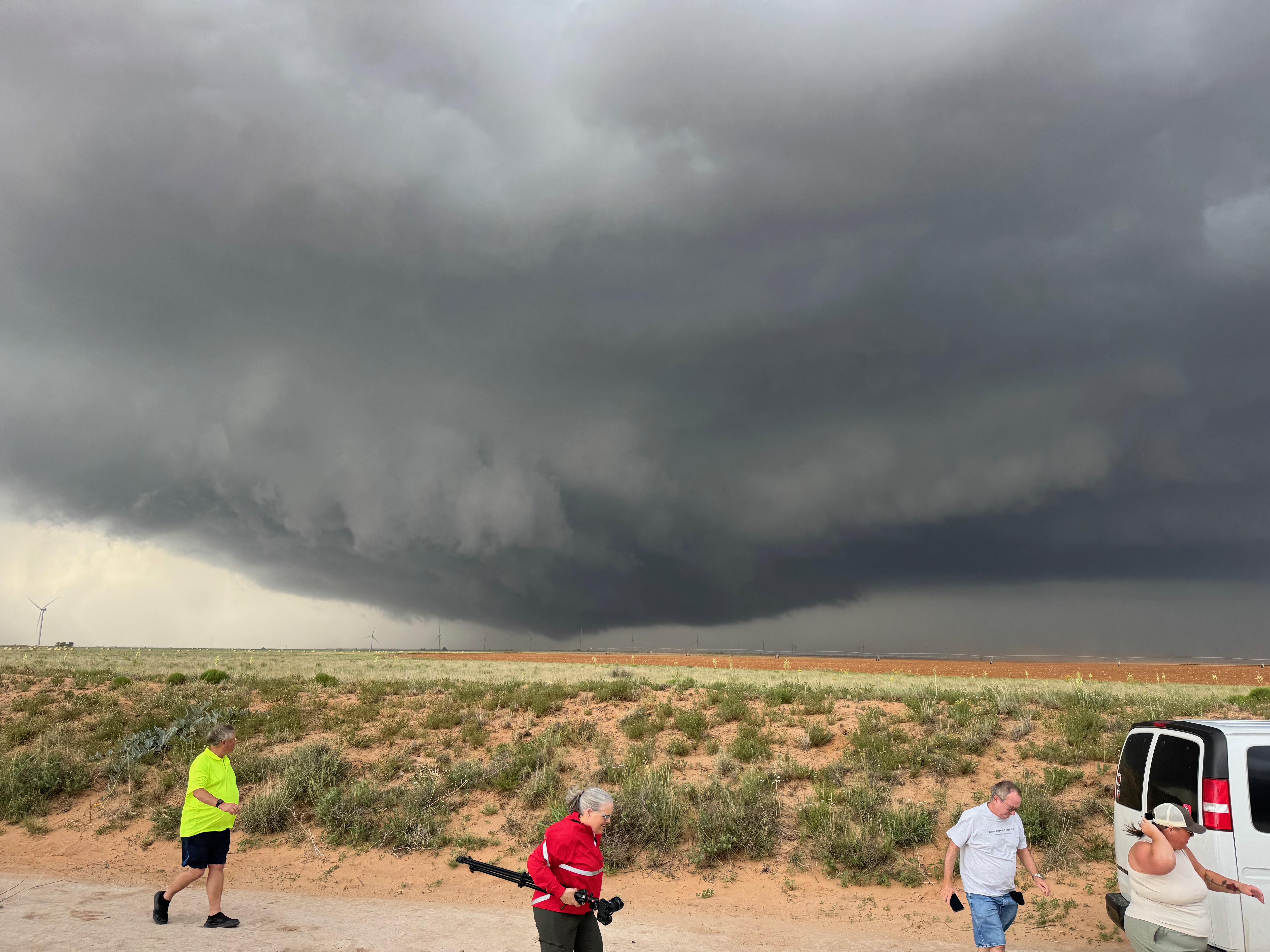
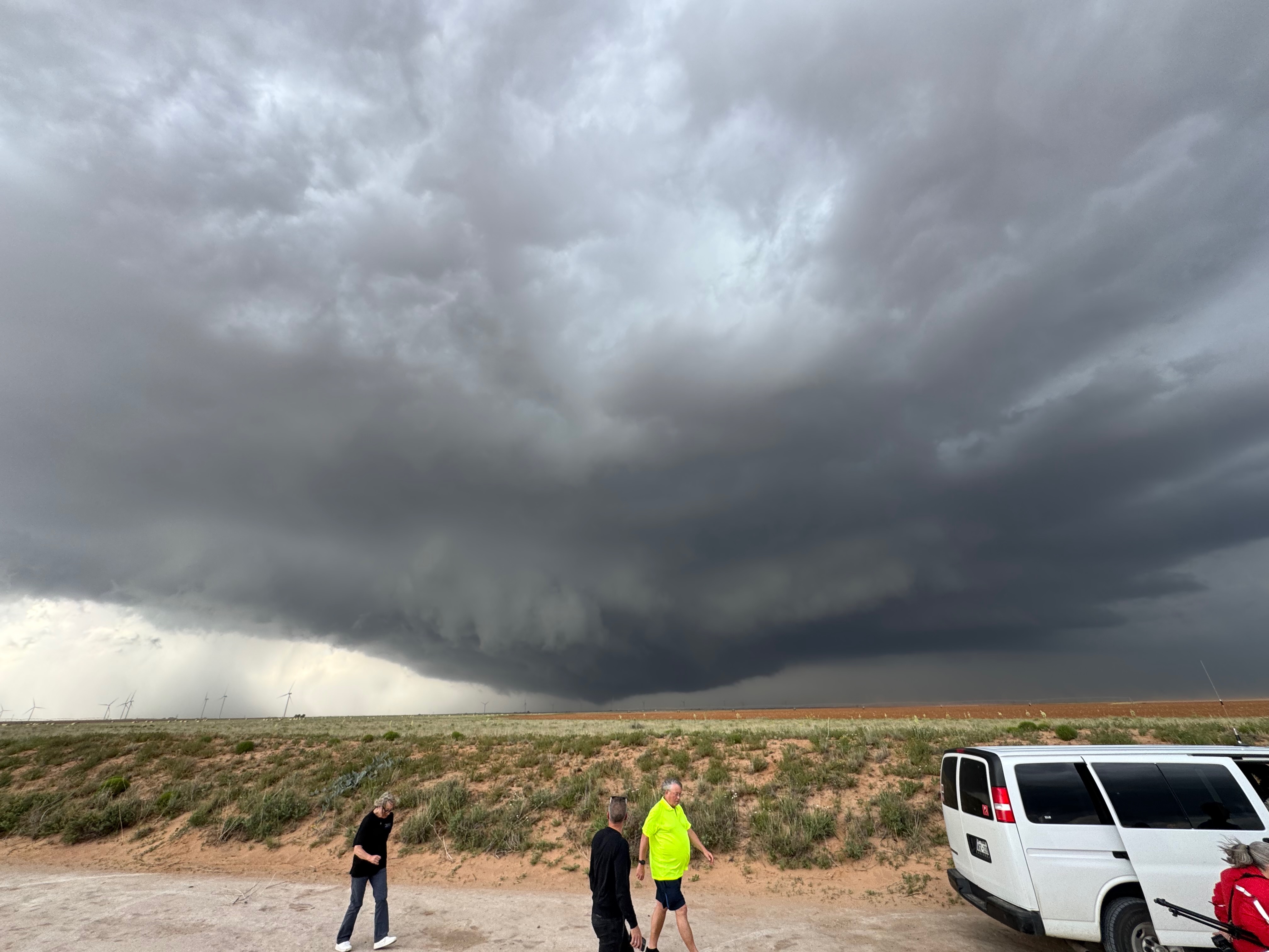
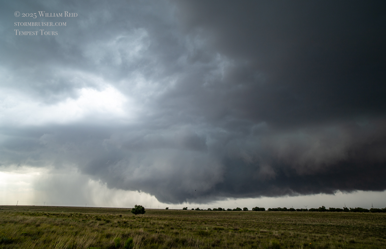
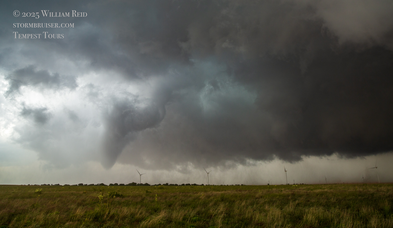
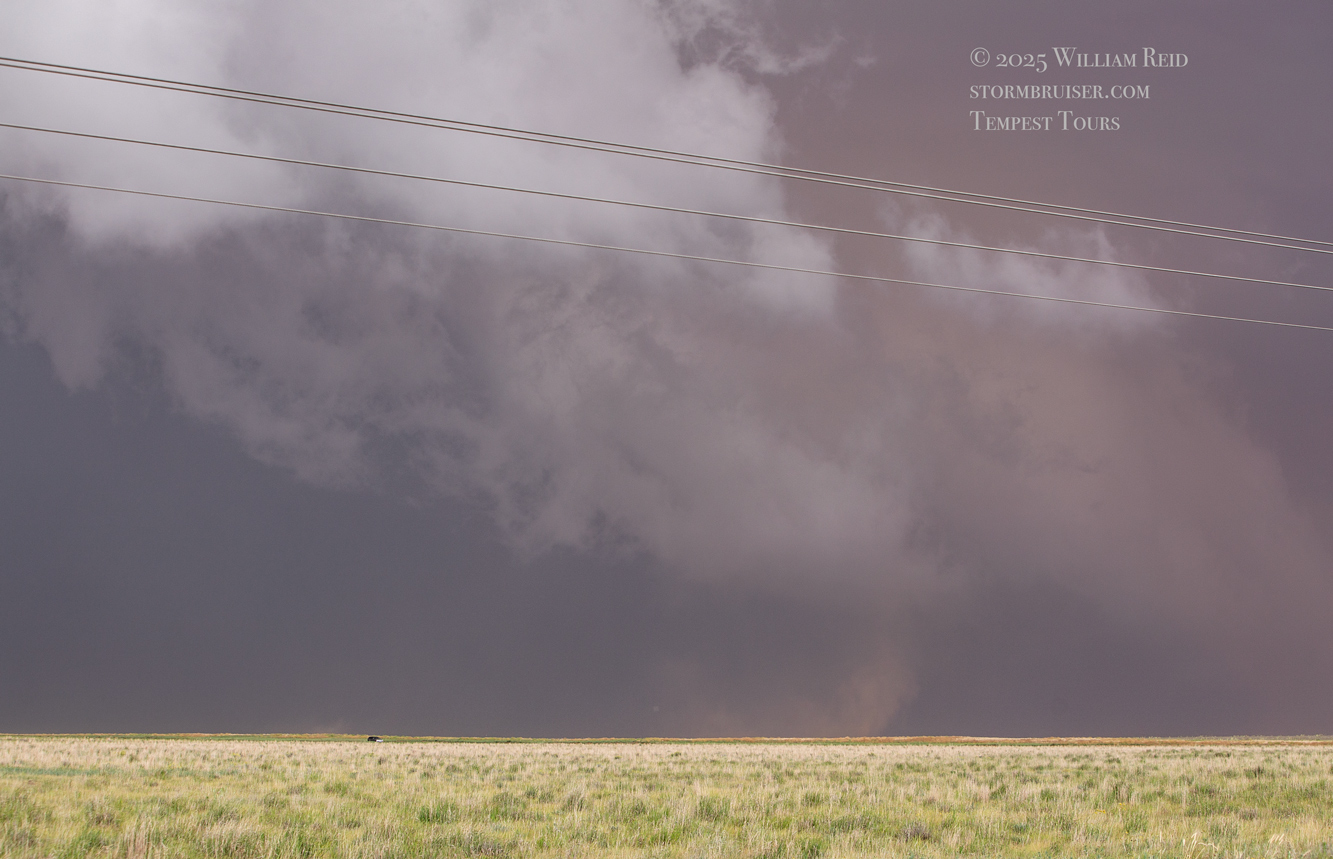
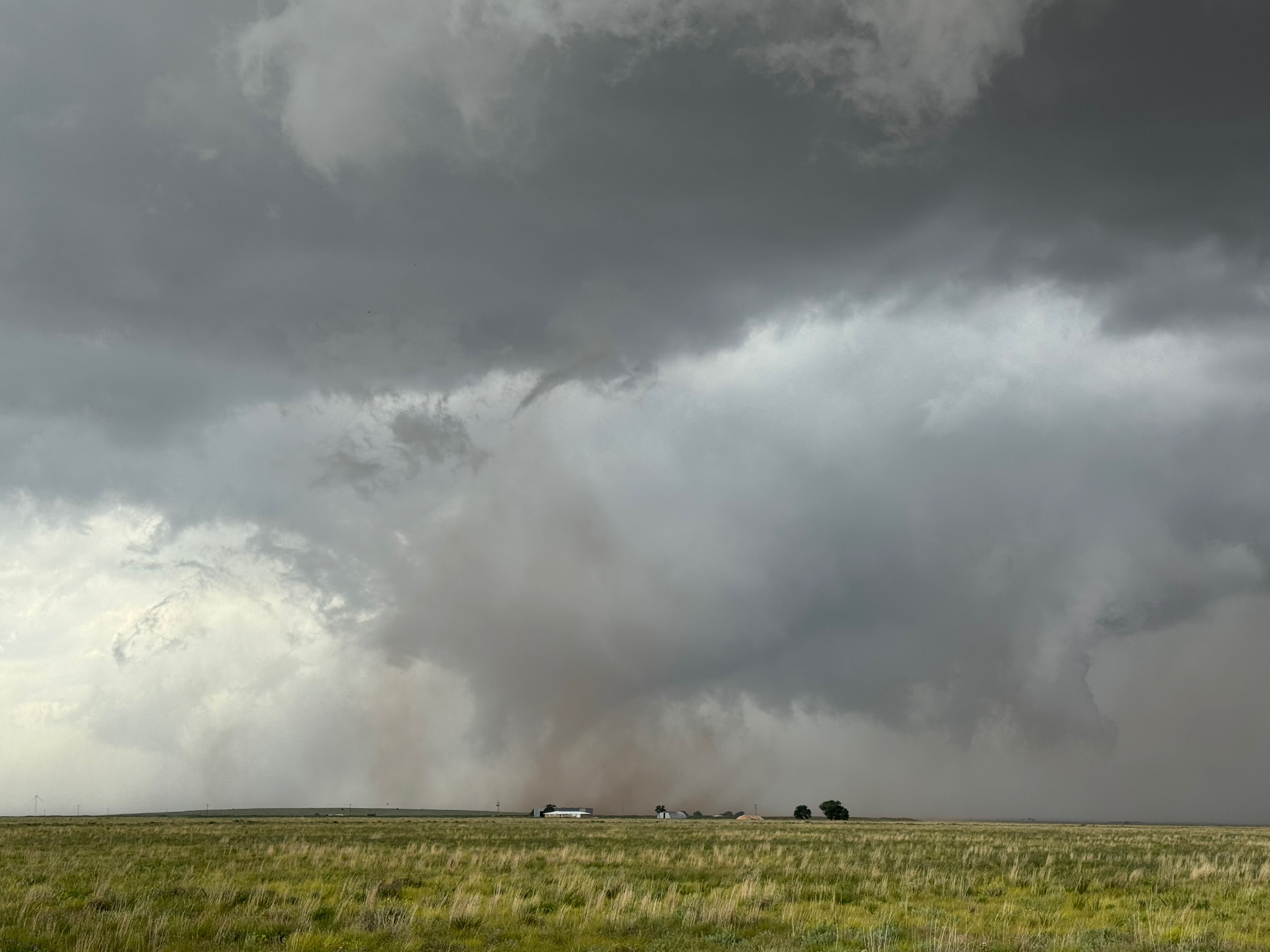
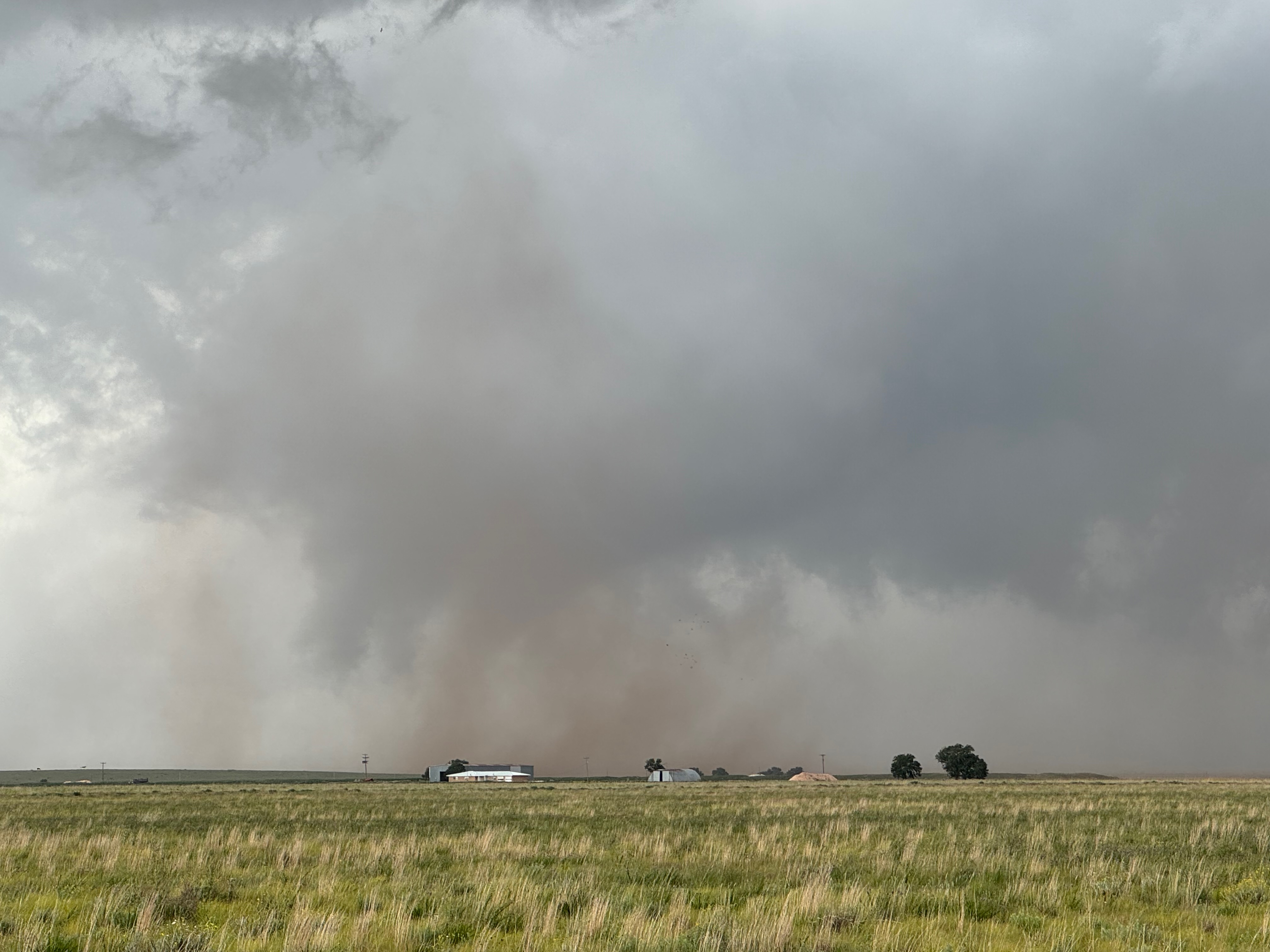
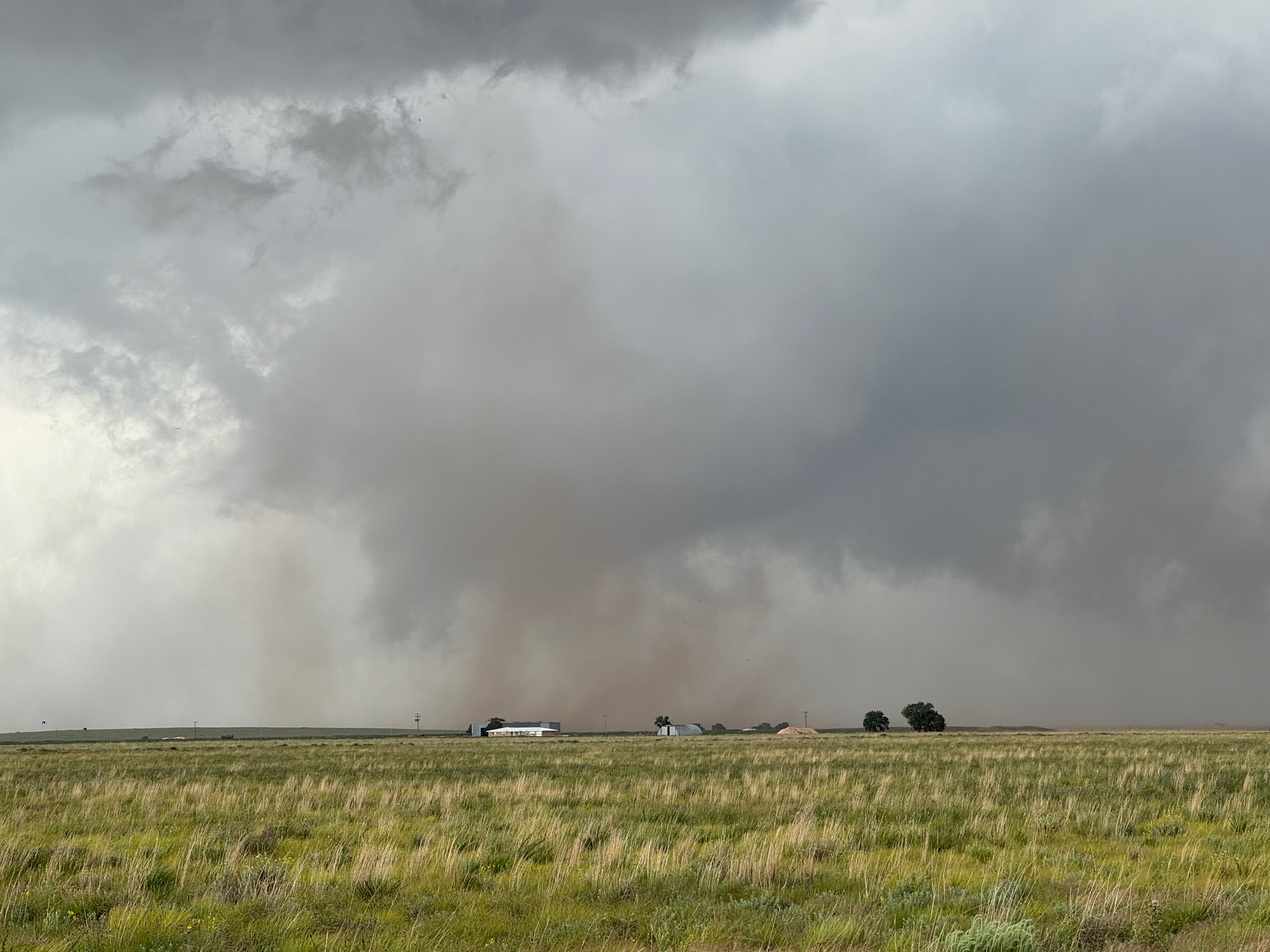
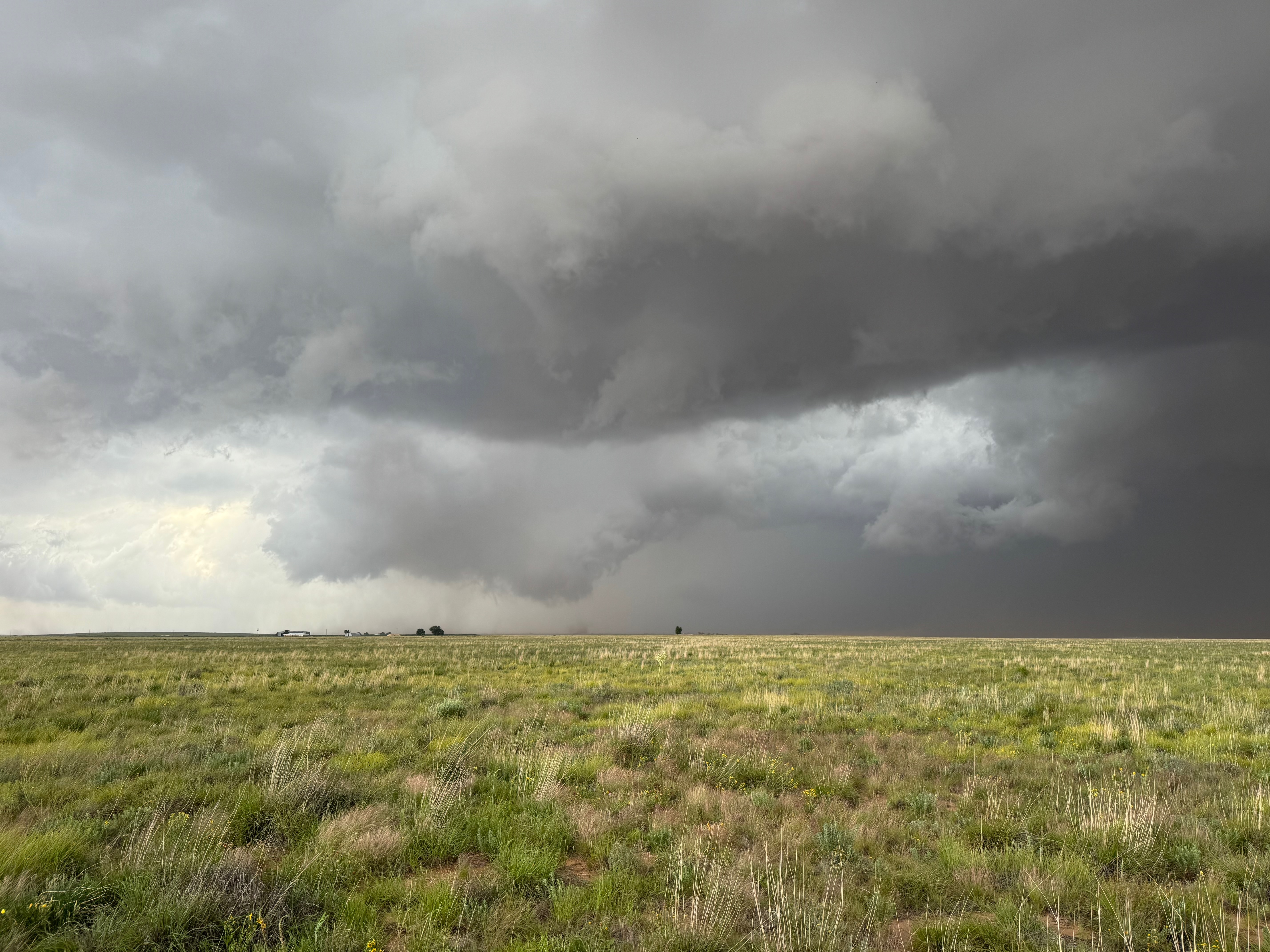
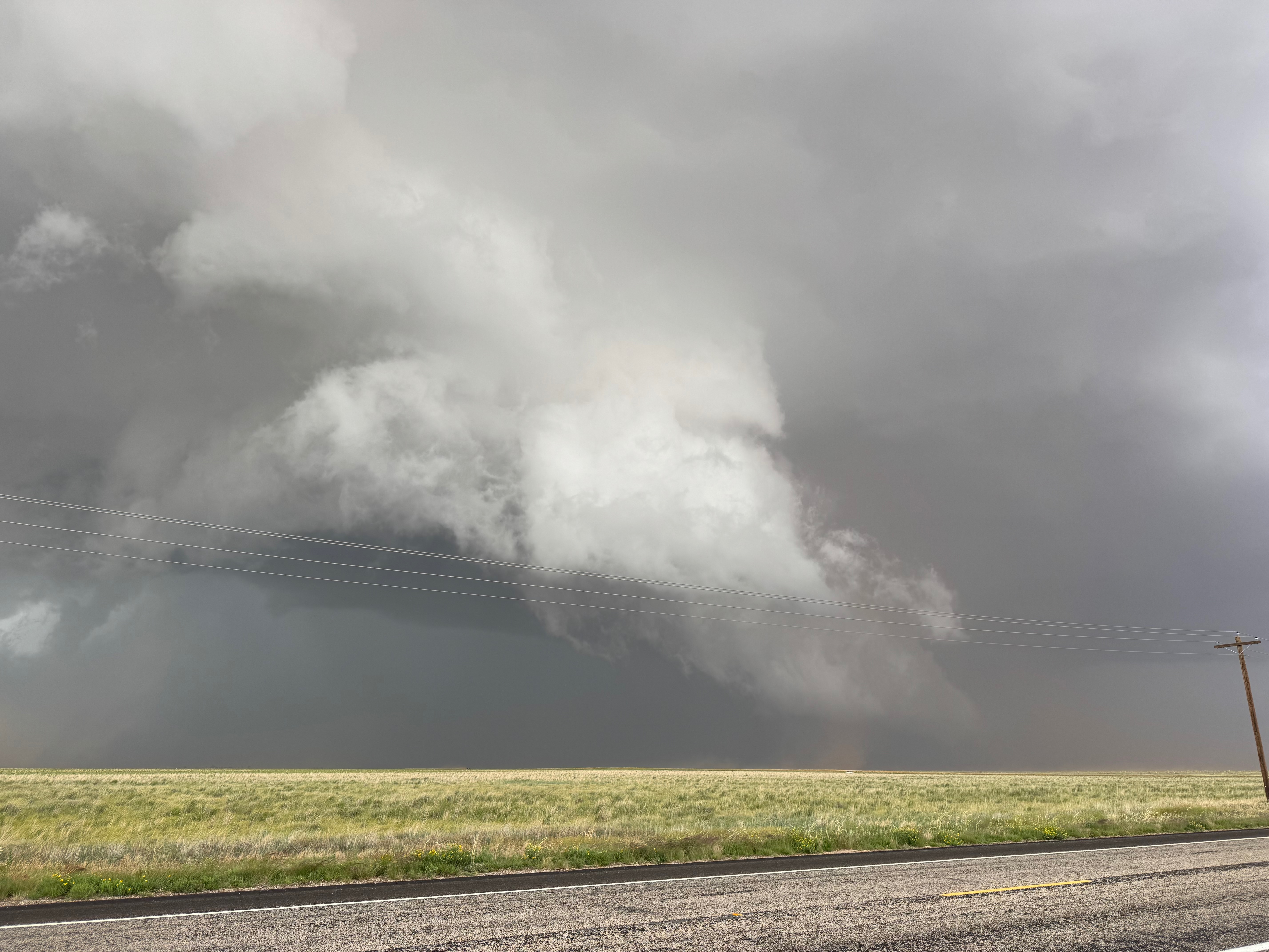
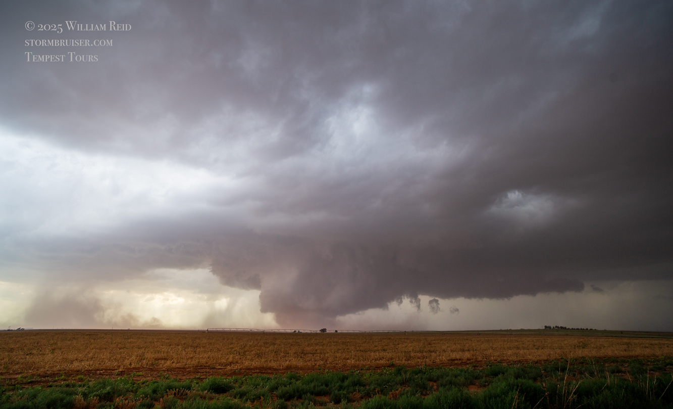
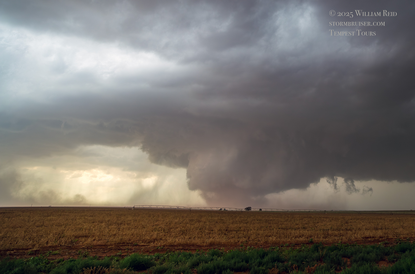
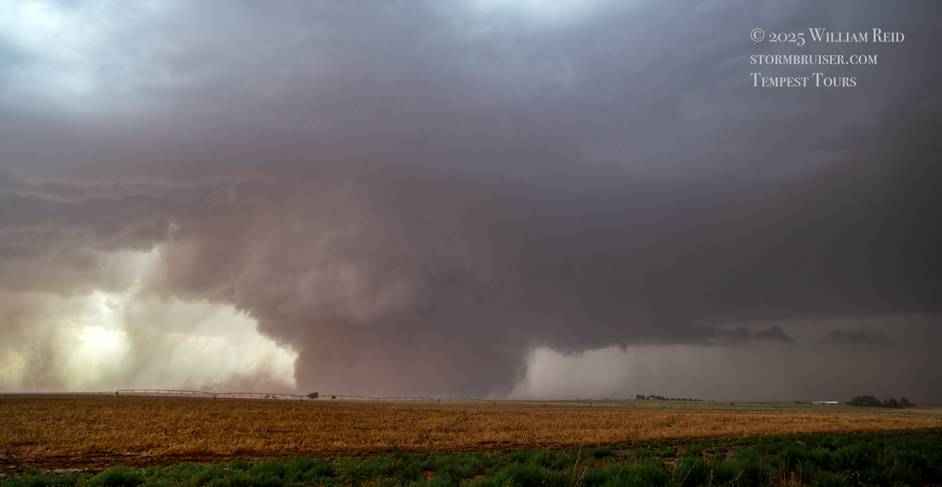
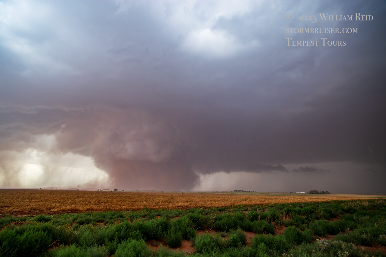
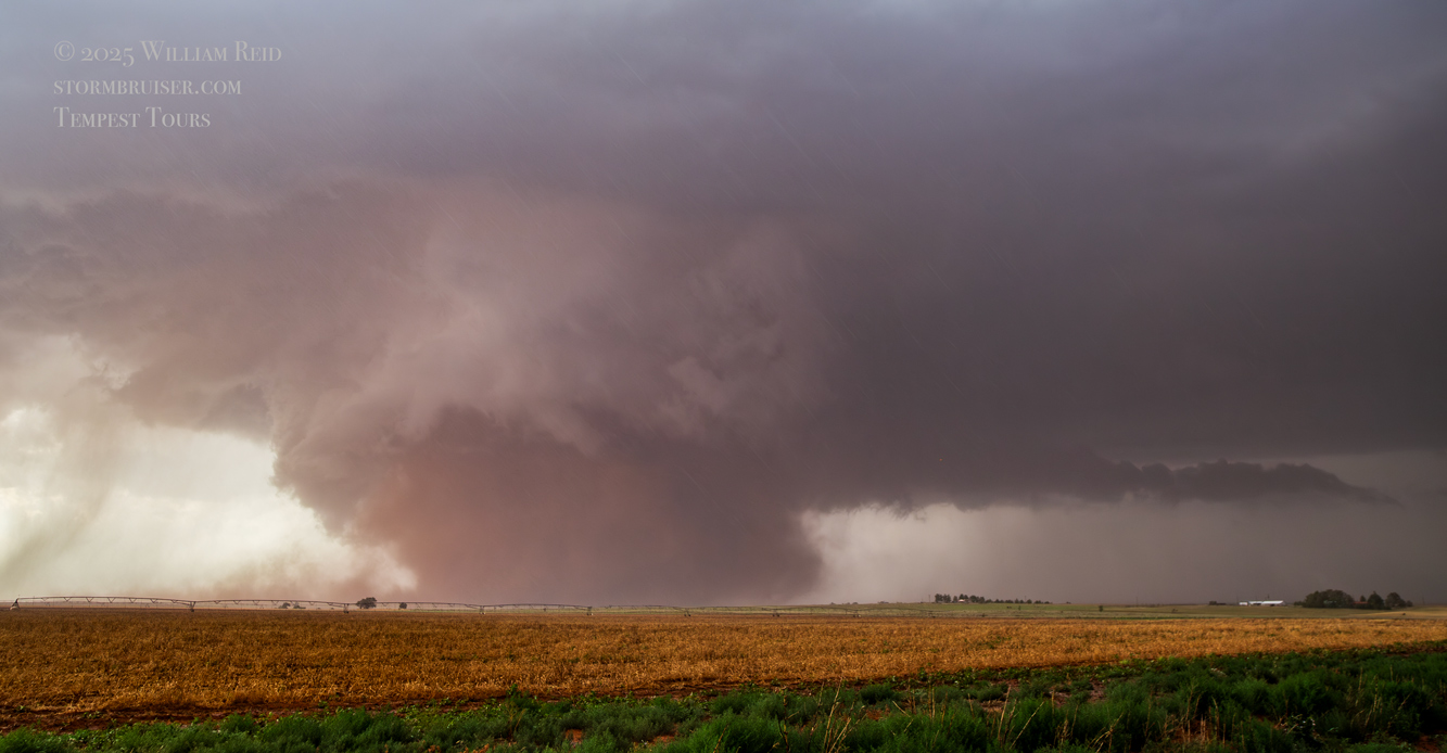
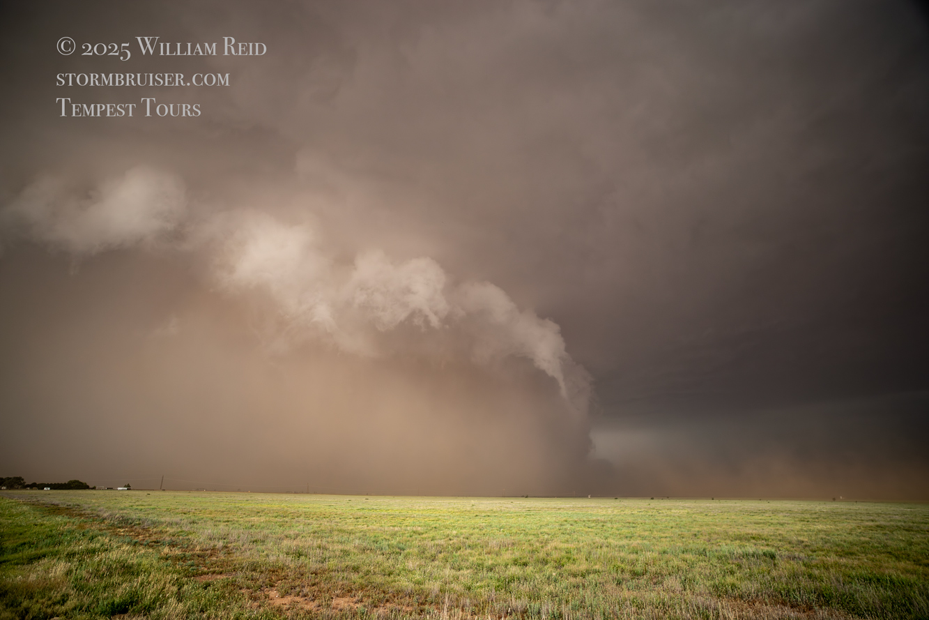
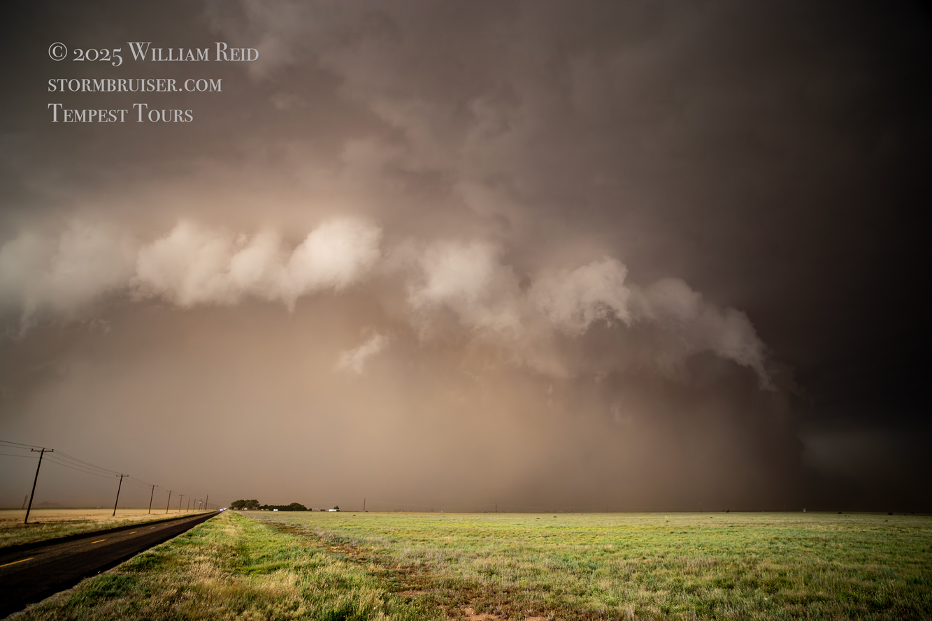
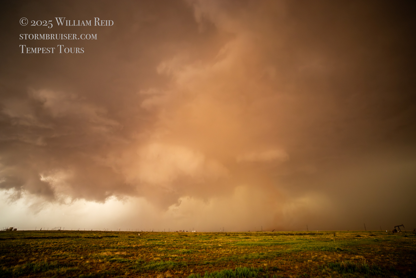
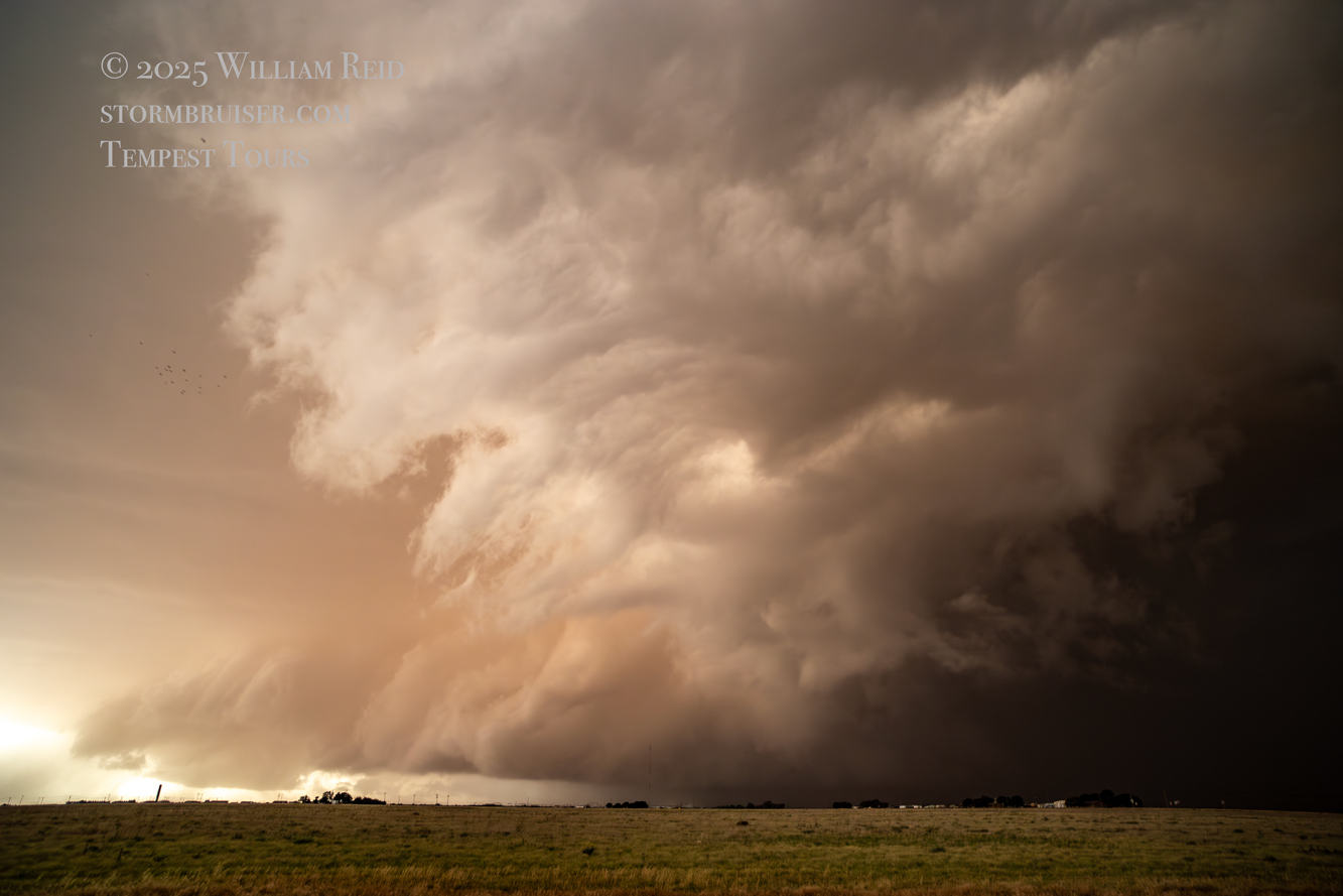
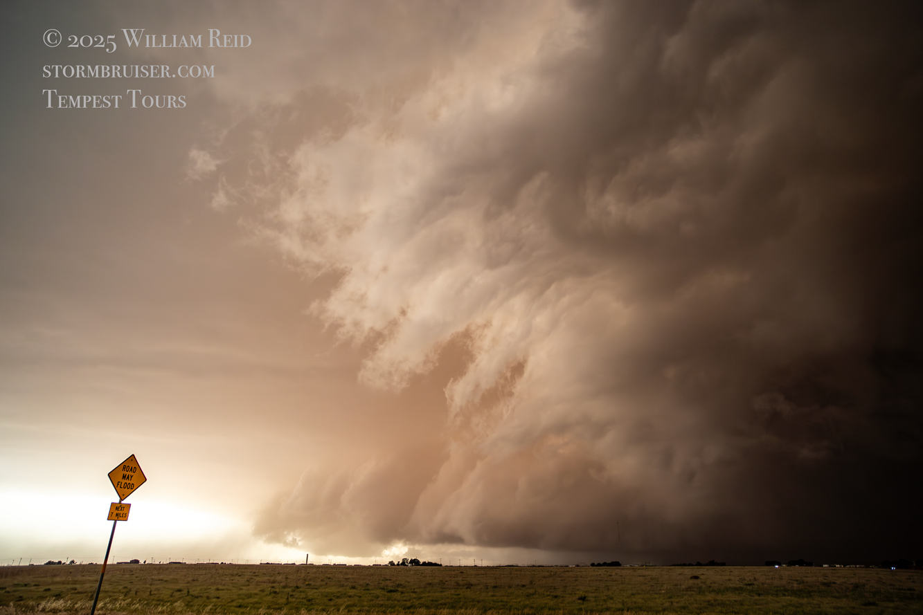
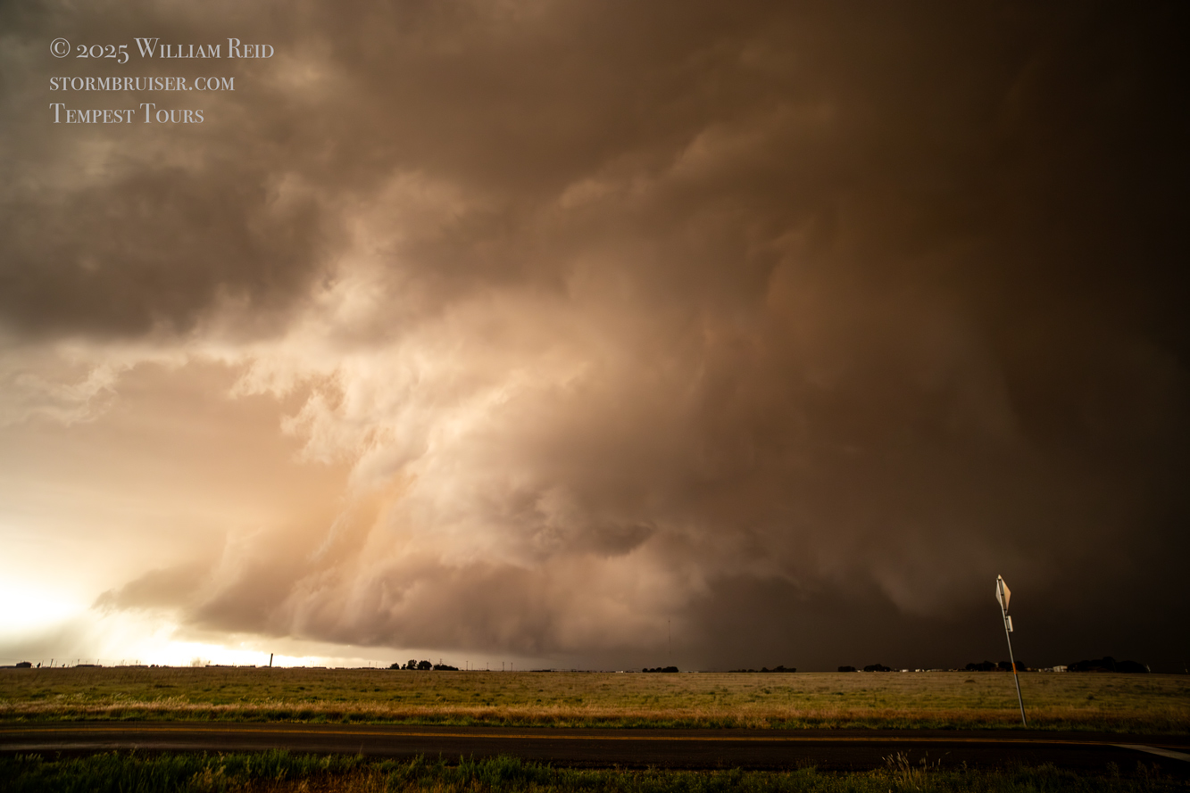
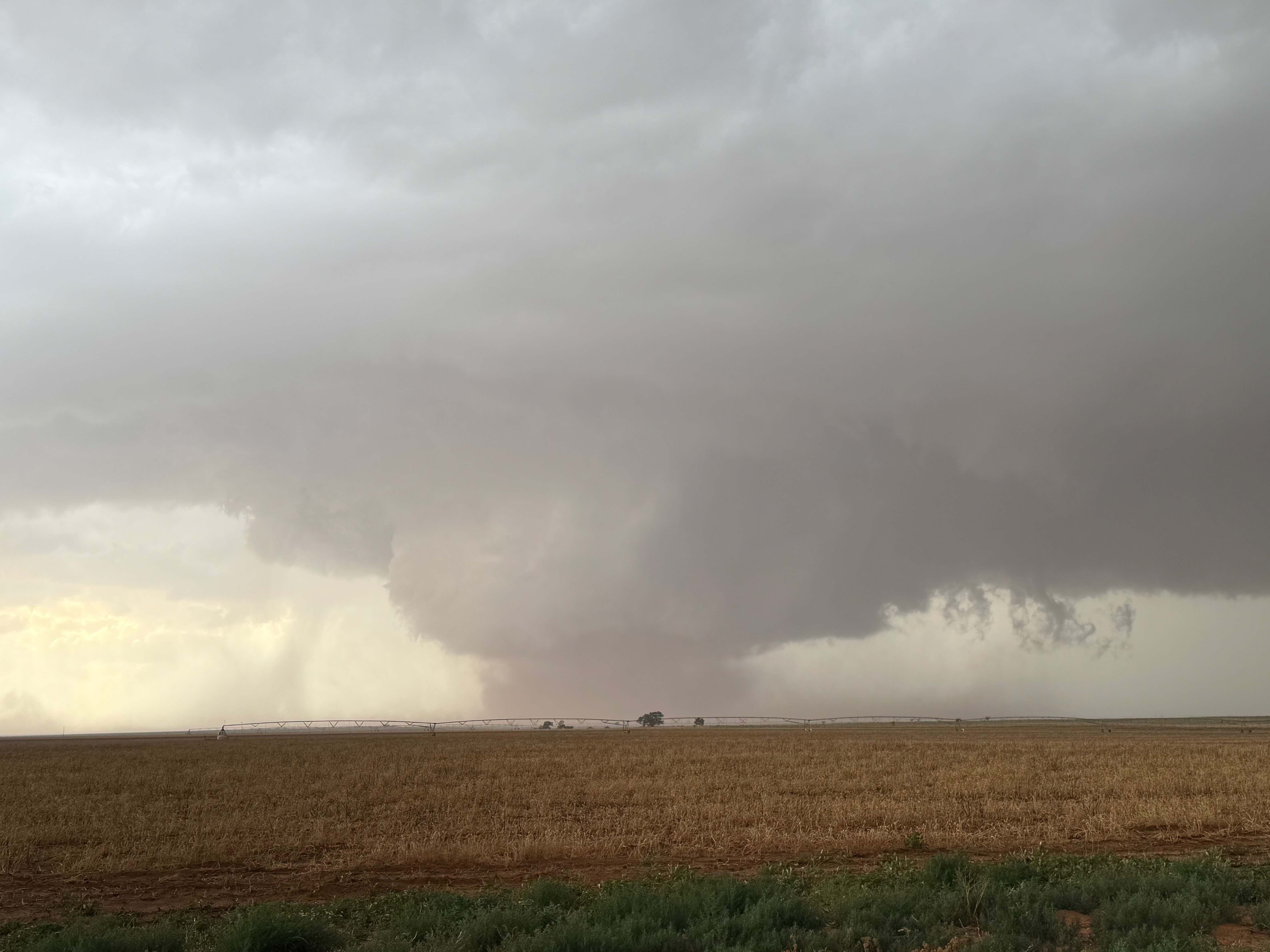
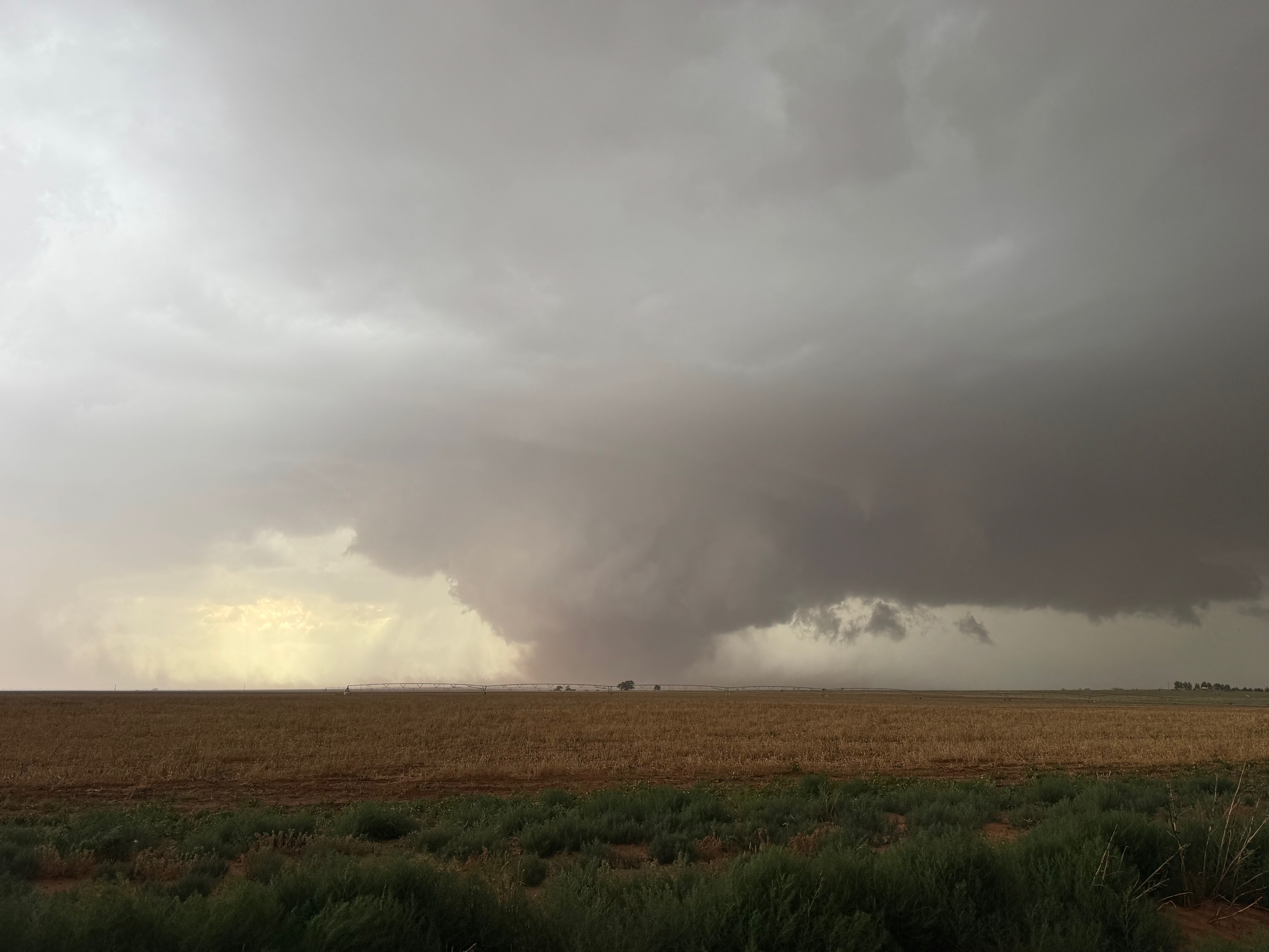
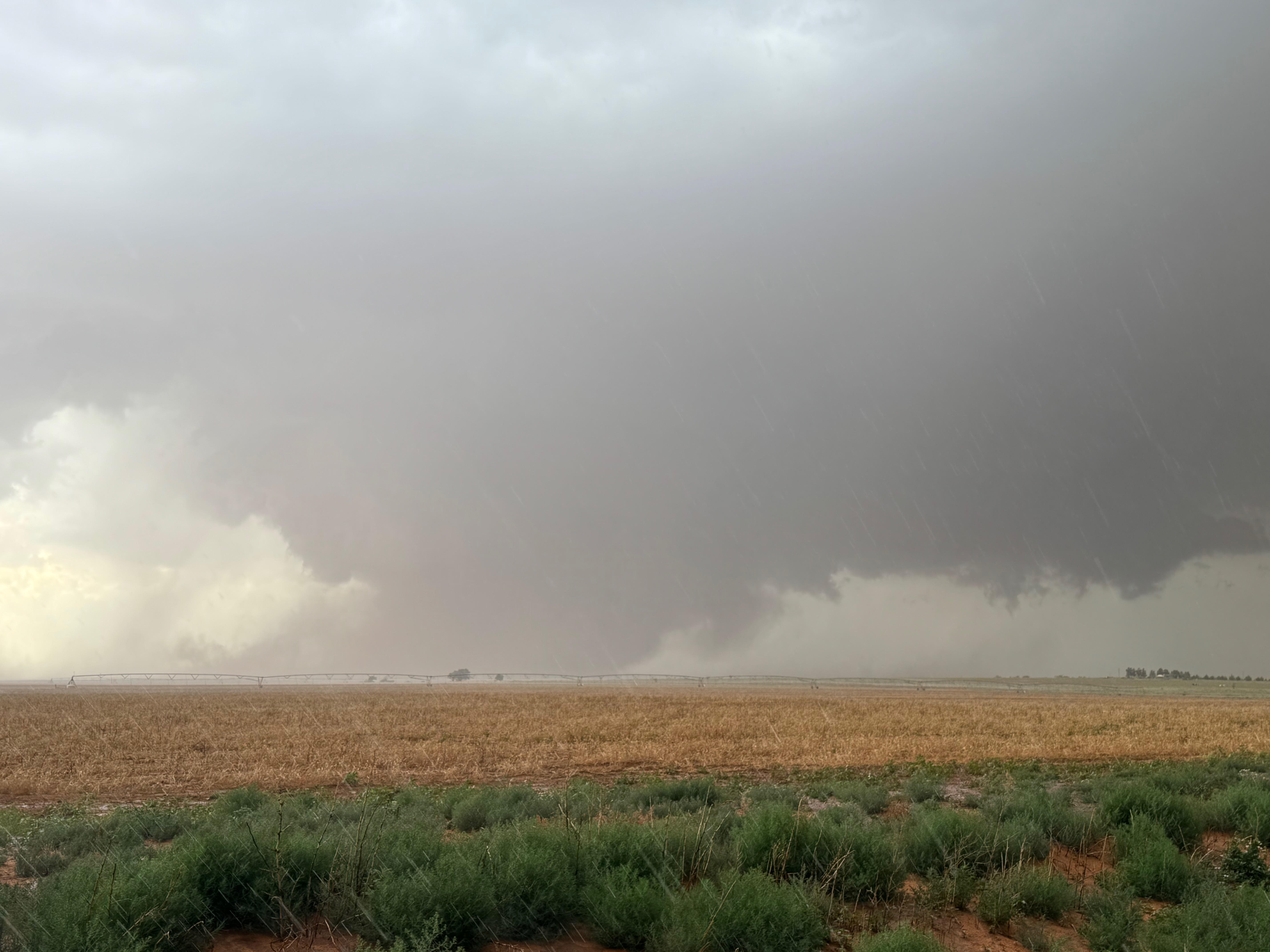
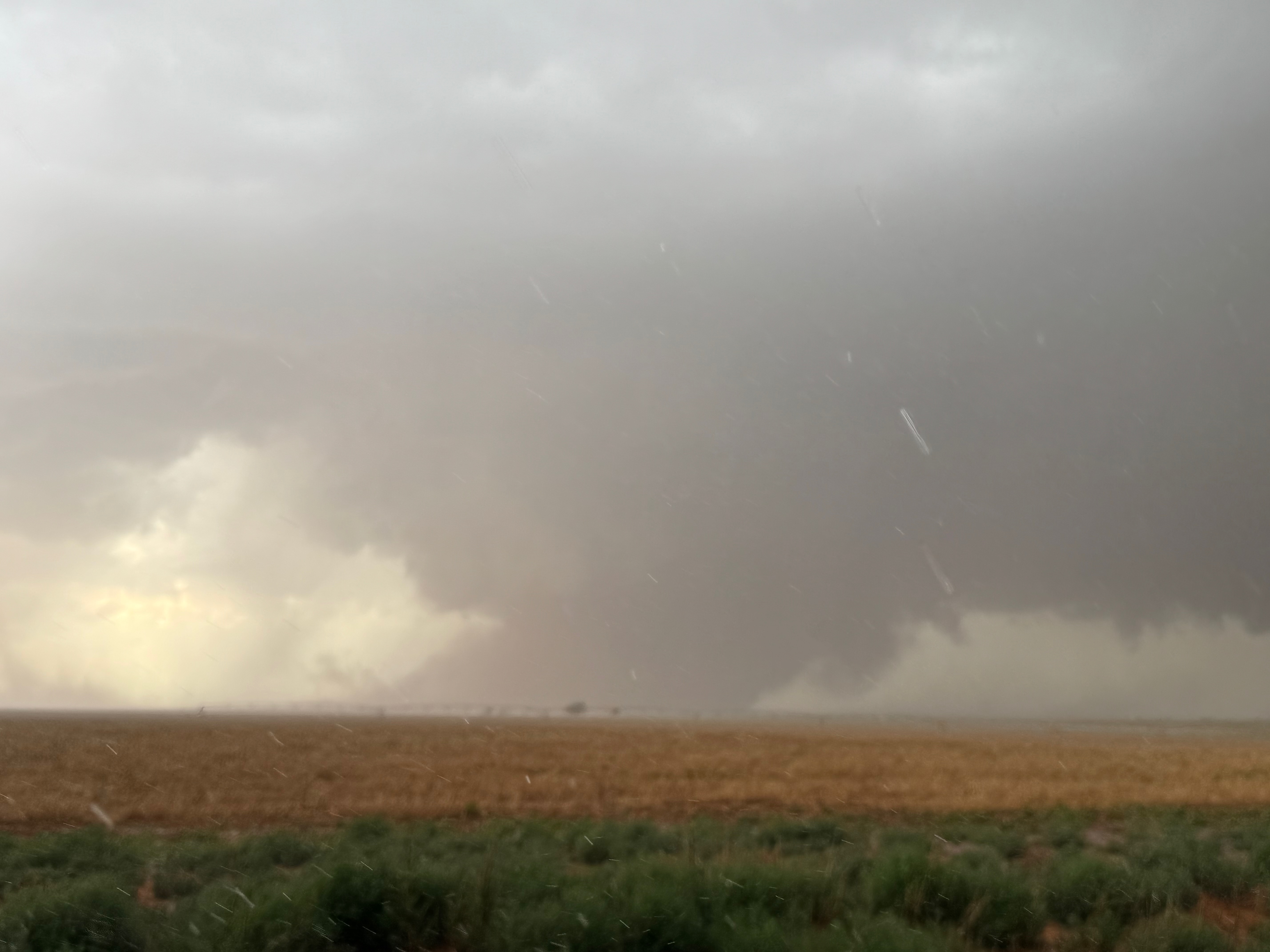
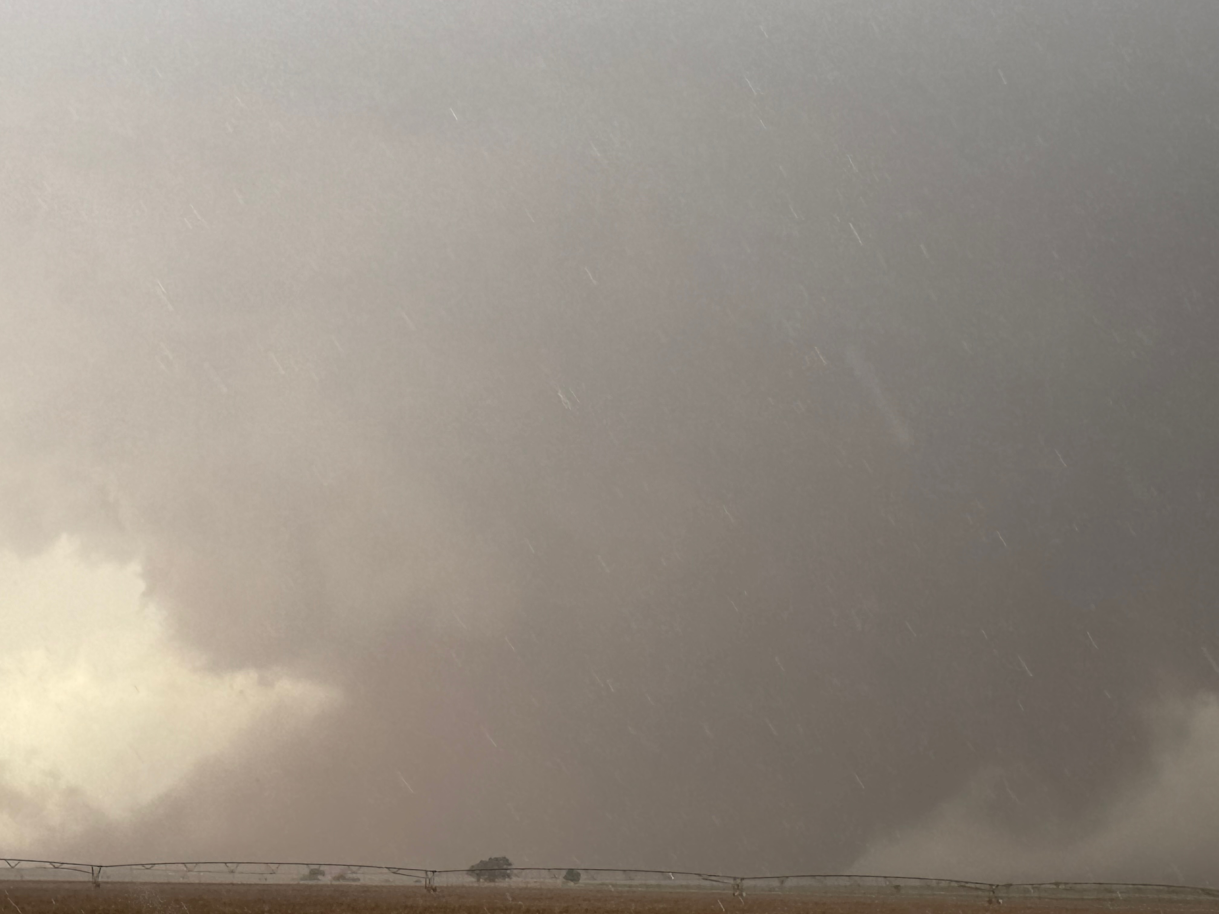
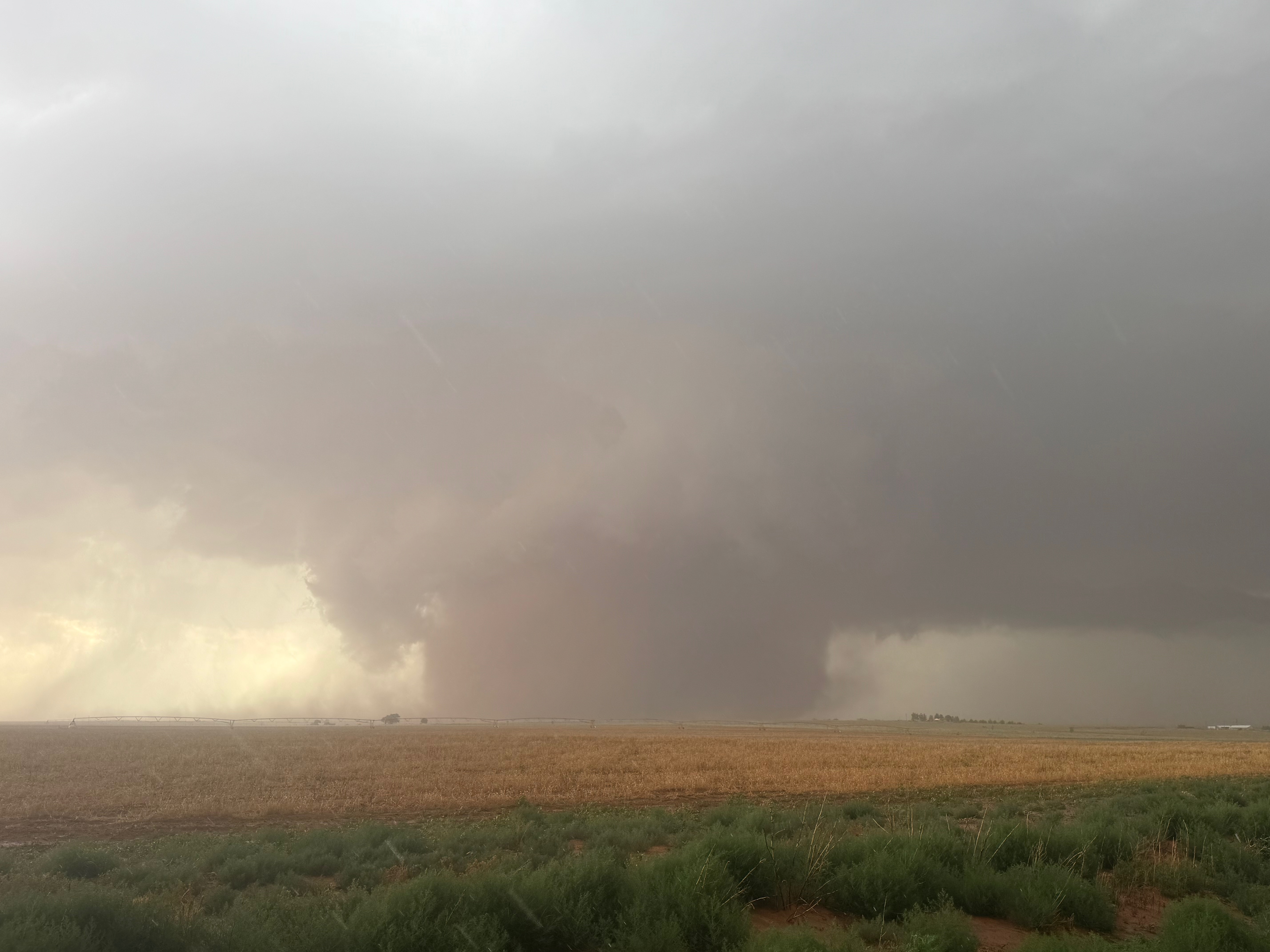
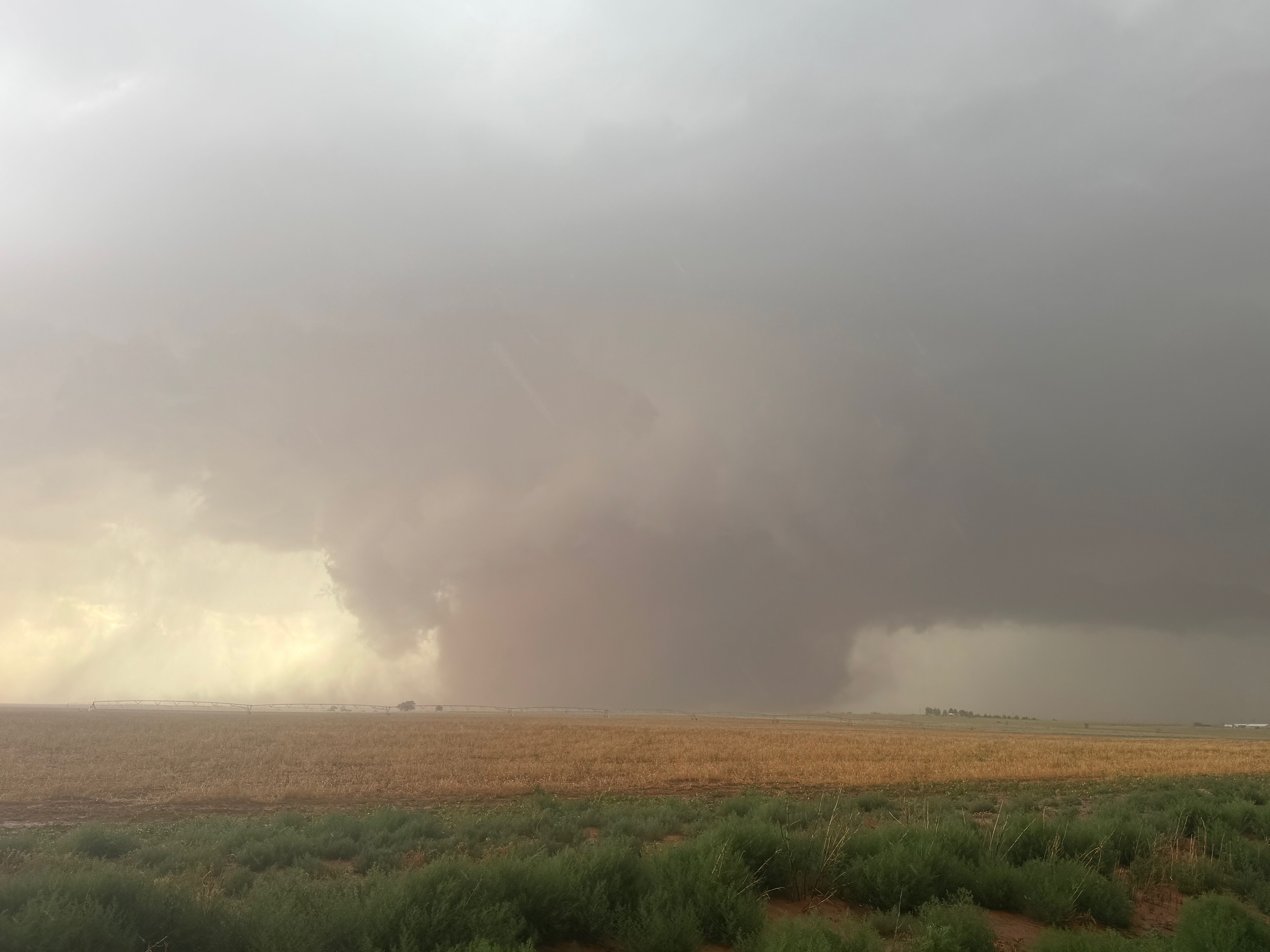
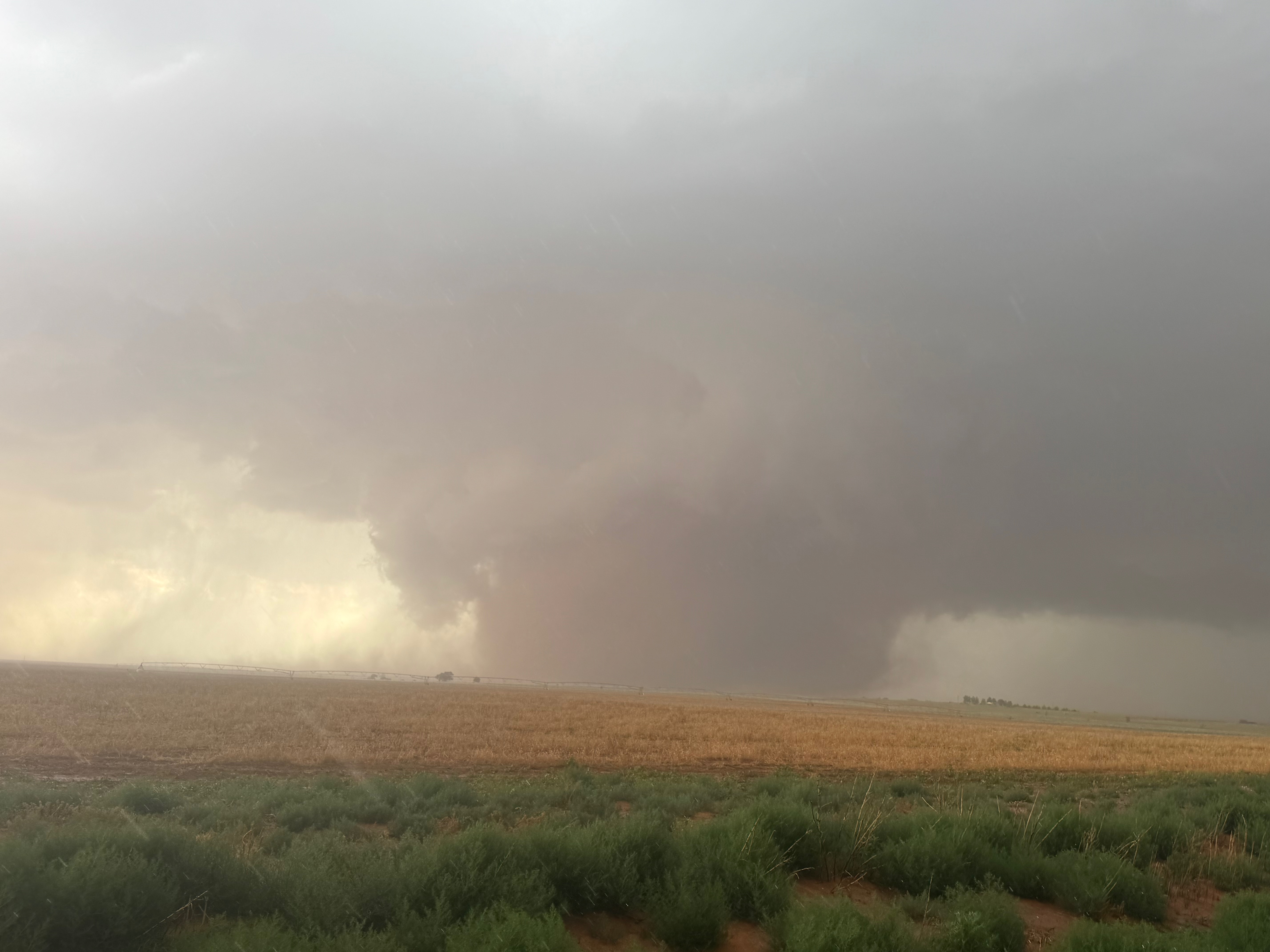
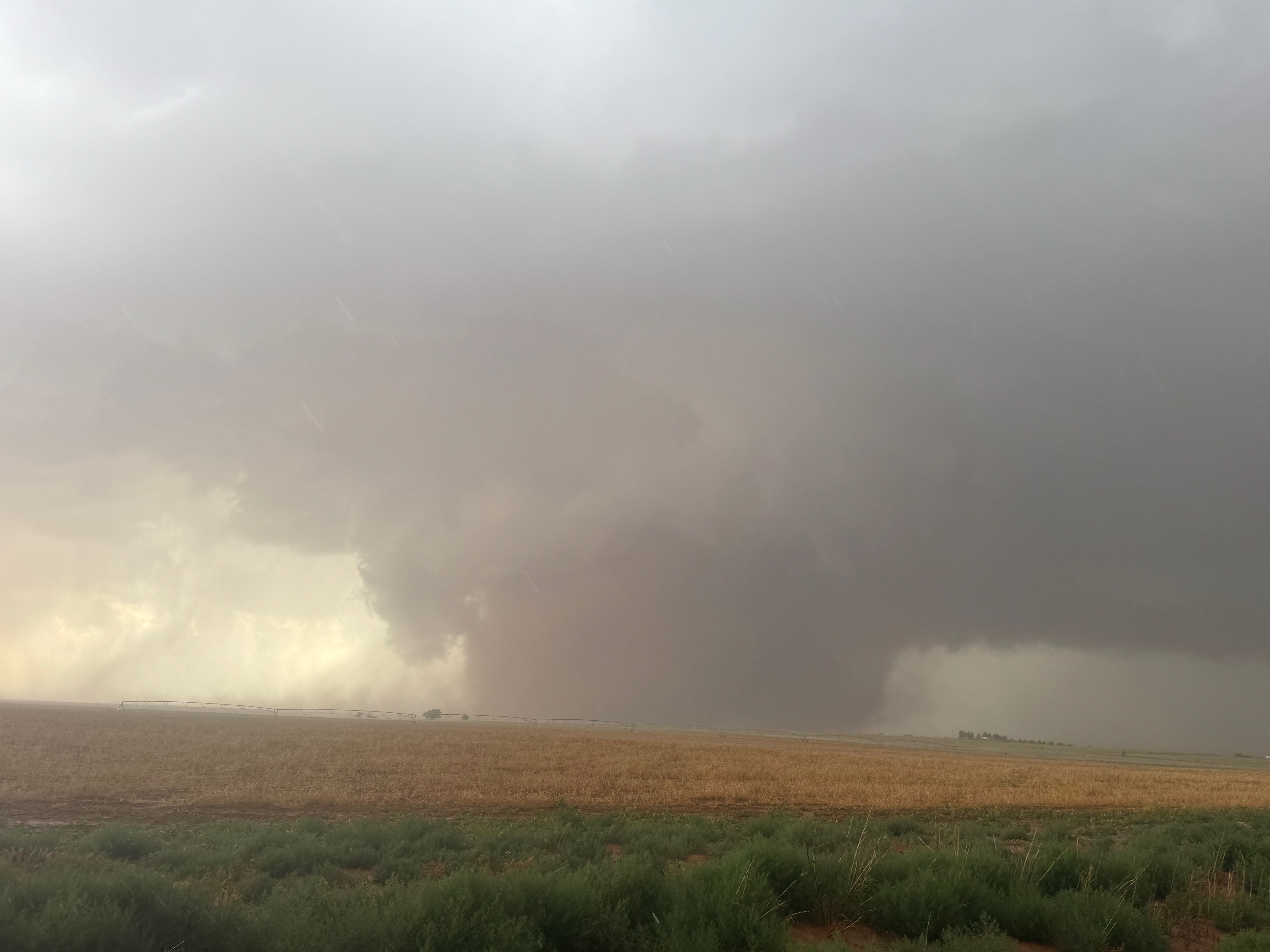
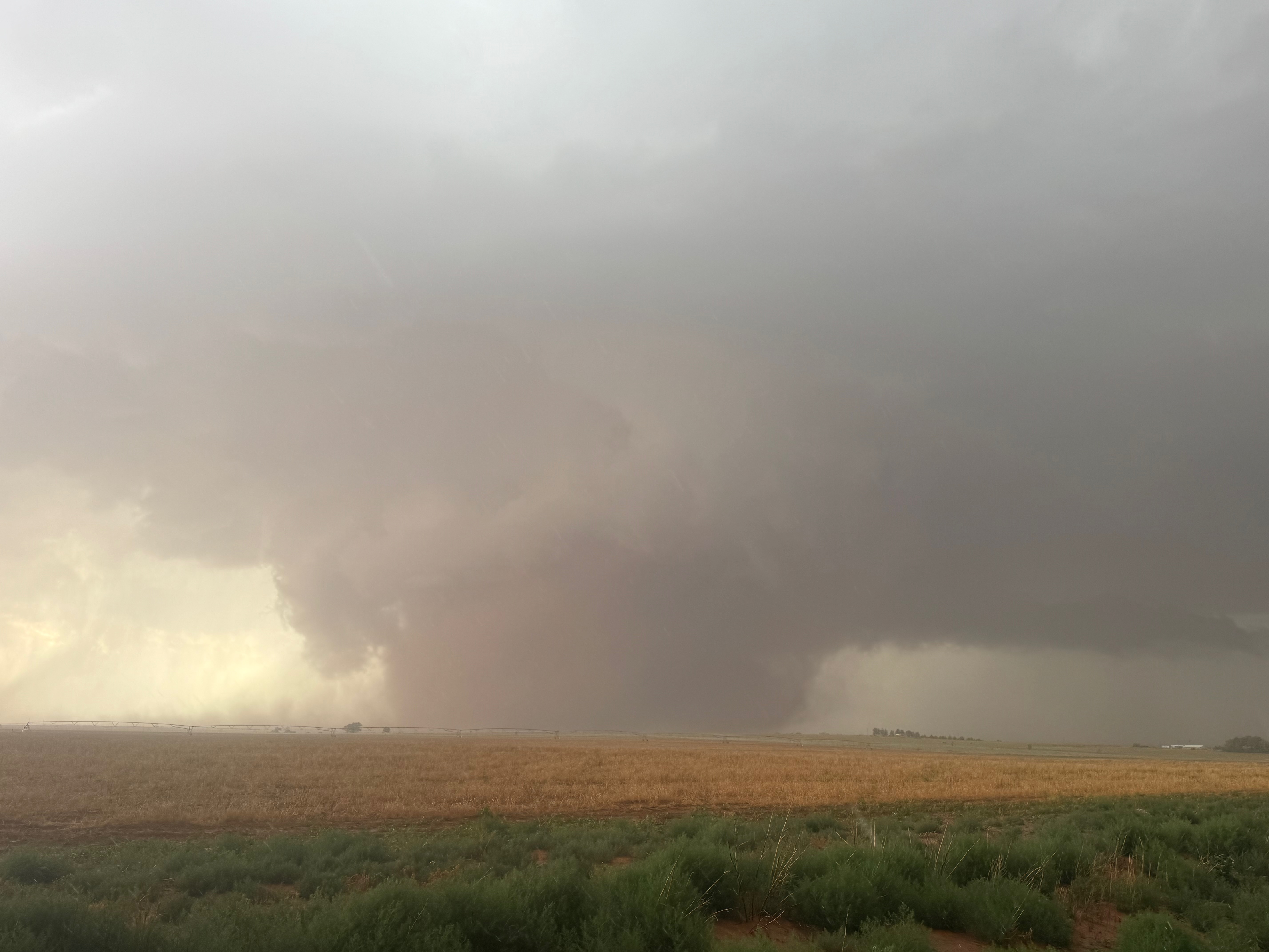
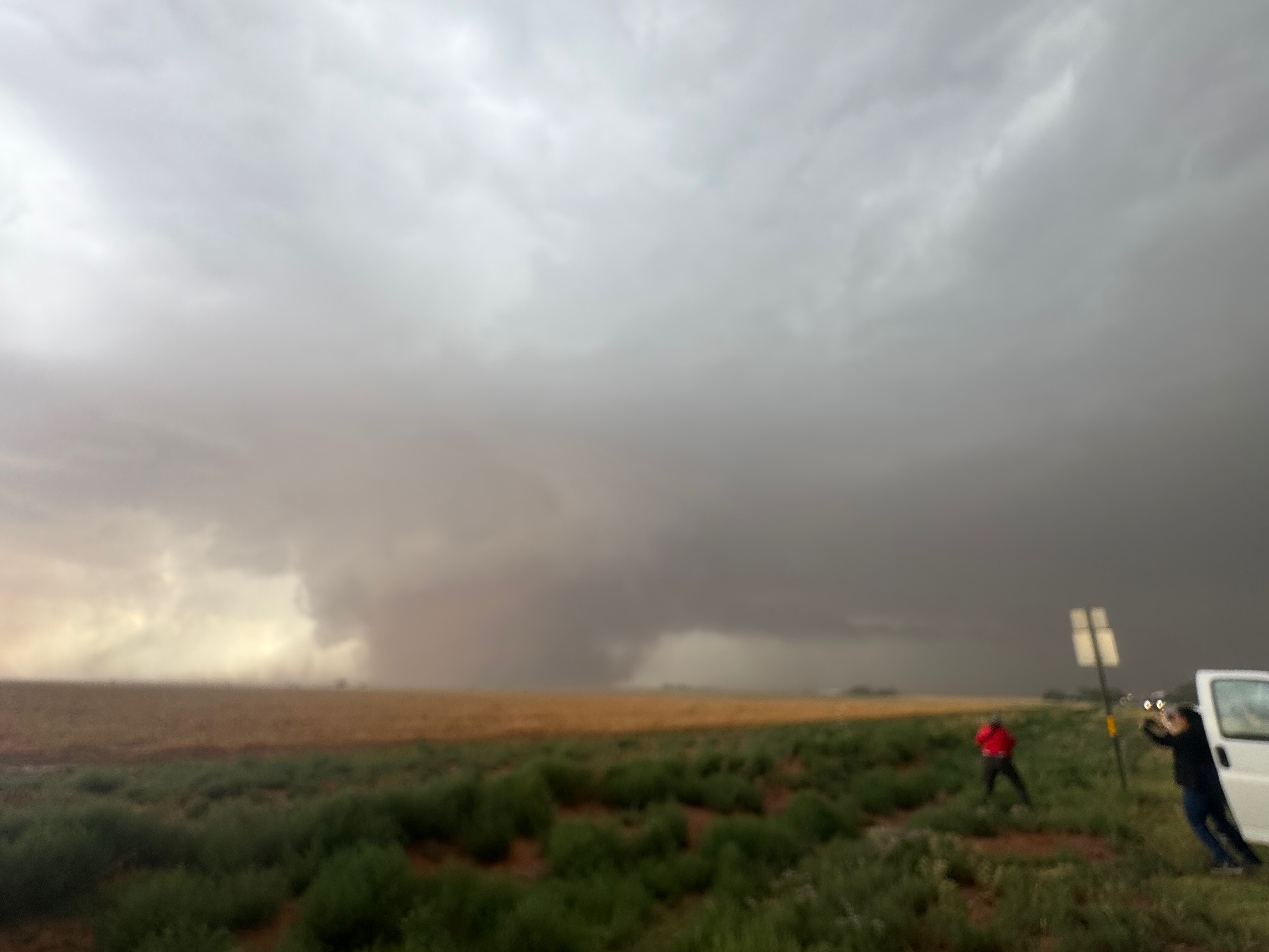
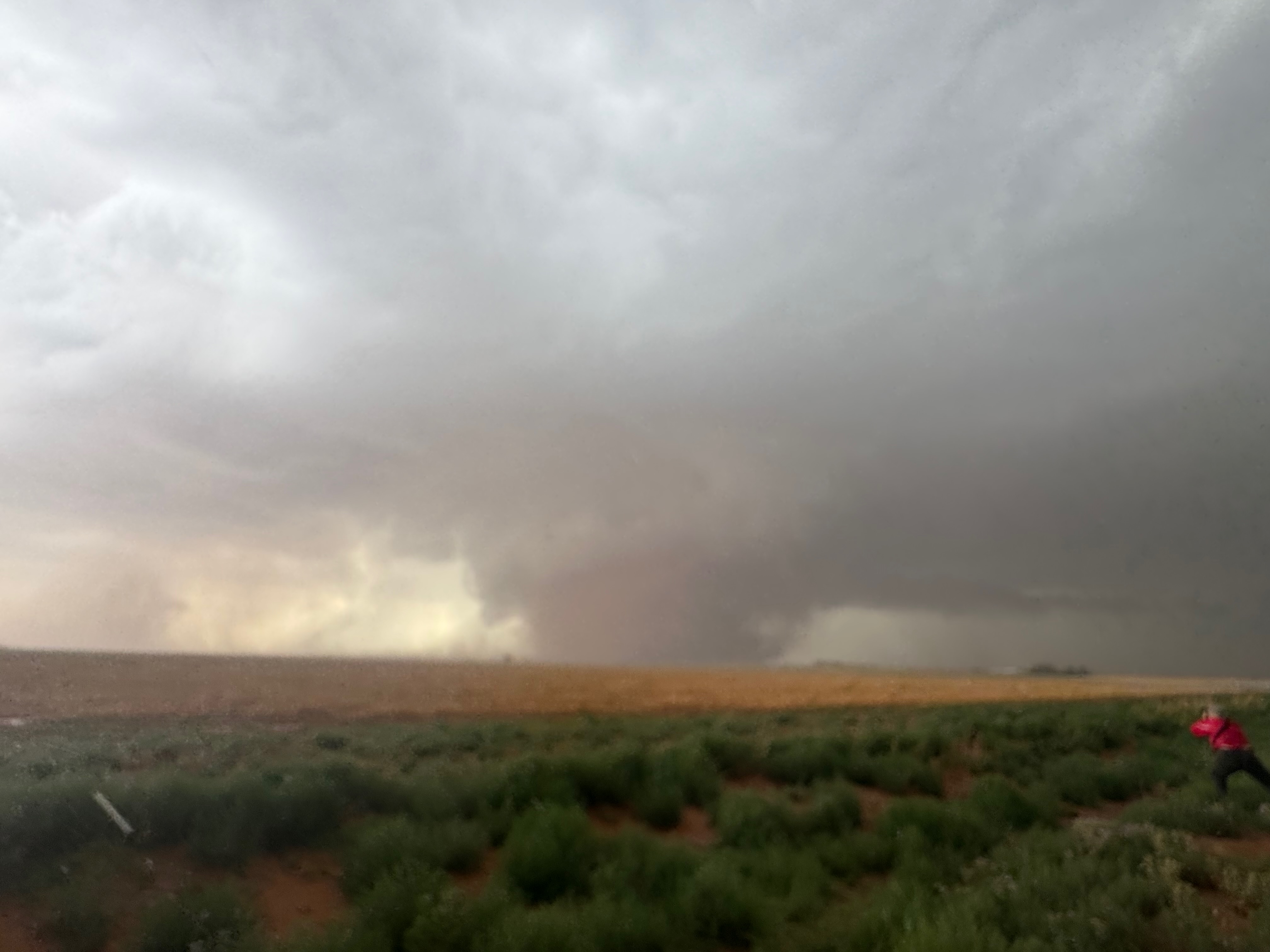
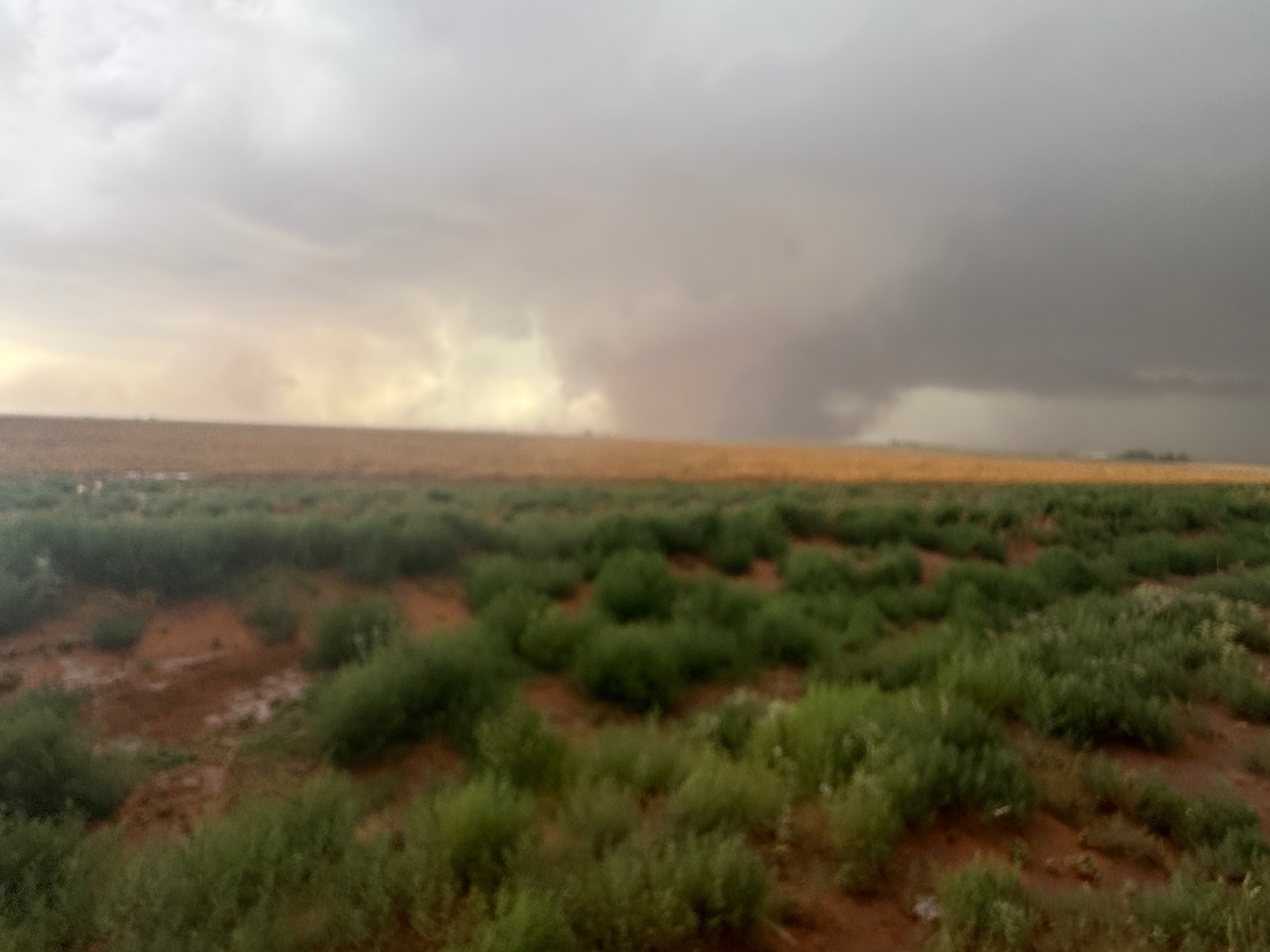
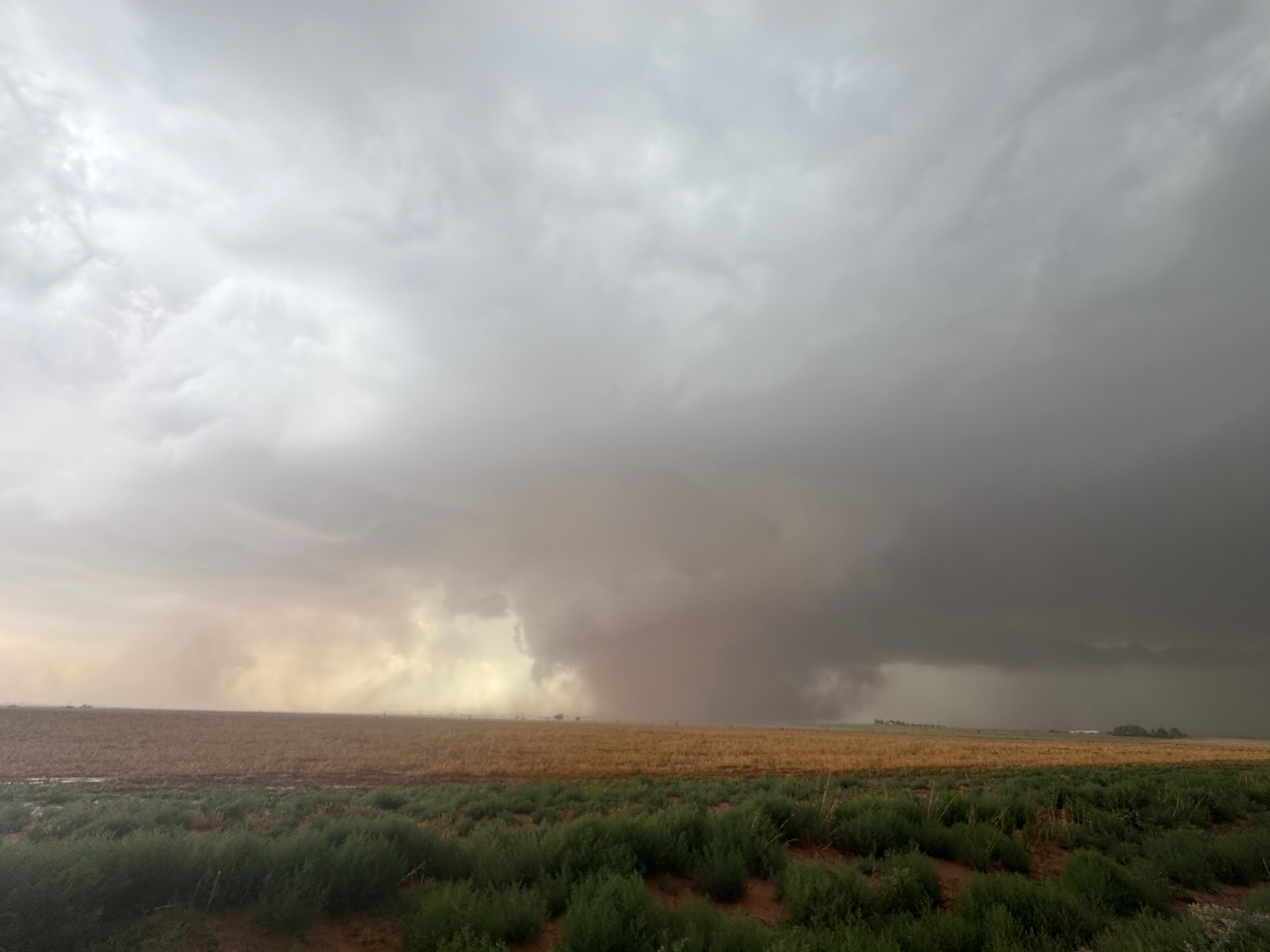
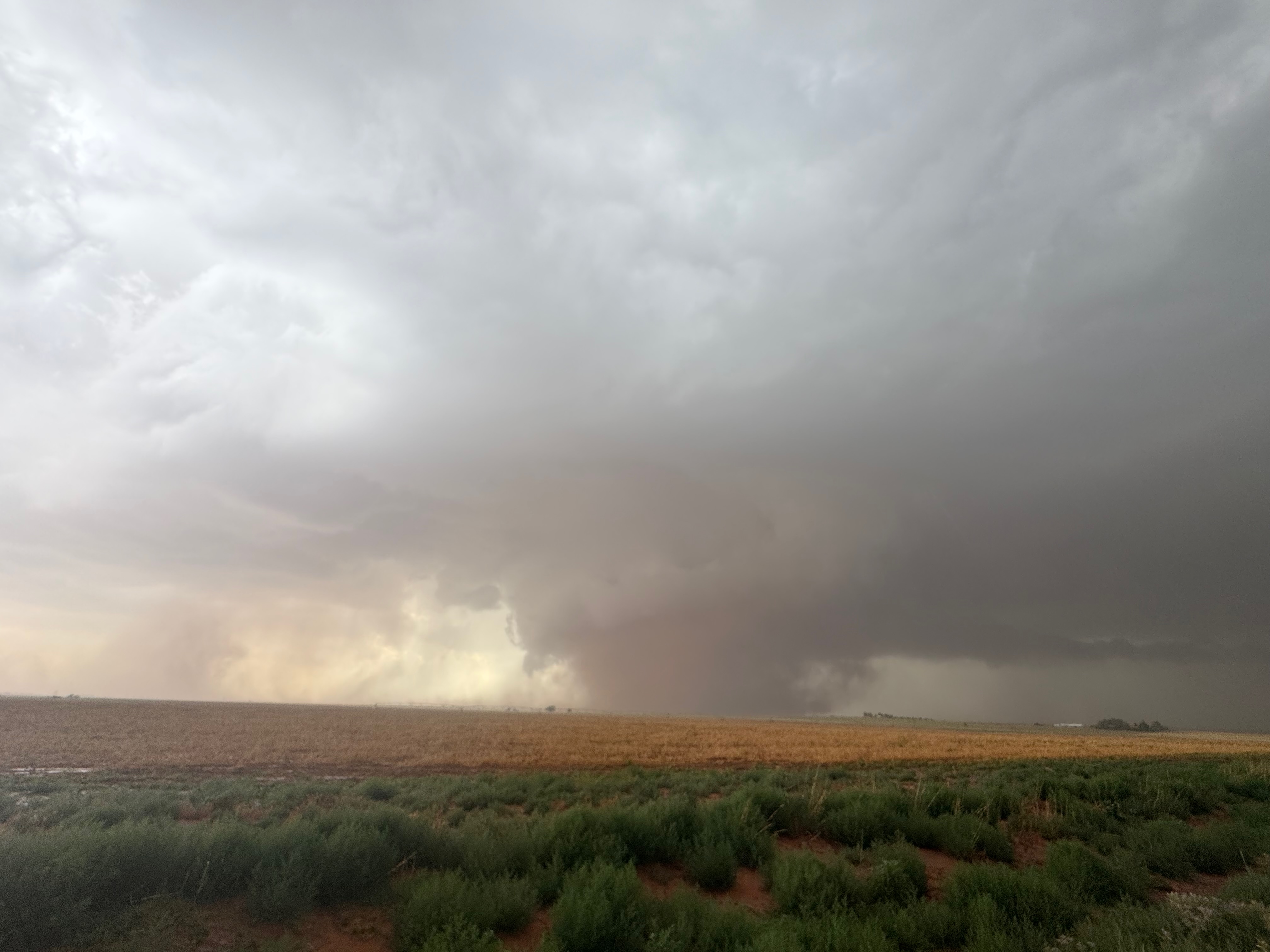
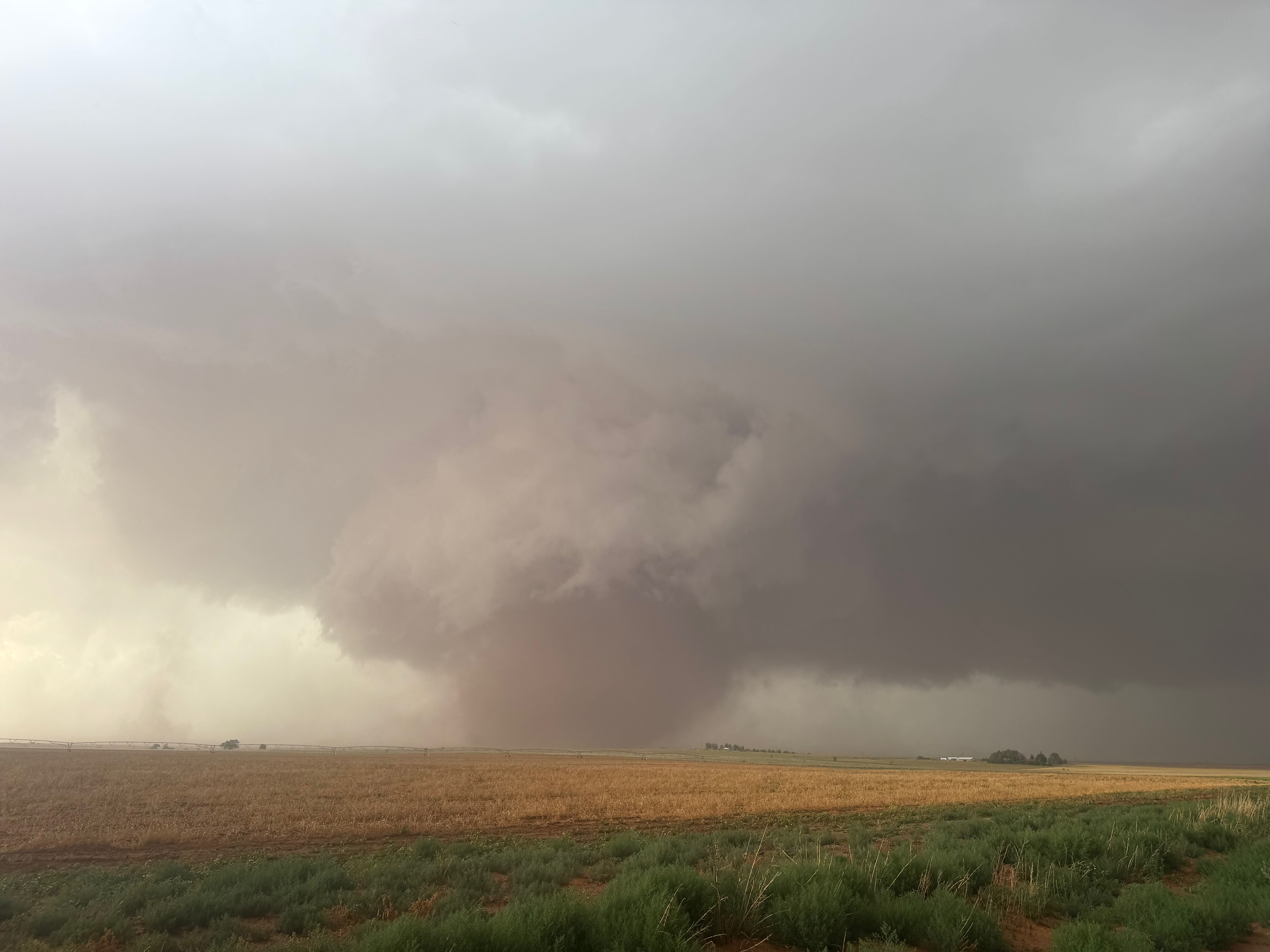
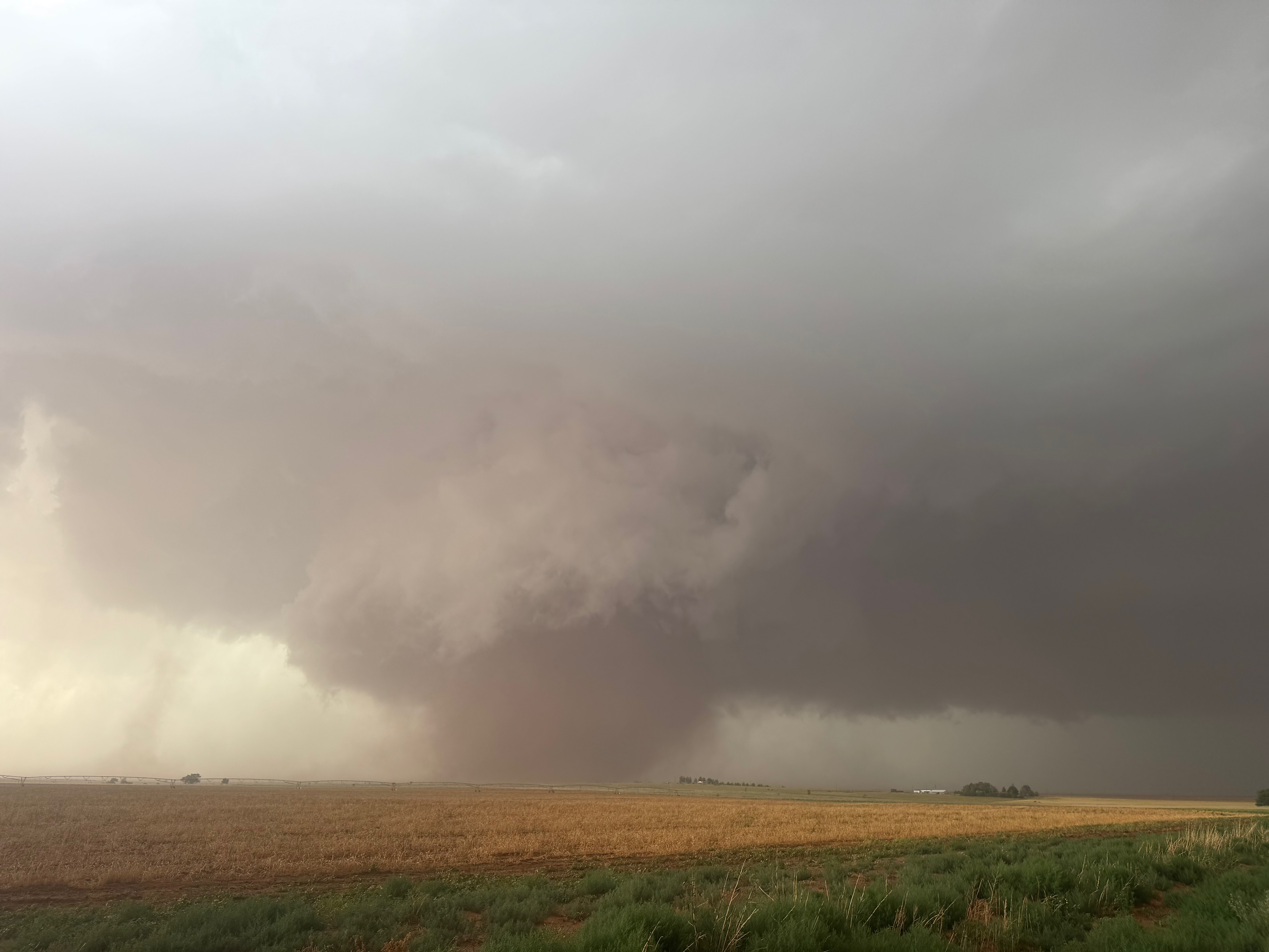
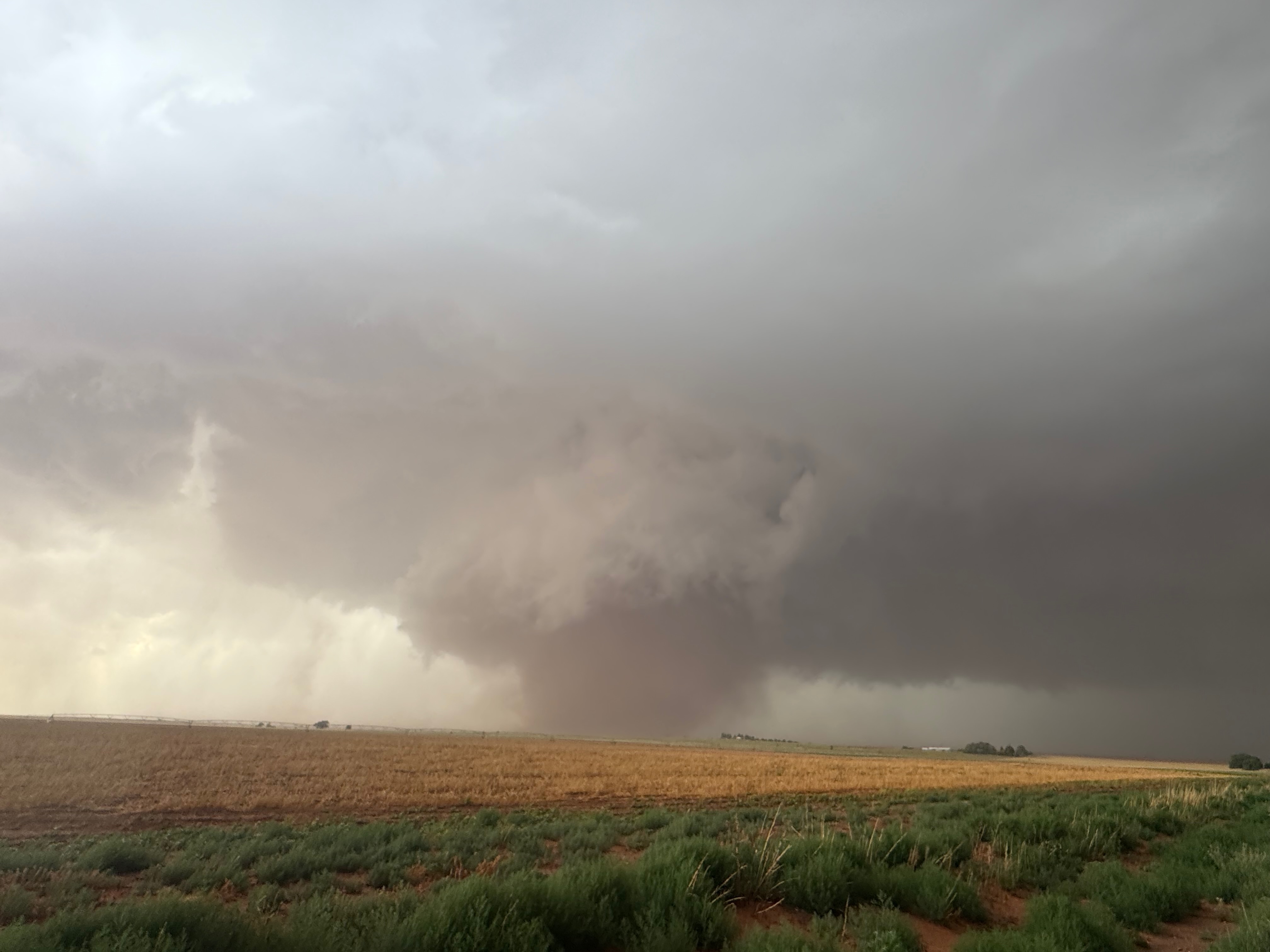
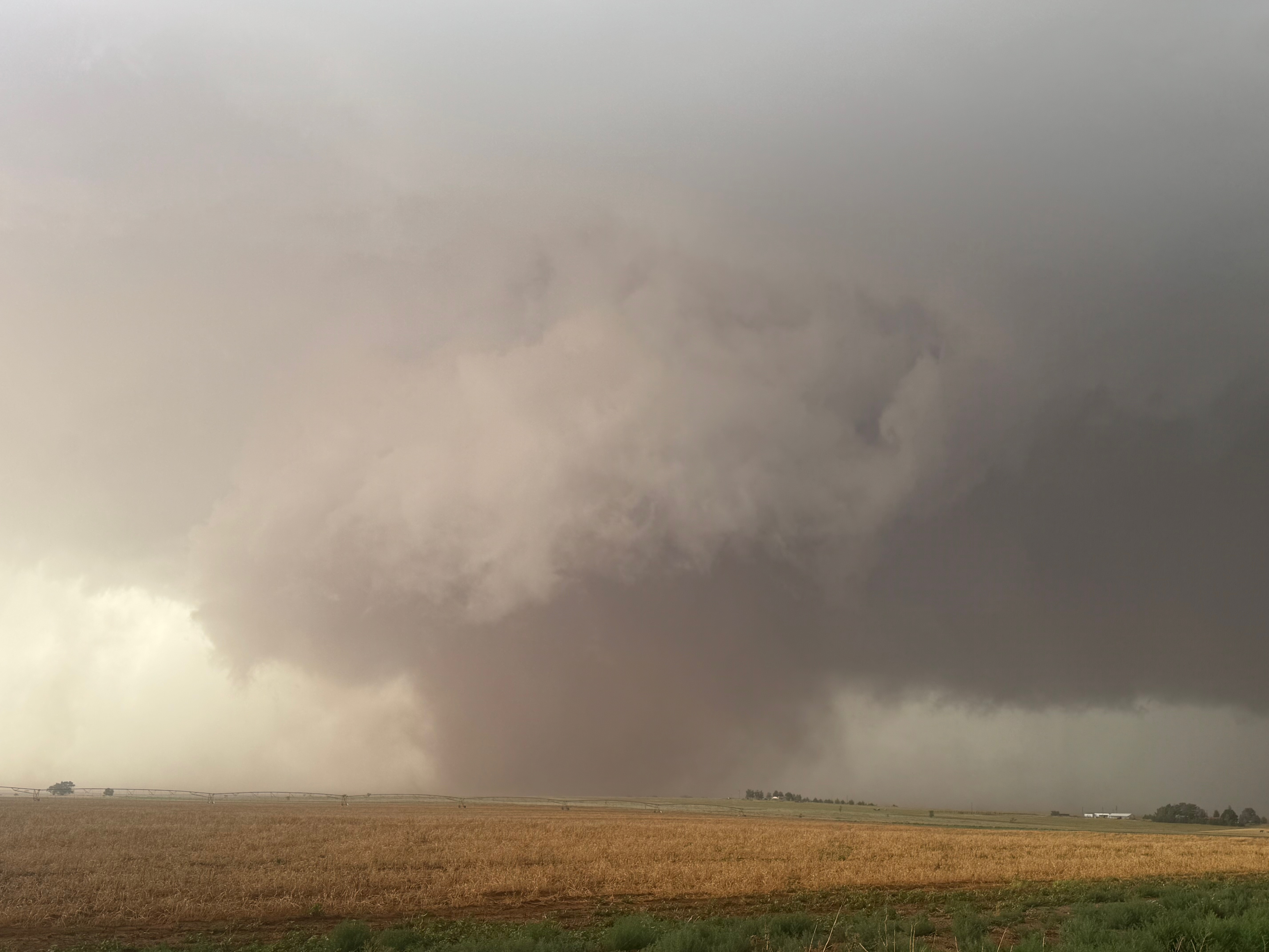
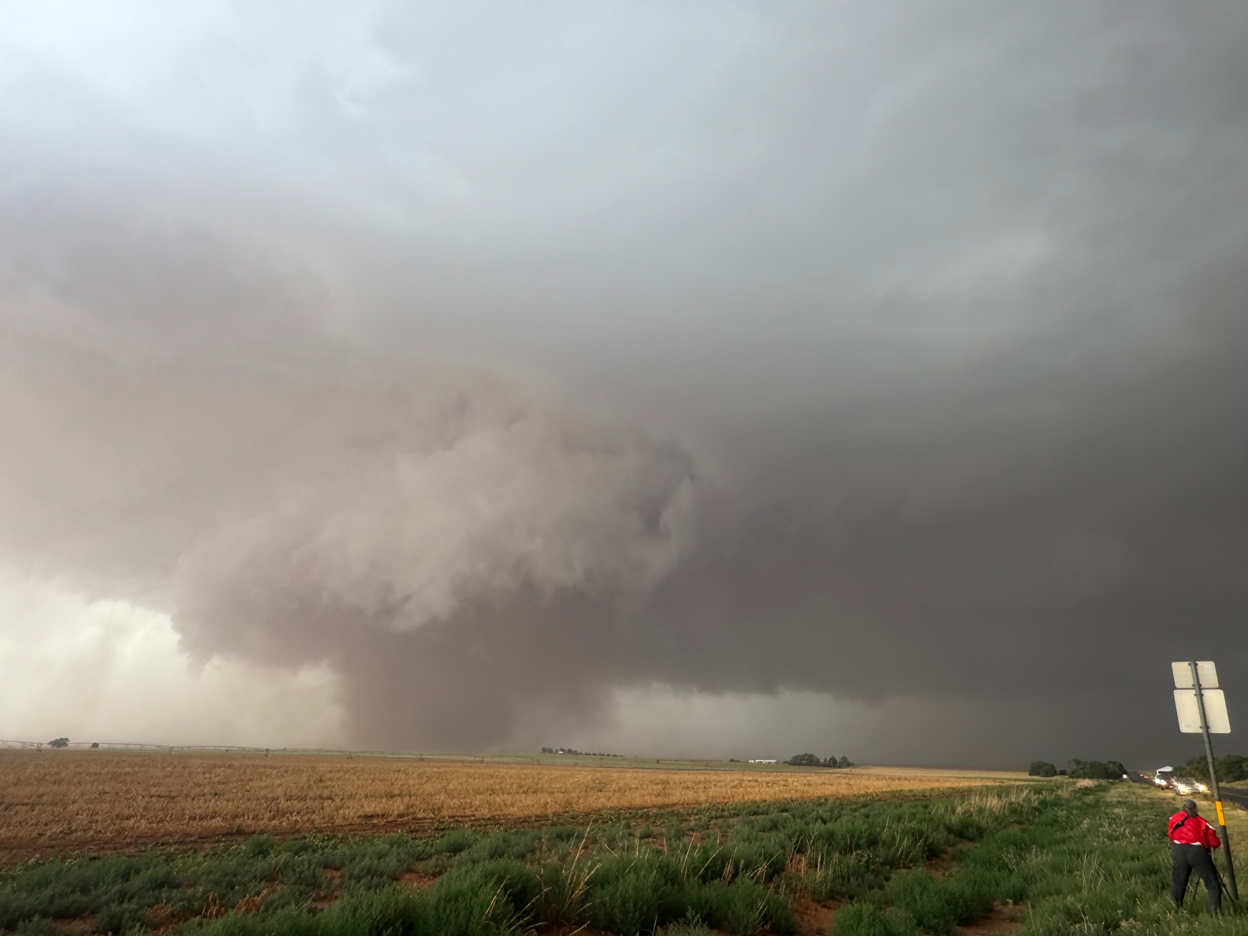
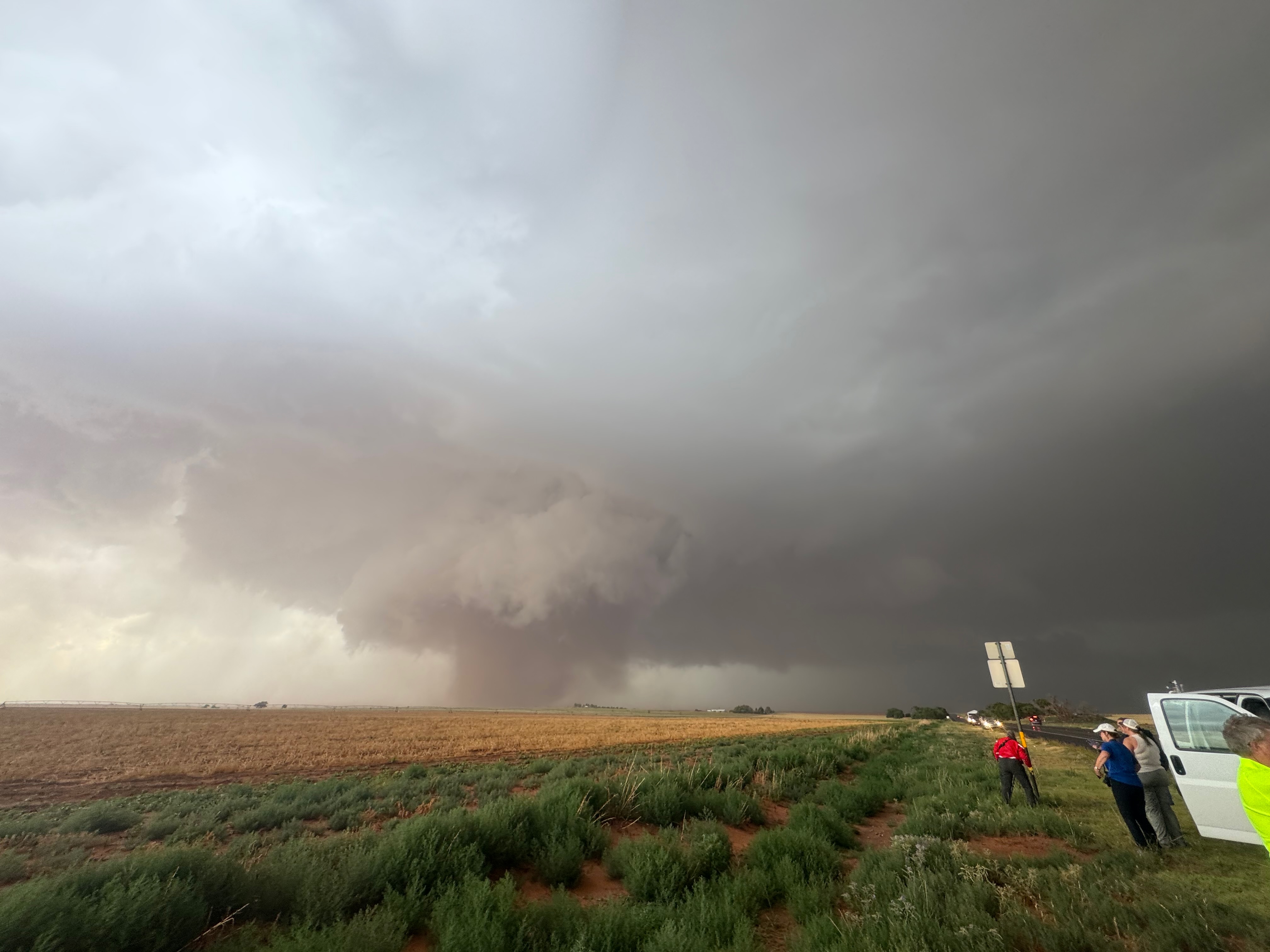
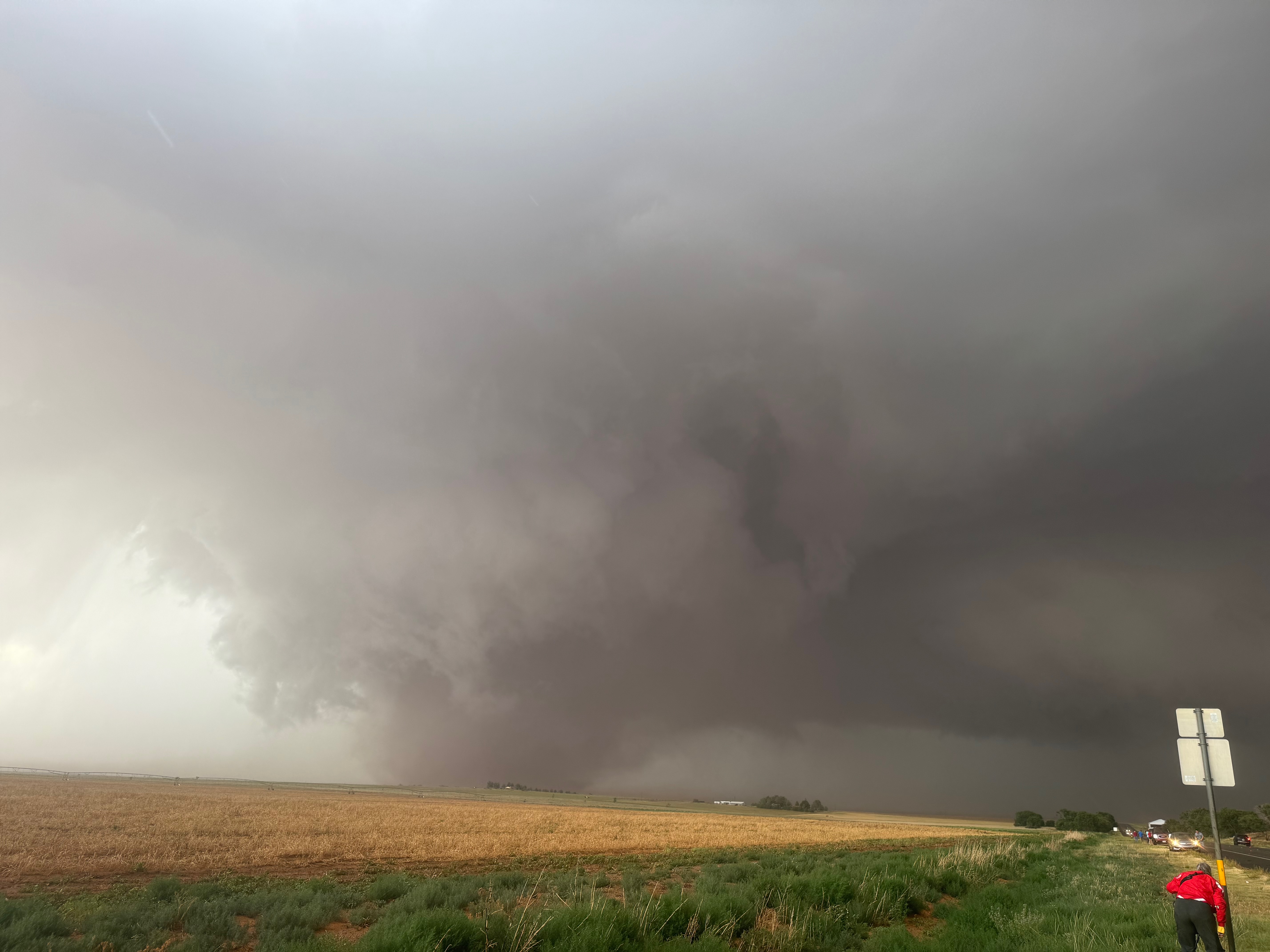
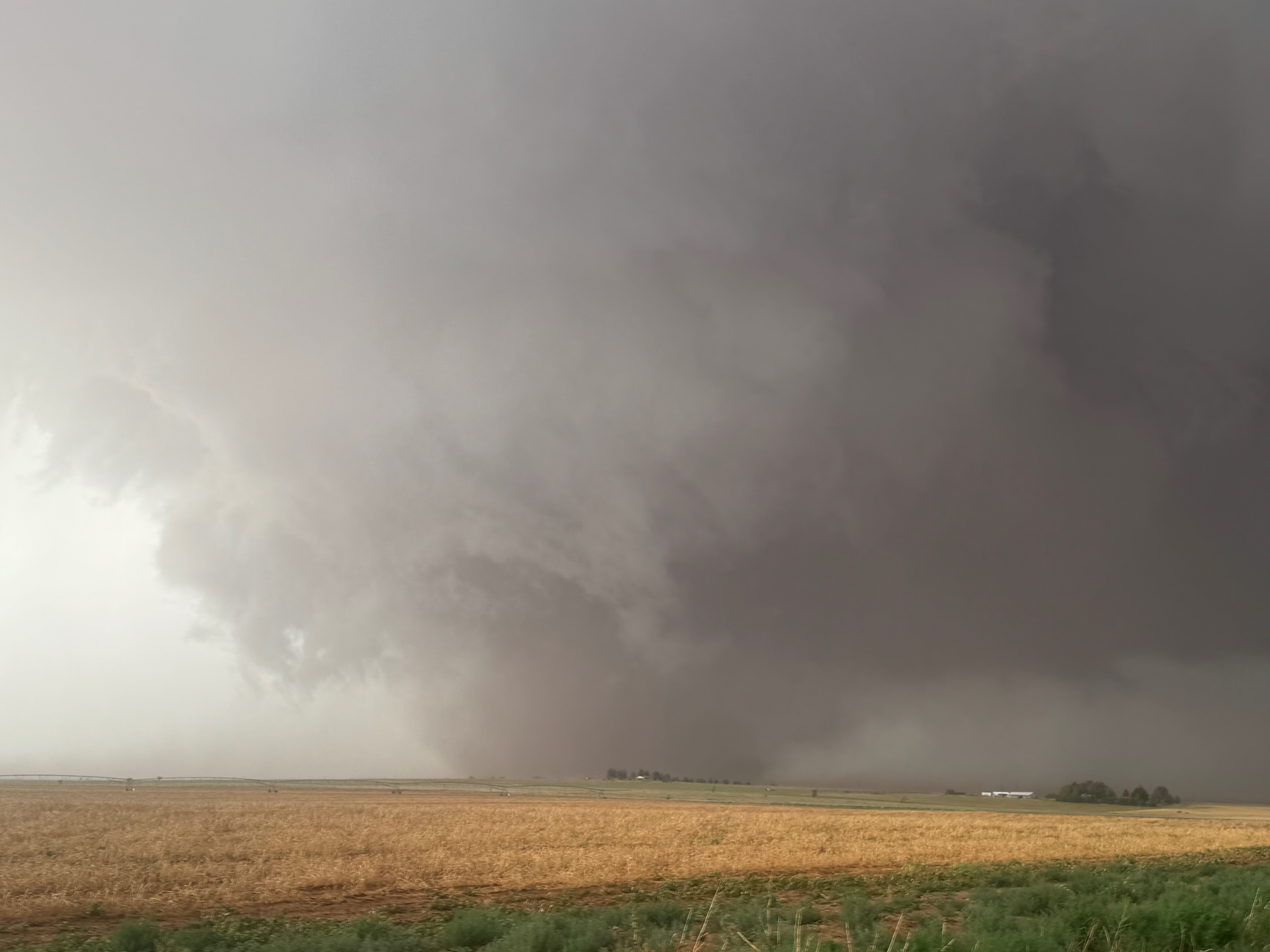
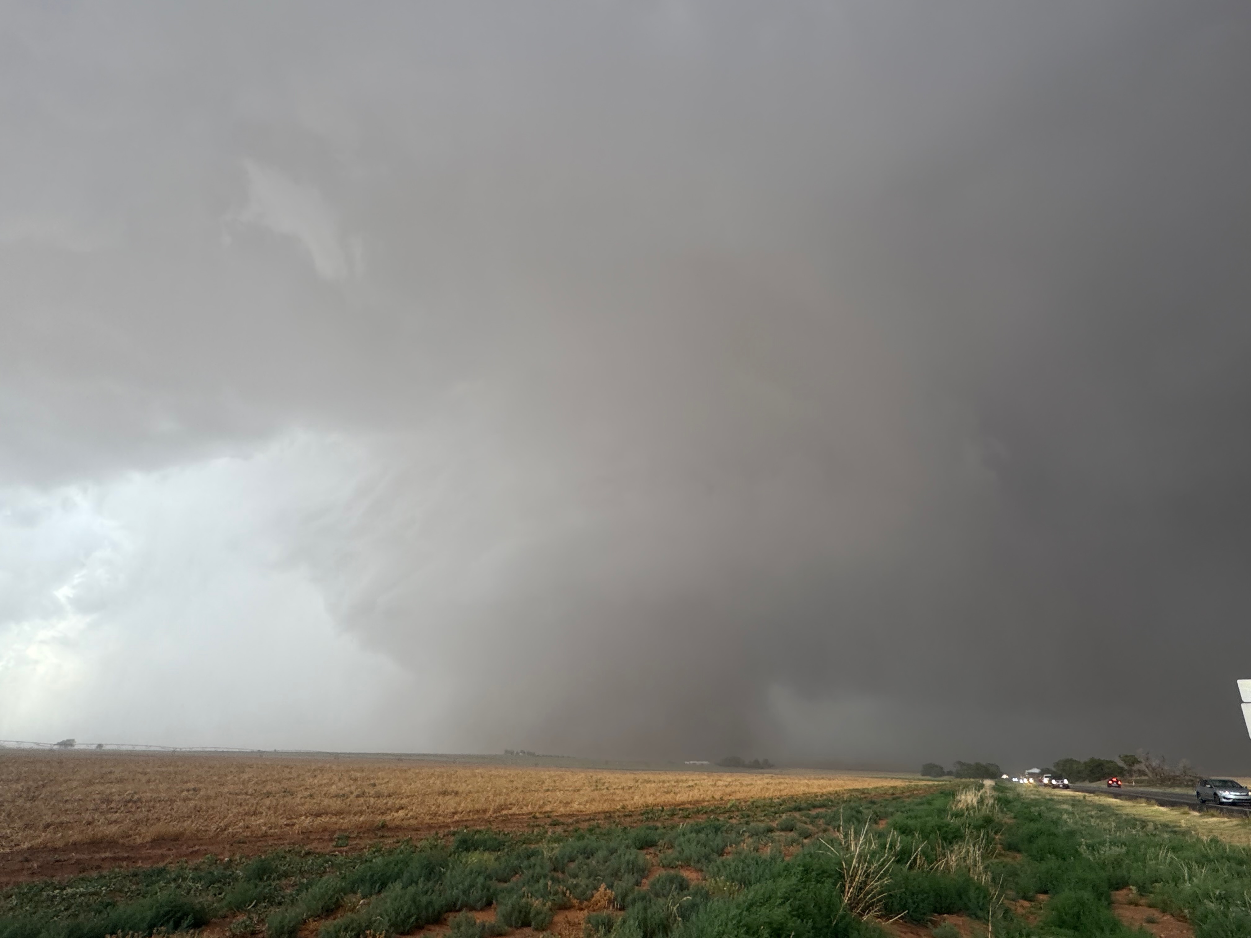
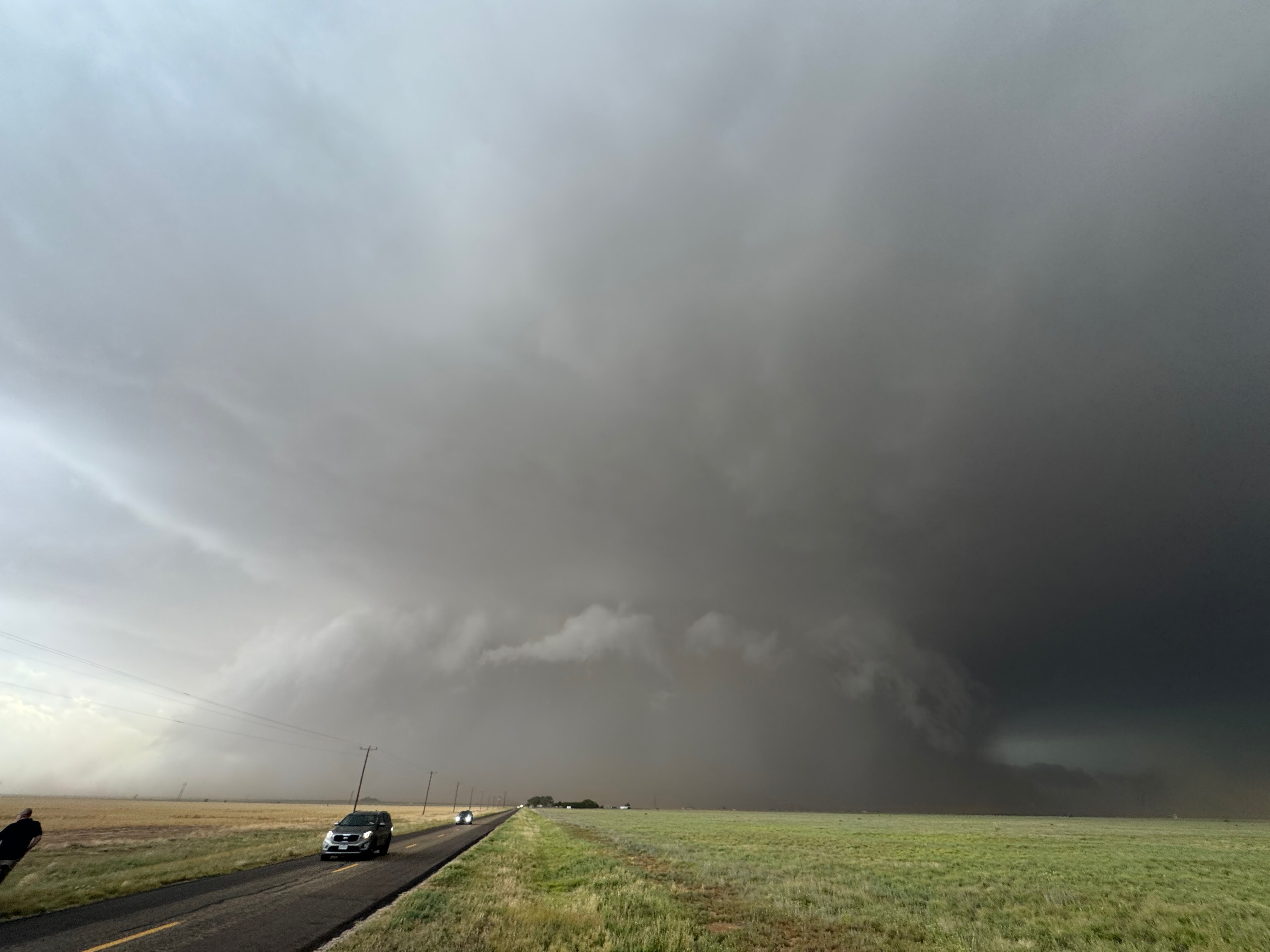
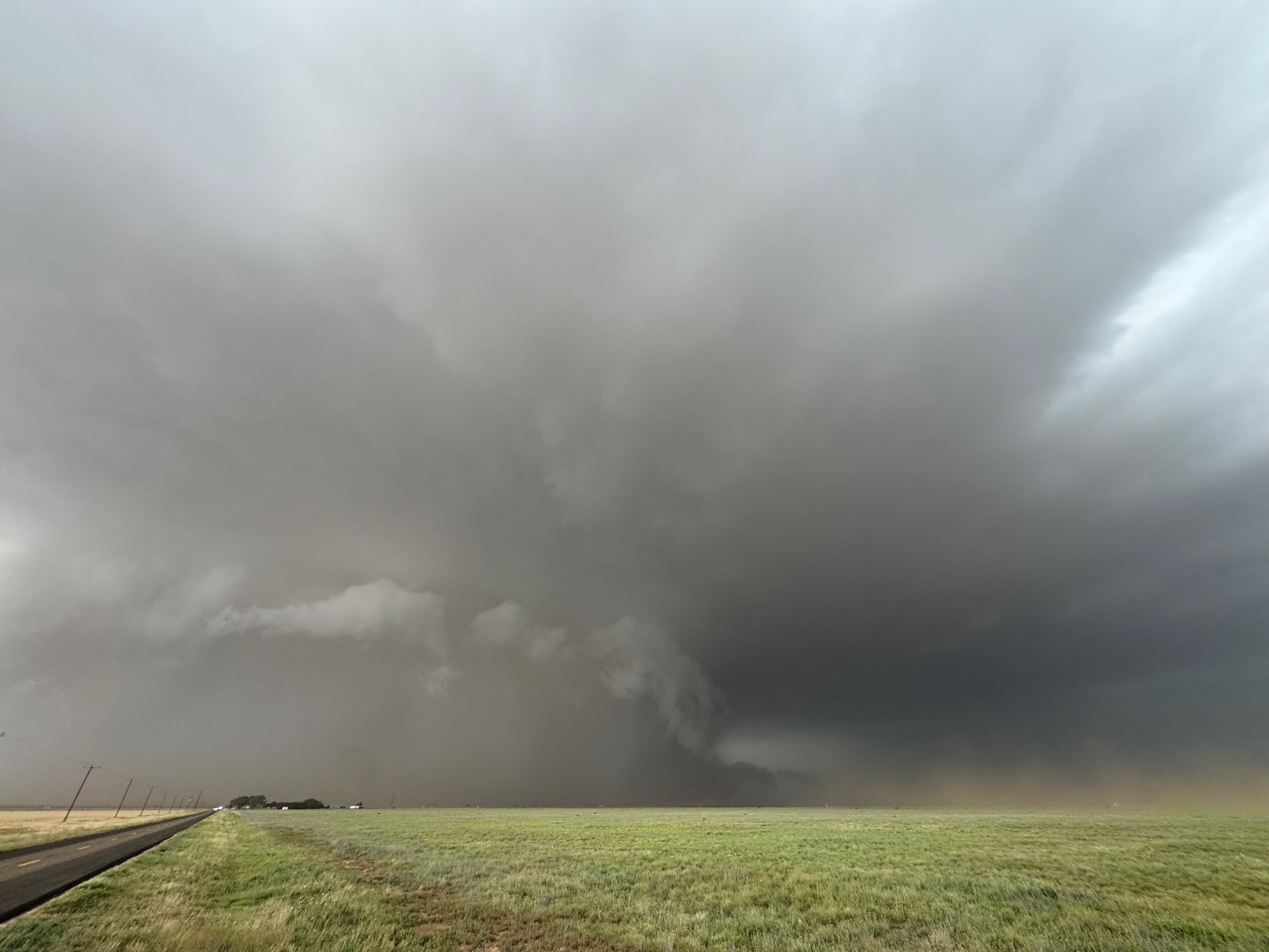
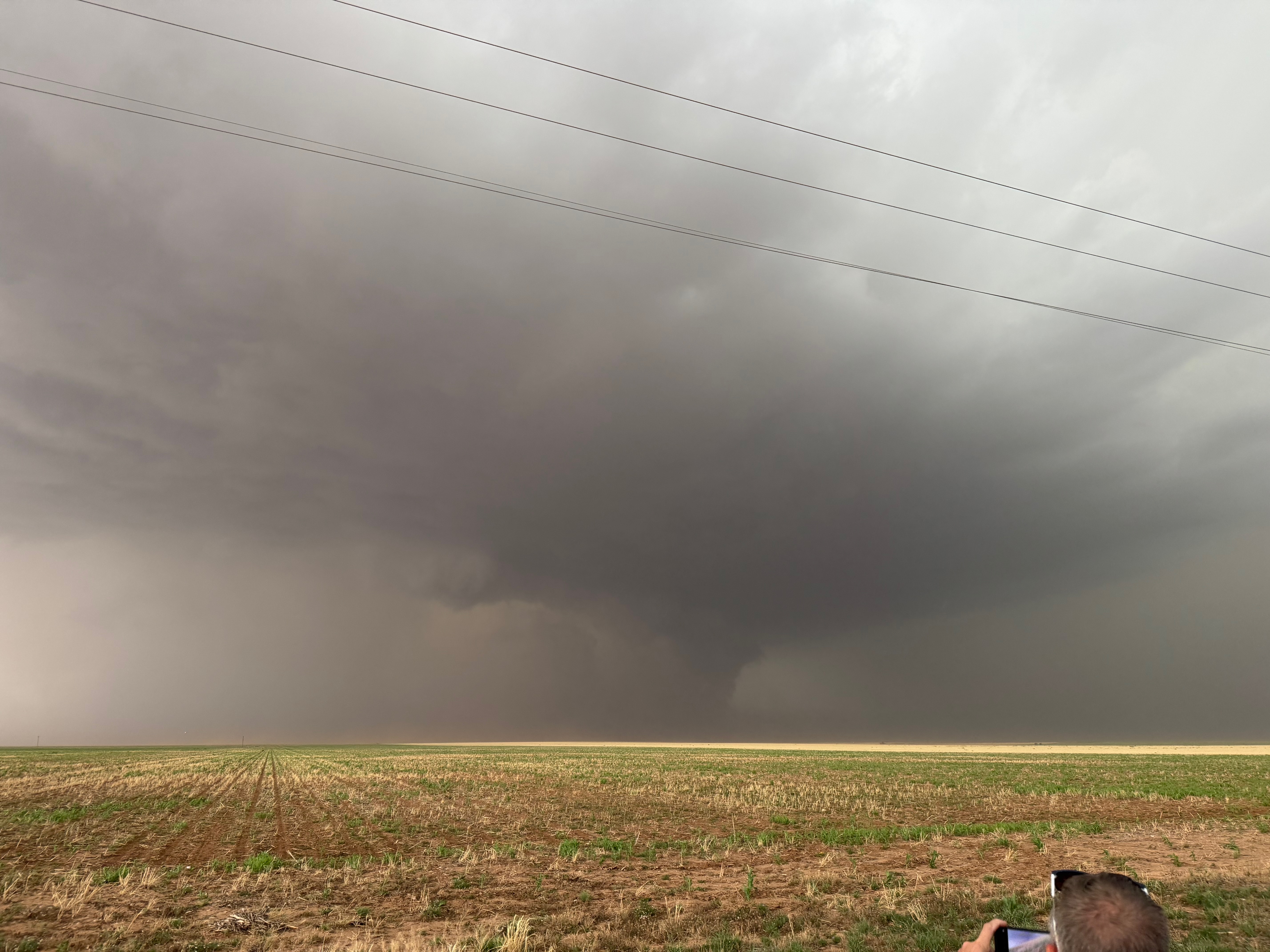
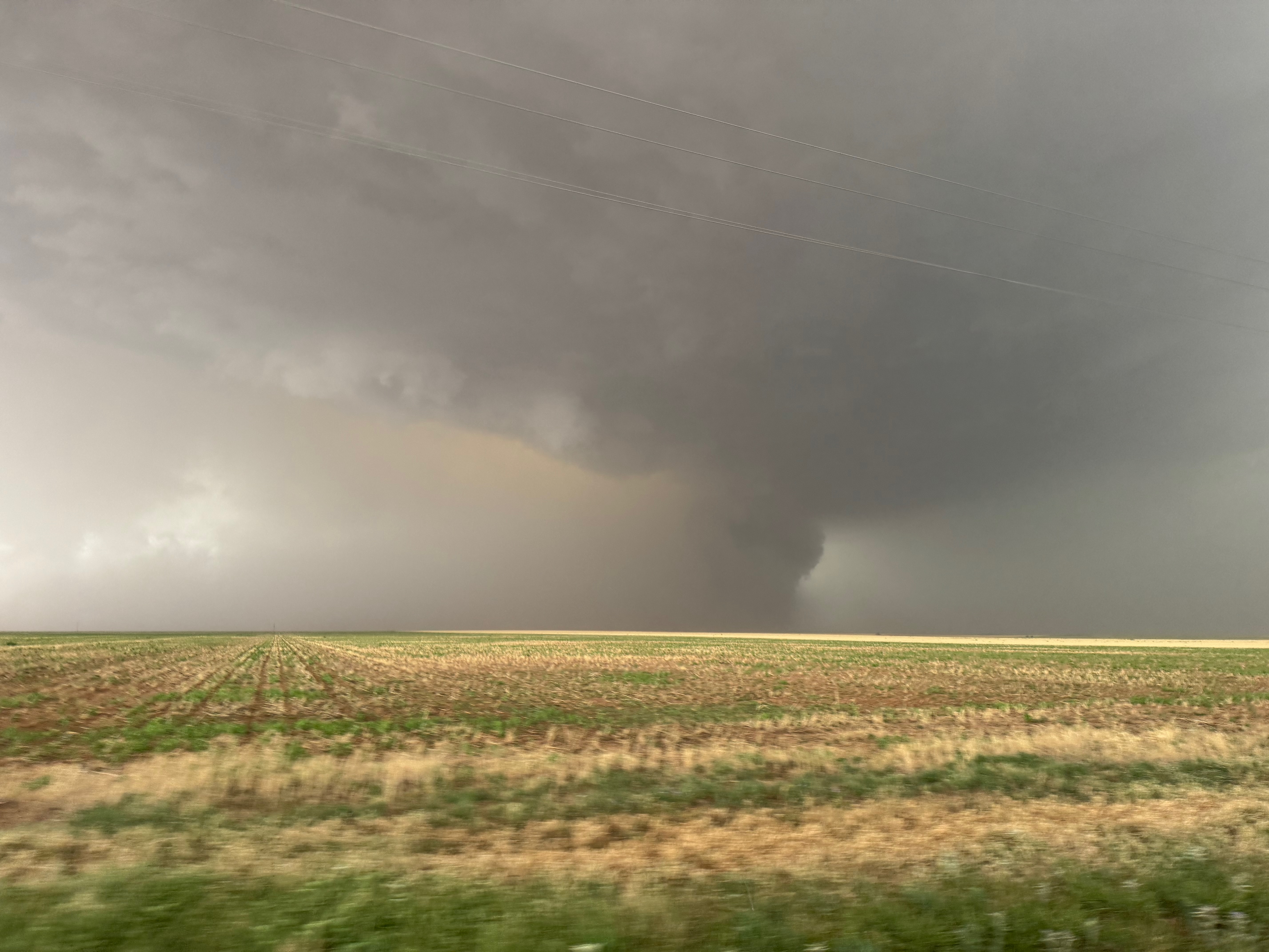
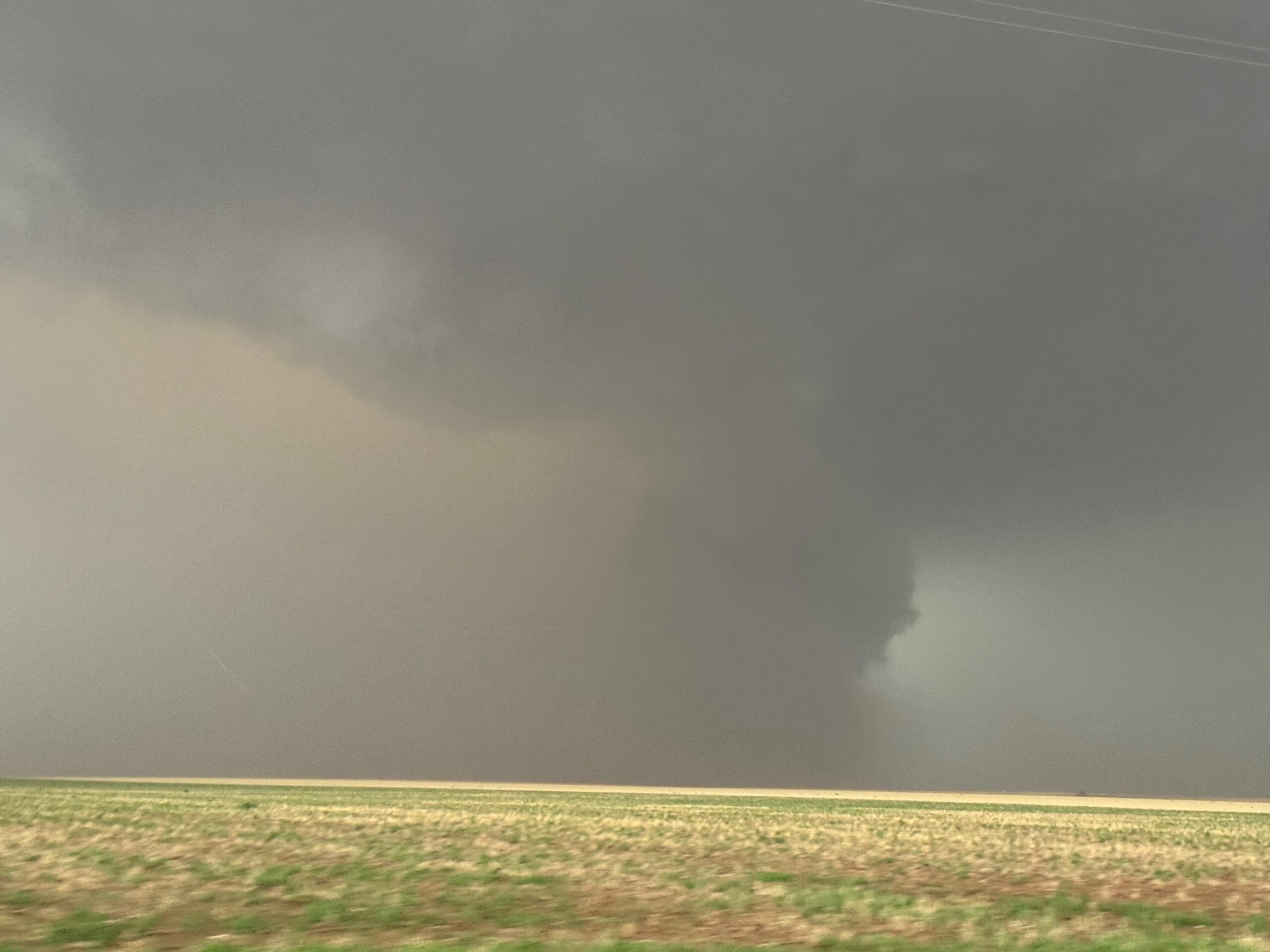
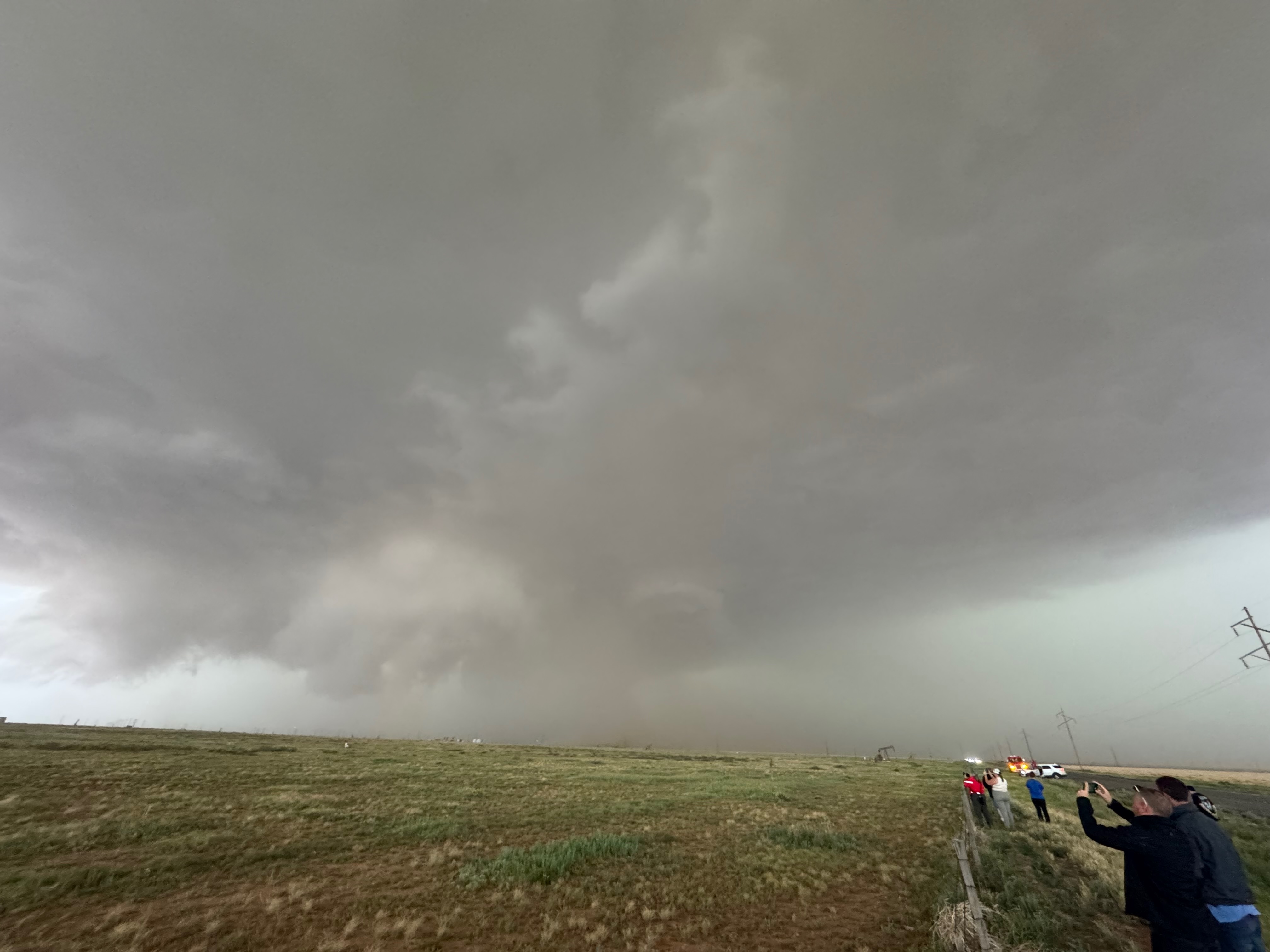
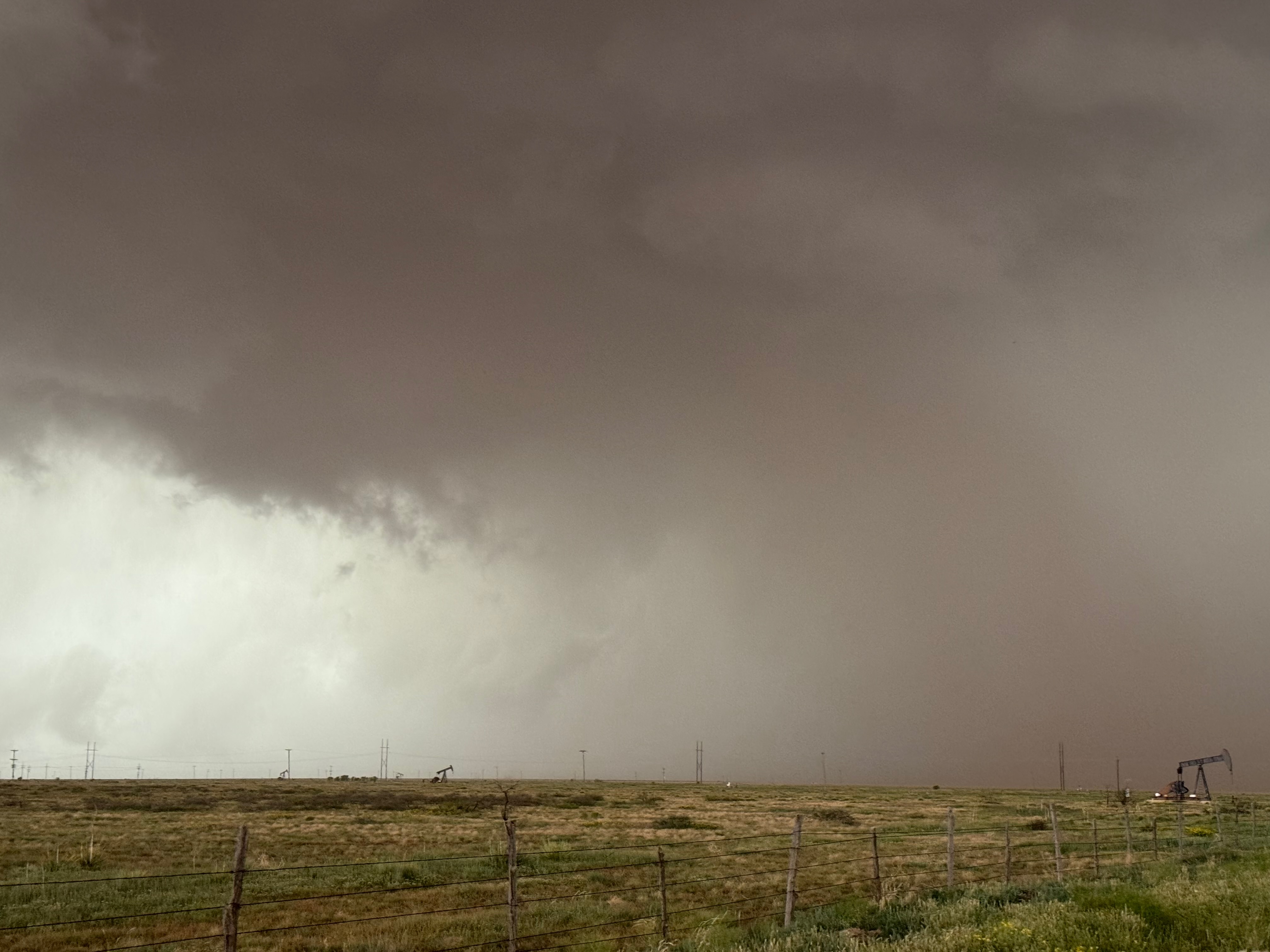
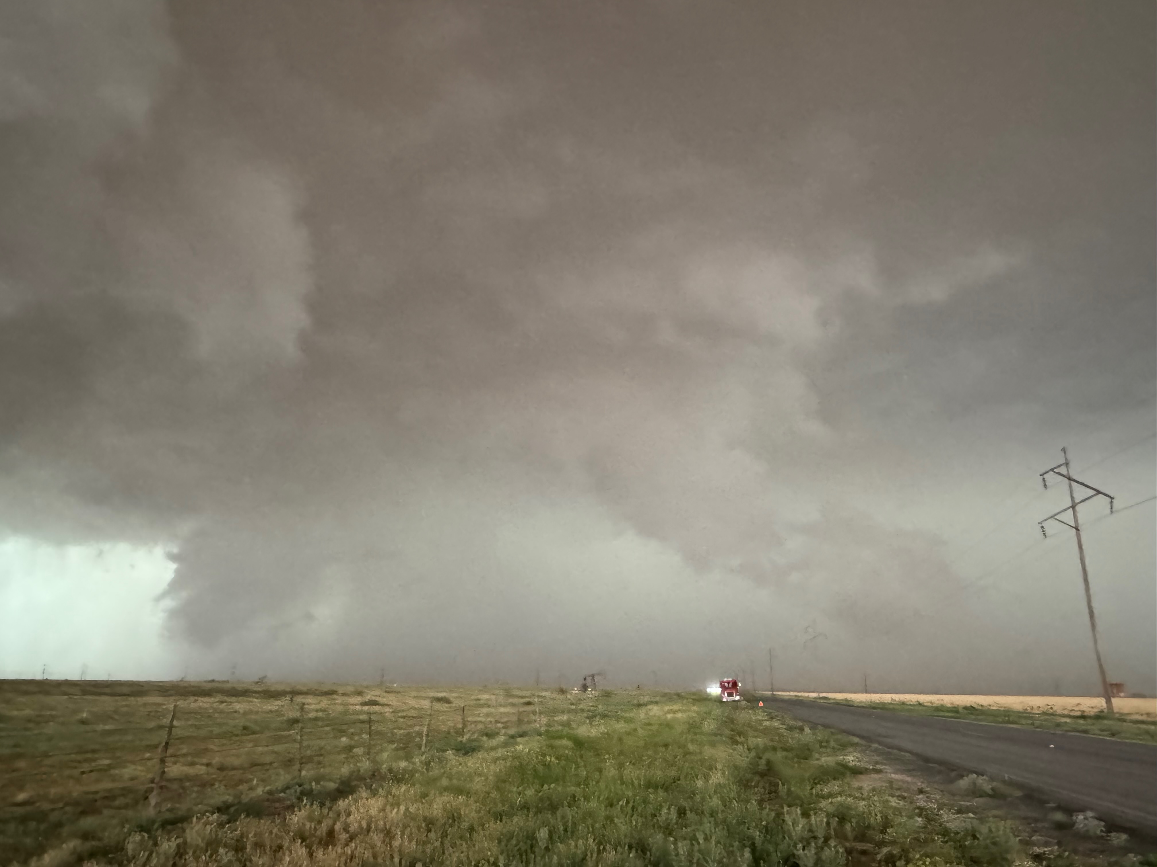
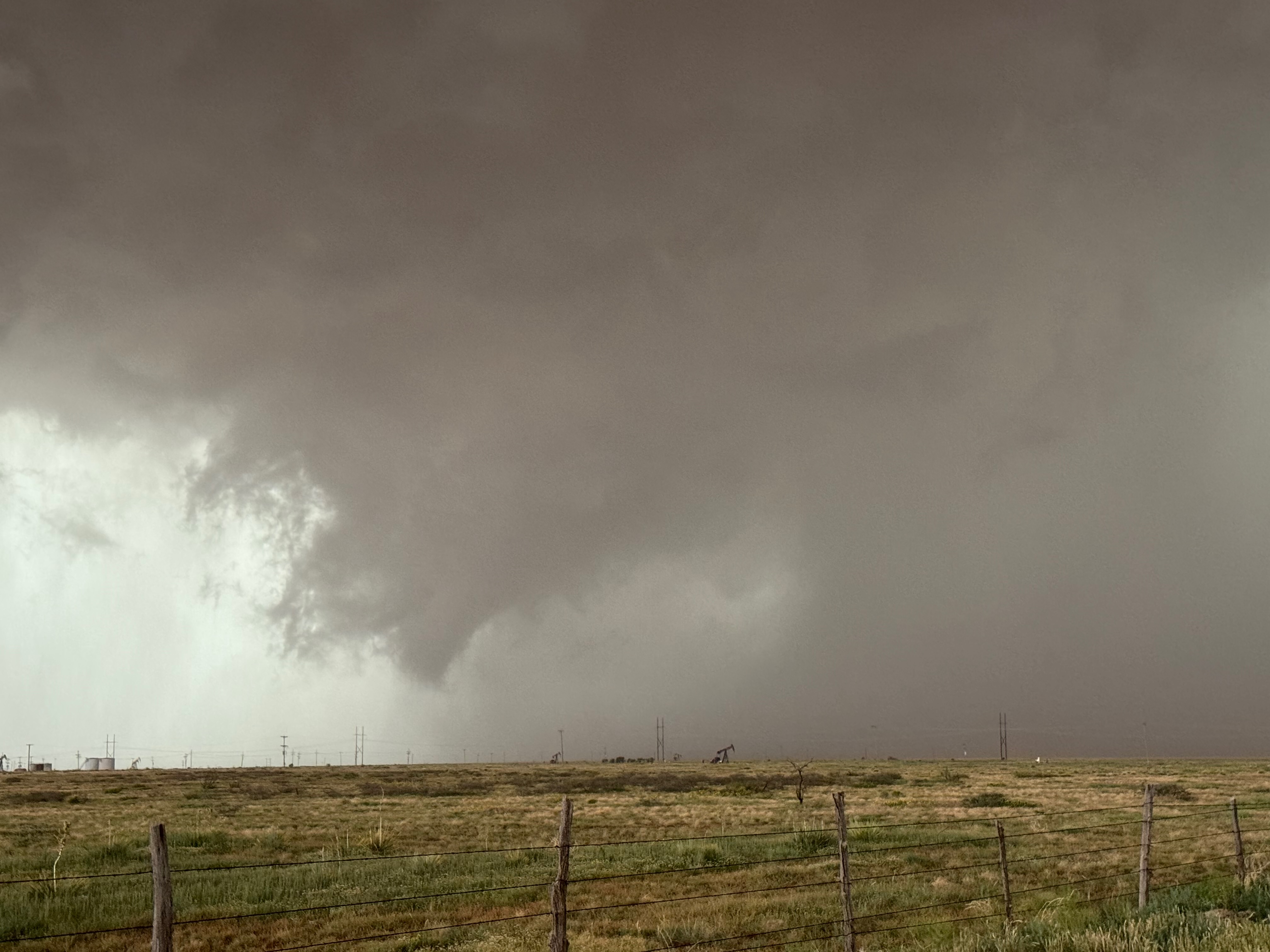
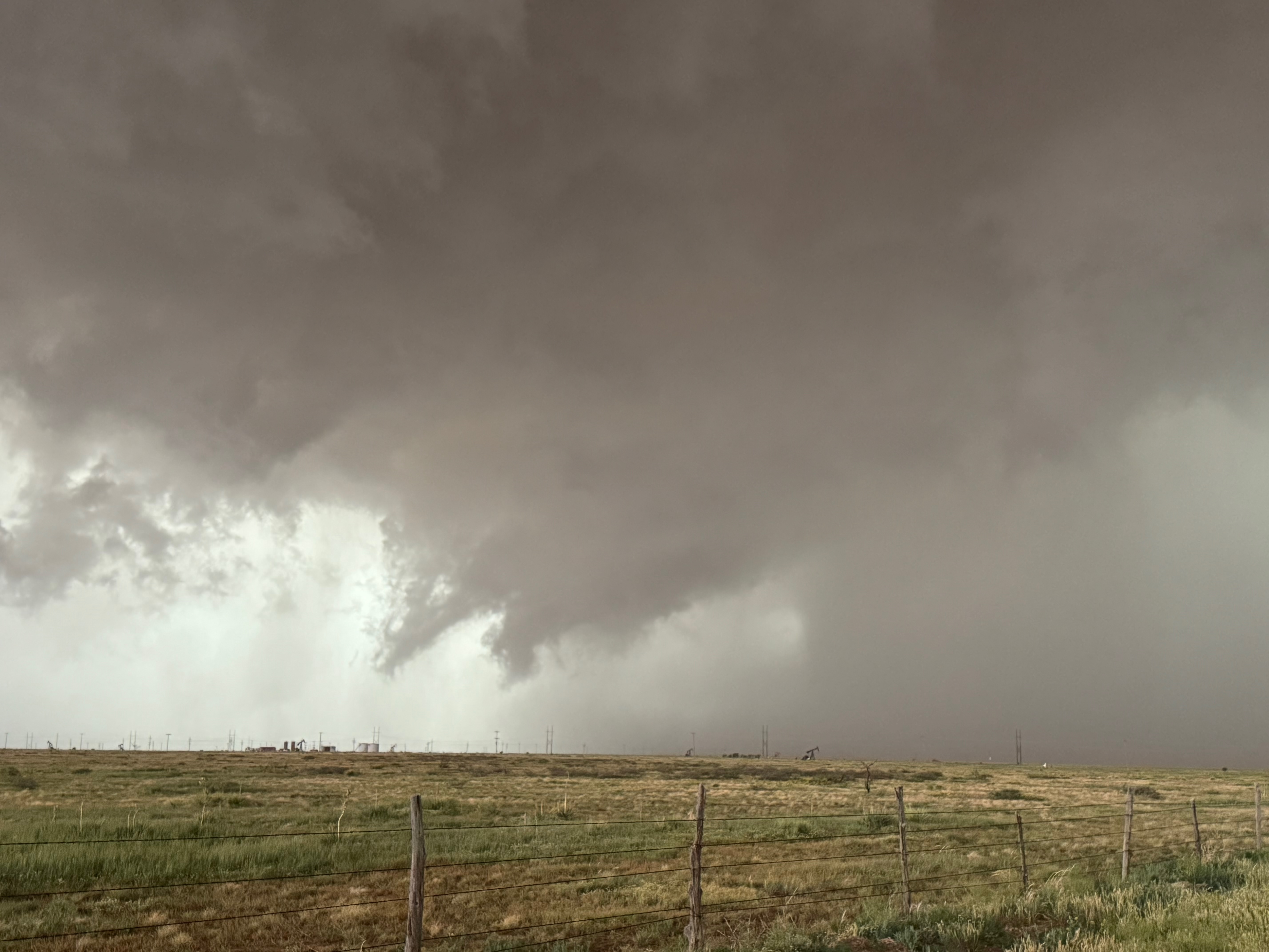
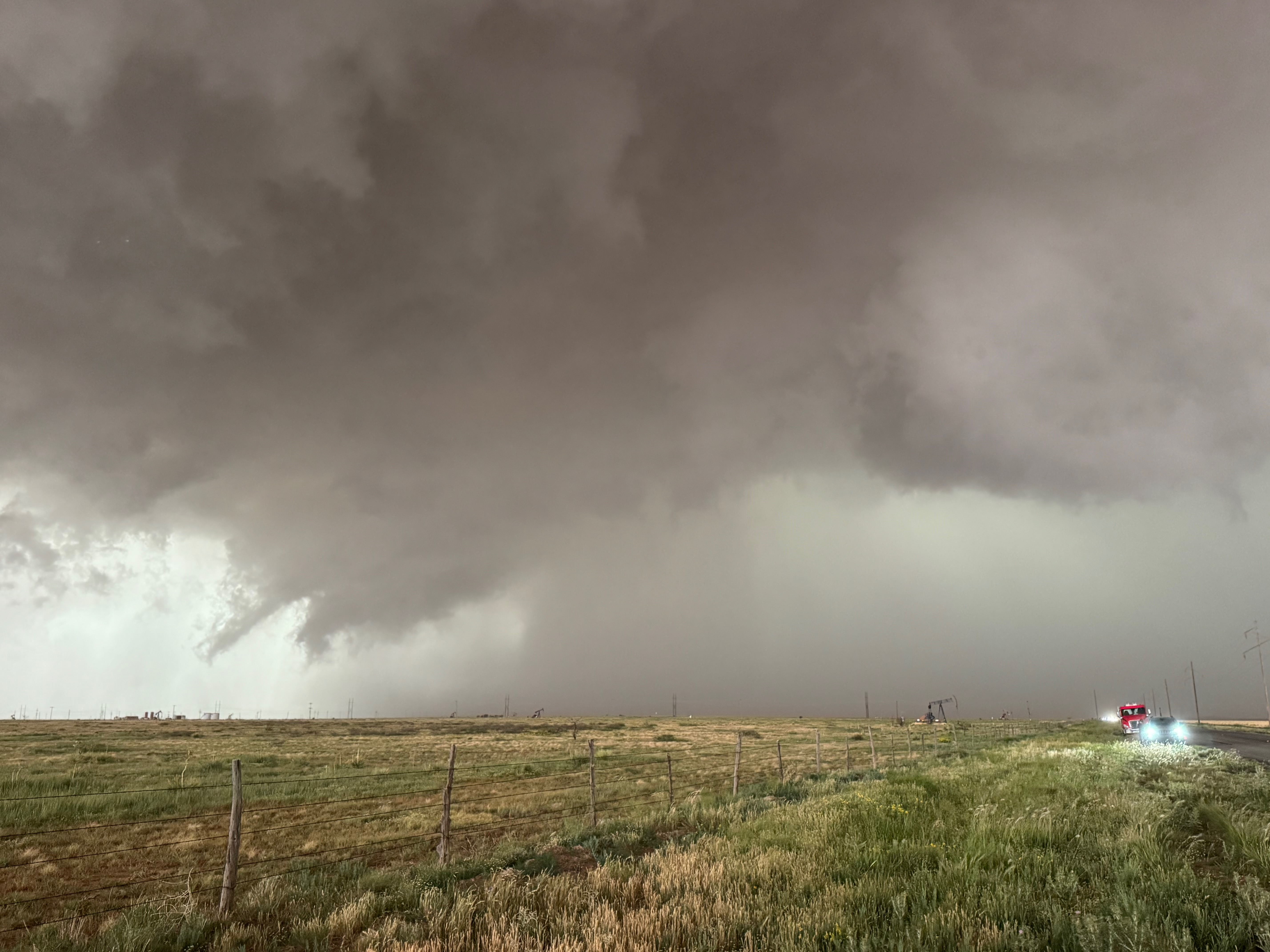
Well, the decision to reposition to a spot a couple of miles north of Morton wound up okay, but the storm went into big WEDGE tornado mode about this time. It was a bit distant to our WNW. Chasers who remained just south of the action area along 114 during this phase were closer and had a great look at the dusty beast. We were also contending with light-to-moderate rain from a nuisance shower. Fortunately it was not heavy enough to keep the group in the vans, and there was no dust to obscure the great view of the approaching tornado! Dust around the tornado was pulled up around the edges of the attendant wall cloud, so the thing looked like a big and dusty wedge for a bit. As the tornado moved to our northwest and north, there was less dust, less of a wedge look, and a bit of precipitation wrapping around. The sequence of photos from my Canon camera zoom lens show the Morton tornado as it approaches FM 214. It crossed 214 about 4 miles north of Morton around 5:46 p.m. CDT, two miles north of where we were. I would estimate that the storm was moving to the east at about 25-30 mph.
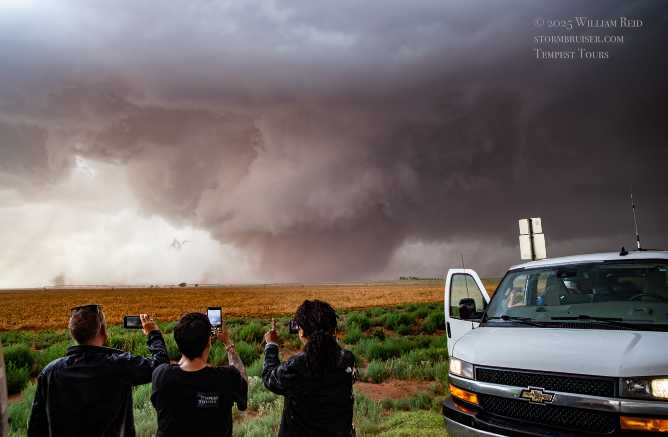
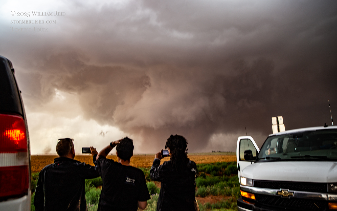
It was time to get back into the vans to keep up with this thing. As the tornado continued to the east in northern Cochran County, it looked like FM 597 would work nicely. We made our quick move to the south and turned left onto 597, but I gave up on this idea after less than a half mile. The tornado to our north looked to be largely wrapped in rain, radar showed the storm sagging to the south slightly, and this road jogged a little to the north a couple of miles ahead. (Chasers were become annoyingly more numerous, too.) I didn’t like the idea of flirting closely with a big rain-wrapped tornado! I diverted to the southeast (via Morton) and east on 114 in order to get safely back in front.
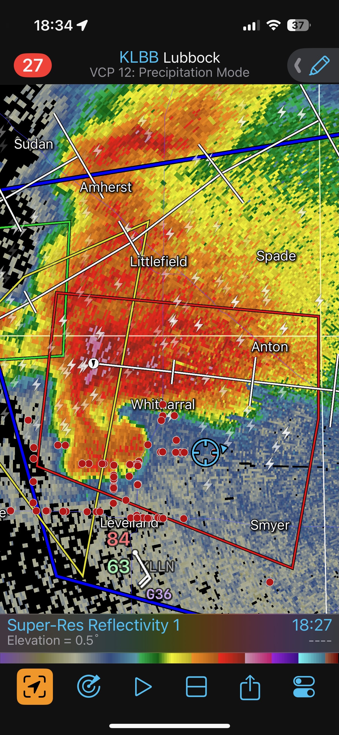
The radar grabs above show our location east of Whiteface, and about a half hour later in front of the hook again, southeast of Whitharral. The first nine images below provide a look at the hook area of the now HP supercell. There are some hints that a tornado might be lurking in the precip core. We were not sure. The storm was north of Levelland about the time of these photos.
I was not enamored with the storm’s HP (high precipitation) nature as it continued E and ESE towards the western edge of Lubbock. I certainly did not want to contend with giant hail or a hidden tornado, so I opted for a new supercell that had developed behind this one (last three images above). This one had a good and nasty look for a bit, but was riding the cool outflow from the lead cell and it was in no position to produce a tornado of its own.
Below is the dump of the remaining iPhone images of the Morton tornado and the rain-wrapped (possible) tornado SW and S of Witharral.
Kim booked rooms for our group in Wolfforth, on the southwest edge of Lubbock. But our hotel had sustained hail damage and their computer system was not working. We went up to Littlefield for the night.

\
Leave a Reply
You must be logged in to post a comment.