
Start: Lubbock/Lunch: Amarillo Big Texan/End: Amarillo/476 miles
Mesoscale Discussions 3:39 p.m. CDT. 7:05 p.m. CDT. 9:48 p.m. CDT
My timelapse video of the supercell
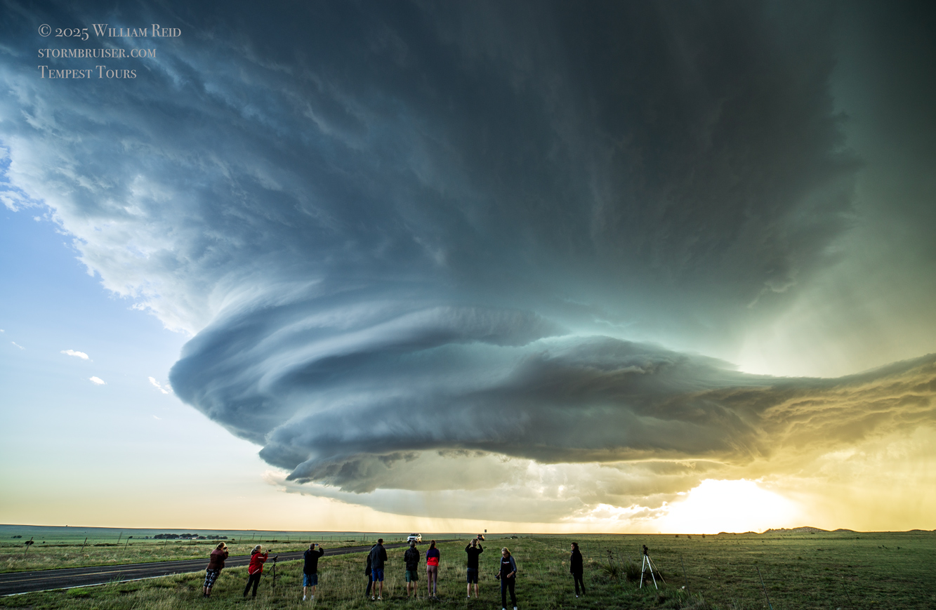
Link to video by Chris Gullikson, with the Tempest Tours Photo group (van/rooftop timelapse)
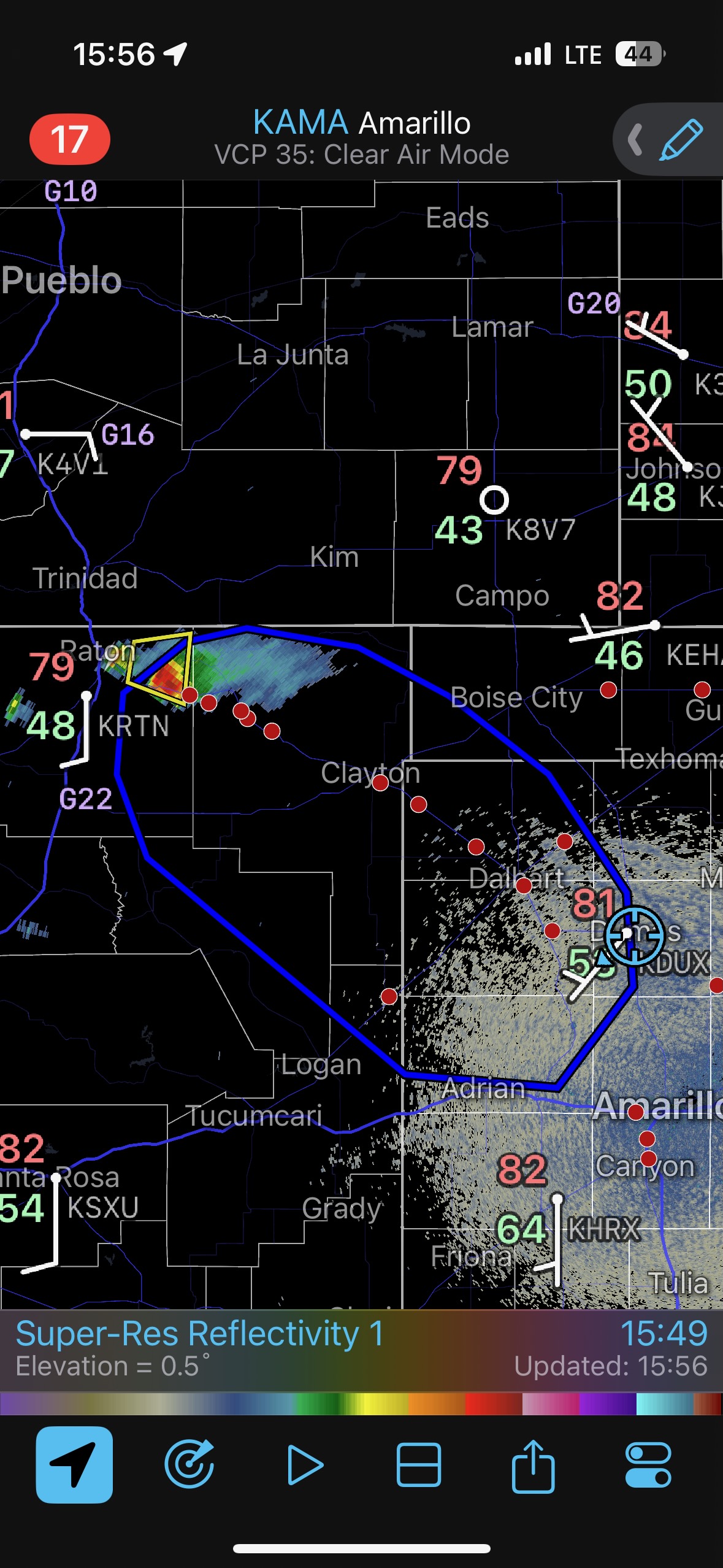
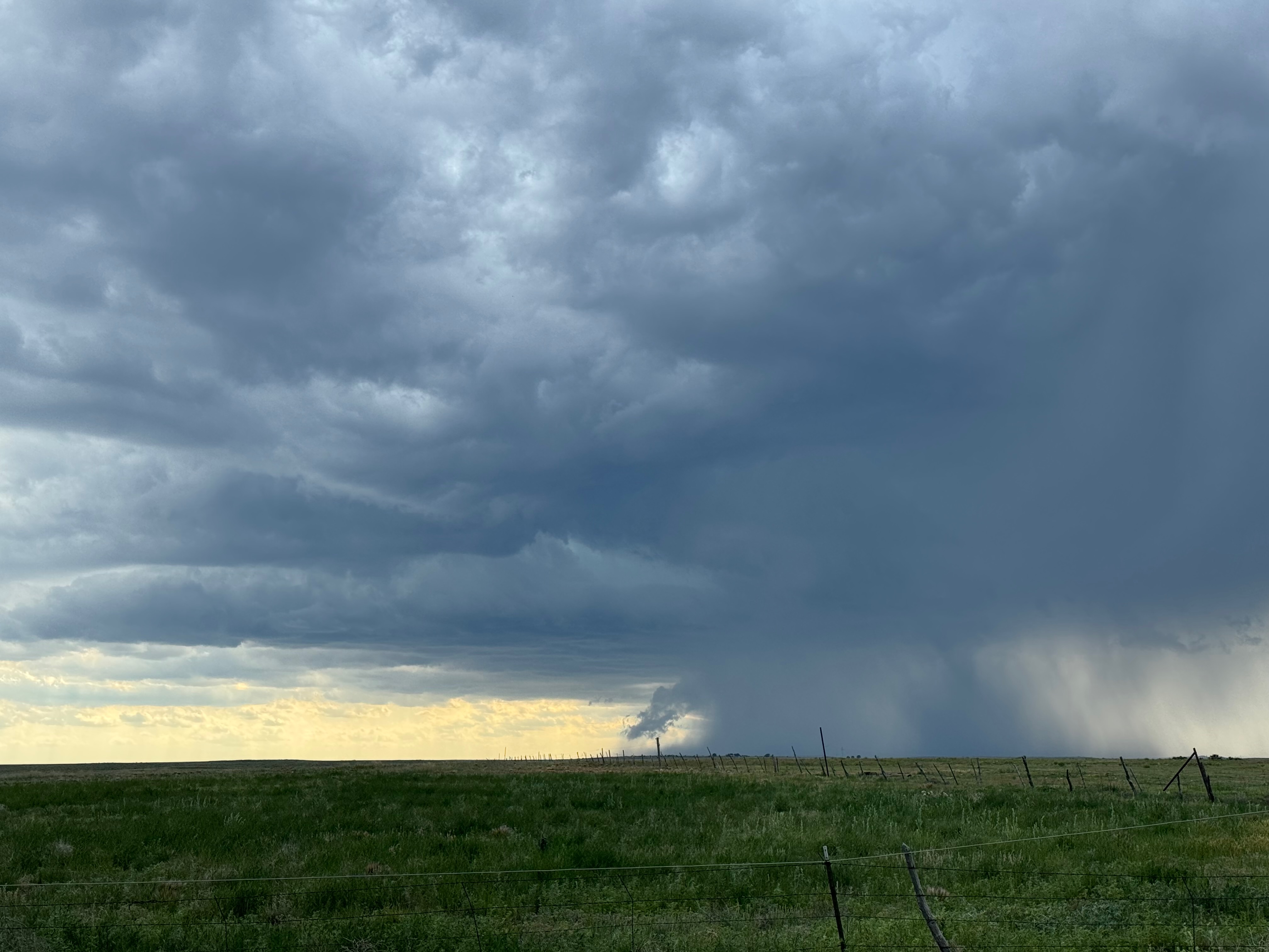
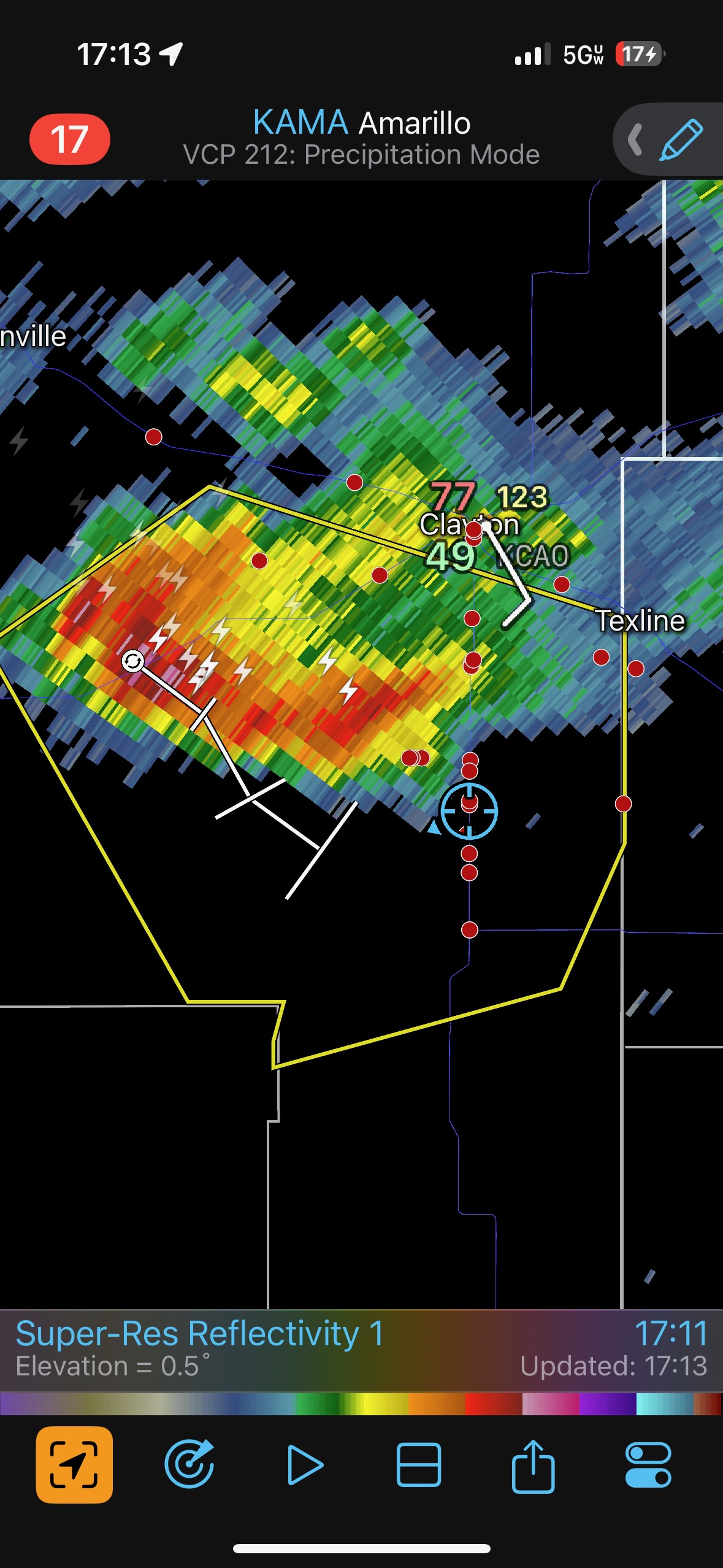
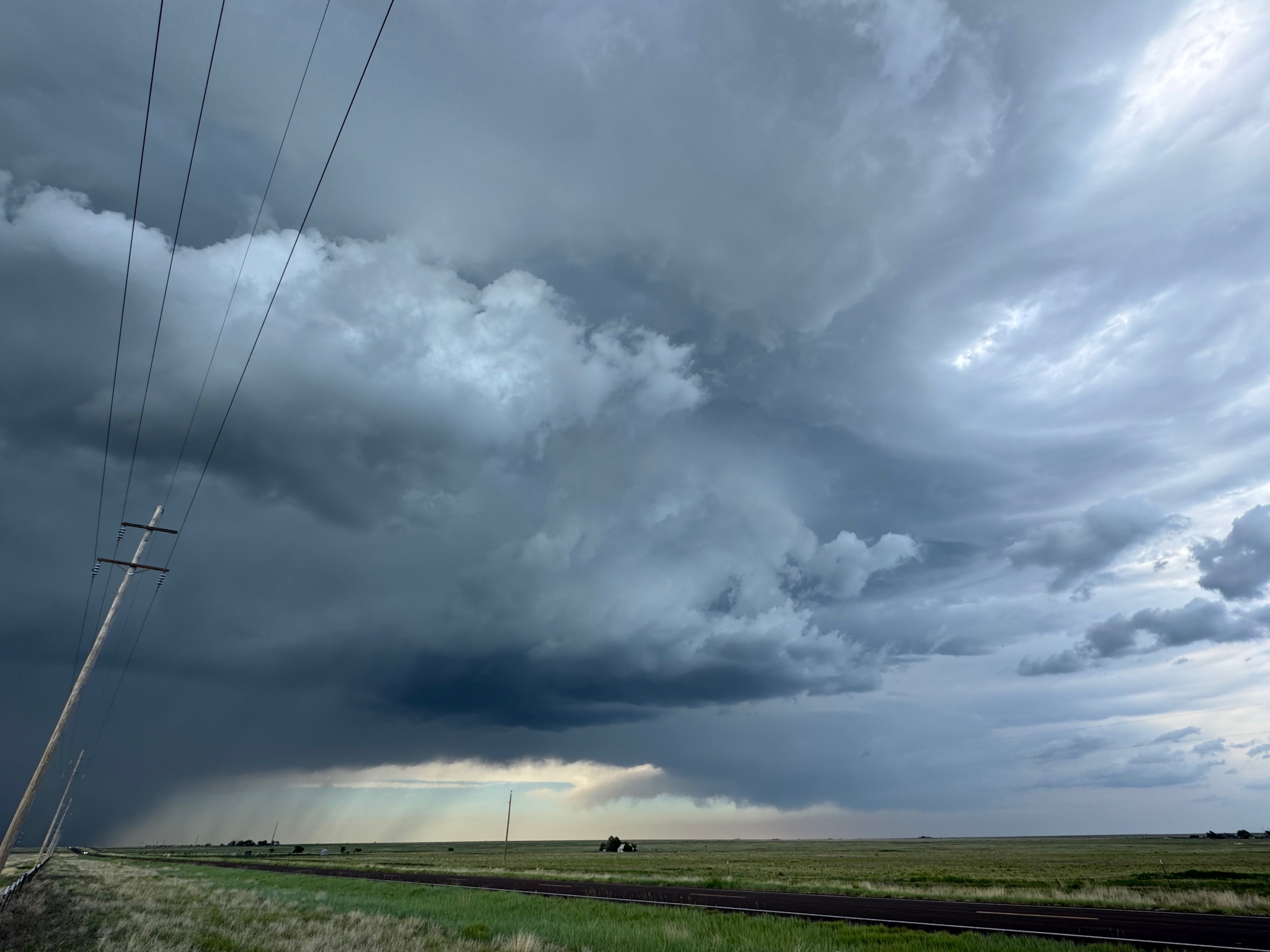
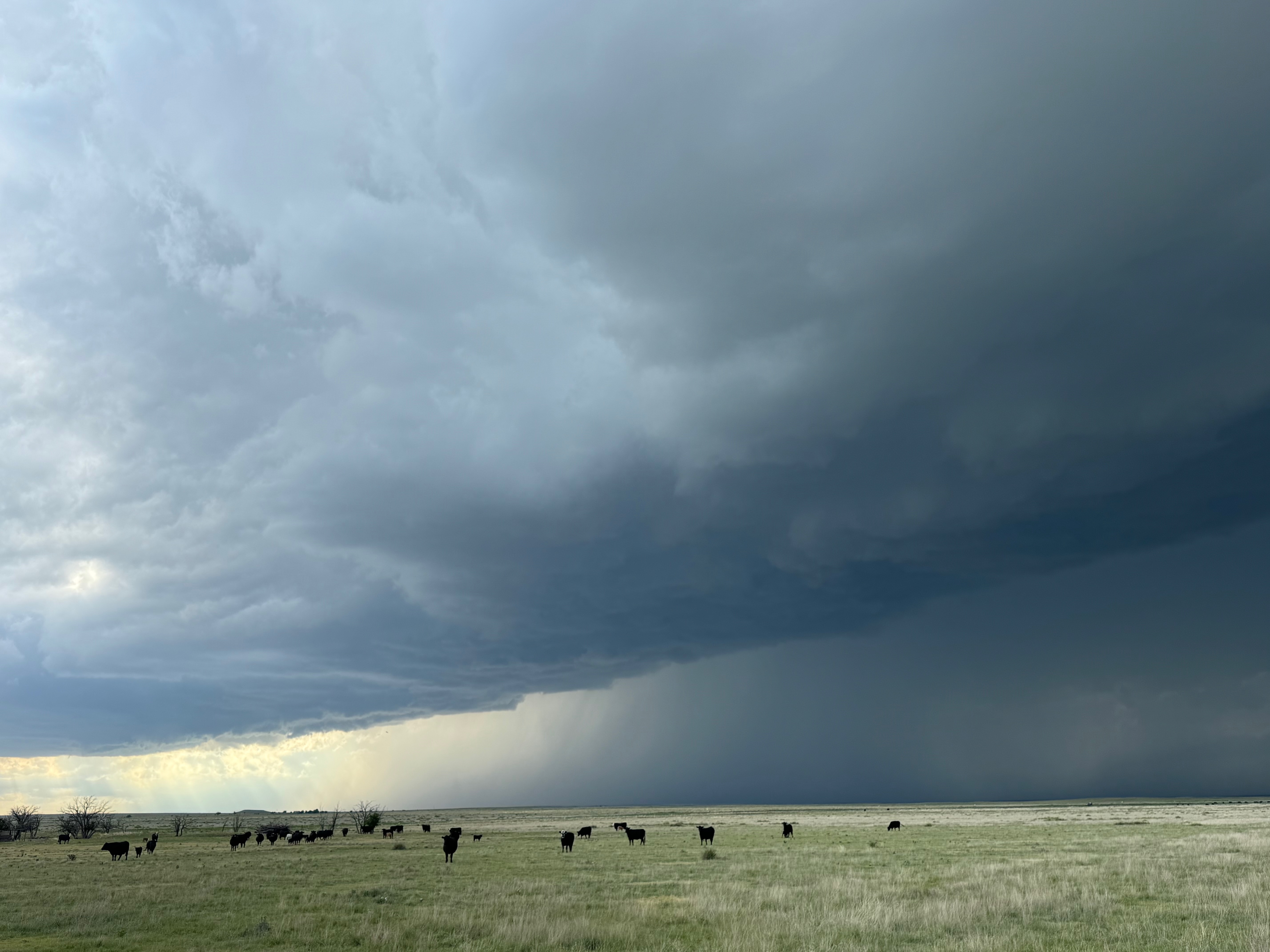
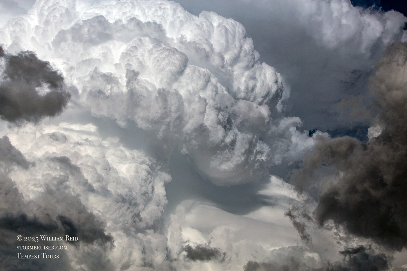
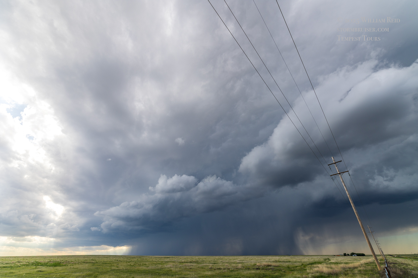
The pattern remained quite good for severe storms on the southern High Plains on this Saturday. Decent moisture was heading upslope towards the Raton Mesa in New Mexico, so the plan was to be in the Clayton area by mid-late afternoon. We had more than enough time for lunch at the Big Texan following our departure from Lubbock. A few hours later, an isolated and discrete storm was looking good west of Clayton. Shear was excellent and organization in this first supercell was okay, but the storm was high-based and it started to struggle as it neared the TX/NM line south of Clayton. It looked pretty in the late afternoon sunlight, maybe a little beefy briefly. But overall it was difficult to get too excited about this one. Fortunately, a second storm was coming off of the Raton Mesa to our northwest, and it would also be an easy catch.
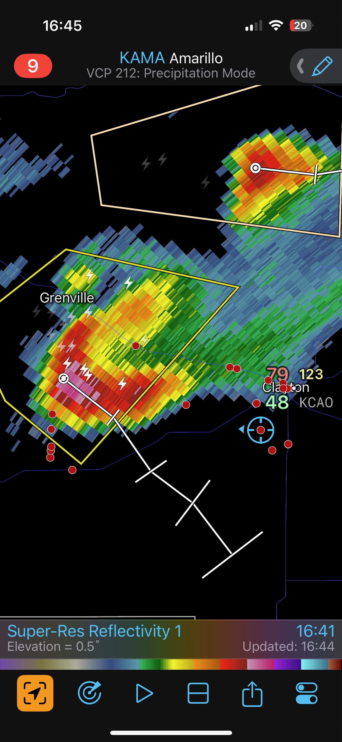
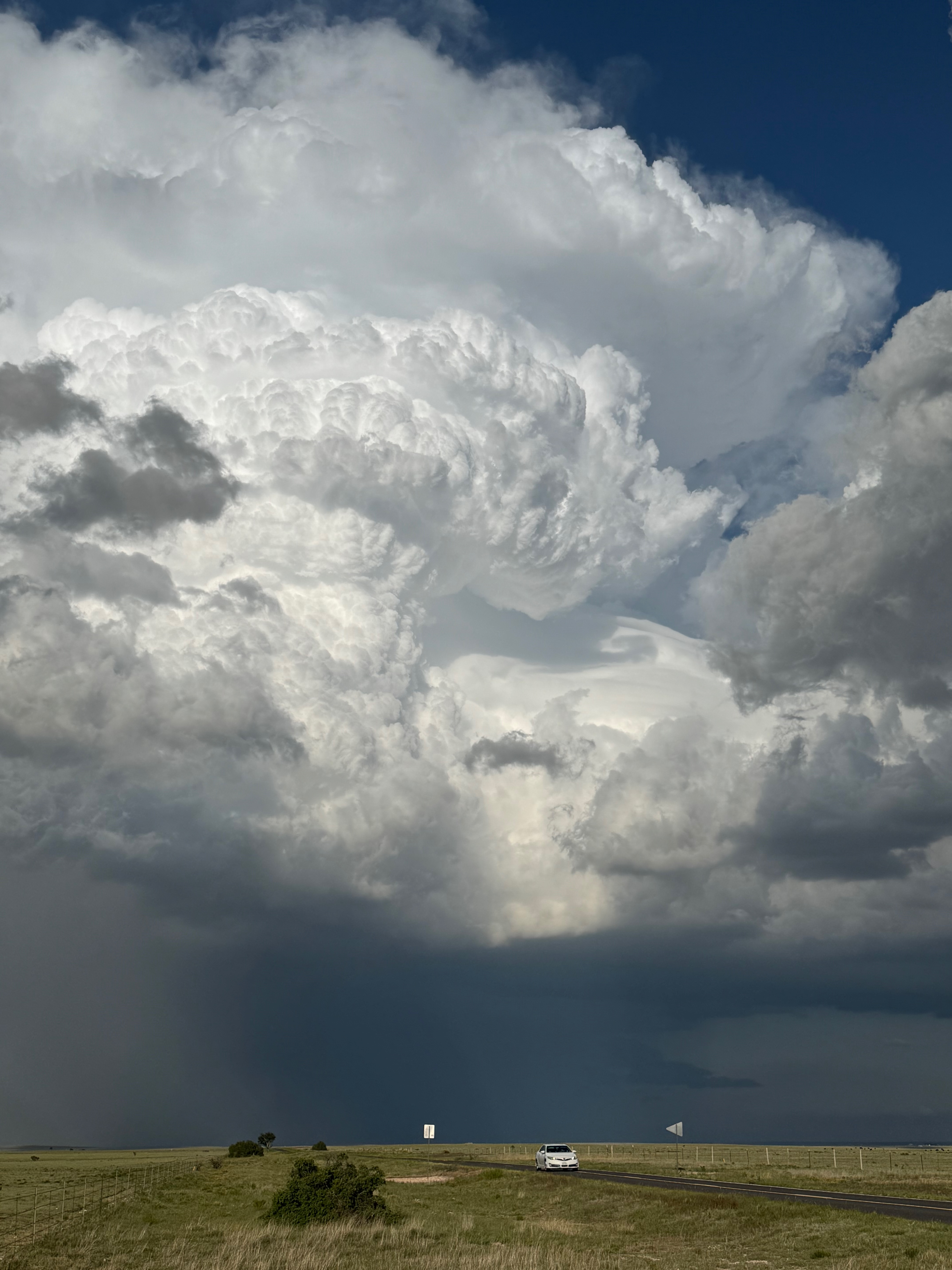
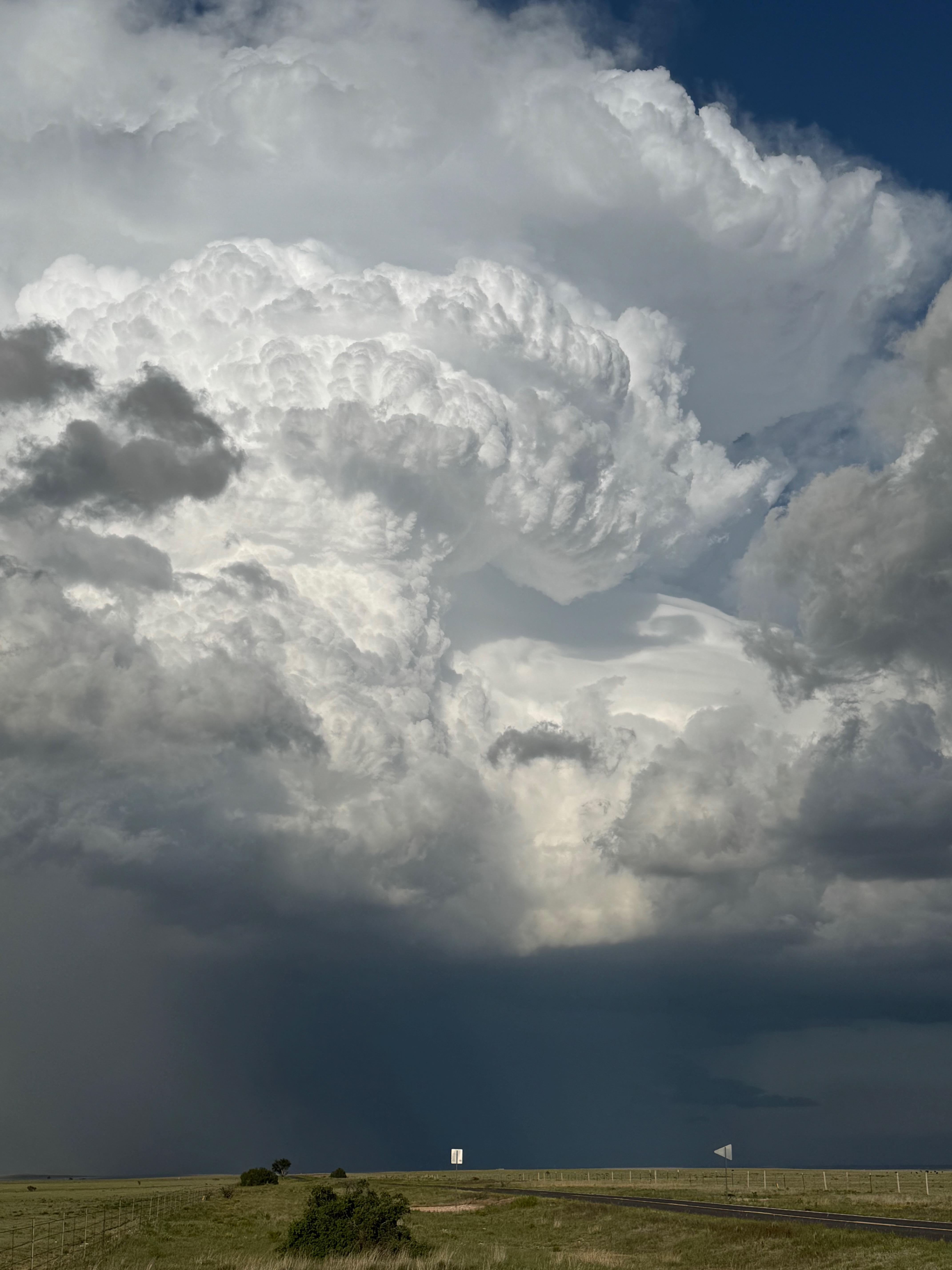
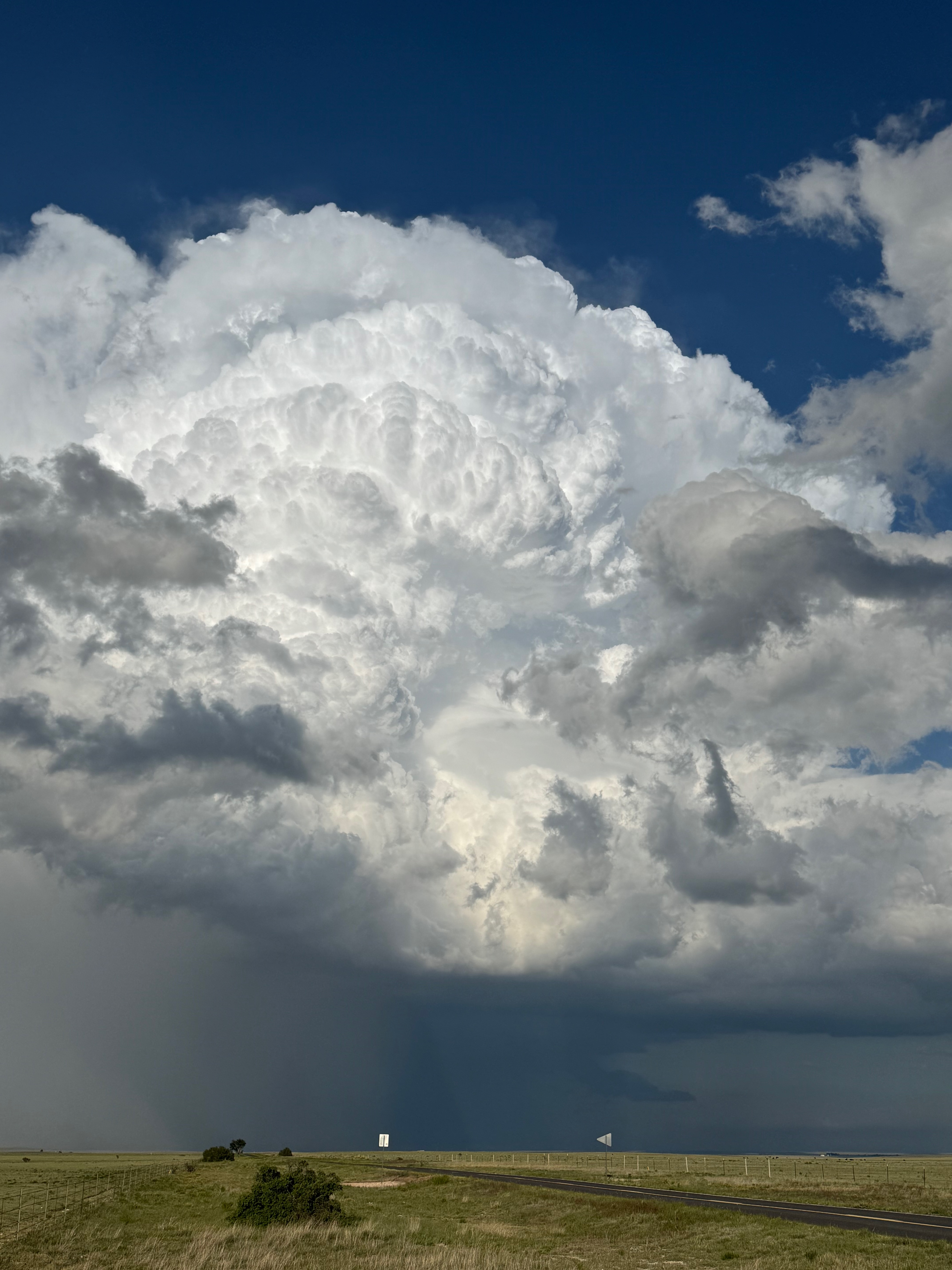
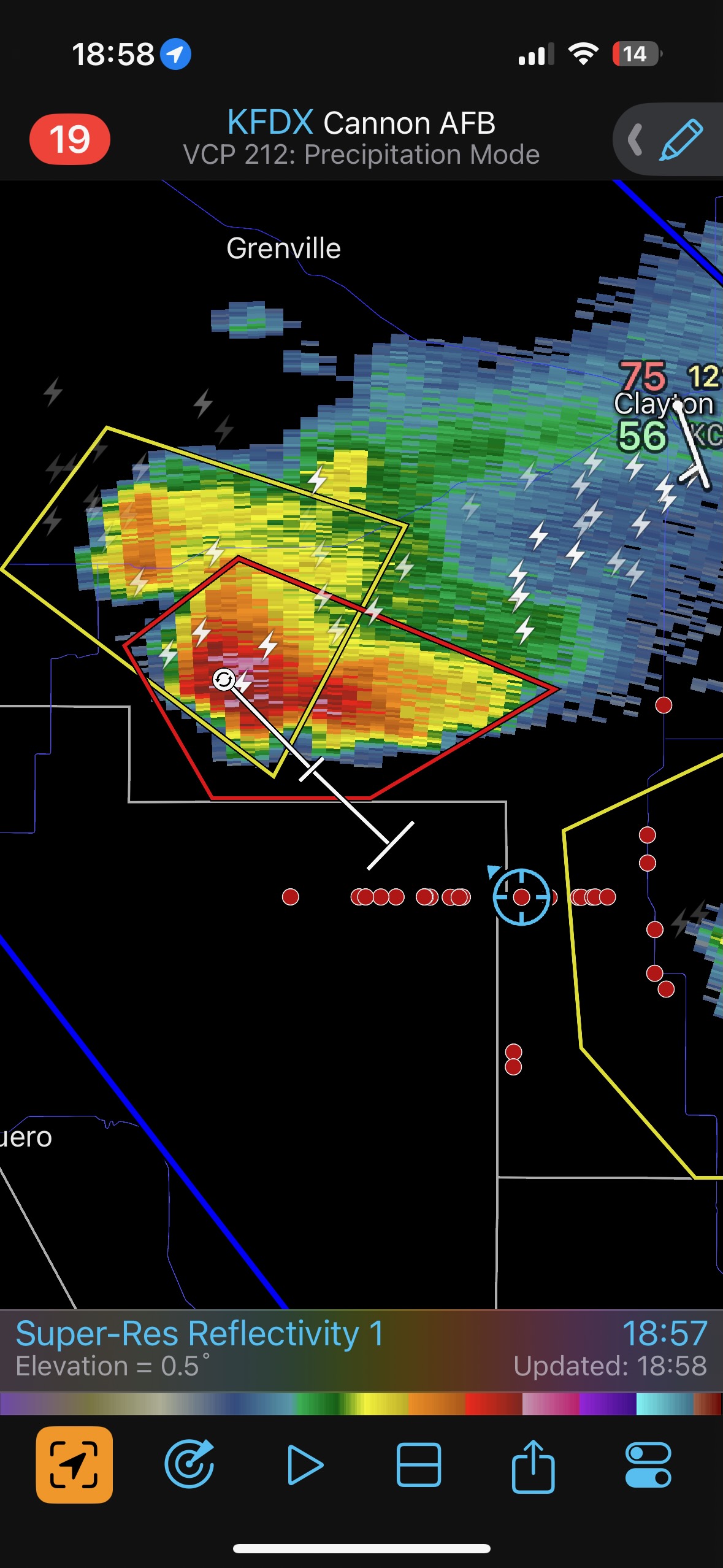
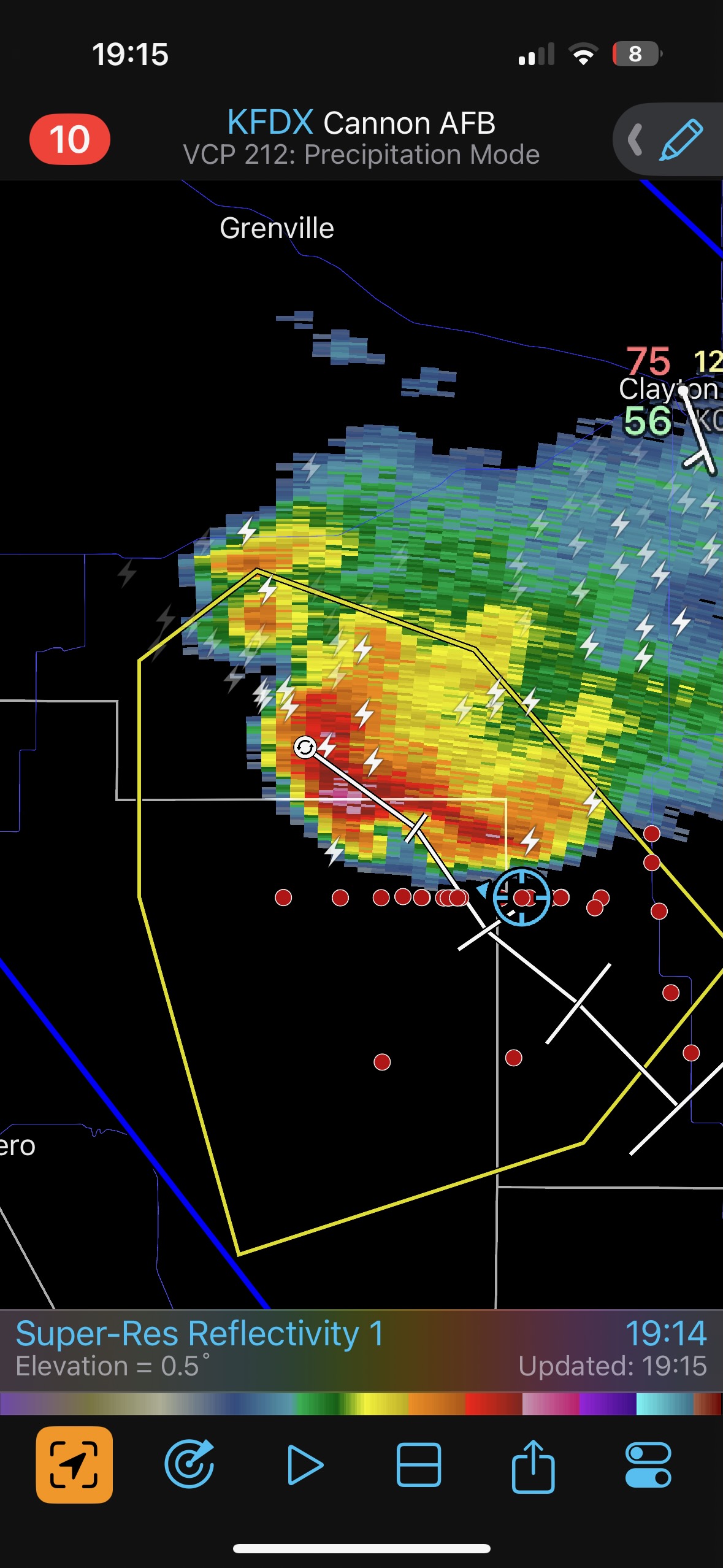
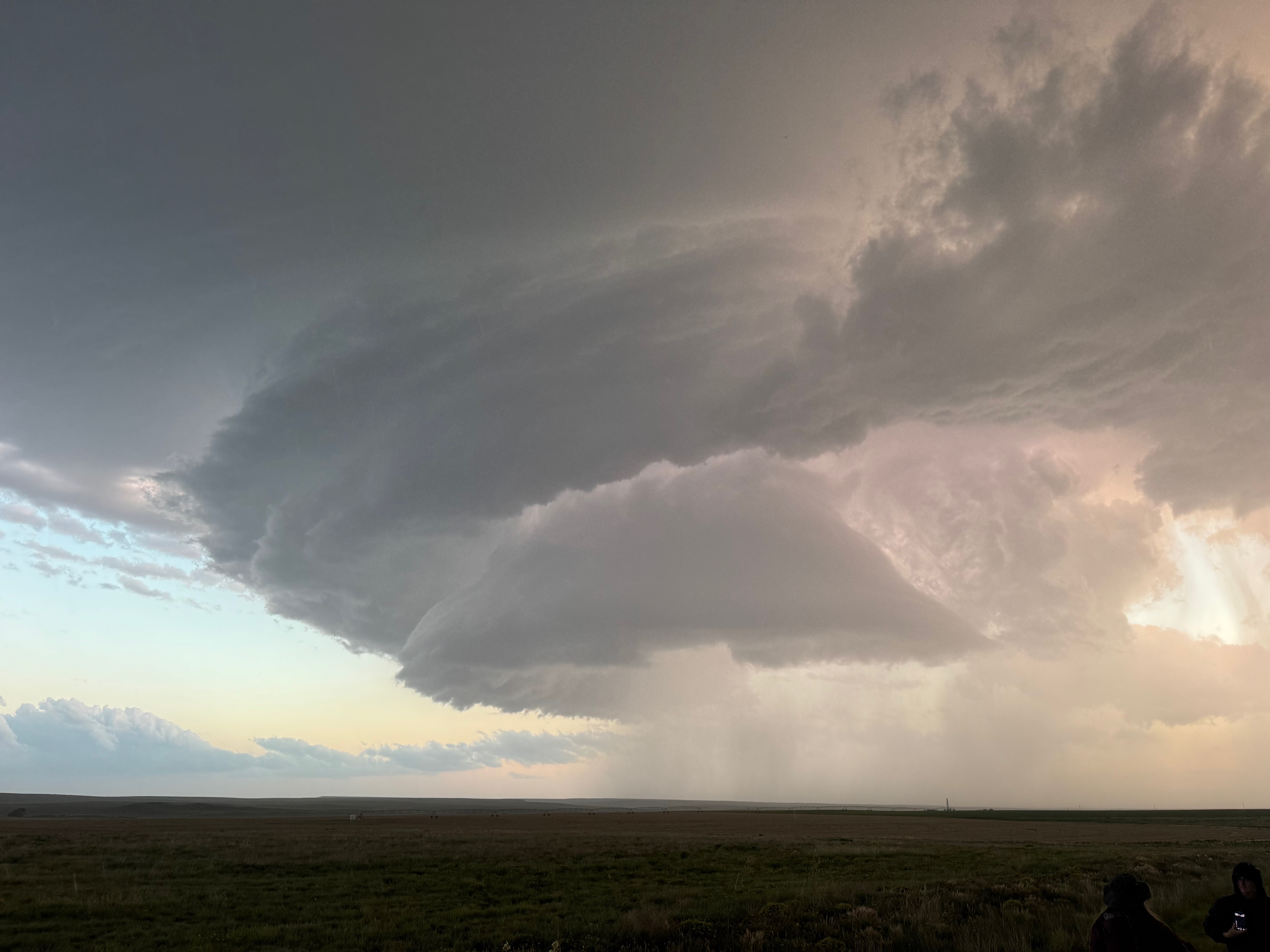
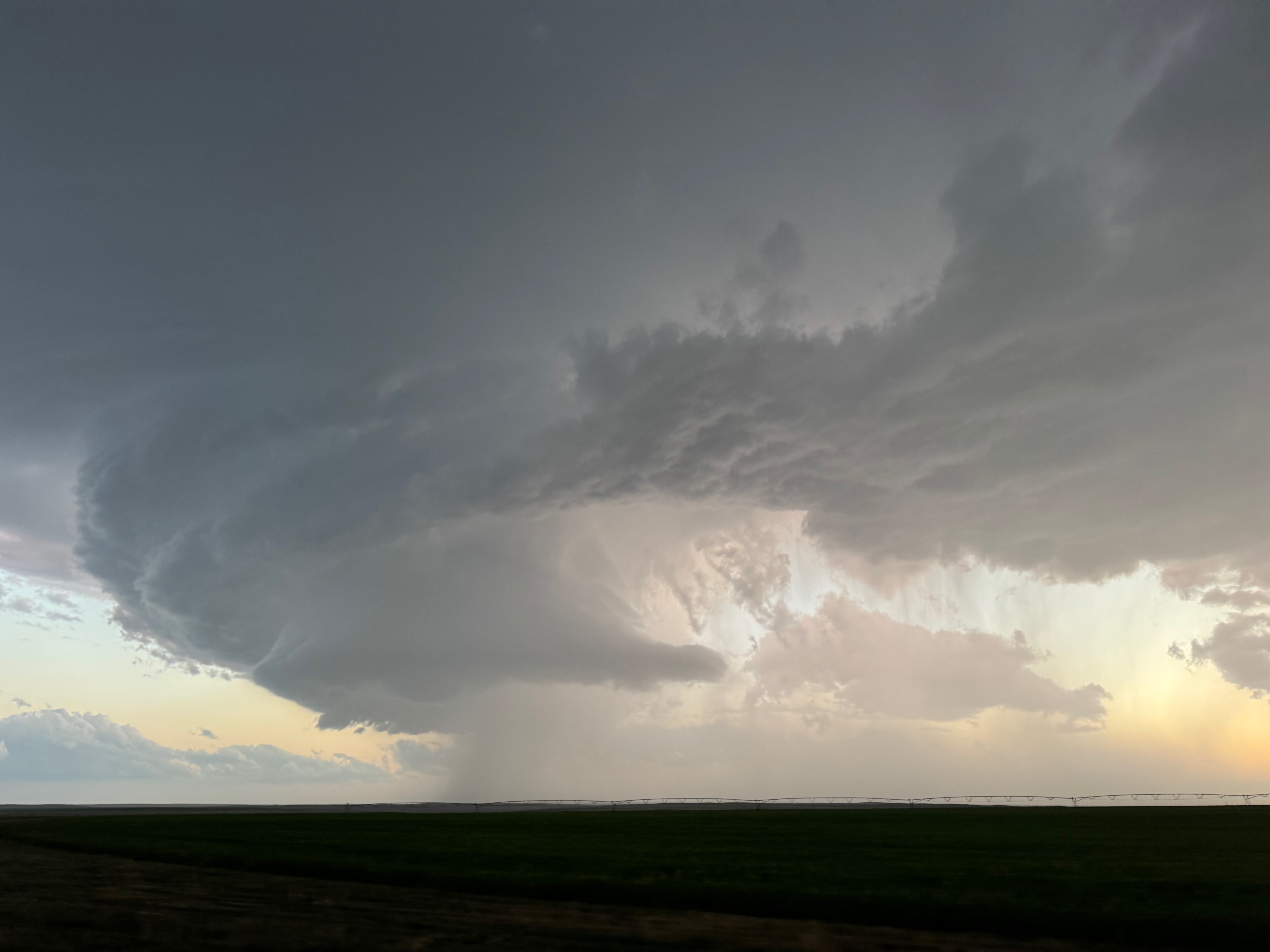
This first batch of photos below shows the first supercell, west and southwest of Clayton, with the accompanying radar screenshots. Our location is the large blue circle.
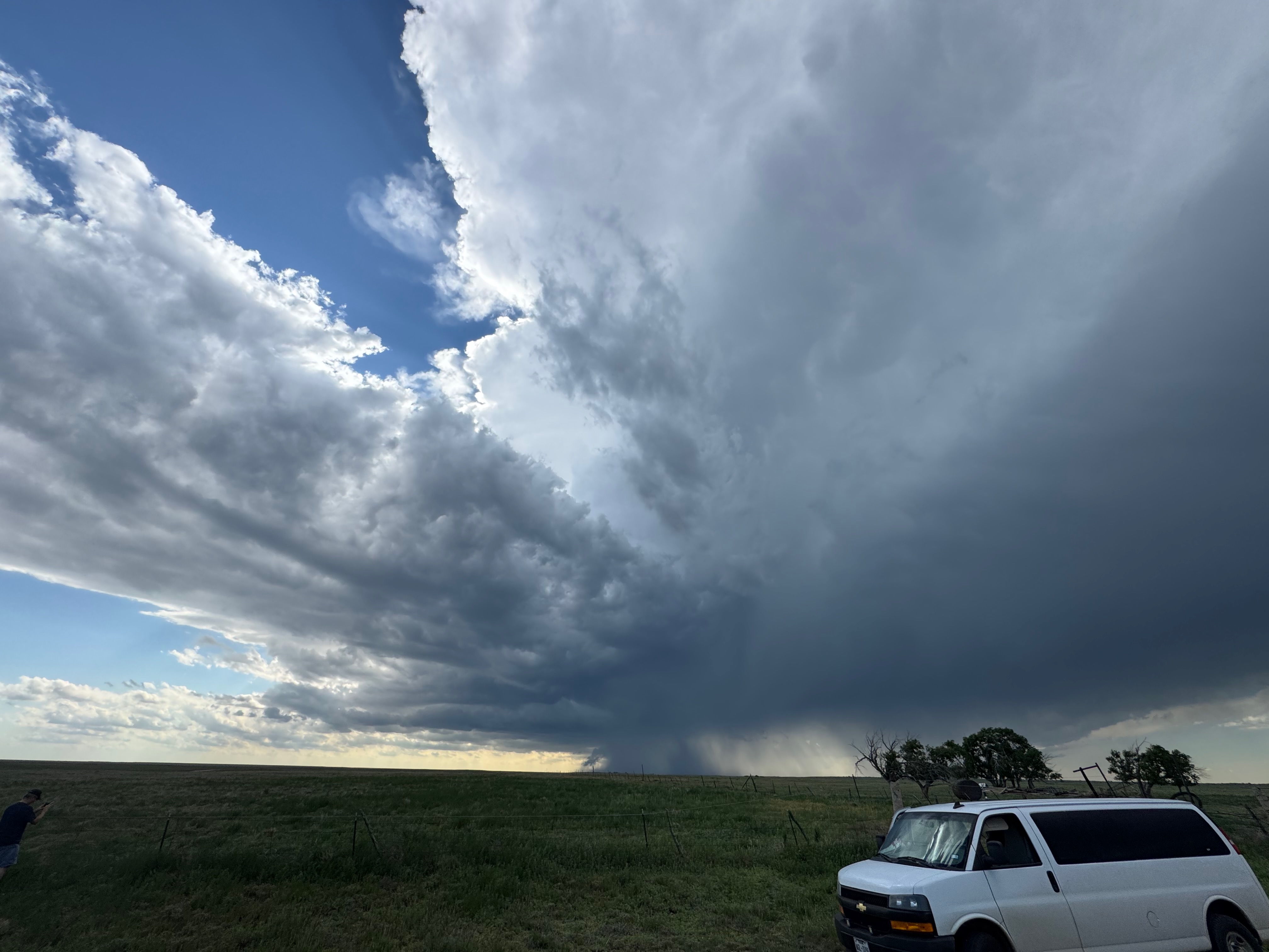
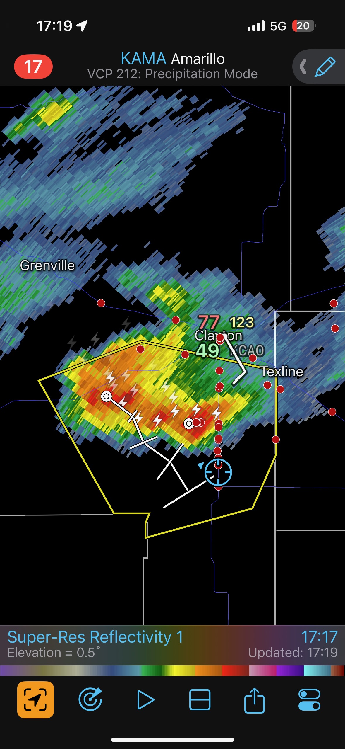
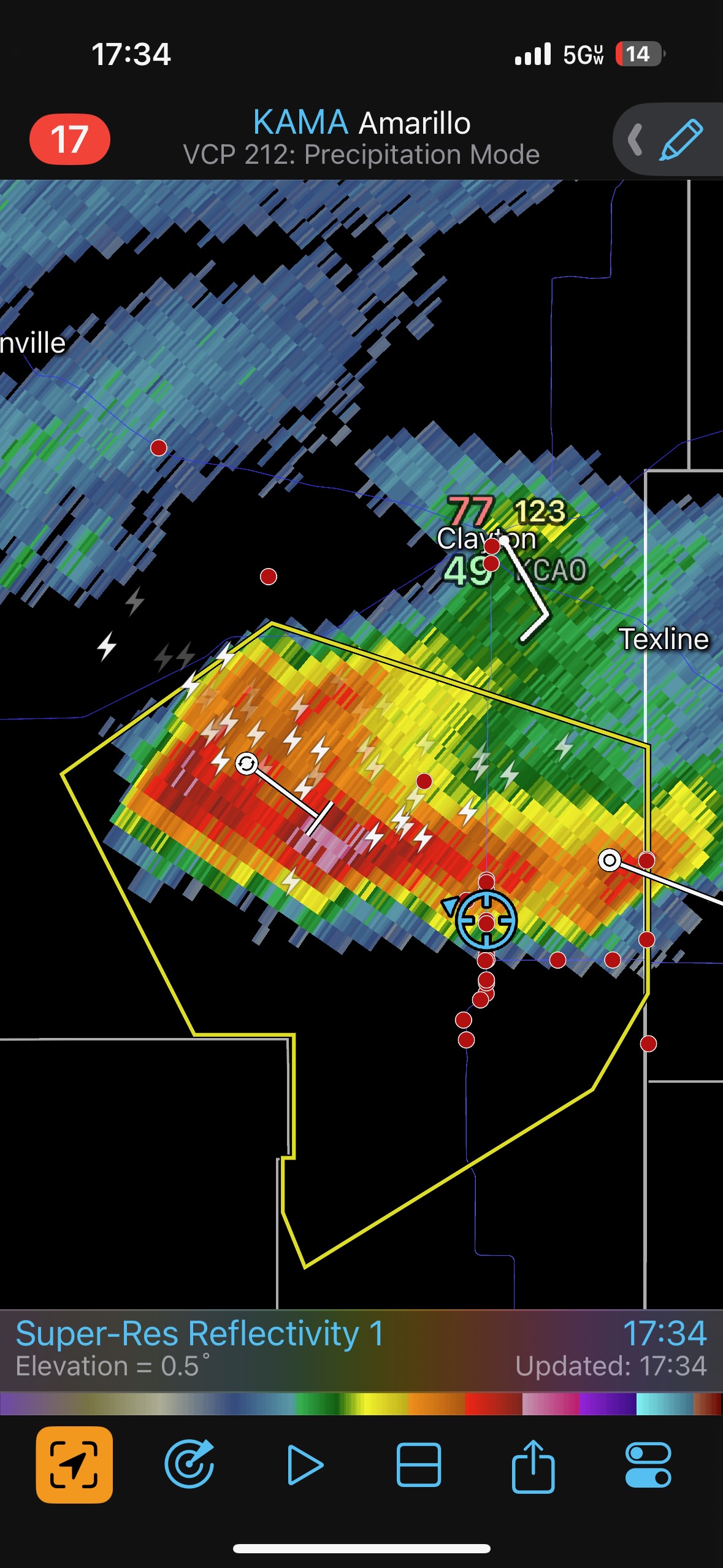
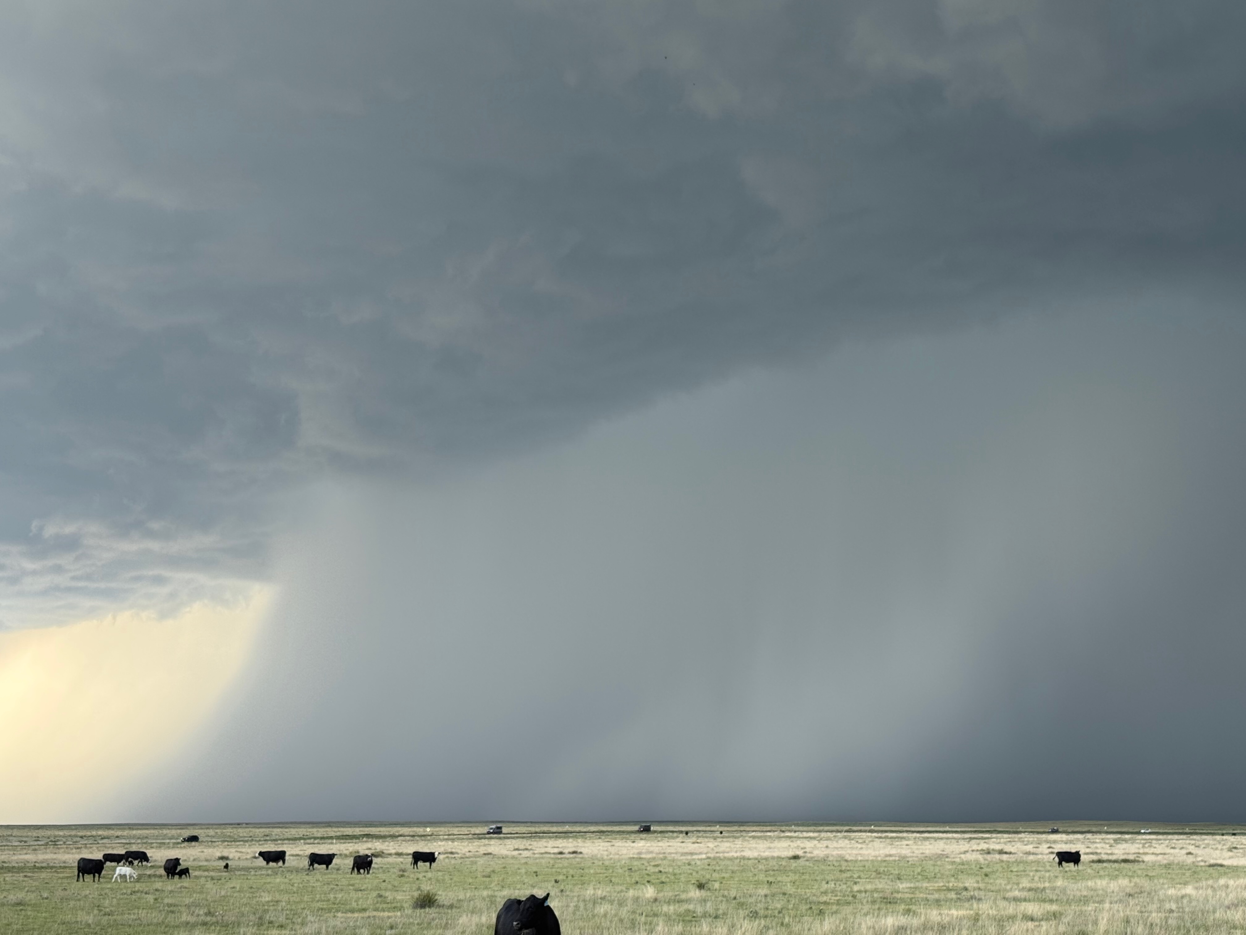
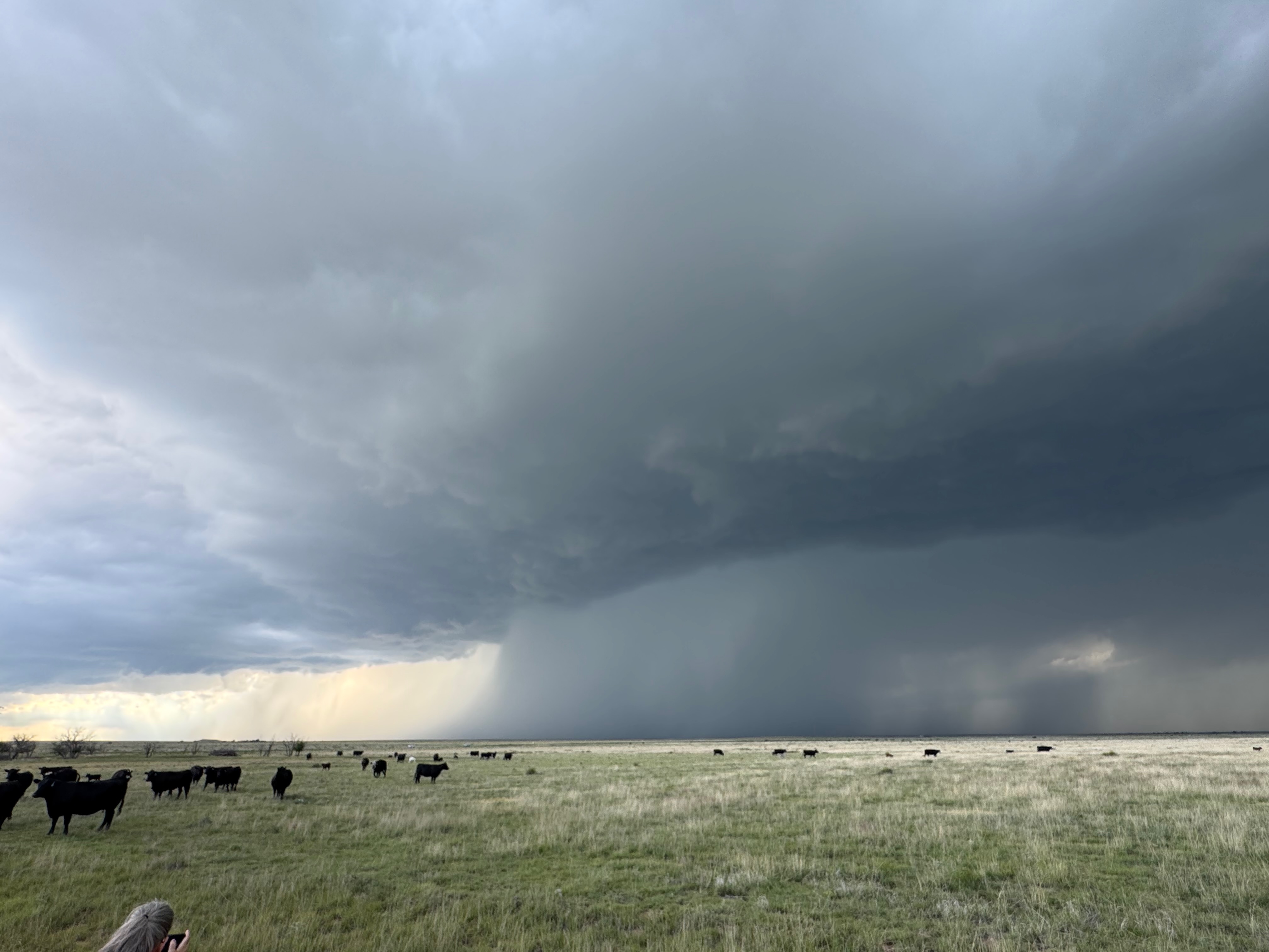
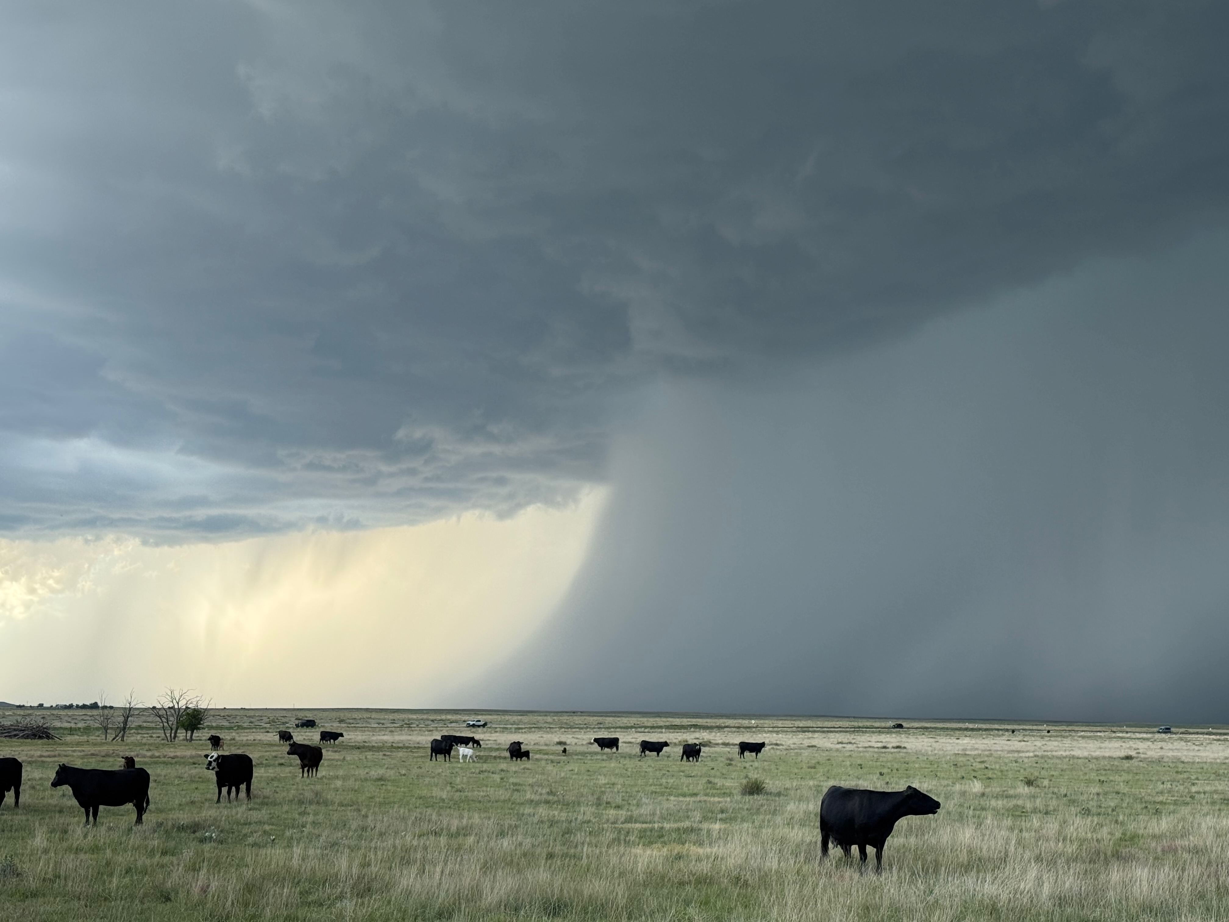
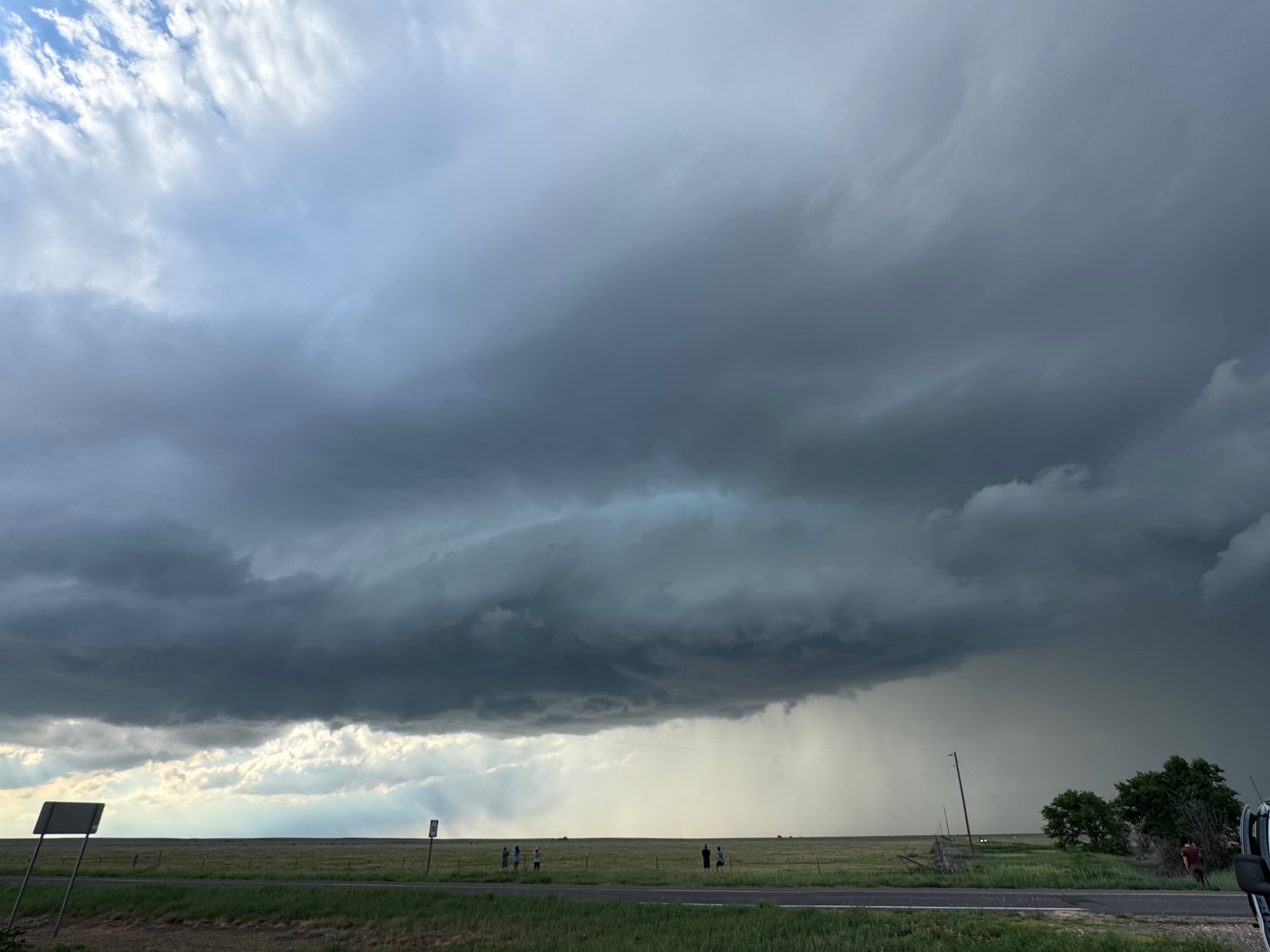
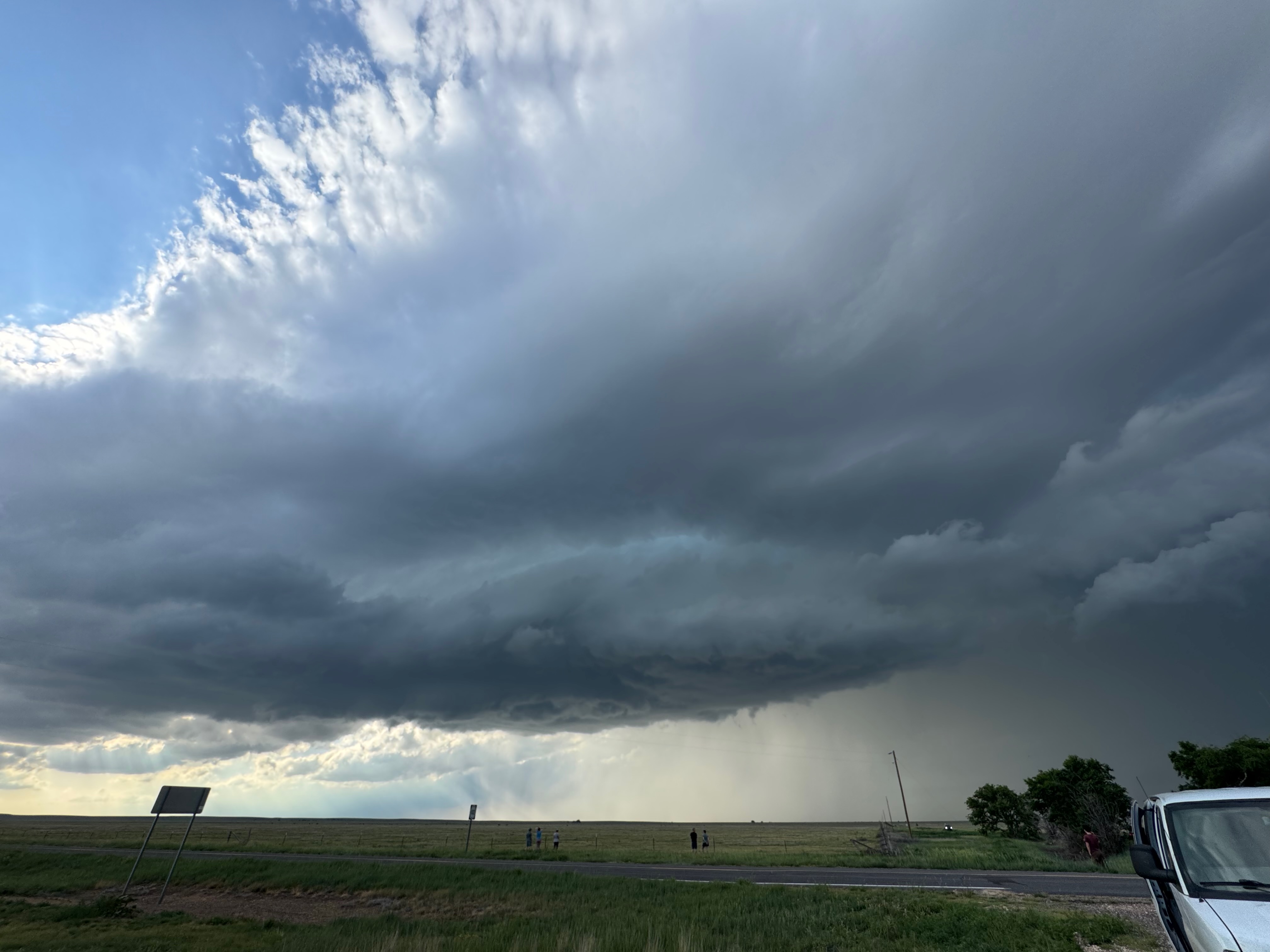
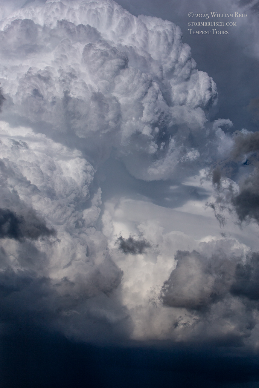
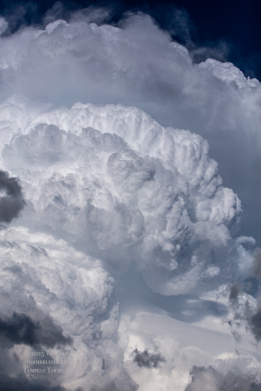
The group of photos below are also of this “lead” supercell. I let it drift to our east to get a look at the backside.
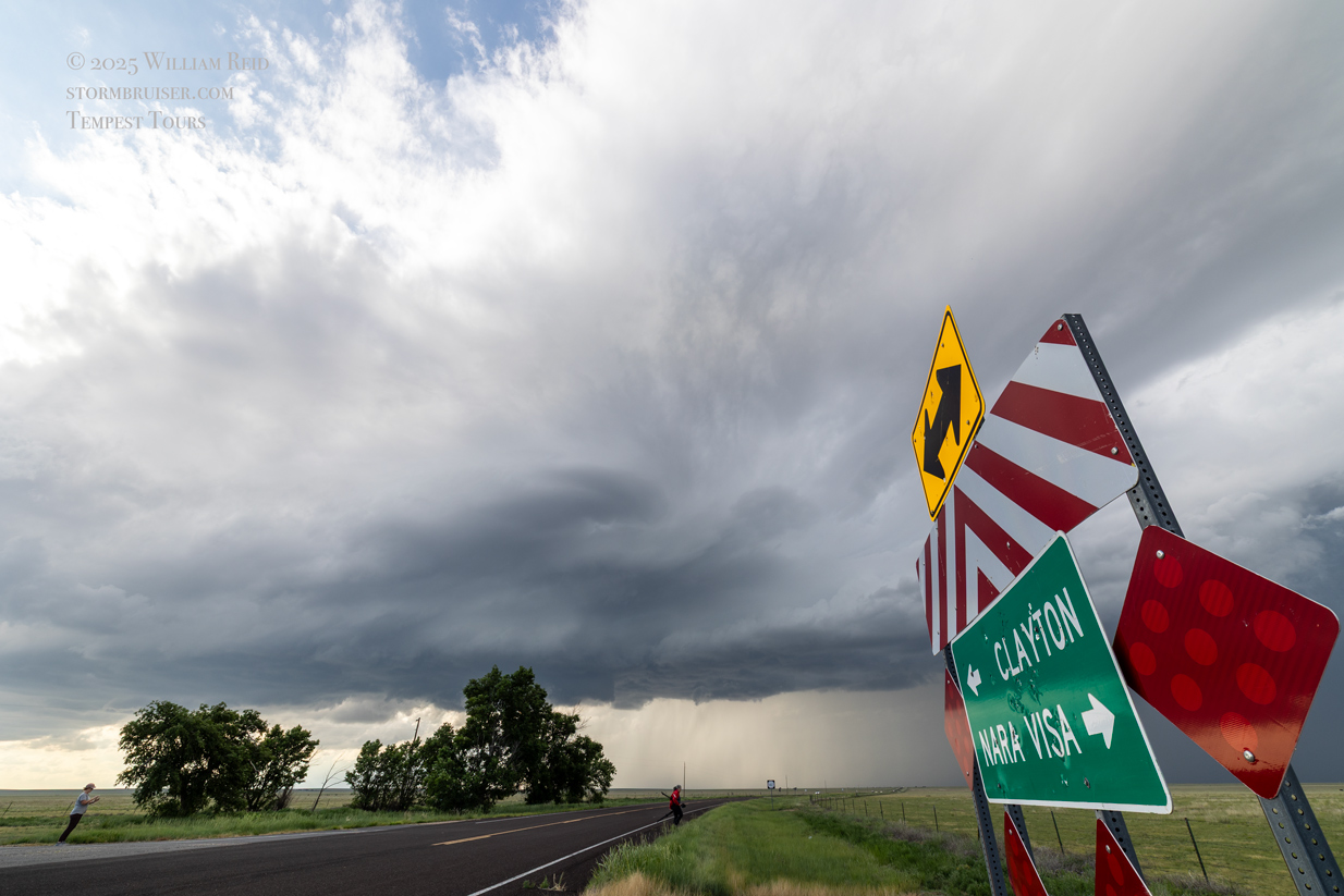
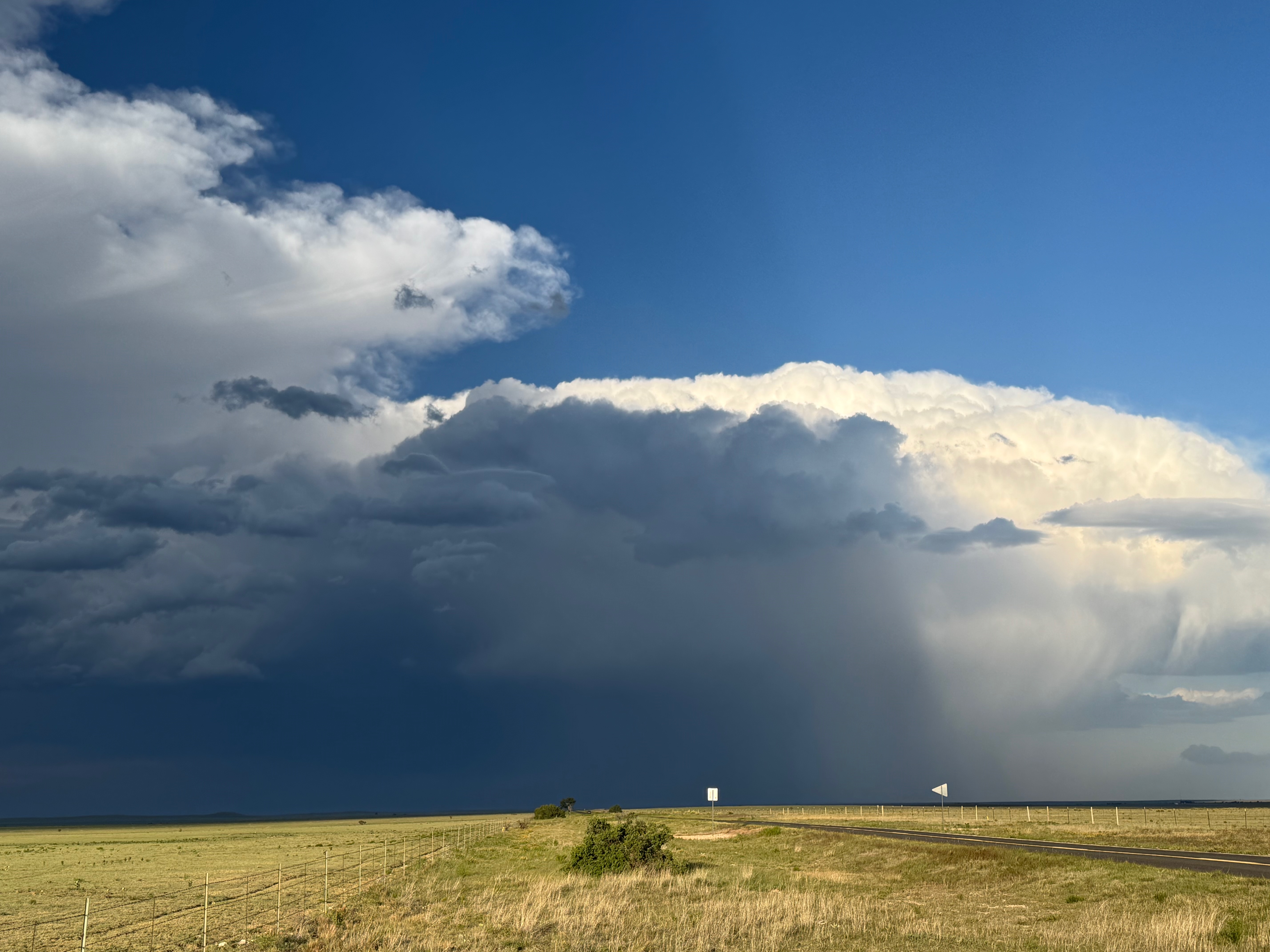
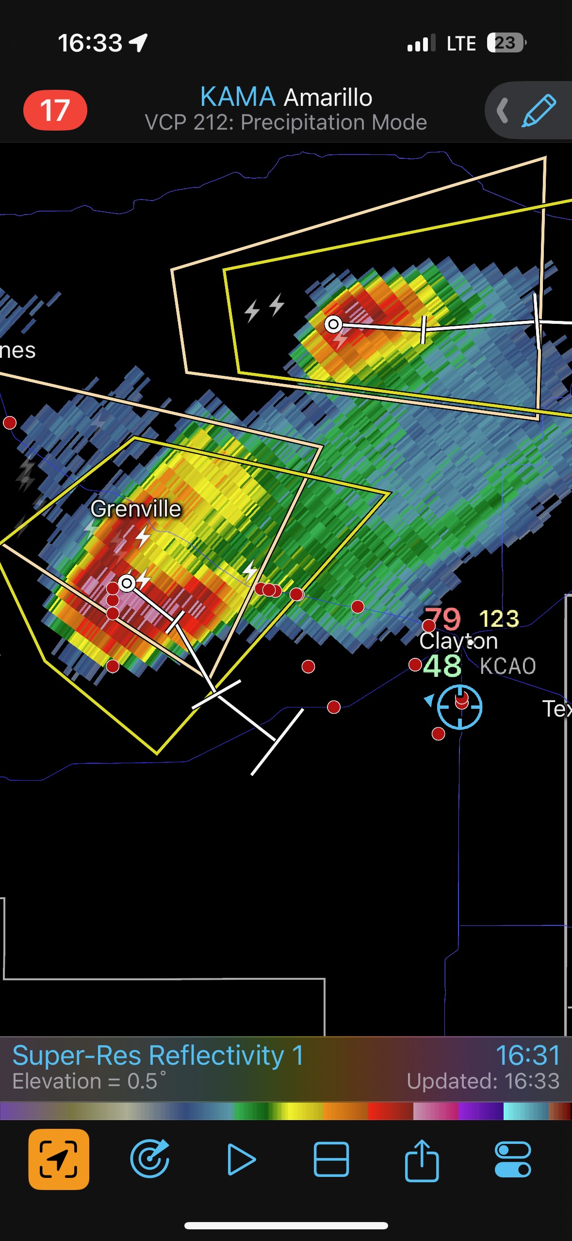
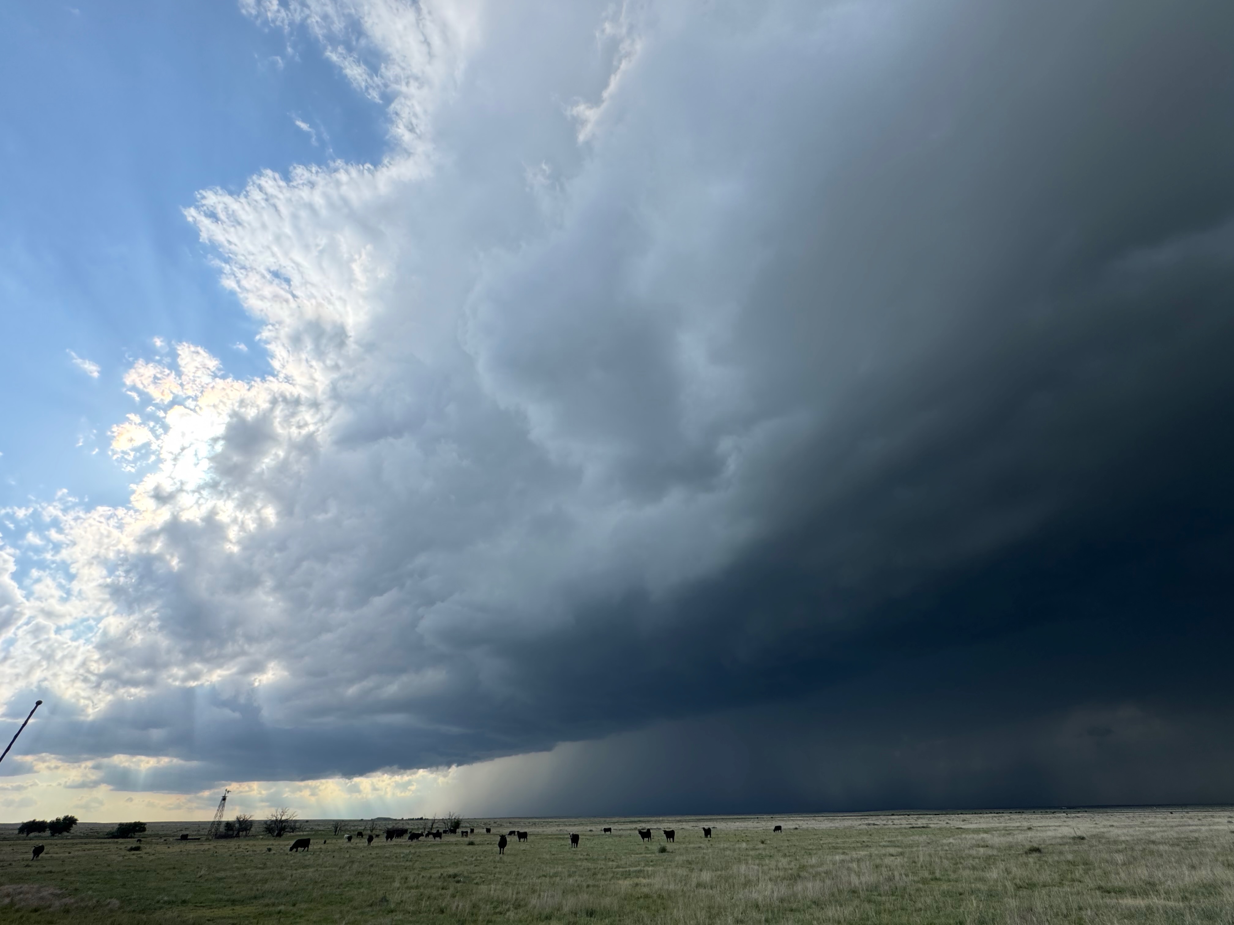
Fortunately, a second storm was coming off of the Raton Mesa to our northwest, and it would be an easy catch.
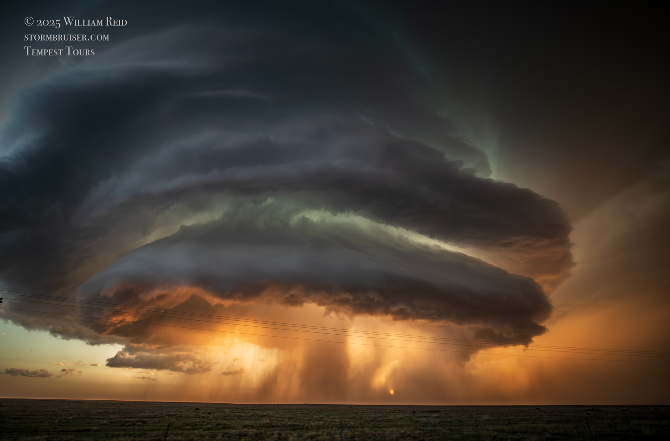
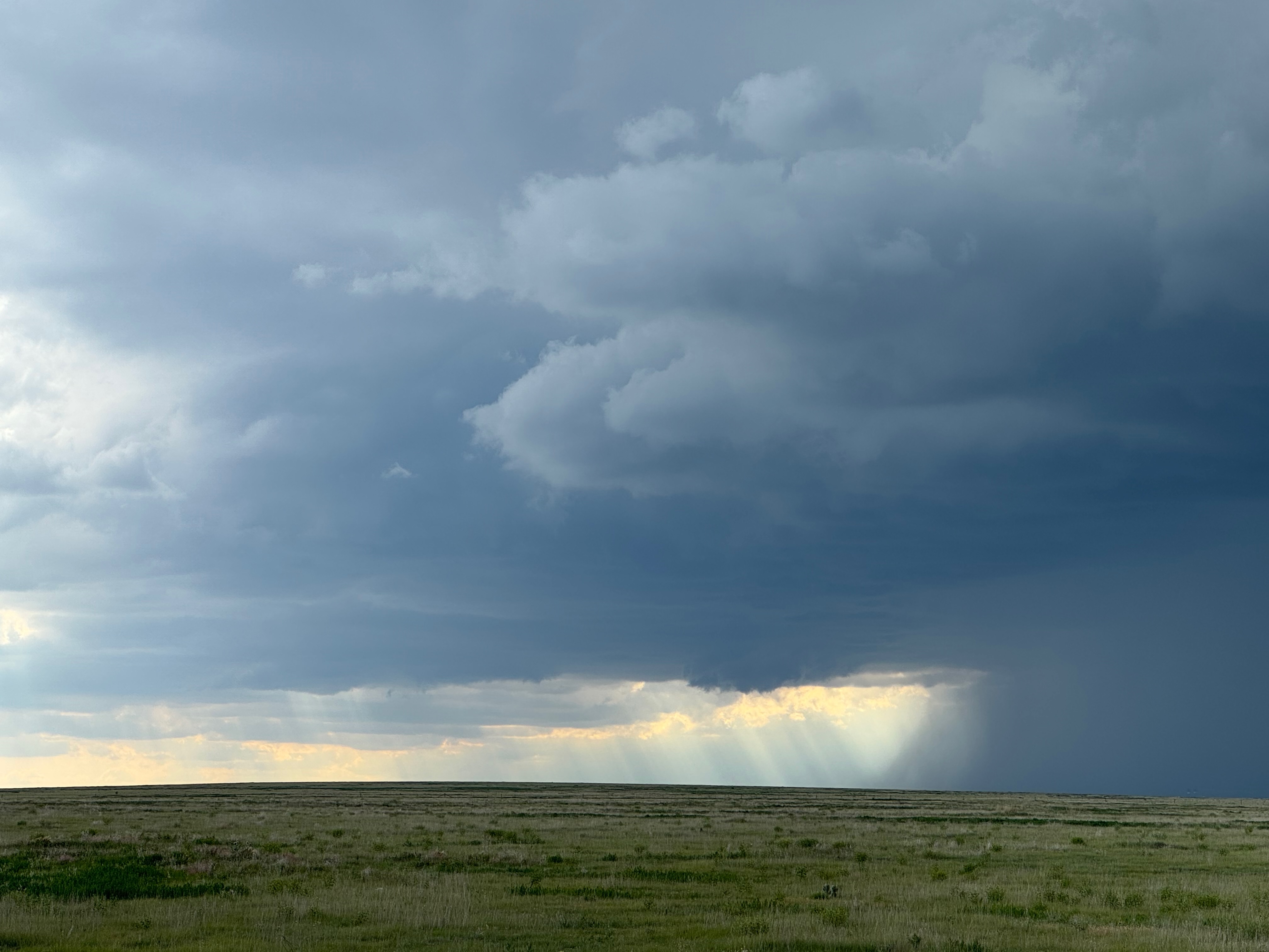
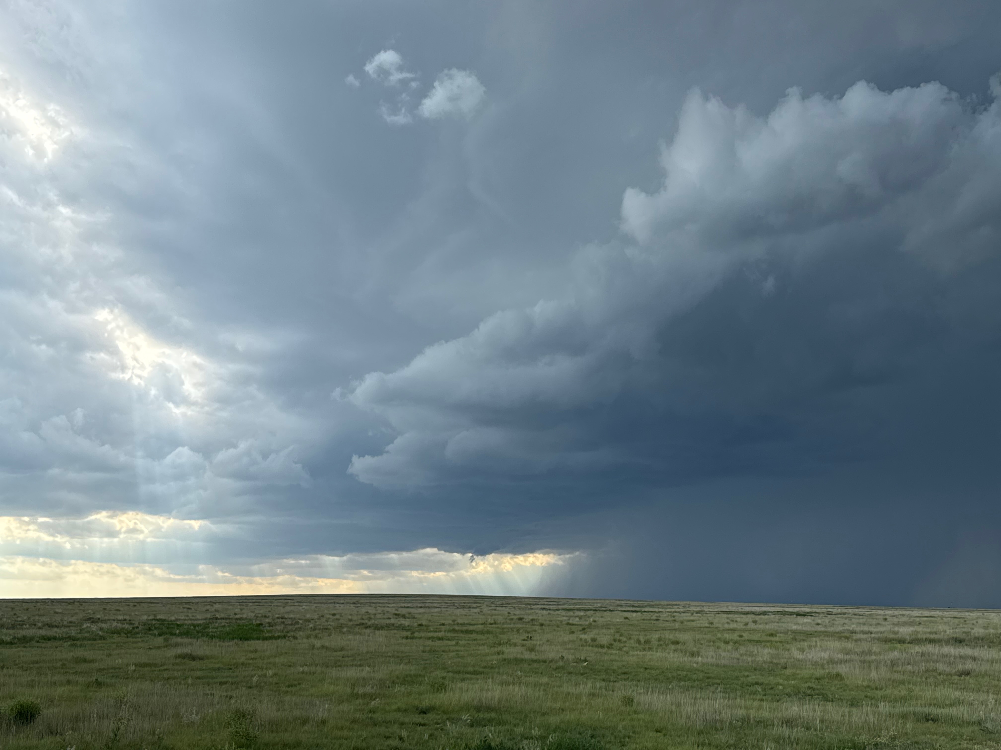
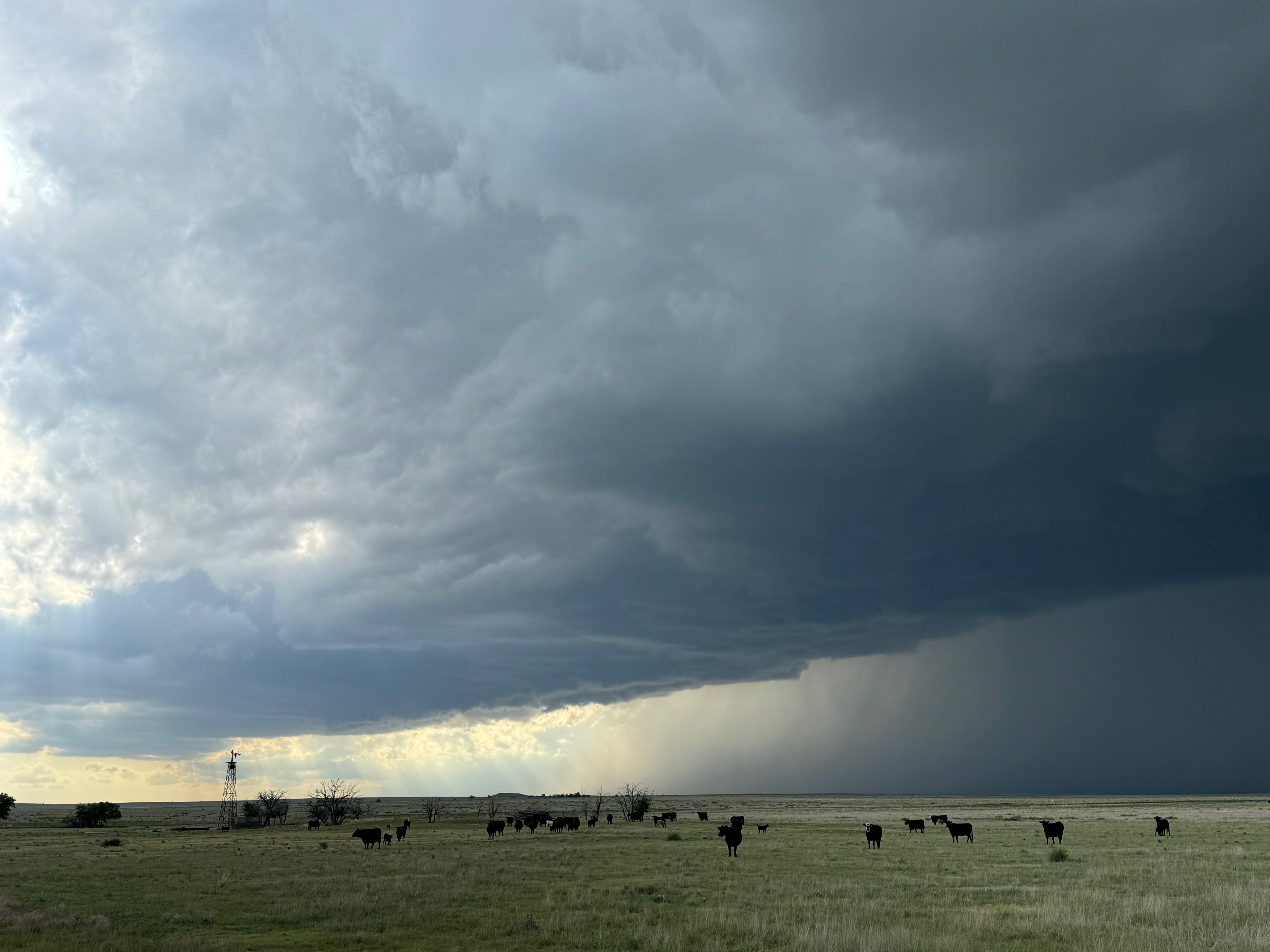
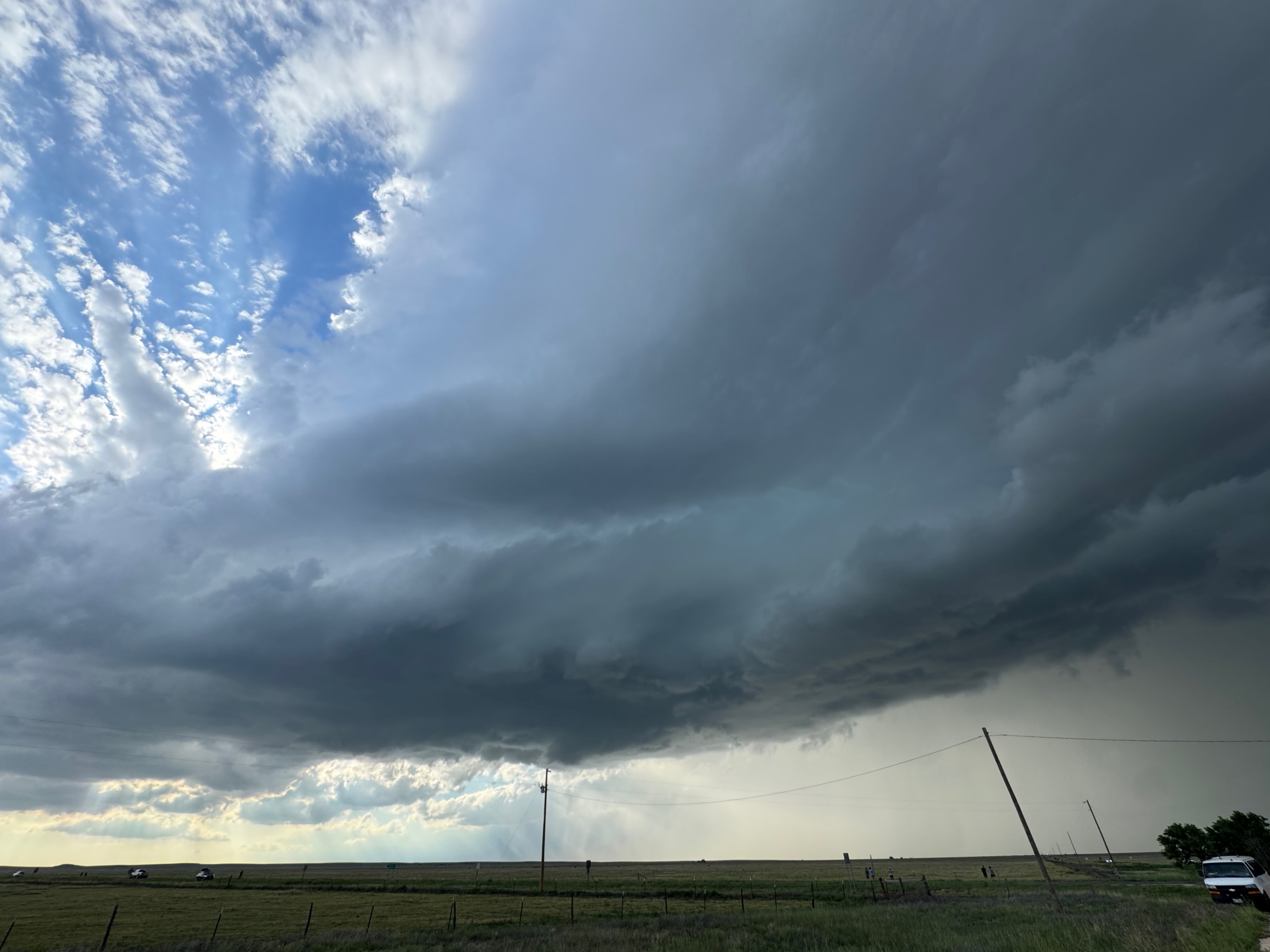
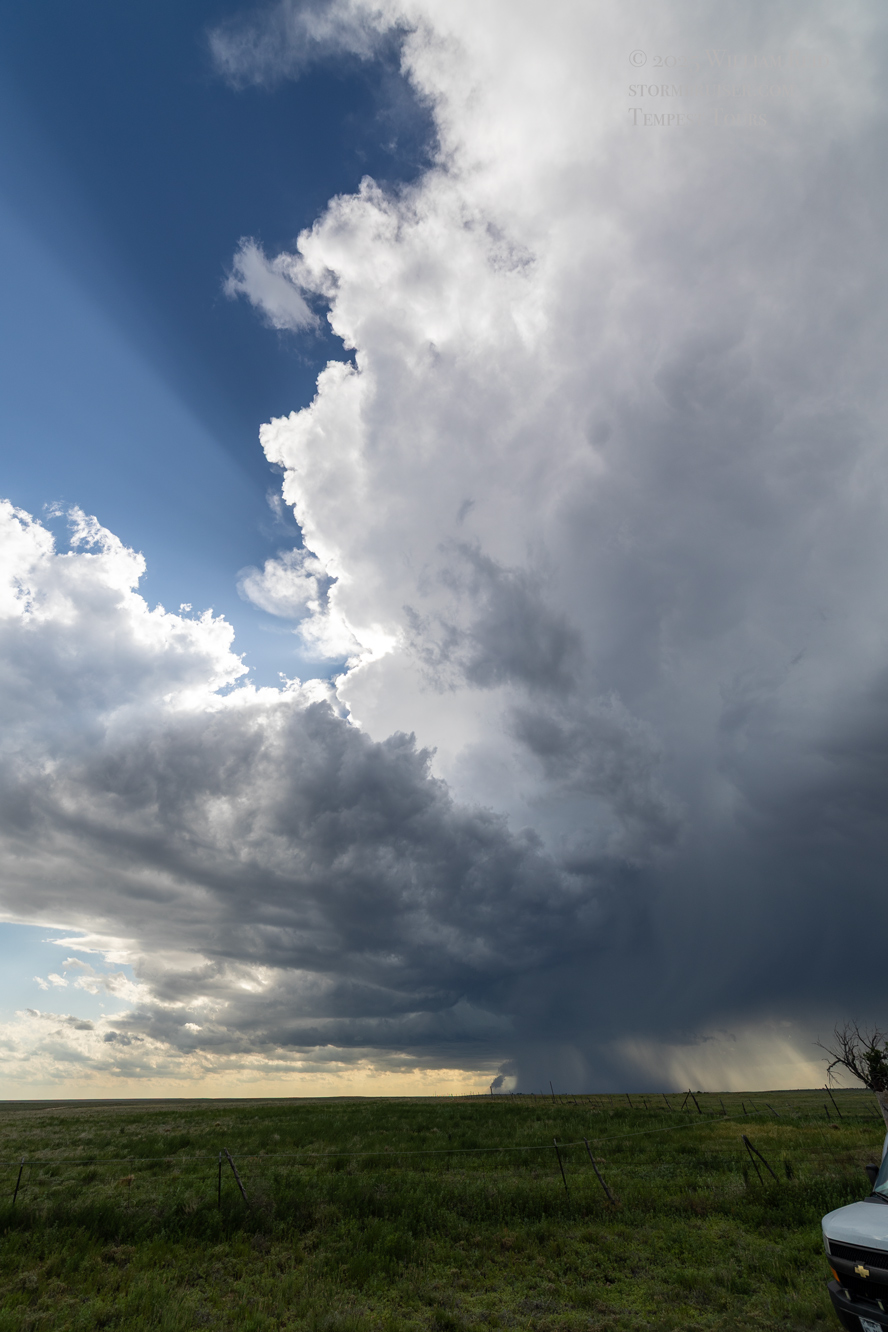
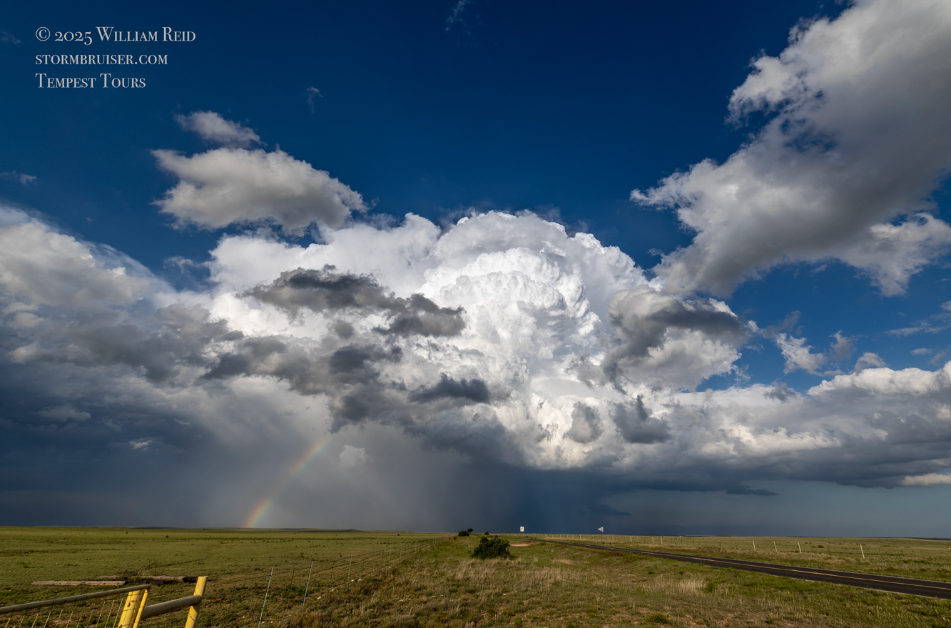
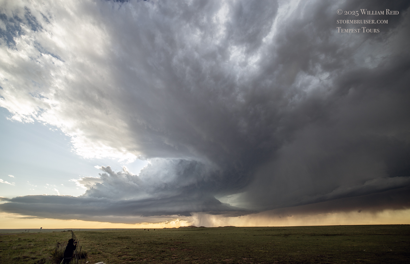
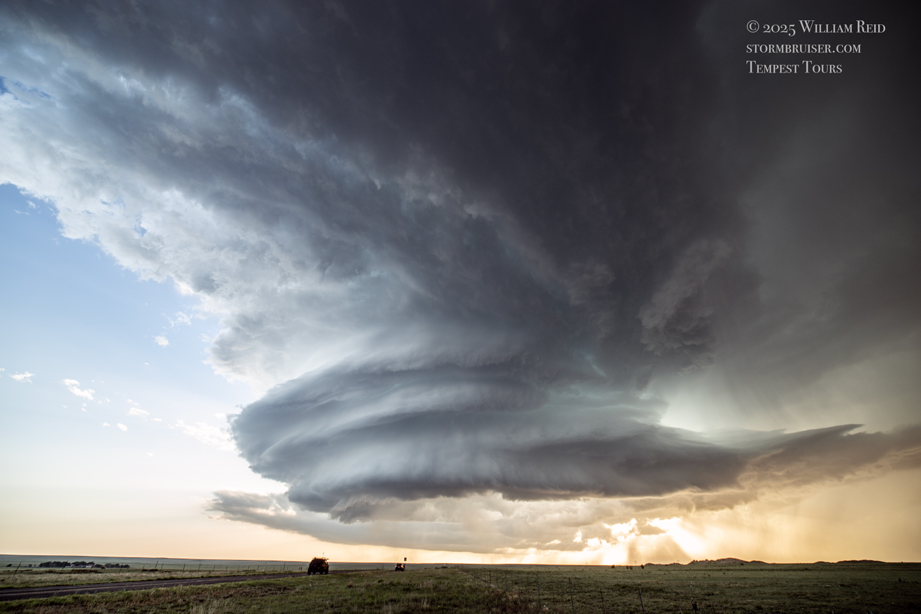
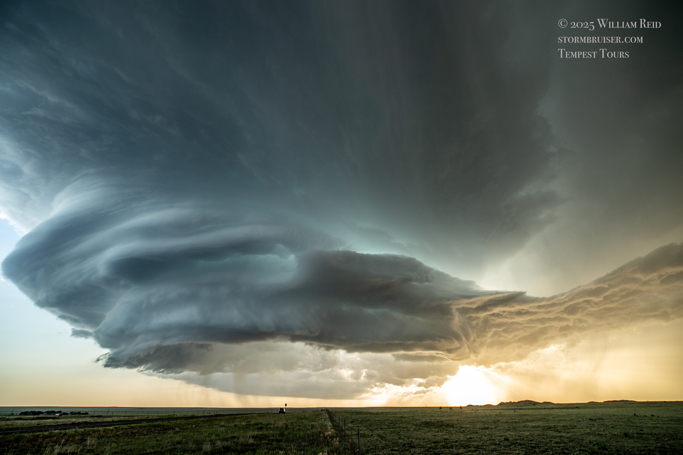
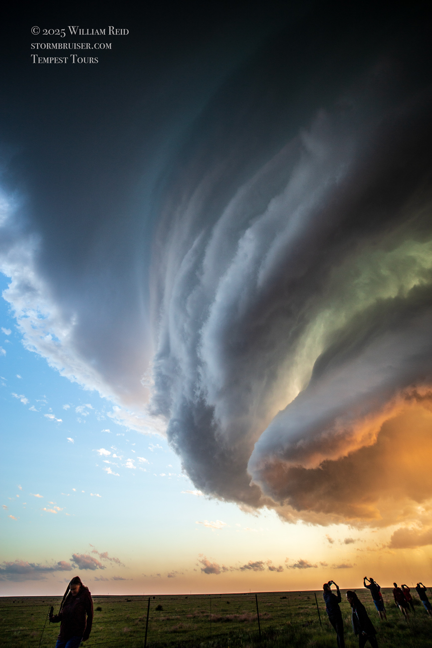
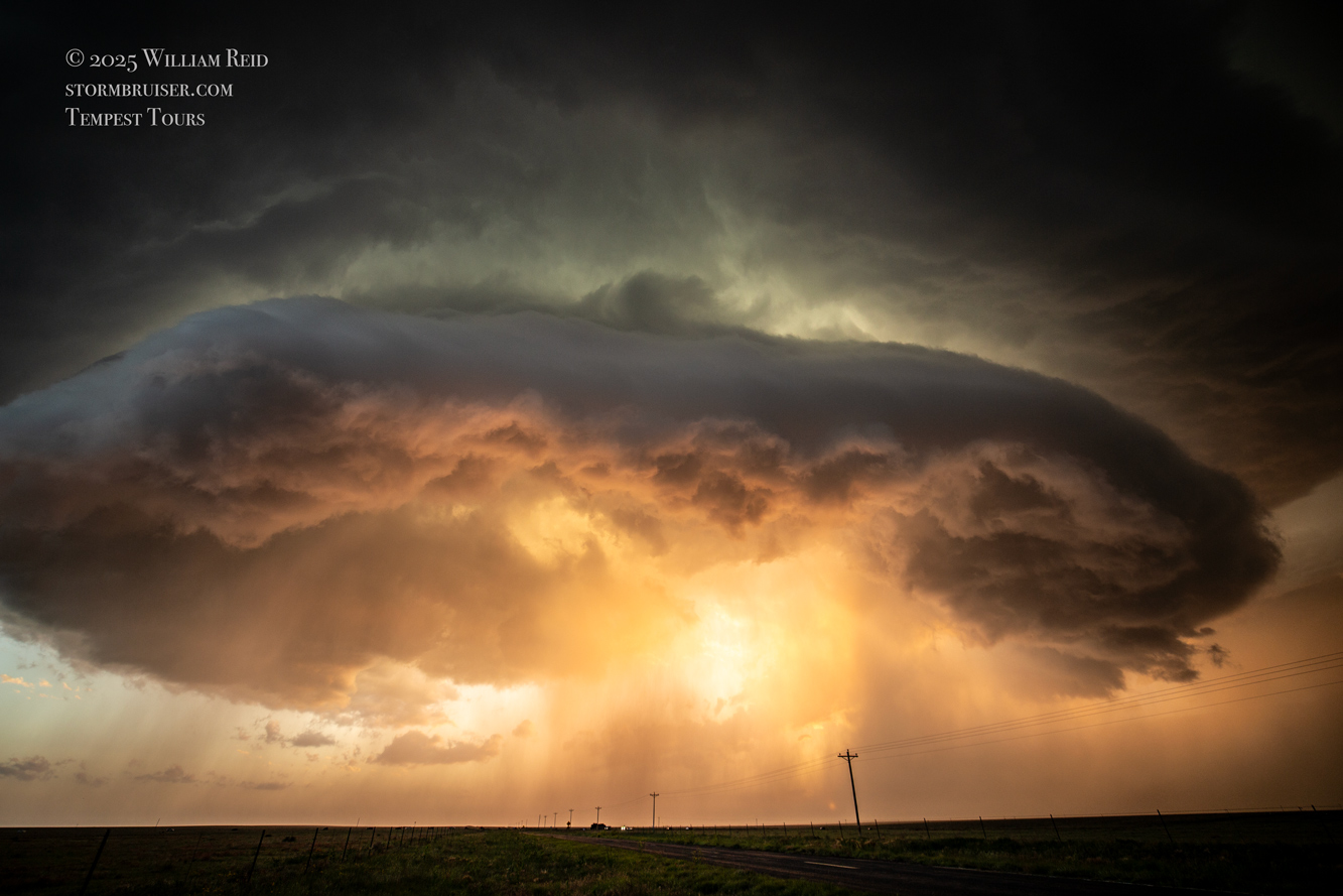
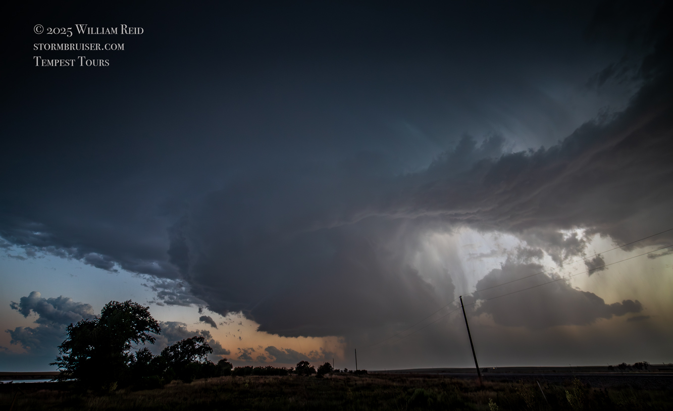
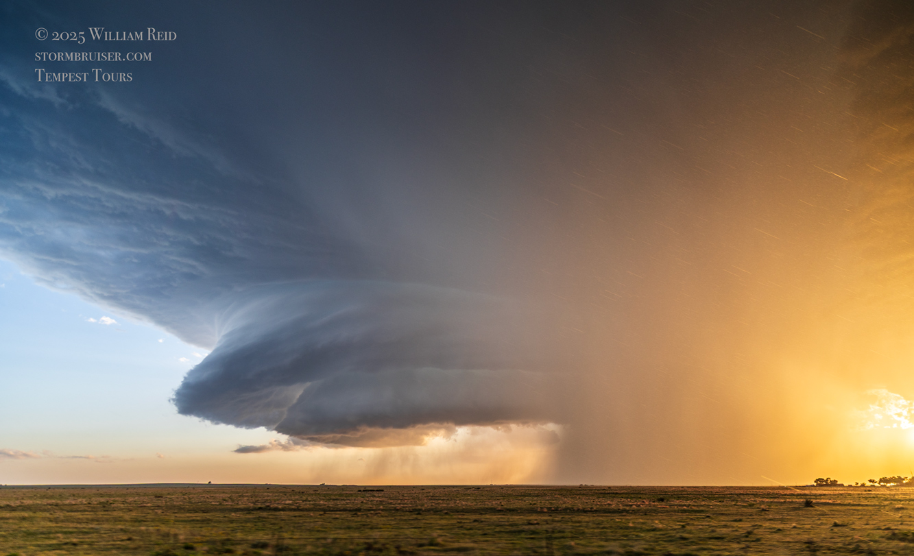
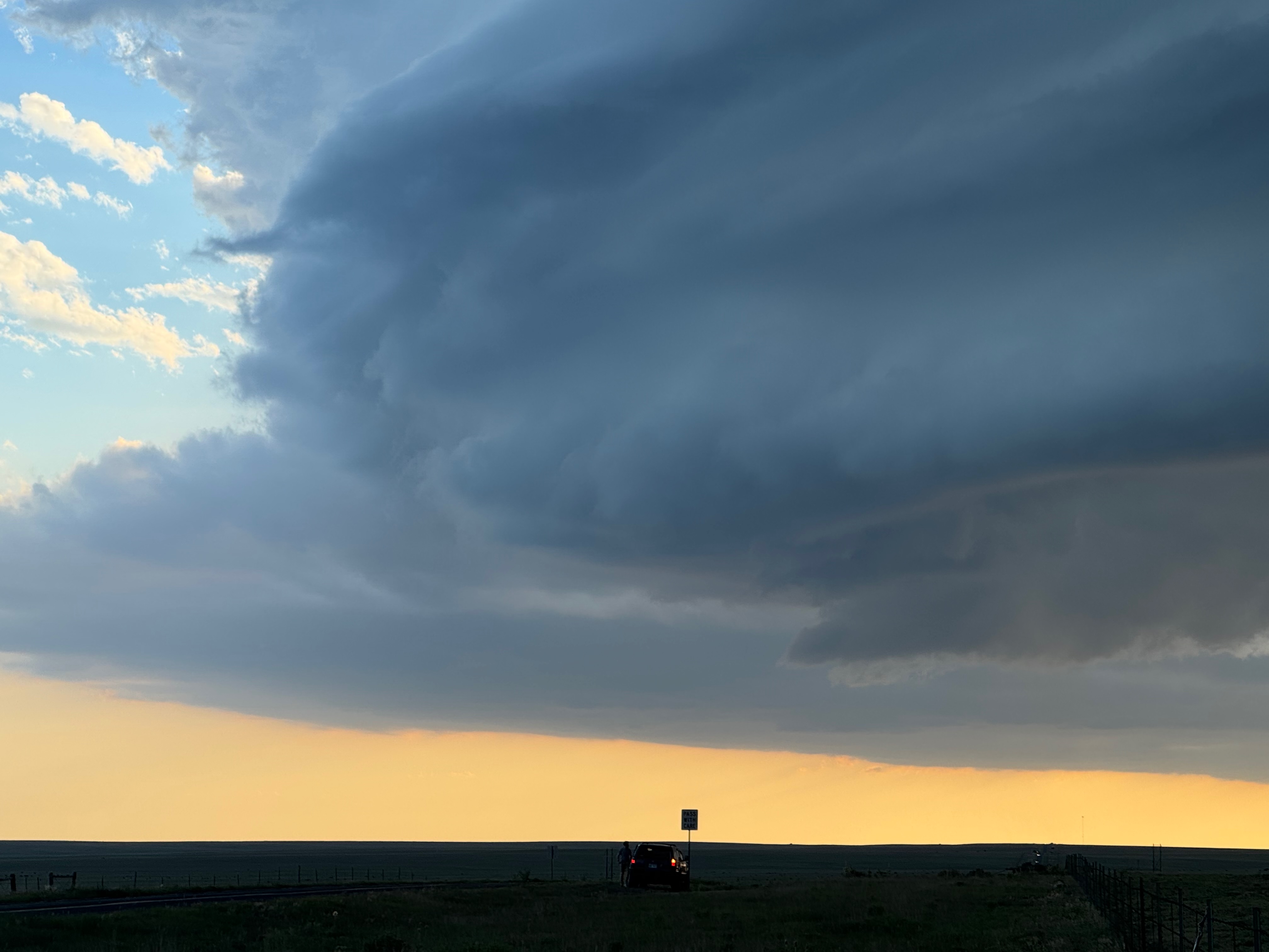
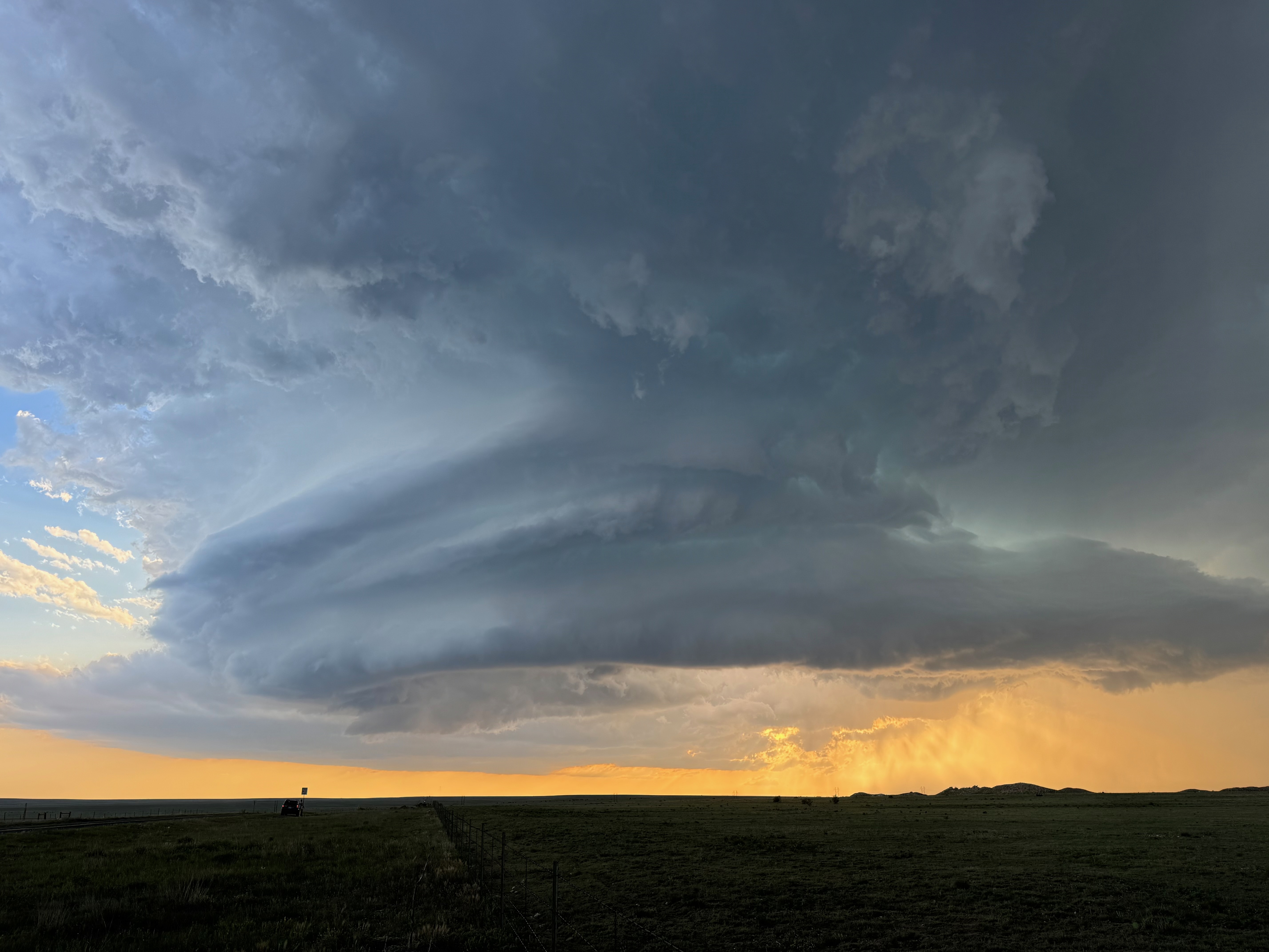
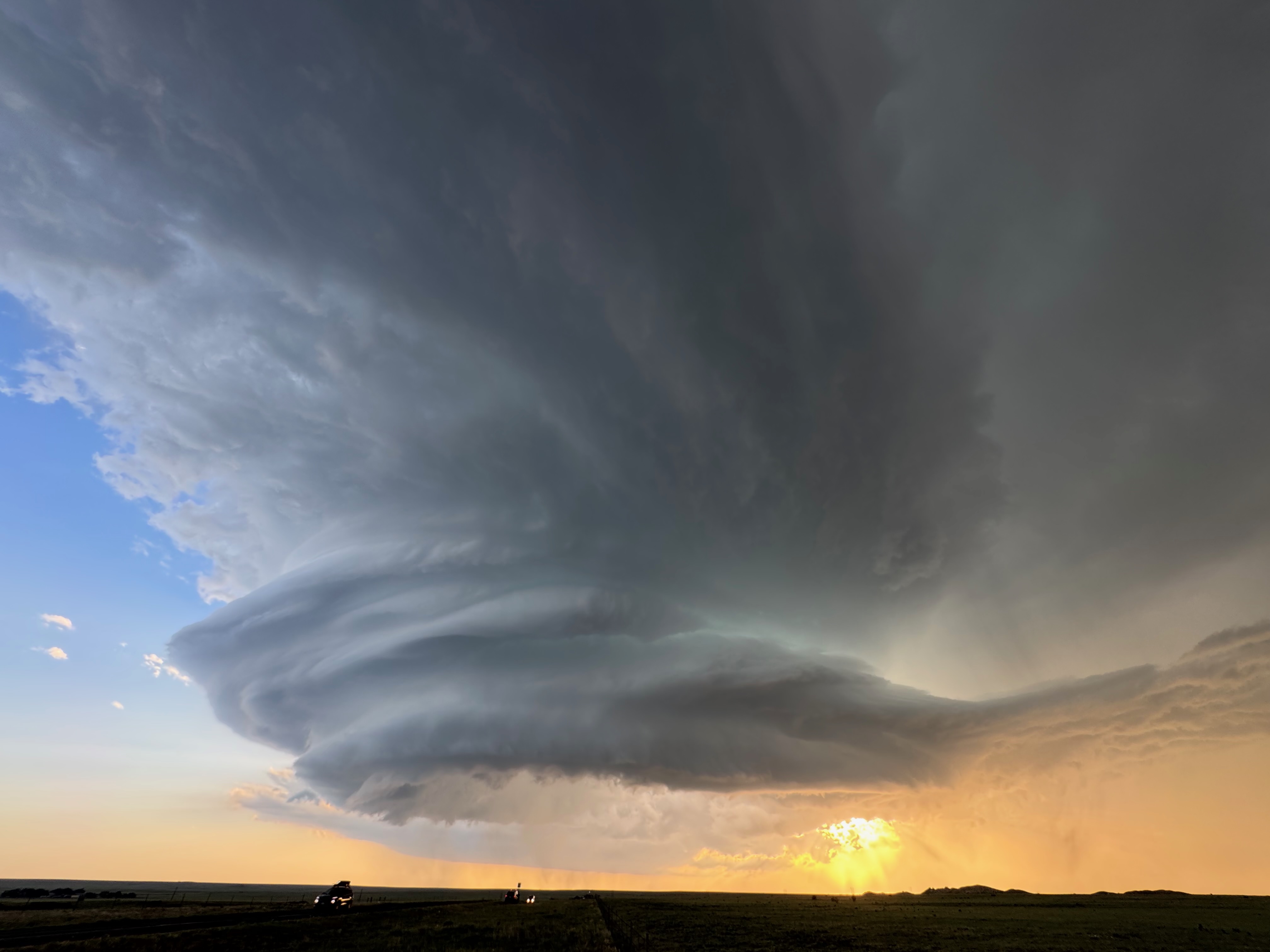
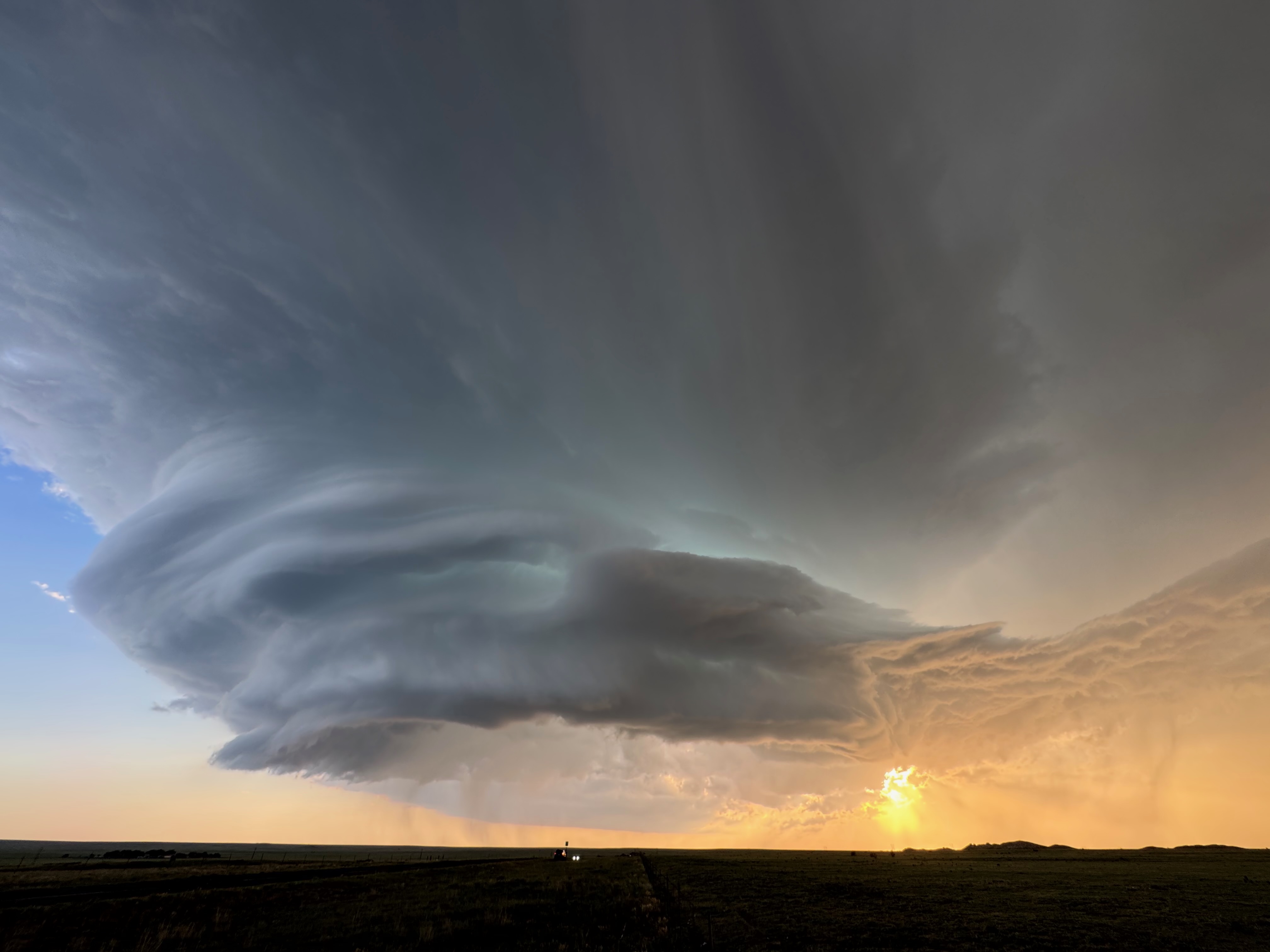
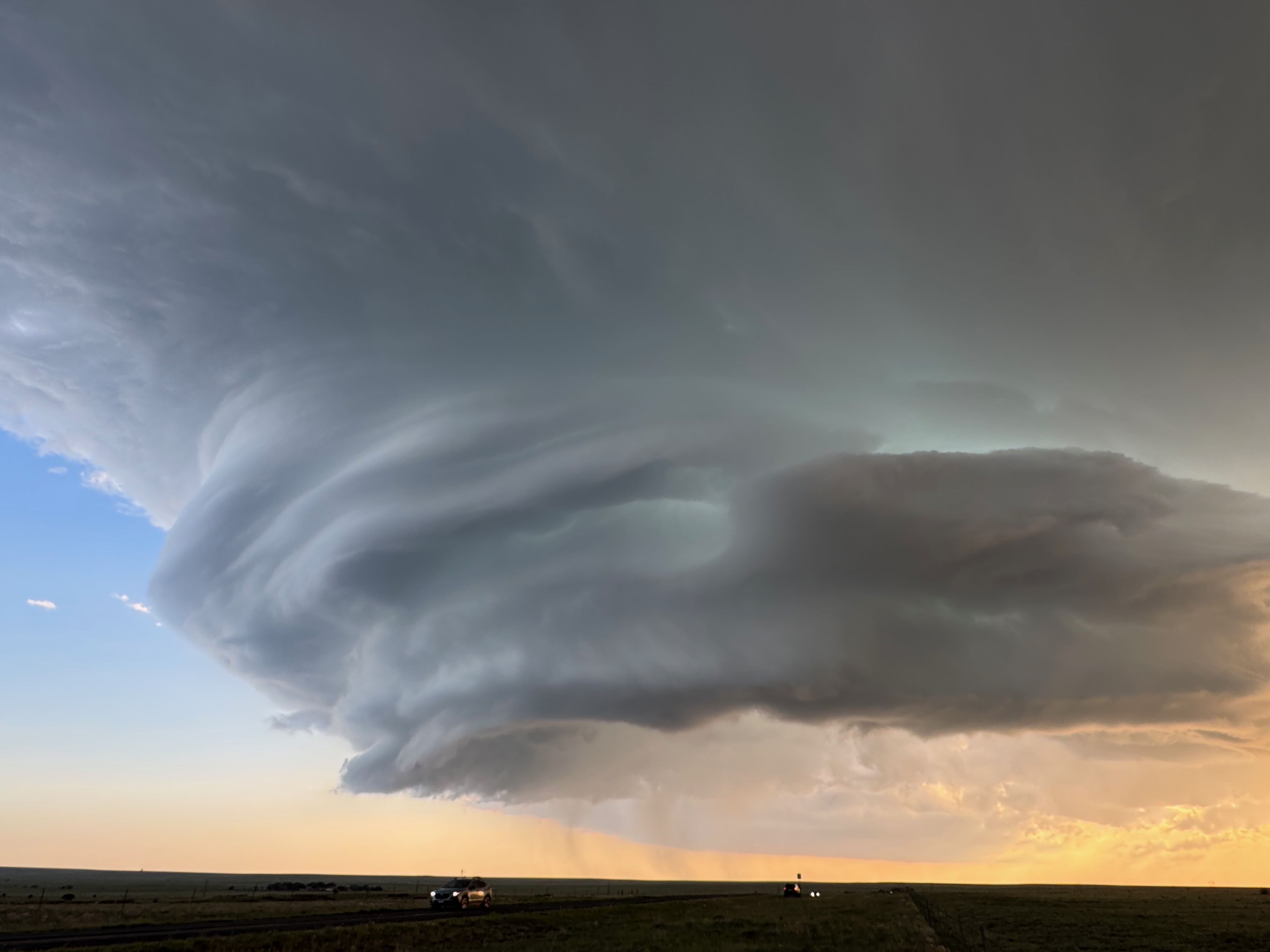
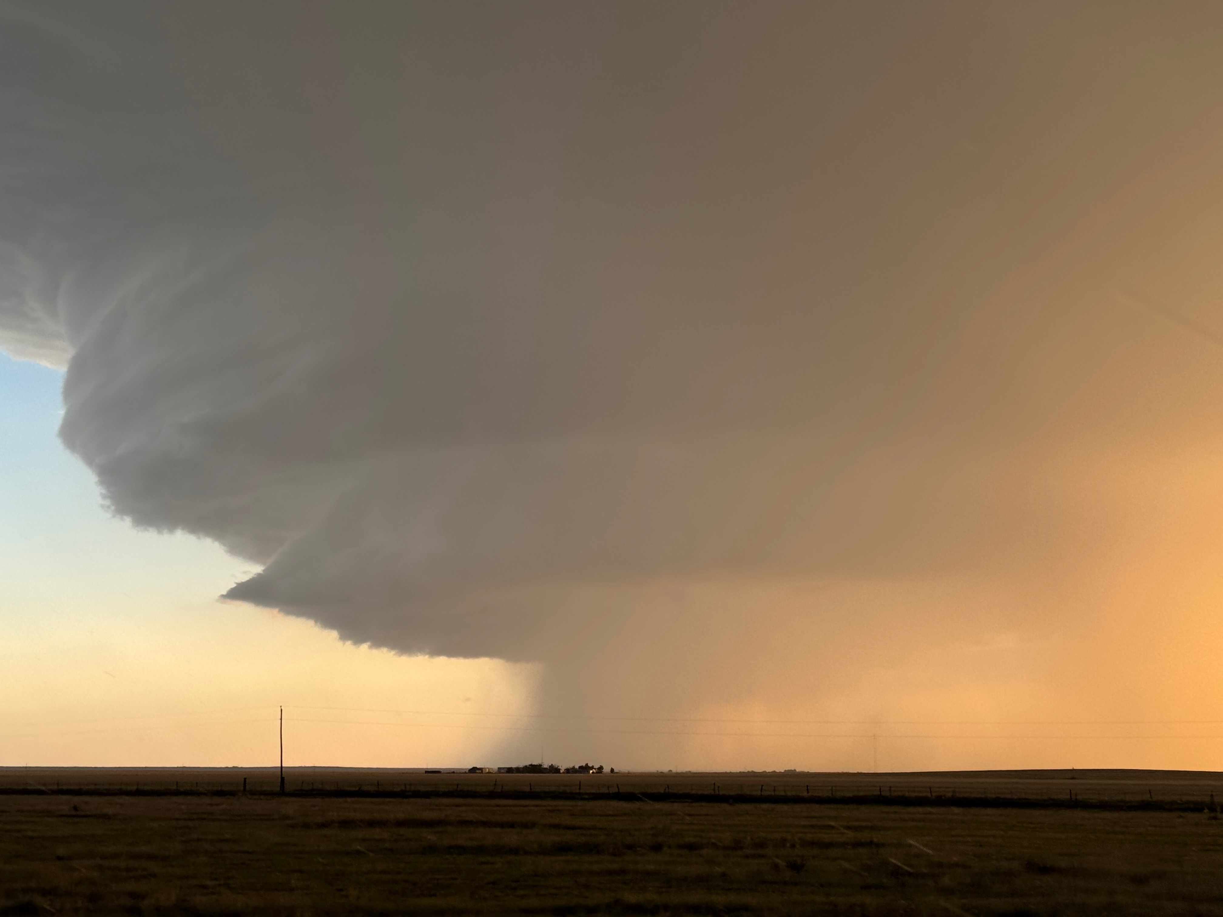
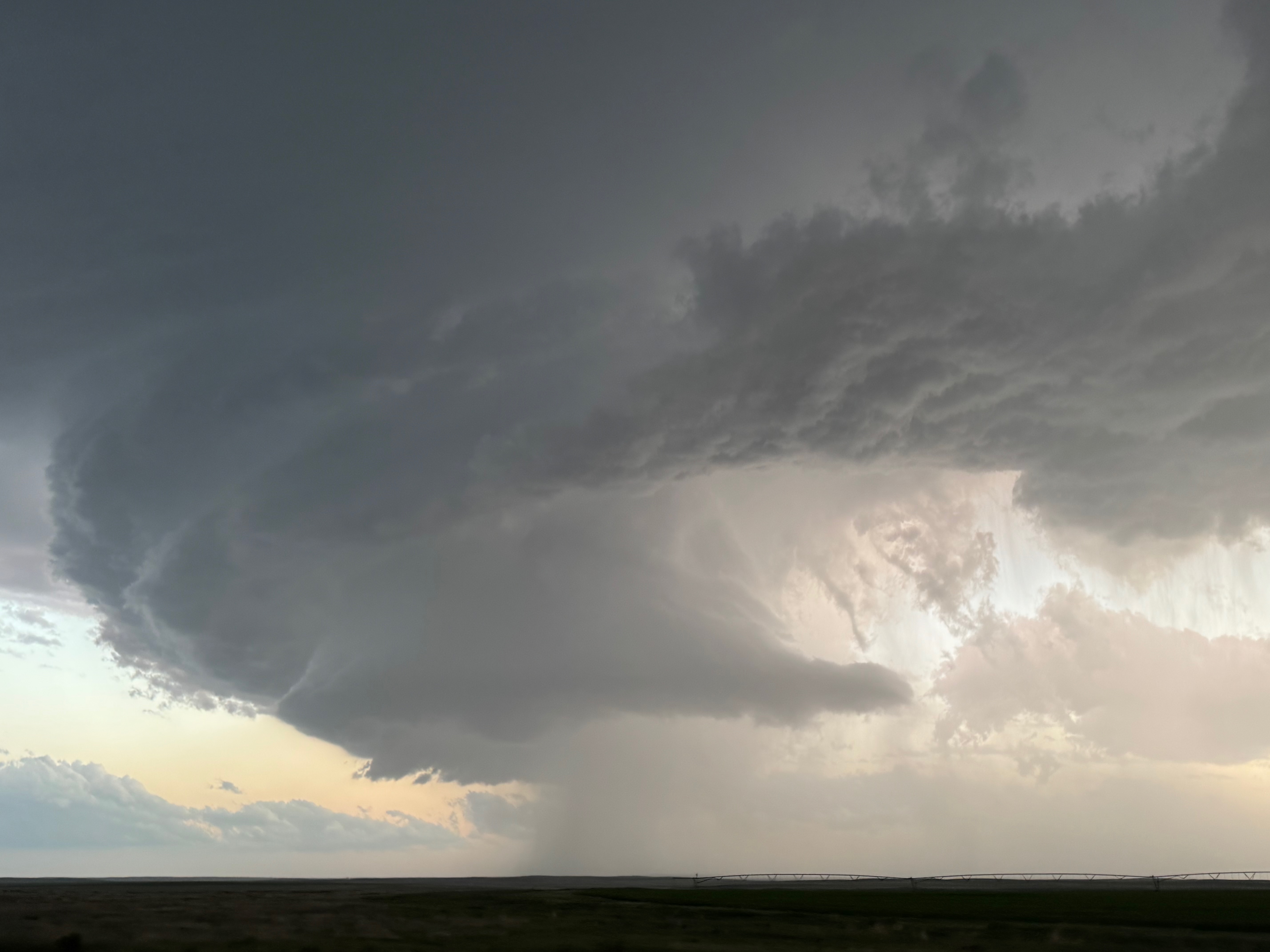
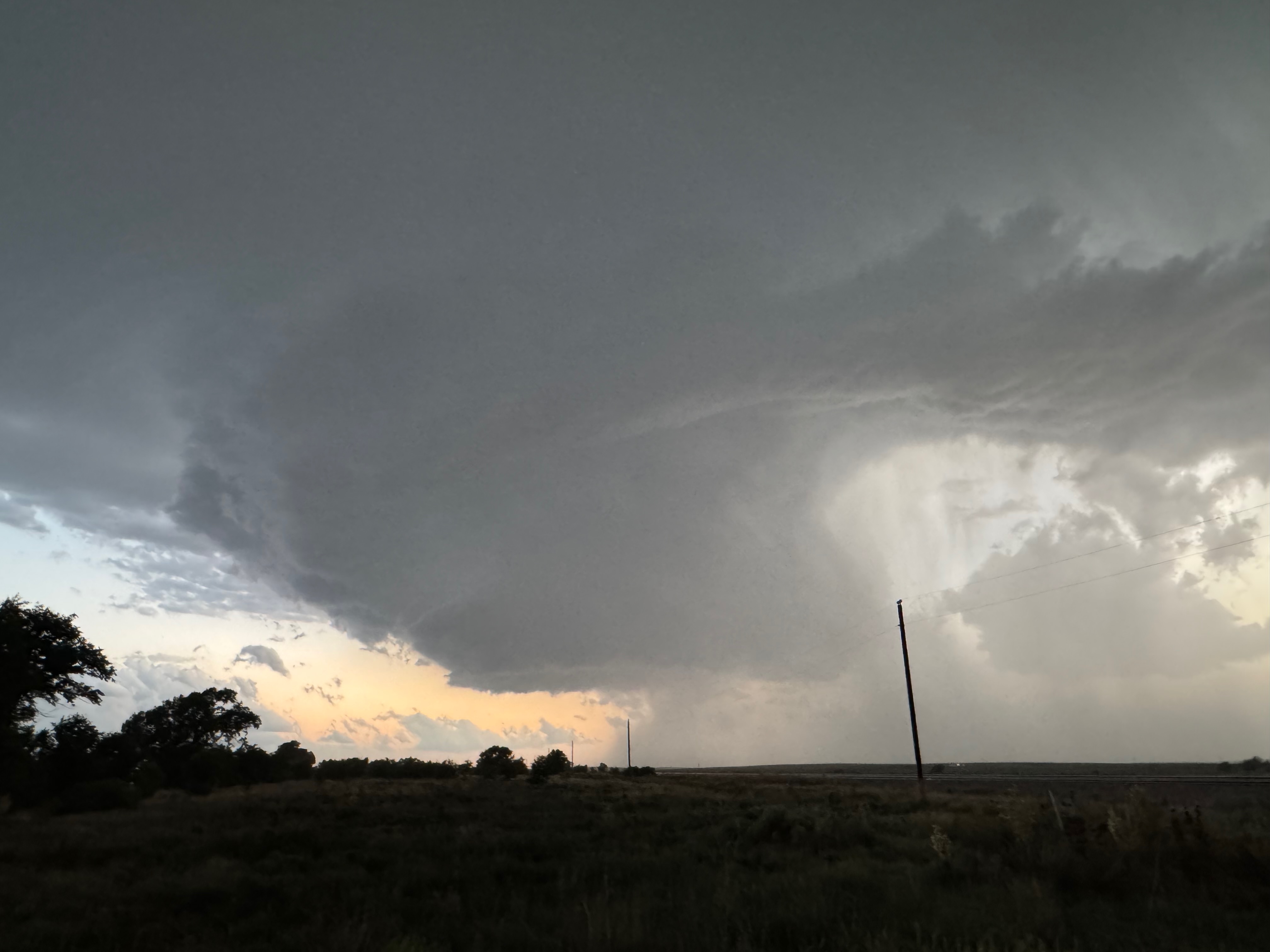
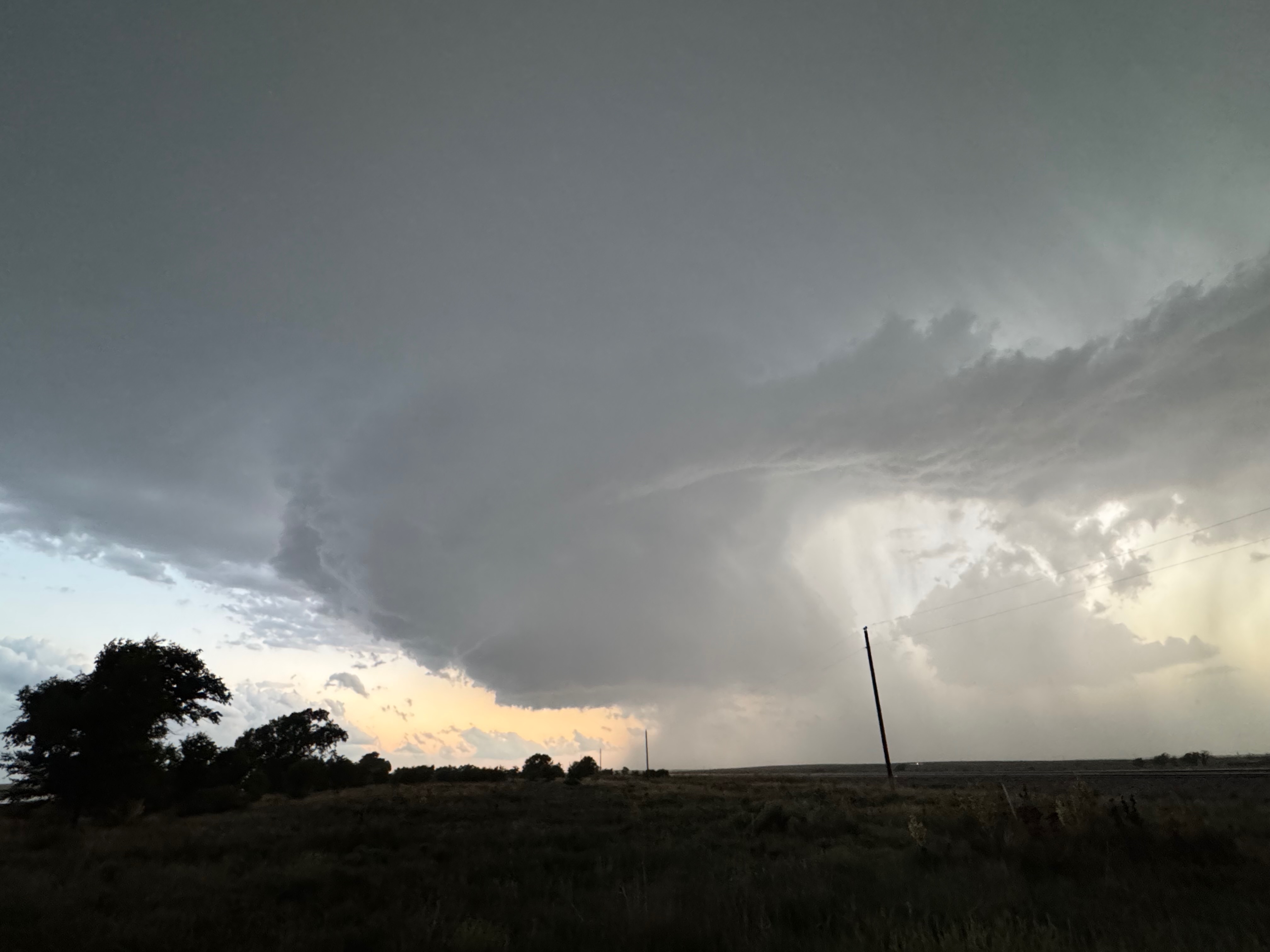
We drifted westward on NM Road 102 from NM Road 402, between Stead and Amistad in Union County, stopping about a third of the way to Bueyeros. The new approaching supercell was big, and it sported excellent low-level organization and structure already. The storm base looked a little too high to offer much of a tornado threat, but the front-end structure made up for that. I was able to set the Canon camera up for some wide-angle timelapse, and after maybe 30 minutes the storm base was a little south of due west.
Canon images above, iPhone pics below
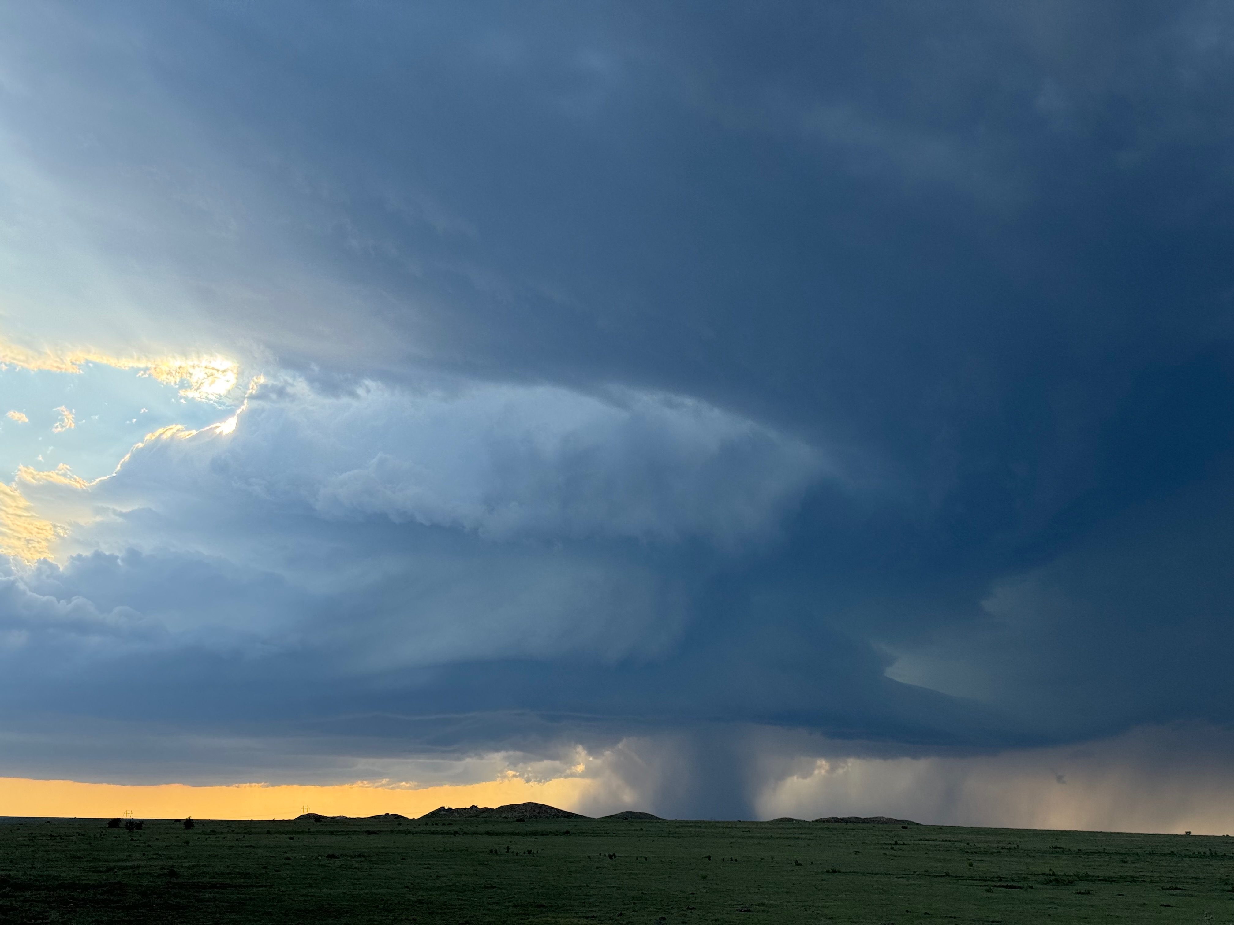
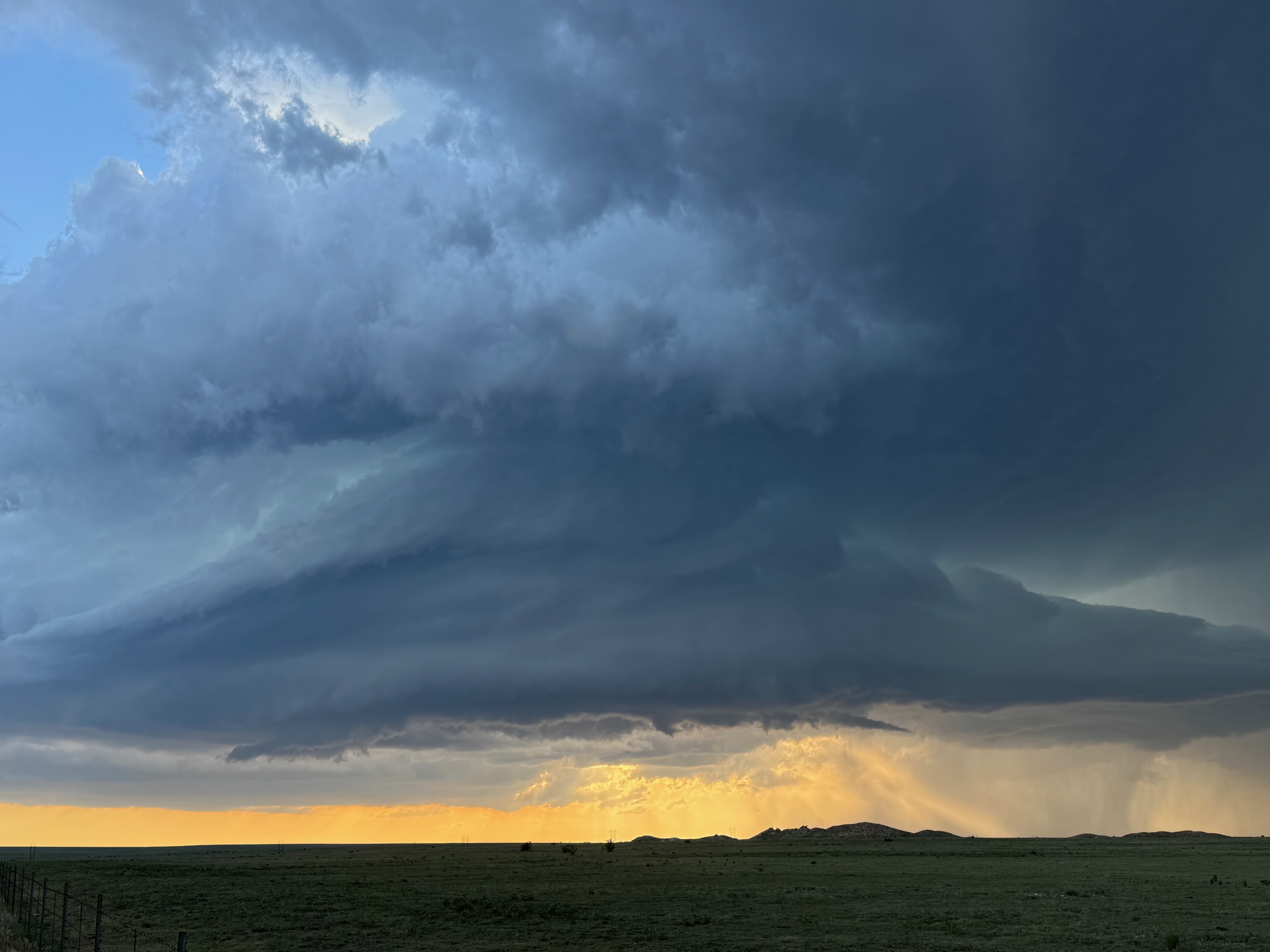
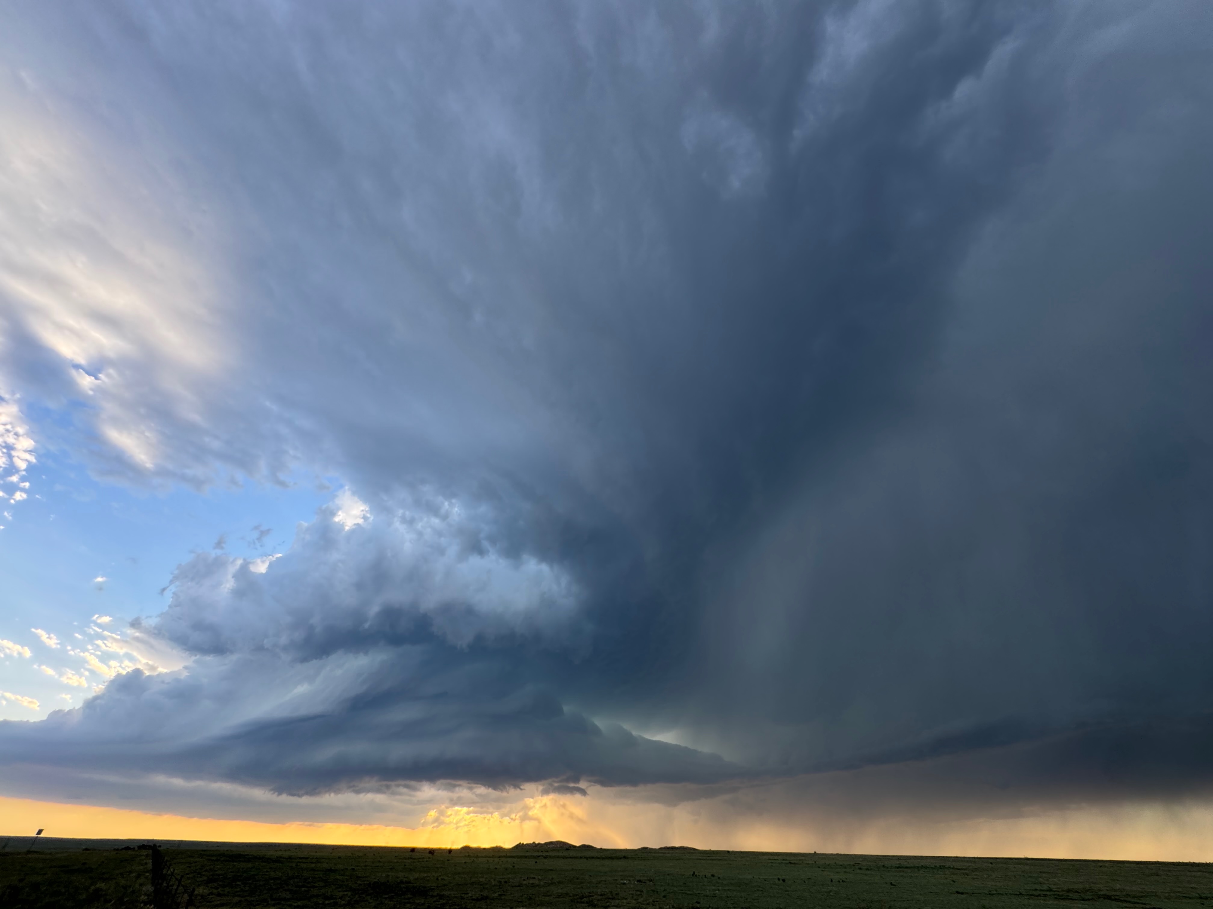
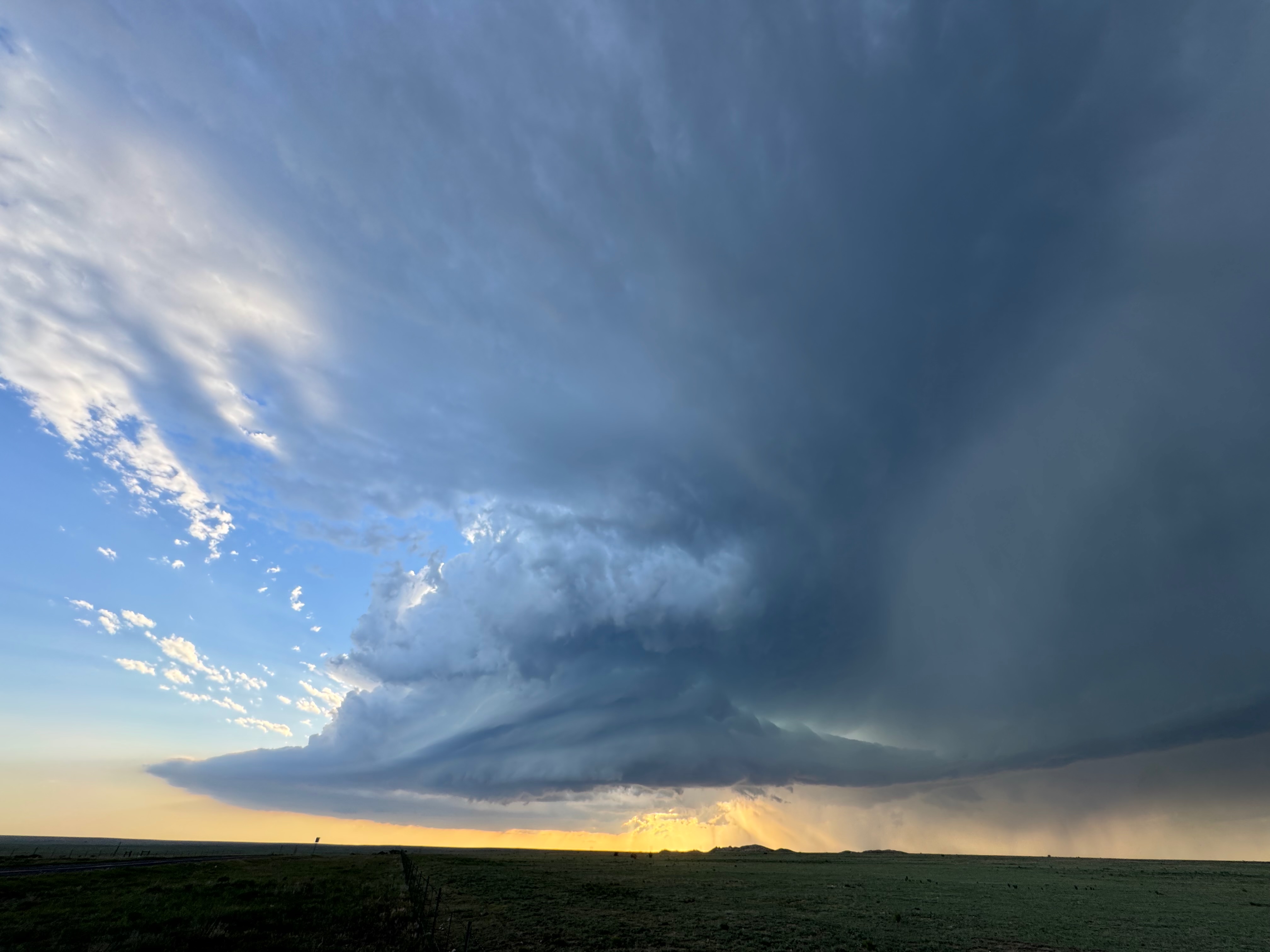
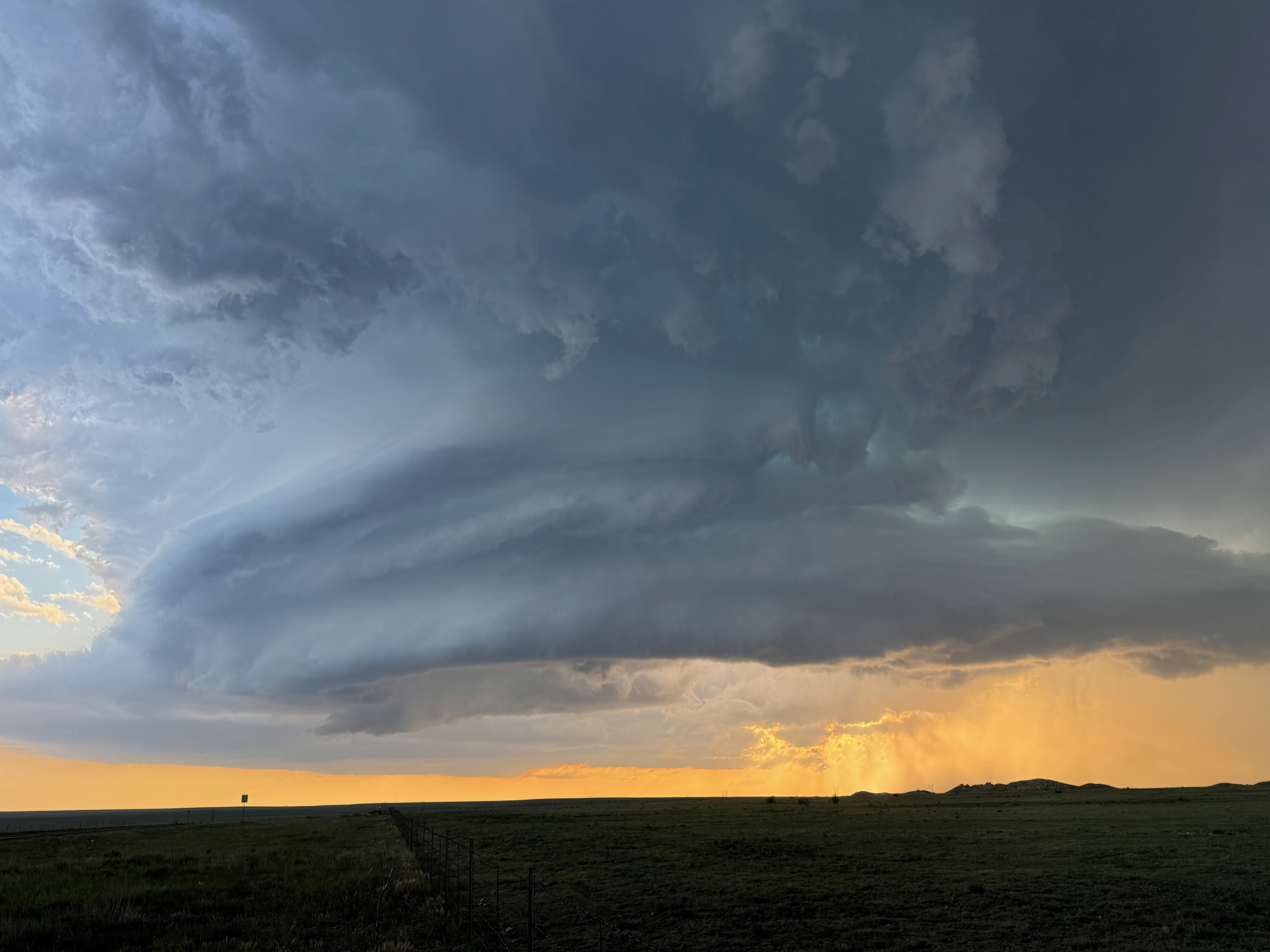
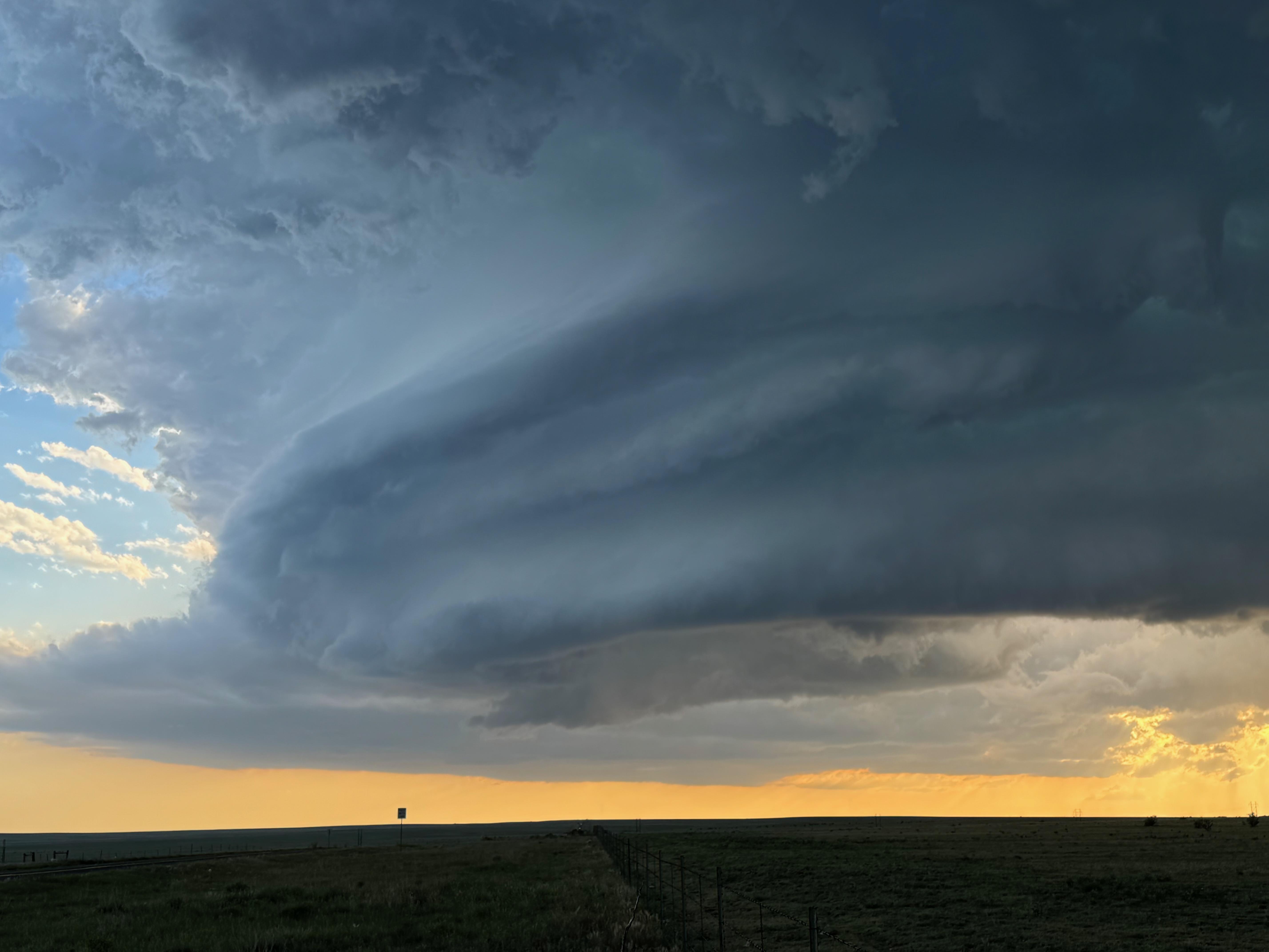
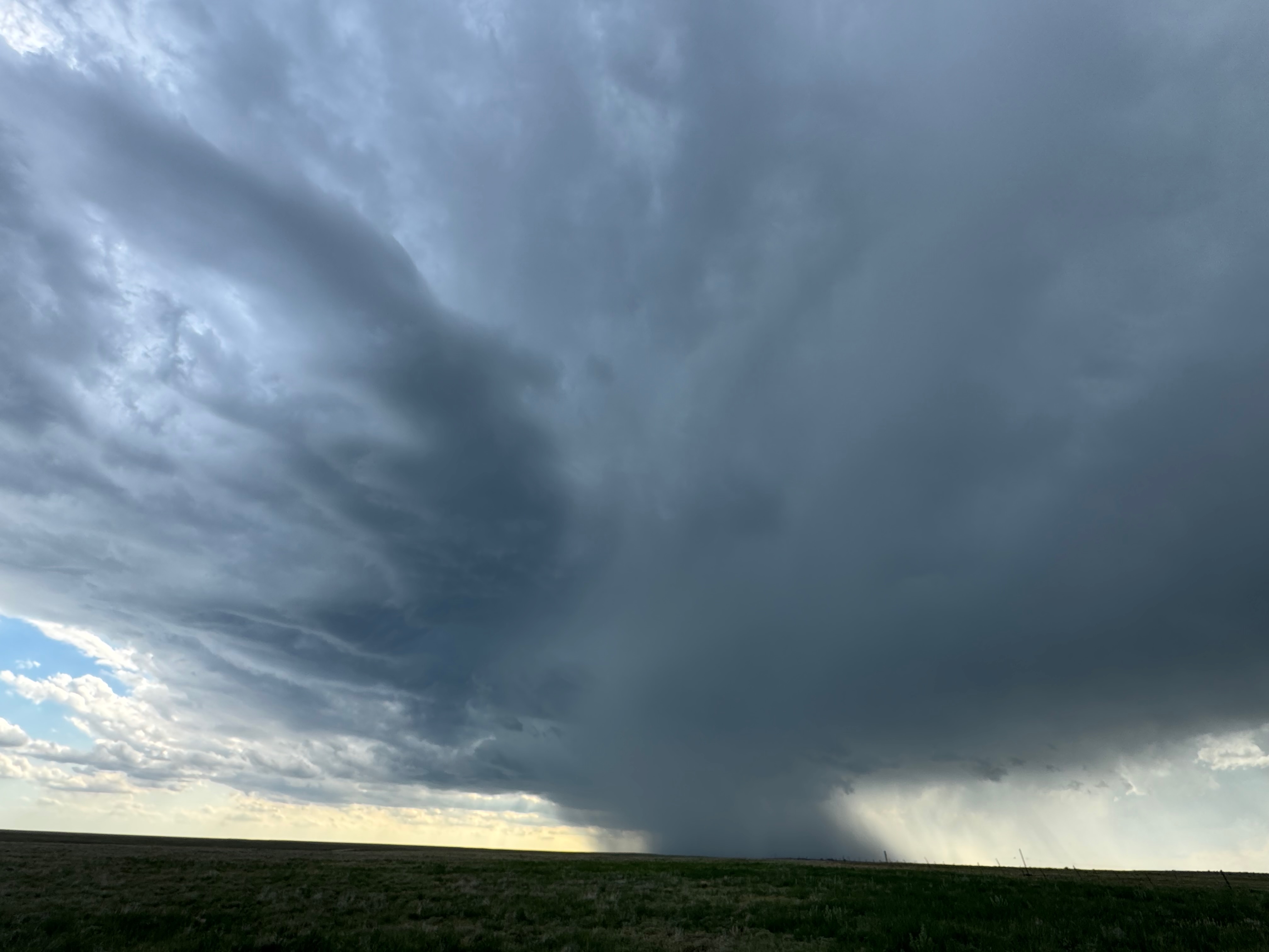
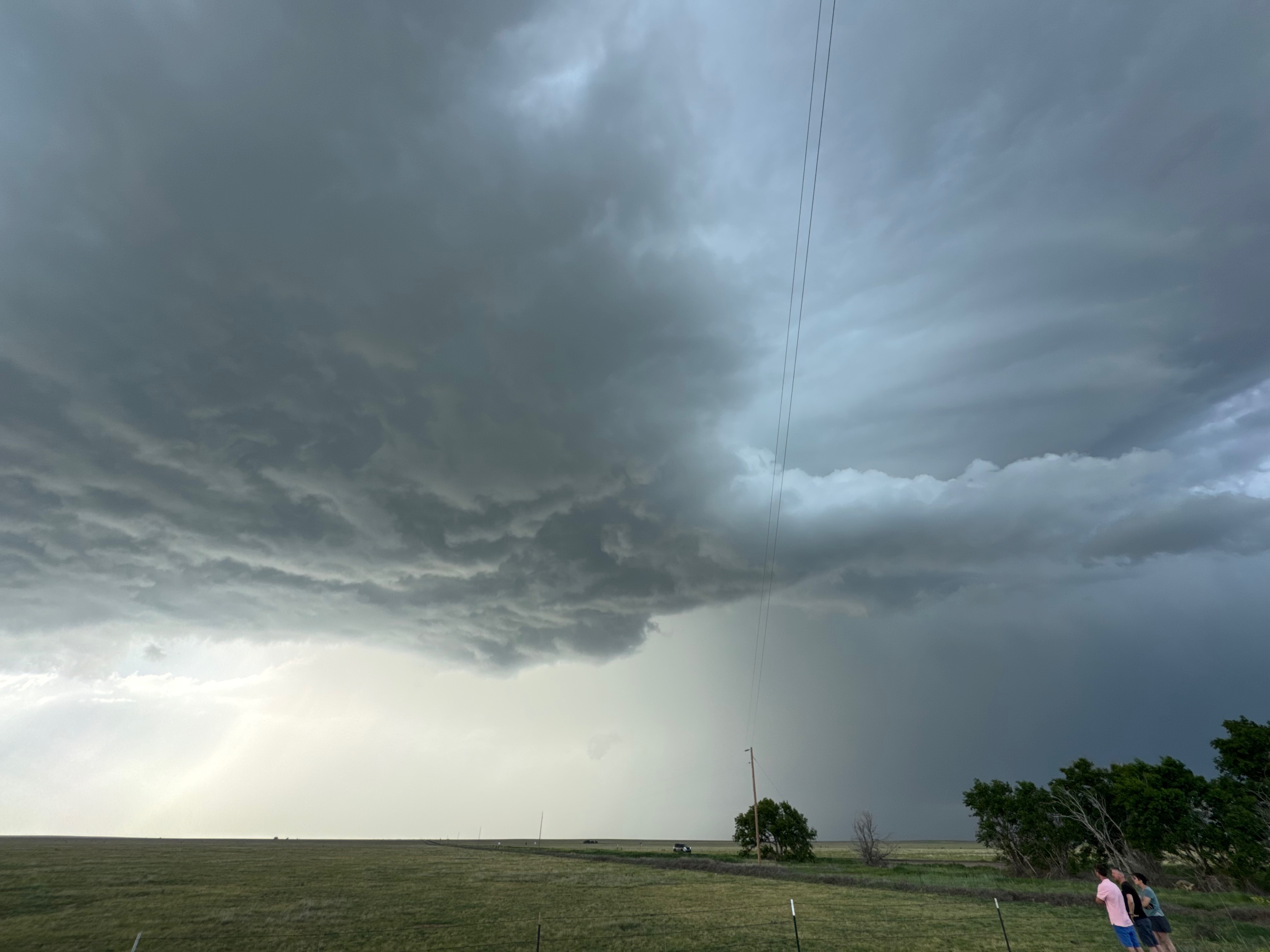
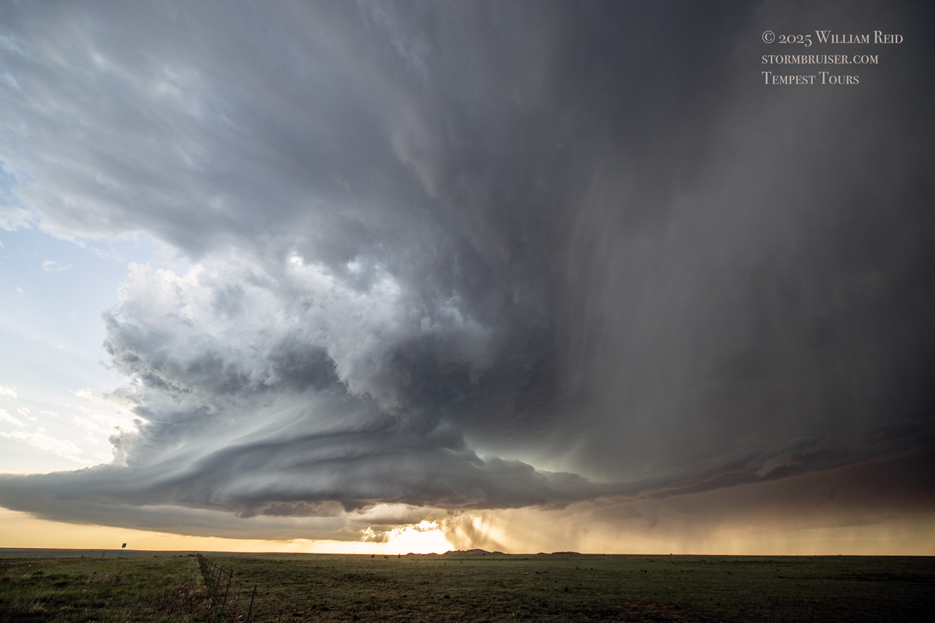
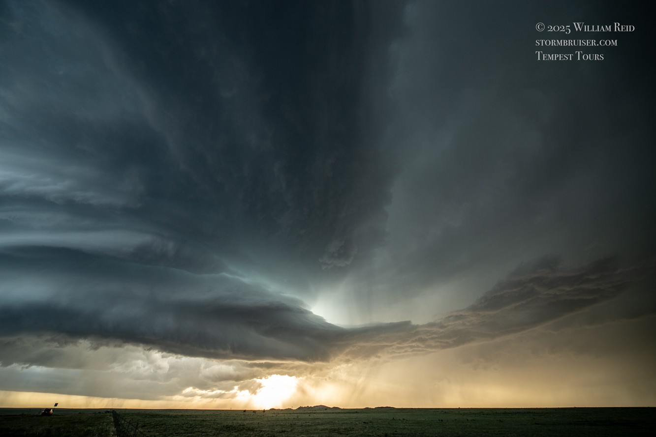
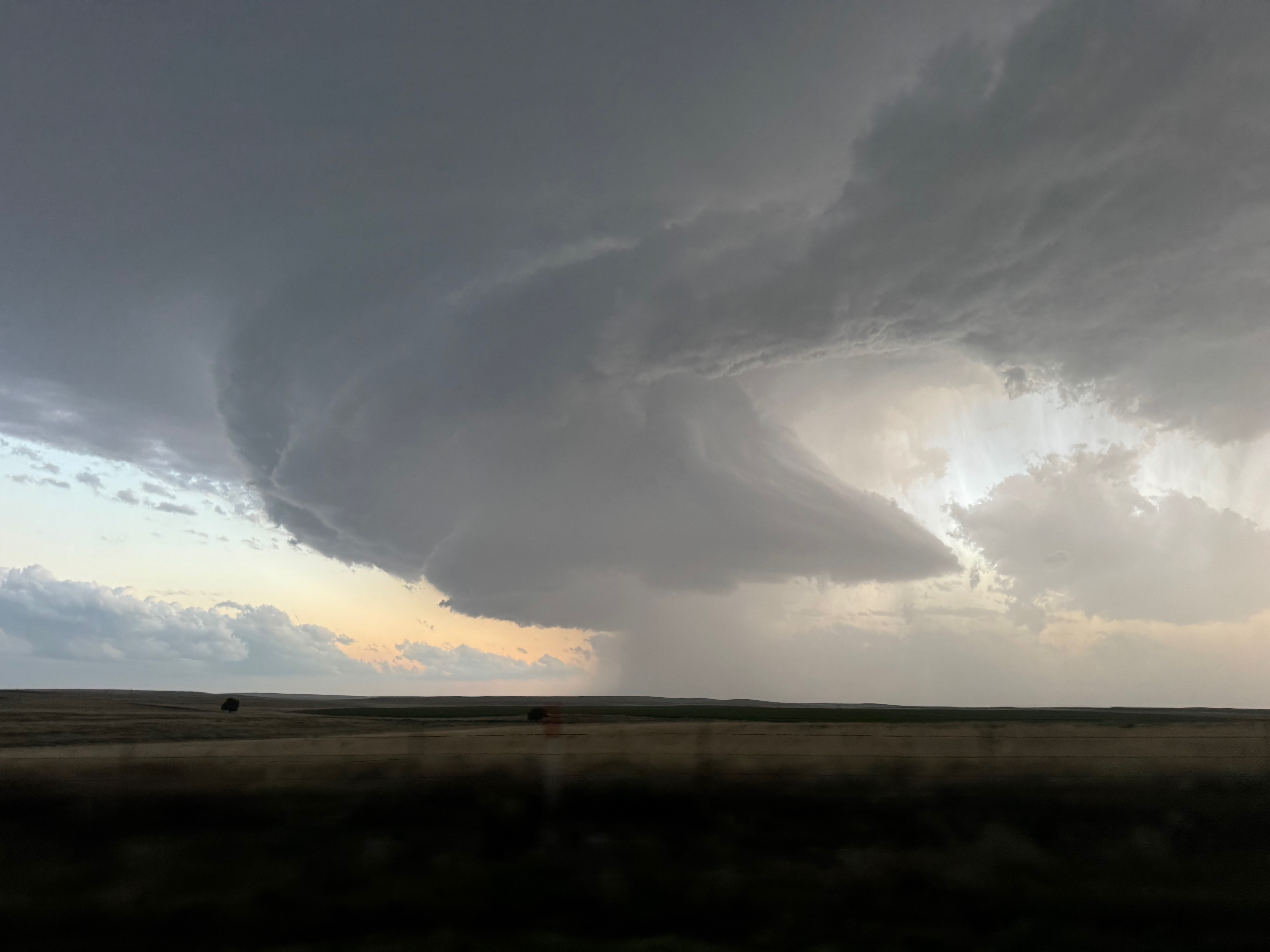
The light on the storm was getting nice, but we could not stay here as the precipitation core and some large hail would be coming through shortly. Sunset would be in around 30 minutes, and it was now obvious that a fabulous High Plains LP (well, mostly LP) supercell-at-sunset photo opportunity was unfolding. The storm was moving SE to SSE at maybe 25-30 mph. We had to make the 8-minute drive east back to 402, and then dash south to try to get back ahead of the front end. I had a great look at the storm during this part, as the storm loomed just to our west outside of my side window! The utility lines were also on my side of the road…oh, well.
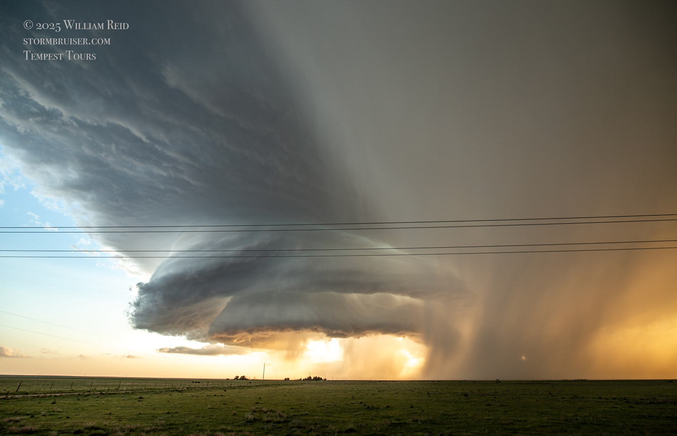
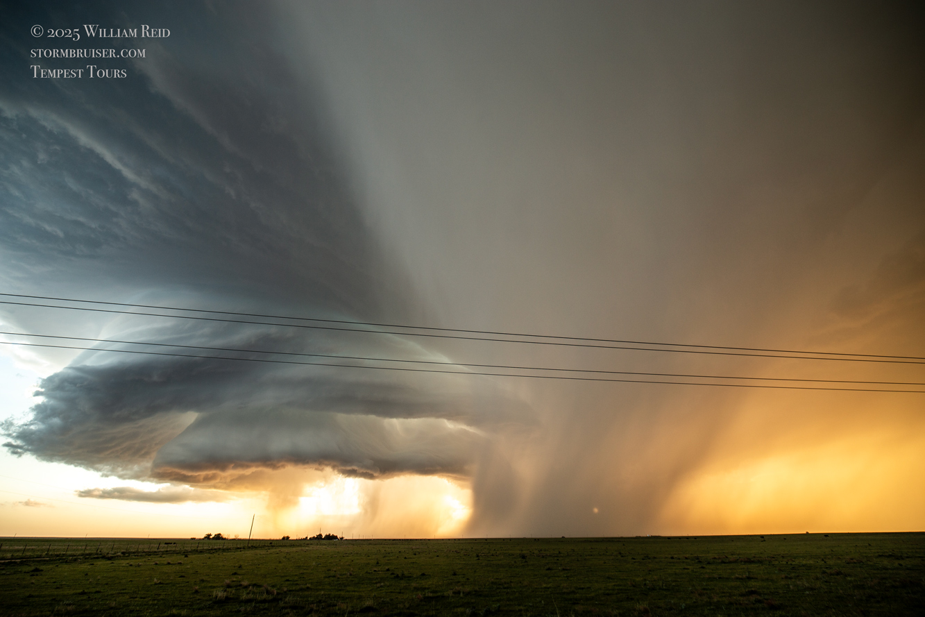
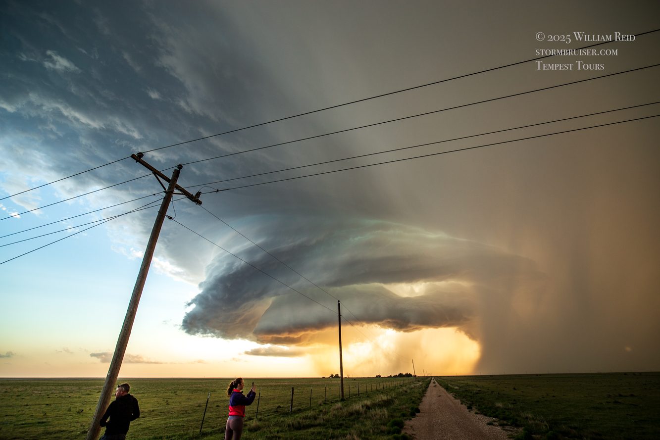
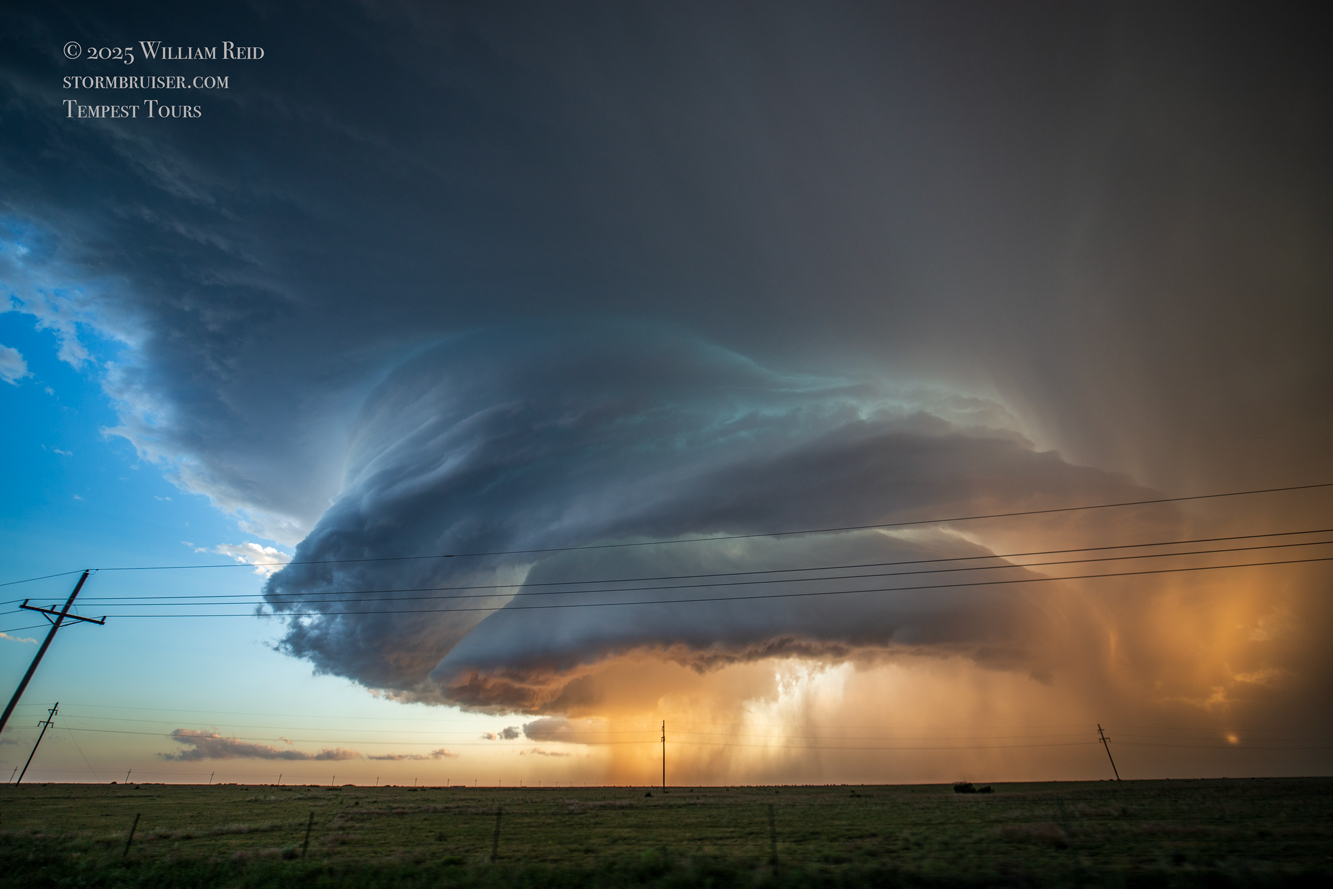
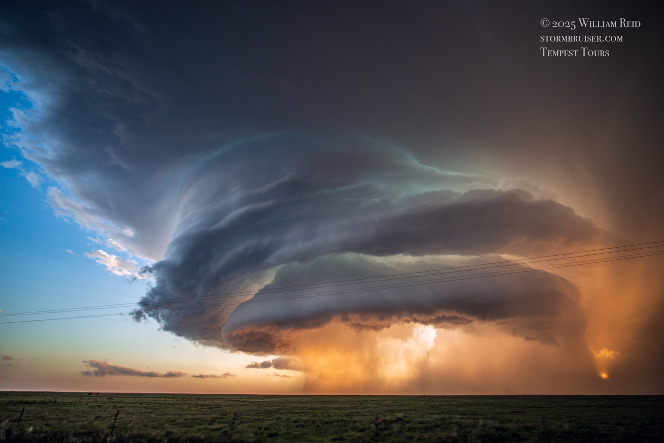
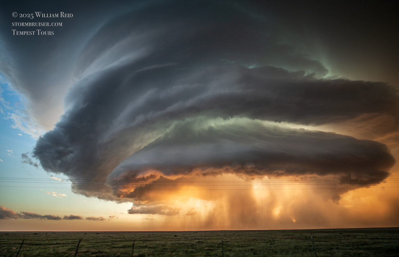

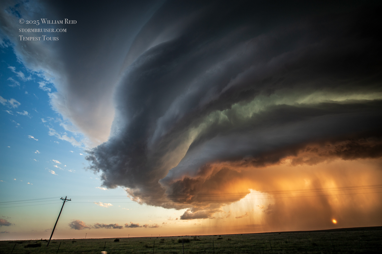
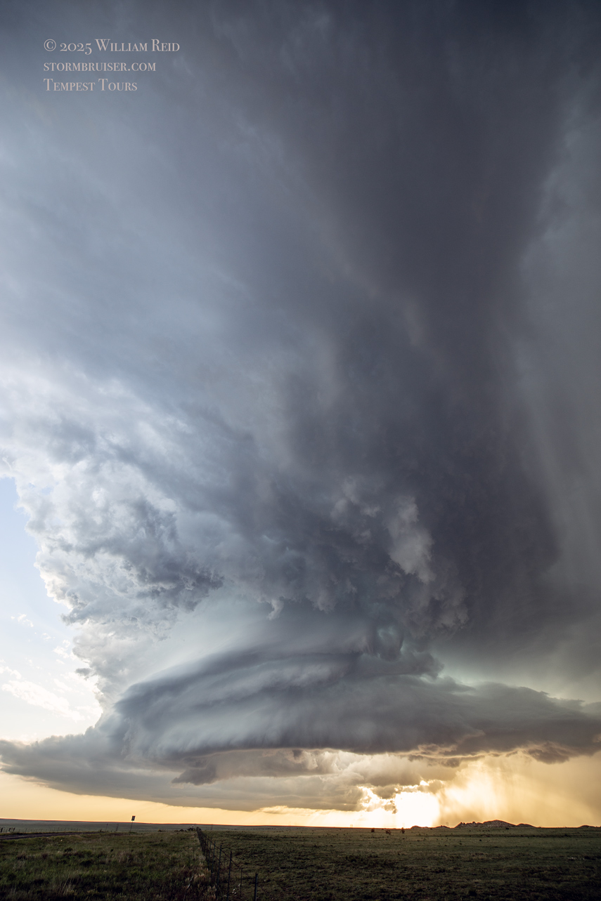
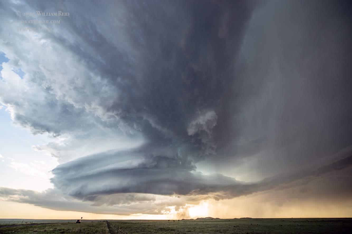
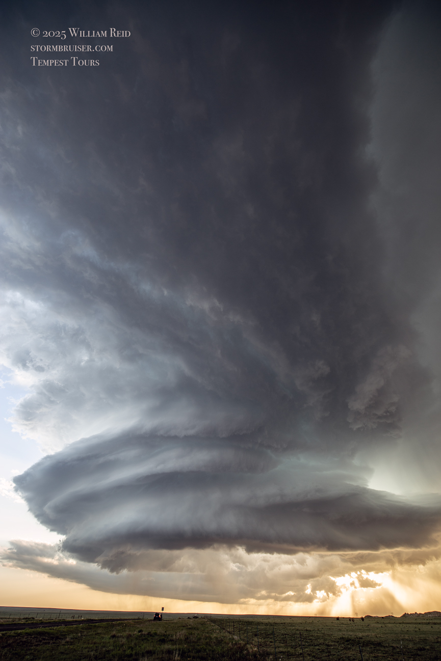
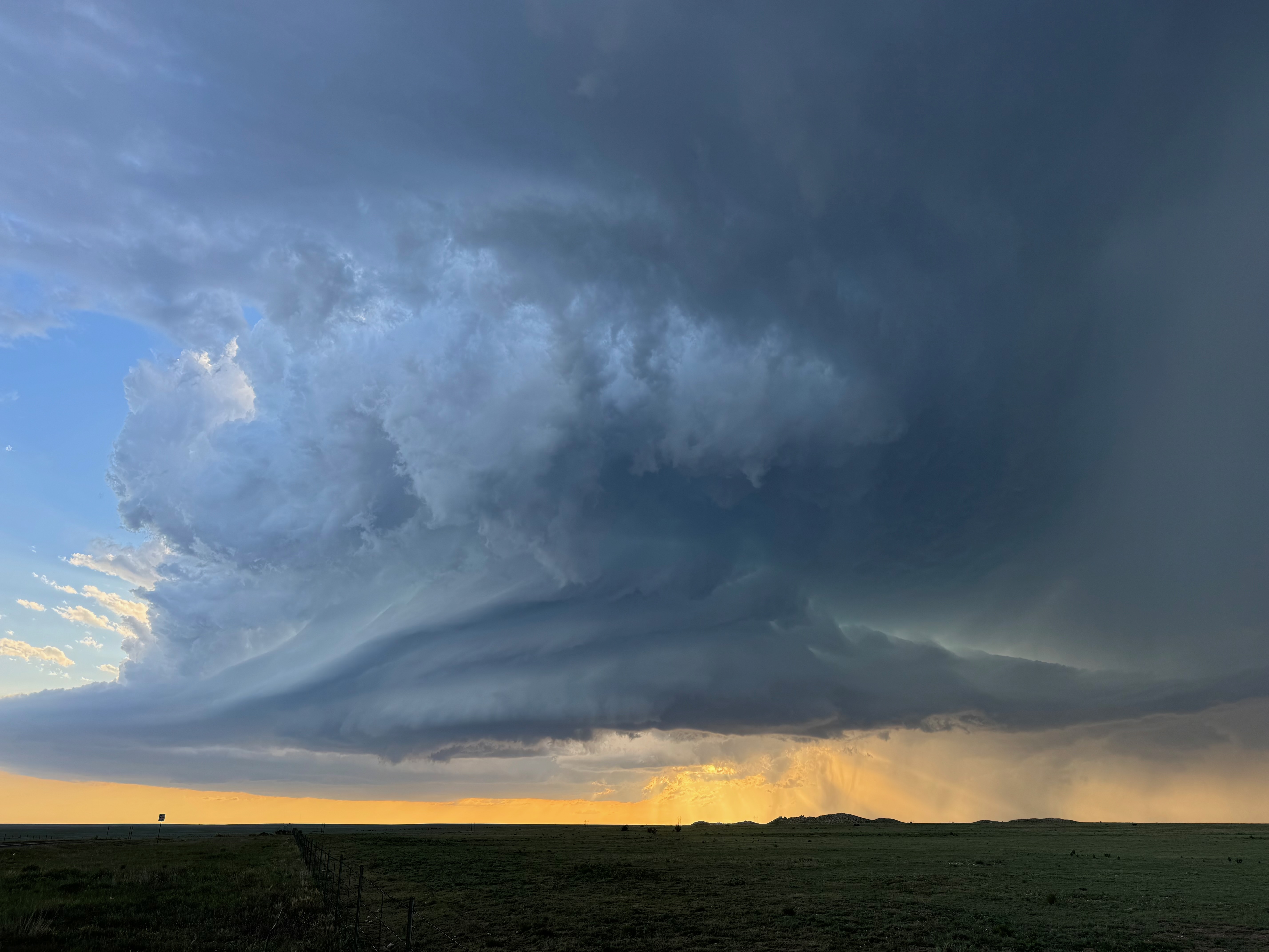
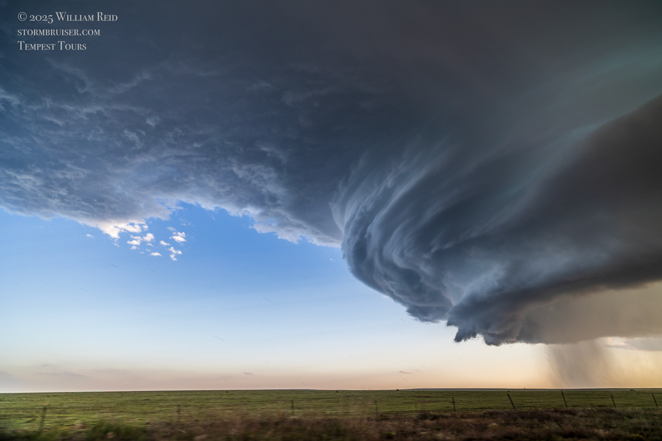
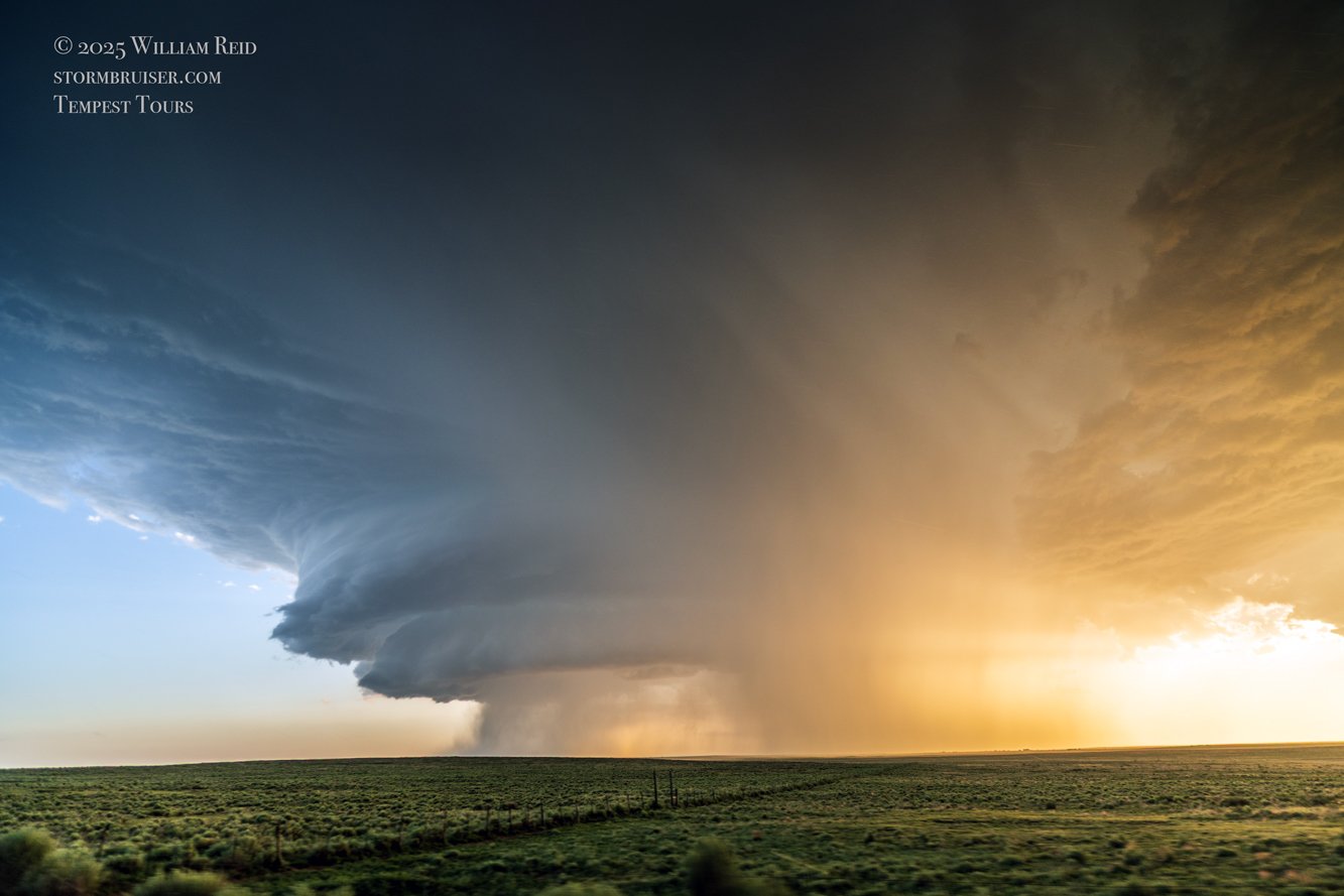
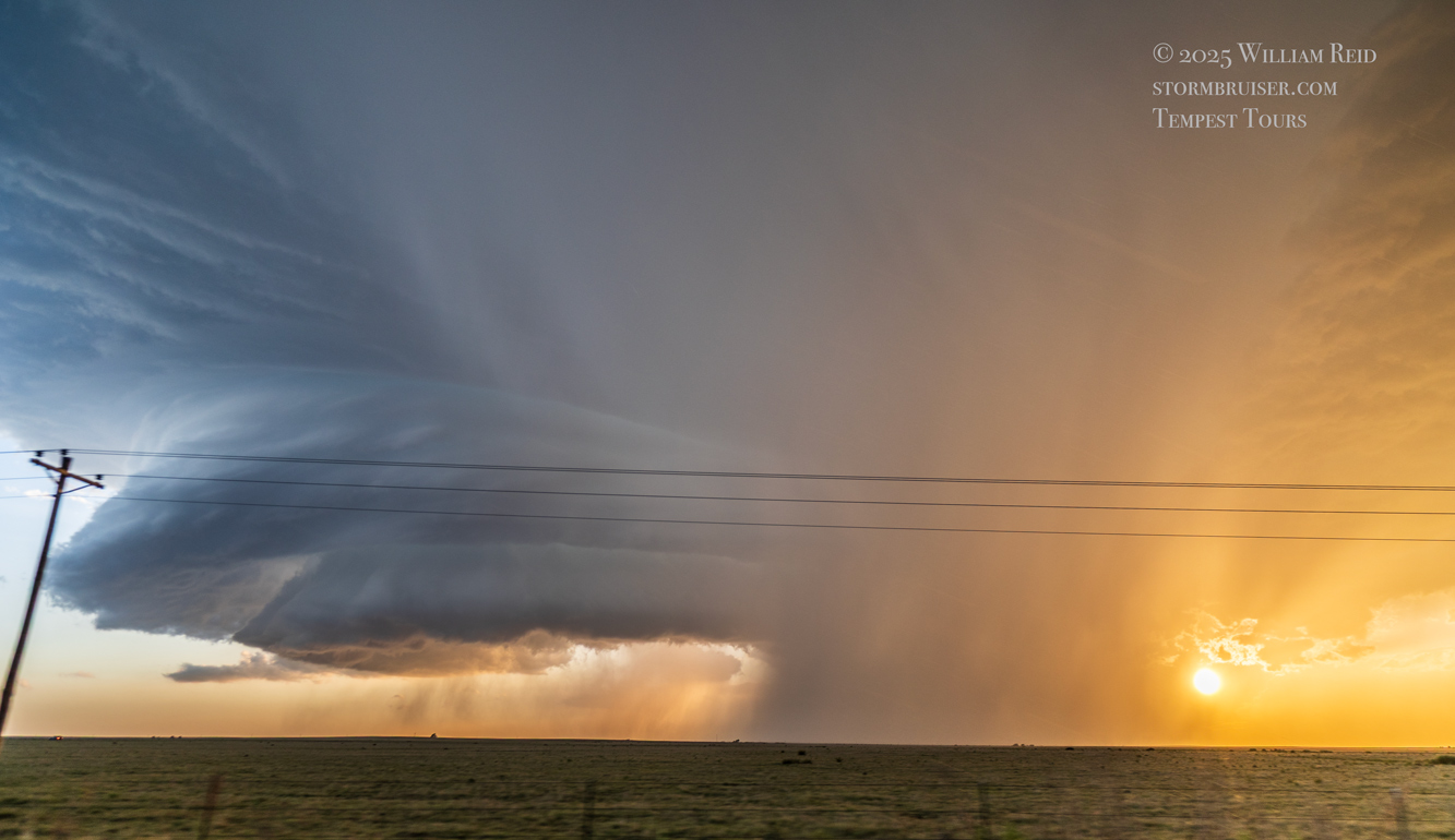
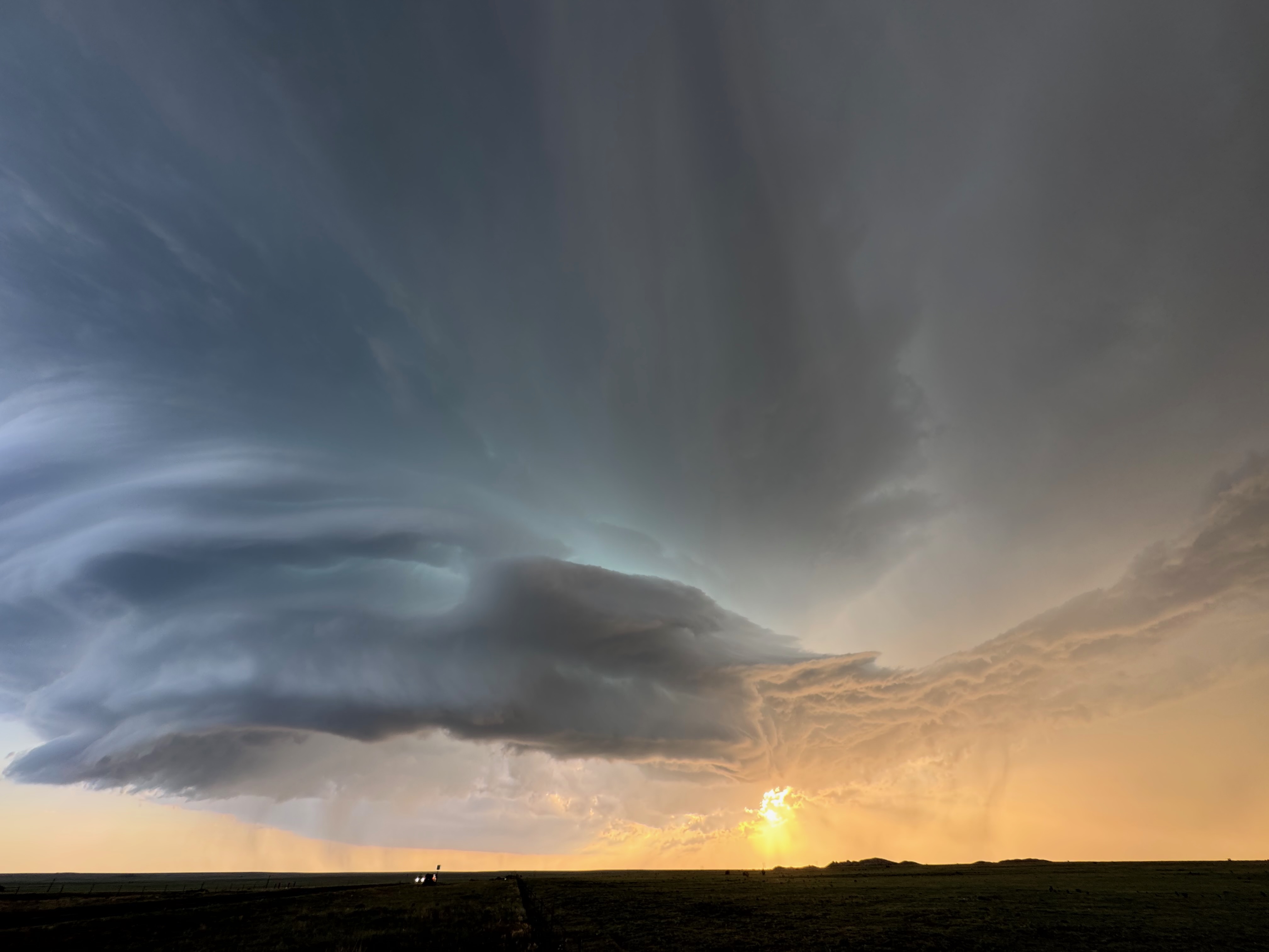
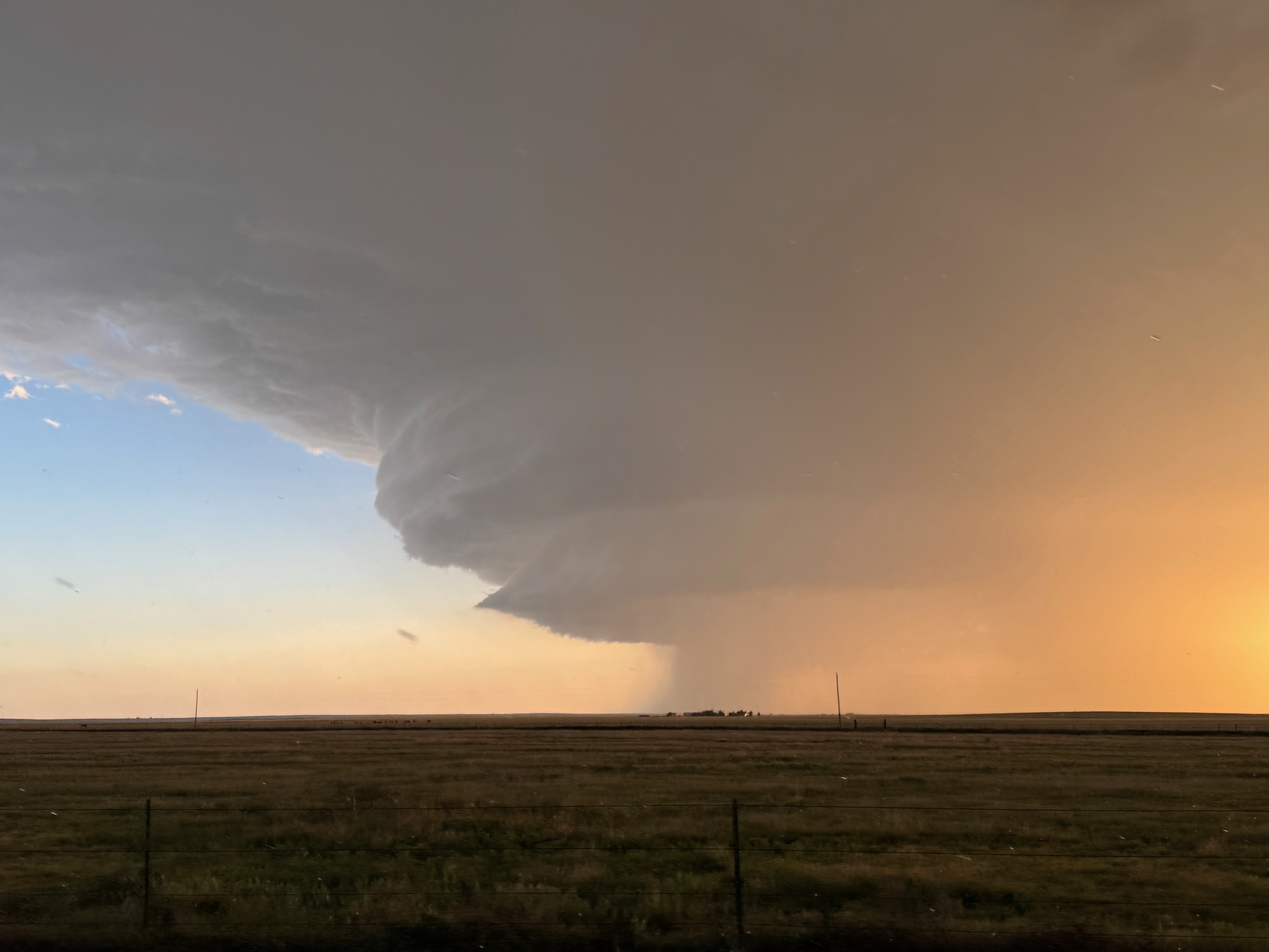
We might have made one quick stop for some pics as the storm looked so nice. But again we had to get further south for the best look. We were a little too close right here to enjoy the entirety of the storm! Further south we headed, finally stopping SSE of Amistad by about eight miles (at 417 and 402). The maps show a little place called Centerville Corner here, where 402 jogs to the east a few miles. The sunset light and the storm structure were magnificent!
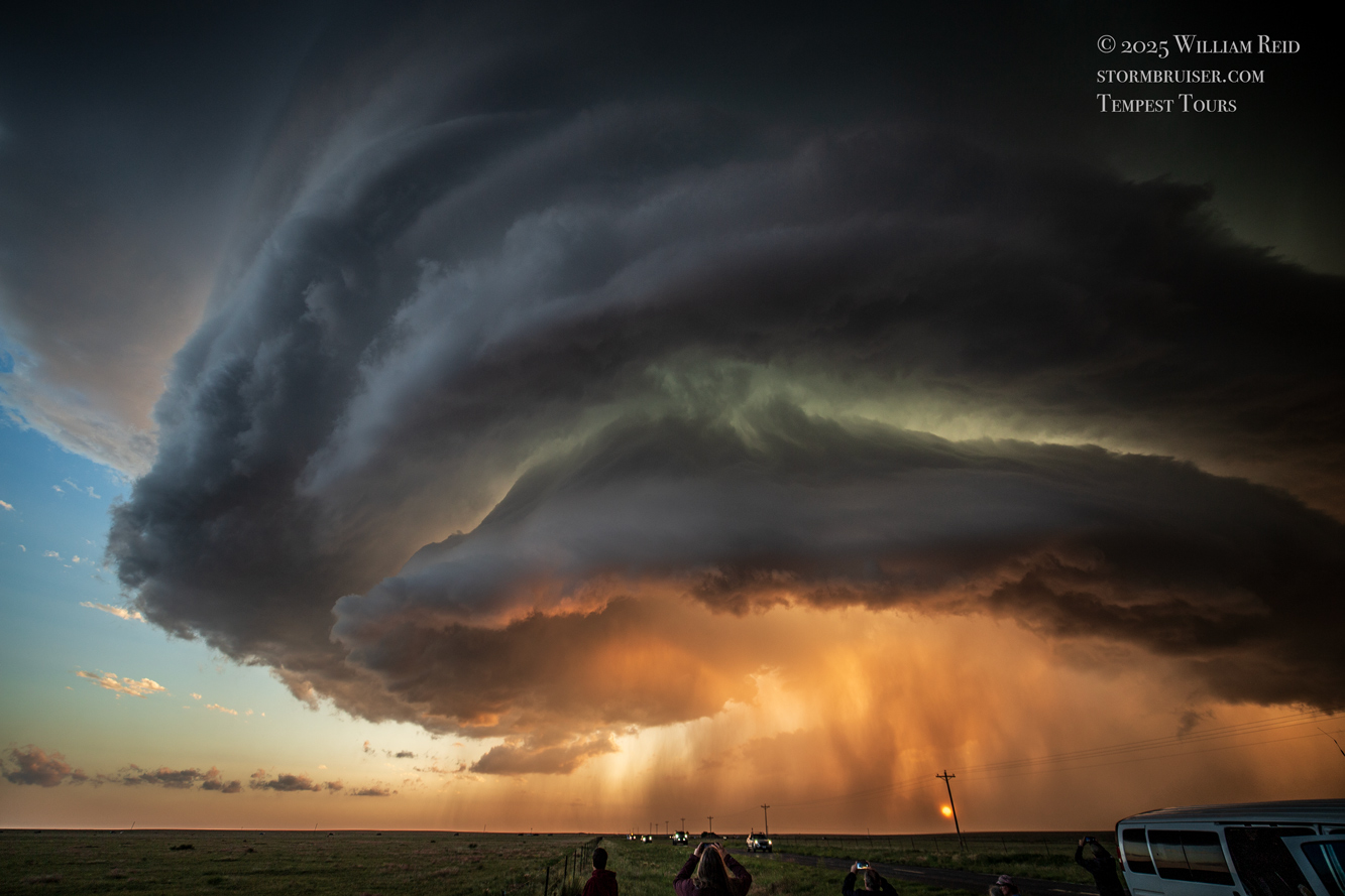
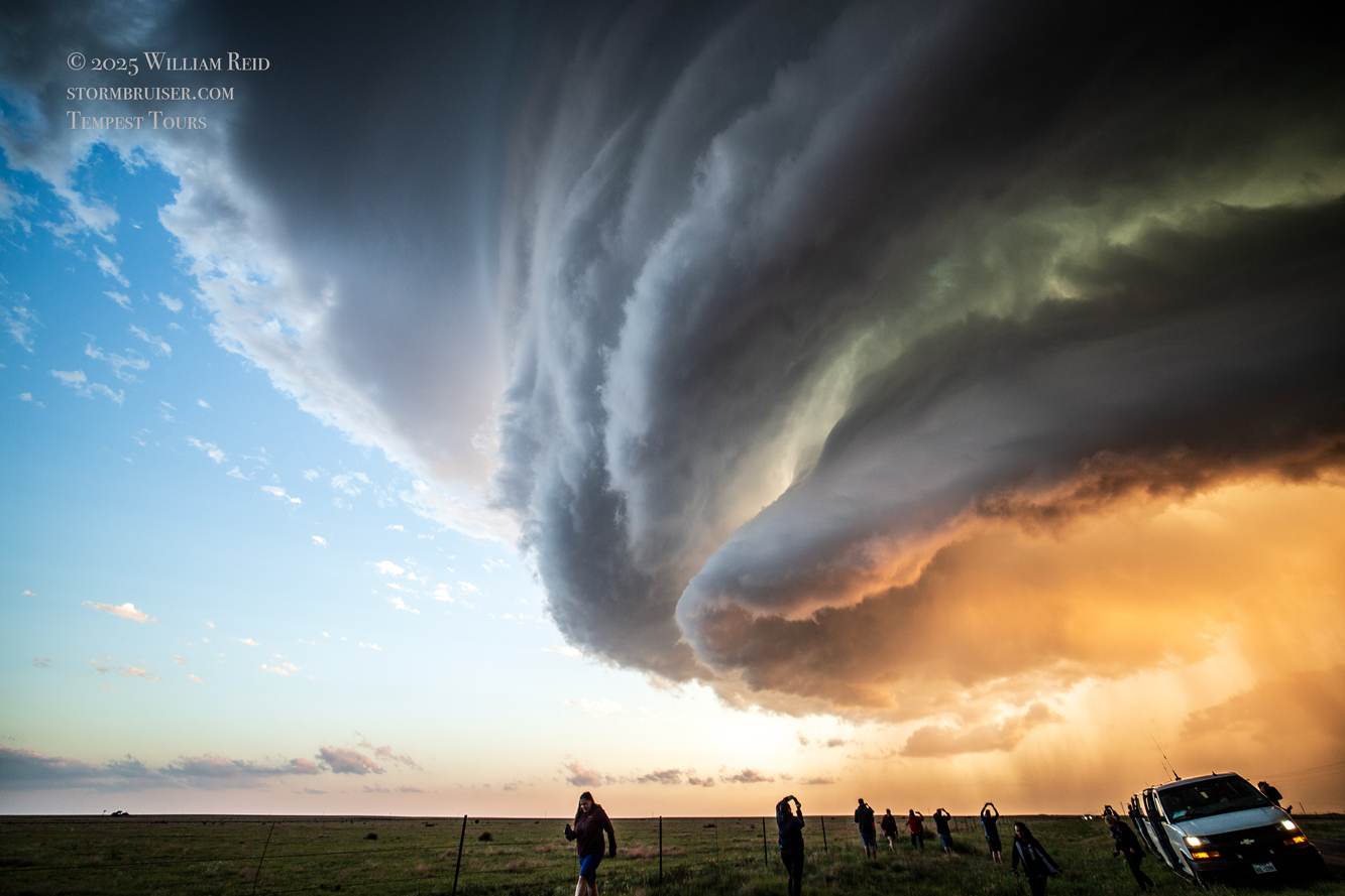
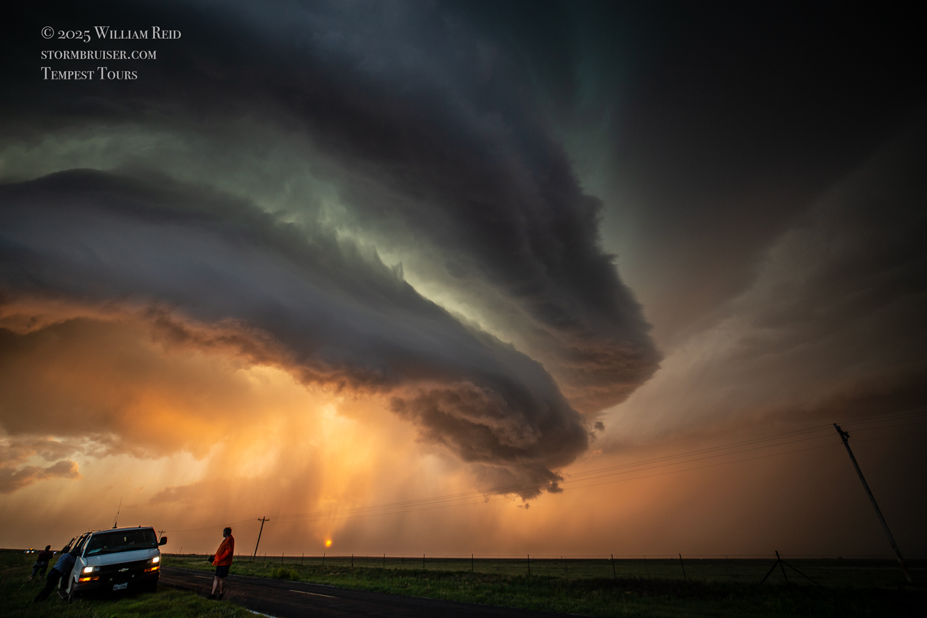
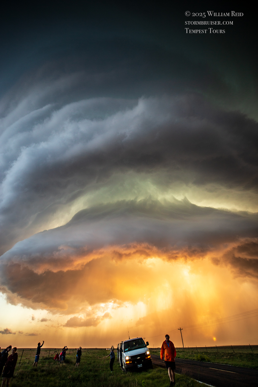
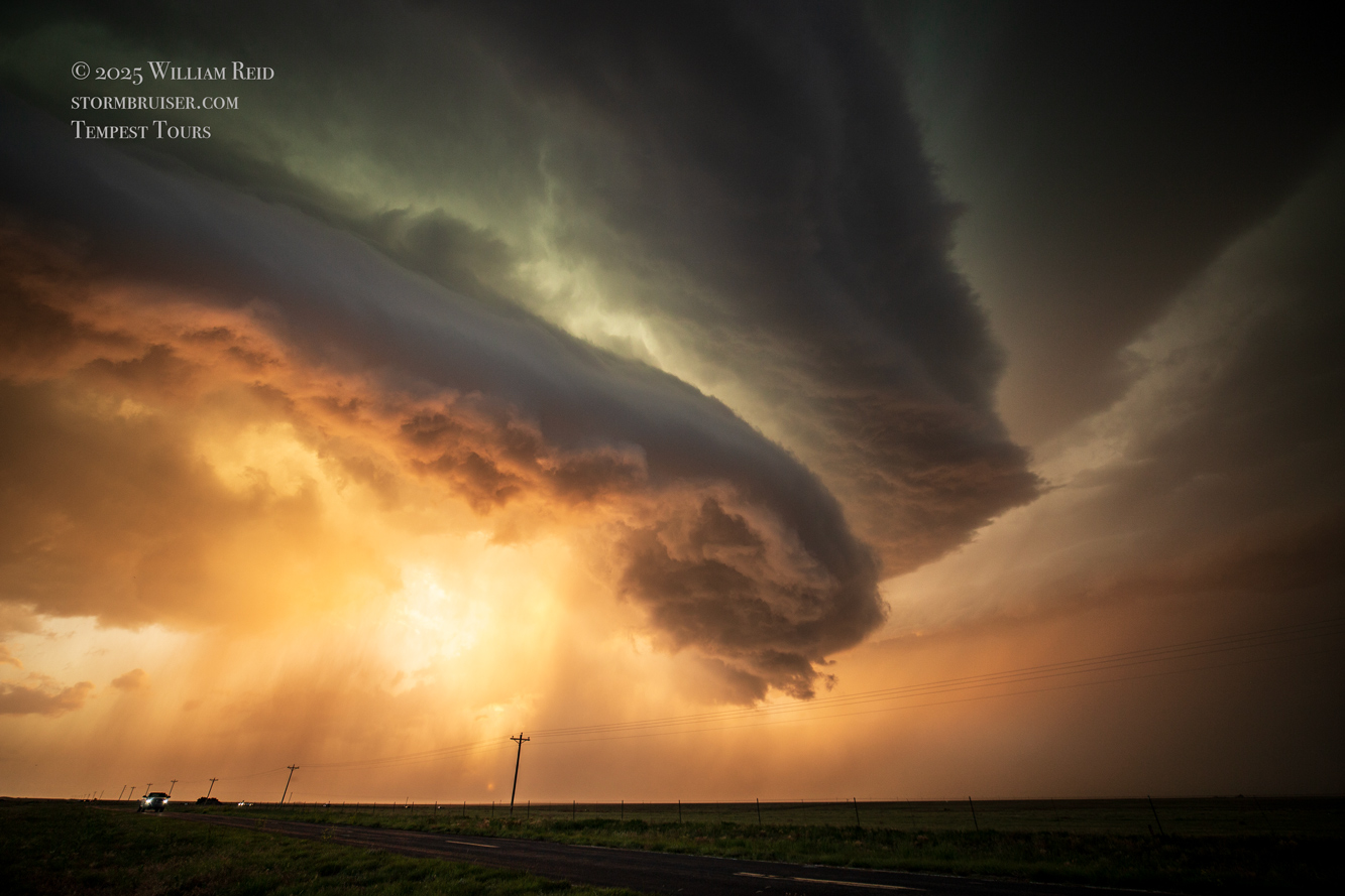
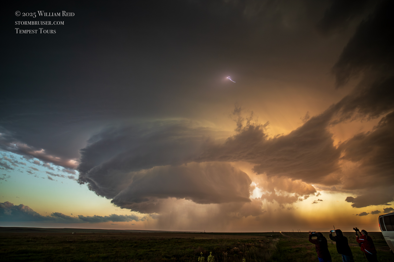
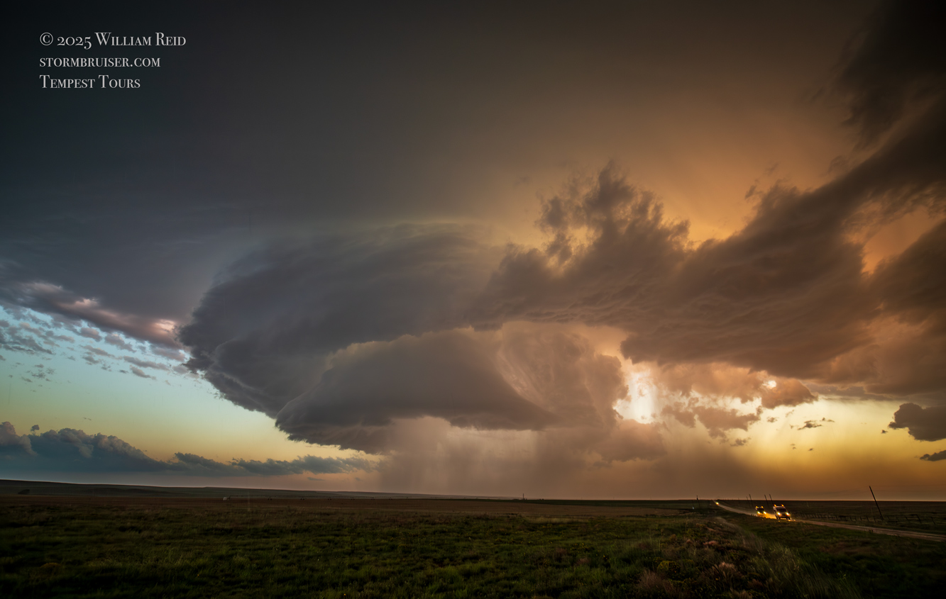
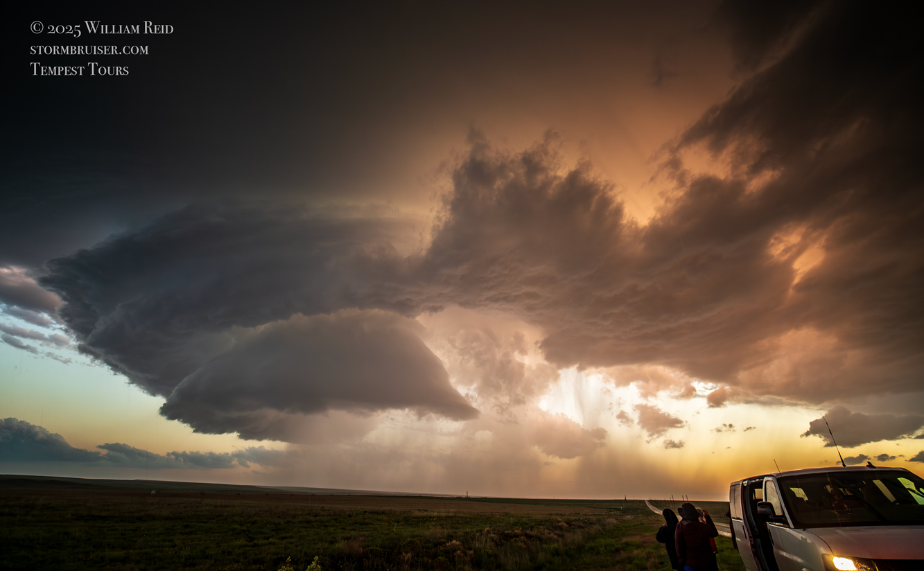
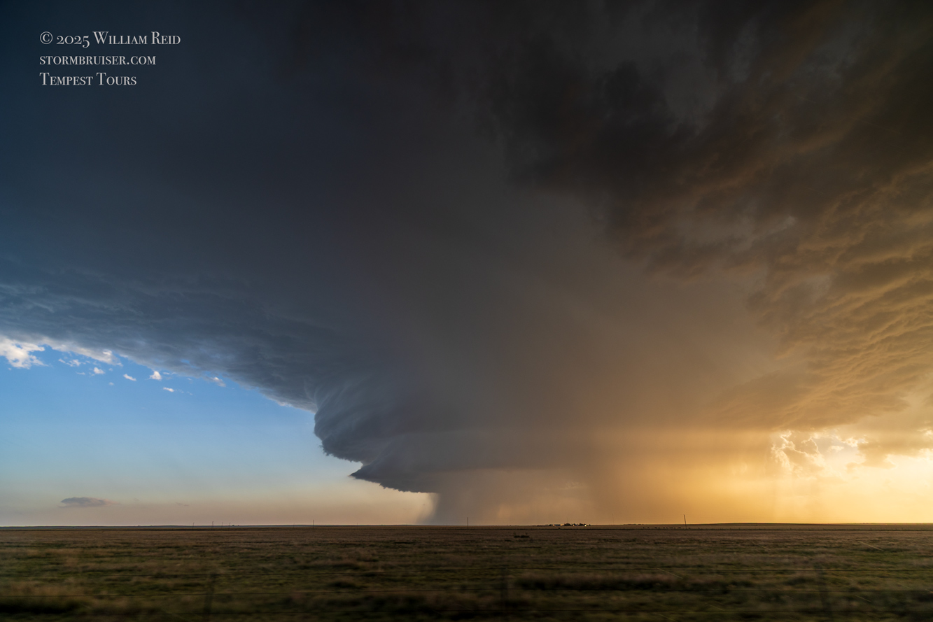
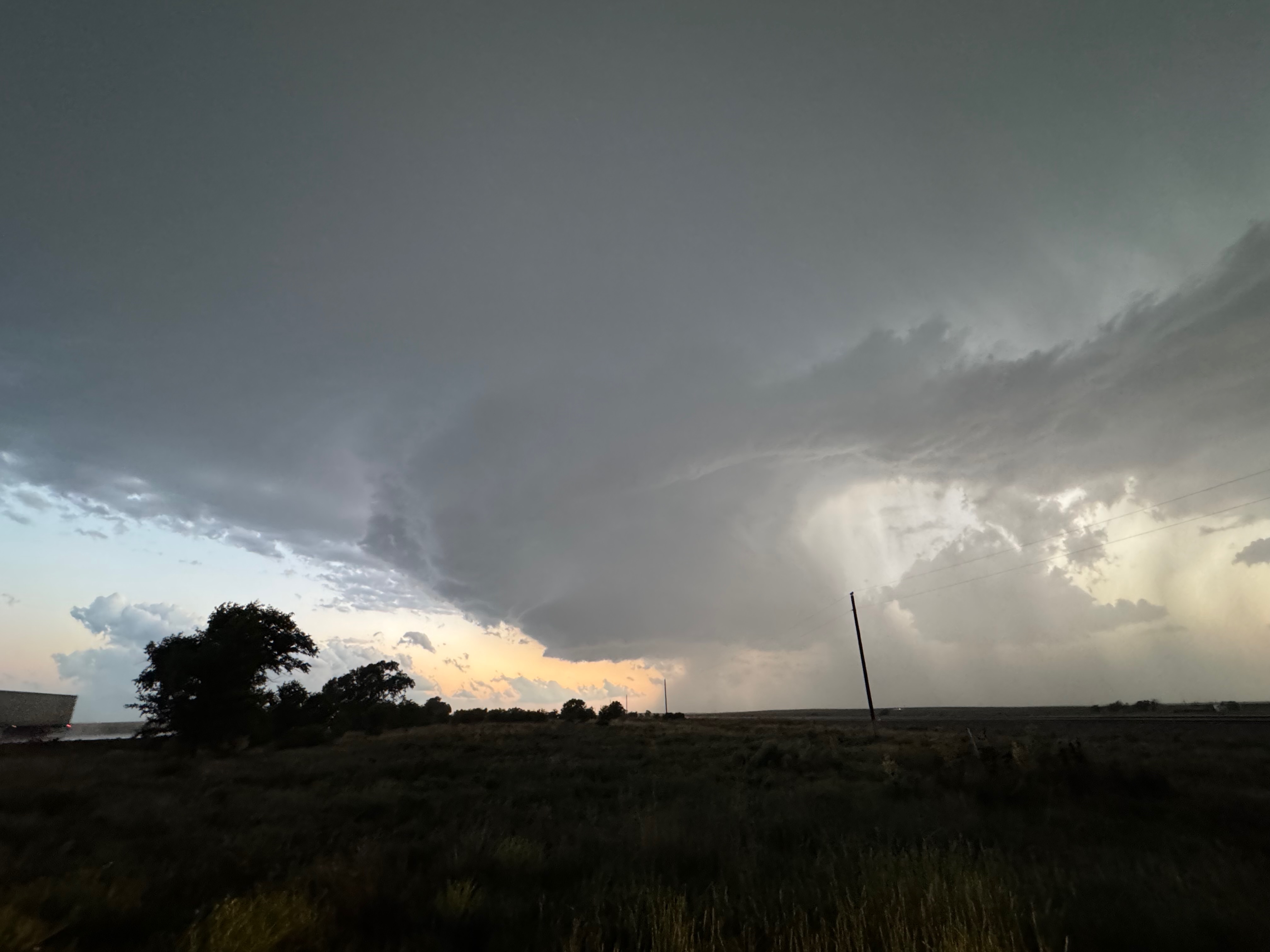
The last few images above are from a point farther east, closer to the NM/TX border on 417. The nice sunset light was diminishing, and soon the supercell was weakening. We observed very few lightning strikes from the storm.
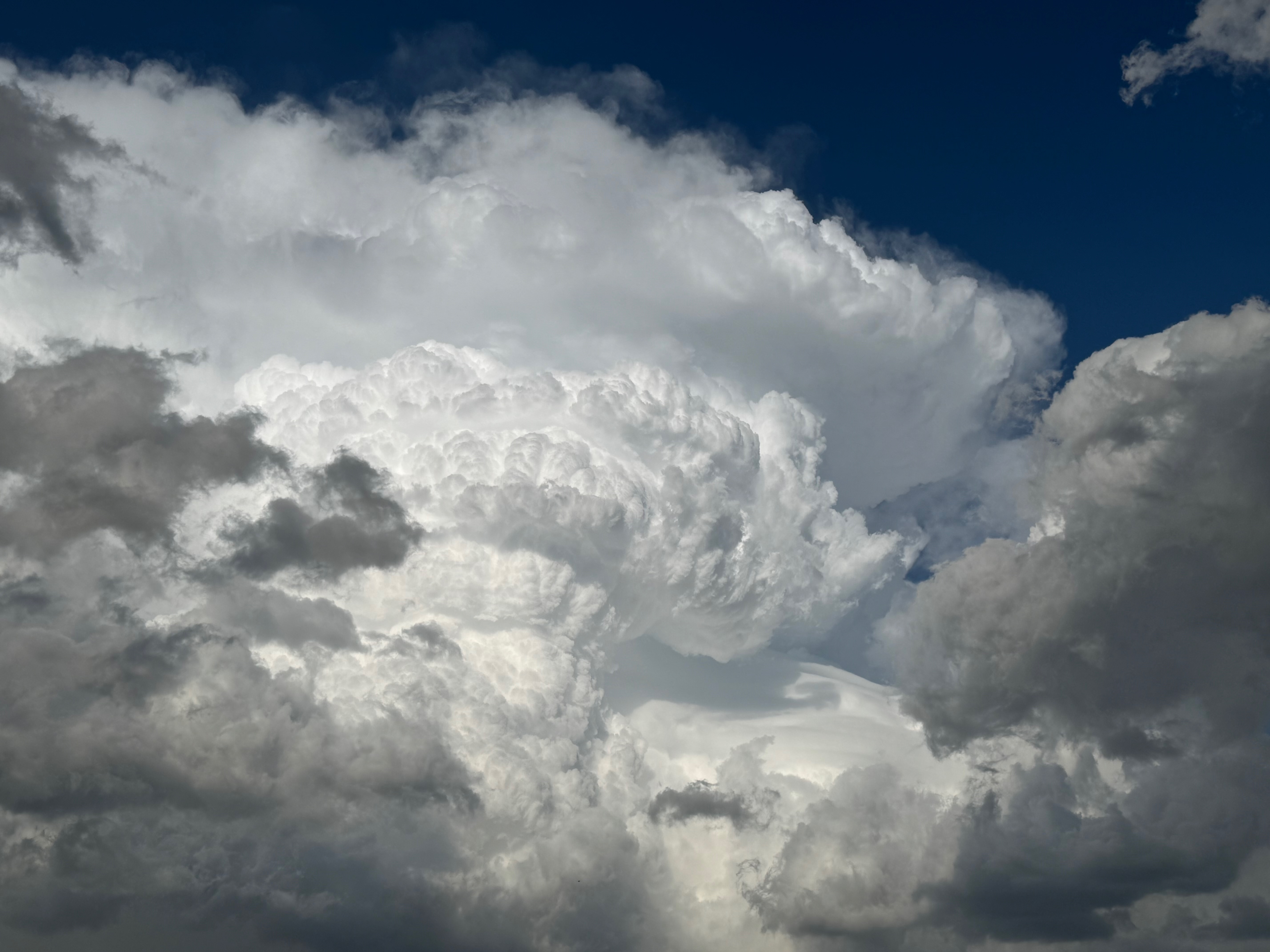
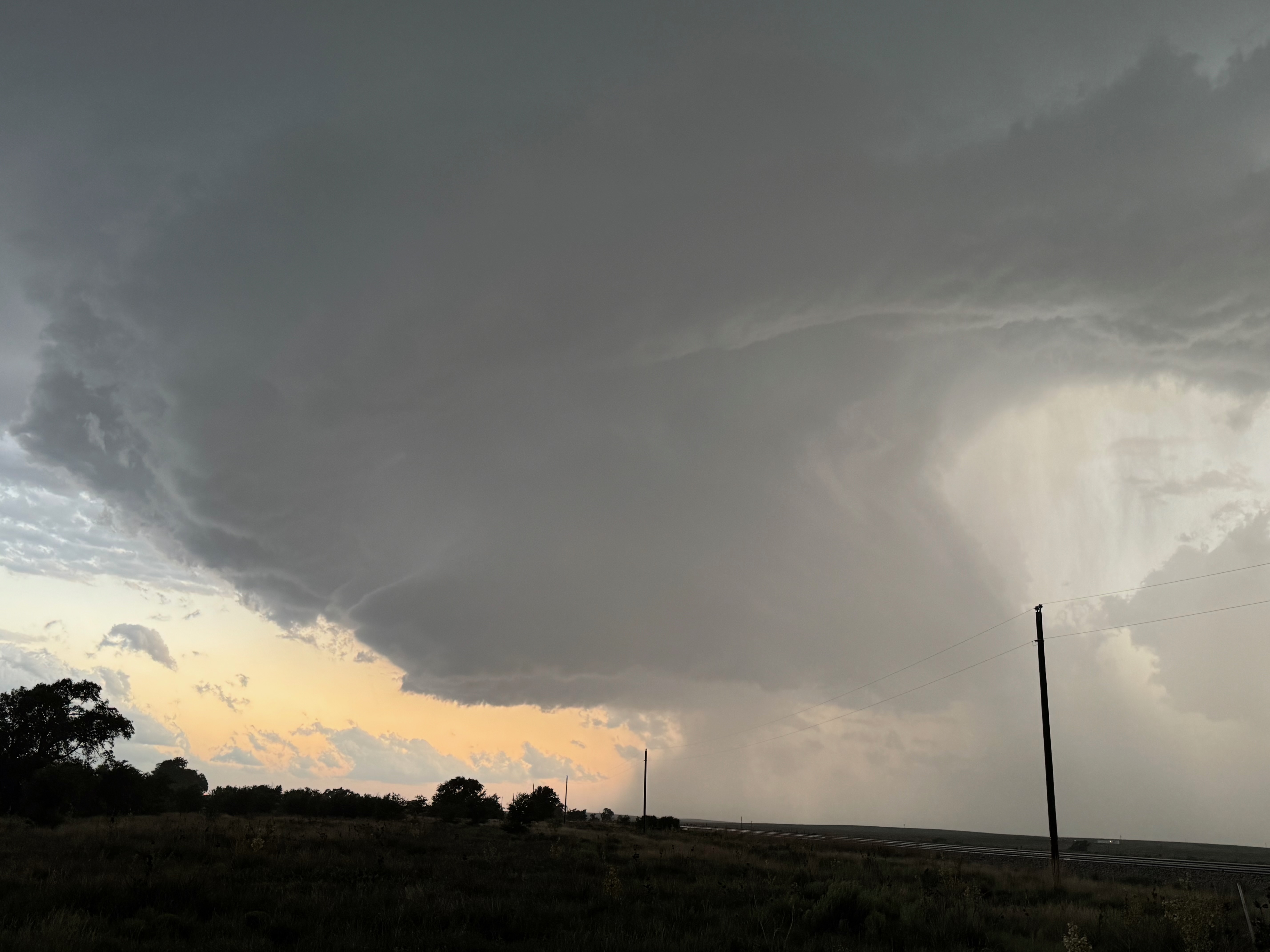
Below is a dump of additional photos which didn’t find their way into the groups above.
Leave a Reply
You must be logged in to post a comment.