
Start: Amarillo/lunch: Pork N Things in Amarillo/End: Amarillo/235 miles
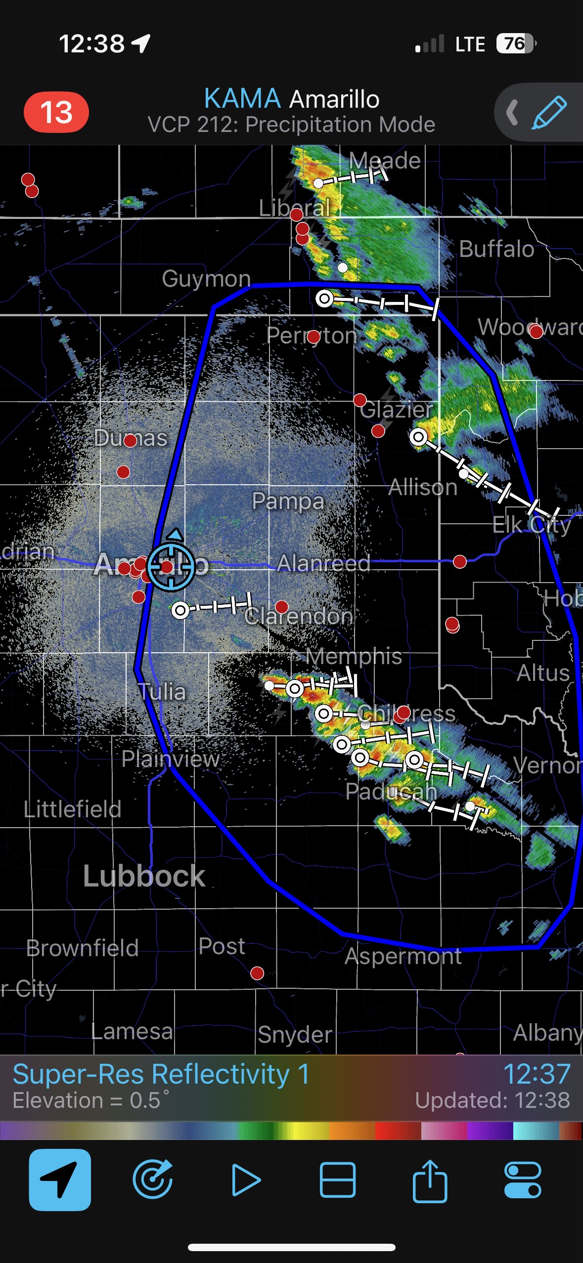
Mesoscale Discussions. 11:04 a.m. CDT 1:27 p.m. CDT. 3:17 p.m. CDT. 5:10 p.m. CDT. 7:22 p.m. CDT
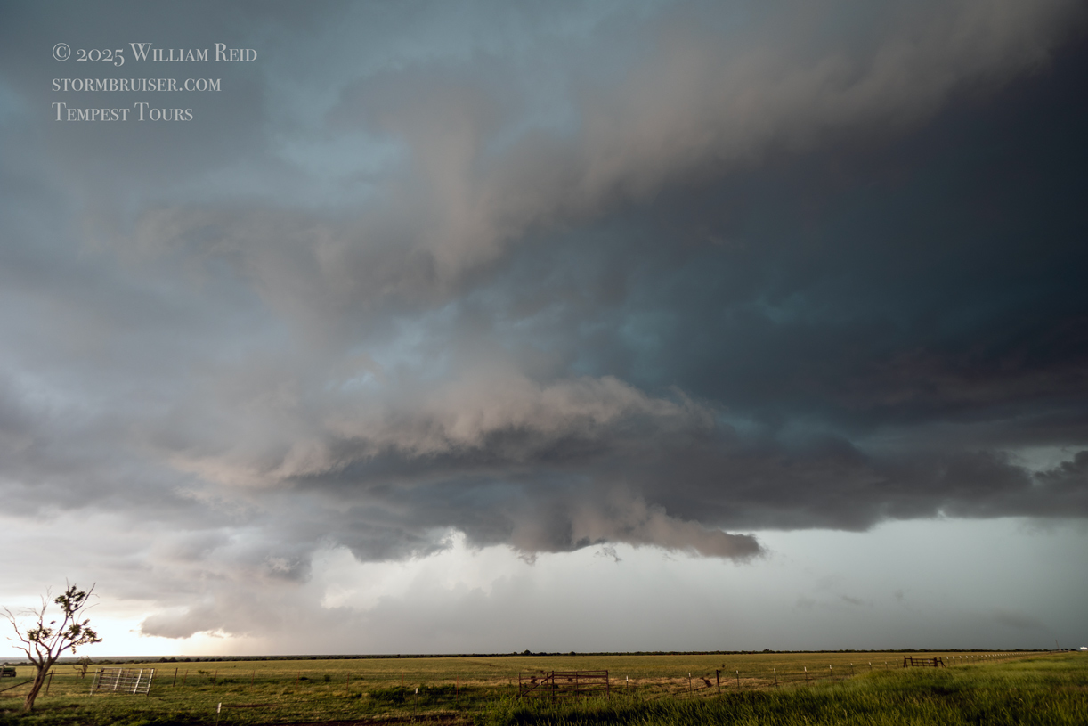
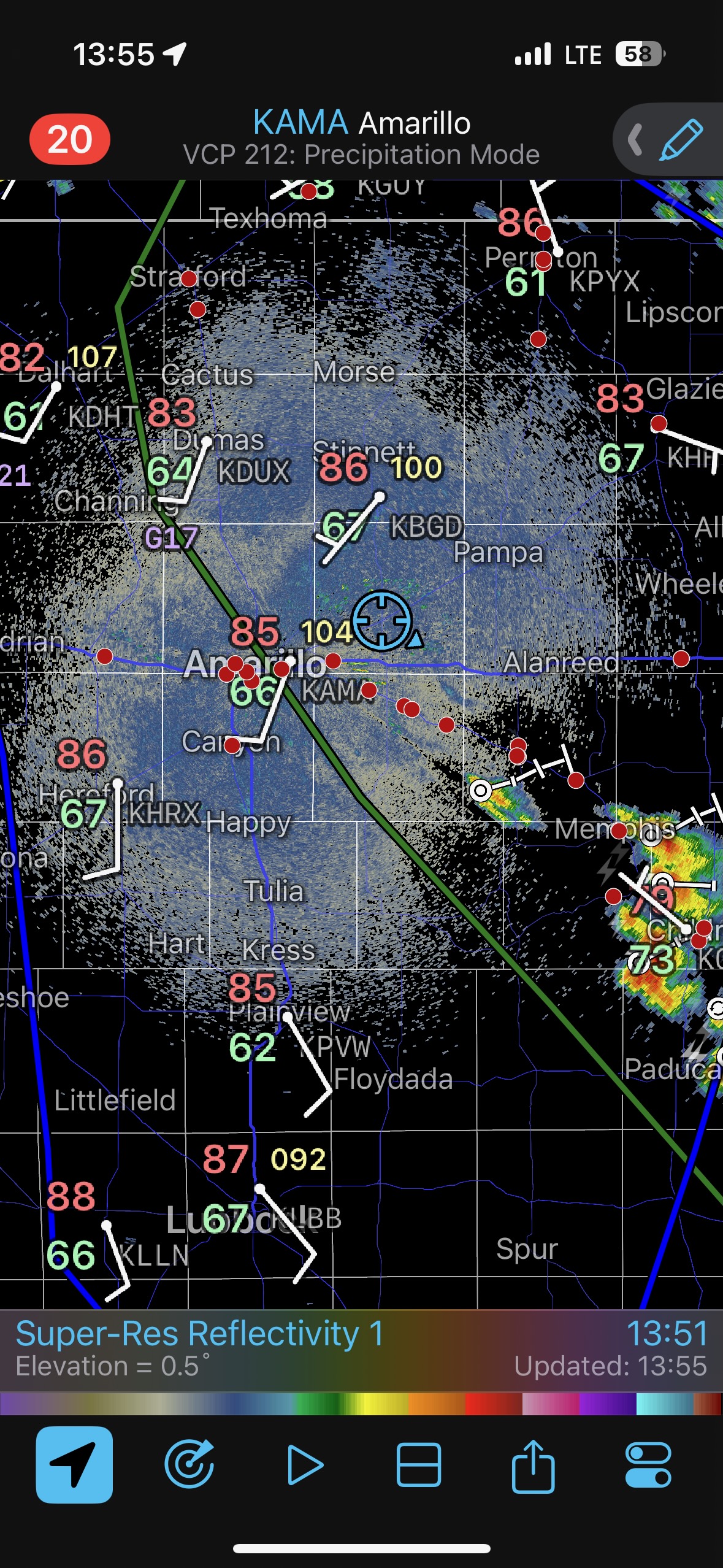
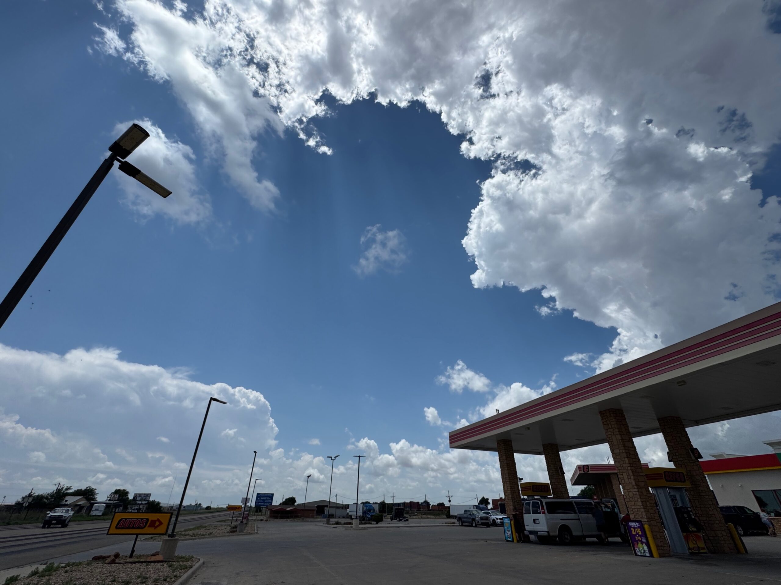
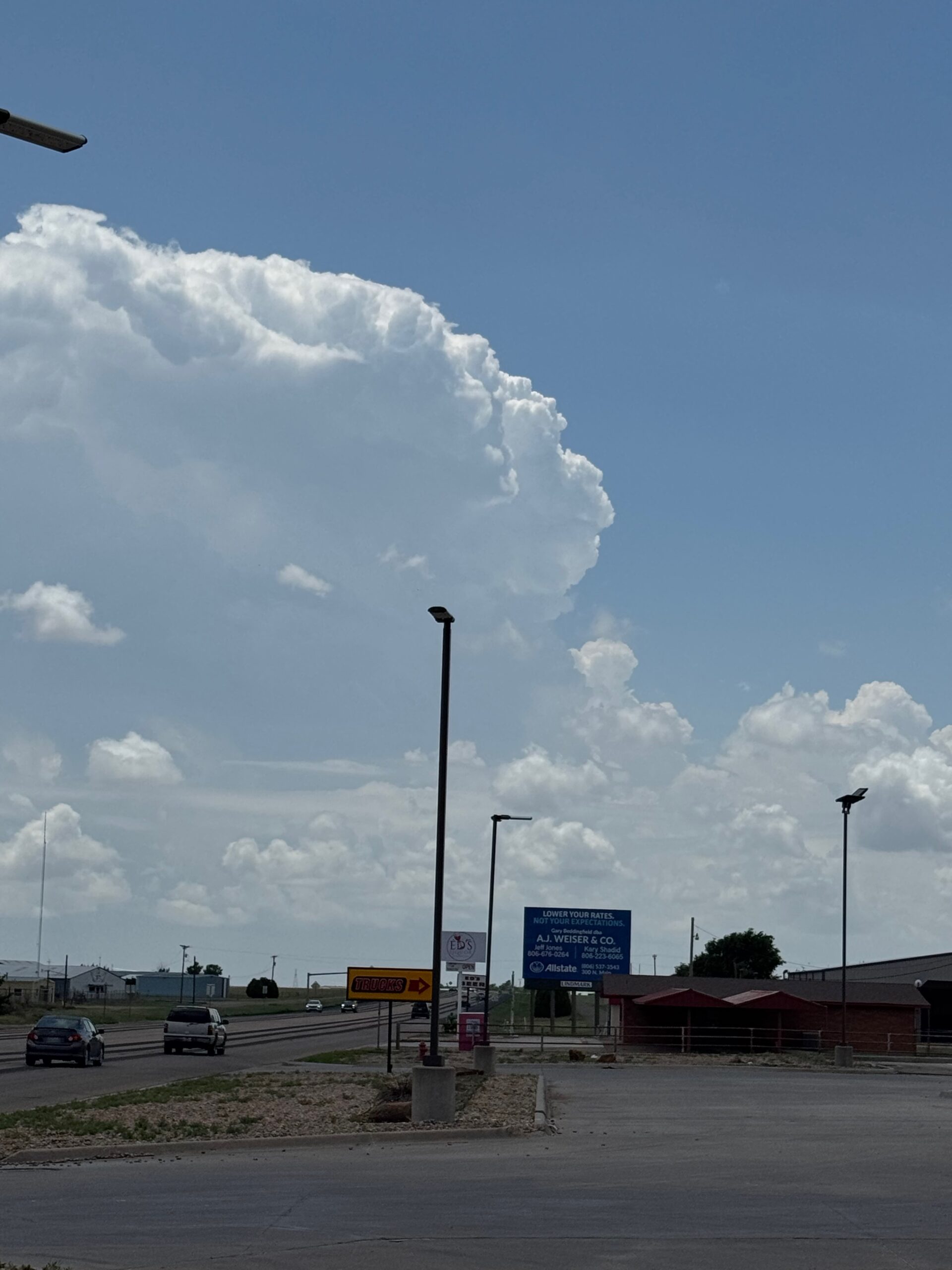
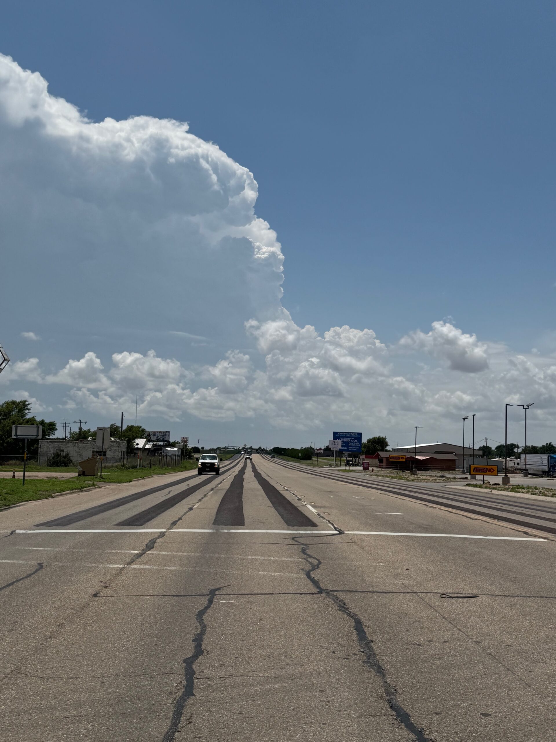
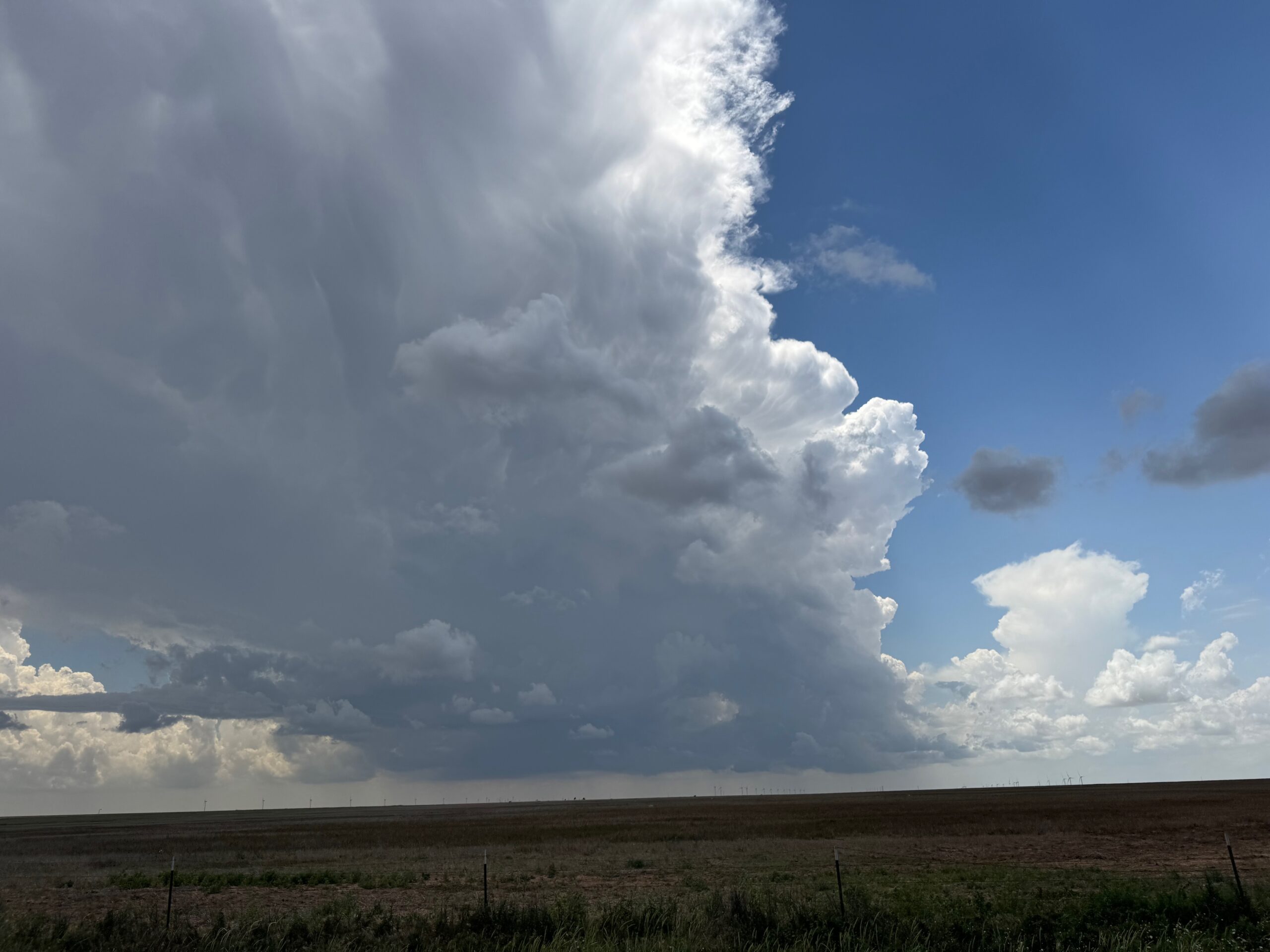
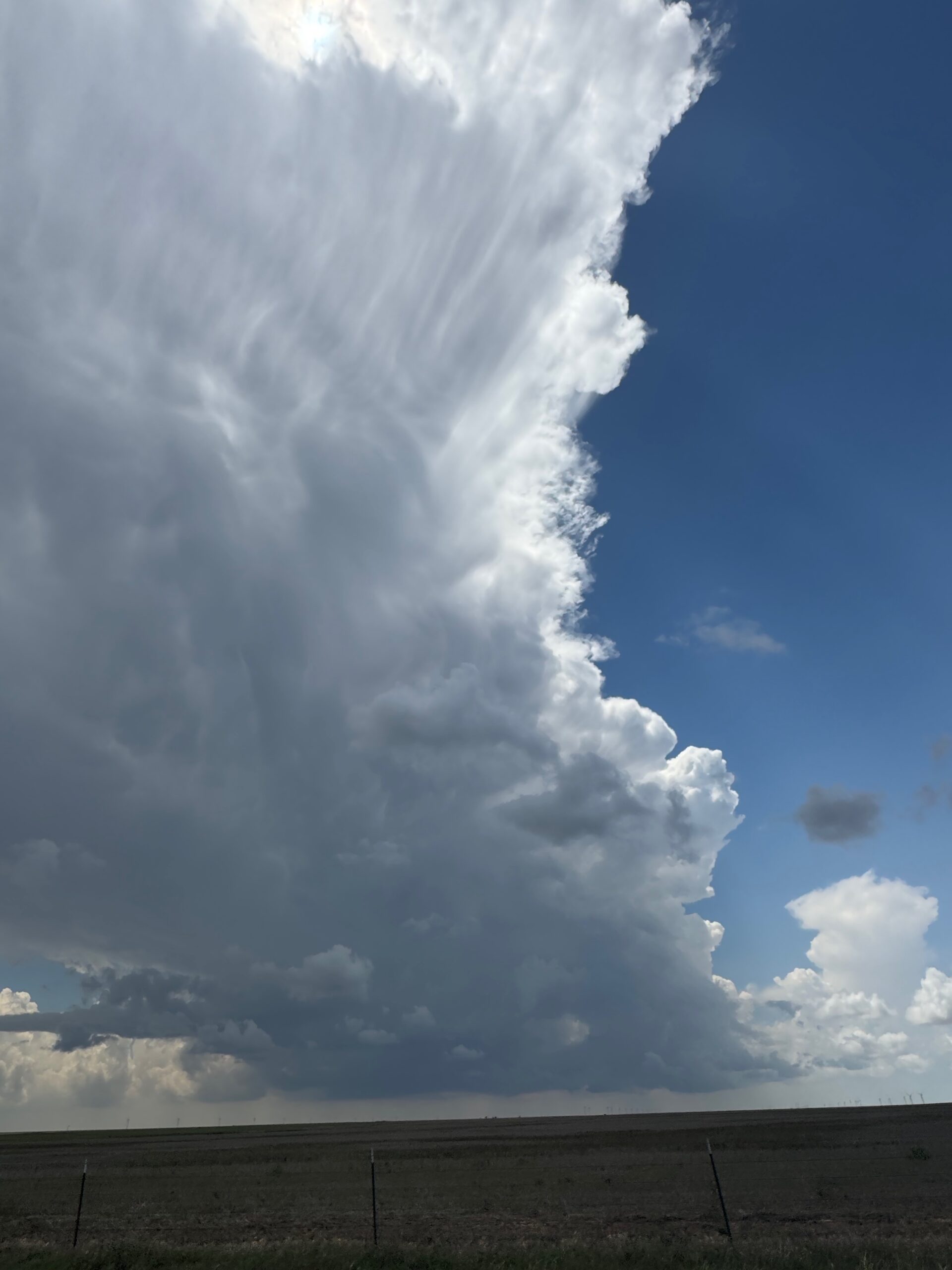
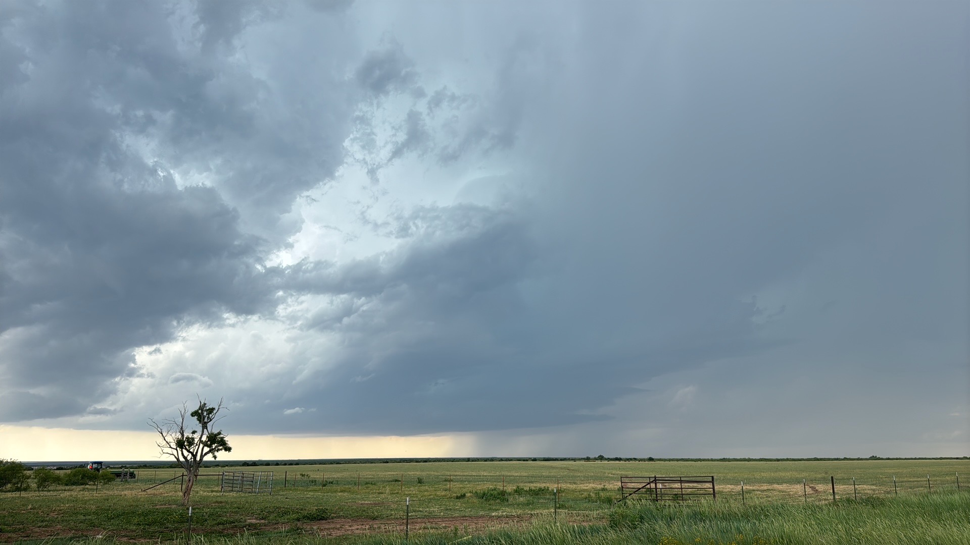
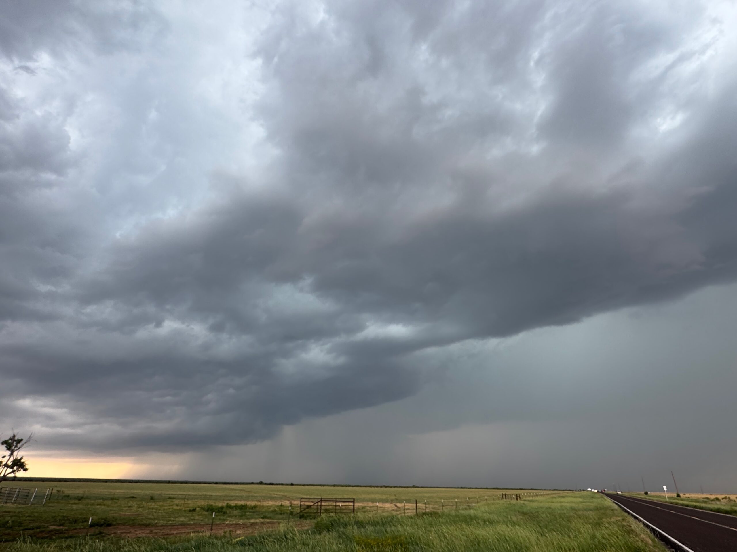
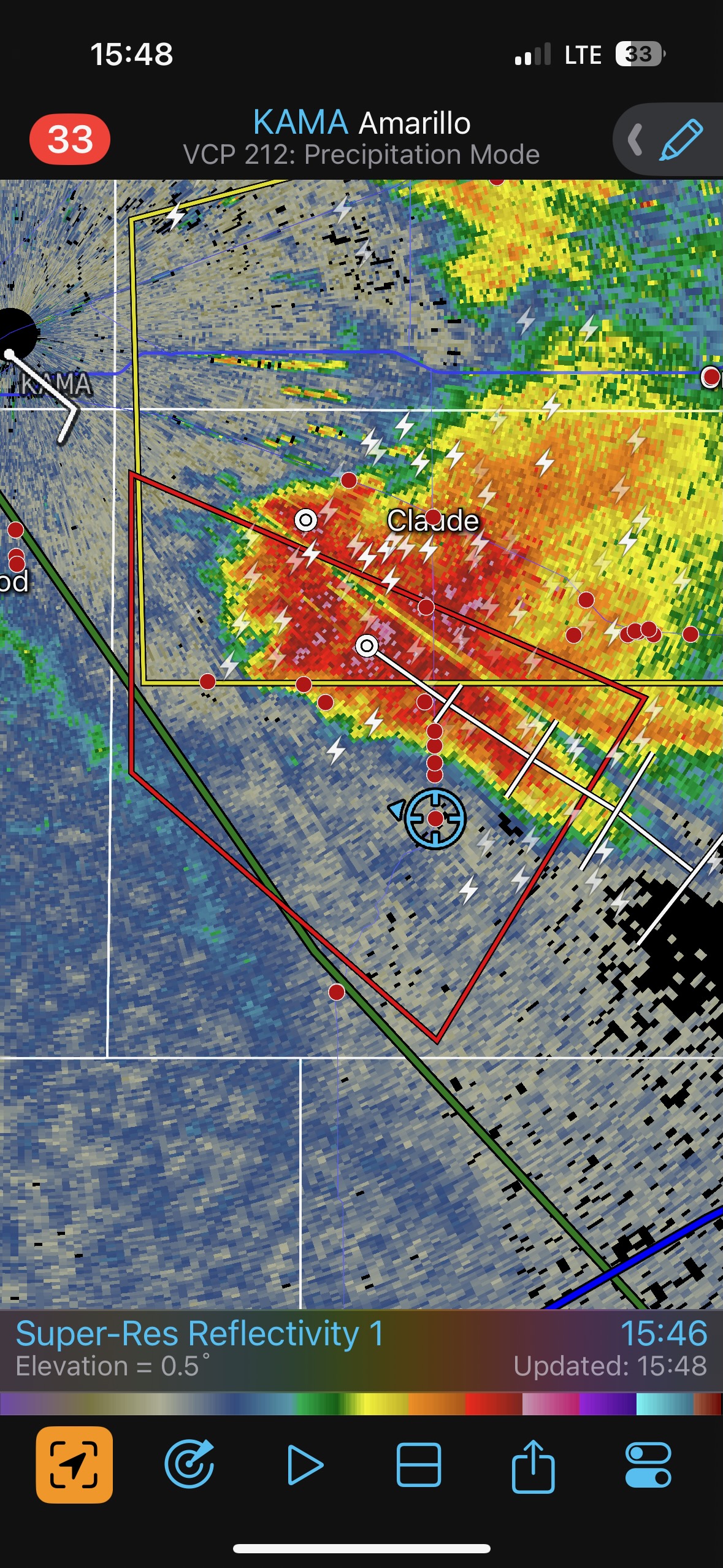
Once again our chase day began in a very convenient location. This time it was Amarillo, and we found a yummy spot for lunch on the east side of town. Shear and moisture were really good again on the Panhandle. It looked fairly obvious that we should stick pretty close to Amarillo for the start of the show. Plenty of midday elevated convection was throwing a bit of shade onto matters, figuratively and literally. But that junky stuff moved out of the way soon enough, and we had big towers forming really close to Amarillo by mid-afternoon.
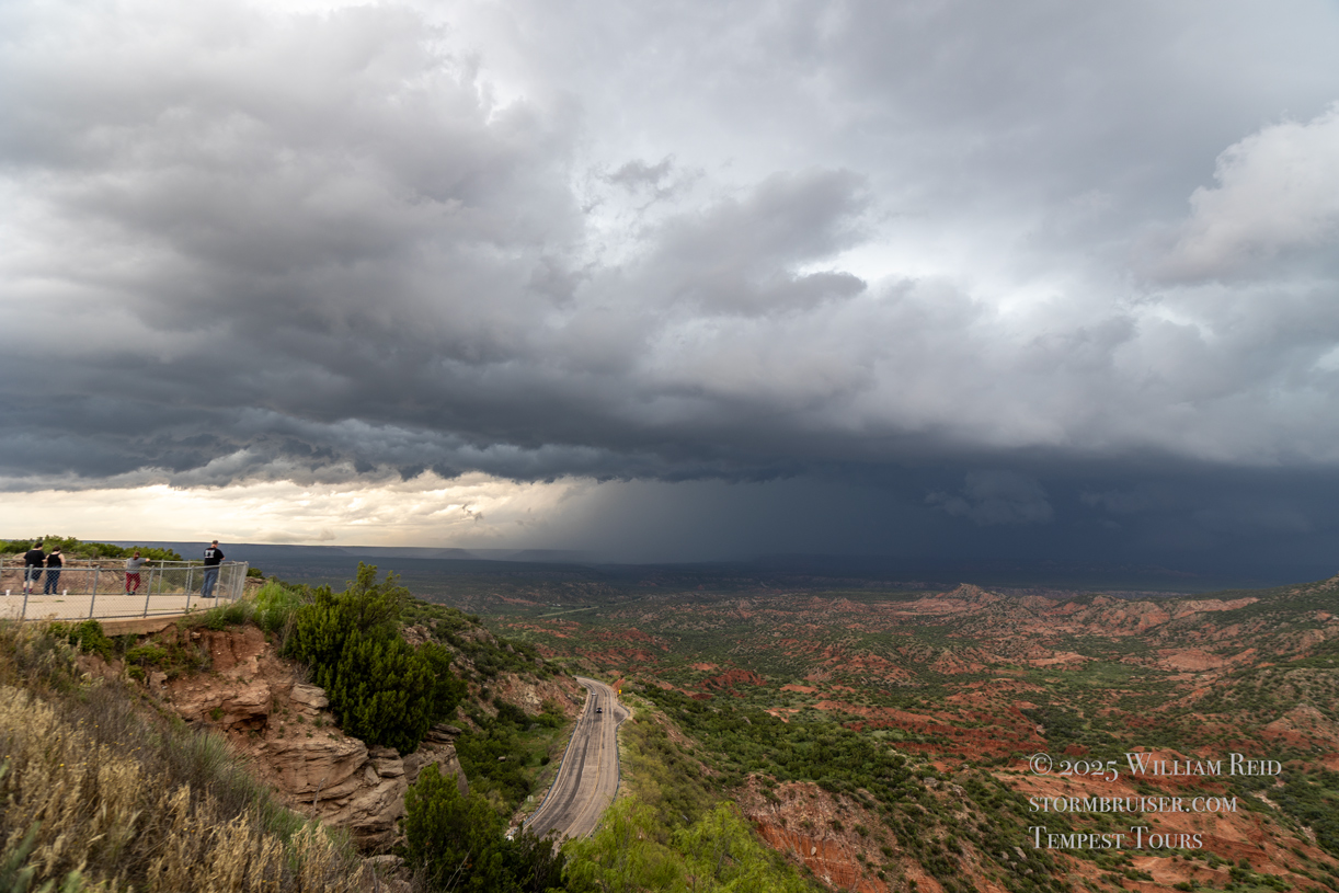
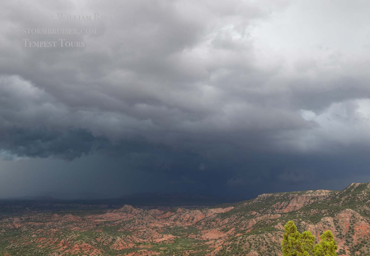
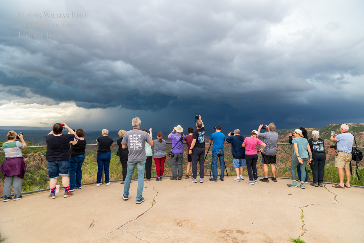
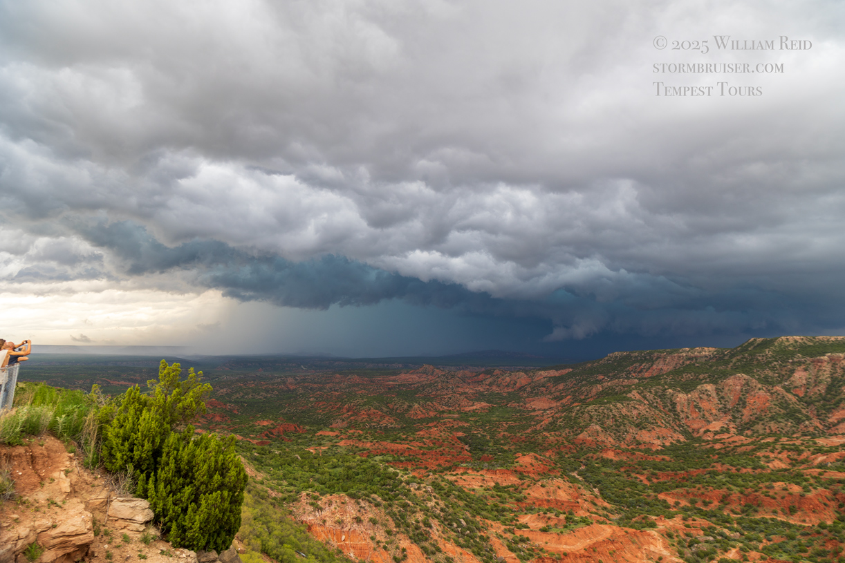
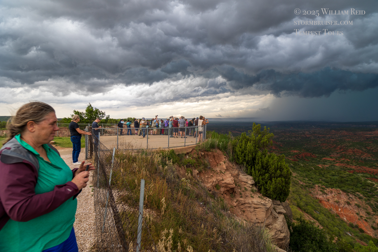
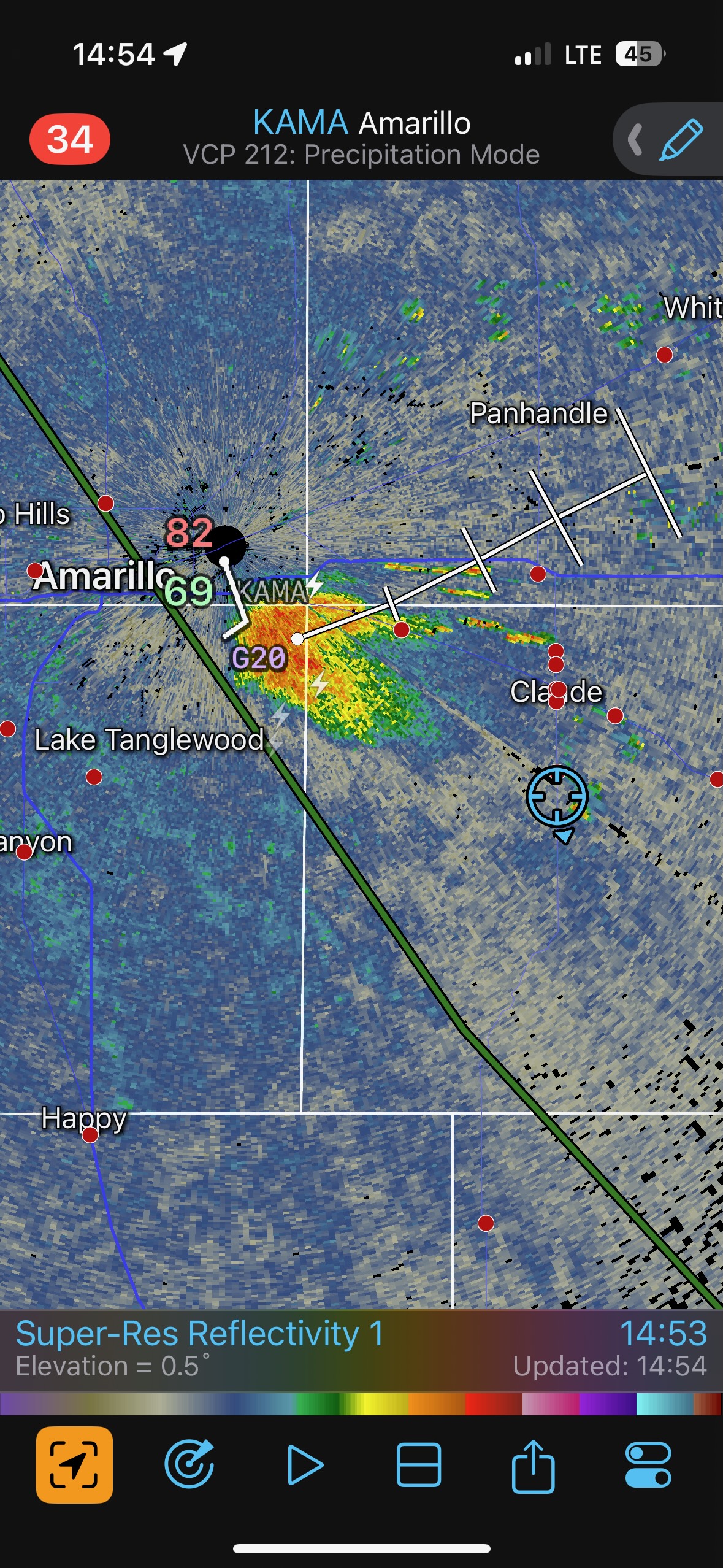
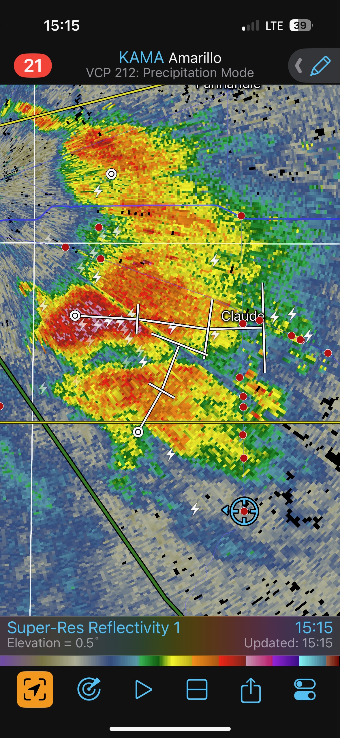
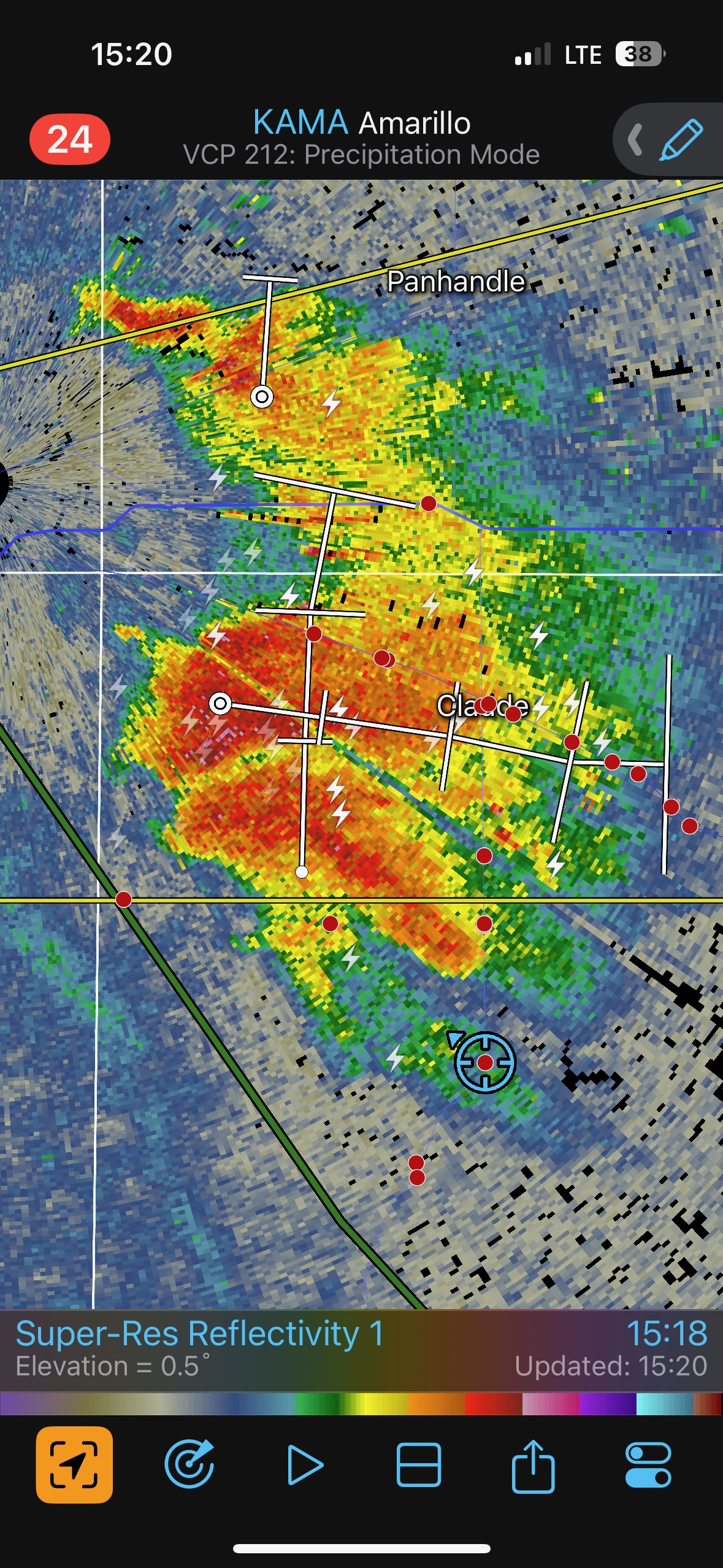
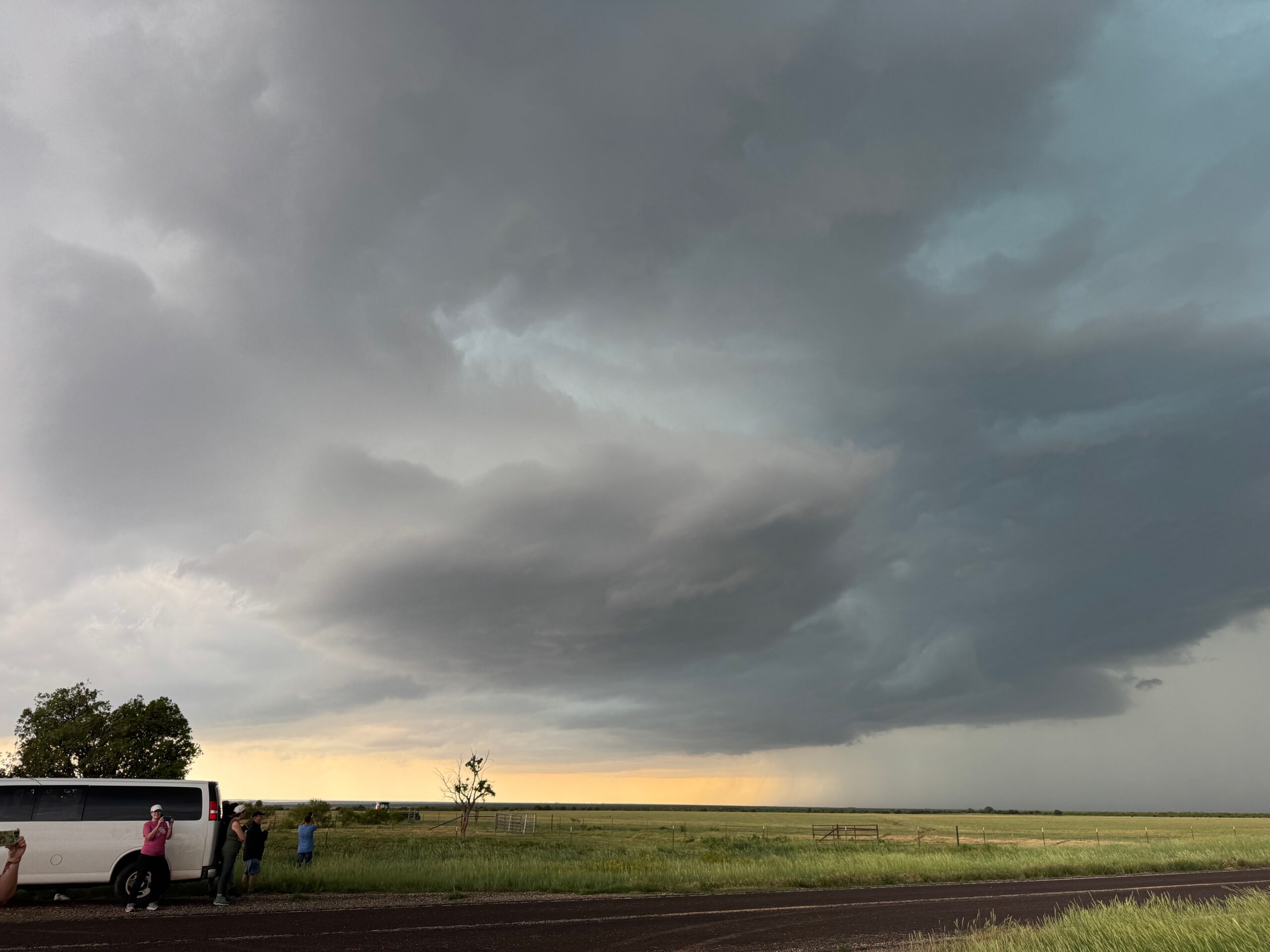
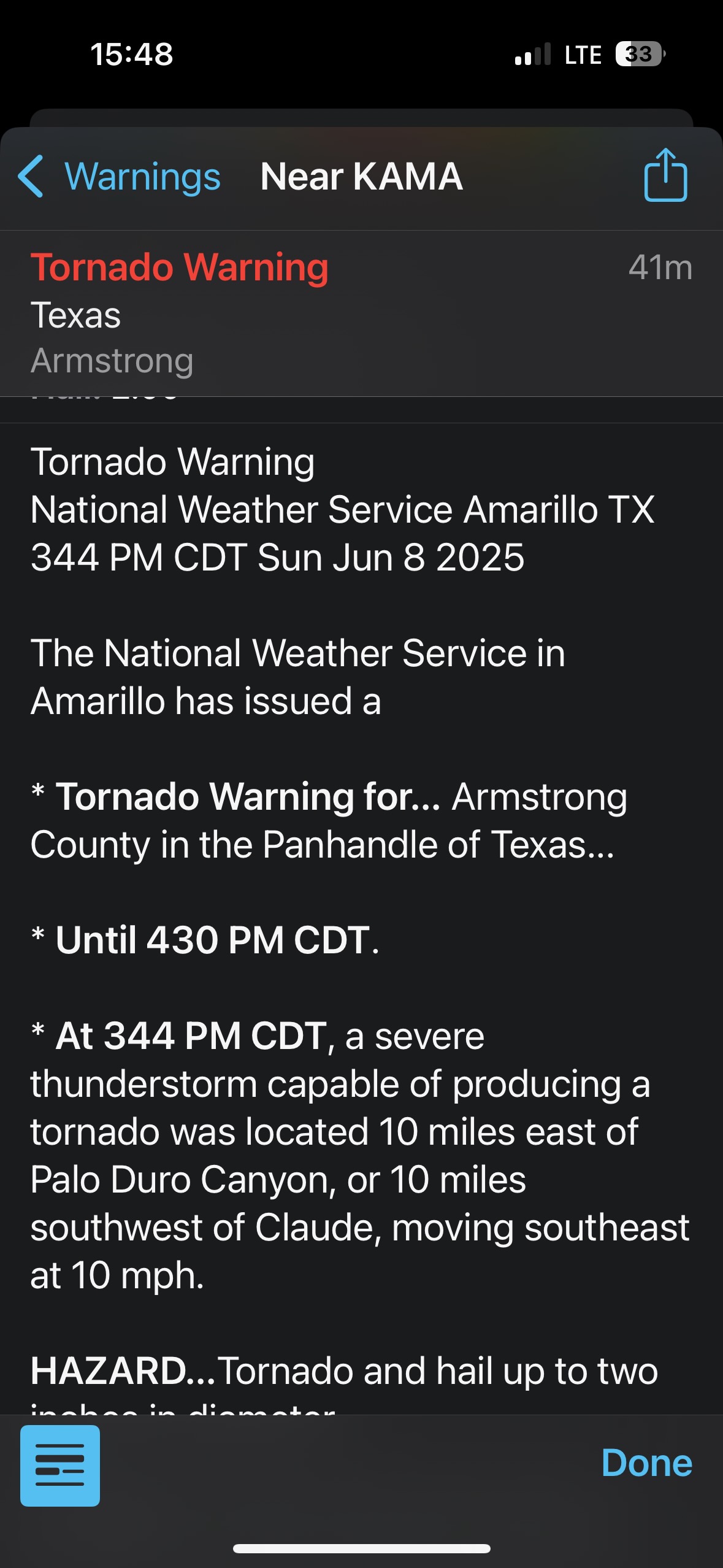
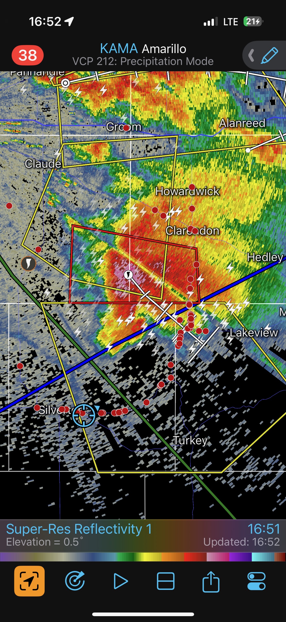
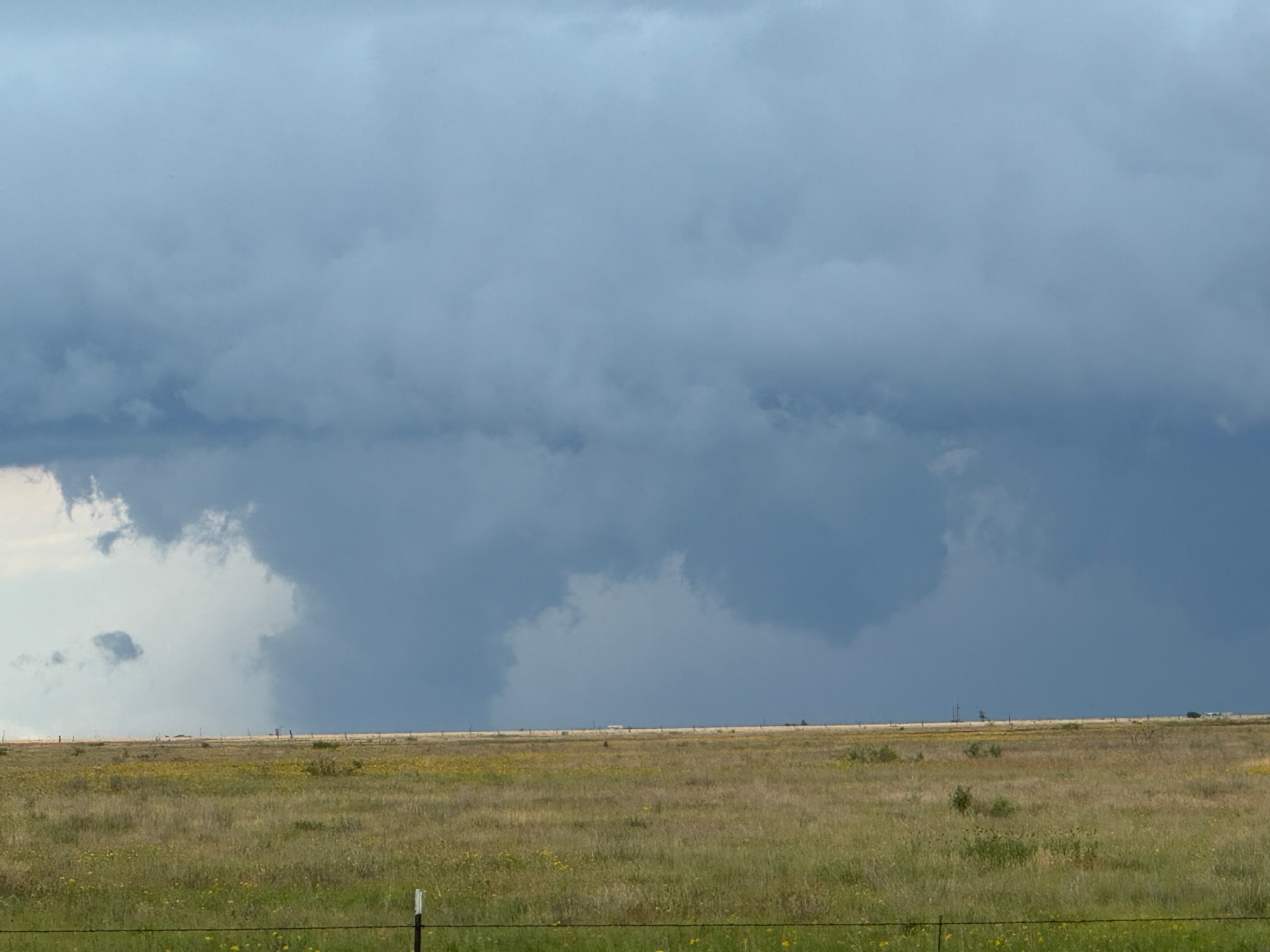
A cell or two strengthened considerably and we stayed a little southeast and south of the main storm core as it moved to the ESE. Our “Claude” supercell was moving off of the Caprock and into the sparse road network south-southeast of Claude. We watched from a Palo Duro Canyon scenic lookout on the south side of the Prairie Dog Town Fork of the Red River in Armstrong County. This was far enough south to evade the 4-inch-plus-size hail that was reported up 207 to our north (ten miles south of Claude at 4:16 p.m. CDT).
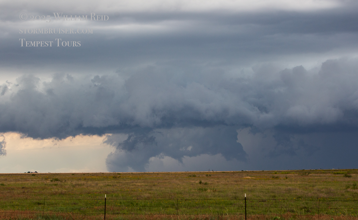
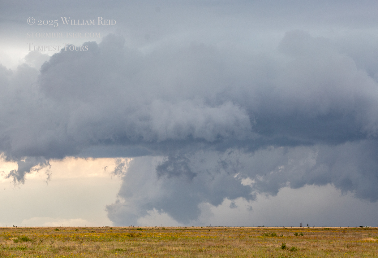
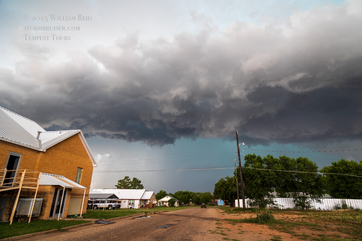
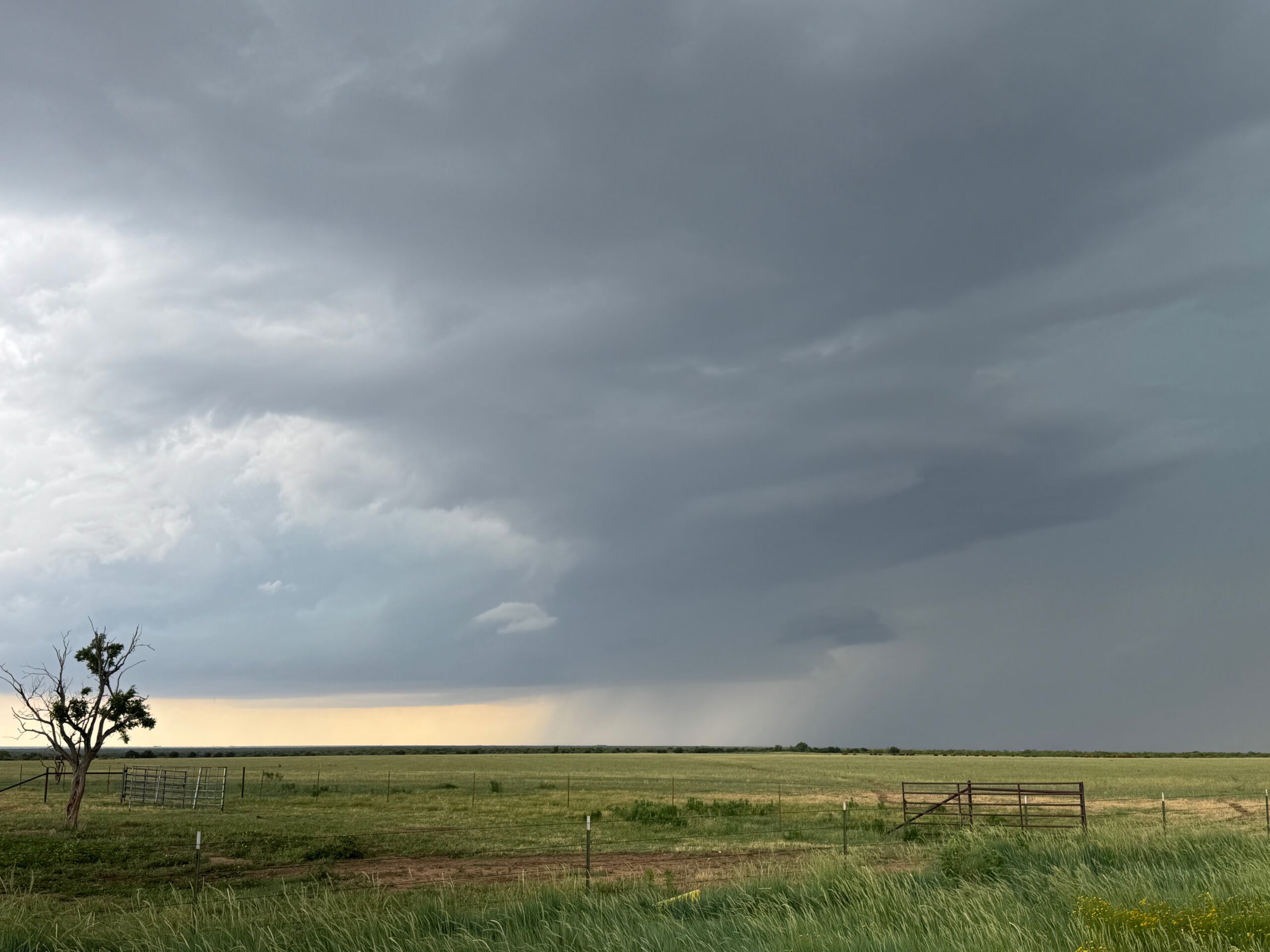
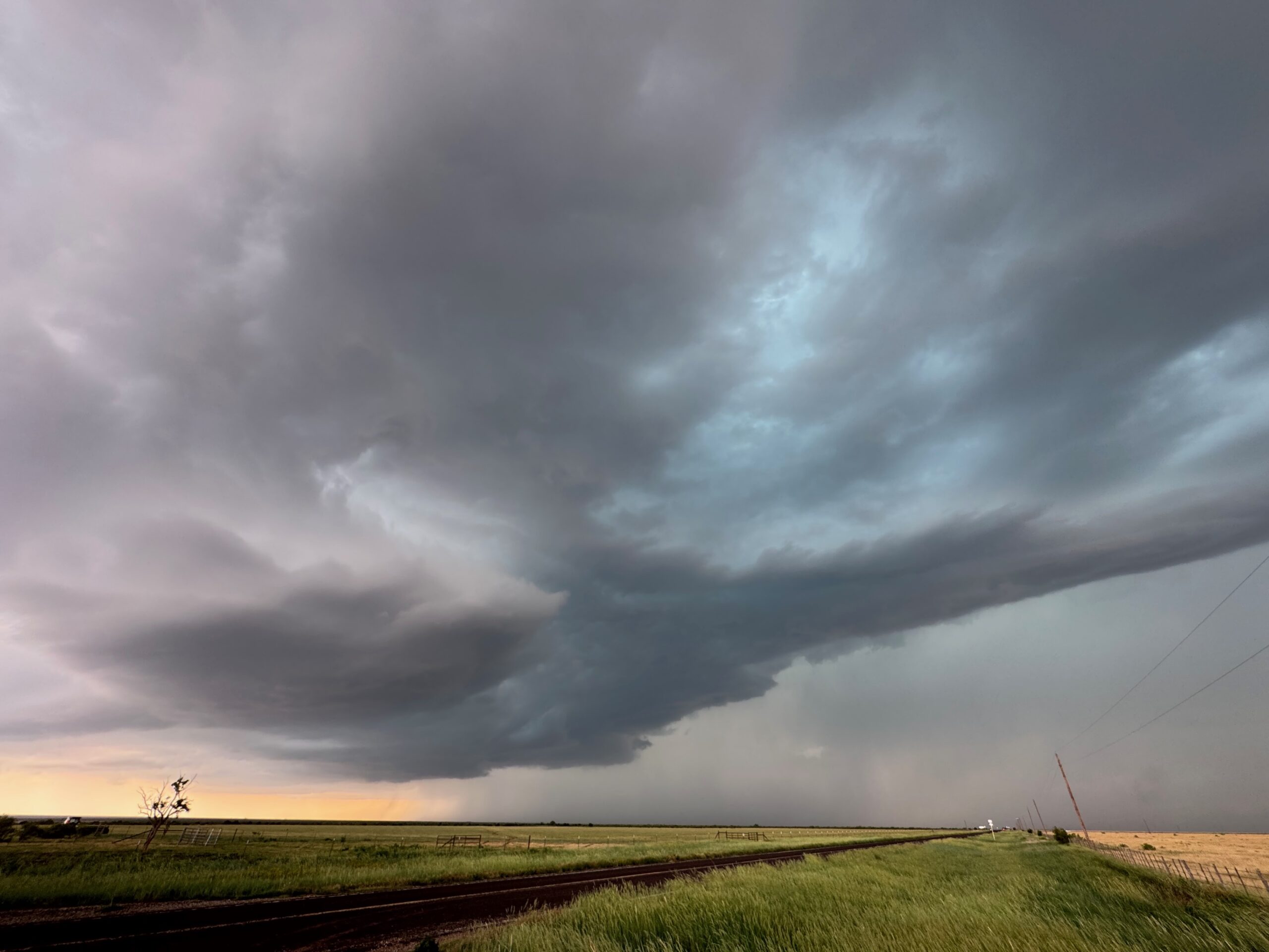
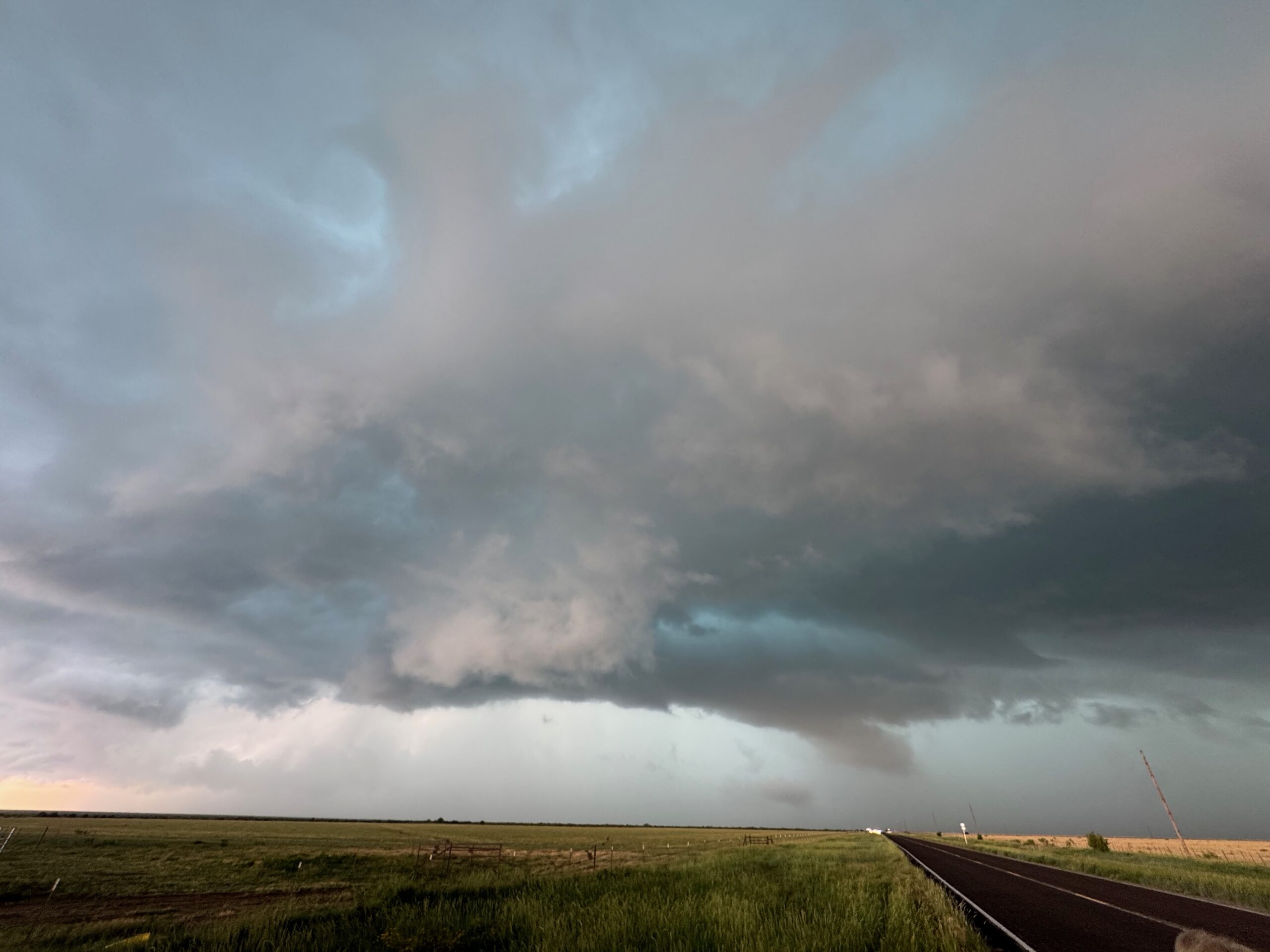
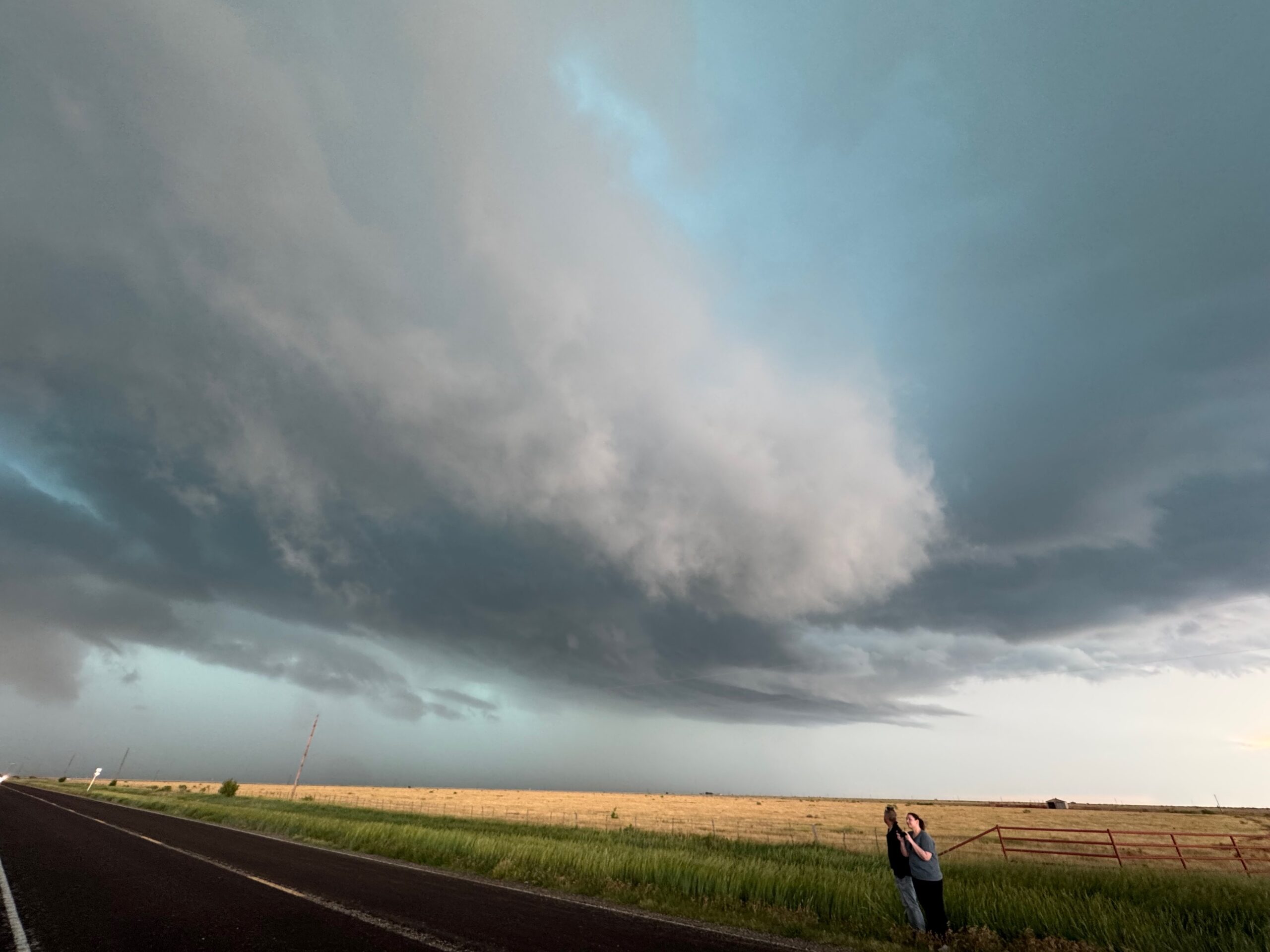
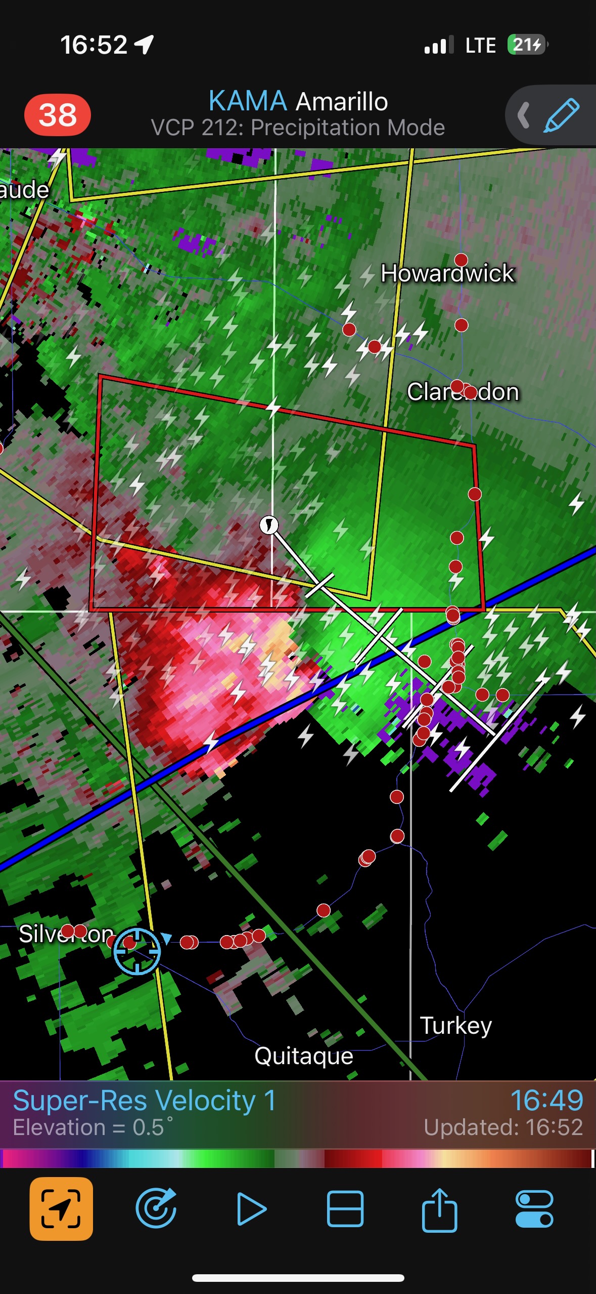
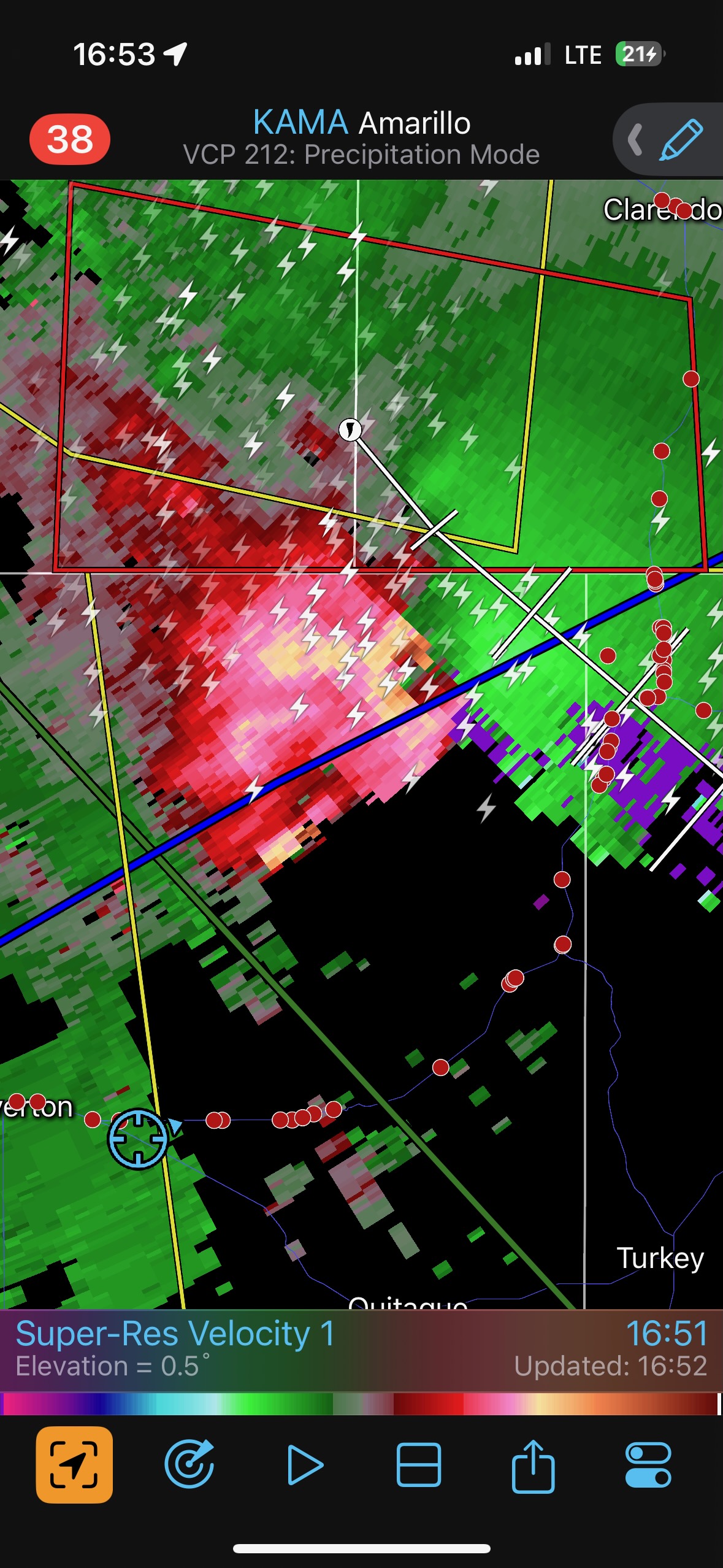
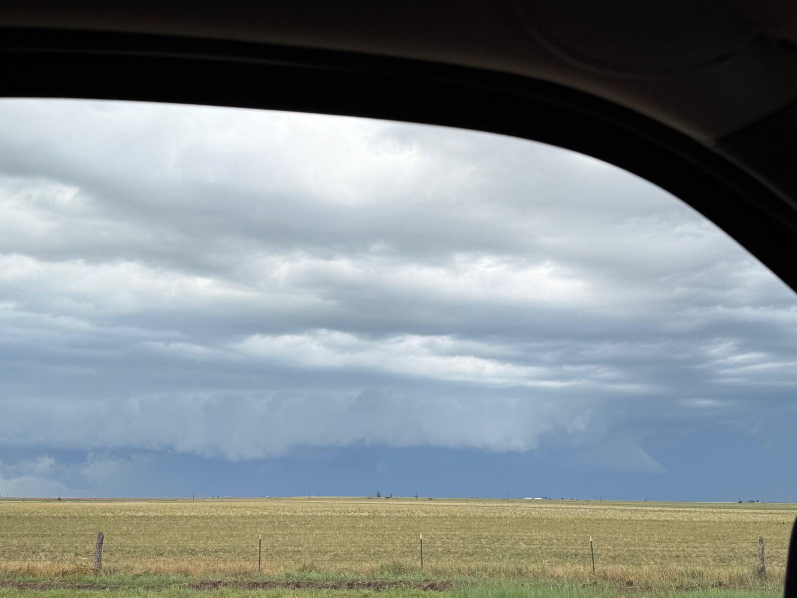
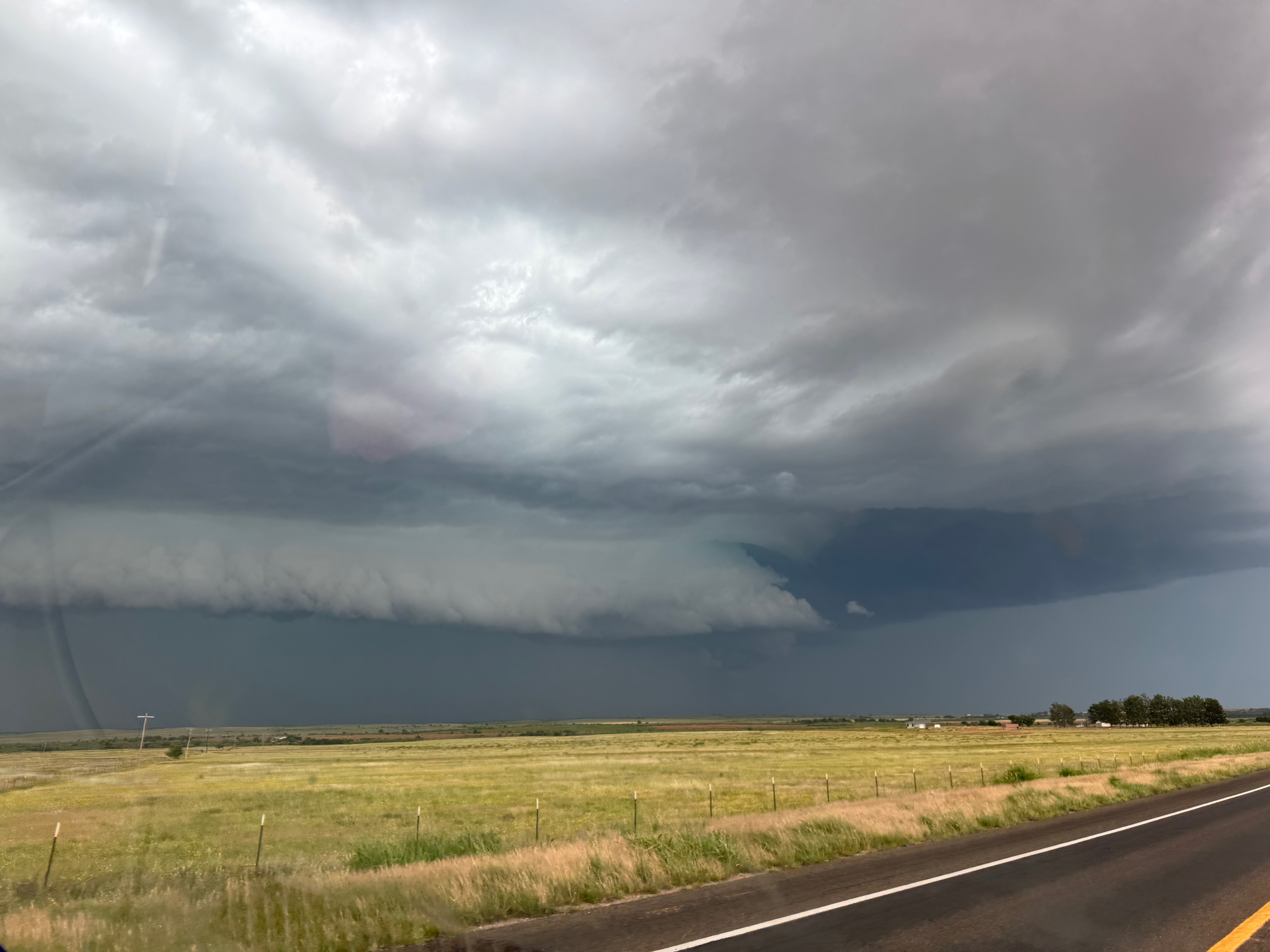
Our supercell was looking rather HP and messy as we tried to get back into position near Turkey. There was a blocky and very low wall cloud which looked like it might have a tornado for a minute or two (first two pics below)…but I guess not. The radar depiction looked good, and there was a tornado warning with the storm, but if there was a tornado then it was not significant (or it was totally rain-wrapped). I think the storm was undercut, which greatly minimized tornado potential.
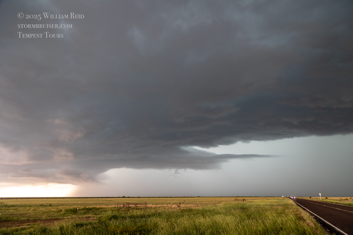
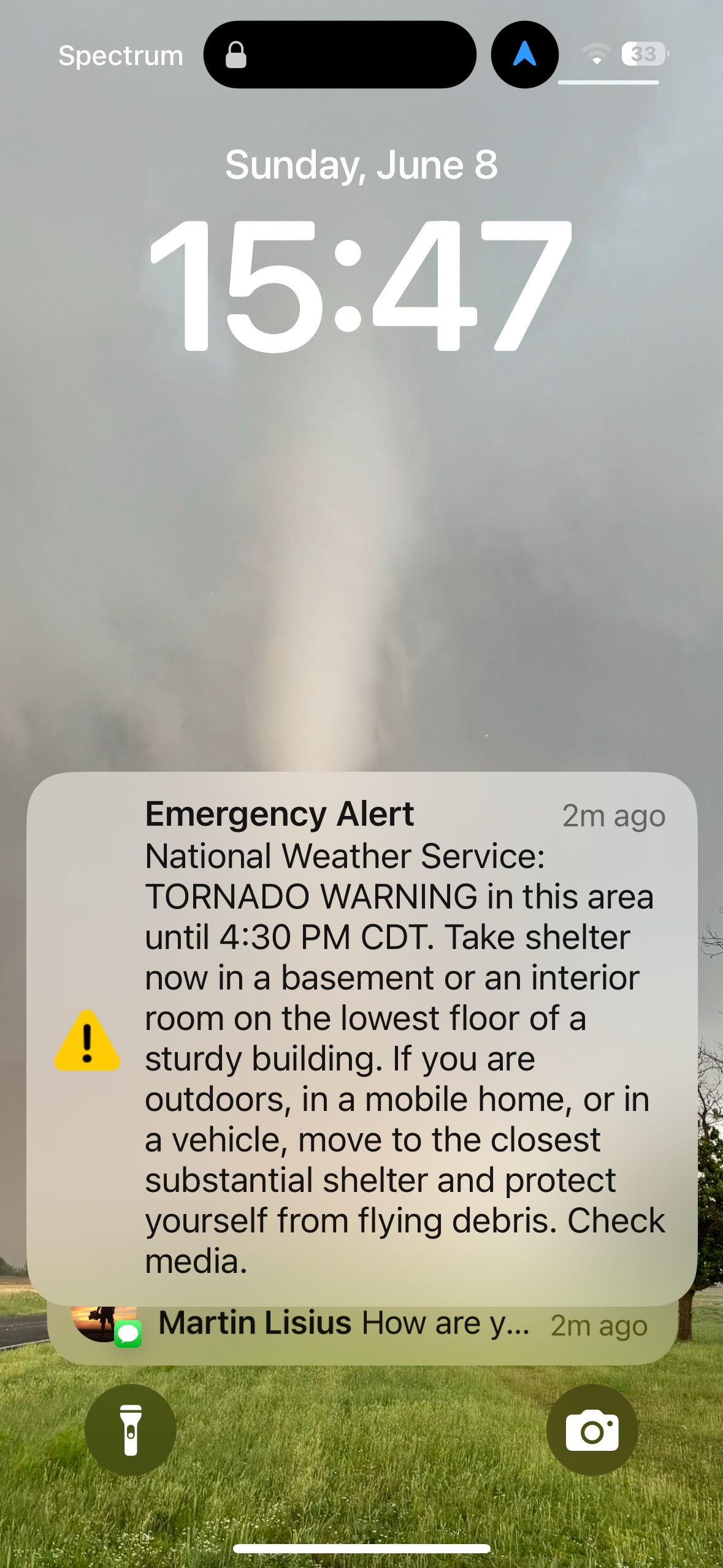
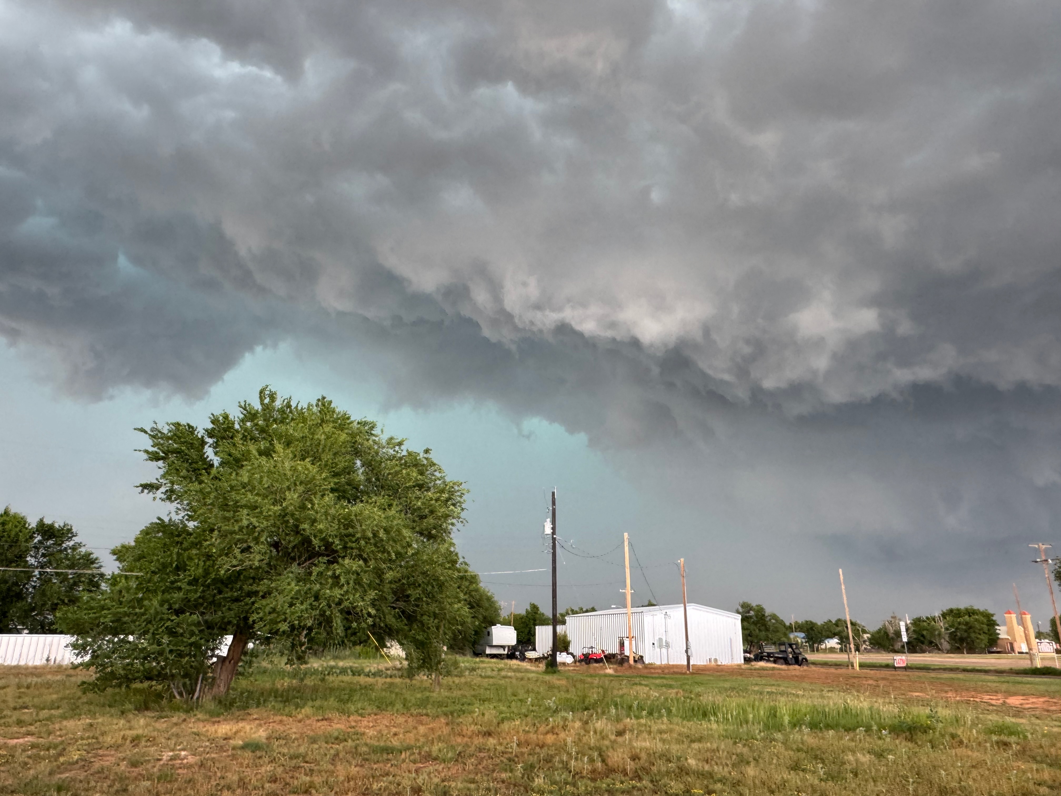
At Turkey, we were met with some coolish outflow and a long line of chasers from the north just prior to the advance of a shelf cloud. This was outflow-ish junk with wind and hail, and little-or-no tornado chance. Am I jaded now? We waited out the wind and hail under some cover at Turkey, but the main core was a few miles to the east. I was done with this one, and we went back to Amarillo for the night, with another storm or two to observe near town.

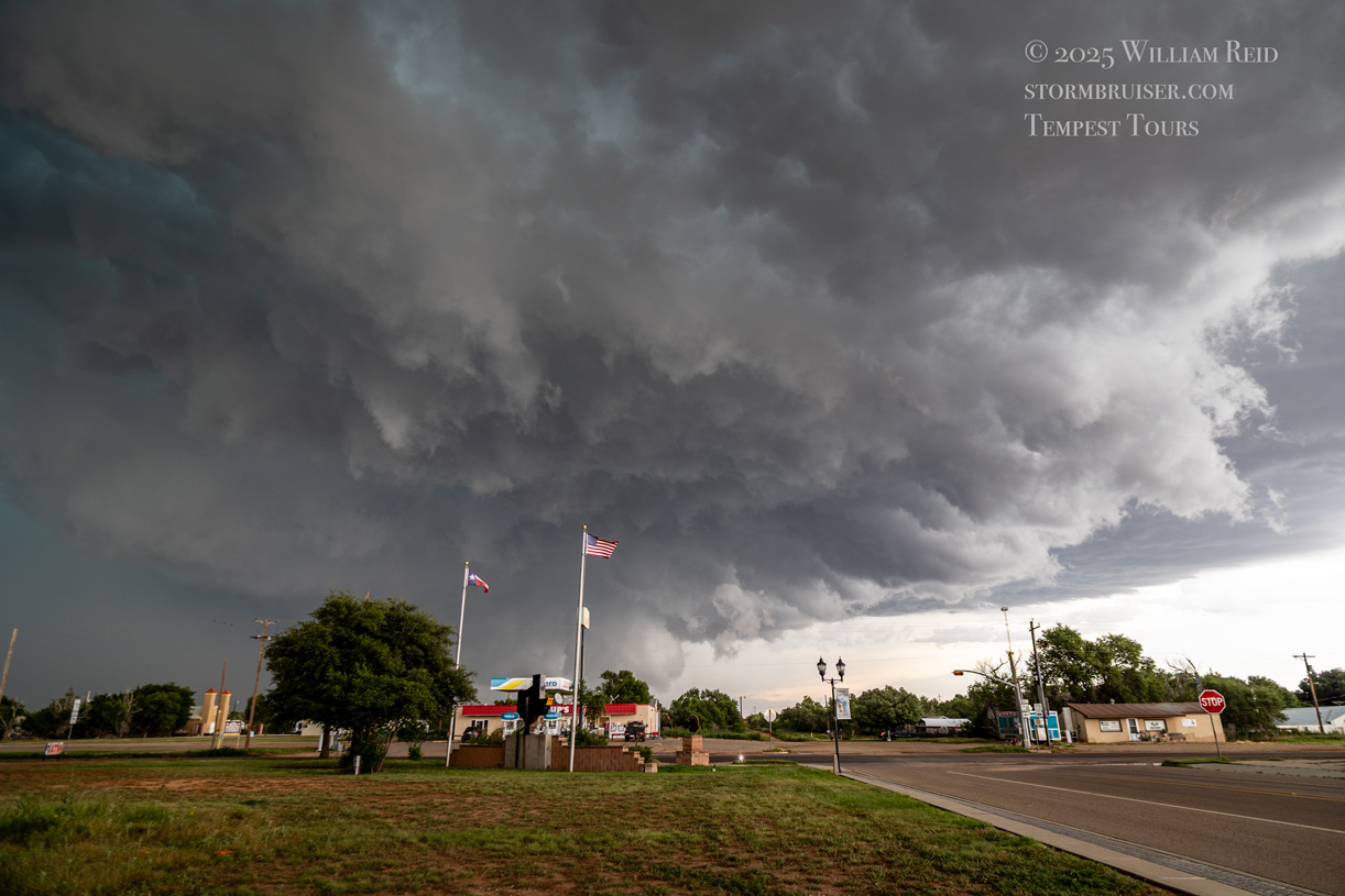
The Canon pics are above and the iPhone pics are below. About the first 2/3 of the images below are from Panhandle to south of Claude, where we waited for the supercell as it approached. The last two pics above were taken in Turkey as the tornado sirens were blaring.
Leave a Reply
You must be logged in to post a comment.