
I have made two Stormbruiser web entries for this chase day. This page, Part One, contains the chase account and iPhone images and the video links. A second web entry, Part Two, contains the higher-quality images off of the Canon cameras.
Start: Valentine, Nebraska/lunch: Coachlight Cafe in Valentine/End: Oberlin/302 miles
Mesoscale Discussions. 4:46 p.m. CDT. 6:12 p.m. CDT. 7:16 p.m. CDT. 9:25 p.m. CDT
Note that on the graphic for the 6:12 p.m. discussion by SPC that there is no indication of any development yet in Lincoln County, Nebraska, where the Dickens supercell formed. The graphic on the 7:16 p.m. discussion shows the massive thunderstorm above southern Lincoln County.
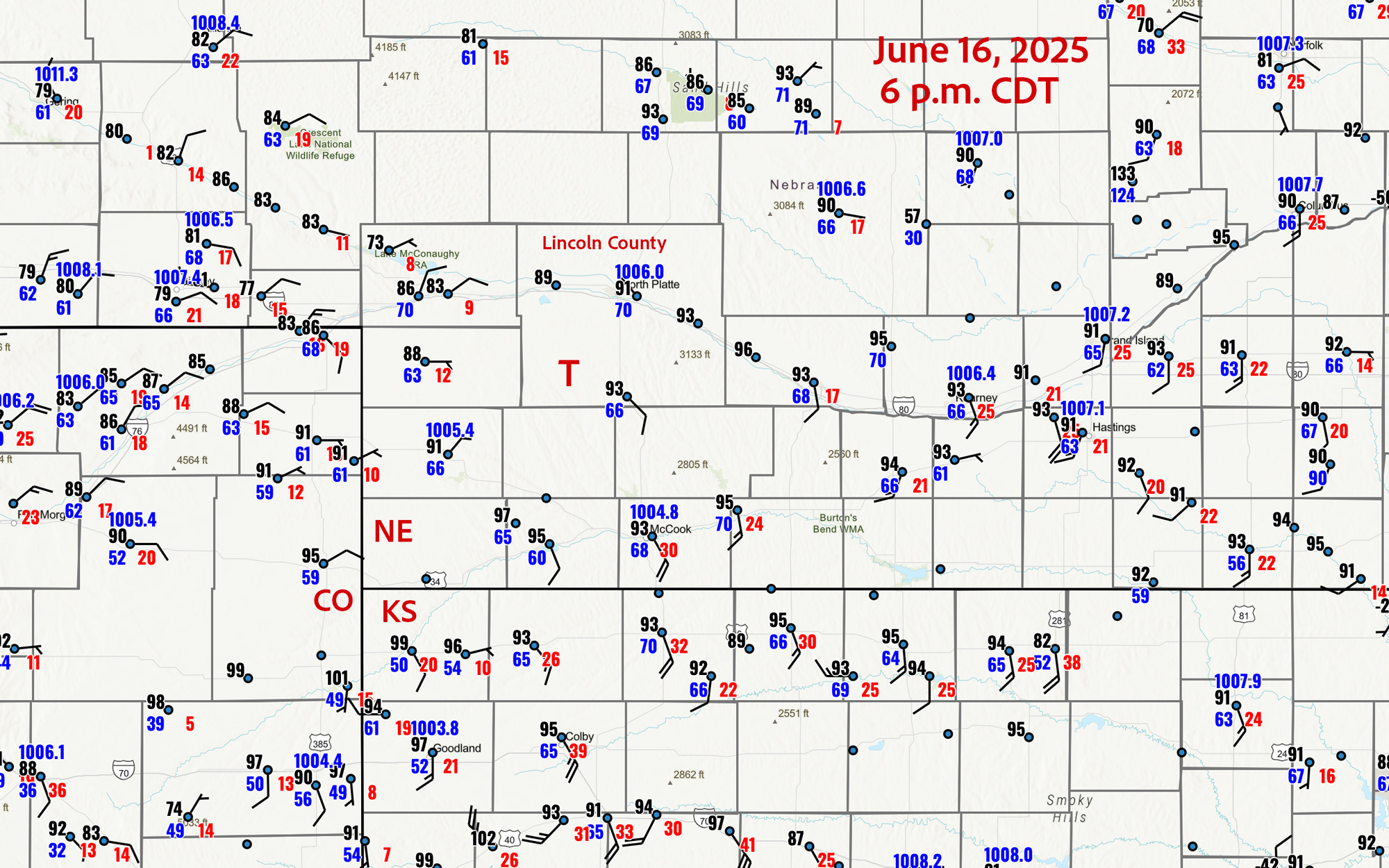
The surface observation plot above is for 6 p.m. CDT, just prior to the development of the storm near Wellfleet in southwestern Lincoln County (where the “T” is). The wind at North Platte has just switched to NW. It was calm the hour prior at North Platte, and was north at 10 knots at 7 p.m. The healthy and moist southeasterlies at McCook and Oberlin indicate the really good feed of high-octane air available to the Wellfleet storm. The supercell developed in an area of rather weak low pressure coincident with weak-to-moderate surface moisture convergence. Some weak convection was bubbling in extreme northwestern Kansas a little prior to 6 p.m. CDT and I was tempted to edge that way. That was in the hot air (99F at Saint Francis) and would have been very high-based, and would have had to move a county or two east or northeast to tap the really good low-level moisture.
My videos of the Wellfleet/Dickens tornadic supercell, on YouTube:
22-minute realtime tripodded wide-angle video (first half of the event)
Time lapse clips of the above wide-angle video
17-minute realtime tripodded zoomed-in video (plus some iPhone video clips shot as we got closer along W Medicine Road)
5X timelapse of the above zoomed-in video off of the Panasonic camcorder
and
Timelapse Video of the event by Chris Gullikson, on the west side of the storm with the Tempest Tours photo group
This chase day was likely the best one of the year for me, as we observed the tornadic supercell in southwestern Lincoln County, Nebraska (east of Dickens and northwest of Wellfleet) in its entirety. Featured was a long-lived, slow-moving, high-end tornado which was easily visible. This is how our day went!
Our group awoke in Valentine, and it was clear that we had to scoot southward towards Thedford and North Platte to be near a subtle boundary that was slowly sagging southward through the Sandhills during the afternoon. SPC’s outlines generally favored areas along and a little north of I-80 in central Nebraska, showing just a 2 percent tornado risk but a 30 percent hatched hail risk in the southern portions of the Sandhills to I-80. Weather maps showed really high instability numbers in the North Platte area by late afternoon, as warm and moist southeasterly winds streamed in. Shear was more-than-adequate for a supercell should a storm form. This was one of those all-or-nothing chase days, where a bust was quite possible, but a very impressive storm might eventuate if the cap could be broken. All it would take was enough daytime heating and low-level convergence on the subtle boundary, where moist air was piling up.
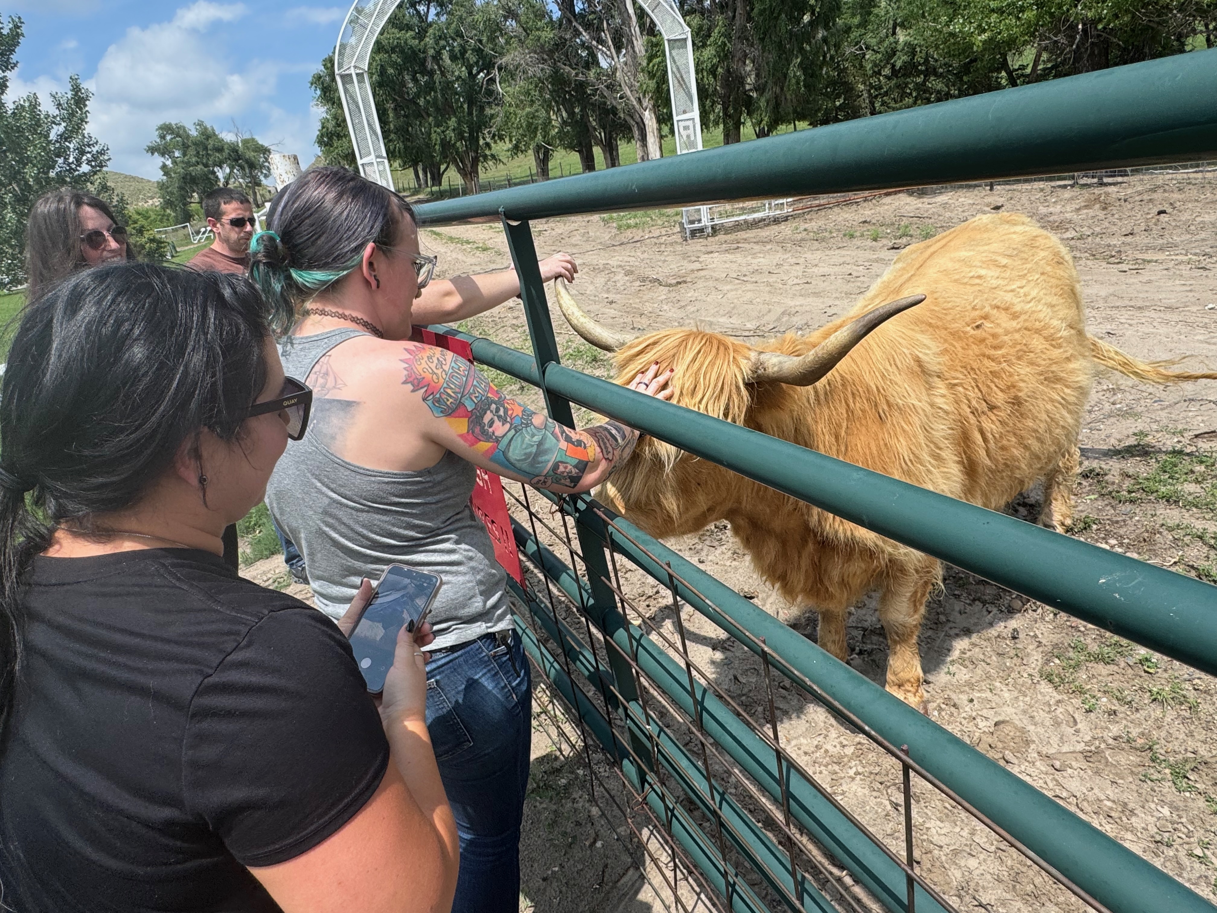
We had a late-morning brunch in Valentine and then began to drift southward. Any storm development would likely not be until rather late in the afternoon. One stop was at the old (Bryan) bridge over the Niobrara, and another stop was at an animal farm in Seneca, a little west of Thedford (first two photos below). We were killing lots of time along U.S. 83, as I felt quite comfortable with regard to where we needed to be if something were to develop.
By around 5:30 p.m. we were in North Platte. Nothing was happening yet in my target area, which was generally right along this boundary near I-80. There was not even a cumulus field, and the outlook seemed to be bleak for this chase day. I took the group to a Jimmy Johns for a pit stop and some sandwiches for the hungry. Usually we don’t get these dinnertime stops on the better chase days! The air was quite muggy and hot. What to do now?
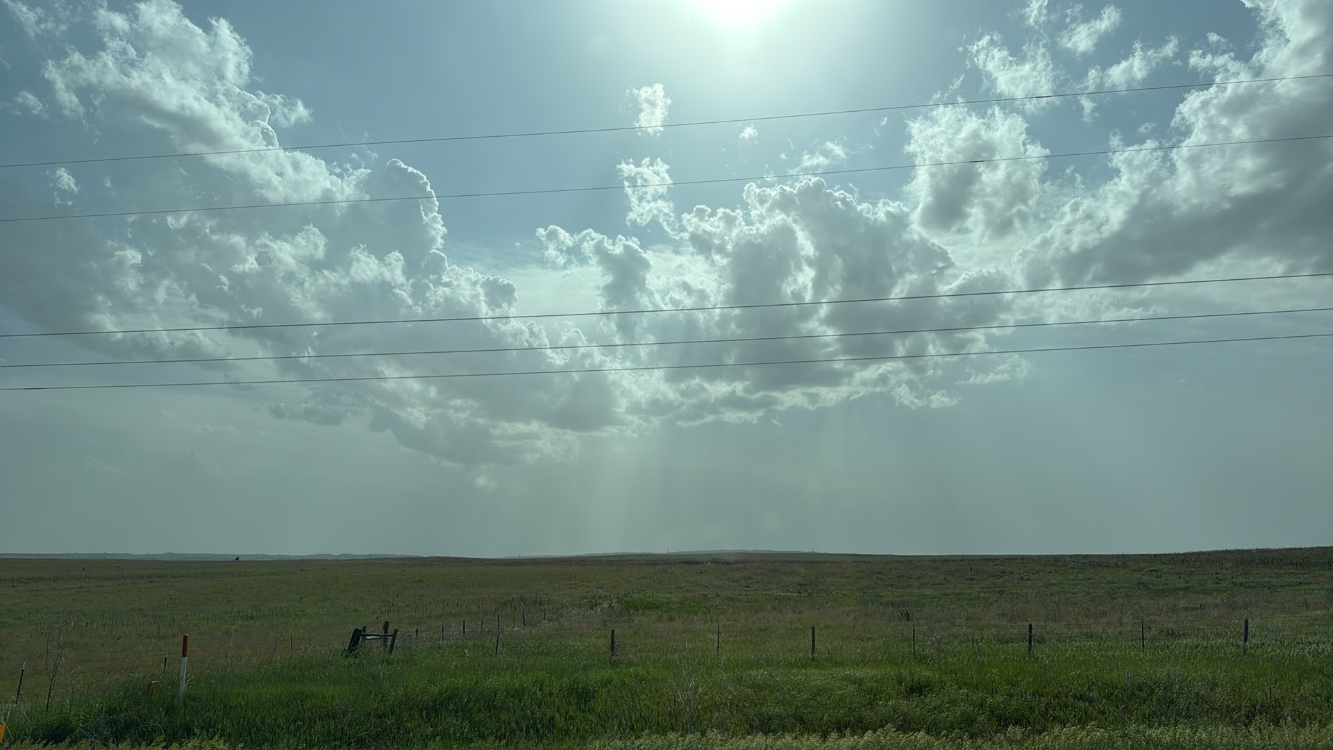
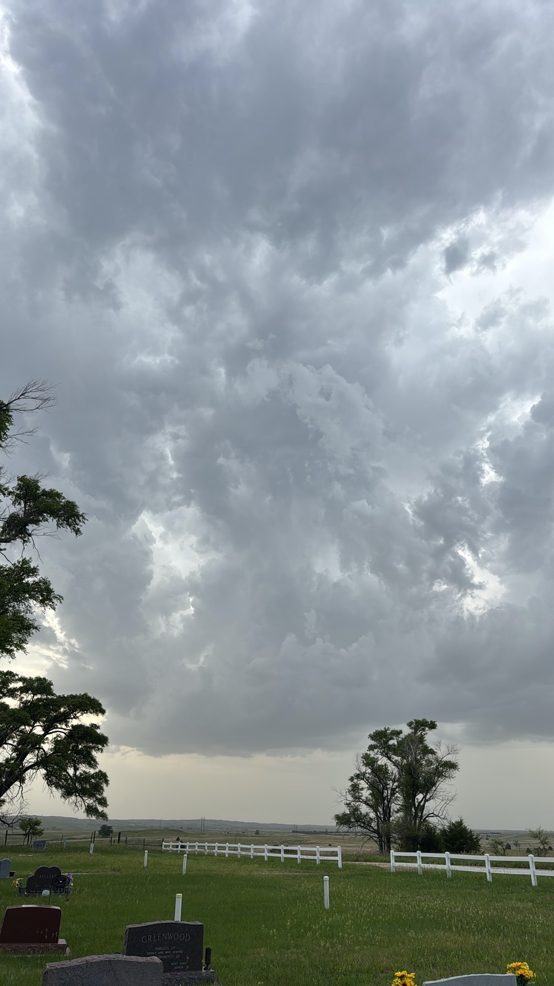
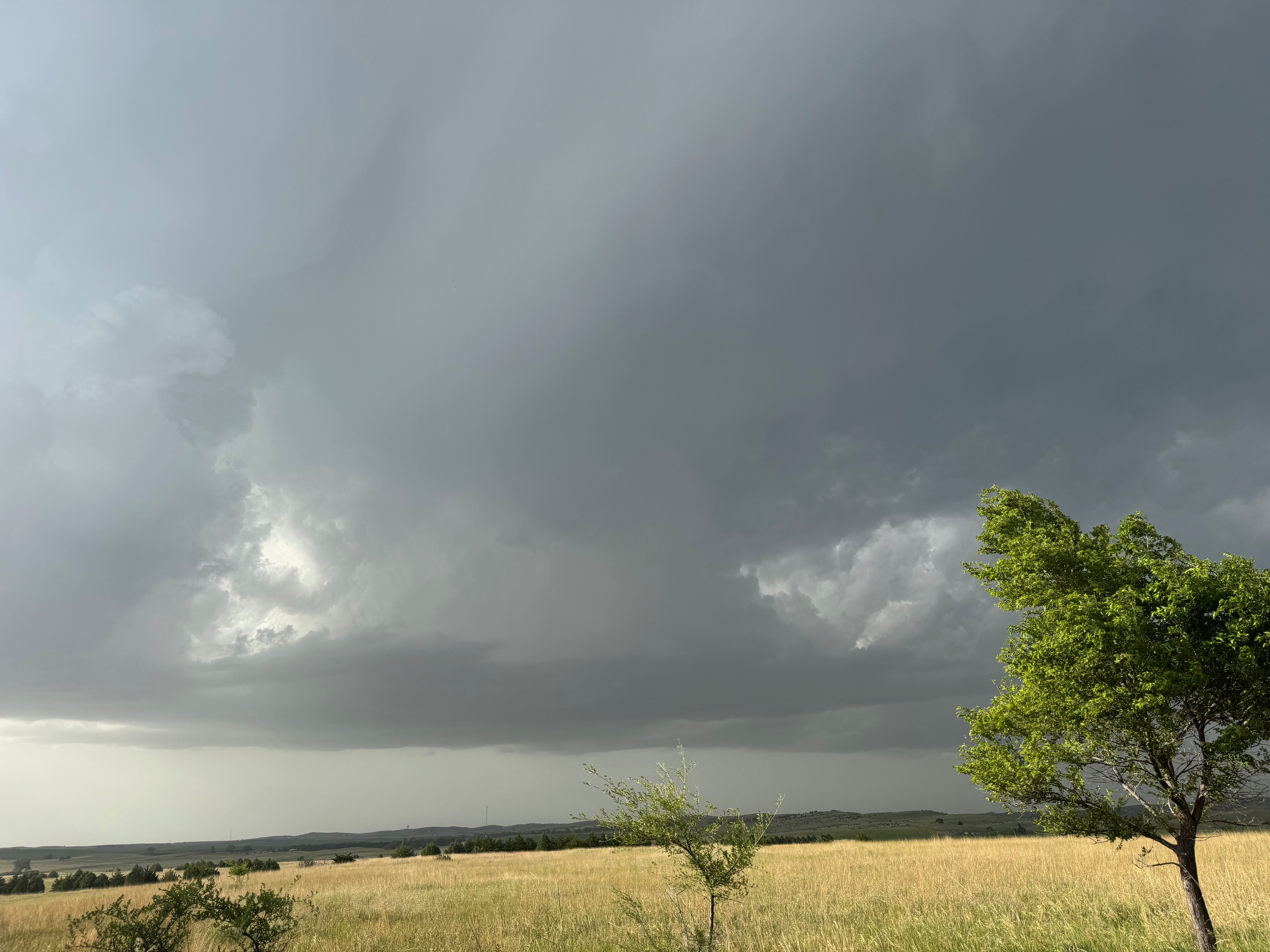
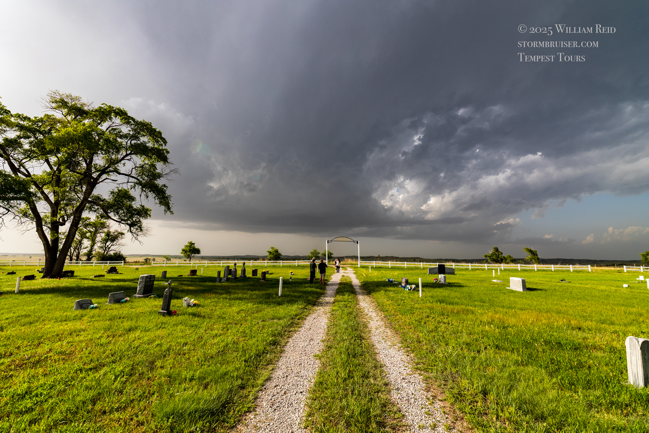
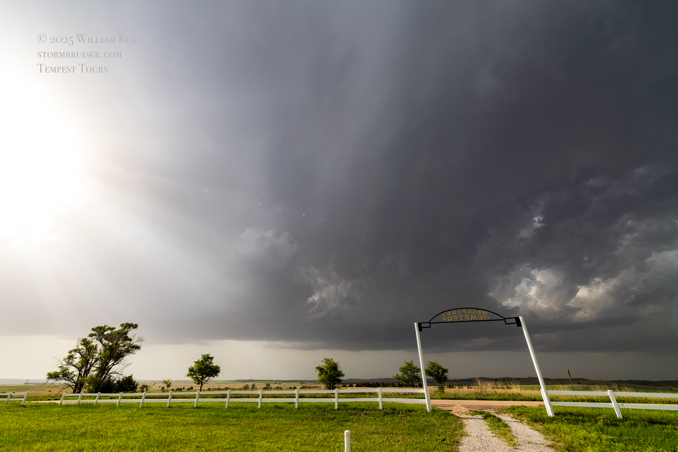
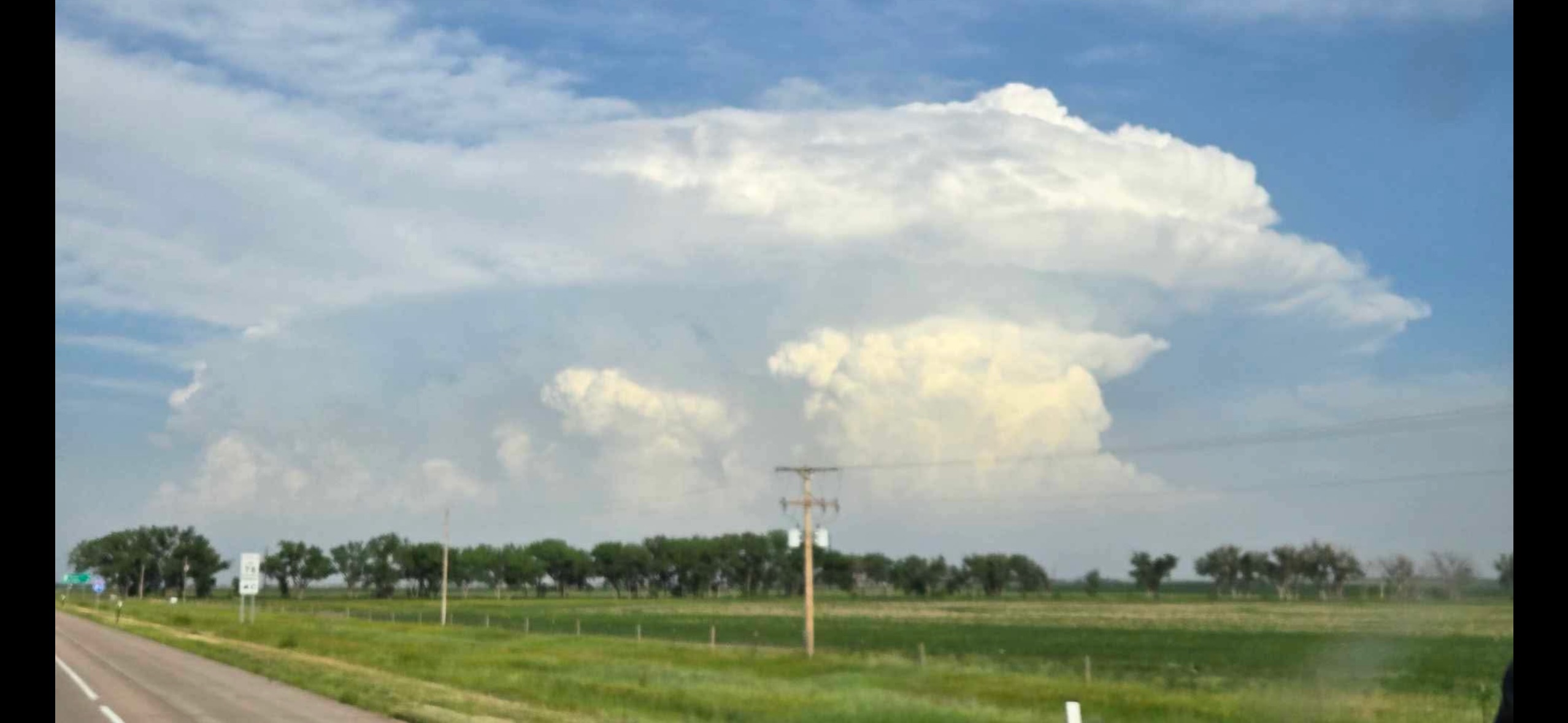
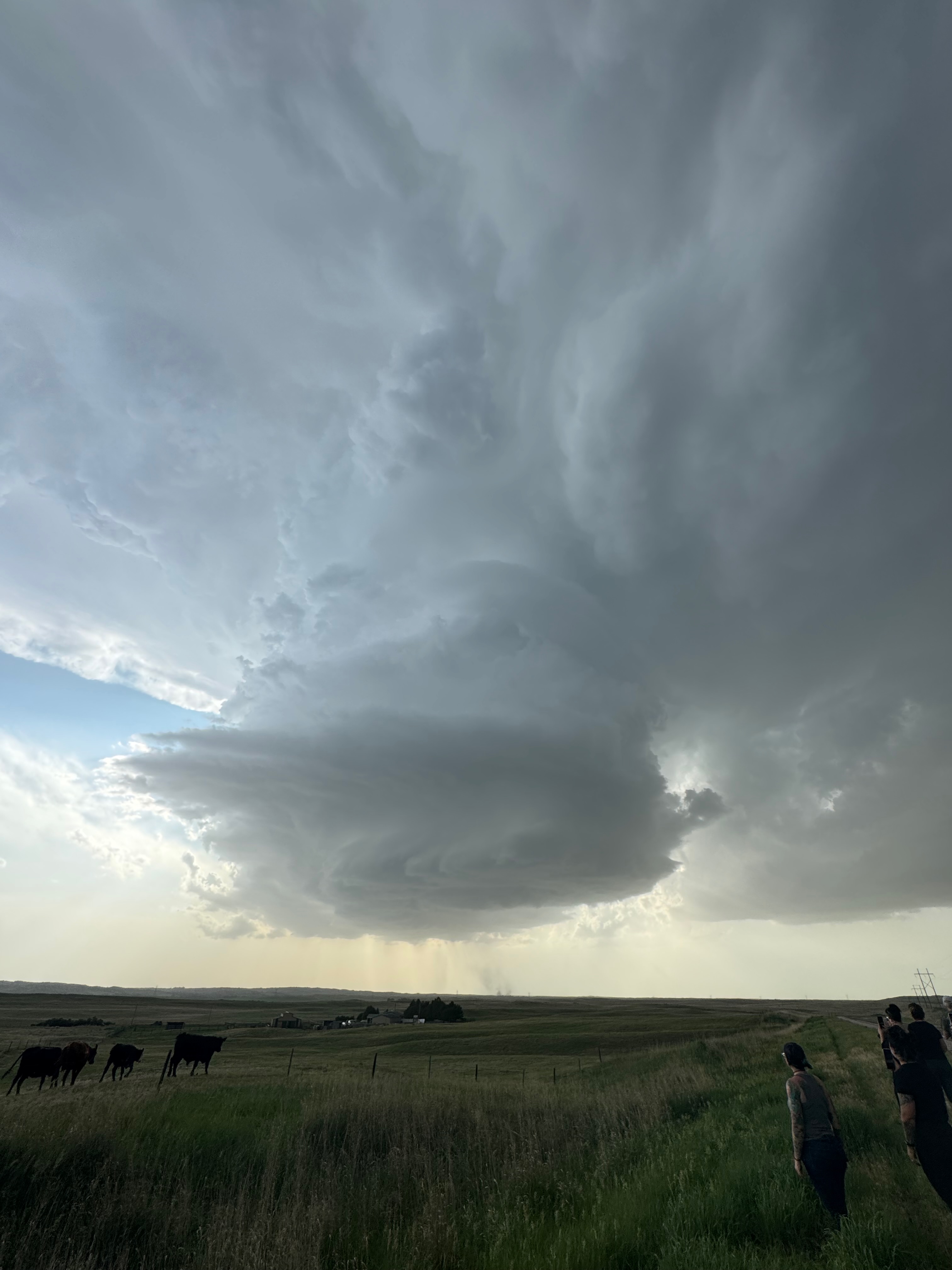
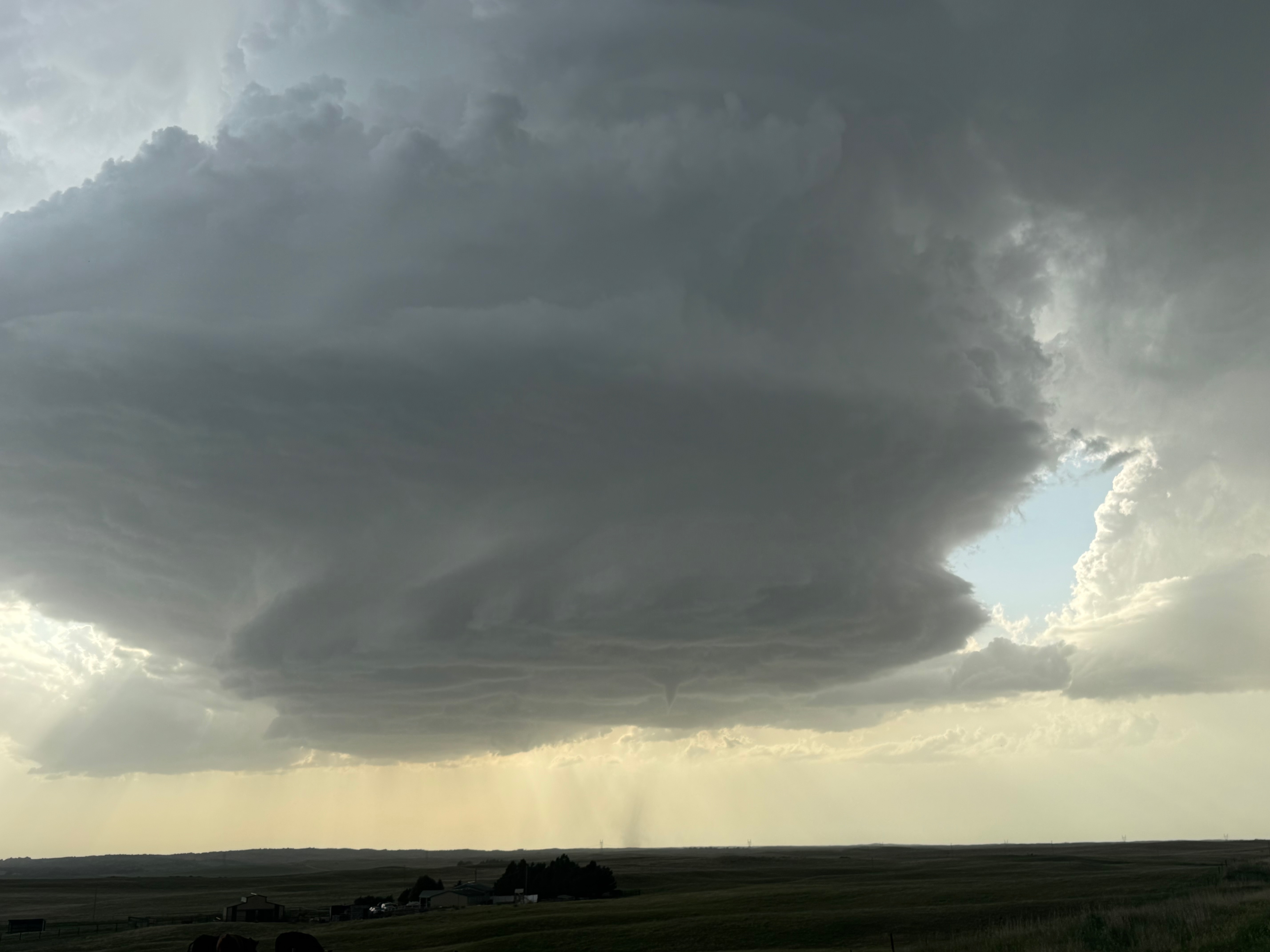
I was drawn further southward from North Platte in part because some convection was starting down towards extreme southwestern Nebraska and northwest Kansas, near Benkelman. That area was kind of a back-up plan. But the conditions required for a high-end supercell and a tornado were much, much better here in southern Lincoln County. The sky was murky and we could not see any distant towers. I stopped at the Wellfleet cemetery, some 25 miles south of North Platte. There was some mid-level cloudiness taking shape a little to the south, and this was moving northward. The group and I spent perhaps 30-40 minutes hanging out at the cemetery, and we watched a patch of mid-level altocumulus castellanus (accas) clouds become quite perky just to our southwest and west (see 3rd and 4th images below). I was not sure at all what might eventuate from this activity. But, some of the cloud towers were getting to be quite impressive. As these towers continued to move to the north, the cloud base on the most impressive tower lowered significantly. We had a storm! (See the last several photos below.)
Well, that was convenient. I wasn’t really expecting that a patch of mid-level clouds would wind up producing what we wanted. There was no conventional cumulus field at all prior to the development of this “Wellfleet” updraft.
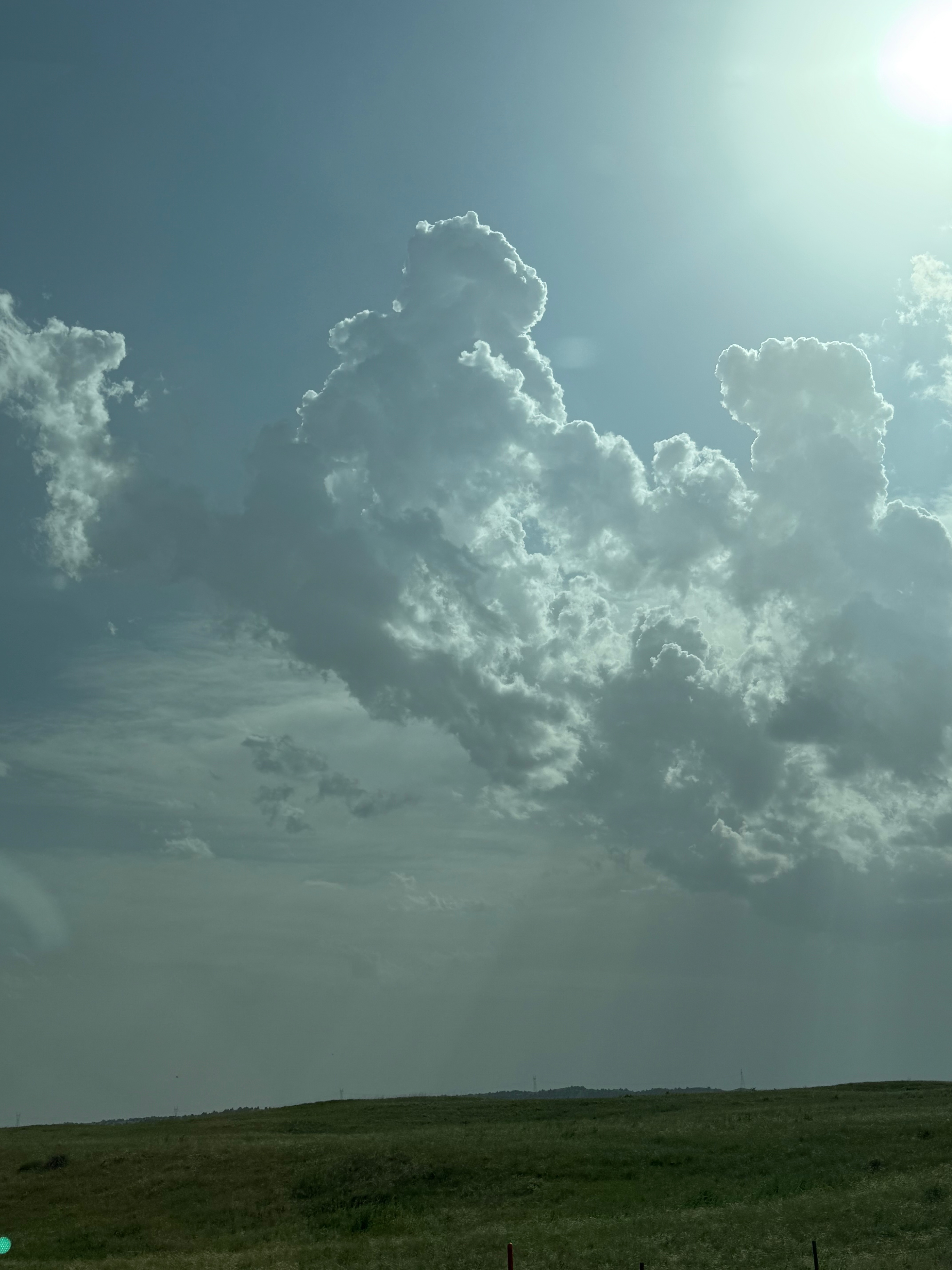
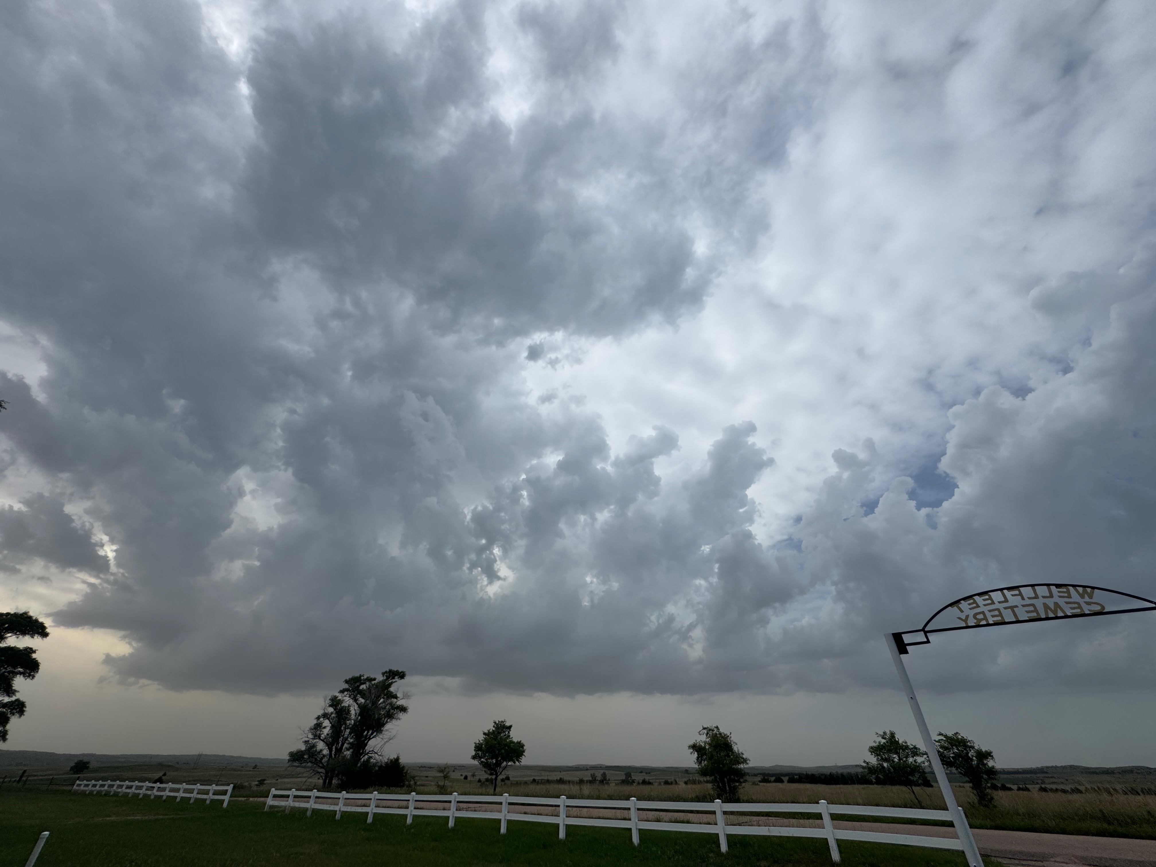
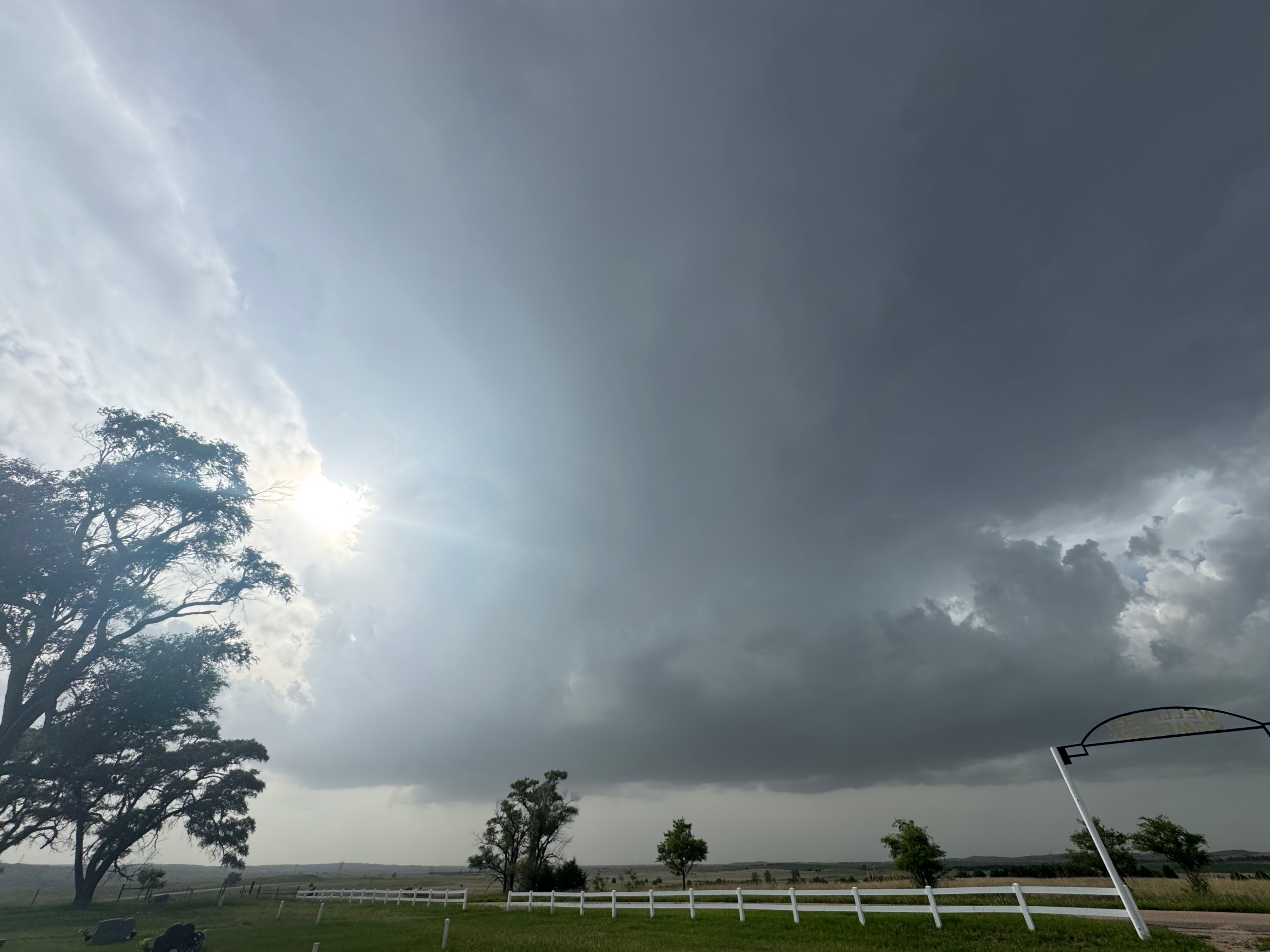
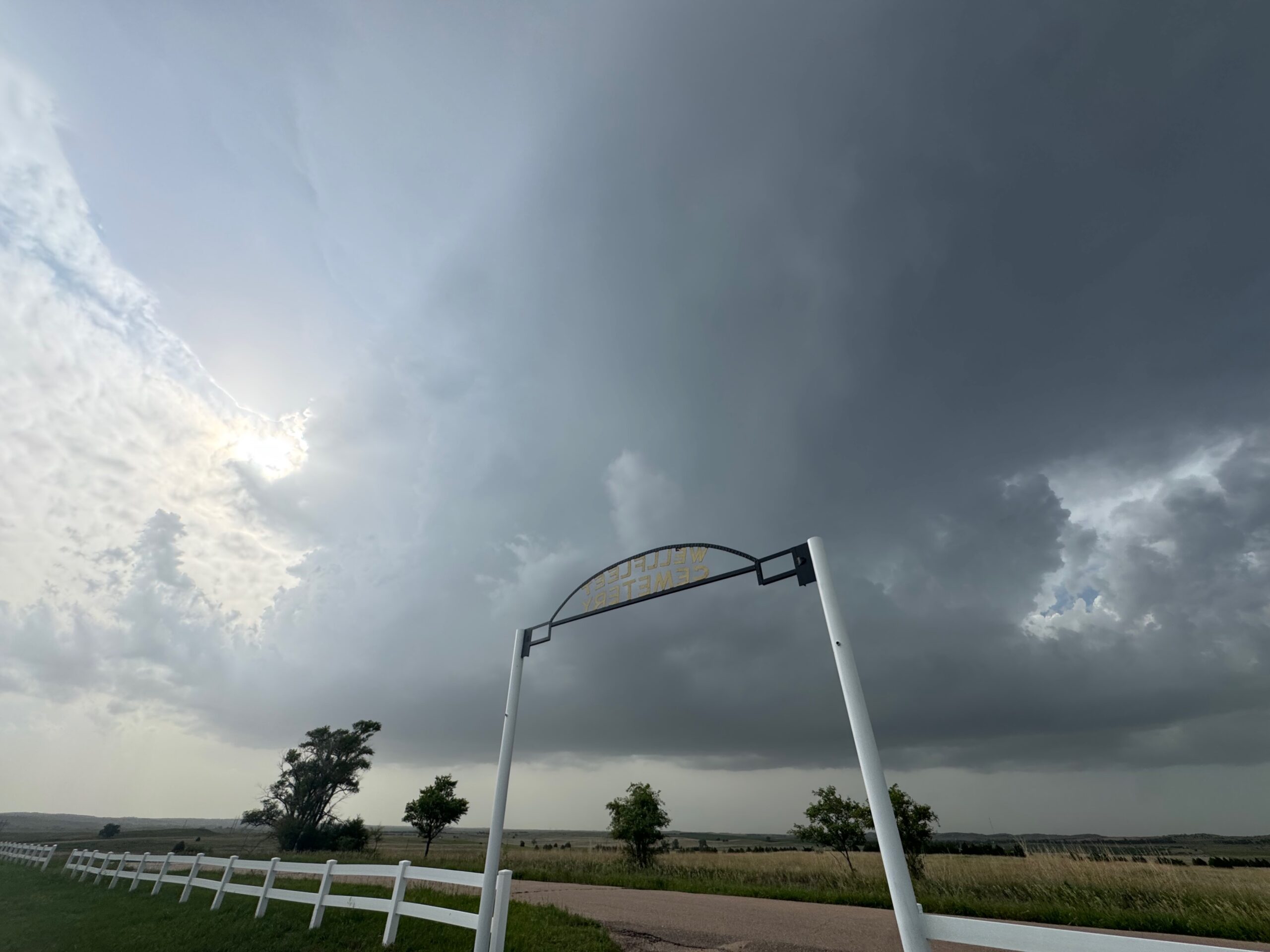
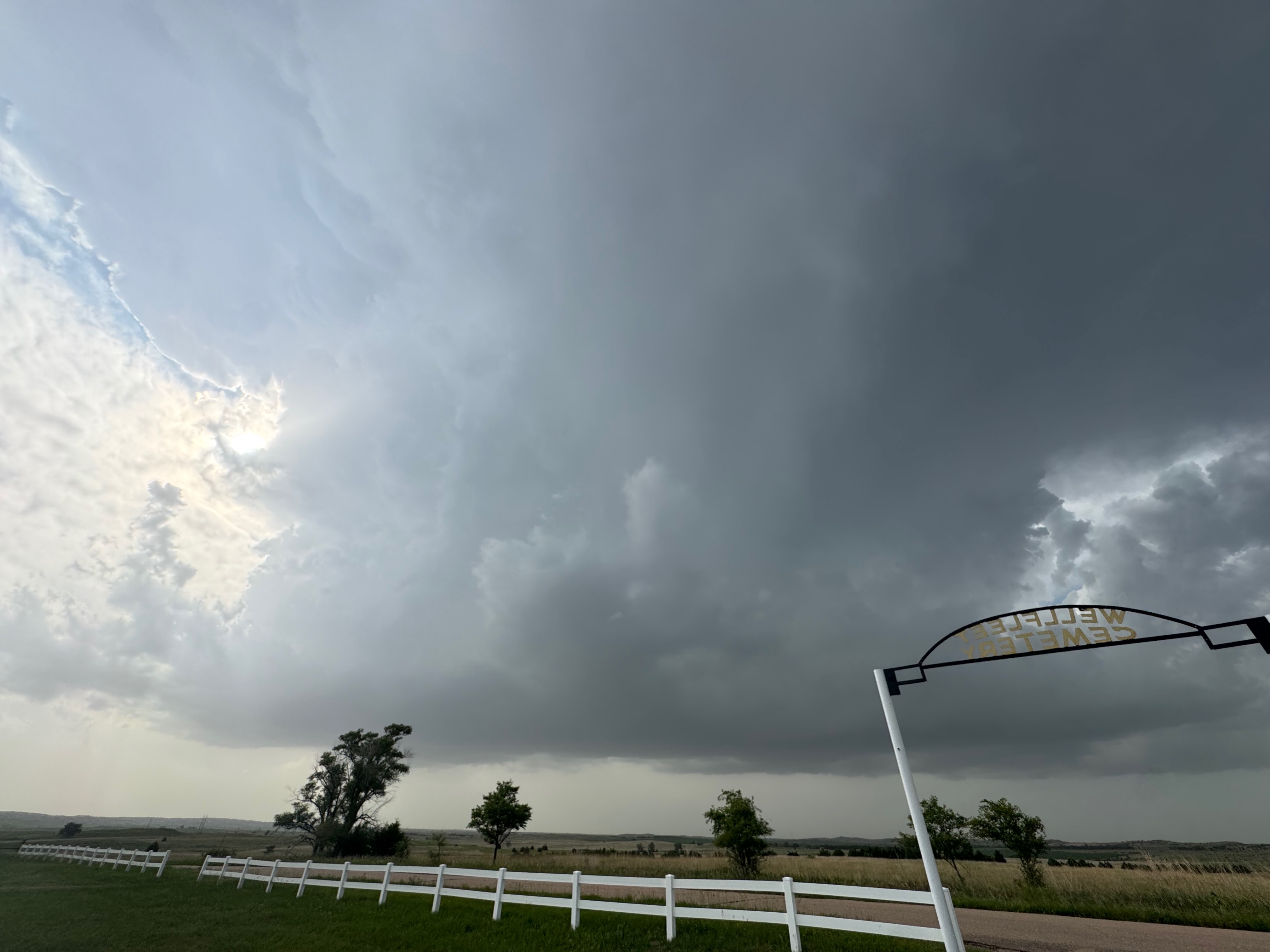
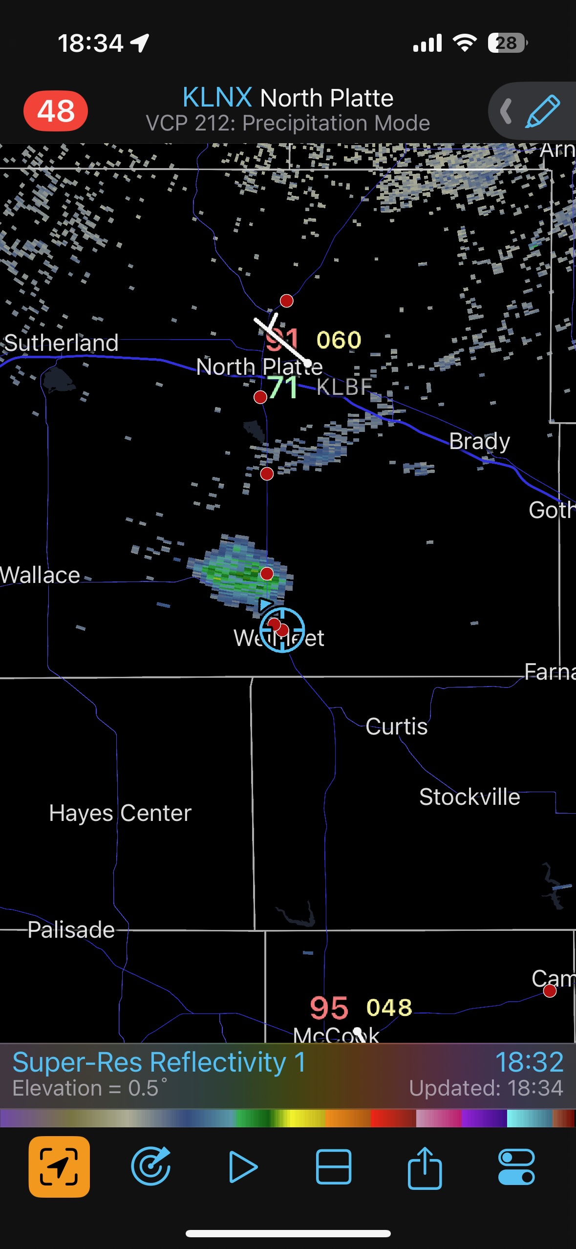
The final few storm photos above show a nice, flat, and relatively low base to our northwest. These shots were taken from the Wellfleet cemetery. The radar screenshot shows our location at this time, 6:34 p.m. CDT, and the first returns of light precipitation associated with the storm nearby. The new storm cell was moving to the north (seemingly), so we followed it up to Highway 23, just 5 miles away.
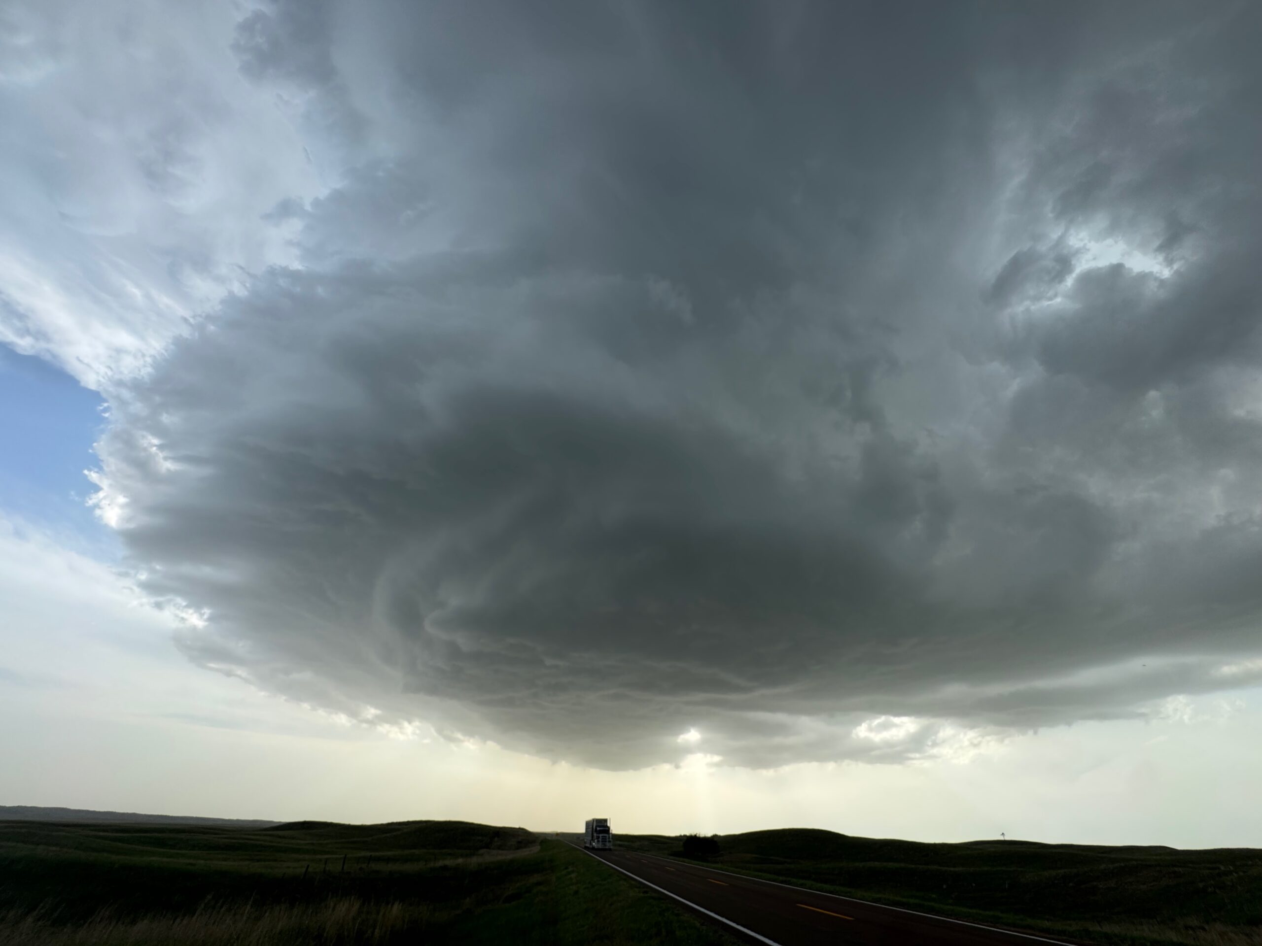
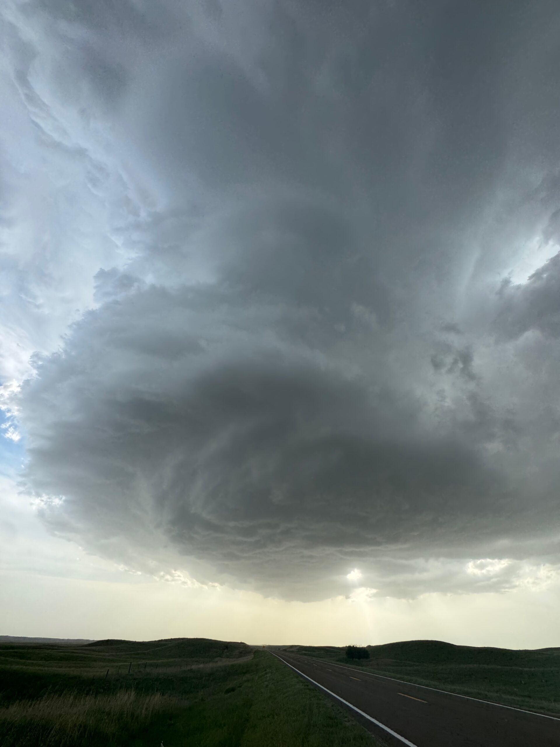
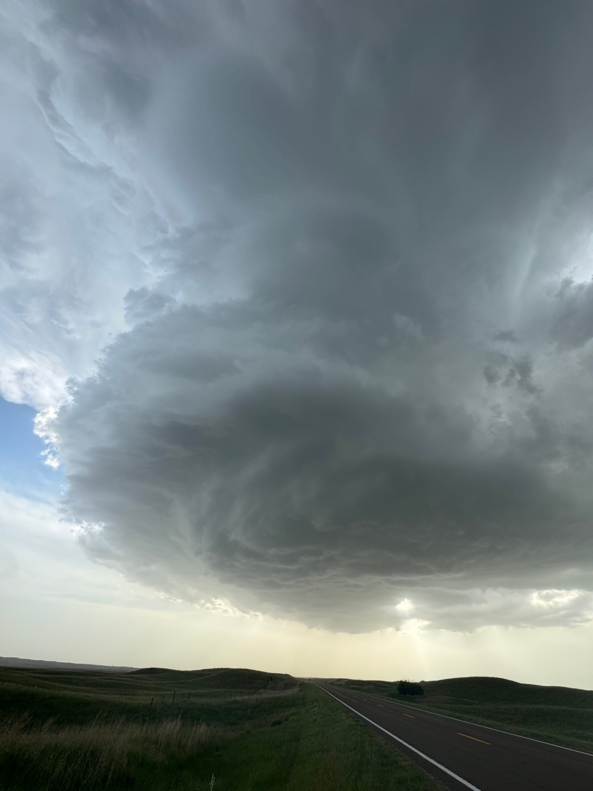
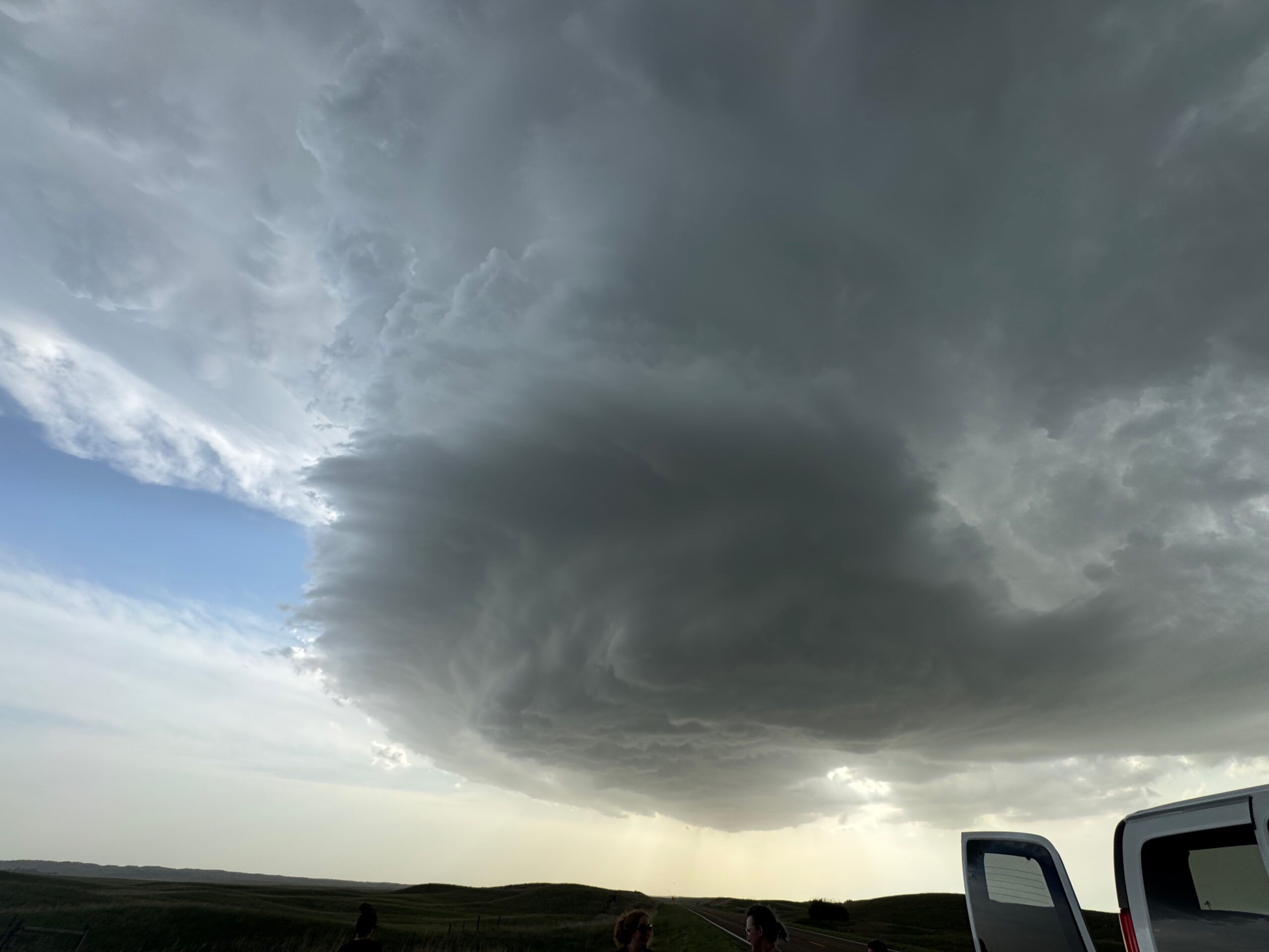
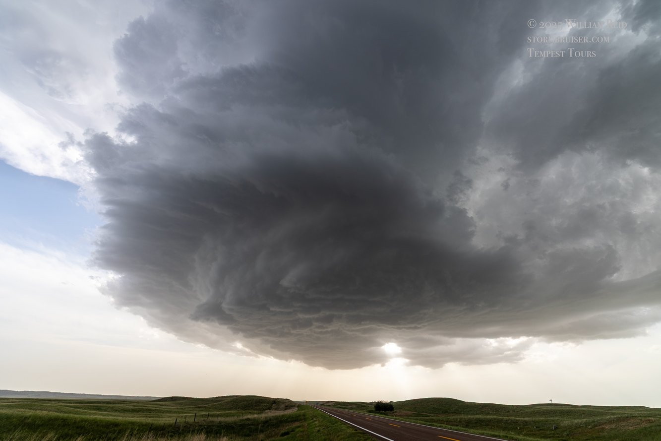
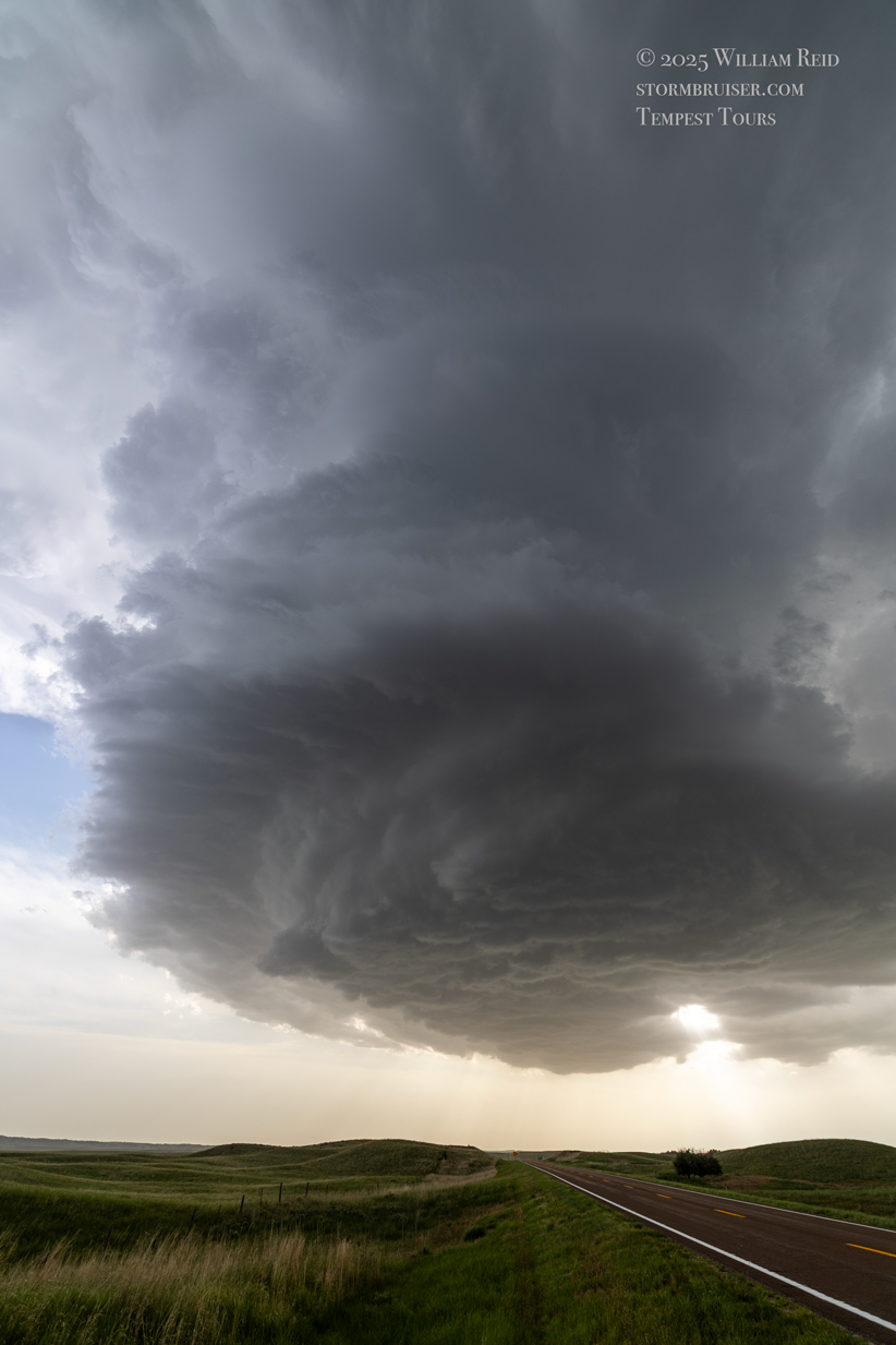
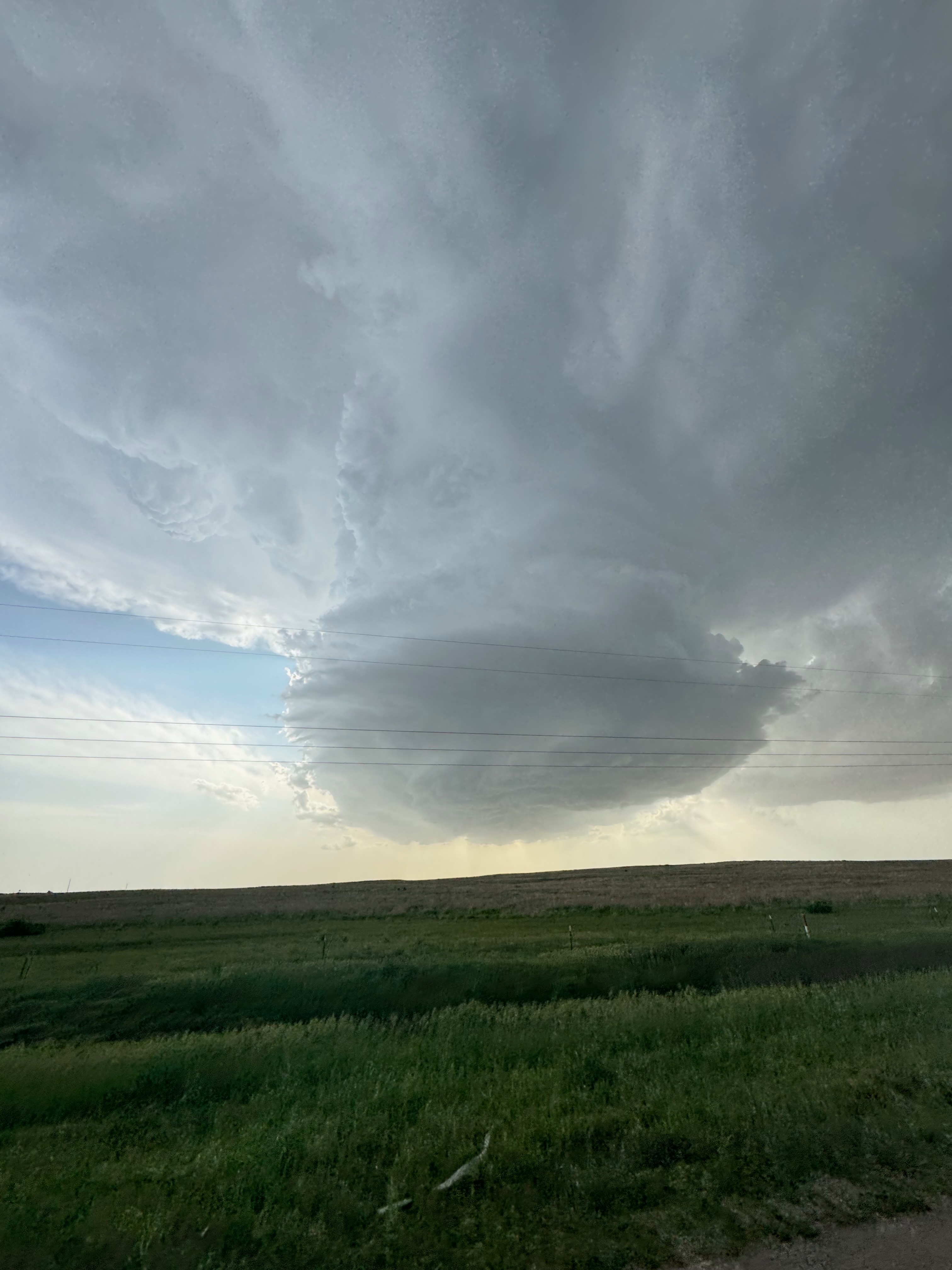
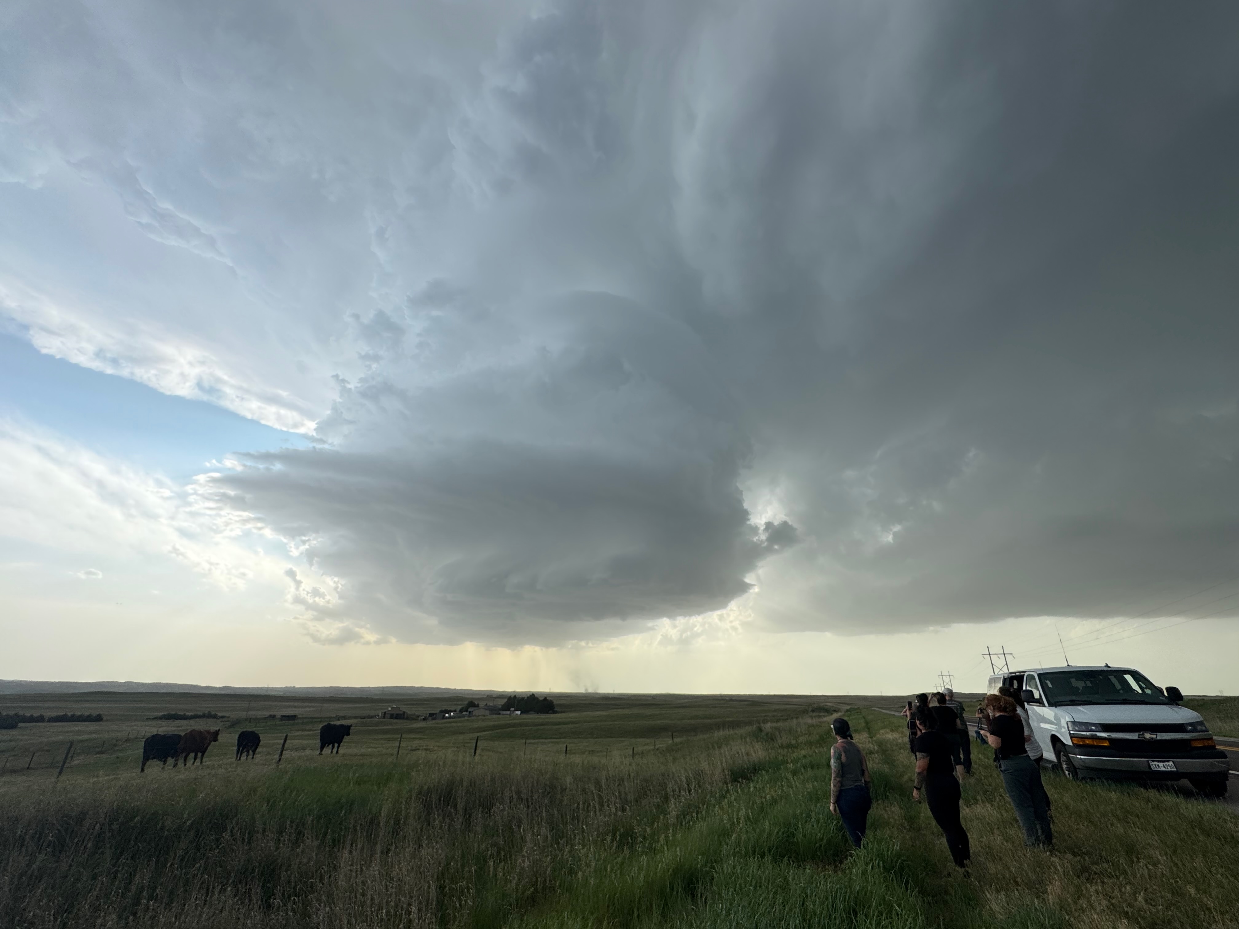
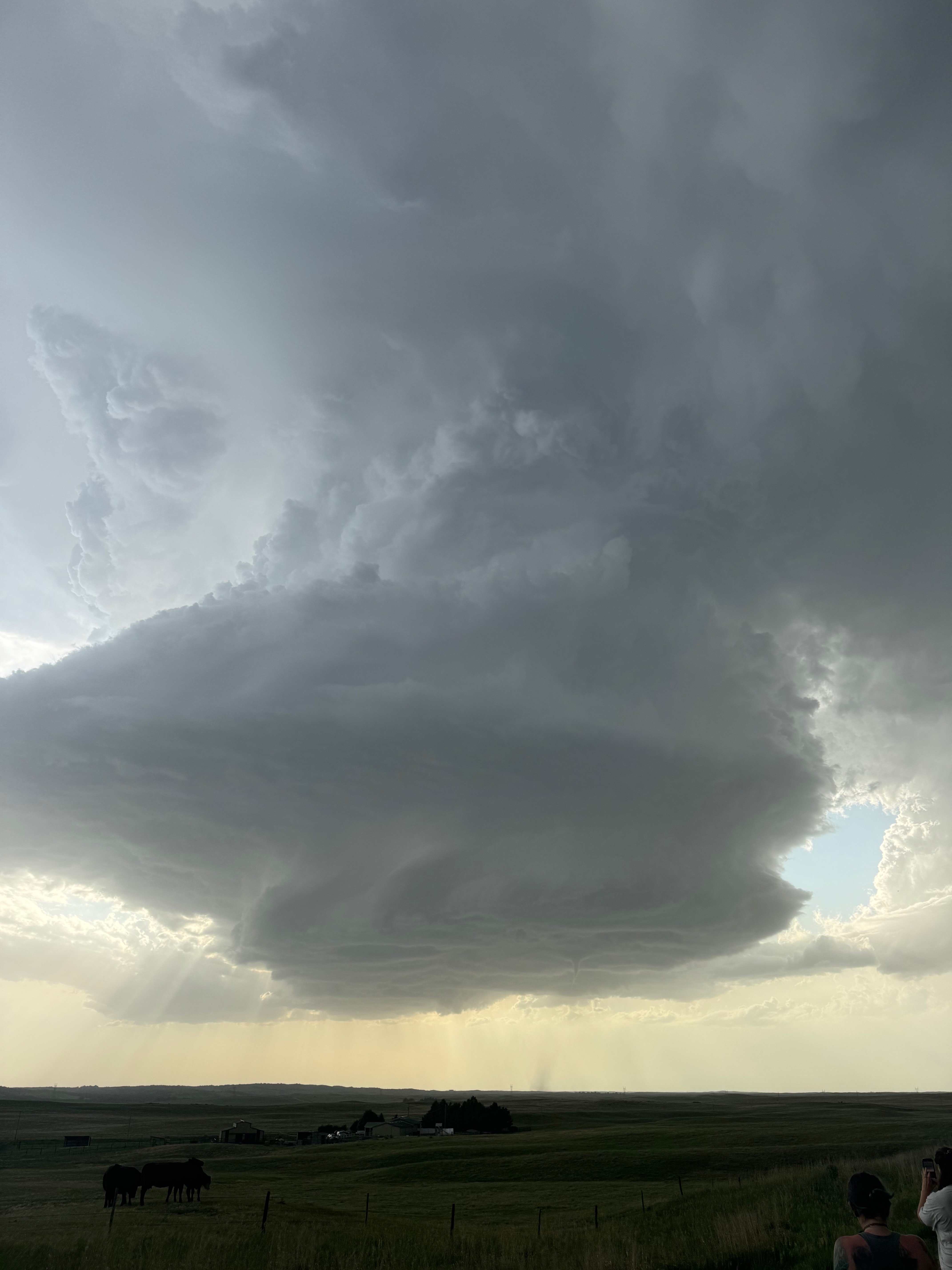
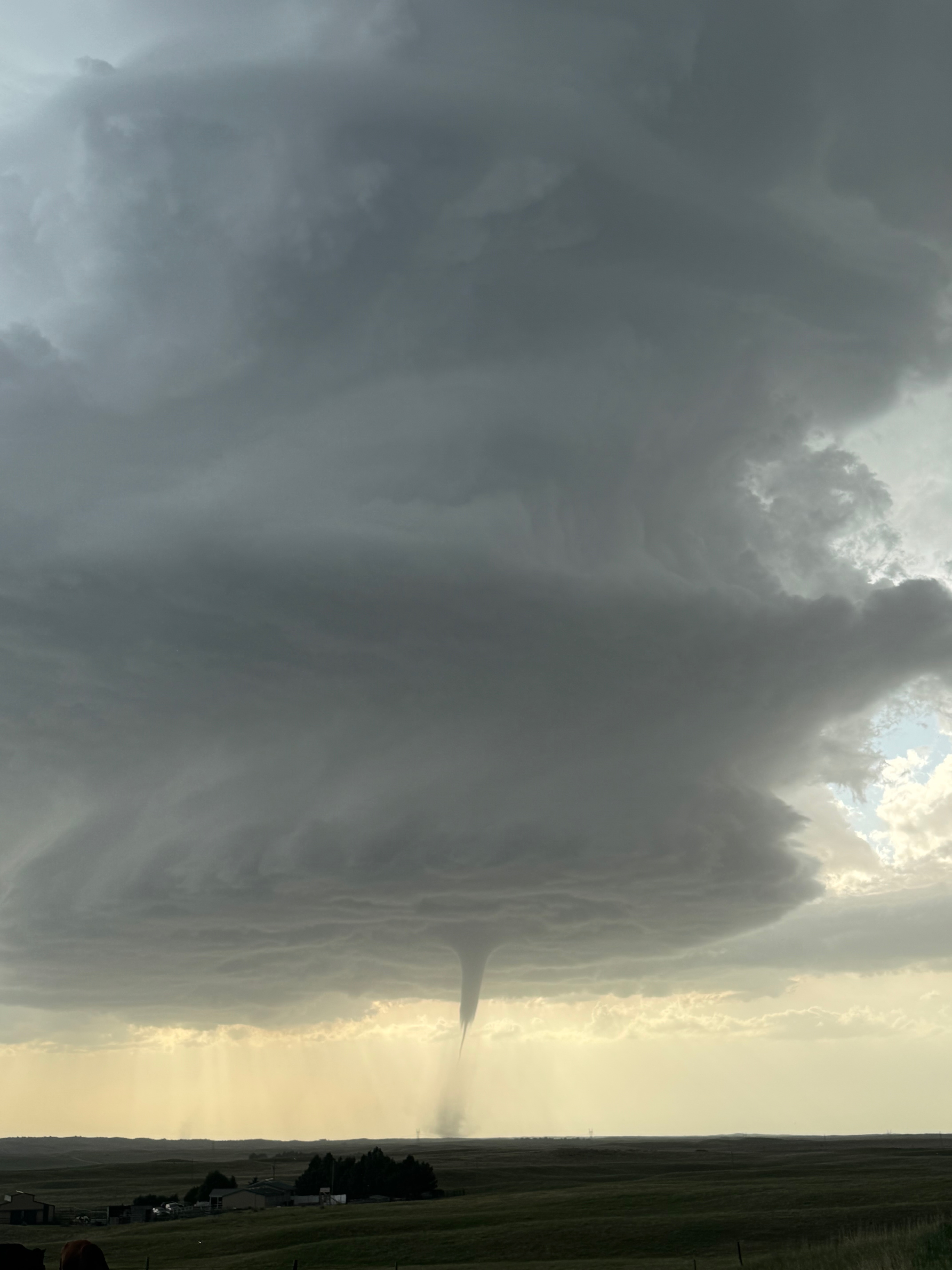
The storm base was west of U.S. 83 a little, so we went west on 23 several miles and stopped just short of the updraft (see images above, taken around 6:55 p.m. CDT). Wow — the storm was already very impressive with a strongly rotating updraft, and it was no longer moving to the north. It wasn’t moving much at all! This was now a surface-based storm. It was pretty much exactly what we wanted, and it was almost too good to be true. The base was right along 23 to our west and was on the high side. This storm was very LP-ish, and so we needed to back off a little in order enjoy the spectacle, right?!
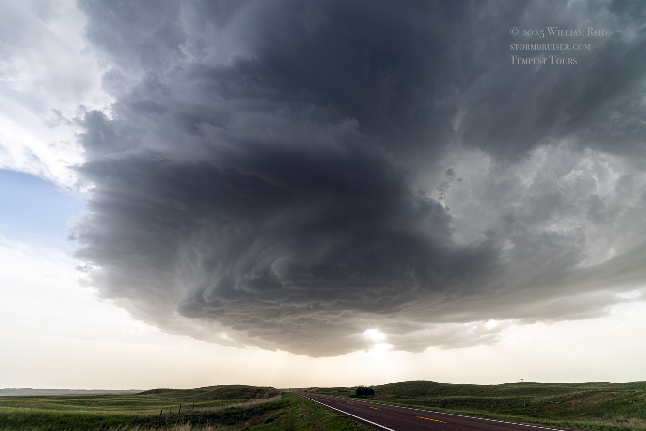
Unfortunately, I was not thinking “tornado” with this storm. I WAS thinking large hail. We were in a spot that was very vulnerable to large hail, so I thought it prudent to back off some. We went back east to 83 and south a few miles to a nice hilltop with a splendid view of the supercell structure. Here is a short clip during that repositioning, at 7:00 p.m. CDT, along U.S. 83 southbound.
Certainly this updraft would start to move a bit more in our direction and would approach U.S. 83. But for now, this was perfect. I set up the Canon camera with the wide lens onto the tripod for video. This would make for a very cool time-lapse!
Let’s sneak in a half-dozen shots off of the Canon of the new Wellfleet supercell updraft and base. The first two are from the cemetery and the next three are from Highway 23, between Dickens and U.S. 83.
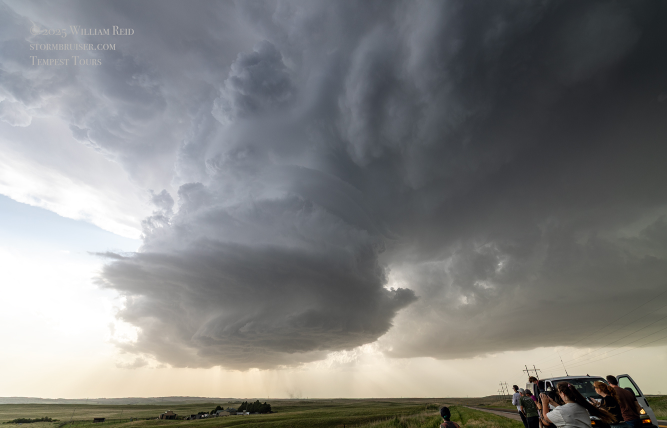
Around the time that we were approaching the storm base on Highway 23, Chris Gullikson shared his view of the storm with me, see image below. This was a very healthy storm! Chris and crew were still a good 30 miles or so distant, along I-80 and west of Sutherland. They would soon dive south from Sutherland to Wallace, and turn east on 23 towards Dickens and come up to the west/back side of the storm in time.
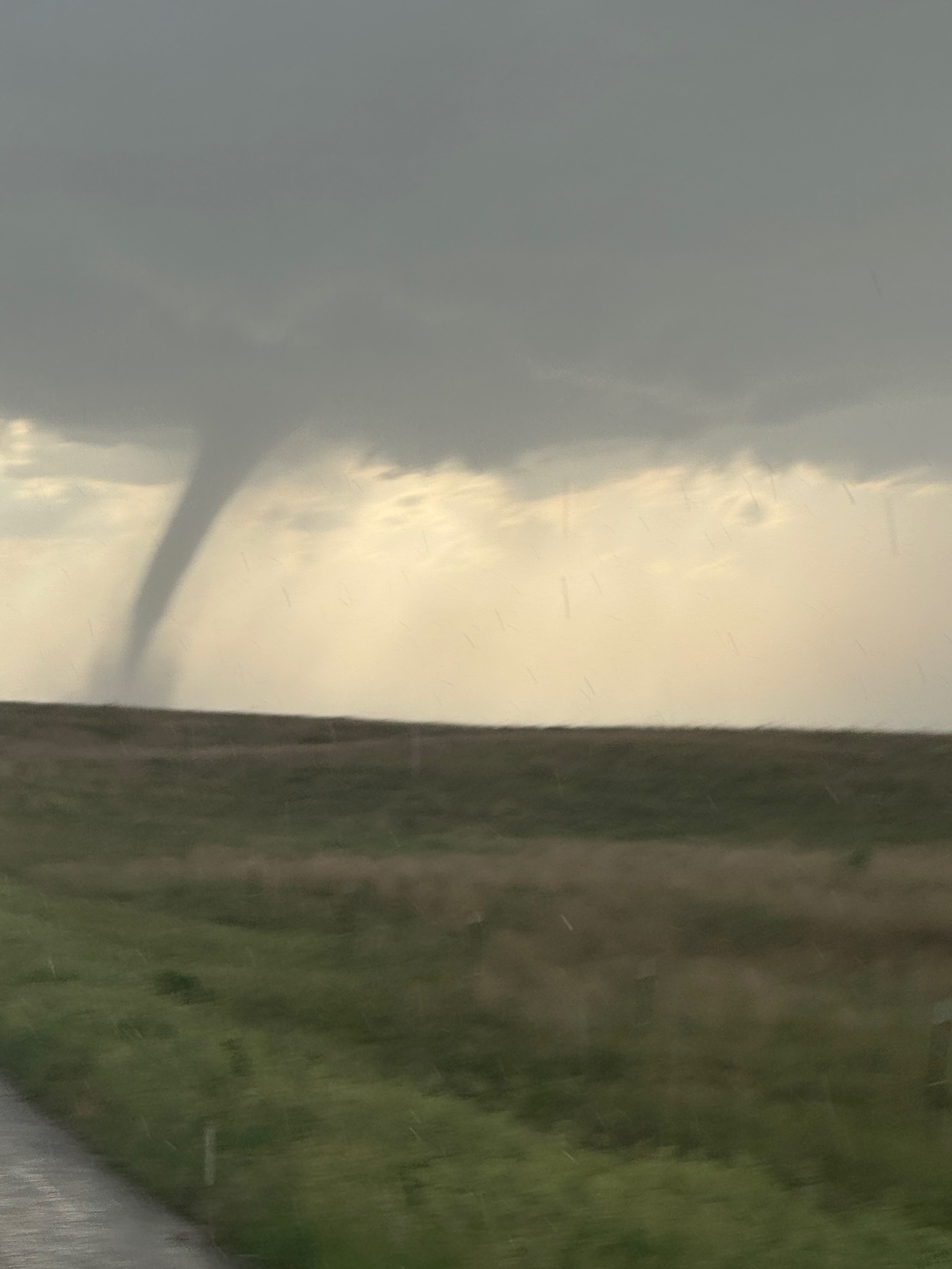
Within a minute or two of stopping on 83, and just a minute or two after 7 p.m. CDT, we were seeing dust get stirred up right below the updraft base to our WNW. Was this high-based thing going to tornado for us, right after we were sitting right next to it? Yes. I set up the Panasonic camcorder so I could easily zoom in on any tornado development. And develop it did — we had a splendid tornado to observe and photograph for about the next 55 minutes!
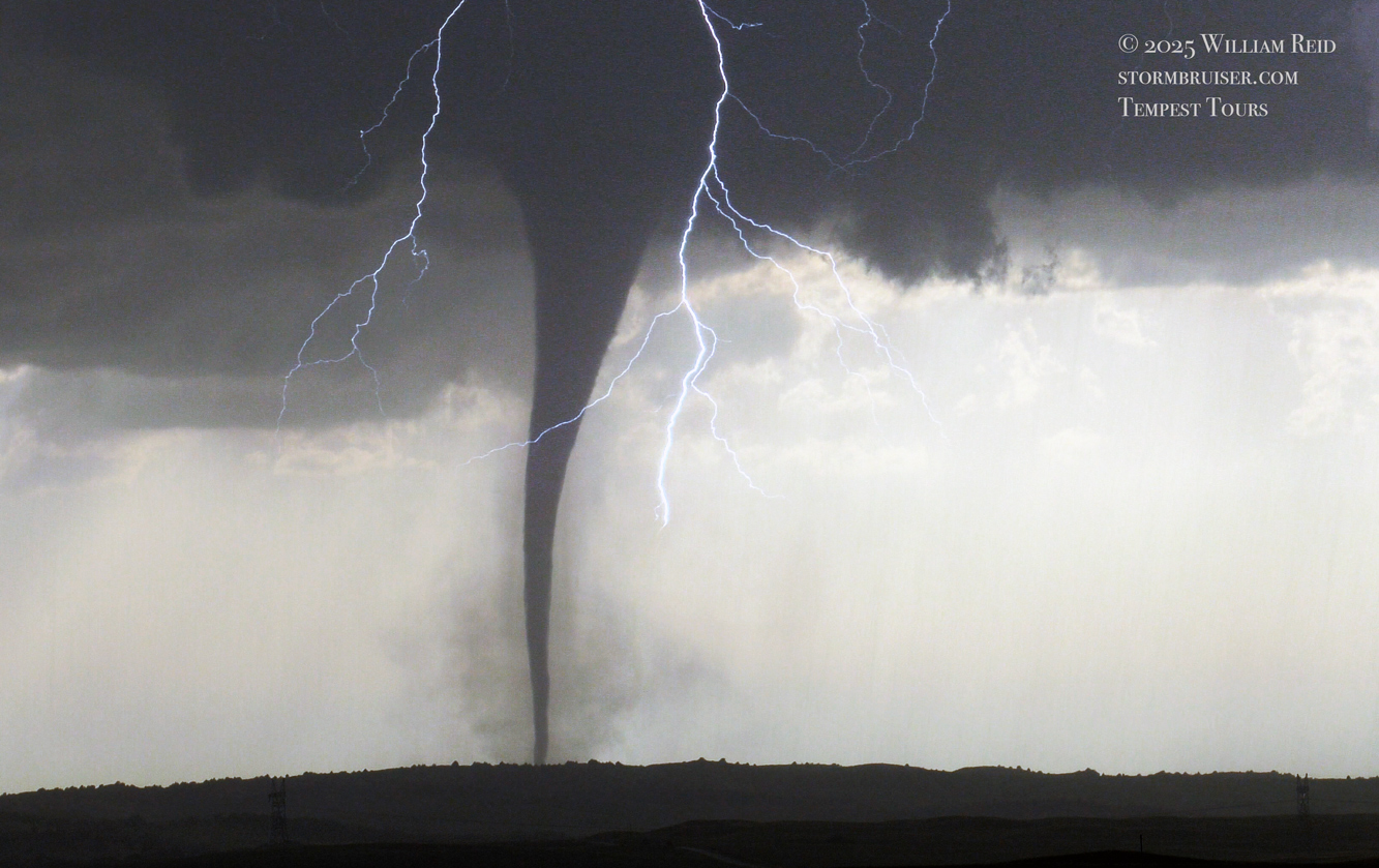
I took a lot of photos on my iPhone and my Canon cameras, long lens and wide angle. Imagine that! Since I have so many images to share, I am breaking this Wellfleet/Dickens tornado account into two parts. The part that you are looking at now is the “account” with the iPhone images. A second (Part 2) web entry includes the images off of the Canon cameras. Somewhat higher quality tornado and lightning shots are on that Part Two page.
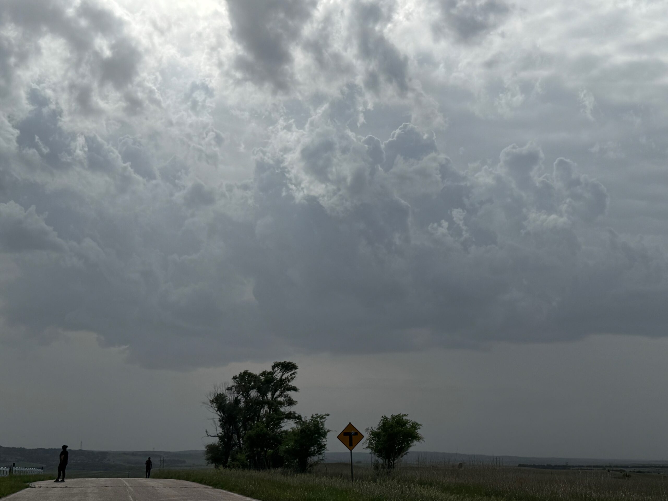
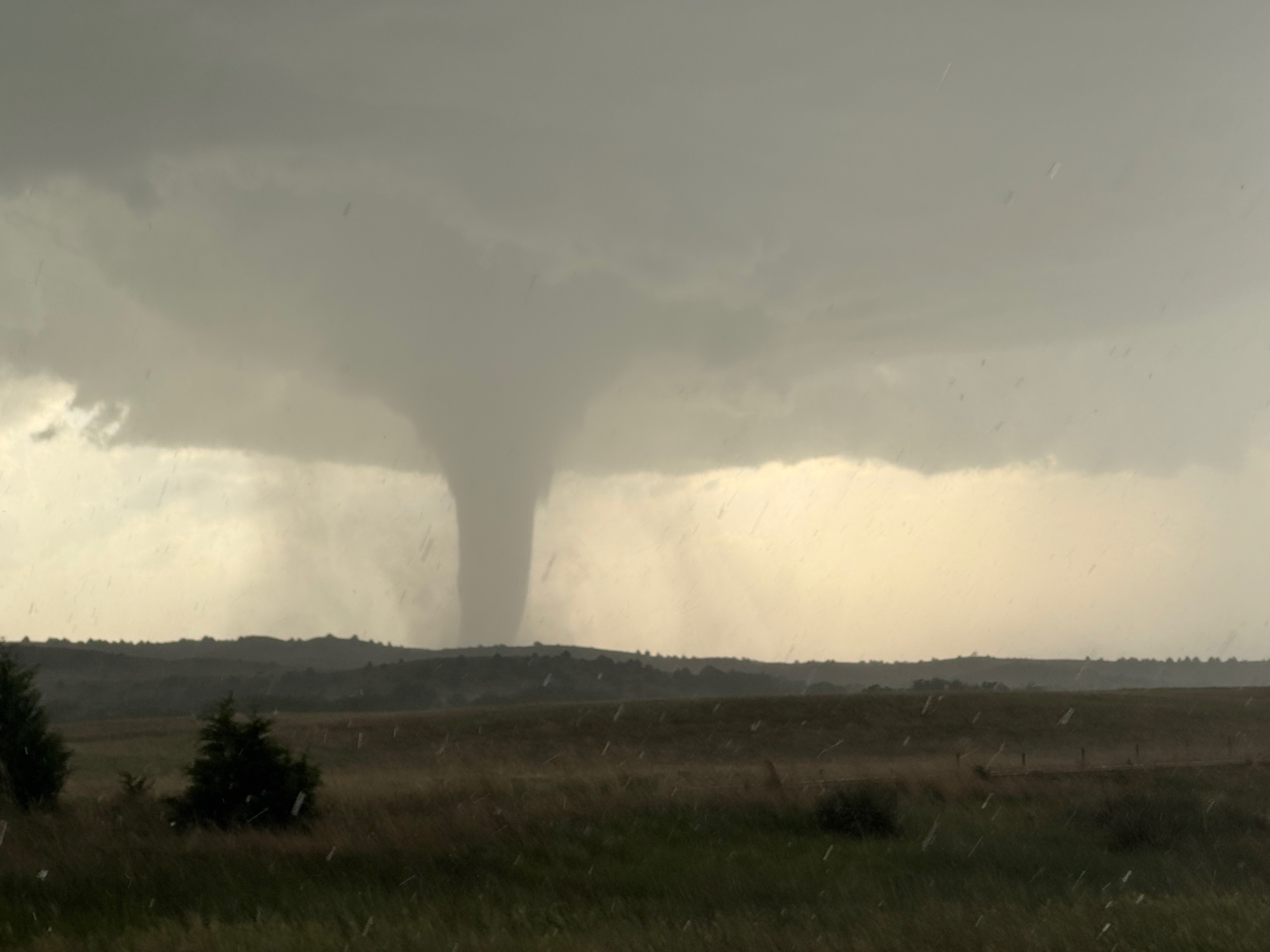
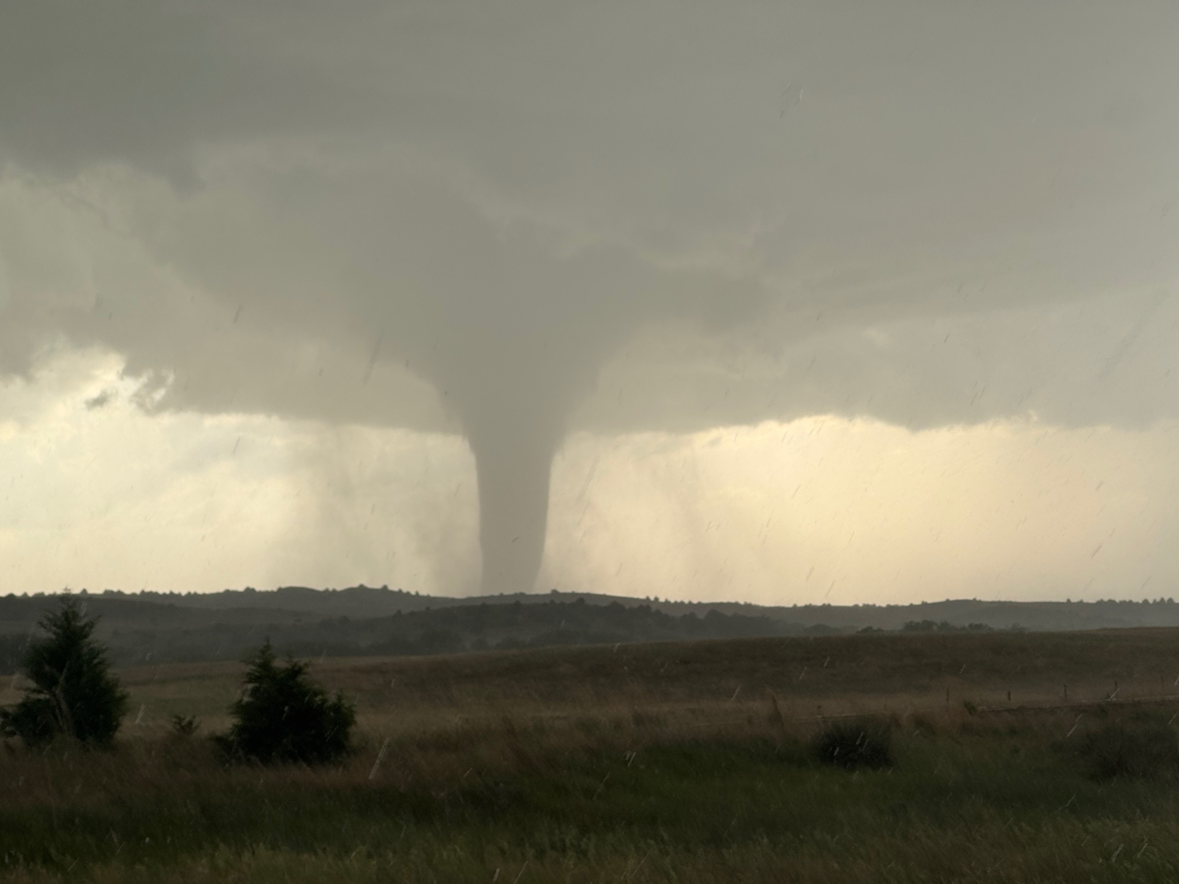
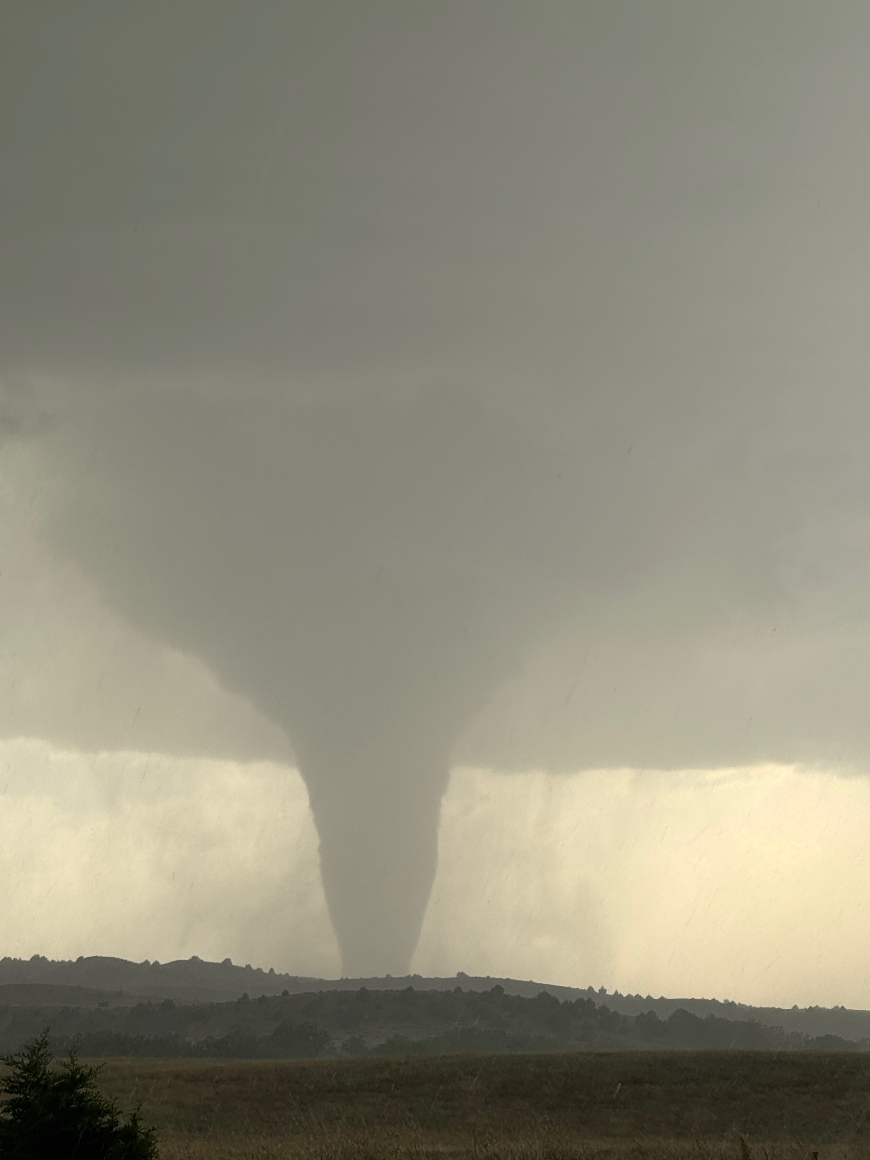
The dirt and dust stirred beneath the storm base for a few minutes, and after maybe five minutes a narrow funnel cloud started to descend. A pretty tornado #1 lasted for around another 4-5 minutes and dissipated (see first 14 images of the 30 below). This “first” tornado was somewhat landspout-ish in character and appearance. It was close to Highway 23 and it did not move much at all.
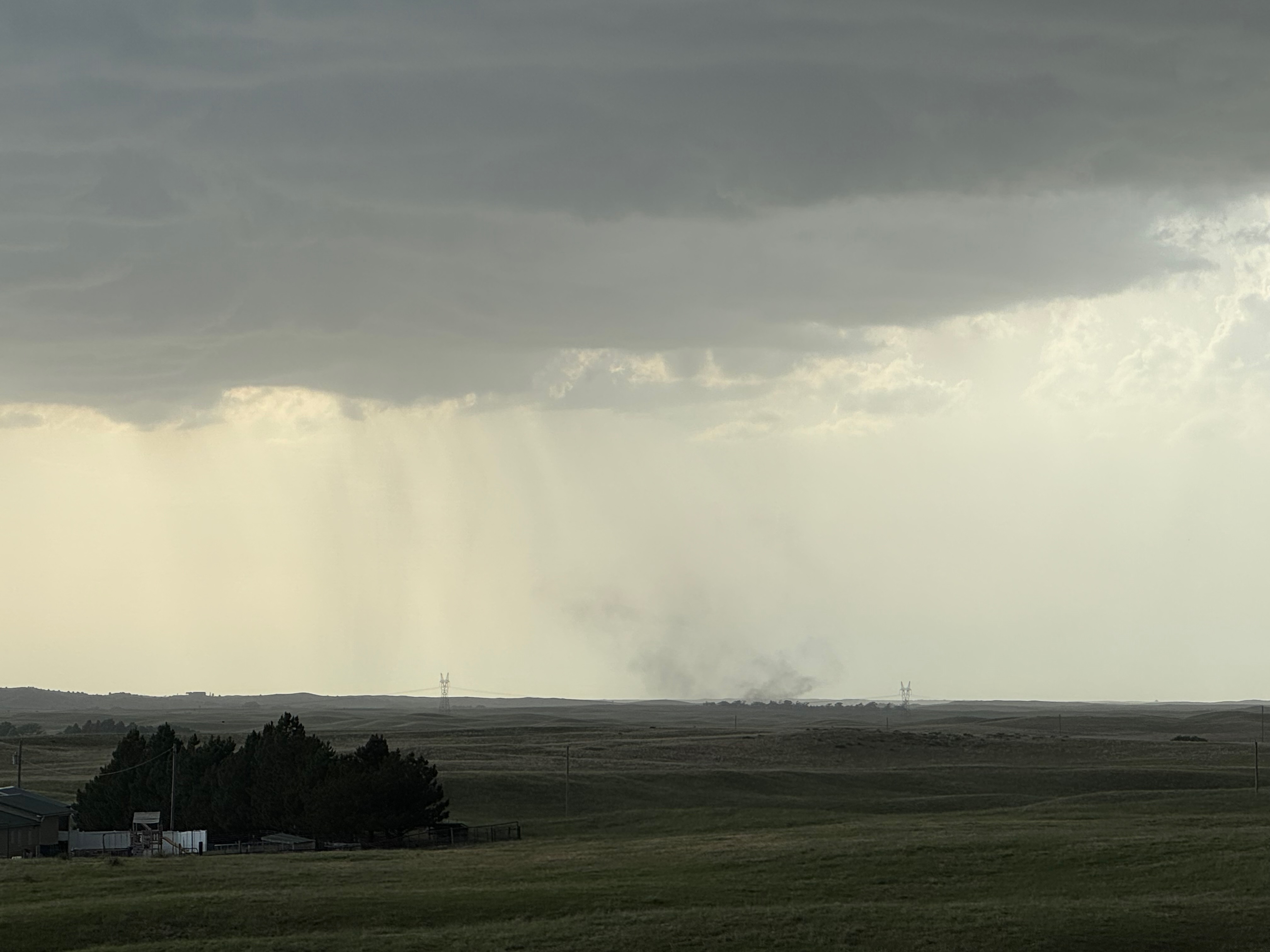
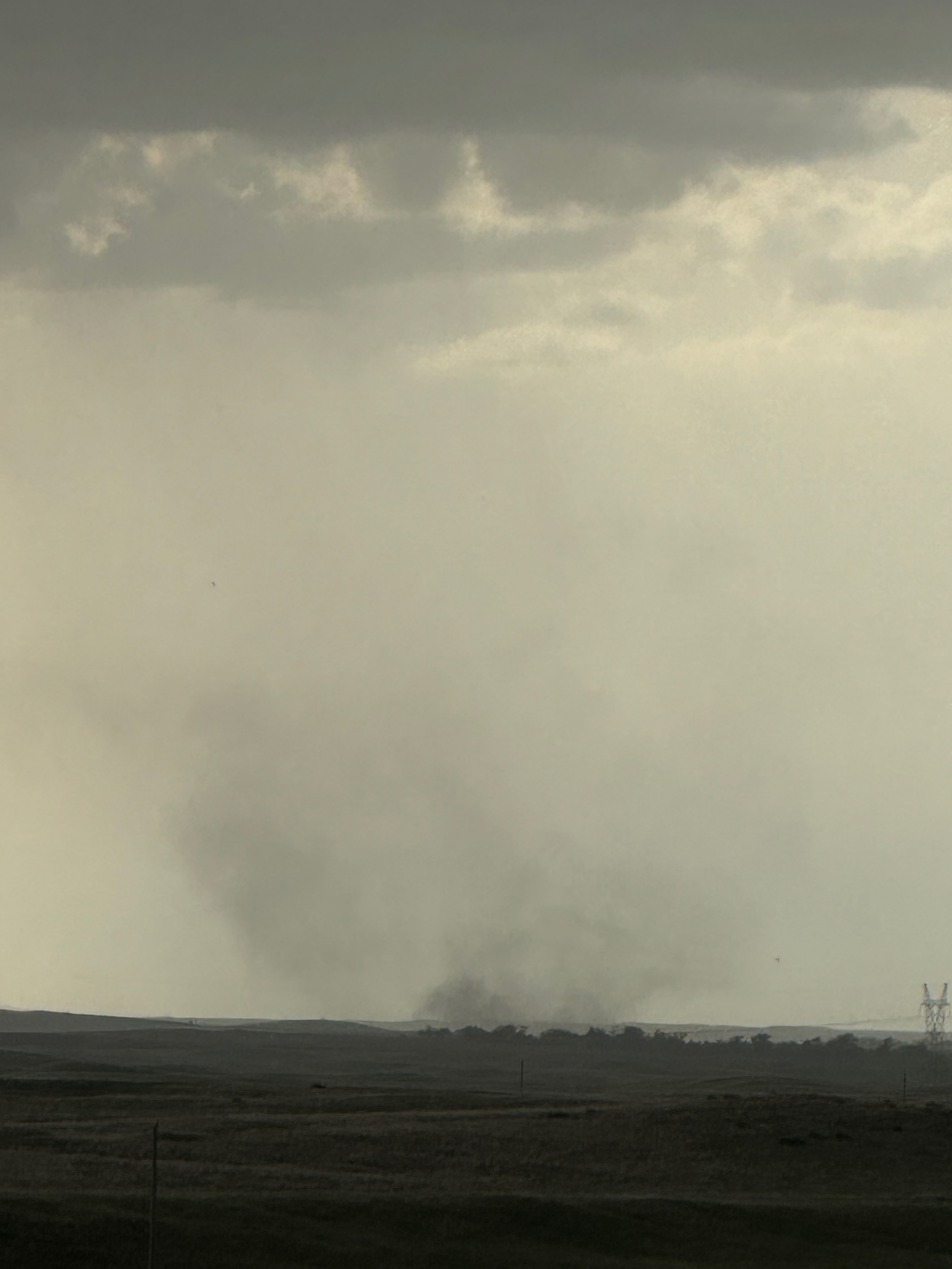
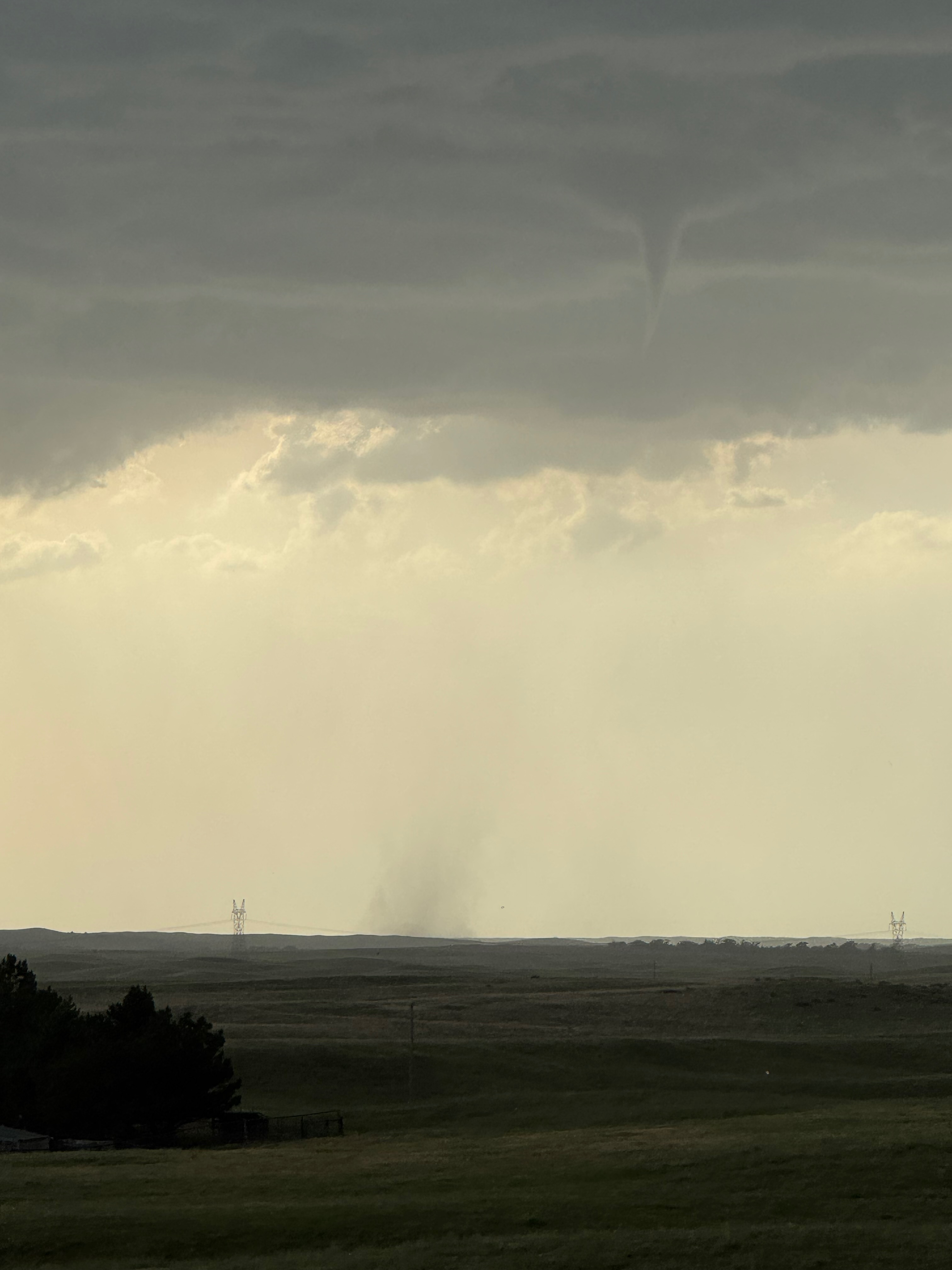
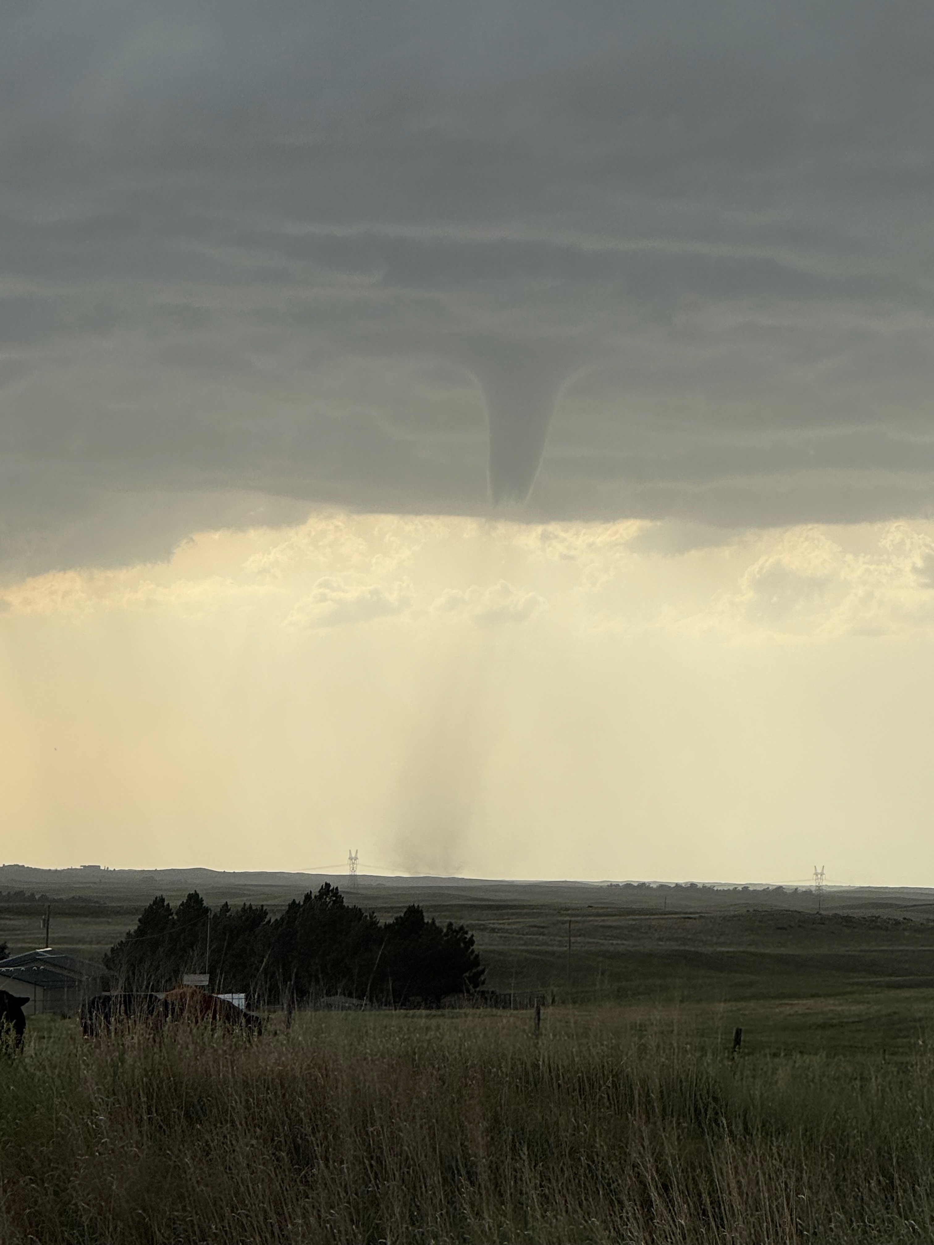
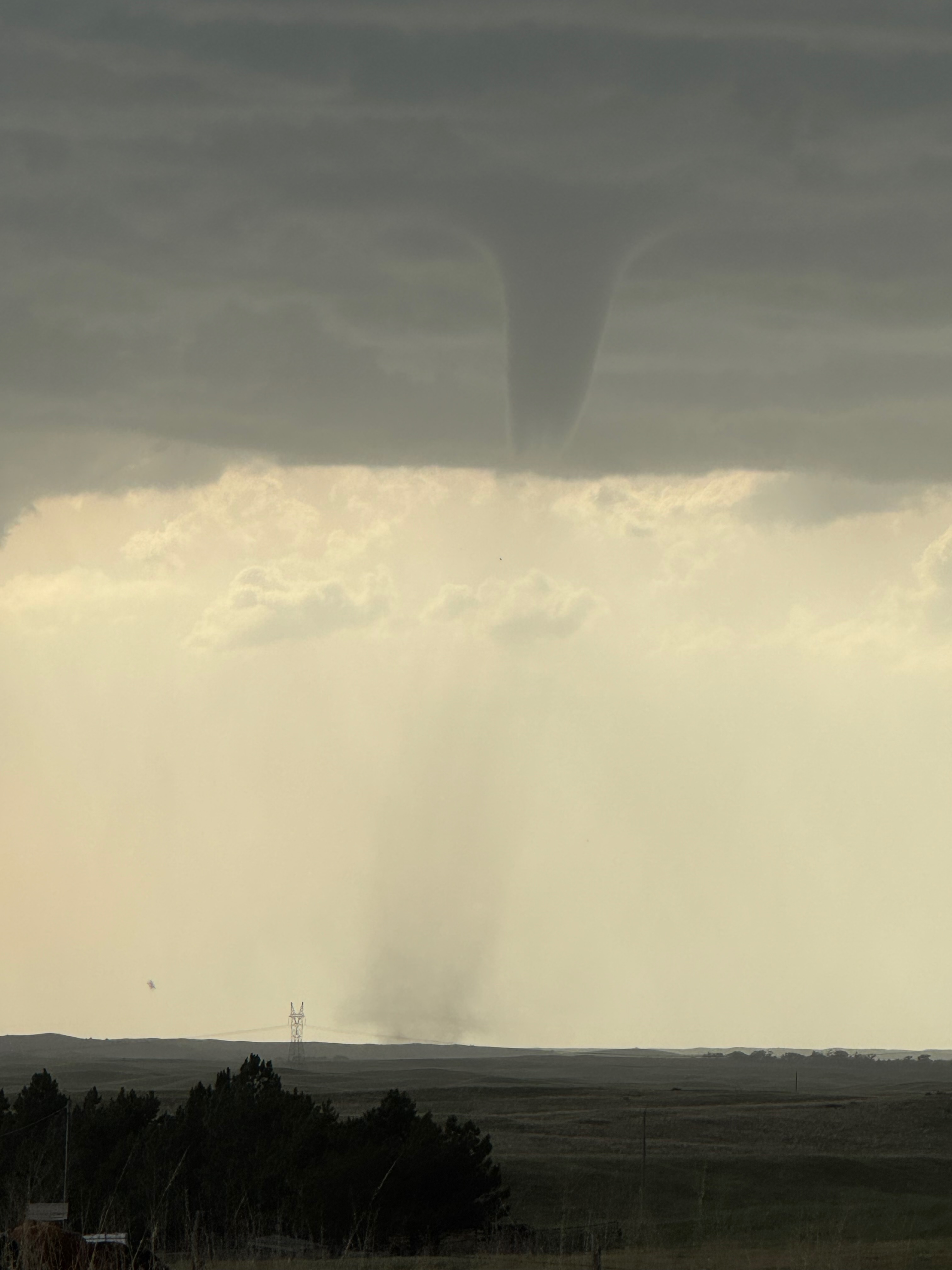
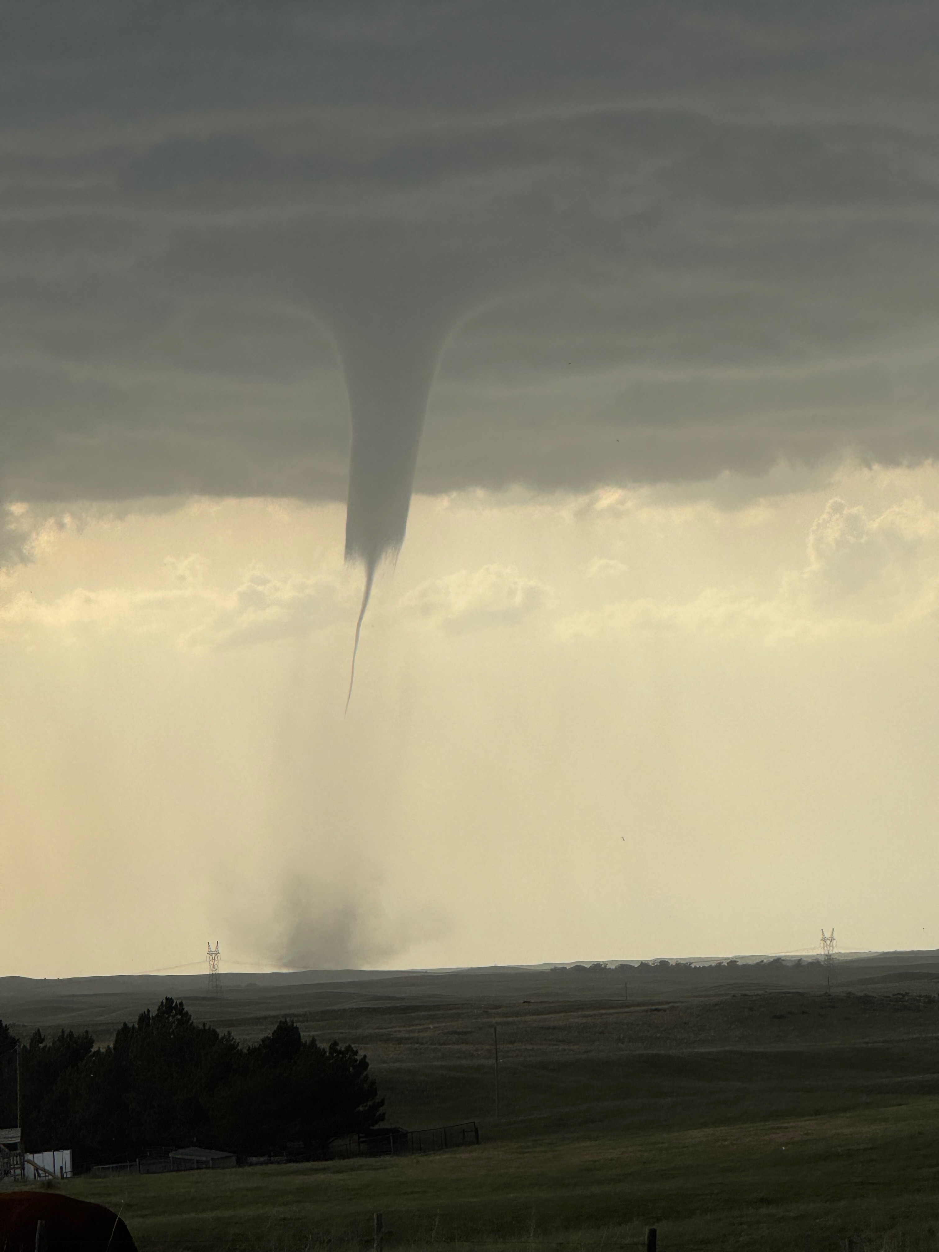
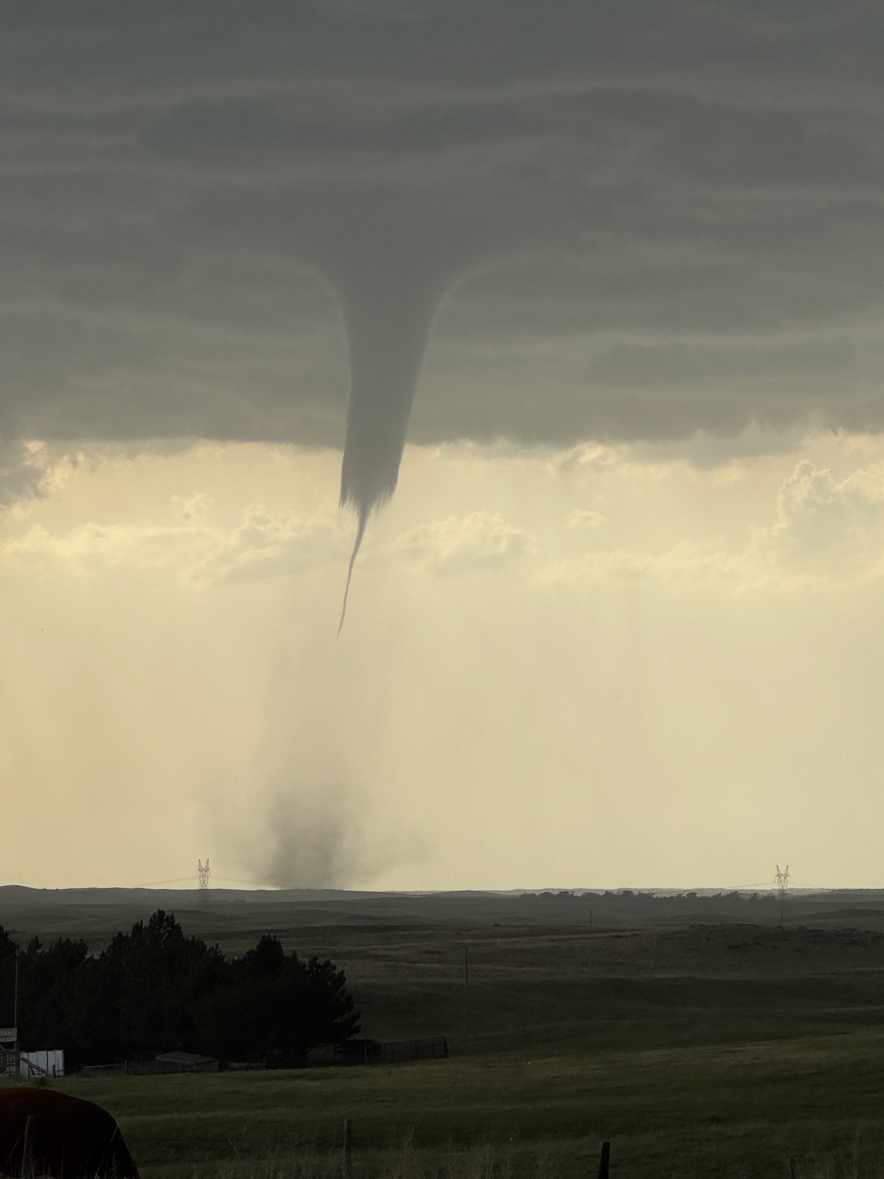
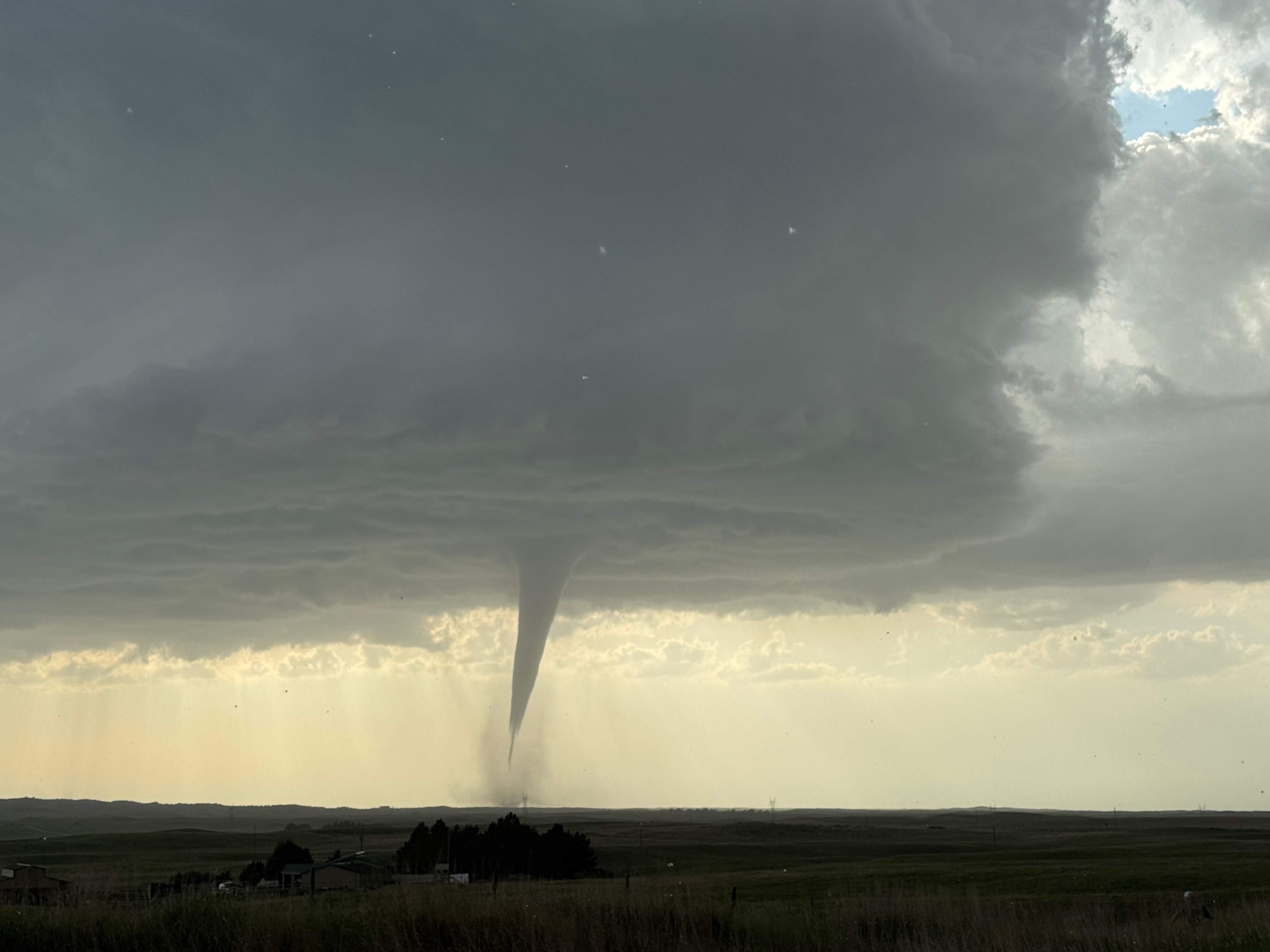
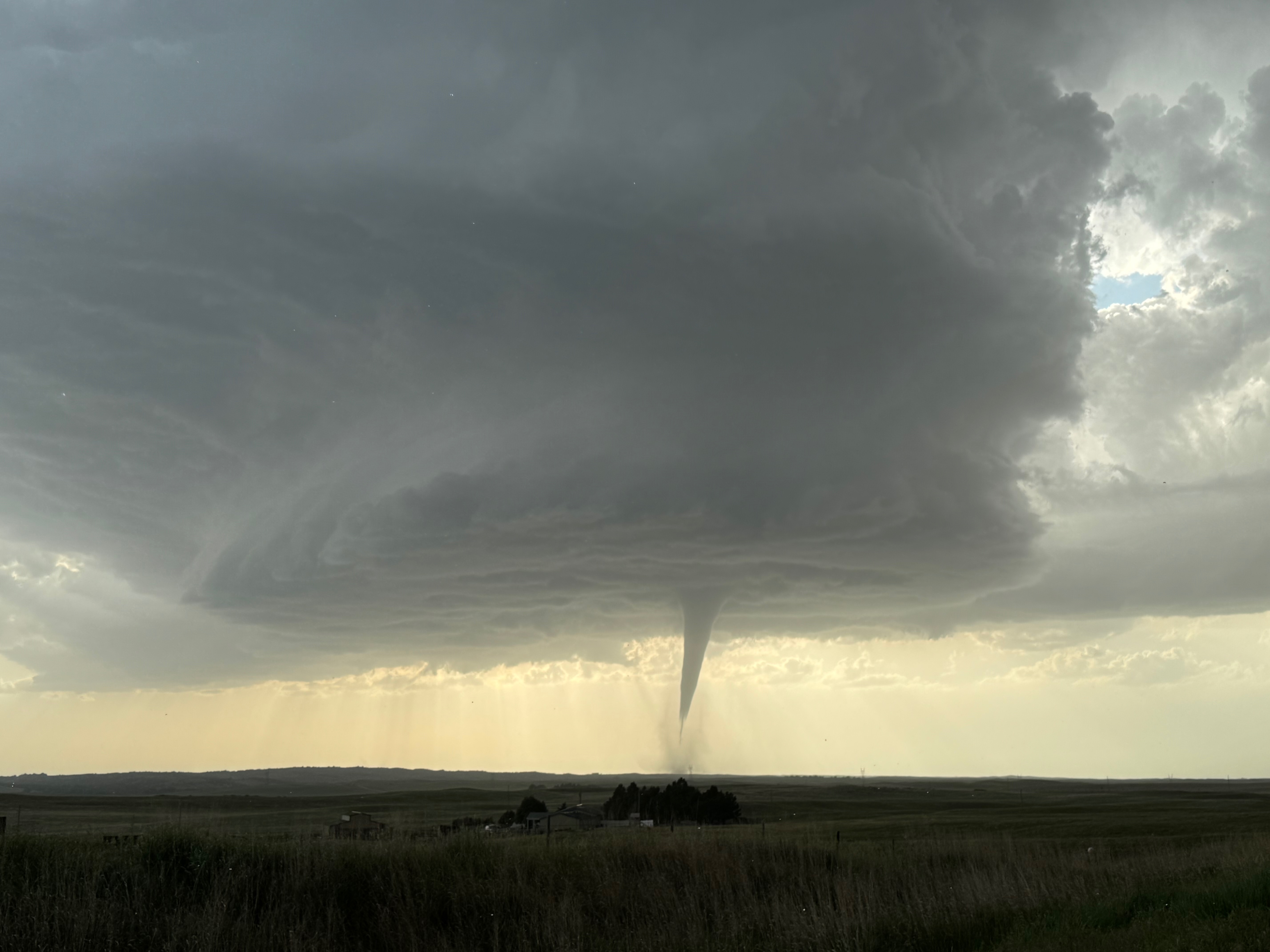
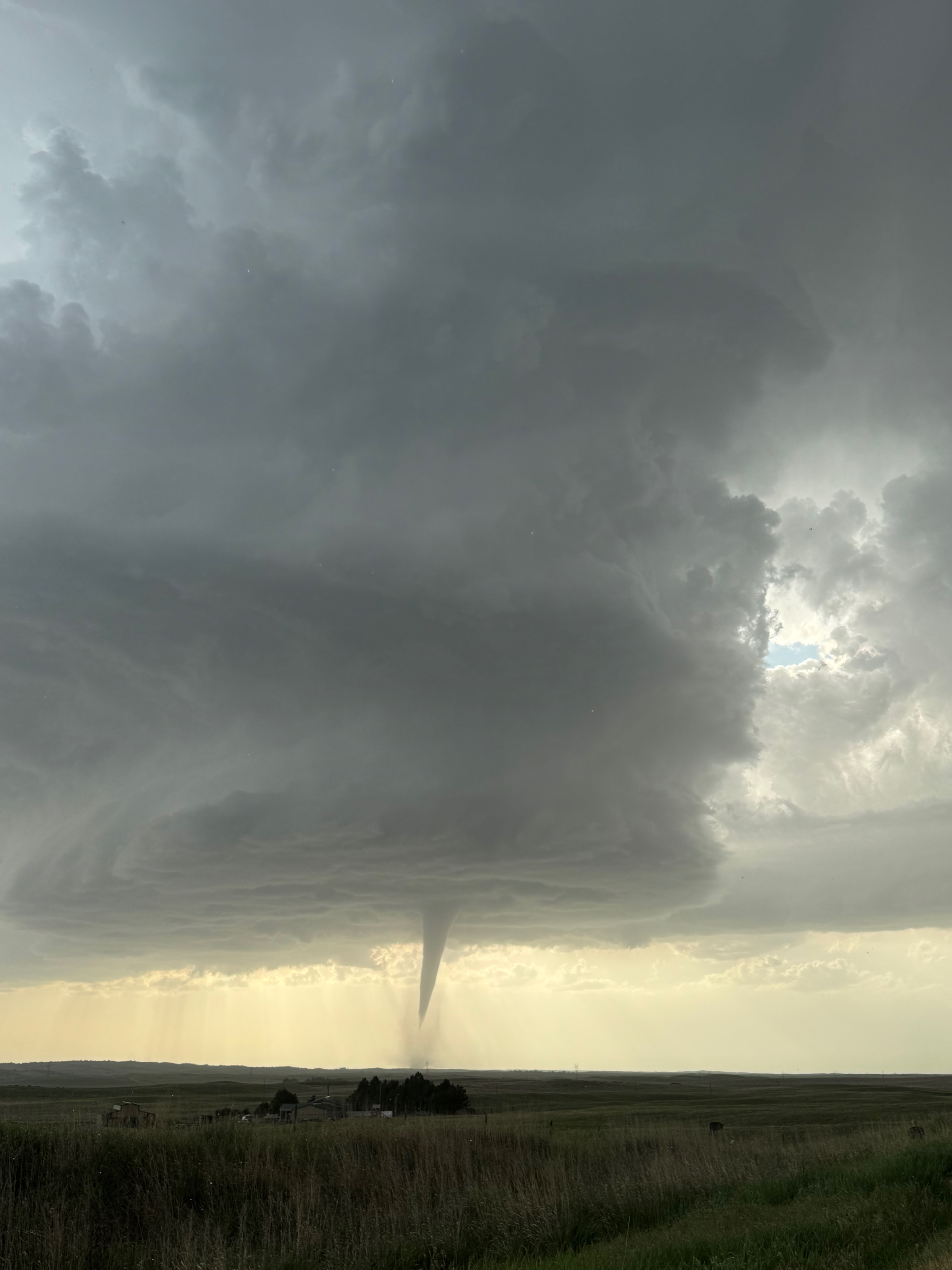
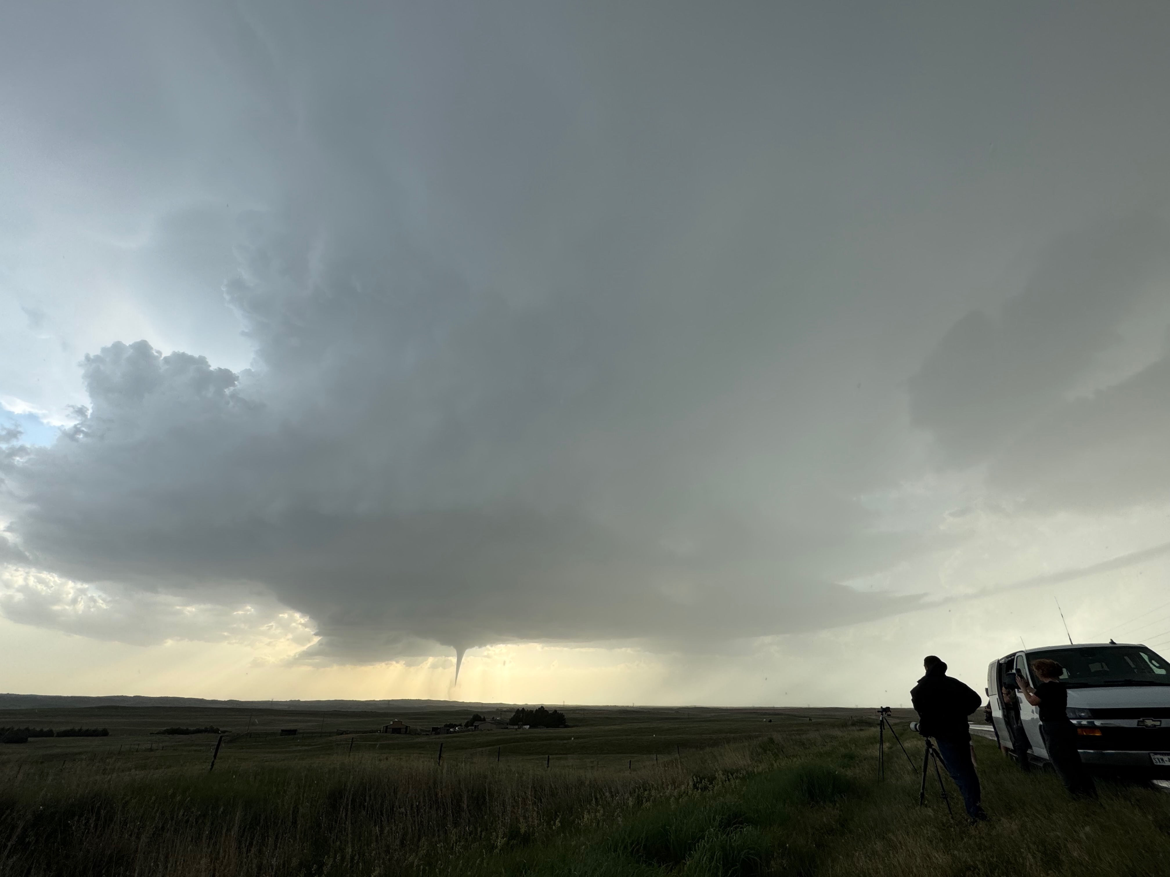
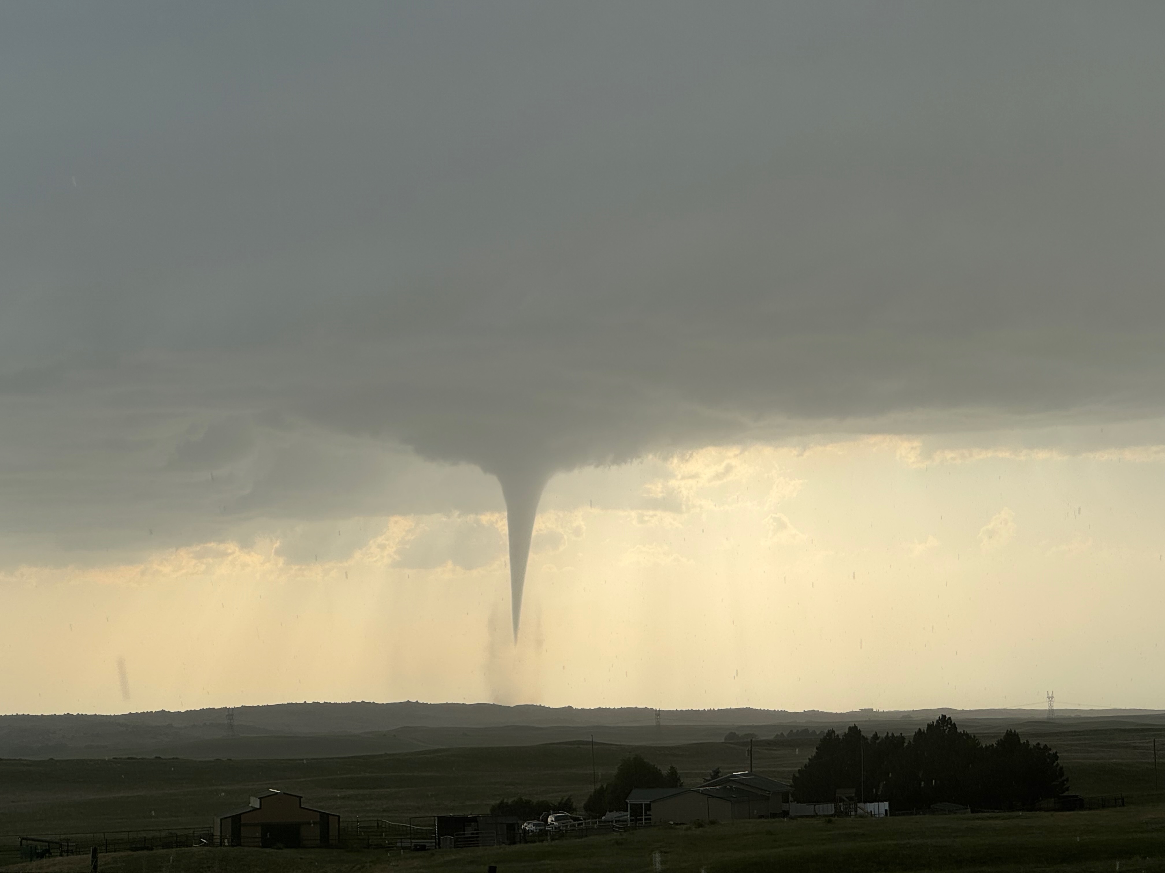
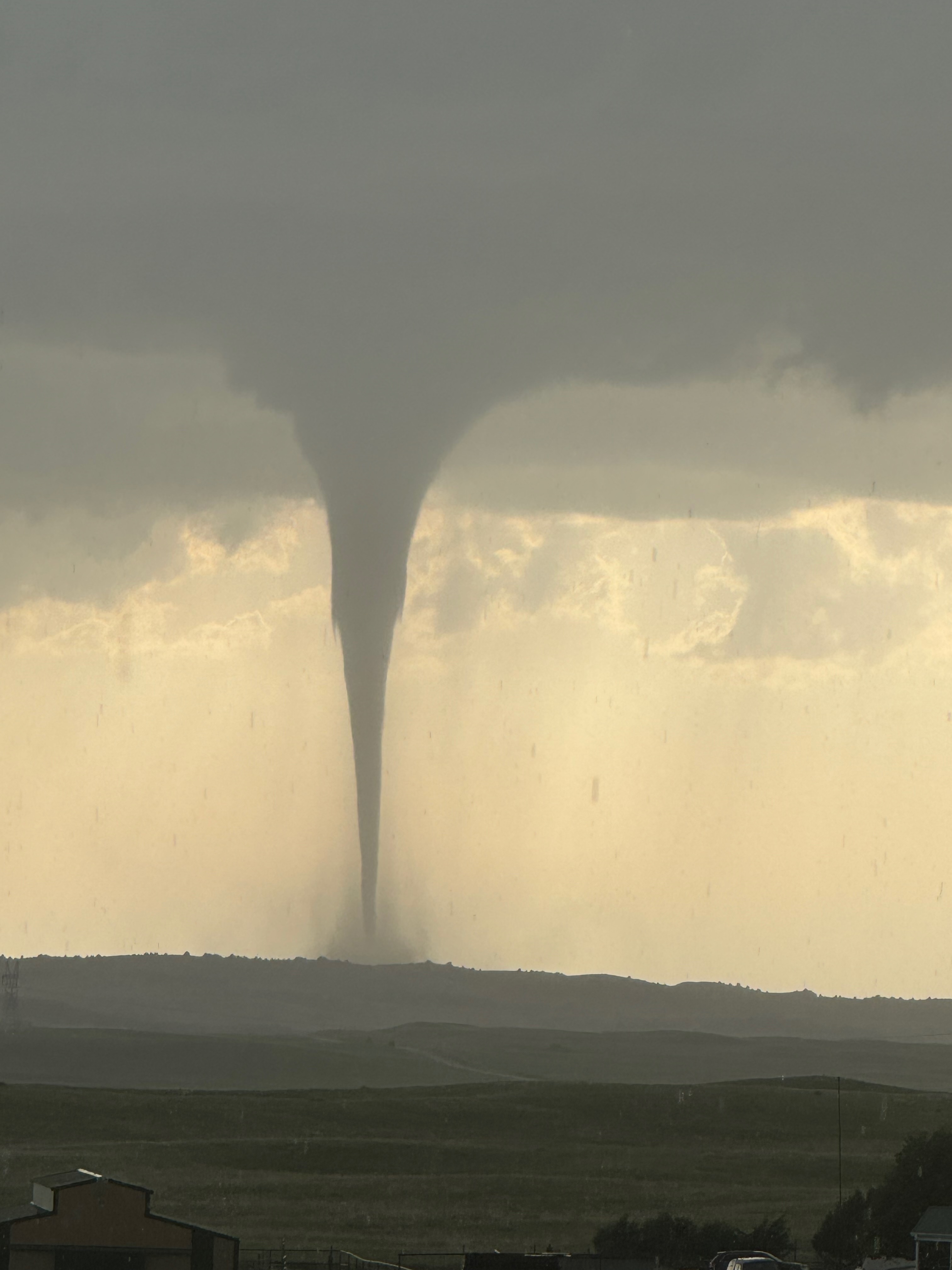
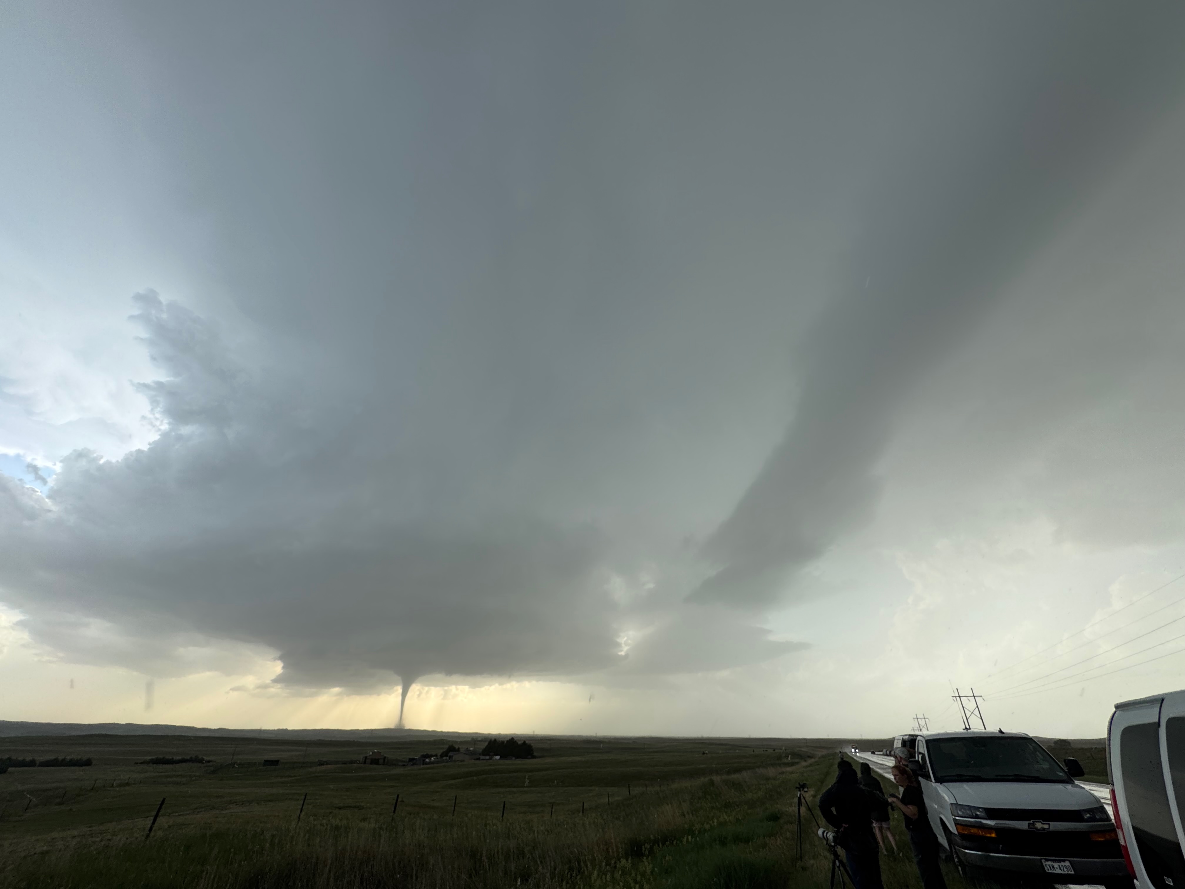
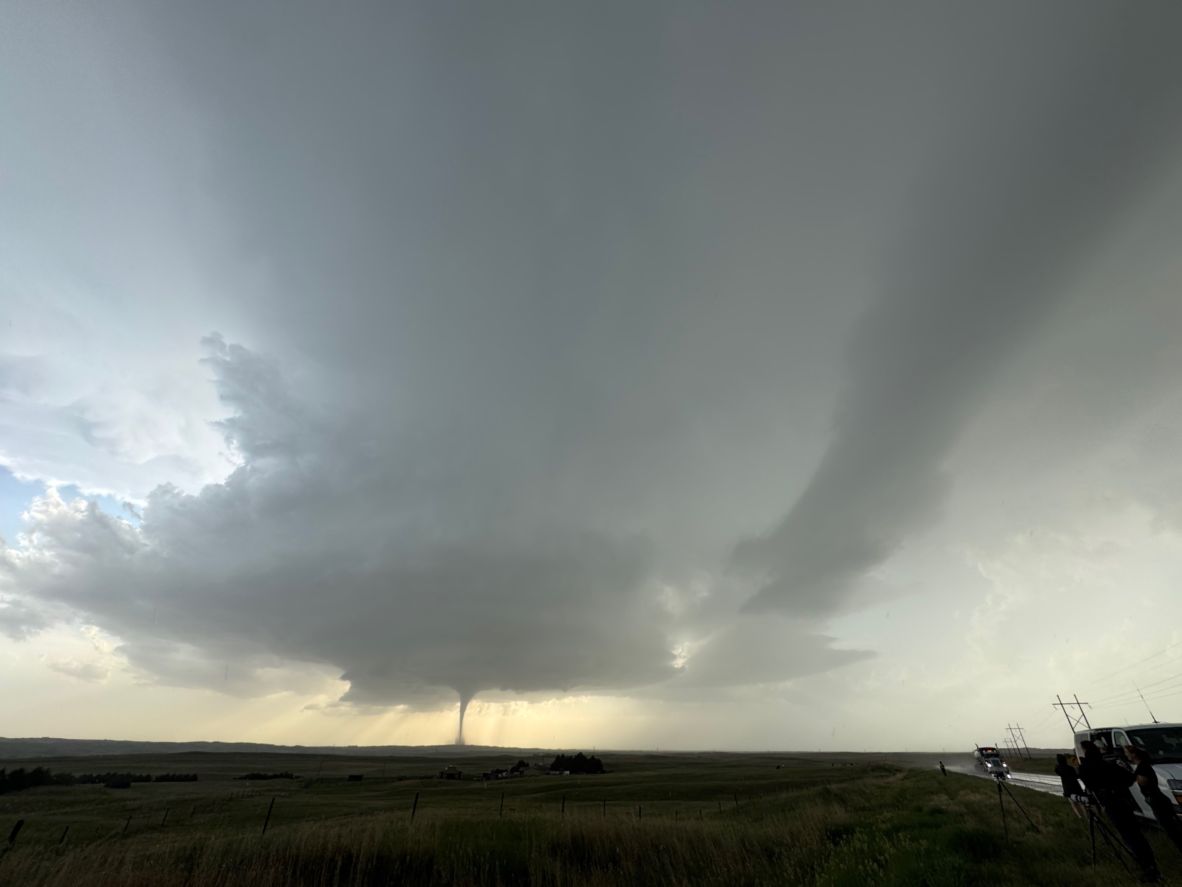
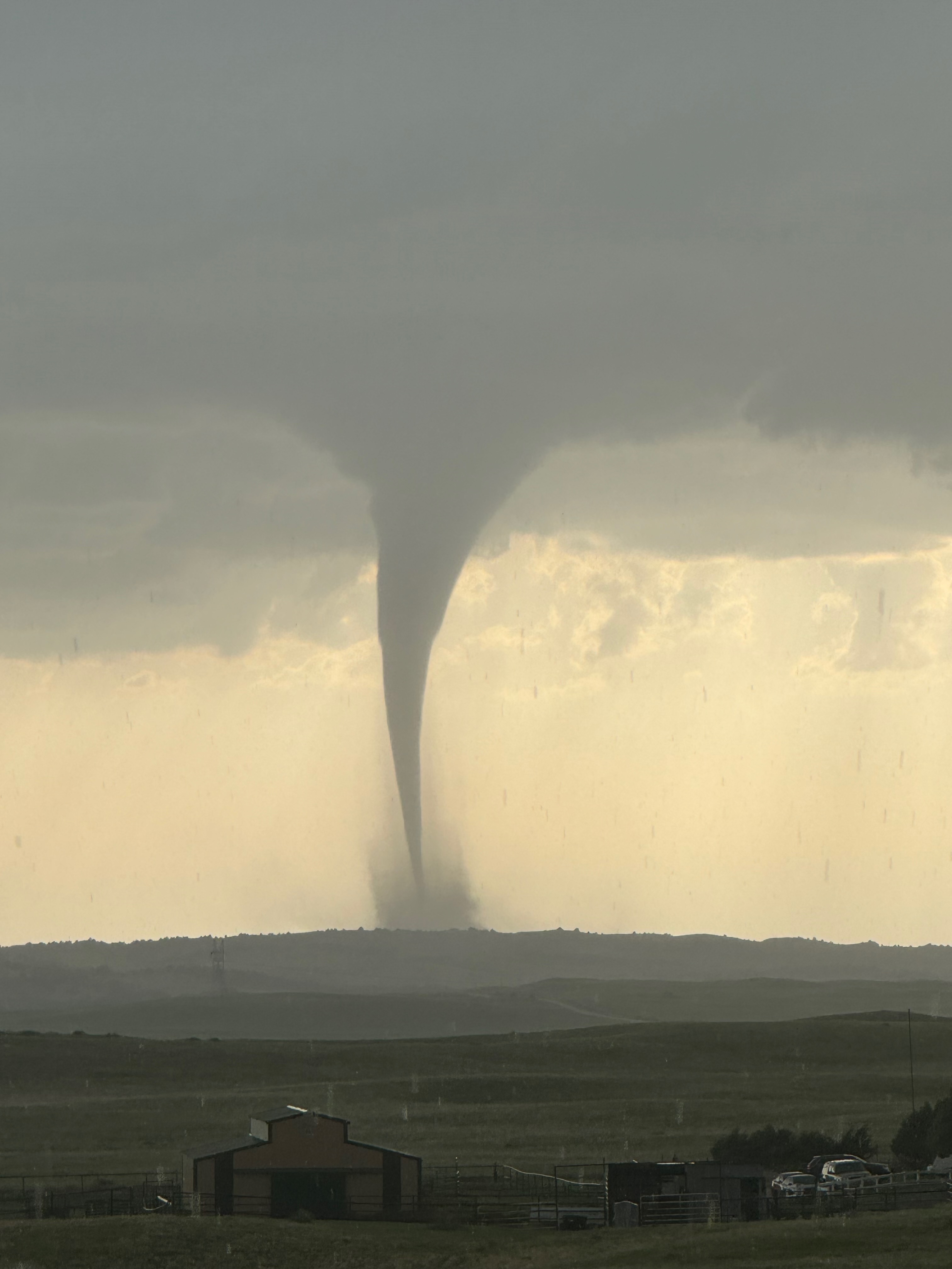
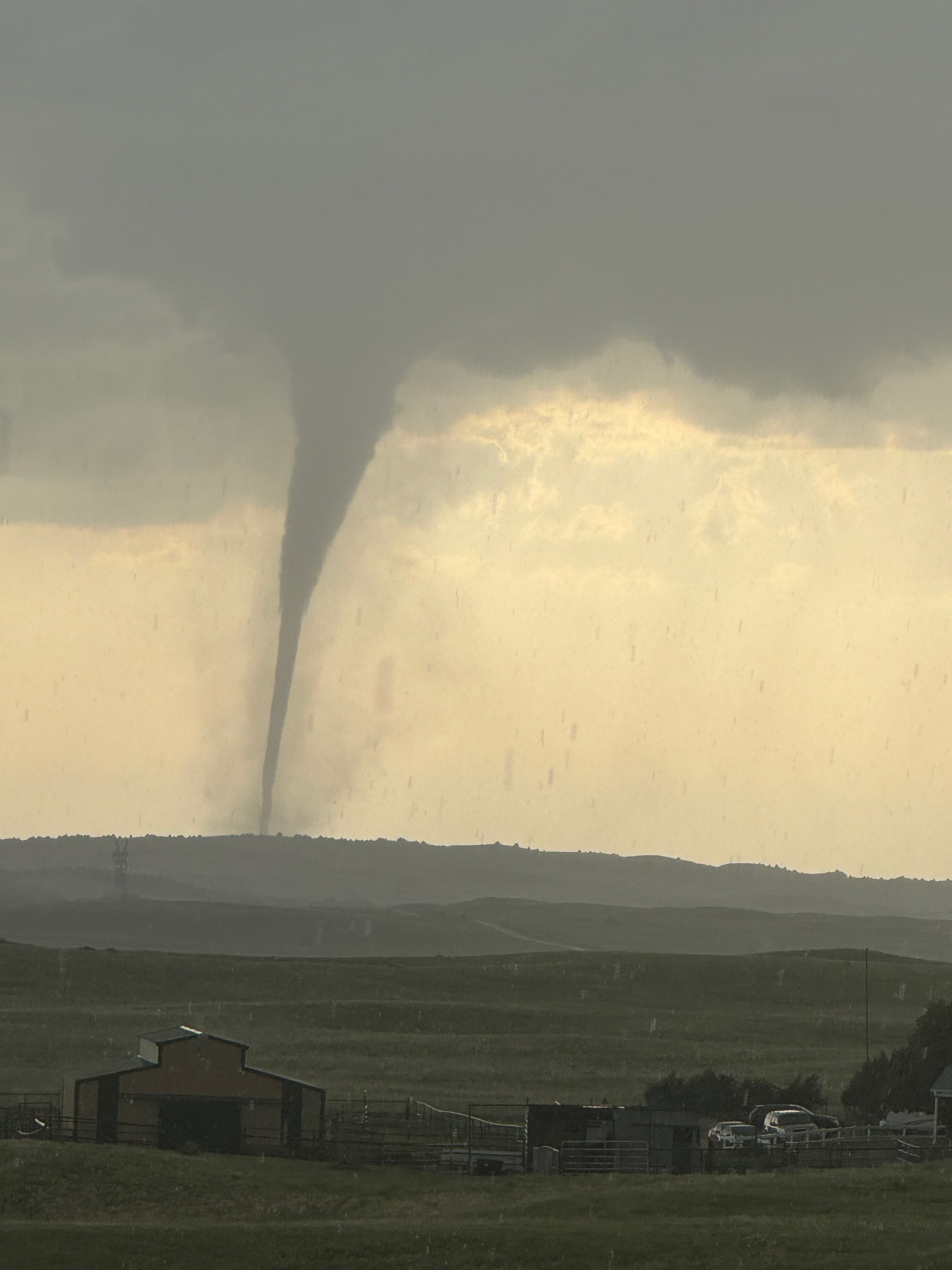
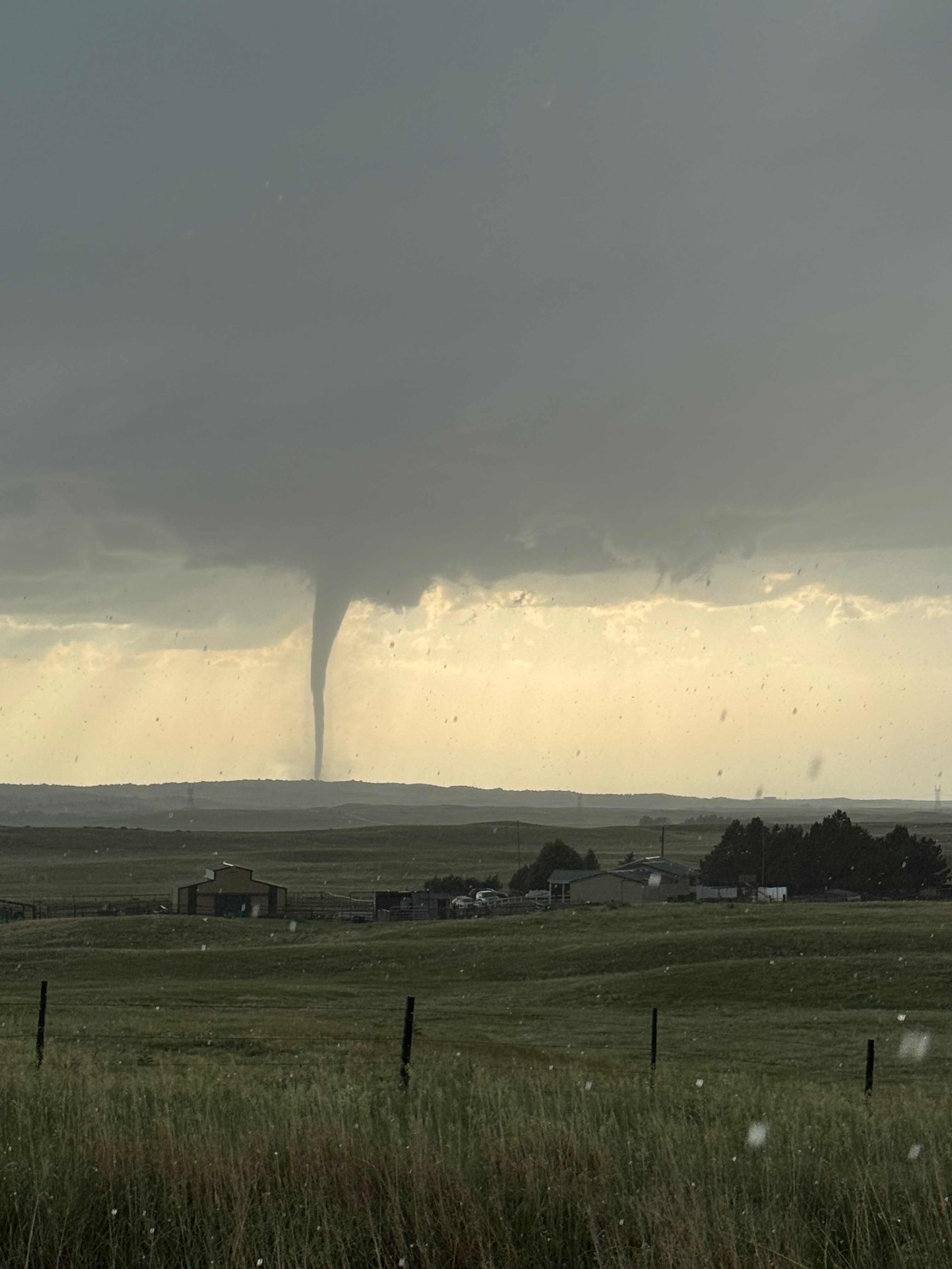
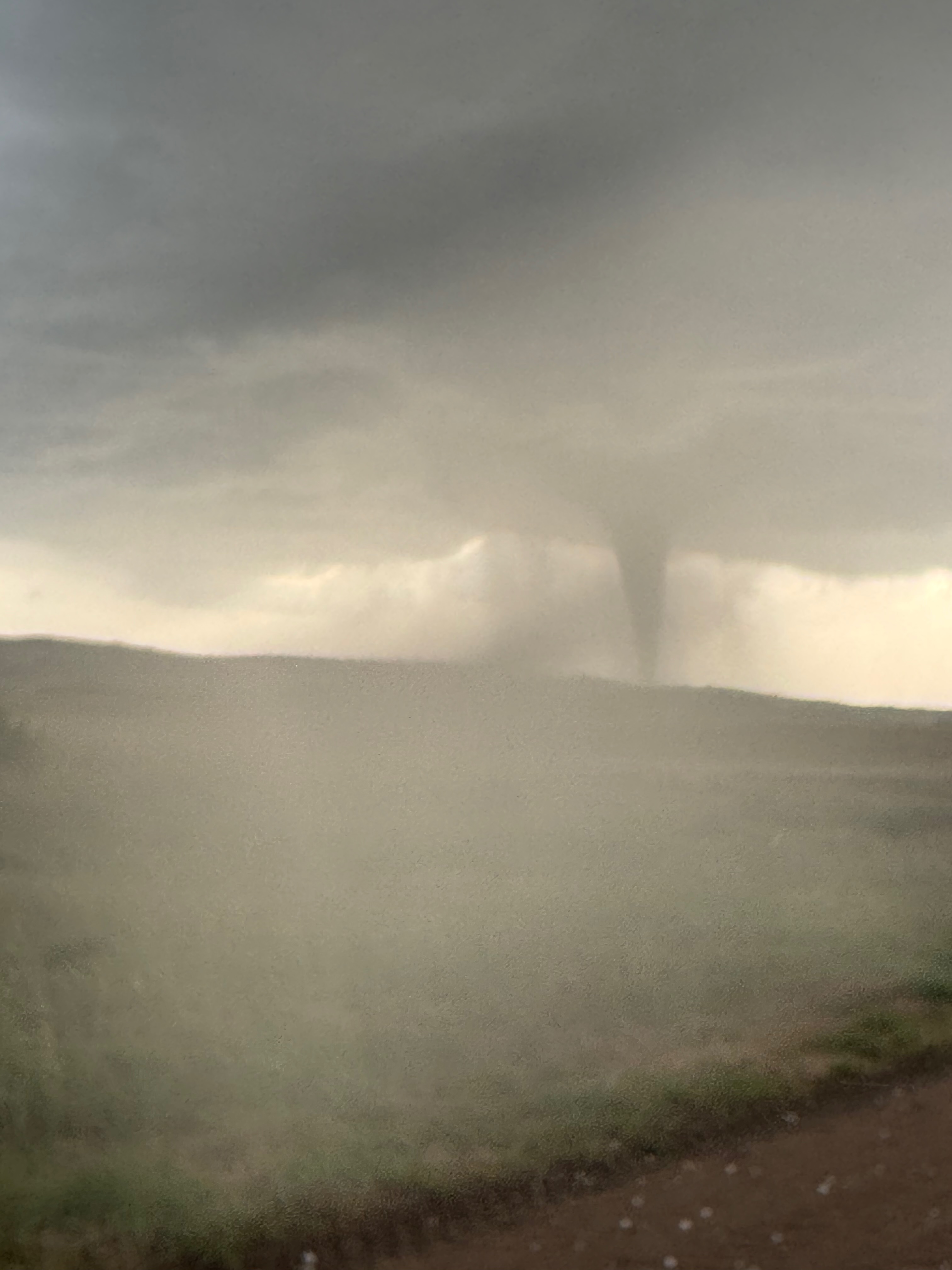
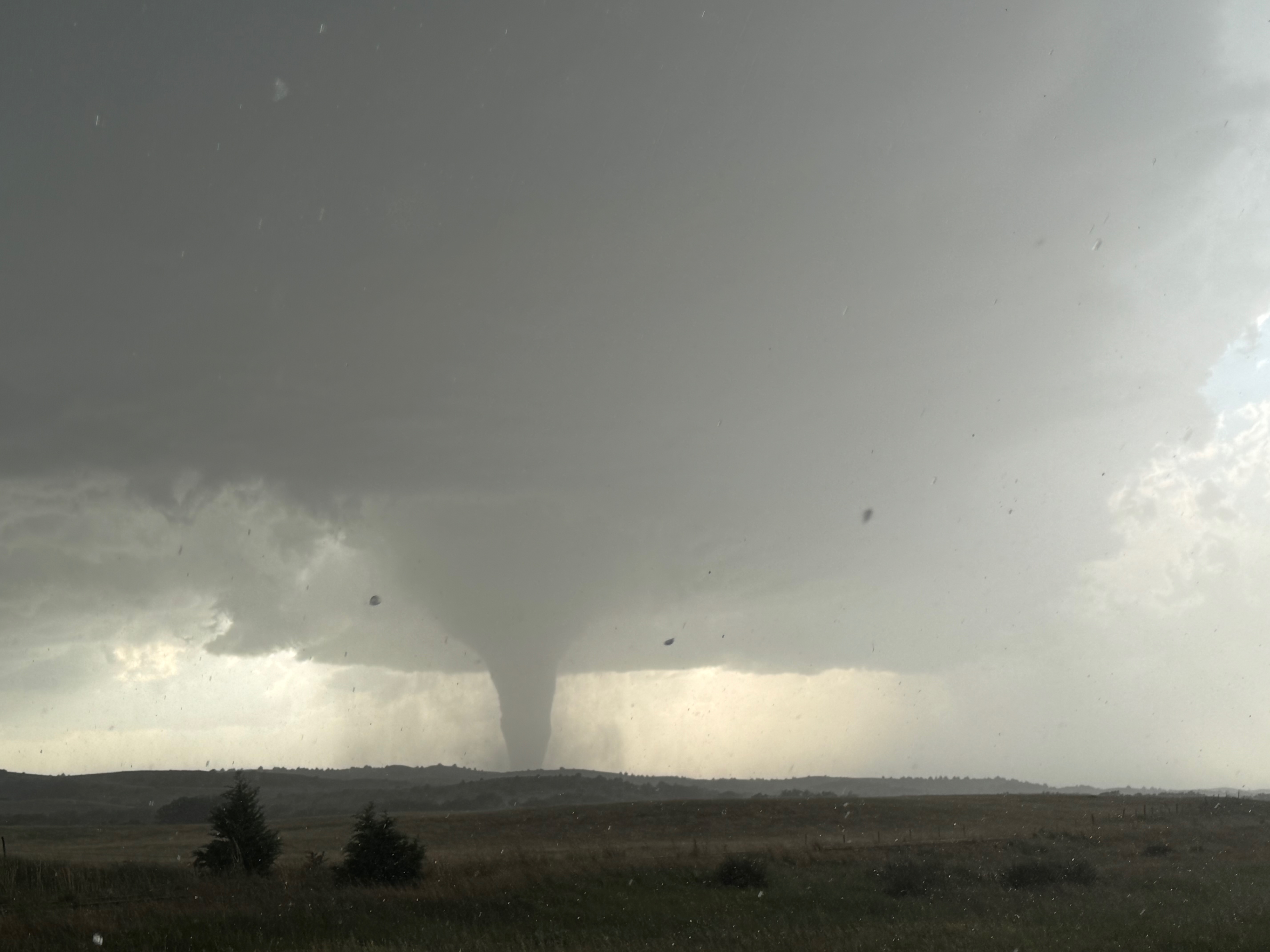
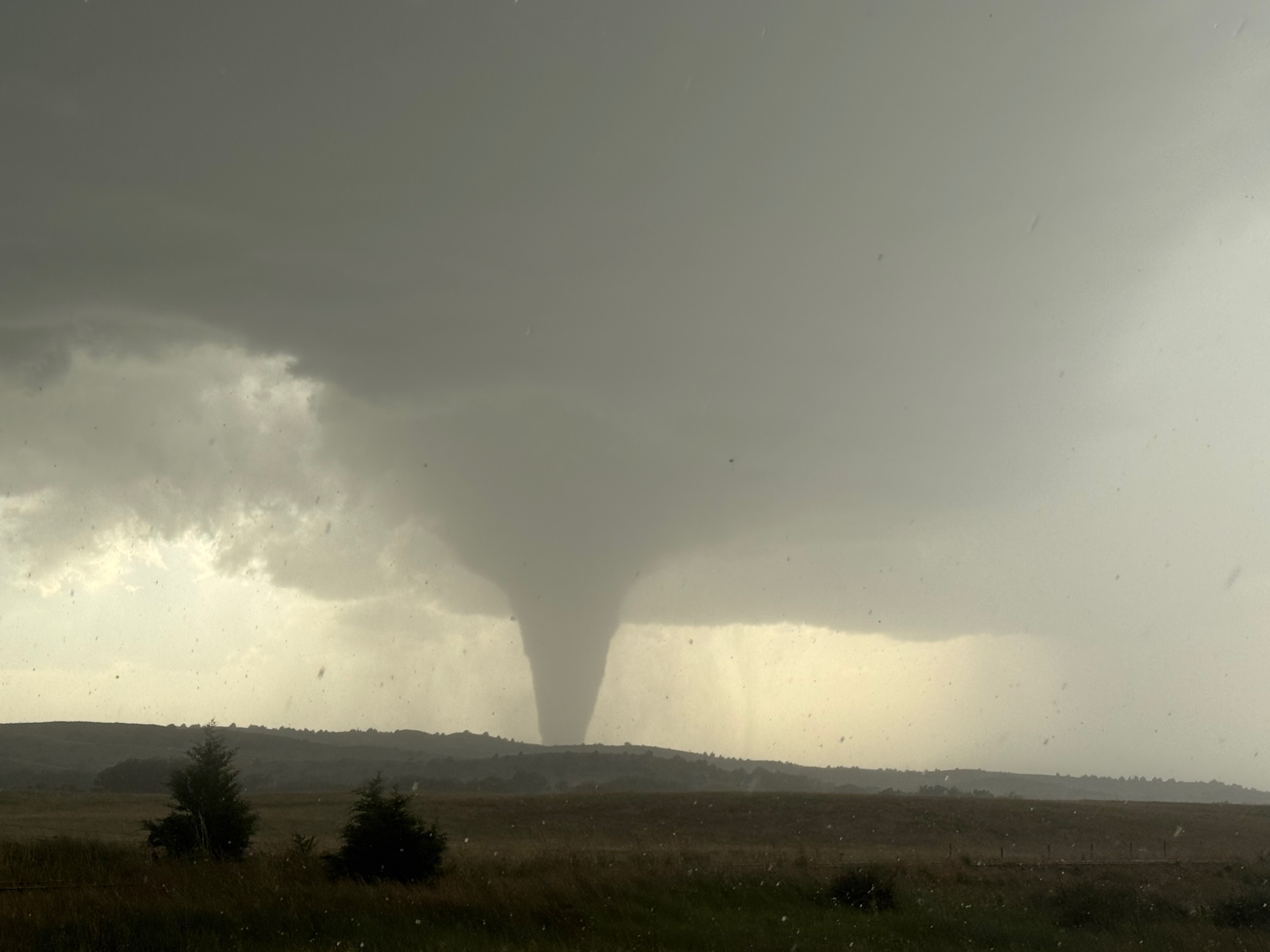
The final 17 images of the 30 above show “phase 2” of the tornado. When the initial “landspout” tornado dissipated, there was a lull of a minute or two with no tornado present from our vantage point (around 7:15 p.m. CDT). However, chasers close to the action along 23 reported a continuous circulation on the ground. A “second” tornado commenced quickly. It was very pretty and slender for quite a while. We were far enough away to have a really good view of the storm structure and the tornado, so I was shooting zoom and wide images on the iPhone. The contrast was very good with the sun behind the storm.
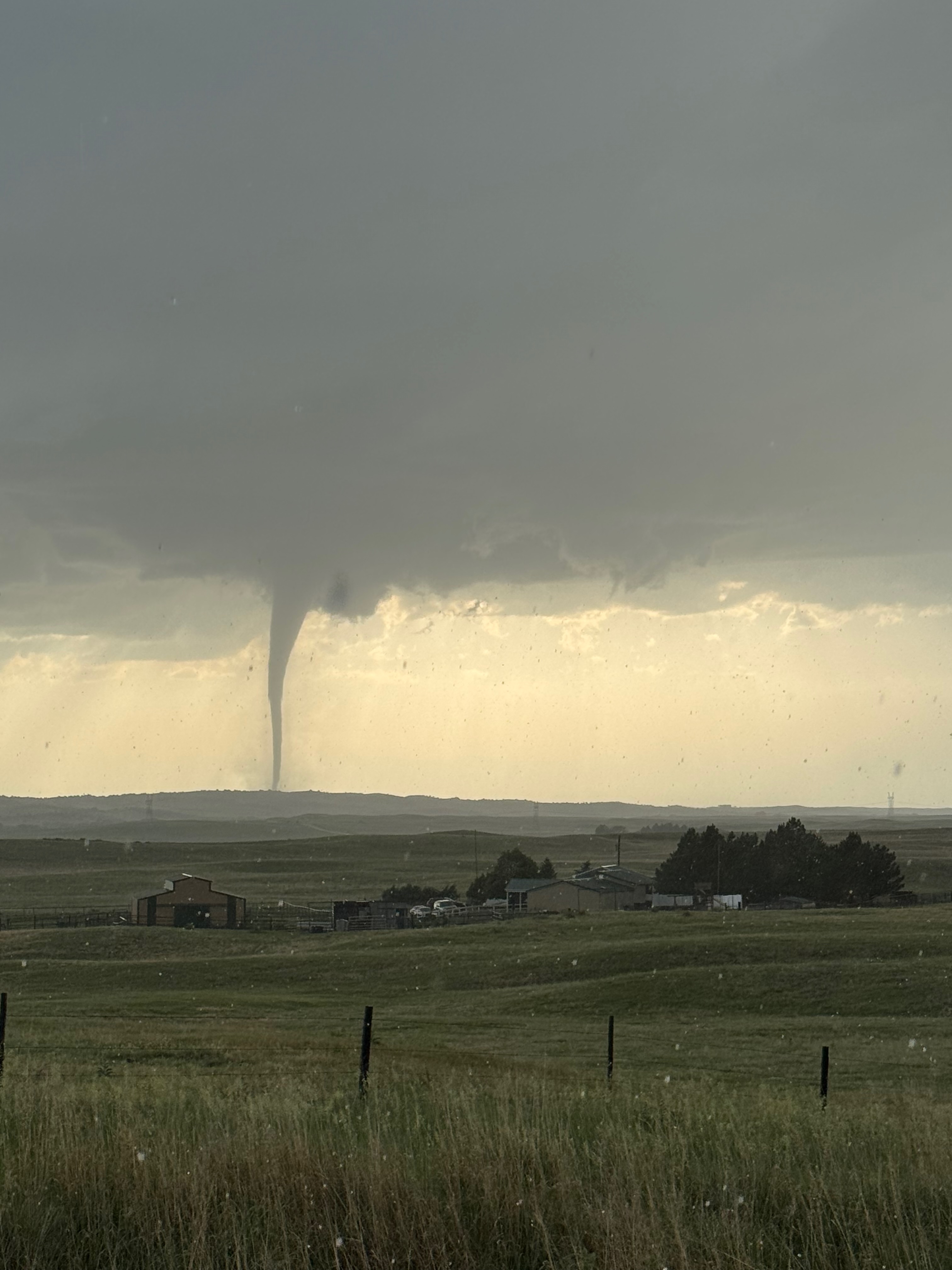
Light rain and maybe some small hail began at our location fairly soon after the second tornado started. This was out of the anvil which was quickly spreading overhead to the ESE and SE of the base. The precipitation wasn’t bad enough to keep us in the van. After another 15-20 minutes, the rain was a little heavier and more of a nuisance, and the tornado was still doing its thing beneath the storm base to our WNW. It had drifted right-to-left and looked about the same. It seemed to be moving S or SW or maybe W…one thing for sure was that it wasn’t moving in our direction. The storm structure continued to dazzle, but this “chase” had become a bit tedious. Since it was raining and since we had already taken a thousand pictures from this spot, why don’t we try to get closer while in a nice and dry chase van, right?!
I had Tom and Ron take us back north a few miles to Highway 23. I didn’t have a great handle on exactly where the storm and tornado were with respect to Highway 23. After less than a mile, along the due north segment of 83 just north of the NW-SE jog, it was apparent that the tornado was a little south of 23, and just a little north of due west of where we were right now. If we had tried to approach the tornado via 23 now, we would have been in heavier rain and almost certainly in some damaging hail. That was not something that I wanted to contend with. A good time to have tried to get close via Highway 23 would have been during that little “lull” or interlude some 20-25 minutes ago, but now it was too late. The time now was close to 7:40 p.m. CDT.
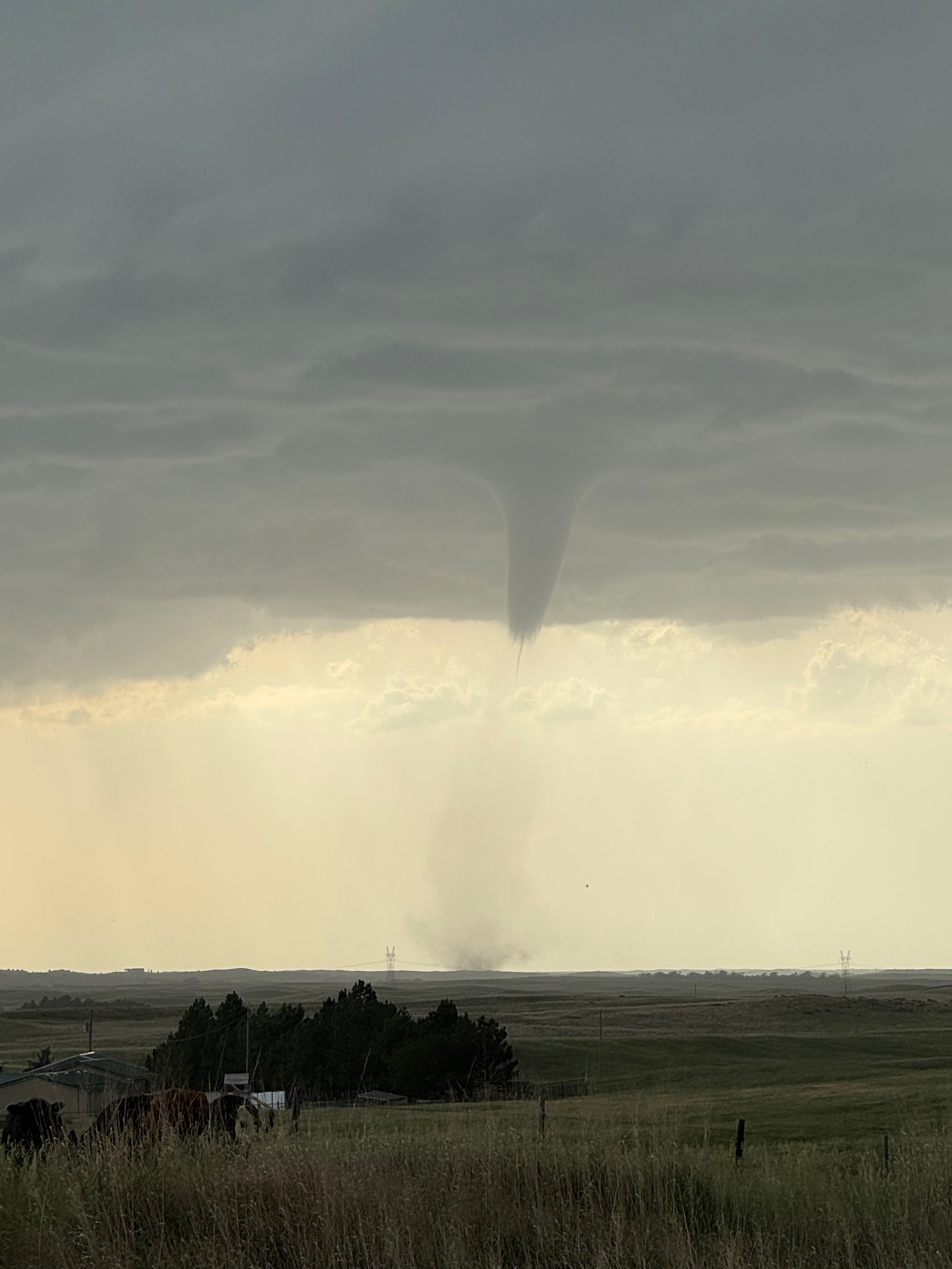
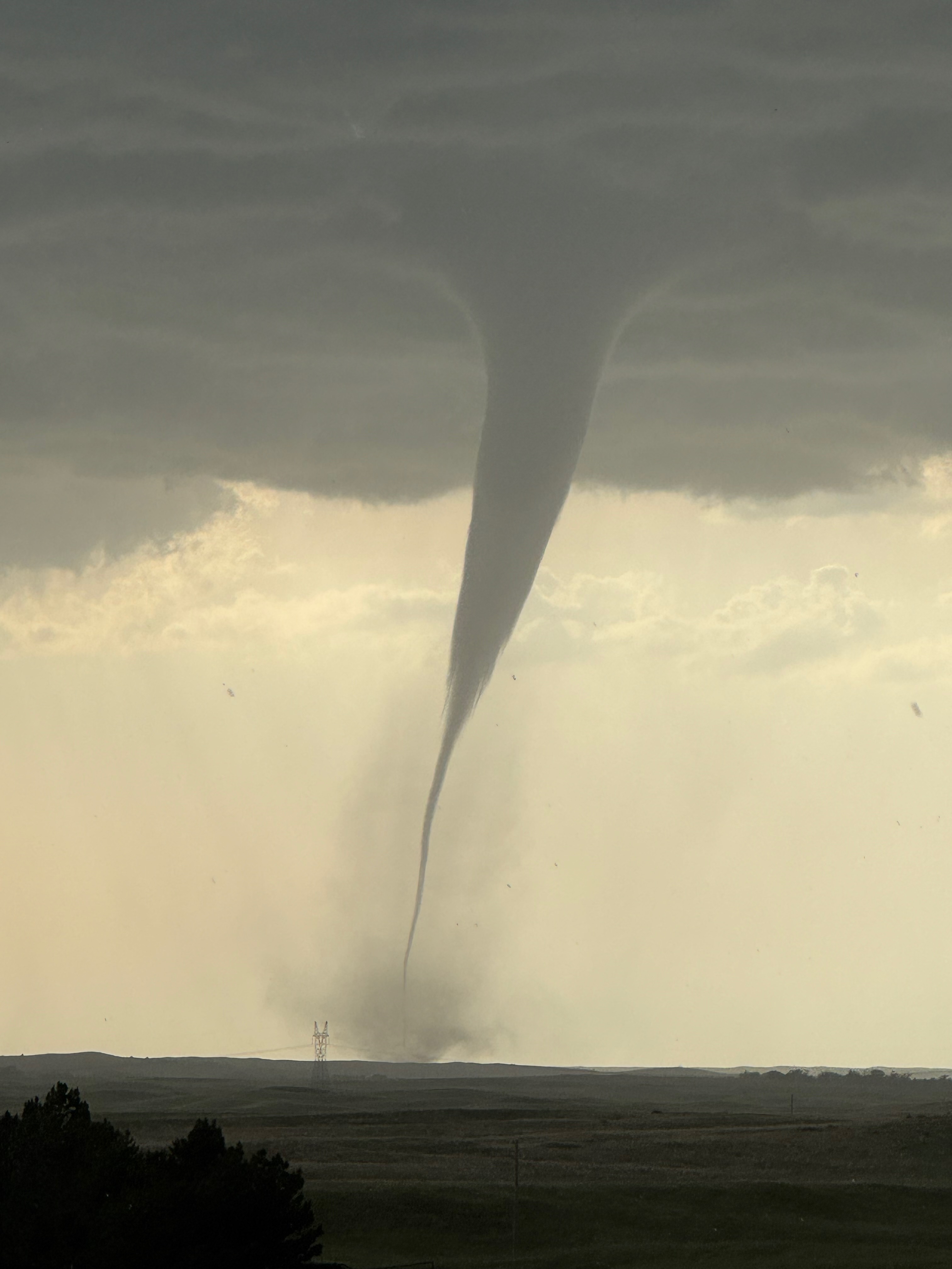
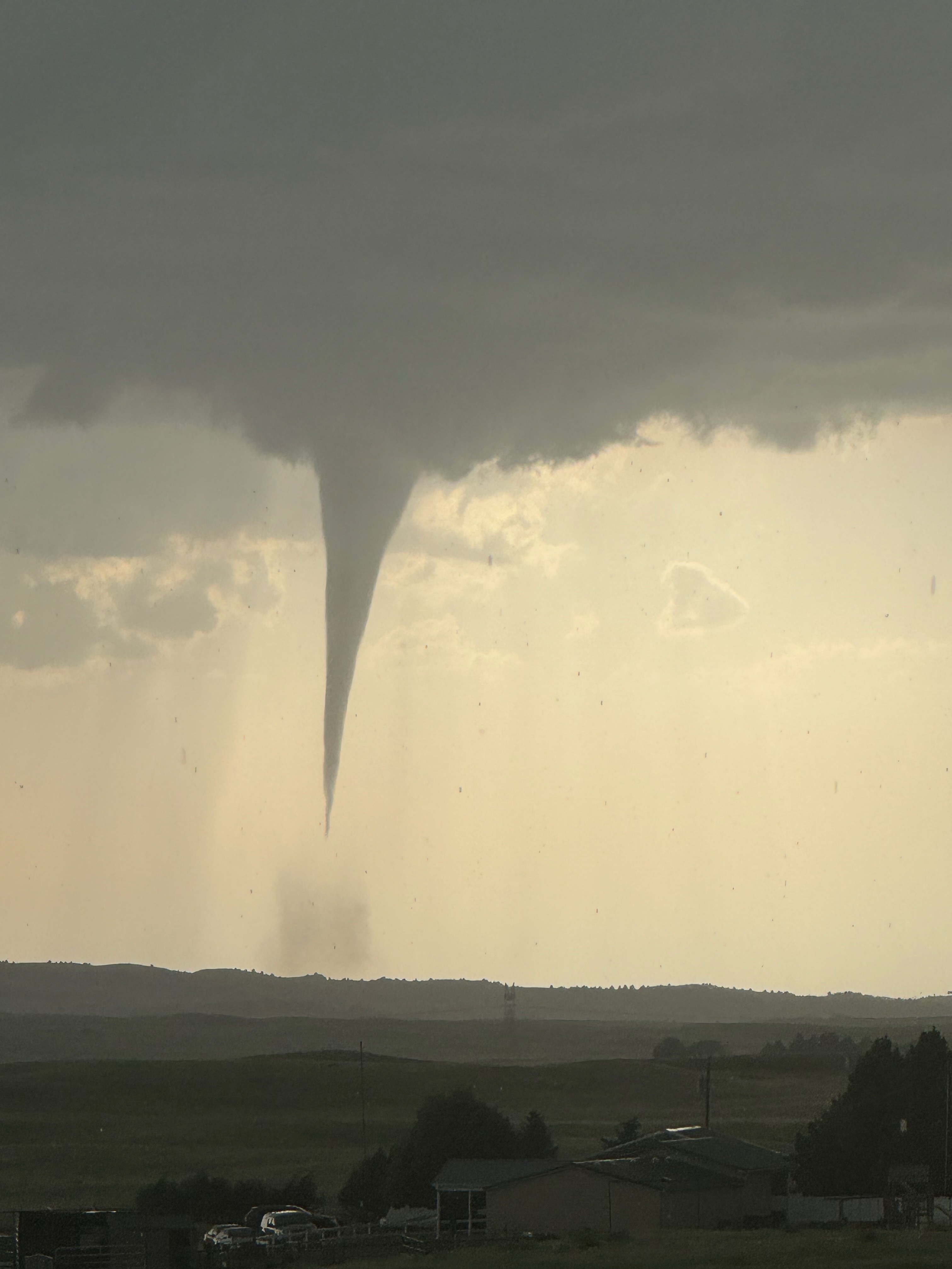
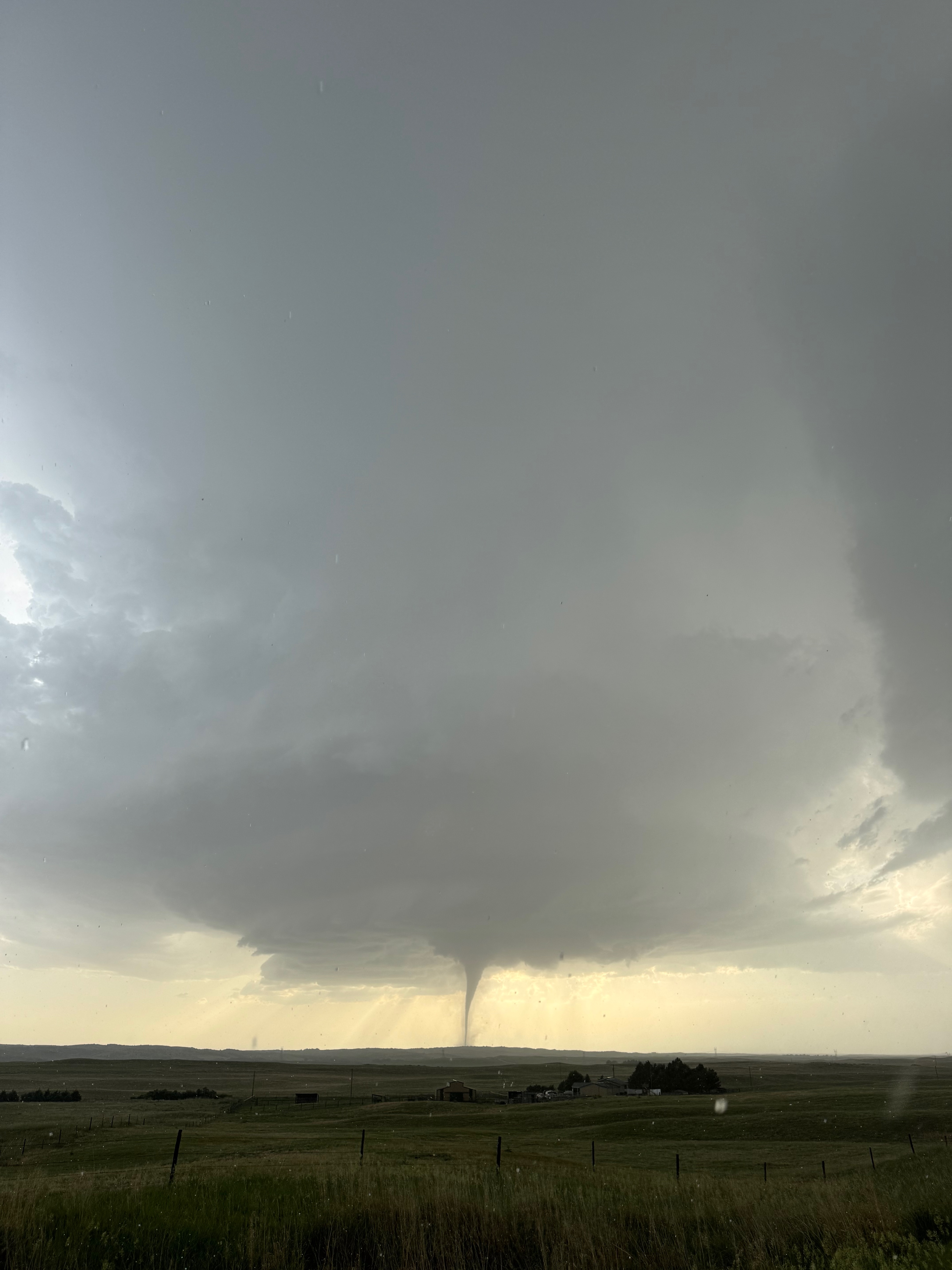
We turned around, and Tom told me that we had just passed a paved road west. Well, that sounded about perfect — thank you, Tom! This was West Medicine Road. We blasted westward for several miles and gained ground on the slow-moving tornado, which was still edging slowly southward about 7-8 miles west of 83. (See video clips linked above, notably the third one which contains the iPhone clips). We remained in moderate rain and marble-sized hail on this stretch, and then came up to a split. Our nice paved road had ended. One dirt road went WNW, leading to points E and NE of the tornado. Another less-improved dirt road continued to the west, and it looked like a winding mess through some dubious terrain for the next few miles. I really wanted to get closer to the tornado by continuing to the west, but I had no idea how good or bad this winding road to the west was (still called West Medicine Road). I could not risk getting stuck on a wet dirt or mud road with a big tornado nearby. The road to the WNW (Somerset Road) was a reasonably good, graded dirt road. I had Tom take us about a half mile on it to a spot where the hills to the west were not too obnoxiously high.
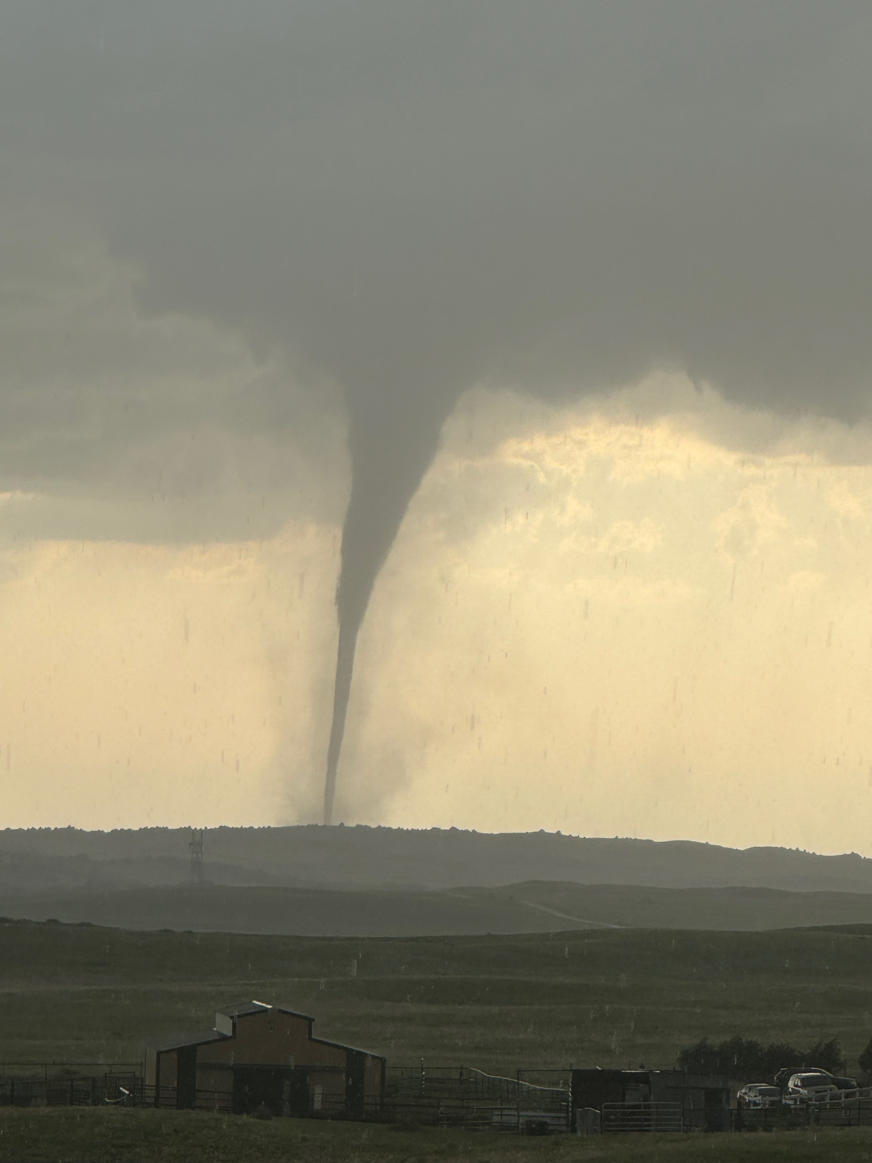
Here we stopped in moderate rain with some big and small hail stones falling. Some of the guests ran out of the vans to pick up some which looked about golfball-sized. The tornado, now quite a bit closer but still maybe four miles distant, looked stronger. It was approaching “monster” status! Here are the images off of the iPhone for this part of the chase along W Medicine and Somerset roads:
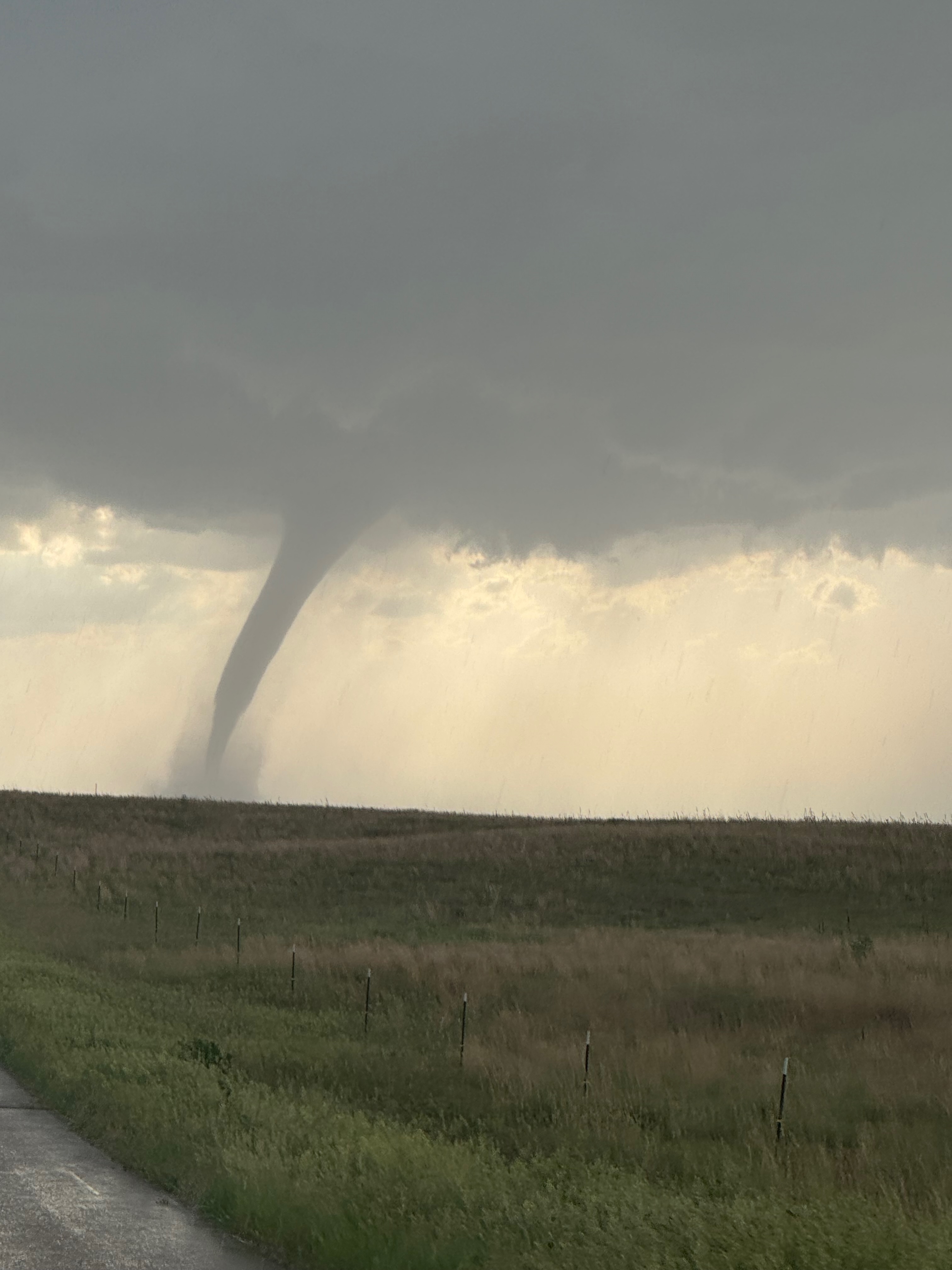
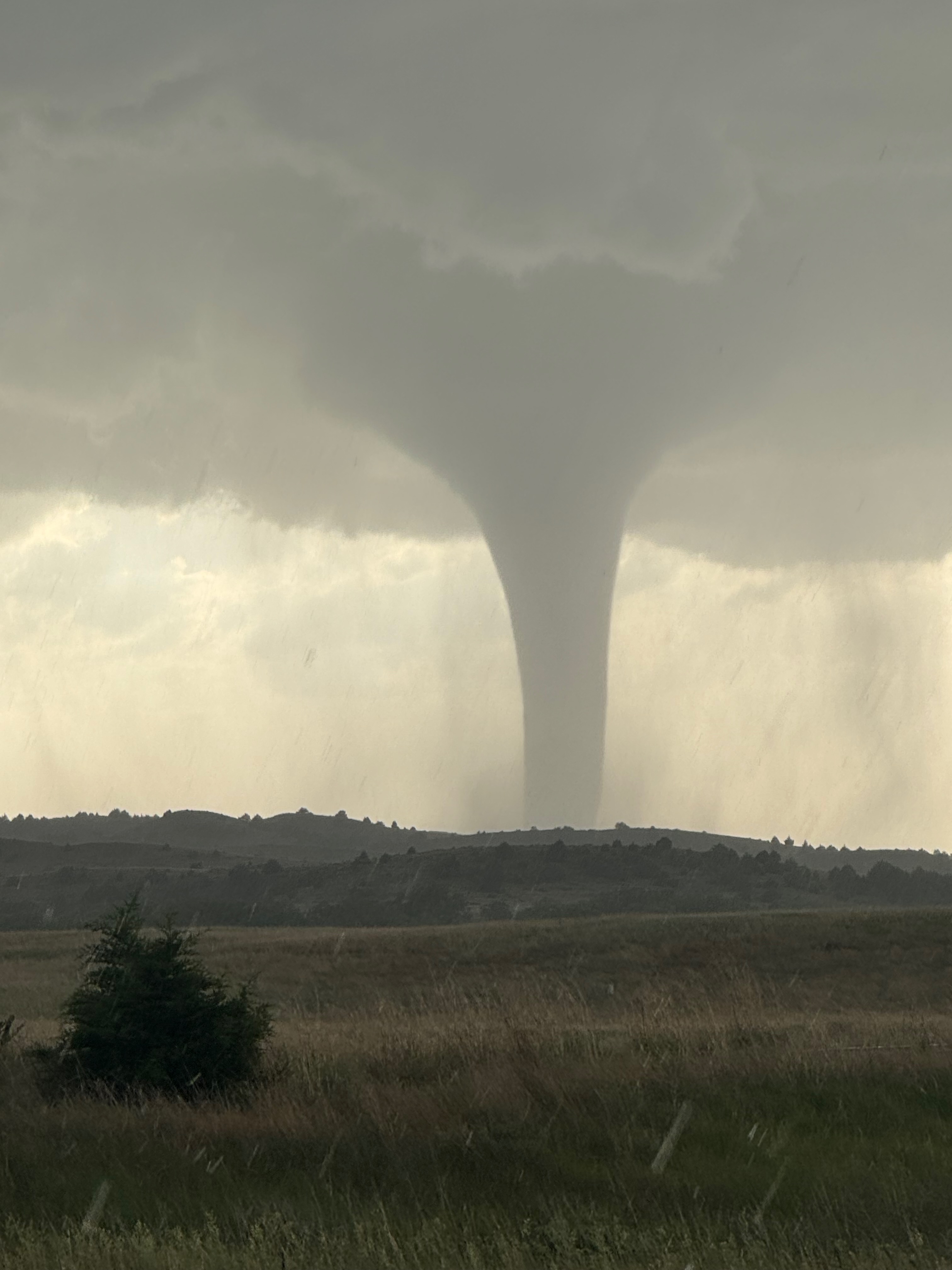
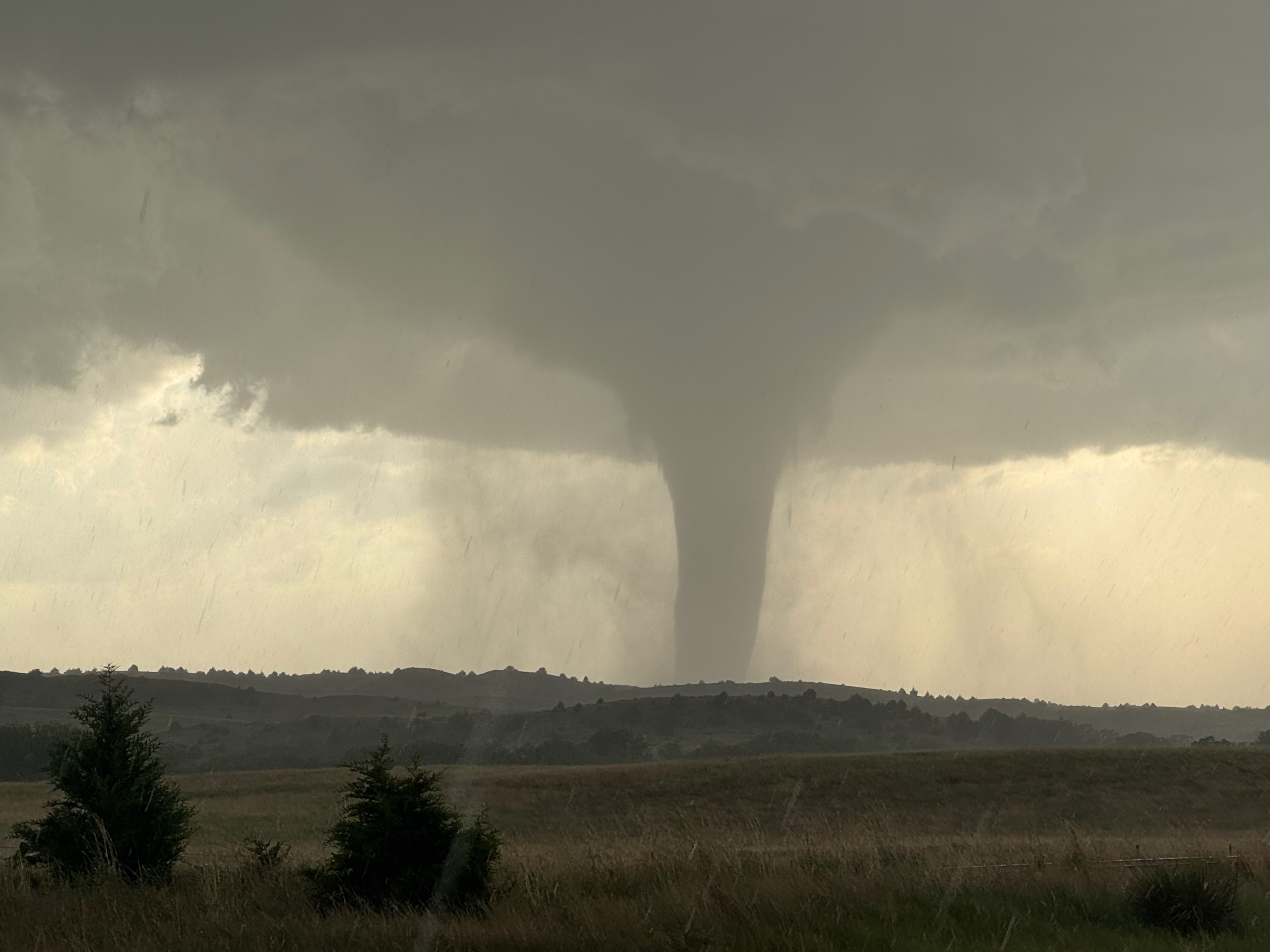
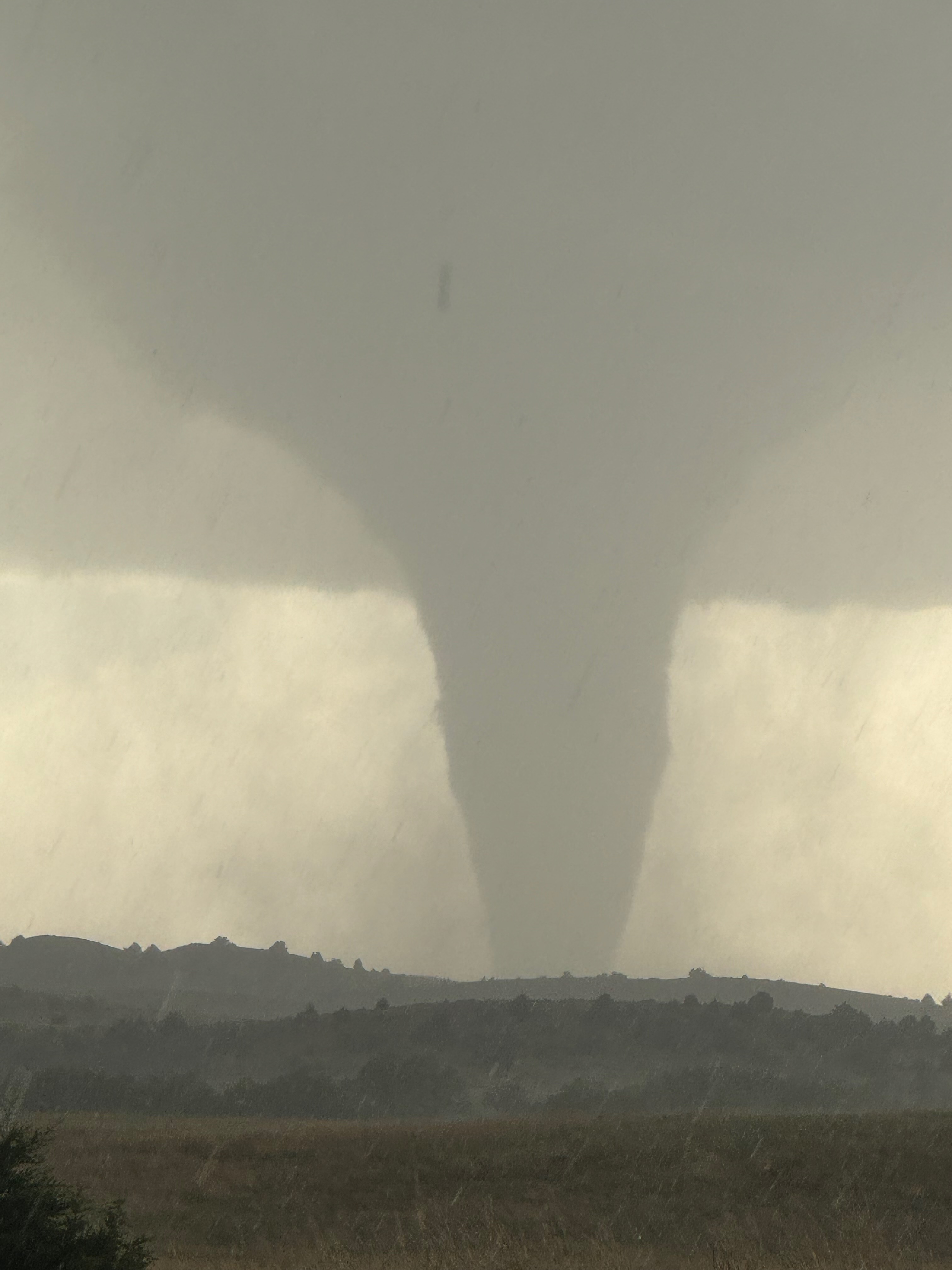
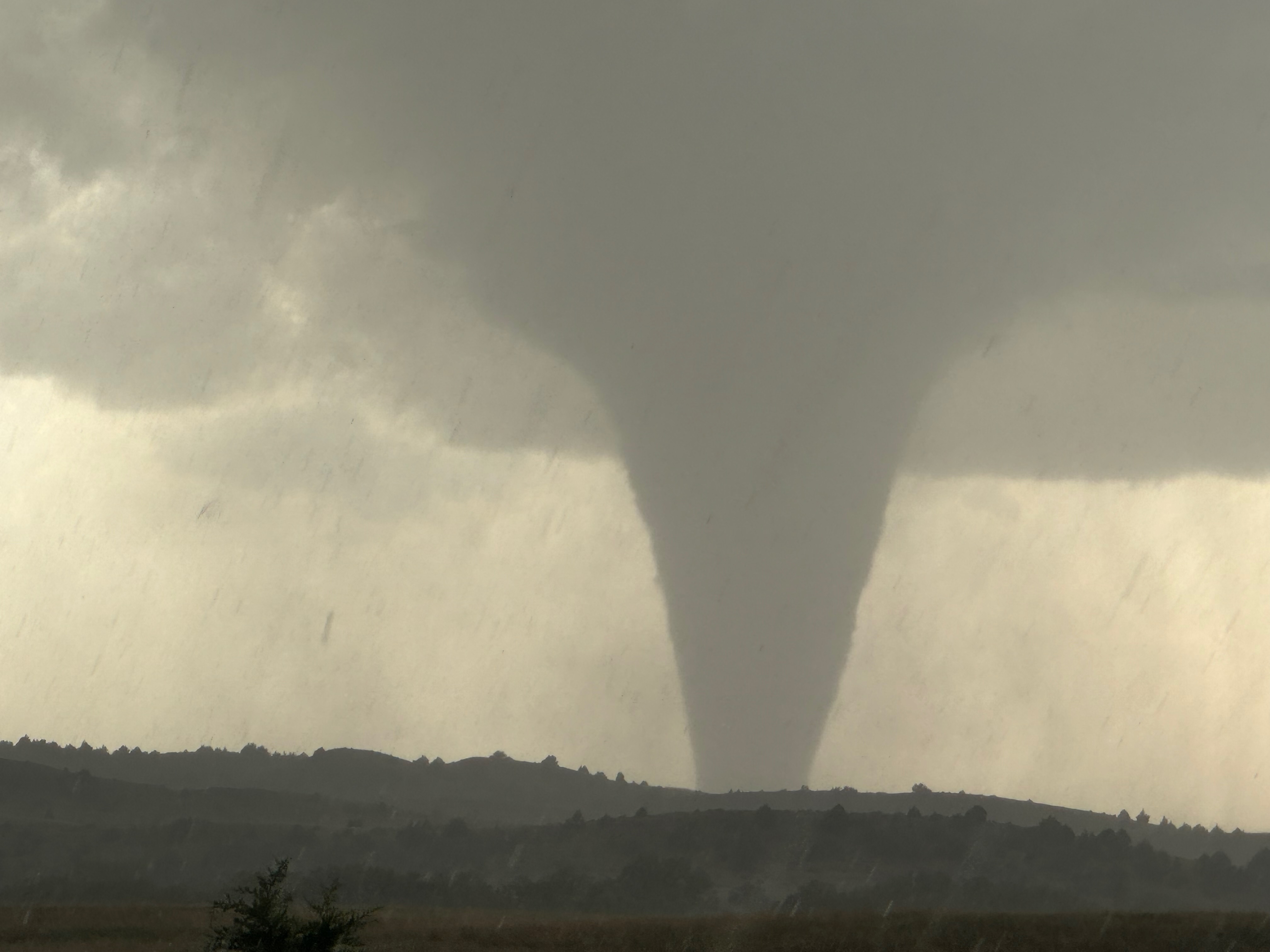
As you can see, we were battling the precipitation here. And as you can see, this Dickens tornado was quite sizable now! After several minutes at this spot the hail was getting uncomfortably large and frequent. We bailed back to the east on W Medicine Road to lose the big hail. The final image above was taken at 7:53 p.m. CDT.
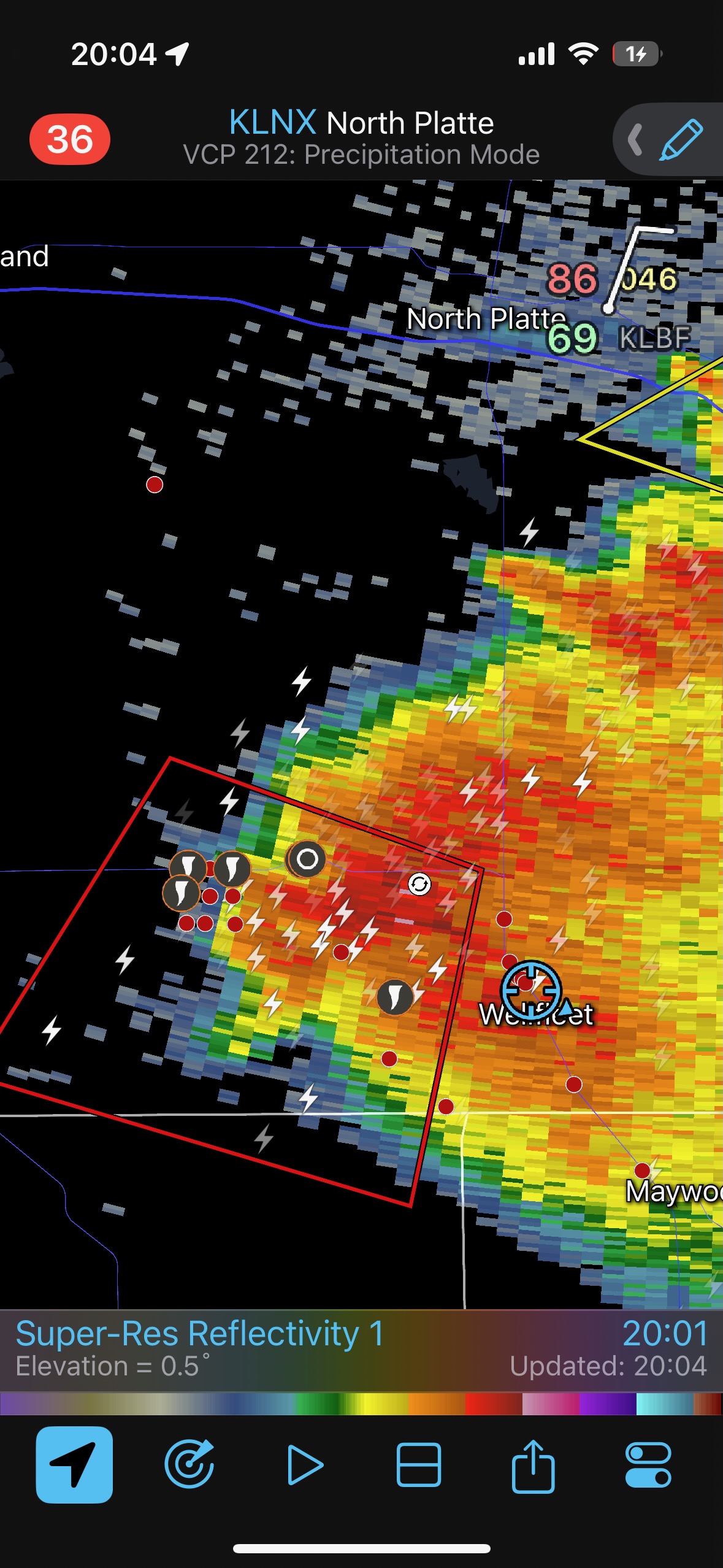
Radar at 8 p.m. CDT, shortly after the end time of the tornado.
We stopped just short of 83, looked back to the west, and the tornado was in its dissipating stages. I have images of this off of my Canon that you can find on the WELLFLEET/DICKENS PART TWO web entry! The same goes for the awesome lightning show and images at dusk.
The tornado was gone by around 8 p.m. CDT, close to an hour after the wispy dusty stirrings beneath the base began, a few miles east of Dickens. The second tornado moved mostly to the south, winding up a few miles southeast of Dickens.
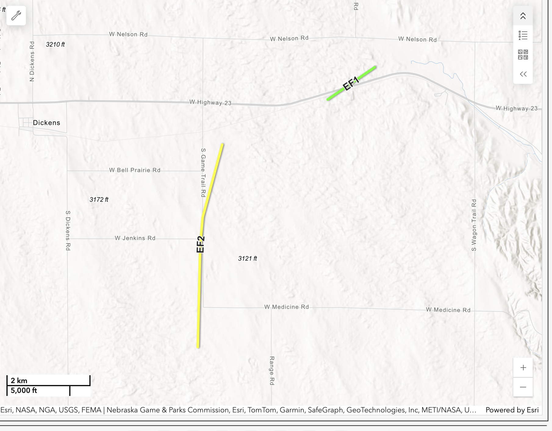
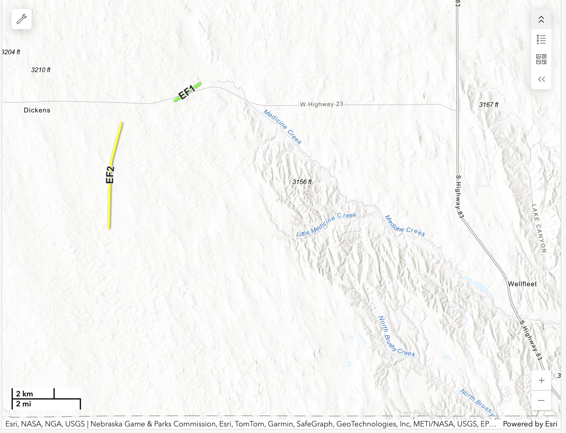
The map above, courtesy of NWS North Platte, shows the tracks of the two tornados in southwestern Lincoln County. The first tornado, the landspout, was rated EF1. The second one didn’t hit much and was rated EF2. A wider view (below) shows Wellfleet with respect to the tornadoes. Our primary viewing location was just SSE of where Highway 83 turns due north, NNW of Wellfleet.
When the second tornado roped out to our west, I was thinking that there may well be another one quite soon. I was looking for a way via a paved road that could put us fairly close, south or southeast of the updraft base, in quick fashion. But there was nothing available. The storm was about equidistant between the paved N-S highways 83 and 25. It was moving slowly to the south, nearing the Lincoln/Hayes county line now. The spot to be right now would have been Hayes Center and vicinity, but that would have necessitated a long drive via McCook and Culbertson…or treks in the rain on dirt roads.
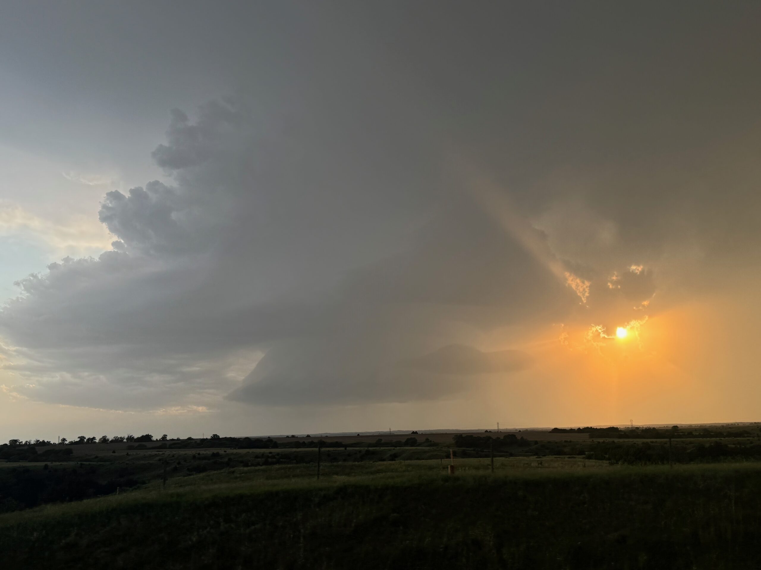
We went south on 83 past Wellfleet and Maywood, and I found a good unpaved road west. There was no tornado apparent, and the storm still sported an impressive bell-shaped updraft. The sun was about to set, so we stopped after several miles on a hilltop and enjoyed the frequent CG lightning — wow — and what a chase day this wound up to be! It was a U.S. 83 chase in its entirety (save for a few short forays to the west of U.S. 83), from Valentine to North Platte, Wellfleet and finally to Oberlin, KS, for the night.
Leave a Reply
You must be logged in to post a comment.