
On this day I managed to chase, observe and photograph perhaps the best California supercell storms that I have yet to witness! And, I was really close to not even heading out to chase. The write-up and a lot of iPhone images are below. But first I just want to stick the best “regular” camera still shots at the top here in order to make it easy for you to view the best images.

And here is my chase account. All of the images and screenshots below are from the iPhone.
The moist remnants of ex-tropical storm Mario were making their way through Southern California on this Thursday. There was a little thunder at home in Westlake Village after midnight, with about 1/3 inch of rain during the morning. I think that this was the first time I had heard thunder at home in a year or two. There looked to be decent thunderstorm prospects in the deserts on Thursday afternoon. The HRRR and the other short-range models suggested some heavy storms in the southern deserts (such as Palm Springs to Blythe and the Salton Sea area), and also decent-looking activity in the northern deserts, maybe around Victorville to Barstow or maybe even a little west of there, around the Antelope Valley. My ideal desert chase might be a thunderstorm with a lot of lightning out around the Death Valley area, especially towards dusk when the light is good. The goal: to shoot a storm with lightning across the bleak, empty, pristine and awesome landscape out there. Of course, these situations and opportunities do not present themselves very often in the region. Death Valley averages less than an inch of rain from May to September.
I don’t do very much “local” thunderstorm chasing into the California deserts, averaging just a few every 10 years or so. I get my fill of chasing on the Plains during the spring. But I do keep tabs to see if a nice summertime setup is developing when I am off of work. Today I was off and I was waffling on whether to make the drive or not. I had ruled out the 3-to-4 hour drive to the southern deserts. The play in the northern/upper desert was looking somewhat good. The cloud situation was fine with plenty of sunshine getting through midday. Forecast CAPE around Mojave to Barstow was over 1000 J/kg, and Barstow and Daggett were showing really nice east winds by late morning with mid-60 dew points. These east winds were below S to SSW flow at 500mb at about 25 to 30 knots. Thus, there was a decent wind profile which might allow some storm organization. But, these speeds (and bulk shear values) seemed to be not quite good enough to think “severe.” Barely. SPC was not onboard for severe weather, showing just a “general” thunderstorm outline.
It would be nice to get out there and see some storms and lightning, for sure, but I had another distraction that was kind of keeping me tied to home. A FedEx delivery was scheduled this day, and I needed to be home to sign for it in order to get it. Ugh. The delivery was supposed to be between about 10 a.m. and 1:30 p.m. So, I was thinking that I would let the FedEx delivery dictate whether I would chase or not. If I were really serious about getting out there for the chase, then I would have been out of the house before noon. The HRRR showed stuff going up by around 2 or 3 p.m. If the delivery was by noon, then I could take off. If the delivery was as late as 1 or 2 p.m., then I would probably just stay home, avoid the traffic, save gas and money…relax…watch on radar. Probably.
Noon and 1 p.m. came and went. No FedEx. The FedEx tracking e-mail showed the delivery guy’s face and name: “Edward.” C’MON Edward! Then, at 1:15 p.m., I see the FedEx truck pass by my place! Yes! It would make a quick delivery or two up the street and then come back the way he came, right down my street. This was the only way to get back out of this complex. Edward would stop at my condo and walk up to my gate and I would sign the thing and get my package! And then I could look at my laptop to see if I should chase, even though it was now near the very end of the go/no-go time limit. But then I saw the FedEx truck go past my place without stopping. EDWARD!! I raced outside in my bare feet and saw the truck disappear behind the trees towards the condo complex exit. Nooooo!
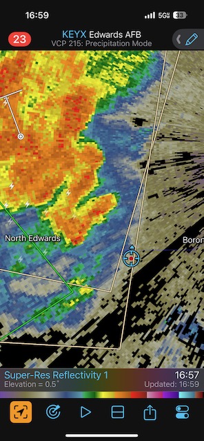
I got in my Xterra and drove to the other part of the condo complex to see if the FedEx truck was still nearby. How could this guy forget my delivery? But Edward was not to be found. I went back home and looked at the laptop and the SPC meso page. It showed a big-time moisture convergence bullseye close to Edwards AFB, roughly in the area bounded by Palmdale, Mojave, and Boron. This never happens! This is the Northern Deserts, where the dew point is always 26F, right?! The east winds at Barstow were surging right into this area. The HRRR showed good stuff forecast-wise with echo tops near 40,000 feet later. I needed to get myself up there. It was just after 1:30 p.m.
I stopped for gas in Rosamond (between Lancaster and Mojave) around 3:30 p.m. Some storms were evident already to my north and northeast, but radar showed nothing too earth-shaking. These were moving to the north at maybe 20 mph, and I needed additional storms to form in that convergence area not too far to my east. I got what I wanted. And FedEx texted me to say that Edward tried to make a delivery at 2:40 p.m.
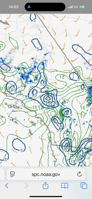
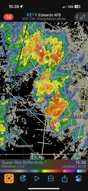
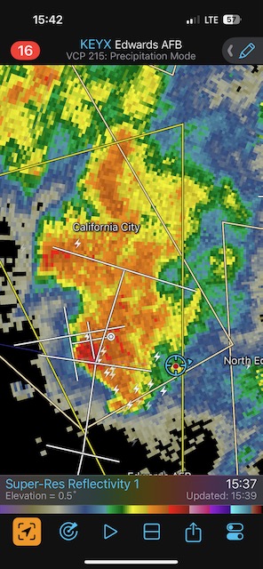
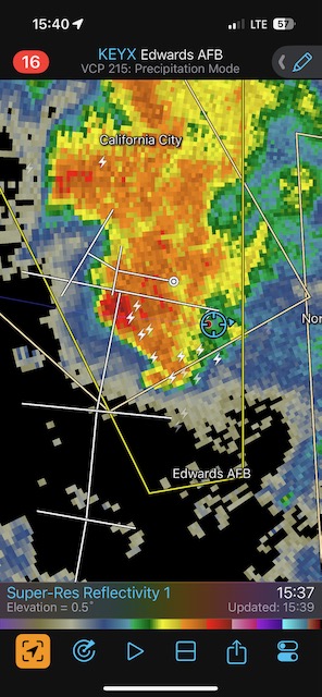
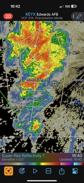
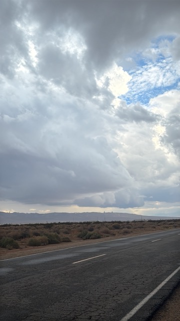
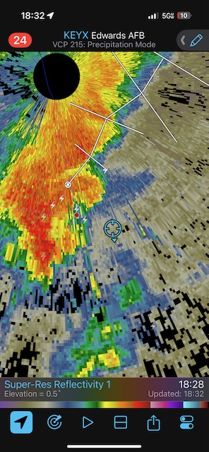
The iPhone photos below show an impressive updraft not too far to my east as I motored from Rosamond to Mojave. That 1000-plus CAPE was kicking in! At Mojave I jumped on 58 eastbound, and this was a perfect route to intercept the big new storm, which now featured a white hail shaft. The third image below shows a value of 20 for the surface moisture convergence in the vicinity of Boron and Victorville, near the Los Angeles/Kern/San Bernardino county triple-point between Barstow and Palmdale. The mixing ratio values around 15 are also quite impressive for that area of the world.
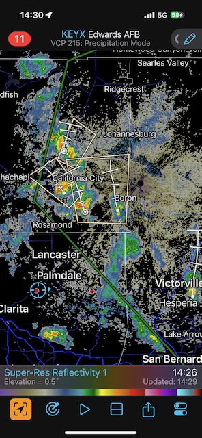
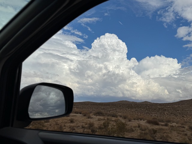
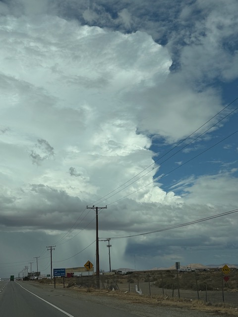
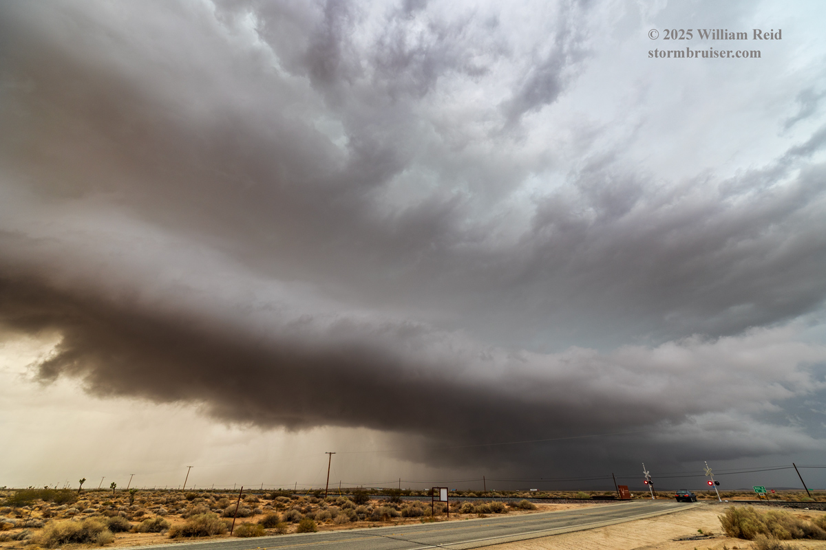
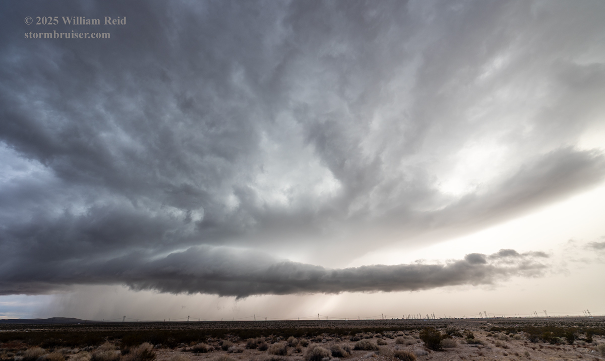
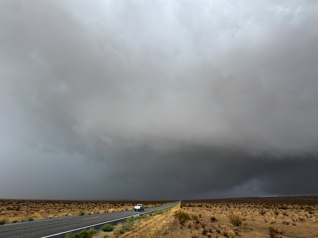
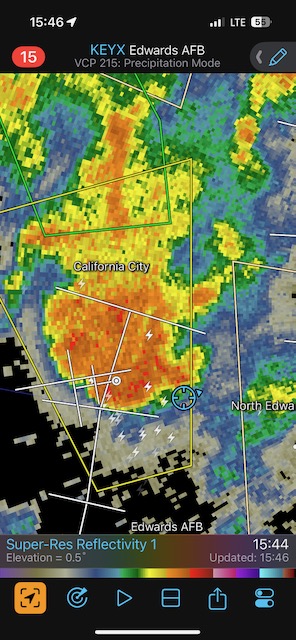
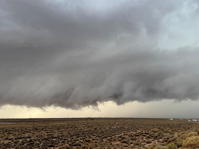
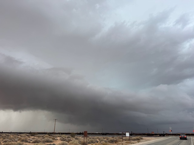
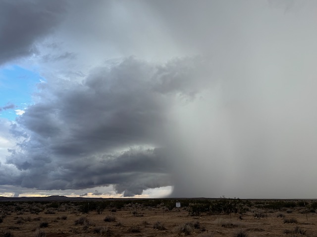
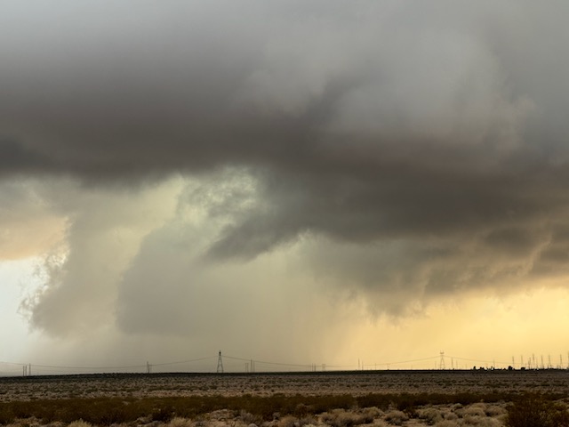
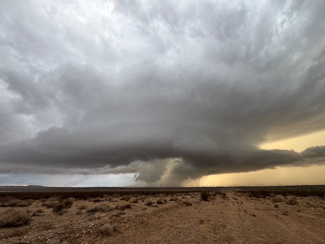
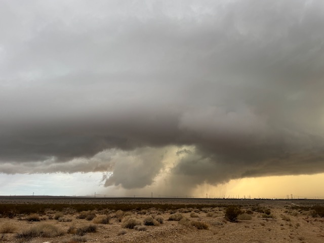
I wanted to be on the east side of this activity, on the side where the moist inflow was heading into the storm base. I drove through the storm core and dealt with very low visibilities and heavy rain. If there was a hail stone then it was very small, and wind was maybe 25-35 mph. No big deal. I came out near a road that went north towards California City, which was in the path of this storm. I stopped to shoot a roundish and low base which looked to have some organization, not far to my northeast.
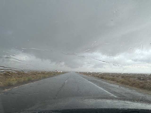
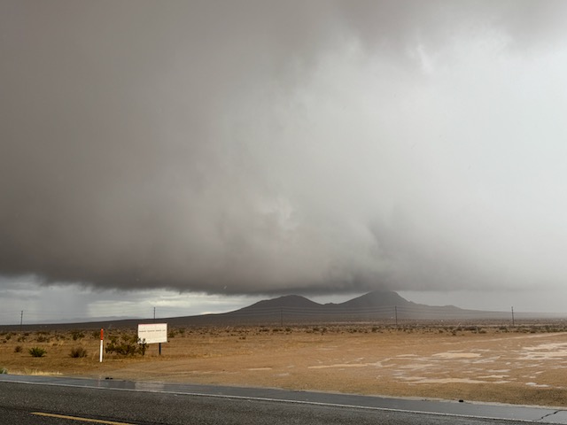
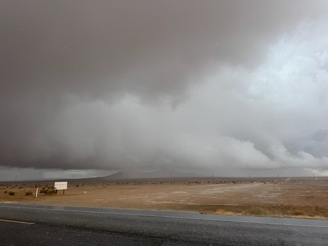
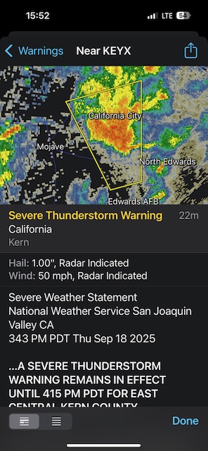
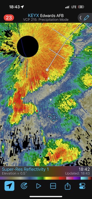
Below are some radar screen grabs to go with this timeframe. I was in a lot of pesky rain and there was some street flooding on the southeast side of California City. I was not getting any hail or strong wind, or even seeing much lightning.
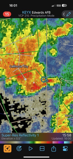
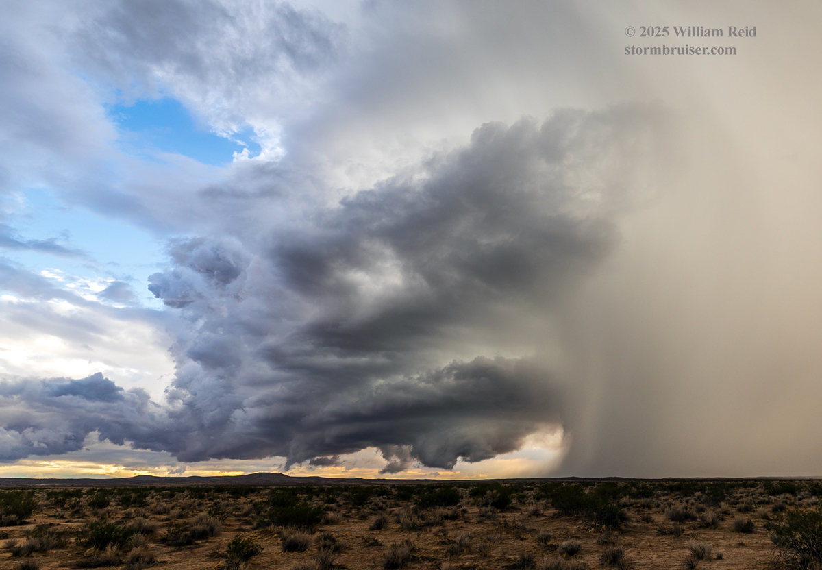
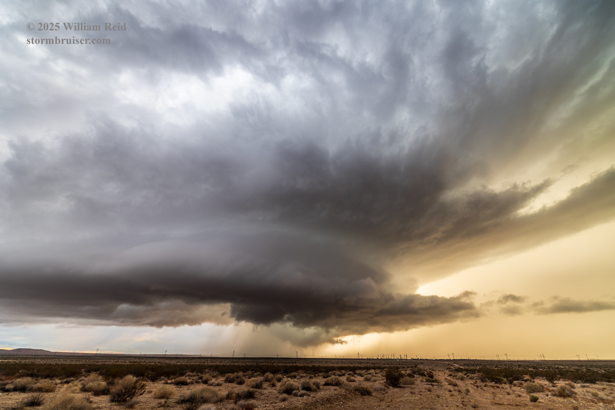
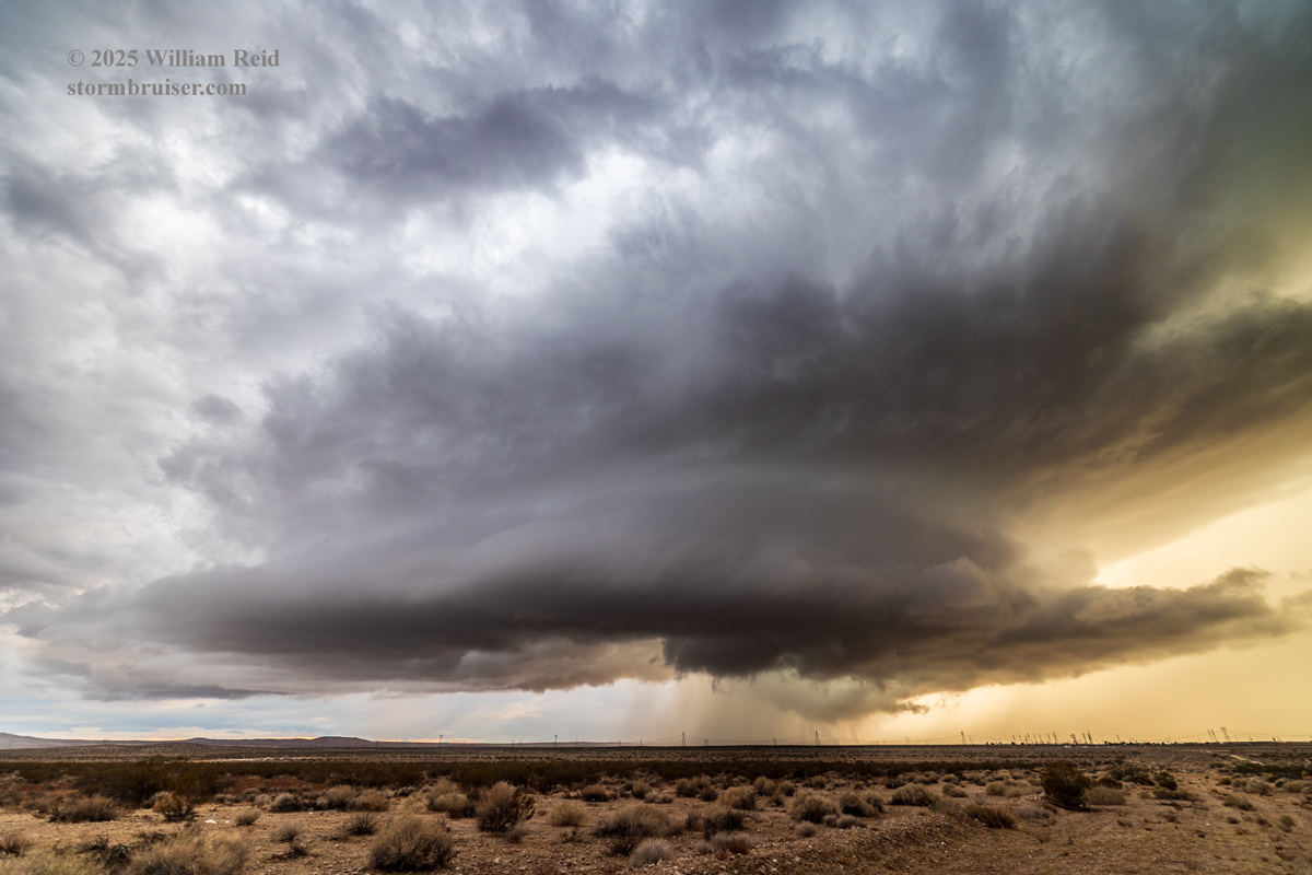
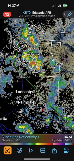
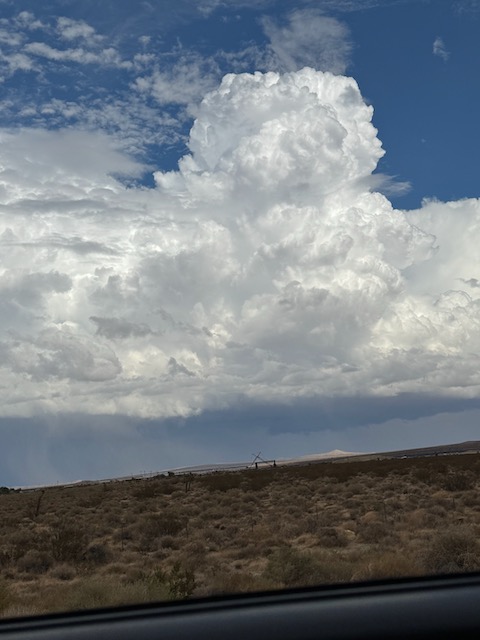
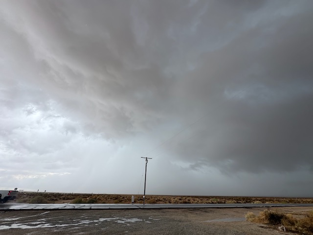
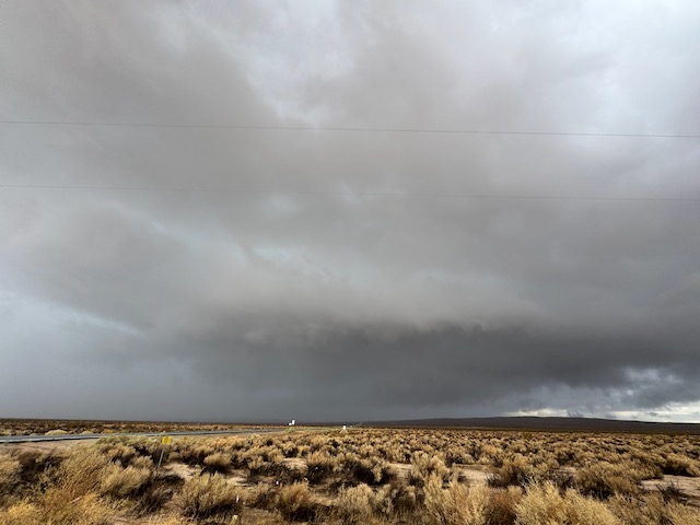
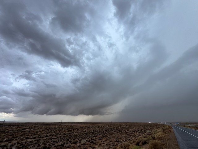
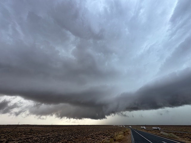
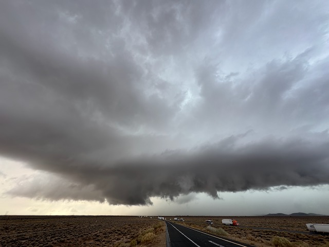
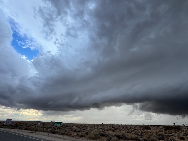
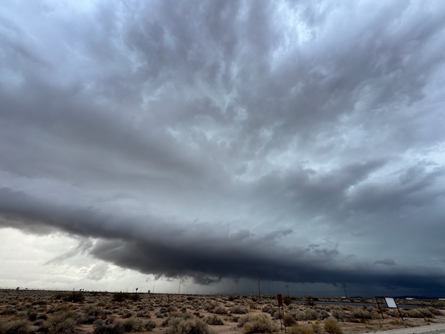
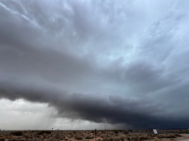
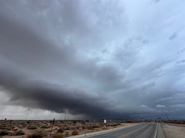
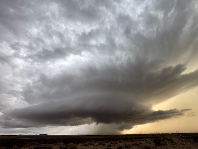
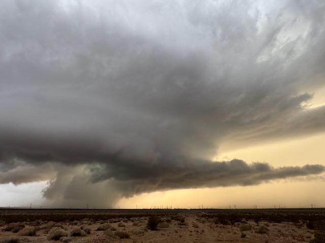
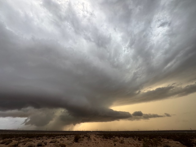
There wasn’t an easy way to stay with this storm, so I set my sights south again towards more new development. I went back down to 58 and east a bit, and a new, decent cell was now ramping up just to my WSW. This thing looked pretty darn good, like a Great Plains severe storm/supercell, with a low base! The storm base was rain-free and had a bit of a sculpted look. A clear slot/RFD cut had made its way into the base. I didn’t see much low-level rotation, though. More iPhone shots below of this storm, which was maybe 10-15 miles west of Boron along Highway 58.
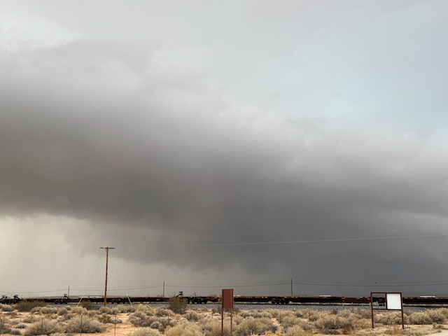
Associated radar screen grabs:

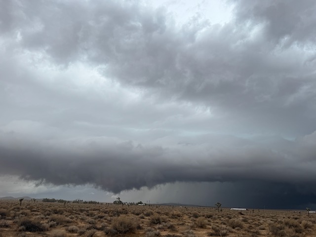
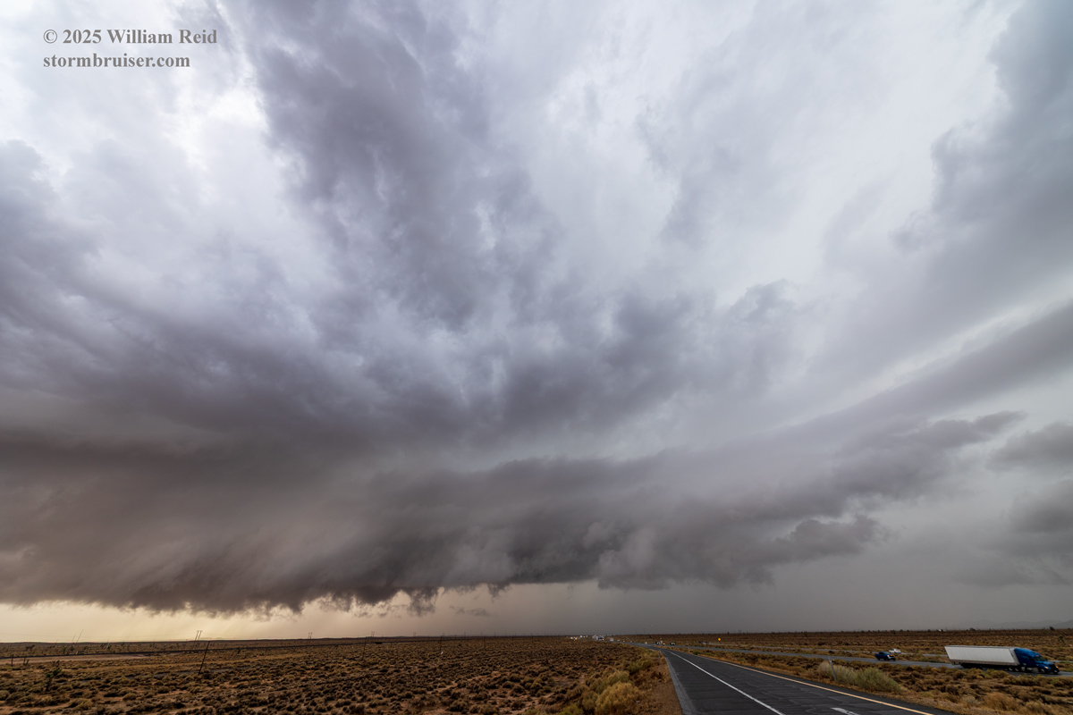
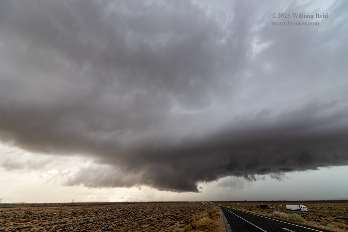
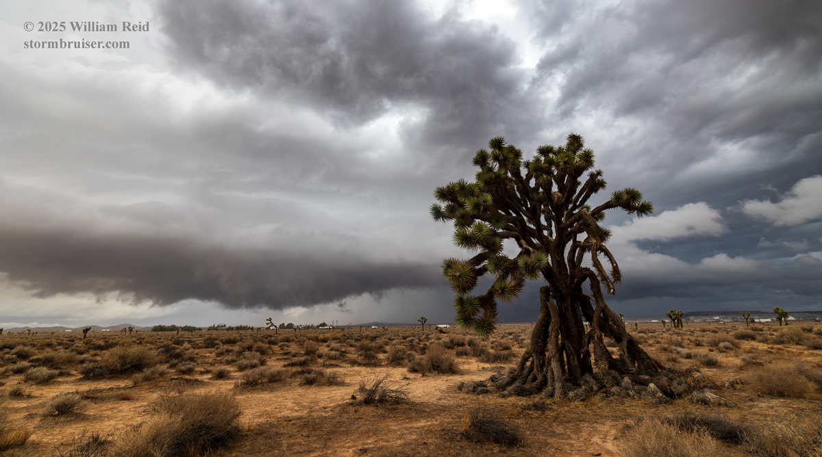
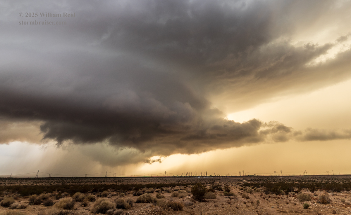
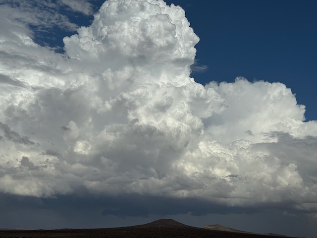
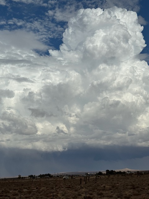
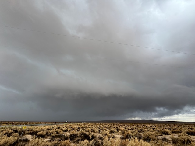
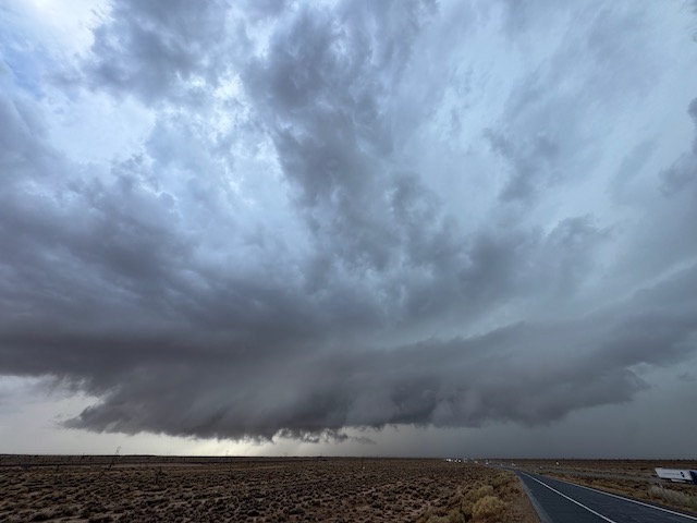
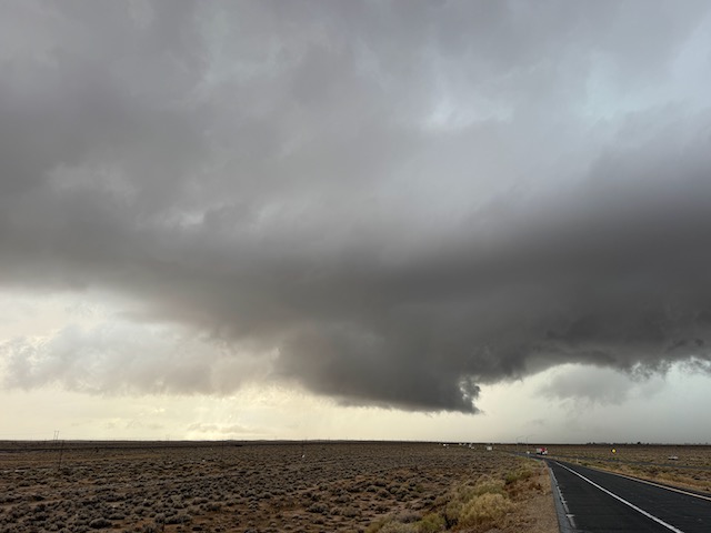
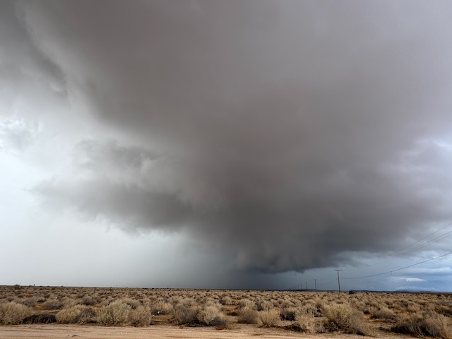
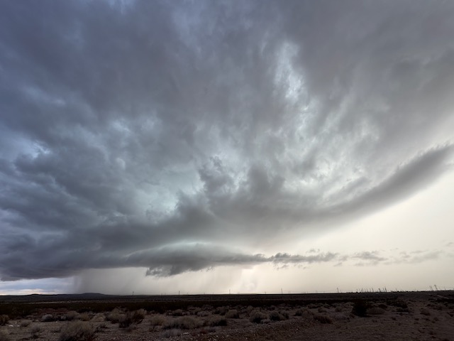
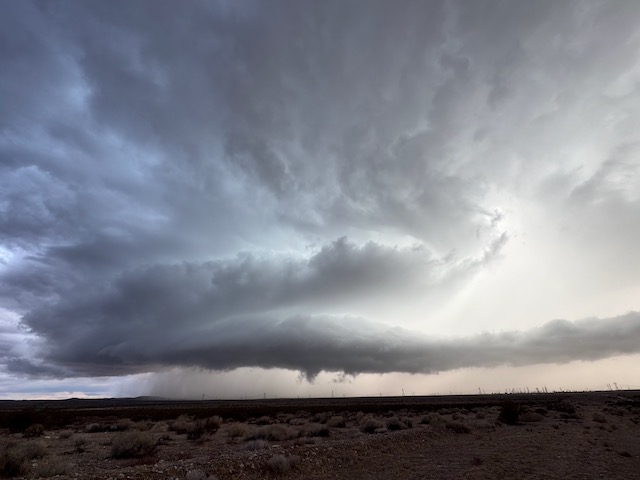
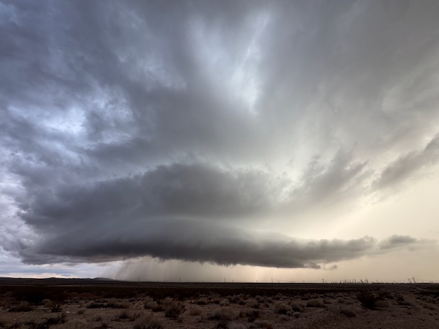
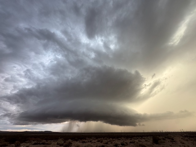
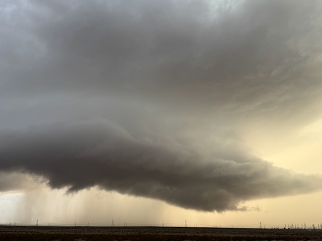
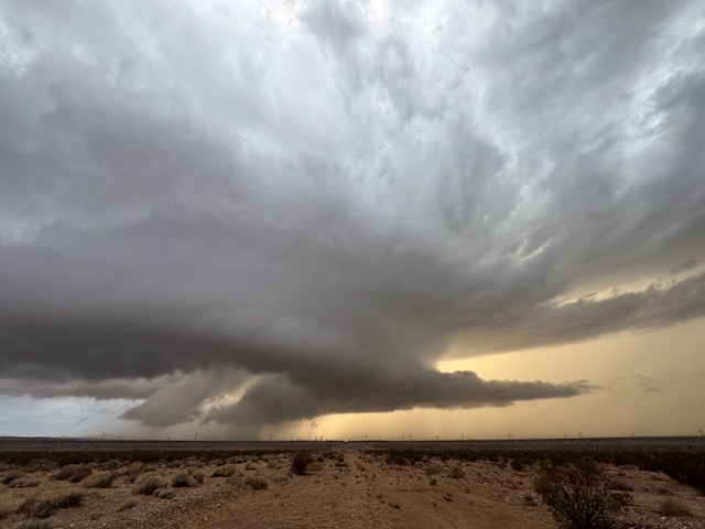
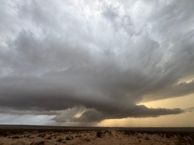
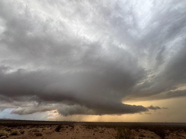
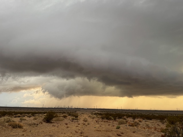
This organized storm, just to my west, moved north and continued to sport a lowering and an action area with an RFD cut. It was over a relatively sparse and roadless area between Boron and California City. I considered heading east to Boron, where I could head north on 395 to key tabs on it. But overall the storm was getting a wetter and messier look. I headed into Boron and a little farther east to Kramer Junction on 395. New development was apparent again maybe 5-10 miles south of Boron. I grabbed a hot dog at the Pilot truck stop, and then scooted south a mile or two on 395. And lo and behold, a really nice cell with a blocky wall cloud was in progress to the WSW! See iPhone pics below.
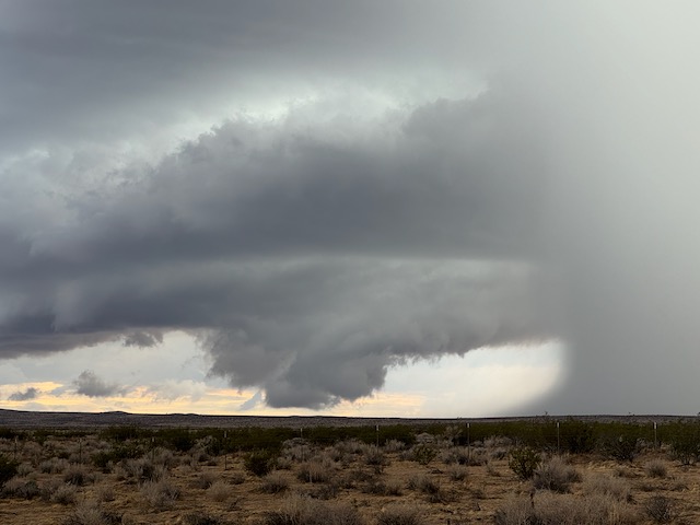
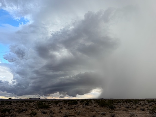
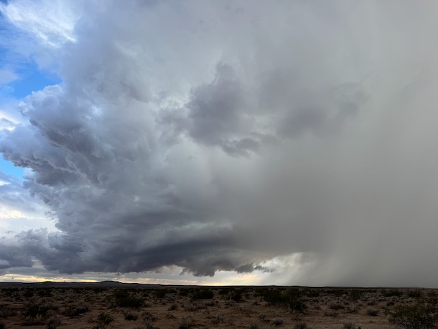
This storm rivaled a lot of the Great Plains supercells that I have witnessed, at least in terms of pretty structure. Was it dumping big hail? I don’t know. Was it associated with a nice lightning show? No, but there was continuous thunder in the updraft which was close to overhead for me. The muggy E or ENE wind was blowing into it, and it looked to be a tornado candidate. I didn’t see a tornado.
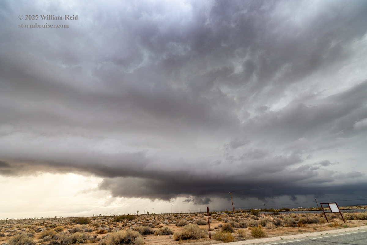
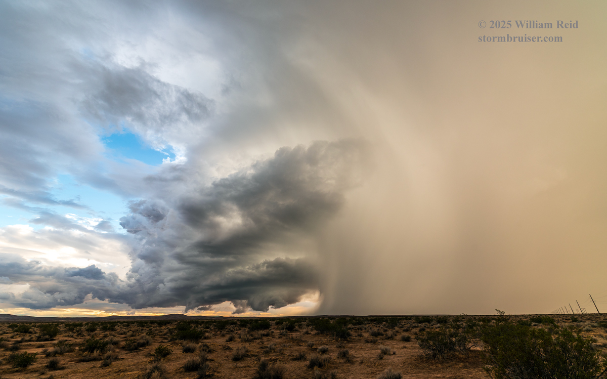
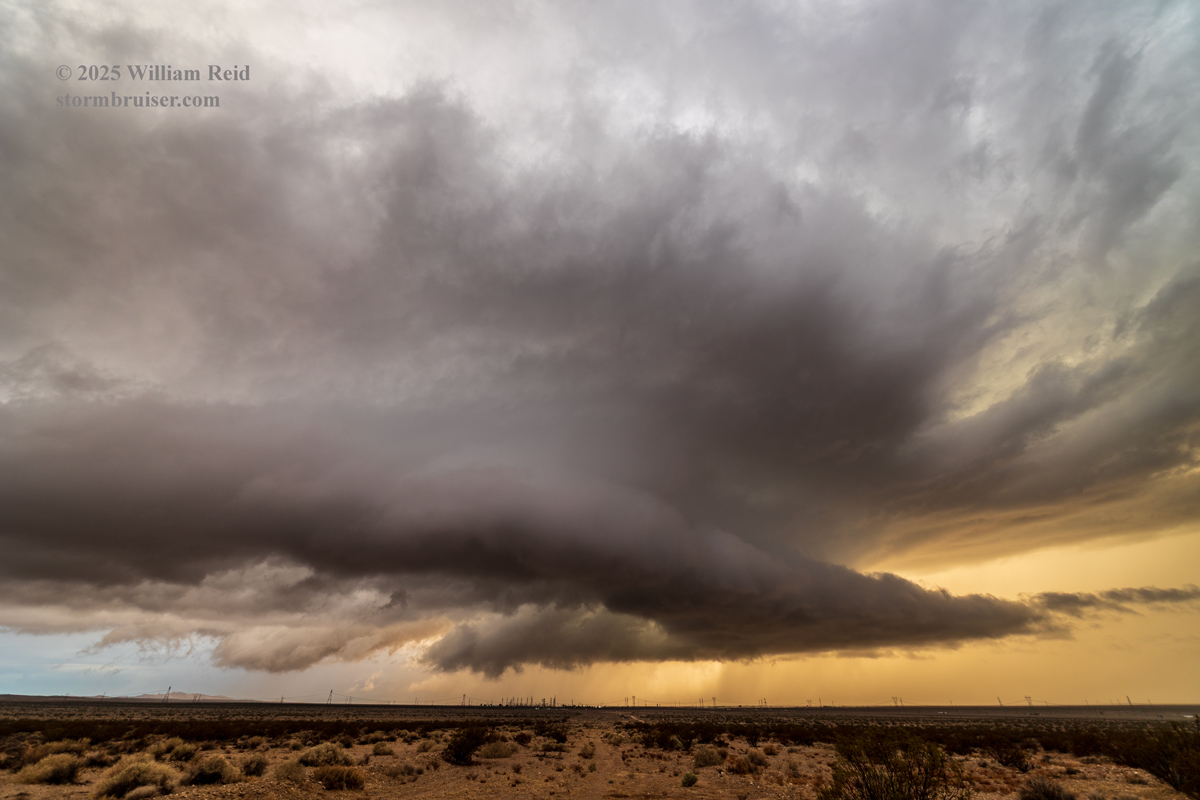
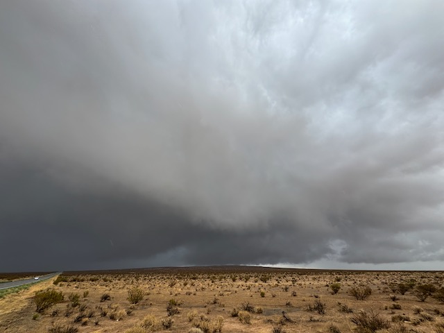
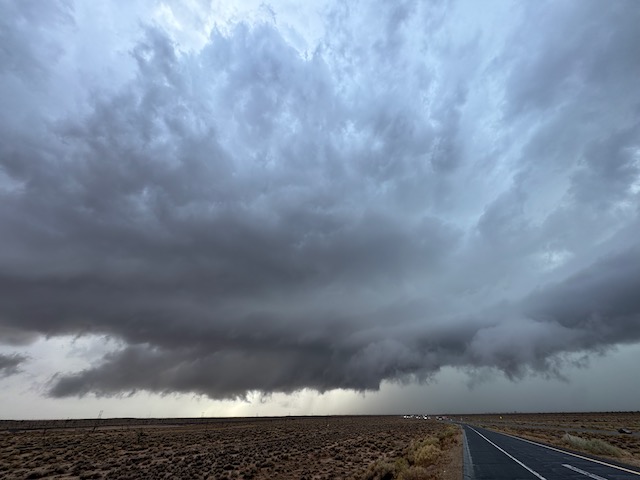
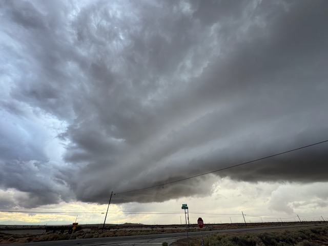
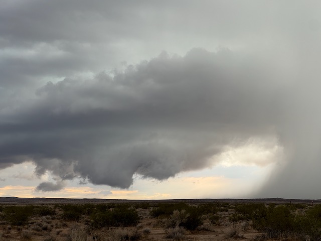
I elected to back off to the ENE a couple of miles to lose some annoying utility wires, and I set up the camera on the tripod for some time-lapse video. This was east of Kramer Junction. More iPhone pics below.

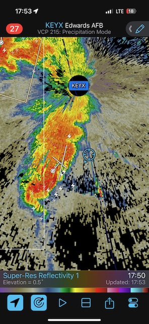
Look how close I wound up to the Edwards radar site on this chase. EDWARDS!
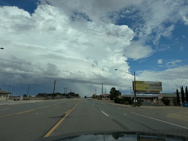
And that was about it. The sun had just set, I was getting rained on a bit, and the storm scooted to the north and got a little wetter and messier. There was no nice lightning to shoot, so I headed back to Mojave (with some road flooding near Boron) and was home by about 10 p.m. I had completed what might have been my best California “storm” chase ever. I have had some California chases which have been a little better in terms of photography and WOW factor (lightning displays over the coastal waters, firestorms, fantastic wave cloud displays, etc.). But to witness very nice supercell structure so close to home on this September chase was special. The meteorology suggested that something like this could happen. But a California storm chaser, generally speaking, does not leave Westlake Village thinking that he or she will be looking at a desert supercell later in the day! In case you missed it, there is a link near the top of this post to my timelapse video of the supercell near sunset at Kramer Junction.
Edward dropped by with my FedEx delivery on the following day at 2:30 p.m.
This storm event, courtesy of ex-tropical storm Mario, caused quite a bit of flooding and flash flooding in desert areas from north of Mojave (around Jawbone Canyon) to Randsburg and northeastward into Death Valley. Some main roads were damaged and some casualties resulted.
Leave a Reply
You must be logged in to post a comment.