
I was solo this day. As the Tempest Tour 6 bunch tried their luck in extreme northwestern Missouri, I stayed on the High Plains of eastern Colorado. Out of Oakley, KS, I drifted west as it looked like I needed to be somewhere from Limon to La Junta. Today would be a little different for me, as I had no easy data via the laptop as I usually do when in the Tempest van. I relied heavily on the weather radio, with occasional checks of the cell phone for surface maps and radar data. The severe weather setup looked pretty decent. Here is the 1630Z Day One outlook by SPC:
SPC Jun 11, 2015 1630 UTC Day 1 Convective Outlook
If you are disinclined to click on that link, here is the pertinent part regarding the slight risk area (and 2 percent tornado risk) for southeastern Colorado and vicinity:
.CO INTO KS/OK...
   A POSITIVELY TILTED MID LEVEL TROUGH EXTENDS FROM WESTERN NEB INTO
   THE FOUR-CORNERS REGION TODAY.  SEVERAL WEAKER IMPULSES ON THE
   SOUTHEAST FLANK OF THIS TROUGH WILL HELP TO INITIATE SCATTERED
   THUNDERSTORMS OVER THE CENTRAL ROCKIES TODAY...SPREADING INTO THE
   PLAINS STATES.  A COLD FRONT SAGGING SOUTHWARD ACROSS WESTERN KS
   WILL PROVIDE ONE FOCUSING MECHANISM...WHILE OTHER STORMS FORM
   SOUTHWARD ALONG THE DRYLINE OF WEST TX.  A DEEP-MIXED BOUNDARY LAYER
   OVER MUCH OF THIS AREA WILL POSE A RISK OF GUSTY/DAMAGING WINDS IN
   THE STRONGER CELLS.  SUFFICIENT WESTERLY FLOW ALOFT WILL ALSO
   ENHANCE RISK OF ORGANIZED MULTICELL OR ISOLATED SUPERCELL STORMS
   CAPABLE OF HAIL.
By the time I reached Kit Carson — the town, not the person — I had a storm to intercept! It was to my west — dead ahead — by about 80 miles, and moving to the east.
And, by 2:38 p.m. MDT, a severe watch had already been issued for southeastern CO and a new mesoscale discussion was issued:
MESOSCALE DISCUSSION 0973
   NWS STORM PREDICTION CENTER NORMAN OK
   0338 PM CDT THU JUN 11 2015

   AREAS AFFECTED...PORTIONS OF E-CNTRL AND SERN CO

   CONCERNING...SEVERE THUNDERSTORM WATCH 284...

   VALID 112038Z - 112215Z

   THE SEVERE WEATHER THREAT FOR SEVERE THUNDERSTORM WATCH 284
   CONTINUES.

   SUMMARY...A LARGE HAIL/DAMAGING WIND THREAT CONTINUES ACROSS WW 284.

   DISCUSSION...RADAR IMAGERY FROM KPUX SHOWS SEVERAL STRONG TO SEVERE
   THUNDERSTORMS ACROSS SERN CO...WITH ONE SUPERCELL OVER SRN LINCOLN
   COUNTY MOVING ESEWD WITH TIME. ADDITIONAL CONVECTION IS FORMING
   ACROSS THE HIGHER TERRAIN OF SERN CO WITH THE APPROACH OF A
   SHORTWAVE TROUGH OVER SRN CO/NRN NM. OTHER STORMS MAY FORM ALONG
   OUTFLOW BOUNDARIES GENERATED BY EARLIER CONVECTION. SFC TEMPERATURES
   HAVE WARMED INTO THE LOW TO MID 80S...WITH DEWPOINTS GENERALLY
   REMAINING IN THE MID TO UPPER 50S. MLCAPE OF 1000-1500 J/KG WILL
   CONTINUE TO SUPPORT A LARGE HAIL THREAT WITH THE STRONGER
   CORES...WHILE STEEP LOW-LEVEL LAPSE RATES MAY ALSO PROMOTE A
   DAMAGING DOWNDRAFT WIND THREAT. WITH MID-LEVEL FLOW STRENGTHENING
   WITH THE APPROACH OF THE SHORTWAVE TROUGH TO THE W...THE CONVECTION
   FIRING ALONG THE HIGHER TERRAIN OF SERN CO SHOULD ALSO BECOME SEVERE
   WITH TIME. ELY LOW-LEVEL FLOW VEERING TO SWLY ALOFT AND 0-1 KM SRH
   AROUND 150 M2/S2 PER THE KPUX VWP SUGGESTS AN ISOLATED TORNADO MAY
   ALSO BE POSSIBLE...ALTHOUGH WINDS IN THE 0-2 KM LAYER ARE RELATIVELY
   WEAK.

   ..GLEASON.. 06/11/2015
This was working out nicely for me! But, I made the mistake of heading west and then WNW on 287 to Aroya, thinking that the storm would move mainly to the east. It started to turn more to the ESE — no big surprise — but I didn’t figure that out soon enough. As I headed east from Aroya on 94, I pondered my chances of squeezing by in front of the storm along 71, between Punkin Center and Ordway. That was looking too dicey. I didn’t need more hail dents on the Xterra and windshield glass in my lap. This new supercell was starting to look pretty good, and I needed to be a little southeast of it. Now, I was northeast of it, in a rather sparse paved road network. I pondered going back to Kit Carson and south to Eads and west to Haswell to get into position. GAD! That would take forever and take me too far from this nice storm for too dang long! Well, what about a dirt road? Hmmm…there’s that old State Highway 63 that goes north-south through here somewhere west of Aroya…but it is not paved. I think I had used it once before to get from Aroya to Haswell without any problems. But, it was a good 30 or 35 miles to Haswell, and it has been a wet spring, there’s this growing supercell approaching, nothing could go wrong, right?! I had a high clearance 2WD SUV, though, I should be able to get down south easy enough! And, lo and behold, there’s old State Highway 63 right there, it’s time to turn left! You wouldn’t expect a storm chaser to turn around and do the prudent thing, would you?
Right off the bat, the dirt road was a problem. There was a long mound of dirt going down the middle, and I soon learned why — a couple of big road graders were doing what graders do best — grade big roads. Apparently the road had been messed up and needed attention. Not good. I was driving in the left shoulder where the sand was pretty bad in spots. A conventional car would have had big issues through here, but my Xterra was doing okay. I just didn’t know if the road ahead would get worse or not. If it got worse and I had to turn around, then I might be dealing with a bad road getting rained on, and then I might be in heaps of trouble.
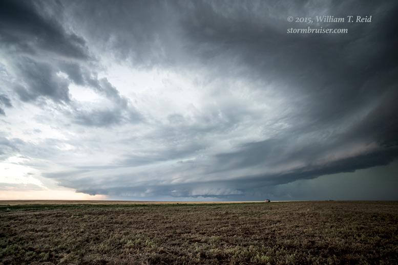
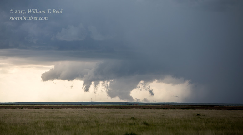
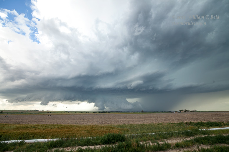
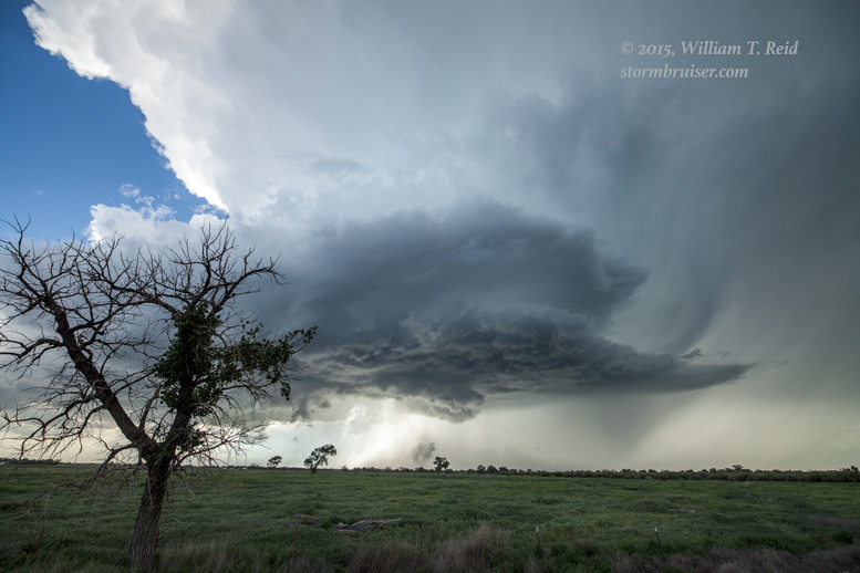
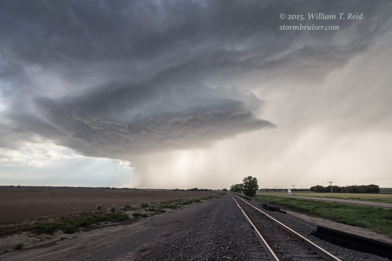
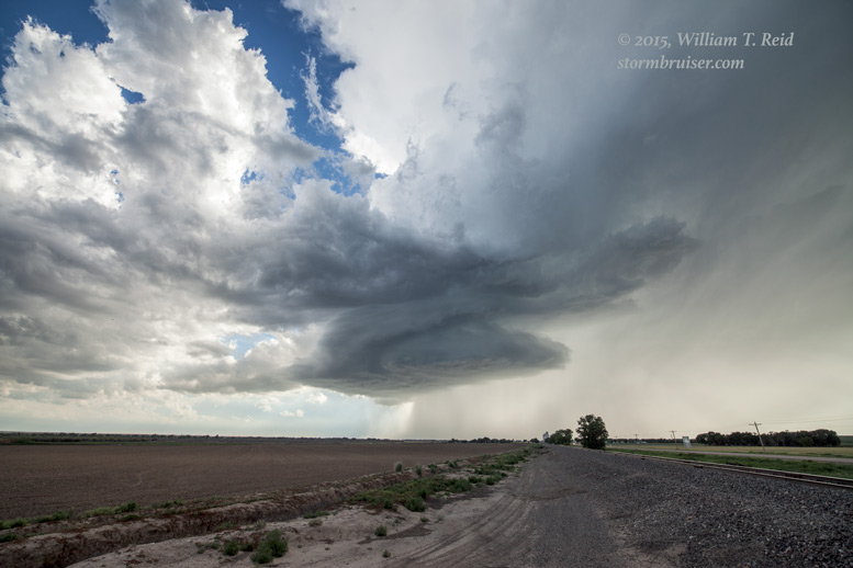
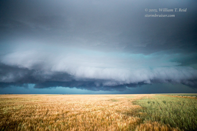
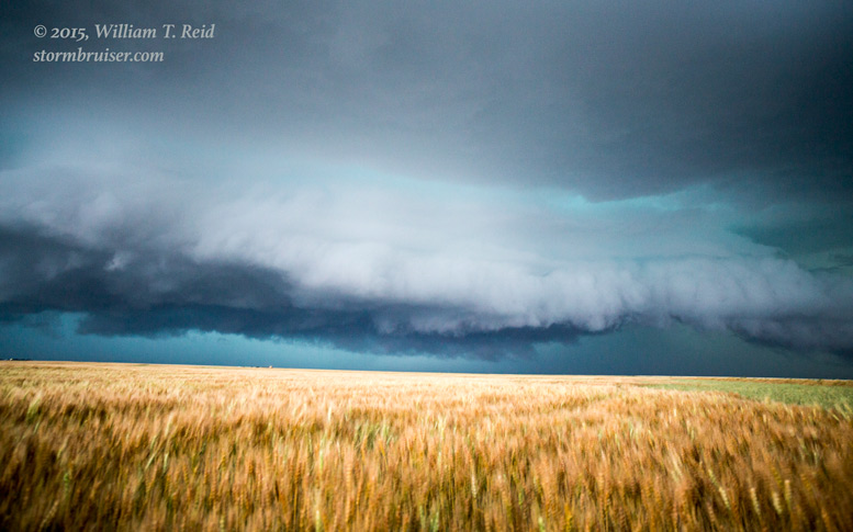
After I passed the graders, I was still driving in the sandy left shoulder for a while. A few miles later though, the unpaved road was back to normal and I could do an easy 50 mph on it. The developing supercell was still to my southwest as I neared the halfway point to Haswell, and I had a little time to stop and take some pictures.
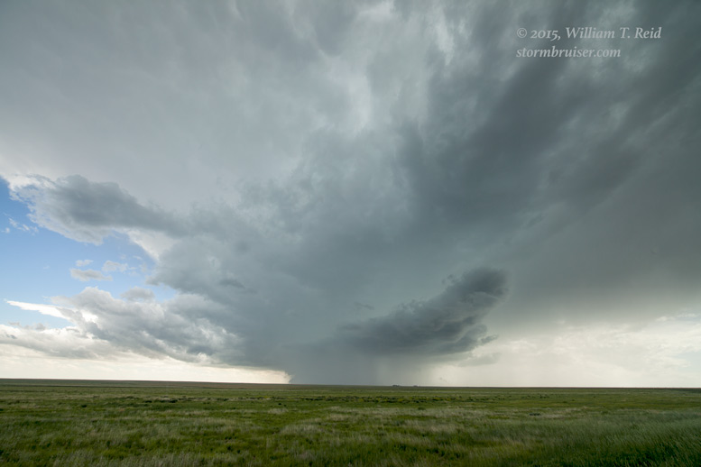
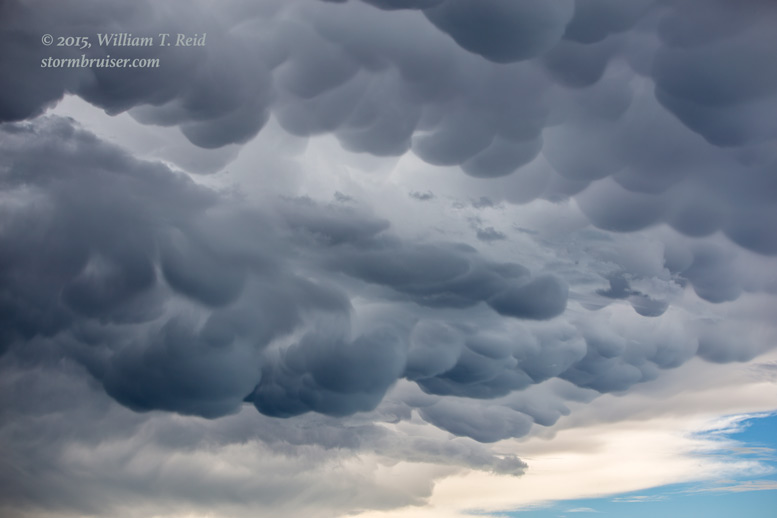
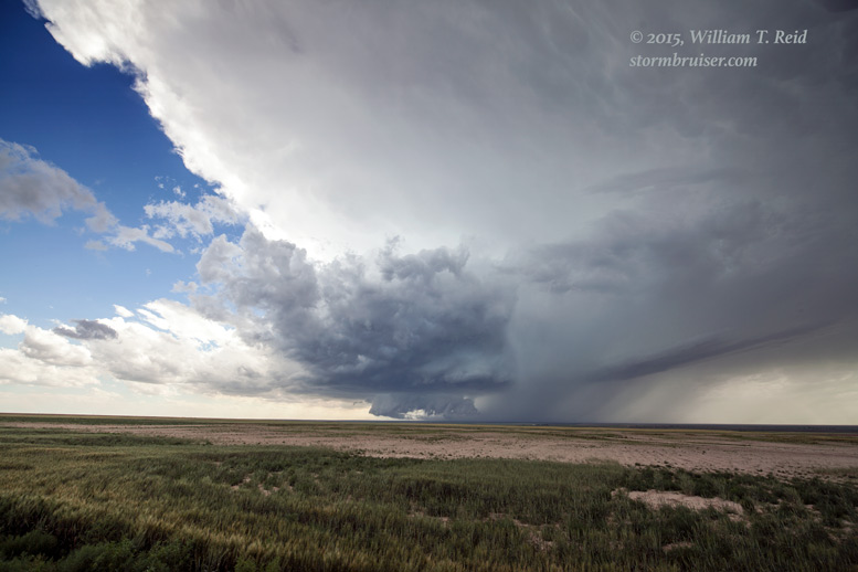
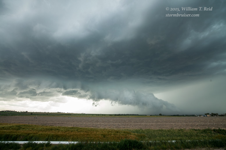
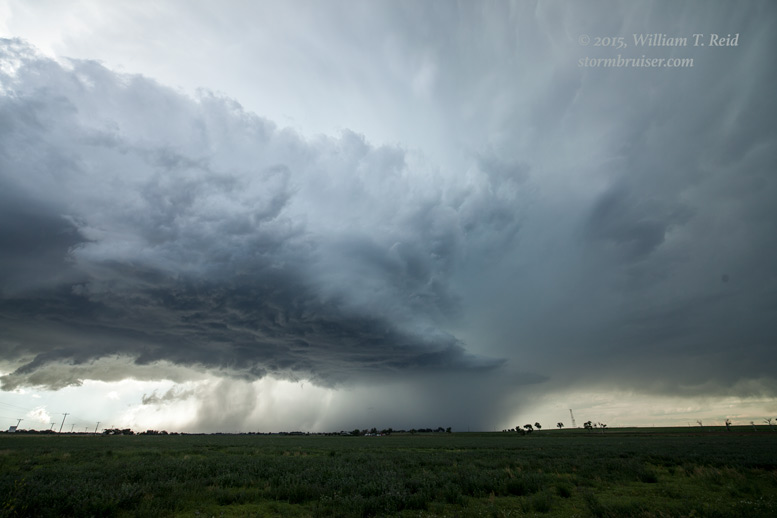
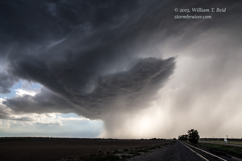
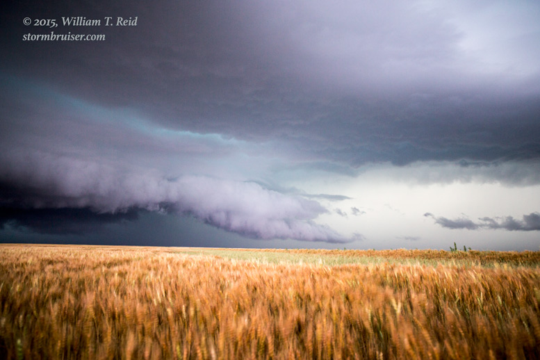
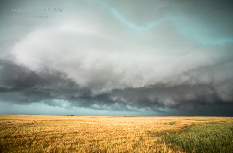
The mammatus just to my northeast was quite impressive! I needed to keep moving or risk having my road ahead getting wet and soft. It was raining lightly when I reached Haswell, and the storm base was to my southwest by maybe 9 miles. A nasty hail core loomed down highway 96, west-southwest of Haswell. A major-league wall cloud begged to have its photo taken, though it did not seem to show much rotation. I stopped in the rain just east of Haswell to appease it.
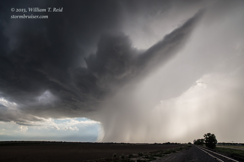
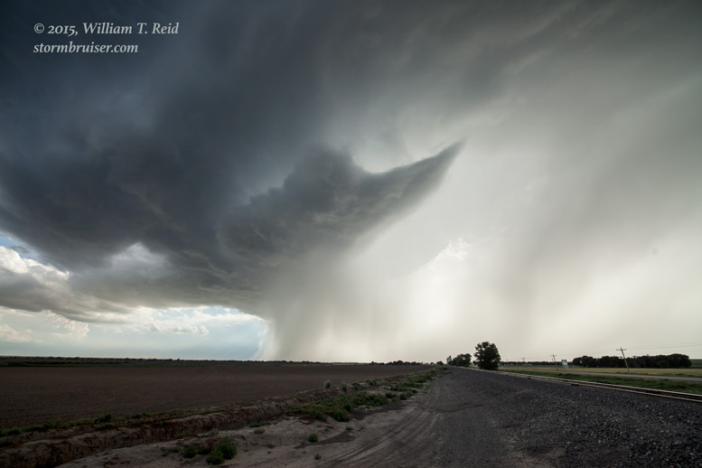
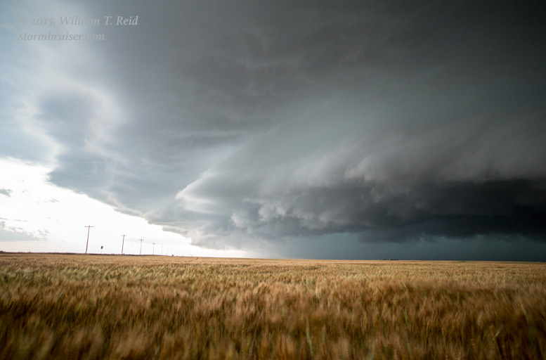
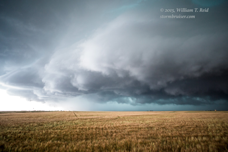
With the updraft to my southwest and storm motion to the ESE, I had more re-positioning to do. I headed east to Eads and south towards Wiley. I stopped near Wiley and had a great view of the action area as it headed in my direction.
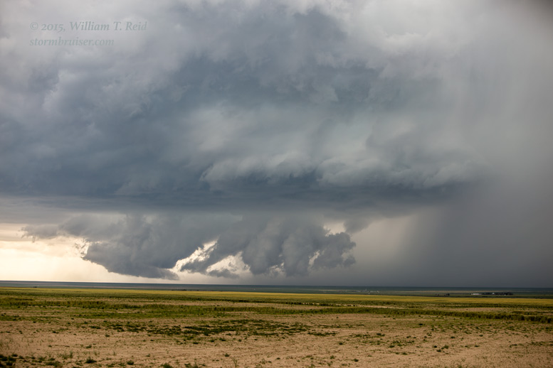

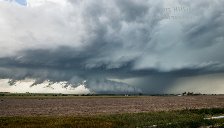
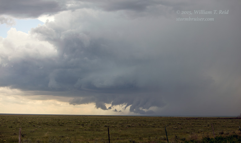
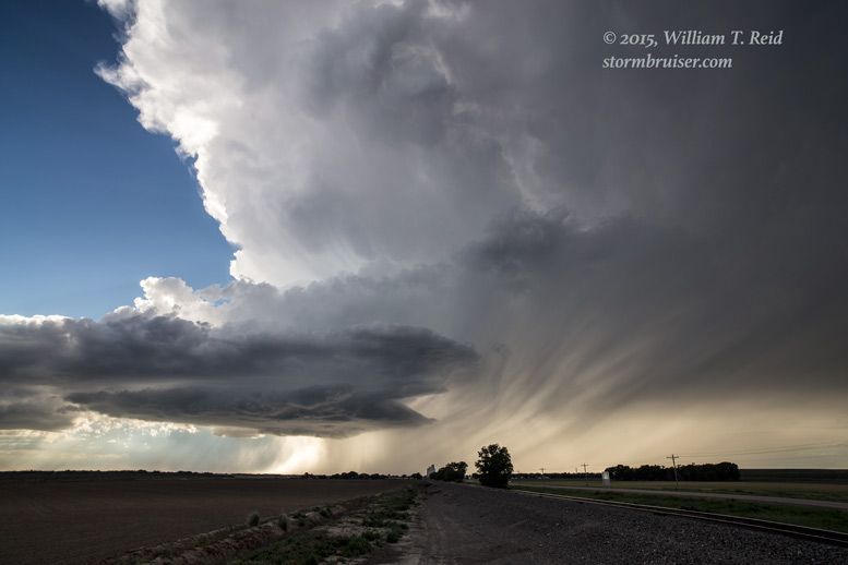
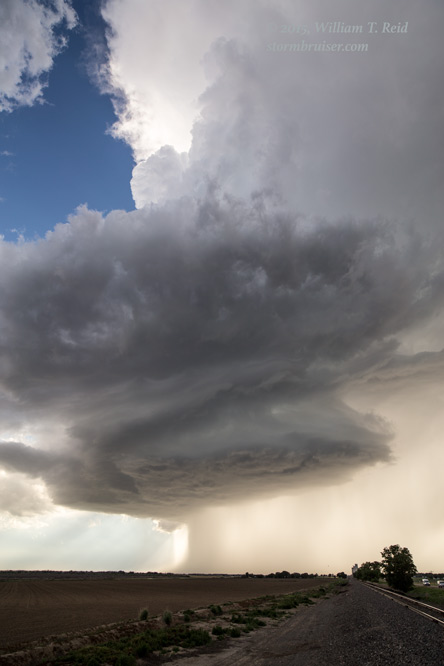
The shots above show a large tail cloud feeding the updraft base from north to south. The other lowered areas were generally industrial-sized pieces of scud which were attached to the base and not rotating much, at least from my vantage point.
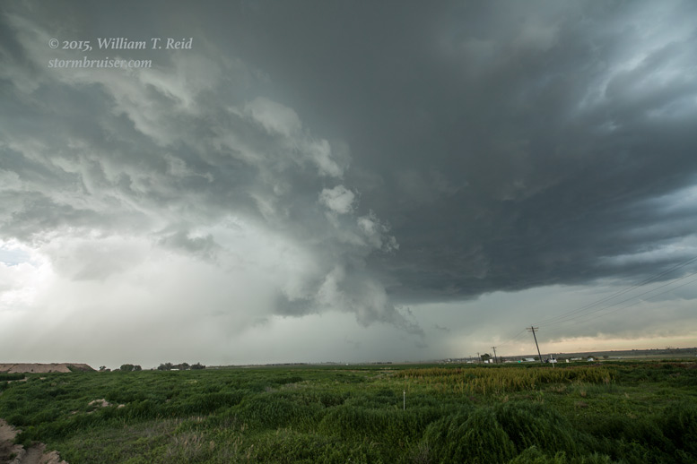
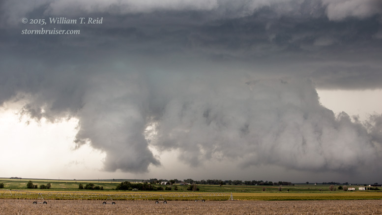
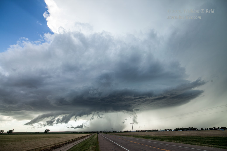
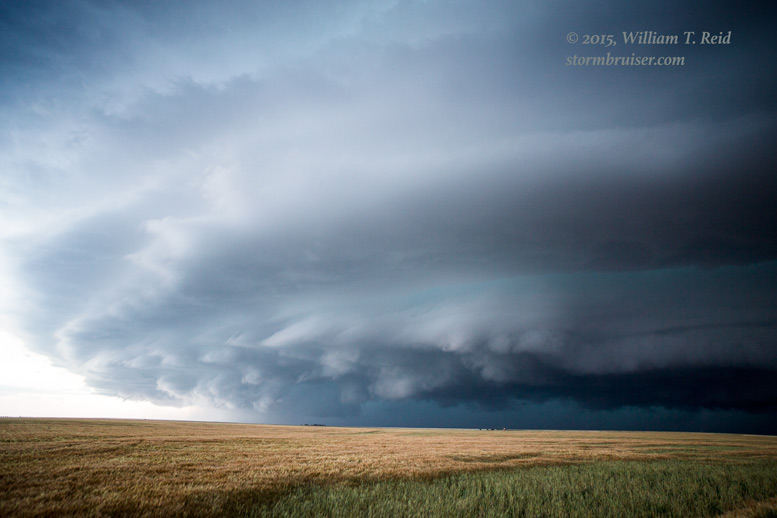
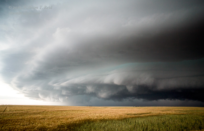
I scooted closer to Wiley as the base, above, moved towards Highway 287. It didn’t look like this supercell was going to make a tornado, so I went into structure-viewing mode. About 20 minutes later I was a few miles east-northeast of Lamar, with a good view of the supercell.
My chase buddies Martin and Kim were getting hammered by hail at this time on the west side of Lamar. They kept calling me — Is the hail core clear of U.S. 50 yet?! Nope — it is sitting on Lamar and you can’t get here from there without getting pounded! The supercell continued to look good as it cleared Lamar and took aim on Granada.
and, during the same time frame near Granada , with a second camera:

The updraft began to weaken and the updraft base became a bit cockeyed at this point. I think I stayed with it to Coolidge, KS, but by then it was a goner. It was only 6 p.m. MDT, though, so what to do next? SPC was still thinking CHASE, BILL, CHASE!
   MESOSCALE DISCUSSION 0978
   NWS STORM PREDICTION CENTER NORMAN OK
   0710 PM CDT THU JUN 11 2015

   AREAS AFFECTED...SE CO...SW KS...NRN TX PANHANDLE...OK PANHANDLE

   CONCERNING...SEVERE THUNDERSTORM WATCH 284...286...

   VALID 120010Z - 120145Z

   THE SEVERE WEATHER THREAT FOR SEVERE THUNDERSTORM WATCH
   284...286...CONTINUES.

   SUMMARY...TSTM ACTIVITY...INCLUDING SUPERCELLS...IS EXPECTED TO
   PERSIST FOR AT LEAST THE NEXT TWO HOURS OVER AT LEAST THE SRN
   PORTION WW 284 AND THE MAJORITY WW 286. GIVEN THE PRESENCE OF
   SUPERCELLS...ALL SEVERE HAZARDS ARE POSSIBLE WITH LARGE HAIL
   REMAINING AS THE PRIMARY THREAT.

   DISCUSSION...REGIONAL RADAR IMAGERY CONTINUES TO SHOW NUMEROUS
   STRONG TO SEVERE STORMS...INCLUDING SEVERAL SUPERCELLS...ACROSS THE
   WATCH AREAS. WITH THE ANTICIPATED PERSISTENCE OF STEEP MID-LEVEL
   LAPSE RATES AND STRONG SHEAR /RECENT KPUX VAD HAD 50 KT OF 0-6 KM
   BULK SHEAR AND 00Z DDC SOUNDING HAD 46 KT OF EFFECTIVE SHEAR/...THE
   OVERALL ENVIRONMENT IS EXPECTED TO REMAIN SUPPORTIVE OF SUPERCELLS
   FOR AT LEAST THE NEXT 2 HOURS.

   A SEMI-DISCRETE TO DISCRETE STORM MODE WILL LIKELY CONTINUE THROUGH
   01Z. PROLIFIC HAIL PRODUCING SUPERCELL THAT MOVED ACROSS PROWERS
   COUNTY CO HAS RECENTLY SHOWN SOME SIGNS OF WEAKENING WHILE MOST OF
   THE OTHER SUPERCELLS HAVE SHOWN THE TYPICAL CYCLING OF STORM
   STRENGTH. AT SOME POINT...THIS INITIAL CELLULAR ACTIVITY IS EXPECTED
   TO EITHER DIE OFF OR MERGE INTO CLUSTERS AS THE LOW LEVEL JET
   INCREASES WITH A RESULTANT INCREASE IN ISENTROPIC ASCENT OVER THE
   FRONT. AS A RESULT OF THESE POTENTIAL MERGERS AND INCREASED STORM
   COVERAGE...THE POTENTIAL FOR UPSCALE GROWTH EXISTS.

   ..MOSIER.. 06/12/2015
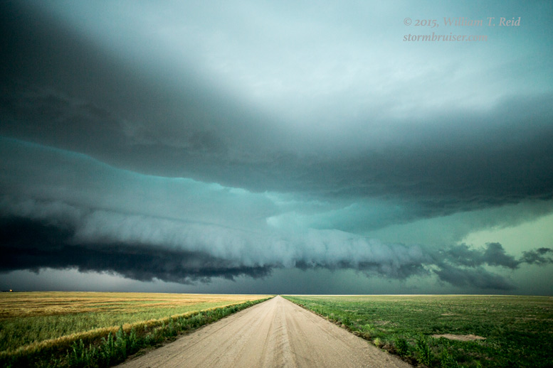
A strong cell was south of Holly, so I checked that one out. I would have liked to have gotten south of it, but the core blocked Highway 89 for a while. By the time it cleared, the storm was sputtering. Some new stuff was moving into Baca County, and the air there still looked good. Martin and Kim had found me, and we made our way down to Lycan and over to Two Buttes. We stopped a few miles short of 287 on Highway 116, with a good view of a nasty storm that was taking aim on Springfield!
This was a REAL beast! It was large and it was spinning hard and it meant business. Daylight was in very short supply, though, and I wanted to be a little closer. I made my way to 287 and then south perhaps five miles, halfway to Springfield. The supercell’s main updraft was primarily to my southwest, with a sculpted wall approaching fast from the west, too.
In the images above, the dirt road heads to the west and the line of power poles leads southward, to Springfield. Even the 15mm lens could not fit the entire thing in! As the core neared my location, I had to get out of Dodge FAST. Actually, there were three options. I could stay where I was, ride it out, and probably get hammered by golfballs. Or, blast south into Springfield and try to find shelter for the vehicle in time. Or, blast north and put as much space as I could between myself and the nastiest part of the storm, which was approaching Springfield. I chose the latter option! Springfield was visited by all sorts of atmospheric tumult, and it is a good thing that I didn’t try the dash to Springfield. That window had closed! Tornadoes were reported northwest and northeast of town. Two-inch hail swept through on severe winds. Numerous power poles were blown down in and around town. This was a very large and vicious storm! It got even worse a little farther east, at Walsh, with severe winds and 3-inch hail. I managed to make it a few miles north, back to the junction of highway 116. The hail wasn’t too big, but the wind and heavy rain made driving impossible. Fortunately, I just had to wait ten minutes or so.
My drive to the motel in Lamar was a rather slow and wet and windy affair, and it was nice to take a long and relaxing break after a long day on the road. It had been a while since I had chased by myself on a very active day, and I got out alive! (Martin and Kim had made it south of the supercell, south of Springfield, before the core moved through.) The Baca County supercell weakened as it moved into Kansas, which was a fortunate thing for residents of Morton and Stanton counties. The storm received special mention in the SPC mesoscale discussion issued at 8:48 p.m. MDT:
MESOSCALE DISCUSSION 0982
   NWS STORM PREDICTION CENTER NORMAN OK
   0948 PM CDT THU JUN 11 2015

   AREAS AFFECTED...FAR SE CO...SW KS...NRN TX PANHANDLE...OK PANHANDLE

   CONCERNING...SEVERE THUNDERSTORM WATCH 286...

   VALID 120248Z - 120415Z

   THE SEVERE WEATHER THREAT FOR SEVERE THUNDERSTORM WATCH 286
   CONTINUES.

   SUMMARY...ISOLATED SVR THREAT CONTINUES ACROSS THE WATCH AREA WITH
   UPSCALE GROWTH UNDERWAY ACROSS FAR SE CO. LARGE HAIL REMAINS THE
   PRIMARY SVR THREAT.

   DISCUSSION...RADAR IMAGERY OF THE SUPERCELL IN BACA COUNTY SUGGESTS
   THAT A TRANSITION TO A MORE LINEAR MODE IS UNDERWAY. THIS IMAGERY
   ALSO SHOWS A MESOSCALE VORT MAX JUST NW OF THE SUPERCELL. THE
   SUPERCELL IS EXPECTED TO CONTINUE EWD INTO WW 286 WITH A CONTINUED
   SVR HAIL AND DAMAGING WIND THREAT. THE TRANSITION TO A LINEAR MCS
   WOULD TYPICALLY FAVOR MORE OF A DAMAGING WIND THREAT BUT THE
   DOWNSTREAM BOUNDARY LAYER STABILITY IS EXPECTED TO LIMIT MOMENTUM
   TRANSFER TO THE SURFACE. SOME DAMAGING WINDS ARE STILL
   POSSIBLE...PARTICULARLY WHENEVER THE MCS INTERACTS WITH ANY
   ANTECEDENT DOWNSTREAM UPDRAFTS. TSTM CLUSTERS ALONG THE FRONT IN
   OCHILTREE AND LIPSCOMB COUNTIES IN THE TX PANHANDLE WILL CONTINUE TO
   POSE A SVR THREAT /PRIMARILY HAIL/. ACTIVITY IN CLARK COUNTY KS HAS
   SHOWN A DOWNWARD TREND DURING THE PAST FEW SCANS.

   ..MOSIER.. 06/12/2015
Leave a Reply
You must be logged in to post a comment.