Start, Kimball, NE; end, Oakley, KS; 415 miles; late breakfast in Kimball (at The Diner)
Bob Smith and the Tempest guests and I began the day in a chilly, drizzly and windy Kimball, NE. In the morning briefing I said that our target area was not too far to our south: generally the Yuma and Washington counties area of northeastern Colorado. All we needed to do was to find storms that were moving northward into backed/easterly winds in that area. There would be plenty of early afternoon sunshine and enough moisture (dews in the low 50s) to allow strong storms. The forecast easterly upslope winds looked really good to me, and I told the group that they had about a 50-50 chance of seeing a tornado this day.
spc-mesoscale-discussion-545 NE CO/11:30 MDT
spc-mesoscale-discussion-547 NE CO/4:20 p.m. MDT
spc-mesoscale-discussion-550 W KS/5:30 p.m. MDT
spc-mesoscale-discussion-551 NE CO/6:30 p.m. MDT
Check out the SPC graphics and discussions provided above for today’s meteorology. The SPC surface chart in the early graphic shows the east-west front through northeastern Colorado, roughly along U.S. 34 from Akron to Wray. Tornadoes like those boundaries, so it would be prudent to be in position on storms that were near or on this east-west boundary. The 500mb flow was quite healthy and primarily from the south, at 45 to 50 knots.
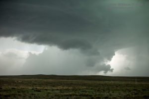
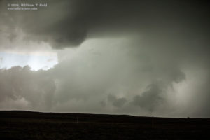
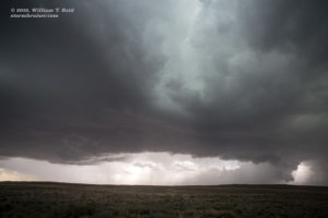
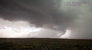
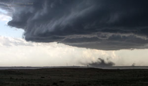
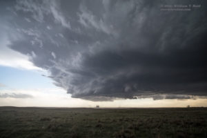
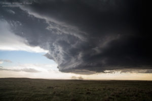
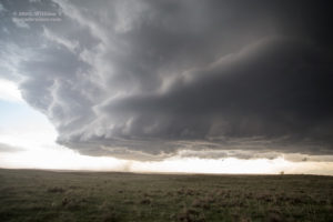
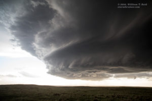
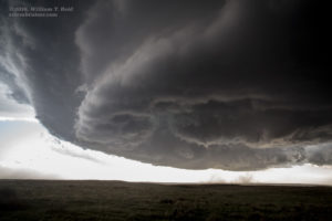
We spent much of the early-to-mid afternoon along U.S. 36 (about 30 miles south of U.S. 34) from Last Chance to Anton to Cope and Joes. Winds were easterly along this east-west route and we just had to be patient. Storms initiated near I-70, which straddles the Palmer Divide. I blew off the first cell over towards Stratton and focused on new stuff farther east, around Flagler. We watched a couple of cells approach while near U.S. 36, and there was some decent structure, but the storms were rather high-based still and not particularly close to being tornadic. Storm bases were high, and precipitation shafts were heavy.
These views (above) are generally to the south as the supercells approached. There were occasional lowered areas and some evidence of low-level rotation, but this rotation was not strong. One cell was quite intense north of Joes and chased us north on 59. It provided some one-inch hail and then gave it a better tornado try — not quite. We scampered east on Yuma County Road 26 to get out of anvil rain, and saw an action area to our southwest. It became rain-wrapped quickly (last four images above and two below), and our video suggests a possible tornado.
The SPC reports include a “brief” tornado 4S of Heartstrong (which is on Road 26) at 2215 GMT (4:15 p.m. MDT). Rain hit us again, and I led our group north on Road Z to U.S. 34, west of Wray.
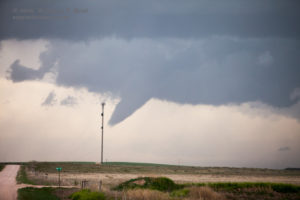
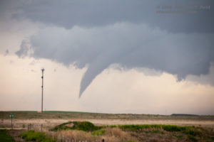
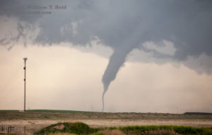
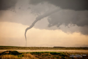
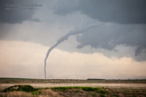
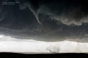
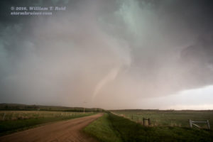
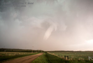
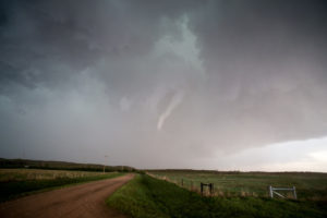
A lot of chasers seemed to be “honing in” on a big cell or two not too far from Wray, Colorado, in Yuma County. We were, too. It was about 5 p.m. MDT by now, with plenty of daylight left and with storm bases nearby that were looking big, and ready to rock and roll! We stopped about five miles north of Wray (on U.S. 385) to watch a wall cloud to our west. I decided to call for rooms at this moment, and naturally, a funnel cloud forms to our west. I cut the call short, and a few minutes later a tornado was in progress to our west, maybe six miles distant. It looked great! It would have been nice to have been a little closer, but it was in the sand hills where roads are few and dubious. This one had a rather slender funnel and it lasted at least four minutes. The rope out was cool. The SPC log gives the location as 5 to 7 miles NNE of Eckley, near Road W at 5:01 p.m. MDT. This would put it about nine miles to our west.
I think what I recall most from this “intercept” was that we were near a cattle feedlot, and the smell was awful for the entire time. We must have been on County Road 42, west of 385 a bit, as Google maps shows a huge feedlot right there.
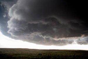
The supercell which spawned the tornado was continuing to the north, on the west side of U.S. 385. It looked like a new action area might be forming, and we went north another few miles — maybe as far as the next curve in the road, one-third of the way to Holyoke. I had Bob stop. Another large supercell was coming at us from the south along 385. It was south of Wray. Bob was somewhat keen on turning around to chase that one, as he really liked how it was looking visually. It is difficult to leave a proven tornado-producer, which we definitely had just to our northwest. The newer supercell to our south sported a large and impressive rain-free base, and was coming right at us. It was south of Wray by perhaps 5-10 miles. The tornado-producing supercell to our northwest was not especially appealing, visually. I was torn. Should I commit to the new cell or stick with the old cell? My eyes, and Bob’s input, eventually convinced me. It was time to turn back to the south. I was thinking that maybe the sweet spot for tornadoes was along that same east-west axis/boundary where the Eckley tornado formed…this next cell could very well produce when it arrived along the same axis. Bob says that he remembers me saying as much to our tour group!
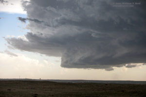
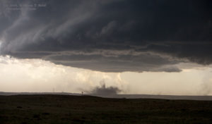
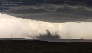
We stopped north of Wray (on Road 39, four miles north of Wray at U.S. 34), with a great view of the approaching storm. I had the camcorder running as the supercell and its nice structure advanced towards the town. Dusty spin-ups occurred beneath a churning base —- that looked to be just south of Wray, but I was not sure. The town was directly in the path of the action area, that was for sure. And so were we.
In the zoomed-in images above, the Wray water tower is visible in front of the dust that is getting kicked up by weak tornado activity just south of town. The view is to the south. The wide-angle shots show the storm updraft structure as the supercell approached. The SPC log states that a tornado lasted two minutes, three miles south of Wray, near County Road 32, around 5:41 p.m. MDT.
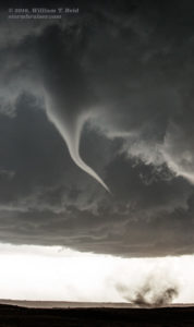
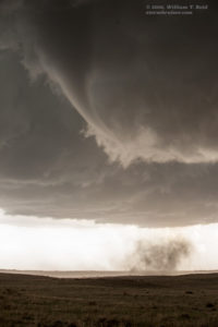
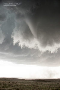
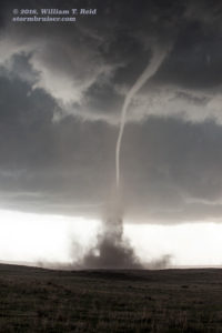
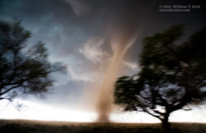
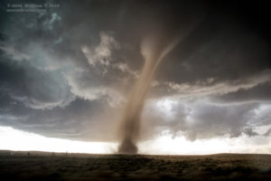
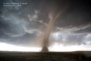
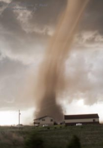
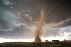
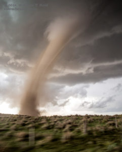
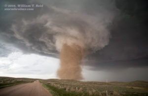
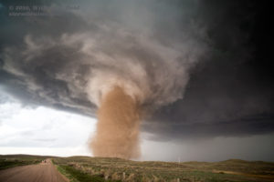
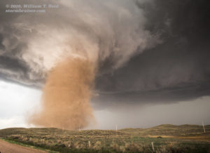
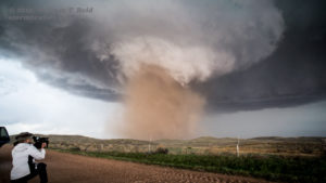
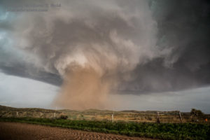
As the storm base neared, it was rotating quite hard towards the leading edge. Dust started to stir again beneath. A slender funnel cloud materialized from the base above, and connected to the dust a minute or two later. This eventuated about a mile away. We marveled at the awesome scene, but then I had to figure out if we should move east or west, as this thing was going to move through our spot, or within 200 yards of it, in the next few minutes! It was about 5:52 p.m. MDT.
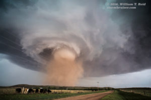
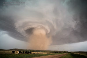
I asked Bob to back up to the west, then changed my mind and had him charge east across 385. I was a bit nervous and quite uncertain as to which side of the tornado we should be on as it passed by. I didn’t consider, or even think of, heading north a little on 385 to remain in front of it. I don’t know why. I don’t really know why I changed my mind and went east instead of west, either. Maybe I intuitively knew that being a tad farther west might mean an increasing threat of hail. The bottom line was to be somewhere else, and not here! Meanwhile, the tornado was looking about as fabulous as tornadoes can look. I clicked away furiously towards the south—this was indeed a good direction to go, as I had a perfect view of the tornado through my open van window. Bob took us east about a quarter mile. We stopped and shot a few more stills and video, and had to get farther east again. This was on a dirt road. The wind was getting nasty, and the tornado was getting a little too close and scary-looking for this tour director. Here are the looks to the south from County Road 39 in Yuma County, less than a mile east of U.S. 385. All were shot with the 21mm wide-angle lens on the full-frame Canon camera. Some images are cropped.
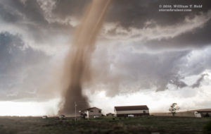
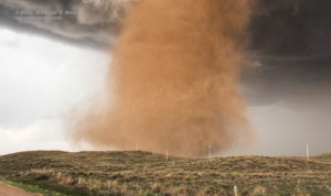
After about another one-half mile, we stopped and got out to see a gigantic dust tube spinning rapidly just to our WSW, perhaps a half-mile away. (CR 39 goes WSW-ENE here.) The tornado moved rather methodically to the NNE, and we were able to watch without too much concern for our safety now! I managed a bunch of stills and video — this tornado was quite strong and quite close and absolutely spectacular. What a moment this was!
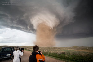
We started getting some rain and hail along with the wind, so I had the gang get back into the van. I figured that we should try to stay with it. Bob steered us east again, and the road soon made a nice turn back to the north. We only went a quarter mile or so north before stopping again, as CR 39 jogged east again here. With the rain getting to be more of a nuisance, I was reluctant to go much farther on the unpaved surface. From here, we still had a great look at the tornado, so we stopped again and I took more pictures.
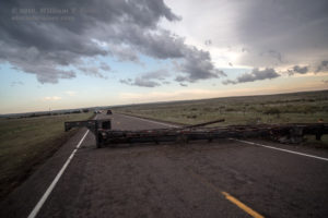
All of the images above were from the intersection of CR 39 and CR JJ. There was plenty of rain and wind and sporadic hail. That is road JJ above, which points the way to the north. The tornado eventually became more involved with rain and roped out around 6:15 p.m. MDT. Wow–what a stunning 20 minutes that was! We didn’t much care about following the supercell any longer, as nothing could top what we had just witnessed. There were no other storm cells heading towards our magical east-west boundary, so there was no need to rush off anywhere. We went back to 385 and saw some of the damaged buildings where we had just been. Some stuff was partially blocking 385, but we were able to make our way around that. We went east into Kansas on U.S. 34 and eventually to Oakley for the night. There were no other storms to chase along the way.


















Leave a Reply
You must be logged in to post a comment.