Start, Kimball, NE; end Dodge City, KS; 529 miles; lunch at North Platte (Runza)
Following the big bust yesterday in southeast WY, we had a chance to redeem ourselves today. SPC had a large swath of severe risk painted from the Rio Grande near Sanderson northward to north of Bismarck, ND. The enhanced slight risk area was from SW KS to near Lubbock, TX. East of the dry line/surface trough, winds were backed some and dew points were well into the mid 60s. This could be a good tornado day. We started at Kimball and moved over to North Platte for lunch. I liked the southwest Nebraska target area, from about McCook to North Platte. (So did some other chasers — we saw the big research armada at North Platte at lunchtime). Instability and shear appeared to be just as good up in Nebraska as it did down south towards the Panhandles. I didn’t see a pressing need to blast south into KS or the Panhandles.
spc-mesoscale-discussion-676 SW KS and PHs/1:40 p.m. CDT
spc-mesoscale-discussion-677 W NE/3 p.m. CDT
spc-mesoscale-discussion-679 NW KS and SW NE/5:45 p.m. CDT
spc-mesoscale-discussion-682 SW KS and PHs/7 p.m. CDT
spc-mesoscale-discussion-689 NW KS/10:19 p.m. CDT
may-22-route (courtesy of Chris Gullikson)
Youtube link to Chris Gullikson’s video of storm intercept
And the link to the associated GoPro timelapse video by Chris.
After lunch our group headed south on U.S. 83; perhaps halfway to McCook. This appeared to be an area where storm development would be likely, and by 3 or 4 p.m. an area of agitated cumulus was nearby. The cap was winning, though. I did a lot of looking at the models — the HRRR, NAM 4K, RAP, etc. These were generally showing a decent storm or two in this region prior to sunset, but they were also showing a general diminishing trend in coverage and intensity right after 00Z (7 p.m.) I did not like that at all. Storms need to be getting stronger as sunset approaches, and not weaker! In contrast, the storms down south in the tornado watch boxes were NOT forecast to diminish after 00Z — the models kept them going quite nicely.
Near Wellfleet, perhaps (south of North Platte), we watched some towers struggle some more. It was around 4:30 or 5 p.m.CDT, still early and definitely not the time to panic, but I just had a bad feeling about our prospects in Nebraska, especially given what I was seeing on the frequently-updated model runs. Was today going to be another horrible bust where I was, while other chasers reveled in tremendous tornado intercepts elsewhere? I couldn’t stand the thought of that. Some decent radar echoes were starting to show up in extreme southwestern Kansas, well to our south and SSW. If I led the tour down there, I was pretty confident that we would see some severe storms. But that would be a 3-to-4-hour drive, and it would be close to sunset upon arrival. Leaving one’s original target area at 5 p.m. and going for a different target area, more than 3 hours away, is almost ALWAYS a losing proposition. There was also the chance that we would miss a fantastic event here in southwest Nebraska — if I changed my mind.
I decided to do it.
I told the group that we were going to Kansas. I don’t know what they were thinking, but the tour guests might have been less than enthusiastic about the idea as we continued south near McCook. A very beefy storm tower was in our rearview mirrors! Pay no attention to the storm behind the curtains! I can’t look back, now. This day, whatever happens in Nebraska, stays in Nebraska.
As we headed southbound on 83 into Kansas, I tried to figure out when we might finally be close to a storm. This would be about a 200-mile drive during the best storm-chase hours of the day, through storm-free northwest Kansas. There was some good news, though. A nice cell was moving northward, southwest and west of Garden City, KS. All we had to do was to continue down U.S. 83, and if the storm continued to move the way it was moving, we could be on it before sunset.
By about 8 p.m. we were near Scott City, with a view of the murky and dark area to our southwest. This is where our big target storm was, and it was still looking good on radar. It was in kind of a road hole as far as paved roads go — northwest of Garden City and near the 4-corners area of Wichita, Finney, Kearny and Scott counties. Our view in that direction just showed some anvil and little else as far as storm features. We went 15 miles south of Scott City and stopped. I think it might have been raining a little, and I was not much interested in heading off towards this storm on unpaved roads which were going to become more and more problematic. The cell was moving to the north at no more than 15 mph, and it had produced hail to 3.5 inches and a small tornado in the past hour (north of Deerfield). How should I approach this beast?
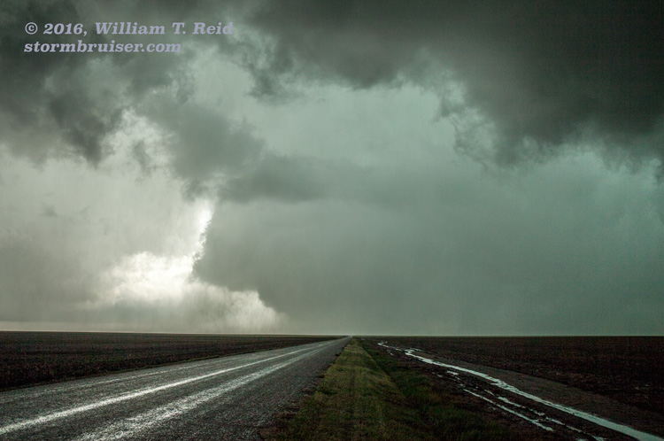
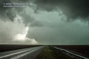
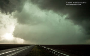
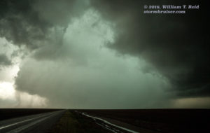
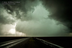
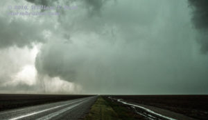
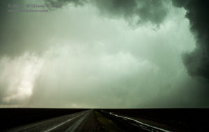
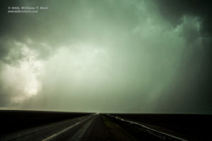
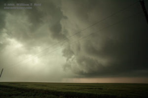
A cop car was also stopped nearby along U.S. 83. Was he concerned with us, or the storm? Or both? I looked at the map, and there was a road to the west, right to where I wanted to be. We had just passed it. Well, we might as well try that road, I figured. This was our last and only chance to get close to anything good before sunset. We went back north a half mile and turned left. This was the road to a little place called “Friend.” And, lo and behold, it was paved! And it continued paved beyond Friend! Off into the unknown we headed. After maybe seven miles or so, we could view what looked to be an updraft base, and, near the ground in the distance was what appeared to be the north side of a wide tornado. We weren’t certain of anything, but as we neared, maybe 4 or 5 miles away, it did indeed look more and more like there was a large tornado in progress to our due west! There was plenty of precipitation blocking the area that we were interested in seeing. The storm base was low and ominous, and the edge of a likely tornado persisted. Our paved road turned to dirt about 11 miles west of Friend, or about 2.5 miles east of the the “4-corners” area. We stopped here to take in the view — whew, it had been a long ride from Nebraska! But we had made it, and to our west was an intense tornado cyclone with a very low base. The edge of a wide tornado was still apparent — but now it was the south side that was revealing itself. A lot of precipitation continued to become involved with the base, and we never did quite see an “obvious” tornado in contact with the ground. If only we had been here about 5 or 10 minutes earlier! Still, we had a splendid view of an intense, rain-wrapped region that held a significant tornado.
Reed Timmer emerged from the action area and shared his up-close tornado intercept story. The SPC reports indicate that a large, rain-wrapped, wedge tornado occurred some 7 to 8 miles east of Lydia, Kansas, in Wichita County, from 8:25 to 8:30 p.m. CDT. This would put it just west of the 4-corners spot, or about 3 to 4 miles west of where we stopped, at the end of the pavement on W Finney Scott Road. Apparently, this tornado was rated EF1, but this web site link states that the tornado was likely strong enough to produce EF3 damage based on video evidence. The wide-angle GoPro video by Chris shows the entire approach from Friend to our stopping point, east of the tornadic storm base. It is an excellent example of how a tornadic “HP” supercell often looks (or “sometimes” looks). Even though we were approaching the cell from a great angle, logistically, to see what might be occurring, we could only see subtle clues which might suggest a strong tornado in progress.
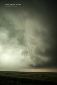
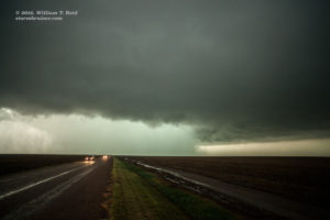
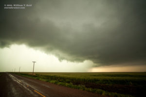
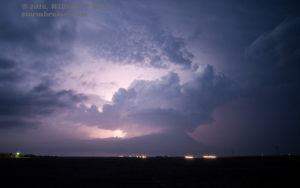
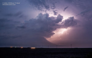
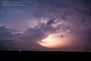
The wet tornado cyclone drifted towards us and precipitation curtains sped across the road, just to our west. We backed off a little, and then a little more as lightning got close. The storm looked even more “HP” and nondescript as skies darkened. Later, a bell-shaped updraft base took shape in the lightning flashes to the north, from the Friend area. The images below start from the point where we exited the van at the end of the paved road, about 11.5 miles west of U.S. 83. These are wide-angle images taken with the 21mm lens.
Chaser Brian Stertz and company were a little earlier to the right spot, and videoed the formation and wedge stage.
The large tornado might also be known as the “Lydia, Kansas tornado.” Though it moved slowly and covered very little ground, it apparently impacted at least three different Kansas counties: Wichita, Kearny, and Scott. Meanwhile, in our original target area in southwest Nebraska, a pretty but rather small “LP” supercell occurred. It didn’t persist for very long and it didn’t get particularly strong. We made the correct choice today.
In a “post-mortem” discussion regarding this chase, Chris Gullikson says:
I felt good about the McCook area until mid afternoon when we lost surface convergence and surface winds went southerly. There was a surface map around 20-22z that showed 2 surface obs…maybe Garden City and Dodge…that backed to southeast and I believe there were some interesting CU down there. I was totally on board with you ditching our target and didn’t even mind driving away from the developing storm that we saw behind us. We had lost all good surface winds in NE.

Leave a Reply
You must be logged in to post a comment.