Start, Dodge City, KS; end, Woodward, OK; 275 miles; lunch in Shattuck, OK (fast food)
spc-mesoscale-discussion-695 W OK/2:18 p.m. CDT
spc-mesoscale-discussion-697 W TX/5:30 p.m. CDT
spc-mesoscale-discussion-698 W OK/6:08 p.m. CDT
spc-mesoscale-discussion-699 W OK and E TX PH/8:58 p.m. CDT
may-23-route (courtesy of Chris Gullikson)
Video courtesy of Chris Gullikson
From Dodge City, we headed south towards the SPC “enhanced slight risk” from I-40 in W OK southward to the Midland and Big Spring area of TX. Though the better risk looked to be south of I-40, I was not convinced that we needed to go so far south. And, it was nice to see SPC extend the enhanced risk and 5% tornado risk areas northward into NW OK on their 1630Z outlook. There was a boundary heading westward towards the dry line in extreme western OK, and that would aid in initiation and perhaps low-level vorticity for increased tornado potential in NW OK later in the afternoon. The high-resolution models were helpful as they indicated a decent storm or two in NW OK by evening. Shear and instability were more than adequate for strong supercells, and dew points were also very good. (High dew points = lower storm bases and much better tornado odds!)
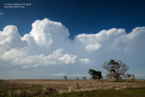
At lunch time we were near Laverne, which has a very small selection of eateries. One place that we were interested in was closed for the day. Chris made reservations for us at the Mexican Restaurant — Cocina De Lucia. We got there and thought about it some. It probably was not a good idea to sit a group of 16 people down to eat on what might be a big chase day, and it was probably already after noon. And, this was especially the case if we indeed needed to drive another four or five hours south — ugh — hopefully that would not be required today. We cancelled the reservations (in person!) and continued south to Shattuck. We found some junky fast food there, and continued south another 15-20 miles to Highway 60. This was the critical decision point of the day. We stopped for several minutes and wondered what other chasers were thinking as they passed by heading south, or north. I was not certain whether we should continue south or not, but it looked like, if we did, it would be another 2-3 hours to get into position. We were already in good shape if we stuck with the northwest OK target. The look of the sky was not helping too much yet. Chris was a little nervous about chasing south of I-40 in the eastern TX PH, where there had been flooding problems the previous evening. I elected to stick with the NW OK target. We were there, and on paper it was looking about as good as the southern play. We went back north to Shattuck…and north to Laverne. Deja vu! Eventually some towers developed…yes!
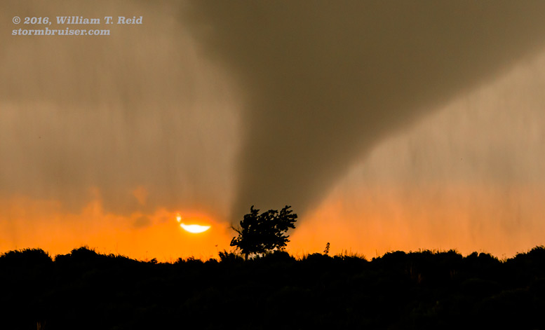
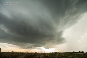
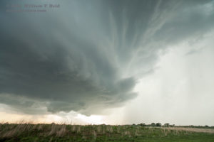
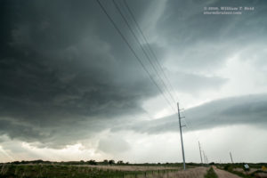
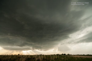
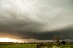
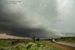
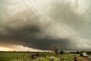
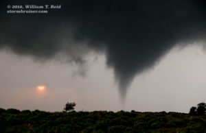
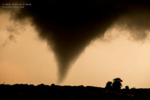
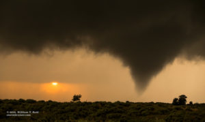
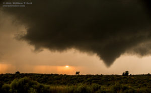
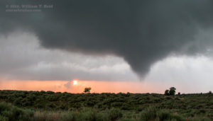
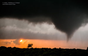
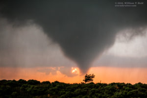
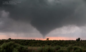
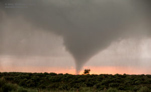
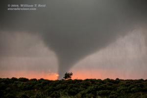
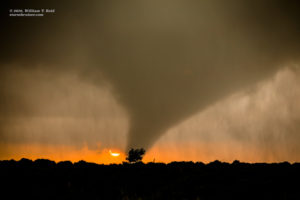
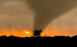
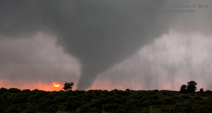
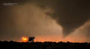
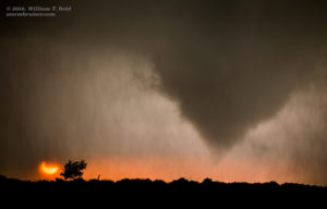
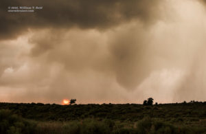
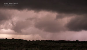
From Laverne we headed east and northeast to Buffalo to monitor some new cumulonimbus clouds near the OK/KS border. These moved to the east, and dragged us about 40 miles east to Freedom, OK. These looked somewhat promising, and were probably dropping a little hail. But, they were sputtering. Another storm tower to our south was worth monitoring closely. We had a decent view of that one. Nothing was strong enough to commit to. Finally, a good-sized cell developed back to our southwest, on the dry line, not too far from Woodward. Time to move! We blasted down 50 from Freedom to Mooreland, which put us due east of the updraft. It was looking very healthy. It was moving little, so we closed in on it via 50B and 34C, just north of the North Canadian River. I was fretting some —- would I have to chase this thing in the dumb trees and hills near the river? Would I have to go through the traffic and stop lights of Woodward to stay in position? Why can’t this storm be above perfectly flat and treeless terrain? We stopped to set up shop for a bit a mile or two northeast of Woodward, and soon the tornado sirens were sounding in Woodward! (This was about 7:40 p.m. CDT.) We may as well get closer to the base if it is going to tornado, right? We drove the one mile to 34 and north a little. A tornado did not appear imminent. I did not like that location due to hills and trees, so we went another couple of miles north to a slightly better spot with a decent view of the base to the west. I managed a few wide-angle shots of the storm structure, which was getting better and better. As the sun dipped towards the horizon beneath the base, a funnel cloud dipped towards the ground from the base! Tornado time!
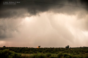
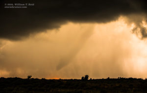
A photogenic tornado played “pat-a-cake” with the ground for a couple of minutes and then decided to stay down for a good 6 to 8 minutes. The sun was setting right behind it! The tornado drifted a little to the left, and then the right, and then away from us to the northwest. I guess we won’t have to move. Towards the end of its lifespan, it became rain-wrapped, ropier and uglier as the nice light faded away. The time frame of the tornado was about 8:25 to 8:35 p.m. CDT, and it first touched down approximately five miles NNW of Woodward.
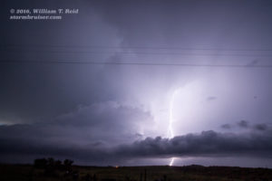
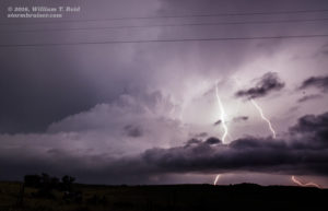
The storm was not moving much at all, but it seemed to be getting slightly farther away by drifting to the N or NW. We went north several miles and stopped to pick up some large hail stones. A few of these were about 3 inches in diameter, and one measured in at 3.25 inches. This was about nine miles north of Woodward. As it got dark we were treated to a decent lightning display, and another tornado, around 9:30 p.m., was photographed by Chris Gullikson.
It certainly was nice that the target area worked out perfectly on this day, and the short 10-minute drive to Pizza Hut and the motel in Woodward was welcome, too! Down in the eastern TX Panhandle, chasers were treated to an impressive tornadic supercell near Turkey and Northfield, but the main show was well “after dark.”

Leave a Reply
You must be logged in to post a comment.