
Start: Oklahoma City (start of Tour 4, with Rook and Chris)
Lunch: Chandler, OK/Taco Mayo and Sonic
End: Shawnee, OK
431 miles
SPC Mesoscale Discussion 864 SPC Mesoscale Discussion 866
SPC Mesoscale Discussion 873 SPC Mesoscale Discussion 877
SPC Mesoscale Discussion 878 SPC Mesoscale Discussion 883
SPC Mesoscale Discussion 884 SPC Mesoscale Discussion 888
A recurring theme for chasers during May 2017 was disappointment with regard to tornadic activity. There were several days with (seemingly) fairly high-end tornado potential, when SPC was advertising the chance for significant and long-lasting tornados. But these days fell flat for chasers for the most part. Sure, there was the successful tornado intercept here and there on a day or two, but the highly-advertised days wound up being duds for most chasers. It seemed that each and every time that SPC drew a 10 percent tornado area, the end results were less-than expected tornado-wise. And please do not take this as a knock on the fine forecasters at SPC! I am just relating to you, the reader of Stormbruiser chase accounts, how things went this season for me and many chasers.
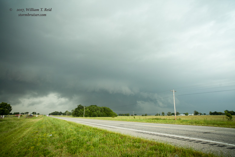
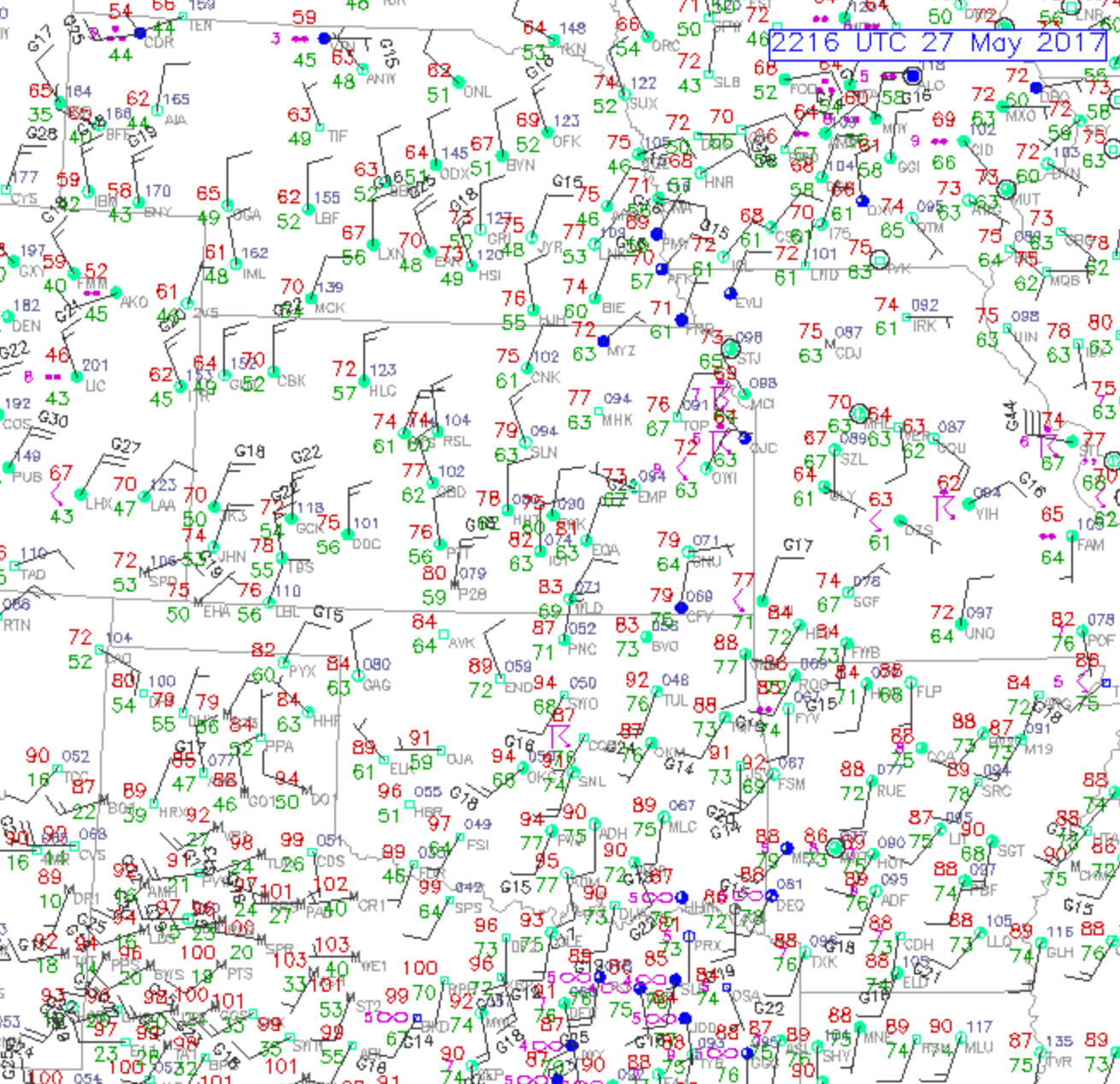
This chase day was one of those potential BIG days. Look at all of those mesoscale discussions! It was the first day for Tour 4, and the shear and instability were looking fabulous for northeastern Oklahoma, especially from Tulsa to the northeastern corner of Oklahoma. SPC showed a 10-percent hatched tornado area from Tulsa into Missouri. There was also a good chance of supercells in the Oklahoma Panhandle and vicinity, an area I favor for chasing. But with the tour, I had to go for the much better tornado prospects. After lunch we watched the sky from Stroud, and I think we were looking for an open auto parts store to take care of something with the van. But this was a Saturday on Memorial Day weekend, and the small towns were closed up. The cap was very strong today (finally — no early development!), and the cumulus fields were struggling. A nice area of surface moisture convergence drew us up beyond Tulsa to Vinita, OK. A couple of strong updrafts took shape north of I-44 and moved ENE-ward. We wound up on a fine candidate for severe weather near Vinita, and it soon had a wall cloud and interesting action area. Given the low-level shear, low storm base and big-time CAPE, it would not have been surprising had a significant tornado developed. But the storm was having none of that. It continued to the east-northeast, and soon the next storm behind it was raining into it and turning it into a messy HP. This was near the southwest side of Miami.

The tail-end storm went quickly into messy, ugly, non-interesting HP mode. What is the problem here?!
With about 90 minutes of light remaining, we charged down I-44 to catch a new supercell which was trying to get strong near — yes — our lunch stop town of Chandler. It took longer than I was hoping to get into position, as it slowed down and turned more to the right. We got southeast of the base near Prague, I think, and had some decent structure and lowerings and lightning to view in the darkness. It wasn’t too bad of a start for the new guests, but the day under-performed tornado-wise. Why am I so tornado-centric now? I took just 4 pictures today, and I bet I would have taken a lot more on that crazy supercell coming out of Baca County, Colorado. Oh, well.
Leave a Reply
You must be logged in to post a comment.