Begin:
End:
Yes, this was the one day of the chase season, the one day which pretty much happens every season, that I REALLY wish I could do over. I had a decent forecast — central Kansas along I-70, especially towards the Salina area towards sunset. That worked out great, but my actual chasing went down in flames as I abandoned the eventual tornado-producing supercell. This was the day of the tornado near Tescott, Kansas.
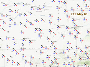
The day was looking like good one, the first such chase day for me this spring. SPC had a 10-percent hatched tornado risk from about Russell to Salina. We watched initial development in the vicinity of Hays and Plainville, which moved towards the ENE. This early stuff was a little high-based and was slow to organize. We got a little behind the first storm, but recovered and got east again in front of the convection.
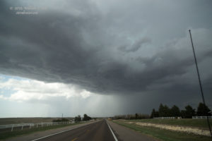
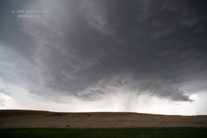
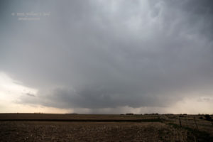
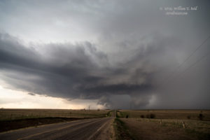
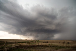
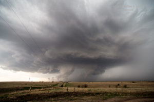
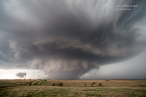
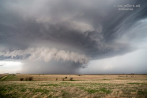
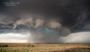
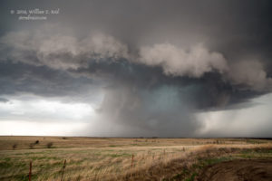
Eventually we were in good shape in front of a well-organized supercell in the vicinity of Galatia, Kansas (between Russell and Hoisington). Storm structure was quite nice, and all we had to do for about 30 minutes was to take in the view as the storm approached. It was first to our west, and later to our nearby northwest.
The images above were taken from near Susank, Kansas. The updraft base was involved with plenty of precipitation for much of this time. I think it became tornado-warned during this timeframe, also. However, all of the rain and hail would have made it difficult to see a tornado with this one.
Anyway, the rest of the chase should have been easy, as the storm continued to move into the favored target area and all of those great parameters, right?! Unfortunately, my instincts went off of the rails on this one. We were hit by some coolish storm outflow as the storm base and its precipitation core passed a few miles away to our northwest. This did not give me a warm and fuzzy feeling. Usually, storms with the type of outflow that we were experiencing do not produce tornadoes. There was still a good amount of daylight remaining, maybe 3 hours. I should not have given up on this one, but I did. The radar showed another storm or two down south along the dry line in central and south-central Kansas. These other storms looked healthy on radar, and seemed less likely to be outflowish, at least so far. I made the hasty decision to blast south to the next one. The storm that we were leaving was a fairly high-end supercell, but since it was on the HP side and outflowing already, a switch to another supercell to the south did not seem to be a bad idea.
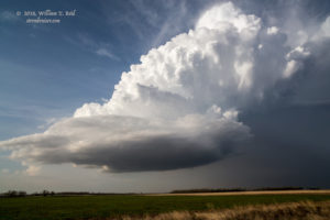
We got on a rotating storm near Stafford or St. Johns, but it was high-based and small. UGH. And, it was weakening. The day was lost. As we floundered and tried to salvage the day with another dying updraft near Medicine Lodge, the storm which we had abandoned near Susank had continued to the ENE and produced a good-sized tornado near Tescott.
So, there are no pretty pictures of the Tescott tornado on Stormbruiser. Can I have a do-over, please?


Leave a Reply
You must be logged in to post a comment.