Begin: McCook, NE
Lunch: St. Francis, KS
End: Oakley, KS
390 miles
SPC Mesoscale Discussion 552 SPC Mesoscale Discussion 553 SPC Mesoscale Discussion 557
SPC Mesoscale Discussion 558 SPC Mesoscale Discussion 561
Link to time-lapse video by TT guide Chris Gullikson
(The video by Chris has better information as to the route and times.)
We weren’t too far from where we needed to be when I gave the morning chase briefing to the tour group at our motel at McCook. Some morning thunderstorms were cruising through western Nebraska, and an east-west boundary would be left behind during the afternoon from northwestern Kansas westward into eastern Colorado. The models showed development towards mid-afternoon on the Colorado section of the boundary. And, the boundary could come in to play as a promoter of tornado development, too.
We had a somewhat rinky-dink lunch at Saint Francis, KS. I saw no reason to head down to Goodland for better lunch options, as good storms come before good food. Goodland was south of the boundary. Convection sometimes starts early in Colorado, and with the boundary closer to U.S. 36, it seemed prudent to stick close to that highway.
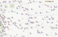
After lunch we drifted westward into Colorado on 36, past Idalia and to the Joes area. We were on the north side, or cool side, of the boundary, and a lot of perky stratocumulus and cumulus were about as some sunshine filtered through. The humid and mild east winds in this area were great —- this day could be a tornado day! By about 2 p.m., both Wray and Burlington had E to ESE winds and a dew point near 60F, but Wray air temperature was 64F and Burlington was 82F. We killed some time at a fancy rest area somewhere near Joes, I think, and then drifted south past Kirk on 57. Less than halfway to I-70 (and Stratton) we found the boundary! Skies were quite a bit clearer now to our south, and it was certainly warmer and muggier here. While stopped and watching the skies, we experienced a wind shift to northeast with cooler air. It was rather subtle, but the boundary was right here right now.
It was mid-afternoon and time for some storm development. I needed a nice east-west paved road here, halfway between U.S. 36 and I-70, but there was none. Moisture convergence maps and satellite trends said “drift west, Bill,” so we went back north to U.S. 36 and headed west past Joes to Cope. With mid and upper-level flow from the south and southwest, it would be better to be north of the boundary, presumably, if and when a storm tower developed along the boundary.
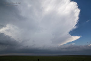
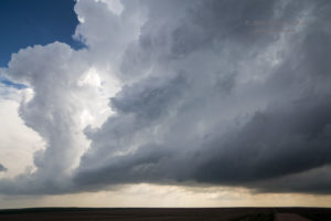
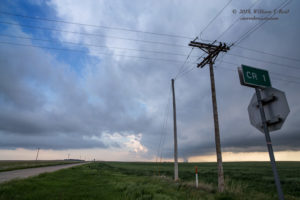
A strong storm updraft finally became well-established right along the boundary, and above the large unpaved sections between 36 and I-70. We dropped south about 8 miles from U.S. 36 at Arickaree (which is not much more than a bend in the road between Anton and Cope in Washington County) and stopped near the Washington/Kit Carson county line. From a small hilltop near Roads LL and 1 we observed a healthy and quickly-organizing storm to our west-southwest.
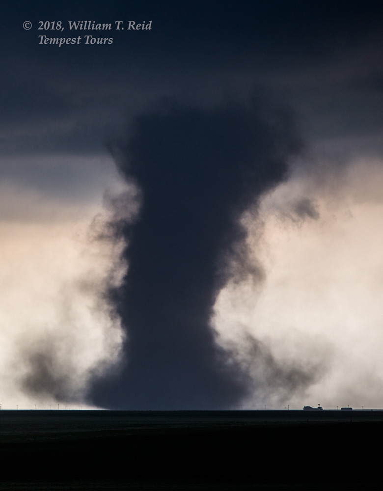
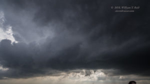
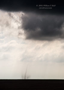
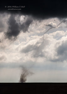
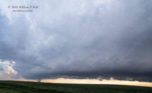
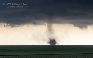
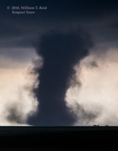
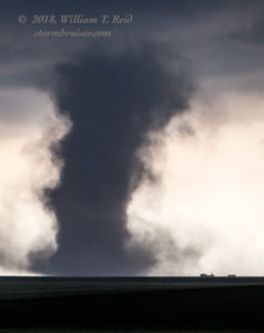
There wasn’t much precipitation near the storm base, but there was a clear-cut RFD. Somewhat quickly, a nubby funnel cloud developed and we had a wispy and dusty circulation along the ground beneath it. Tornado! I grabbed my long lens for this one.
This tornado persisted for 8 minutes, around 4:30 p.m. MDT (2230Z), according to my camera time info. It was maybe four miles distant. It probably corresponds to tornado #1 in the NWS Boulder survey, and it was VERY close to the point where Washington, Lincoln, and Kit Carson counties meet. The tornado was likely right on the surface boundary.
As I write this post about three months later, the next hour of this chase is a bit of a tornado-filled blur. The tornado that we had just observed had not budged much at all. It looked like the storm was moving to the north or NNE, so I dragged the tour to the north and west a bit as the base appeared poised to try again. We found ourselves on a remote dirt road next to a farmhouse (at roads KK and 5 in Washington County), with one-inch hail starting to fall and the clouds whirling overhead. It was time to escape the hail, and we drove east a few miles. I think it was during this stretch, again just north of the Washington/Kit Carson county line and south of Arickaree, that we found ourselves amidst a couple, or a few, weak tornadoes. The term “tornadoes” is probably a little generous for these, as they were weak spin-ups without condensation funnels. But, these were beneath a very active and turbulent storm base, they persisted for a couple of minutes at a time, and they were right where one would not be surprised to see tornado development!
These spin-ups forced us farther to the east several miles, and I think that the road network forced us south a couple of miles, too. After the little flurry of spin-ups, we stopped again a bit east of the action areas. The storm looked rather elongated south-to-north, from our SSW to our NNW. To the northwest, there appeared to be a cranking supercell updraft base, replete with a fabulous RFD cut and wall cloud. That is where we need to be…that is the area to watch, right? Well, maybe. The NWS Boulder tornado page (linked here again) shows a bunch of tornadoes (#2,3,6,7,and 8) about this time and place. I am not sure if some of these were those weak ones which were nearby or not as we motored eastward. But, I am pretty sure that some of these on the NWS Boulder list were associated with this increasingly HP-ish supercell to our northwest, and that we did not see some, or did not see all of these. Chasers along U.S. 36 in the vicinity of Cope would have been better positioned for these, but apparently they (i.e., the tornadoes, NOT the chasers) were not photogenic and some may have been wrapped in precipitation. At about the same time, another tornado, this one very obvious, was developing towards the south end of this elongated line. It was to our SSW.
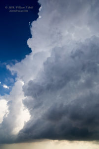
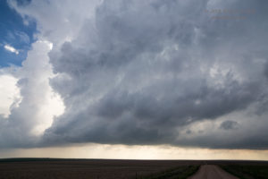
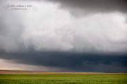
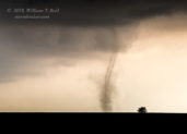
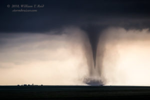
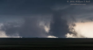
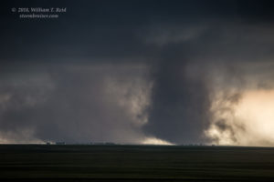
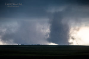
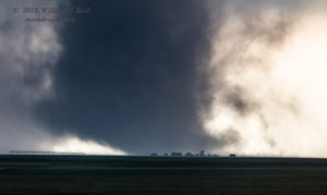
That first image in the set of 6 above is the low supercell updraft base to our northwest. The other five are of the new tornado to our SSW. This tornado was beneath a higher base, and beneath an updraft with some organization.
Should we head north to the big and ugly supercell? Or should we head south towards the rather weak tornado? I wasn’t really putting two and two together at this point in time. It was difficult to take my eyes off of the big and black and well-organized (and low!) storm base to the northwest. But the tornado action was to the south. It did not come to mind that the two obvious and more-photogenic tornadoes up to now were those right on that boundary, which was still to our south by several miles. The environment north of the boundary was great for making supercells with low bases, but it wasn’t really good for tornadoes. I think that the air north of the boundary, up near U.S. 36, was a bit coolish and the wind direction more NE versus E. The tornado-making environment was much better to our south, along the boundary. I was a bit perplexed by the structure of this entire storm complex. The new and lesser-organized and higher-based convection to the south is what I should have honed in on.
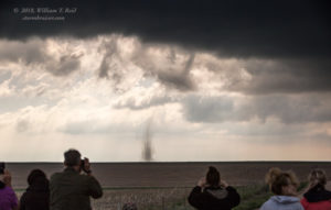
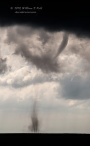
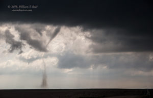
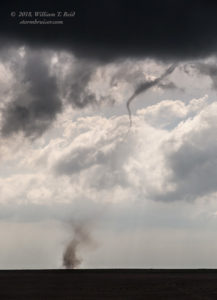
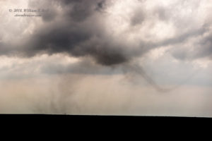
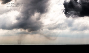
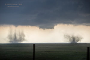
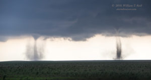
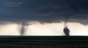
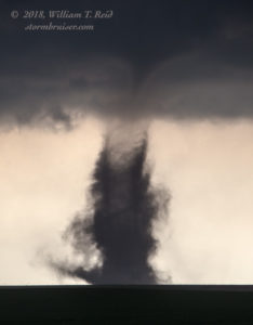
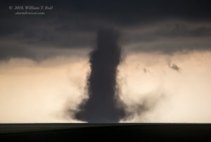
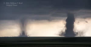
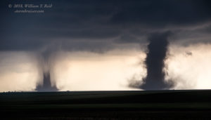
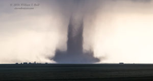
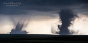
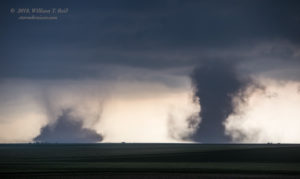
So, somewhat in perplexed mode, I remained in the middle ground near the Washington/Kit Carson line, in front of a convective mass to my west which had a very slow eastward component. We were back on the unpaved roads and heading east and south again after this second tornado dissipated. And it did not take long, but another tornado was developing to our SSW by perhaps five miles. And then another one right next to it! We were still west of Highway 59, and I elected to try to get a bit closer by driving a couple more minutes, despite the pleas of the guests to stop for this spectacle!
We spotted the first of these from CR 1, and headed south a few miles (on Road 10?) before stopping.
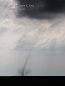
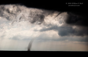
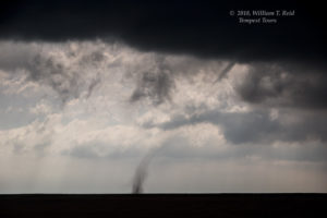
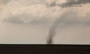
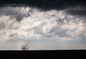
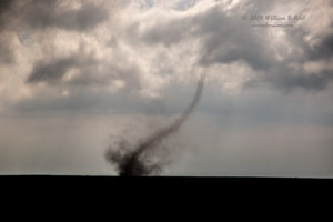
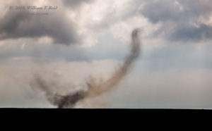
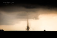
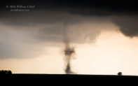
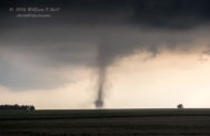
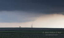
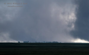
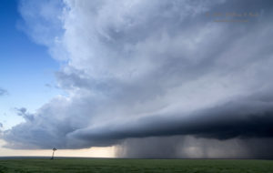
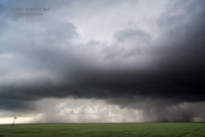
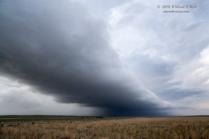
All of the images above were with the 70-200mm zoom lens. The tornadoes were a few miles to our SSW, and they lasted for a good 6-8 minutes or more. These were in Kit Carson County, and, yes, on the boundary! I am glad that I was not near that cranking supercell up to our NNW, as that would have put us too far from the double-tornado show. As these tornadoes petered out, we positioned ourselves a little farther east, and right in front of another rotating base with the RFD cutting in and the wrapping rain curtains — would this be another one, bigger and better and a super grand finale?! Nope — it teased us and then sputtered.
And, from here, the activity turned more into a weakly-outflowing and linear mushfest. We motored down to I-70 at Seibert and then to Burlington for a break, but the fun was done for the day.
The photogenic tornadoes observed on this chase day were labeled as “landspout” tornadoes by many chasers. These “boundary” tornadoes definitely were on the weak side, and they visually resembled many landspout tornadoes. They formed from relatively high-based updrafts and were above that surface boundary. But I think that these tornadoes were also associated with rotating updrafts with the RFD cutting into the base and aiding in the development of the tornadoes. I was not really close enough to the later tornadoes to get a good look at the updraft base and its organization (or lack thereof), but the first tornado to our WSW looked to form beneath a bonafide supercell. So, I am hesitant to categorize these as landspouts. Tornadoes don’t care about our classification system, so maybe we can call them hybrids. They had some landspout/non-mesocyclone tornado characteristics, and they had some mesocyclone characteristics, too. Of course, as long as the tour guests are seeing a bunch of tornadoes and are giddy, you can call them Fig Newtons and I wouldn’t care. At least until I write my chase account.

Leave a Reply
You must be logged in to post a comment.