
Begin: Oakley, KS
Lunch: Buffalo, OK (Loves Subway)
End: Woodward, OK
436 miles
SPC Mesoscale Discussion 565 SPC Mesoscale Discussion 566
SPC Mesoscale Discussion 567 SPC Mesoscale Discussion 569
SPC Mesoscale Discussion 571 SPC Mesoscale Discussion 572
SPC Mesoscale Discussion 573 SPC Mesoscale Discussion 574
From Oakley, Kansas, we headed south and a little east towards the western edge of SPC’s enhanced slight risk area, in the eastern Oklahoma Panhandle. An outflow boundary was stalled out in this vicinity and would be a good spot for storm development. I started south towards Laverne, OK, for a lunch stop. But a big cumulonimbus cloud not too far to our east ruined that plan. We went east to Buffalo for a fast food lunch. We could watch the new convection to our west from here. The big towers would move north a bit and weaken, with a new one coming up from behind to try again. Eventually, the one below survived, and its high base was spinning impressively north of Buffalo.
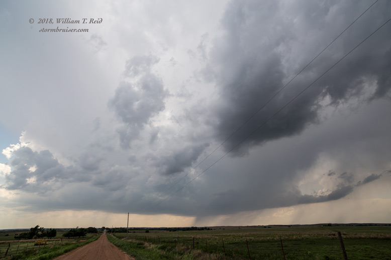
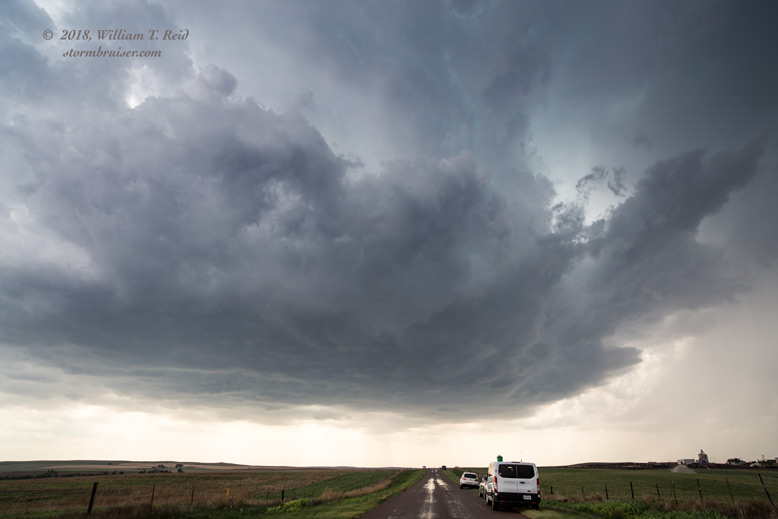
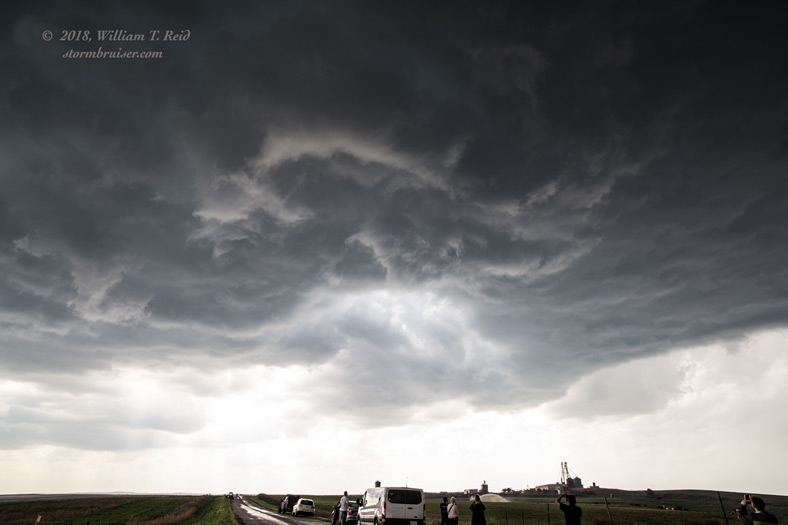
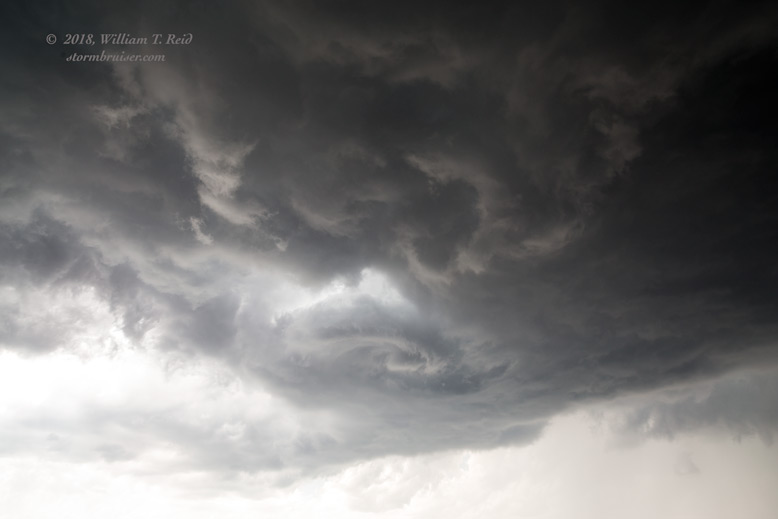
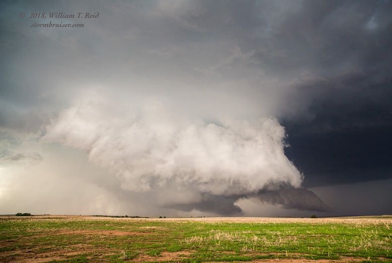
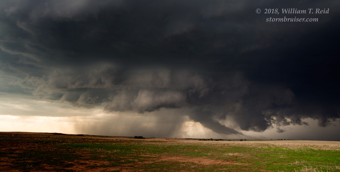
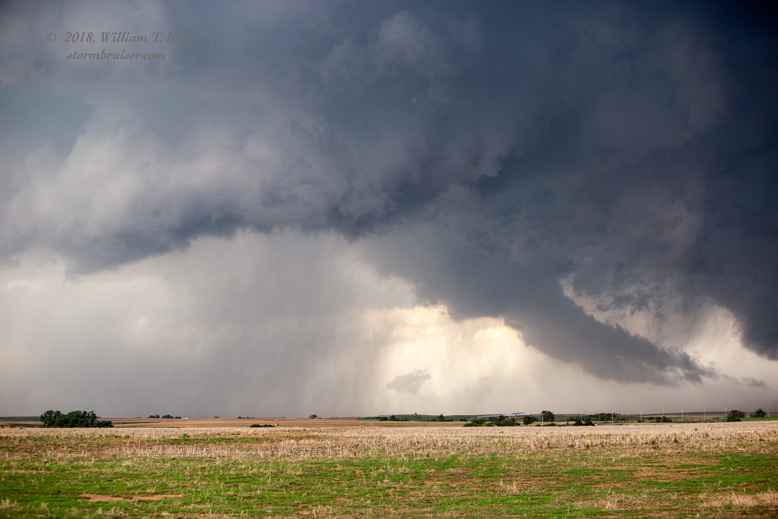
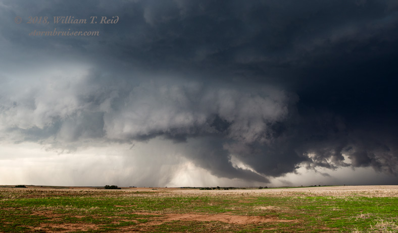
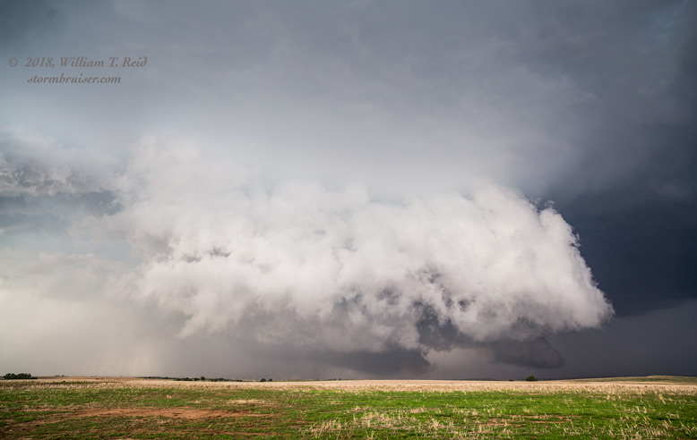
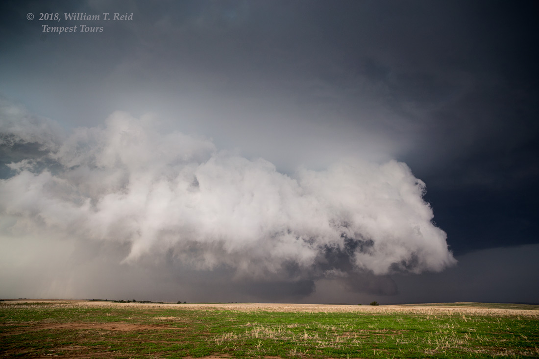
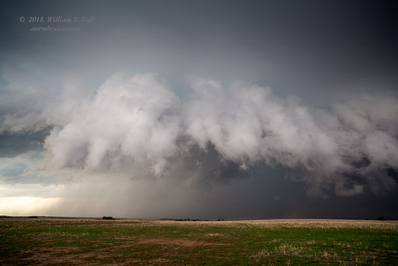
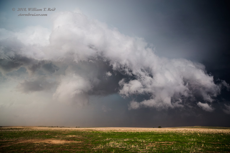
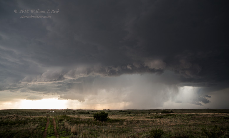
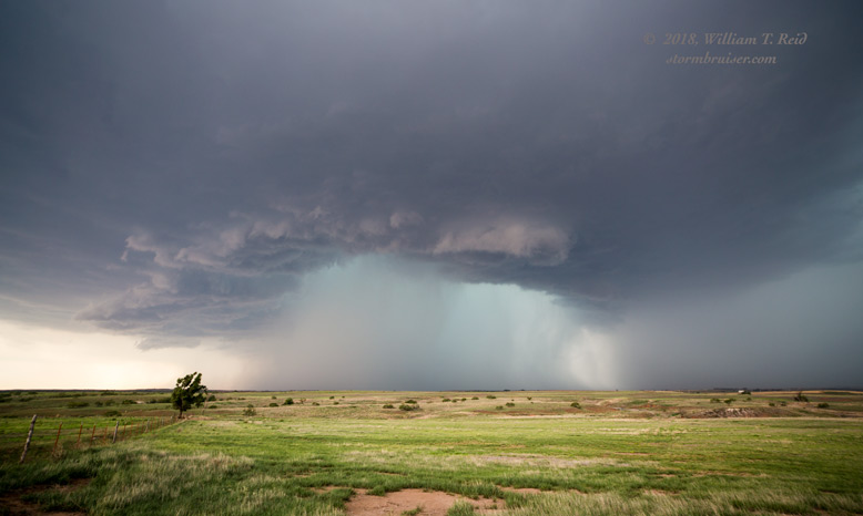
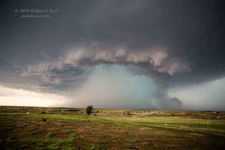
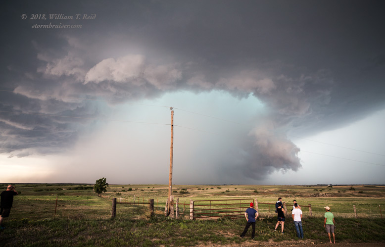
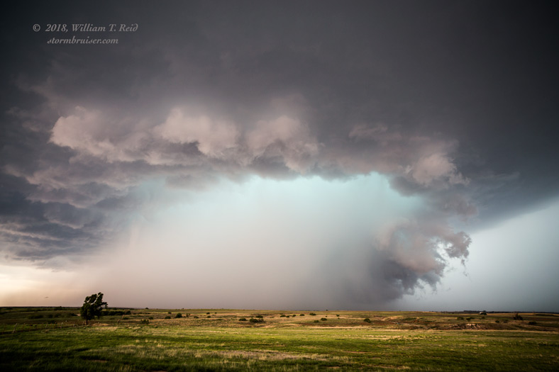
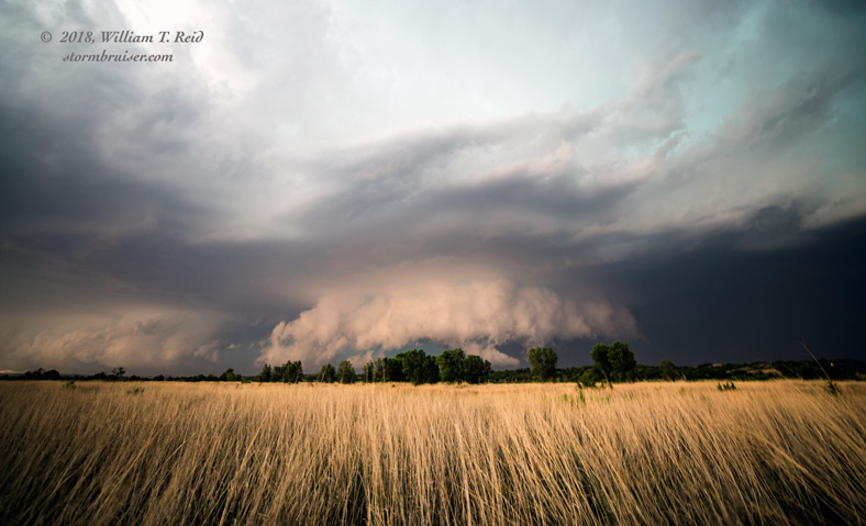
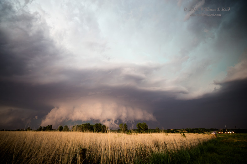
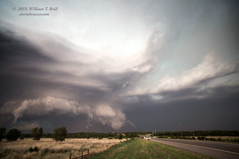
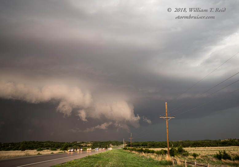
There looked to be some tornado potential with this cell, about six miles north of Buffalo and near the OK/KS border. But the base was still rather high. How should we stay ahead of it, as it drifted eastward into the unpaved road network near the state line? I elected to head south to U.S. 64, and then east about 12 miles, halfway to Camp Houston. With the supercell now to our northwest, I scooted north a mile, and we found a decent spot to view the storm. While here, the storm started to spin much faster, it started to move more to the ESE, and a blob of precipitation descended from the updraft base. This helped to bring down the storm base, and we soon had an ominous wall cloud and other appendages practically scraping the ground! The images below were all from the same spot as we watched this transformation. It appeared that the storm was nearly tornadic.
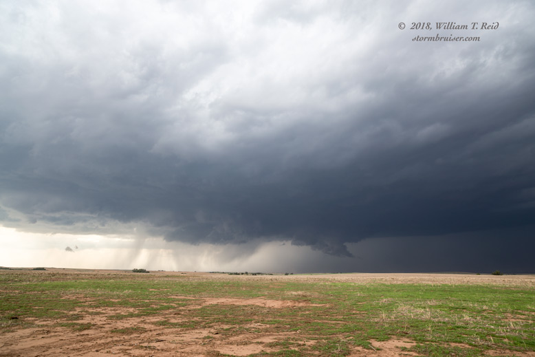
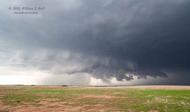
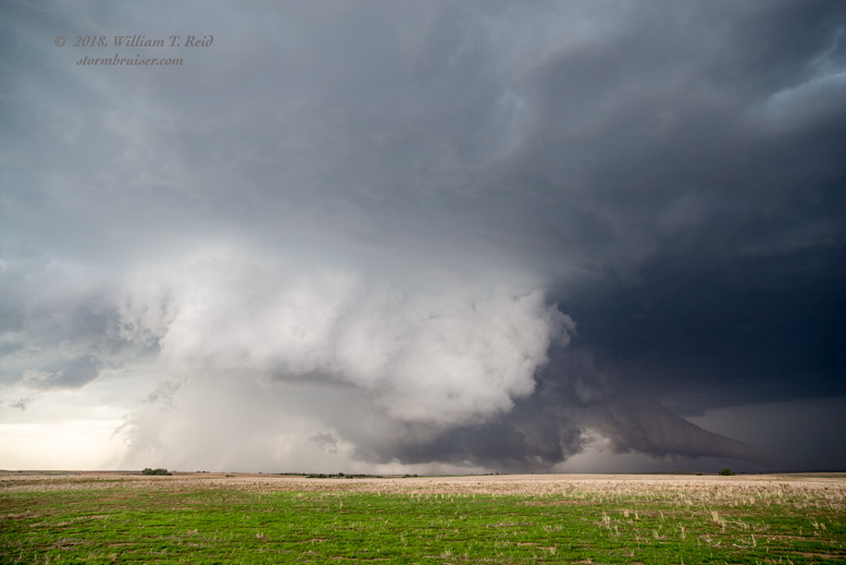
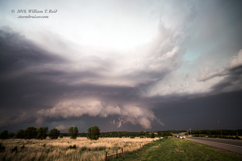
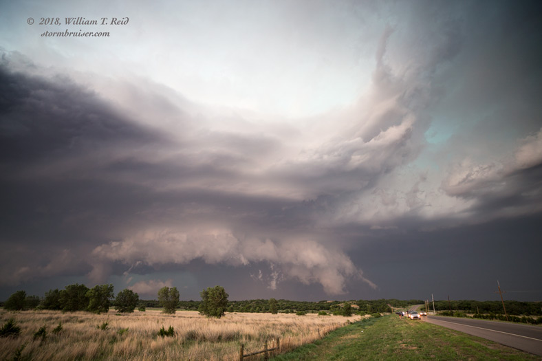
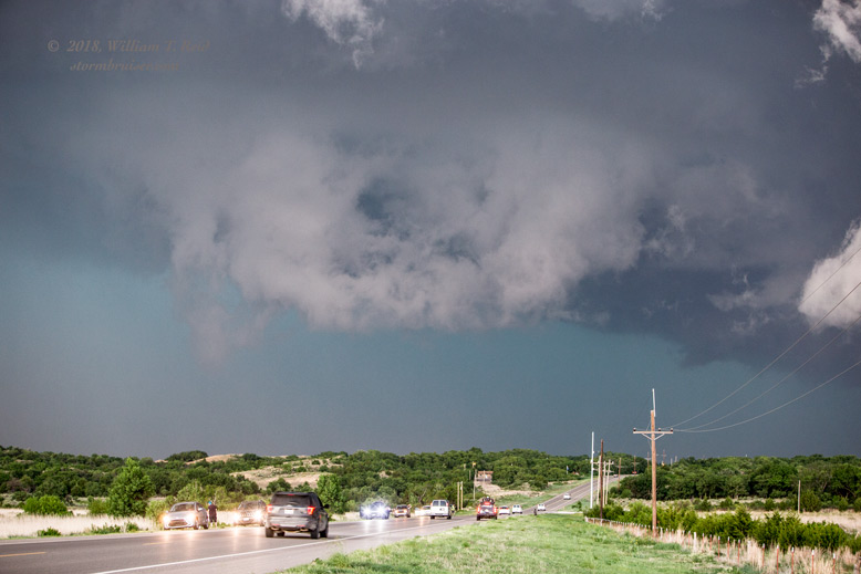
We now had a beast of a supercell in progress, and it chased us eastward on Highway 64 to Camp Houston and beyond. We had a couple of opportunities to stop and to check out the HP look of the storm back to our west.
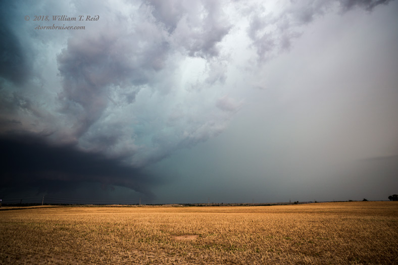
The supercell turned even harder to the right, and moved southeastward towards Waynoka. We made it to Waynoka before the storm, and set up south of town by a few miles to watch it pass to our north.
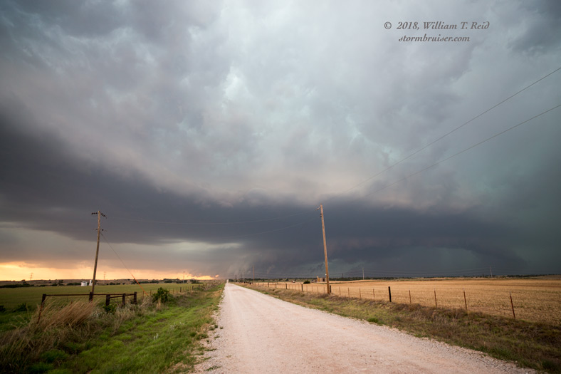
As the supercell passed over the town, a weak tornado developed and surprised some chasers who were riding out the core! We did not see any obvious tornado from our vantage point, but there was definitely some good organization and rotation in the lowering above Waynoka.
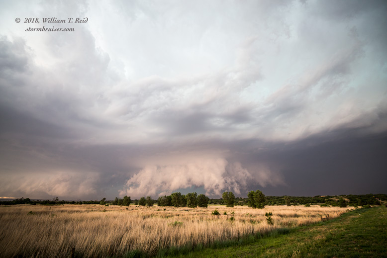
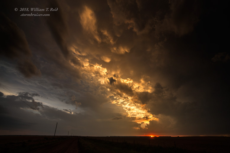
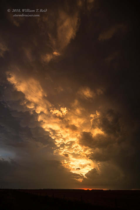
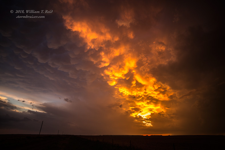
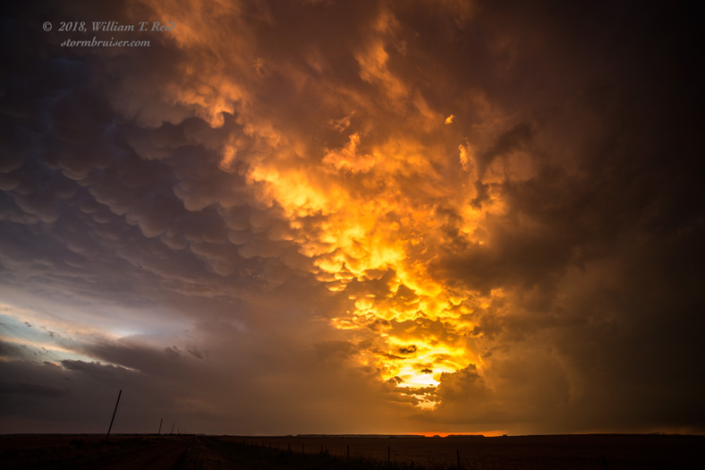
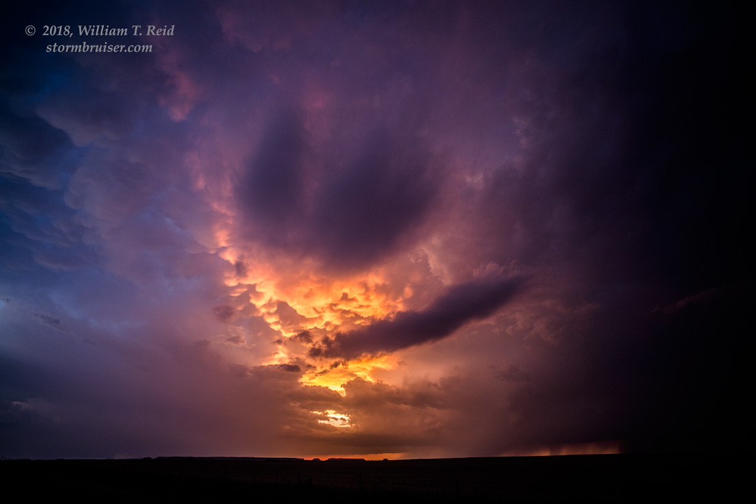
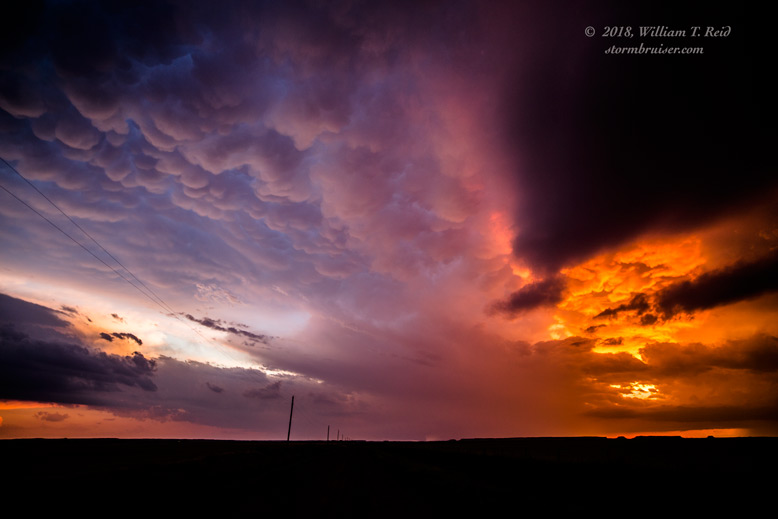
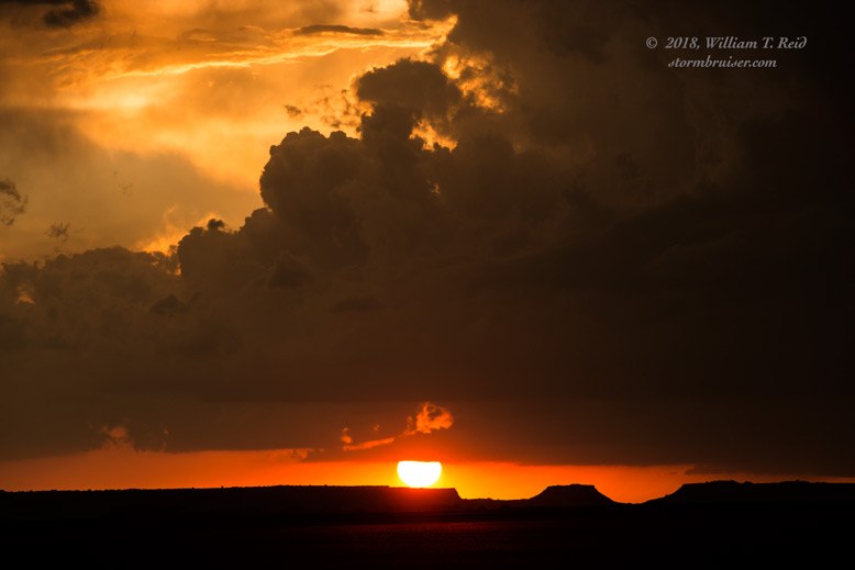
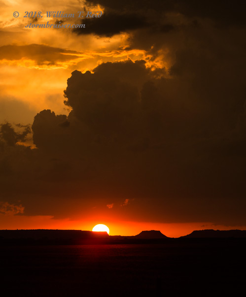
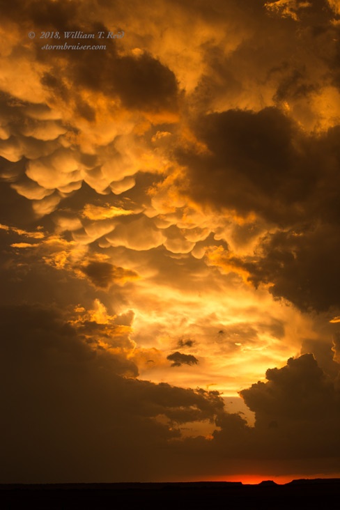
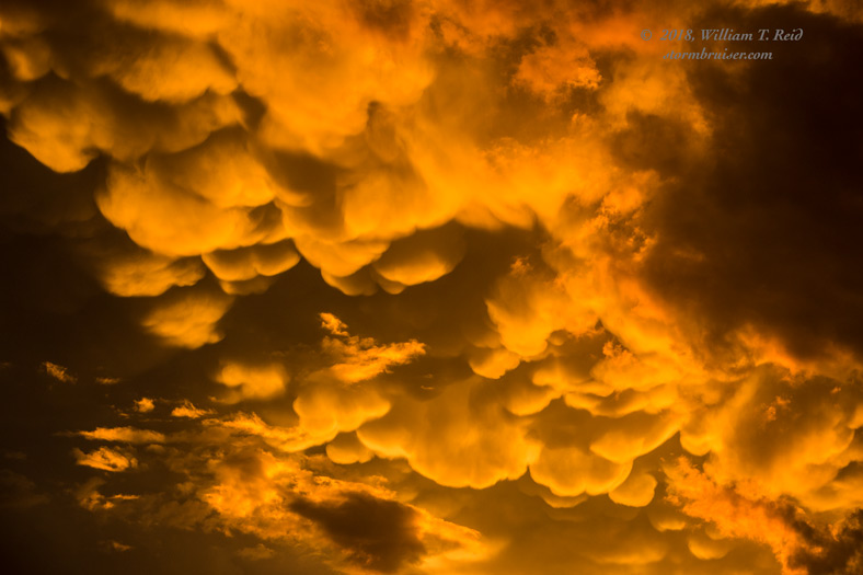
The supercell seemed to go a bit more outflowish as it continued to the Orienta area. We stopped near Orienta for some fantastic mammatus and sunset colors, and then headed through a hailstorm or two to Woodward for the night.
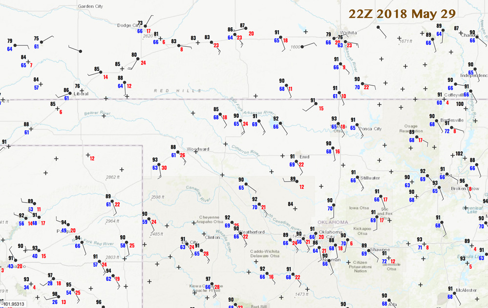
Our long-lived supercell seemed to have a bit too much coolish outflow to permit tornado development, or at least significant tornado development. Perhaps this was because the storm started out so high-based, and/or because the inflow air had a relatively large temperature/dew point spread. Supercells that were north of the outflow boundary, up in the Dodge City area, produced more impressive tornadoes. Though there was no obvious boundary in that area, the low level shear was excellent and the cloud bases were lower. The lower cloud bases meant little or no outflow issues in Kansas, and a greater tornado threat.

Leave a Reply
You must be logged in to post a comment.