
Begin: Lemmon, SD
Lunch: Lemmon/Alaska Cafe
End: Belle Fourche, SD
391 miles
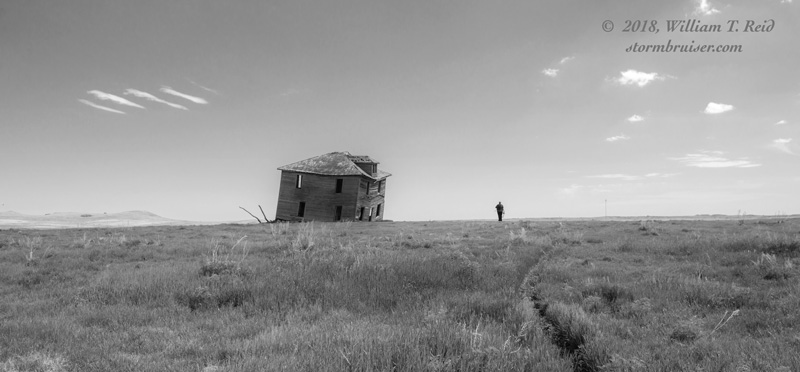
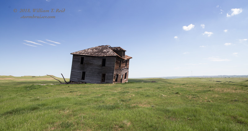
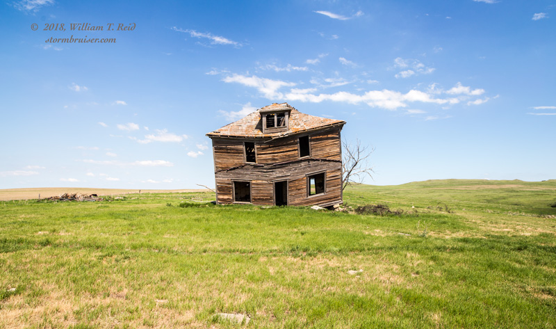
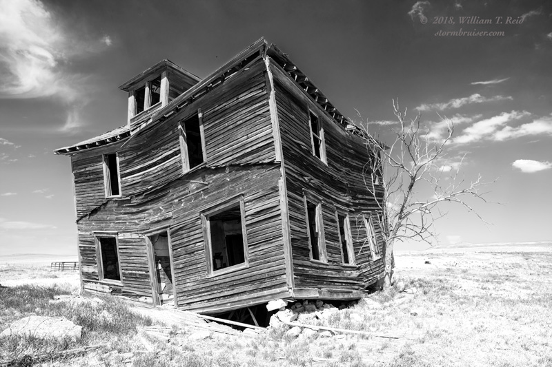
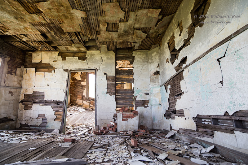
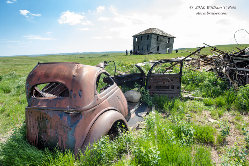
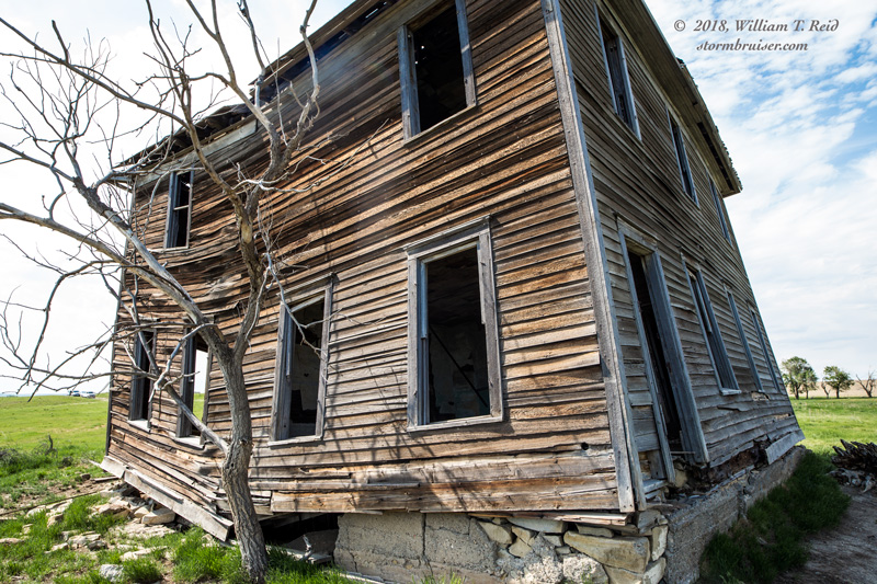
Our group was in great shape position-wise today. At Lemmon we were near the western edge of SPC’s slight risk (the slight risk was expanded westward into MT in the 20Z update). A strong cap would be problematic, though, and storm initiation would be tough from mid-to-late afternoon where we wanted it: near I-94 between Bismarck and Dickinson. Nevertheless, we scooted north to Glen Ullin after lunch, and killed time at a nearby abandoned house.
Mid-afternoon turned to late afternoon, and great-shape-for-positioning morphed into not-so-great positioning. Nothing was going to form near here before sunset, it appeared. Models and satellite suggested storms would move out of Montana and into northwestern South Dakota, just north of the surface low. That area would work, though dew points were not as good out that far west and high storm bases would be expected, at least starting out. We started rolling to the south and west, via Highway 20, and started to get a look at a couple of supercells that were moving to the east through western Harding County, in the northwestern corner of South Dakota.
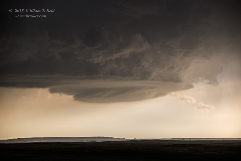
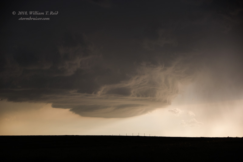
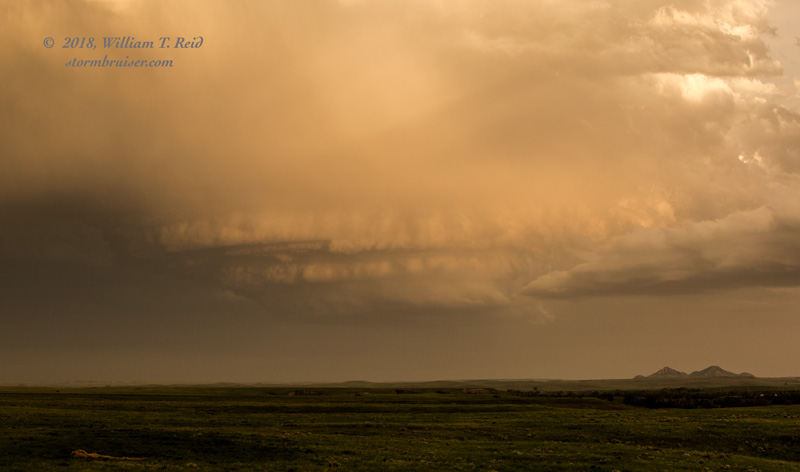
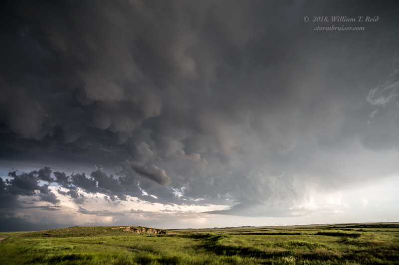
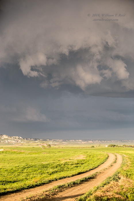
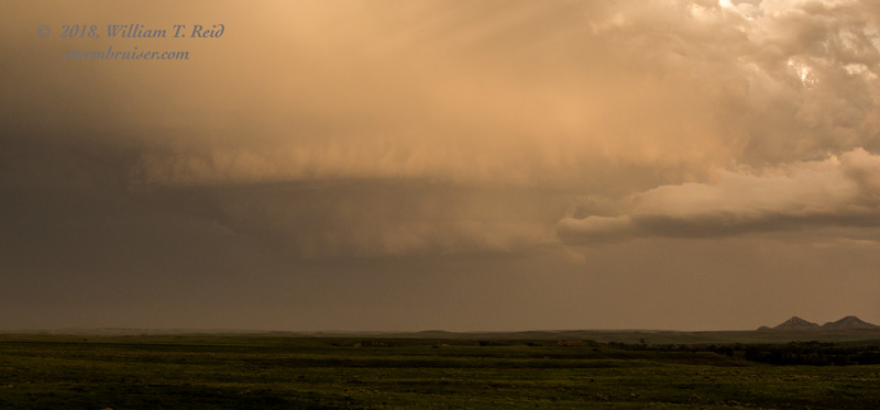
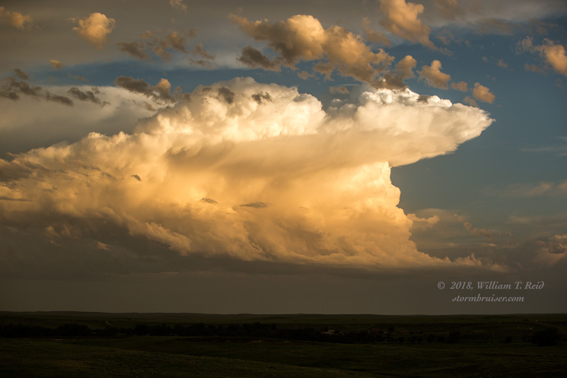
The road network was sparse, so I had to figure out when and where I needed to be when I needed to be there! I headed south on gravel Park Road between Buffalo and Reva, and we had a good look at the base of the north supercell (top 3 images above). However, radar showed this north cell to be struggling some, and the south one was probably the one to be in front of (bottom 2 images above). Unfortunately, our gravel road became a little dubious as we continued south and east and tried to get over to Highway 79. We had to backtrack a little at one point, and then we passed through a ranch with a bunch of bison. This area was beautiful and would be wonderful for a Sunday afternoon drive, but we were trying to get to a paved road in order to open up some options again!
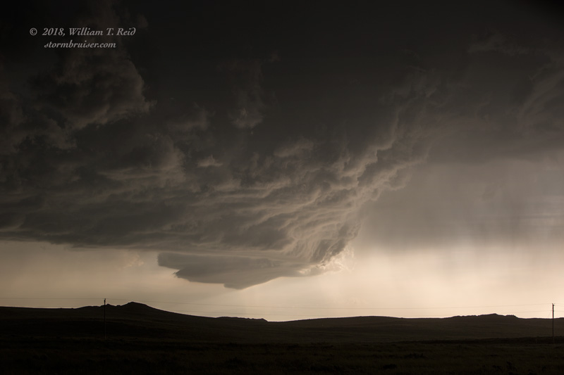
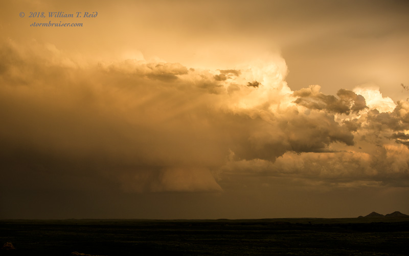
A new storm quickly developed not too far to our east, a little southeast of Reva. This one became tornado-warned! But we had no way to quickly get to it, as we were still on the slow road and going south and east to Highway 79, well south of Reva. We had a good look at its backside (above), and frequent CGs were observed. Darn — I got a little too impatient and wound up without a quick east option.
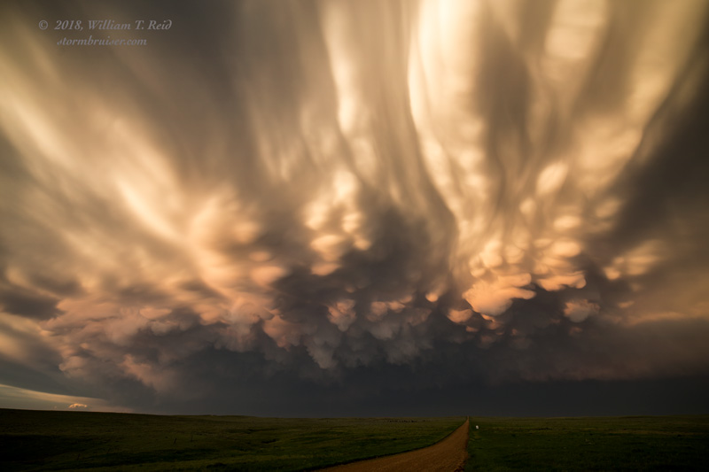
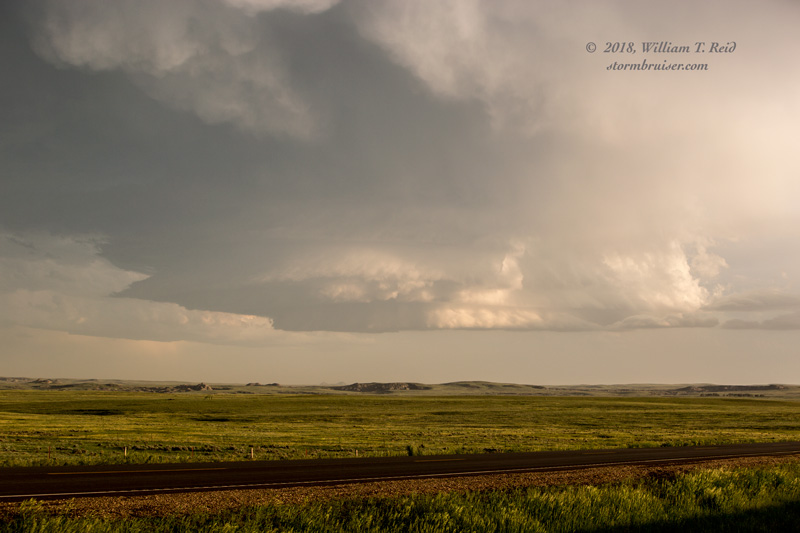
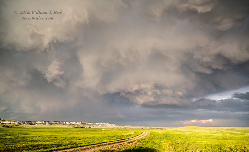
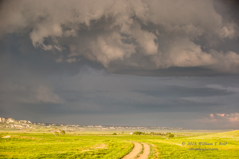
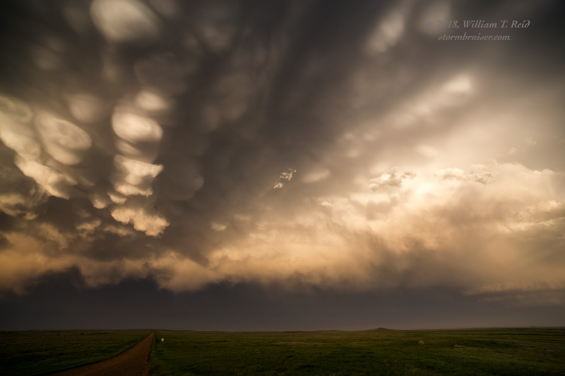
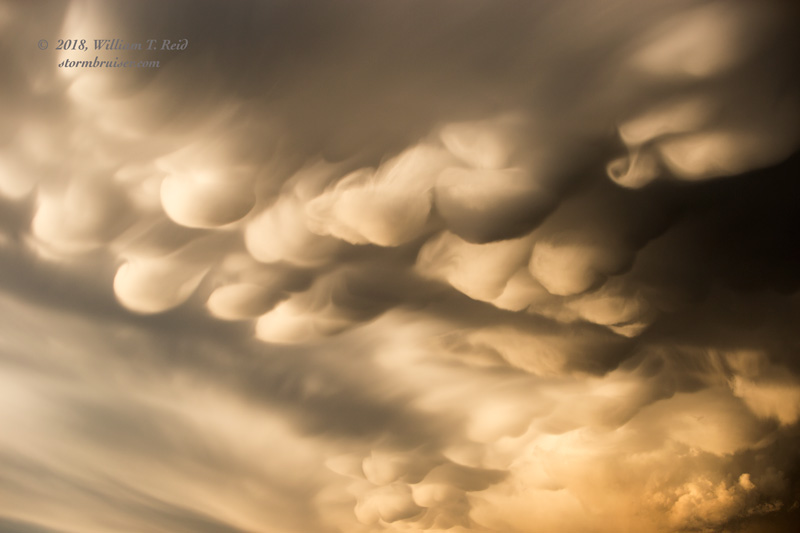
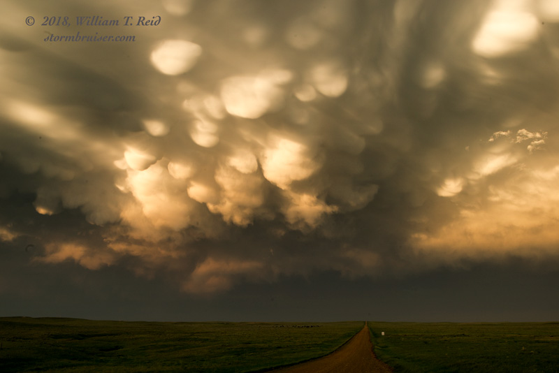
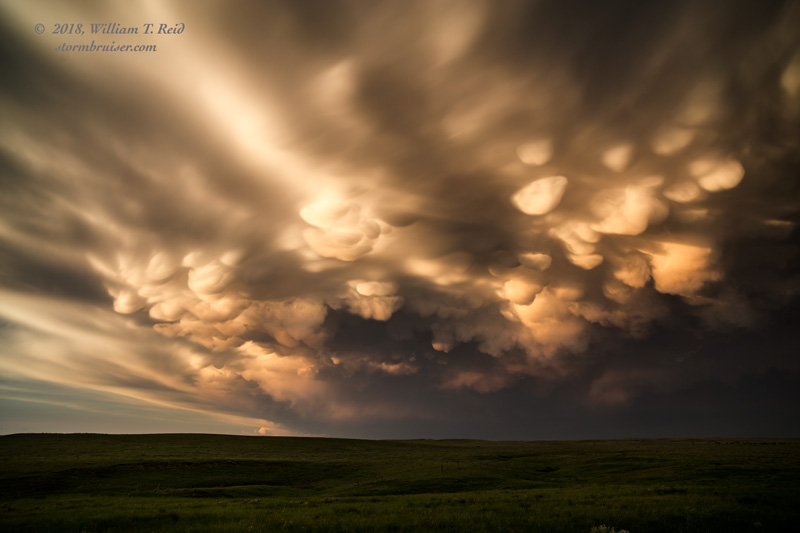
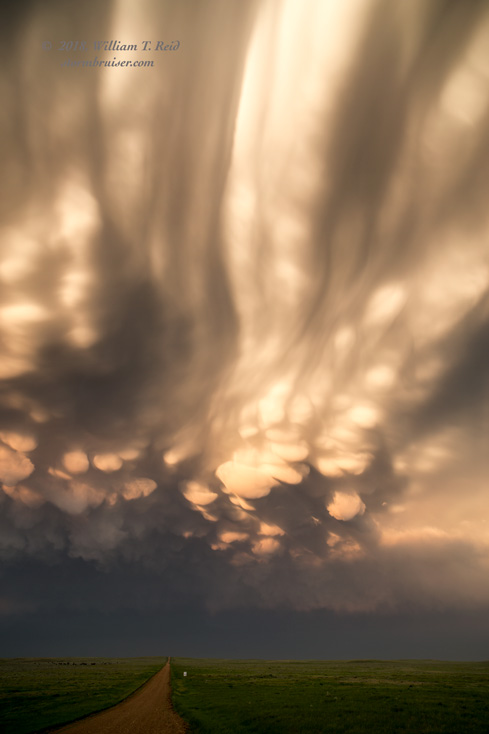
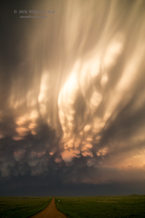
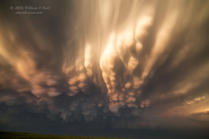
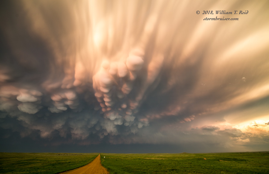
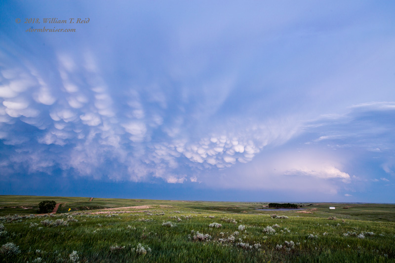
By the time we got to 79 and the Hoover area, it was close to sunset, and the two good storms that were in the region were heading east away from us. I had no good east options still. We stopped on a remote gravel road southeast of Hoover to watch the great mammatus display. The images below include a look at the sculpted storm base well to our SSE. There were plenty of hail and wind reports with this severe-weather event, but most were well after sunset.
Leave a Reply
You must be logged in to post a comment.