Link to Part 2 of the June 19 chase
Begin: Fort Morgan, CO
Lunch: Limon, CO/Arbys and Subway and Taco Bell
End: Lamar, CO
SPC Mesoscale Discussion 791 SPC Mesoscale Discussion 792 SPC Mesoscale Discussion 793
SPC Mesoscale Discussion 794 SPC Mesoscale Discussion 795 SPC Mesoscale Discussion 796
SPC Mesoscale Discussion 797 SPC Mesoscale Discussion 799
This morning’s weather forecast briefing to the tour group in Fort Morgan was a little later than normal, as we were not too far from the areas with the best severe weather potential. I was drawn towards the Palmer Divide area down towards Limon on I-70. It appeared that instability and moisture would be a tad better along I-70 versus up here along I-76, at least during the mid-late afternoon. (Tornado prospects looked decent, and SPC upgraded from 5 percent to 10 percent around Last Chance in the 20Z outlook. ) We had a difficult time dropping south on 71 out of Brush due to a train which was relentlessly going back and forth across the road. Maybe that was fate or a sign or a signal from God — don’t go south, Bill! Well, after about 5 minutes, we turned around and found another street across the tracks in Brush. We went south.
I led the tour group past Last Chance and to Limon, where several fast food eateries awaited our arrival. If fast food had been available in Last Chance, then we would have stopped there! But the Dairy King closed long ago, and Last Chance is just a place to pass through quickly now. When we got to Limon, a storm or two started to develop near Denver and the Front Range. Why do storms have to go up so early over there?! Our guests split up among a few eateries, with most going to the Arbys. I asked them to try to make it a fairly quick lunch stop: hopefully no more than 30 minutes. Some guests might have to eat in the van. We might have to head west on I-70 to that new stuff right after everyone has their food.
I went to Subway, where the line was horrendously long. I grabbed a pre-made sandwich at the gas station instead. Those at Arbys found themselves waiting for a very slow order-taker/slash/cash-register operator. It figures, right?! Well, I waited patiently, and eventually everyone had their meals. Storms to our northwest near DIA were looking good on radar, and we needed to get up there. It was barely past 1 p.m.
Dang. As we headed northwest to Byers on I-70, the storm north of I-70, not too far north of DIA, was already very well-organized. We were maybe 50 minutes away from being in decent position. Another supercell was a little south of DIA, just south of I-70. It was not quite as strong. If I had motored southwestward out of Fort Morgan and Brush this morning, we would be a lot closer. And why didn’t I head west to Byers from Last Chance?! This storm had better not drop a tornado while we are so far away still! I told my driver Chris P. not to dilly-dally. We gotta move! How did that train engineer at Brush know to block my way south earlier? And why did I not take heed? And why can’t Arbys find a better counter dude?
Thankfully, the storm continued to be tornado-free as we approached Byers and Strasburg. We could see a nice updraft and a fairly low storm base and wall cloud by now, to our northwest. The supercell was moving rather methodically to the east along Highway 52, from about Hudson to Prospect Valley. (Prospect Valley is a small community in Weld County, southeast of Keenesburg, near the intersection of Highways 52 and 79, and north of Bennett by 22 miles.) I had a strong notion that this supercell was going to produce a tornado, and sooner rather than later. It had that look, and the surface winds and dew points on its east side were great.
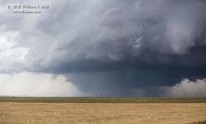
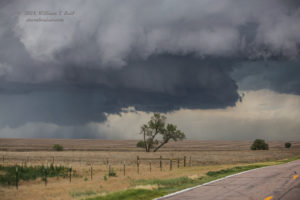
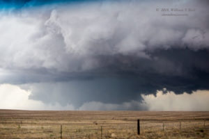
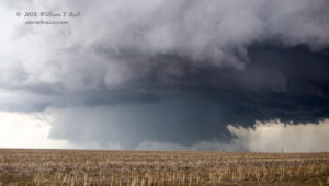
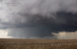
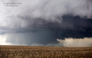
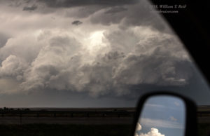
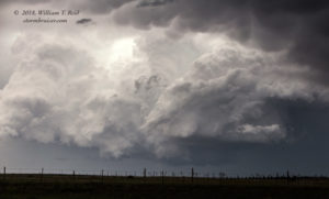
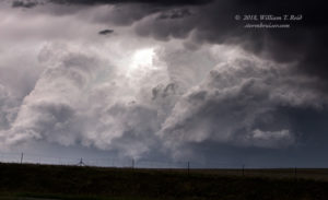
I considered heading to Bennett to go north to get close. The road north out of Bennett is good. But we needed to get north NOW a lot more than we needed to go farther west now. I had been on that Strasburg road recently, and it was a little funky and dilapidated in parts, I think, but it would work. We exited at Strasburg and I exhorted Chris to make it snappy as we made our way north out of town. We saved about 5-6 minutes by heading north out of Strasburg, and that decision saved the chase day. Here are some images prior to the tornado. The first two are from I-70 on the approach to Strasburg. The others are along Strasburg Road/CR 39, northbound from Strasburg.
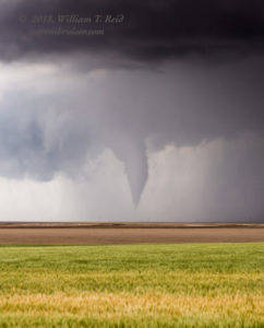
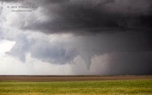
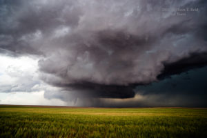
These are views to the NNW. The supercell has an obvious and large “lower tier” which might be considered a large wall cloud, but then a large and more-legitimate wall cloud begins to form (4th image above) back on the north side of this big storm base. The show is starting! We were near 88th Avenue, perhaps, 8 miles north of Strasburg. These are 70mm shots through the windshield while driving north. The four images below were taken shortly afterwards, as a tornado, or large funnel cloud, develops to our NNW with the massive wall cloud around it.
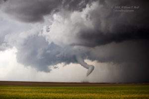
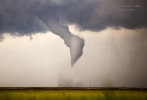
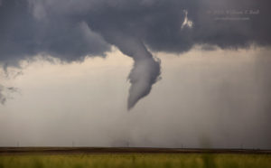
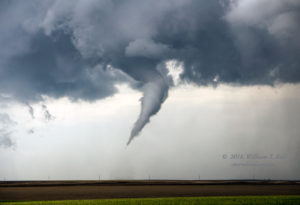
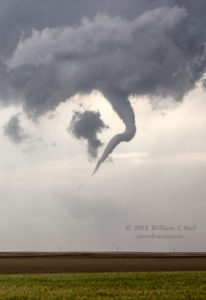
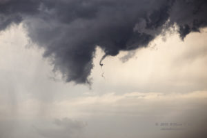
We still needed to get closer. The guests always want to get out of the van when a tornado is in progress, but I figured that this was just the beginning of what should be a decent show. I had to at least get to the north end of this road, which was a few miles farther north (the north end is 15 miles north of Strasburg, at 144th Road). What might have been a decent-sized tornado (above) did not persist very long at all, and the storm appeared to be without a tornado for a time as we covered the final few miles to East 144th Avenue in Adams County.
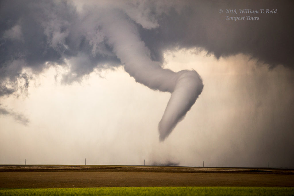
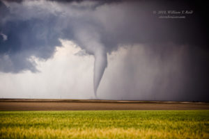
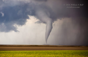
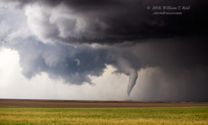
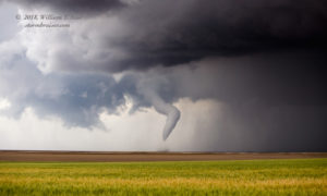
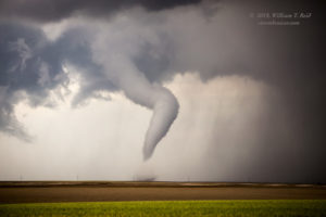
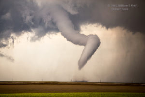
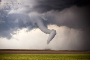
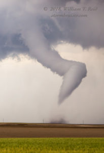
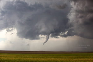
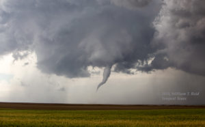
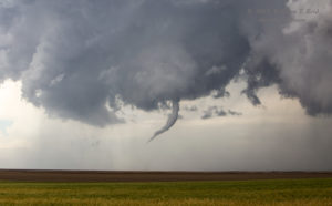
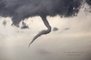
The supercell was looking fabulous as we reached our stopping point at Strasburg Road and East 144th Avenue. And, a funnel cloud was teasing the ground again! We quickly spilled out of the vans and pointed cameras to the N to NNW. This tornado was about four miles distant. I set up a wide-angle camera on the tripod for video of the tornado and structure, but forgot to check the focus — ugh. Fortunately, my long-lens shots came out okay.
The tornado was quite photogenic, and free from rain-wrapping. We had a great vista, without any nuisance rain or wind or lightning threat. Perfect! The tornado continued to put on a show and slowly roped out. These shots were with the 70-200mm zoom lens, at focal lengths mostly from 70mm to 140mm. The tornado lasted about 5 minutes.
Wow — that was cool! And we were quite fortunate to have arrived where we did in time to see the main event. The supercell was showing another new meso with tornado potential a little to the east of the just-completed action area. I needed to get the tour farther east to stay with the supercell, but a paved road to the east was nowhere to be found. As long as there was no tornado at this point, I figured that we should probably head back south to I-70 in order to get east again. And, that supercell that was south of I-70 was looking a bit better now, both visually and on radar.
The images below are a look to the north at the (previously) tornado-producing supercell as it continued east of Prospect Valley and towards the emptiness of southwestern Morgan County. It looked primed to spit out another tornado, but it did not. The southern storm began to dominate.
This crazy chase day was just beginning — the “Prospect Valley” tornado documented above occurred at 2019Z, or 2:19 p.m. MDT. The SPC report log has it at a spot four miles southeast of Prospect Valley, in Weld County. It was very close to the Weld/Adams county line.
This entry is long enough, so I will split the June 19th chase into two here on Stormbruiser. Check Part Two for the remainder of the chase.
Tour guest Lesleyanne Ryan has a great account for this chase day with Tempest, including some excellent wide-angle time-lapse video during the tornado phase. Check it out!

Leave a Reply
You must be logged in to post a comment.