Start: Hobbs, NM
End: Abilene, TX
SPC Mesoscale Discussion 477 SPC Mesoscale Discussion 480 SPC Mesoscale Discussion 481
SPC Mesoscale Discussion 482 SPC Mesoscale Discussion 483 SPC Mesoscale Discussion 485
SPC Mesoscale Discussion 486 SPC Mesoscale Discussion 487
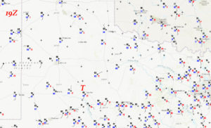
19Z/2 p.m. CDT surface map
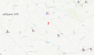
21Z/4 p.m. CDT surface map
I headed east from California for my May and June chase season (working for Tempest Tours) on April 29th. Jennifer was driving for Tour 2, which began around May 4th, so she flew out to L.A. to join me for the drive east. On the 29th we made it out to far West Texas by evening to see some thunderstorms in the Orla area. We stopped near the Guadalupe Mountains for some shots of the impressive development to our east around sunset. However, these shots were lost the next day somewhere near Fluvanna, as I was fumbling around changing camera data cards during a storm chase with tornadoes. UGH. Maybe the camera card is still lying on the ground near Fluvanna. I will look for it the next time I am in the area.
We started April 30th at Hobbs, and we needed to get east or east-northeast into the good moisture, along a front where severe thunderstorm development was very likely during the afternoon. SPC was favoring the areas from Wichita Falls to Texarkana and the Ozarks of southern Missouri. An enhanced risk area here was upgraded to moderate in the 20Z outlook, with a 10-15 percent hatched tornado risk for much of eastern Oklahoma. The slight risk area in the 1630Z outlook extended back to the southwest as far as Sweetwater, TX. I was content to play the western portions of the slight risk area (even though SPC showed only a 2 percent tornado risk here), as it was much more proximate and was a much better area to observe and chase storms.
Jennifer and I headed east on U.S. 180 to the Snyder area, and some cloud towers were giving it a go fairly early in the afternoon, not too far from Lamesa. This was near a triple-point area, where the nearly-stationary E-W front was up against the dry line. The 19Z/2 p.m. CDT surface map (above) shows a warm westerly wind at Odessa (84 over 45), warm and moist southeasterly winds from Big Spring to Sweetwater (80 over 66 and gusting to 25 knots from the SSE at Sweetwater), and quite cool and moist conditions in the Jayton area (63 over 62) with a backed wind (ENE, gusting to 11 knots). If a storm went up on this triple-point/mesolow area and moved E to ENE along the boundary, which was just north of U.S. 180, then I would expect a fairly good tornado chance.
The initial attempts in the Lamesa area failed, as the weak activity drifted to the northeast and became elevated above the cool air behind the front. New mesoscale discussions from SPC during the early afternoon were very bullish on prospects farther to my east several counties. Should I spend the next hour or two heading east, towards the higher instability and higher tornado percentages? We drifted east on U.S. 180 to maybe a little east of Roby. I was trying to keep options open. I was concerned that big-time thunderstorms and tornadoes might develop towards the Wichita Falls and Seymour area. But, the better moisture convergence still seemed to be back west here towards the triple point. Another check of the radar showed a strong storm, finally, back to our west! It was near Gail and maybe 60 miles away, and would be moving E to ENE-ward —- right towards us! Time to blast west.
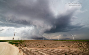
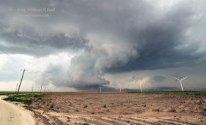
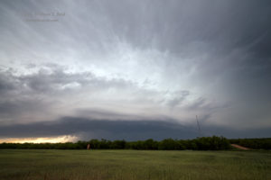
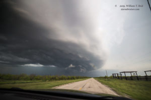
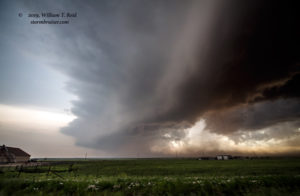
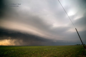
We could soon see the top of the tall storm tower to our west, and the thing was riding the boundary perfectly. Check out that 21Z surface map (above). The storm was right in that triple-point area, with winds pointed into it from the west, southeast, and northeast. We continued west beyond Snyder some ten miles or so to FM Road 1269. This road to the north was perfect, as it would put us right in front of the storm, which was approaching Fluvanna. We stopped south of Fluvanna and had a good look at the storm base to the west, which was fantastically and fabulously low to the ground!
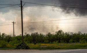
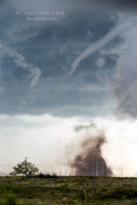
A good-sized RFD cut had already worked its way into the updraft base, and if ever there was a storm ready to produce a tornado, it was this one. It looked like a good time to get closer, so we headed into Fluvanna and then west a mile or so on FM 612. Dusty spin-ups — at least two! — developed just to the north of 612, no more than a mile to our west. I shot some video with my Canon 6D and the long lens, but then filled up my card. I found another card to stick into the camera. I thought that I had put my used-up card into a safe place, but I have not seen it since.
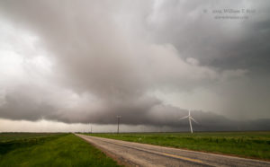
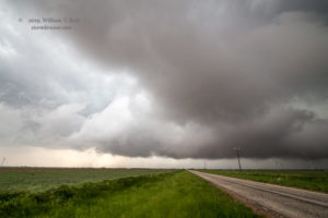
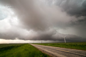
We turned around on 612 and stopped. The weak dusty tornadoes quit at least momentarily, and I managed to get some wide-angle shots of the storm from here (looking west), still a mile or so WSW of Fluvanna.
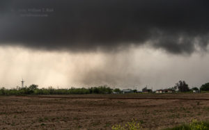
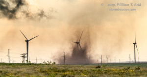
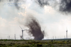
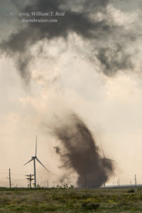
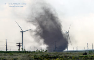
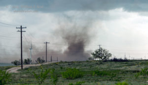
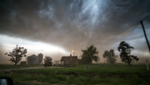
The weak tornadoes that we had just viewed came out of this forward-flank area, not very far away at all. With the storm coming right at us and right towards Fluvanna, I was nervous about something significant forming nearby and charging through the town. I elected to go back into Fluvanna and north to the edge of town to get another look. The memory is a little fuzzy here, but I think that we observed a fairly significant dust whirl to our south, near the south edge of town (a mile distant at most). I took a couple of shots of this with the long lens:
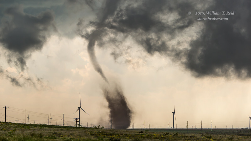
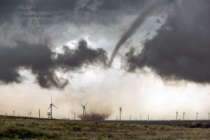
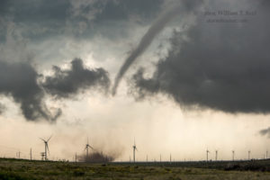
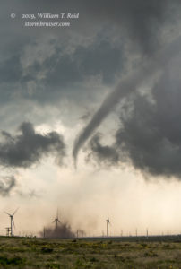
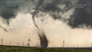
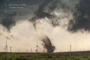
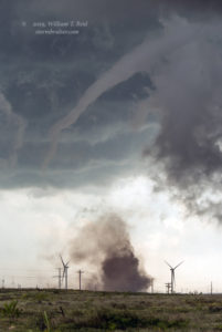
A tornado was in progress, and it was very close to Fluvanna! There was little or no condensation/funnel cloud with the tornado, yet. With the tornado on the south side of town and moving to the east, we needed to move. We jumped on 612 eastbound out of Fluvanna. A mile or two later, we were just northeast of a strengthening tornado, this time with a funnel cloud, and I found a little hilltop south of 612. These were taken with the long lens (70-200mm).
The nice tornado wound up dissipating to our south, maybe a mile distant. It remained generally over cropland to the SE and ESE of Fluvanna. The tornadoes occurred from about 4:10 to 4:35 p.m. CDT.
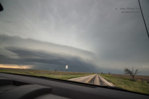
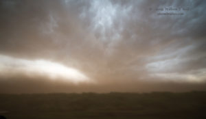
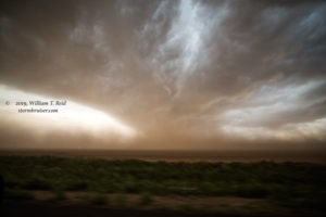
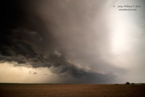
Jennifer and I continued to the east on 612, and were forced southeast on U.S. 84 all of the way to Snyder in order to continue to the east. We turned north on FM 611 to get close to the supercell once more, and zig-zagged towards Rotan. During this period, there was no tornado evident with the storm, but it continued with the nice structure and large and dusty RFD area.
The storm eventually became a bit undercut as we stayed with it near Hamlin, Old Glory and Rule. Hail of about 1.5 inches in diameter impacted us five miles east of Rule. Beyond there, the supercell weakened, the storms had become messy and wet, and our chase day was done. Another tornado or two occurred near the Red River this day, near Wichita Falls.

Leave a Reply
You must be logged in to post a comment.