Start: Amarillo, TX
Lunch: Clarendon (Subway)
End: Altus, OK
428 miles
SPC Mesoscale Discussion 698 SPC Mesoscale Discussion 699
SPC Mesoscale Discussion 702 SPC Mesoscale Discussion 703
SPC Mesoscale Discussion 704 SPC Mesoscale Discussion 705
SPC Mesoscale Discussion 709 SPC Mesoscale Discussion 710
Surface maps, 19Z and 23Z:
(May 19 was a down day/position day)
(Chase account for May 20 by TT guest L. Ryan)
Must Viewing — bucket cam footage by TT guide Chris Gullikson
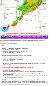
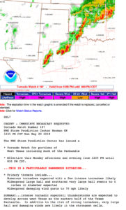
High Risk
45 percent hatched tornado risk
HUGE 45 percent hatched damaging wind risk area
HUGE 45 percent hatched severe hail graphic
And, wording such as the following out of SPC:
 The corridor of greatest concern, including a
   threat of long-track and potentially violent tornadoes, will extend
   from the southeast TX Panhandle into western and central Oklahoma.
Yes, this was going to be a BIG severe weather day on the Southern Plains! And did I say that there was a 45 PERCENT HATCHED TORNADO RISK? Heck, we get excited when there is a 5 or 10 percent risk. How could it be possible for a storm chaser to NOT see a tornado today?! Expectations were very high for the tour group. The tour director had better not mess up.
The western edge of the high risk area, and the western edge of the highest tornado risk, was around Clarendon in the southeastern Texas Panhandle. We had a quickie lunch here, as the energetic atmosphere was apt to whip up a supercell nearby in nothing flat. We had to be ready!
Surface low pressure was centered at or near Palo Duro Canyon. Dew points were in the upper 60s and low 70s on stout southeast winds. The winds aloft, and the effective bulk shear, were outrageous. Storm speeds of 40 mph were expected. Tornado watches were issued around noon.
With a generally mediocre paved road network to work with today, and with fast storm motions to the NNE, this was another day when the chaser had to be careful not to bite too quickly on the early stuff. If you wound up playing catch-up, then there was a good chance that you might not be able to catch up. There was the Red River and its few crossings to consider. Would it be better to wait near the river on the Oklahoma side as storms moved northward out of northwest Texas? And, would the chaser numbers be so great as to cause a real danger? This day was looking really potent, and it was not difficult to imagine grim scenarios on the road later on.
Big storms developed around noon south and southwest of Paducah, Texas. These would move fairly quickly to the NNE. The best tornado potential would likely be around the Red River and into southwestern Oklahoma, so I was not going to forge southward to get close to this new development right off the bat. We waited around between Cee Vee and Northfield. The air was muggy and the southeasterly winds were strong, but we couldn’t see what was going on! It was hazy and murky. I think that a strong storm approached and moved to our west, but it was not what we wanted. One that was nearing Paducah had the best look on radar and the best access to the moist southeasterlies. It was soon clear that we needed to be on this storm. A tornado was reported with it near Paducah, while we were about 20 miles to its north, between Paducah and Childress. Since the supercell’s action area would be a little east of U.S. 83, I elected to head up to Childress and U.S. 287. We would eventually be in position to watch this storm approach!
This was it! This would be the really big show! The environment was off the charts for severe weather and tornadoes! We scooted a little to the east on 287 to Kirkland and waited (with dozens and dozens of other chasers) for the storm to emerge out of the haze. The leading edge of the updraft base and the big RFD cut became visible to our WSW, but there was no tornado apparent at this time. And, if I recall correctly, I think there were a couple of supercells in very close proximity — one on the heels of the leading one. Perhaps the tornado prospects were greatly diminished due to the competing updrafts and the deleterious effects each one had on the other.
We watched the activity move (NNE-ward) to our northwest, and the general look was wet and messy. This did not look like a well-organized storm. We were going to stay with it, though, as there were no other storm candidates. The storm (or storms) were about to cross the Red River into Oklahoma and we needed to reposition. One option was Goodlett to Hollis, but this would put us smack dab into the storm’s core, and/or behind it to its southwest. No thanks. We had to get ourselves to Quanah, about 20 miles to the ESE, in order to get ourselves across the Red River and into Oklahoma. As we began this maneuver, which took us the wrong direction and AWAY from the supercell(s), I was not very hopeful at all that we would be able to catch up again.
From Quanah we headed north and northeast on 6, and then north on 34 towards Duke. Fortunately, there was little or no traffic, and the wait at the railroad crossing was brief! Prospects for intercepting the storm again were improving. It was still to our northwest and moving to the NNE or NE, and the forward motion had slowed some, to perhaps 25 to 30 mph. Maybe the slower motion was due to the atmospheric adjustments that took place due to the interactions of the two cells, as now there was just one supercell! And, now that there was just one prominent updraft instead of two, perhaps the tornado-making would commence!
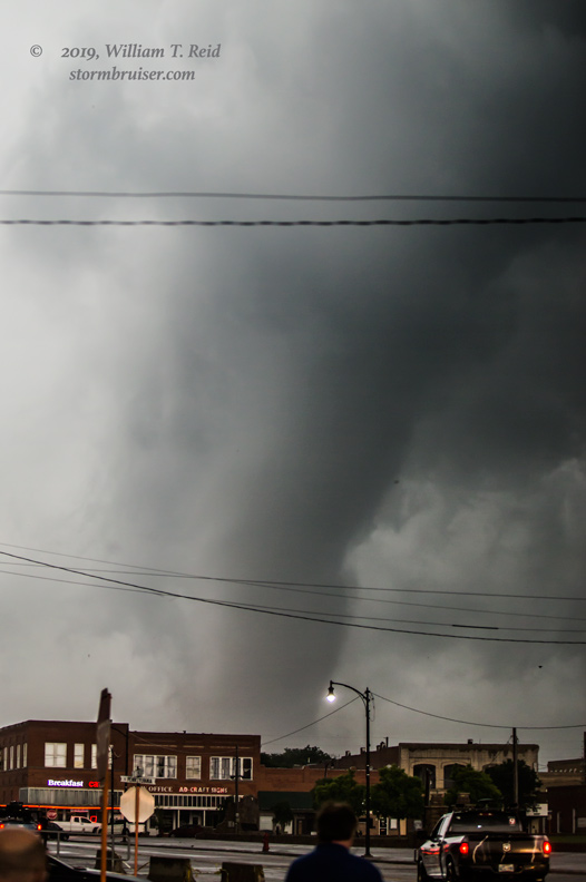
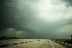
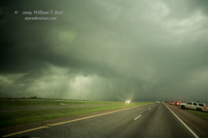
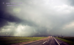
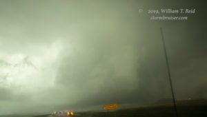
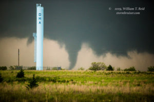
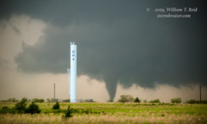
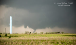
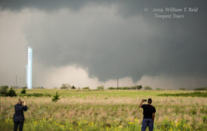
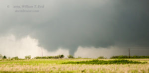
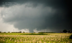
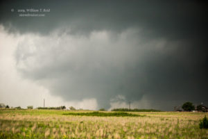
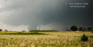
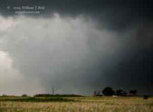
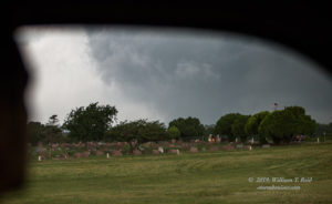
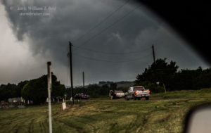
We were able to race northward on 34 at a good clip, and eventually the action area of the supercell was to our west. And, almost immediately, it was going into tornado-making mode! We were about halfway between Duke and Mangum. The looks below are towards the west.
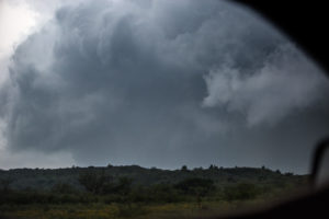
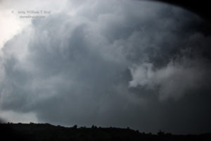
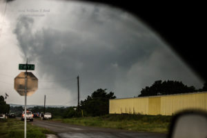
The tornado was perhaps 3-4 miles away to our west, and we continued northward on 34. The tornado became obscured due to both terrain and wrapping rain, but it was looking quite large! The road angled northeastward towards Mangum, and I tried getting some shots with the long lens through the driver’s-side window.
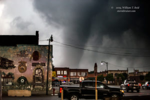
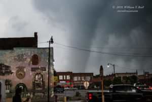
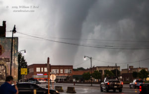
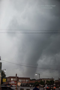
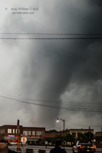
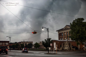
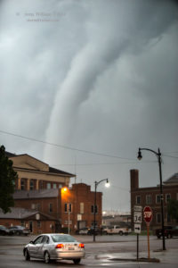
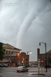
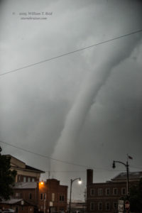
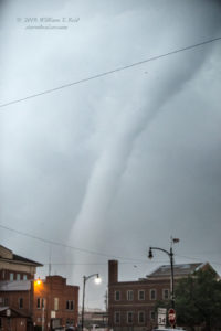
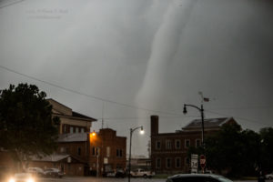
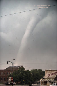
This was a great road to stay with the storm, but there were hills that were blocking the view, and now the outskirts of Mangum were in the way. It was not easy to get a good look at this tornado. We continued into town, and at Mangum’s main intersection (near the courthouse), the sky opened up nicely to the west. The tornado was quite a bit closer than I was expecting! We stopped in a parking lot on the southeastern corner of the junction of 34 and 283 and got out of the vans to watch.
The “Mangum” tornado skirted the west and north side of the town. This was the rope-out stage, and the tornado was perhaps a mile away from our position.
Our view of the tornado worsened due to buildings and distance and poor contrast. It was roping out to our north, so I elected to head east on 283 to 6 north towards Granite. This would give us another chance, presumably, to get back into position should the storm cycle and produce another tornado. The look on radar was fabulous, but as we approached Granite, the actual visual look of the storm was less impressive. Northeast of Granite, the storm was wet and messy and cold looking — it was now above a cool low-level airmass. A boundary was pushing south and undercutting the supercell, effectively ending its tornado chance.
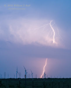
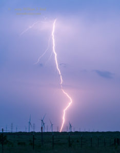
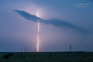
We were quite fortunate indeed to have made it to Mangum in time to witness this tornado! As it turned out, this was the only decent tornado of the day (by chaser standards) in northwest TX and southwest OK. We headed south and stopped just south of Vernon to watch some thunderstorms approach around sunset. The lightning was decent and there was some structure, but our tornado chasing was done for the day.

Leave a Reply
You must be logged in to post a comment.