Start: McCook, NE
Lunch: Red Cloud, NE/Subway
End: Salina, KS
403 miles
SPC Mesoscale Discussion 853 SPC Mesoscale Discussion 854
SPC Mesoscale Discussion 858 SPC Mesoscale Discussion 863
SPC Mesoscale Discussion 864 SPC Mesoscale Discussion 866
Great summary and chase account with forecast maps by Skip Talbot
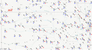
A potent spring-time upper-level trough was approaching the High Plains from the west, providing excellent mid-level winds and the shear necessary for severe storms. Surface low pressure was near Hays, Kansas, with very nice dew points of 68F-70F just east and northeast of the surface low. Even better, an E-W outflow boundary due to morning convention near the KS/NE line was stalling out across north-central KS. Low clouds were still in place north of this boundary during the early afternoon as we headed south from Red Cloud into Kansas. The main difficulty for this forecaster was where to play east-west along this boundary. SPC seemed to heavily favor areas east of U.S. 81/I-135. Tornado risk percentages were 10-percent (hatched) from Salina to Topeka and Kansas City, whereas the area around the surface low, near Hays, was pegged at less than 5%. There was also the dry line through central KS and OK to consider, but surface winds were much more favorable for tornado development along this outflow boundary in northern Kansas. I directed the group southward through Lebanon and Tipton into the mid-afternoon, and we broke out of the stratus overcast as we neared Hunter on Route 181. I had decided that this area along the boundary and just northeast of the surface low would be a satisfactory target area. We drifted south of Hunter a couple of miles into the sunshine and warmer temperatures. There was nothing important bubbling up yet, so we went back into Hunter to poke around and kill some time.
Within minutes, all of the residents of Hunter likely were aware that a couple of vans filled with goofy storm chasers with cameras were swarming through Main Street and vicinity. There was nothing open, no convenience store or gas station, but there was a fabulous town meeting hall with a restroom or two! Yay!
I was a bit nervous that storms might go up a little to our east, where some small cumulus clouds were a little agitated. I didn’t want to be playing catch-up, so we drifted east and north to Beloit and a convenience store stop. The nearby cumulus field was sputtering. But, well to our southwest, storm towers were now developing! We need to get back west.
The new development was near Hays, right on the surface low. We headed west to Cawker City and south to Tipton, and another new cell went up west of Tipton (NNE of the Hays storm). A landspout tornado was reported with the Hays cell. I was happy to sit just southwest of Tipton to watch this northern cell, as we were pretty much RIGHT on the outflow boundary.
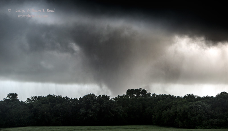
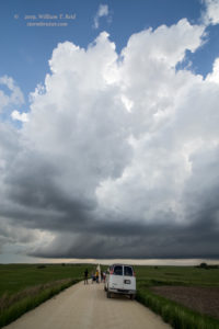
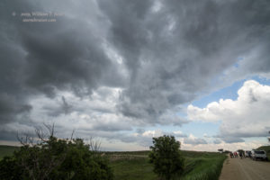
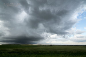
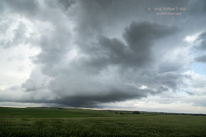
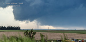
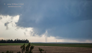
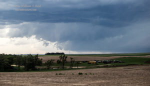
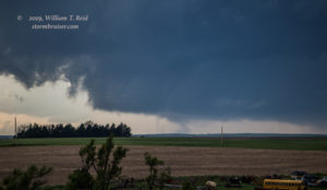
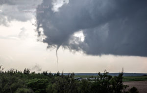
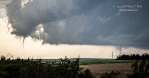
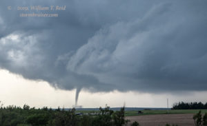
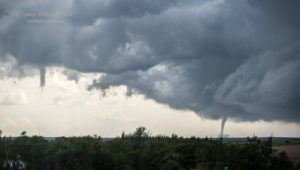
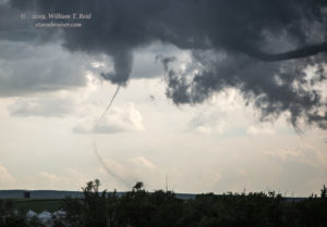
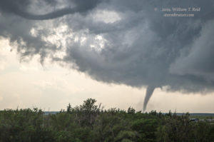
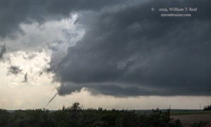
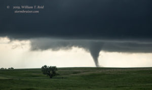
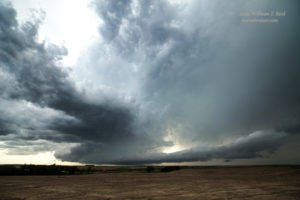
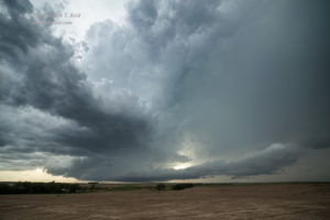
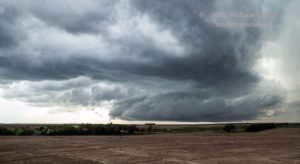
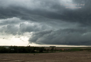
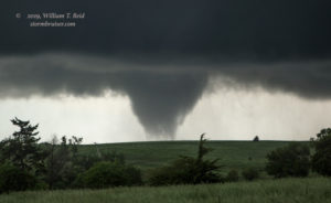
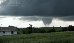
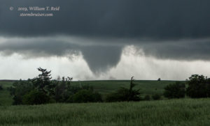
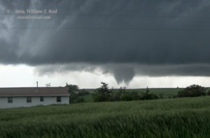
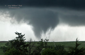
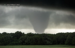
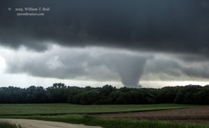
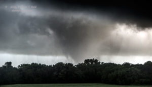
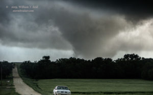
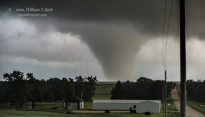
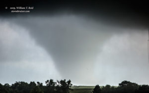
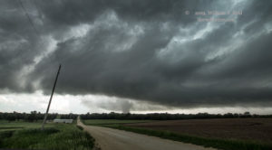
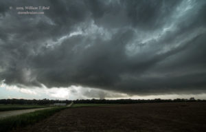
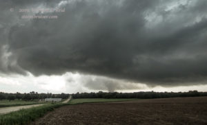
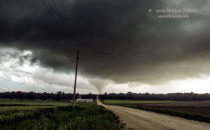
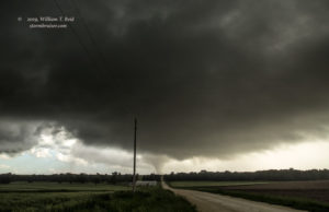
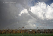
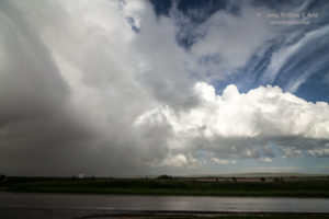
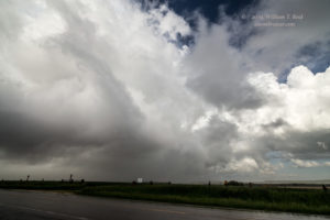
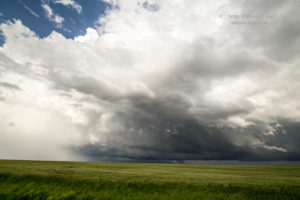
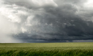
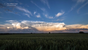
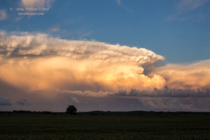
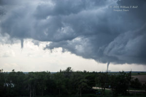
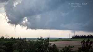
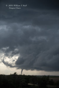
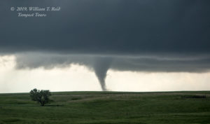
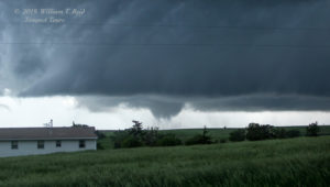
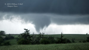
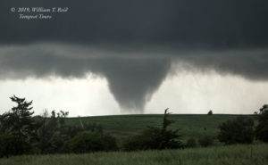
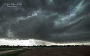
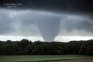
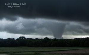
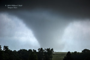
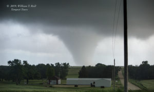
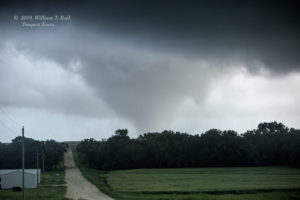
The first image above is looking west at the “Tipton” storm. It sported a nice, low storm base and some good low-level structure right off the bat. The storm headed to the northeast and moved over our heads, with lots of spin and cloud motion in the RFD area. The second image above is looking to the east, with what might be a weak funnel cloud just north of the road. I thought that we might get a tornado close-by around this time. Why was this storm not able to “tornado” for us right here and now?! We scooted north of Tipton a bit to stay with this supercell, with that nice low-level structure persisting — see the 3rd and 4th images above, looking to the NNE. Should we continue with this storm?
Well, it was moving into cooler air and winds from the northeast, and I figured that this was NOT an increasingly favorable environment. The storm had already failed its best tornado chance, as far as I could tell. I elected to head back south to play the tail-end stuff that was moving towards us, north of I-70. I think we were seeing more tornado reports now with this one as it approached the Waldo and Luray area. We stopped about 4 miles southwest of Tipton on County Road 691, in extreme western Mitchell County. A tornado was in progress well to our SSW — we could see it!
Though this tornado was about 13-15 miles distant, I was compelled to stop here as the tour guests wanted to get out of the van to get some pictures. I don’t blame them! The first tornado that we saw dissipated fairly quickly, I think, but a new one soon took its place. I decided to hang out at this hilltop location to watch the storm approach. We were in its path, presumably, but there was plenty of time to set up the video tripods and to get some good zoomed-in photos.
The images above were taken from the aforementioned hilltop, southwest of Tipton on CR 691, looking to the SSW. The storm was now a tornado-making machine, as it interacted with that east-west outflow boundary! Tornadoes love boundaries, and that is why we were hanging out here, right?! There were two or three tornadoes in progress simultaneously for a good five minutes or thereabouts. (The second image above reveals a faint tornado between the two obvious ones.) They seemed to favor the leading edge of this updraft base, as opposed to being buried back in an occluded RFD area. It was rather weird. We were still a good distance away, so I can’t really say with certainty WHAT was going on, except that we had good contrast and a good view and all of this was getting closer and closer! My 15mm wide-angle lens fit the storm structure in nicely (below).
The tornadic supercell was headed at us at perhaps 30 mph, and an area of precipitation was just a few miles away from us to our west. The storm briefly went tornado-less, so I decided to reposition back towards Tipton and the paved road network. Though this gravel road was high quality, I didn’t want to be playing around on unpaved roads in the rain with a tornadic supercell nearby! We went north a mile or so, and Rob (in the follow van) radioed that there was another tornado in progress! GAD! The follow van stopped and got some additional shots, and eventually we were all back on the pavement, about two miles west of Tipton. By now the storm had gone into full-fledged long track/big tornado mode! The tornado was a few miles to our SSW and continuing its approach, and we took a lot more pictures! At one point we scooted east a little more to stay NNE of the tornado.
The images above were with the long lens while the “Tipton” tornado was a couple of miles distant. As it neared and passed to our due south, the contrast deteriorated markedly and the thing was getting increasingly wrapped in rain. Below are the wide-angle looks to our south.
Well, shoot. Now that we were on pavement, the tornado was becoming obscured and was disappearing from view. We went east a mile into Tipton in the rain, and then south. As we came out of the rain, a slinky funnel cloud made its appearance just to the east of the road. Seconds later, it was gone, and the Tipton tornado was history. It had come up to Highway 181 about a mile or two south of Tipton. Here is a link to the NWS report. It was rated EF2. The pic below is courtesy of a Tempest guest, taken as the tornado roped out just to the east.
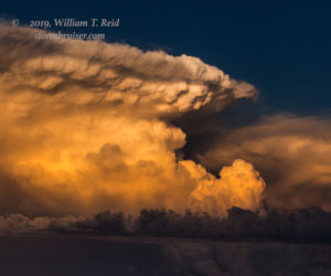
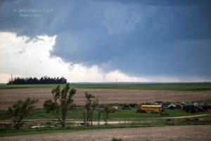
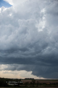
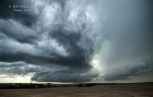
The tornadic supercell continued to move to the east and northeast of Tipton. Would it be able to produce another good-sized tornado? Or would it have difficulty as the previous cell did when it moved north of Tipton’s latitude? We had no new storms coming up from the south, so it seemed prudent to stay with this one. We had to travel south six miles in order to get east again (via Hunter), and this put us well behind the storm. We got close again about a half hour later, south of Beloit, but the storm was a bit of a wet mess without a tornado threat. Another new storm now to our east had a decent look at low levels. The first two pics below show the back end of the Tipton storm shortly after the tornado roped out south of Tipton (looking E). The second two images show the severe storm near Beloit later.
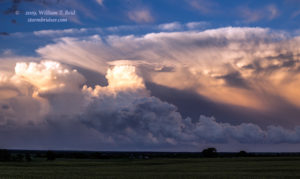
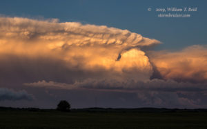
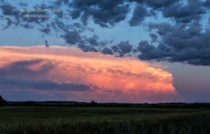
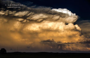
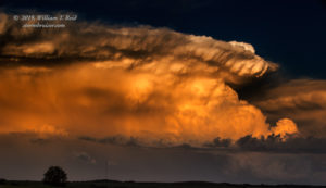
With another few hours of daylight remaining and with mesoscale discussions highlighting tornado threats for much of northern and eastern Kansas, one might assume that we were really busy for the rest of the chase day! But, for whatever reason, the storms decided to go into BLAH mode towards sunset and there was nothing worth chasing as we drifted east to U.S. 81. The tornado show was over! Some pretty storms erupted east of I-135, near Salina. We stopped near Minneapolis to watch them at sunset to our southeast and east.
Link to Brian Morganti’s images of the tornadic storm, closer to Waldo. Scroll to the bottom for May 28 chase.
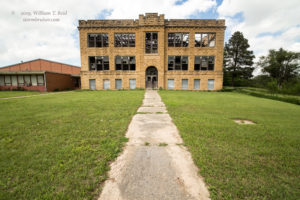
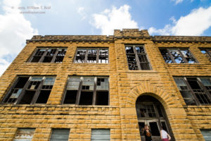
Below are images which were on the early version of this chase account.

Leave a Reply
You must be logged in to post a comment.