
Start: Denver AP
Lunch: Limon/Arbys
End: Colby, KS
438 miles
SPC Mesoscale Discussion 963 SPC Mesoscale Discussion 967
The beginning of Tour 5 out of Denver was plagued by a somewhat poor pattern as an upper-level ridge was over the Rockies and High Plains. There was enough moisture and instability and shear for some strong-to-maybe-severe storms over eastern CO and vicinity, however. SPC showed a slight risk and a 2% tornado risk along the CO/KS border.
My first inclination was to head to southeastern Colorado after lunch in Limon. I have forgotten why. I reversed course at Eads and headed back to Limon. We viewed some developing thunderstorms north of Limon, and these slowly chased us eastward. The cells were fairly high-based and not well-organized. Outflowing and undercut storms ruled.
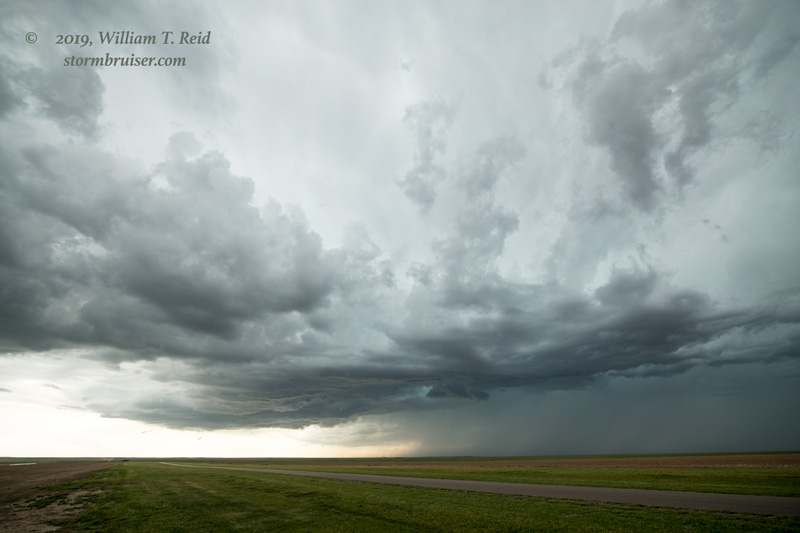
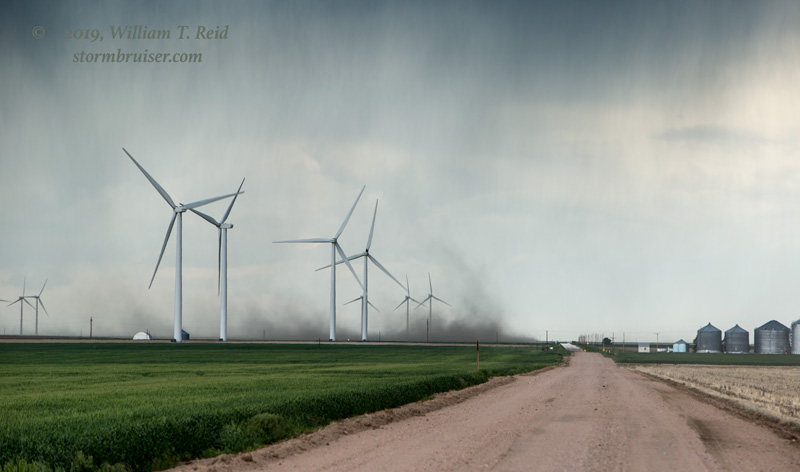
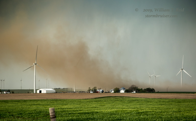
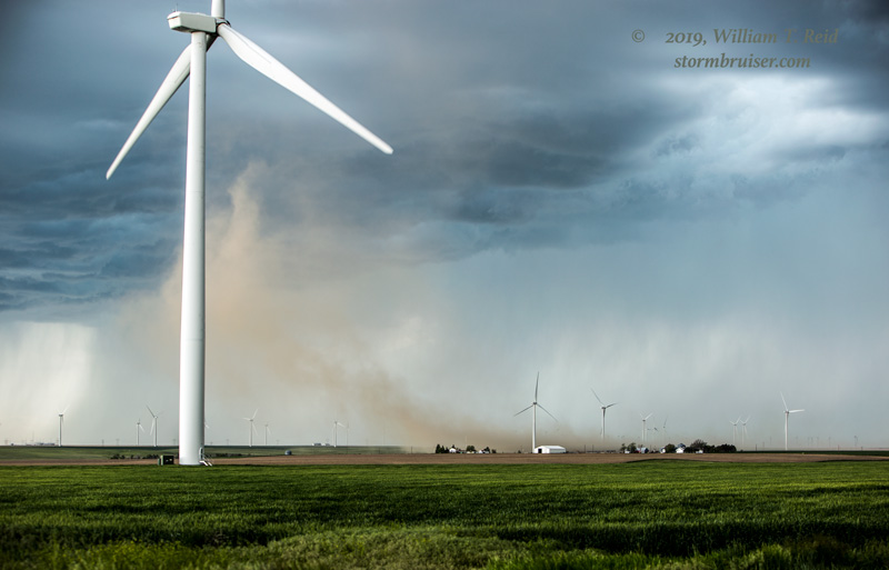
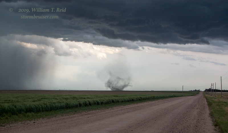
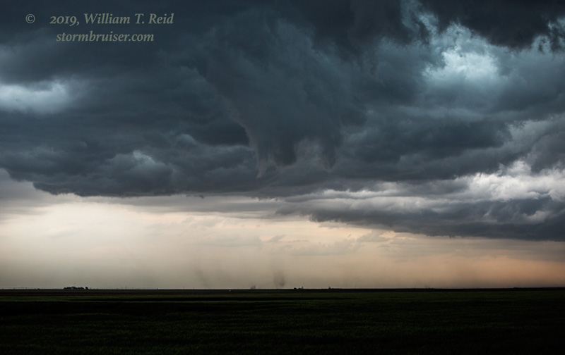
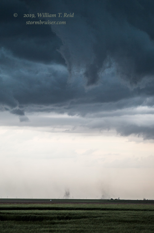
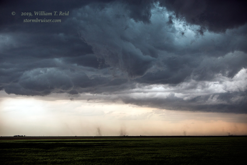
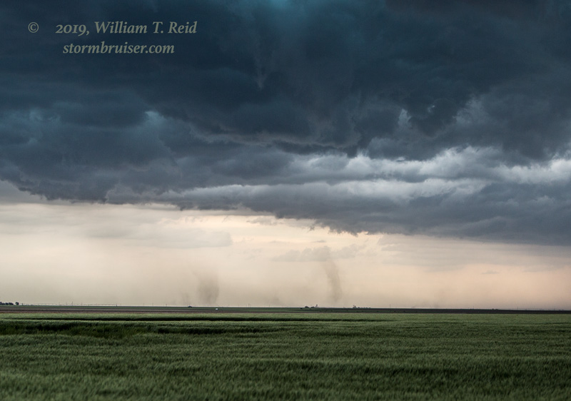
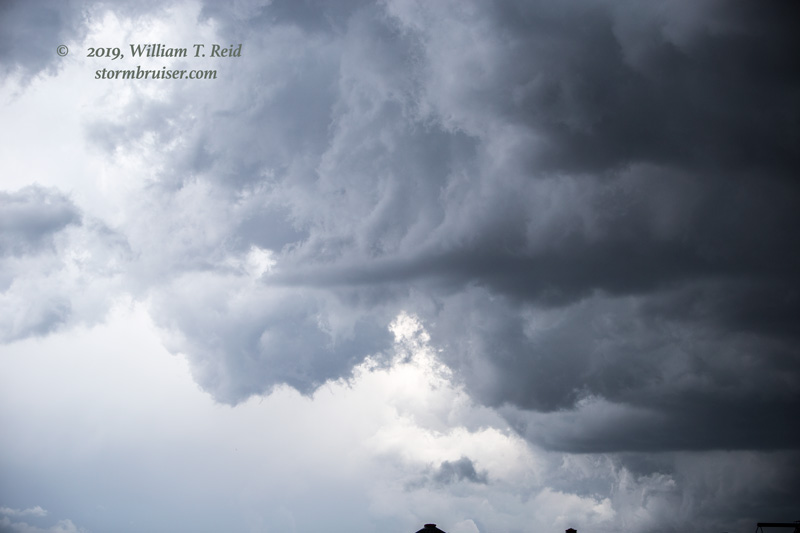
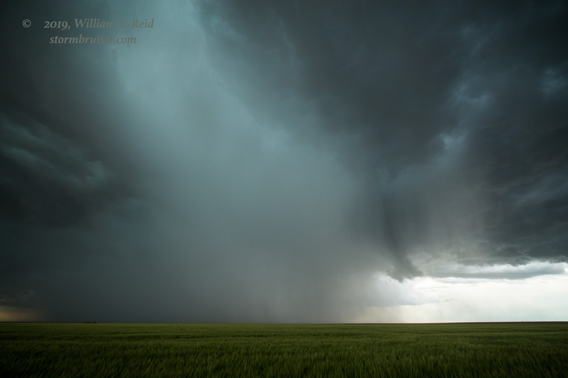
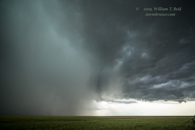
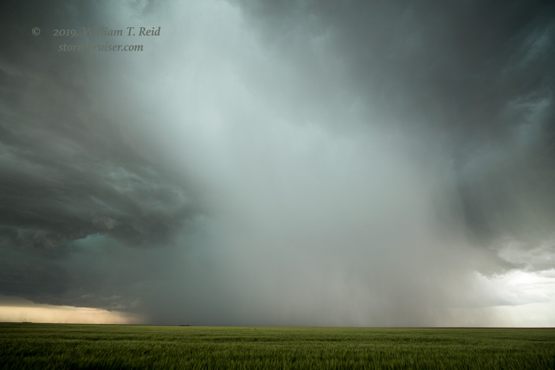
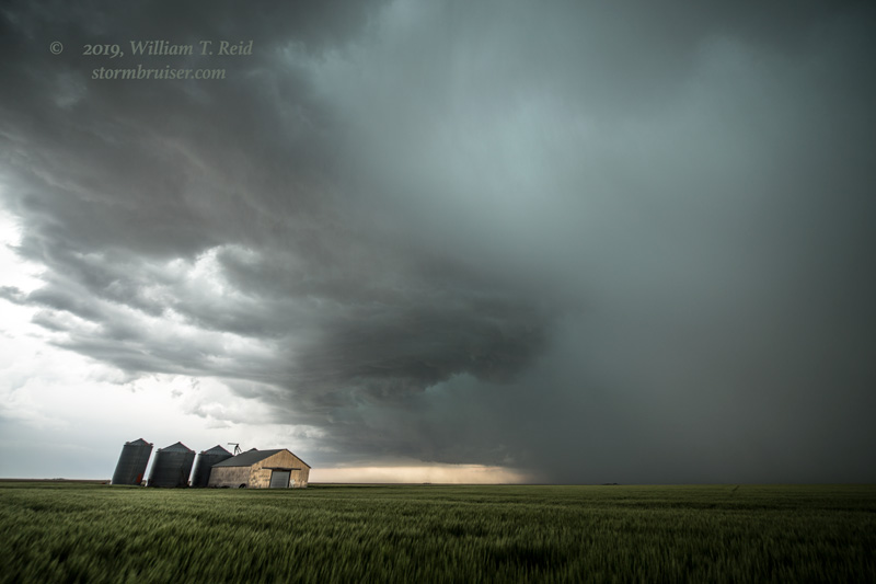
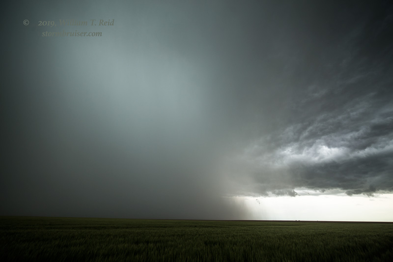
Eventually a potent outflow boundary was blasting eastward from the Flagler area towards the CO/KS line. Another outflow boundary was headed south from Nebraska towards I-70 at the CO/KS line. These boundaries showed up quite clearly on the radar reflectivity. I figured that something interesting might develop when these two boundaries came together. Since our I-70 stuff near Flagler was junky, we headed east on I-70. Nice, big storm towers developed quickly near the state line! As we neared Kanorado, some dust was stirring beneath a base to our SSW. We exited and headed south a few miles on the dirt road. A spin-up persisted for several minutes. I didn’t notice an obvious funnel with the weak tornado at the time, but some of the images suggest a horizontal funnel doing its thing.
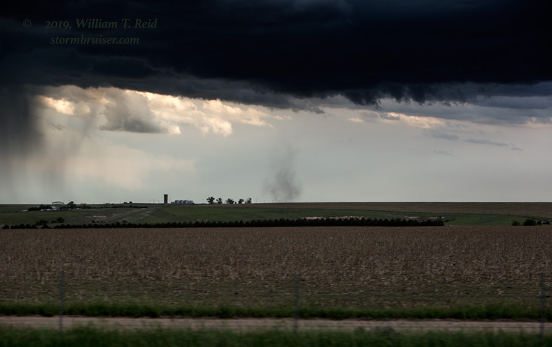
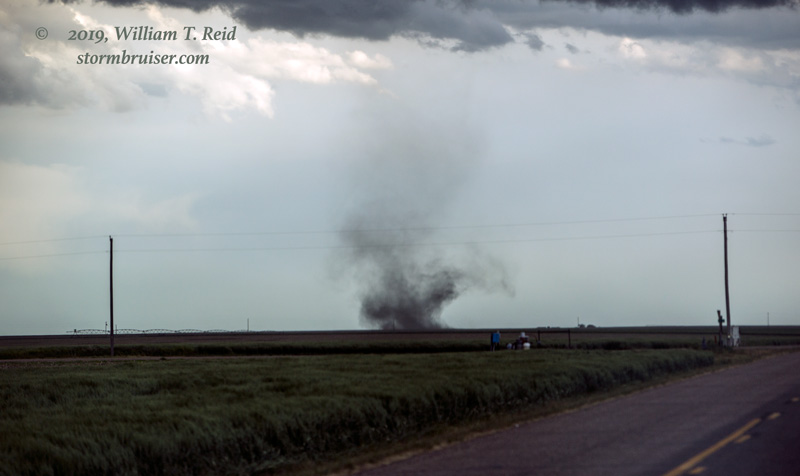
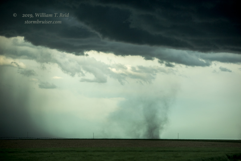
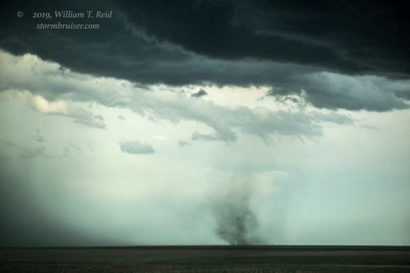
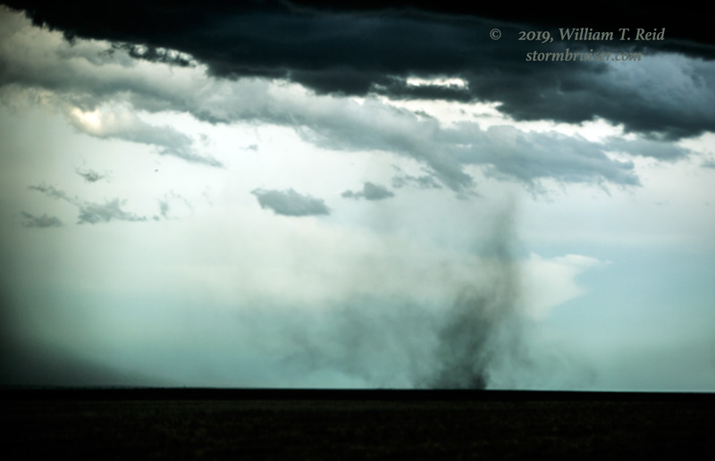
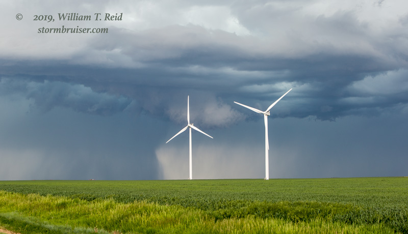
Additional spin-ups, or weak tornadoes, or gustnadoes, were soon lined-up to our east. There was a lot of low-level spinning and stretching going on around here, presumably right about where the outflow boundaries were interacting! Tornadoes love boundaries — don’t you forget that. The cell that produced the first observed tornado, SSE of Kanorado by maybe five miles, drifted just to our east and issued a dramatic rain and hail core. Once we got back on I-70 and continued to the east, the activity was getting messier and the window for weak tornadoes was closed.
Leave a Reply
You must be logged in to post a comment.