

Start: Wheatland, WY
Lunch: Gillette, WY/Taco Johns et al.
End: Lemmon, SD
574 miles
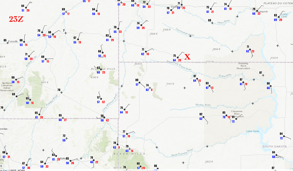
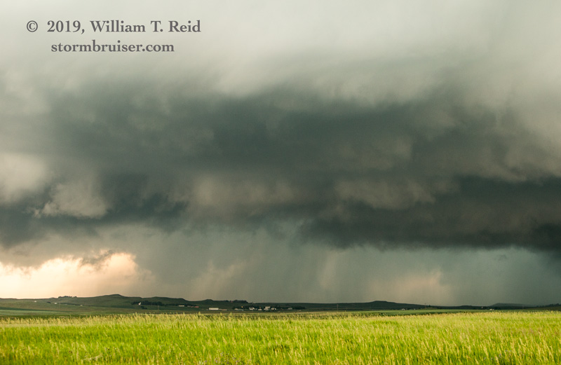
Severe weather prospects were looking quite good in northeastern Wyoming and the western Dakotas this chase day. One play was the usual development off of the Big Horns near Buffalo and Sheridan, but the road network around there is dismal. I liked the area around Buffalo, South Dakota. As we approached that town during the mid-afternoon, a strong and isolated storm went up NNE of there, in North Dakota. We tried valiantly to catch up to this one, as it was moving into unstable air and might have a tornado chance (I think it was tornado warned for a bit). It was moving to the ESE, which helped us some. We headed north into North Dakota via Lodgepole and Hettinger, and had a fairly decent look at the storm to our northeast, still 20-30 miles away (south of Mott). The zoom shots below show this storm, which had a lowering which had a pre-tornadic look.


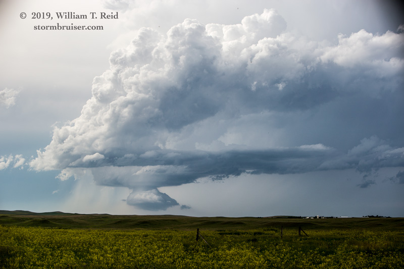
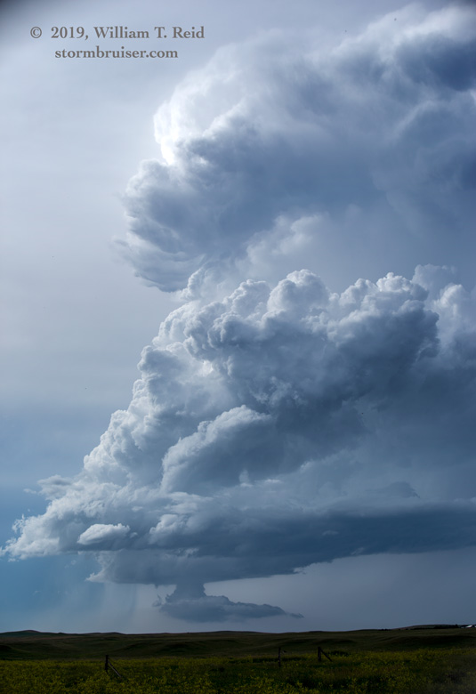

As the cell neared our road east of Lemmon, it decided to weaken dramatically. That was a long drive just to see a storm die.
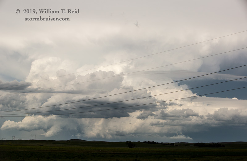
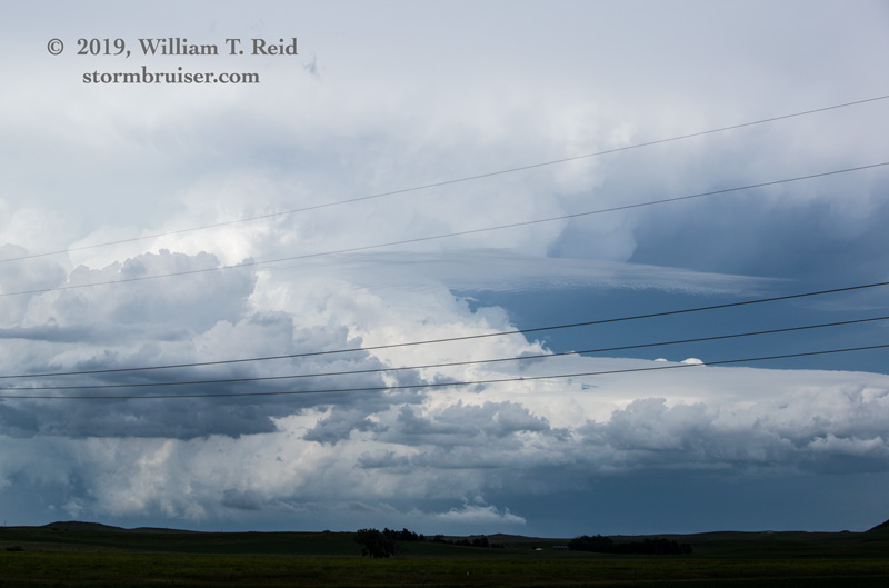
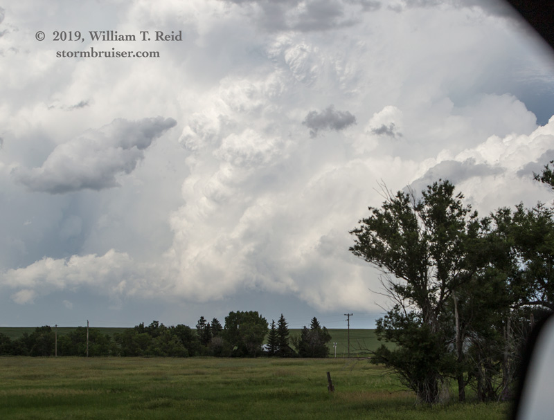
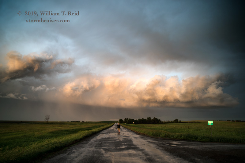
Fortunately, there was plenty of daytime remaining, and more storms were getting strong in southwestern North Dakota. We headed back west, and soon were just east of an impressive storm between Haynes and Hettinger.
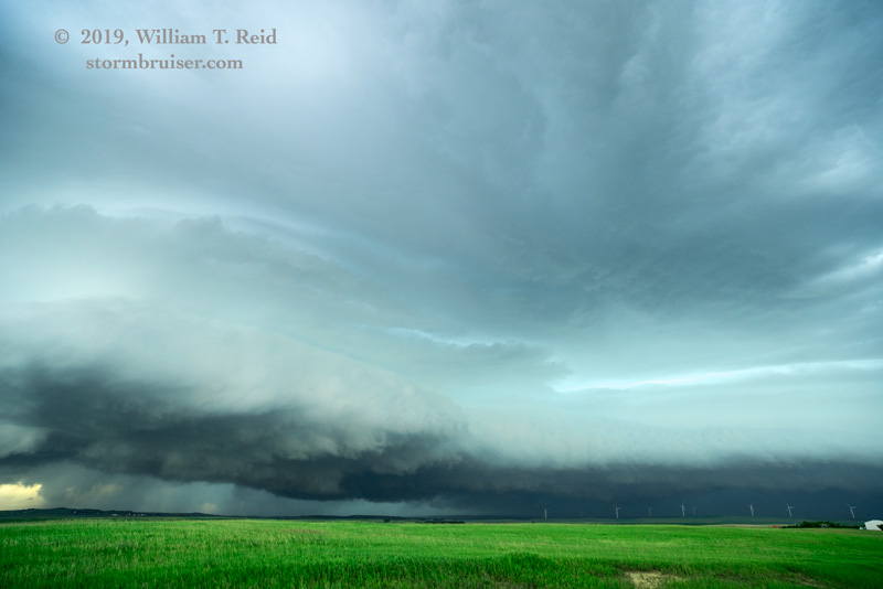
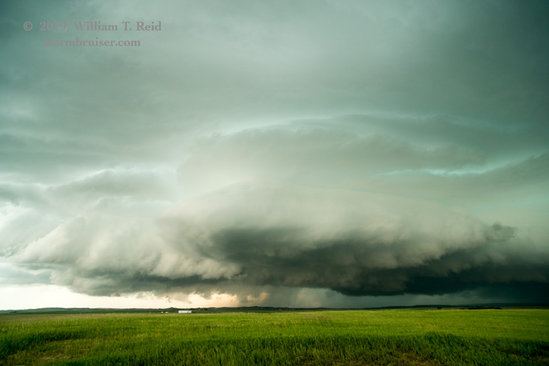


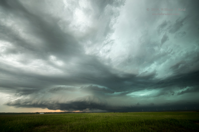

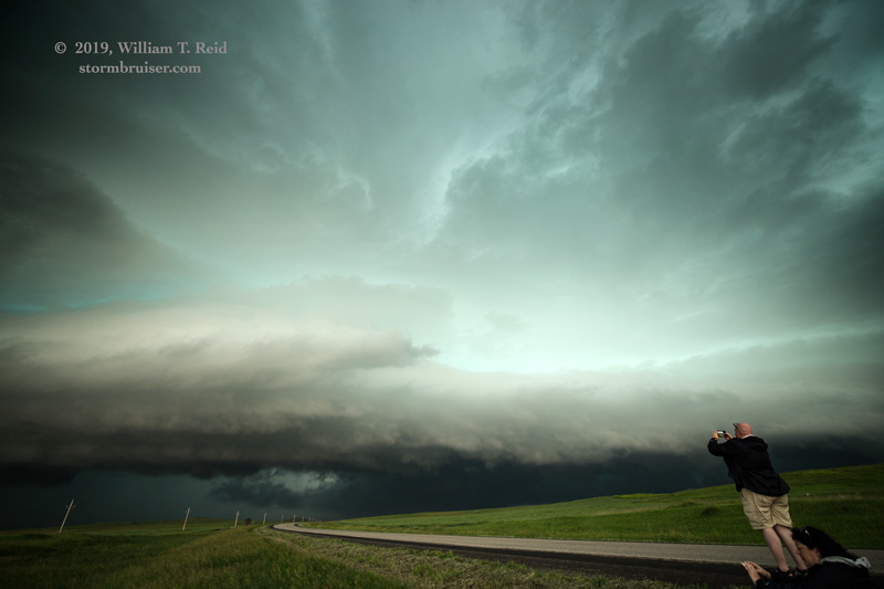
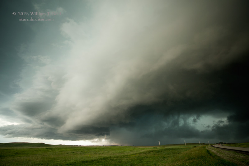
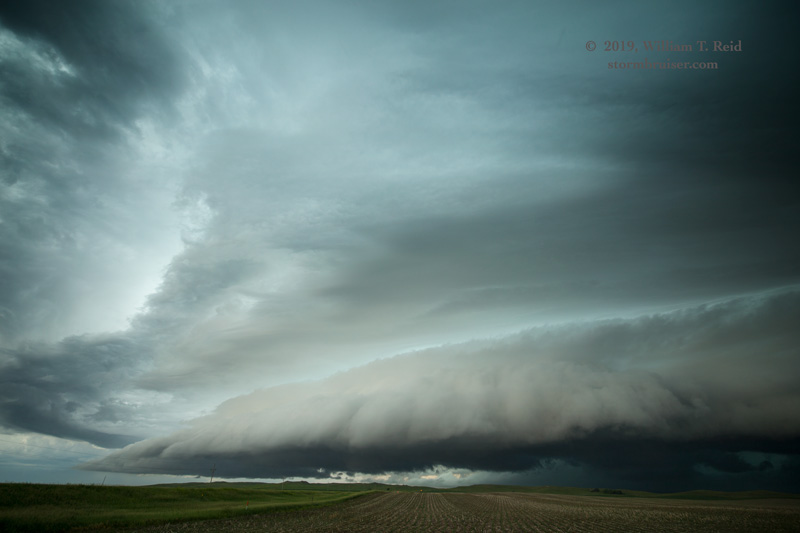
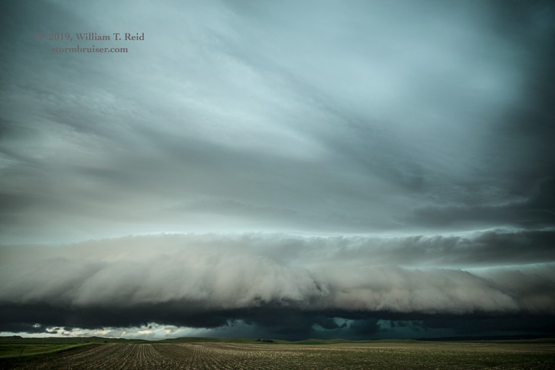


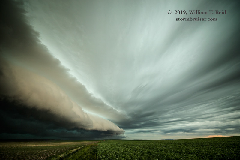
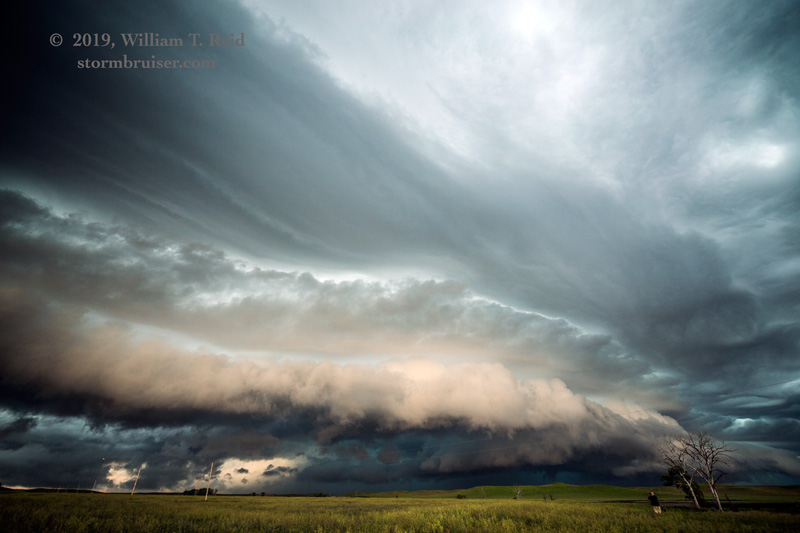
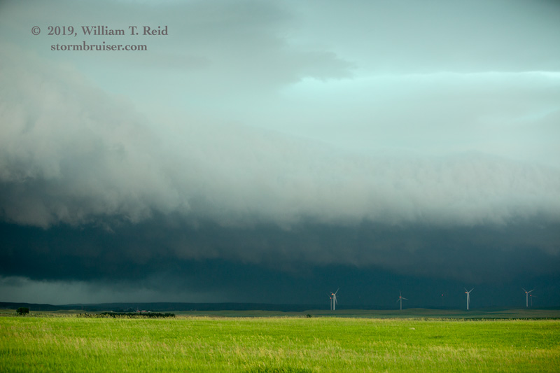
The images above show this storm from near Hettinger eastward to about 7 miles east of Lemmon. It started off as semi-discrete, but gradually became linear-looking and outflow-dominant. The lightning and thunder with it were sweet near Haynes.
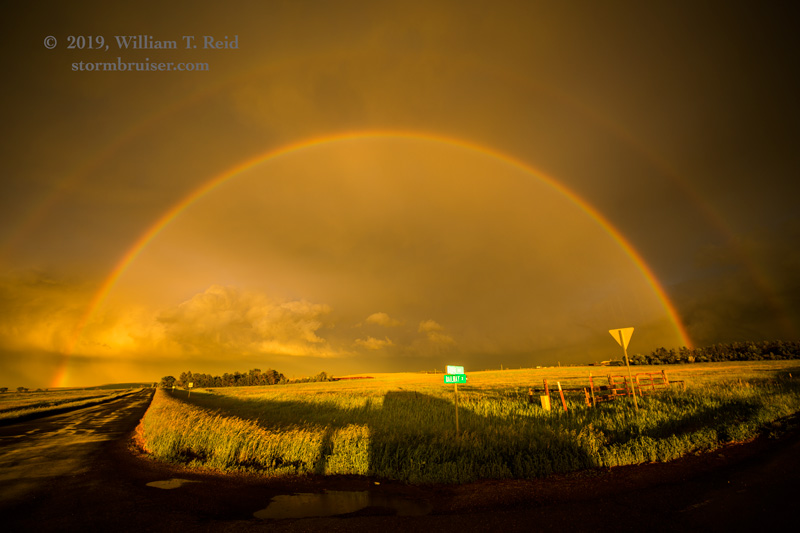
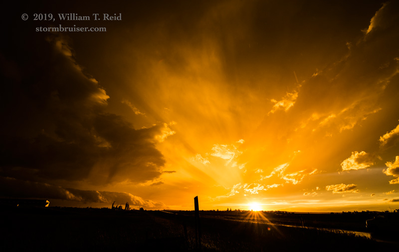
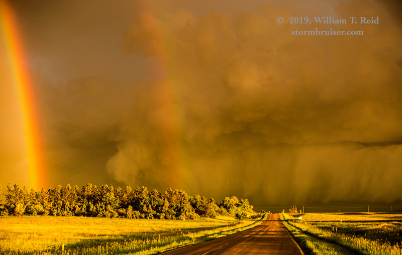
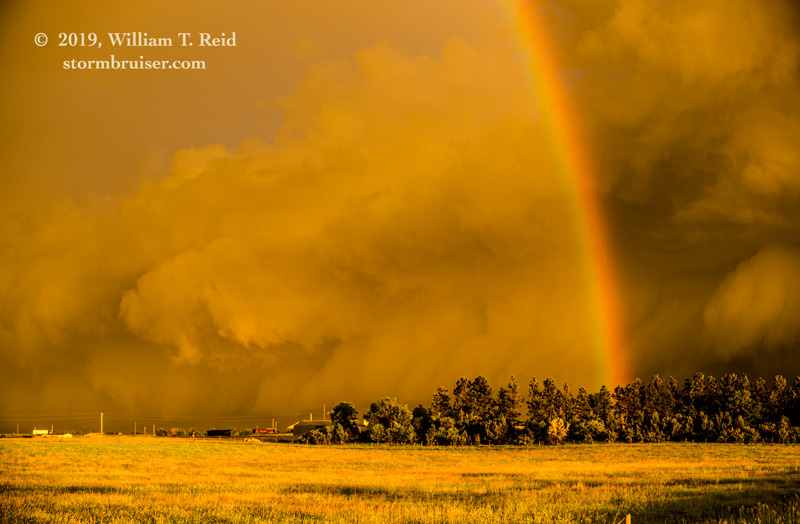
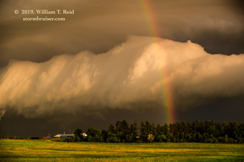
The storm seemed to be losing steam east of Lemmon (deja vu), so we headed west again towards Lemmon to be on its backside at sunset. We were rewarded with some fantastic light on the storm and double rainbow. And, we only had to drive a mile to our motel in Lemmon. That was welcome after such a long drive from Wheatland!


Leave a Reply
You must be logged in to post a comment.