Begin: Glasgow, MT/lunch: Sidney, MT (Sunny’s Family Restaurant)/End: Dickinson, ND/318 miles
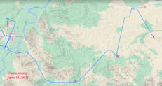
Rough chase route above, beginning with Lunch (L) at Sidney, MT. An “X” marks the primary supercell and tornado-viewing locations.
June 10 Storm Reports
SPC Mesoscale Discussion 907 (with a good surface map)
SPC Mesoscale Discussion 908 SPC Mesoscale Discussion 909 SPC Mesoscale Discussion 910
SPC Mesoscale Discussion 911 SPC Mesoscale Discussion 913 SPC Mesoscale Discussion 914
SPC Mesoscale Discussion 915 SPC Mesoscale Discussion 916 SPC Mesoscale Discussion 918
21Z/3 p.m. MDT surface map and approximate tornado locations (red Ts)
Time Lapse video of the chase by Chris Gullikson for Tempest Tours
Time Lapse Video of the Squaw Gap supercell and tornado by TT guest Richard Rostant
Zoom time-lapse (4X) of Squaw Gap tornado by Chris
Time Lapse of Second Tornadic Supercell by Chris
Zoomed-in video of action area of Second Supercell with tornado by Chris
Big-time moisture and upper-level energy were the featured weather parameters today for areas along and near the Montana/North Dakota border. Tornadoes looked like a pretty good bet, especially just north and northeast of a surface low which was slightly southwest of Sidney, in extreme east-central Montana. North of this surface low, winds were backed very nicely. For instance, from about Alexander to Williston, in northwestern North Dakota, wind at 21Z (see map above) was from the ESE at about 20 knots, with dews nearing 70F! With strong mid-level flow from the S and SSW at or above 40 knots and plenty of clear skies midday, the stage was set for an active afternoon and evening. After 30 years of chasing, I had yet to witness a tornado in North Dakota, so maybe today would be the day. SPC slapped a 10 percent tornado risk along the ND/MT border from about Sidney northward, right where those nicely backed winds were blowing.
I was returning to the tour group following a week of some rest and recharging. Chris and company (Matt and Kim and the tour guests) were enjoying the first few days of Tour 6. I started the day in Wibaux, Montana, and called Chris mid-morning to figure out our meeting point. His group was starting the day in Glasgow, following a successful supercell intercept near Hays, MT, the previous day. We decided to meet in Sidney, MT, for lunch. This seemed to be a good starting point for today’s chase, as Sidney was privy to those very moist and backed winds, northeast of the surface low. My drive north was an easy one, and the gang was already eating when I got to Sidney.
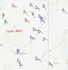
Shortly after lunch, we drifted south of Sidney just a little bit to watch some bubbling cumulus not far to the SSW. This activity was above hot air near the center of the surface low. Check out these surface plots for 2 p.m. MDT (click to enlarge):
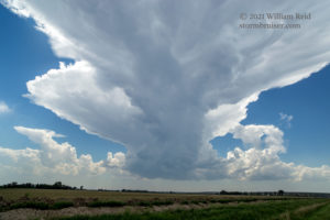
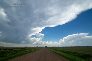
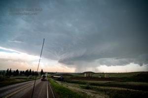
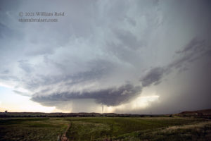
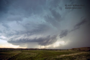
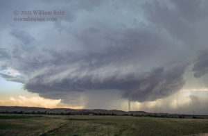
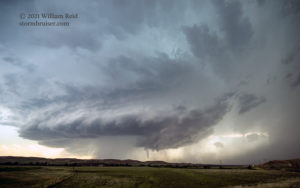
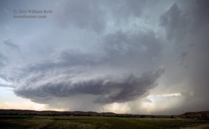
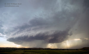
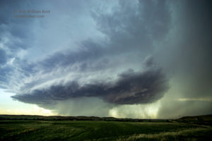
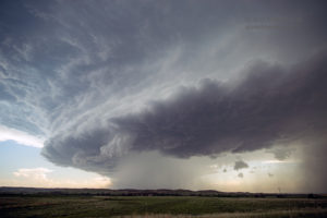
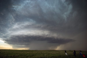
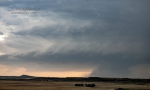
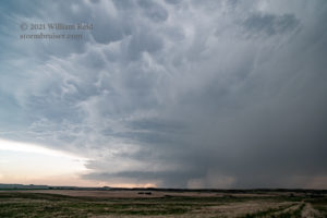
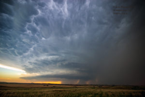
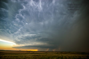
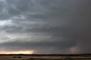
The surface convergence near Glendive, with a WSW wind and 102F temperature, was very strong! The initial updrafts were scrawny with high bases. These just needed to scoot north in order to tap the moist surface air and big CAPE. After an hour or so we were on the north side of Sidney, about halfway to Fairview. I found a hilltop, and I think we watched a weak cell or two pass by to the west and then north. These were not worth staying with. Eventually, the much more substantial anchor storm to our SSW became very apparent. It quickly sported a circular base and large area of forward-flank precipitation — see last three images below.
This new supercell was approaching Sidney (moving approximately SSW to NNE). And, fortunately, it was not moving very quickly. It wasn’t particularly obvious as to where we might want to be, but being beneath this anvil and in light rain was annoying. Should I hang out NNE of Sidney, on the road to Fairview? Or should I head back to Sidney, where several options would be available? That seemed better to me. But, we would be driving right into the area where large hail could be occurring. We made the dash back to the south to Sidney. Upon arrival, some sporadic hailstones fell and the tornado sirens were sounded. That was a little surprising, as the storm did not yet look that close to going into tornado-making mode, at least visually. The base was still somewhat high, and strong low-level rotation was not evident despite the big RFD cut.
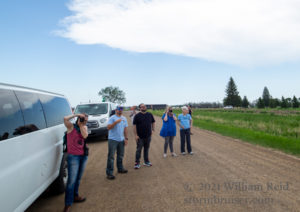
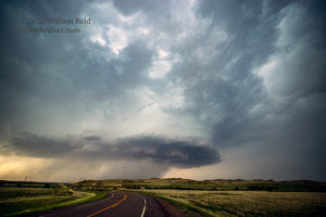
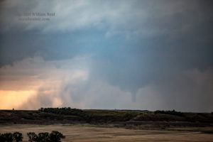
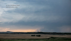
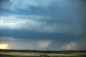
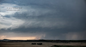
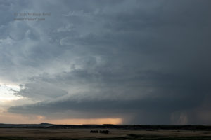
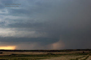
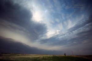
I looked at road options and decided to get on the east side of Sidney. The storm was following the course of the Yellowstone River, and it would be better to be on the east side of the river. We made it through Sidney without any big hail problems (and no tornadoes), and then headed east on 23 towards the ND/MT border. Just prior to the border, I elected to take Montana route 202 to the southeast. The structure of the updraft was nice, for sure, but we were too close to the base for a good view! Road 202 turned into road 38 in McKenzie County, ND. We stopped where the road turned towards due east. The supercell and its nice structure were now far enough to our west for a decent view! The pics below are a bit out of order. #5 is from the hilltop north of Sidney, #6 is looking south as we near Sidney (driving south), # 1 and #2 are looking west from the aforementioned “turn to the east,” and #3 is looking WNW a little later at the “Sidney” supercell.
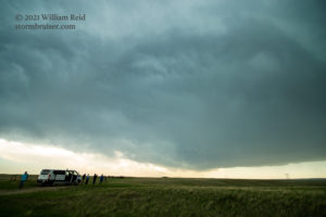
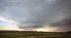
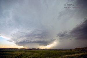
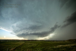
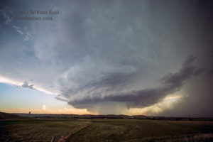
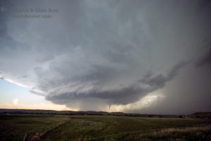
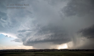
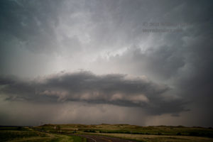
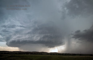
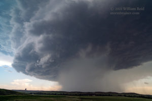
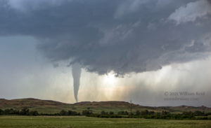
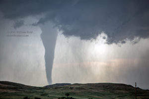
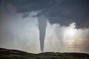
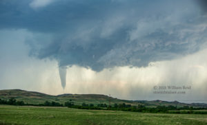
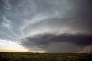
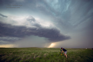
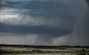
And, guess what?! The Sidney supercell quickly weakened and disappeared! However, while this transpired, a new supercell (#4 above) with a very impressive and round base was developing to our southwest (not too far south of the Sidney supercell). The good air wanted to go to the new southern updraft. By this time we were at the east end of Road 38 (Bennie Peer Road), where it meets N-S state route 16. With our tripods set up and cameras in hand, the supercell to our southwest slowly approached and decided that it was already tornado time!
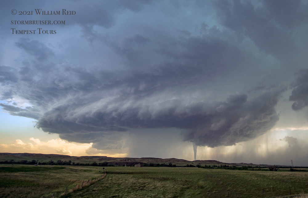
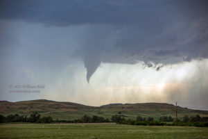
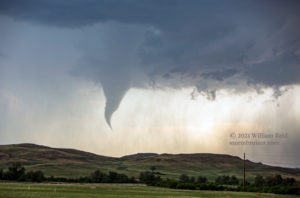
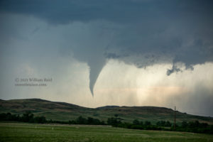
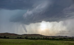
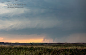
The wide angle/15mm shots below were taken during a timespan of perhaps 8-10 minutes, and shows the obvious tornado on the north or northeast side of the precipitation core that is associated with the RFD. The wet RFD swallowed the tornado for the most part after about 4-5 minutes. The next day we came back to the area where we thought the tornado occurred, but could not find any evidence of its existence. The closest community was a nothing/mostly abandoned place along Route 16 at County Road 5, called “Squaw Gap.” The tornado likely was northwest of Squaw Gap by a few miles, and probably just a mile or two east of the MT/ND border. SPC storm reports has the tornado at 2312Z, or 5:12 MDT, 9 miles NNE of Skaar, ND. We decided to call this one the “Squaw Gap supercell and tornado.” This was my first North Dakota tornado!
The following five photos are from the same timeframe, but were with the Sony camera and 21mm lens. These are in proper chronological order. Photo #2 is to the WNW and is the Sidney supercell. The remainder are of the Squaw Gap supercell. #1, #3 and #4 are prior to the tornado, and #5 is after the tornado as the cell gets quite close to our location.
The Sony camera and 21mm lens wound up on the tripod for wide-angle video of the event. I remembered to grab my other Canon 6D, with the long lens attached! The shots below are from 70 to 200mm.
I was a bit nervous about the risk of large hail as the supercell neared. We headed north on 16 to 68, and then east a little and south a little to a hilltop with a great look at the storm structure to the west. The supercell was fabulous, but the core was very wet. A “wedge tornado” was reported by a chaser (southwest of Alexander) around the time of repositioning. We did not see a tornado of any size or shape, though it would have been quite possible that precipitation in the core had blocked our view of one. The pics below were from our stop near Highway 68, east of 16 a few miles.
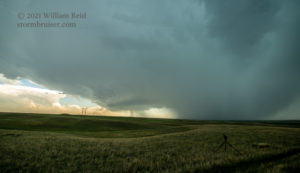
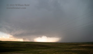
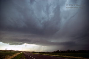
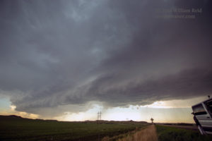
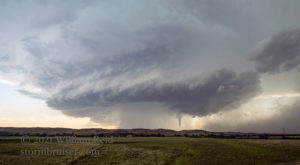
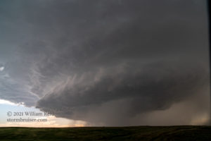
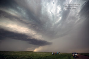
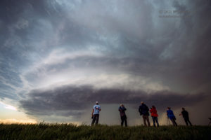
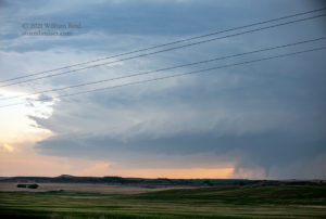
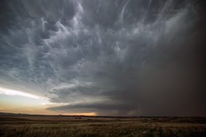
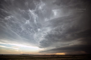
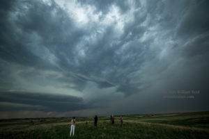
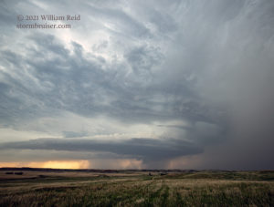
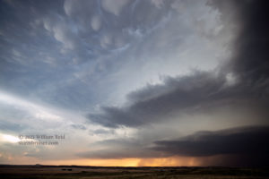
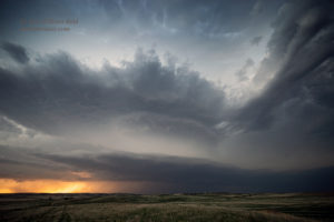
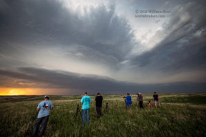
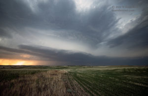
From here, we continued north to U.S. 85 and then east a couple of miles to the big convenience store and service station, on a hilltop. The storm was now looking a lot wetter and less organized. It headed to our north and looked scrawny and cold. After the quick pit stop, radar showed another good supercell in the works to our SSW, not too far from the path that the first supercell had taken. The triple point was a great storm maker today! The map showed that 68 and 16 would take us right to the storm (close to where we had watched the first tornado). But, I was again concerned that that approach might take us a little too far to the west, and we would wind up on the wrong side of the storm and in the rain and hail with little to look at. It was a close call on that. I elected to head south on County Road 27, which is about seven miles east of 68. This gave us a good look at the structure of the new supercell, and as we headed south, we could (barely) see a tornado in progress. This one was heavily involved with rain, even with our view of it towards the WSW. The camera and some enhancement shows the tornado clearly enough (below). We stopped about due west of the supercell, which was maybe 10 miles distant.
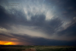
Additional wide angle views of this one are below. SPC indicates that the tornado was 9 miles SSW of Sather Dam at 0057Z (6:57 p.m. MDT). Sather Dam is close to 68 and 16, and their tornado location is VERY close to where we had stopped to view the first tornado! I guess I should have gone back the way we came, but we got good wide-angle supercell shots instead. Shall we call this second tornado the “Bennie Peer tornado?” McKenzie County had a good tornado day, regardless of the nomenclature!
This second supercell moved slowly to our WNW, but no longer looked to be in a tornadic mood (sound familiar?). Similar to previous big chase days, such as the Wray day on May 7, 2016, storms today favored a particular location for the tornado-making. Once they had done their thing and moved away from the special spot, their tornado-making was over.
From here we headed east and then south on 85 to I-94. New lightning-filled updrafts filled the skies to our west and southwest, and we made it to Dickinson unscathed!

Leave a Reply
You must be logged in to post a comment.