

Start: Dodge City
Lunch: Oakley Subway
End: Dodge City 561 miles
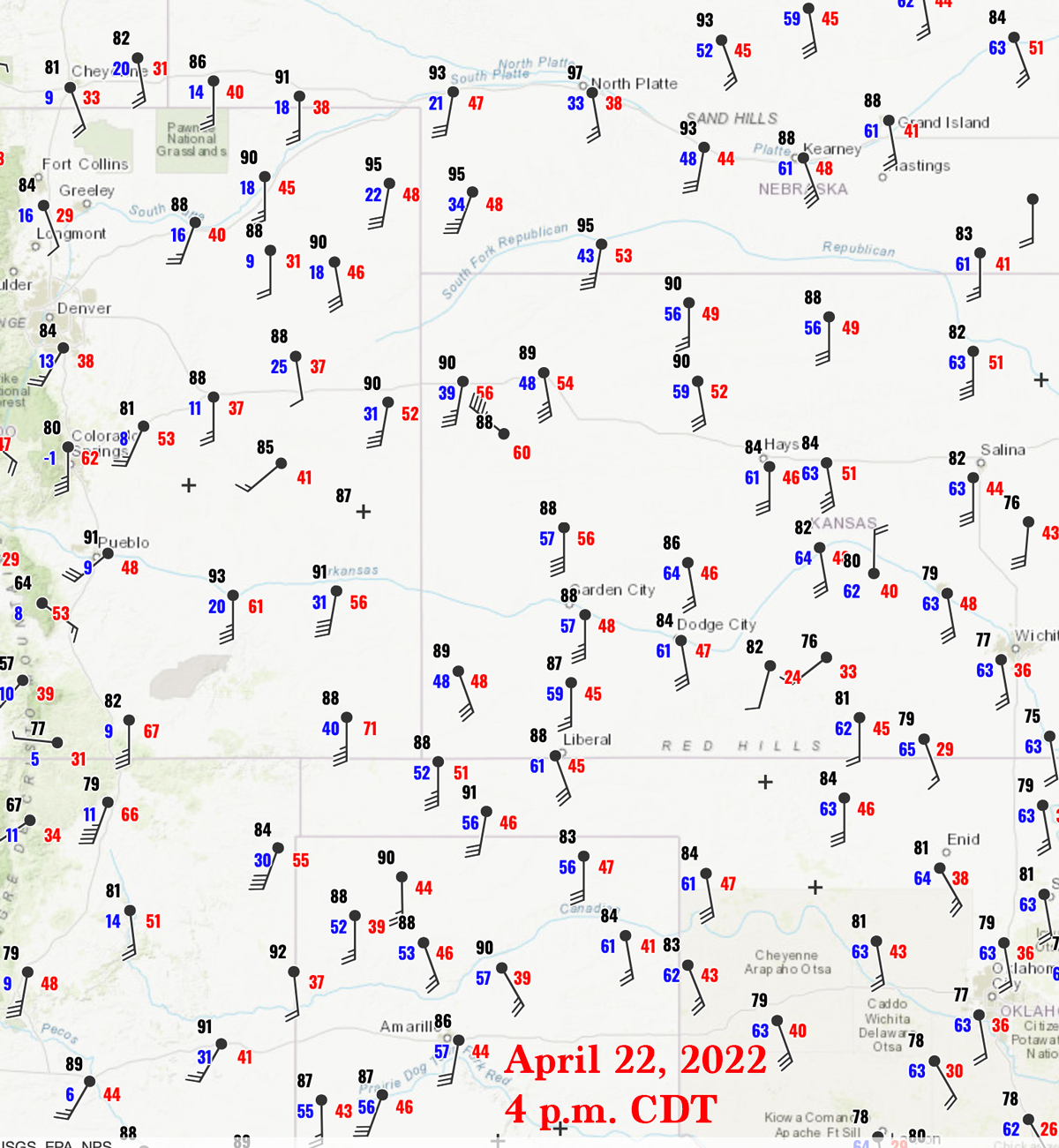
This chase day had very high potential, as a prominent full-latitude trough at 500mb edged eastward through the Great Basin. Southwesterly 500 flow above the High Plains from the Texas Panhandle to western South Dakota was a robust 45 to 55 knots. At the surface, by late afternoon, a lobe of low pressure extended from about Alliance, NE to Clayton, NM. East of this surface low pressure, south winds howled during the day. One had to head up to the NE/SD border, along a warm front, to find decent backed winds. We were starting in Dodge City, and I was eyeing that warm front area, just northeast of low pressure near Alliance. SPC was not stingy with their tornado risk, painting a long 5% area from Brownfield to Broken Bow, and another 5% area where those backed winds were around the Badlands.
On our way north out of Dodge to I-70, I tried to determine where prospects were best for us. I wasn’t having a lot of luck finding good reasons to continue north into Nebraska and then all of the way to South Dakota. The wind north of the warm front up in South Dakota was more northeasterly than easterly. Associated dew points were nothing to write home about, in the low-mid 50s. Alternately, it certainly looked like there would be no shortage of supercells here in western Kansas. But, the wind was largely S to SSE, with models showing only a little more backing by sunset. And, afternoon dew points were adequate but not really good in western Kansas, near 60F. At lunchtime in Oakley, I announced to the tour group that we were going to turn around and head back south, towards southwest Kansas. I liked the idea of having storms coming towards us too, rather than the real possibility of playing catch-up up north.
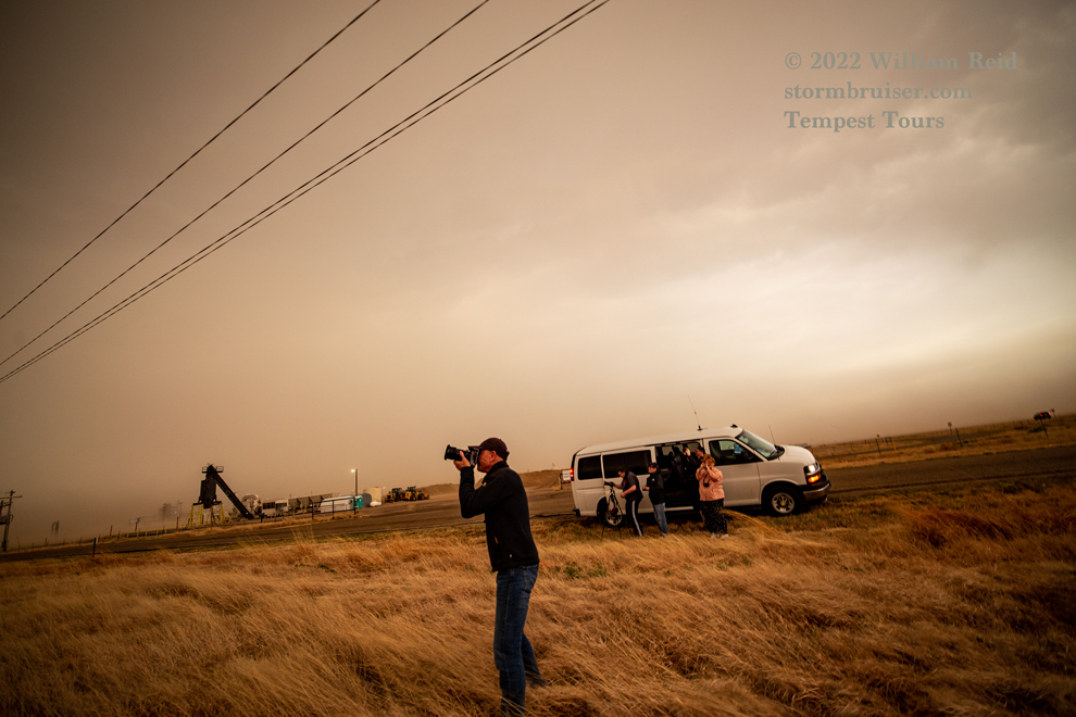
We made our way towards the southwest corner of Kansas, to Elkhart. The S to SSE wind was just nuts, averaging 35-45 mph with gusts well into the 50s. Naturally, there were duststorm conditions about. Storms developed on schedule to our southwest by 4 p.m. and were aiming for Elkhart.
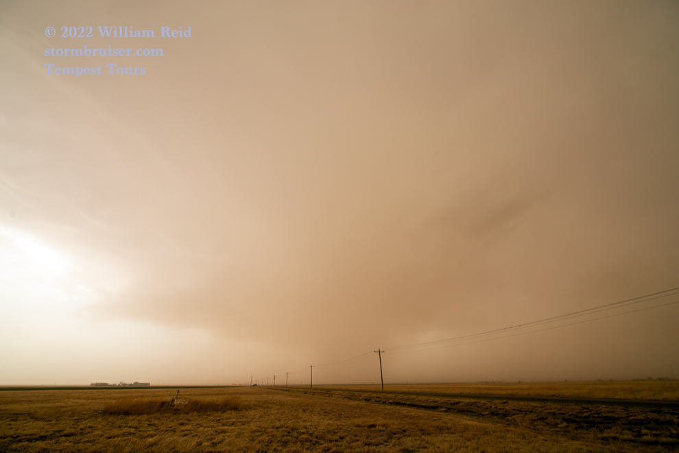

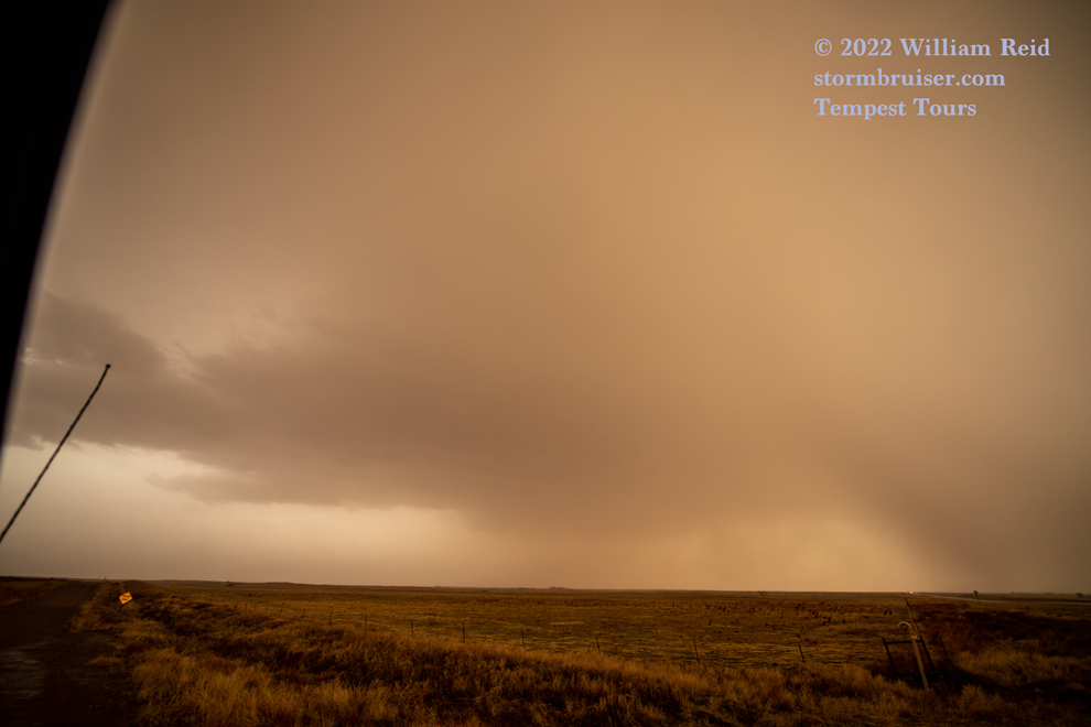
We came up to the first cell that was moving through the Oklahoma Panhandle. We needed to be within a few miles of it in order to see anything! There was some decent structure, but the base was high. No surprise. We let the first one continue to the north, and then edged south towards the core of the next cell. The hail got a bit large, and we high-tailed it back to Elkhart.
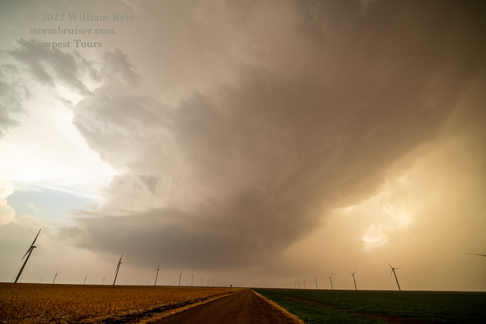
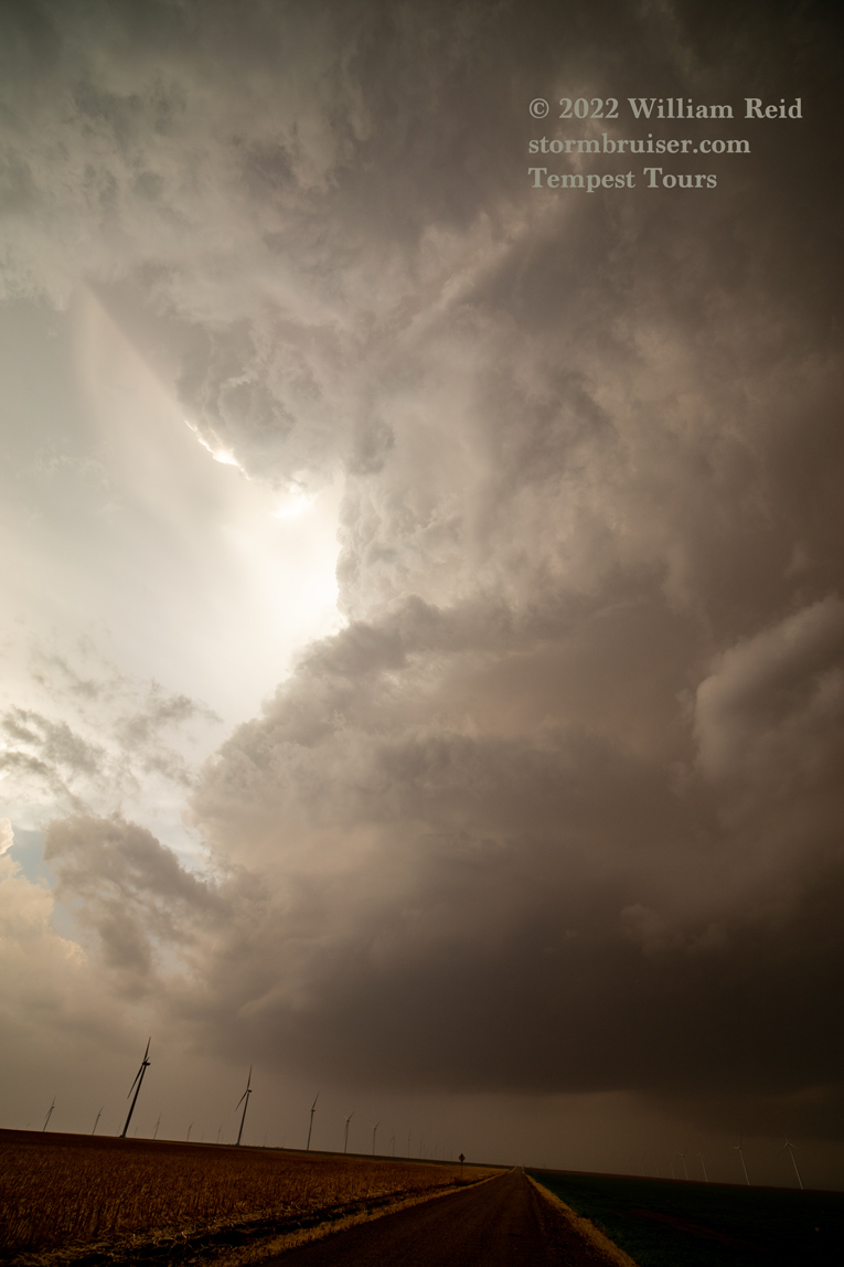
Highway 56 worked out quite well as it headed to the ENE and NE, allowing us to stay with this supercell.
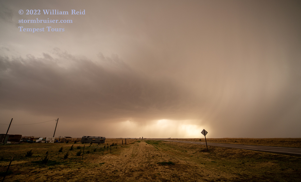
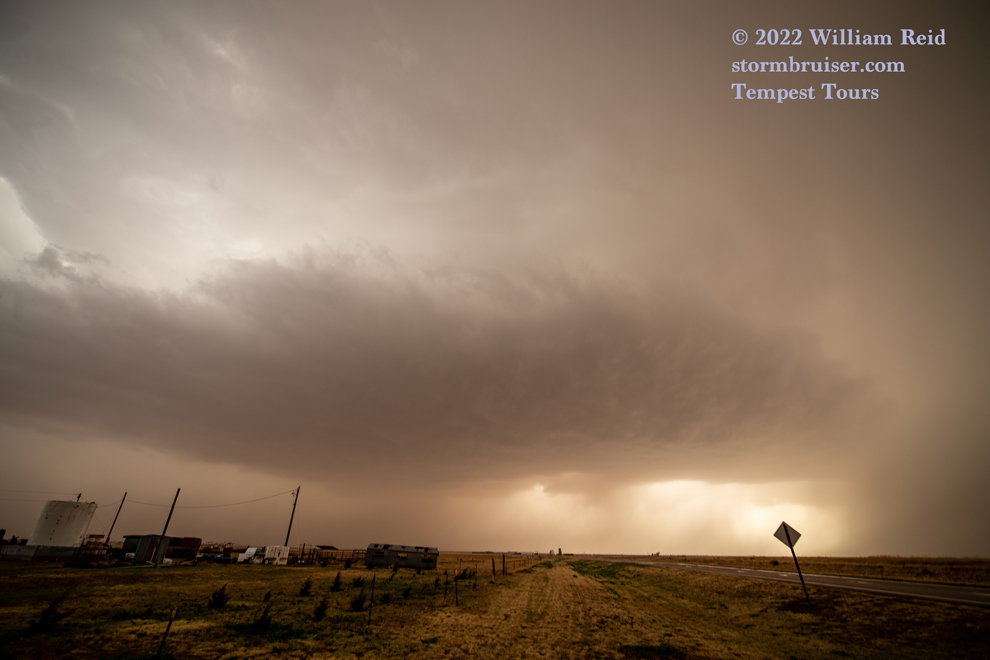
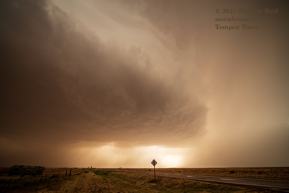
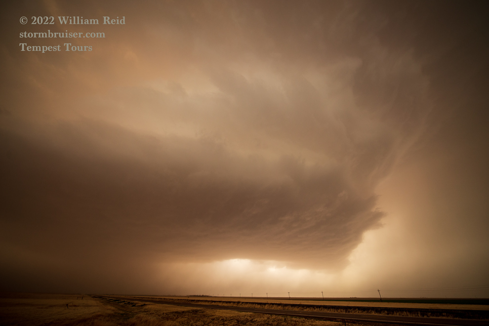
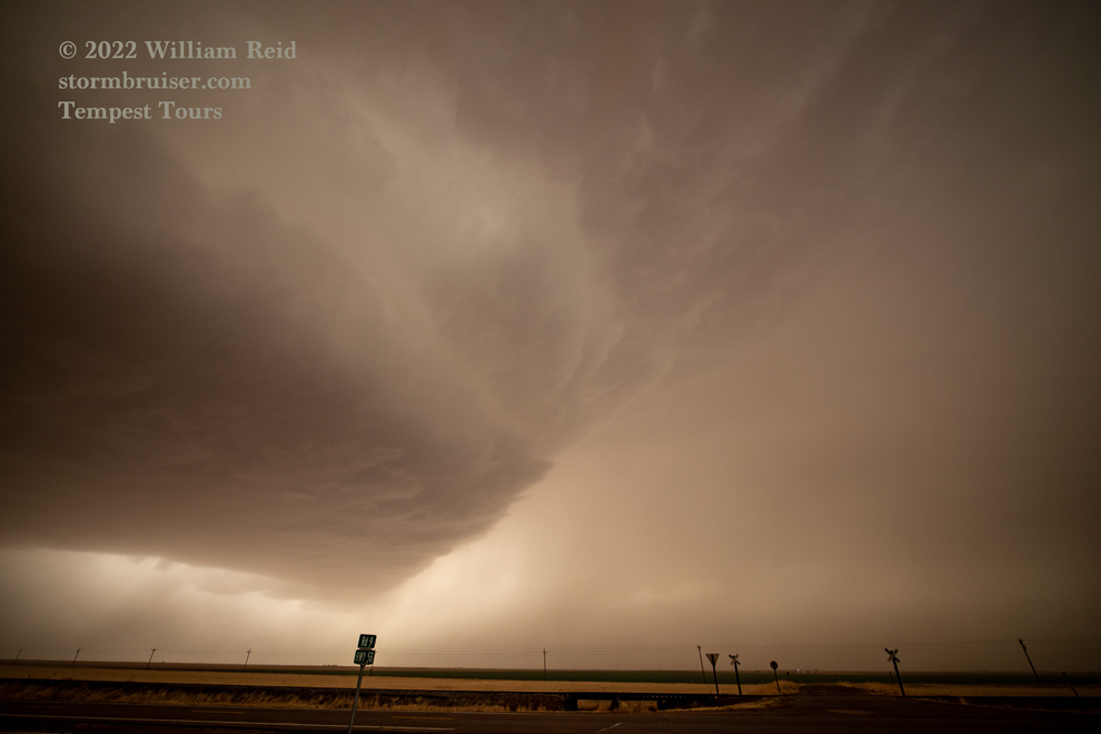
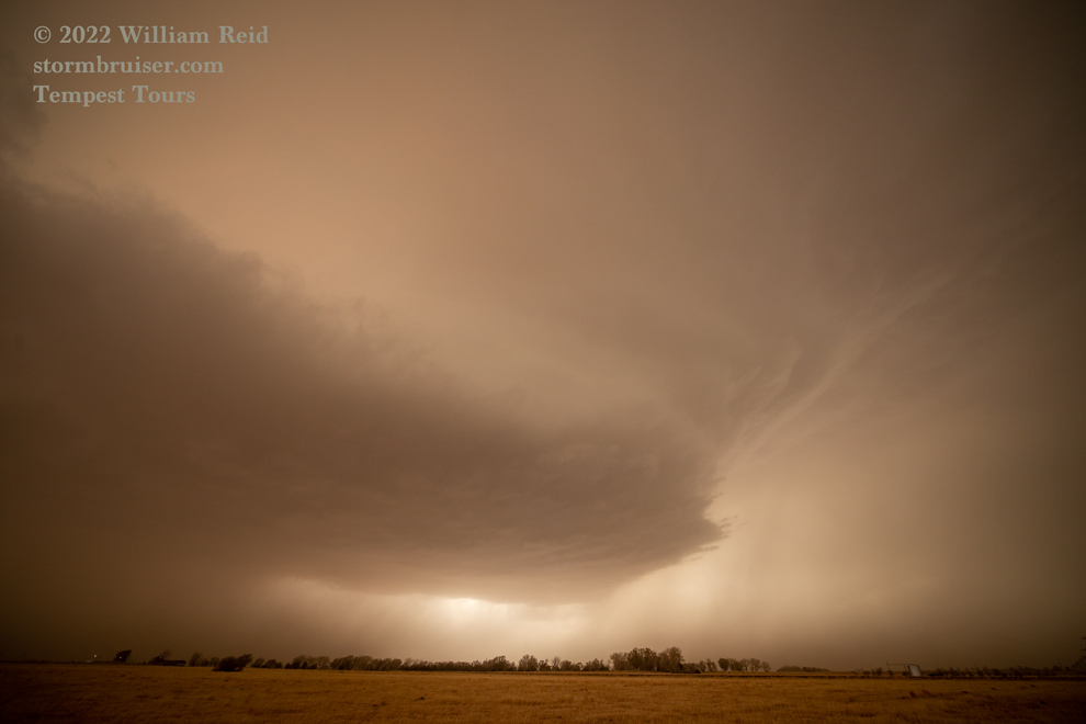
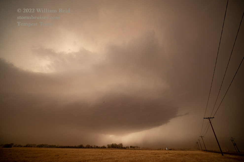
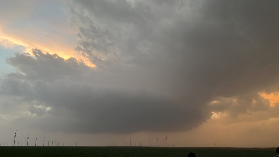
The remaining chase movements are a bit of a blur, but we wound up near Moscow, Kansas, with three fairly impressive and dust-shrouded supercell updrafts nearby. I was rooting for more rain out of these to help provide better visibility!
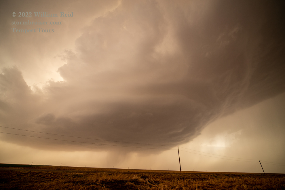
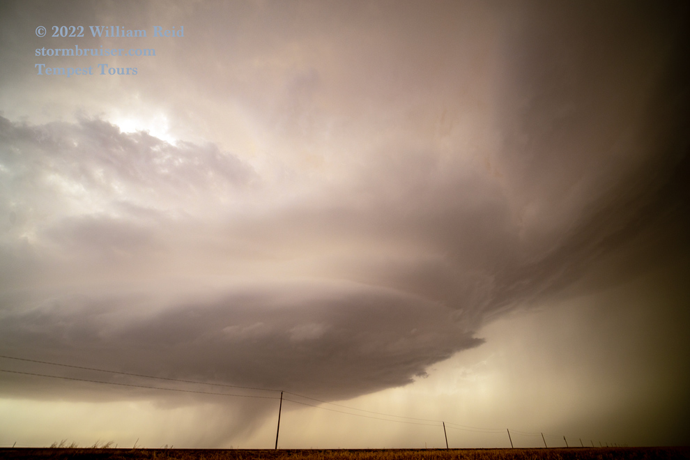
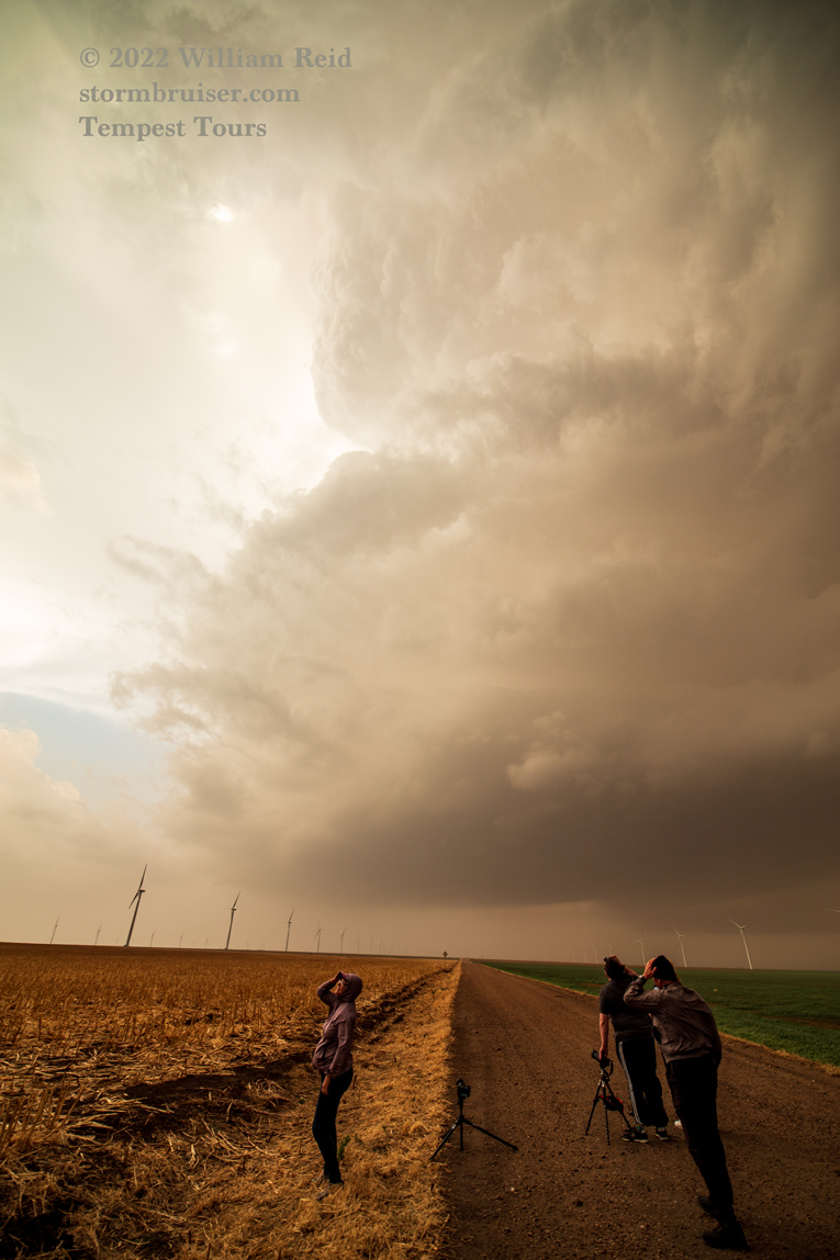
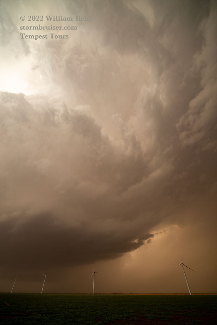
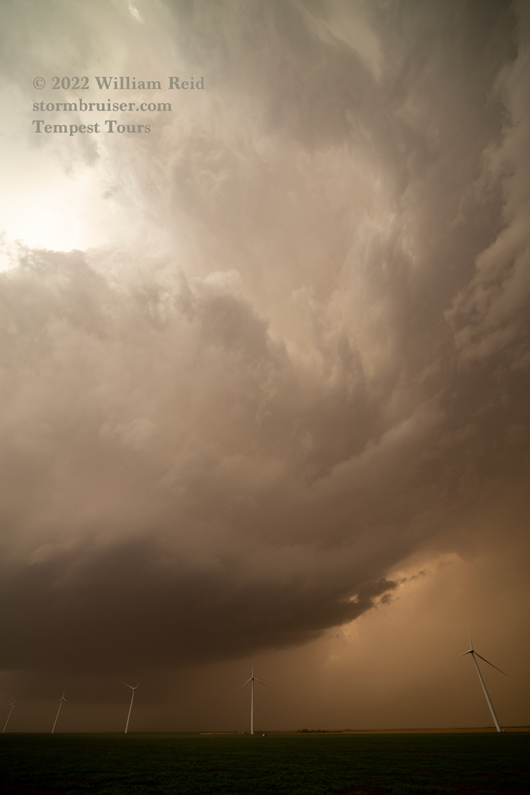
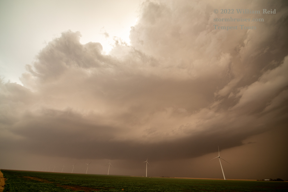
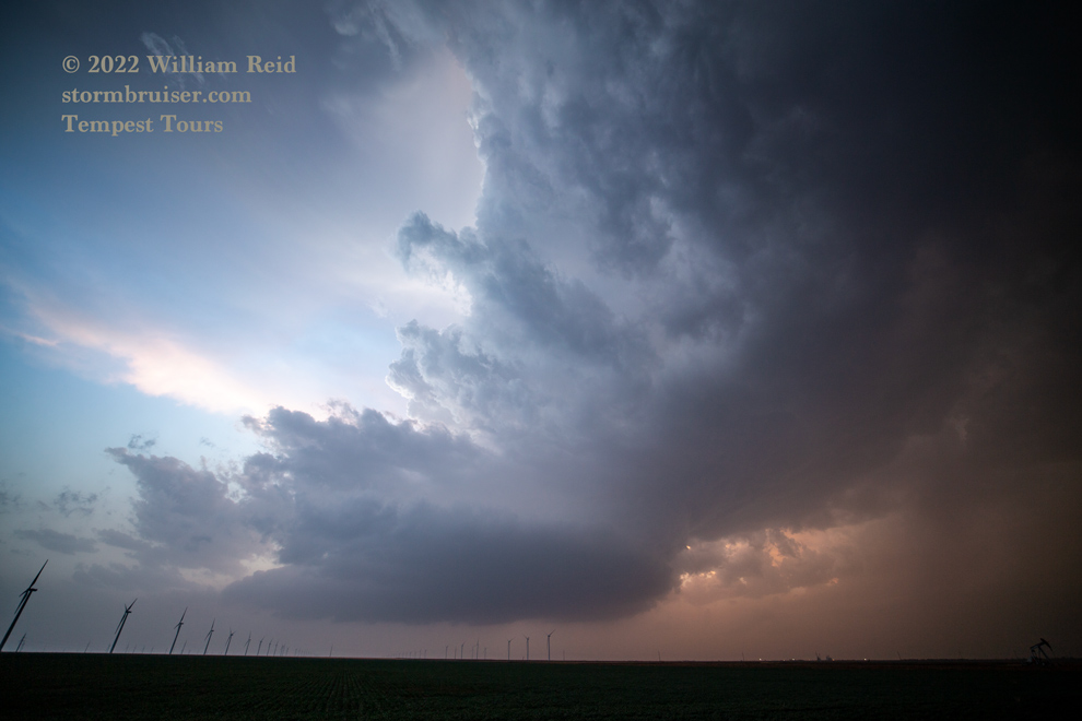
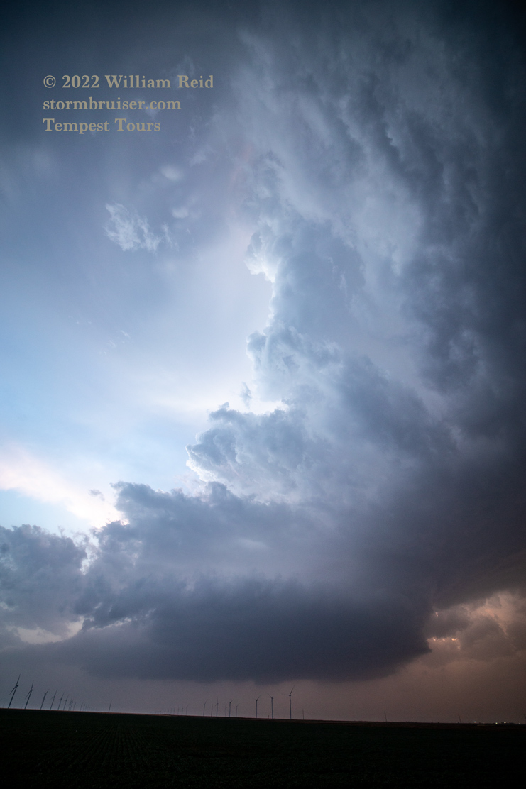
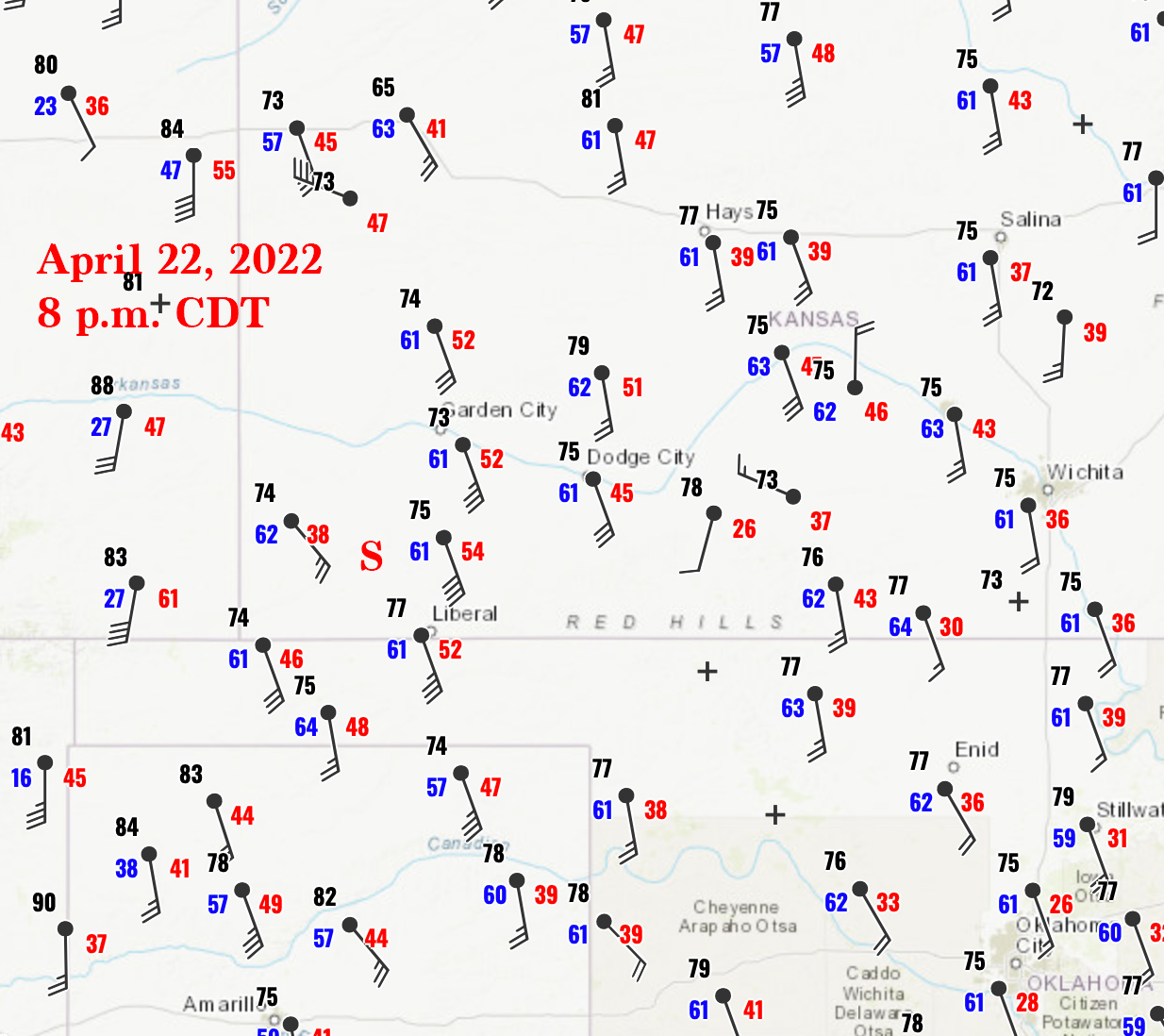
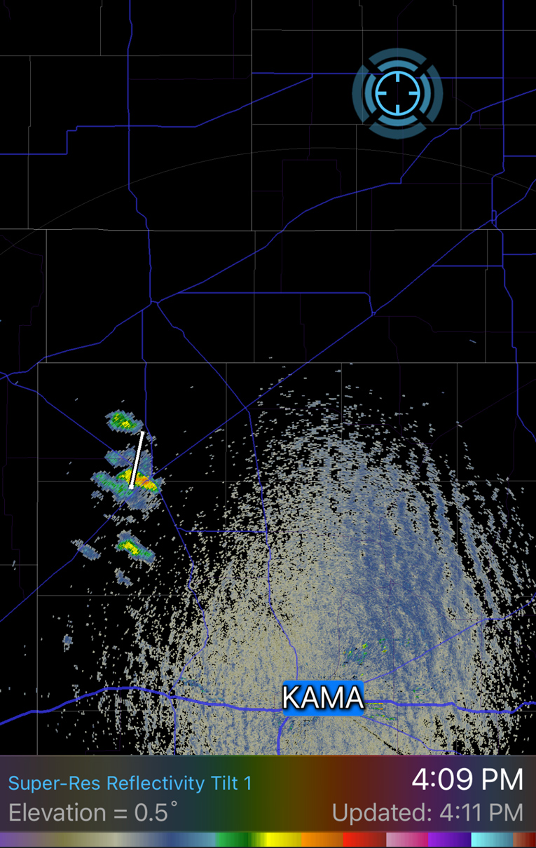
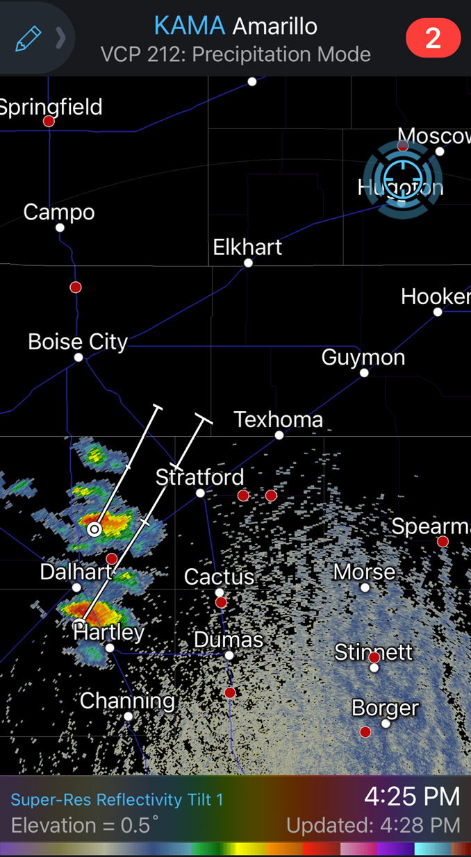
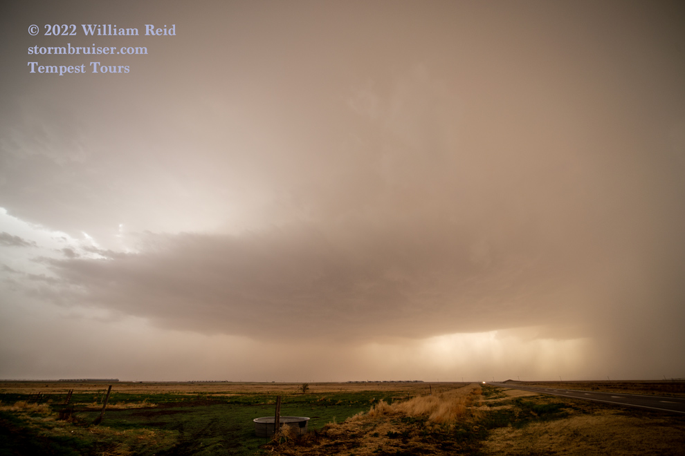
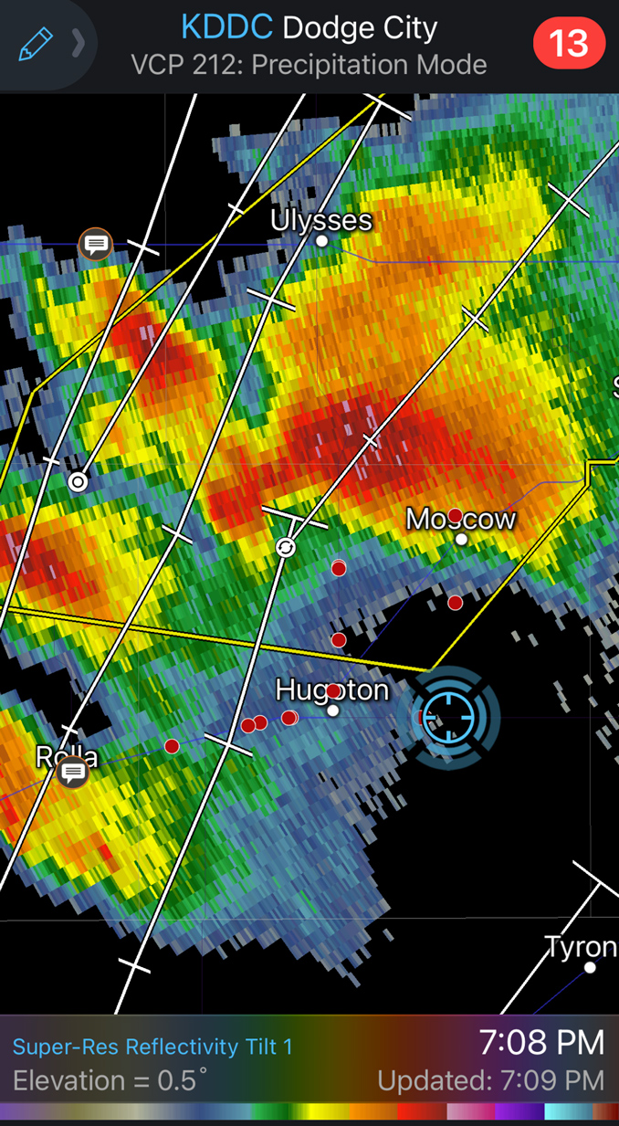
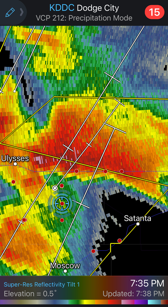
As sunset approached, we had some fabulous updrafts to photograph (while trying to stay upright in the dusty winds). The wind had backed some, but storm bases remained a bit too high to boost any hopes for a tornado. I don’t recall any of these storms with a prominent wall cloud. The look on radar (below) was certainly decent.
This was a satisfying chase! There were no impressive daylight tornadoes on the High Plains today, even up along the warm front. To their credit, SPC’s severe boxes were the right choice (versus issuing tornado watches), and our decision to stay south in Kansas worked out just fine.
Leave a Reply
You must be logged in to post a comment.