
Start: Denver, CO
Lunch: Freddies in Hays only because Kyle was on the tour
End: Ponca City, OK. (680 miles)
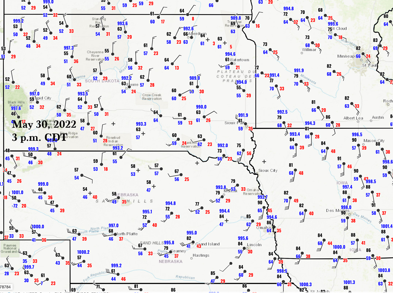
Tornado Summary out of Aberdeen, SD
Chase account by Tempest guest Lesleyanne
This chase day was looking fairly high-end. It was Dynamics City on the Plains. SPC liked the tornado chances, with a 10-15 percent hatched over extreme eastern SD and into MN. There was a moderate risk of severe in that area, with an enhanced slight along a front down to about Salina and Newton, KS. CAPE values were about 2000 to 3000 J/kg, surface winds were backed nicely in southwestern MN and vicinity, in front of a surface low. We started the day in Sioux Falls and saw about six tornadoes, maybe three dozen tornadoes if you count all of the satellite tornadoes and multi-vortex touchdowns. WAIT A SECOND! That previous sentence is a complete fabrication! Our tour group observed zero tornadoes.
A check of the SPC Storm Reports for this date shows a LOT of tornadoes near and north of I-90, primarily along the SD/MN border and into MN…right where they had that 15 percent hatched outlook…right where those nice backed winds were. Where are all of the chaser and John Q. Public photos and videos of these tornadoes?! Check the internet — you might find a few, but these are poor contrast, rain-wrapped, and just plain blah.
This date was the start date for Tempest Tours Tour 5 out of Denver, with guides Matt P. and Brittany. Given that the scheduled tour meeting time was 9 a.m., and the best tornado risk was so far away (a 10-hour drive to Sioux Falls), and given that storms would be initiating around 3 p.m. and moving quickly to the northeast: I was not enthralled with the chase day setup for us. We probably would have had to be rolling by 4 a.m. out of Denver to give ourselves a chance…and then we would get to try to keep up with rain-wrapped tornadoes moving quickly to the northeast in the rain! Woohoo!
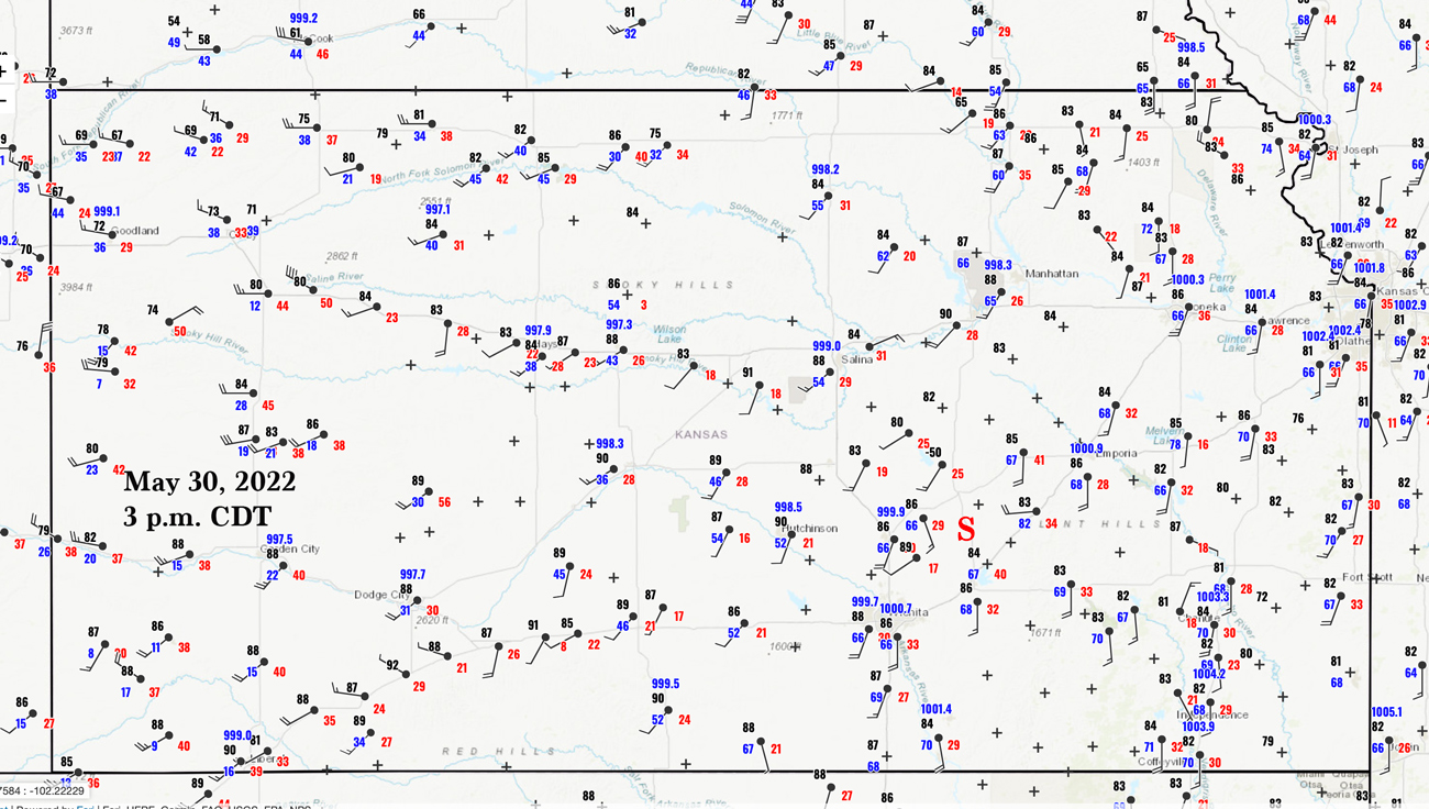
I elected to pass on the higher risk area of SD/MN and to try our luck in eastern Kansas. Right off the bat we had a severe storm nearby! This was near Limon and Genoa along I-70.
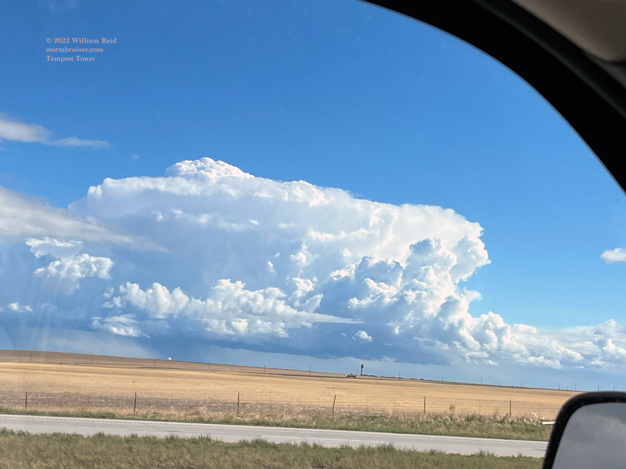
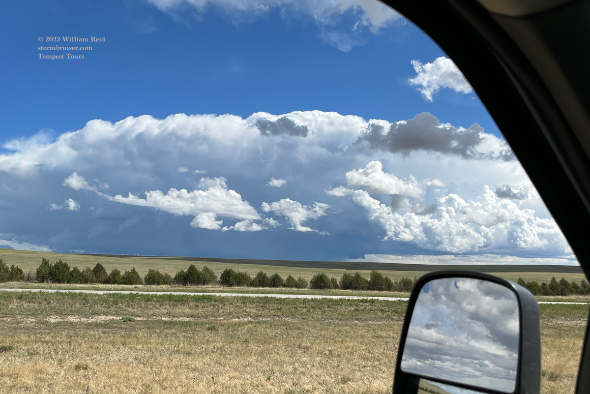

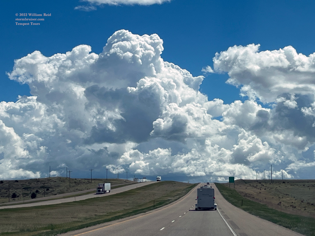
Well, that’s weird. It’s too bad that we didn’t get a morning tornado in Eastern Colorado by accident during the first hour of the tour. This storm was low-topped and probably supercellular, and well behind the cold front. We need to get to Salina and vicinity for the real afternoon storms, though. Goodbye, Colorado. There is a fine line in Kansas waiting for us.


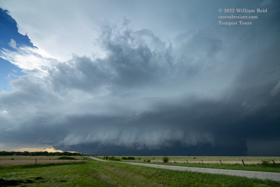
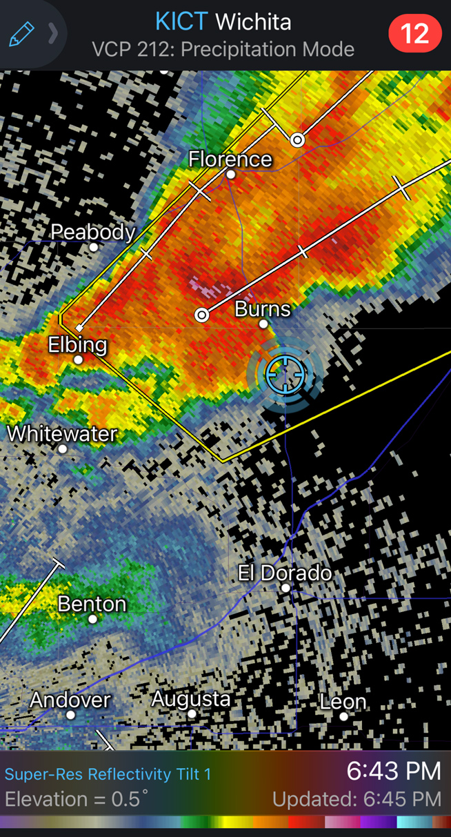
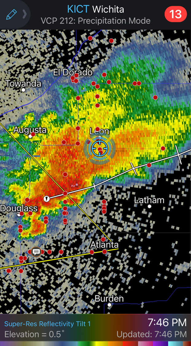
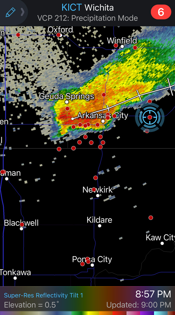
Convection fired off of that line of convergence from about Newton to east of Salina by 4:30 p.m. CDT (see radar above). I figured that our best bet logistically (and maybe meteorologically) was the (hopefully) tail-end stuff around Newton. We headed south on I-135 and managed to get in front of a strong storm near Potwin, which is east of Newton.


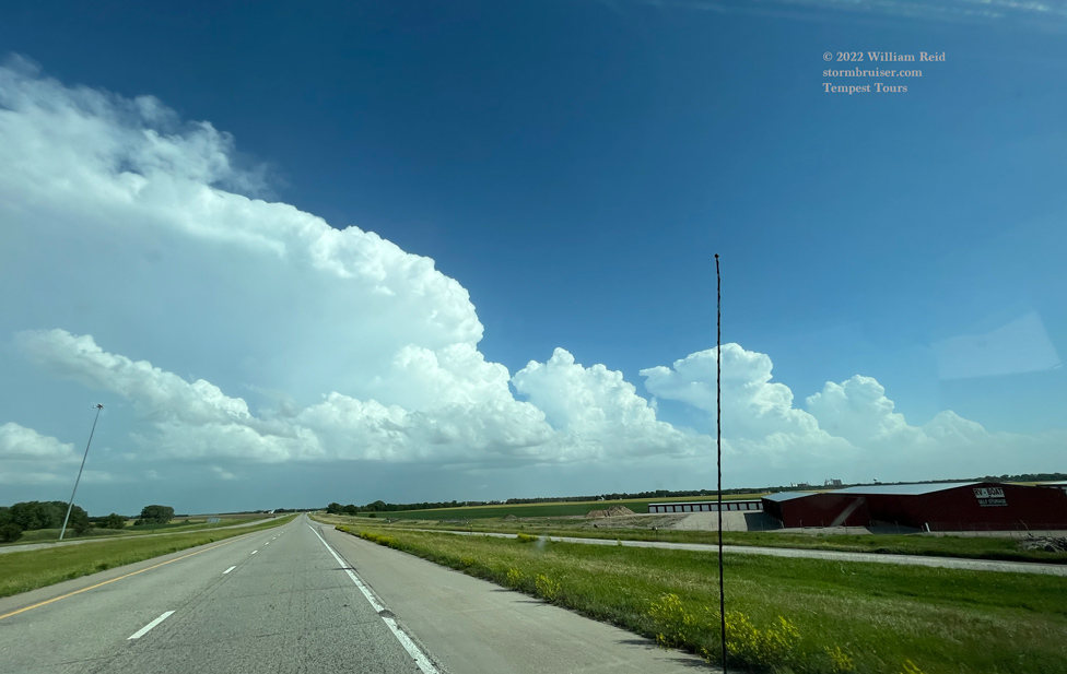
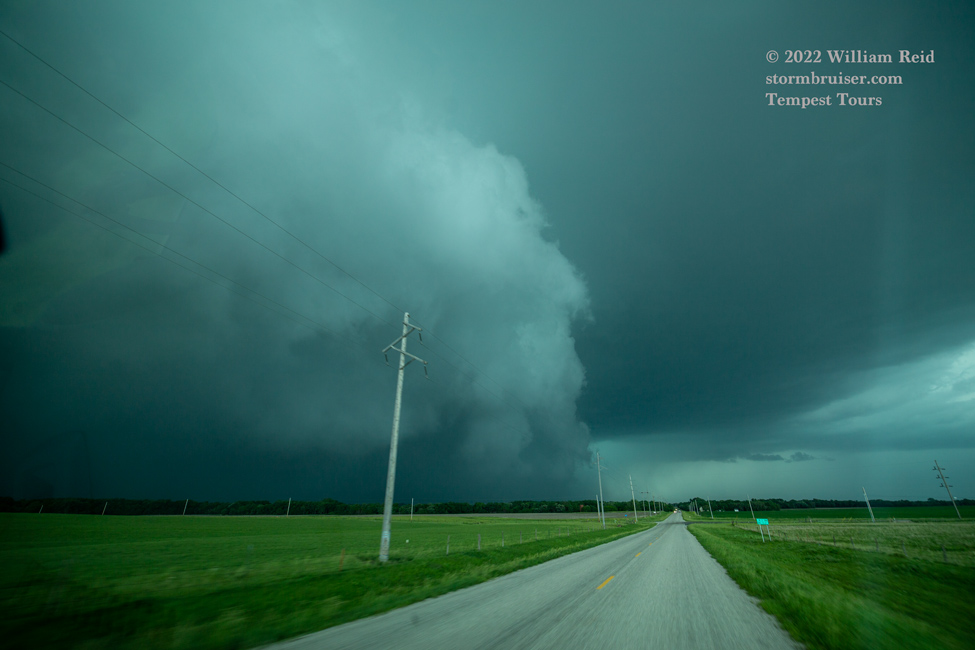
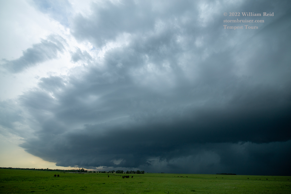
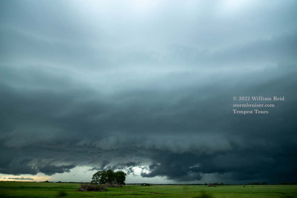
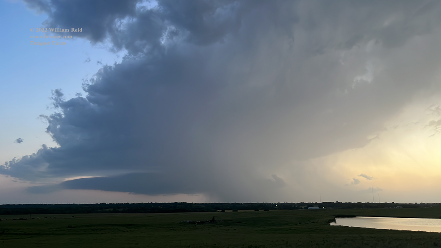
This storm came together quite nicely. It sported a nicely-curved leading edge with a stout updraft. We scooted up towards Burns (see 6:43 p.m. radar) to get right in front!

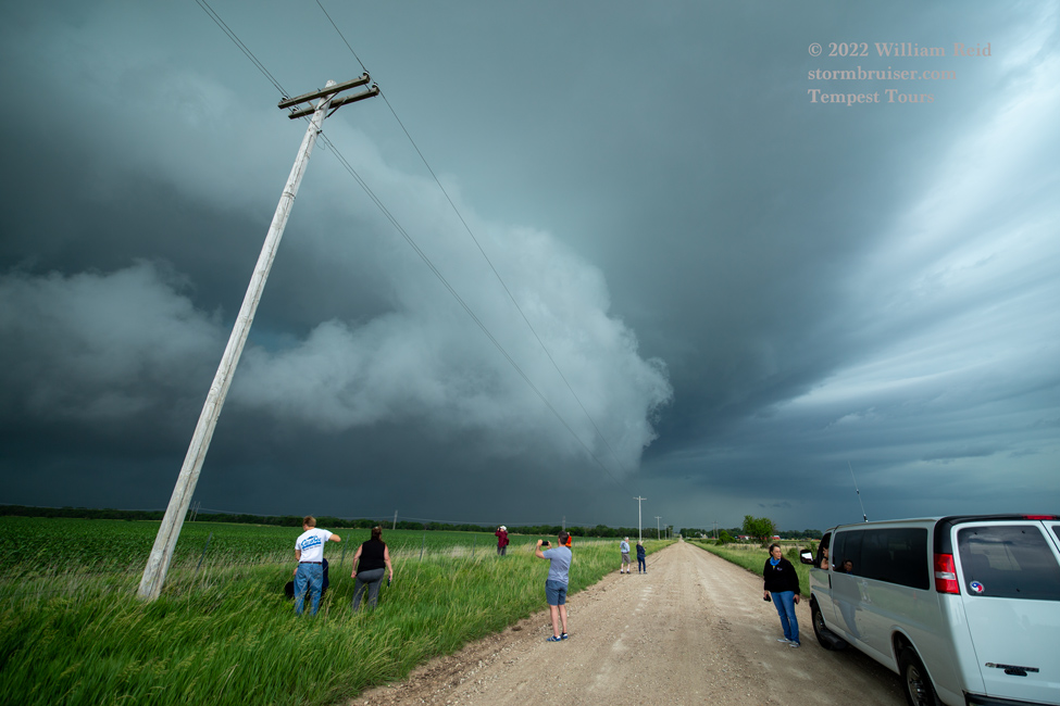
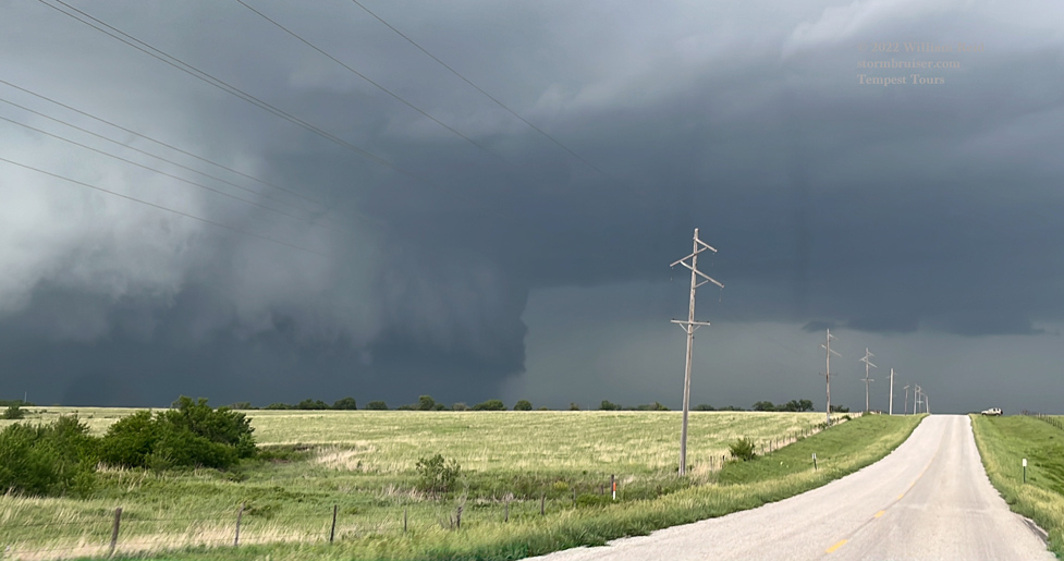
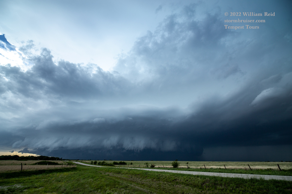
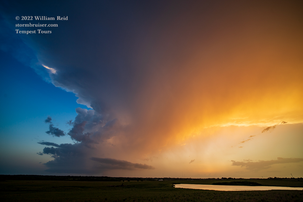
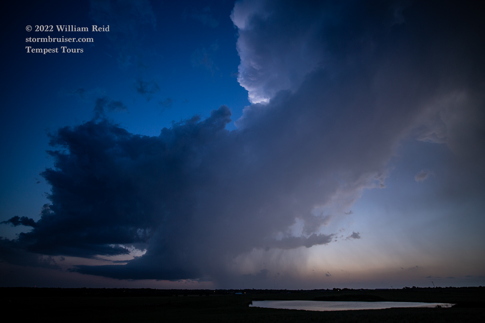
This supercell became a bit wet, and then less organized. We headed south to another one, near Douglass. I think we killed that one in short order. One last storm awaited us before dark. We got down almost to the Oklahoma border (east of Arkansas City) and right in front of a supercell that looked fairly nice on radar. But, it too was starting to weaken as we reached our viewing spot. The sunset light was nice at least! I think it had one or two CGs for us — not enough.


It was nice to get on a couple of decent storms after such a long drive! And, of course, we were rather relieved that the SD and MN play wound up low-end. Can I call it a BIG DUD for most of the chasers that were up there? So what is the moral of this day? I don’t know.
After checking in at Ponca City, we headed out to some darker skies just north of town for a meteor shower or something of the sort (it was a possible meteor storm called the “Tau Herculids!”) that was being hyped a little. It did not materialize for us, unfortunately. So now what is the moral of this day? “Don’t count your tornadoes and your Tau Herculids before they hatch?” Or has that one been used before?
Leave a Reply
You must be logged in to post a comment.