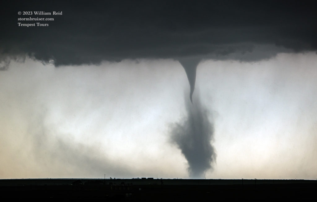
Start: Perryton, TX
Lunch: Smokehouse Restaurant/Perryton
End: Hugoton, KS/292 miles
Chase account by TT guest Lesleyanne
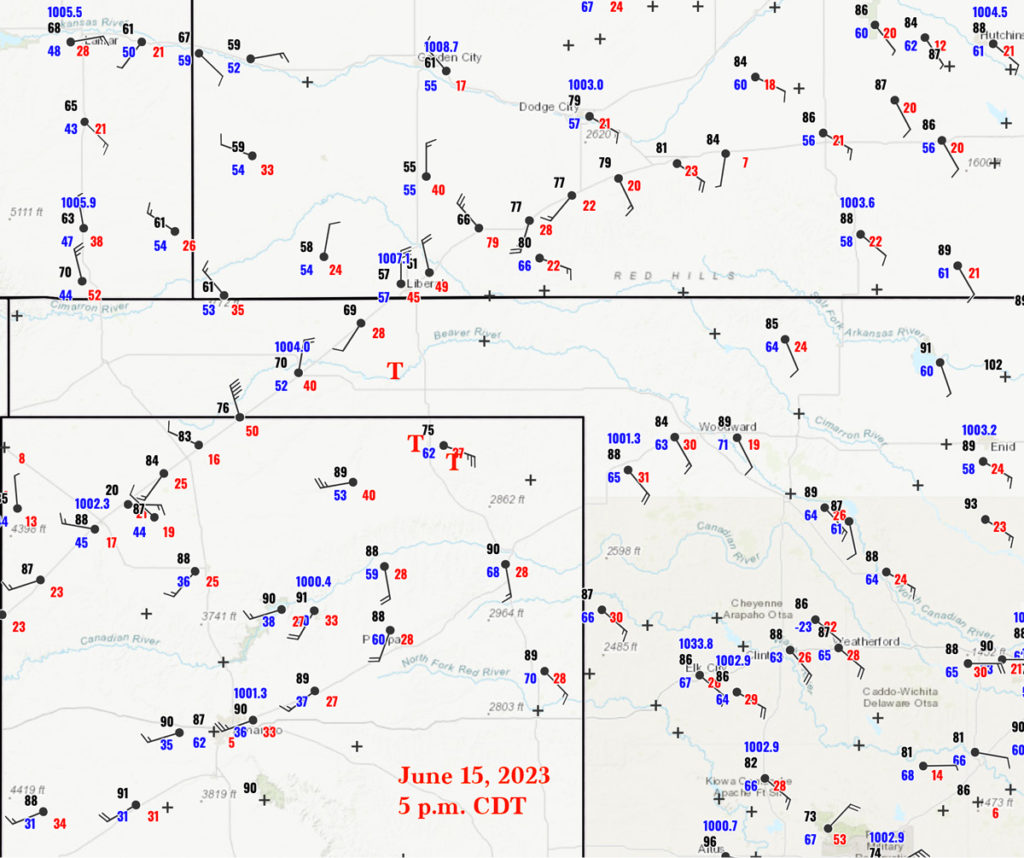
Surface map for 5 p.m. CDT, showing the locations (T) of tornadoes NNW, SE, and in Perryton, TX. Storm Reports shows the Perryton tornado occurring at 5:10 p.m. CDT (2210Z).
This is one of those WHAT IF kind of chase days, as you will see. The tornado of the day was the one which developed pretty much right on the town of Perryton, Texas, in the northeastern TX Panhandle in Ochiltree County. It killed three and was rated EF3.
…NWS Damage Survey for Tornado Event… .Perryton Tornado…
Rating: EF3 Estimated Peak Wind: 140 mph Path Length /statute/: 6.39 miles Path Width /maximum/: 880 yards Fatalities: 3 Injuries: Unknown
Start Date: 06/15/2023 Start Time: 05:06 PM CDT Start Location: 2 NW Perryton / Ochiltree County / TX Start Lat/Lon: 36.4135 / -100.8302 End Date: 06/15/2023
End Time: 05:17 PM CDT End Location: 4 ESE Perryton / Ochiltree County / TX End Lat/Lon: 36.3731 / -100.7284
Scott Bachmeier article with some technical aspects of the tornadic supercell.
This NWS survey shows that it started near the northwest side of Perryton and moved southeast towards the east side of town, lasting 11 minutes from 5:06 to 5:17 p.m. CDT. Apparently the tornado intensified quite quickly when it entered Perryton.
Google “Perryton Tornado” and you will find plenty of articles, with lots of damage photos and drone footage along the tornado’s path. Somewhat odd is that there is not very much chaser and John Q. Public video of the Perryton tornado. (Here is some good footage by Brian Emfinger on a Fox Weather broadcast, and here is a decent but short clip by Bret Hendrikson on X.) This tornado occurred in mid-June at 5 p.m. in an optimal part of Tornado Alley for viewing storms! Why were there so few chasers with good video? Chasers were spread out among a handful of chase targets on this day, and many were on storms that were already in progress more than a county or two distant. The Perryton storm formed a bit later than others to the north, into OK and KS, and it became tornadic quite quickly. Thus, many chasers were either on other storms or were a bit out of position and trying to get a look through rain. Since the Perryton tornado was largely wrapped in rain and hail, it was not easily visible if you weren’t within a mile or two of it. I suspect that there is little public video of the tornado because of the rain and hail, the poor visibility, and because the tornado warning and sirens in town were a little late, apparently.
The conditions for severe weather and tornadoes on June 15 were quite good, and SPC had a moderate risk covering parts of the eastern Panhandles and a 10% tornado outline from Beaver to about Quanah. CAPE values were around 3000 J/kg by mid-afternoon, and effective bulk shear in excess of 40 knots. Low-level flow was SE to ESE on the east side of the dry line with dew points near the mid-60s. We hadn’t really had many of these higher-end setups in the Panhandles up to this point of the chase season.
The day prior, the 14th, was a down day for our tour group. We were in western Oklahoma at Sayre, and my job was to get us to a good place to start the chase on the 15th. On their Day Two outlook for the 15th, SPC showed a large slight and a 5% tornado risk area from near Tribune, Kansas way down to central TX. I liked the looks of the northeastern Texas Panhandle for the 15th on the model data, and booked rooms in…
…Perryton, Texas.
Our Tour 6 group enjoyed a (Chihua’s) Mexican meal for dinner in Perryton on the 14th. This was rather welcome since the chase breaks and relaxed/sit-down meals had been few this June. On the morning of the 15th I provided a weather briefing, as usual, to let the guests know what to expect. I don’t really recall what I said, but it did not look like it would be a good idea to stray too far from Perryton. I don’t like to wander off to different places without a really good reason! Perryton would be near areas of initiation along the dry line during the afternoon, and it looked to me that the instability, wind shear, and low-level moisture were best here. We spent some time in the late morning sun at Leatherman Park on the west side of town. From there we headed a little east and south to the Smokehouse Restaurant in town. This eatery and our hotel were on the south end of Perryton, which was spared tornado damage this day.
We still had at least an hour or two to kill after lunch before storms would start to form. I took the tour group northeast of Perryton five miles on Highway 15 to some tall grain elevators along the rail line. I wanted to be able to watch the sky from a spot outside of town, monitor weather conditions on my van laptop, and be in the shade! The north side of these grain elevators was a good spot for shade. The locals here were a little suspicious about two white vans and a bunch of folks milling about. But they were intrigued about having chasers around and asked about the severe-weather prospects. One nice lady provided the guests a tour of the grain elevator.
Storms were developing a bit on the early side up in Kansas to our NNW, three counties distant. These were severe-warned by 3 p.m. CDT (see radar images below), but were outside of my much-preferred target area here near Perryton. The stuff up north was looking rather messy right off the bat. By 4 p.m. CDT a couple of stations showed very strong outflow winds up there. No thanks.
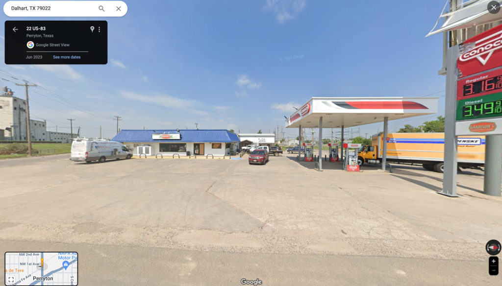
From the grain elevators we went back into Perryton for our last-chance pit stop and convenience store goodies-grab. It was around 2:45 p.m. CDT. Some cumulus clouds were bubbling right about where I wanted them to be — northwest of Perryton by maybe 20 miles. It was time to give them a closer look. Our pit stop was at the Conoco station that was just north of the main intersection on the north side of Perryton (83 and 15). This place would be hit by the Perryton tornado under 150 minutes later. I called the Conoco store in December, 2023, and spoke with Shirley. She was the cashier on the afternoon of June 15, and she says that she recalls our chase group coming in! And, she said that the building received moderate-to-heavy damage, but the roof stayed on for the most part. She rode out the tornado in the freezer and was not injured. The store lost all of its windows and was closed down for more than a month. The heaviest damage path was just a couple of blocks to the southwest and south of the Conoco. Below is a “before” picture of the Conoco. Maybe I’ll ask Shirley for an “after” photo.
text
By 3 p.m. CDT we were stopped a few miles north of the KS/OK border near U.S. 83. Dodge City radar was not showing any returns yet in the Oklahoma Panhandle, and the bubbling cu in the sunshine to our WNW was fabulous.
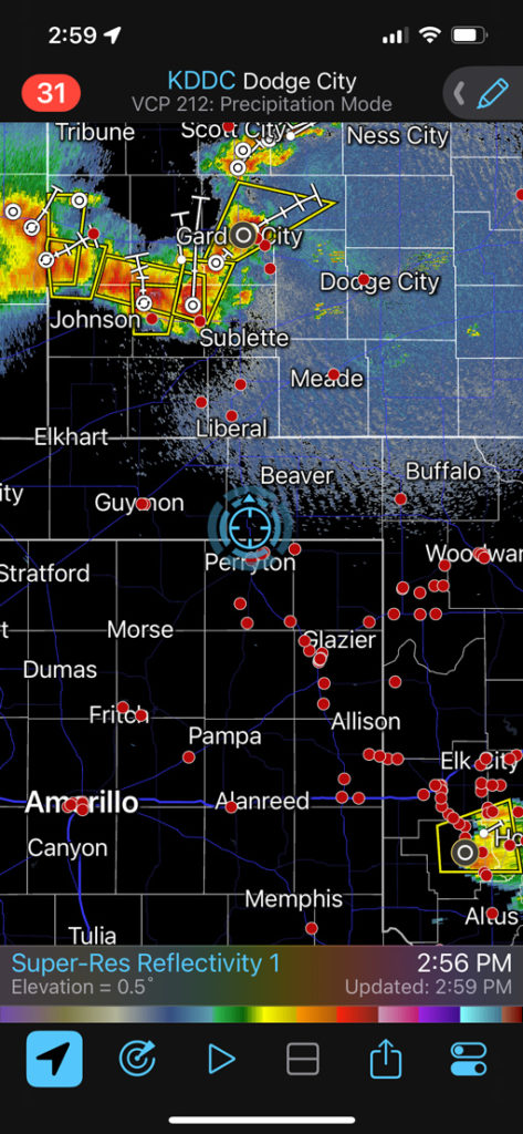
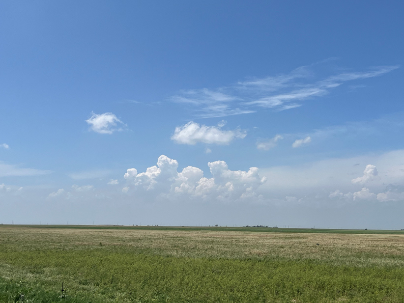
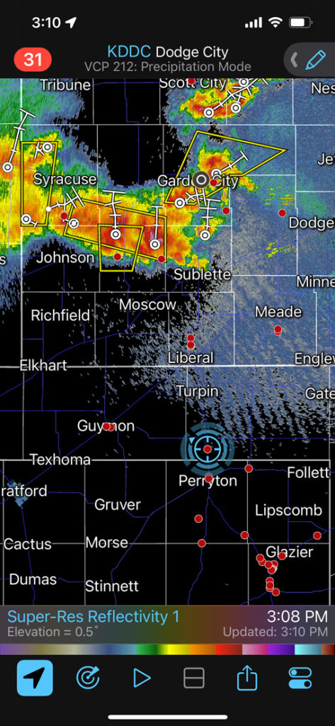
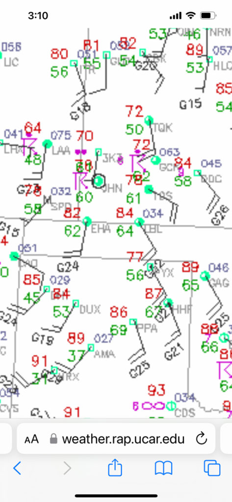
Below are some iPhone photos and screenshots from about 3:10 p.m. to 4:19 p.m. CDT. The surface map shows slightly better-backed winds from Liberal to Dodge City, but the dew points are not quite as good compared to Perryton-Gage-Canadian. (The temperature and dew point data at the Perryton AP ASOS were about ten degrees (F) too low.) Instability maps also showed higher CAPE values for my south target. Our bubbling cu (cumulus field) to the west and WNW grew into CBs (cumulonimbus clouds) rather quickly, and a couple of storm anvils were soaring overhead.
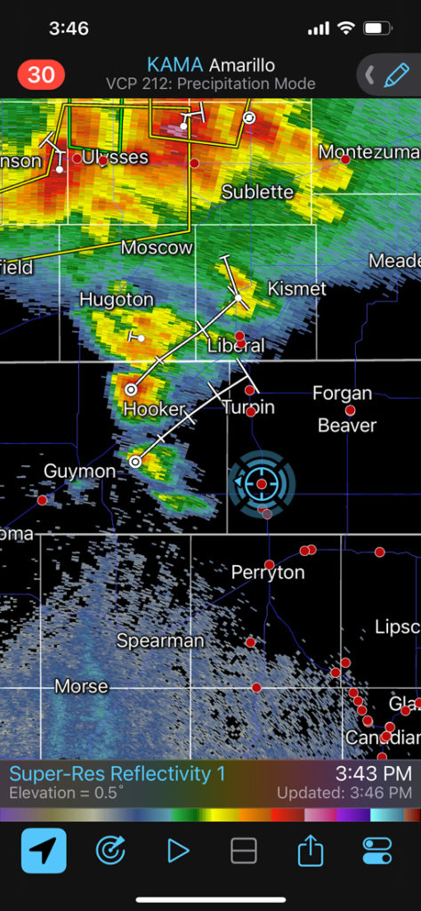
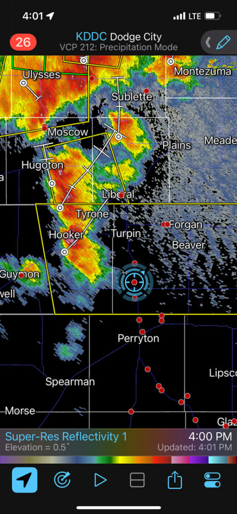
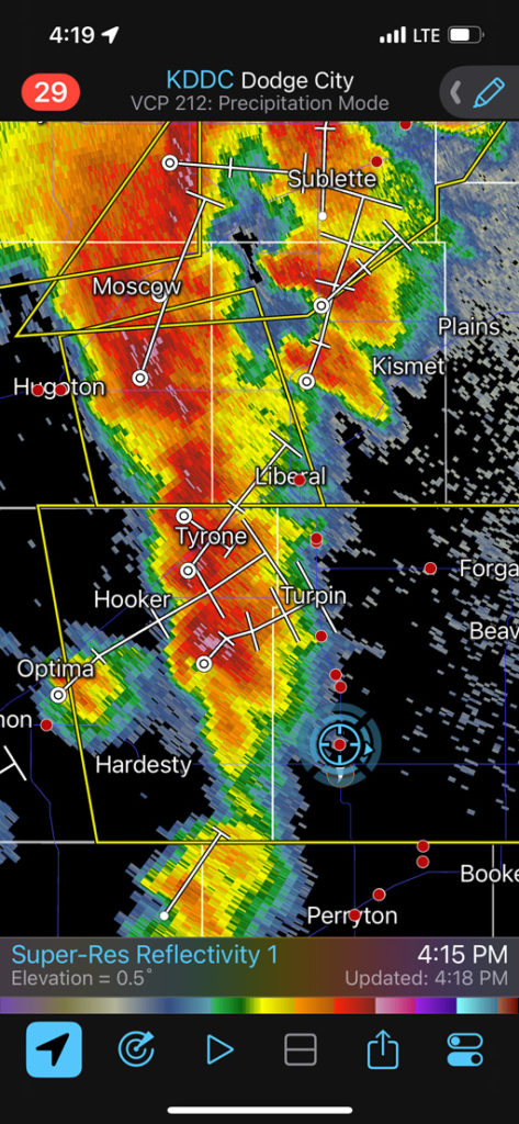
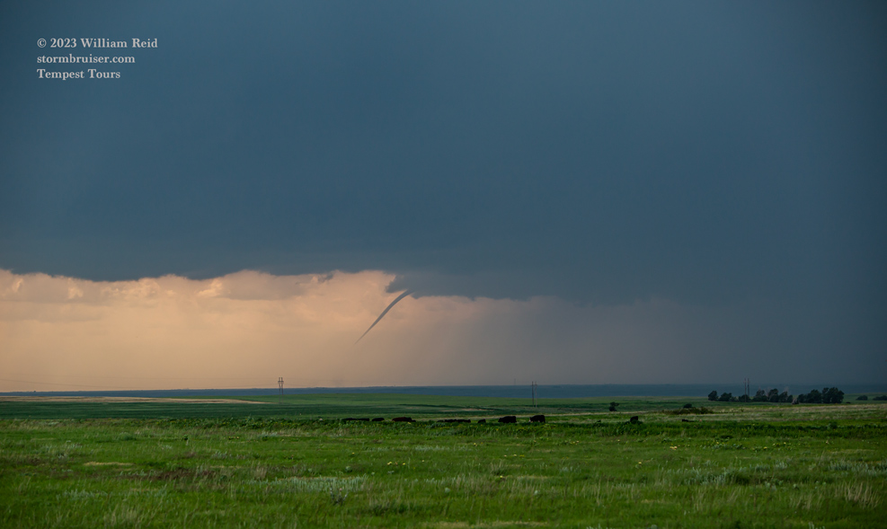
The radar screen grabs show that we were just south of 412 (on 83) from 3:46 to 4:19 p.m. CDT. During this time a supercell developed to our WNW and moved slowly to the northeast. The storm base was medium-high, but an RFD cut in to the base and a skinny tornado was observed for several minutes (around 4:15 p.m. CDT…I don’t see this tornado listed in SPC’s Storm Reports).
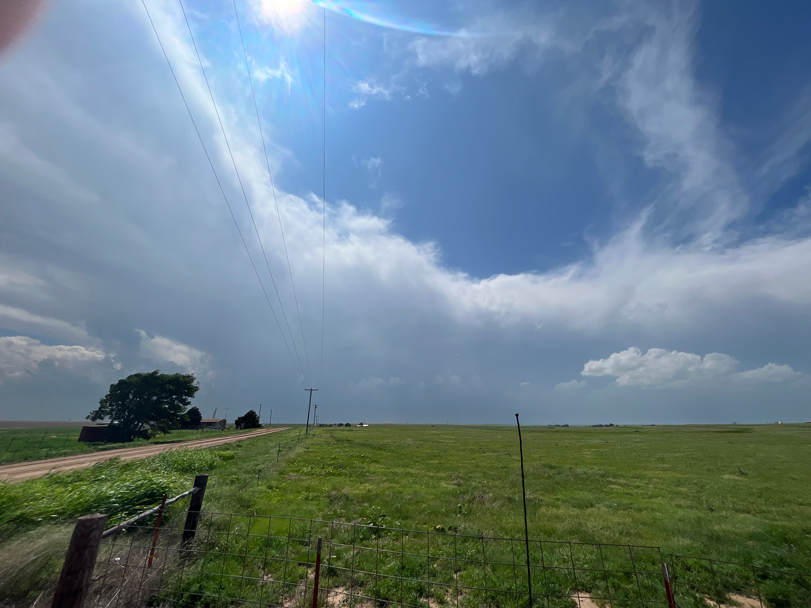
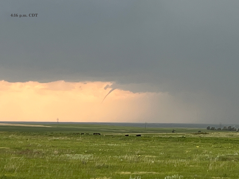
That was a good sign! The atmosphere wants to make tornadoes with this convection. Below are some zoom shots with the Canon of this tornado, which was probably about 12 miles distant and maybe south of Adams, OK, in eastern Texas County. The last image in the group below was taken prior to this skinny tornado.
The weak tornado disappeared, and it seemed prudent to drift north some on 83 in order to be better positioned in front of this supercell. But, one of our vans would not start. We had been here a while and had left the rear monitor screen on, which drained the battery. Usually I am good at making sure that these monitors are OFF if I know that we might be stopped for a while. Anyway, we had the other van and the jumper cables available and were rolling north in ten minutes.
Take a look at the radar grabs for 4:00 and 4:15 p.m. above. The storm to our west was getting a really good shape by 4:15. And, new stuff west of Perryton was starting to organize. We stopped close to the Beaver River, about halfway north through the OK Panhandle. The storm to our west was less-than-impressive visually, as it seemed to be on the cool and outflowish side. Not by a lot…but it just did not look like it was a great tornado candidate at this point. It was probably close to 4:30 p.m. CDT.
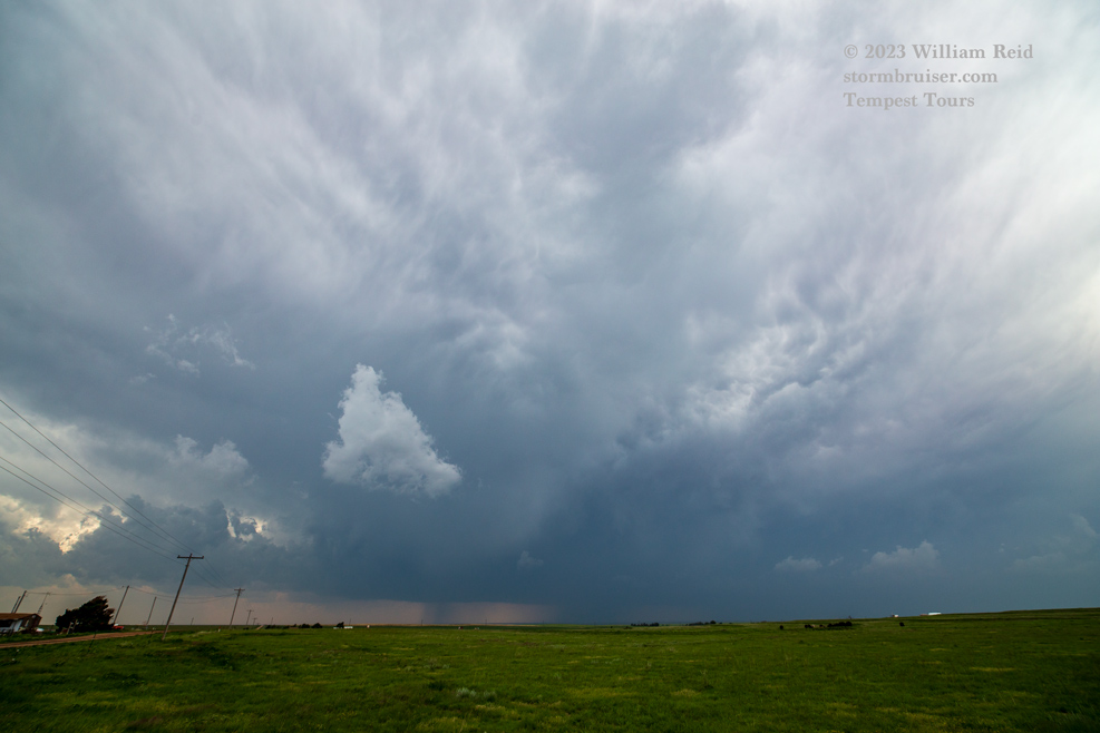
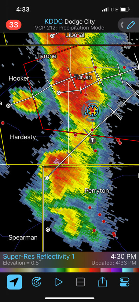
Apparently I did not take any pictures of the supercell just to our west and WNW here. We were getting rained on a bit (see radar image grabbed at 4:33 p.m. below), and “messy” and “less-organized” come to mind to describe what we had nearby. New convection was filling in to the south of our cell, and that was not what we wanted.
We needed to be on the storm that was a little west of Perryton. Our eastern OK Panhandle storm here was serving as the “sucker storm.”
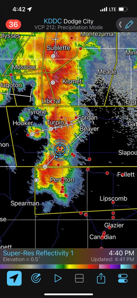
My mind was racing as we blasted south. Could we make it to Perryton before the “Perryton” storm made it to Perryton? The radar image for 4:40 p.m. CDT shows our location near 83 and 412 at 4:42 p.m. It was 15 minutes/15 miles to Perryton, and 5 minutes/5 miles to an alternate paved east option. It was looking like a REALLY close call with the hail core that was developing and approaching U.S. 83, between the state line and Perryton. I elected not to risk getting the windshields trashed by big hail.
I had Matt and Richard take us east on EW 32 Road (three miles north of the OK/TX border). This would keep us safely ahead of the new “Perryton” supercell. At Booker we would presumably have an excellent look at this nice tail-end Charlie storm!
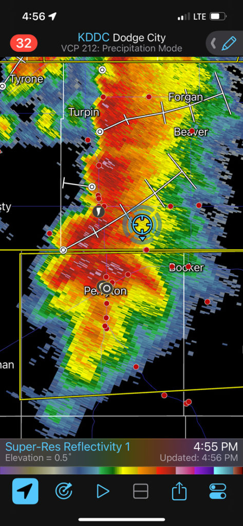
In hindsight, I wish I had tried my luck by continuing south on 83 into Perryton. We would have been in Perryton by 5:00 p.m., several minutes before the start of the Perryton tornado. (But that is assuming that we weren’t slowed down by hail and rain). When I made the “safe” decision to head east (around 4:50 p.m.), there was really no indication yet that this Perryton storm would be tornadic in the next 10-20 minutes. The prudent decision at the time was to make sure that we got in front of the storm without risking hail. There is a radar screen grab below for 4:55 p.m., ten minutes prior to the beginning of the tornado. We are about halfway east to our road south into Booker. The hail core has really ramped up just north of Perryton, and I suspect that some golfball hail would have been encountered had we continued south on 83 to Perryton.
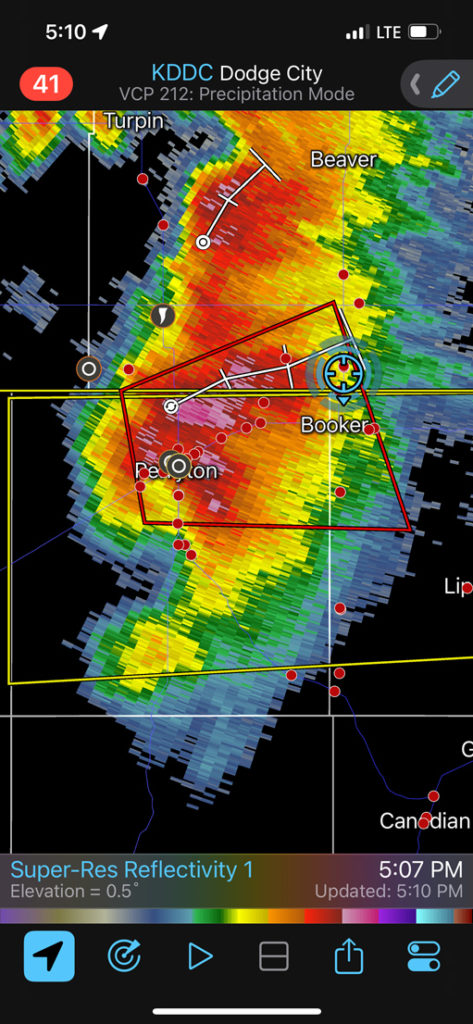
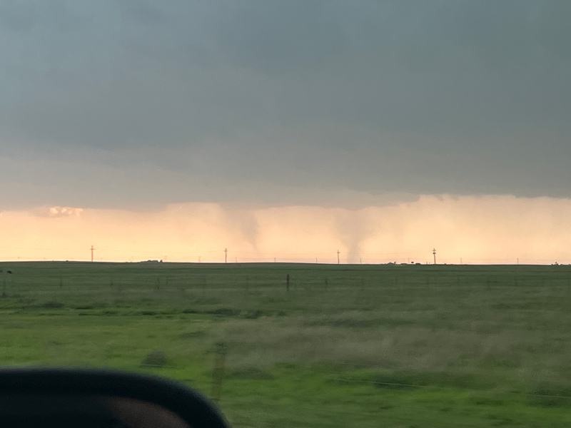
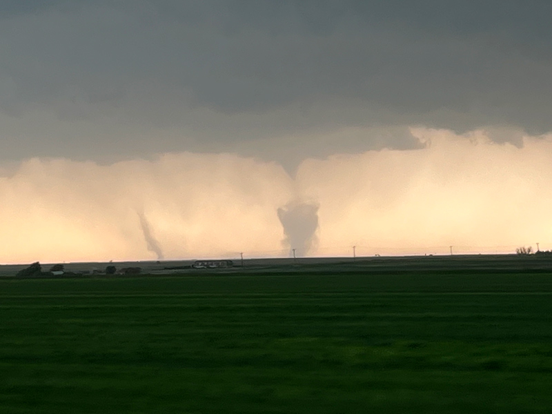
The radar screen grab at 5:10 p.m. above shows the Dodge City radar reflectivity at 5:07, which is very close to the start of the Perryton tornado. There is a good kidney-bean shape to the reflectivity, with the hint of a “hook”. But Perryton and vicinity are mired in rain and hail. The tornado warning is up, and by the time we turned south towards Booker, I already had an empty feeling inside that I was missing the show. I should have chanced it south on 83! But maybe these things happen for a reason. Did I really want to be in Perryton with the tour group while a rain-wrapped tornado was ripping up the town?!
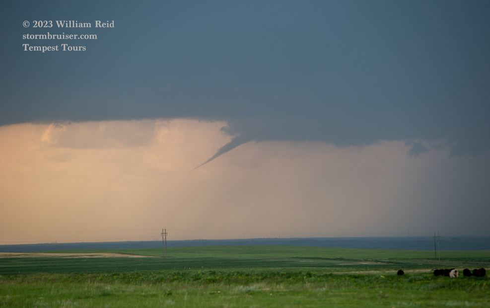
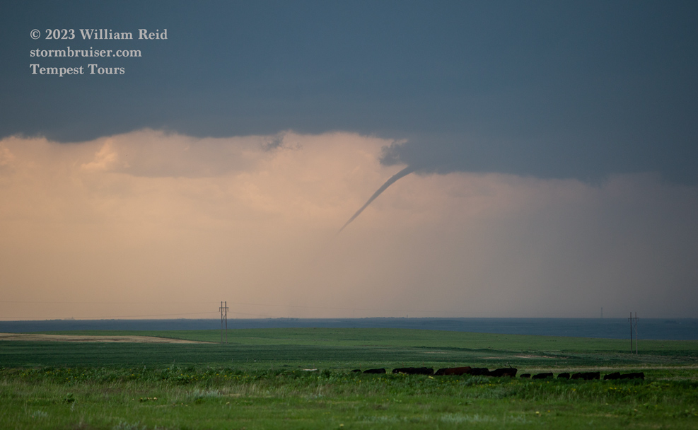
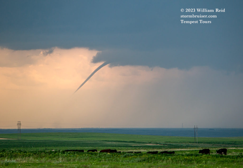
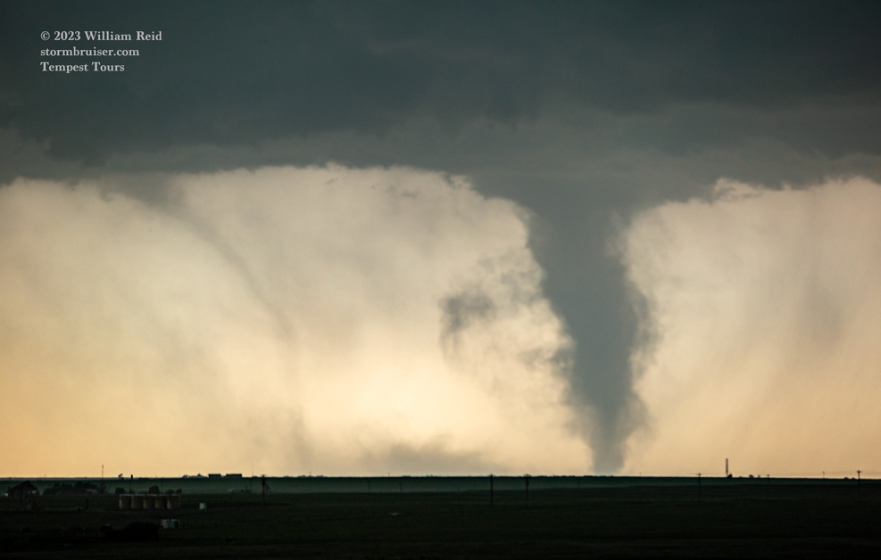
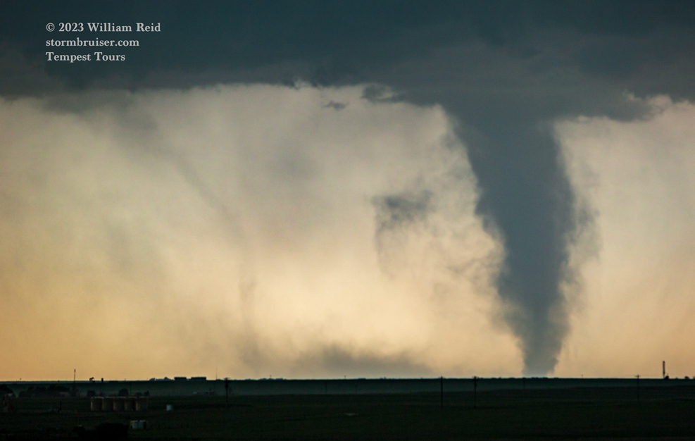
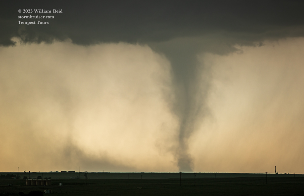
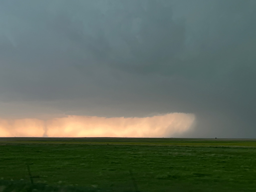
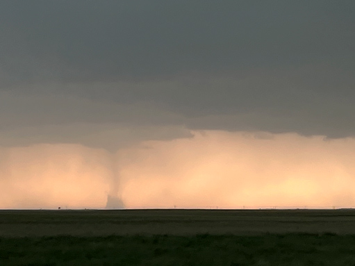
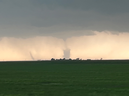
The last two images above show a couple of landspout tornadoes to our SSW as we continued south of Booker! The time was 5:18 p.m., or about the time that the Perryton tornado was ending. This seemed strange. These tornadoes were nowhere near the rainy “action area” associated with the Perryton tornado. These were well southeast of Perryton, perhaps on some SE-NW boundary which was also associated with the Perryton supercell.
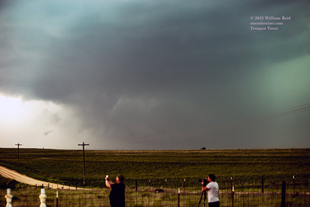
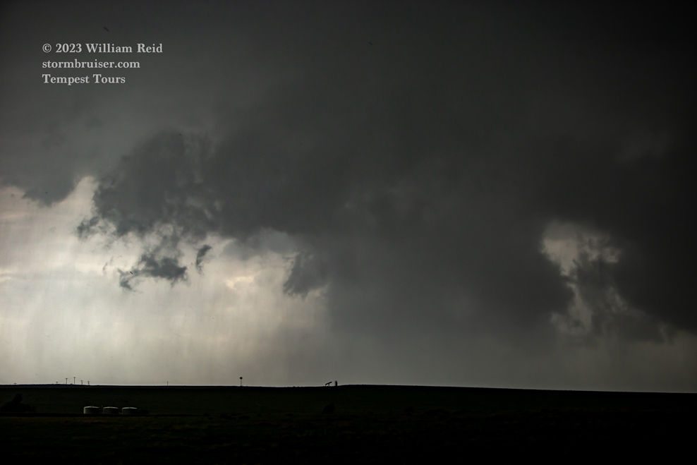
We continued a few more miles to the south. Below are shots with the Canon and long lens of the relatively long-lived landspout tornado. And, interspersed are a few shots to the WNW of the base of the previously tornadic Perryton supercell. These are enhanced quite a bit, and a rainy area with a wall cloud is all that remains post-tornado.
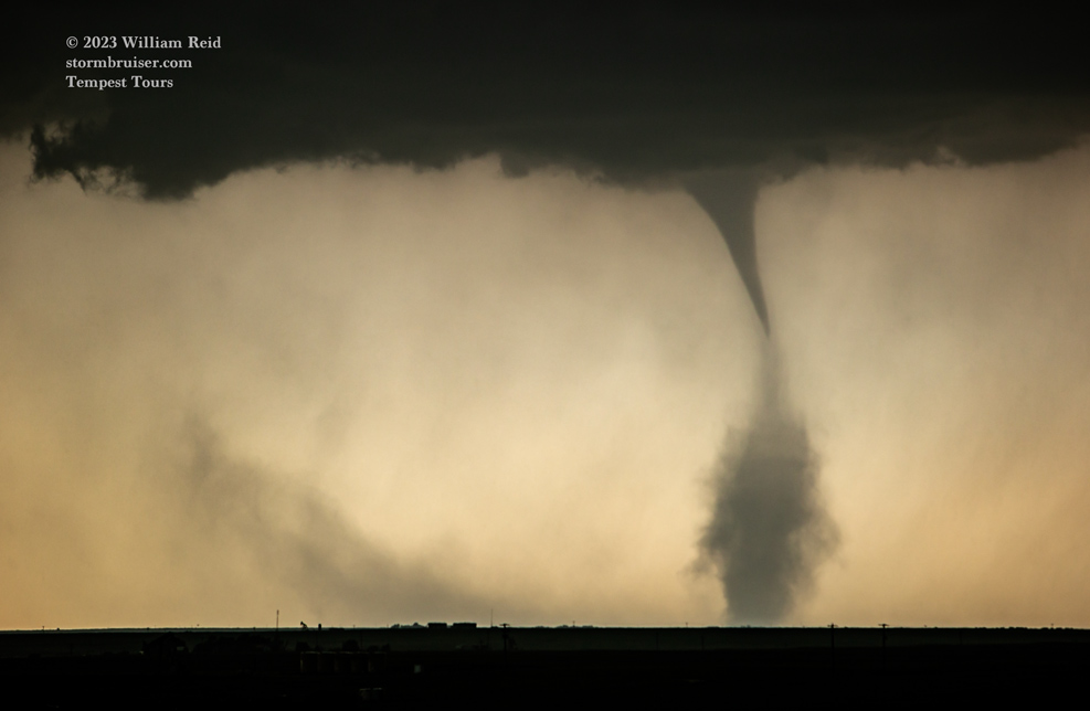
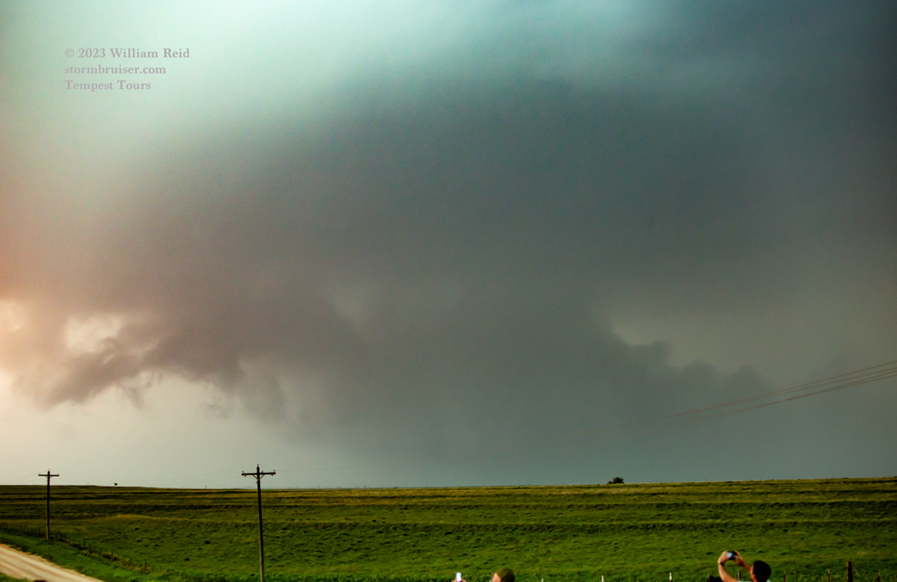
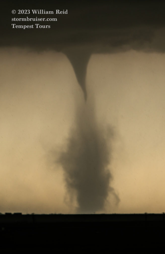

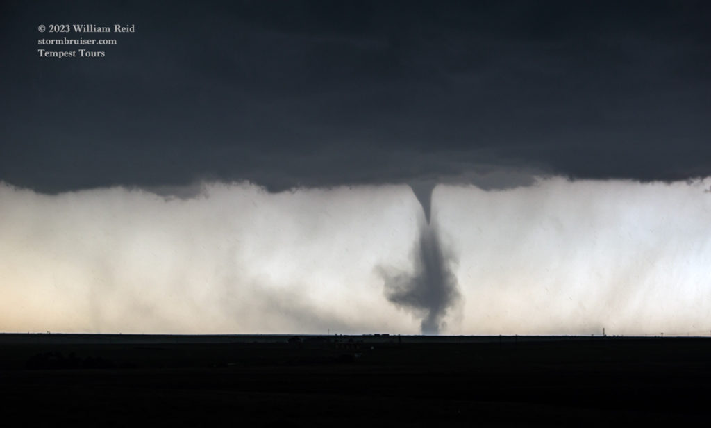
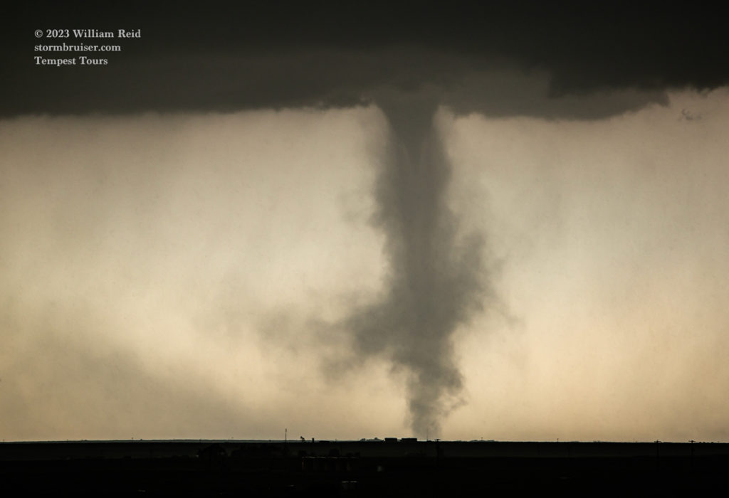
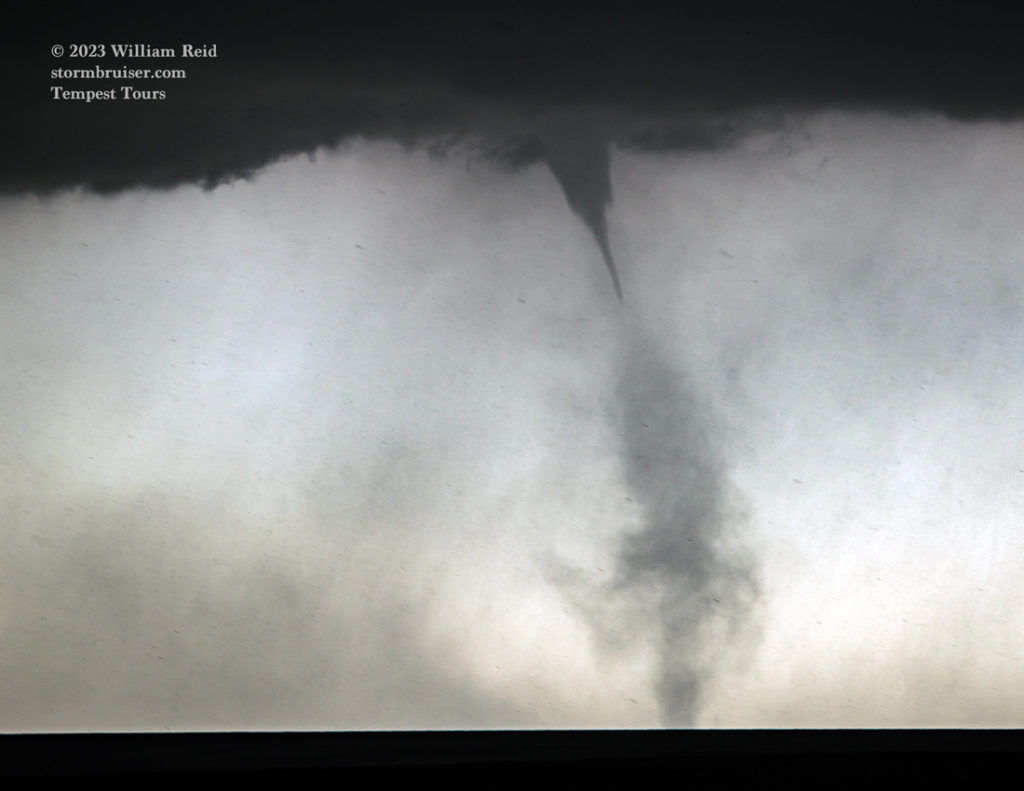
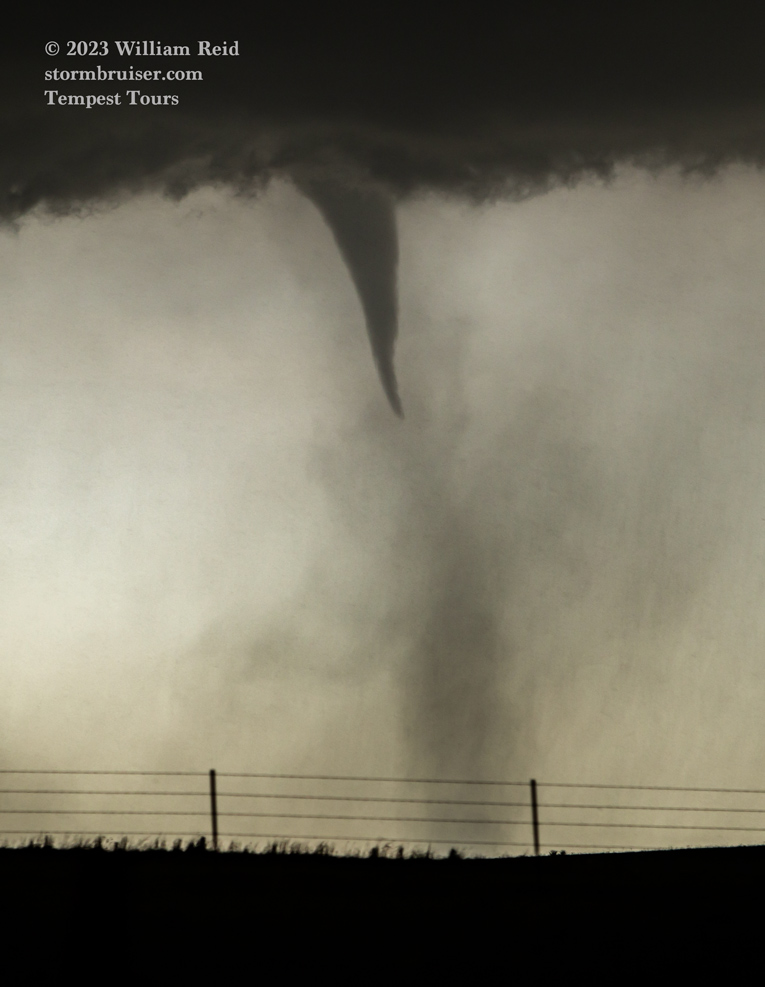
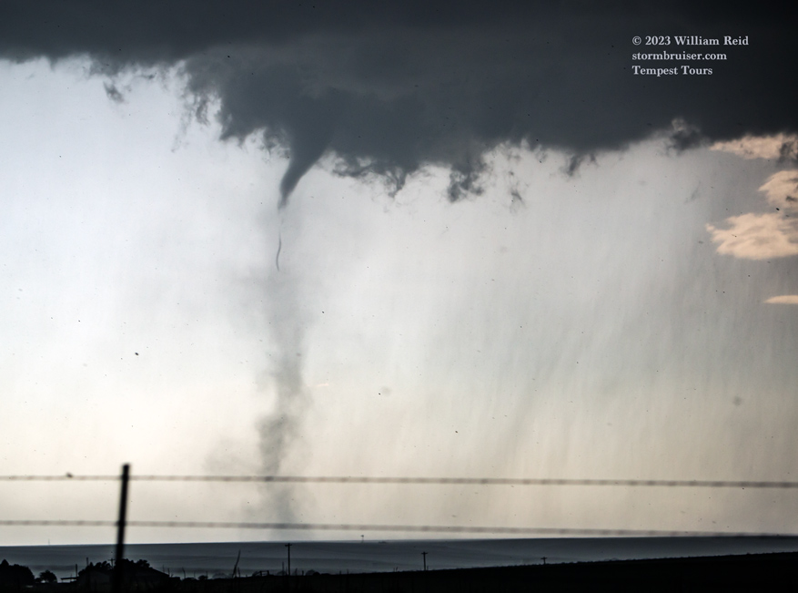
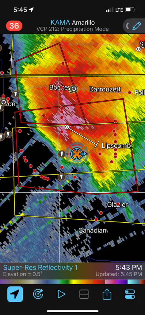
We continued to the south on 23 as the landspout to our SSW finally sputtered and died (after a good 20-25 minutes on the ground!) It looked like a new supercell updraft was developing just to our south and southeast, and we zig-zagged a bit to Glazier to check out this fantastic underside of the storm base. (See radar image at 5:45 p.m. below, which chronologically belongs before the next set of images.)
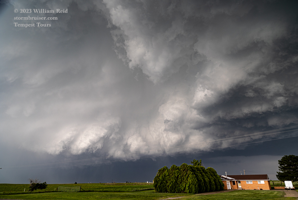
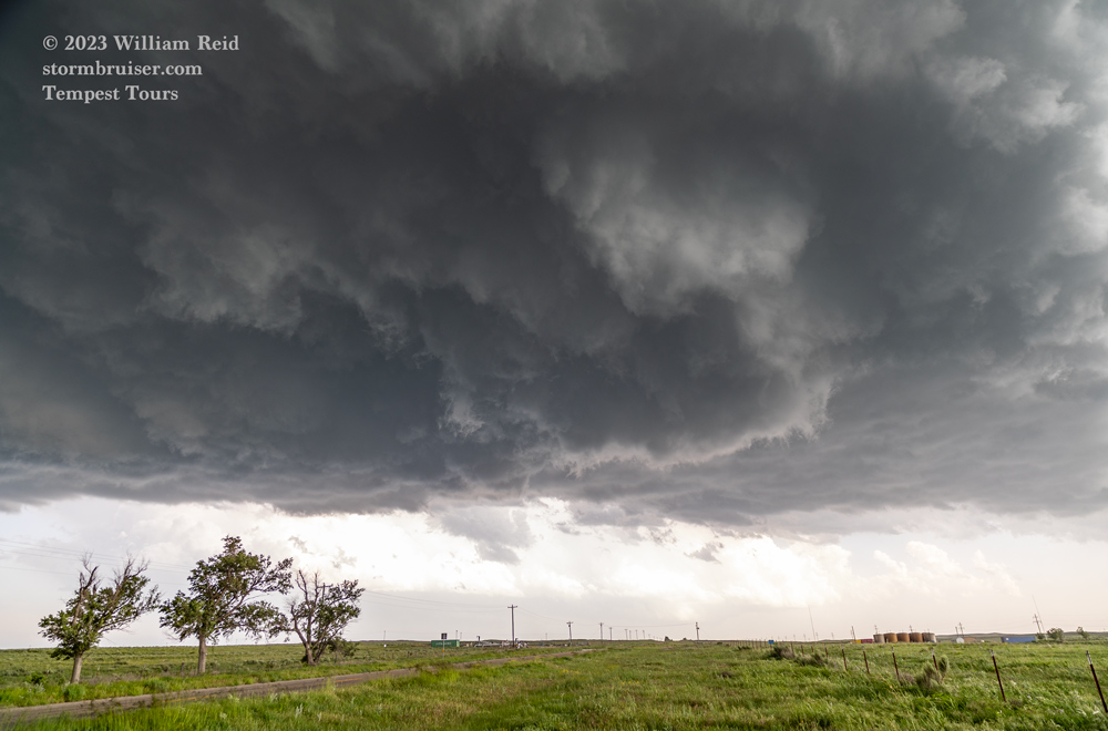
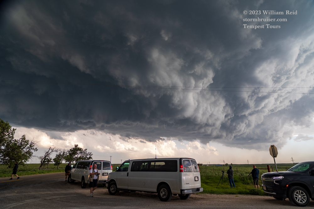
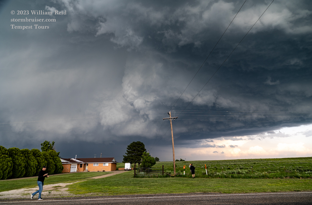
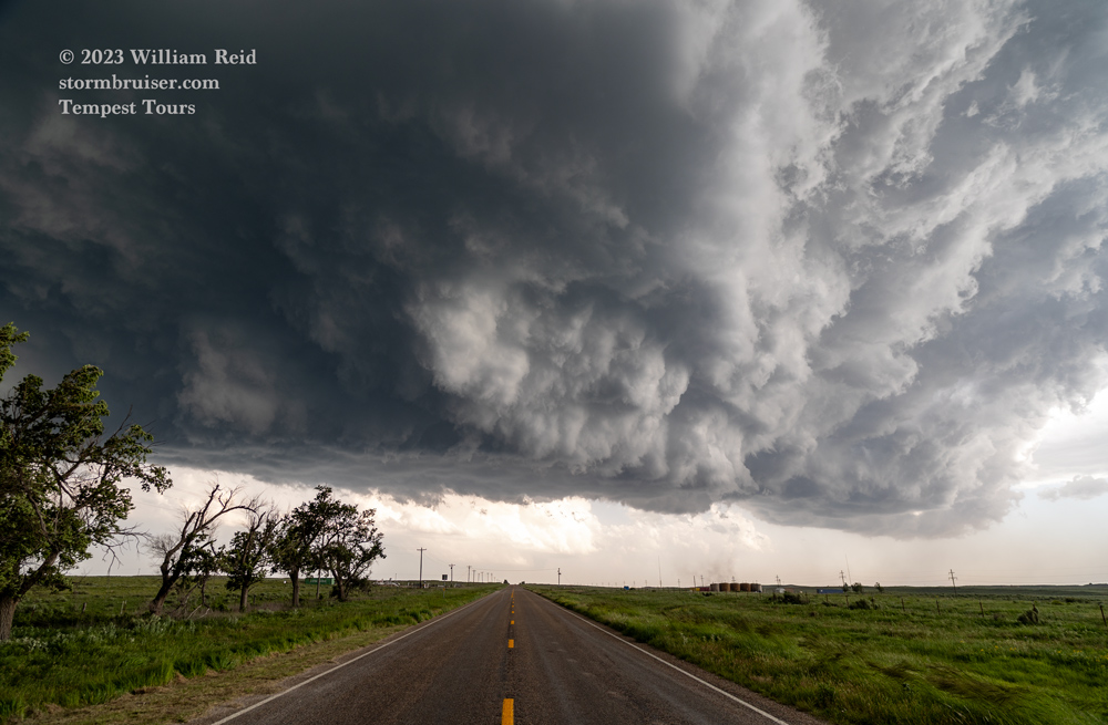
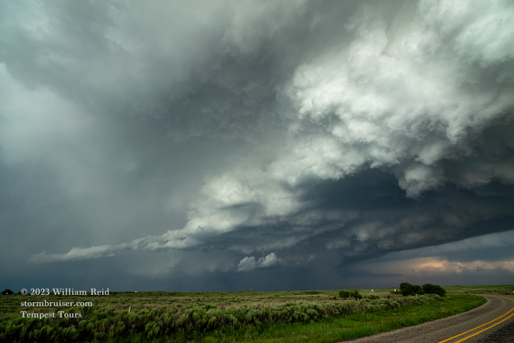
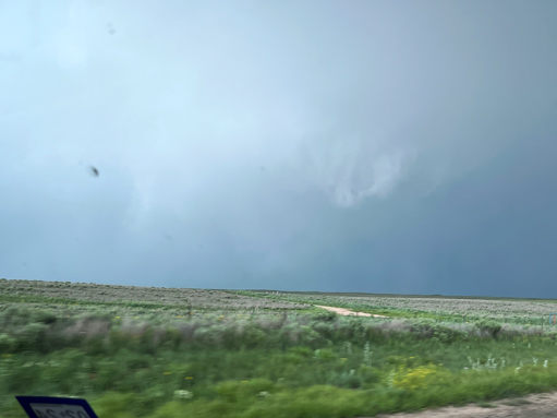
This new and very robust activity was moving to the east, and we needed to catch up. One option from Glazier would be to head ENE on 60 to Higgins, but that looked like an invitation to a big hail party. The base was south of 60. We went east on 2758, and soon had a very suspicious area to our ENE (to the left of the road on the pics below). This was the area which, presumably, was associated with the “Higgins” tornado. This tornado was fairly substantial, and some of the looks that we had showed that something quite substantial may be lurking in that rain-wrapped area (see pics 2 and 3 from the Canon and 5 and 6 from the iPhone below). These images of the backside of the “Higgins” tornadic supercell were taken during the middle timeframe of the Higgins tornado, which was from 6:29 to 6:37 p.m. CDT according to storm reports.
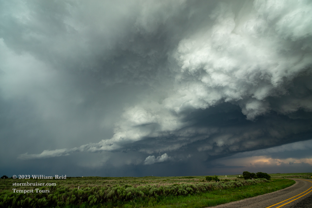
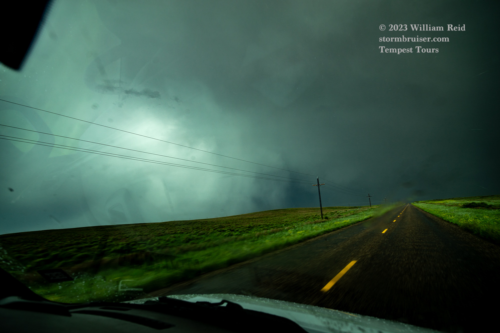
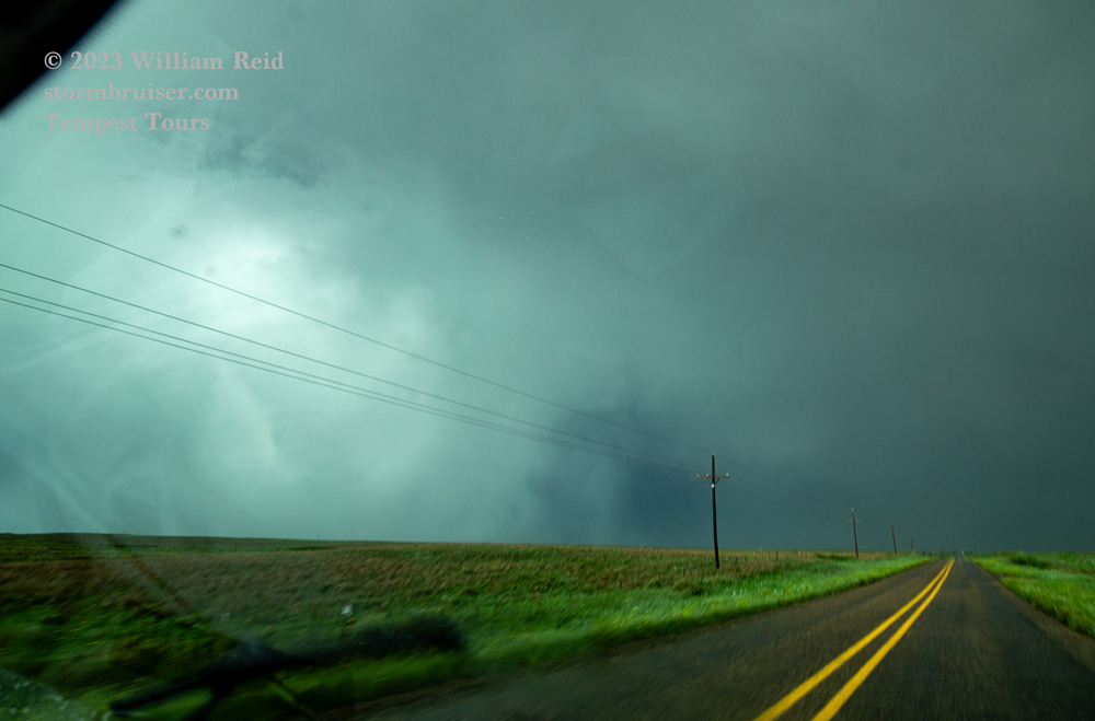
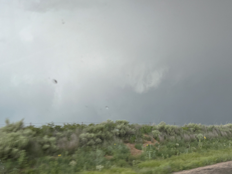
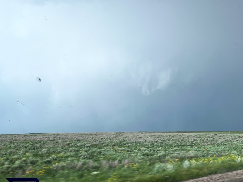
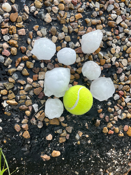
We were south of Higgins and still WSW of the big rain blob (with maybe a hidden tornado) when I decided that catching up and getting into position again probably was not going to happen. I had the drivers take us back north to Higgins on FM1453. Near Commission Creek (halfway to Higgins) we passed the tornado track (with some tree branches down) and then came across large hailstones on the ground.
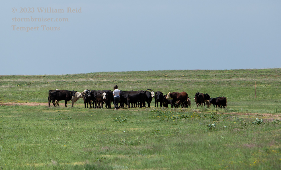
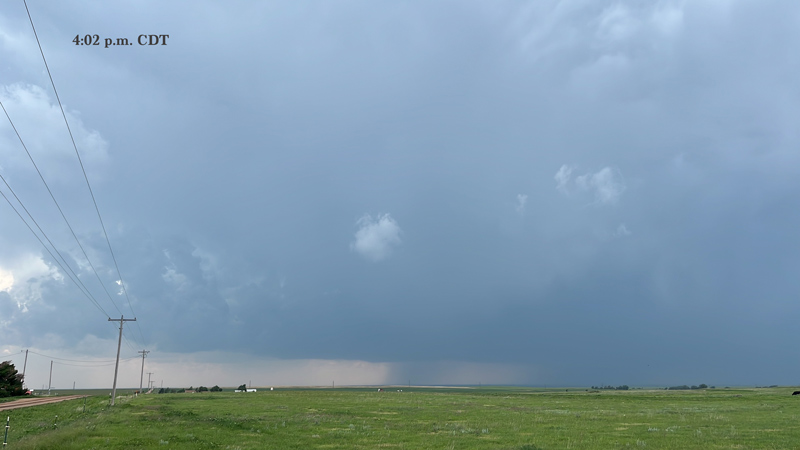
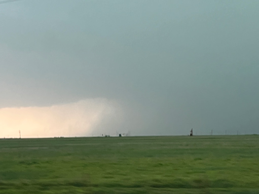
The chase was over, and we contemplated heading back into Perryton to look at the damage. But, it was sounding rather grim there, and we headed up to Hugoton for the night. Below are a few leftover images which didn’t wind up where they should have been in the chase account! The second one below shows the rain core of the Perryton supercell to our southwest from near Booker. The last one below is another look at the backside of the Higgins storm.

Leave a Reply
You must be logged in to post a comment.